

Mountains to Sound Greenway - I-90
All Photos (17)
-

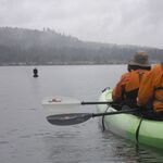
Walking along the beach at Lake Sammamish State Park.
© Merrill Images.
-
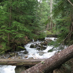
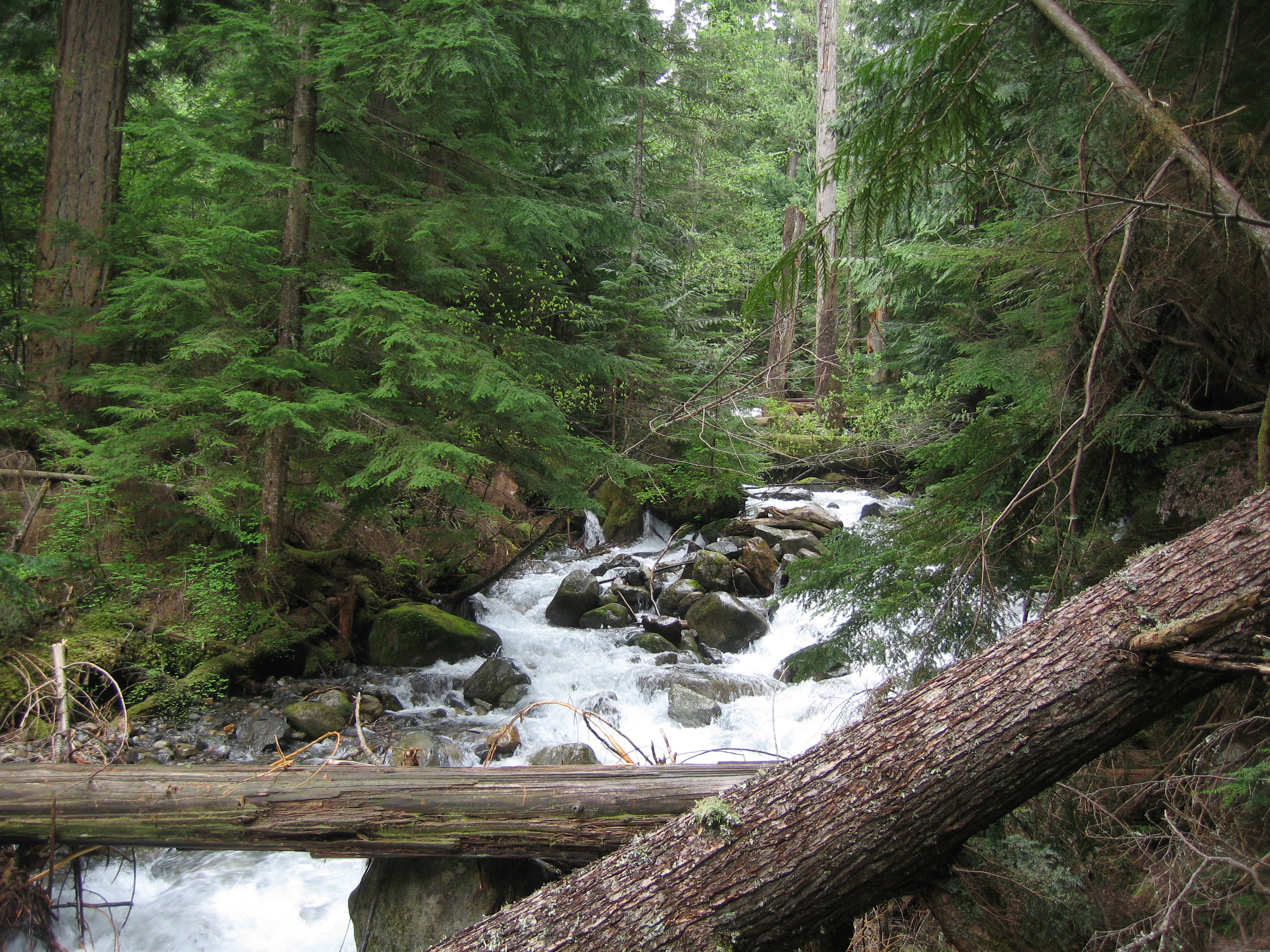
Humpback Creek from the Asahel Curtis Nature Trail, located right off Interstate 90 near Snoqualmie Pass.
Public Domain.
Download Original (3072 x 2304 pixels, 4932.3 MB)
-
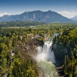
From time immemorial, the Snoqualmie Tribe has considered the Snoqualmie Falls sacred – its birthplace of creation. Mists from the thundering 268-foot waterfall carry prayers to ancestors, and the Falls provide the gifts of food, water, life, health, and healing. Today, the Snoqualmie Tribe warmly welcomes all visitors to this sacred place to experience its power in their own way.
© Puget Sound Energy.
-

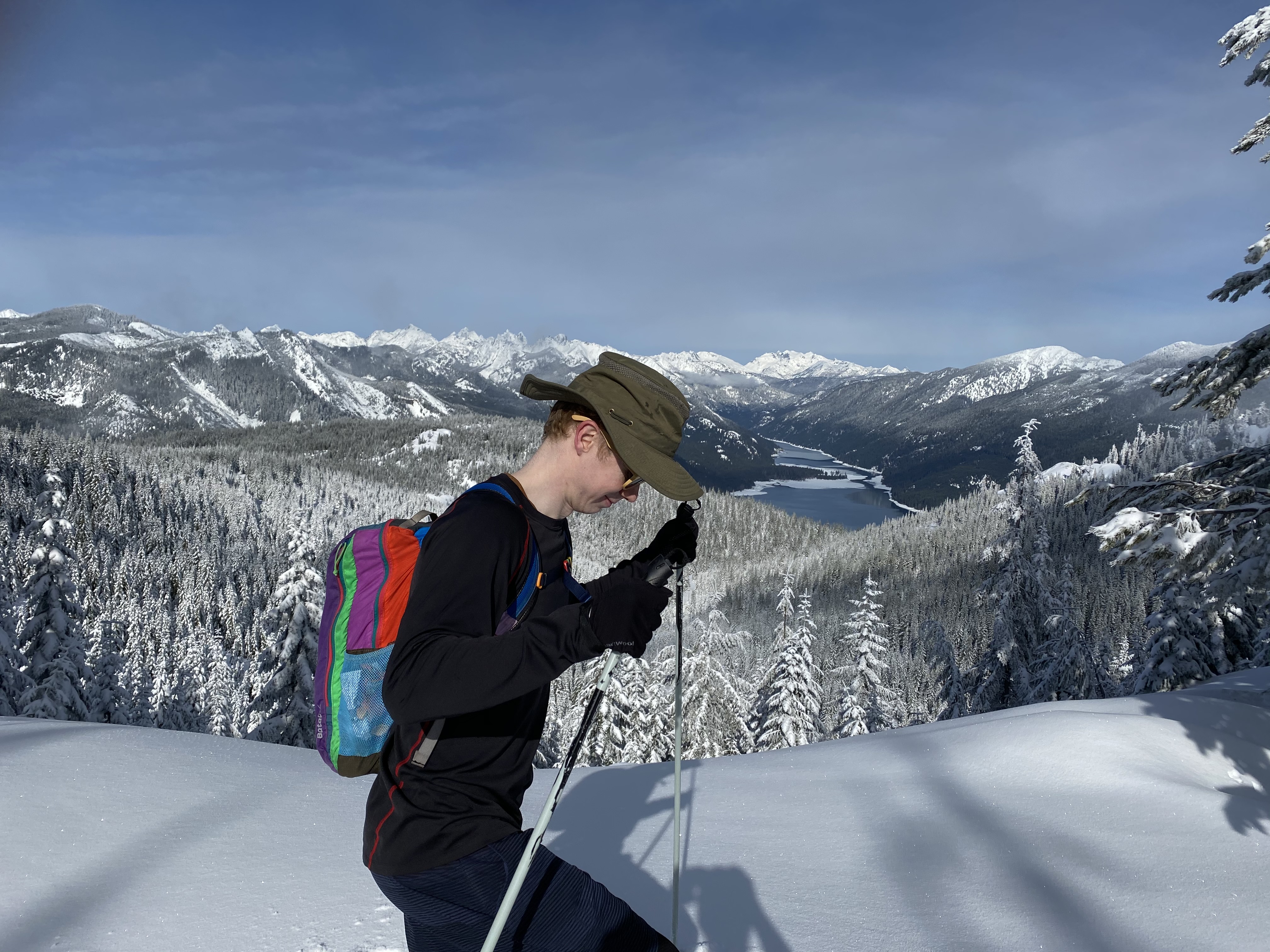
Snowshoeing on Amabilis Mountain above Kachess Lake near Washington's Snoqualmie Pass.
Public Domain.
Download Original (4032 x 3024 pixels, 4501.6 MB)
-
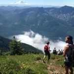
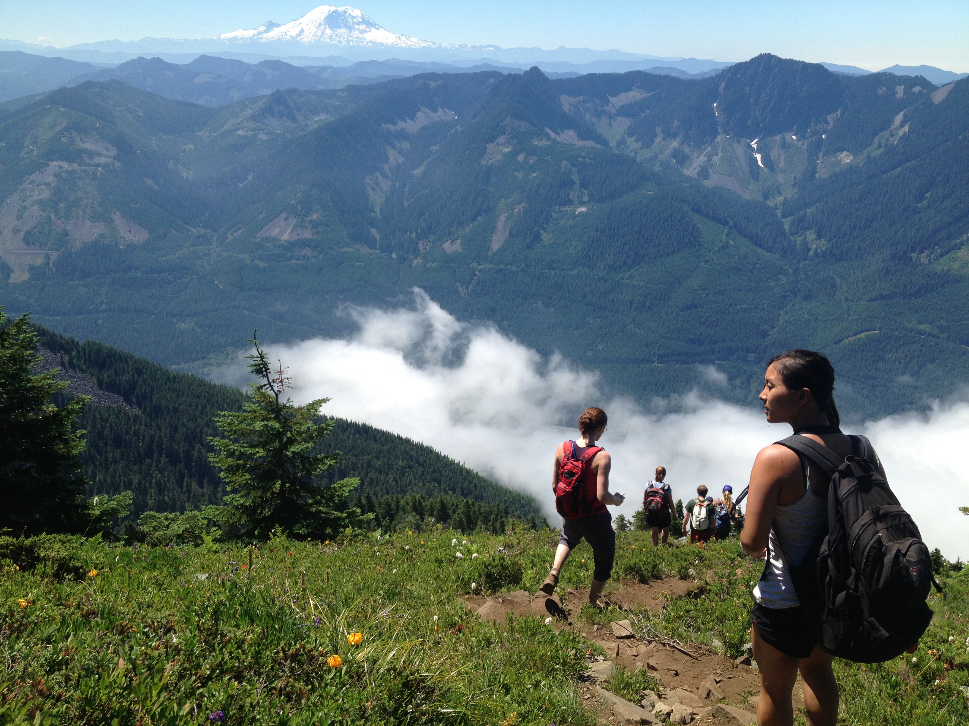
Hikers in the Mountains to Sound Greenway with Mount Rainier in the distance.
Public Domain.
Download Original (3264 x 2448 pixels, 3185.5 MB)
-
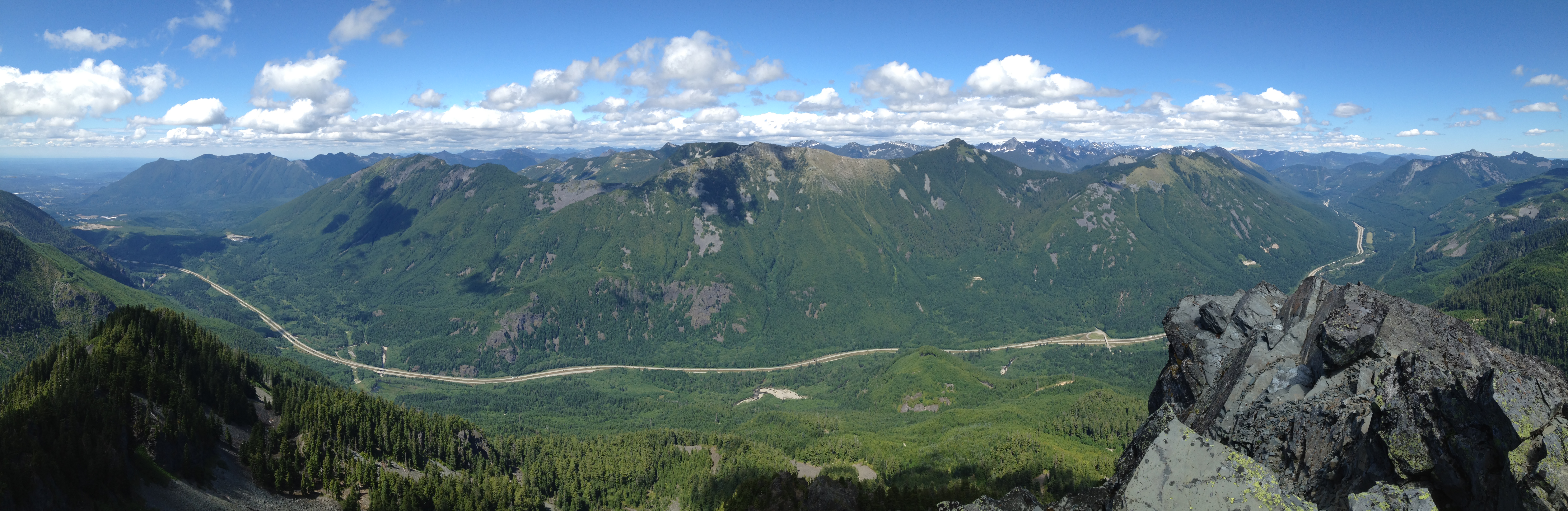
Interstate 90 and the Cascade Mountains in the heart of the Mountains to Sound Greenway National Heritage Area.
Public Domain.
Download Original (7504 x 2446 pixels, 6045.1 MB)
-
A quiet moment at Lake Sammamish State Park. This favorite day-use destination, just 15 miles east of downtown Seattle, accommodates swimming, picnicking, hiking, motorized and non-motorized boating, and water skiing.
Public Domain.
-
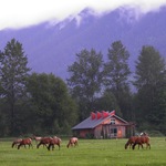
This scenic open space at Meadowbrook Farm on the Snoqualmie Valley Floor is an important story location to the Snoqualmie Tribal people. Historically, the Snoqualmie Tribal people maintained the prairie through traditional methods. Today, Meadowbrook is managed for historic and cultural interpretation, wildlife habitat, agriculture, and public recreation.
Public Domain.
Download Original (4288 x 3216 pixels, 2829.0 MB)
-
-
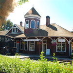
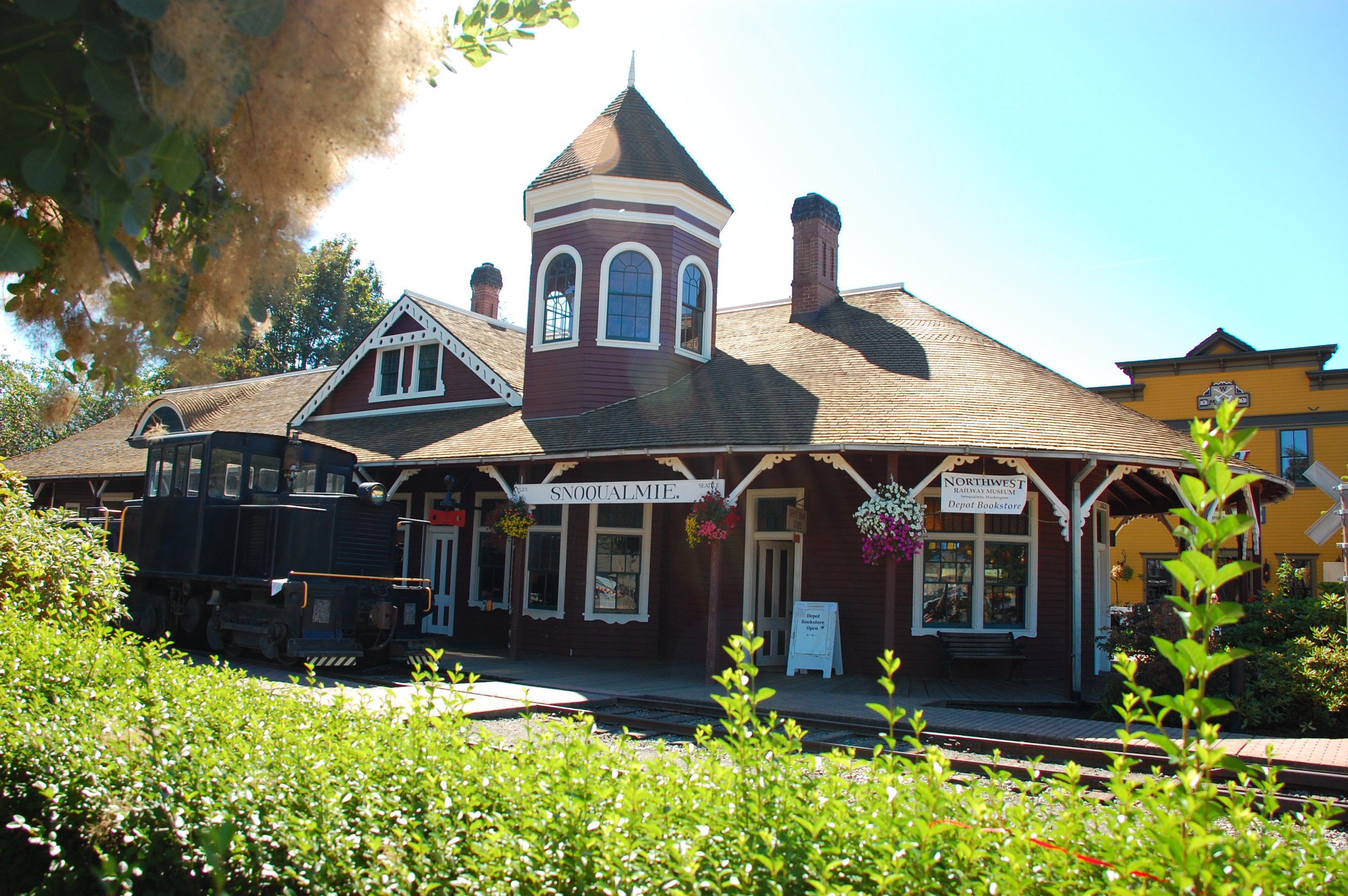
The Northwest Railway Museum resides in this grand Snoqualmie Depot, constructed in 1890. Visitors learn about northwest railway history inside the Depot, at a nearby exhibit hall, and at the collection of locomotives, freight cars, and passenger cars in town. A five-mile train ride in a historic rail coach provides a unique view of Snoqualmie Falls.
Public Domain.
Download Original (3008 x 2000 pixels, 1556.6 MB)
-
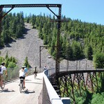
The Palouse to Cascades Trail spans Washington state from the western slopes of the Cascade Mountains to the Idaho border. Bicyclists, hikers, equestrians, skiers, and snowshoers experience Washington's diverse and scenic landscape, traveling through evergreen forests and dark tunnels, over high trestles and spectacular rivers, and across open farmland and high desert.
The Palouse to Cascades Trail follows the path of the historic Chicago-Milwaukee-St. Paul-Pacific Railroad, also known as the Milwaukee Road, that operated from 1909 to 1980.Public Domain.
-
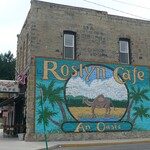
Charming Roslyn maintains much of the character of its early years as a coal town, incorporated in 1889.
Public Domain.
Download Original (1929 x 1479 pixels, 745.6 KB)
-

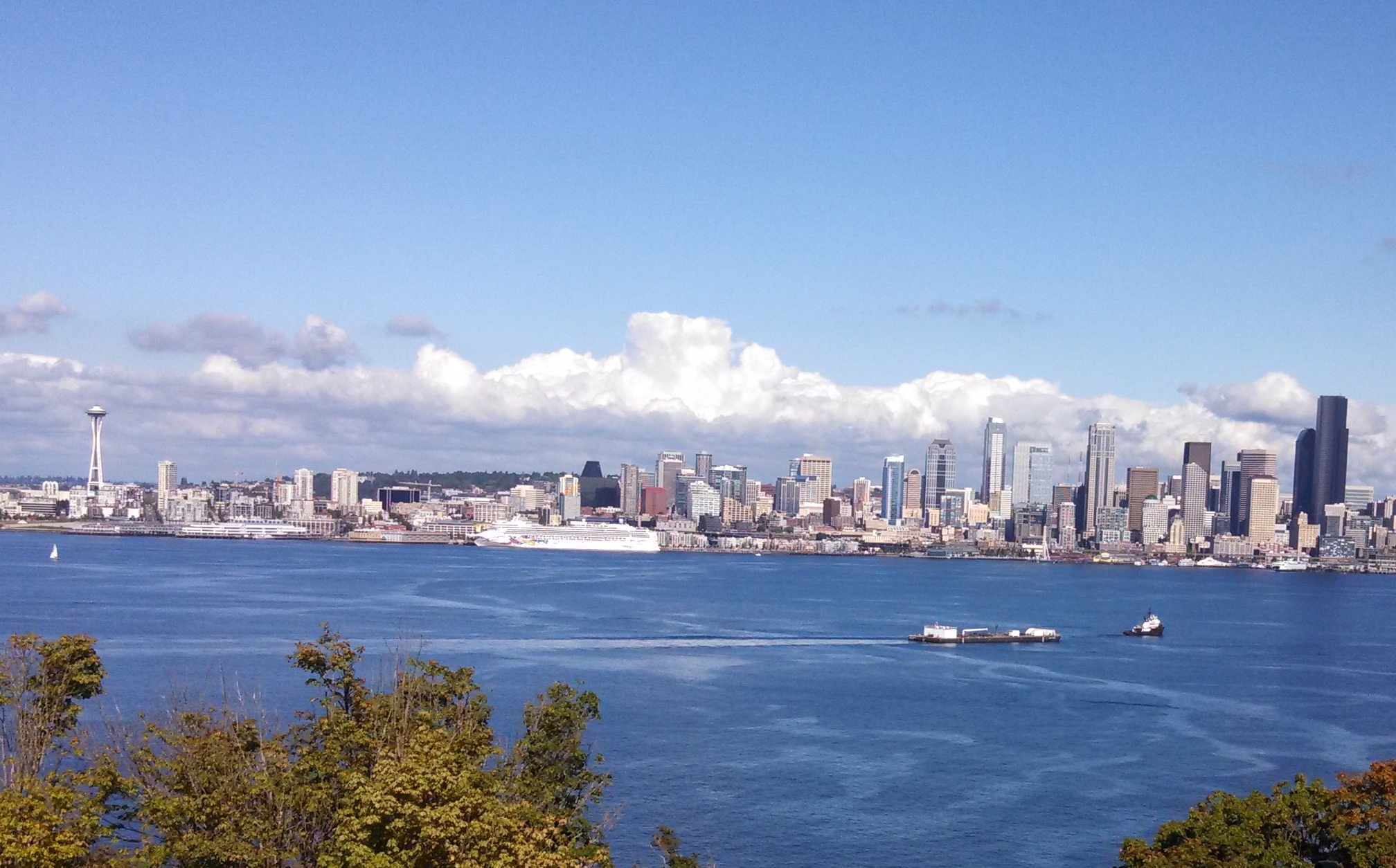
Extensive greenspace, numerous water bodies, and the surrounding mountains make Seattle one of the world’s most beautiful cities. Seattle anchors the western terminous of the Mountains to Sound Greenway Byway.
Public Domain.
Download Original (2016 x 1254 pixels, 790.5 KB)
-
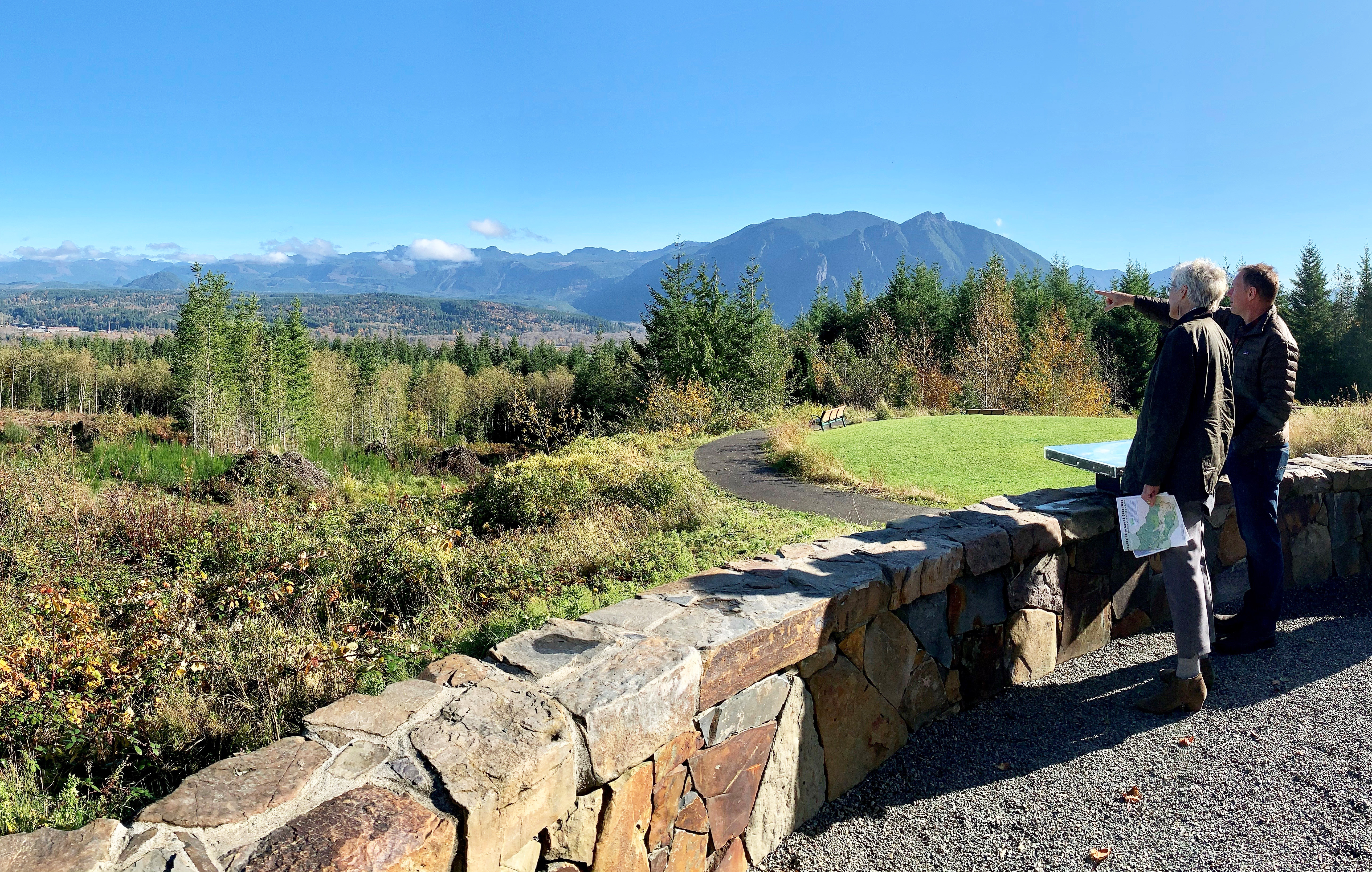
From the dramatic promontory at Snoqualmie Point Park, visitors can see the western front of the Cascade Mountain range from British Columbia to Snoqualmie Pass. Below the Cascades, the view sweeps over thousands of acres of forest and farmlands and comes to rest on the rural cities of Snoqualmie and North Bend, with the rugged face of Mt. Si towering above.
Public Domain.
Download Original (5152 x 3274 pixels, 14187.1 MB)
-
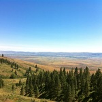
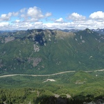
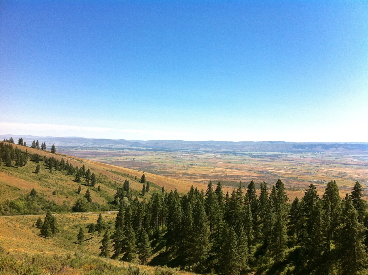
The Yakima River valley viewed from Table Mountain.
Public Domain.
Download Original (1280 x 957 pixels, 442.3 KB)
-
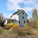
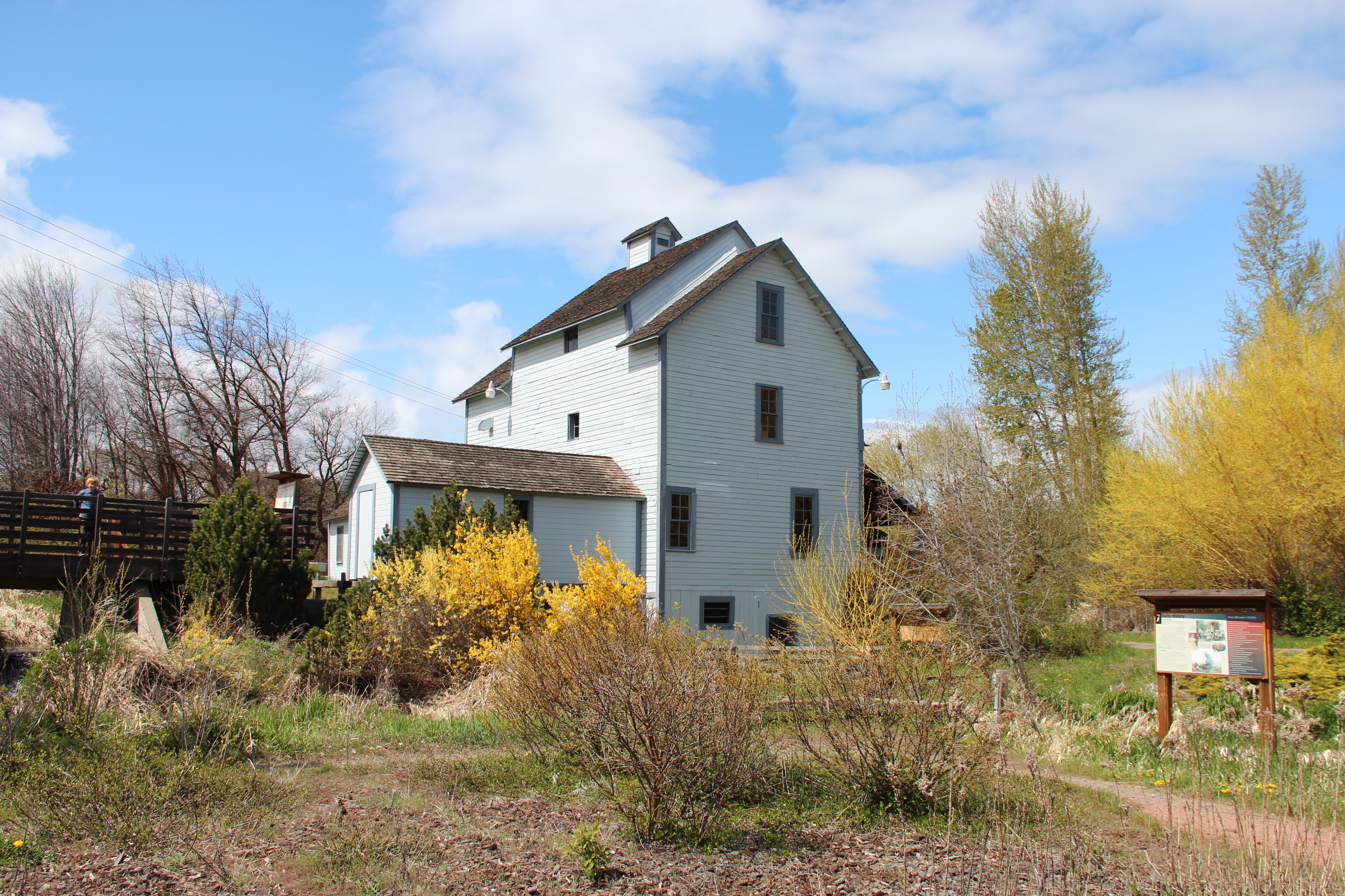
The Thorp Grist Mill - the oldest remaining industrial artifact in Kittitas County - showcases a remarkable collection of handmade wooden mill machinery. Constructed in 1883, it served as an essential place for flour milling and social interaction for Kittitas County residents until 1946.
Public Domain.
Download Original (3456 x 2304 pixels, 5339.2 MB)
-
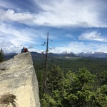
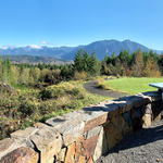
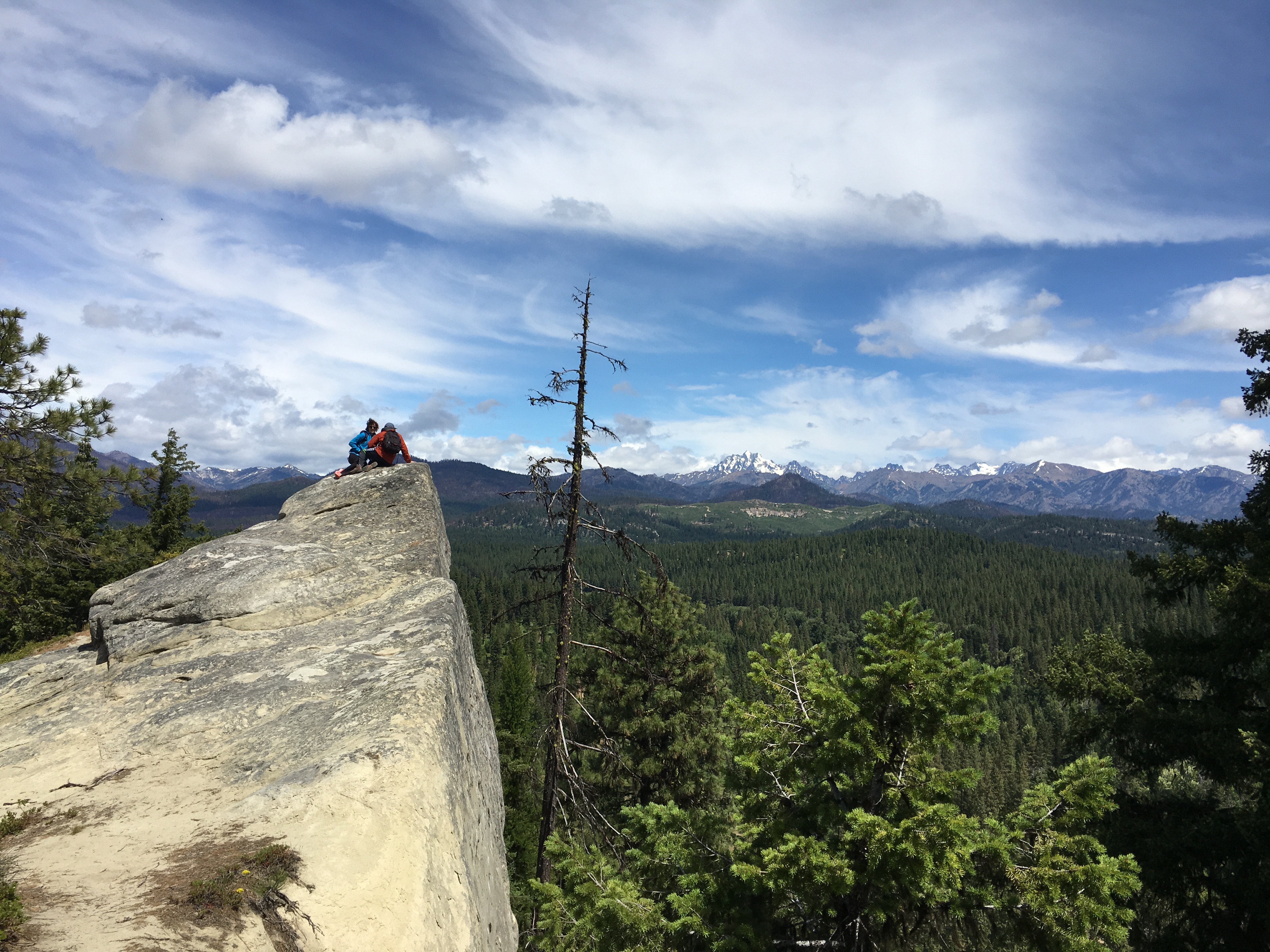
A rock outcropping provides hikers a dramatic view of the Teanaway River Valley.
Public Domain.
Download Original (4032 x 3024 pixels, 3087.9 MB)