
Norris Freeway
All Photos (27)
-
Public Domain.
Download Original (4288 x 2848 pixels, 6328.8 MB)
-
Public Domain.
Download Original (4032 x 3024 pixels, 4511.6 MB)
-

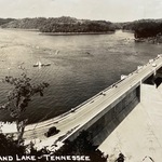
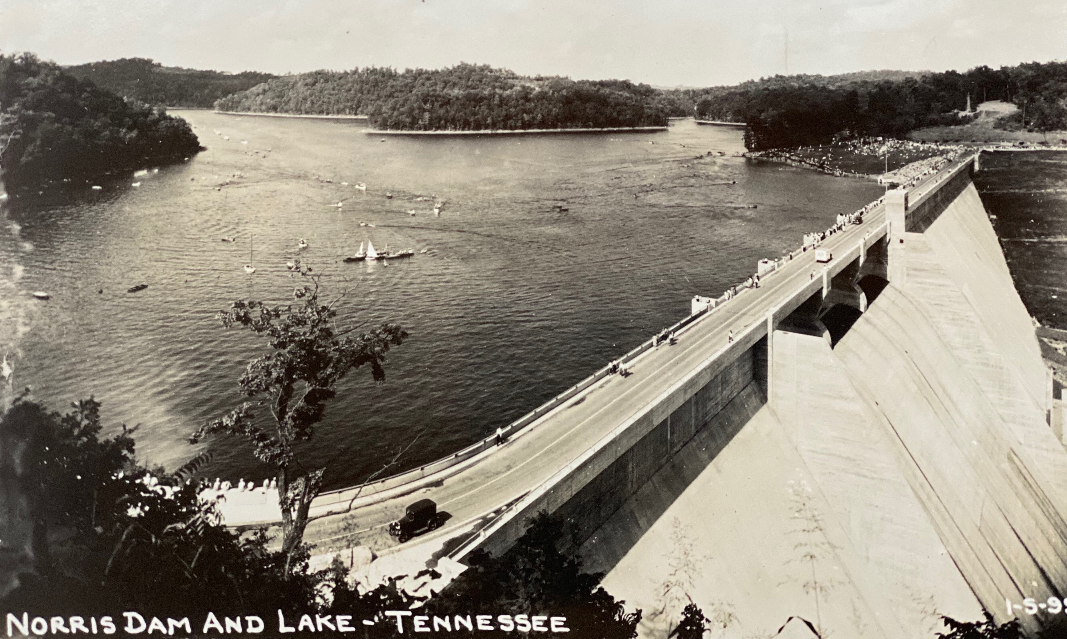
This historic photo was originally a postcard of the 1930s that captures the face of the massive concrete Norris Dam, and the lake with its motor boats and sail boats. Forested hills form the background. Finally, Norris Freeway is the centerpiece, running across the top of the dam. Cars, that now look like antiques, are passing over the dam.
Public Domain. Norris Museum Archives
Download Original (3735 x 2238 pixels, 2460.9 MB)
-
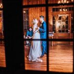
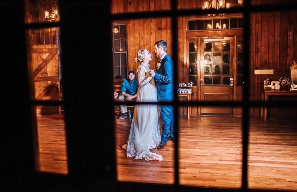
The interior of the Tearoom with its wood paneling, glossy hardwood floors, transoms and multi-pane doors hasn't changed in its 85 year history. Here's one of its special uses, welcoming a newly married couple for their first dance, kicking off their wedding reception.
Public Domain. Michael Carberry
Download Original (1024 x 663 pixels, 91.6 KB)
-

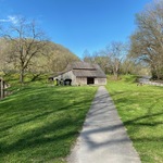
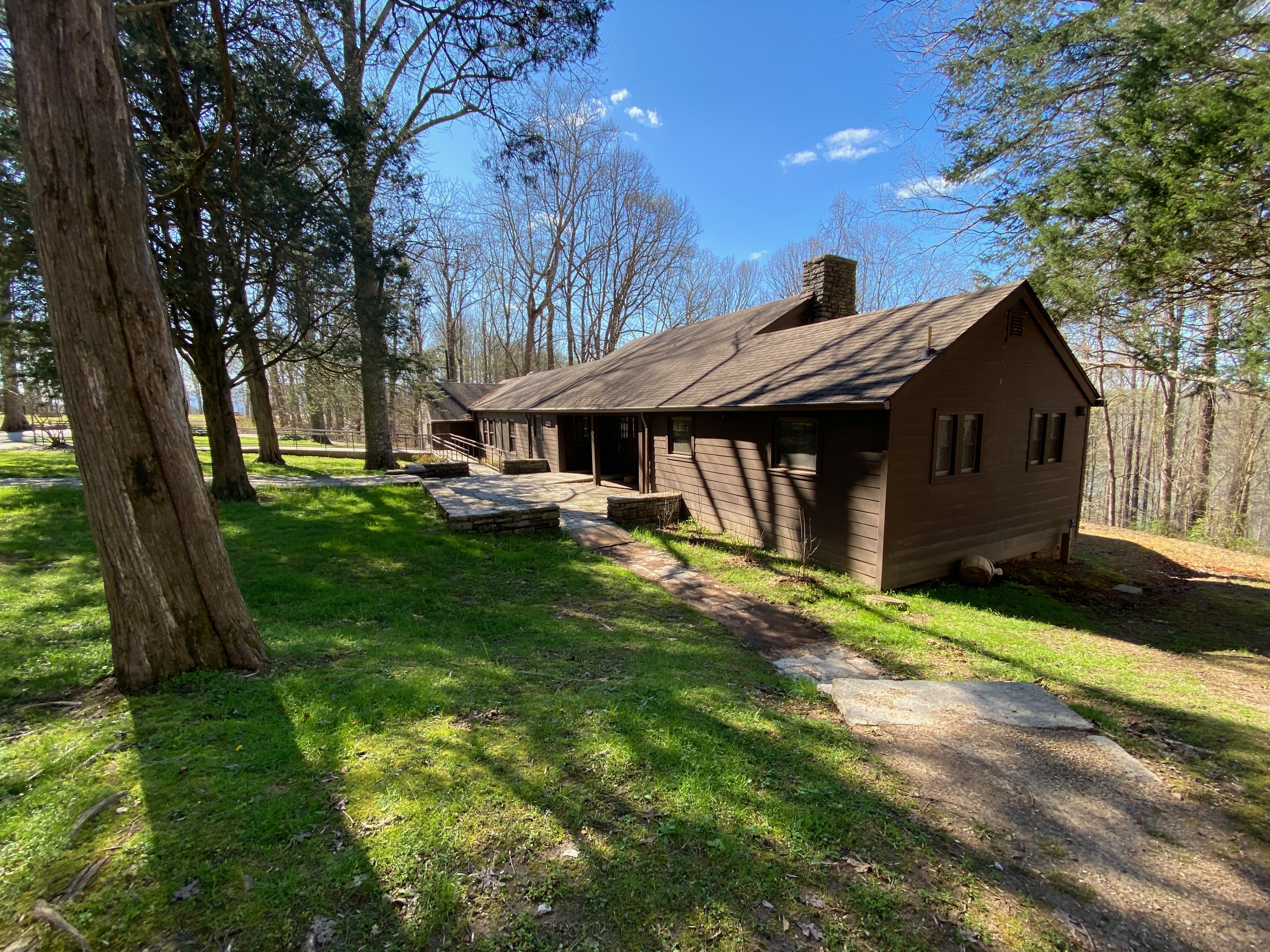
This building was the centerpiece of "Norris Park" as TVA called its new recreation area. This stone and wooden structure was built by the Civilian Conservation Corp (CCC) in the early 1930s. In the early years it contained a restaurant. Today, it serves a meeting center.
Public Domain. Michael Carberry
Download Original (4032 x 3024 pixels, 4275.0 MB)
-
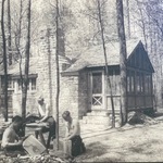
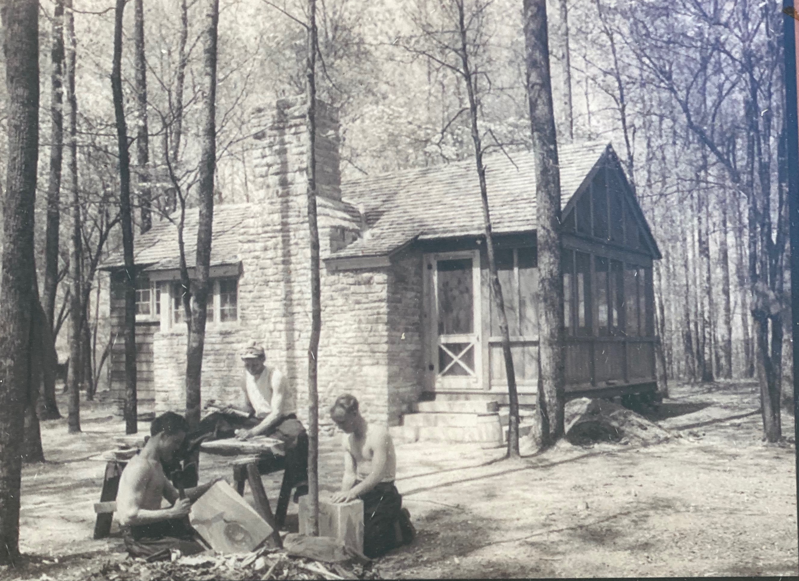
Here are the CCC boys, as they were nicknamed, completing stone and wood work for the original cabins. This particular cabin, like the other 18 cabins, are still there and are available for seasonal lodging.
Public Domain. TVA
Download Original (2654 x 1931 pixels, 1812.5 MB)
-

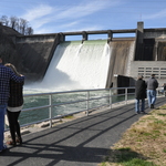
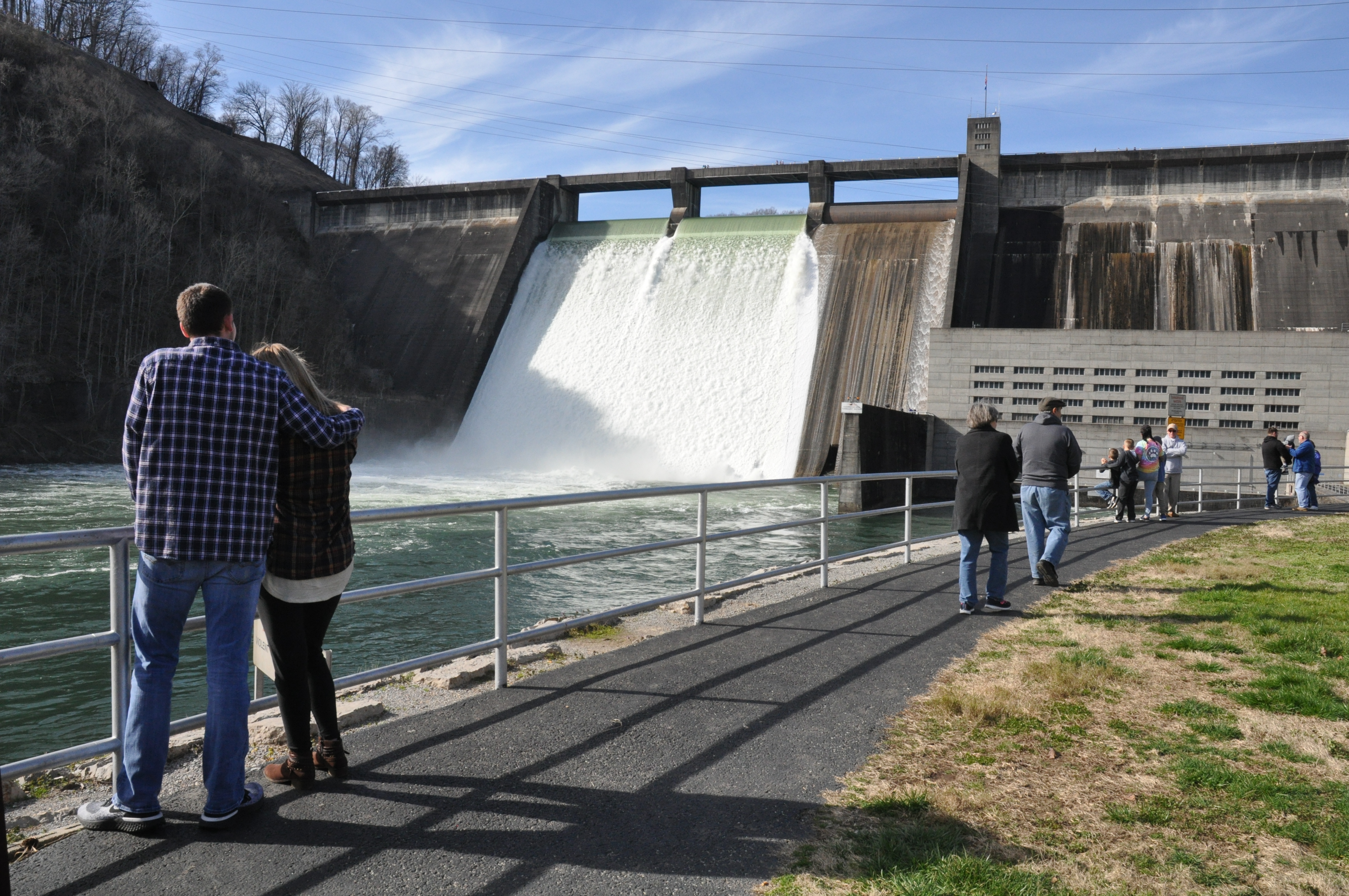
On rare occasions, such as after days of rain, Norris Lake reaches full pool and the water is released the over the top of the dam. Many visitors arrive to see what looks like and sounds like a massive waterfall.
Public Domain. Michael Carberry
Download Original (4288 x 2848 pixels, 6328.8 MB)
-
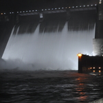
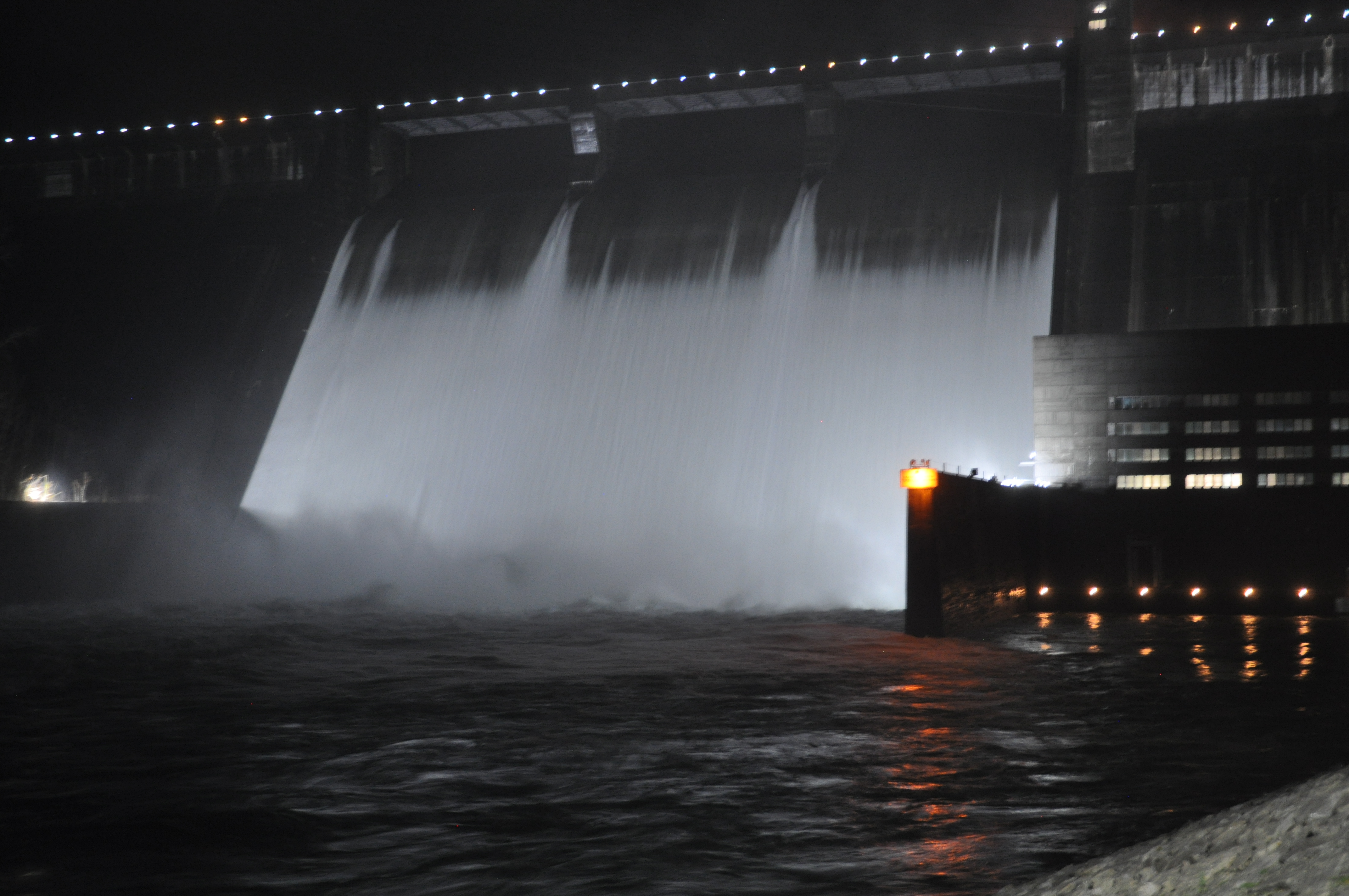
The parking area below the dam remains open into evening hours. The dam takes on a new life as it is well lit and floodlights make the electrical-generating powerhouse and the flowing lake water glow.
Public Domain. Michael Carberry
Download Original (4288 x 2848 pixels, 4468.8 MB)
-
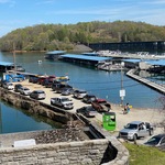
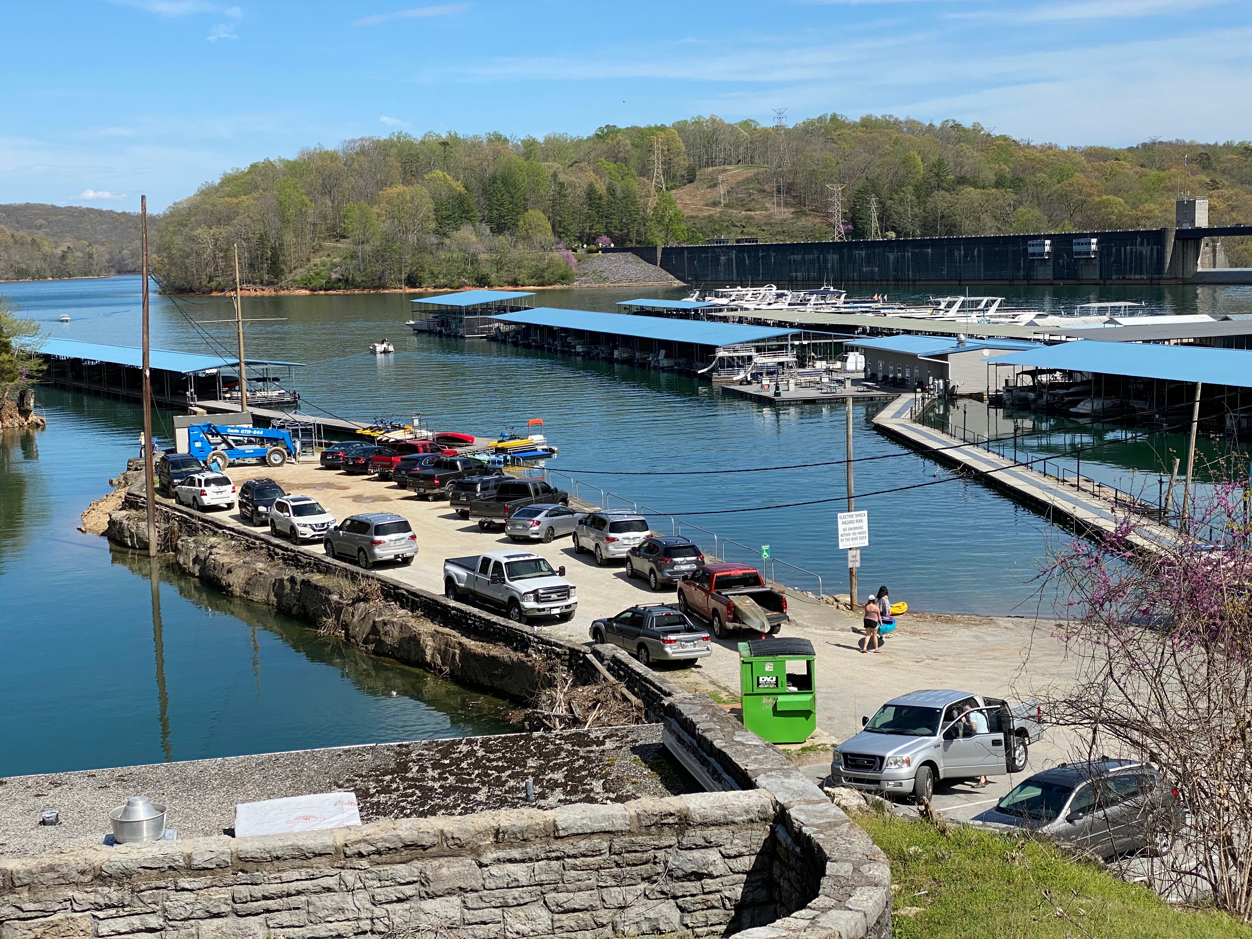
The beautiful lake is home to dozens and dozens of boat docks and boat slips. Here, you can also see a long boat launching ramp and a few kayakers ready to take to the lake.
Public Domain. Michael Carberry
Download Original (4032 x 3024 pixels, 4196.2 MB)
-
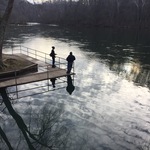
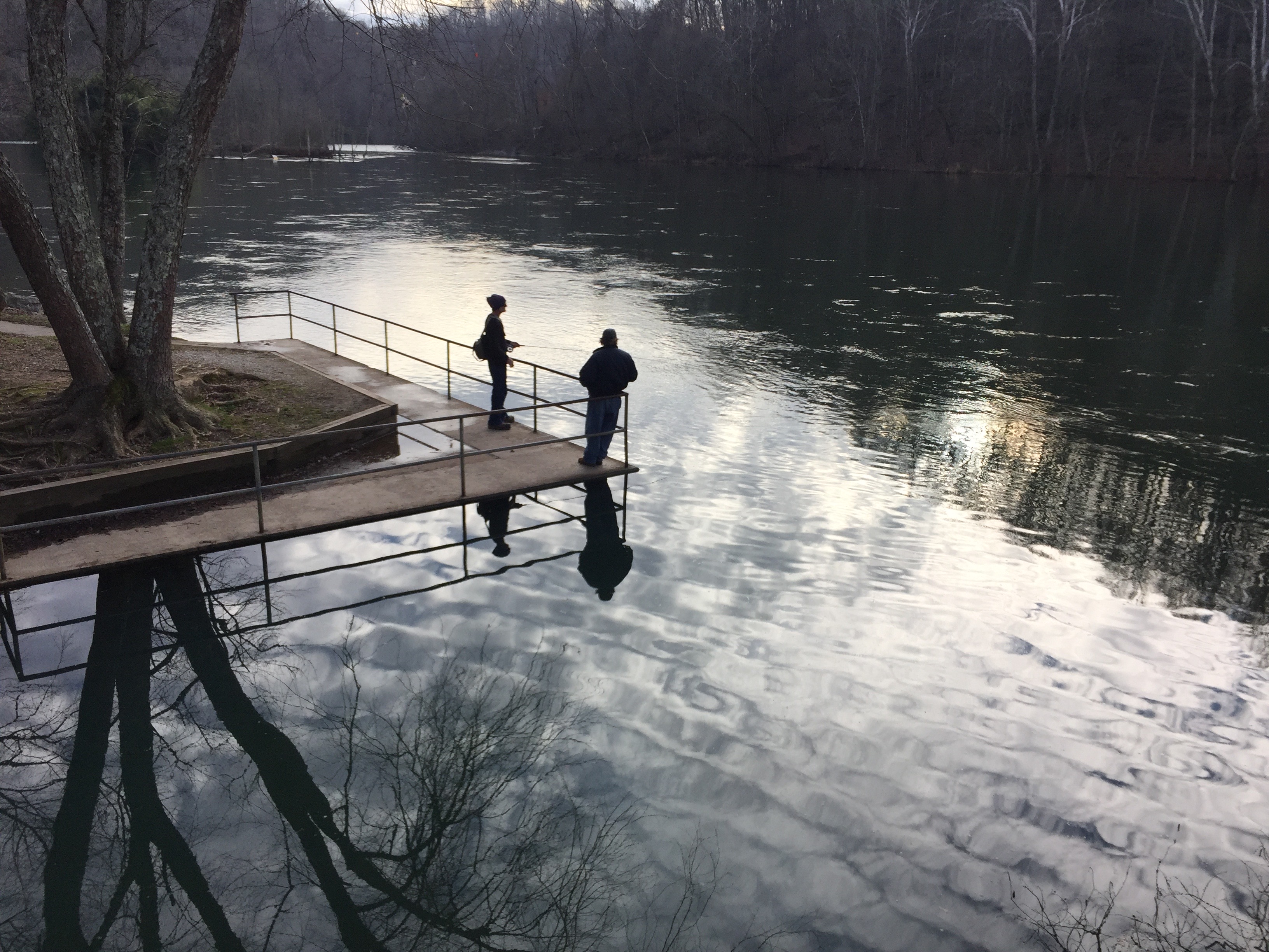
Here a woman with her fishing rod in hand and her friend are at Clear Creek. The concrete platform there offers a good spot to cast a line into the Clinch River. A lovely reflection of the winter hardwoods can be seen in the water.
Public Domain. Michael Carberry
Download Original (3264 x 2448 pixels, 2122.5 MB)
-
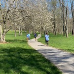
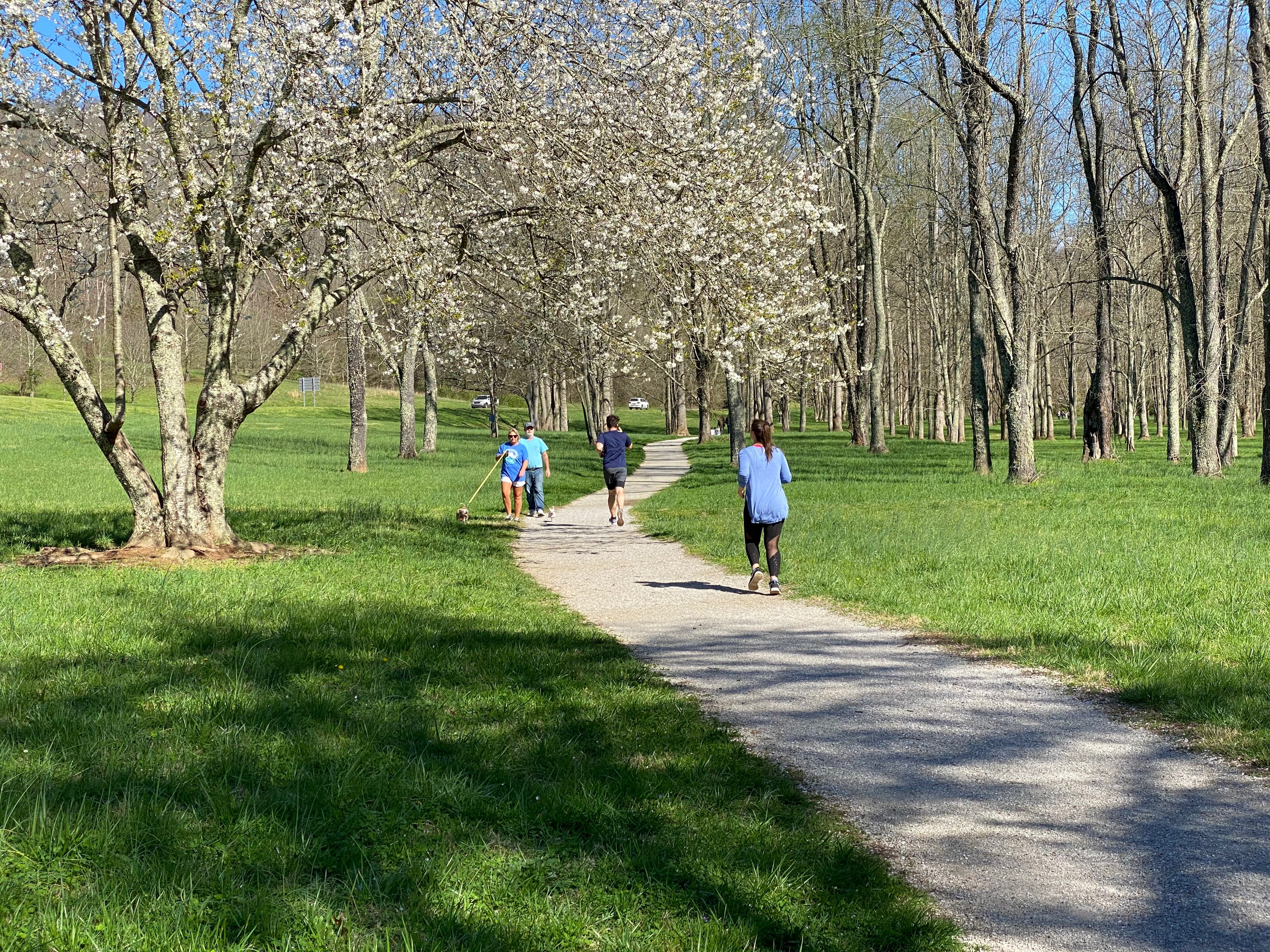
This trail is renowned for its multitude of swallows, Bluebirds and finches. In spring time, the birds are everywhere so are flowering Dogwood and cherry trees. Here are the flowering white blossoms with joggers and walkers enjoying a sunny day.
Public Domain. Michael Carberry
Download Original (4032 x 3024 pixels, 6840.5 MB)
-
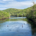
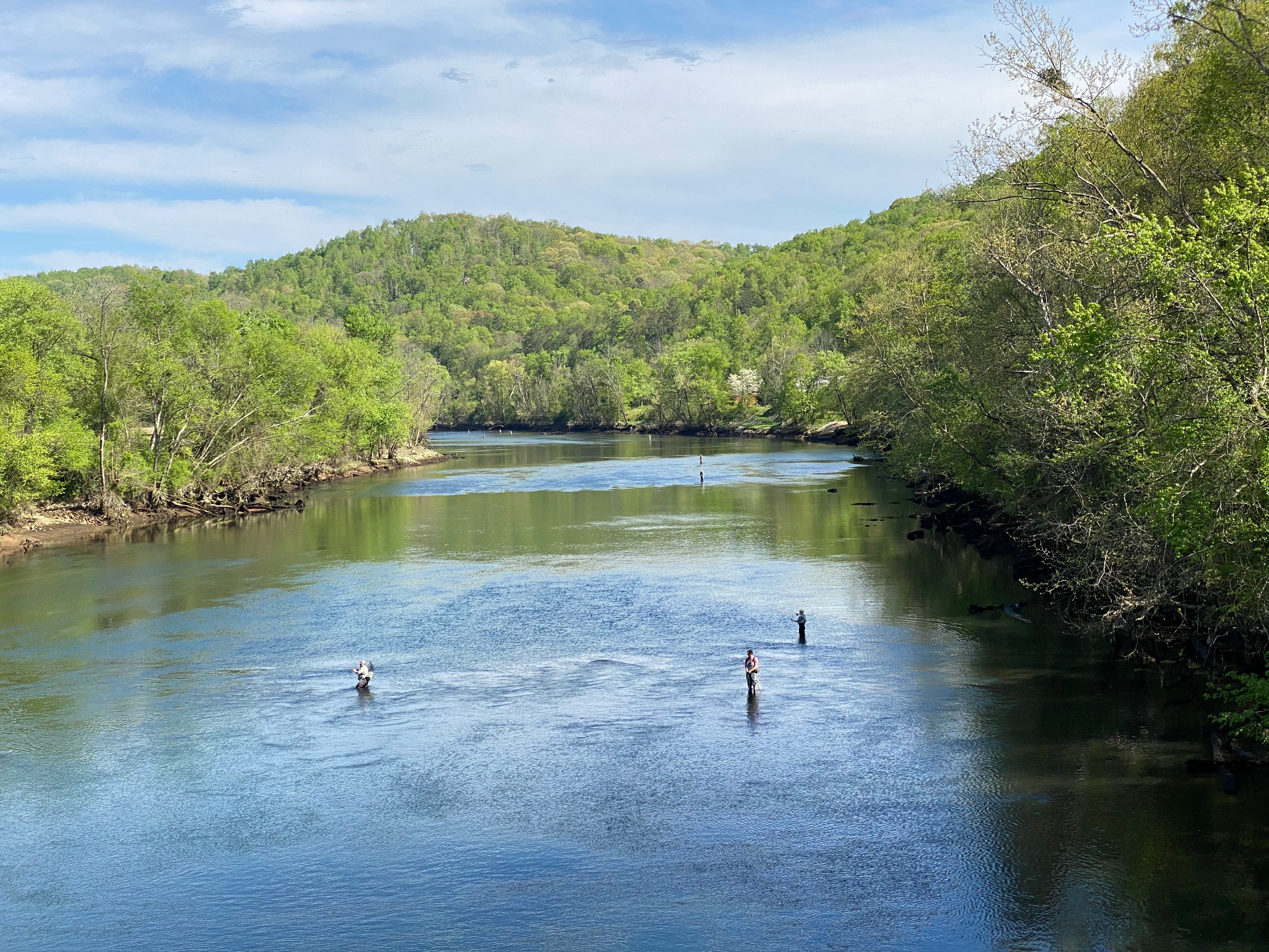
The Clinch River is occasionally low enough for fly fishing here. You can see people casting their lines up and down the stream on a beautiful Spring day. This river is a destination for trout fishing...the Tennessee record for a Brown Trout catch,28 pounds, was made here.
Public Domain. Michael Carberry
Download Original (4032 x 3024 pixels, 4377.6 MB)
-
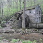
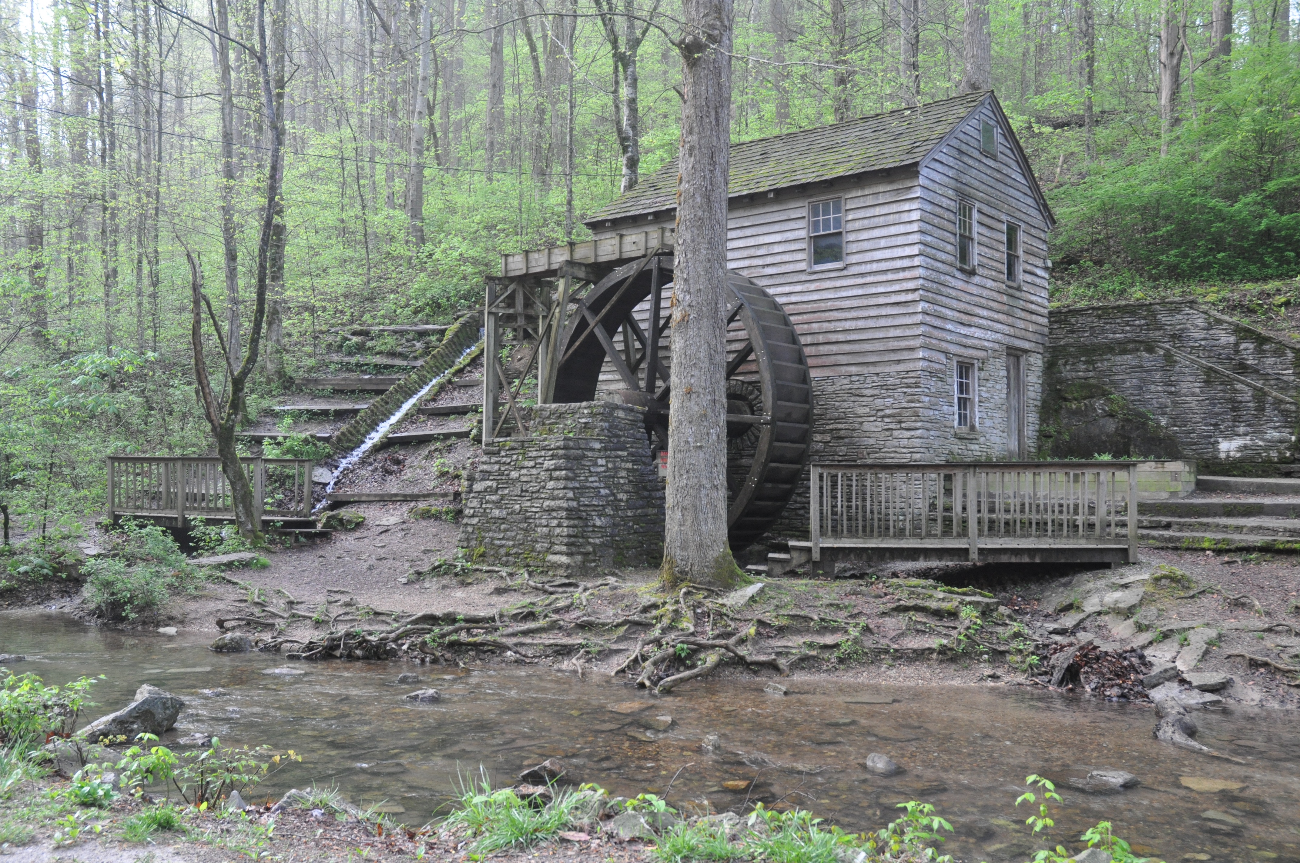
This wooden mill was built 1798. It was moved here the mid-1930s because it would have been submerged under Norris Lake. The CCC boys worked with the National Park Service to mark the boards as it was dismantled and reassembled here. Its large wheel turns with flowing water, enabling heavy, mill stones to grind corn into corn meal.
Public Domain. Michael Carberry
Download Original (4288 x 2848 pixels, 3738.4 MB)
-
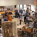
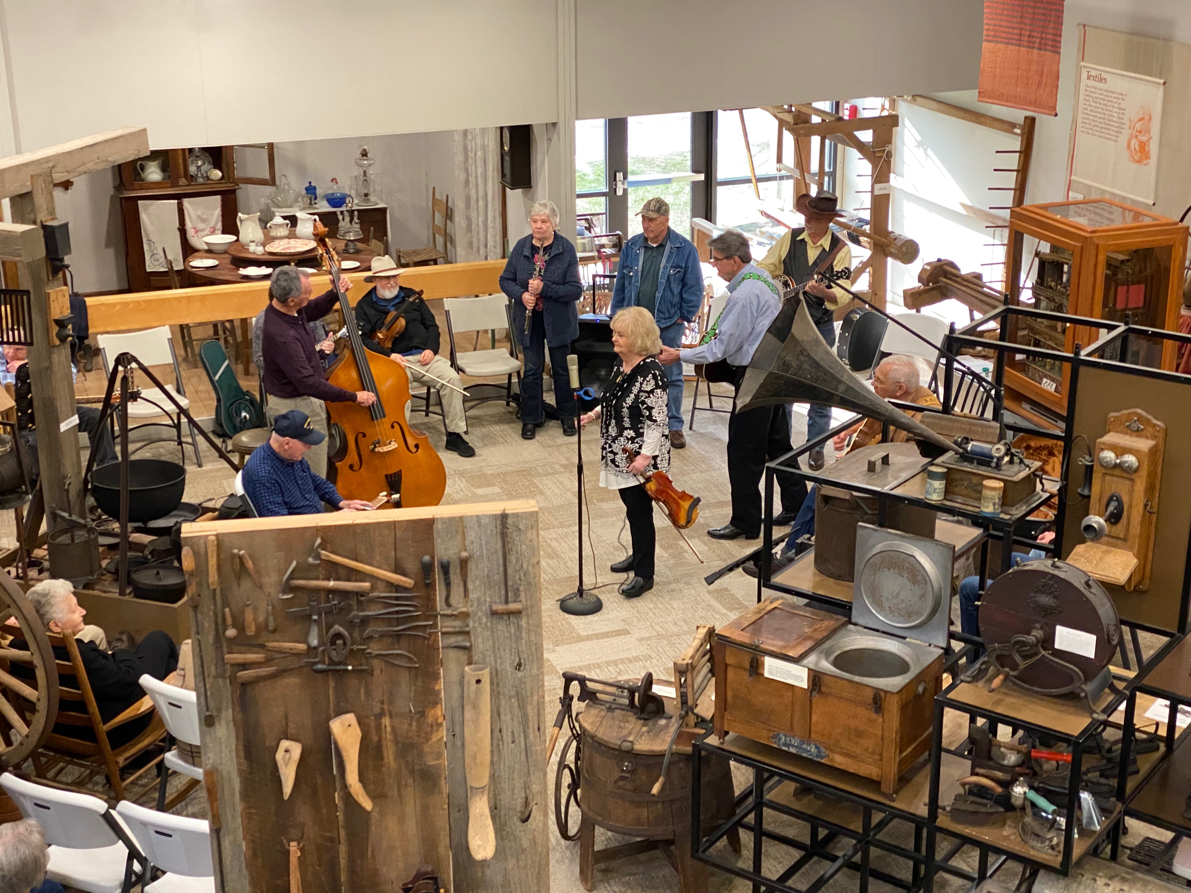
Every Sunday afternoon Bluegrass musicians gather here to play their Old Time music. You'll hear fiddles, mandolins, bass and banjos harmonizing together. And it's free!
Public Domain. Michael Carberry
Download Original (4032 x 3024 pixels, 2266.3 MB)
-
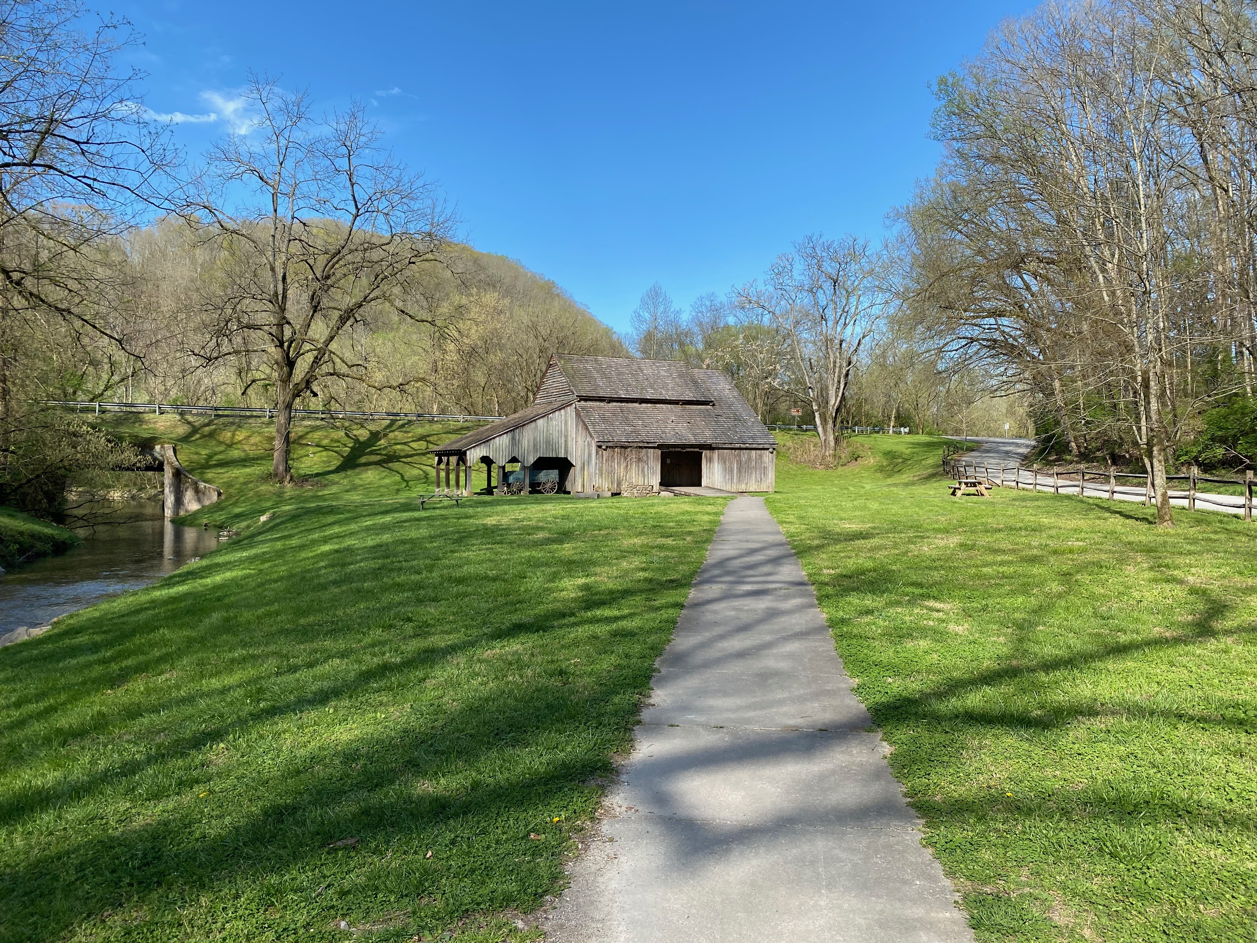
This barn, dates from the 1830s, and was saved from the lake waters of another TVA project, Cherokee Dam and Lake. After being stored by the National Park Service for years, State Park officials agreed to accept its components and reconstruct it here. The large structure is covered in clapboard and has a roof of wooden slats. The large entrance enabled oxen to be hooked up the threshing machine that went in circles to grind grain.
Public Domain. Michael Carberry
Download Original (4032 x 3024 pixels, 5128.1 MB)
-
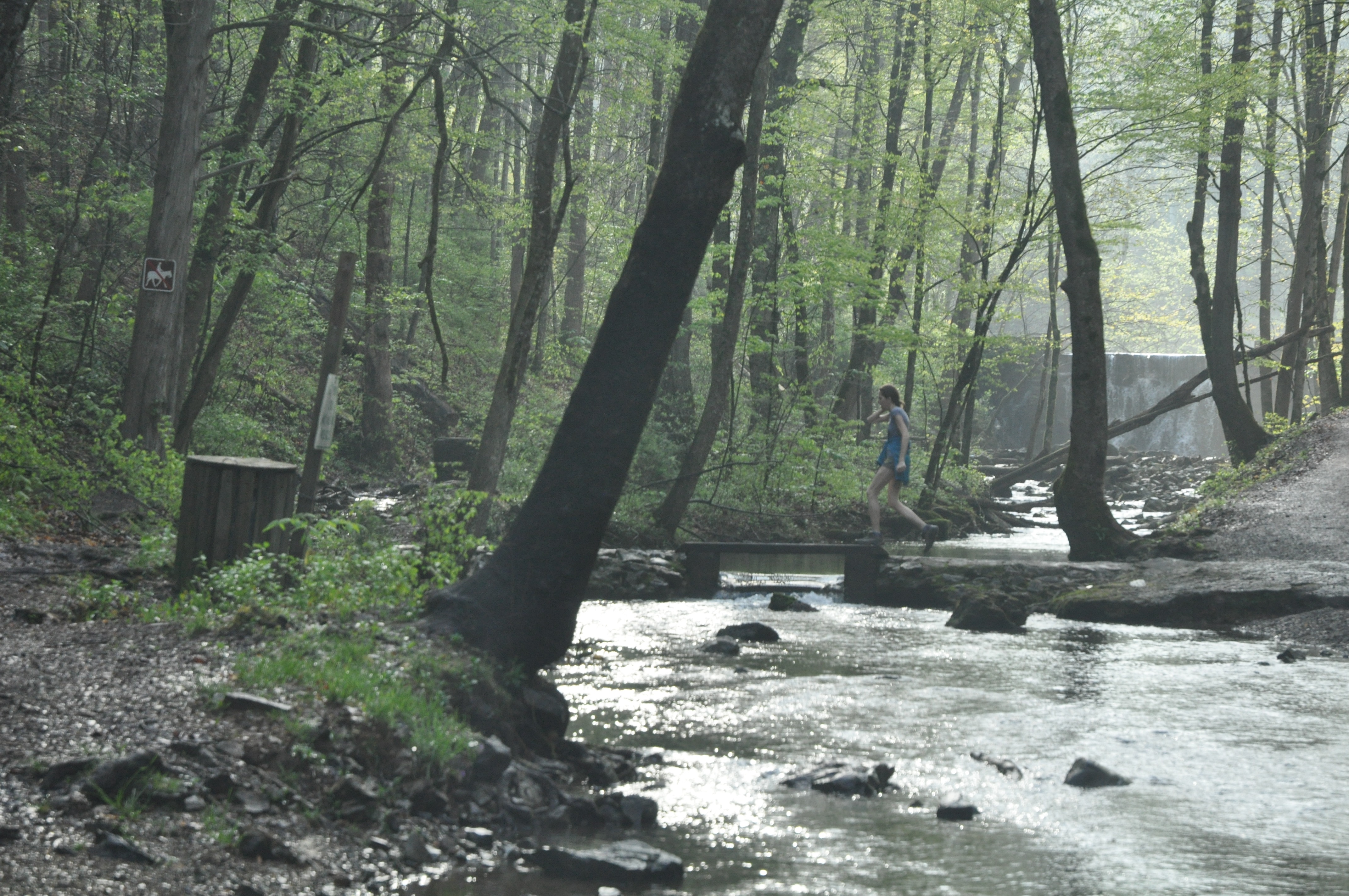
This stone-faced dam was built by the Civilian Conservation Corps. The small lake behind the dam forms a nice habitat for herons and other water fowl. Hikers, such as this fellow crossing the creek are often in this area.
Public Domain. Michael Carberry
Download Original (2848 x 4288 pixels, 4189.5 MB)
-
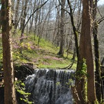
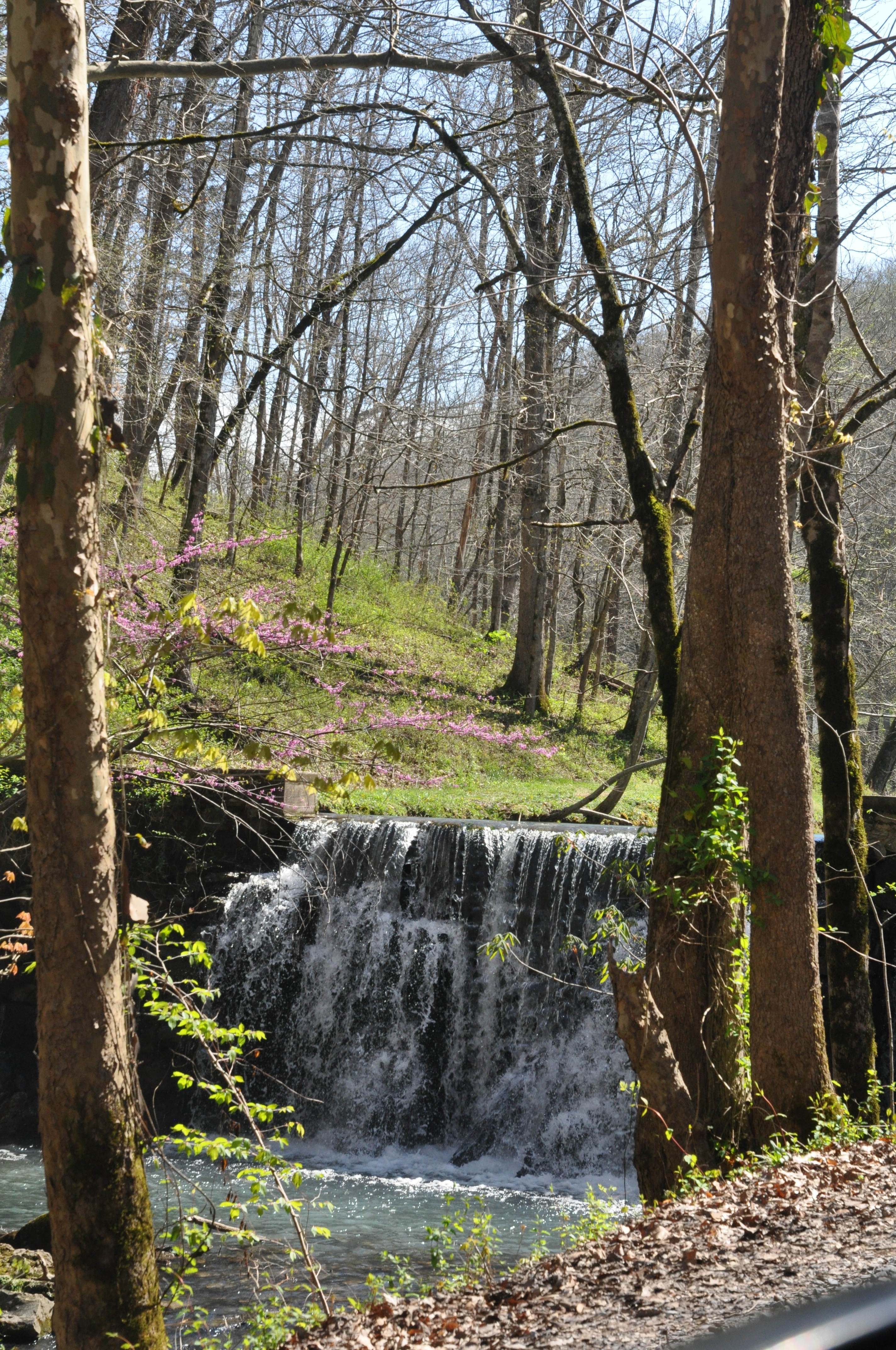
This small water fall is coming over a beautiful dam. It was constructed of cut stone by the CCC boys. Blue herons and Green Herons dabble in the ponds upstream of the dam.
Public Domain. Michael Carberry
Download Original (4288 x 2848 pixels, 2729.3 MB)
-
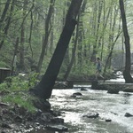
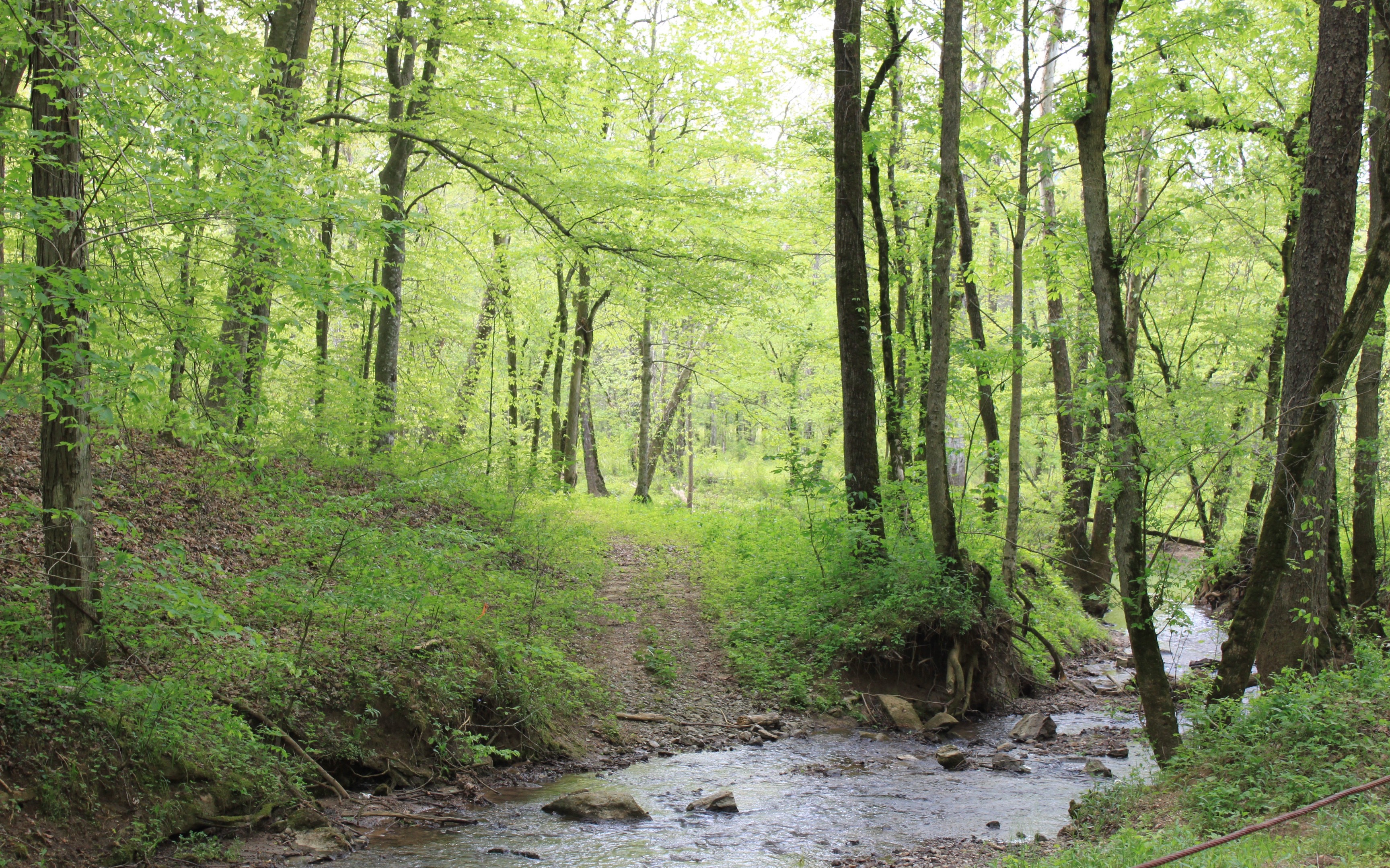
The Clear Creek is pristine and serve as the water source for the City of Norris. On the other side of the creek is one of the many hiking trails in the area. The bright green leaves are a sure sign of a nice Spring day in the forest.
Public Domain. Michael Carberry
Download Original (3456 x 2159 pixels, 3156.6 MB)
-
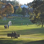
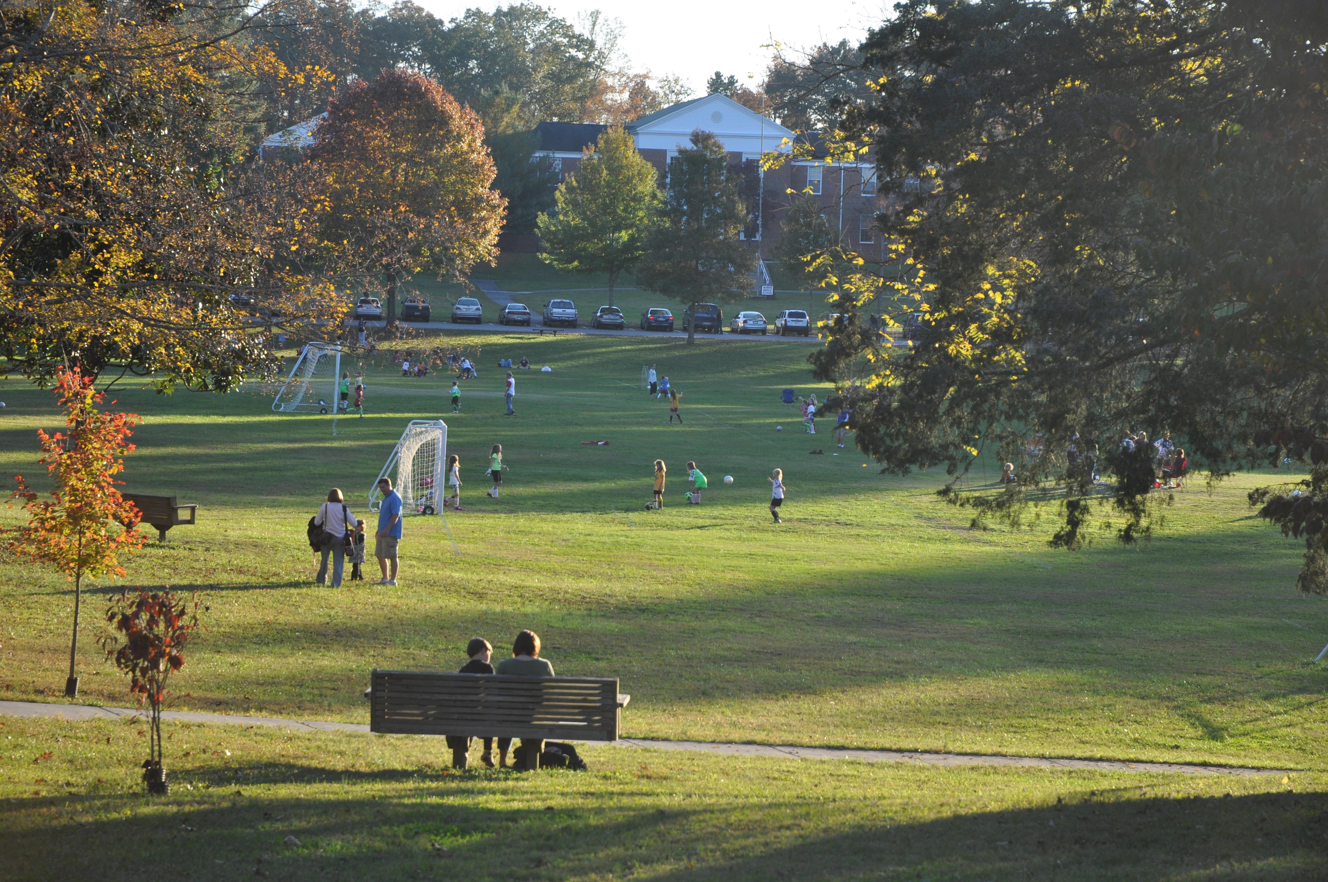
This broad park space is the centerpiece of the town of Norris. In this scene there are dozens of kids playing soccer and adults sitting on the hillside overlooking the action on the field. A variety of trees surround the open space, and have led to the recognition of the Commons as a Tennessee arboretum.
Public Domain. Michael Carberry
Download Original (4288 x 2848 pixels, 3276.6 MB)
-
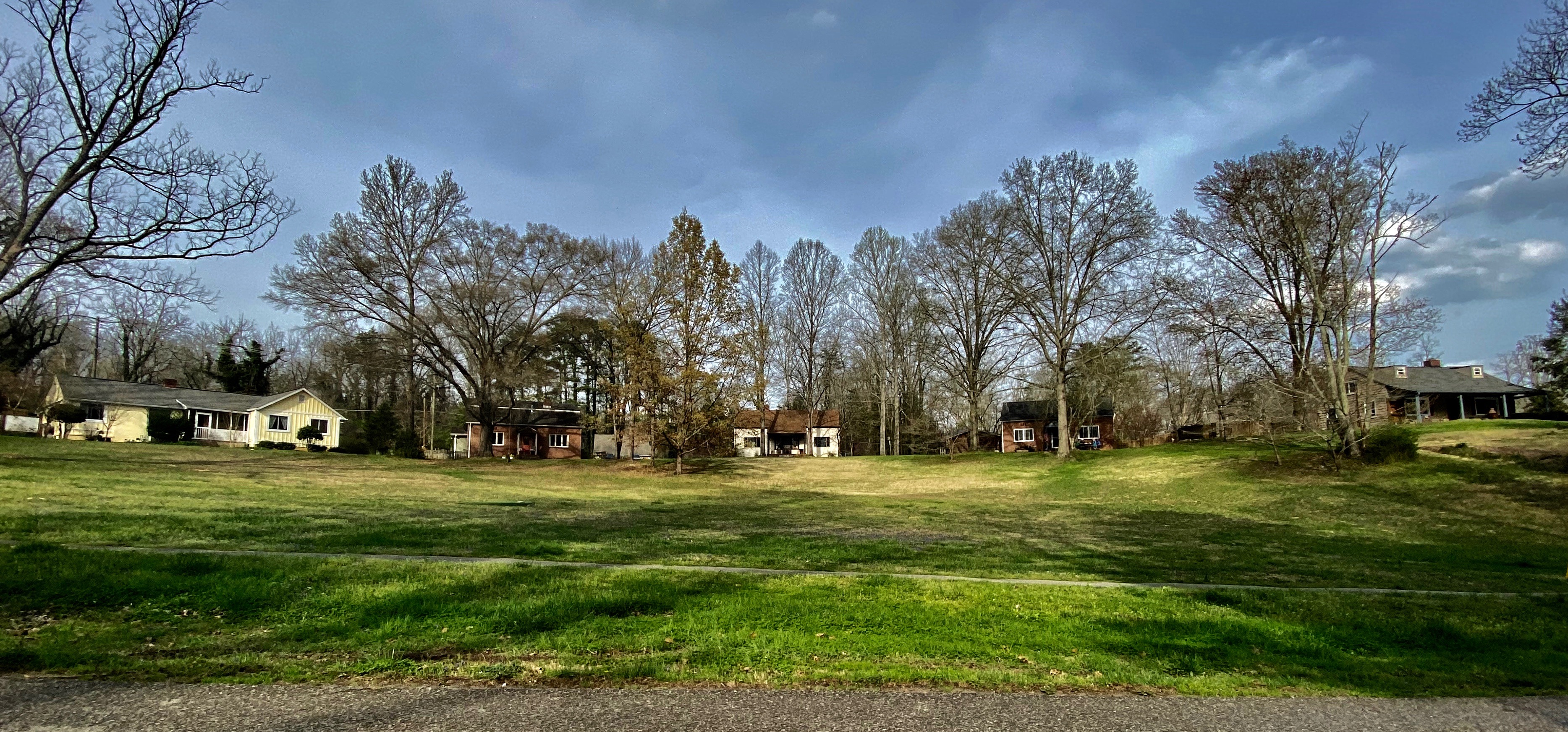
The semi-circular line of houses overlooks a public open space. The houses were constructed in the mid-1930s and each has its own quaint architecture that mimic housing styles and materials of East Tennessee.
Public Domain. Michael Carberry
Download Original (3735 x 1745 pixels, 2530.6 MB)
-
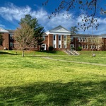
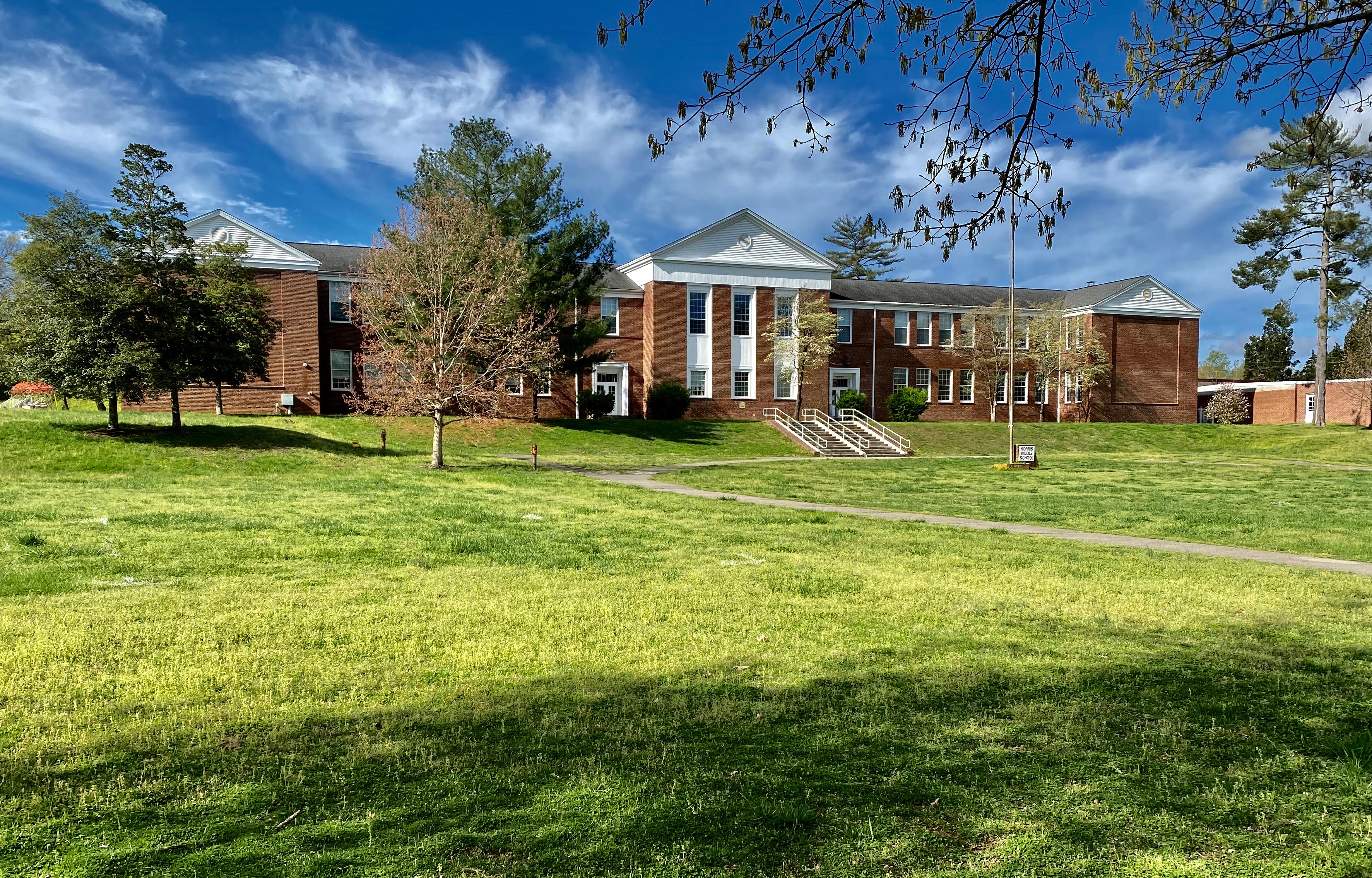
This brick edifice is handsomely situated across from the Commons. Its two-stories, contain the classrooms where thousands of local kids have been educated over the years. It was originally a school for every Norris child, kindergarten thru high school. Today, it is the Norris Middle School.
Public Domain. Michael Carberry
Download Original (3546 x 2269 pixels, 4026.5 MB)
-
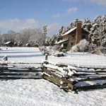
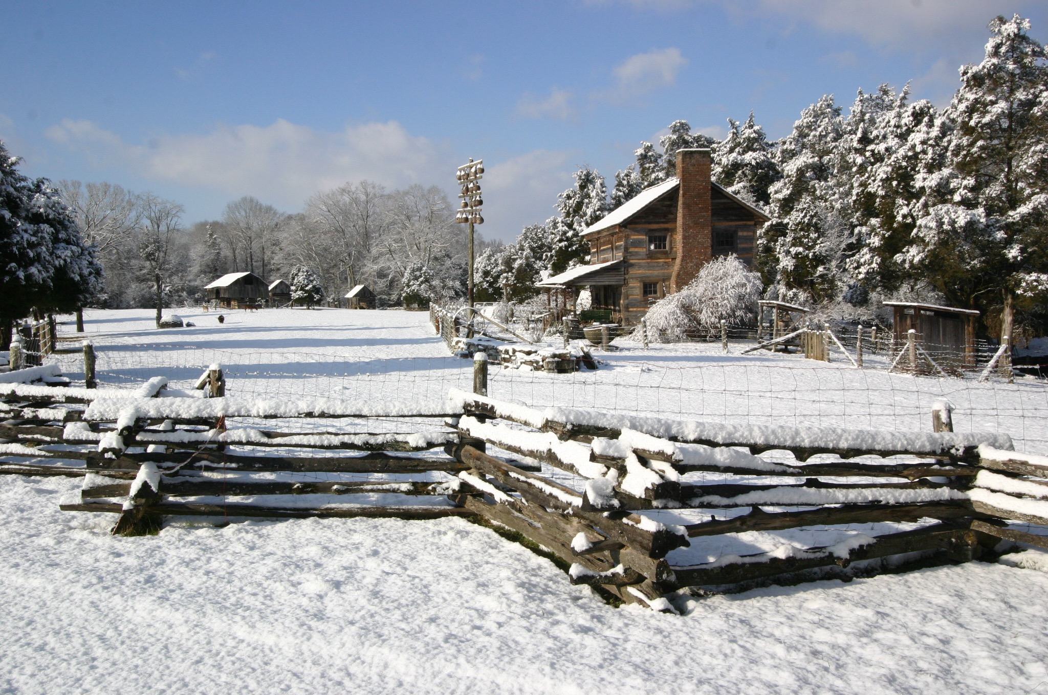
This kind of snow-covered landscape is occasionally seen in this East Tennessee. However, experiencing an early, two-story log house like this one is not an every day experience. The gourd on the pole is actually a bird house. The split-rail fence was typically used on early farm lands.
Public Domain. Michael Carberry
Download Original (2048 x 1360 pixels, 924.7 KB)
-
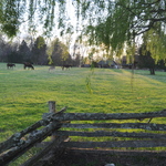
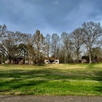
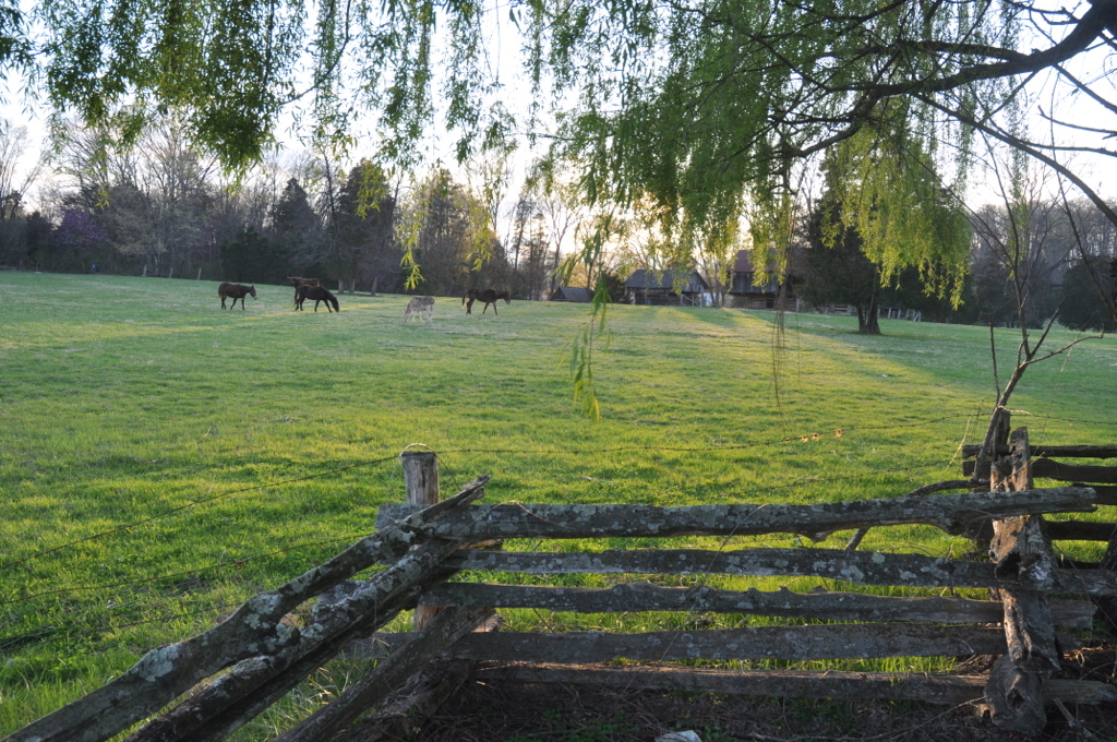
The lush, green fields here are grazed by horses, oxen, sheep and goats. Log buildings are in the background, including a good-sized barn.
Public Domain. Michael Carberry
Download Original (1024 x 680 pixels, 496.9 KB)
-
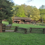
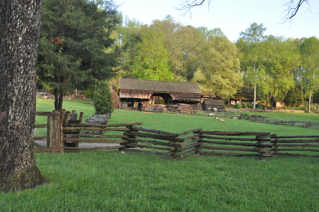
This log barn is cantilevered. In other words, the second level overhangs spaces where live stock can come up to feed and be protected from the elements. In the foreground, a split rail fence surrounds the pasture and sheep.
Public Domain. Michael Carberry
Download Original (1024 x 680 pixels, 436.7 KB)
-

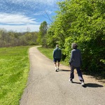
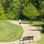
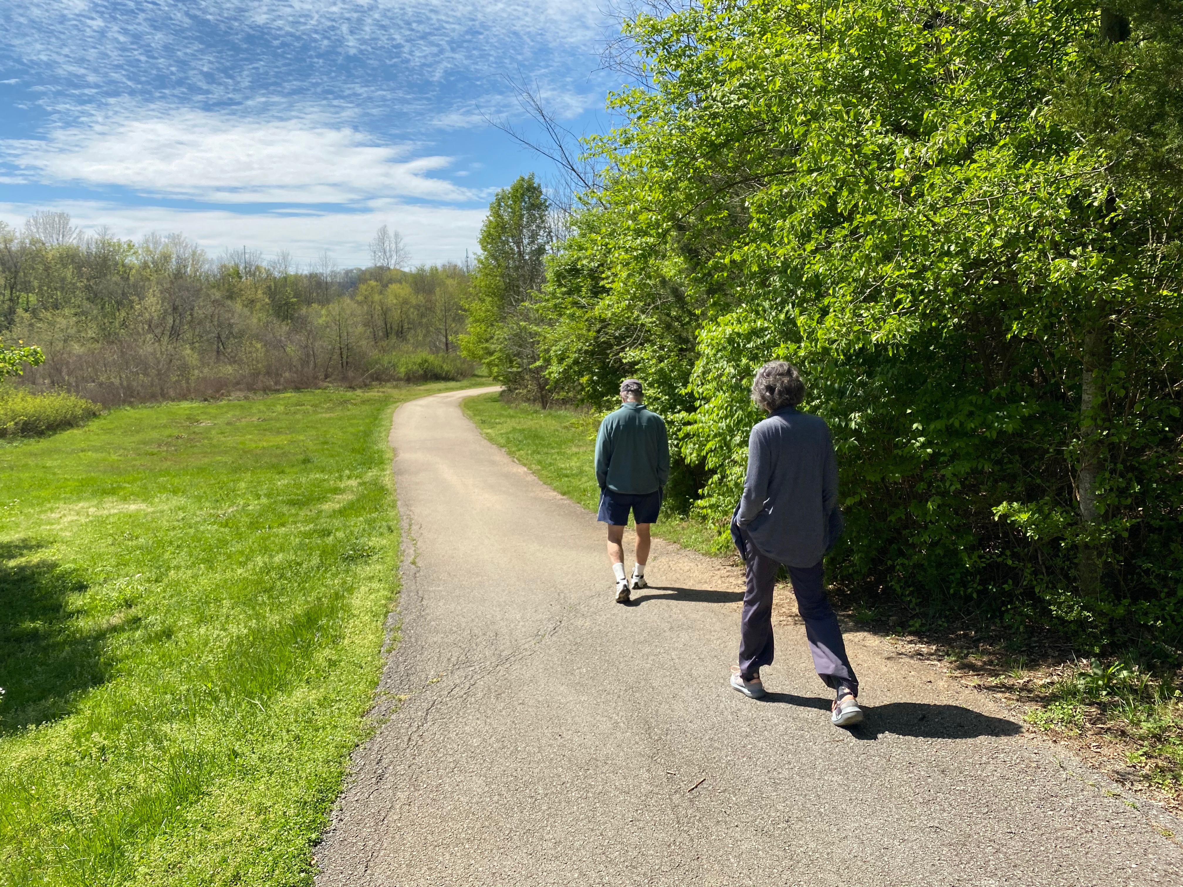
The older couple that is walking down this asphalt trail are heading into the Halls Greenway. In the background is the flat, lightly forested flood plain of Beaver.
Public Domain. Michael Carberry
Download Original (4032 x 3024 pixels, 4511.6 MB)
-
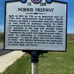
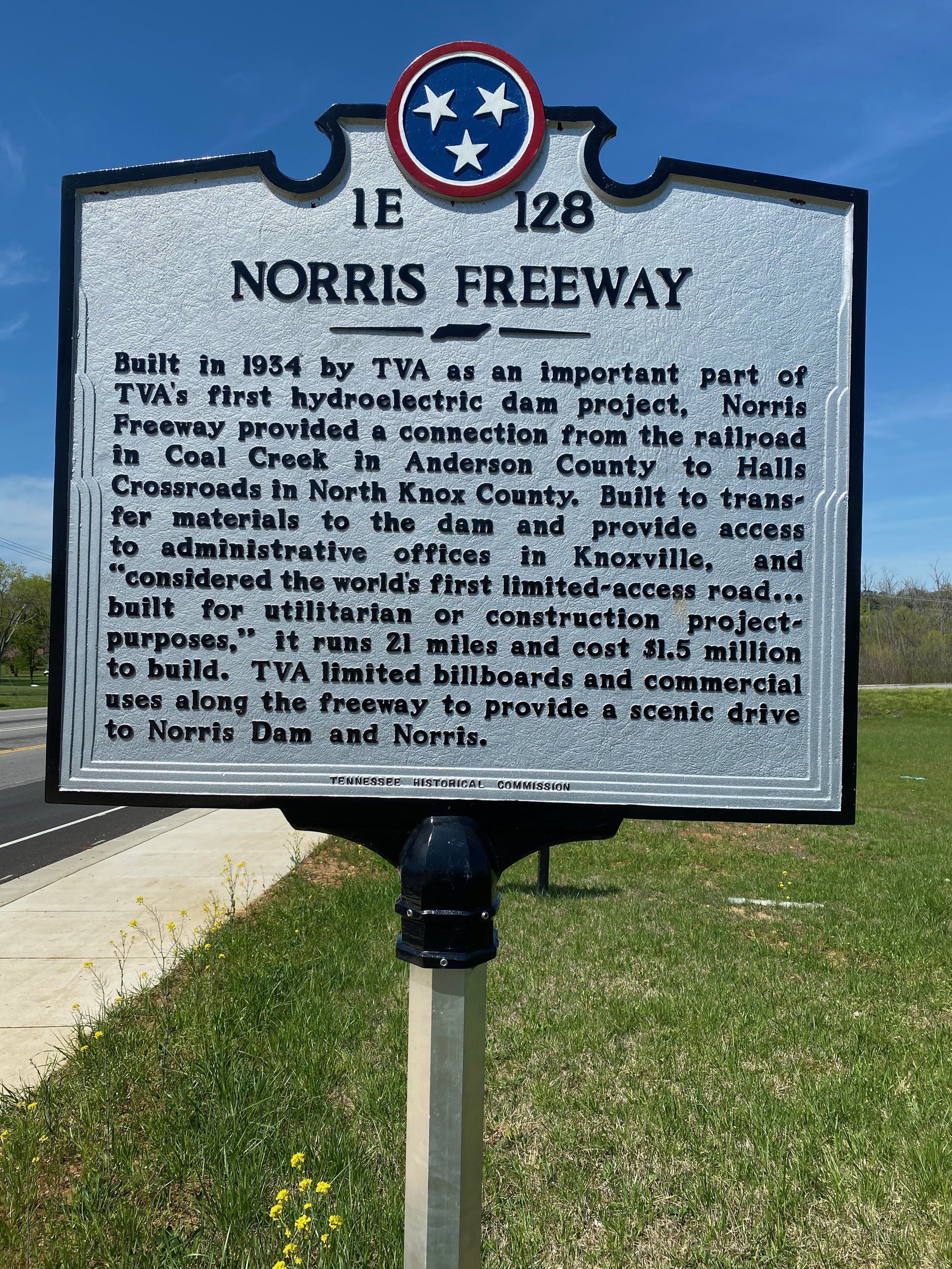
This marker is emblematic that, indeed, Norris Freeway is one of Tennessee's historic features. Such silver markers are used by the State to bring a driver's attention to a historic building, site or event on the nearby landscape. The members of the Halls Women's League were responsible in having the marker erected and bring attention to the historic Freeway.
Public Domain. Michael Carberry
Download Original (3024 x 4032 pixels, 5046.7 MB)
-
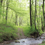
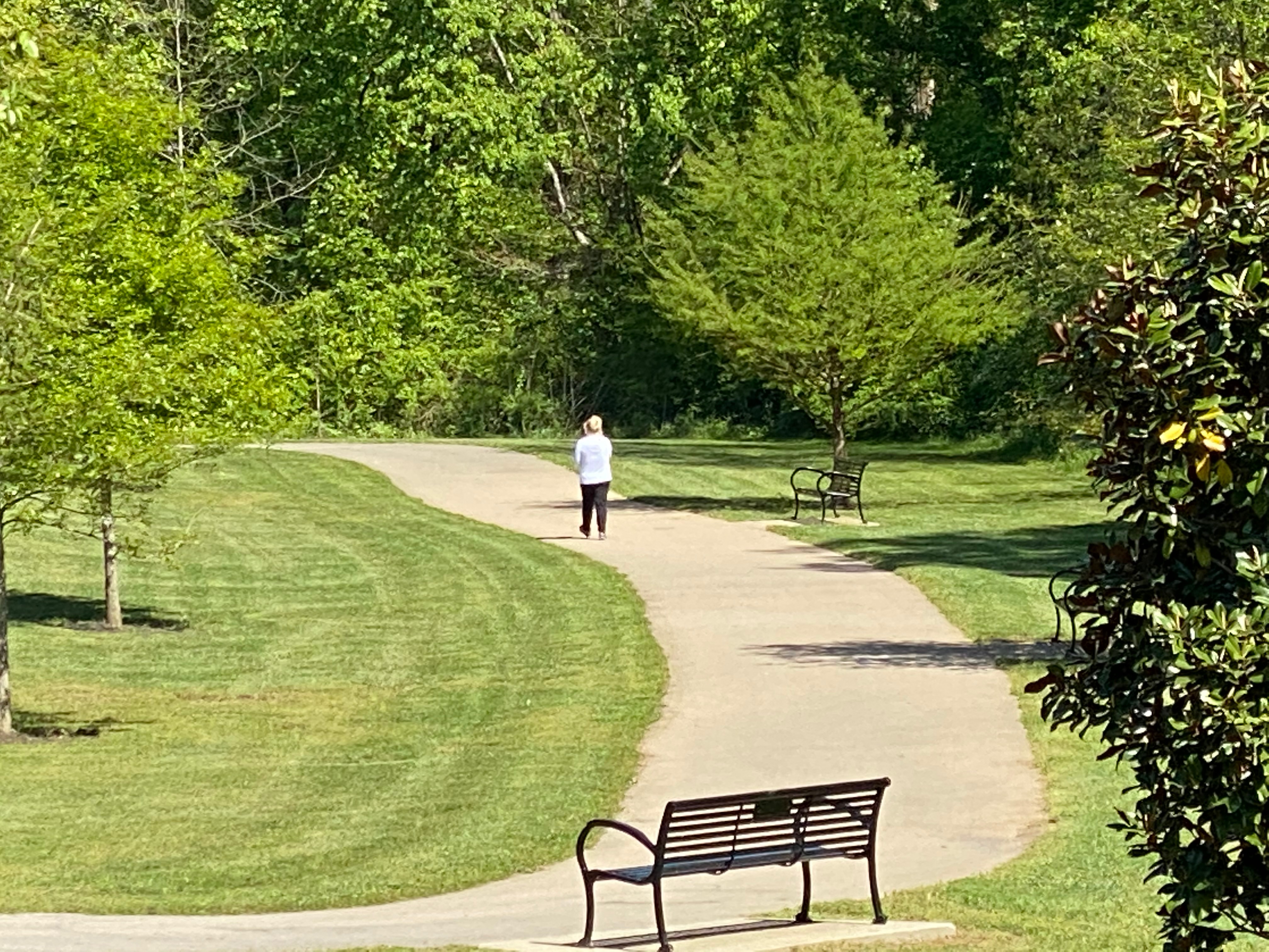
Clayton Park has a rolling landscape where a walking trail has been created for area residents. Here the trail and its visitors wind down a hillside toward Beaver Creek.
Public Domain. Michael Carberry
Download Original (4032 x 3024 pixels, 2382.0 MB)