Select a State to View Byways
Tennessee (TN)
-
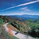
Cherohala Skyway
The Skyway offers the cultural heritage of the Cherokee tribe and early settlers in a grand forest environment in the Appalachian Mountains. Enjoy mile-high vistas and brilliant fall foliage, as well as great hiking opportunities and picnic spots in magnificent and seldom-seen portions of the southern Appalachian National Forests. -
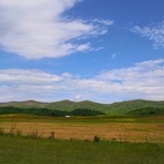
Cumberland Historic Byway
The landscape of the northern Cumberland Plateau is one of mountain paths, winding trails, sacred hunting grounds, and rich timberlands. Each landscape is defined by its own distinctive geologic formations, natural characteristics, legendary characters, and history. Over the 150-mile length of the Cumberland Historic Byway, each one of these landscapes gives way to another, and forms what was, at one time, a hidden frontier in America. The Cumberland Historic Byway links the Upper Cumberland Region, the Cumberland Gap, and the Cumberland River. This byway holds natural resources, unique geology, rich histories, and recreational activities for its travelers. -
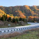
East Tennessee Crossing
This route follows the original path of the Cherokee Warriors Path, the Wilderness Road across the Clinch Mountain and the Cumberland Gap, the Dixie Highway of the Civil War period and Thunder Road of moonshining lore. -
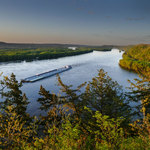
Great River Road
Throughout history, the Mississippi River influenced many lives: the Dakota, Chippewa, and Hopewell cultures; early French voyagers; African-Americans seeking freedom on the Underground Railroad; and many more. Through its charming river towns and metropolitan cities, historic sites and cultural artifacts, today s Great River Road still links resources, people, and history. -
Natchez Trace Parkway
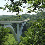
Native Americans, Kaintuck boatmen, post riders, government officials, and soldiers all moved across this trail, creating a vital link between the Mississippi Territory and the fledgling United States. Pass through forests, cypress swamps, and farmland to meander through the rock-studded hills of Tennessee, cotton fields in Alabama, and Mississippi s rural countryside. -

Newfound Gap Road Byway
Newfound Gap Road is a 31-mile linear landscape that connects Gatlinburg, Tennessee to Cherokee, North Carolina. It forms a vital component of the Great Smoky Mountains National Park’s circulation system that is completely contained within the National Park’s boundaries. This roadway is often the first or primary means for visitors to acquaint themselves with the character of the National Park and its natural, recreational, and cultural resources. Travelers can stop along the roadway to take hikes and then continue on the byway to ascend along pronounced curves to view beautiful overlooks. -

Norris Freeway
Norris Freeway, located near the heart of East Tennessee, is a byway steeped in American innovation history. This byway passes over Norris Dam, the location of which was selected by the Tennessee Valley Authority, to control the flooding in the Clinch and Powell River watershed. This byway begins in Rocky Top (once known as “Coal Creek”) and heads southeast to the unincorporated community of Halls. Parts of Anderson County, Campbell County, and Knox County are traversed along the route. With the beautiful scenery of the Tennessee Valley and state parks, travelers along the Norris Freeway can marvel at the innovation of the Norris Dam. -
Sequatchie Valley Scenic Byway
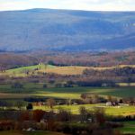
The Sequatchie Valley Scenic Byway runs through Marion, Sequatchie, Bledsoe, and Cumberland Counties, connecting one of the most picturesque and undisturbed regions of the United States. Rich in history and offering many opportunities for outdoor recreation, agritourism, and regional folk culture, the Sequatchie Valley Scenic Byway is poised to become one of Tennessee’s most desirable destinations. The Sequatchie Valley holds one of Tennessee’s most dramatic landscapes, its geographic and geological characteristics shaping its history and culture. The byway’s side roads offer opportunities for outdoor recreation on trails and the Sequatchie River, and the Valley tells the story of the mining history that was prevalent in the late nineteenth to early twentieth centuries and shaped the historic built environment in the Sequatchie Valley. -
Woodlands Trace
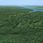
Running along a ridge of land between Kentucky Lake and Lake Barkley, Woodlands Trace is a beautiful, easy drive in rolling terrain with opportunities to pull off and explore on your own or at developed interpretive facilities. This outdoor setting includes the seasonal splendors of nature, with blossoming trees and flowers, a green canopy, brilliant fall foliage, and the open view in the forest in the winter.
-
Local Information
TennesseeOfficial Tennessee Dept. of Tourism 615-741-9001
Tennessee Scenic Byways

