
Cumberland Historic Byway
All Photos (25)
-
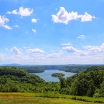
Island View Overlook
Public Domain. Tennessee Department of Transportation
-
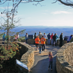
Attached is a picture of a crowd at Pinnacle Overlook within the Cumberland Gap National Historic Park. In the background is the 'Gap' or mountain valley, as well as the states of Kentucky, Tennessee and Virginia.
Public Domain. National Park Service
-

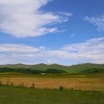
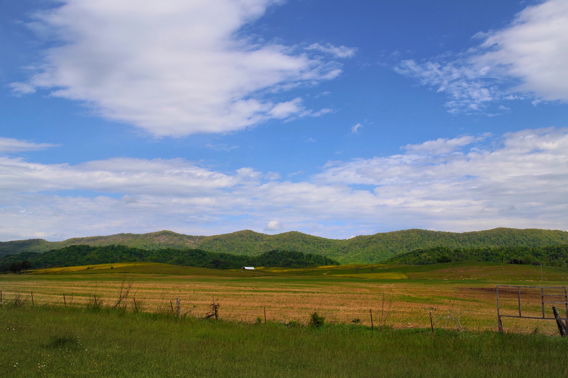
This picture was taken while travelling the byway route along S.R. 63 near Speedwell, TN. Rolling farmland and scenic mountain tops make a drive on the Cumberland Scenic Byway a special drive.
Public Domain. Tennessee Department of Transportation
Download Original (1920 x 1280 pixels, 647.5 KB)
-
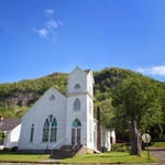
This image is of the First Baptist Church in the Historic Register District in downtown Cumberland Gap, TN. A nearby mountain and the TN/VA border is in the background.
Public Domain. Tennessee Department of Transportation
Download Original (1857 x 1238 pixels, 835.2 KB)
-
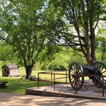
This image shows the front displays at the Cumberland Gap National Historic Park visitors center The cannon and cabin in the background are representative of the area's significance in during the colonial and Civil War eras.
Public Domain. Tennessee Department of Transportation
Download Original (1920 x 1280 pixels, 1623.8 MB)
-

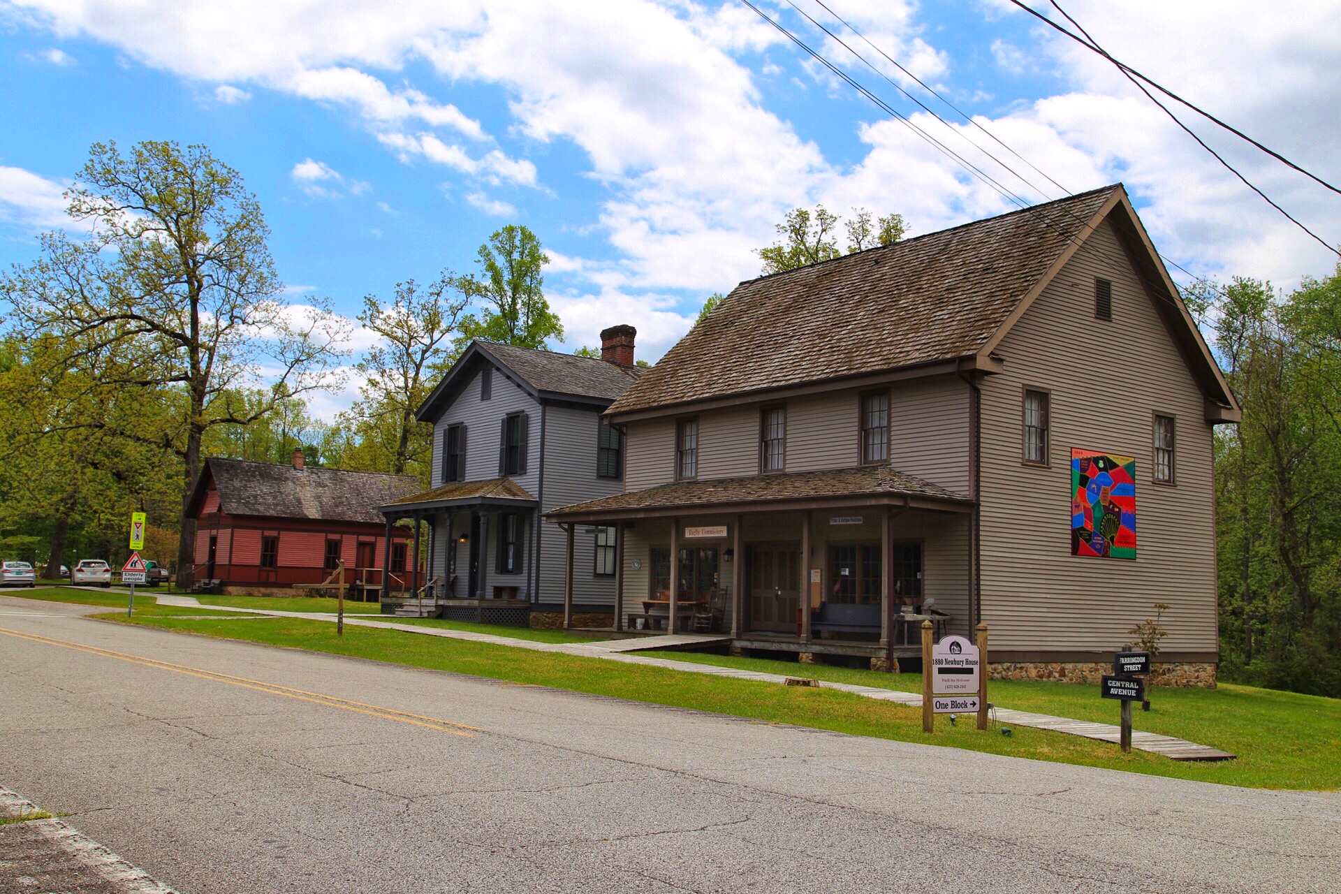
This image is of 3 original Victorian structures in Rugby. The middle building is currently used as a wood furniture maker's store. Also in the background is an example of pedestrian oriented sidewalks and pavement markings.
Public Domain. Tennessee Department of Transportation
Download Original (1920 x 1280 pixels, 1135.1 MB)
-
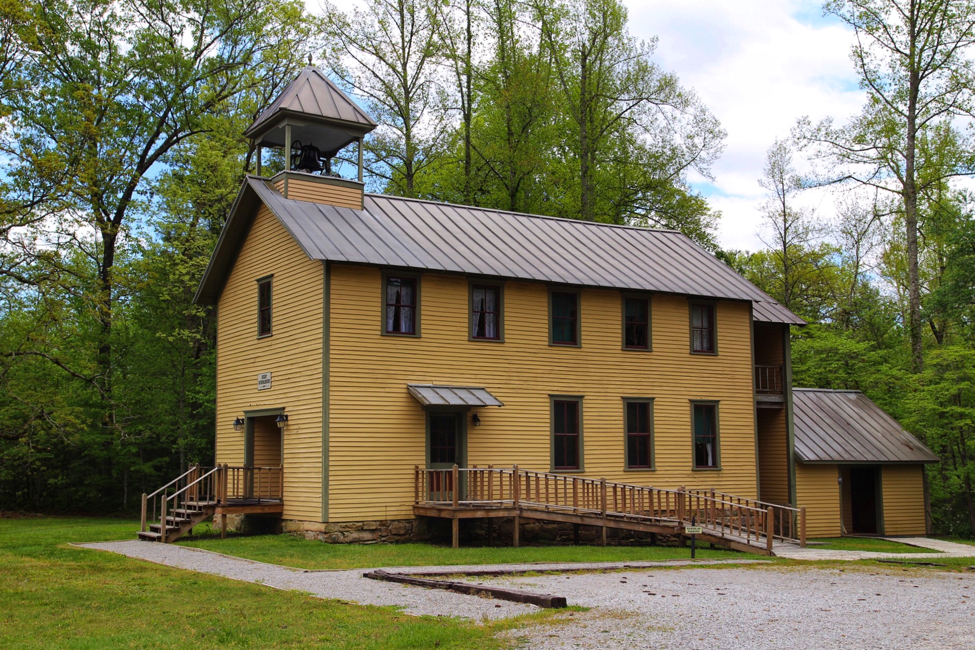
This image is the Christ Church Episcopal Church in the historic Rugby colony.
Public Domain. Tennessee Department of Transportation
Download Original (1900 x 1267 pixels, 1393.5 MB)
-
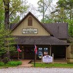
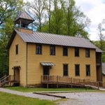
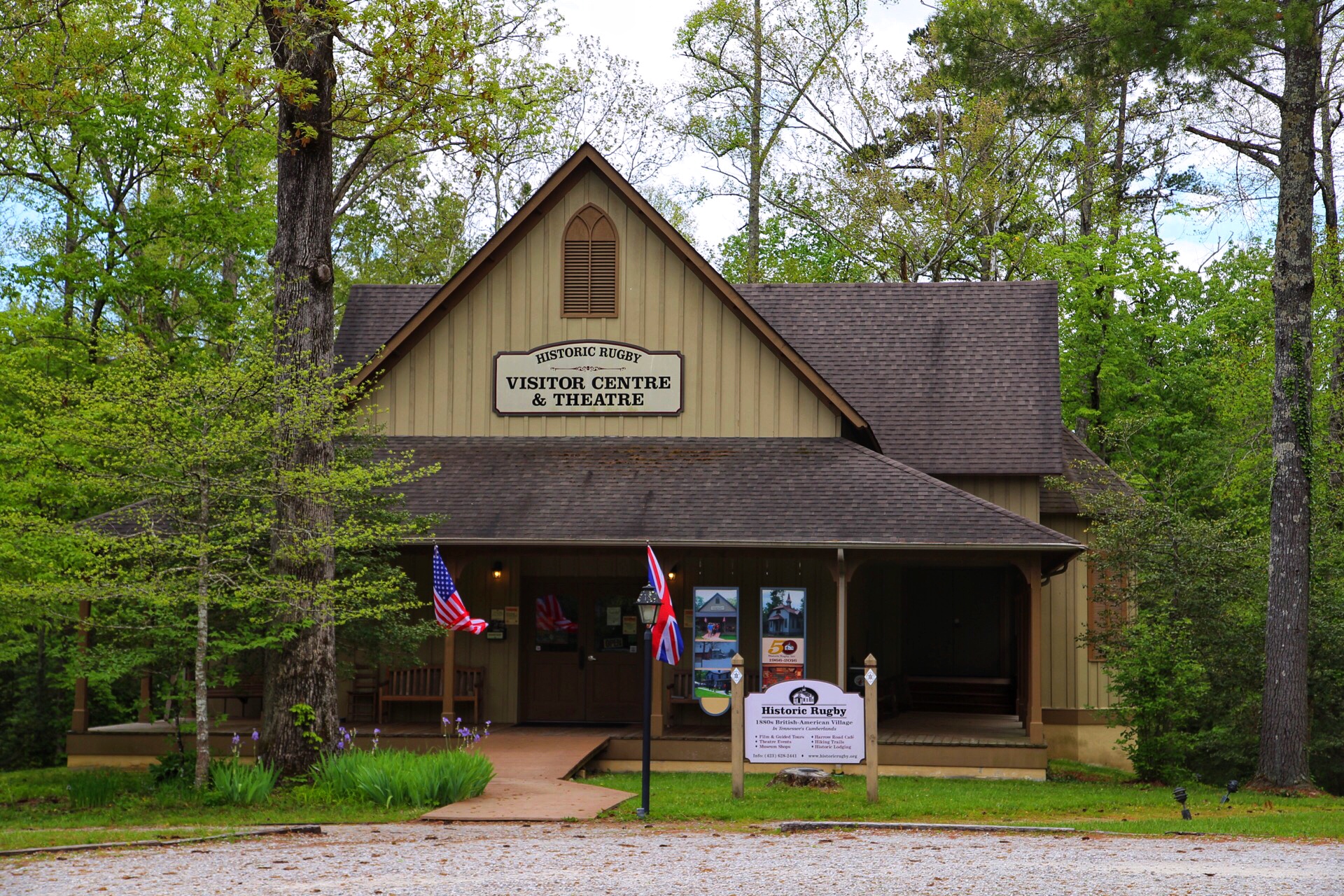
This image shows the National Park Service managed Rugby visitors center and theatre. This building has multiple interpretive displays and information about structures in the area.
Public Domain. Tennessee Department of Transportation
Download Original (1920 x 1280 pixels, 1359.8 MB)
-
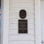
This image depicts the National Register of Historic Places marker near the front door of the Allardt Land Company office.
Public Domain. Tennessee Department of Transportation
Download Original (1280 x 1920 pixels, 643.1 KB)
-
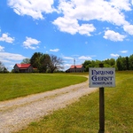
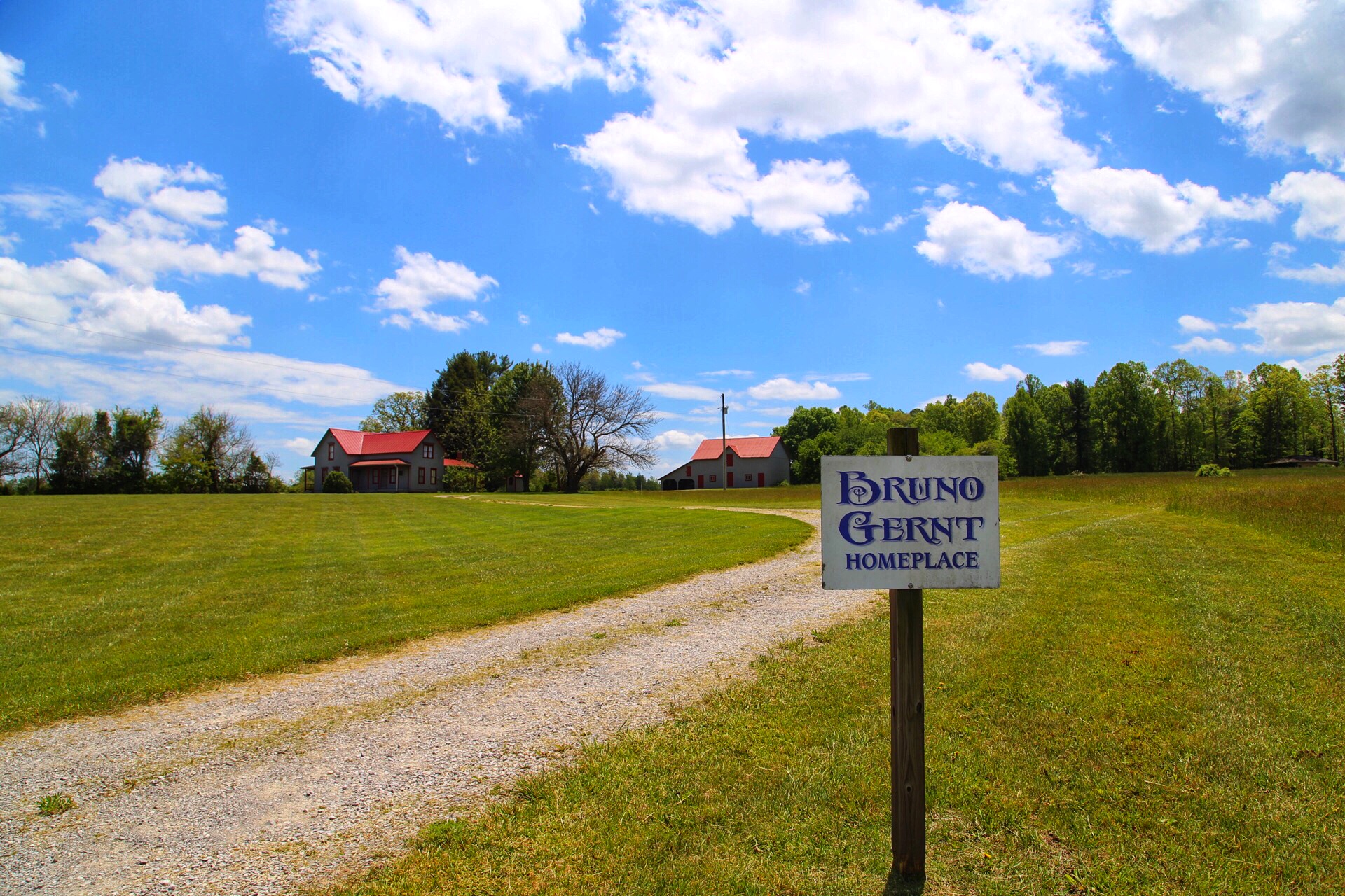
This image shows the entry sign and driveway to the Gernt homeplace, as seen from the road. In the background is the Gernt home and barn.
Public Domain. Tennessee Department of Transportation
Download Original (1920 x 1280 pixels, 1110.0 MB)
-
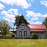
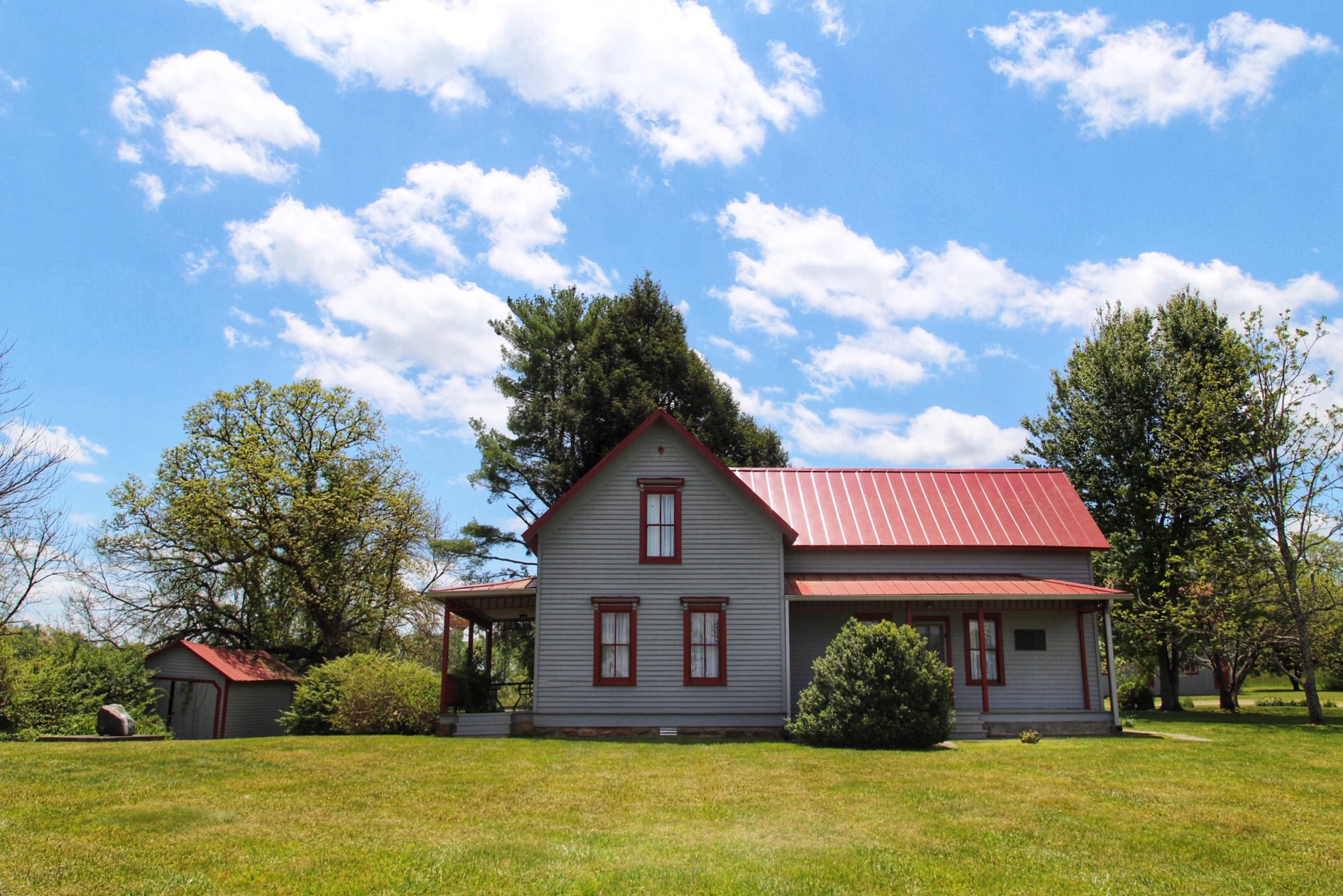
This image is of the Gernt homeplace.
Public Domain. Tennessee Department of Transportation
Download Original (1891 x 1261 pixels, 961.0 KB)
-
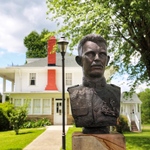
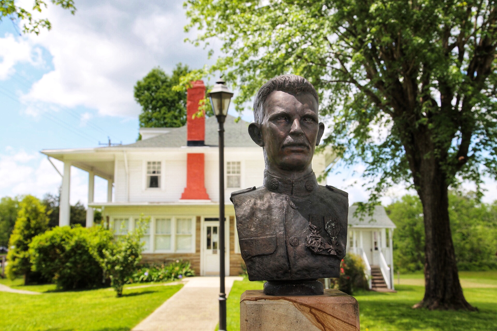
This image is of a bust of Alvin C. York, with the York's second home in the background.
Public Domain. Tennessee Department of Transportation
Download Original (1920 x 1280 pixels, 677.4 KB)
-
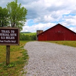
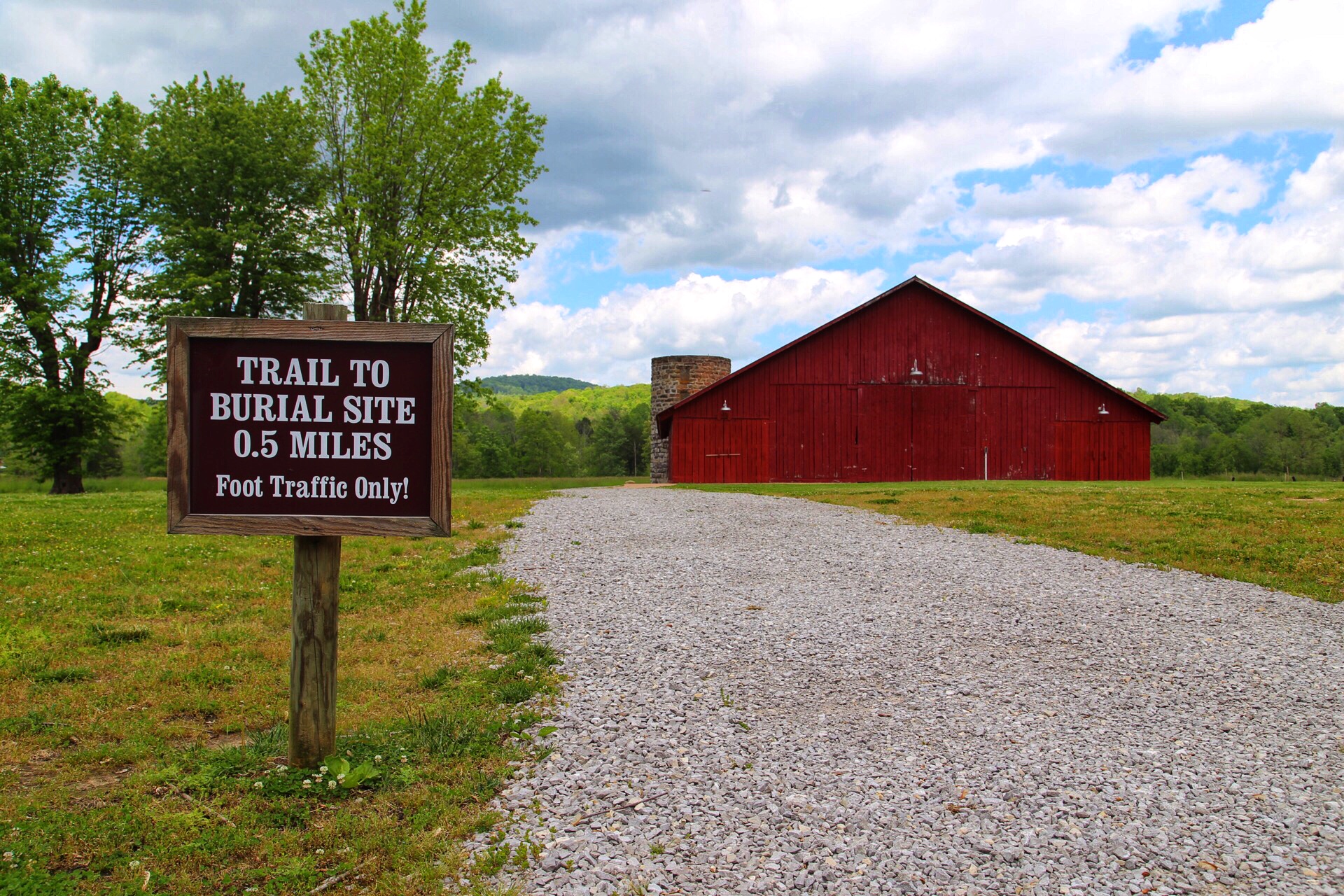
This image depicts the trail head to the Alvin C. York burial site. The York's red barn and a nearby mountain is prominently featured in the background of the picture.
Public Domain. Tennessee Department of Transportation
Download Original (1920 x 1280 pixels, 1222.6 MB)
-
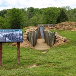
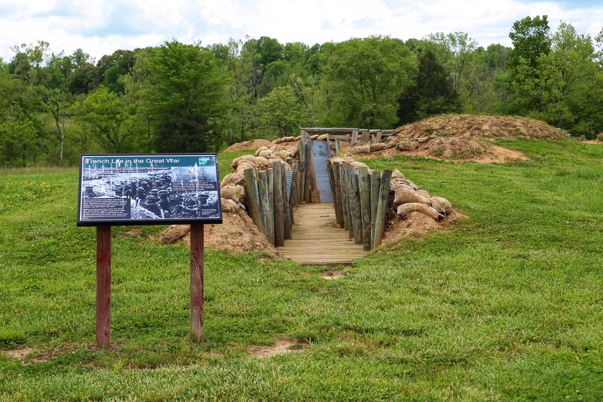
This image is of a new, several hundred foot World War One era trench complex, at the York park property. An interpretive panel is also in the picture.
Public Domain. Tennessee Department of Transportation
Download Original (1920 x 1280 pixels, 1413.7 MB)
-
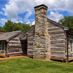
This image is of a replica 2-room log cabin, connected by a breezeway. It's similar to Cordell Hull's birth and early home.
Public Domain. Tennessee Department of Transportation
Download Original (1920 x 1280 pixels, 1384.4 MB)
-
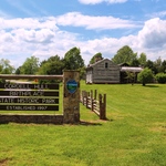
This image is the entry sign to the Cordell Hull Birthplace State Park. Visible in the background is the cabin and museum.
Public Domain. Tennessee Department of Transportation
Download Original (1920 x 1280 pixels, 1232.9 MB)
-
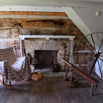
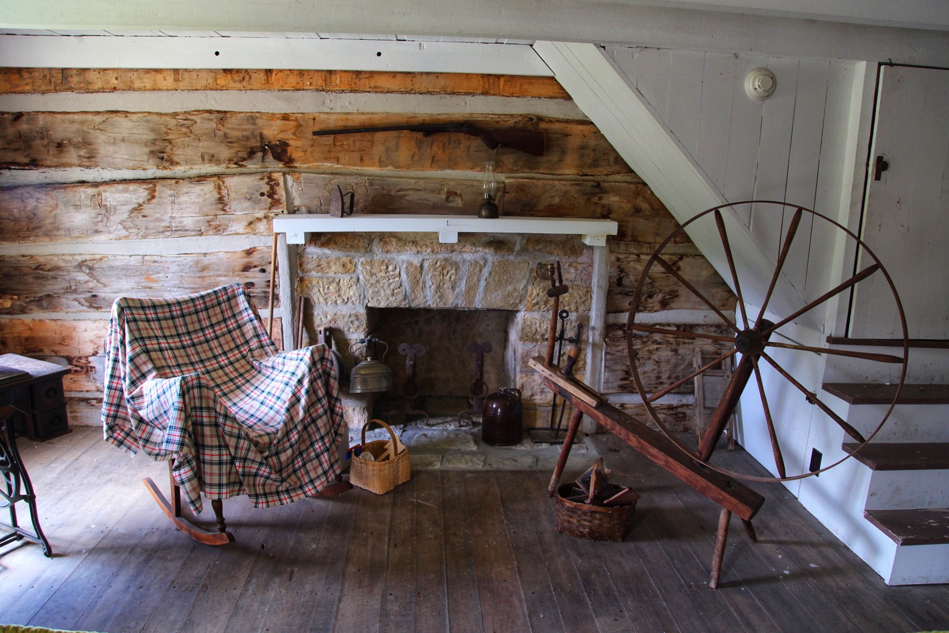
This image is of the interior (living room) of the Cordell Hull cabin. A spinning wheel, fireplace and rocking chair are visible.
Public Domain. Tennessee Department of Transportation
Download Original (1882 x 1255 pixels, 848.9 KB)
-
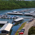
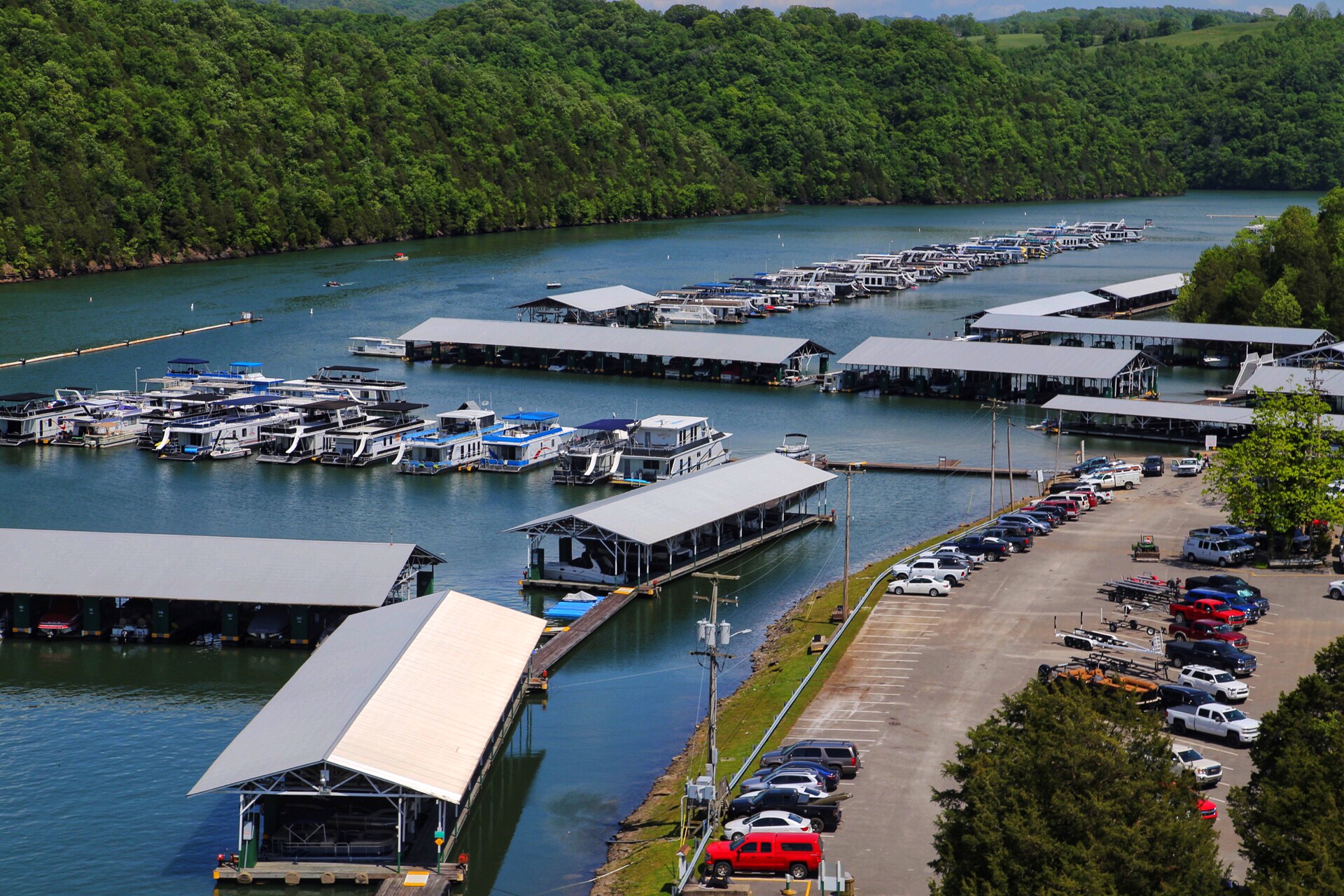
This image is an overhead view of the Sunset Marina & Resort from S.R. 111 near Midway, TN. Dale Hollow Lake, the marina, and several docked boats are features in the photo.
Public Domain. Tennessee Department of Transportation
Download Original (1920 x 1280 pixels, 1027.2 MB)
-
Attached is a picture of the front of the Dale Hollow National Fish Hatchery in Clay County. The hatchery and aquarium are open to the public.
Public Domain. Chuck Southerland
Download Original (5472 x 3648 pixels, 8141.2 MB)
-
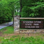
This image is of the entry sign and road shoulders to Standing Stone State Park.
Public Domain. Tennessee Department of Transportation
Download Original (1920 x 1280 pixels, 1278.0 MB)
-

This image shows a 1 lane bridge and dam in the Standing Stone State Park. A row of rental paddle boats exist in the left side of the picture, and the road meanders up a hill to a scenic overlook.
Public Domain. Tennessee Department of Transportation
Download Original (1920 x 1280 pixels, 1395.4 MB)
-
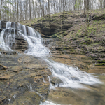
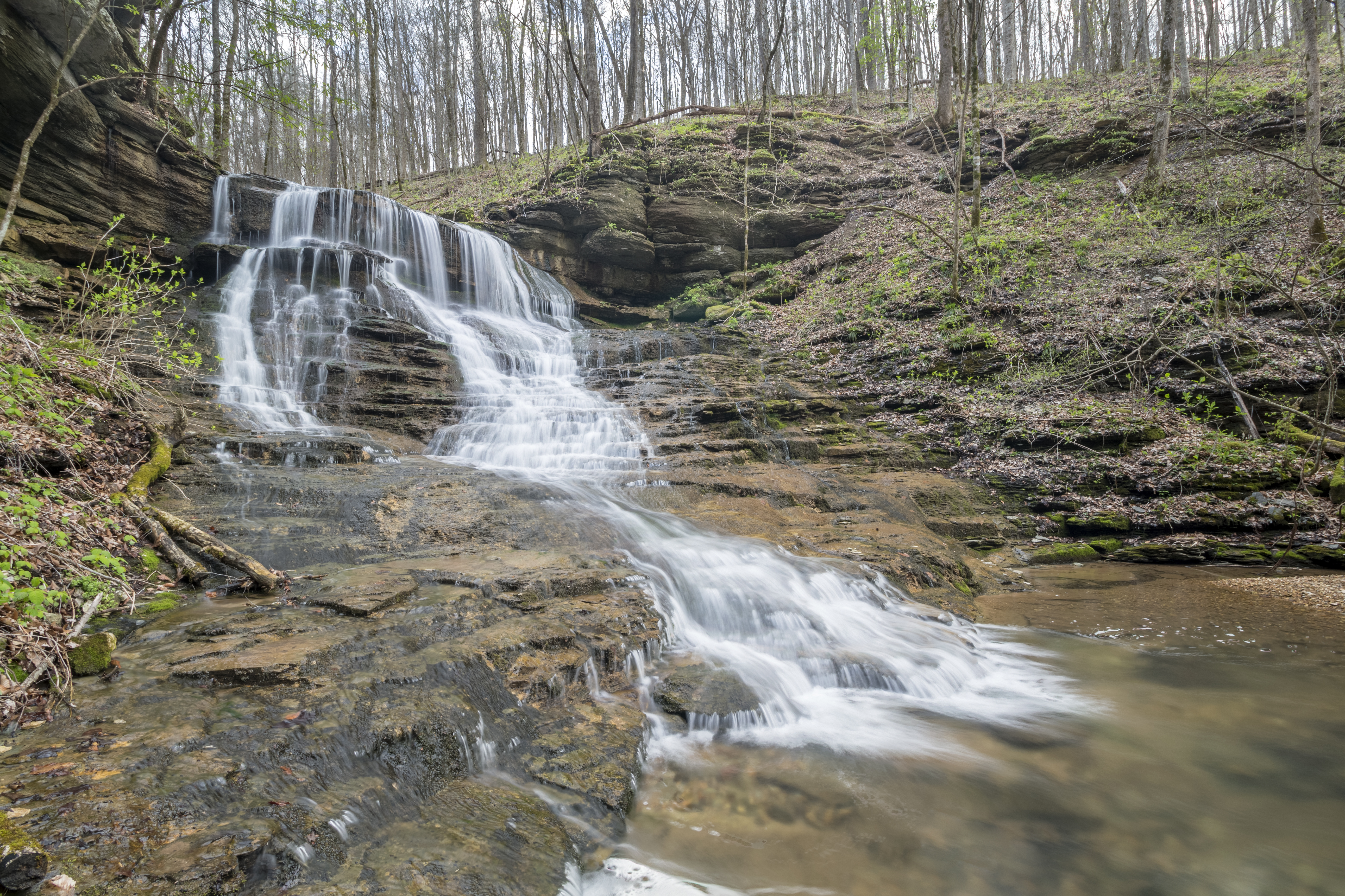
This image is of the Bryan Falls waterfall along a trail in Standing Stone State Park.
Public Domain. Chuck Southerland
Download Original (5166 x 3444 pixels, 12574.8 MB)
-
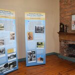
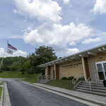
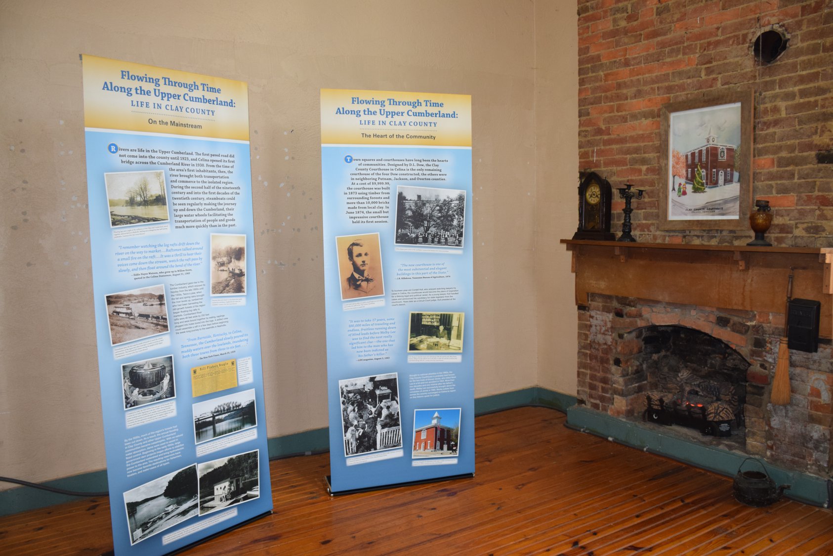
This picture depicts interpretive panels in the renovated Clay County Historic Courthouse.
Public Domain. Middle East TN Tourism Council
Download Original (1686 x 1125 pixels, 290.8 KB)
-
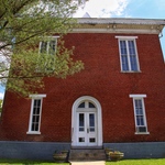
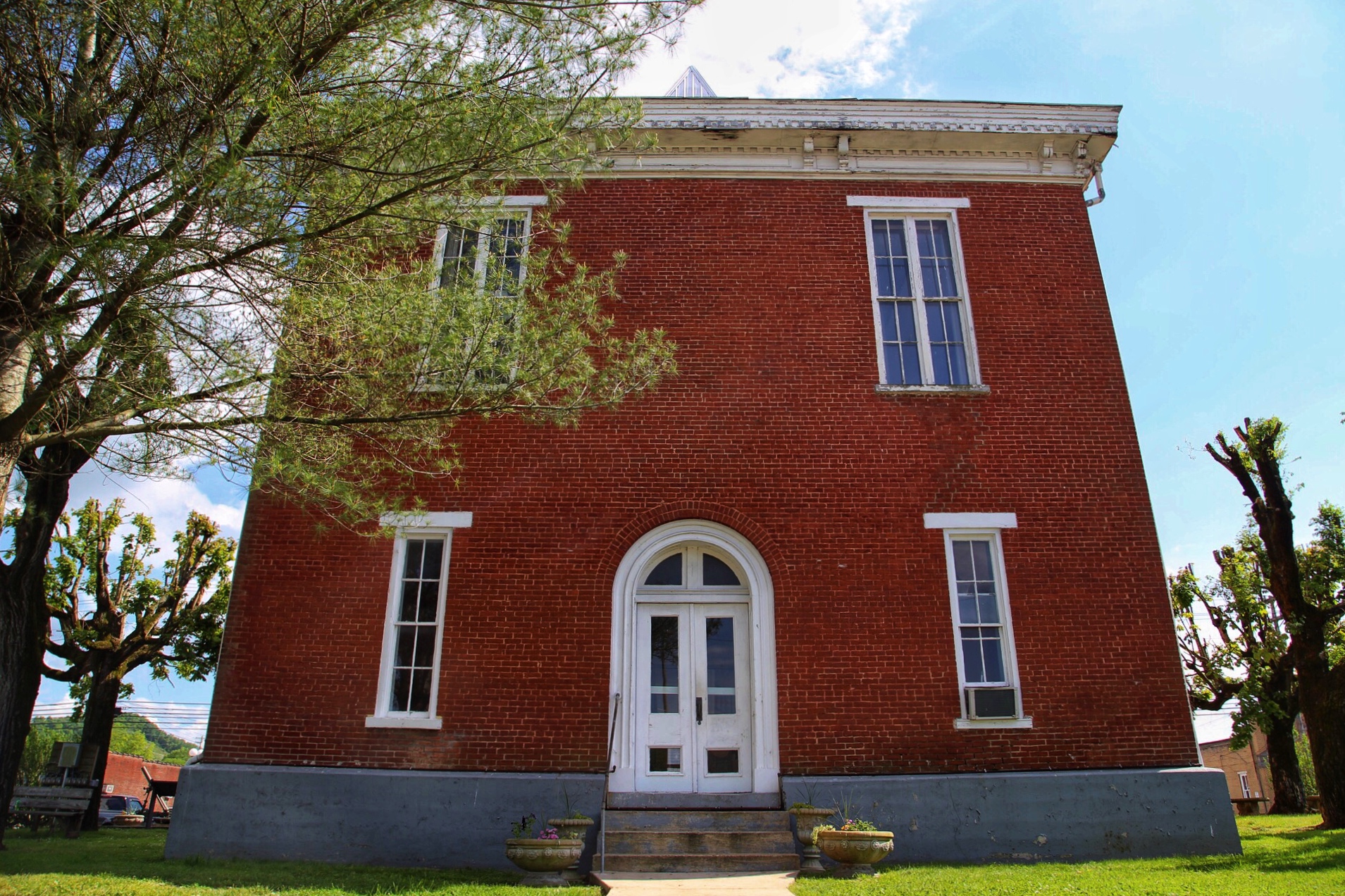
This image is of the façade of the historic Clay County Courthouse.
Public Domain. Tennessee Department of Transportation
Download Original (1909 x 1272 pixels, 1231.2 MB)
-
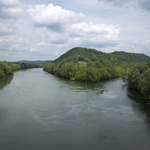
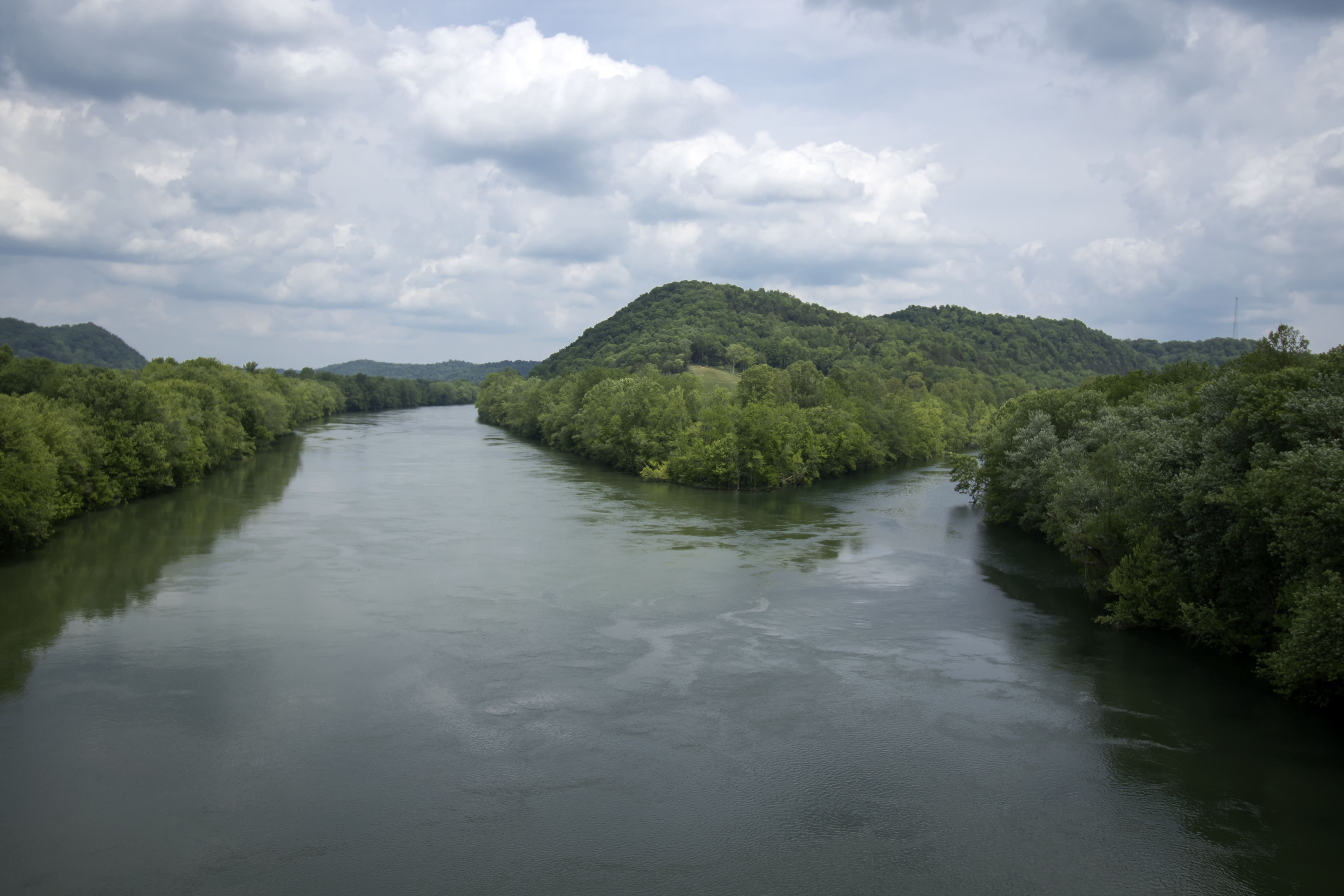
This image is an overhead shot of the historic convergence of the Obey and Cumberland Rivers, near Celina, TN. The convergence was a major site for floating lumber to Nashville from the Upper Cumberland.
Public Domain. Chuck Southerland
Download Original (5472 x 3648 pixels, 7592.1 MB)