
Mohawk Trail Scenic Byway
All Photos (15)
-

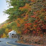
A view traveling through the Hairpin Turn in Clarksburg during fall foliage.
Public Domain. Eugene Michalenko
-
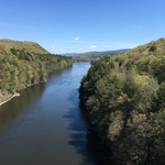
This picture shows the view of the Connecticut River from the French King Bridge on the Byway in Erving. The view is a long and wide view of the river looking to the north.
Public Domain. Franklin Regional Council of Governments
-
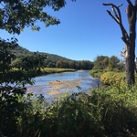
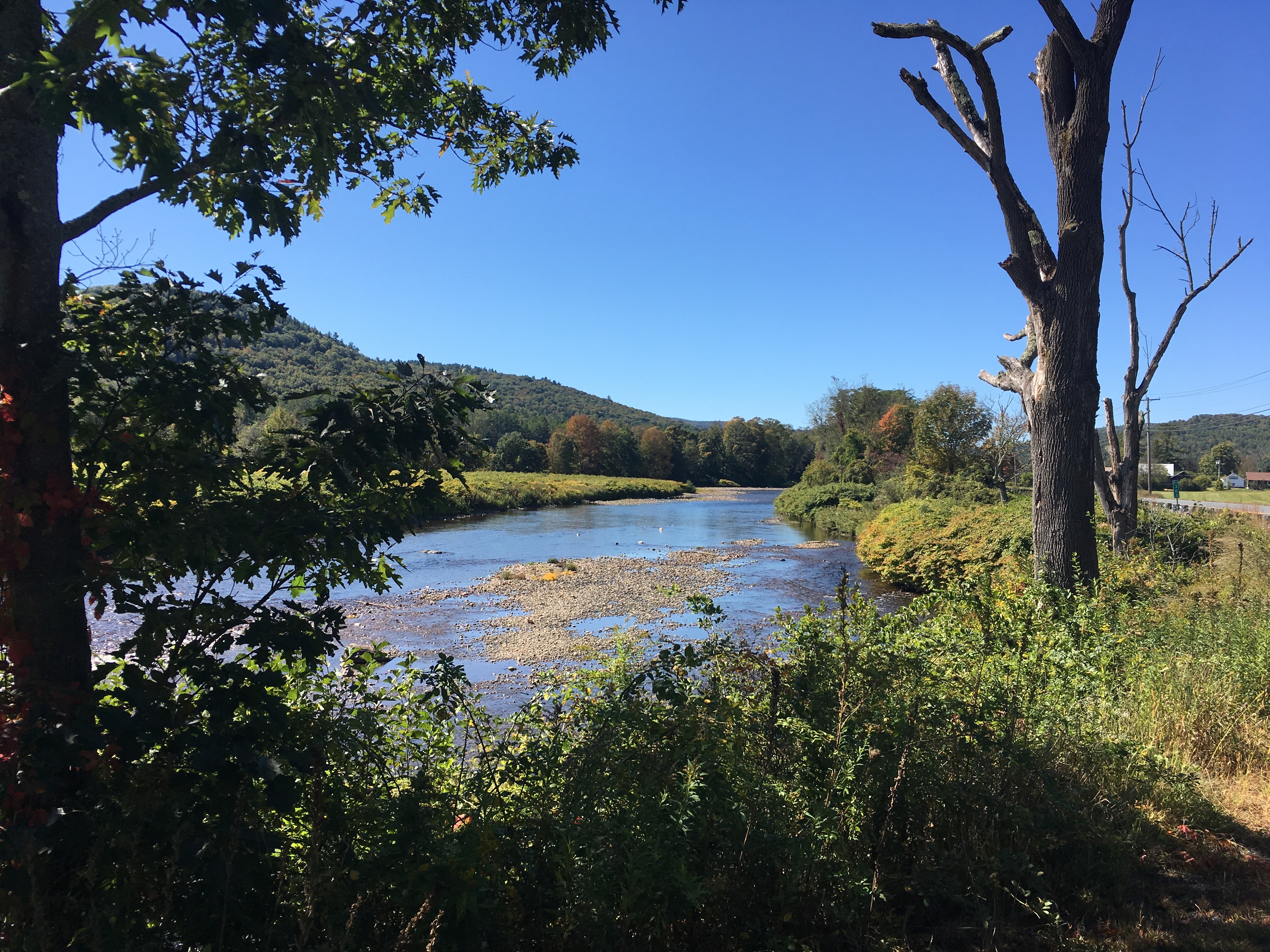
This photo is of the view of the Deerfield River as seen from the pull-off area on the south side of the Byway. The view is to the west and there are trees and vegetation in the foreground, the foothills of the Berkshire Mountains in the background, and the Deerfield River.
Public Domain. Franklin Regional Council of Governments
Download Original (4032 x 3024 pixels, 7648.6 MB)
-
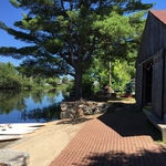
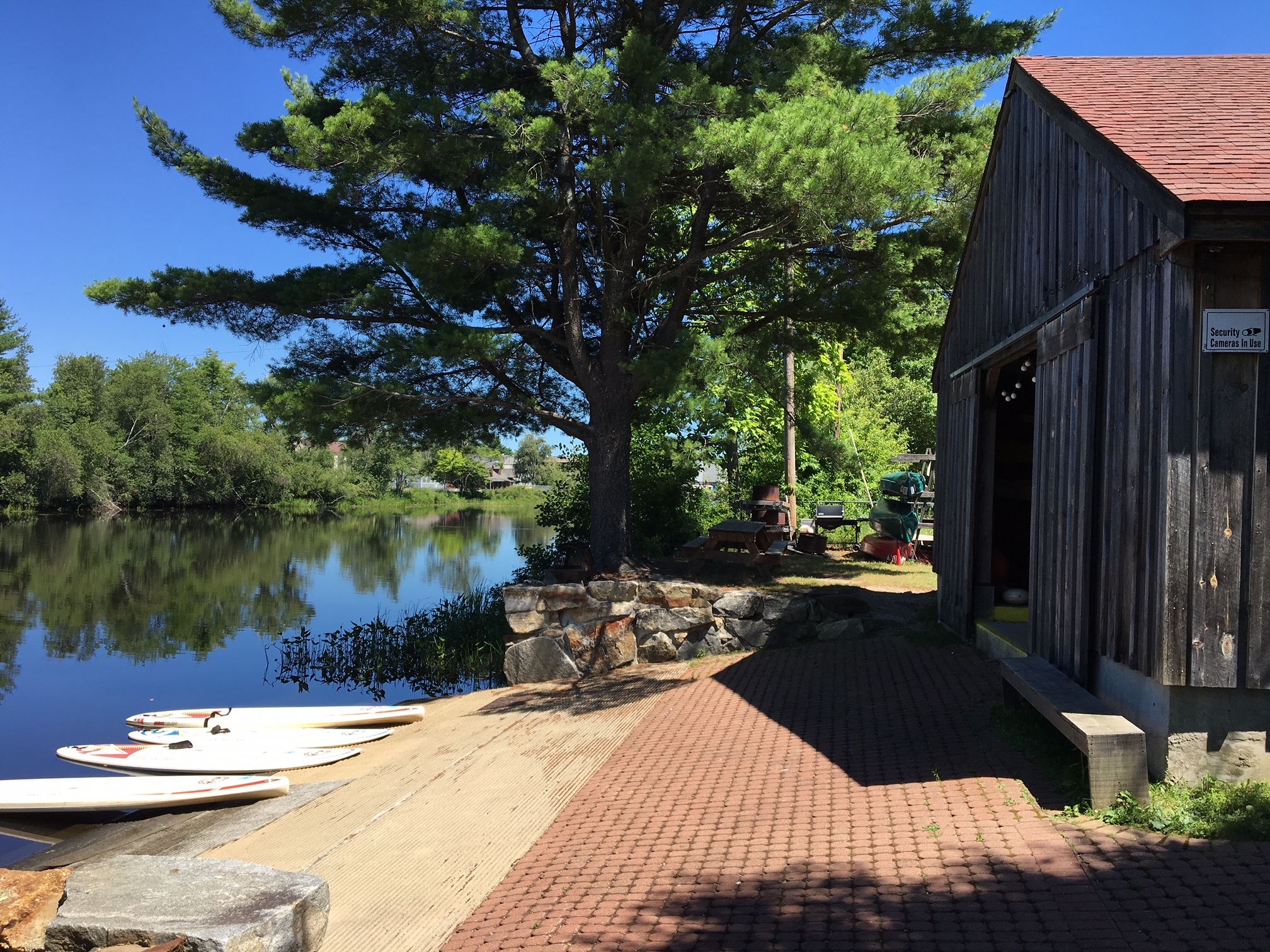
This picture shows a view of the boathouse and launch area at the Orange Riverfront Park. The launch provides access to the Millers River Blue Trail. The Millers River is shown in the picture.
Public Domain. Franklin Regional Council of Governments
Download Original (2016 x 1512 pixels, 2227.4 MB)
-
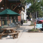
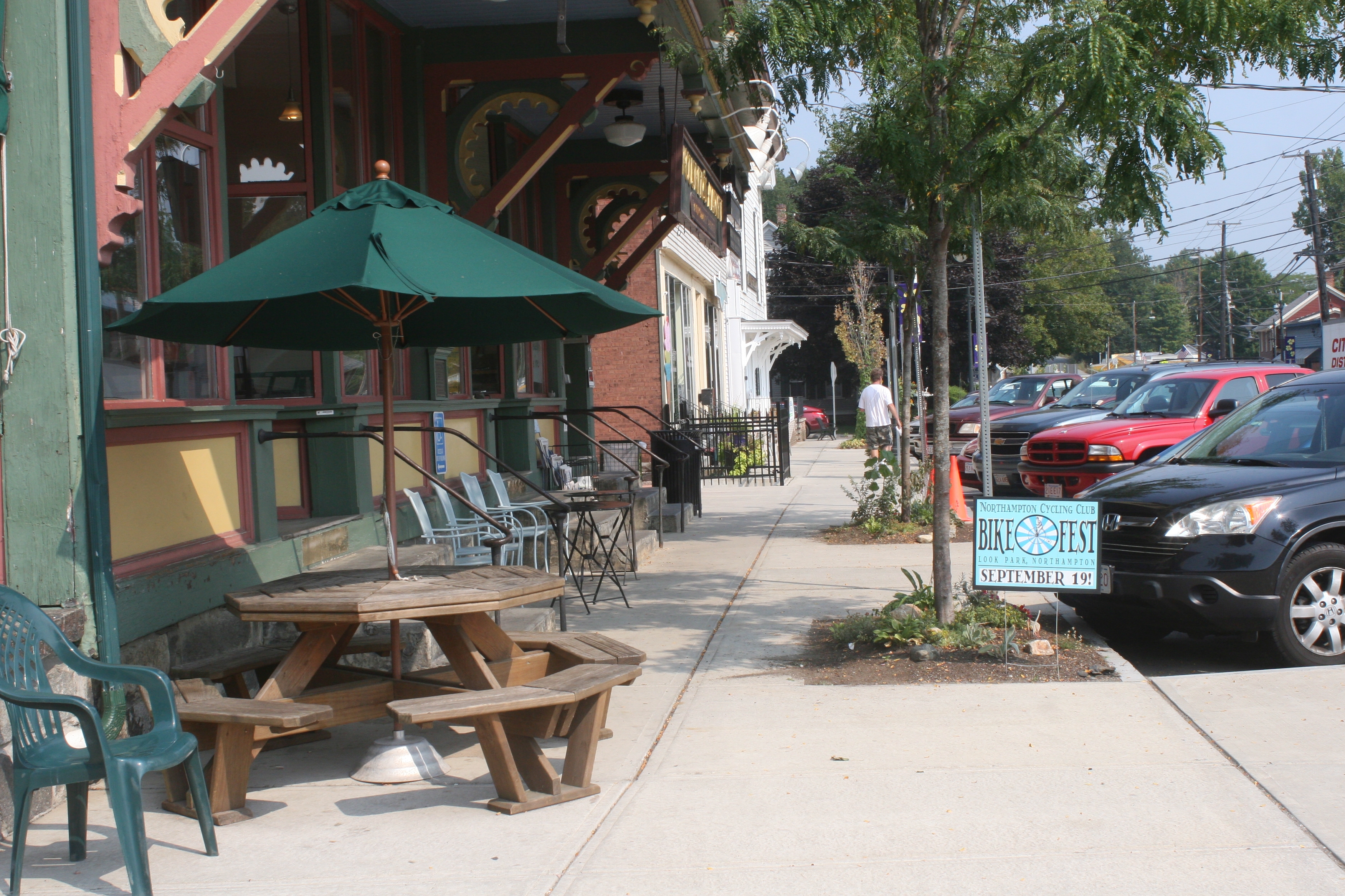
This photo shows the streetscape in Shelburne Falls on State Street in the Buckland side of the village. It shows an outdoor seating area of a grocery store. The photo shows a glimpse of the colorful facade of the historic building where the store is located.
Public Domain. Franklin Regional Council of Governments
Download Original (3504 x 2336 pixels, 5333.4 MB)
-
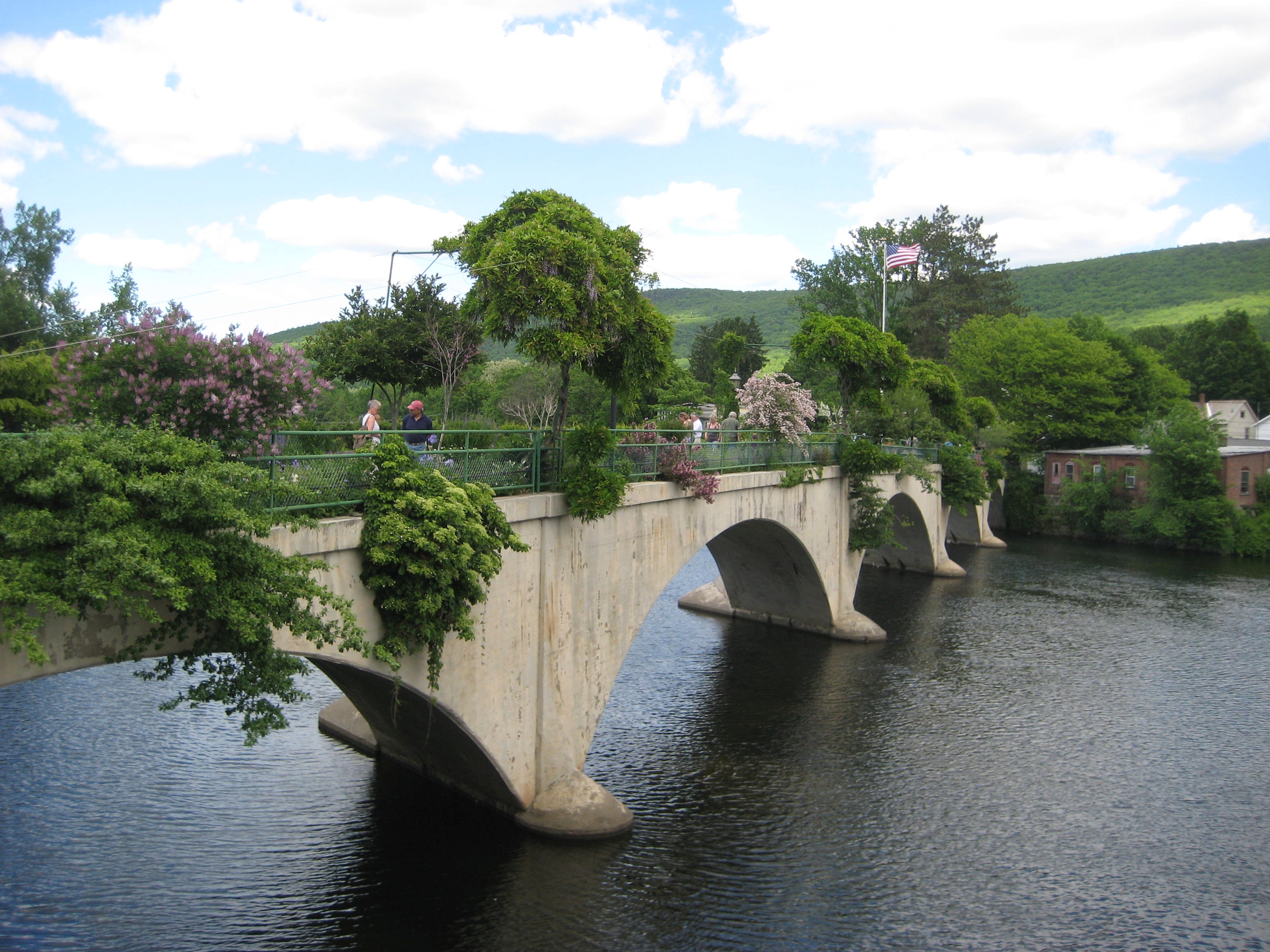
This photo shows the Bridge of Flowers in Shelburne Falls. The concrete bridge structure has a walkway that is lined with flowers and plantings that can be seen in the picture. People are visible strolling across the bridge.
Public Domain. Franklin Regional Council of Governments
Download Original (3072 x 2304 pixels, 2768.4 MB)
-
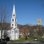
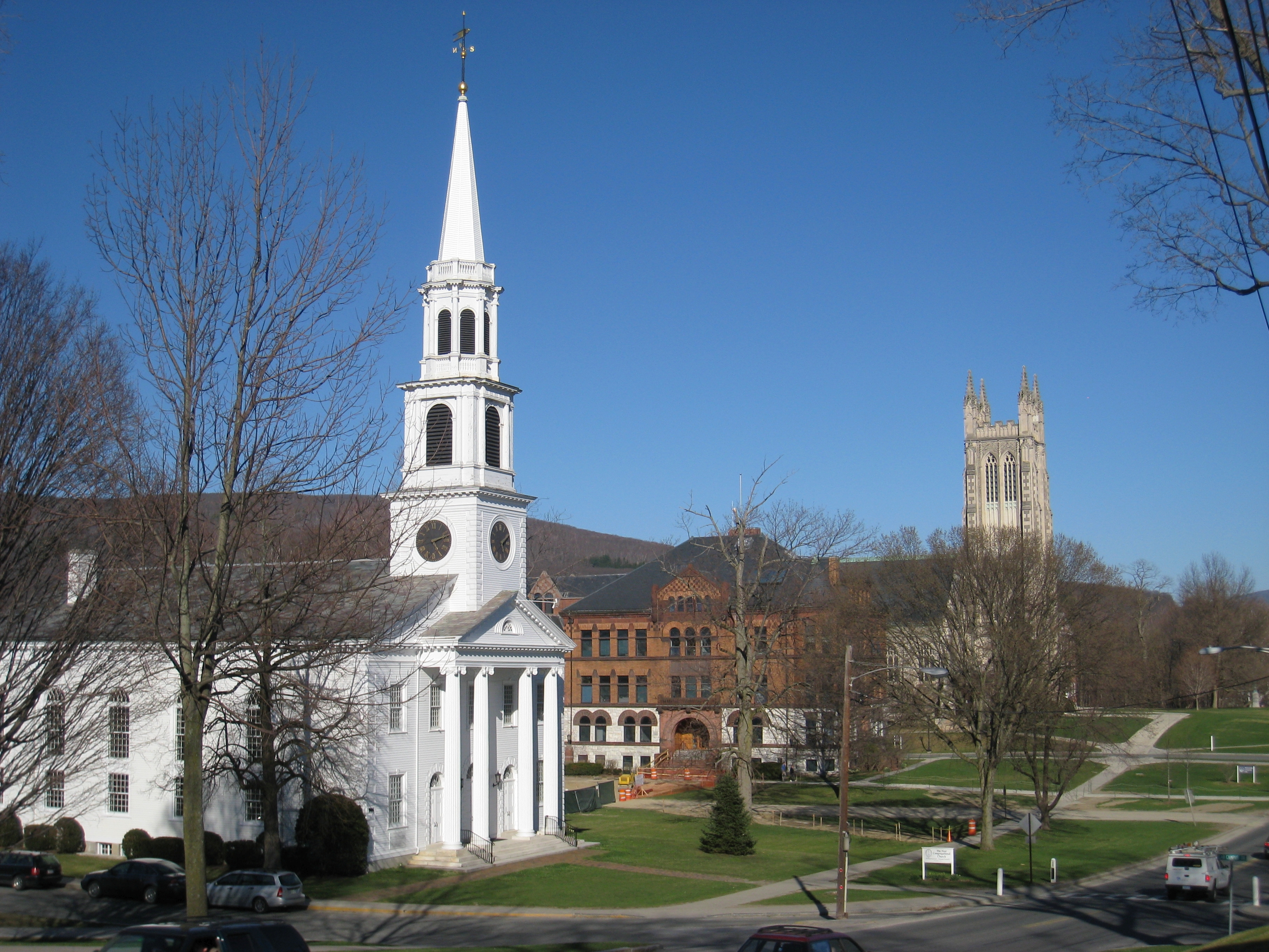
A view of a church and buildings on the campus of Williams College that can be seen from the Byway in Williamstown.
Public Domain. Berkshire Regional Planning Commission
Download Original (3264 x 2448 pixels, 5035.9 MB)
-
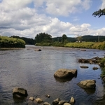
This photo shows a fishing location on the Deerfield River in east Charlemont. The photo shows a bend in the river. Rocks in the water and a cloudy sky.
Public Domain. Franklin Regional Council of Governments
-
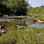
This picture is of a fishing location on the Millers River in Erving. The photo shows the river and the rocks in the river.
Public Domain. fra
-
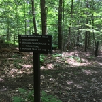
This photo shows a wooded section for the Mahican Mohawk Trail that is near the County County Road Trailhead in Florida, MA. It is near the Byway. The photo shows a trail sign with directions and distances to other milestones on the trail.
Public Domain. Franklin Regional Council of Governments
Download Original (4032 x 3024 pixels, 9427.8 MB)
-
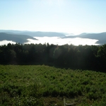
This picture is the view of the distant mountains and fog covered valleys.
Public Domain. Raine Brown
-
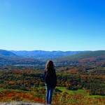
A woman looking out at the vast panoramic view of distant mountains and ridgelines from the Top of the World near the Hairpin Turn.
Public Domain. Kara Thornton
-
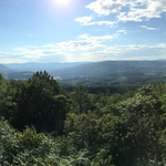
A panoramic view looking to the south of the distant mountains on a sunny day.
Public Domain. Raine Brown
-
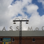
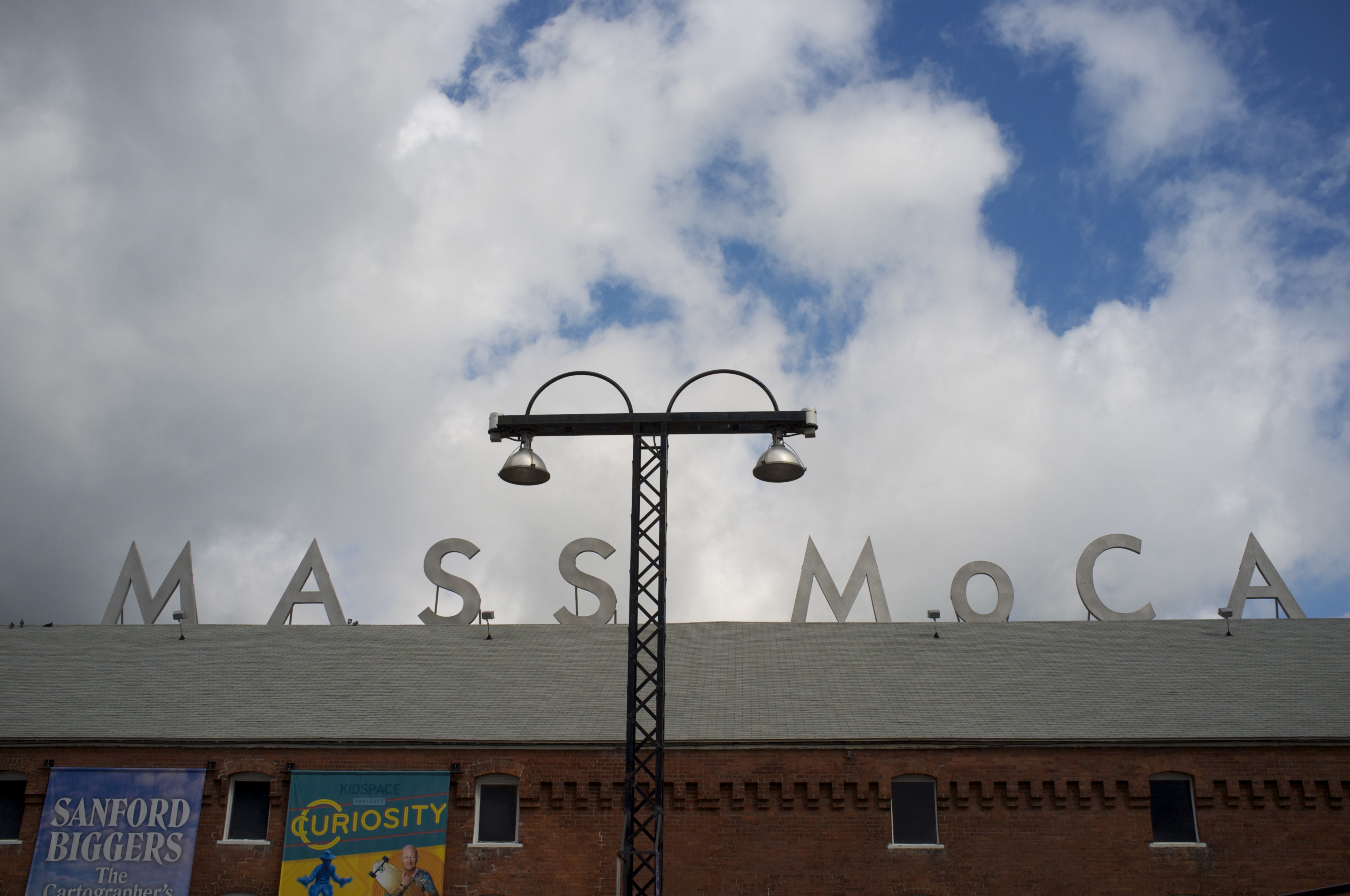
This photo shows the roofline of the Massachusetts Museum of Contemporary Art (MassMoCA). The roofline is visible with the MassMoCA letter signs across the top of the roof.
Public Domain. New Arts Collaborative
Download Original (4221 x 2803 pixels, 4329.7 MB)
-
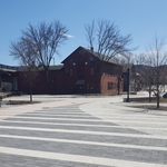
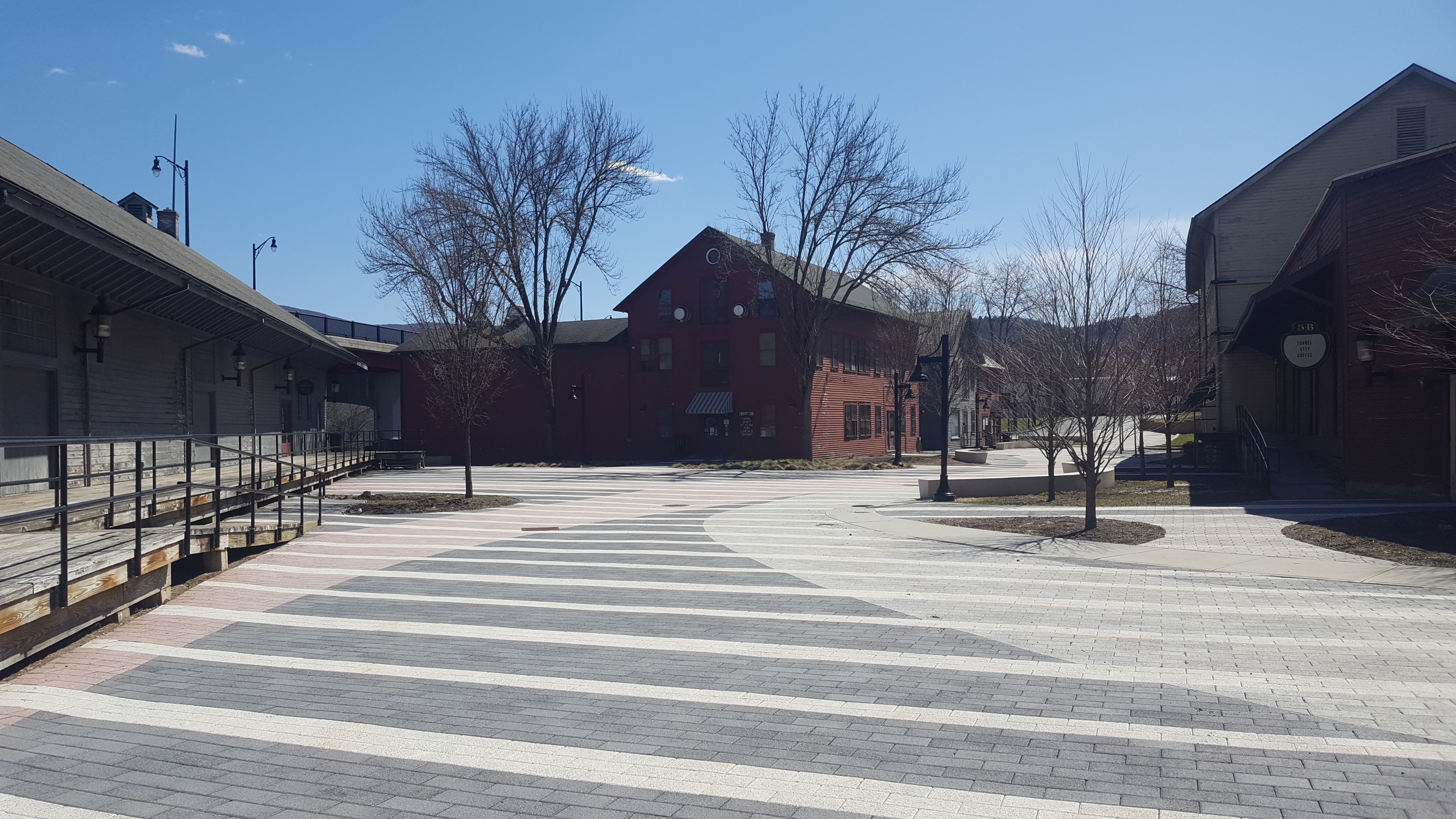
The picture is of the historic buildings that are part of the Western Gateway Heritage State Park.
Public Domain. Berkshire Regional Planning Commission
Download Original (3264 x 1836 pixels, 3451.2 MB)