
Old Frankfort Pike Historic and Scenic Byway
All Photos (23)
-

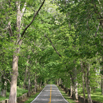
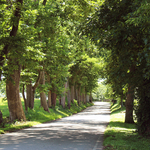
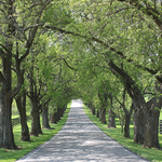
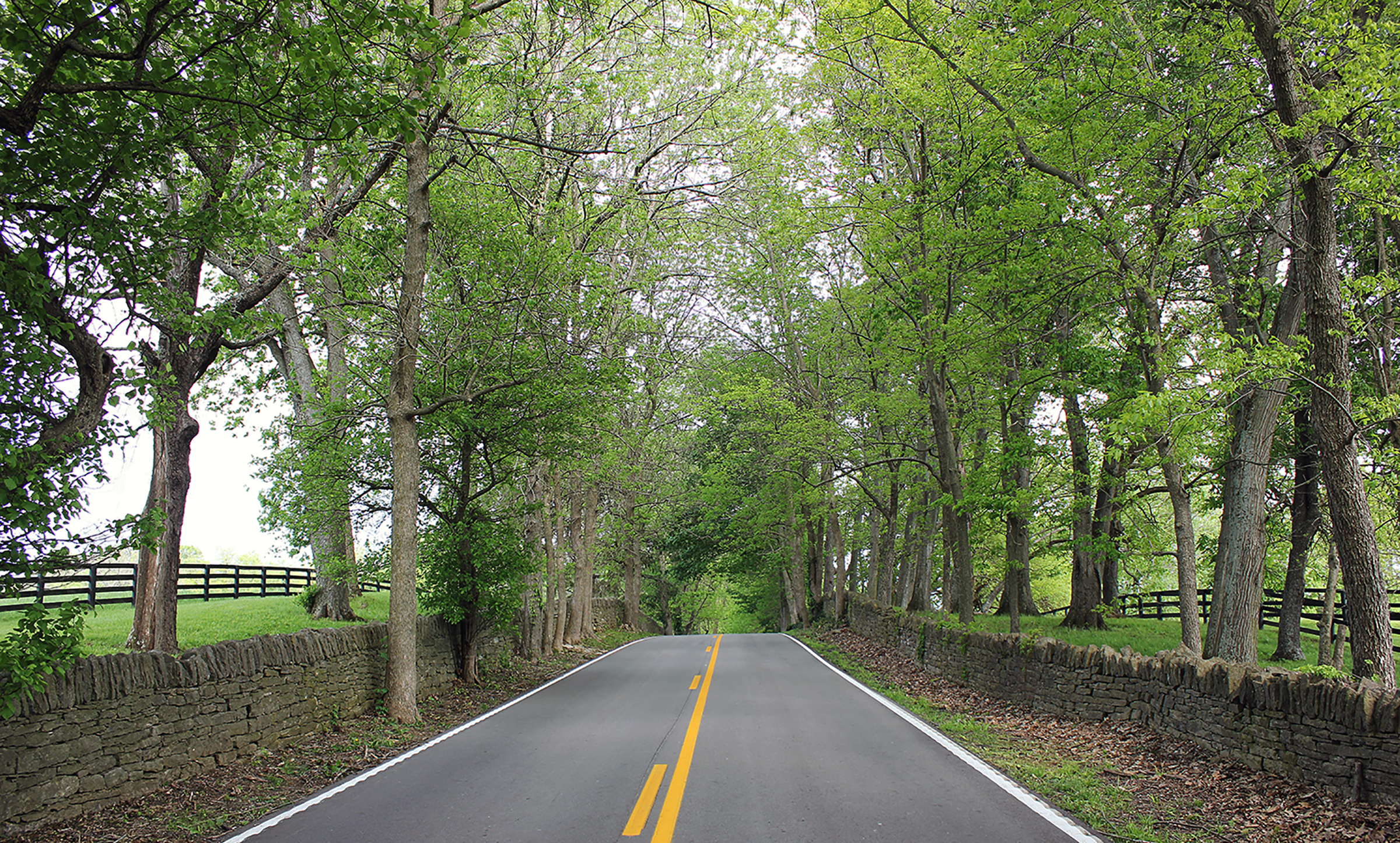
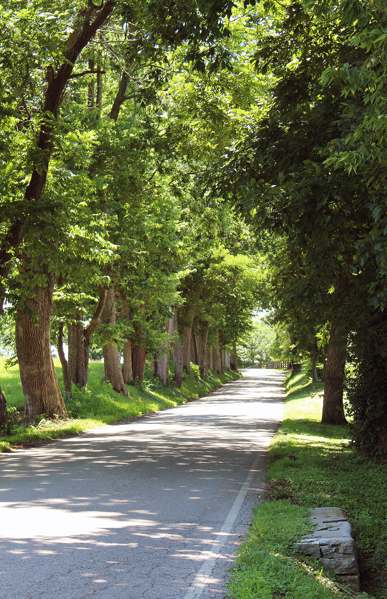
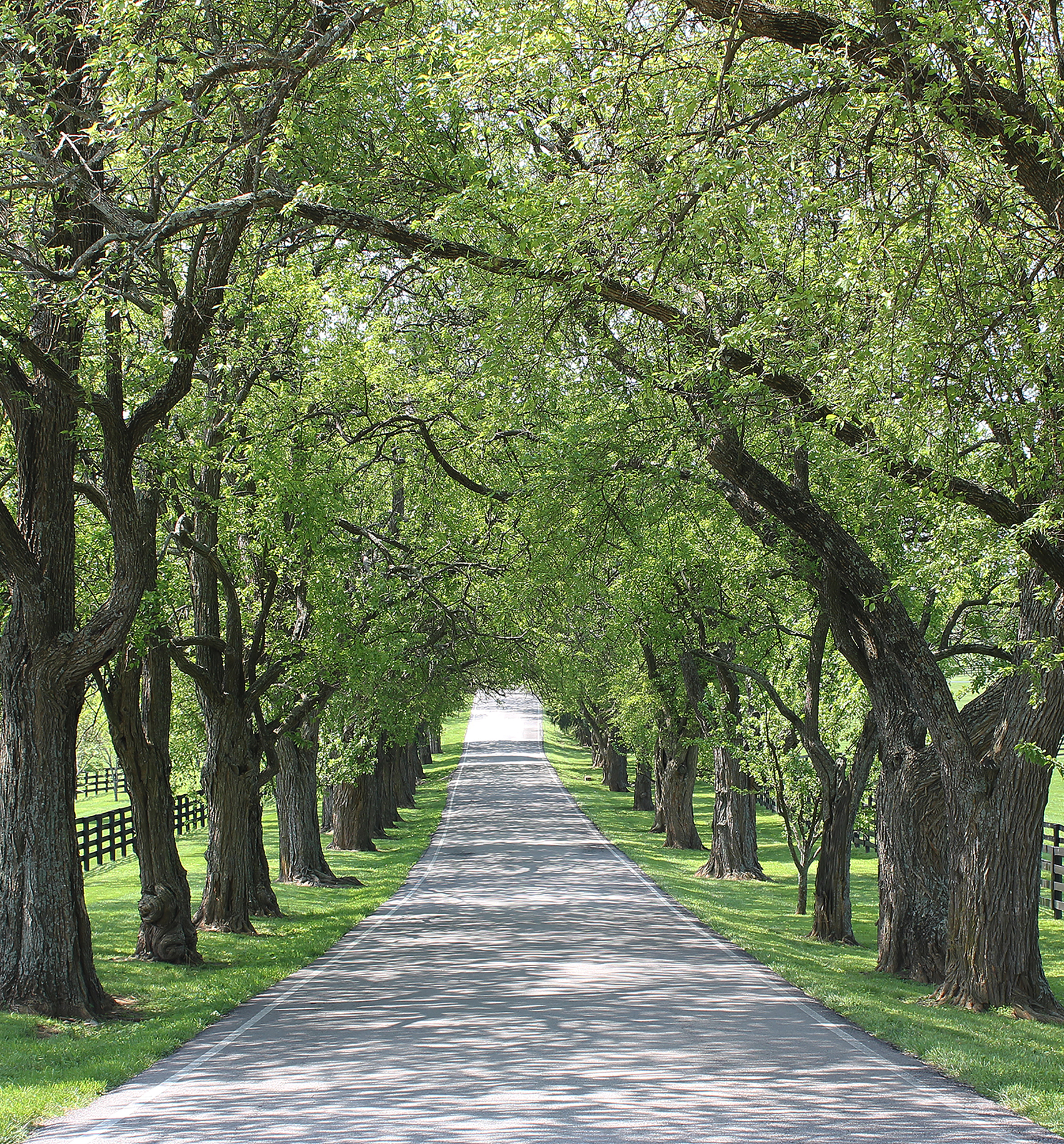
This unforgettable view shows one of the most iconic sections of Old Frankfort Pike in Woodford County. Here the road passes for two-miles between historic dry-laid limestone fences and beneath an unbroken canopy of hardwood trees.
Public Domain. Chris Amos
-
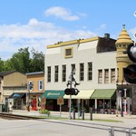
Enjoy a day of shopping and dining at a small-town pace in Midway, Kentucky’s first railroad town. (The Midway Historic District is located about two miles north of Old Frankfort Pike on US 62, Midway Road, a Kentucky Scenic Byway that intersects Old Frankfort Pike at Nugent’s Crossroad Historic District. The railroad runs through the center of town with shops and restaurants along either side.
Public Domain. Chris Amos
-
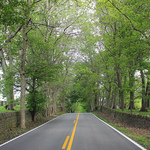
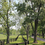
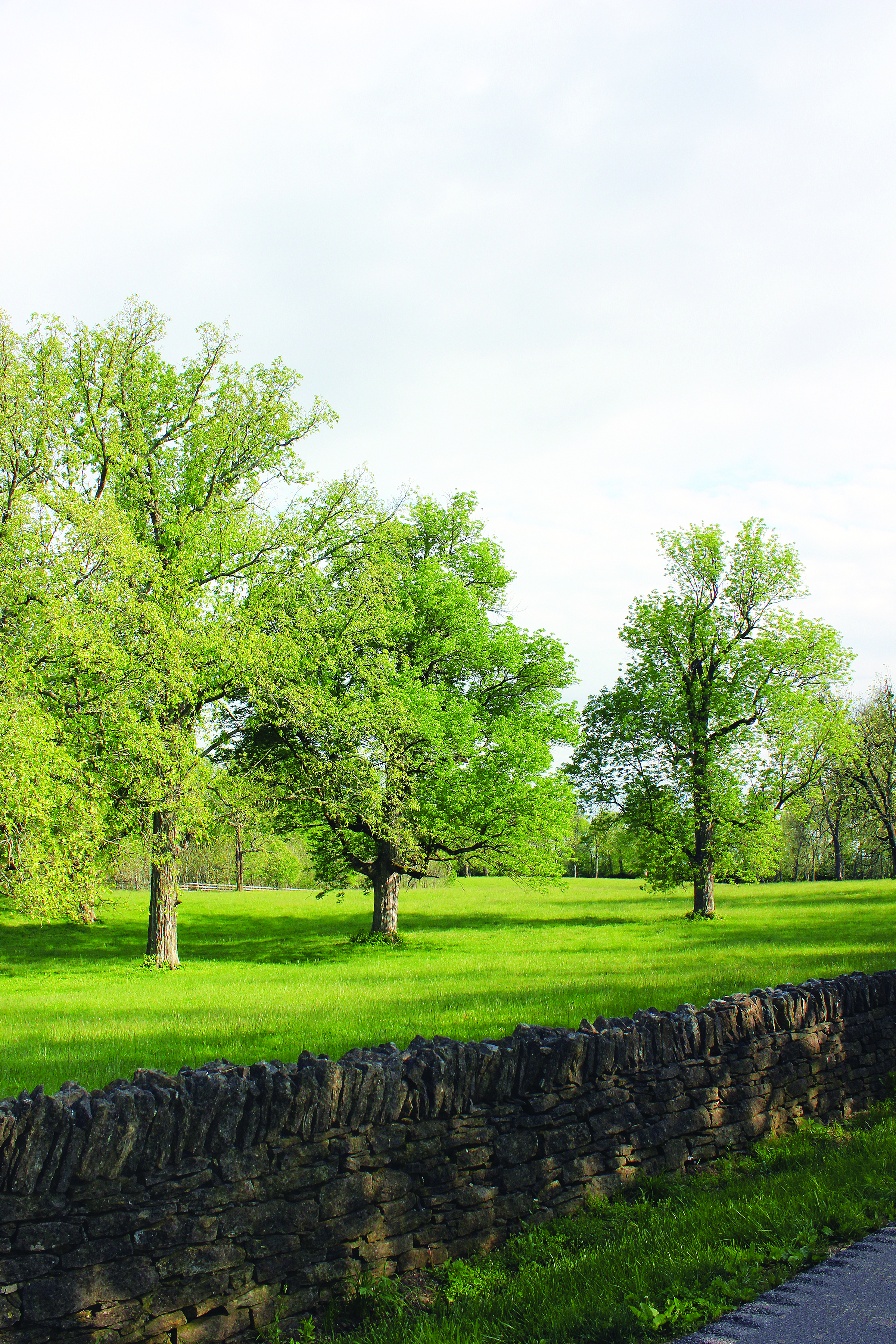
Untold years of travel along the route that originated as a buffalo trail or "trace", have carved the roadbed below the level of pastures along either side. Dry-laid limestone fences define the road’s tree-lined corridor.
Public Domain. Chris Amos
Download Original (2400 x 1446 pixels, 4128.8 MB)
-
Thoroughbred horse farms, both historic and modern, give Old Frankfort Pike its distinctive character with buildings, structures and landscapes of the equine industry.
Public Domain. Joanne Fishback
-
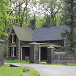
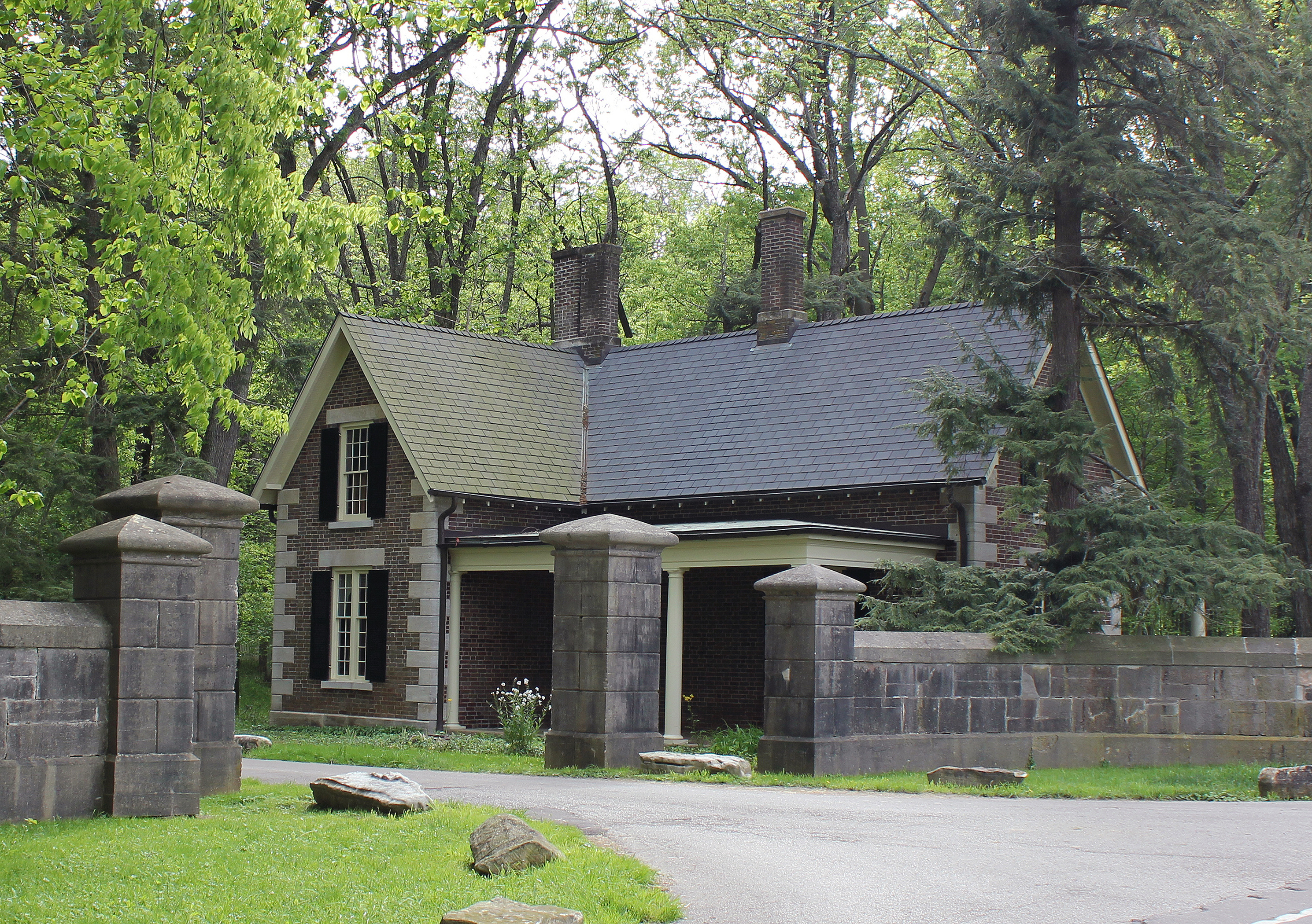
At the edge of Old Frankfort Pike, an historic brick and stone gate house marks a private farm entry.
Public Domain. Chris Amos
Download Original (2979 x 2100 pixels, 7292.9 MB)
-
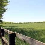
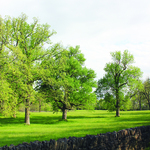
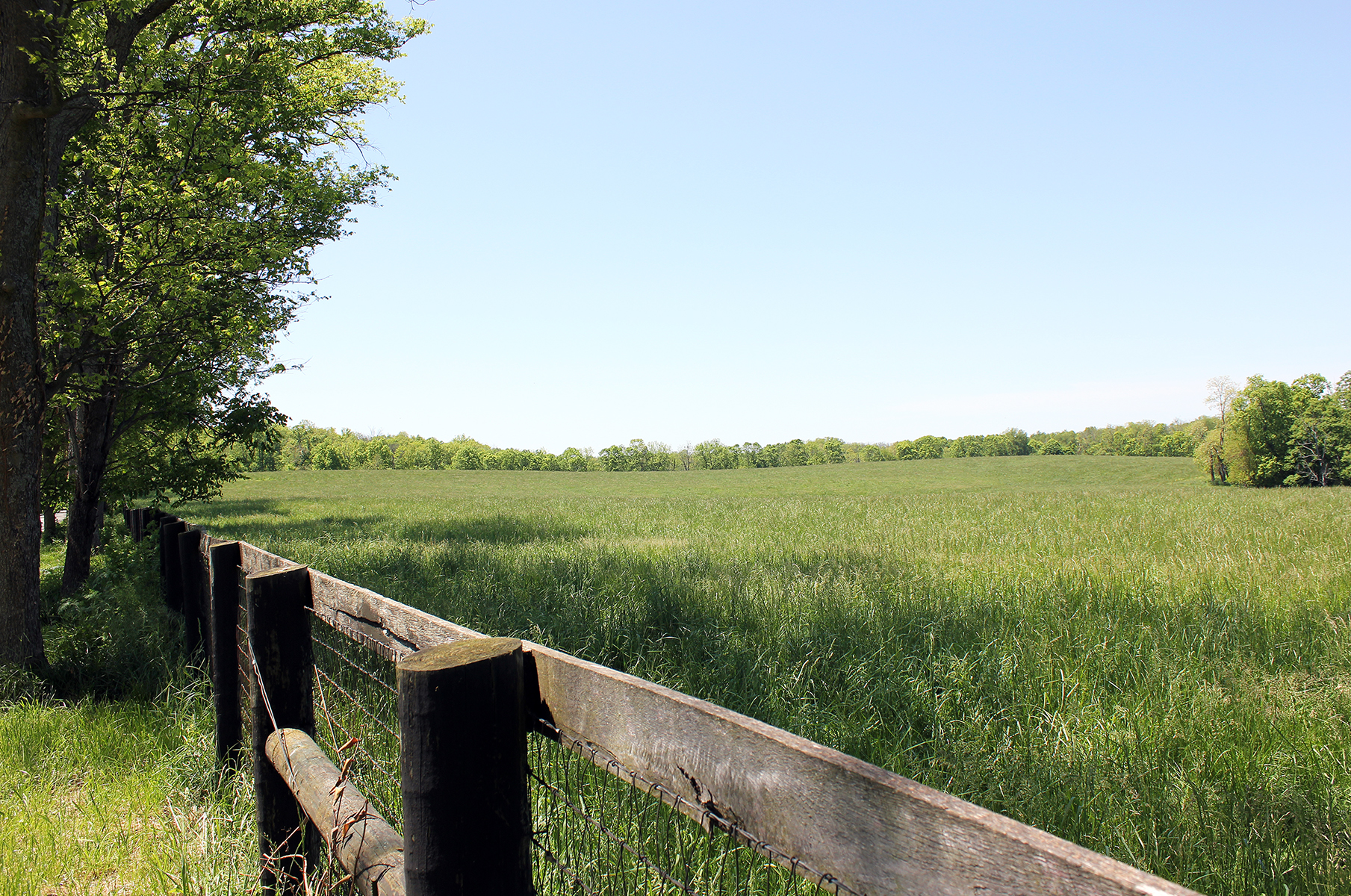
Green fields of crops and pastures for horses and livestock provide long views from the roadways in the Big Sink Rural Historic District along Old Frankfort Pike.
Public Domain. Chris Amos
Download Original (1809 x 1200 pixels, 2520.2 MB)
-
Narrower roads often mark the boundaries between farms in the Big Sink Rural Historic District. These are the earliest legal boundaries that trace to before the Revolution when surveyors first mapped this land.
Public Domain. Chris Amos
Download Original (1357 x 2100 pixels, 3697.9 MB)
-
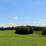
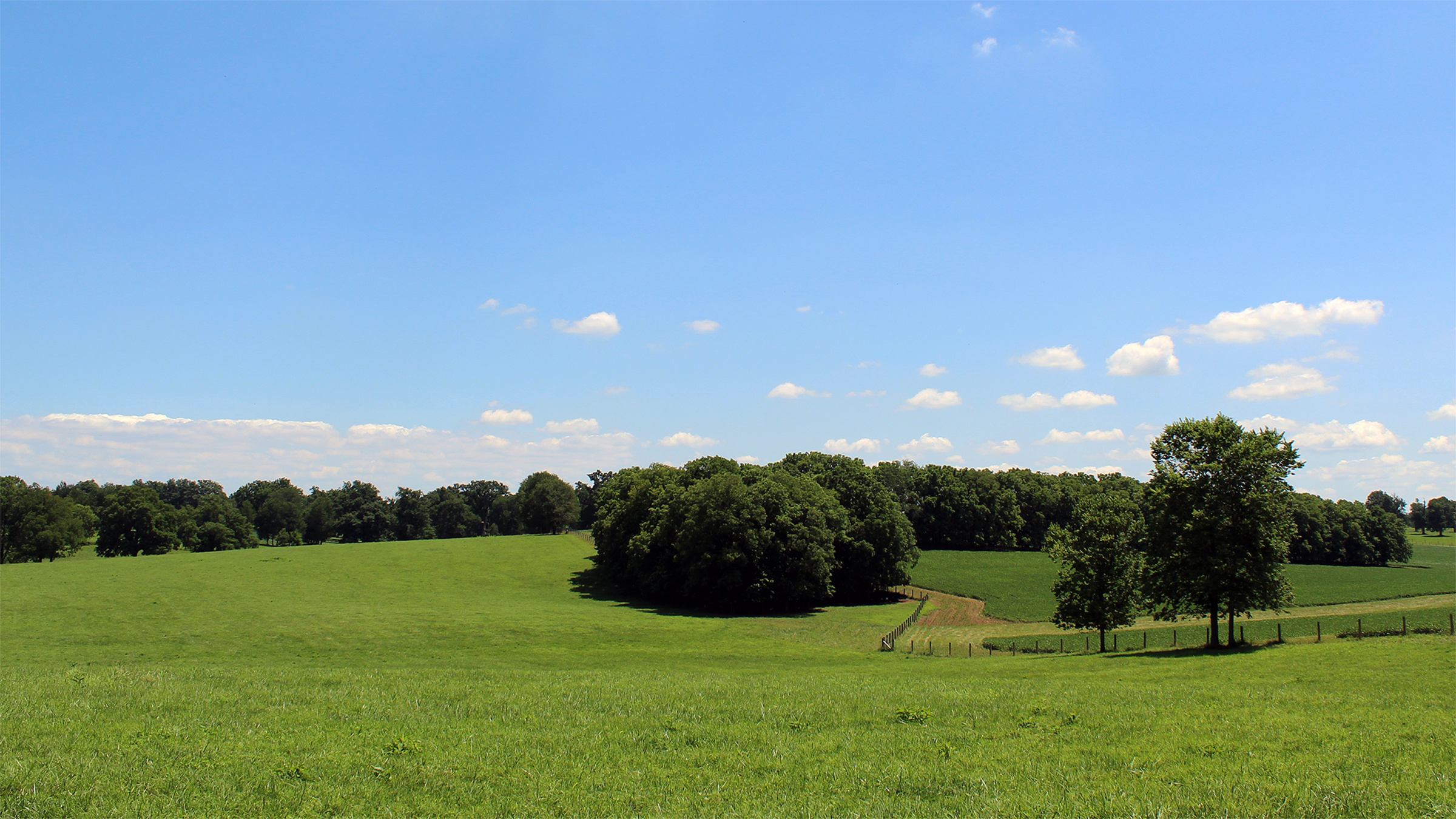
The undulating fields and pastures of the Big Sink hint of the hidden Karst geology beneath the surface of the rich loam soils here in the Bluegrass Region.
Public Domain. Chris Amos
Download Original (2400 x 1350 pixels, 2404.3 MB)
-
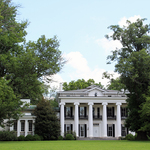
Travelers catch seasonal glimpses of the historic residence at Woodburn Farm that has been home to generations of the Alexander family since the early 1800s.
Public Domain. Chris Amos
-
Woodlake Road (aka Spring Station) intersects Old Frankfort Pike, forming the corner of the “Sale Woods” at Woodburn Farm. The woodland pasture, one of the most distinctive features of the Bluegrass landscape, is a park-like pasture of widely spaced native hardwood trees, carpeted with lush grasses and sparse undergrowth. Once a common element of almost every farm along Old Frankfort Pike, woodland pastures are now rare remnants of the historic farm landscape.
Public Domain. Chris Amos
Download Original (2400 x 3600 pixels, 16030.8 MB)
-
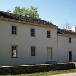
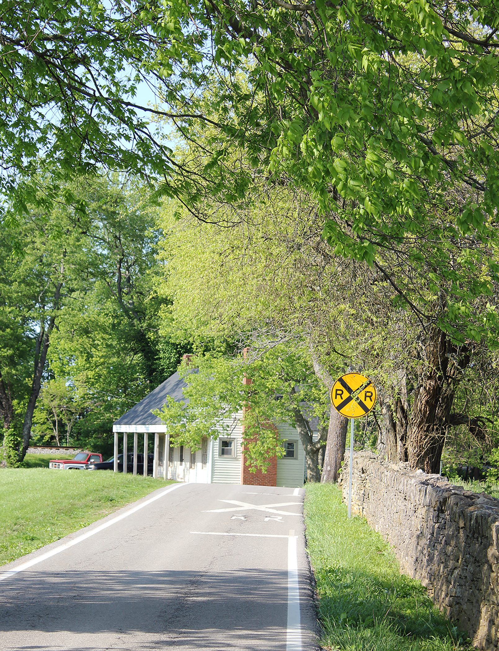
Woodburn had its own railroad stop on Woodlake Road. Referred to as Spring Station, Alexander’s and Woodburn Station, the stop once had a post office, station house (seen here), blacksmith and general store.
Public Domain. Chris Amos
Download Original (1609 x 2100 pixels, 4003.1 MB)
-
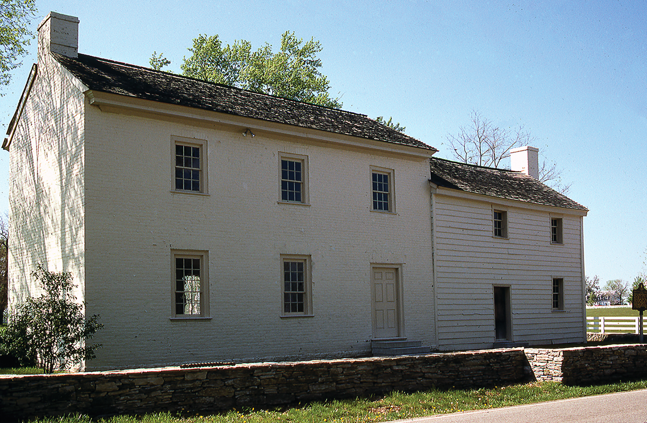
The oldest surviving community place on Old Frankfort Pike is the Offutt-Cole Tavern (aka Lee’s Tavern) at the Byway and US 62, Midway Pike in the Nugent's Crossroad Historic District. Since about 1799, the two-story log and brick building has anchored the crossroad as an inn and stage coach stop and later a tollgate house.
Public Domain. Chris Amos
Download Original (2100 x 1373 pixels, 2922.4 MB)
-
The historic stone Pisgah Church - the oldest Presbyterian Church in Kentucky, nestles into a curve on Pisgah Pike, a Kentucky Scenic Byway. The church property is bordered by a dry-laid limestone fence, shaded by ancient trees and surrounded by a cemetery marked by beautifully carved historic headstones. Pisgah Pike meets Old Frankfort Pike at its north terminus at Mt. Vernon Baptist Church.
Public Domain. Chris Amos
Download Original (1800 x 2446 pixels, 8134.3 MB)
-
Pisgah Pike is known for its tree canopy of old growth Osage Orange trees. Osage Orange hedges were once prolific in the Pisgah neighborhood, but most were removed over the years. These were pruned over the years to form a green canopy along Pisgah Pike.
Public Domain. Chris Amos
Download Original (2100 x 2258 pixels, 6074.4 MB)
-
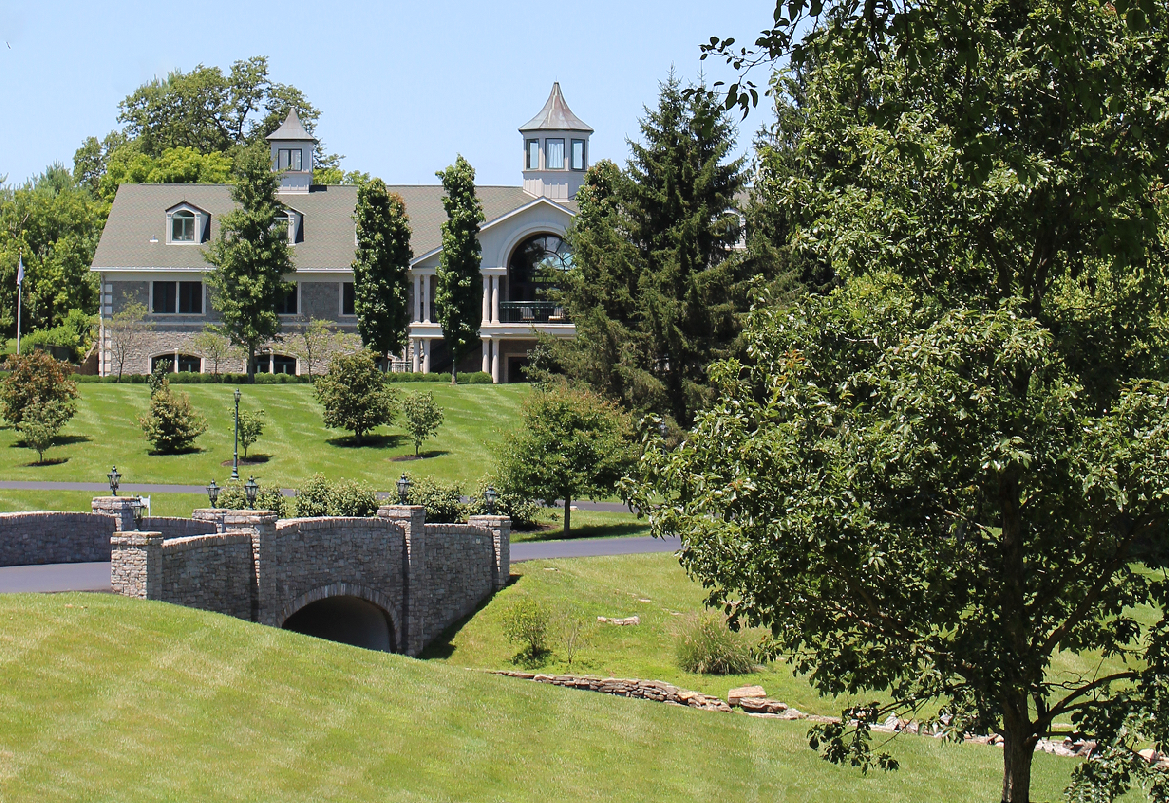
Winstar Farm is a modern Thoroughbred horse farm in the Pisgah Rural Historic District. At its core is Silver Pond Farm, and the original farmhouse, smokehouse, pond, and bank barn are visible from the Pike. Winstar is the home of "Justify" the thirteenth winner of the American Triple Crown, and just the second horse to accomplish the feat while still undefeated.
Public Domain. Chris Amos
Download Original (2400 x 1650 pixels, 3282.2 MB)
-
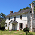
Historic farms might still include structures like this early 19th century brick house that marks a farm established 200 years ago. Over the centuries, families might update and renovate, but the original two-rooms up and two-rooms down configuration of this home is still apparent.
Public Domain. Chris Amos
-

Wisenberger Mill is one of the only remaining operating mills in central Kentucky. Find the popular and picturesque business by going north on Paynes Depot Road at Old Frankfort Pike or travel east out of Midway on Stevens Avenue. Either way is a scenic approach to the noteworthy historic mill on South Elkhorn Creek.
Public Domain. Chris Amos
-
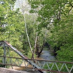
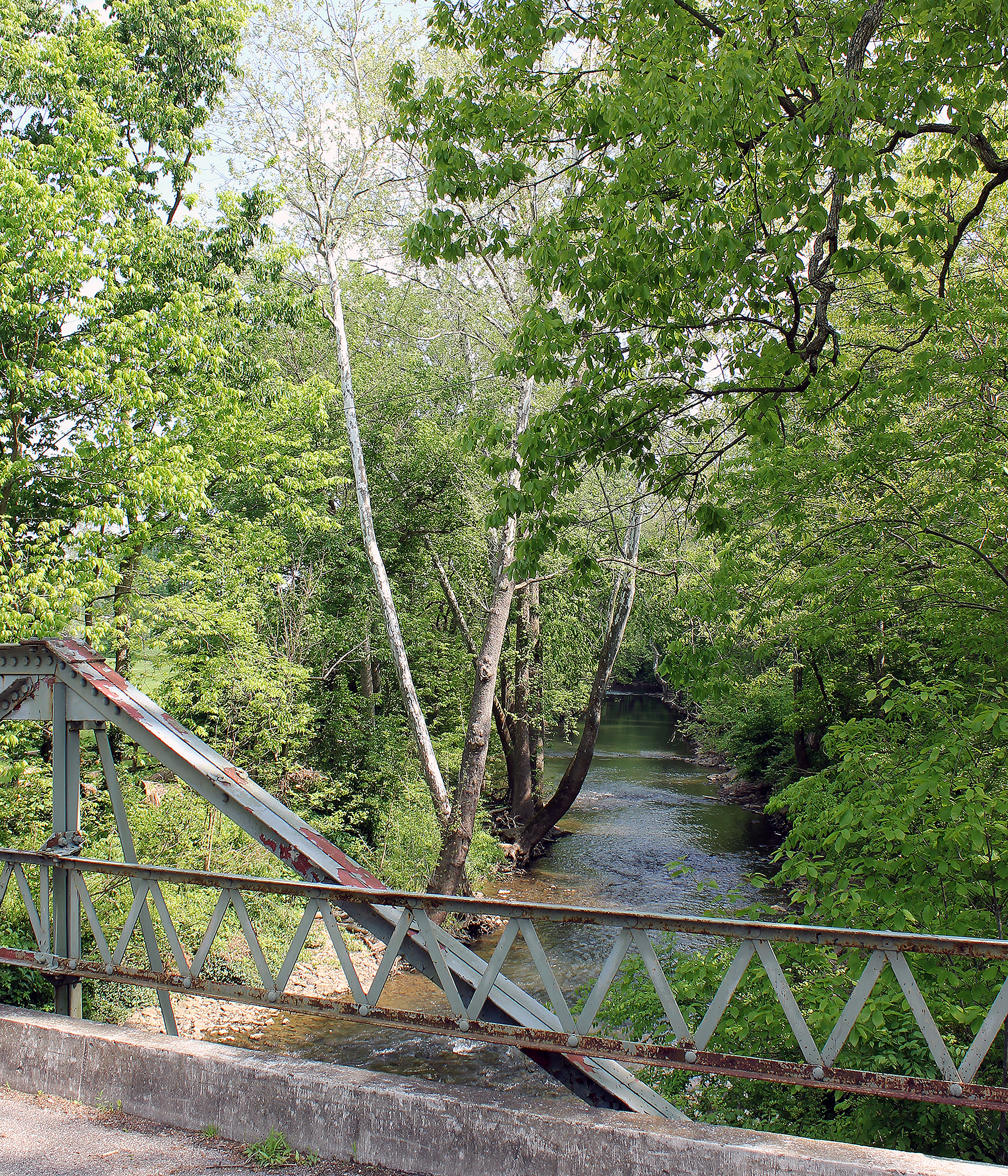
The historic Paynes Mill Road bridge crosses Elkhorn Creek where the creek marks the boundary between Woodford County and the Pisgah Rural Historic District, and Fayette County and the Redd Road Rural Historic District. Today’s quiet rural setting belies the fact this was a busy local place of commerce and trade in the 18th and 19th centuries.
Public Domain. Chris Amos
Download Original (1800 x 2101 pixels, 6921.5 MB)
-
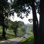
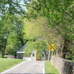
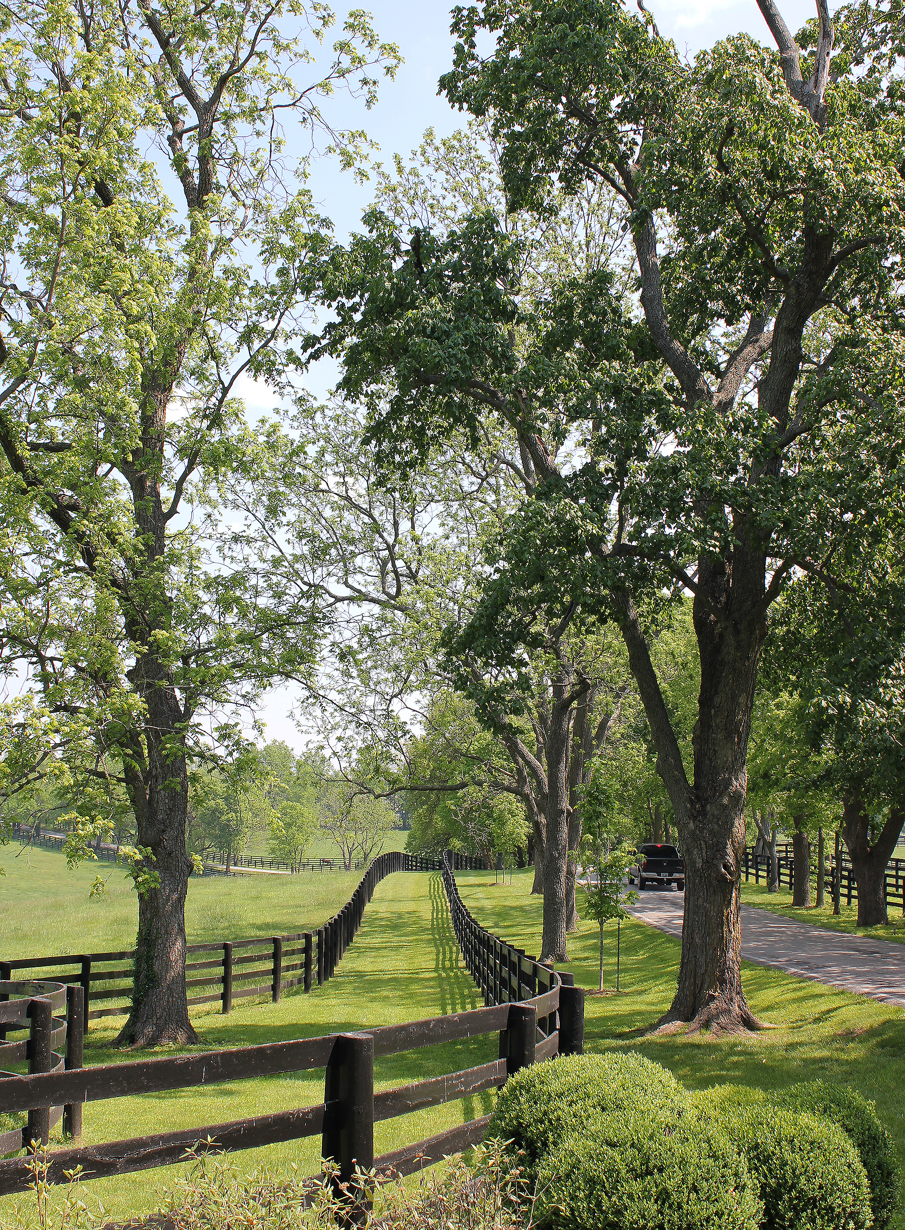
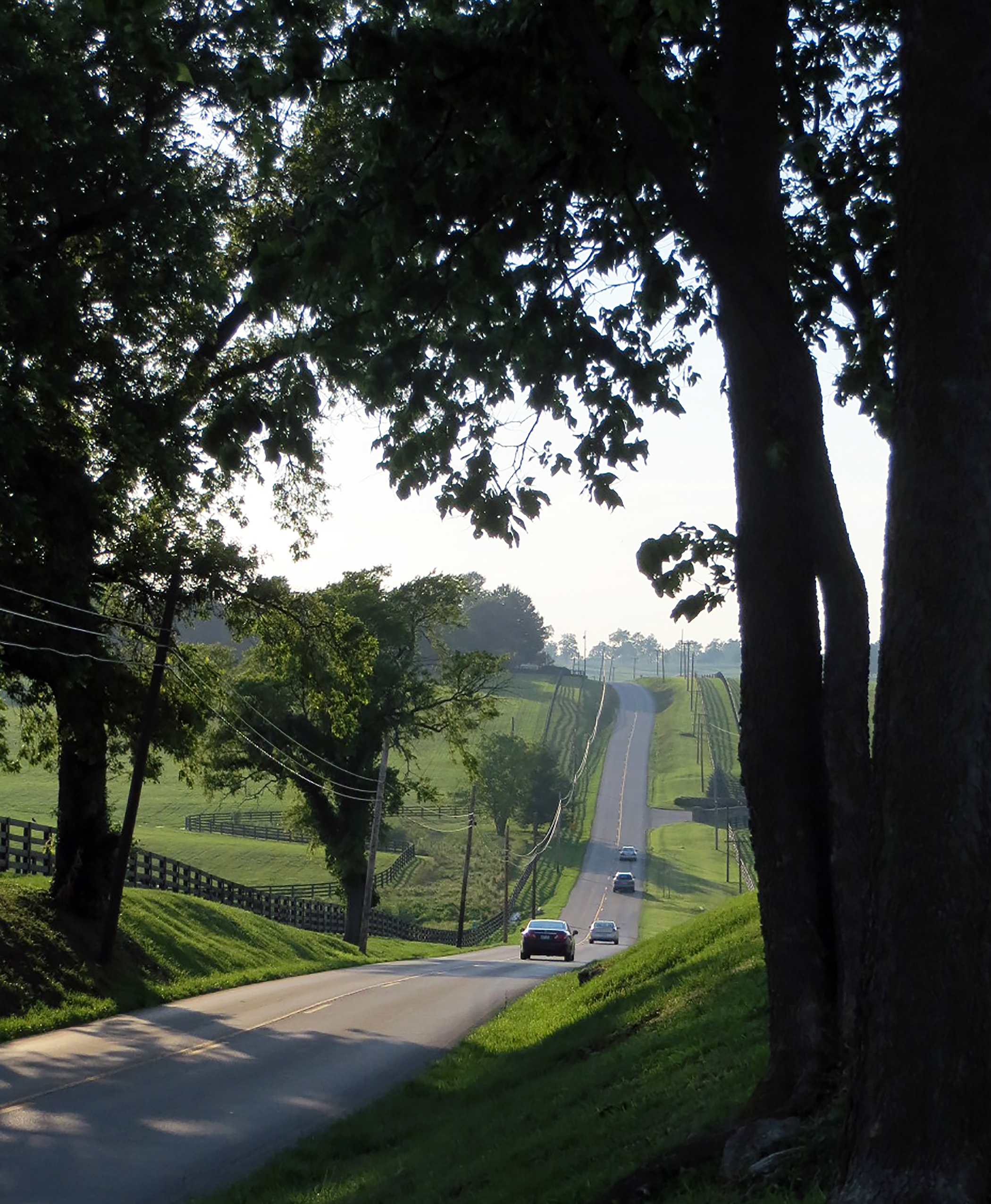
Driving Old Frankfort Pike on a warm summer evening with green fields and trees in full leaf.
Public Domain. Chris Amos
Download Original (2100 x 2552 pixels, 2740.5 MB)
-
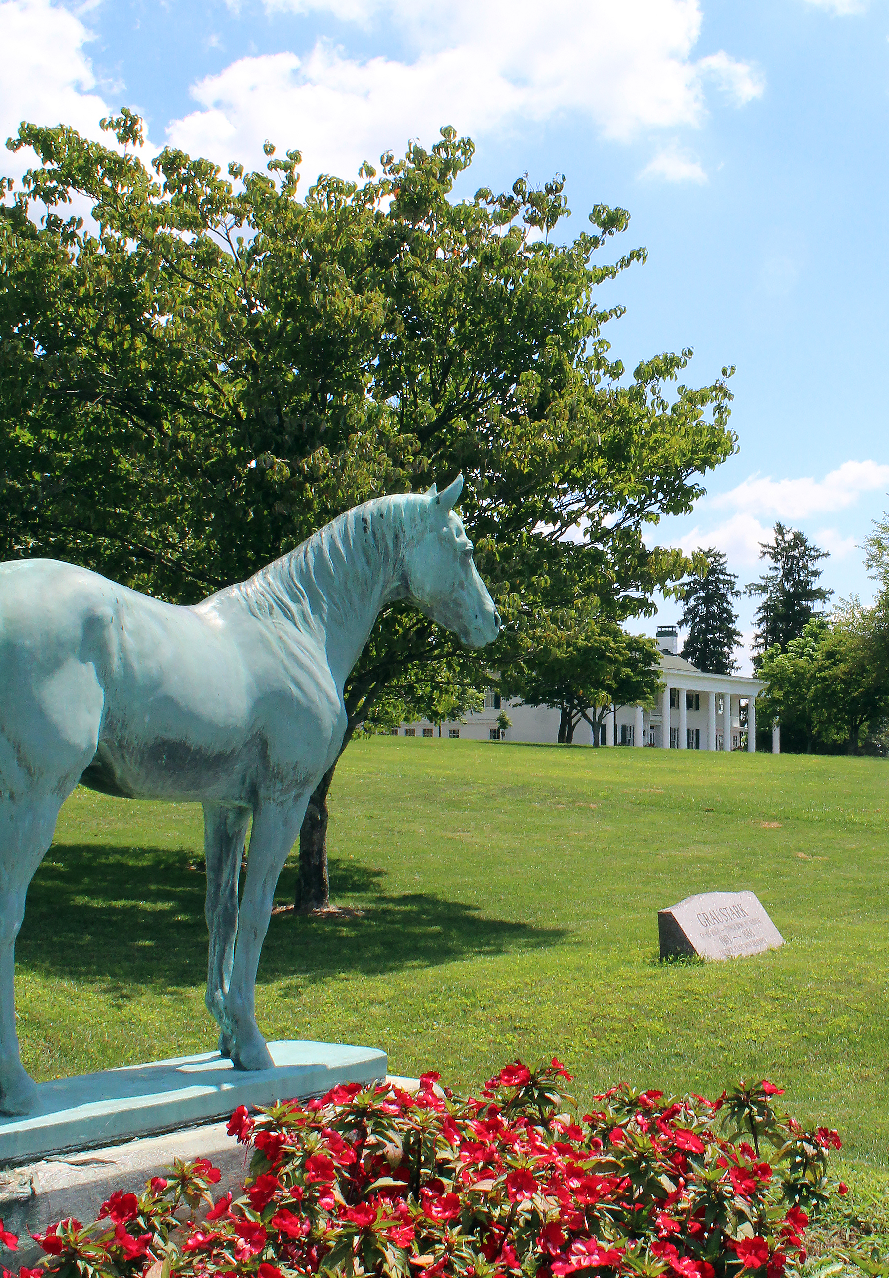
The Thoroughbred cemetery and main home at Darby Dan Farm. This is the historic Idle Hour Farm established by E.R. Bradley in the early 20th century. The farm contains an array of unique historic buildings and structures built when Bradley had his own racecourse, equine hospital, firehouse and dormitories on the farm.
Public Domain. Chris Amos
Download Original (1800 x 2586 pixels, 5796.7 MB)
-
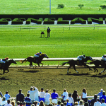
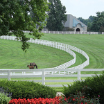
Keeneland Race Track in the West Fayette Rural Historic District is a destination unlike any other. The excitement of spring and fall race meets, and activities throughout the year make this National Historic Landmark a very lively, and special place.
Public Domain. Keeneland
-
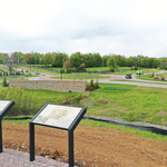
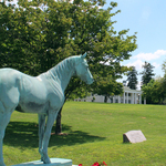
The Old Frankfort Pike Visitor Viewing Area looks off to the statue of Secretariat at the roundabout of the Pike and Alexandria Drive. From this point, visitors view the landscape of the West Fayette Rural Historic District.
Public Domain. Brad Boaz
-
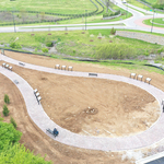
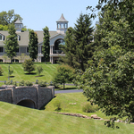
An aerial view of the Old Frankfort Pike Visitor Viewing Area looks west to the roundabout at the Pike and Alexandria Drive. The self-guided walking loop contains interpretive panels that tell the story of Old Frankfort Pike and this historic neighborhood at the west edge of Lexington, Kentucky, "The Horse Capital of the World".
Public Domain. Brad Boaz