
Coulee Corridor Scenic Byway
All Photos (33)
-
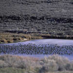
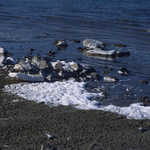
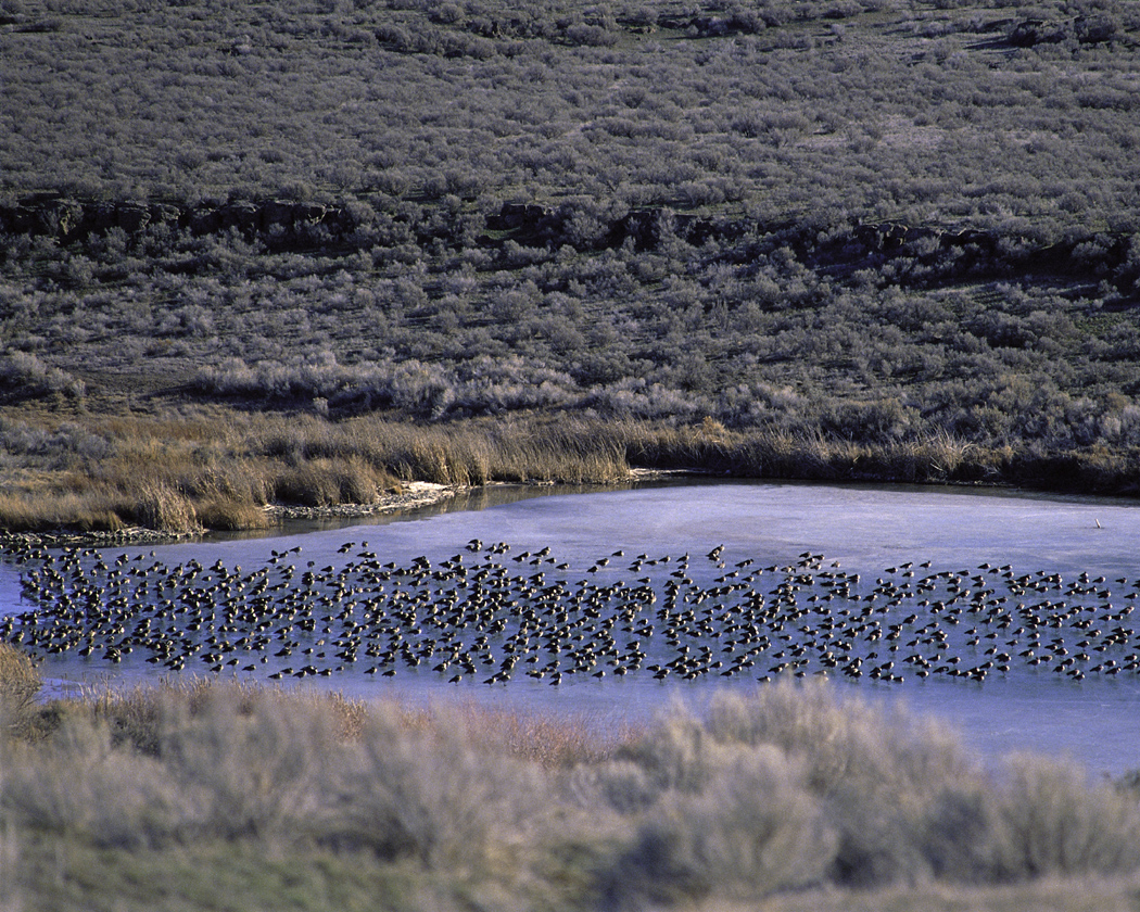
This flock of resting waterfowl makes its home in the blue lakes and marshes of Columbia National Wildlife Refuge.
Public Domain.
Download Original (1050 x 840 pixels, 754.4 KB)
-
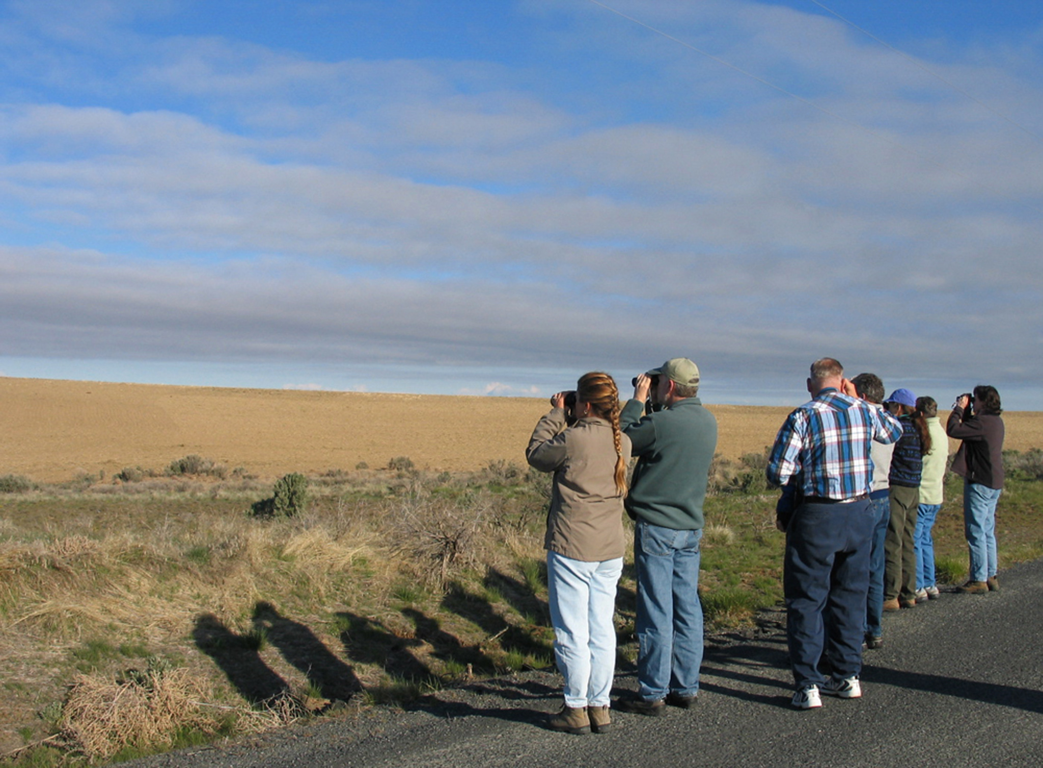
The Coulee Corridor is on a 'flyway,' literally a travel corridor for migrating birds heading north in the spring and south in the fall. It also offers nesting habitats for many species that are rare or impossible to find in other parts of Washington. Couple these facts with the 300 days of sunshine annually and birders flock to the Coulee Corridor year round.
© 2004 Karen Haire.
Download Original (2048 x 1507 pixels, 908.4 KB)
-
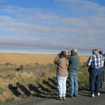
The annual Othello Sandhill Crane Festival attracts birders from all over the northwest. Some come in groups sponsored by Audubon Society Chapters, others as school groups and many as families. The Festival offers guided tours by bus and van to various locations around Othello and the Columbia National Wildlife Refuge as well as to spots farther afield along the Coulee Corridor.
© 2002 Sunny Walter.
Download Original (2048 x 1397 pixels, 1390.5 MB)
-
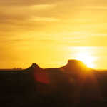
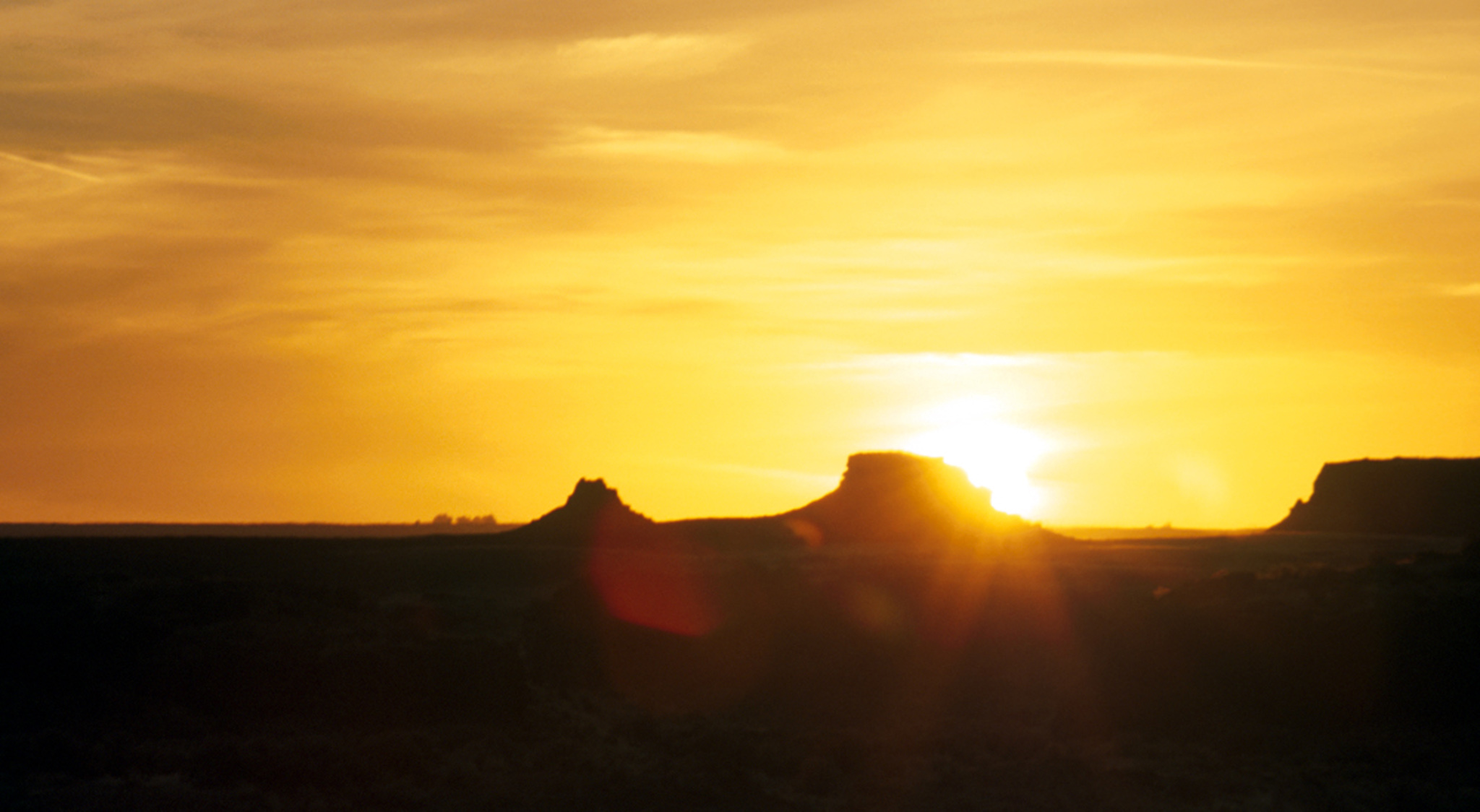
A setting sun provides stunning scenery. The rugged coulee walls and countless lake of the Coulee Corridor have always inspired artists to take pen to papers, brush to canvas or to capture an image on film or digital media. Scenic overlooks abound along the byway giving the artist space to capture an image in his or her chosen medium.
© 2002 Teri J. Pieper.
Download Original (2048 x 1124 pixels, 459.5 KB)
-
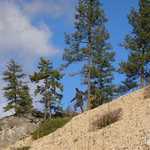
This is a view of the mouth of Northrup Canyon as seen from the Steamboat Rock State Park day use area. Historically, Northrup Canyon provided a travel route to Almira from the Grand Coulee for the Plateau Indians and early settlers of the area. Its outcroppings of rounded granite rock contrast dramatically with the straight basalt walls of the canyon and the larger coulee. The canyon has a mixed evergreen and deciduous forest with a mixture of shrubs and flowers underneath. Bald Eagles use the Coulee Corridor's only native evergreens as an important winter night roost site. Hiking, birding and horseback riding are popular activities in the canyon, part of Steamboat Rock State Park.
© 2004 Teri J. Pieper.
Download Original (2048 x 1149 pixels, 788.4 KB)
-
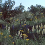
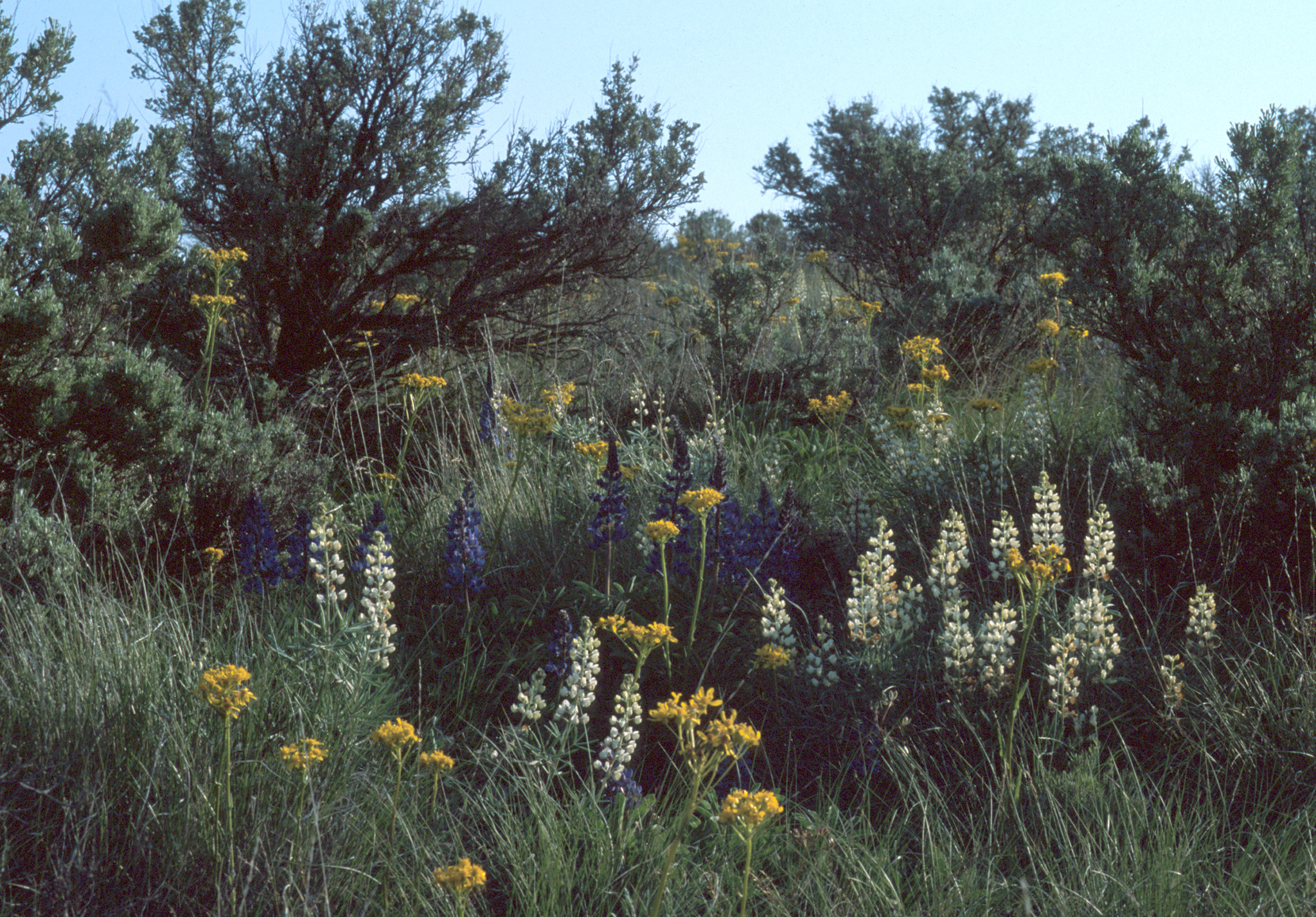
While the showy bright yellow arrowleaf balsamroot flowers may catch most people's eye as they travel the Coulee Corridor in their car, when they leave the confines of the automobile behind and begin to look at the diverse plant community of the native shrub-steppe habitat, they will be surprised at the colors, shapes and sizes of the wildflowers.
© 2002 Teri J. Pieper.
Download Original (2048 x 1427 pixels, 2352.9 MB)
-

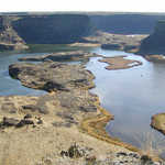
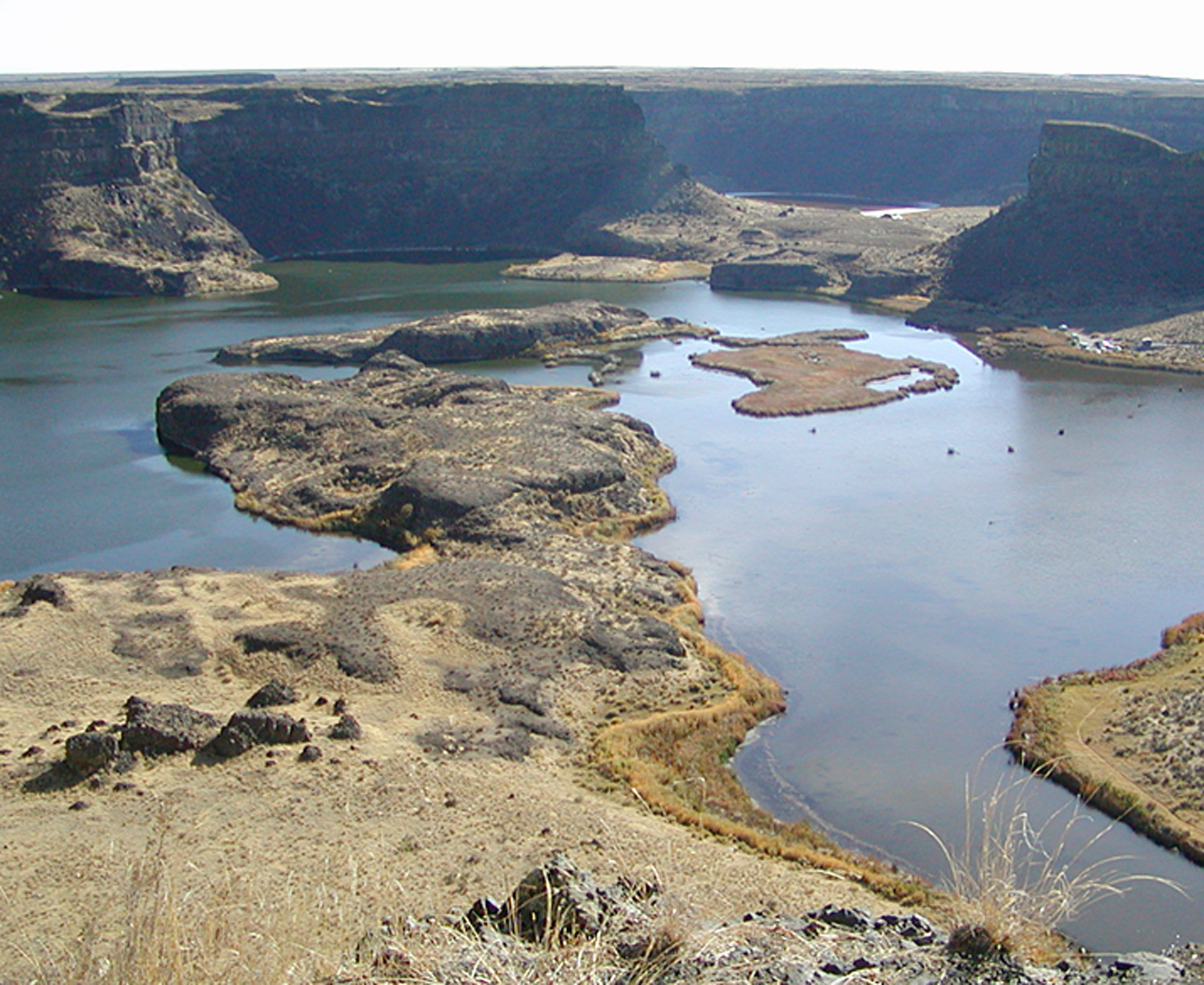
From the overlook at Dry Falls the traveler can look down to see Dry Falls Lake, a former plunge pool of the ancient waterfalls. Now it's a serene scene dotted with waterfowl and seasonally anglers using fly fishing tackle. This is just one of the thousands of Ice Age Floods features to be found along the byway.
© 2004 Teri J. Pieper.
Download Original (2048 x 1675 pixels, 1161.6 MB)
-
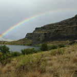
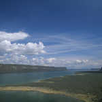
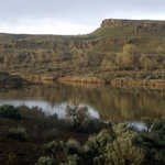
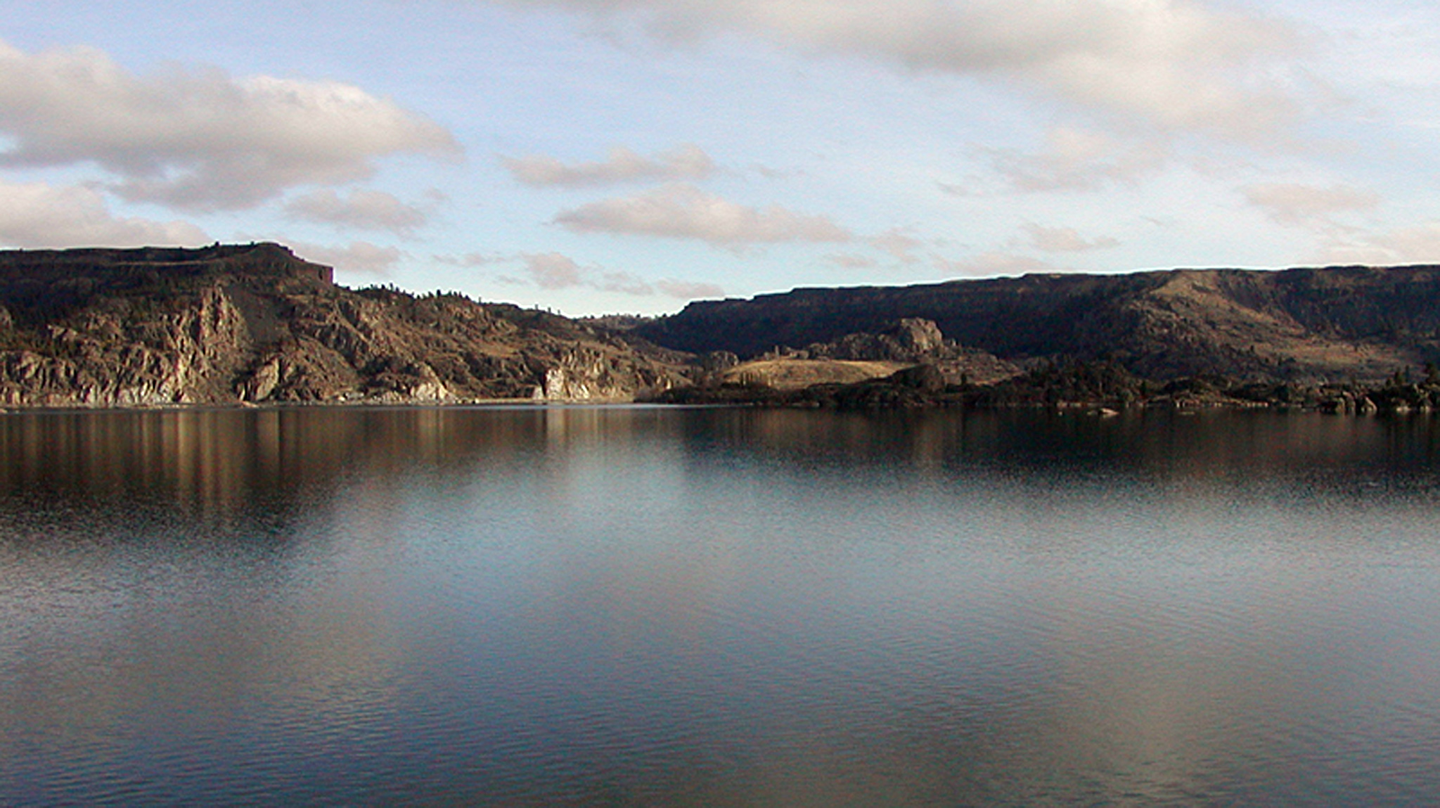
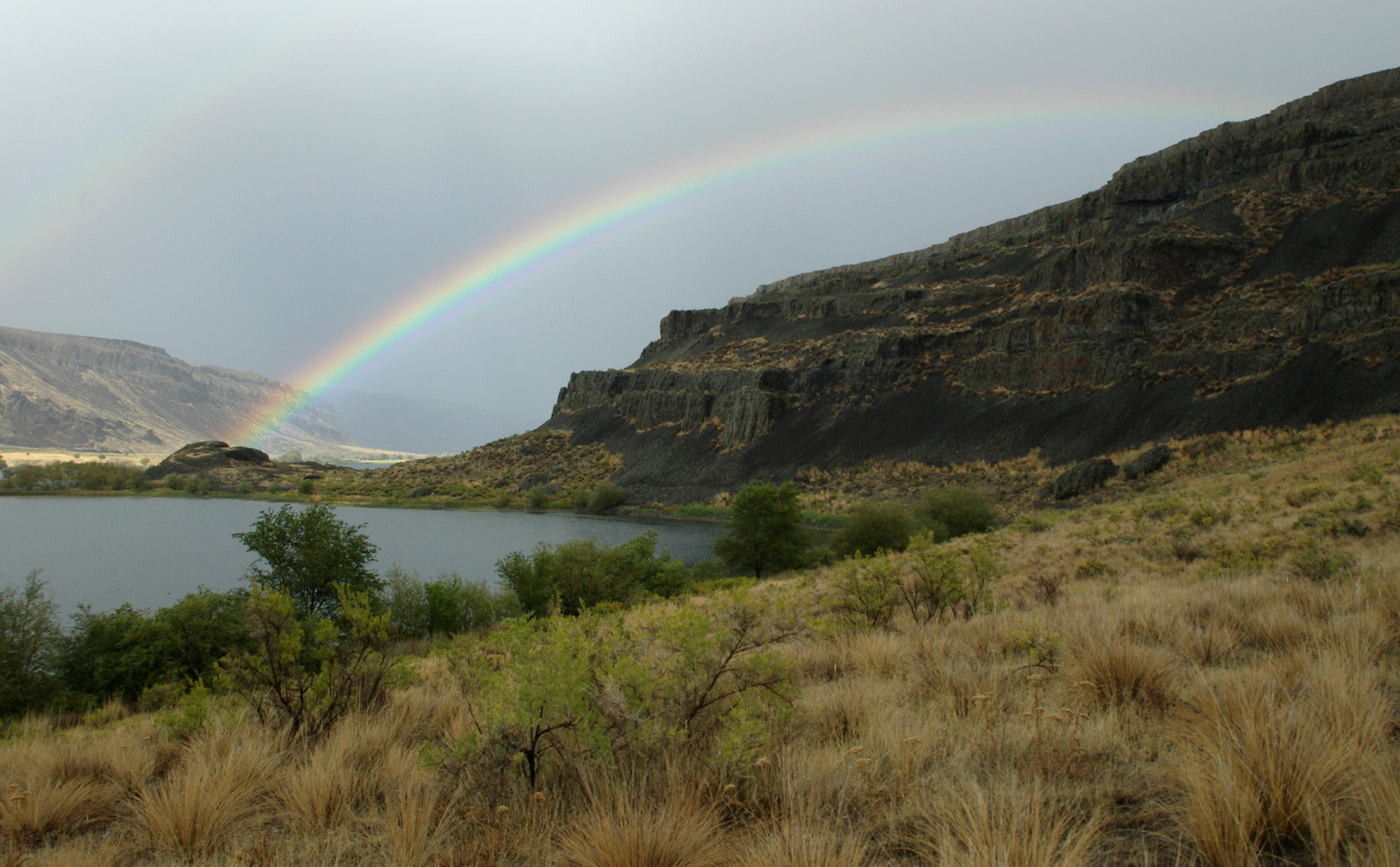
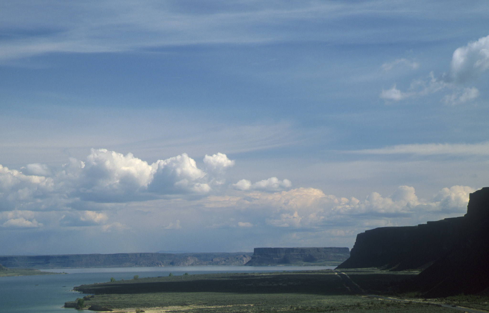
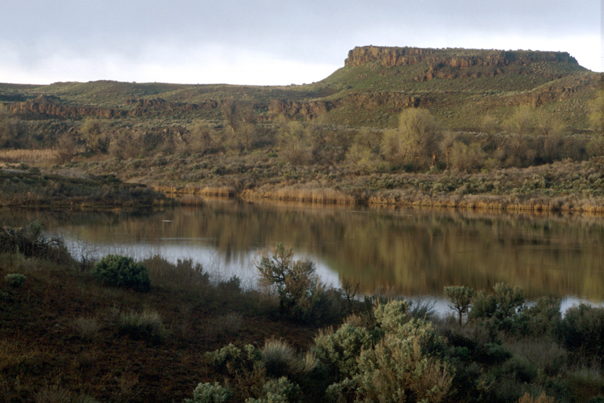
The Lower Grand Coulee has many natural lakes and smaller year round and seasonal (vernal) ponds. Coulee wallls reflect in the water and rare rains bring stunning rainbows contrasting sharply with the basalt cliffs. At the north end lake waters are fresh - Blue Lake is home to many rainbow trout and attracts large numbers of loons and grebes. At the south end Lake Lenore is very alkaline hosting brine shrimp and salamanders and Lanonton trout, creating a rich source of food for a variety of birds.
© 2004 Teri J. Pieper.
Download Original (2048 x 1269 pixels, 1007.2 MB)
-
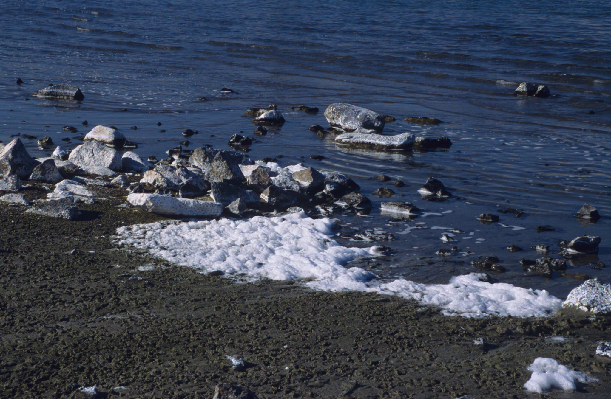
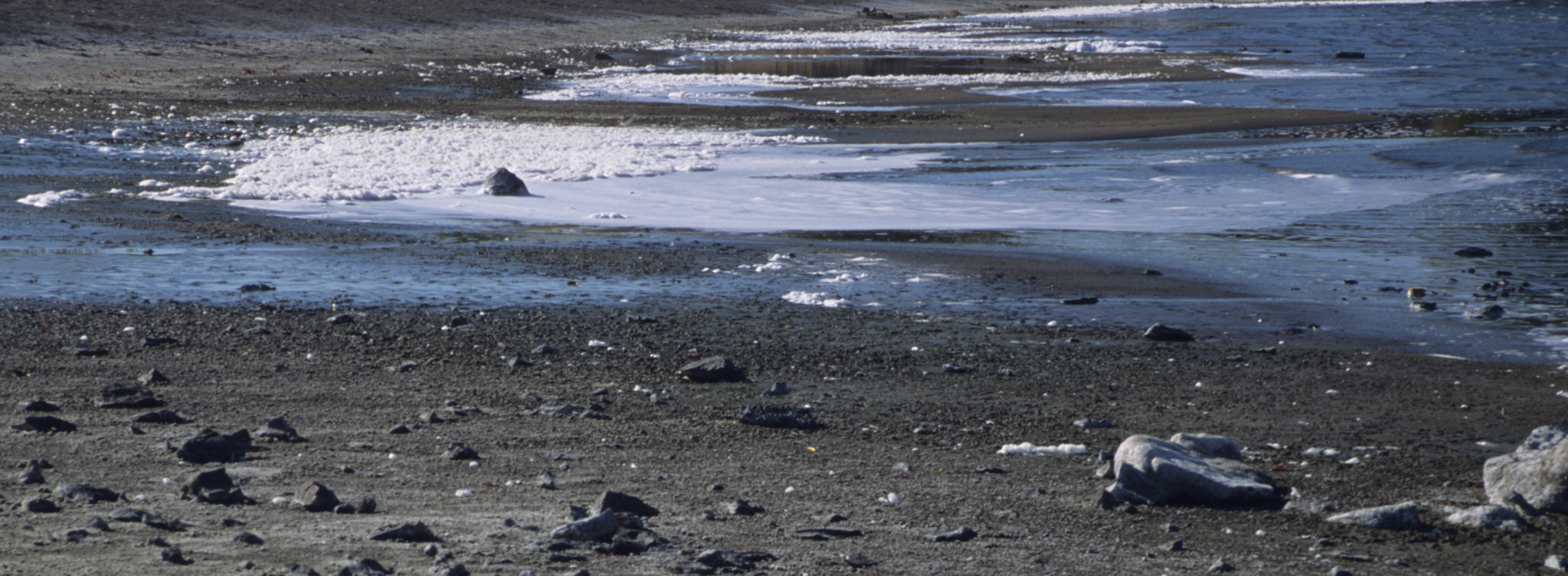
Naturally occuring foam along the shore may be what gave Soap Lake its name. Soap Lake is 'meromictic' meaning the water is stratified into layers that do not mix with each other. The layer of water near the bottom of the lake is supersaturated with minerals that were first identified for their healing characteristics by the Plateau Indians of the region. Nowadays people travel to Soap Lake to 'take the waters' and to observe the unusual birds that find the lake's characteristics beckoning. The town is becoming a favorite with artists and performers also.
© 2004 Teri J. Pieper.
Download Original (2048 x 1339 pixels, 1243.2 MB)
-
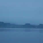
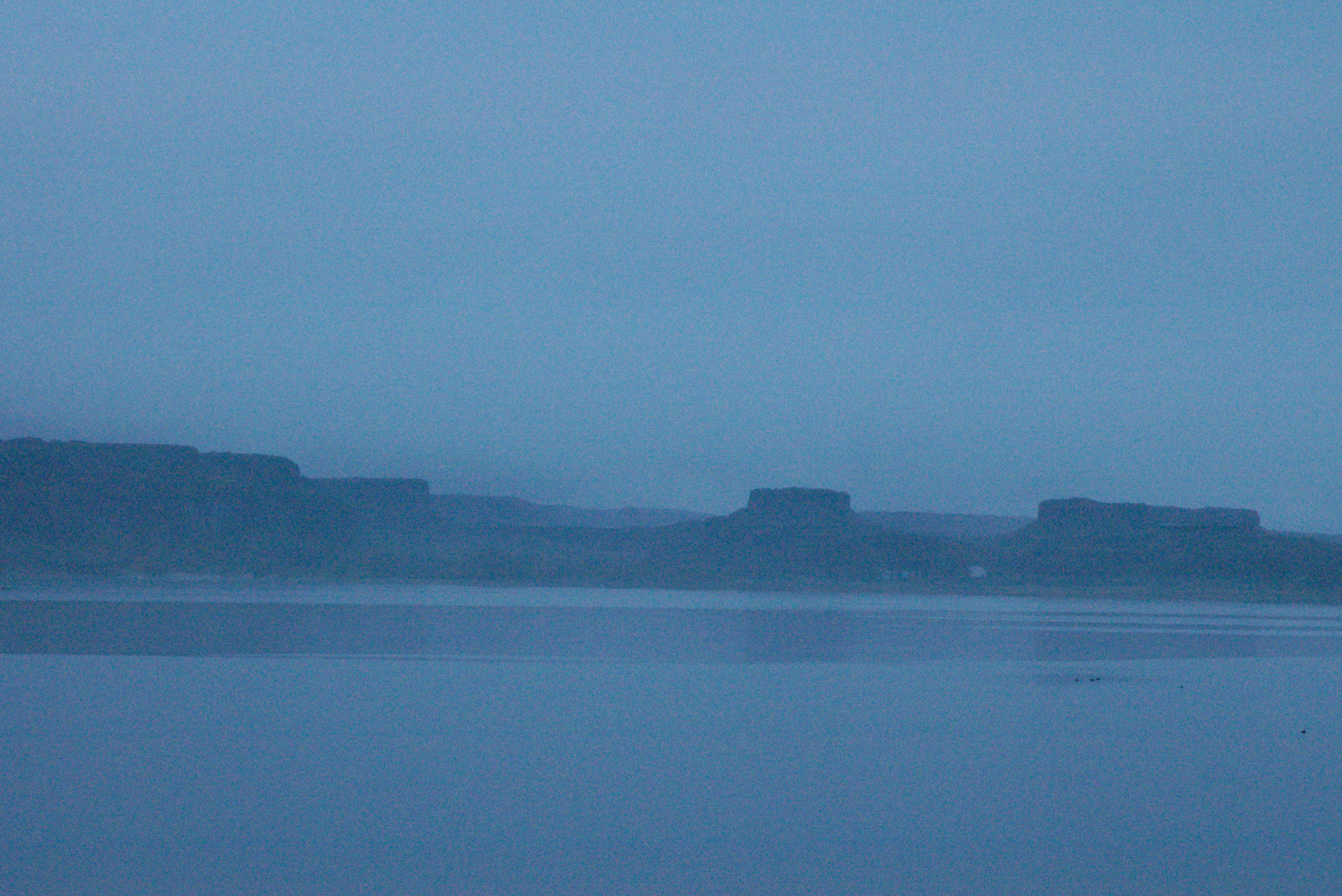
While the Coulee Corridor region is blessed with over 300 days of sunshine per year, occasional night-time rains will bring early morning fog, blanketing the lakes and cliffs in an eerily silent mist. Fog has a way of removing some of the texture of the landscape but the bold outlines of the basalt walls remain. Small ducks and grebes feed on Soap Lake's unique inverterbrates just below the water's surface.
© 2005 Teri J. Pieper.
Download Original (2048 x 1367 pixels, 1782.3 MB)
-
The Grand Coulee, a National Natural Landmark, was carved by the massive Ice Age Floods. An ice dam blocked the Clark Fork River on the Idaho/Montana border, creating glacial Lake Missoula, which contained more water than Lakes Erie and Ontario combined. When that ice dam gave way, the massive waters rushed forward in to Washington, carving coulees and depositing huge boulders, gravel bars and sand dunes along the Coulee Corridor.
© 2004 Teri J. Pieper.
Download Original (2048 x 1313 pixels, 840.2 KB)
-
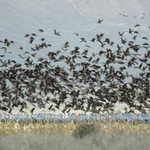
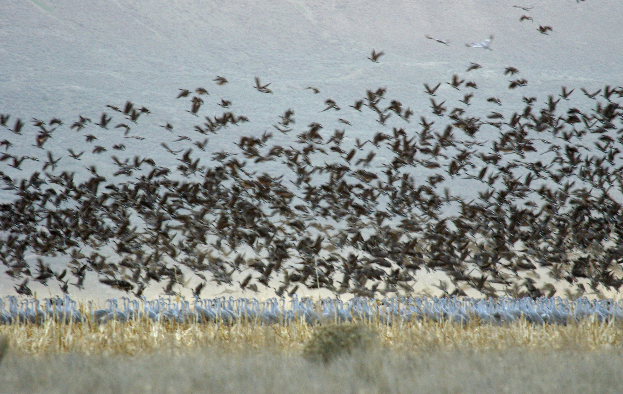
Sandhill Cranes, Canada Geese and other waterfowl migrate through the Coulee Corridor each Spring and Fall. Many of these birds congregate at the Columbia National Wildlife Refuge at the south end of the Byway creating a spectacle of sight and sounds! Refuge managers maintain corn fields, leaving some of the grain in the fields over the winter in anticipation of the birds' arrival. Following the birds, bird watchers arrive with scopes, binoculars and camera gear to take in the wondrous sight of thousands of each species arriving, feeding and returning to roost each evening. Each species has its own distinct voice and calls among the flocks create a sound landscape perhaps as impressive as the visual landscape.
© 2005 Teri J. Pieper.
Download Original (2048 x 1295 pixels, 1478.3 MB)
-
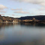
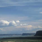
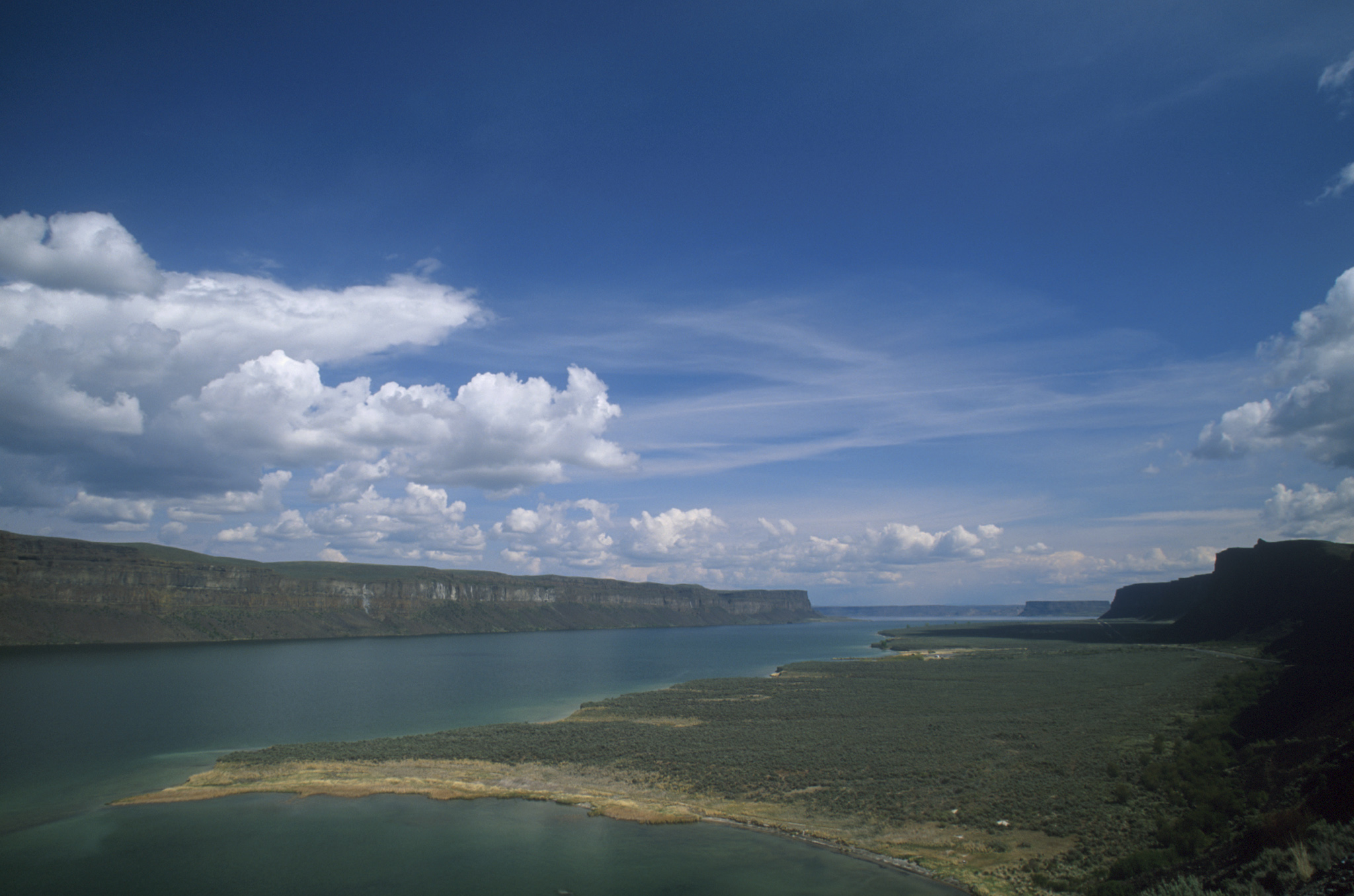
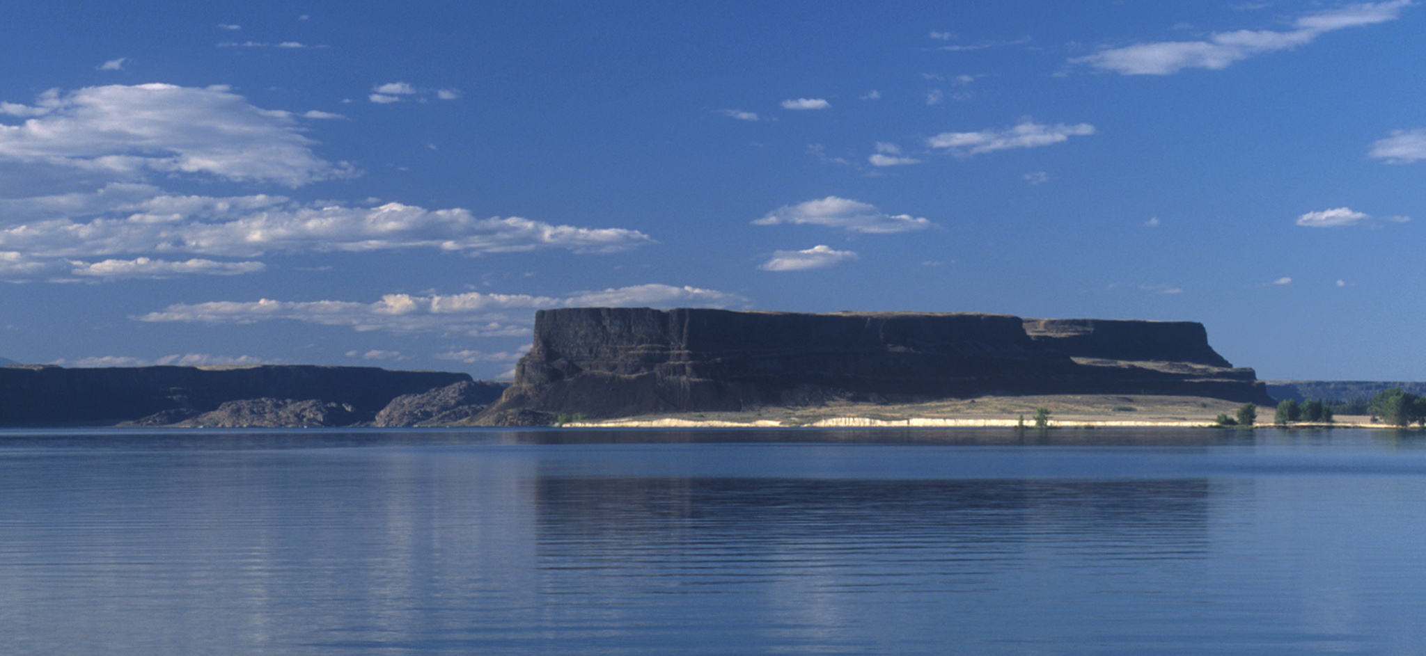
The Upper Grand Coulee is seen from the Million Dollar Mile section of the Coulee Corridor. 900 foot coulee walls contrast sharply with the waters of Banks Lake in this Ice Age Floods carved coulee. Here the power of ancient waters is graphically illustrated and reported in the strata of ancient basalt laid down by multiple lava eruptions from millions of years ago and hundreds of miles away. Steamboat Rock, a columnar basalt butte that was once an island in a rerouted Columbia River bed now towers 800 feet above the surface of Banks Lake.
© 2004 Teri J. Pieper.
Download Original (2048 x 1356 pixels, 739.4 KB)
-
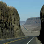
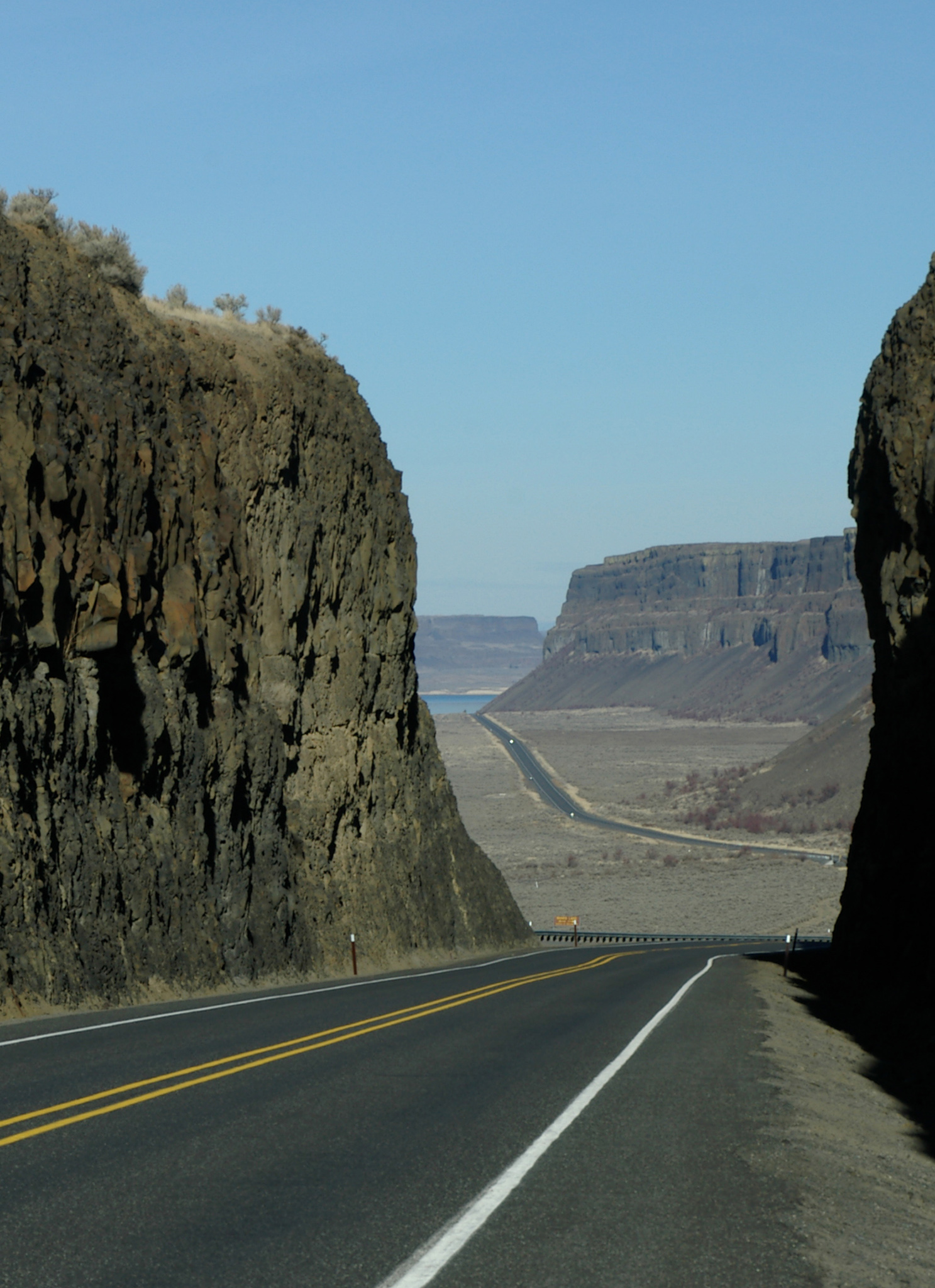
In order to build SR 155 in the 1940s along Banks Lake a large cut had to be made through the basalt cliffs. At the time it cost a million dollars to create this mile-long stretch of highway - an astronomical amount of money at the time. It is fun to imagine how the highway would be built in today's world and how much more it would cost.
© 2004 Teri J. Pieper.
Download Original (1487 x 2048 pixels, 874.7 KB)
-

Waves wash onto the beach on Soap Lake. From the many testimonials of those it has helped, few doubt that the water of Soap Lake has curative powers.
© 2003 Teri J. Pieper.
Download Original (2048 x 752 pixels, 722.3 KB)
-
Here Dry Falls is seen from the overlook along the Coulee Corridor Scenic Byway. During the Ice Age Floods this waterfall was 3.5 miles wide and ten times bigger than Niagara Falls. It is known as a 'recessional waterfall' - it eroded its way backwards from an original point near present day Soap Lake to its current site some fifteen miles north. Now it stands as a silent reminder of the force of the water that carved this landscape. Below the overlook, quiet lakes fill the low spots and swifts and swallows do their aerial dances celebrating the rites of spring and summer's warmth.
© 2004 Teri J. Pieper.
Download Original (2048 x 969 pixels, 762.9 KB)
-
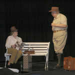
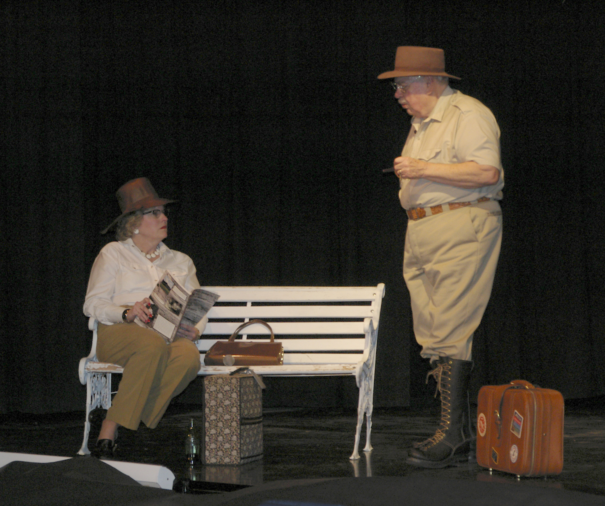
At the Coulee Corridor's annual celebration of its stories and people, Charlie Mason plays 70 year old J Harlen Bretz and Susan Lacy plays a train traveler he meets in Ephrata in the Spring of 1952. Bretz regaled the lady with tales of the Ice Age Floods and how he was able to discover and develop the stories behind them. This two person play has been filmed and will be used for educational purposes around the Coulee Corridor and Washington.
© 2005 Teri J. Pieper.
Download Original (2048 x 1713 pixels, 1369.7 MB)
-
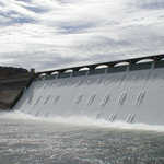
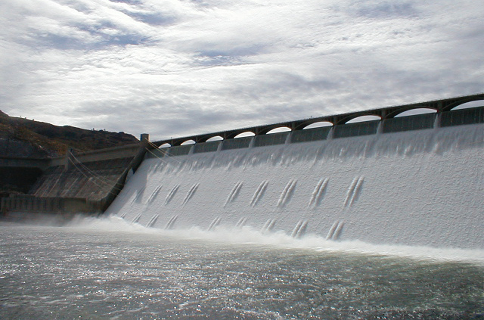
The Grand Coulee Dam is seen from the day use park by the Grand Coulee Dam Visitor Arrival Center. The Grand Coulee Dam, located on the Columbia River in central Washington, is the largest concrete structure in the United States. It forms the centerpiece of the Columbia Basin Project, a multipurpose endeavor managed by the U.S. Bureau of Reclamation. In addition to producing up to 6.5 million kilowatts of power, the dam irrigates over half a million acres of Columbia River Basin farm land and provides abundant wildlife and recreation areas.
© 2003 Teri J. Pieper.
Download Original (2048 x 1354 pixels, 769.4 KB)
-
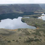
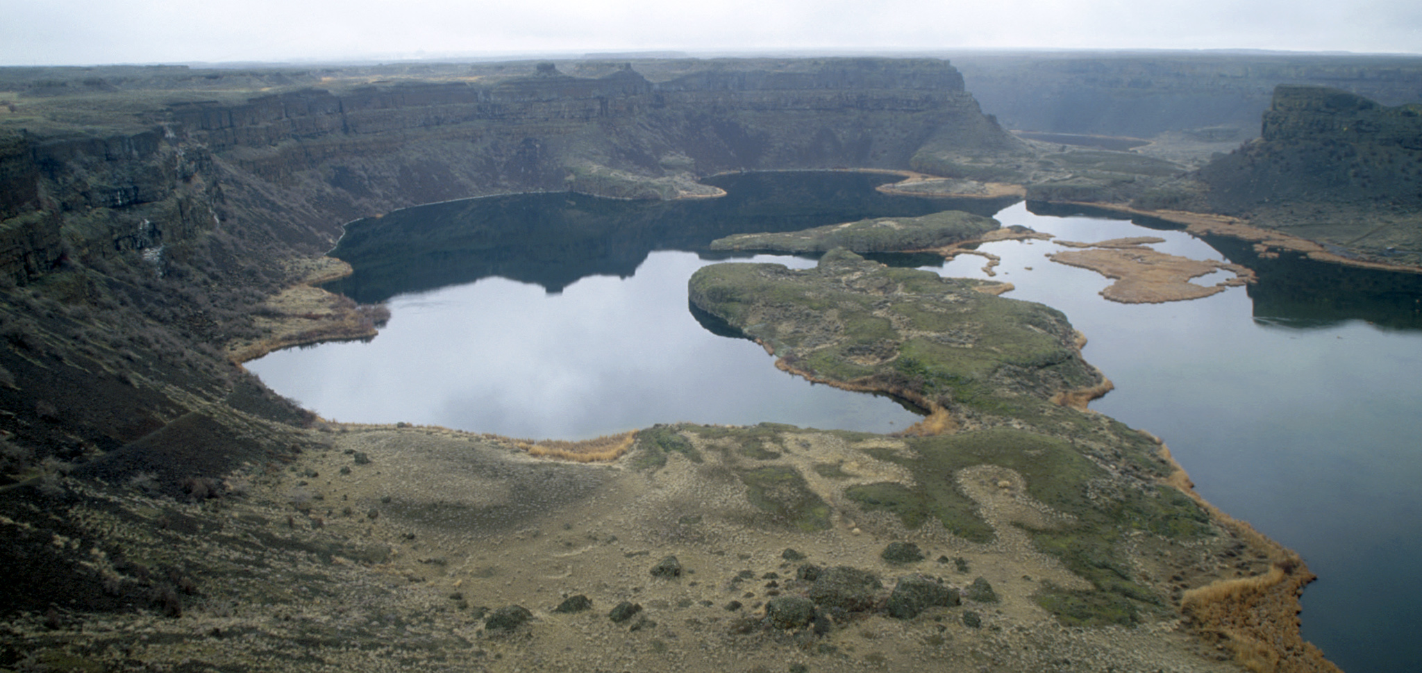
Wigeon Lake in the Drumheller Channels is just one of many lakes that dot this National Natural Landmark. Additionally, Crab Creek, the longest creek in Washington, winds its way through the area. The Drummheller Channels are an example of 'butte and basin' scabland, an erosional landscape characterized by hundreds of isolated steep sided hills surrounded by a braided network of channels or coulees. The Ice Age Flood waters left this area a rugged jumble of cliffs, canyons, lakes and remnants of ancient lava flows.
© 2000 Teri J. Pieper.
Download Original (2048 x 1368 pixels, 1024.5 MB)
-
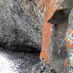
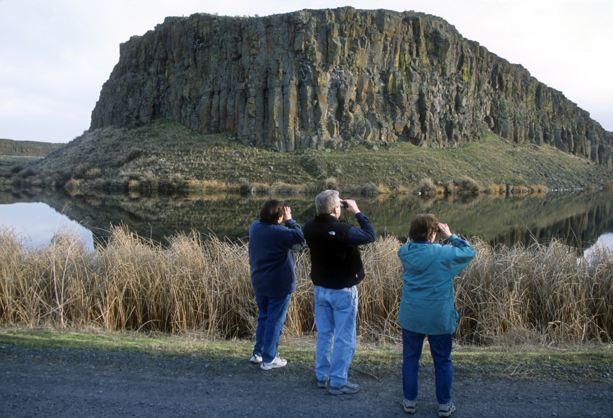
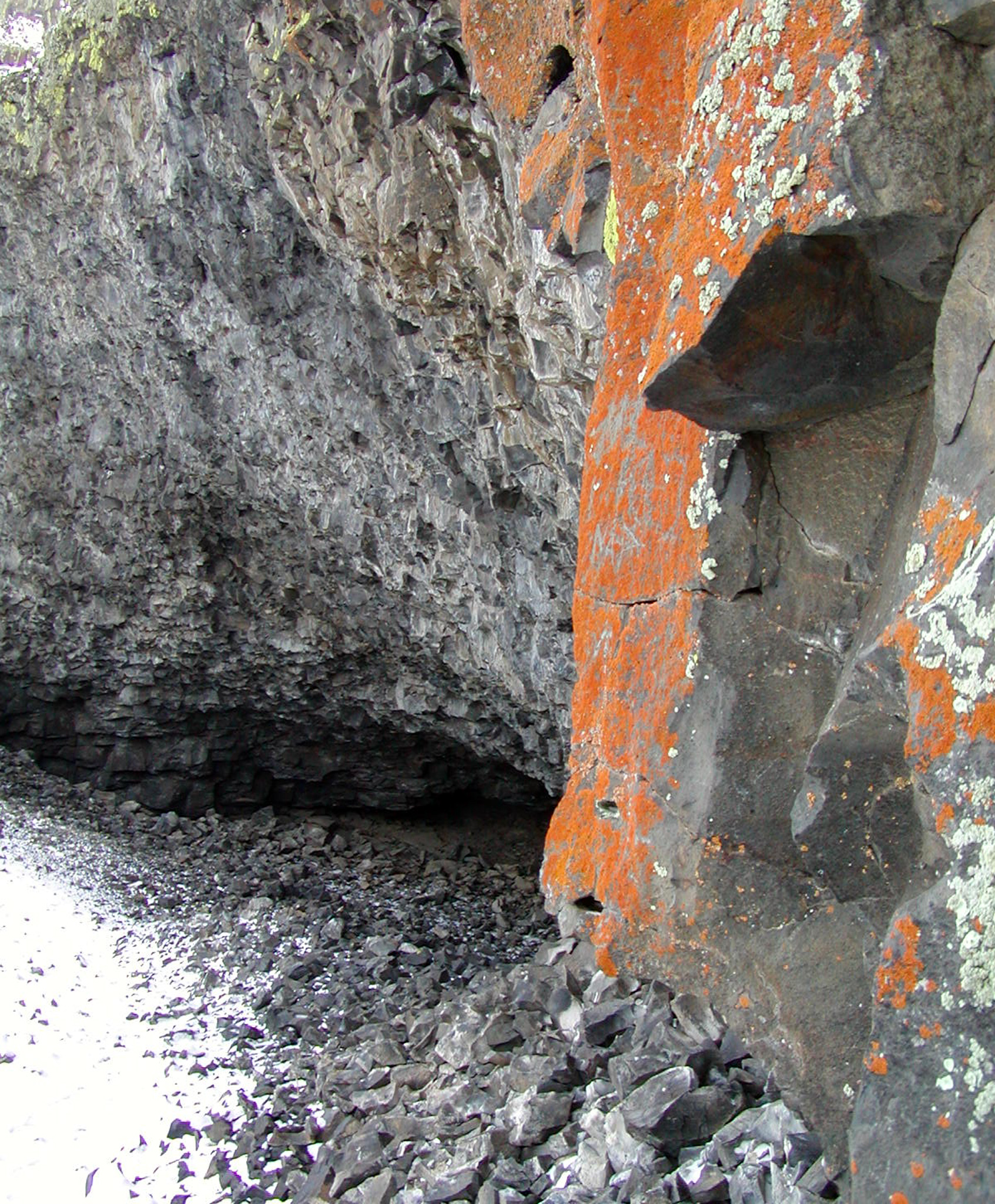
This area of Sun Lakes State Park has a rugged trail leading to a series of rock shelters that were historically used by the Plateau Indians for storage and for shelter. Colorful lichens decorate the rocks in oranges, yellows and greens. The occasional winter snowfall adds to the contrast with the dark basalt walls. These caves were created when whirlpool-like floodwaters from the Ice Age Floods sucked rocks out of the basalt walls.
© 2003 Teri J. Pieper.
Download Original (1693 x 2048 pixels, 1694.4 MB)
-
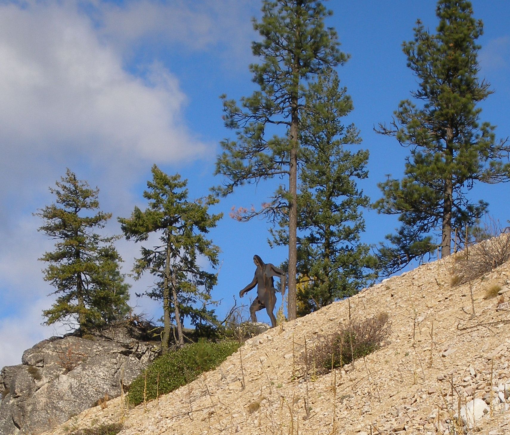
An 18-foot-tall Sasquatch statue welcomes visitors on the Coulee Corridor Scenic Byway.
Public Domain.
Download Original (1711 x 1459 pixels, 534.2 KB)
-
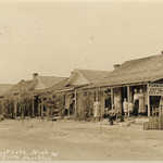
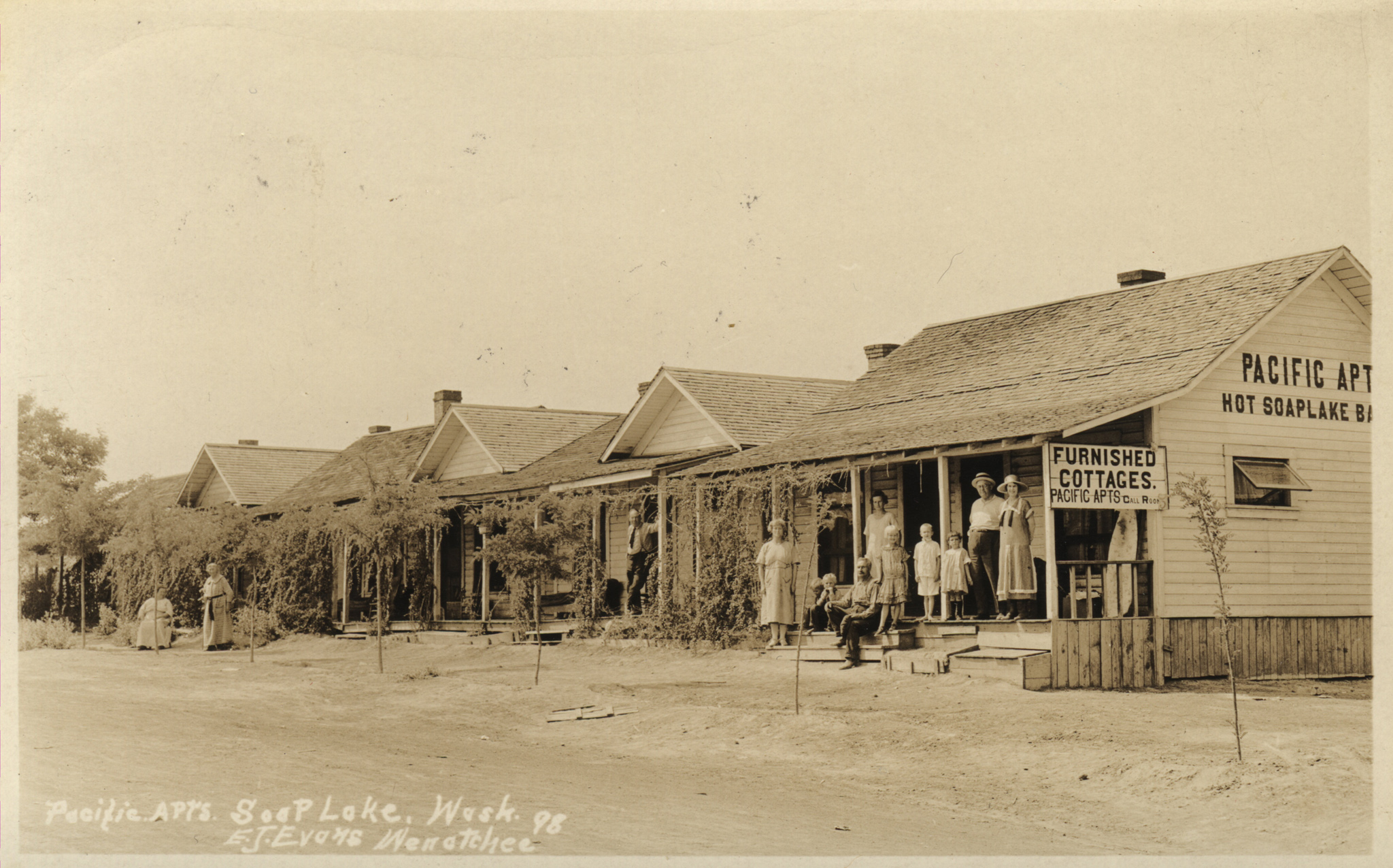
In 1905 one of the most famous hotel-sanitariums in Soap Lake was built on a hill overlooking East Beach. It was nationally advertised as the social center and health resort of the Columbia Basin til it burned in a blaze that was started accidentally by the resort’s owner. By the time Soap Lake was incorporated in 1919, it was already a busy resort and health spa with four hotels, many rooming houses and apartments, and businesses catering to the campers by renting tents, boats and bathing suits.
Public Domain. From postcard collection of Marge Lawrence
Download Original (2048 x 1276 pixels, 954.3 KB)
-
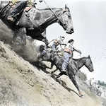
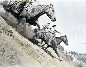
Horses and cowboys race down an incredible slope with the dust blowing dramatically behind them, making you want to say "Whoa!"
Public Domain.
Download Original (300 x 233 pixels, 22.5 KB)
-
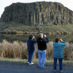
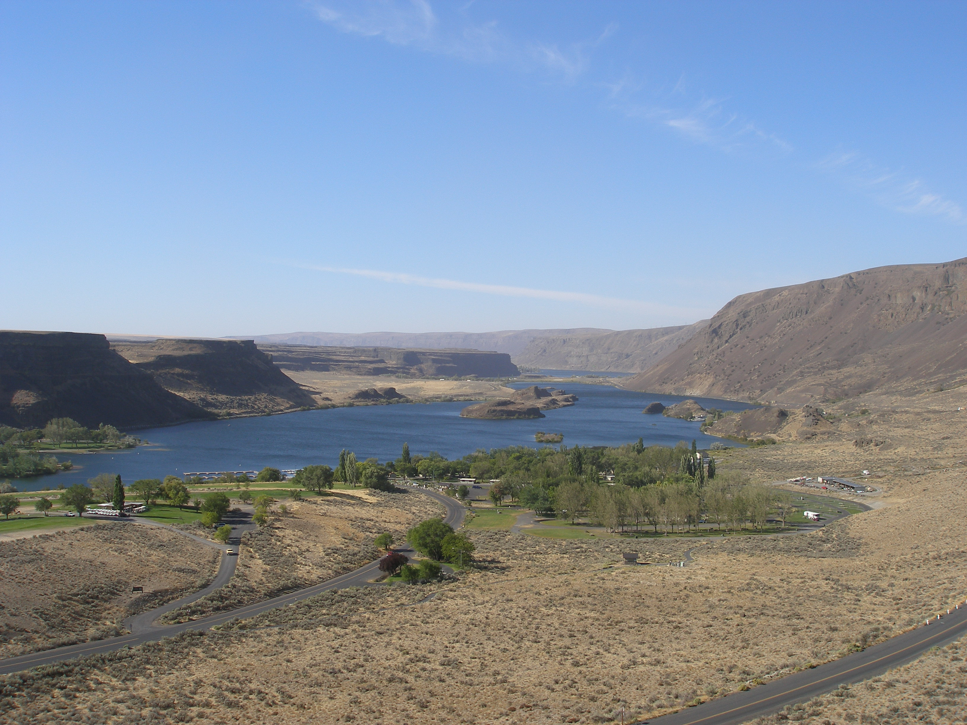
Steamboat Rock is seen from SR 155 on the Coulee Corridor. Steamboat Rock is a long established area landmark, first used by nomadic Native American tribes and then by early settlers. The basalt butte rises 800 feet above Banks Lake. It was once an island in the Columbia River bed. When the Columbia returned to its natural course, after centuries of being dammed by ice, the massive rock remained. There is a Washington State Park featuring large campgrounds, day use areas, boat launches and hiking trails. The south end of the peninsula is managed as a wildlife area by Washington Department of Fish and Wildlife.
© 2004 Teri J. Pieper.
Download Original (2048 x 943 pixels, 560.2 KB)
-
Sun Lakes State Park is bathed in sun, its blue water and tree-lined landscape overlooked by clear skies.
Public Domain. Photo by Tim Alling
Download Original (3264 x 2448 pixels, 1564.5 MB)
-
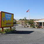
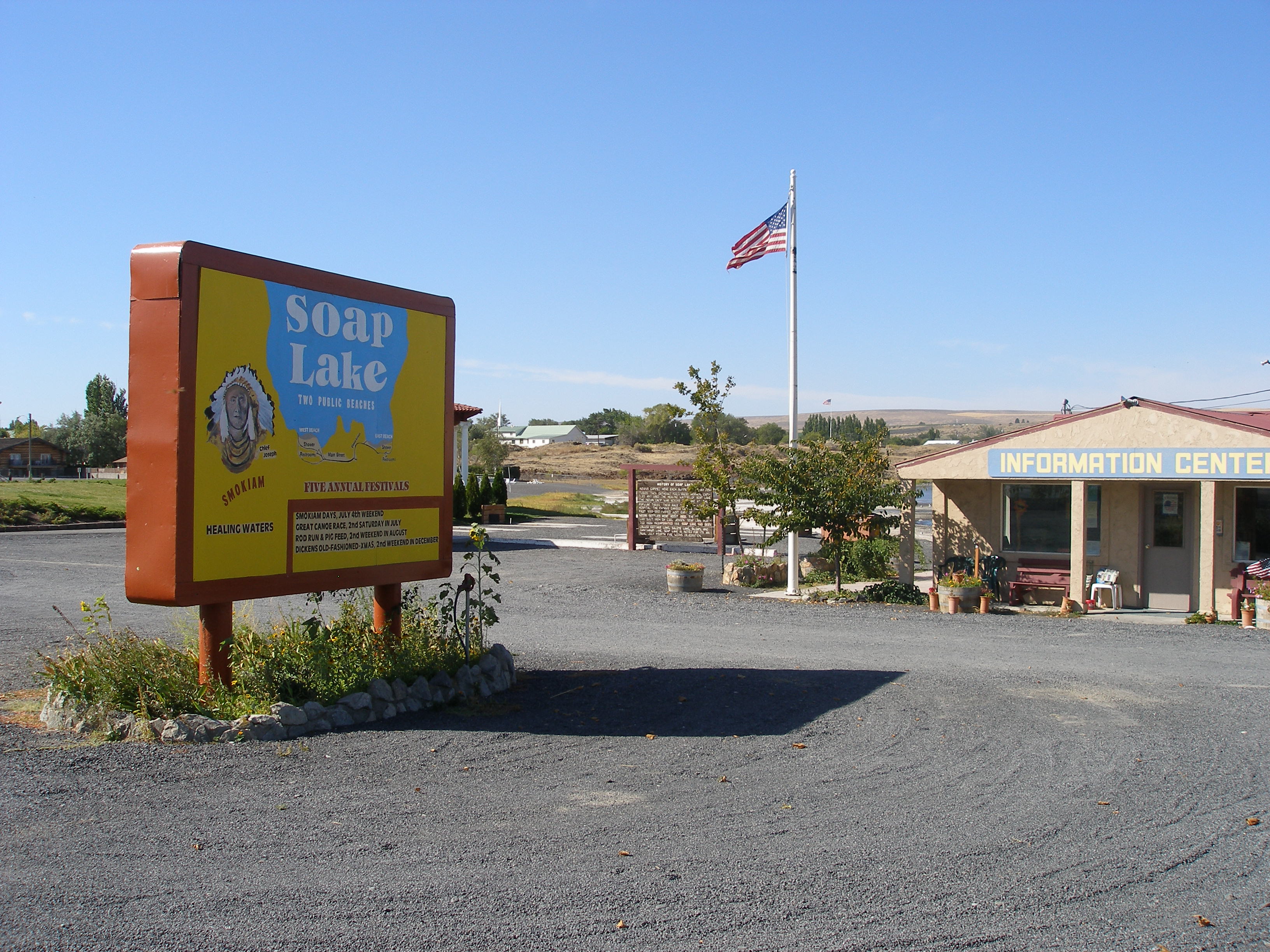
With its bright yellow, blue and orange color, the sign in front of the Soap Lake Visitor Center welcomes tourists.
Public Domain. Photo by Tim Alling
Download Original (3264 x 2448 pixels, 1344.8 MB)
-

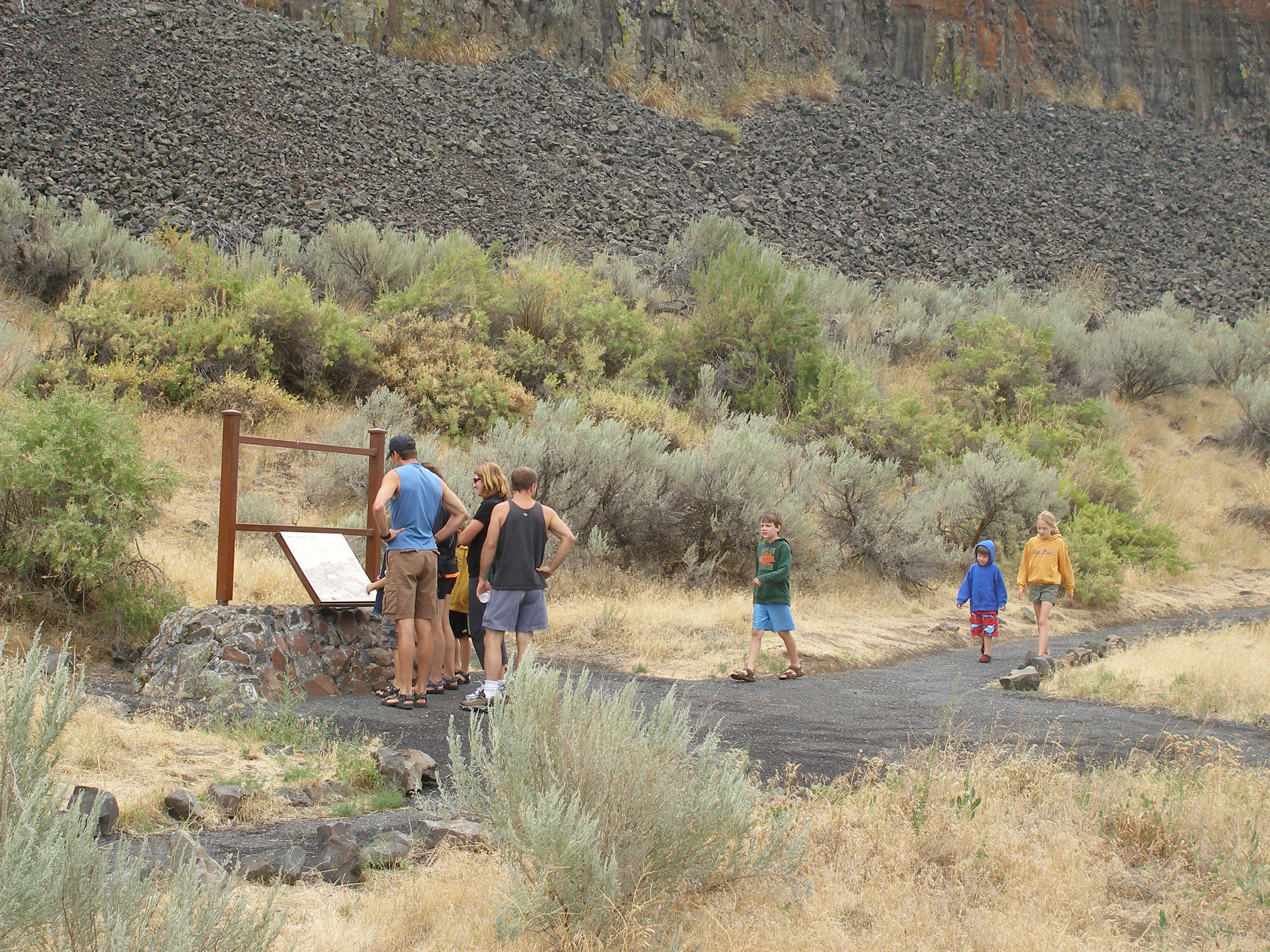
A group of visitors at the Lake Lenore Caves Trailhead reads a sign giving information about the Lake Lenore Caves, seven of which are accessible from the main trail.
Public Domain. Photo by Tim Alling
Download Original (3264 x 2448 pixels, 1325.1 MB)
-
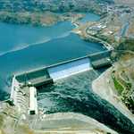
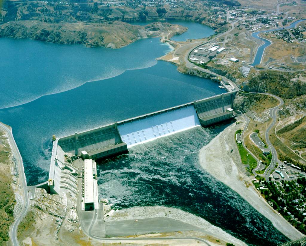
An aerial view shows the entire Grand Coulee Dam, both the concrete structure and the water behind. Its enormity is more than a picture can capture.
Public Domain.
Download Original (1024 x 825 pixels, 149.6 KB)
-

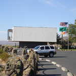
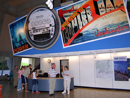
Visitors wait by the visitor's desk beneath a colorful billboard inside the Grand Coulee Dam Visitors Center to learn more about the Grand Coulee Dam.
Public Domain.
Download Original (450 x 338 pixels, 192.1 KB)
-
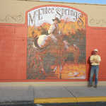
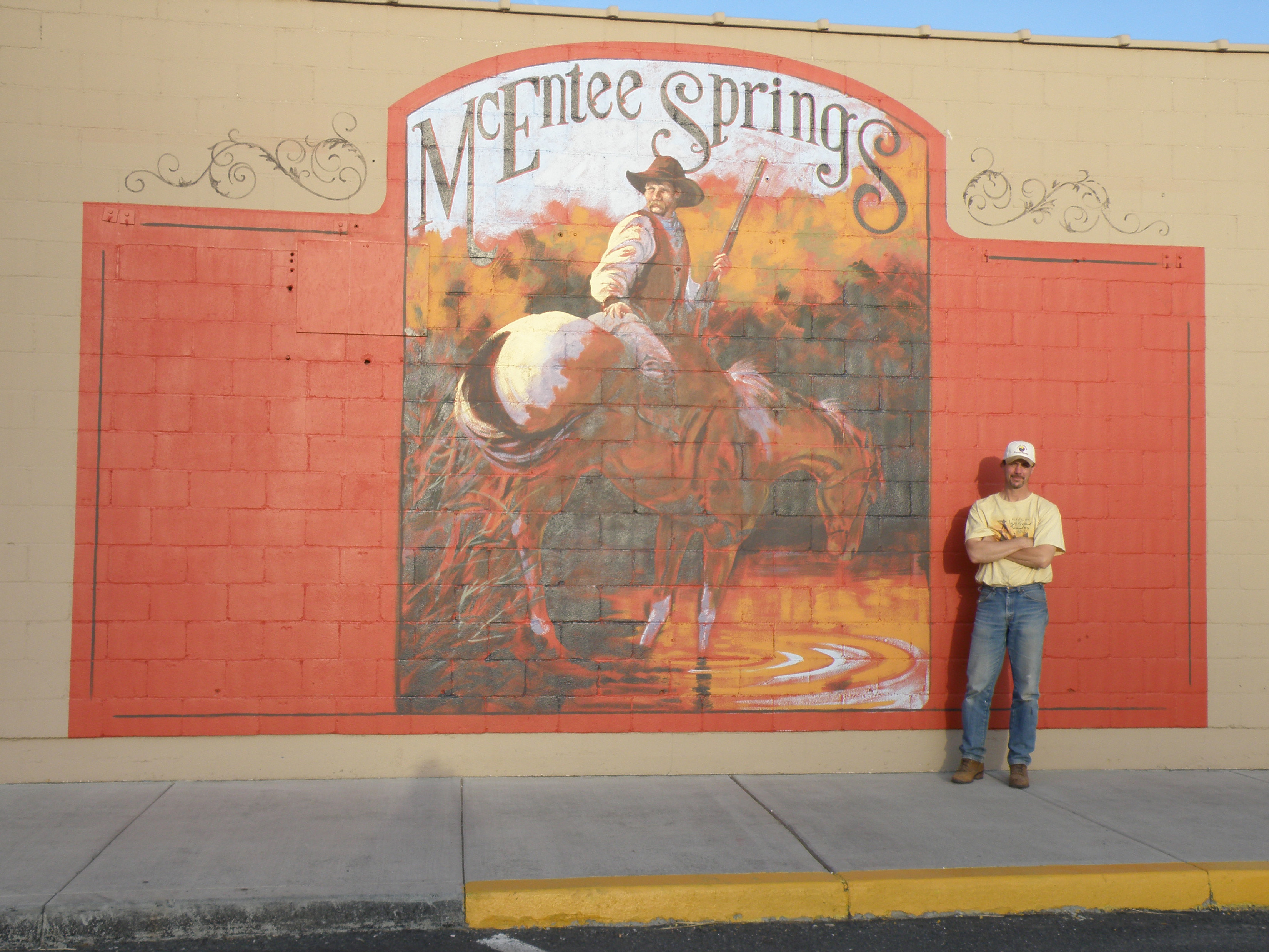
A man stands next to the McEntee Springs Mural, which brings to life a horseman stopping to let his horse take a drink at McEntee Springs. With a gun in hand, the cowboy is looking back.
Public Domain.
Download Original (3300 x 2475 pixels, 1857.3 MB)
-
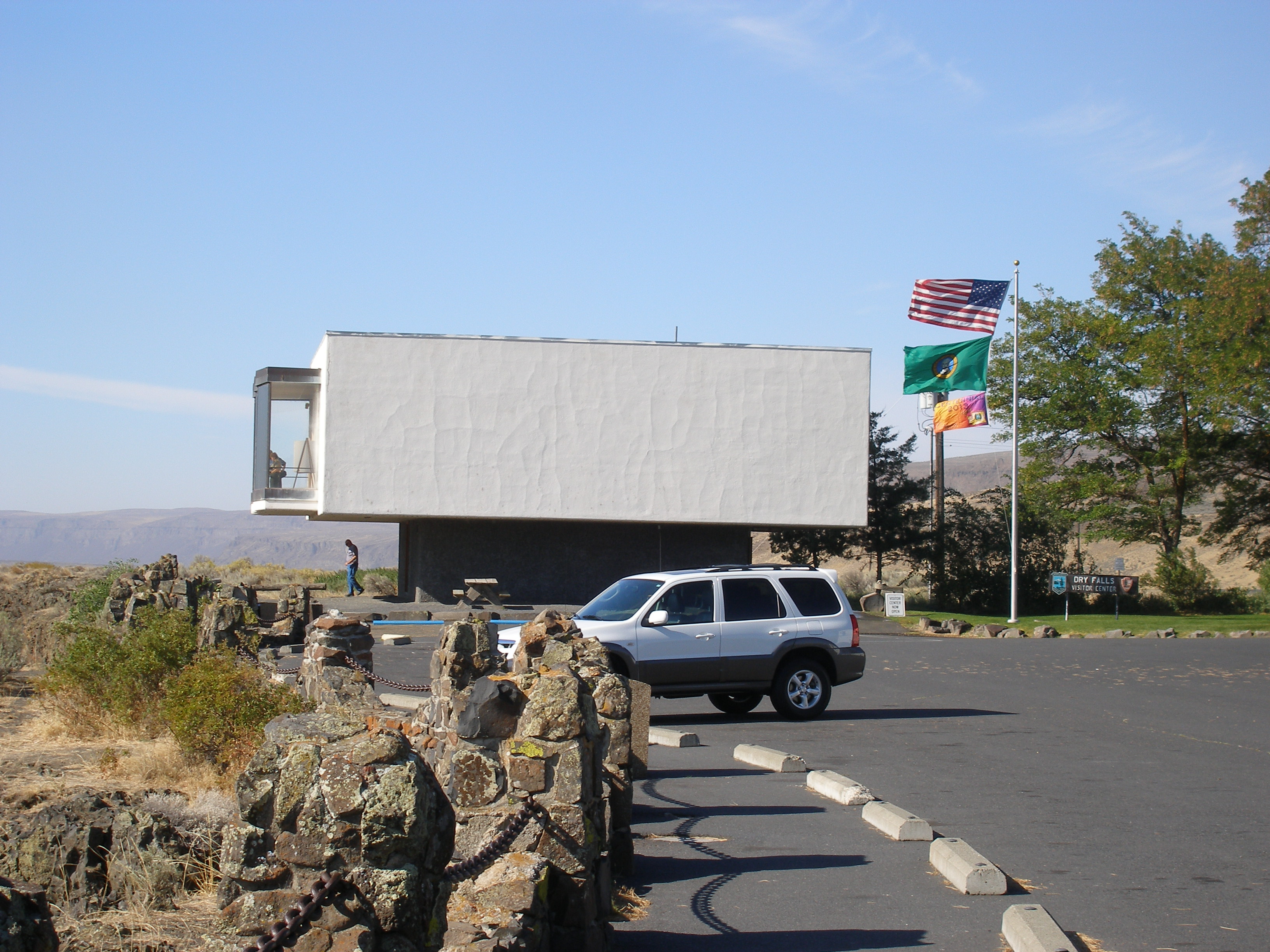
Sitting on the edge of the Dry Falls with a full parking lot of visitors who want to get a glimpse at the Ice Age Flood Landmark stands the box-like, white Dry Falls Visitor Center that made a statement in the '60s.
Public Domain. Photo by Tim Alling
Download Original (3264 x 2448 pixels, 1613.9 MB)
-
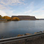
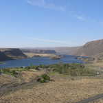
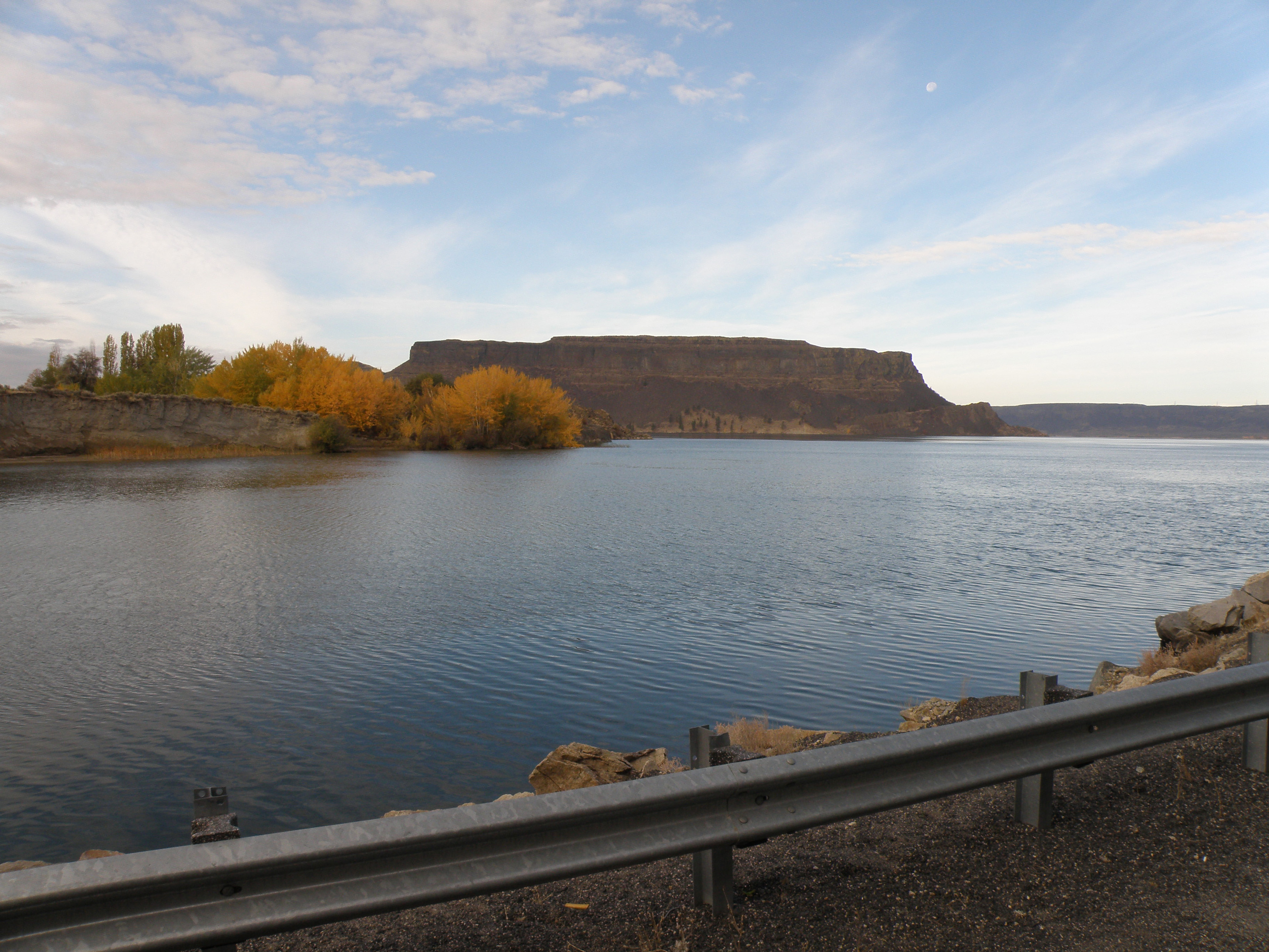
Banks Lake sits still and peaceful during a fall day, surrounded by fall colors and a magnificent blue sky.
Public Domain. Photo by Tim Alling
Download Original (3300 x 2475 pixels, 1818.3 MB)
-
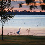
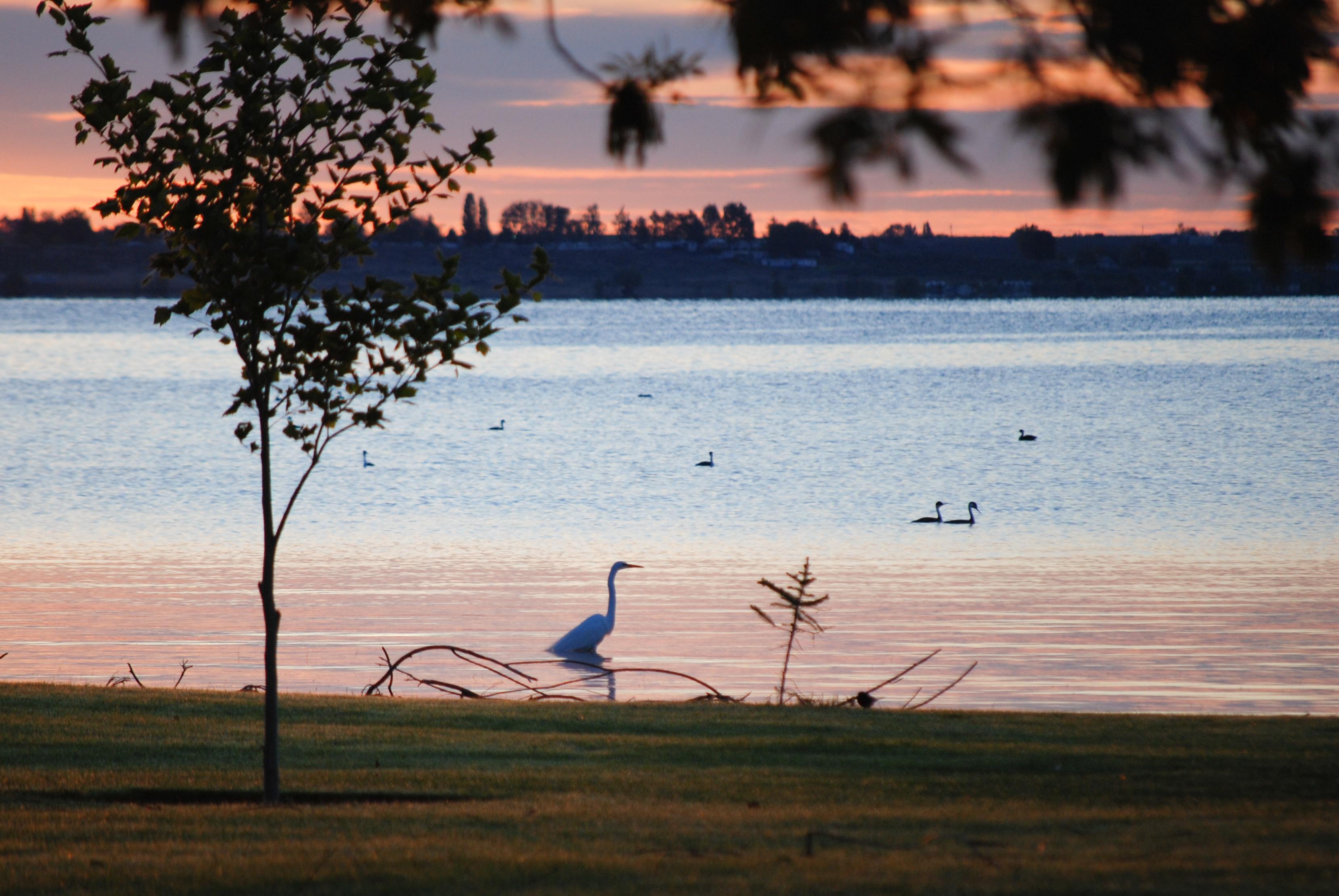
An egret patrols the shallows in search of an early meal as grebes swim nearby.
 © 2008 Steve Voght.
Download Original (3316 x 2220 pixels, 2192.8 MB)