
Trail of the Ancients
All Photos (95)
-
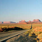
Fluffy clouds speckle the sky over the rock formations of Monument Valley from U-163 heading south from Mexican Hat, Utah.
© January 2005 Alexander Glazkov.
Download Original (1280 x 960 pixels, 561.5 KB)
-
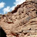
The formations in the photo are sandstone in Monument Valley which were named Yeis in the Navajo culture because they appear to be tall, standing figures. (A Yei is a Holy Person.)
Public Domain. Photo courtesy of Utah's Canyon Country Visitor Services
Download Original (568 x 506 pixels, 38.6 KB)
-
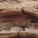
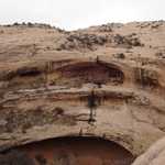
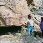
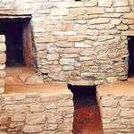
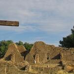
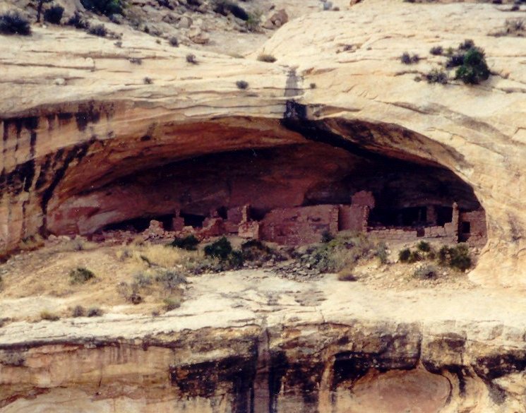
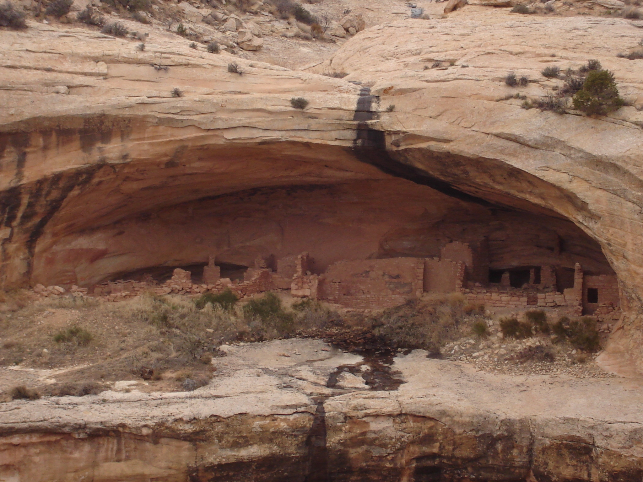
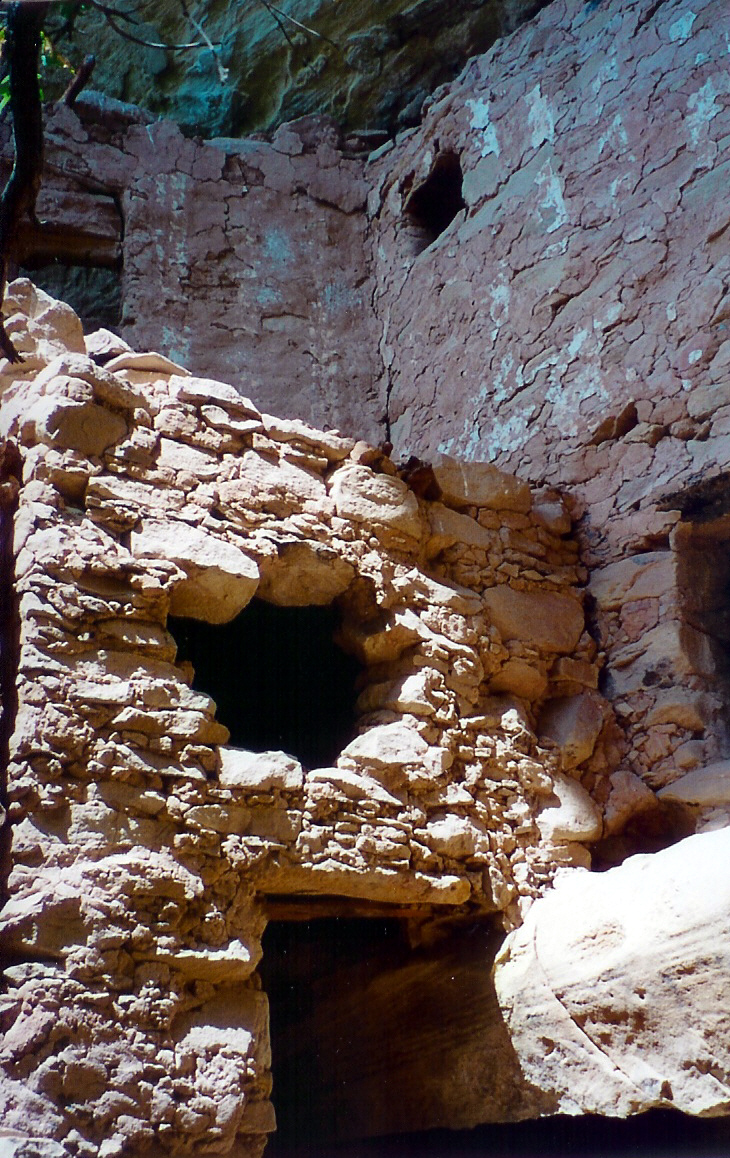
For hundreds of years this niche has protected these American Indian cliff dwellings.
Public Domain. Photo by Susan Taylor
Download Original (745 x 585 pixels, 105.1 KB)
-
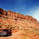
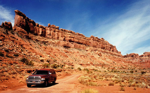
A red truck easily maneuvers a dirt road that accesses some of the pristine and remote redrock country around the Trail of the Ancients.
Public Domain. Photo courtesy of Utah's Canyon Country Visitor Services
Download Original (500 x 309 pixels, 63.6 KB)
-
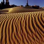
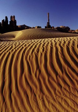
Rivulets of golden sand, formed by the wind, crawl towards the horizon. In the background, totems rise off of the desert floor.
Public Domain. Photo courtesy of Utah's Canyon Country Visitor Services
Download Original (255 x 366 pixels, 25.1 KB)
-
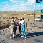
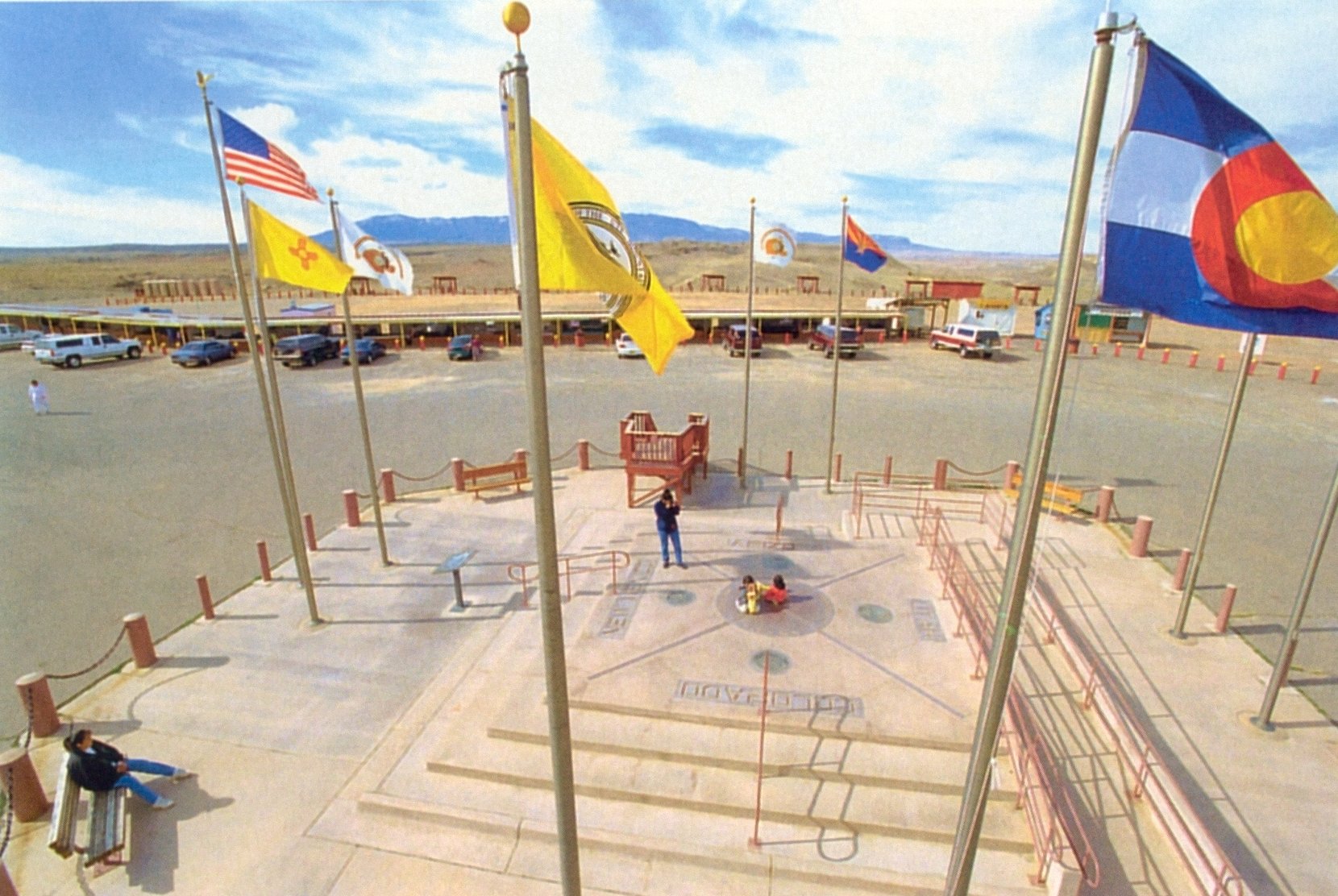
A slight breeze lifts the colorful flags that surround the Four Corners Monument, the only place where four states, Utah, New Mexico, Arizona, and Colorado, meet.
Public Domain. Photo courtesy of Utah's Canyon Country Visitor Services
Download Original (1660 x 1112 pixels, 343.4 KB)
-
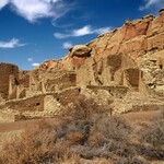
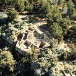
Tucked away under a sandstone overhang, you can see the remains of a pueblo community.
Public Domain.
Download Original (2048 x 1536 pixels, 2009.1 MB)
-
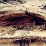
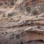
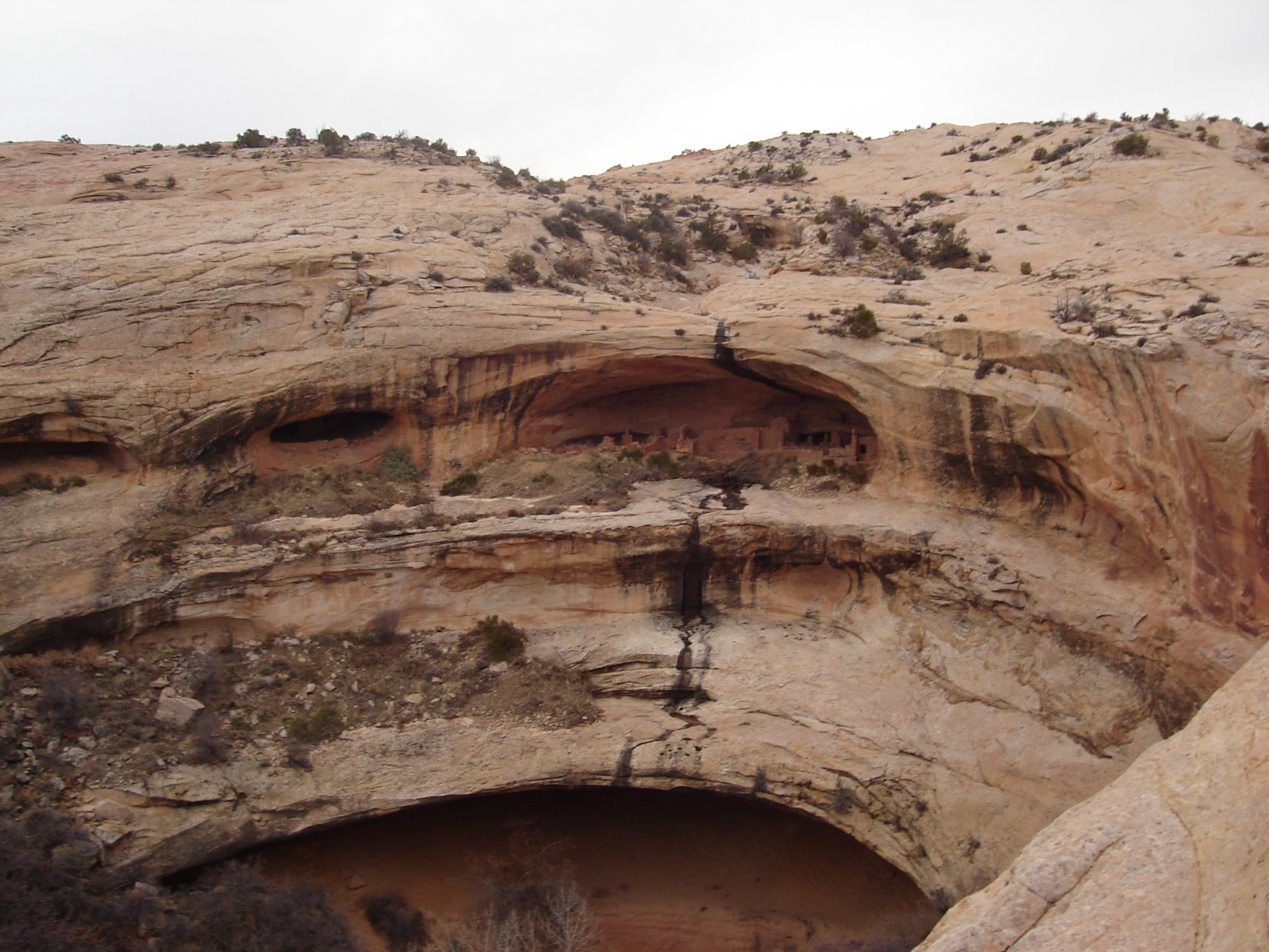
Almost imperceptible from this distance, in the top pocket of the rock are ancient cliff dwellings. The shot lends perspective to the discreet placement of the settlement.
Public Domain.
Download Original (2048 x 1536 pixels, 1884.2 MB)
-
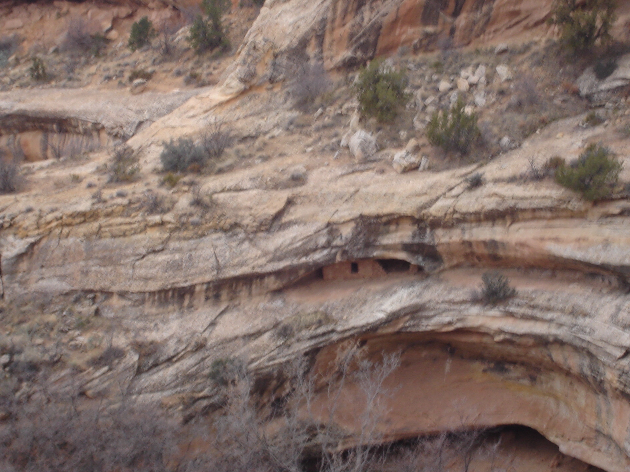
Tucked under an overhanging rock, look for the window of the one-story home.
Public Domain.
Download Original (2048 x 1536 pixels, 1833.9 MB)
-
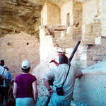
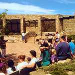
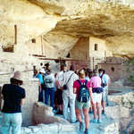
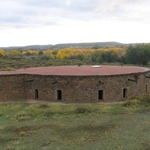
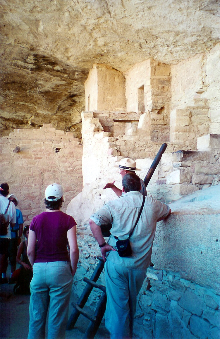
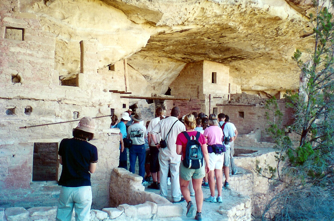
A tour group stops to learn about and admire the Balcony House at Mesa Verde National Park.
Public Domain. Photo by Sally Pearce.
Download Original (752 x 1159 pixels, 670.0 KB)
-
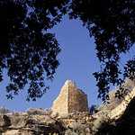
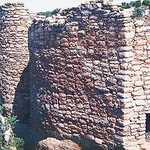
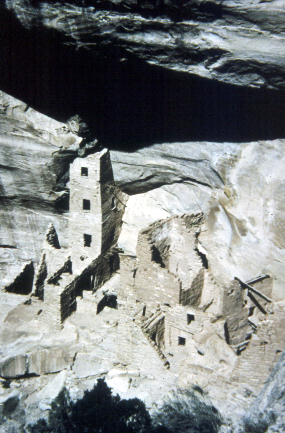
Found in Mesa Verde National Park, the Square Tower is one of many ancient structures found here.
Public Domain. Photo by Sally Pearce.
Download Original (920 x 1400 pixels, 1017.6 MB)
-
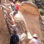
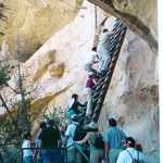
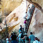
A few hikers wait on a warm, sunny day as a young girl ascends a wooden ladder in the Ute Mountain Tribal Park.
Public Domain.
Download Original (1190 x 2048 pixels, 478.3 KB)
-
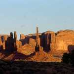
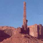
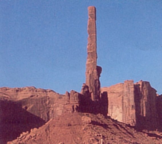
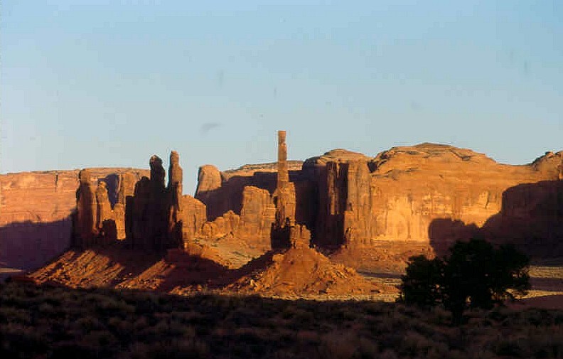
Sunlight shines on the redrock spires known as "The Totems" in Monument Valley.
© January 2007 Bob Ward.
Download Original (792 x 505 pixels, 75.9 KB)
-
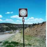
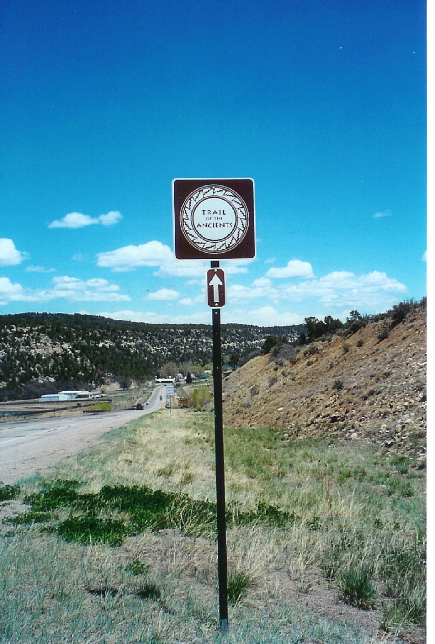
Signs like this one are found along the Trail of Ancients in Colorado and Utah to help guide your way.
Public Domain. Photo by Sally Pearce
Download Original (1398 x 2068 pixels, 1811.7 MB)
-
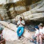
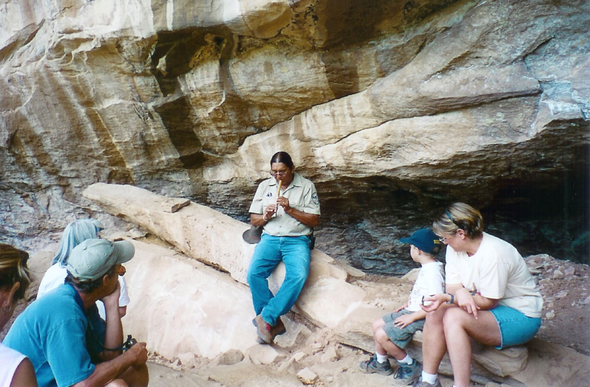
A group of visitors sit around their tour guide, a Native American Ute, who interprets each site throughout the Ute Mountain Tribal Park by telling stories.
Public Domain. Photo by Sally Pearce
Download Original (2031 x 1333 pixels, 442.2 KB)
-
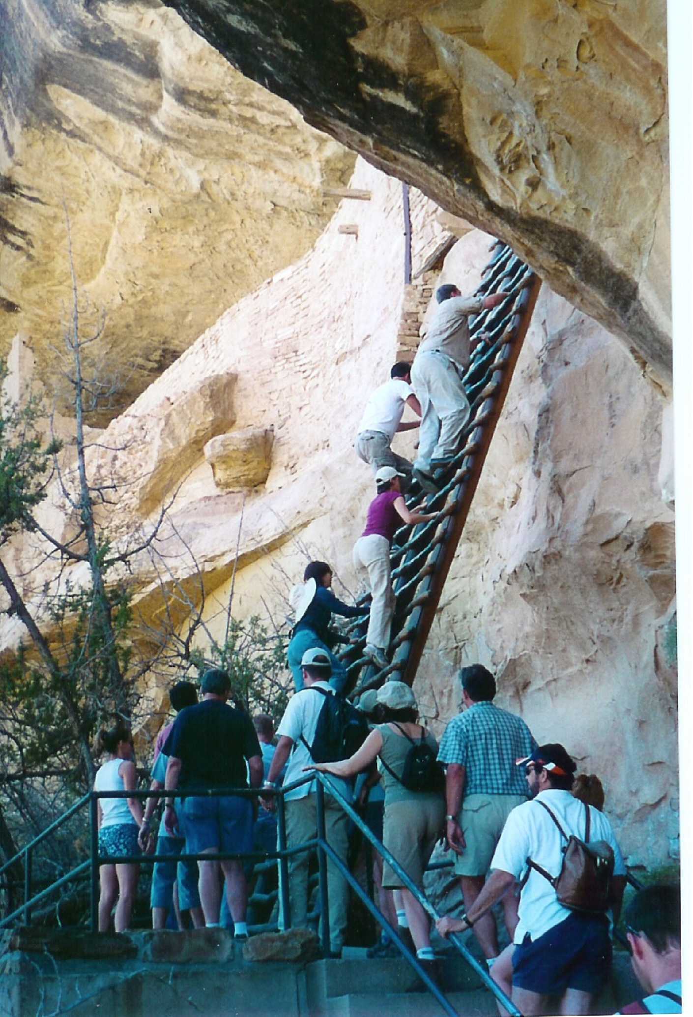
Hikers at Mesa Verde National Park climb ladders up to Balcony House, one of the cliffdwellings available for exploration.
Public Domain. Photo by Sally Pearce
Download Original (1410 x 2068 pixels, 1872.0 MB)
-
While visiting Ute Mountain Tribal Park, visitors can accompany a Tribal member to a remote canyon to see Porcupine House.
Public Domain. Photo by Sally Pearce
Download Original (2068 x 1358 pixels, 1903.2 MB)
-
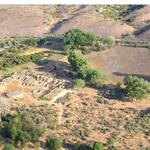
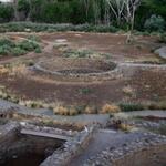
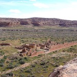
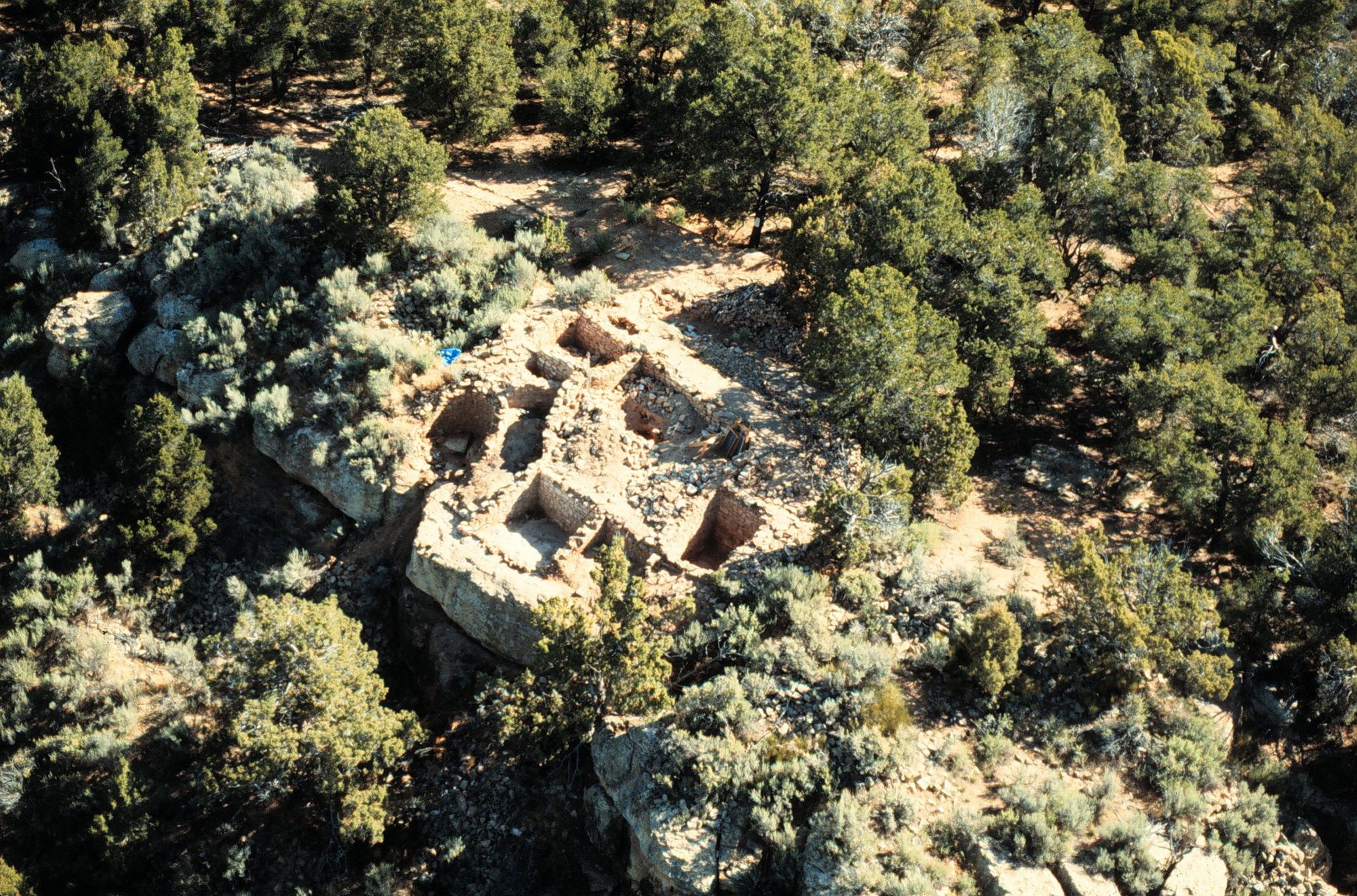
This aerial view is of Sand Canyon Pueblo, one of the small ruins scattered throughout the Canyons of the Ancients National Monument. The pueblo sits on the edge of one of the hundreds of canyons in the monument. Rooms in the ruin are clearly visible.
Public Domain. Courtesy of Crow Canyon Archaeological Center
Download Original (3101 x 2048 pixels, 1488.7 MB)
-

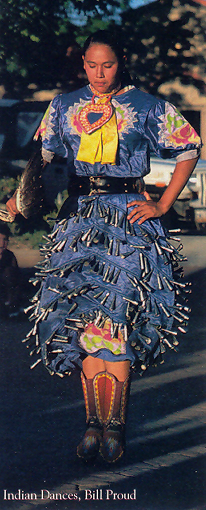
This woman is ready to perform the bangle or bell dance, traditionally performed by girls. The bangles attached to her bright blue skirt jangle as she moves.
Public Domain. Courtesy of Bill Proud
Download Original (828 x 2048 pixels, 283.1 KB)
-
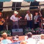
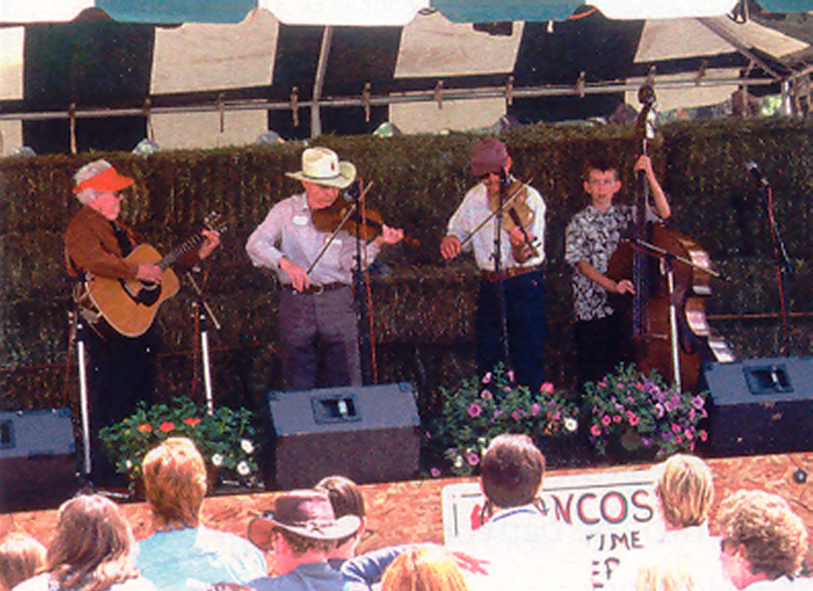
Four muscians play their string instruments for an avid crowd at the annual Mancos Ole' Time Fiddlers Contest in Mancos, Colorado. The contest is a professionally judged competition that encourages both young and seasoned performers to participate.
Public Domain. Courtesy of Branson Reynolds
Download Original (2816 x 2048 pixels, 673.9 KB)
-
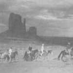
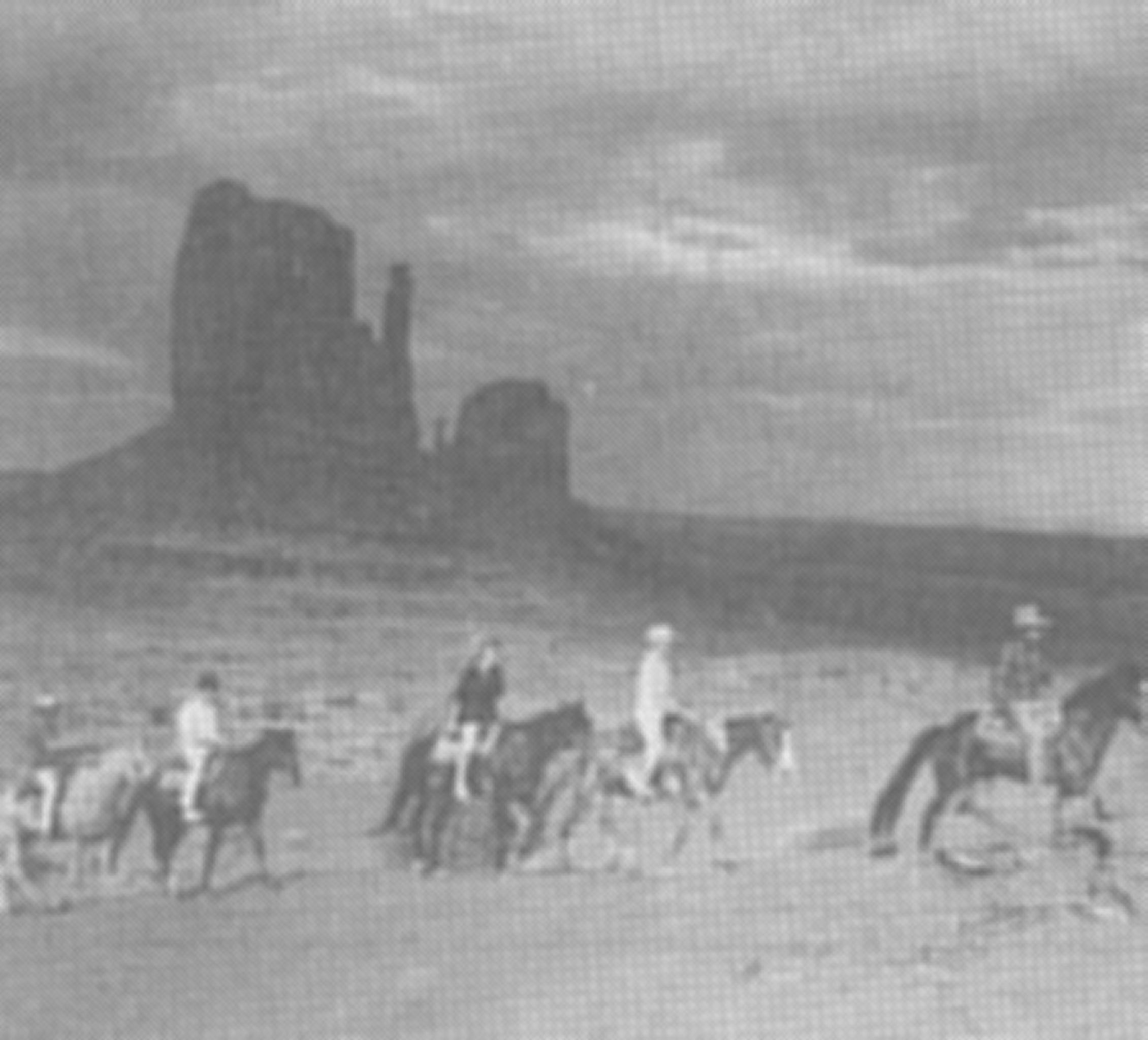
Horseback tours travel through Monument Valley to spots a vehicle cannot access. "The Mittens," a landmark along the trail, looms in the background in this historic photo.
Public Domain. Courtesy of David Boyer
Download Original (2260 x 2048 pixels, 302.2 KB)
-
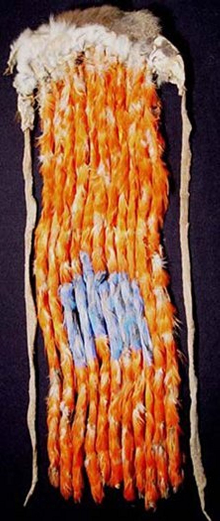
Found on the Abajo Mountains near Blanding, this sash is made of macaw feathers which were imported by the Puebloan Indians from Mexico. The sash is in excellent condition and is on view at the museum at the Edge of the Cedars State Park and Museum.
Public Domain. Courtesy of Edge of the Cedars State Park & Museum
Download Original (866 x 2048 pixels, 236.0 KB)
-
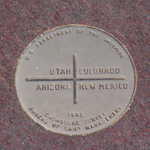
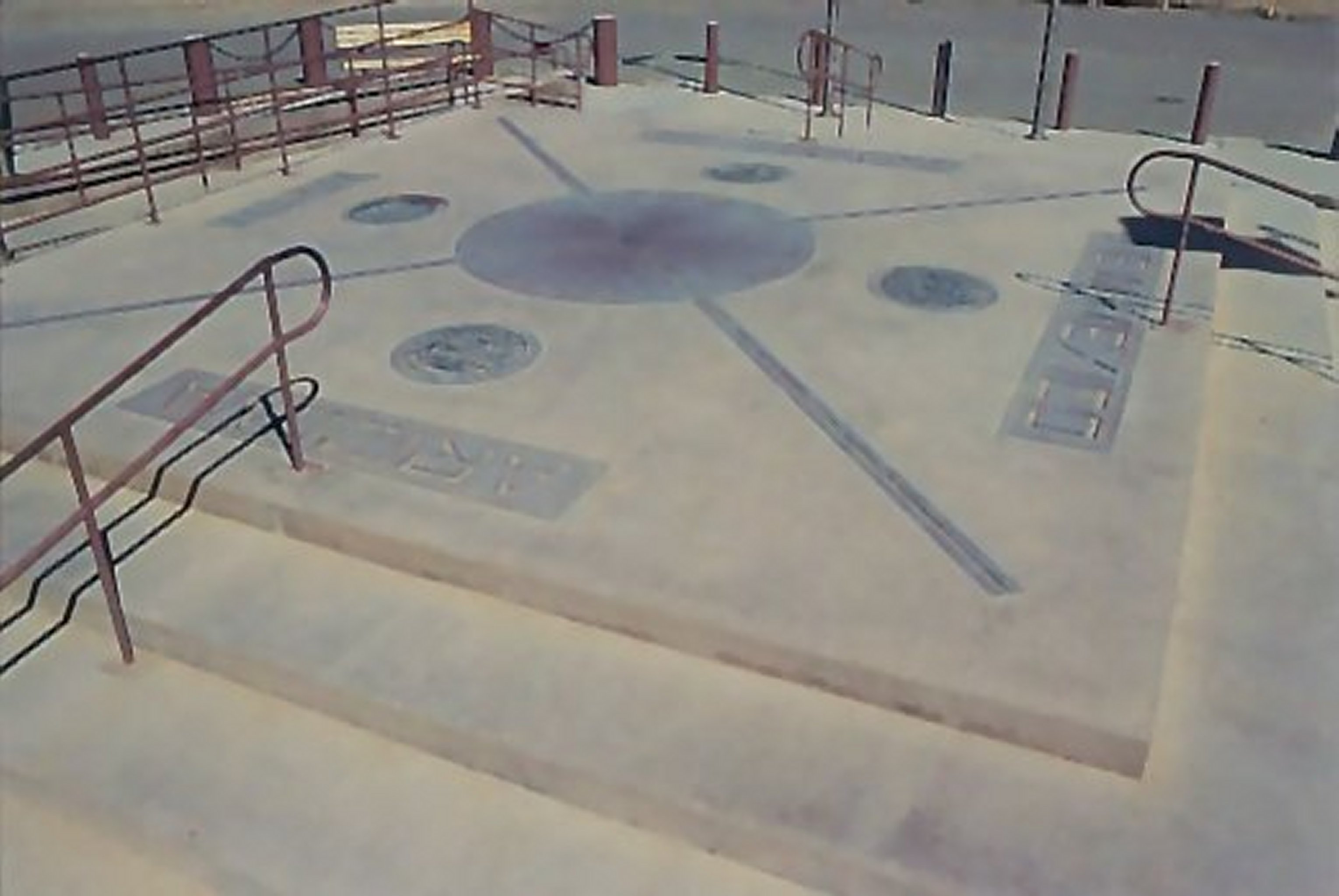
The photo shows the actual survey marker and is very like a "section corner" used to deliniate surveyed sections of land. The marker is made of granite, a bronze disk, and colored concrete with inserted metal plates showing the great seals from each of the four states (Utah, Colorado, New Mexico, and Arizona).
Public Domain. Courtesy of Martin L. Begaye
Download Original (3060 x 2048 pixels, 328.8 KB)
-

American Indians dance to the beat of a big drum at the Cortez Cultural Center. On summer evenings, the center hosts excellent, free programs such as dances by Utes, Navajos, and other American Indians and cultural programs that focus on such topics as the tradition of Navajo sand painting or Navajo Code Talking during WWII.
Public Domain. Courtesy of Mesa Verde Country
Download Original (2012 x 2048 pixels, 606.0 KB)
-
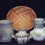
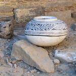
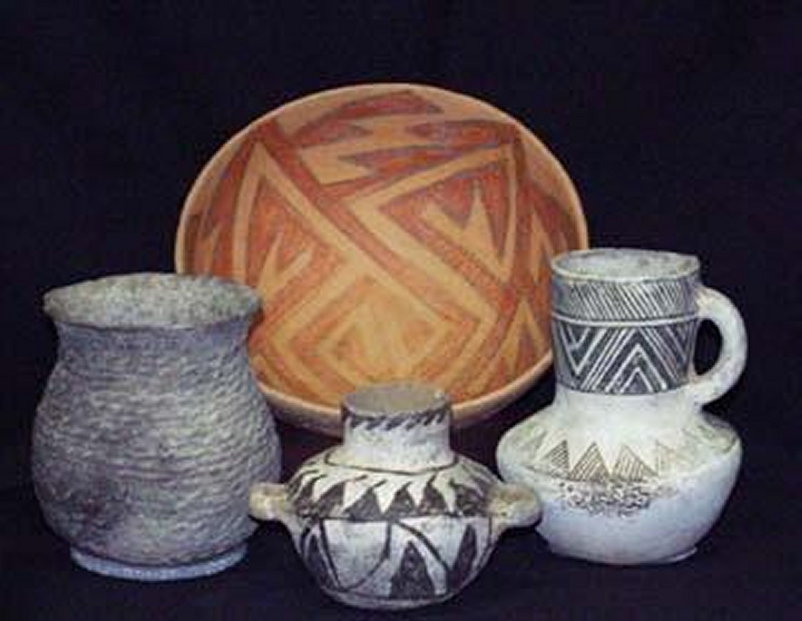
The painted pottery bowl, beakers, and cup featured here are typical of the pottery found at the Edge of the Cedars State Park and Museum.
Public Domain. Courtesy of Mike Nelson
Download Original (2643 x 2048 pixels, 339.9 KB)
-
Visitors may climb the ladder into the reconstructed kiva and wander through the residence block around the kiva at the Three Kiva Pueblo.
Public Domain. Courtesy of National Park Service, Hovenweep National Monument
Download Original (1351 x 2048 pixels, 682.4 KB)
-
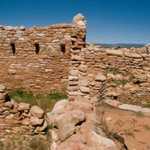
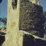
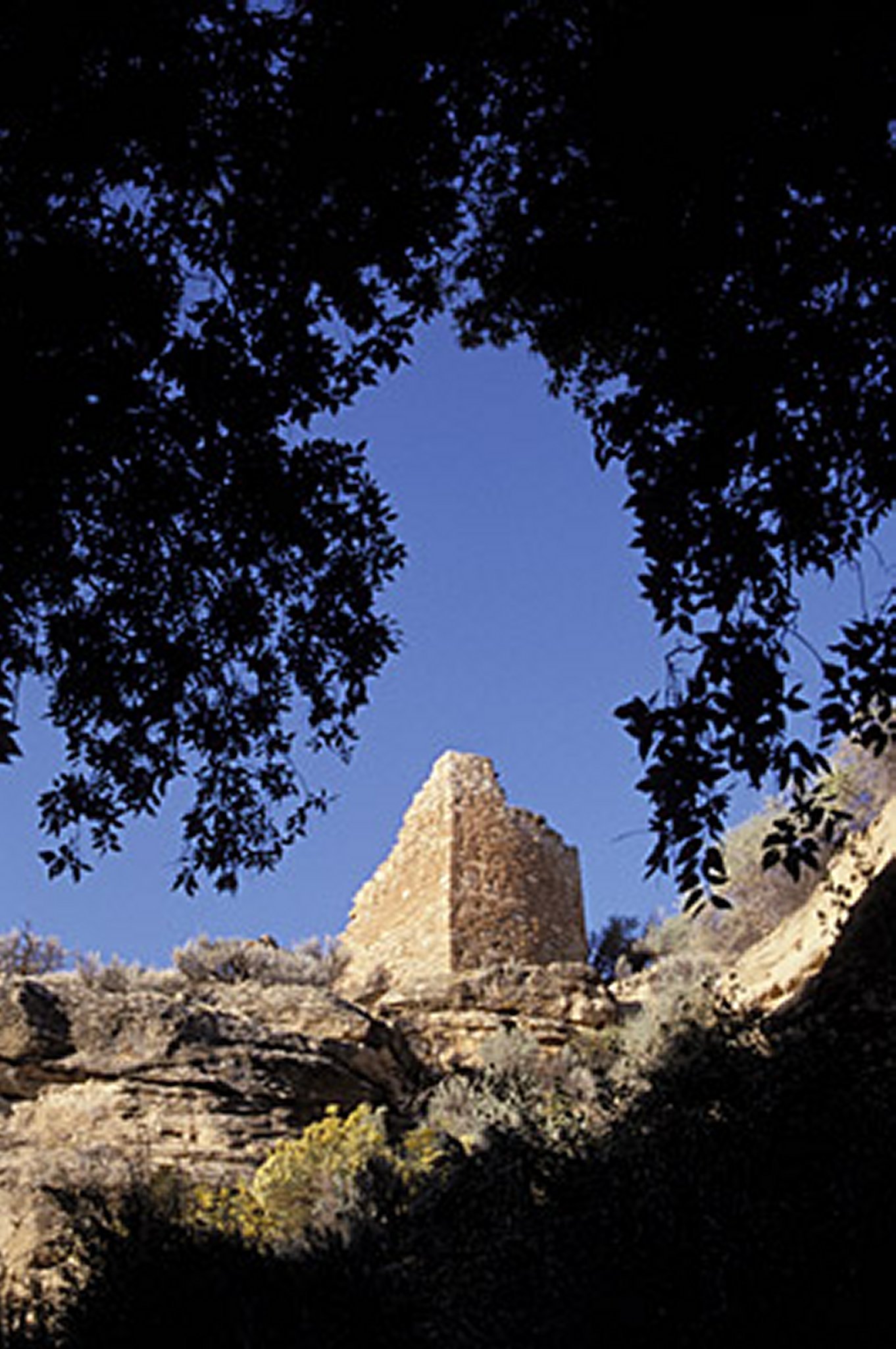
Taken from the canyon below, in the distance is the Square Tower Ruin.
Public Domain. Courtesy of National Park Service, Hovenweep National Monument
Download Original (1362 x 2048 pixels, 324.2 KB)
-
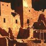
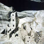
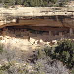
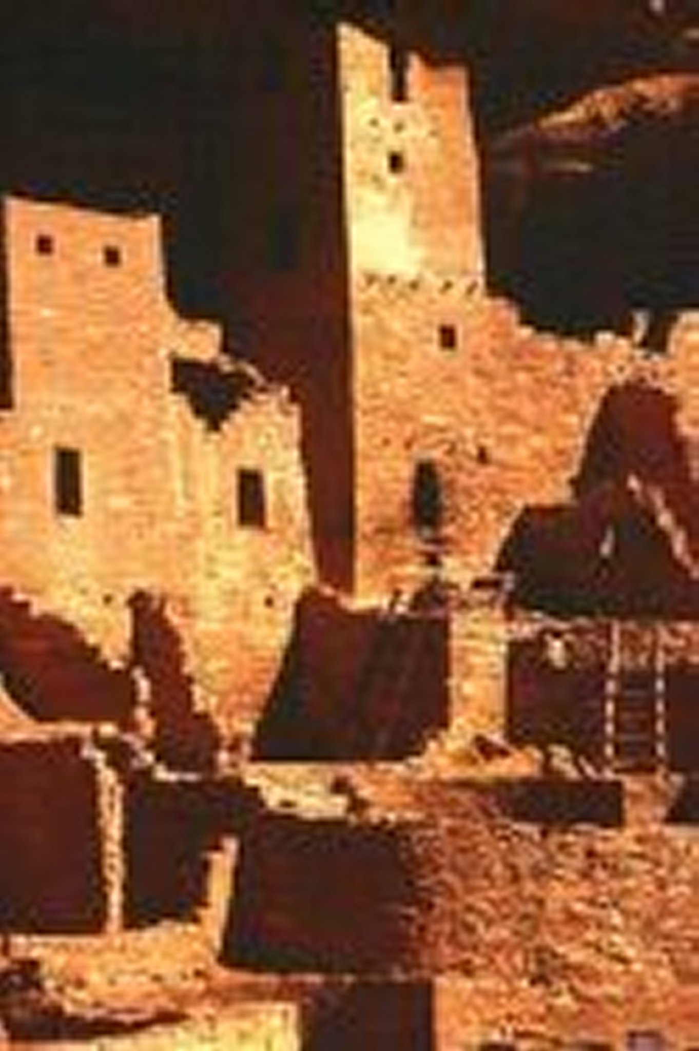
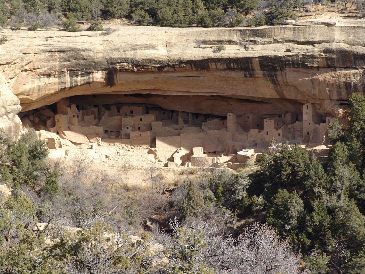
The largest cliff dwelling in North America, Cliff Palace is one of the major ruins in Mesa Verde National Park. The buildings were constructed primarily using sandstone, mortar, and wooden beams.
Public Domain. Courtesy of National Park Service - Mesa Verde National Park
Download Original (1362 x 2048 pixels, 223.2 KB)
-
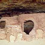
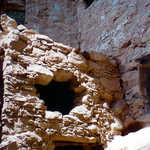
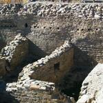
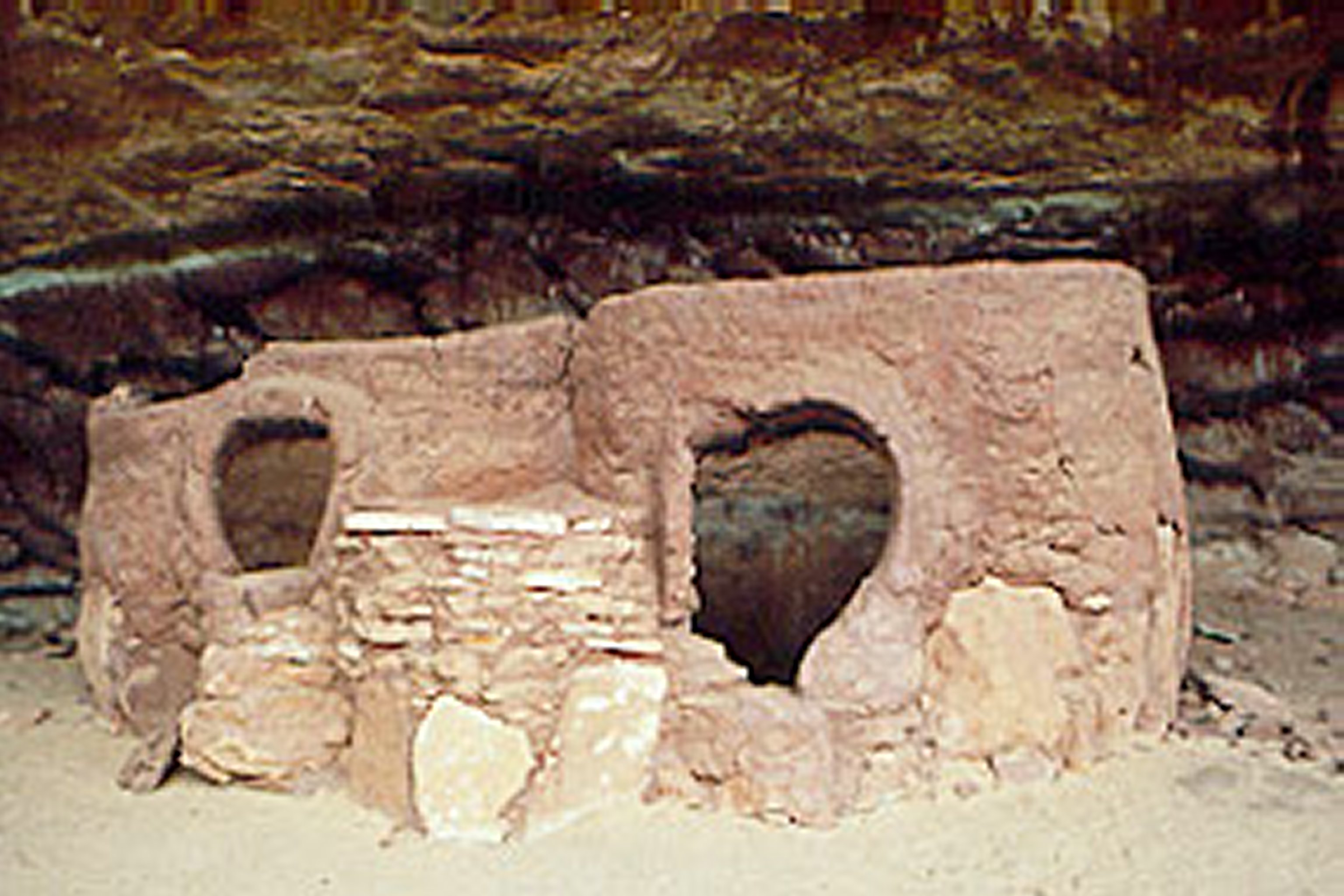
The photo shows the granaries as well as the distinctive doorways of Horsecollar Ruin, named because the doorways look like collars used on horse harnesses. Notice the large stones used as a "foundation" under the smaller stones.
Public Domain. Courtesy of National Park Service, Natural Bridges National Monument
Download Original (3072 x 2048 pixels, 547.2 KB)
-
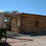
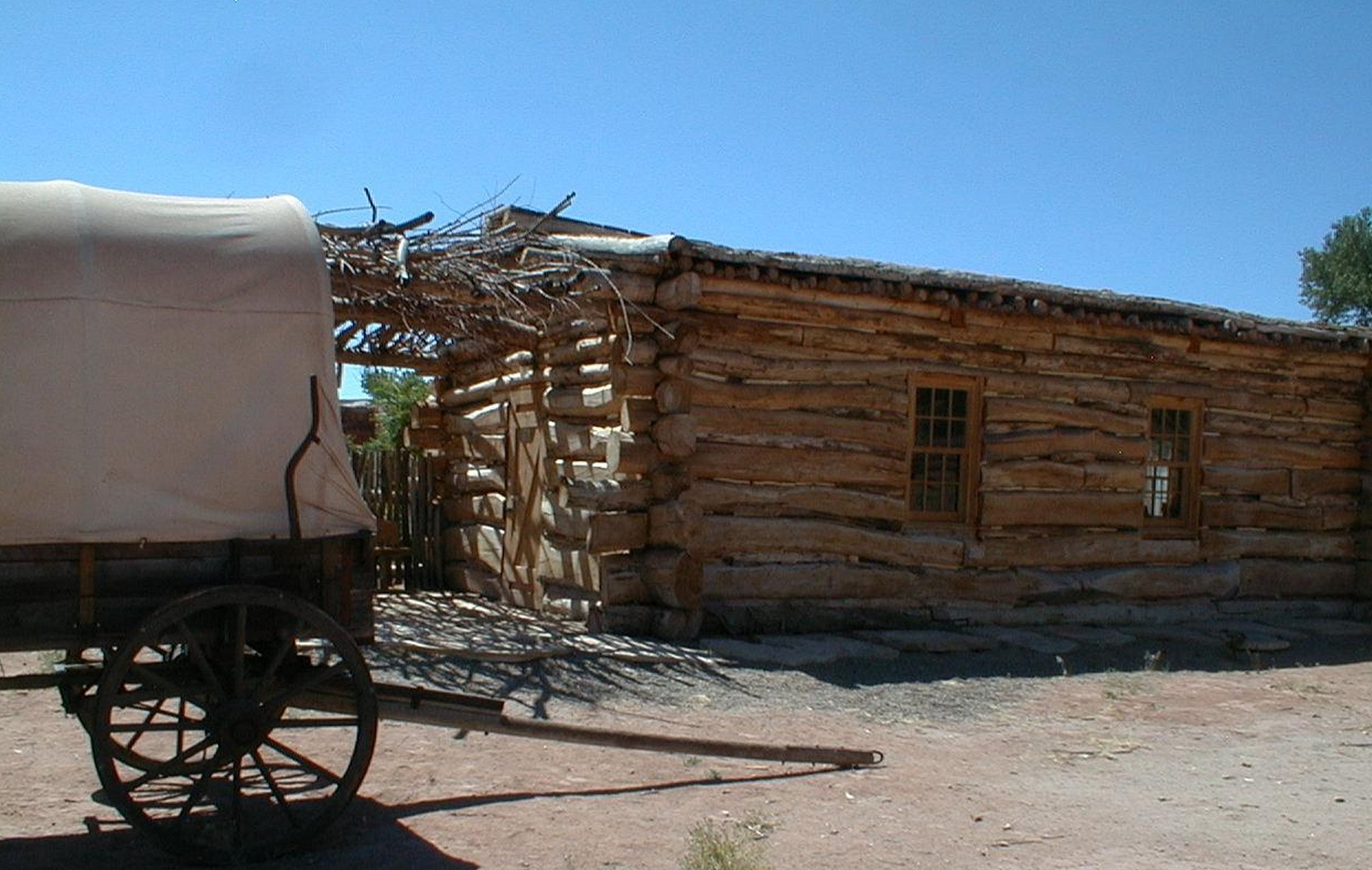
This photo shows the replica of the original meeting house in Bluff, established in 1880, with a "prairie schooner" parked in the yard. The meeting house was used for church services, community gatherings, the first school, and court. As the community grew, other buildings were constructed to meet each of those needs.
Public Domain. Courtesy of San Juan County Visitor Services
Download Original (3231 x 2048 pixels, 717.5 KB)
-
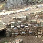
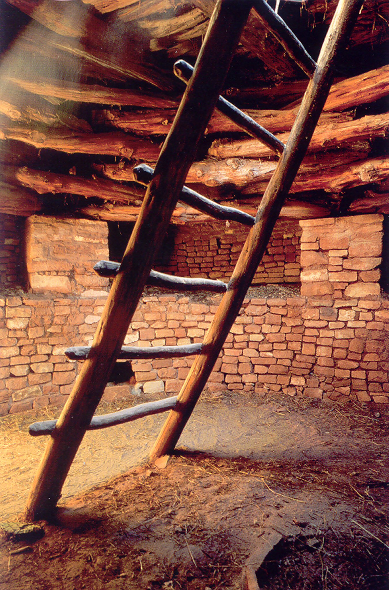
This is the wall inside the kiva at Mule Canyon Ruin. Over time the kiva's roof has completely disintegrated.
Public Domain. Courtesy of San Juan County Visitor Services
Download Original (3079 x 2048 pixels, 1074.8 MB)
-
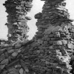
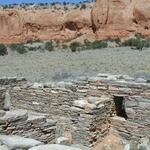
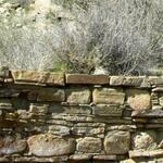
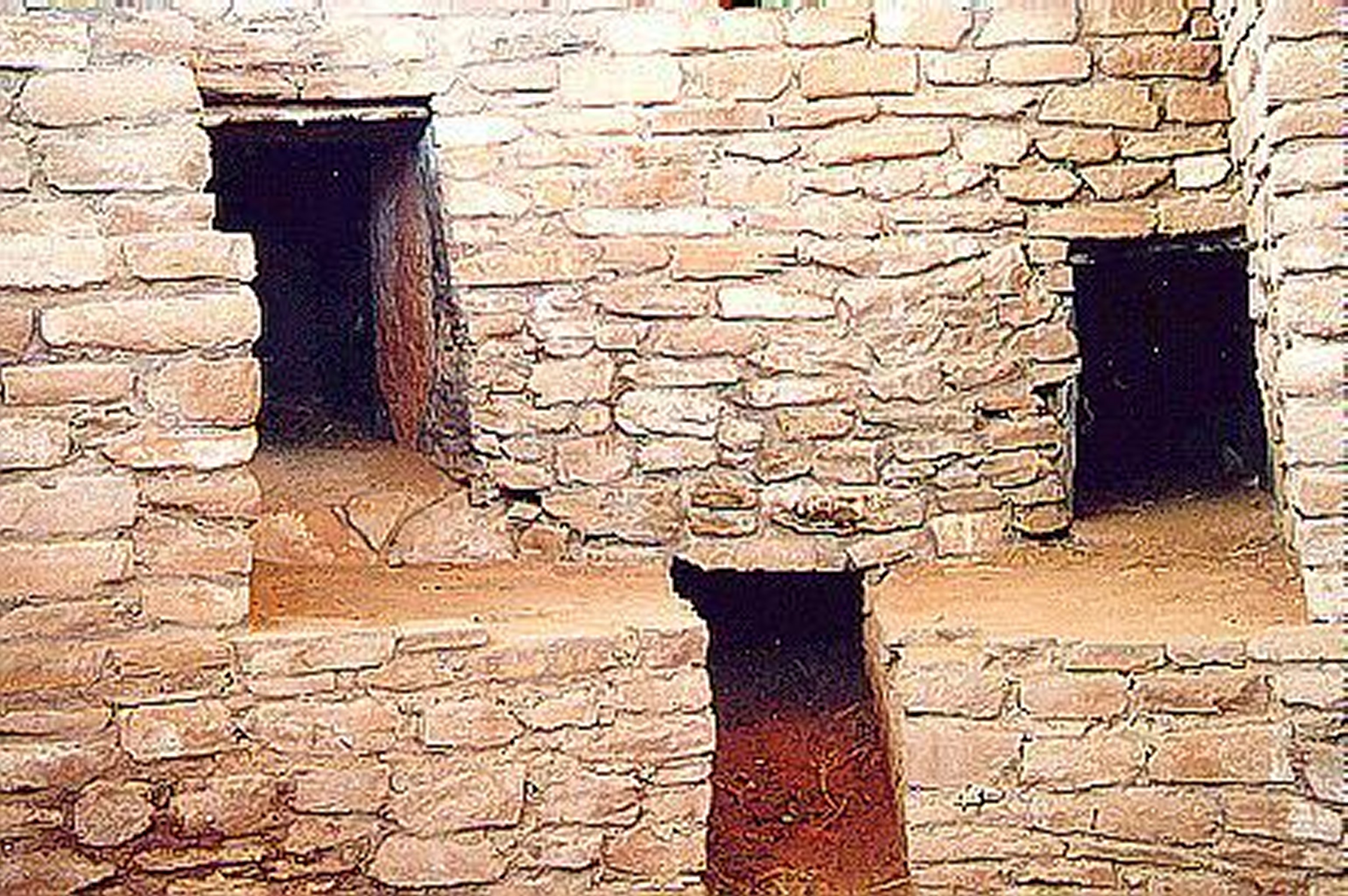
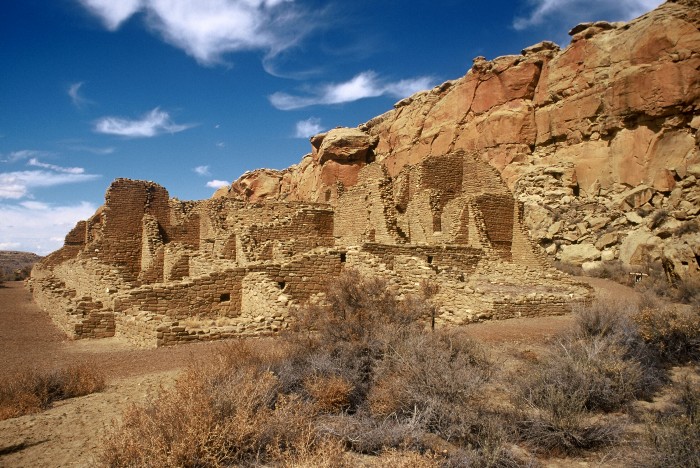
Featured here is the ruin at Edge of the Cedars State Park/Museum. Only a portion of the site has been excavated and stabilized for visitors.
Public Domain. Courtesy of San Juan County Visitor Services
Download Original (2991 x 2048 pixels, 605.9 KB)
-
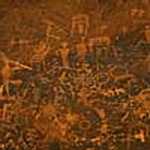
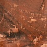
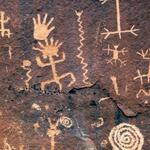
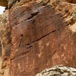
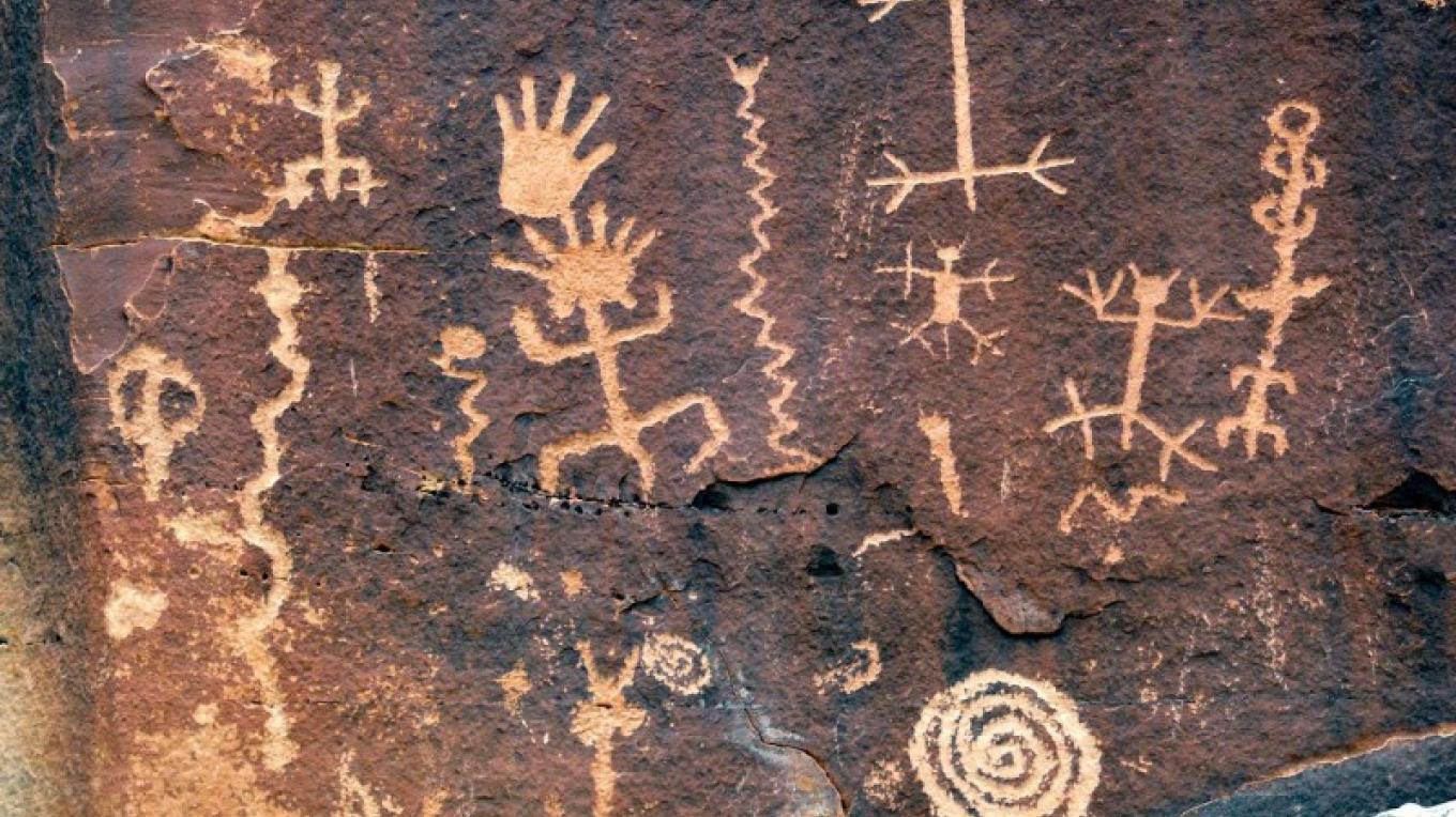
Showing only a portion of the petroglyph panel at Sand Island, this section reveals rock art dating from the Ancestral Puebloan occupation of the Four Corners. It is typical of rock art panels throughtout the area with both animal and human forms. The mythological figure of Kokopelli can be seen on the left side of the panel playing his flute.
Public Domain. Courtesy of San Juan County Visitor Services
Download Original (3072 x 2048 pixels, 347.0 KB)
-
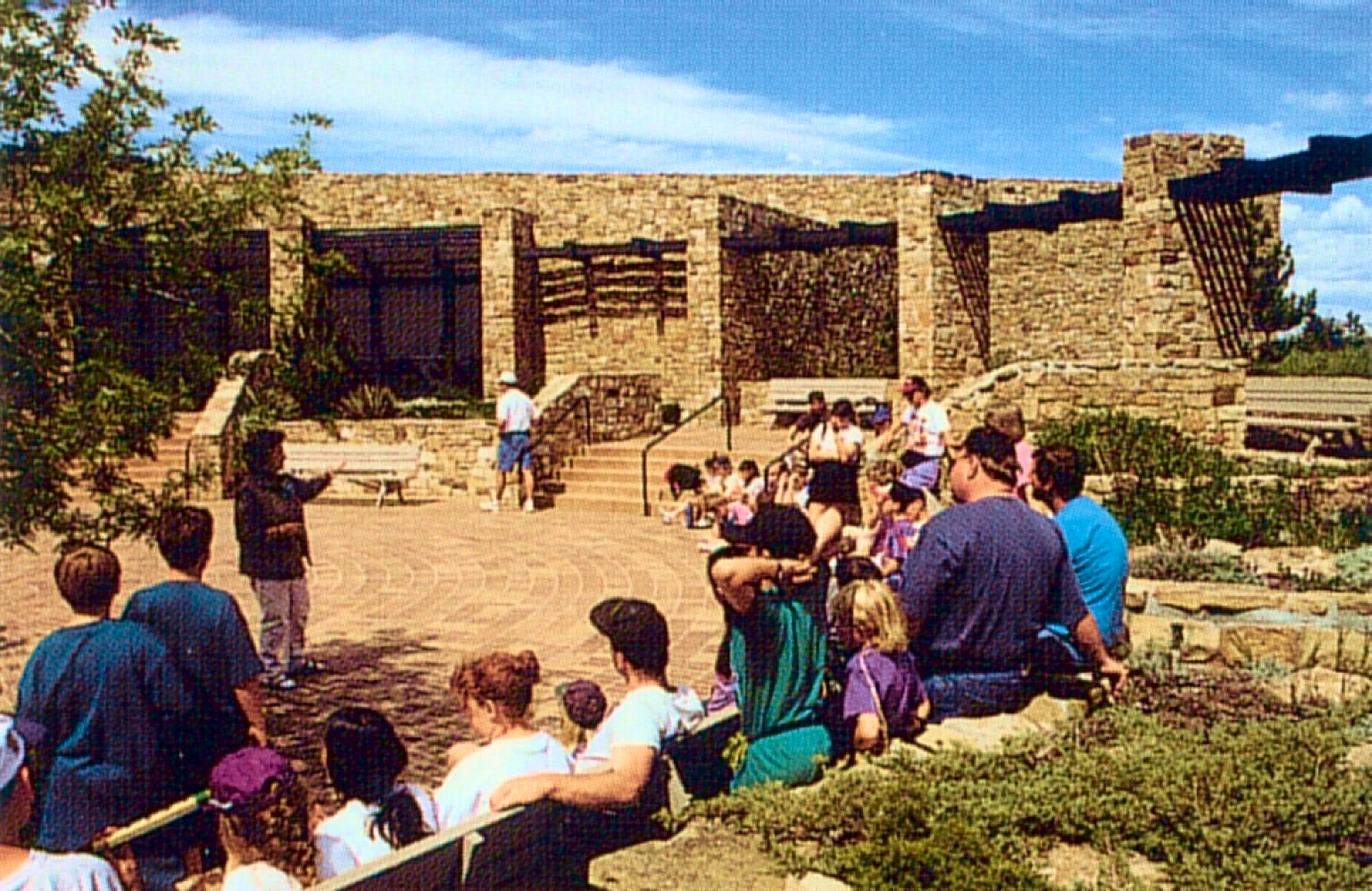
A crowd listens to a program presented in the outdoor plaza at the Anasazi Heritage Center.
Public Domain. Courtesy of the plaza at the Anasazi Heritage Center
Download Original (3151 x 2048 pixels, 1000.8 MB)
-
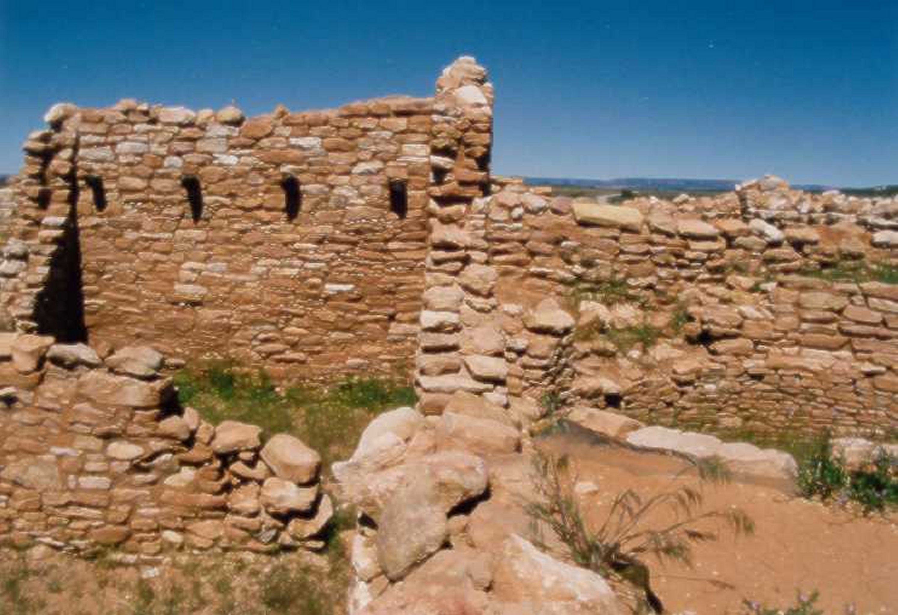
Around 1200 AD, thousands of stones were piled to form this "D" shaped tower, a form not seen often in the Four Corners region. The builders of the towers at Hovenweep used this shape, along with square and round towers.
Public Domain. Courtesy of National Park Service, Hovenweep National Monument
Download Original (3072 x 2048 pixels, 1033.2 MB)
-
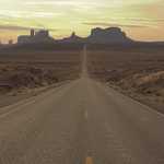
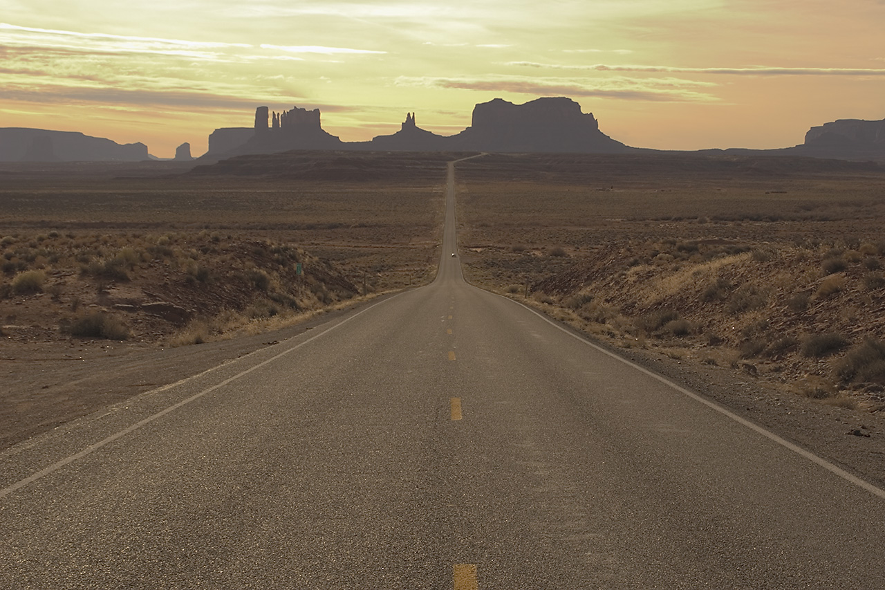
An empty road stretches out towards the dying light of the sun in Monument Valley.
© January 2006 Neil Li.
Download Original (1280 x 853 pixels, 422.3 KB)
-

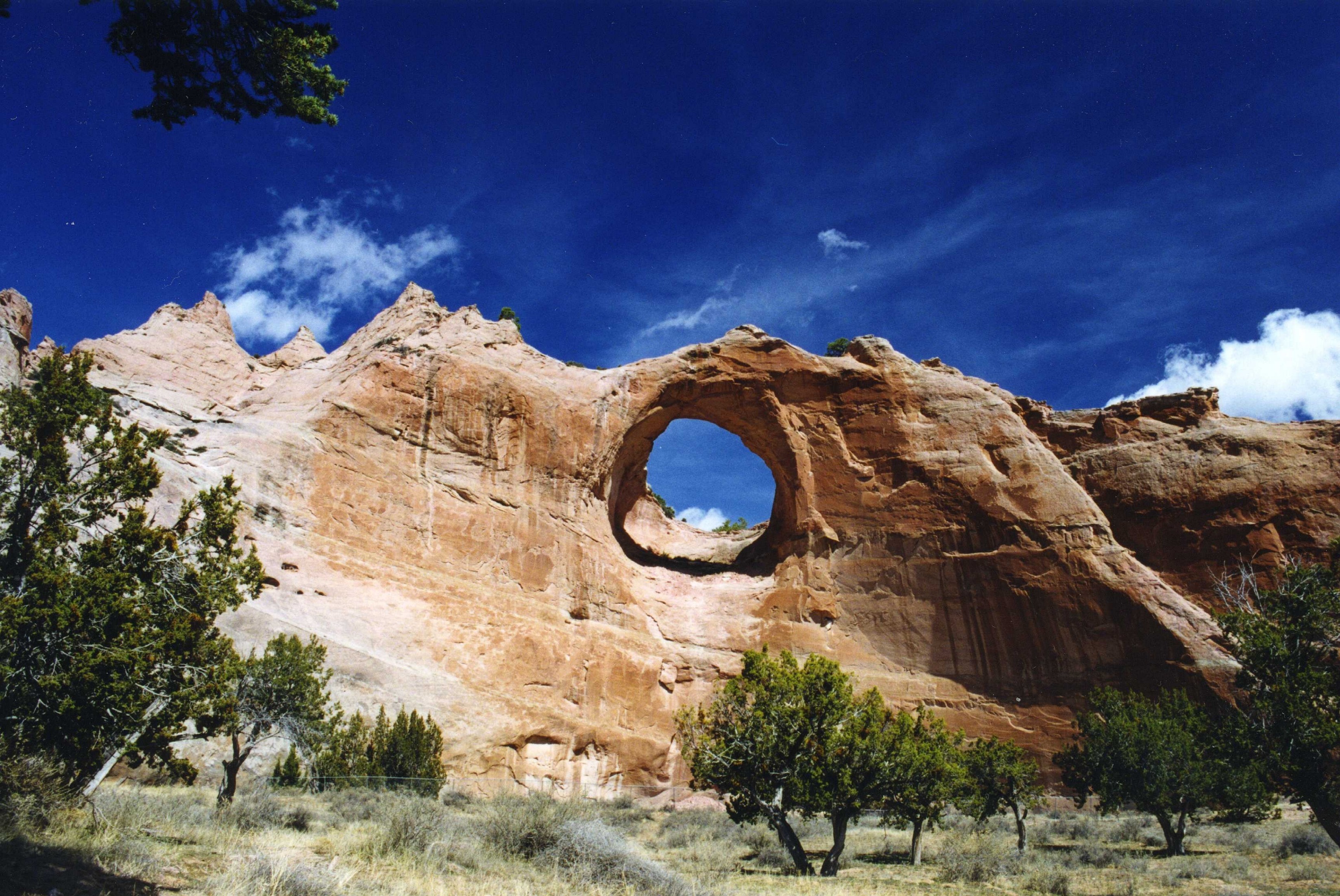
Window Rock stands near the headquarters of the Navajo Nation on the border between Arizona and New Mexico under a piercing azure sky.
© August 2006 Bob Ward.
Download Original (3295 x 2204 pixels, 1658.8 MB)
-
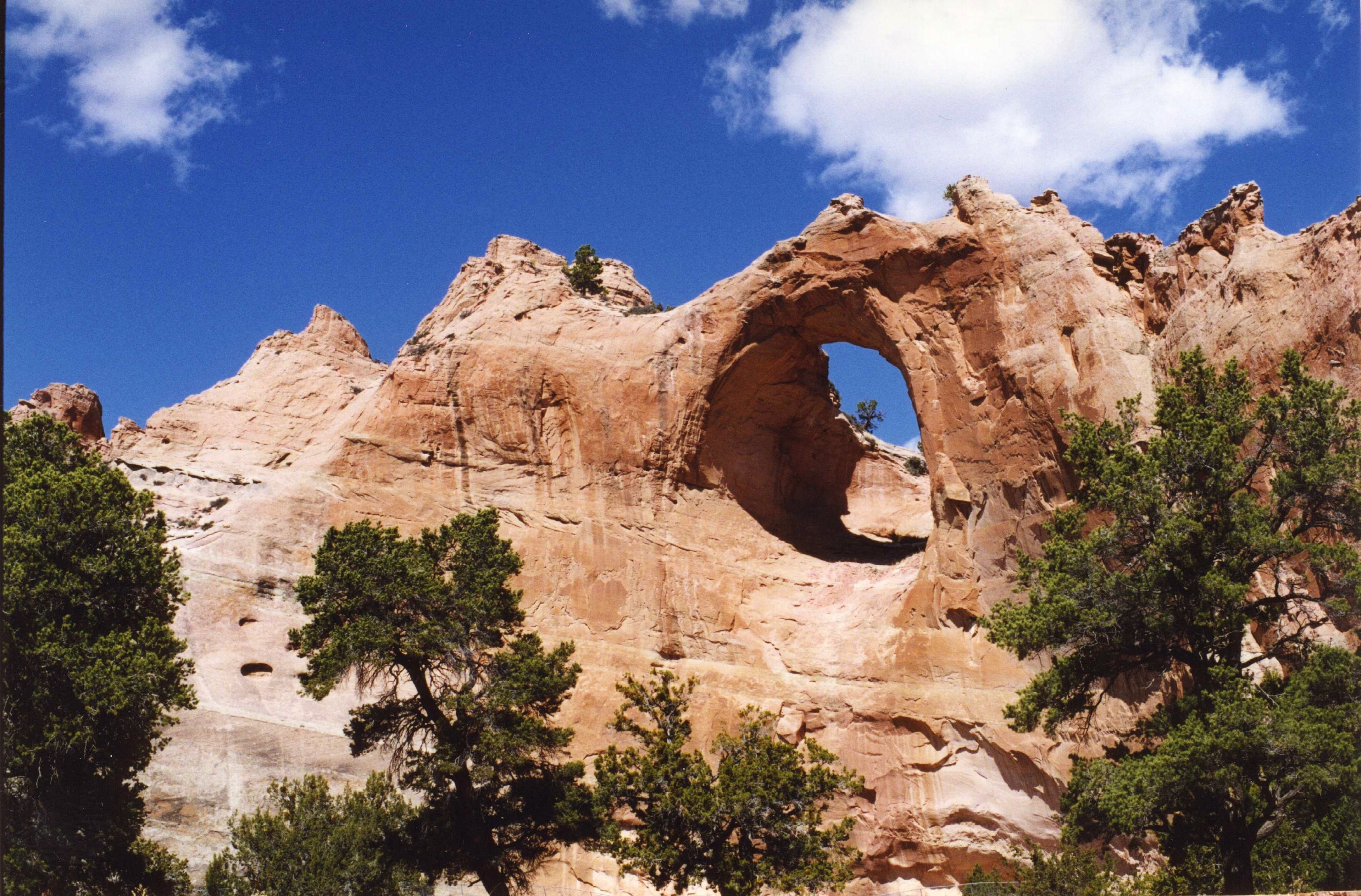
Window Rock, which stands surrounded by green trees and a striking cobalt-blue sky, is held sacred by the Navajo people.
© August 2006 Bob Ward.
Download Original (3300 x 2173 pixels, 1822.9 MB)
-
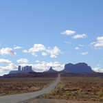
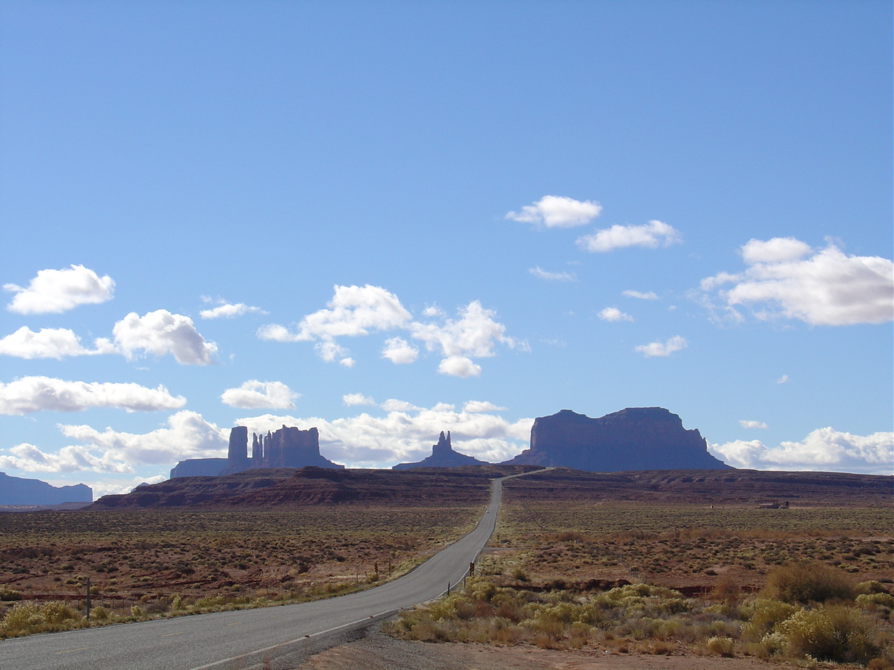
Stand by the side of the road and gaze at a distant but classic view of Monument Valley to the south of the town of Medicine Hat.
© September 2003 Robert Reinhard.
-
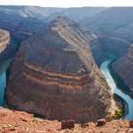
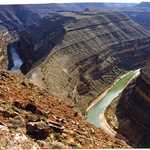
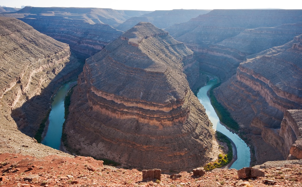
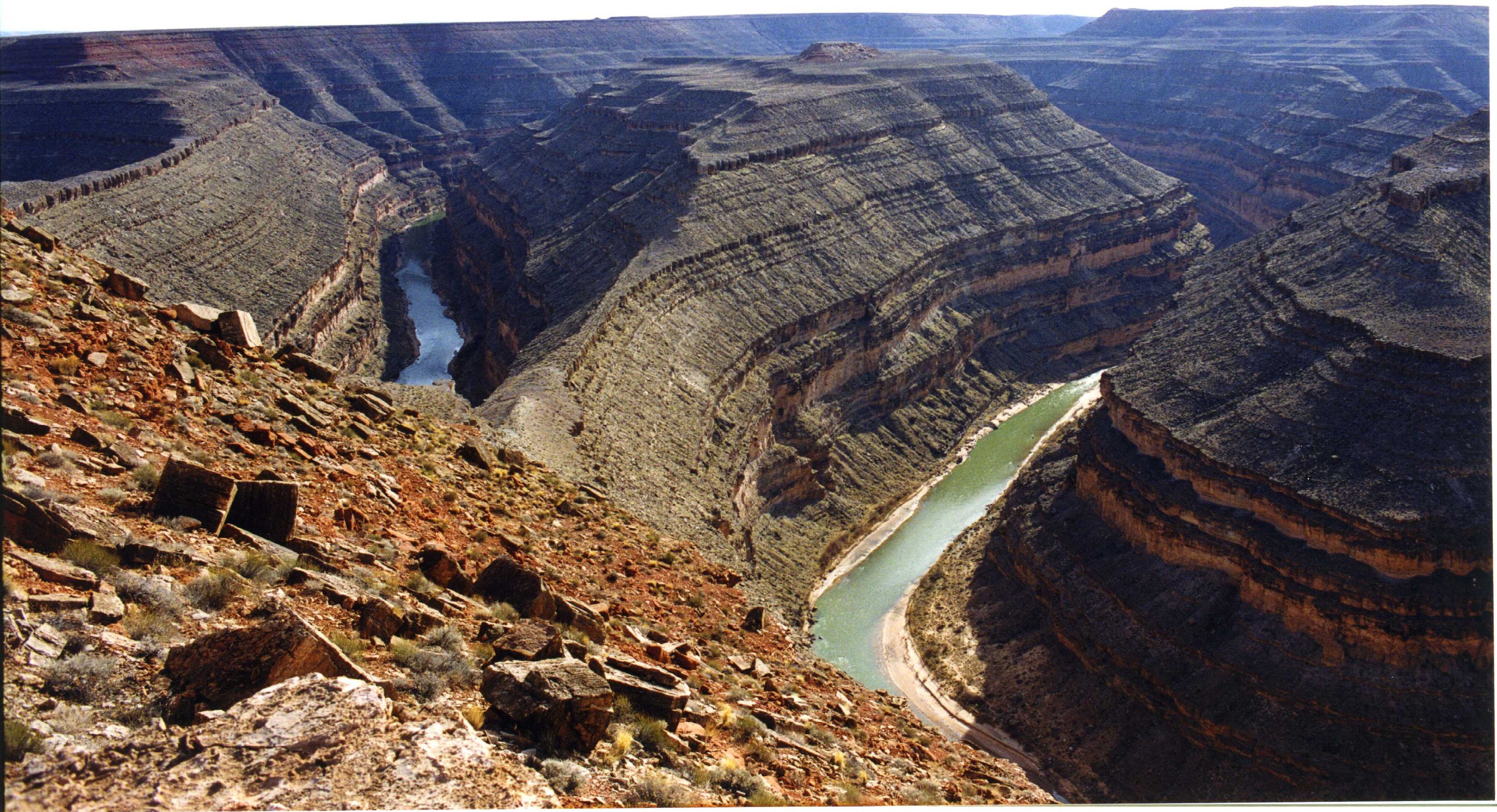
Along one memorable section, the San Juan River snakes back and forth amidst the red rocks of Southern Utah, earning the name 'The Goosenecks.'
 © August 2009 Lundur39 of Flickr.com.
Download Original (1024 x 636 pixels, 278.1 KB)
-
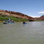
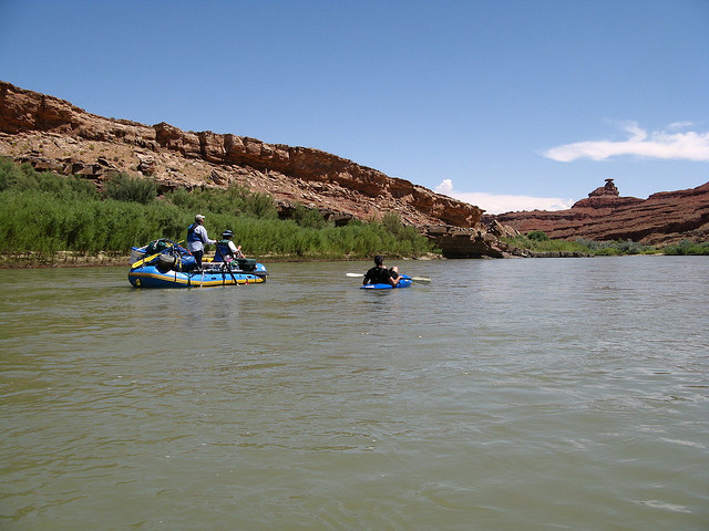
River rafters enjoy a beautiful summer day while drifting along with the calm current of the San Juan River.
 © July 2008 Raymond Johnson.
Download Original (640 x 480 pixels, 100.9 KB)
-
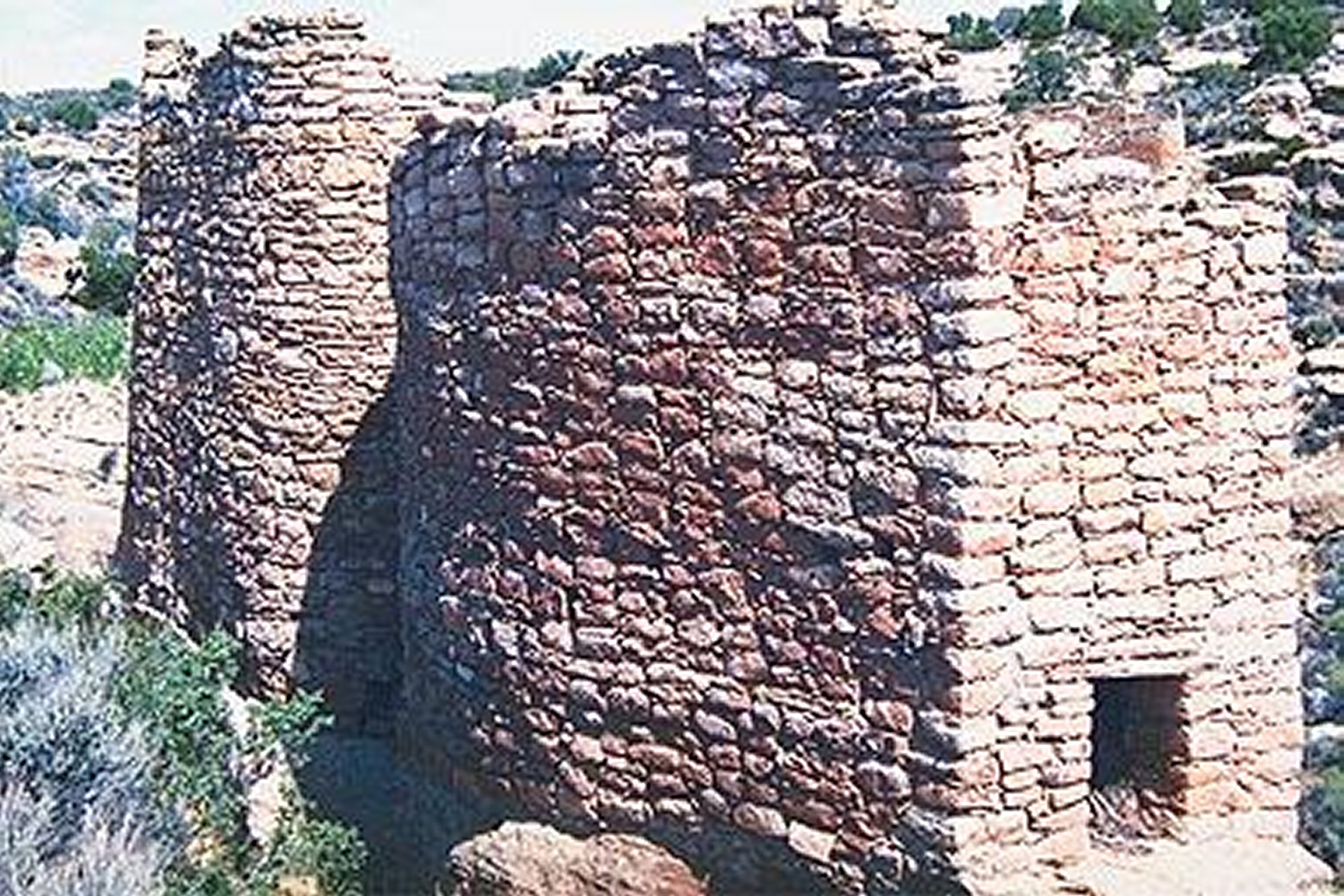
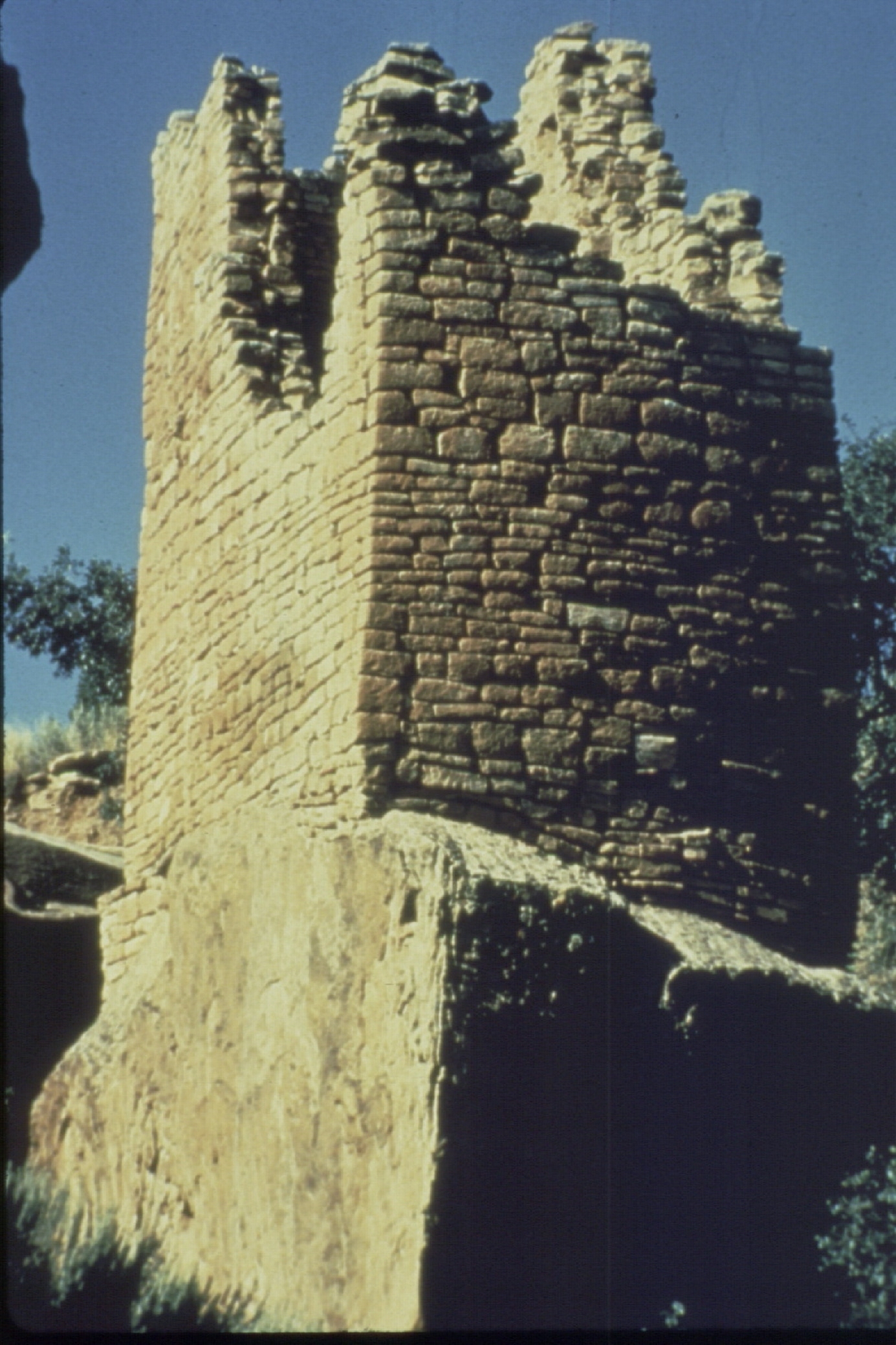
Located in both Colorado and Utah, this National Monument is characterized by square, oval, circular, and D-shaped towers built by Puebloans around 1200 AD.
Public Domain.
Download Original (1385 x 2078 pixels, 1424.3 MB)
-
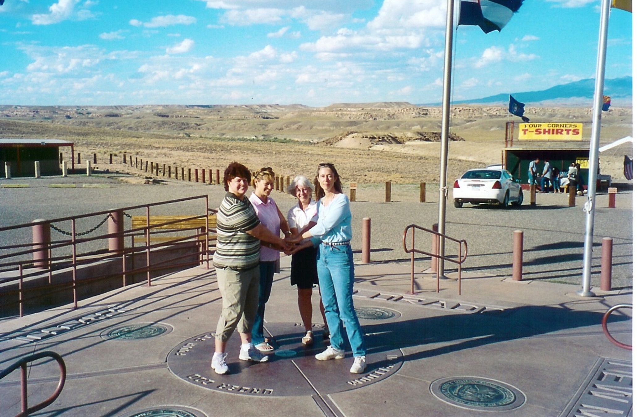
Popular with many tourists, the Four Corners Monument is the only place in the United States where four states conjoin at a common point.
Public Domain.
Download Original (2079 x 1351 pixels, 1501.6 MB)
-
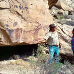
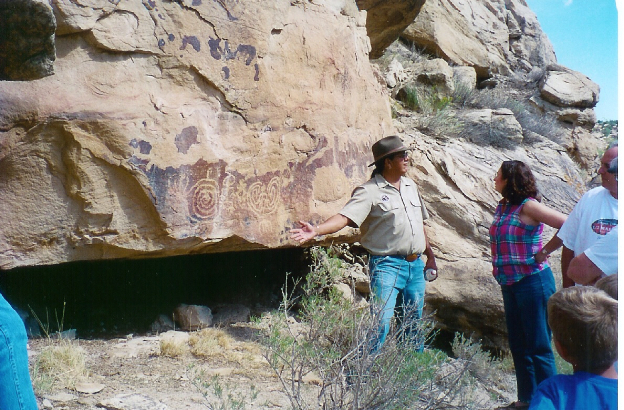
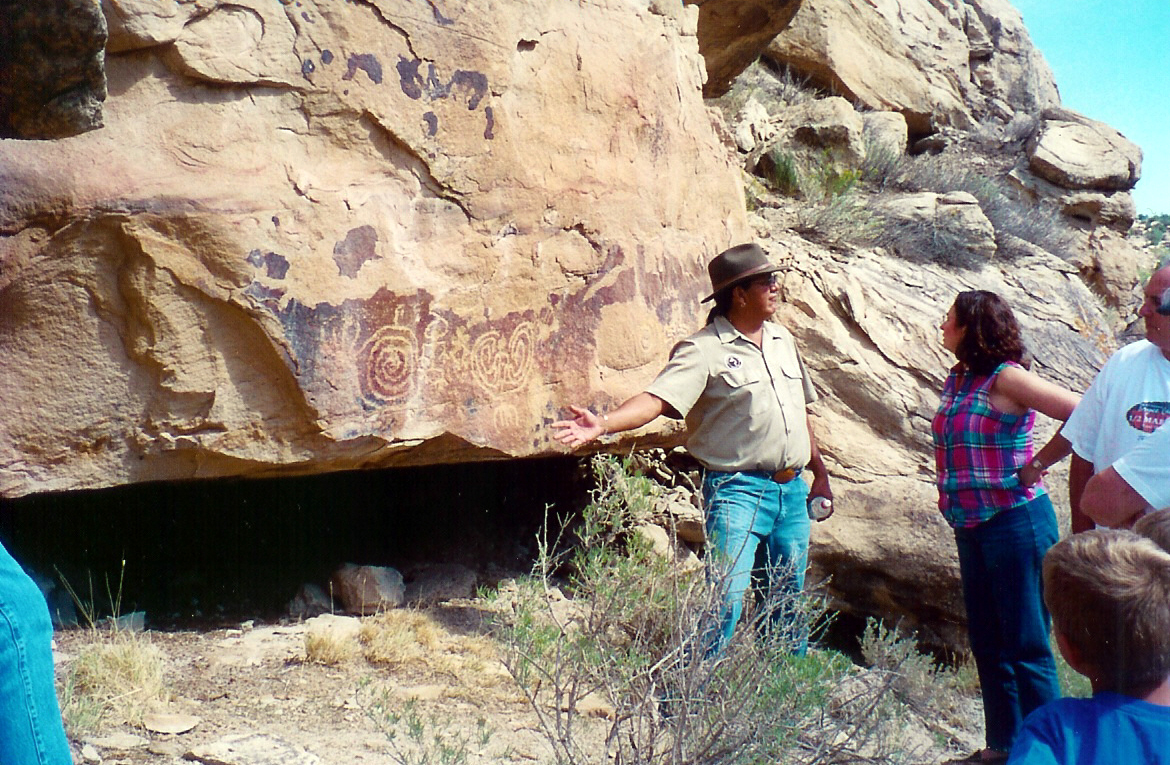
A tour guide presents visitors with some Pueblo petroglyphs.
Public Domain. Photo by Sally Pearce
Download Original (1170 x 765 pixels, 922.0 KB)
-
The Ancestral Pueblo people lived in dwelling communities like these around AD 1300.
Public Domain. Photo by Sally Pearce
Download Original (730 x 1158 pixels, 805.1 KB)
-
Cliff Palace sits below an overhanging cliff at Mesa Verde National Park.
© April 2005 Terry Mathews.
Download Original (1280 x 960 pixels, 606.0 KB)
-
The Seal of the Department of the Interior is at the exact location that Colorado, Utah, Arizona, and New Mexico meet in Four Corners, US.
© April 2005 Terry Mathews.
-
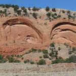
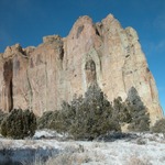
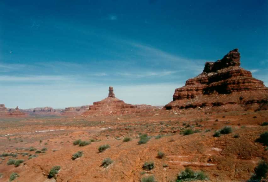
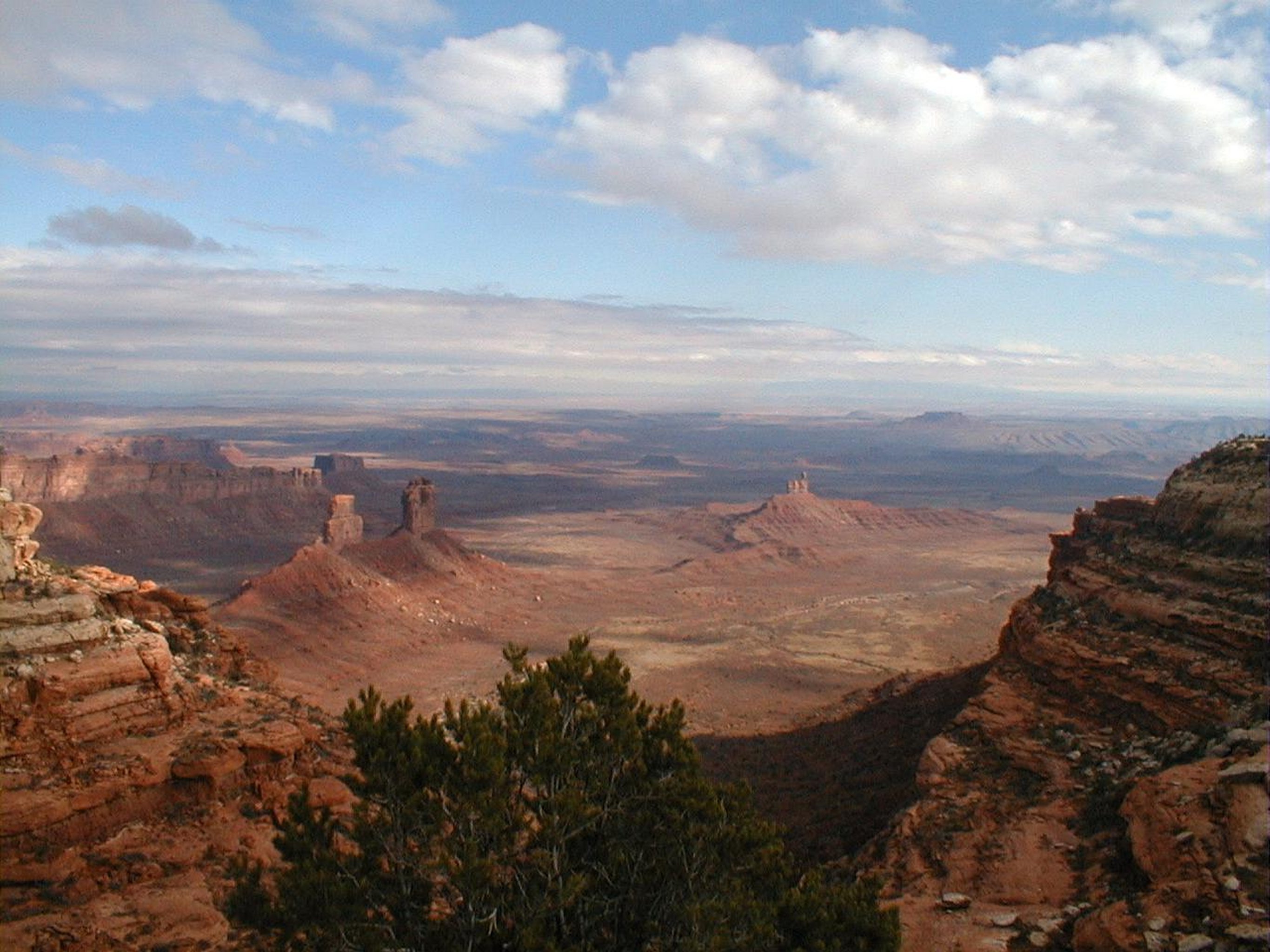
Jutting into the clear blue sky, a clump of mountains rises from the daunting desert landscape.
Public Domain. Photo courtesy of Utah's Canyon Country Visitor Services
Download Original (852 x 578 pixels, 54.7 KB)
-
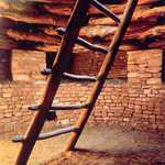
Visitors climb a ladder while touring the dwellings at Mesa Verde National Park.
Public Domain. Photo by Sally Pearce
Download Original (754 x 1166 pixels, 762.5 KB)
-
Visitors explore the Balcony House at the Pueblo dwellings in Mesa Verde National Park.
Public Domain. Photo by Sally Pearce
Download Original (1166 x 772 pixels, 830.5 KB)
-
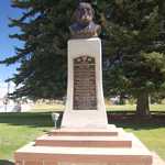
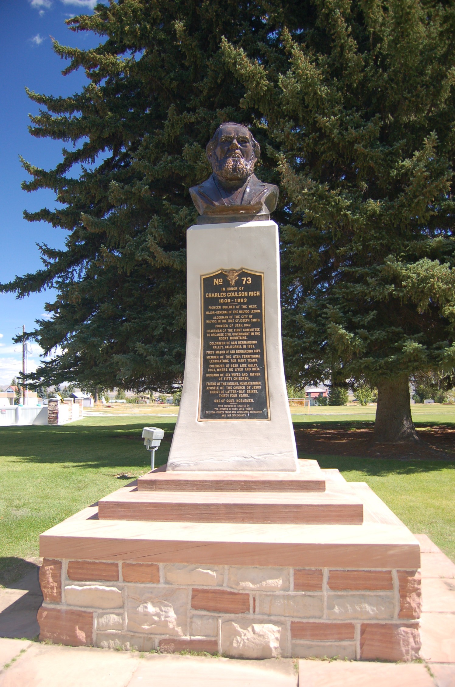
Recently restored on the grounds of the Paris Tabernacle (as of 2008) is this bust of Charles Coulson Rich, a Mormon pioneer who settled the Bear Lake Valley, as well as San Bernardino in California.
Public Domain. Photo by A. E. Crane
Download Original (1496 x 2256 pixels, 806.5 KB)
-
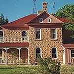
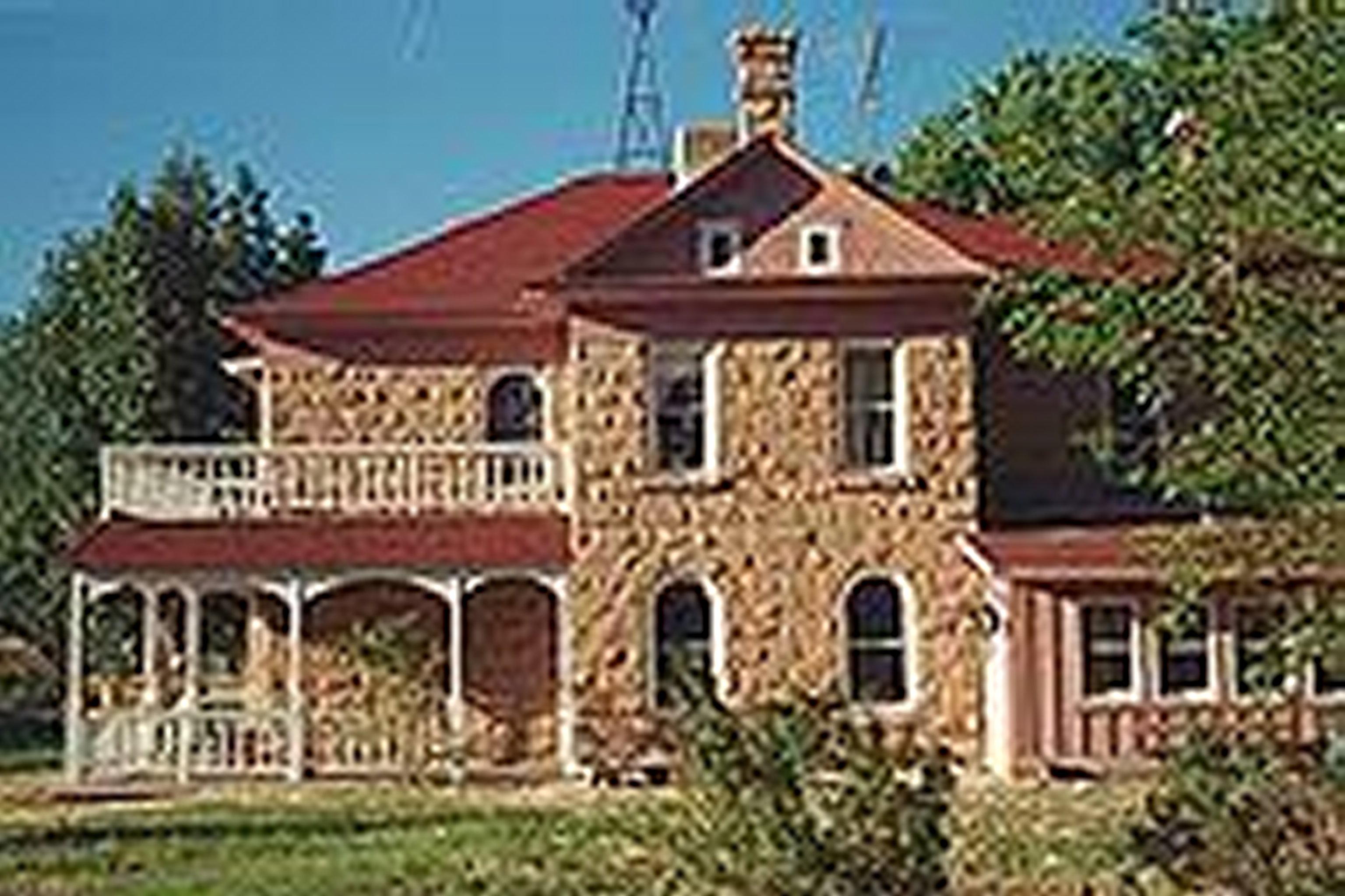
This is an impressive, old Victorian home in Bluff, built of native sandstone and finished in the Victorian style. The home is part of a Historic Walking Tour that winds through the community.
Public Domain. Courtesy of Utah's Canyon Country Visitor Services
Download Original (3072 x 2048 pixels, 610.7 KB)
-
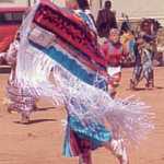
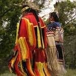
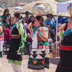
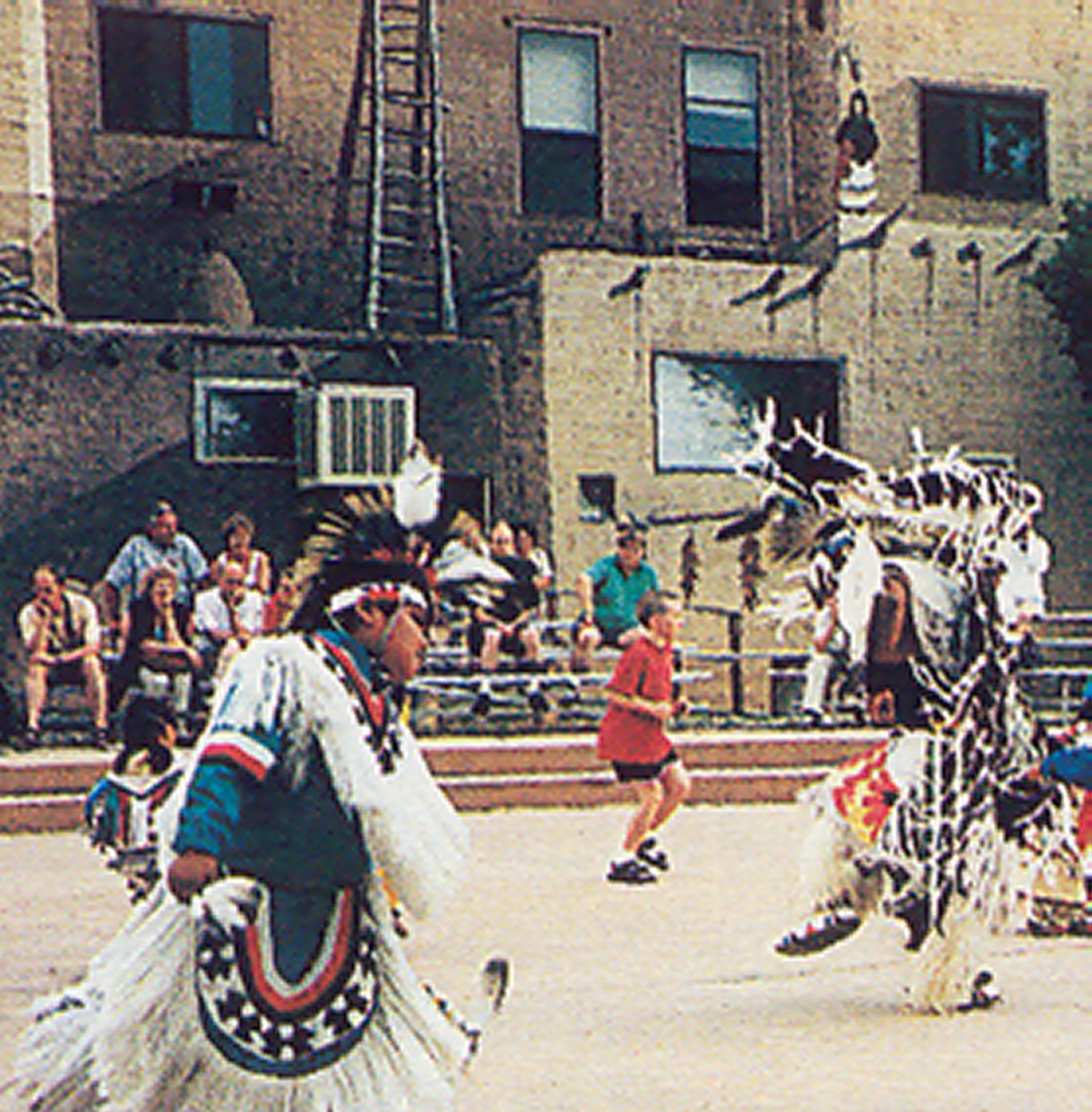
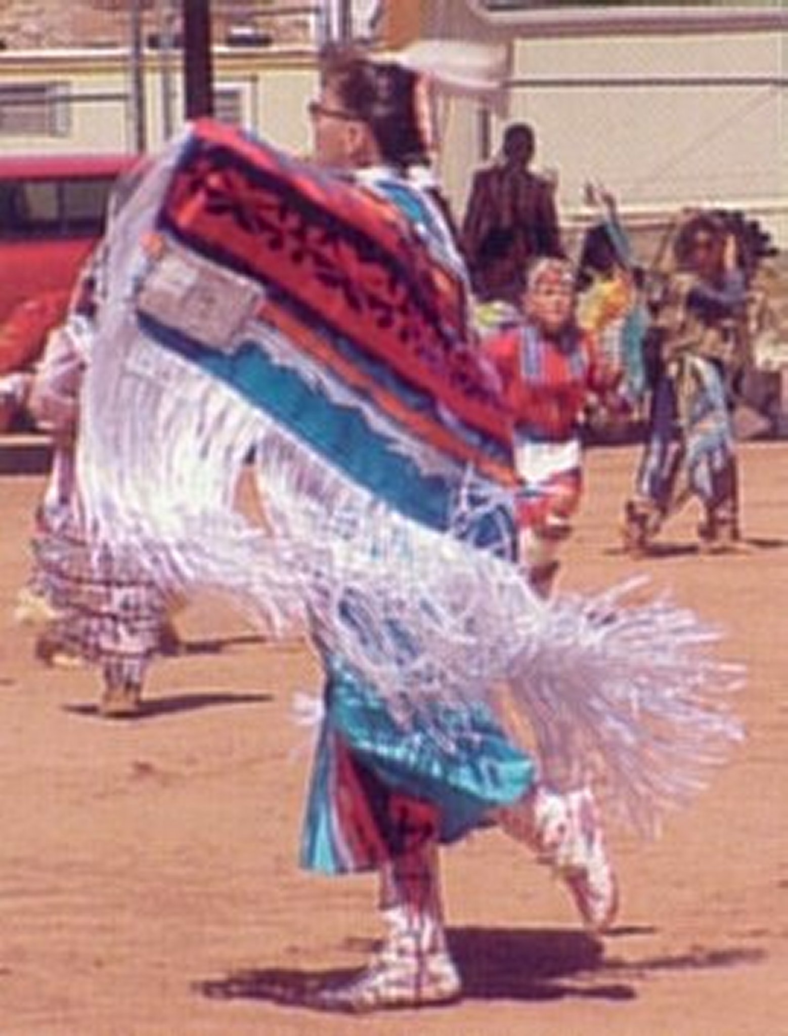
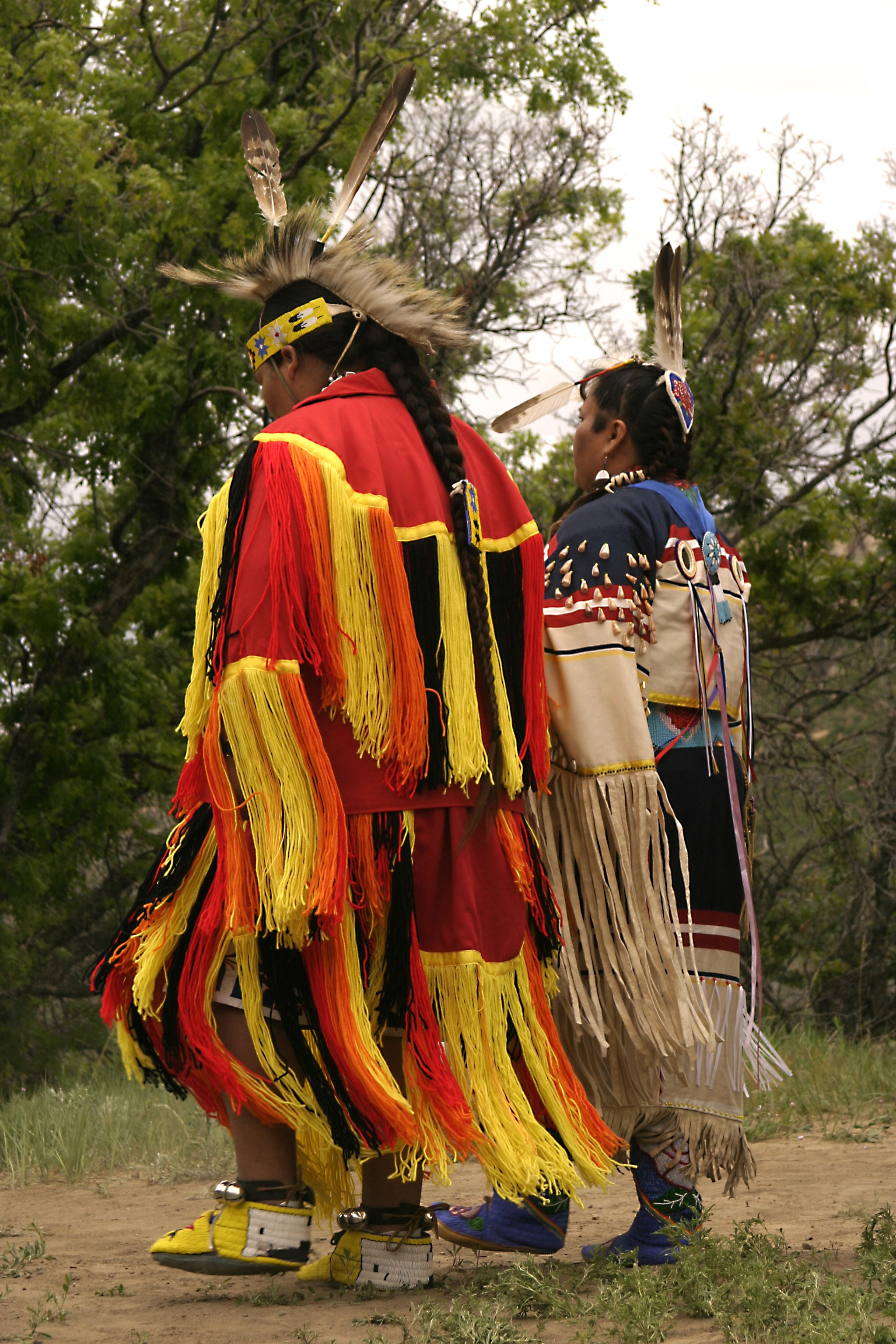
This young woman is preparing for her turn on the dance floor, a pounded dirt area adjacent to a covered drumming area, at the Utah Navajo Fair, held each fall in Bluff. One of the most exciting events at the fair is the fancy dress dance competition.
Public Domain. Courtesy of Utah's Canyon Country Visitor Services
Download Original (1558 x 2048 pixels, 287.4 KB)
-

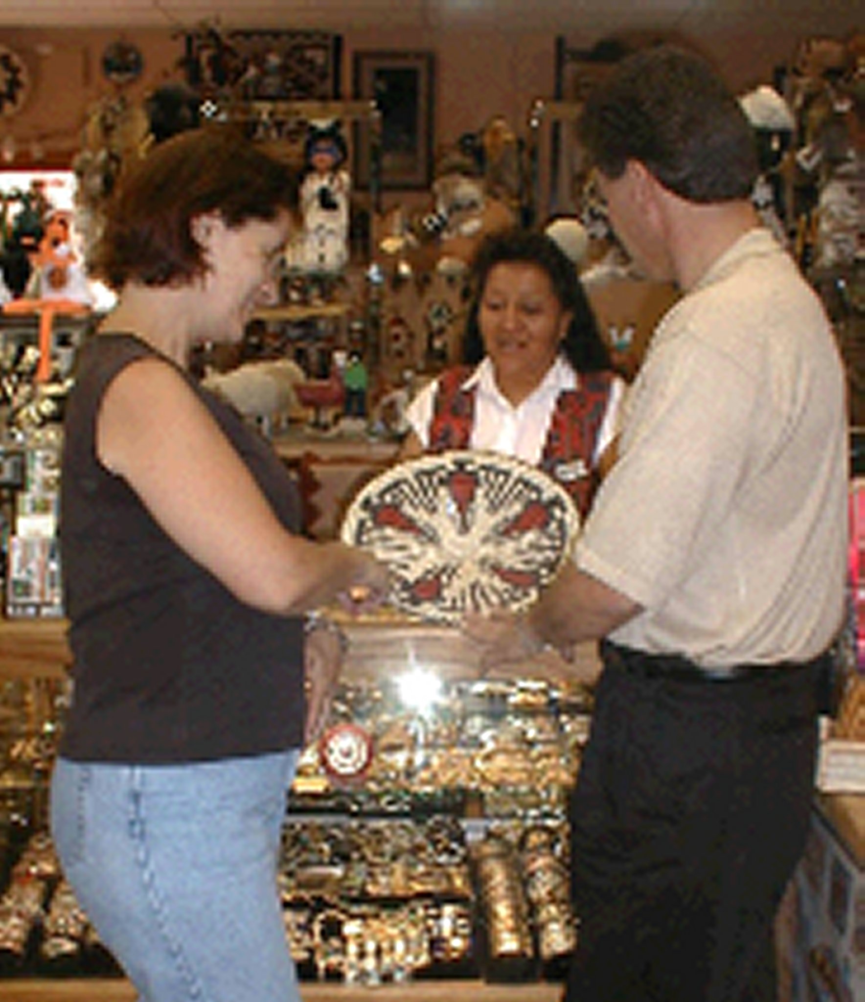
Two people mull over the wares of this Native American woman. Shopping along the Trail of the Ancients is prevalent and unique. There are trading posts throughout the area that deal in Navajo jewelry, baskets, and carvings. Many also carry Ute baskets, cradle boards, flutes, and beaded items. Traditional western clothing is available in many of the communities and saddles, bridles, spurs, and boots are also found along the Trail. Many locations allow purchase directly from the artisan, which adds color to the purchase and gives the visitor the opportunity to learn something about the item and the artist.
Public Domain. Courtesy of Utah's Canyon Country Visitor Services
Download Original (1768 x 2048 pixels, 334.2 KB)
-
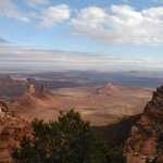
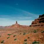
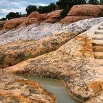
A fitting name for such an immense, awe-inspiring place, this view of Valley of the Gods is from the top of Cedar Mesa. The valley is a miniature version of the spectacular monoliths present in Monument Valley.
Public Domain. Courtesy of Utah's Canyon Country Visitor Services
Download Original (2731 x 2048 pixels, 615.6 KB)
-
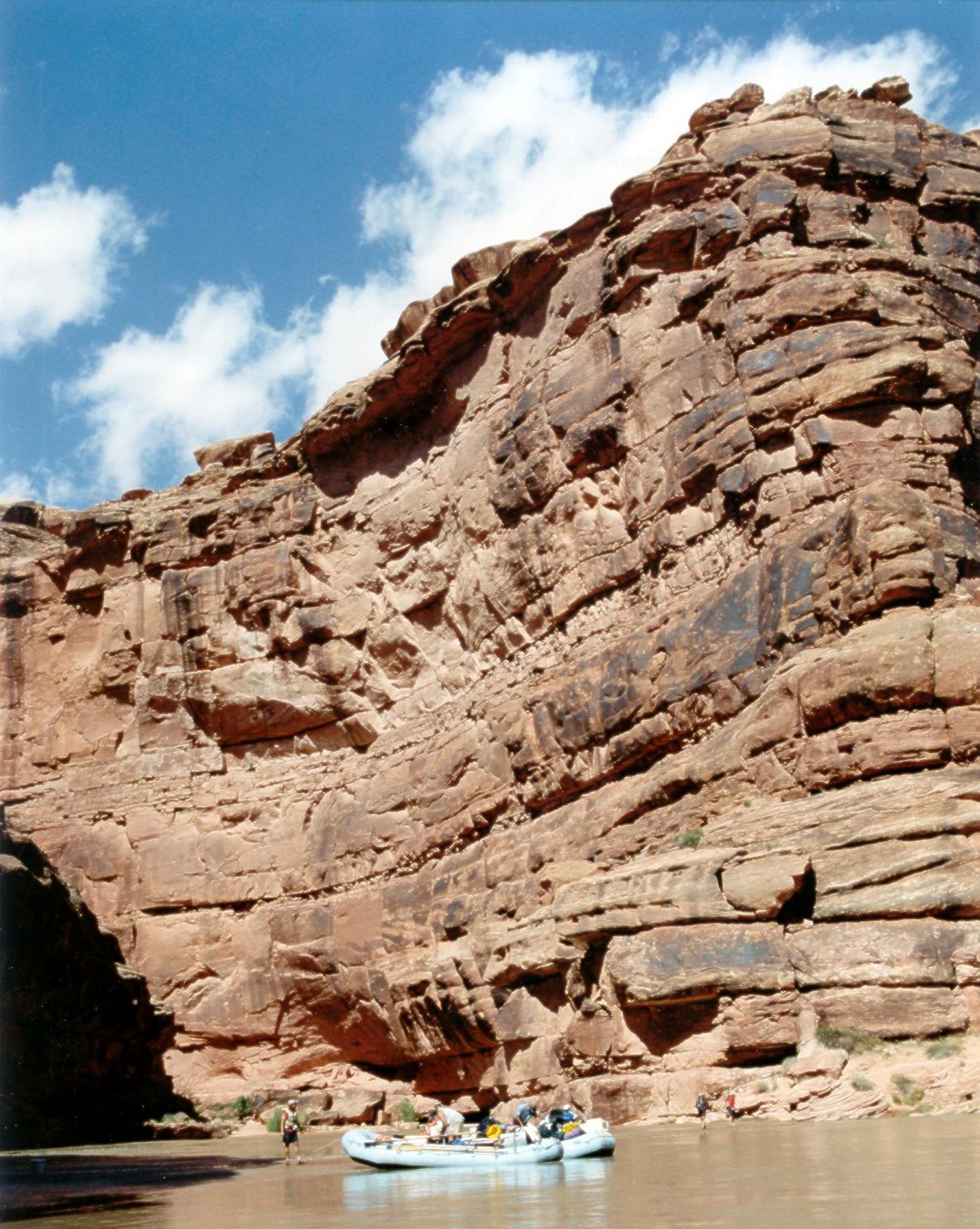
A raft lazily floats by beautiful, sandstone cliffs. Float trips travel the San Juan River from Bluff to Mexican Hat and beyond to Lake Powell.
Public Domain. Courtesy of Wild Rivers Expeditions (Tim Tyson)
Download Original (1633 x 2048 pixels, 623.6 KB)
-
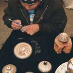
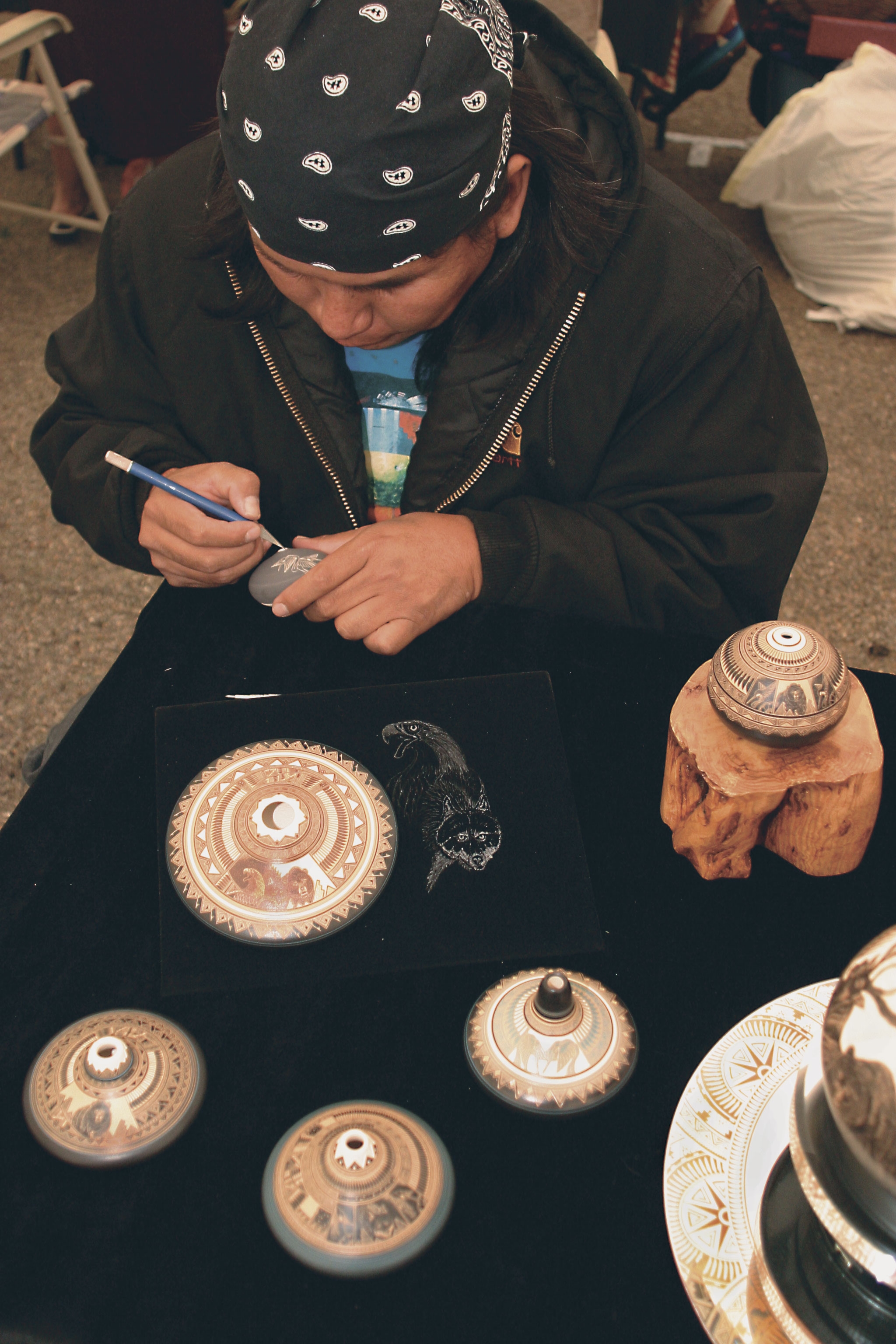
The Indian Art Market, part of the annual Indian Arts and Western Culture Festival held in Mesa Verde Country, features 40 Native American artists. This artist is painting details on pots ready to sell.
Public Domain. Photo by Branson Reynolds
Download Original (2048 x 3072 pixels, 2501.8 MB)
-
Indian Dances and Cultural Programs are performed several nights a week at the Cortez Cultural Center. They are free to the public and demonstrate the rich Native American culture of the area.
Public Domain. Photo by Branson Reynolds
Download Original (2048 x 3072 pixels, 3315.3 MB)
-
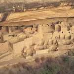
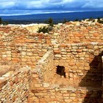
Cliff Palace, the most well-known archaeological site in Mesa Verde National Park, is the largest cliff dwelling in North America.
Public Domain. Photo supplied by Mesa Verde Country
Download Original (2200 x 708 pixels, 1944.7 MB)
-
A small park creates an overlook for this magnificent view of a horseshoe curve in the San Juan River near Mexican Hat, Utah.
© August 2006 Bob Ward.
Download Original (3300 x 1791 pixels, 1776.7 MB)
-

Chaco Cultural Historical National Park, the Center of an Ancient World. Today the large buildings of the Ancestral Puebloan people testify to the organizational and engineering abilities not seen anywhere else in the American Southwest. Chaco provides a deeper contact and window into the canyon that was central to thousands of people between 850 and 1250 A.D.
Public Domain. NM Tourism Department
Download Original (700 x 468 pixels, 138.7 KB)
-
Cover photo highlighting how the feature supports the intrinsic quality.
Public Domain. National Park Service
Download Original (2592 x 755 pixels, 318.3 KB)
-
A view from the sky over the National Monument.
Public Domain. National Park Service
Download Original (800 x 410 pixels, 65.9 KB)
-
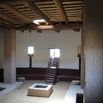
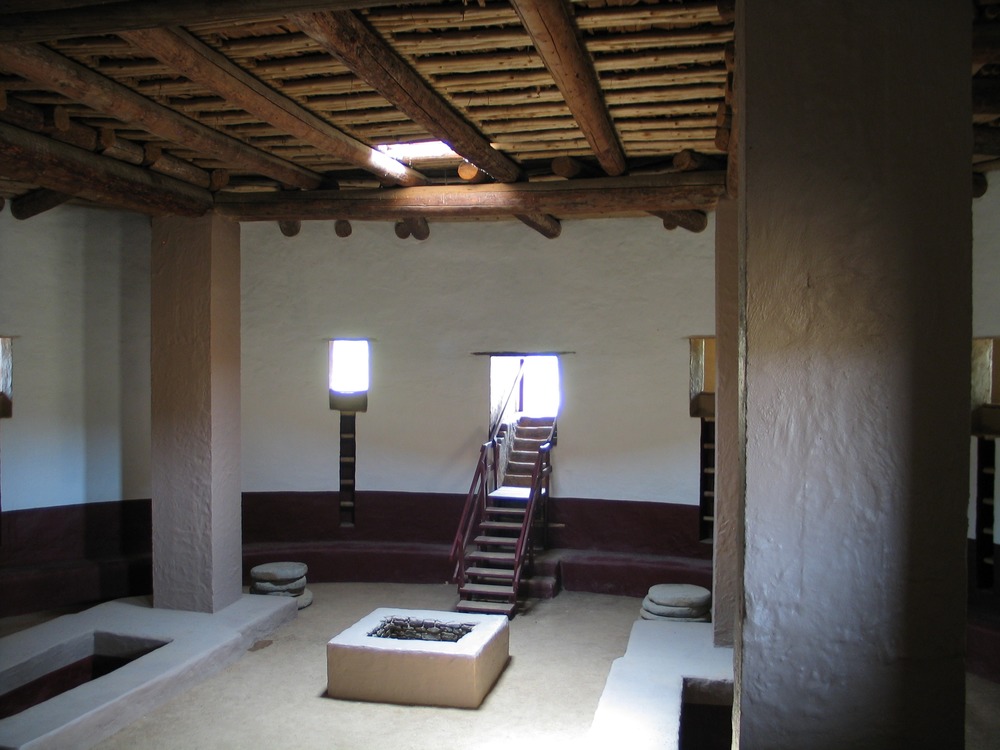
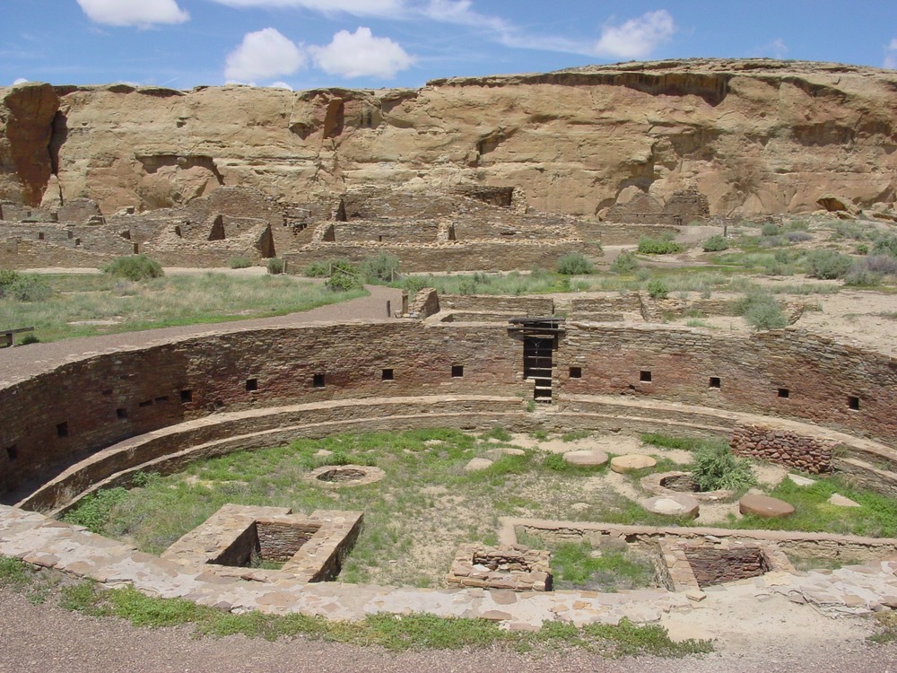
The Great Kiva, picture from inside, which is accessible to the public.
Public Domain. National Park Service
Download Original (1000 x 750 pixels, 141.7 KB)
-
A full moon looks down and illuminates the National Monument.
Public Domain. National Park Service
Download Original (1360 x 764 pixels, 138.8 KB)
-
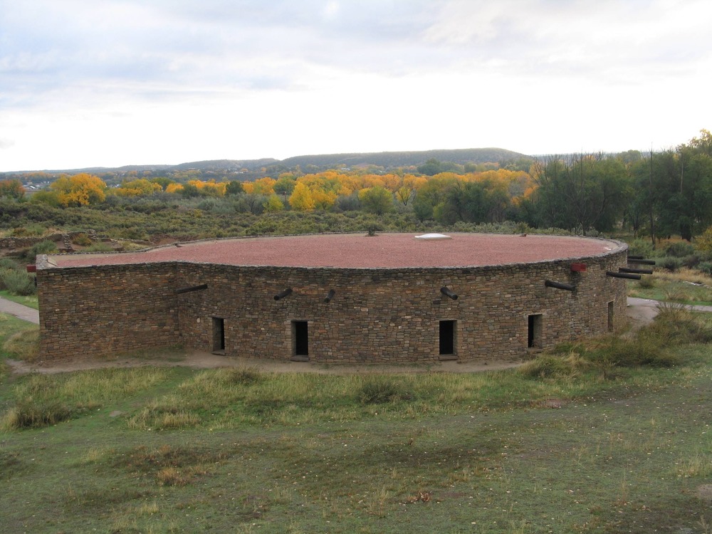
The Great Kiva from the outside in Fall.
Public Domain. National Park Service
Download Original (1000 x 750 pixels, 193.2 KB)
-
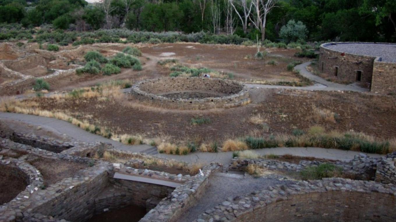
Salmon Ruins Cover Photo, A view from the second level, just east of Tower Kiva highlighting how the feature supports the intrinsic quality.
Public Domain. Larry L. Baker
Download Original (1360 x 764 pixels, 195.3 KB)
-
A San Juan Occupation kiva, located at the southwest corner of the Pueblo ruin.
Public Domain. N S Espinosa
Download Original (1360 x 764 pixels, 190.1 KB)
-
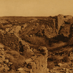
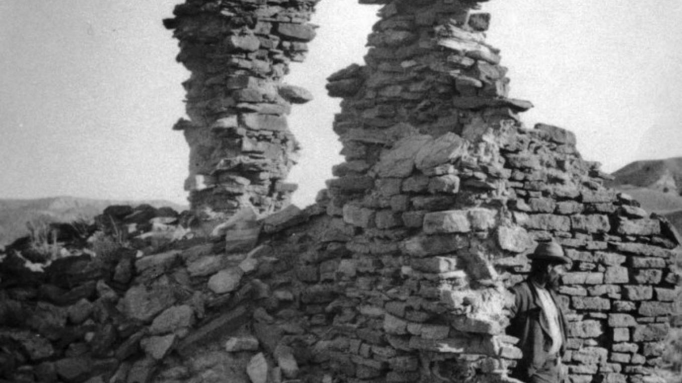
Salmon Ruin circa 1874.
Public Domain. Photo Courtesy Smithsonian Institution
Download Original (1360 x 764 pixels, 116.9 KB)
-
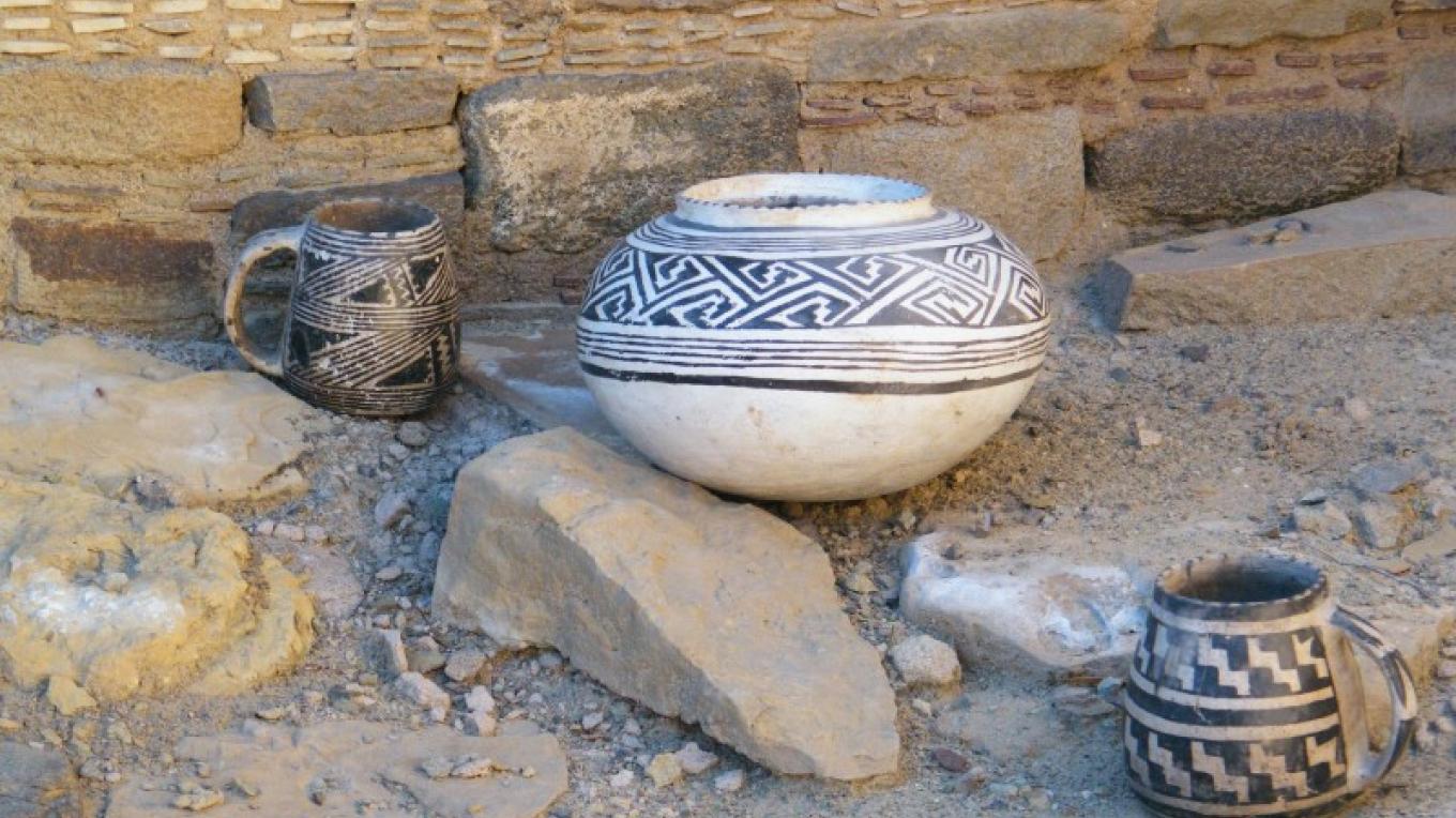
Ceramic Vessels found during excavations.
Public Domain. Larry L. Baker
Download Original (1360 x 764 pixels, 163.0 KB)
-
Salmon Ruins, 2010 Summer Solstice.
Public Domain. N S Espinosa
Download Original (1360 x 764 pixels, 86.5 KB)
-
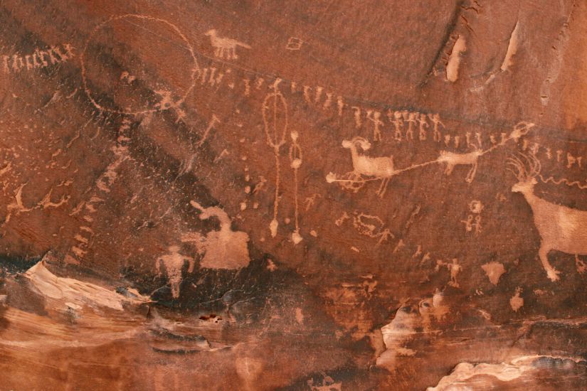
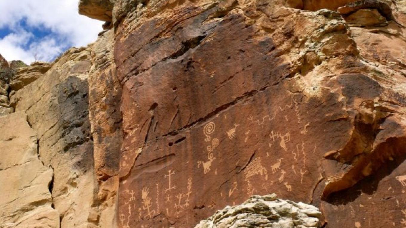
Throughout the ancient Pueblo world, people converted sheer rock faces into artists’ canvasses—pecking, and sometimes painting, images that offer unique glimpses into life in the distant past.
Public Domain. Crow Canyon Archaeological Center
Download Original (825 x 550 pixels, 91.0 KB)
-
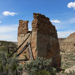
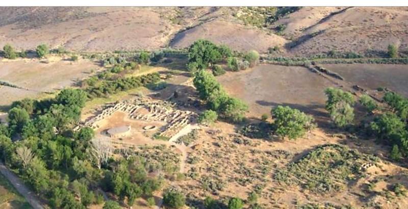
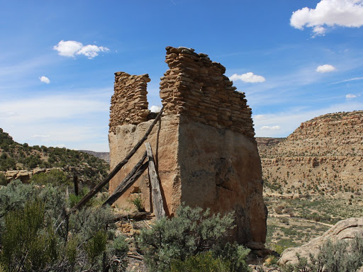
Ruins at Crow Canyon Pueblito
Public Domain. City of Aztec Tourism
Download Original (512 x 384 pixels, 78.2 KB)
-
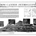
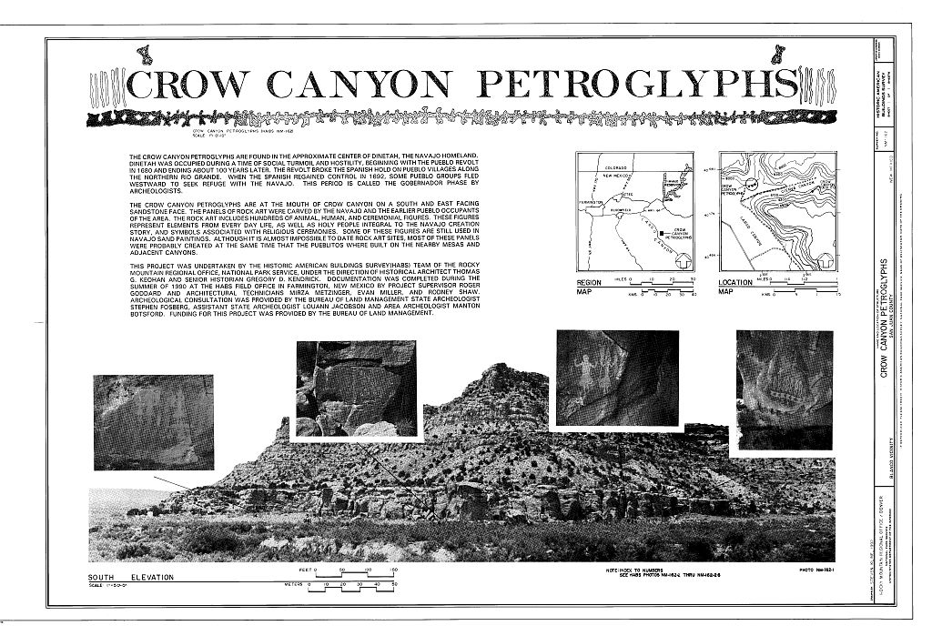
Crow Canyon Petroglyphs Historic Brochure
Public Domain. Library of Congress
Download Original (1024 x 699 pixels, 184.7 KB)
-
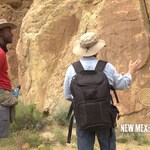
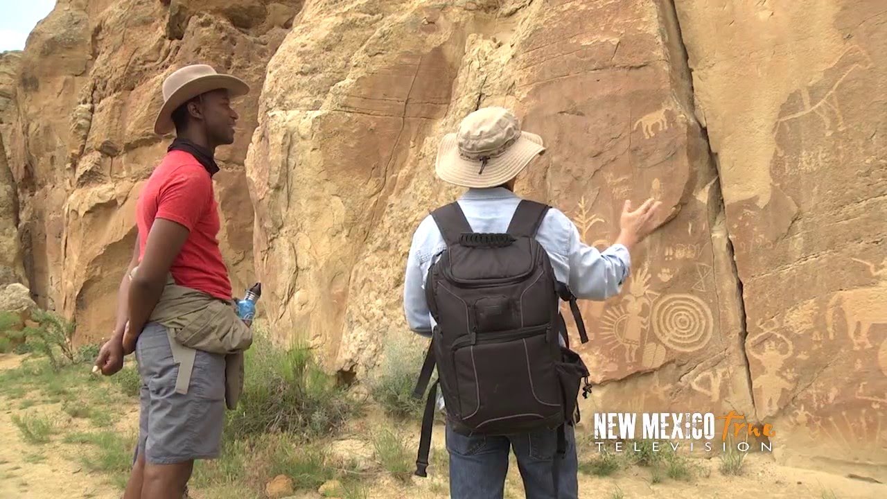
Tour of Crow Canyon Petroglyphs for New Mexico True Television
Public Domain. NM Tourism Department
Download Original (1280 x 720 pixels, 189.8 KB)
-
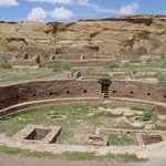
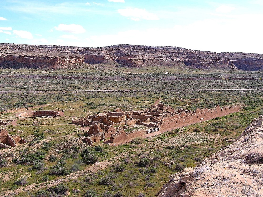
Chetro ketl overview from the cliffs above along the Pueblo Alto trail.
Public Domain. National Park Service
Download Original (1000 x 750 pixels, 385.5 KB)
-
Time lapse photo of Casa Rinconada with star paths.
Public Domain. National Park Service
Download Original (999 x 666 pixels, 304.1 KB)
-
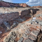
The great kiva in the plaza of Chetro Ketl.
Public Domain. National Park Service
Download Original (1000 x 750 pixels, 286.0 KB)
-
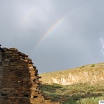
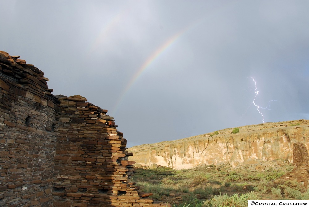
New Mexico's weather is powerful and beautiful over Chaco Canyon.
Public Domain. National Park Service
Download Original (1000 x 671 pixels, 141.5 KB)
-

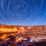
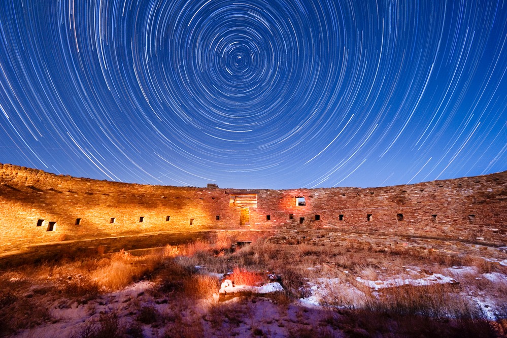
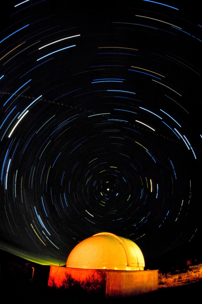
Star trails swirl in a concentric pattern above the dome of Chaco Observatory.
Public Domain. National Park Service
Download Original (664 x 999 pixels, 124.7 KB)
-
Casamero Pueblo Ruins Cover Photo, an excellent example of a Chacoan Outlier highlighting how the feature supports the intrinsic quality.
Public Domain. Bureau of Land Management
Download Original (435 x 295 pixels, 138.4 KB)
-
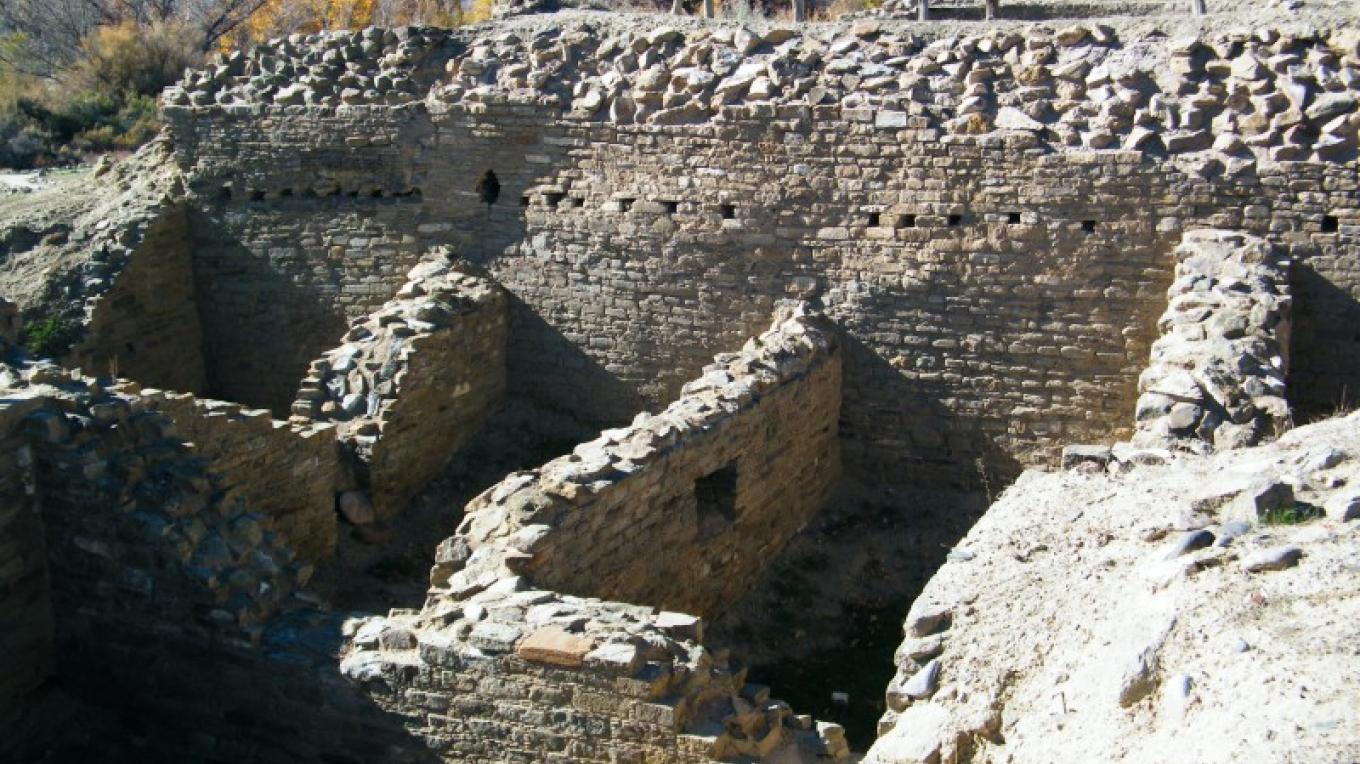
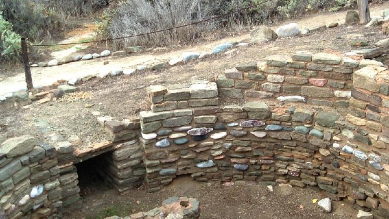
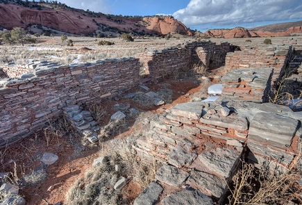
Exposed rooms at the Ruin
Public Domain. Tom Obenauf
Download Original (1360 x 764 pixels, 196.6 KB)
-
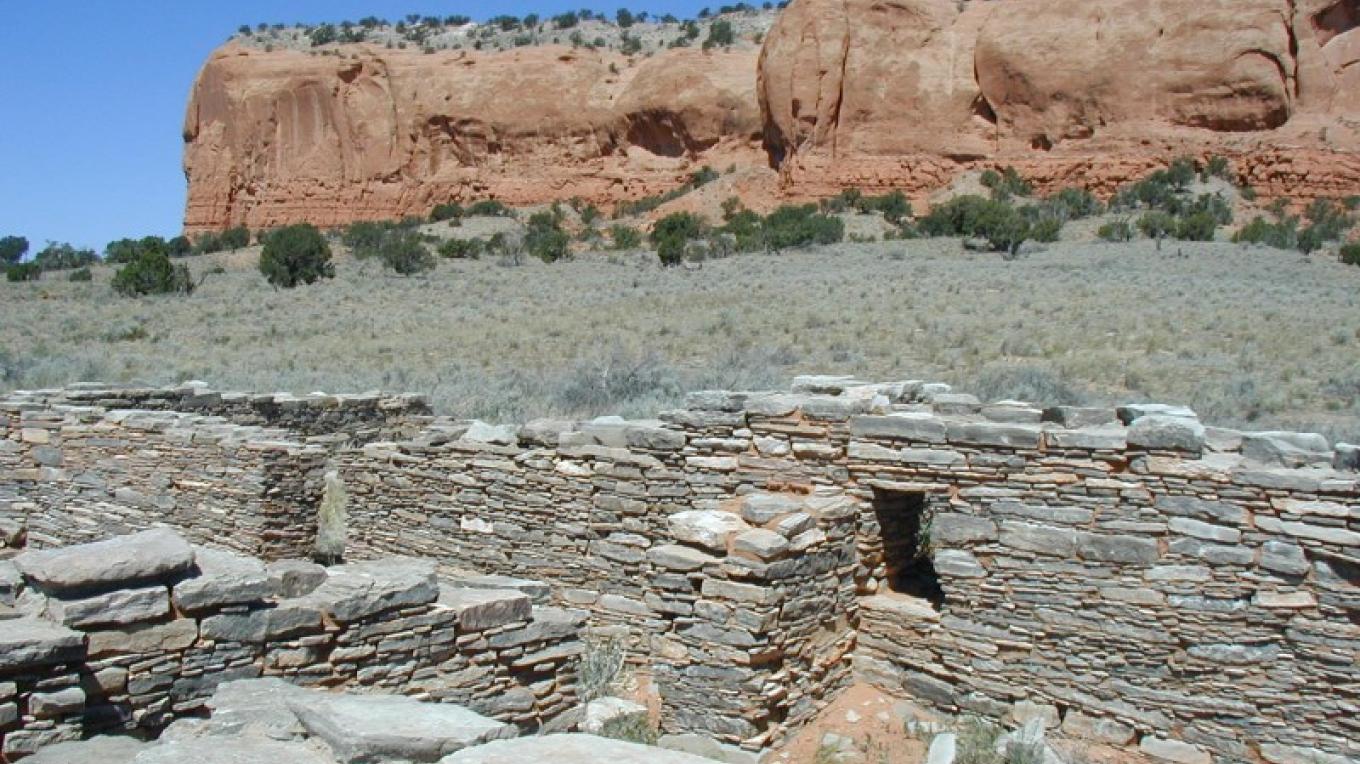
Casamero Ruin with Tecolote Mesa in background
Public Domain. Carol Chamberland
Download Original (1360 x 764 pixels, 144.6 KB)
-
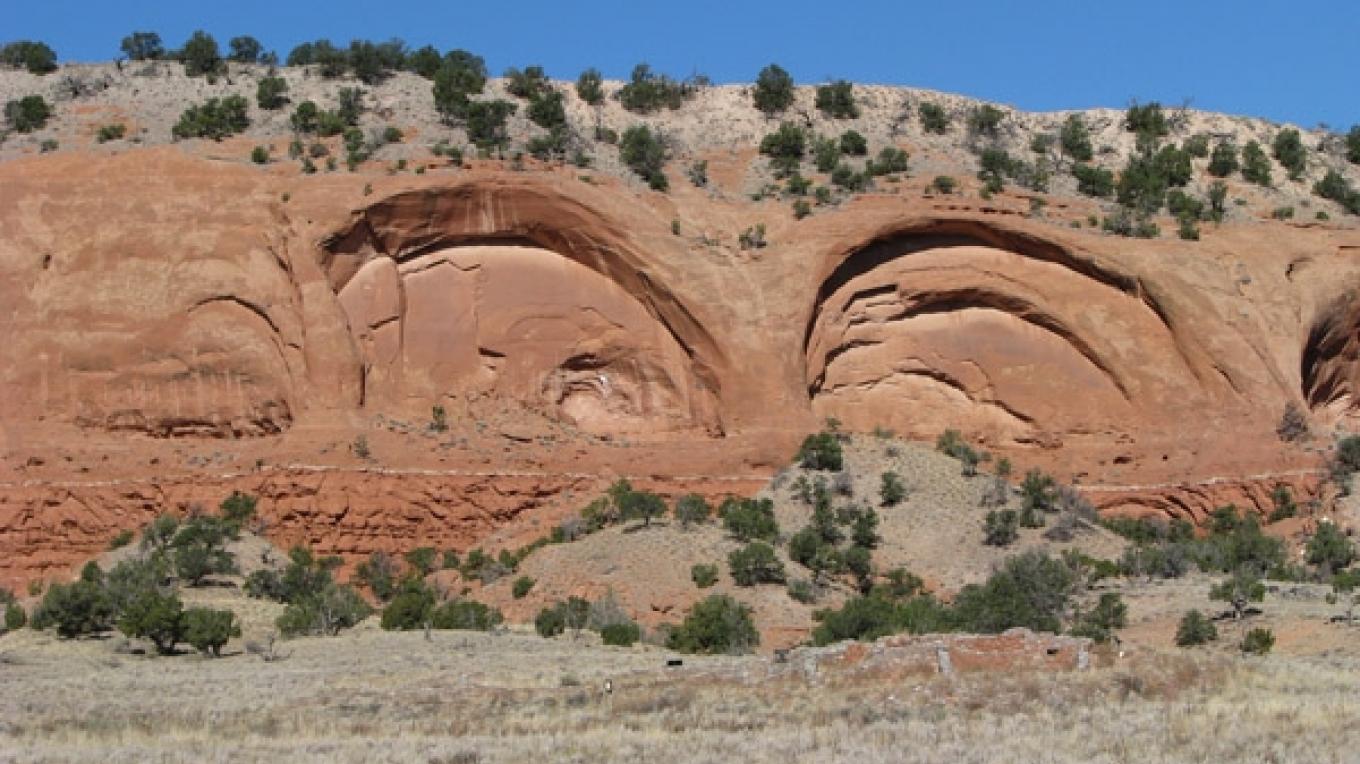
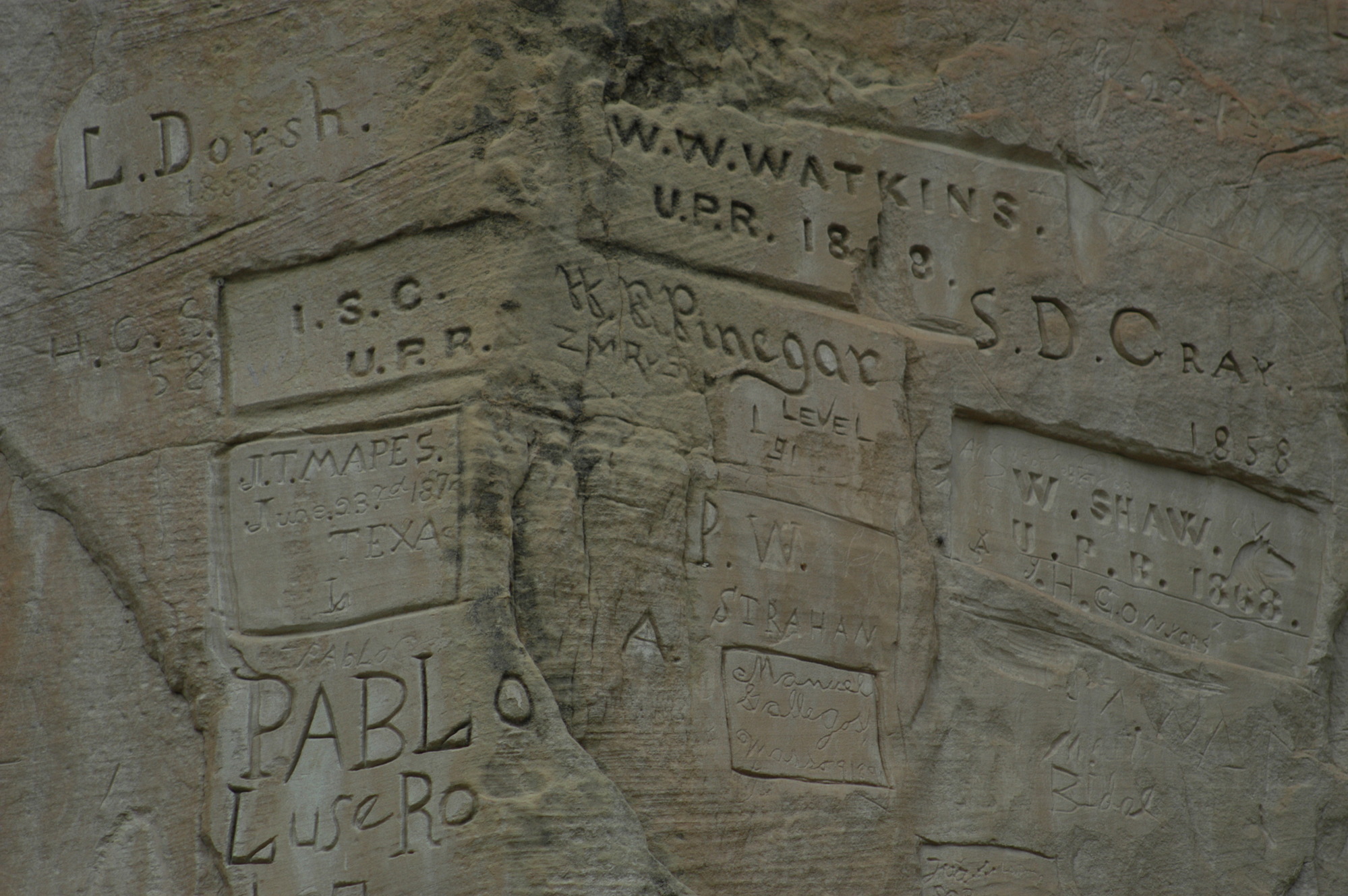
The "point of the rock" has the highest concentration of inscriptions.
Public Domain. National Park Service
Download Original (1999 x 1329 pixels, 656.7 KB)
-
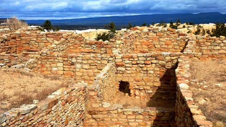
An excavated section of the 875 room Atsinna Pueblo high atop the bluff, which was built and occupied between 1275 and 1350, with 1500 inhabitants
Public Domain. National Park Service
Download Original (465 x 262 pixels, 59.3 KB)
-
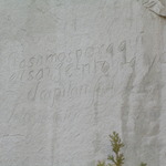
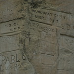
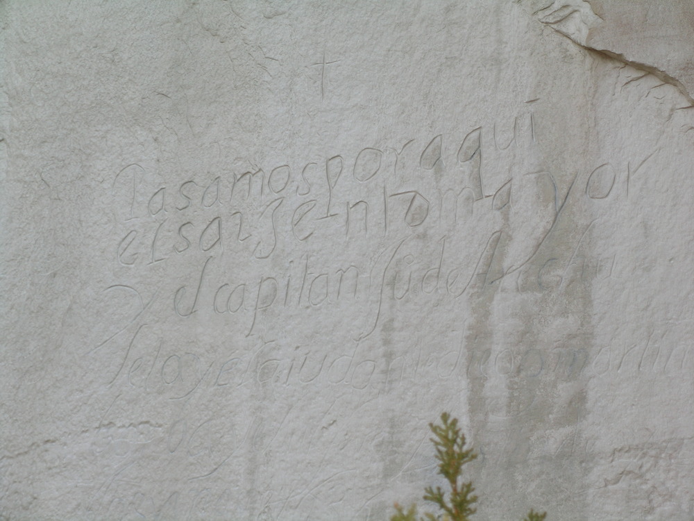
Translated to english as, "We sergeant Major and Captian Juan de Arechuleta and adjutant Diego Martin Barba adn Ensign Agustin de Ynojos, passed by here, in the year or 1636."
Public Domain. National Park Service
Download Original (1000 x 750 pixels, 184.0 KB)
-
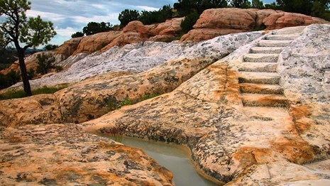
El Morro National Monument offers hiking opportunities on beautiful trails.
Public Domain. National Park Service
Download Original (465 x 262 pixels, 59.5 KB)
-
El Morro, or "the bluff", is seen here with a dusting of snow on the ground.
Public Domain. National Park Service
Download Original (999 x 665 pixels, 260.9 KB)
-
Rock art detail on mesa above Village of Great Kivas.
Public Domain. Tom Kennedy
Download Original (1360 x 764 pixels, 198.0 KB)
-
Village of the Great Kivas rock art in context.
Public Domain. Tom Kennedy
Download Original (1360 x 764 pixels, 161.1 KB)
-
Wall portion at Village of Great Kivas showing Chacoan influence.
Public Domain. Tom Kennedy
Download Original (1360 x 764 pixels, 195.3 KB)
-
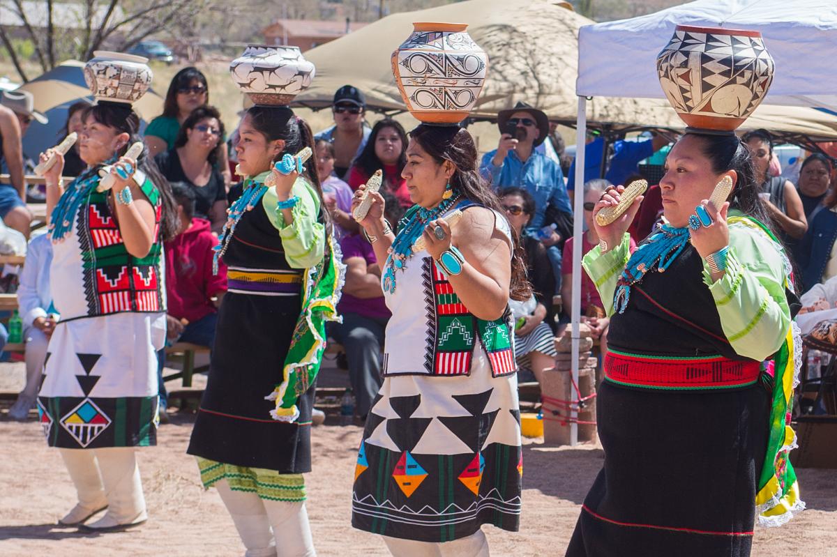
Zuni Dancers perform the Corn Dance.
Public Domain. Zuni Tourism
Download Original (1200 x 799 pixels, 169.0 KB)
-
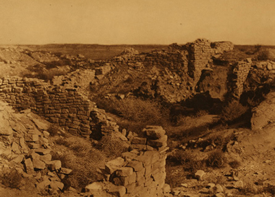
The Hawikuh ruins, once the largest of the Zuni cities of Cibola, and the first pueblo to be encountered by the Spanish Coronado expedition
Public Domain. Library of Congress
Download Original (402 x 288 pixels, 124.8 KB)
-
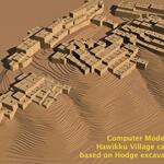
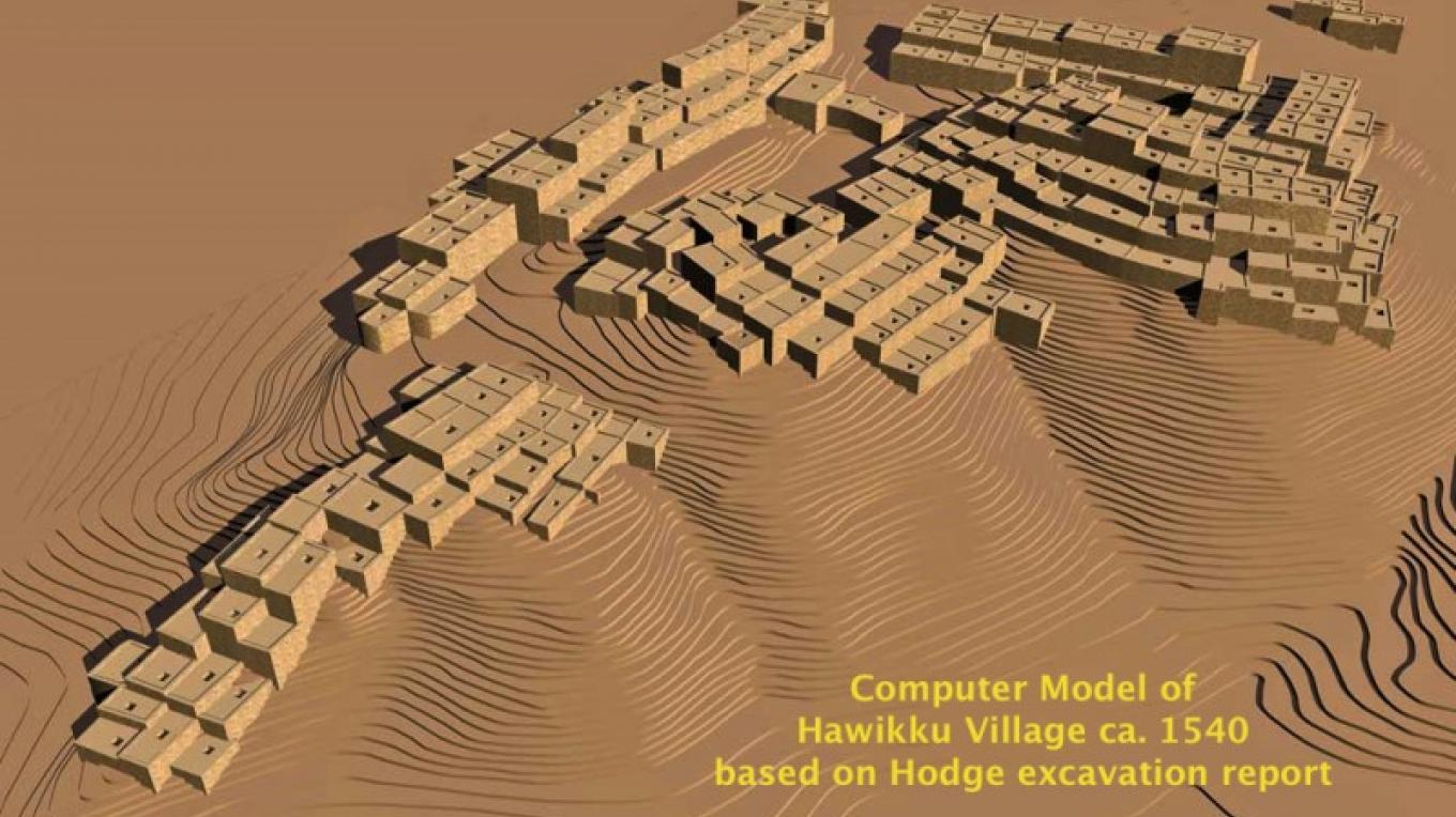
Computer model of Hawikuh based on archaeological findings.
Public Domain. Dennis R. Holloway
Download Original (1360 x 764 pixels, 137.7 KB)
-
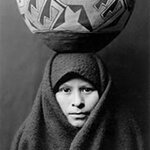
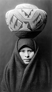
A Zuni woman, c. 1900. The Zuni have always created beautiful pottery – ancient shards of which remain untouched at Hawikuh.
Public Domain. Library of Congress
Download Original (182 x 320 pixels, 24.6 KB)