
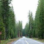
Volcanic Legacy Scenic Byway
All Photos (108)
-
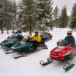
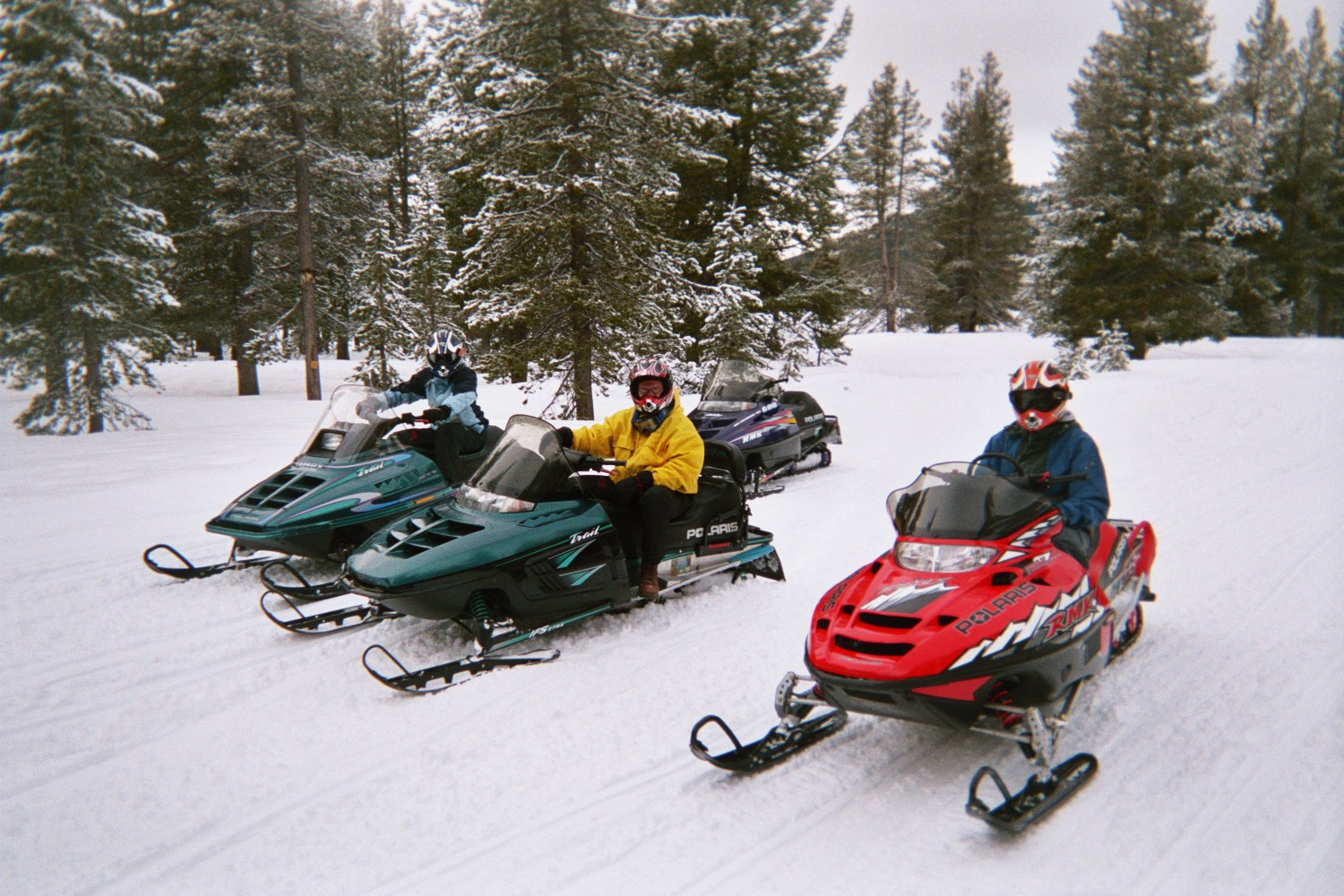
A trio of snowmobile riders enjoy well-groomed trails near Volcanic Legacy Scenic Byway.
Public Domain.
Download Original (1500 x 1000 pixels, 450.9 KB)
-
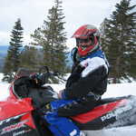
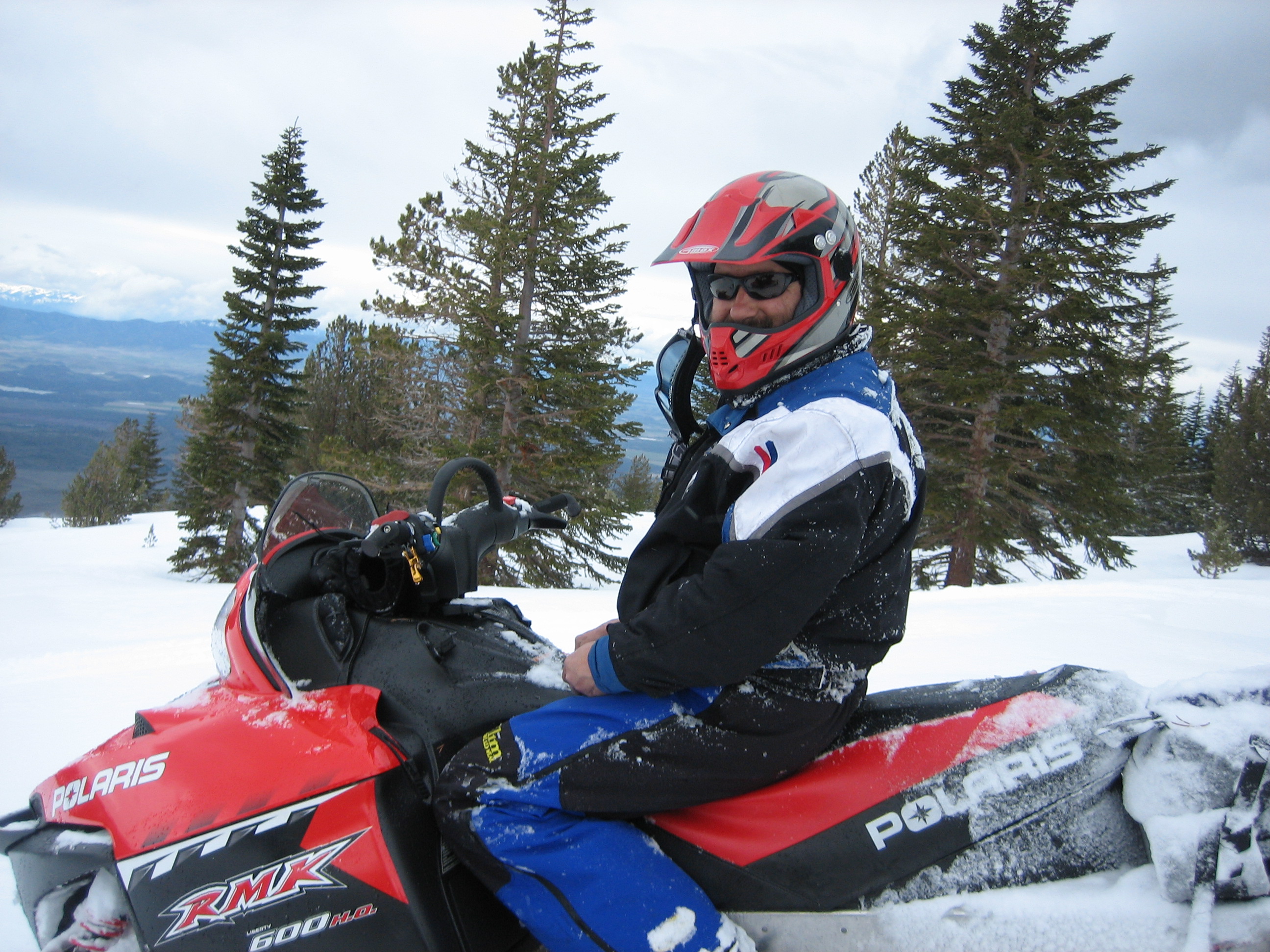
A snowmobile guide along Volcanic Legacy Scenic Byway invites travelers to enjoy a perfect day on the snow.
Public Domain. Courtesy of the Fun Factory in Deer Mountain Snowmobile Park
Download Original (2592 x 1944 pixels, 1424.3 MB)
-

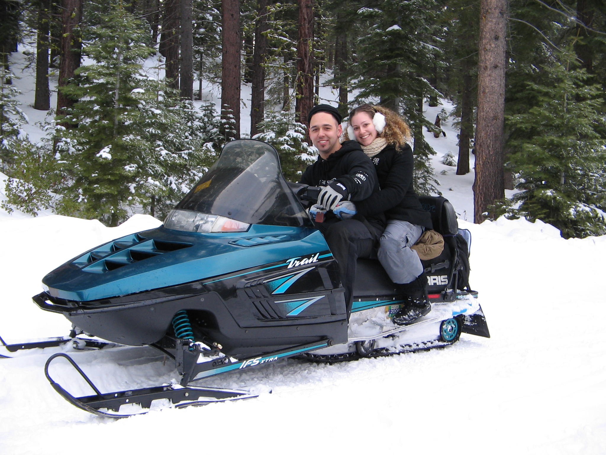
A young couple takes advantage of groomed snow and a great machine to snowmobile together along the Volcanic Legacy Scenic Byway.
Public Domain. Courtesy of the Fun Factory in Deer Mountain Snowmobile Park
Download Original (2048 x 1536 pixels, 453.9 KB)
-

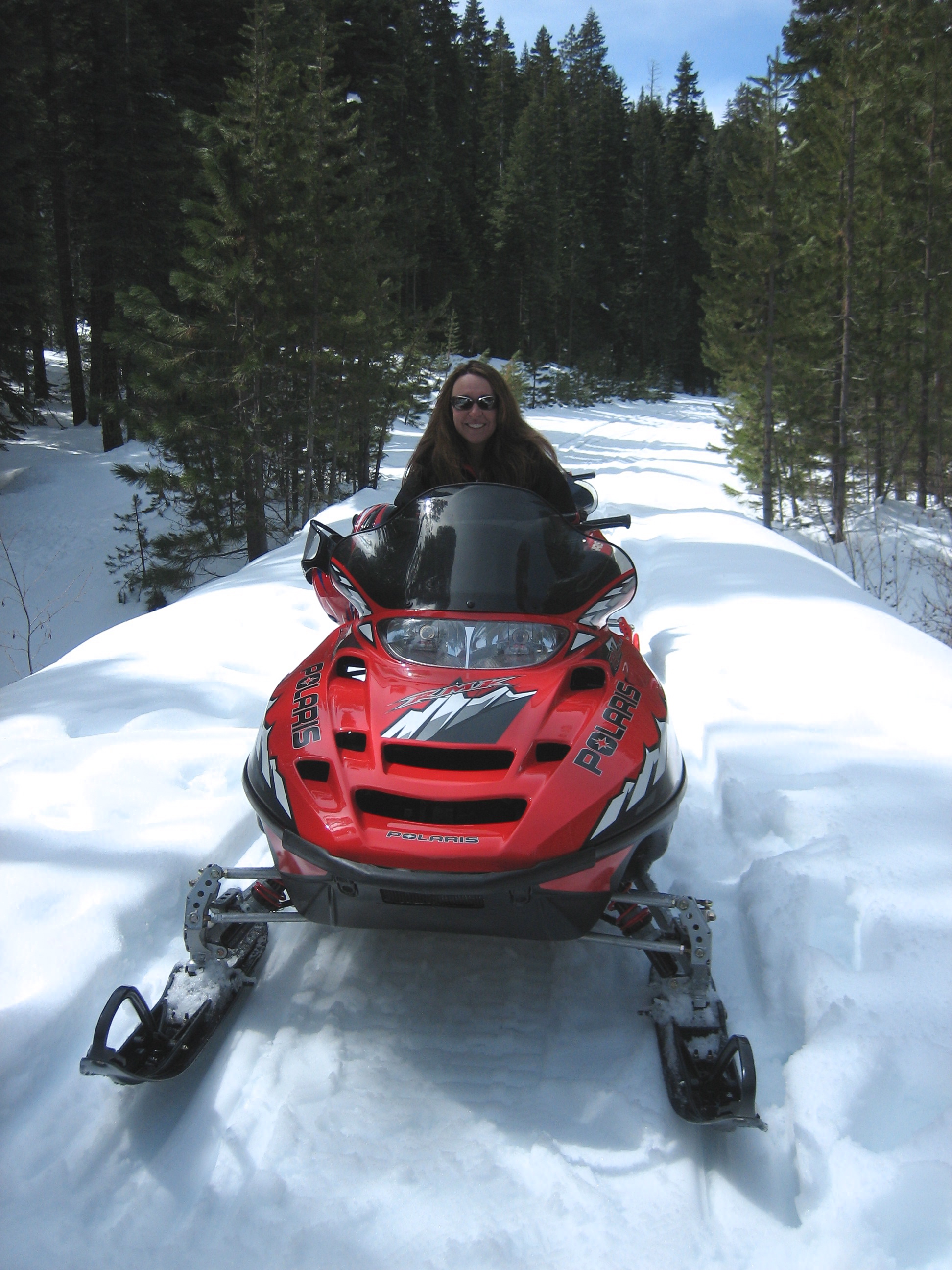
Tight curves through tall conifers provide a great afternoon ride for this snowmobile rider.
Public Domain. Courtesy of the Fun Factory in Deer Mountain Snowmobile Park
Download Original (1944 x 2592 pixels, 1455.8 MB)
-
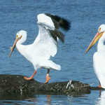
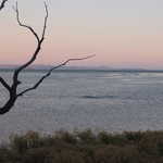
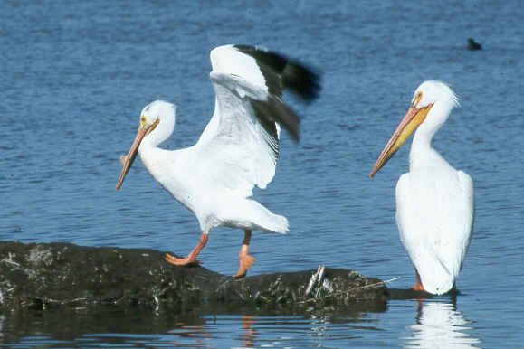
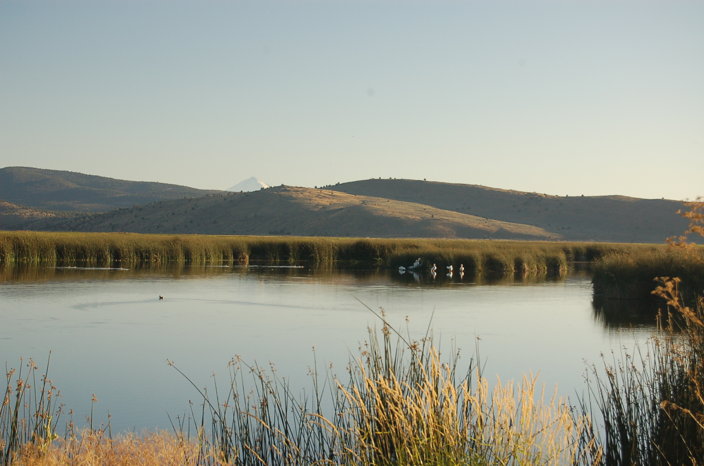
Two pelicans fish for food at the edge of Pyramid Lake.
Public Domain. Photo Courtesy of USFWS
Download Original (579 x 386 pixels, 24.4 KB)
-
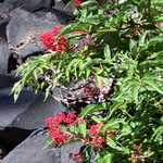
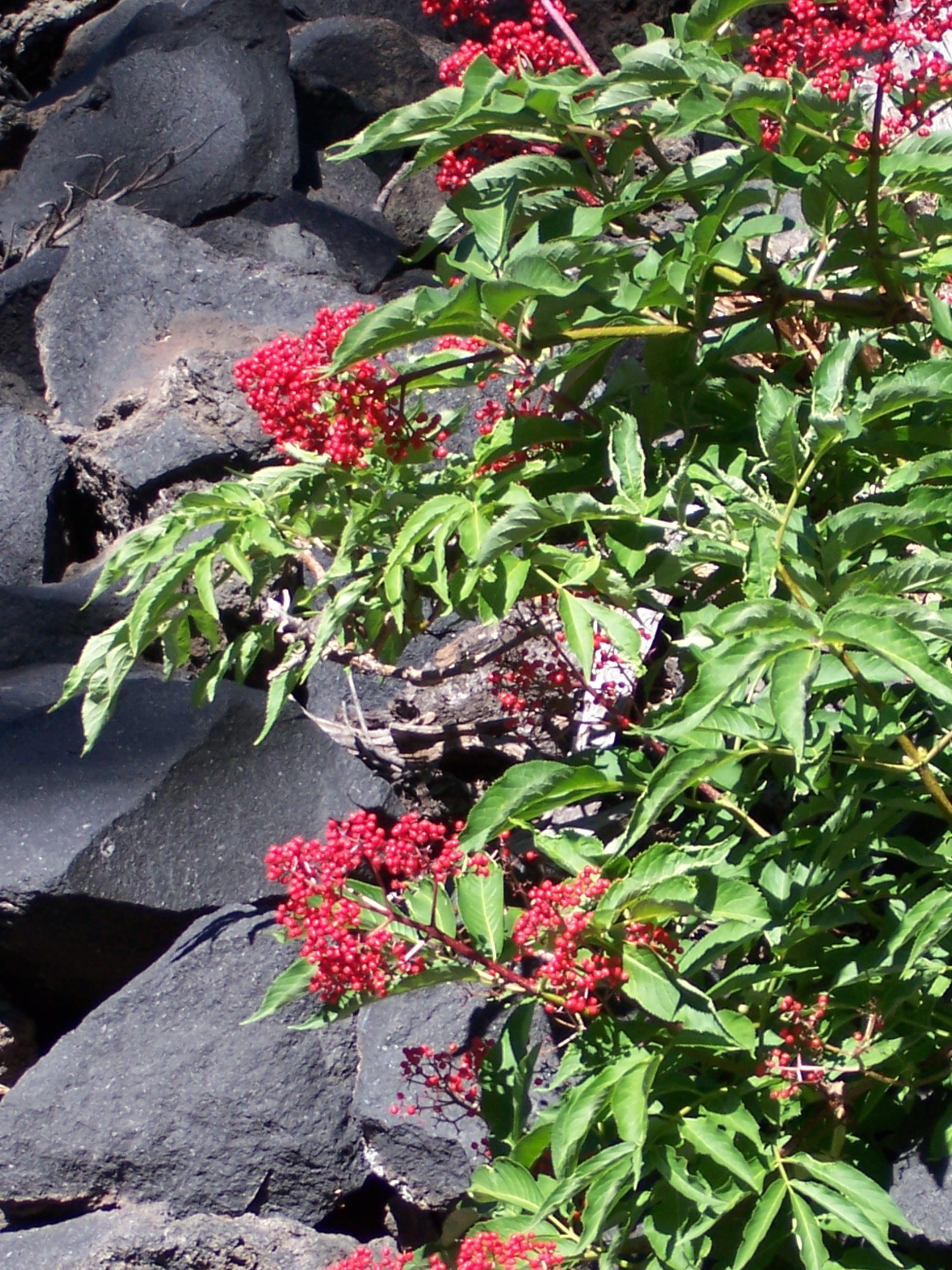
A bush with red berries grows on the rocky shoreline of Crater Lake in Crater Lake National Park.
© August 2006 Christina Lilienthal.
Download Original (1932 x 2576 pixels, 1187.1 MB)
-
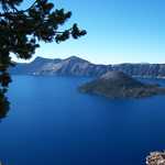
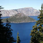
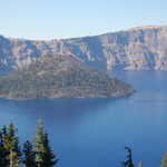
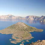
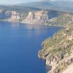
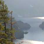
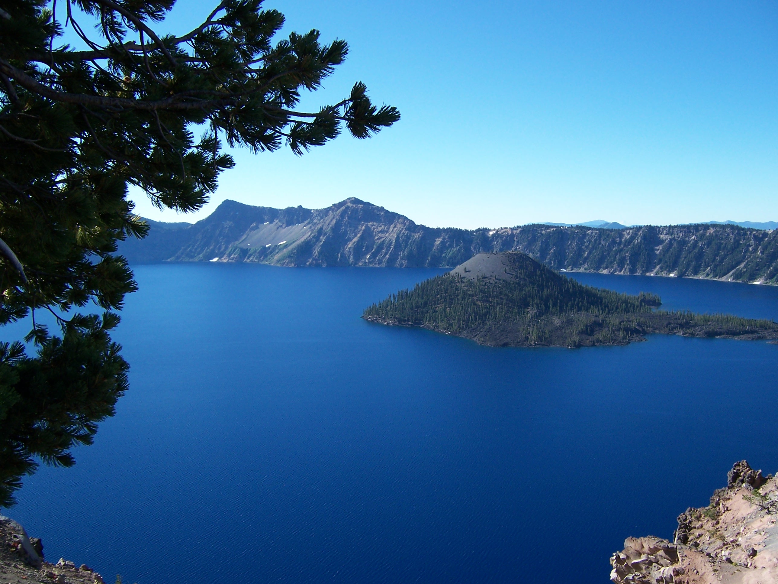
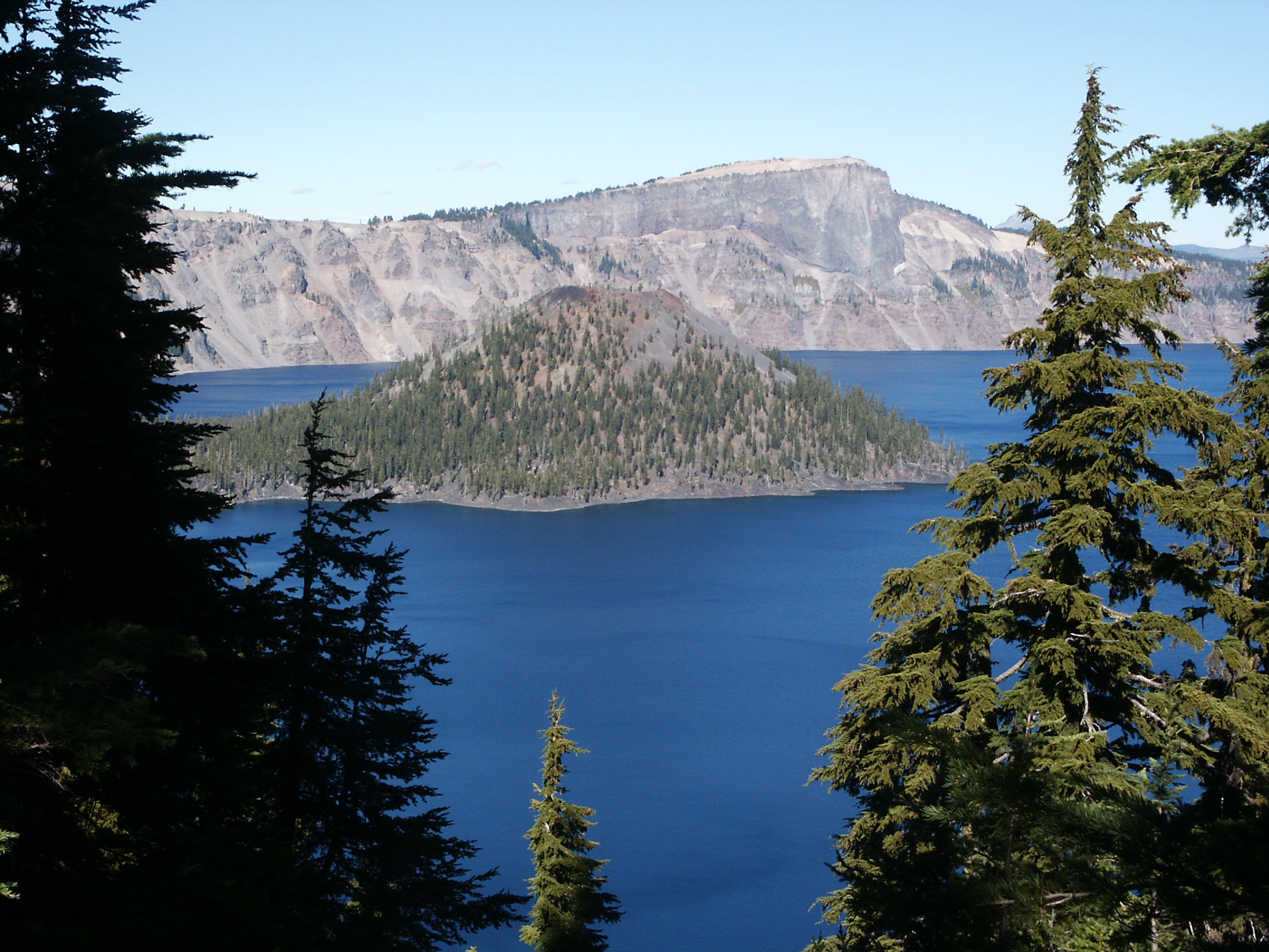
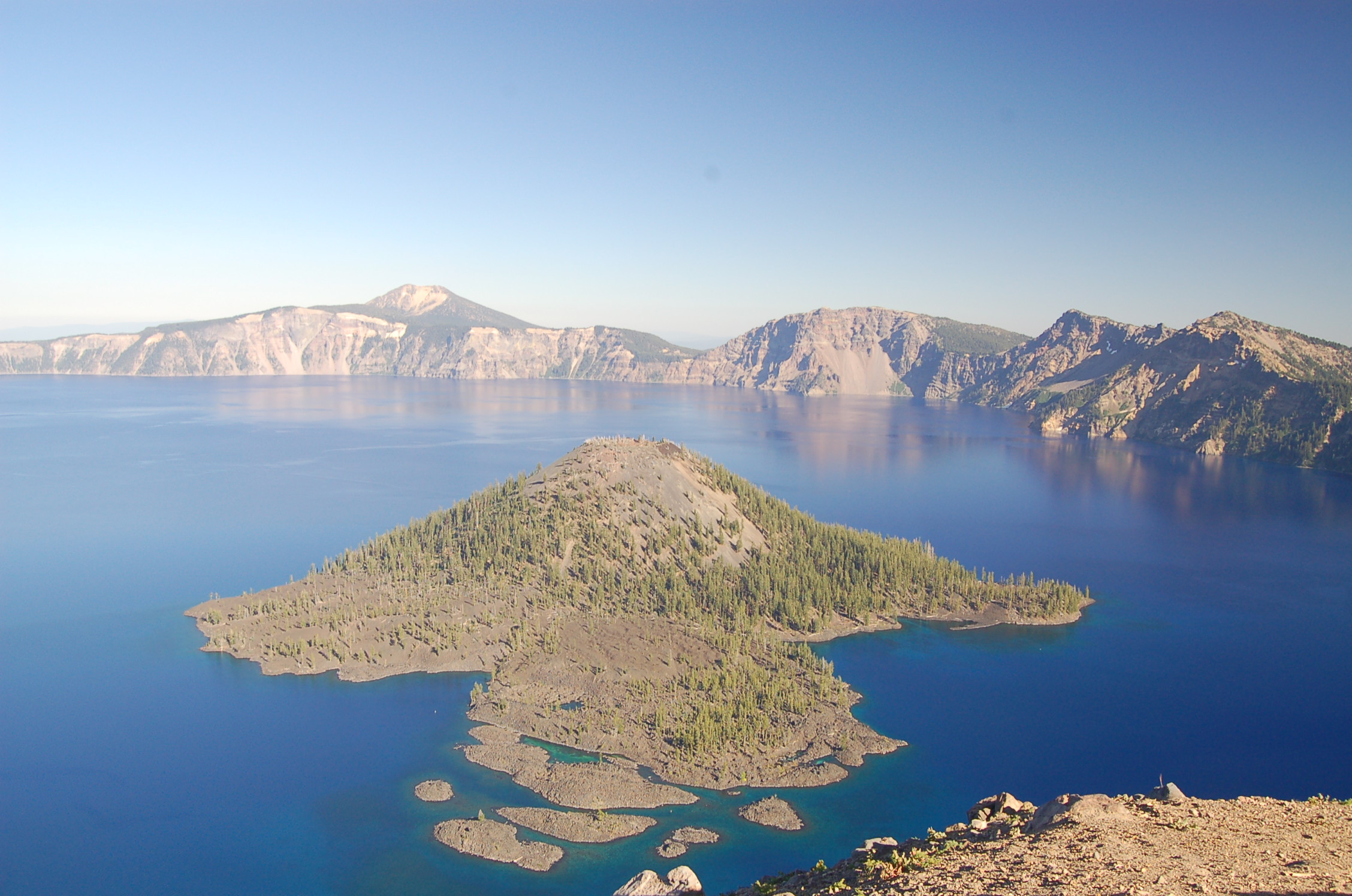
Wizard Island rests placidly on the still blue waters of Crater Lake.
© August 2006 Christina Lilienthal.
Download Original (2576 x 1932 pixels, 943.1 KB)
-
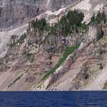
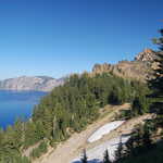
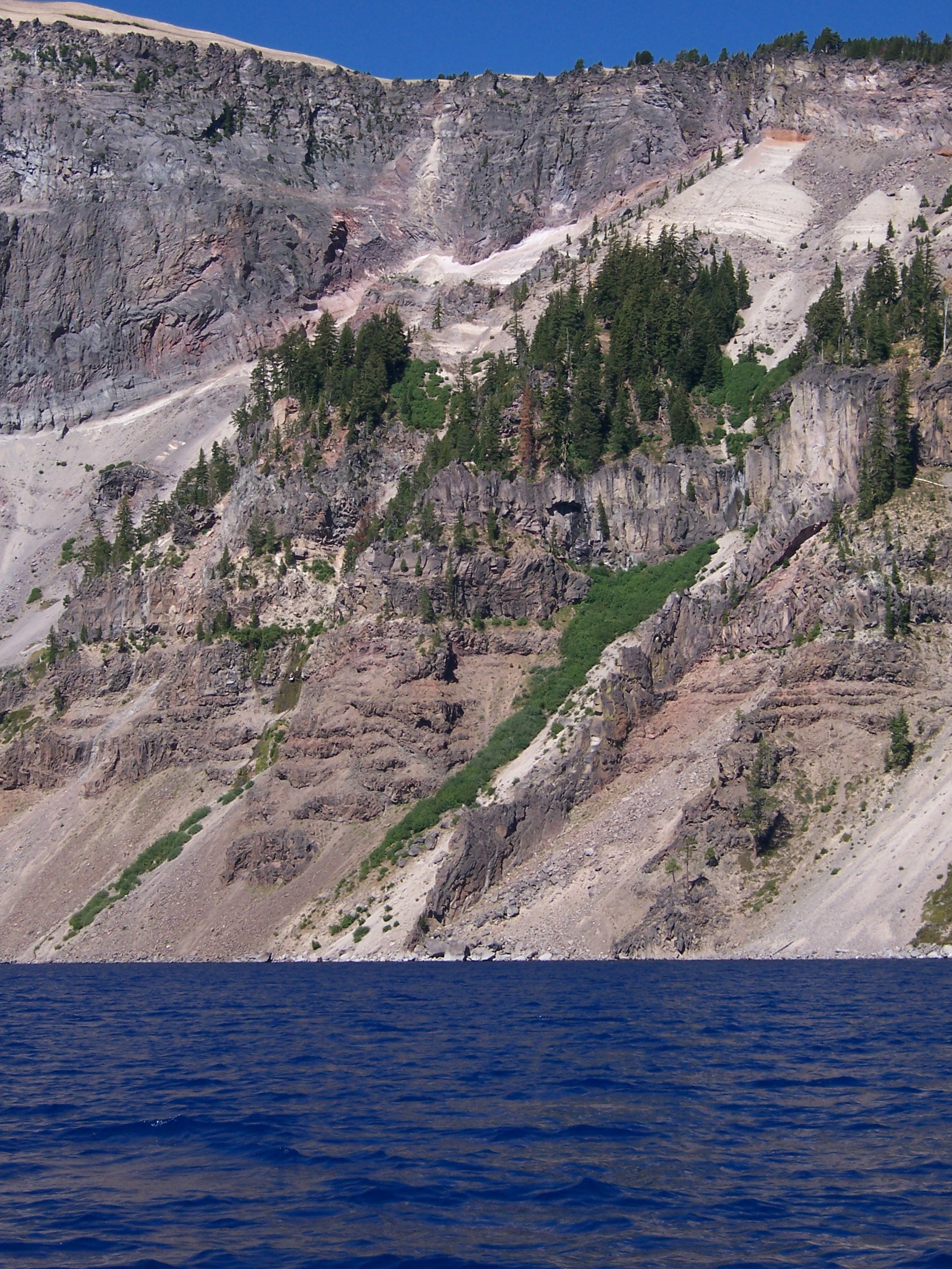
Trees and other plants somehow survive on the steep slopes above Crater Lake inside the caldera.
© August 2006 Christina Lilienthal.
Download Original (1932 x 2576 pixels, 1671.3 MB)
-
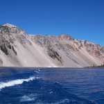
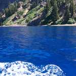
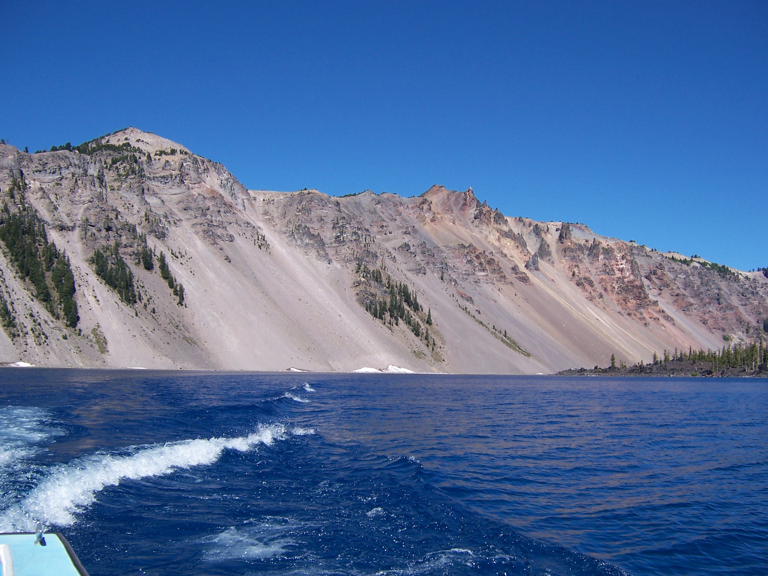
A white wake in blue water curves toward the steeply sloping rocky sides of the Crater Lake caldera.
© August 2006 Christina Lilienthal.
Download Original (2576 x 1932 pixels, 1151.3 MB)
-
A boat's wake makes white waves in the sapphire waters of Crater Lake.
© August 2006 Christina Lilienthal.
Download Original (2576 x 1932 pixels, 1542.4 MB)
-
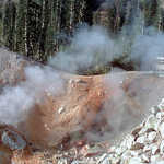
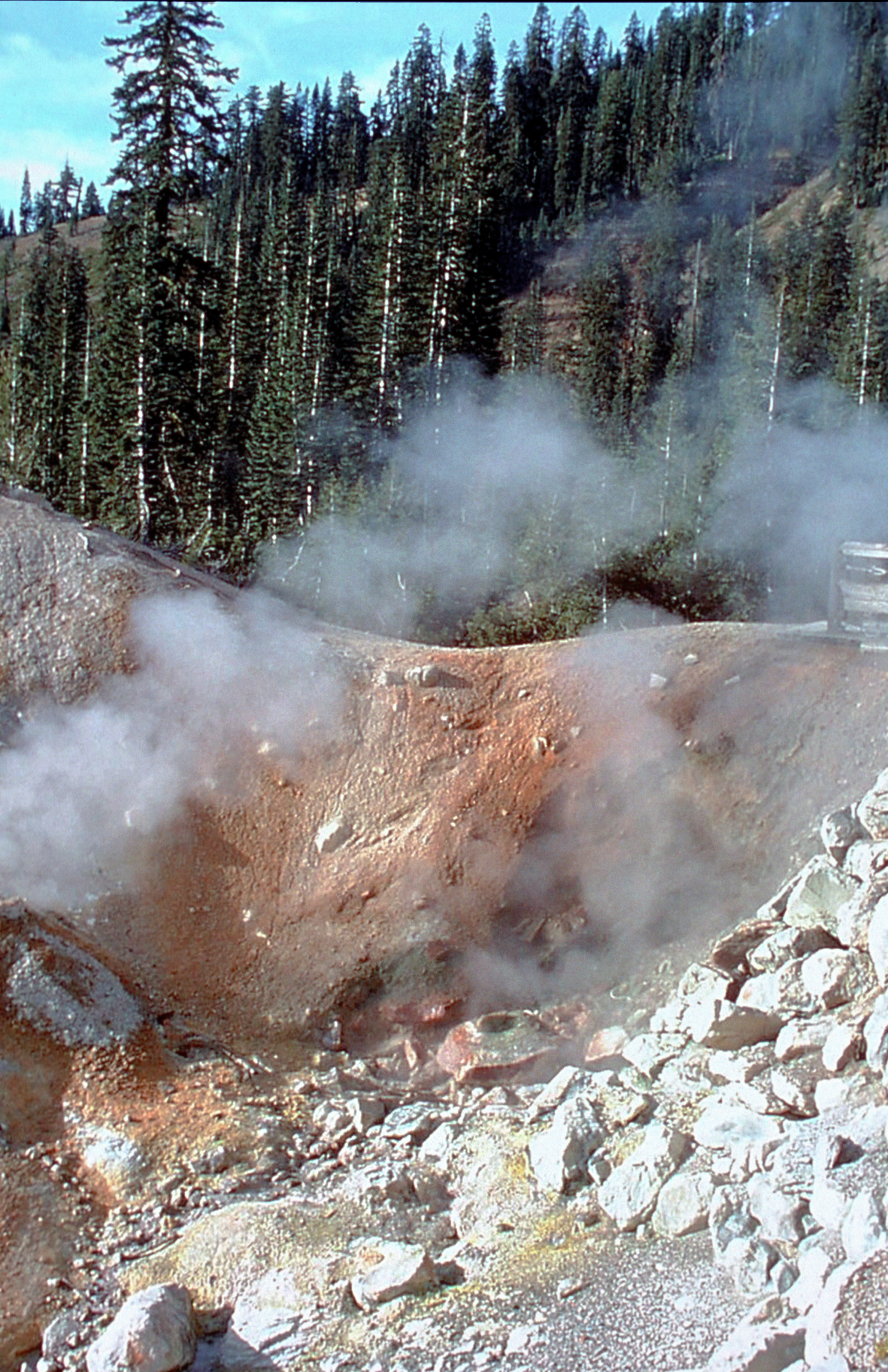
Sulfur Works is thriving with geothermal activity. This area contains sulfur steams, mud pots, and a young dormant volcano. This is just one of the many activities within Lassen National Park. The park also offers over 150 miles of trails, several lakes, 7 campgrounds, one lodge, fishing, bicycling, and backcountry hiking and camping.
Public Domain. Siskiyou County Visitors Bureau, 2001
Download Original (2371 x 3664 pixels, 8015.7 MB)
-
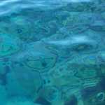
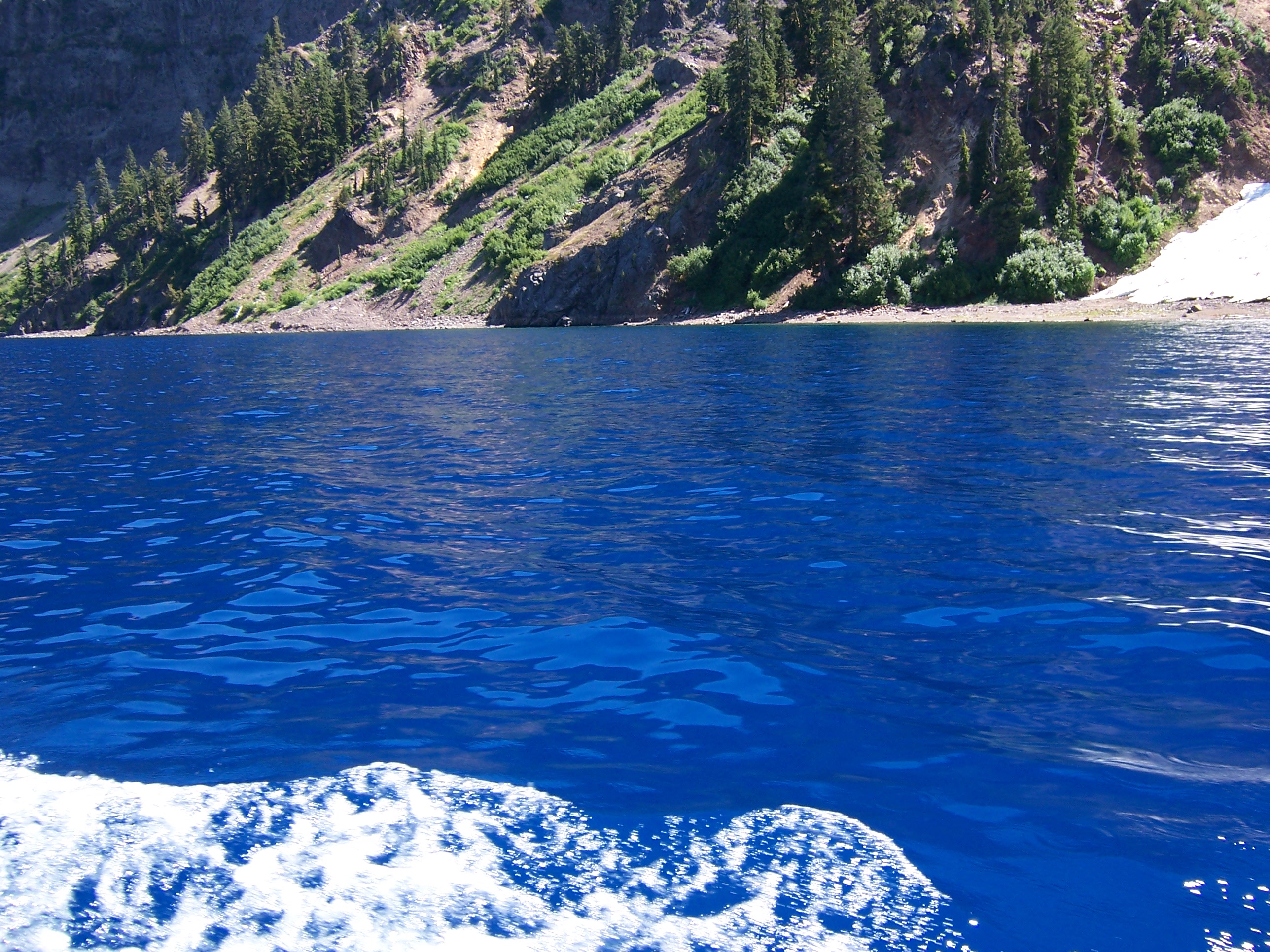
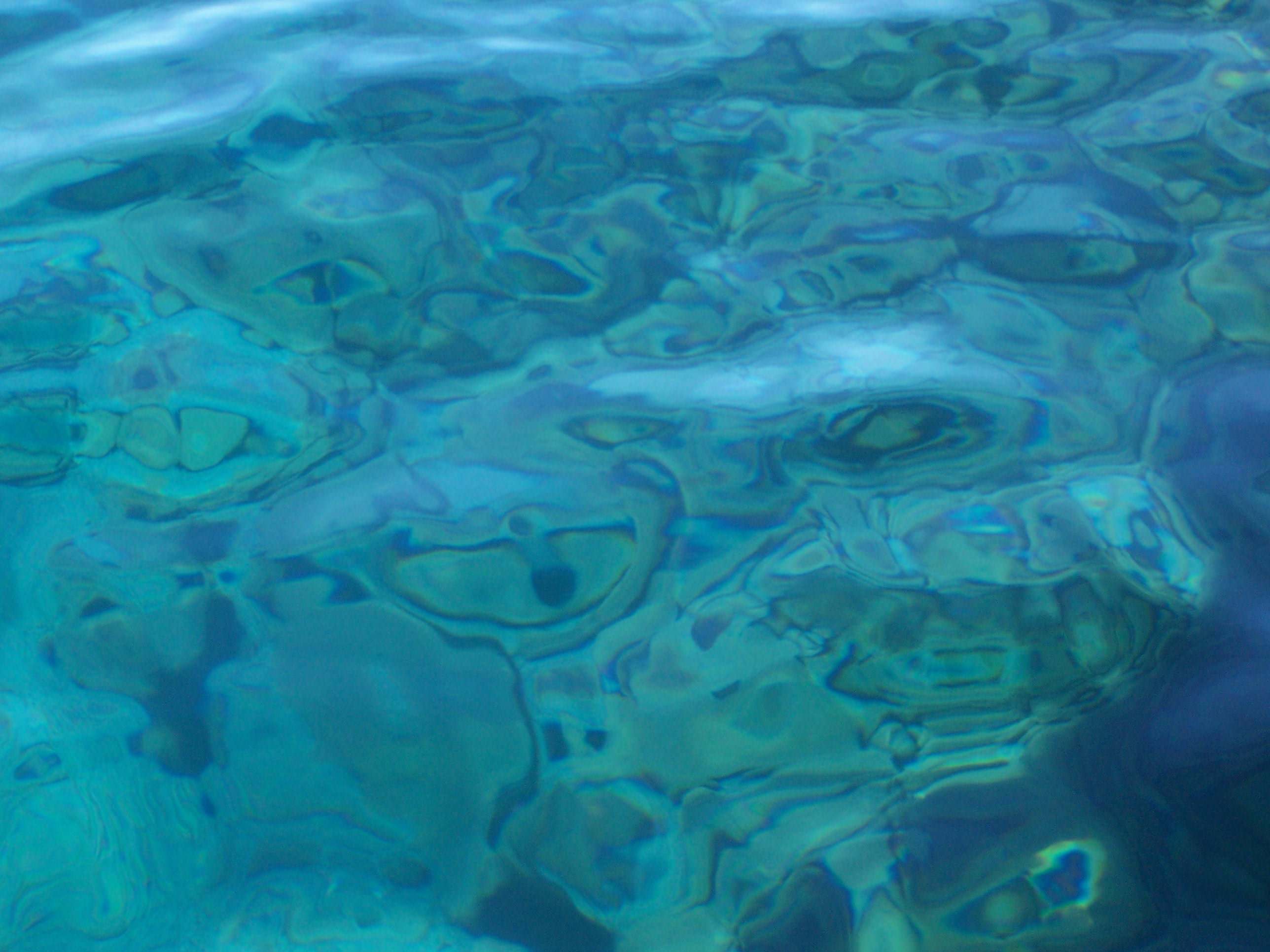
The crystal clear waters of Crater Lake ripple over underlying rocks, creating strange patterns.
© August 2006 Christina Lilienthal.
Download Original (2576 x 1932 pixels, 706.2 KB)
-
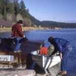
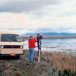
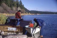
Some boaters prepare for a trip on the clear blue waters of Upper Klamath Lake.
© 1999 Donna Ikenberry.
Download Original (190 x 127 pixels, 13.9 KB)
-
From a viewpoint on the rim of the crater, Wizard Island stands out in the middle of Crater Lake.
© November 2004 P. van der Storm.
Download Original (2272 x 1704 pixels, 690.2 KB)
-
Lassen Peak is one of the largest plug dome volcanoes in the world. It is also considered to be one of the most probable areas for renewed volcanic activity in the lower 48 states. Lassen Peak's last erupted in 1914. Lassen Peak is just one of many examples of the Byway's volcanic legacy.
Public Domain. Courtesy of Siskiyou County Visitors Bureau
Download Original (3640 x 2407 pixels, 7084.1 MB)
-

This majestic mountain is not only known for its recreational and scenic value, but also because it draws visitors from all over the world seeking spiritual insight. Native people believed Mount Shasta to be the abode of the Great Spirit.
Public Domain. Caia Cupito and Ore-Cal RC&D
Download Original (3640 x 2311 pixels, 6813.6 MB)
-
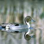
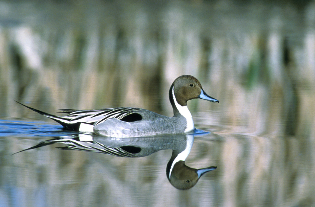
A long pointed tail helps identify this Pintail Duck as it floats across the mirror-smooth water.
Public Domain. USFWS photo by Dave Menke
Download Original (1050 x 692 pixels, 263.9 KB)
-

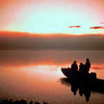
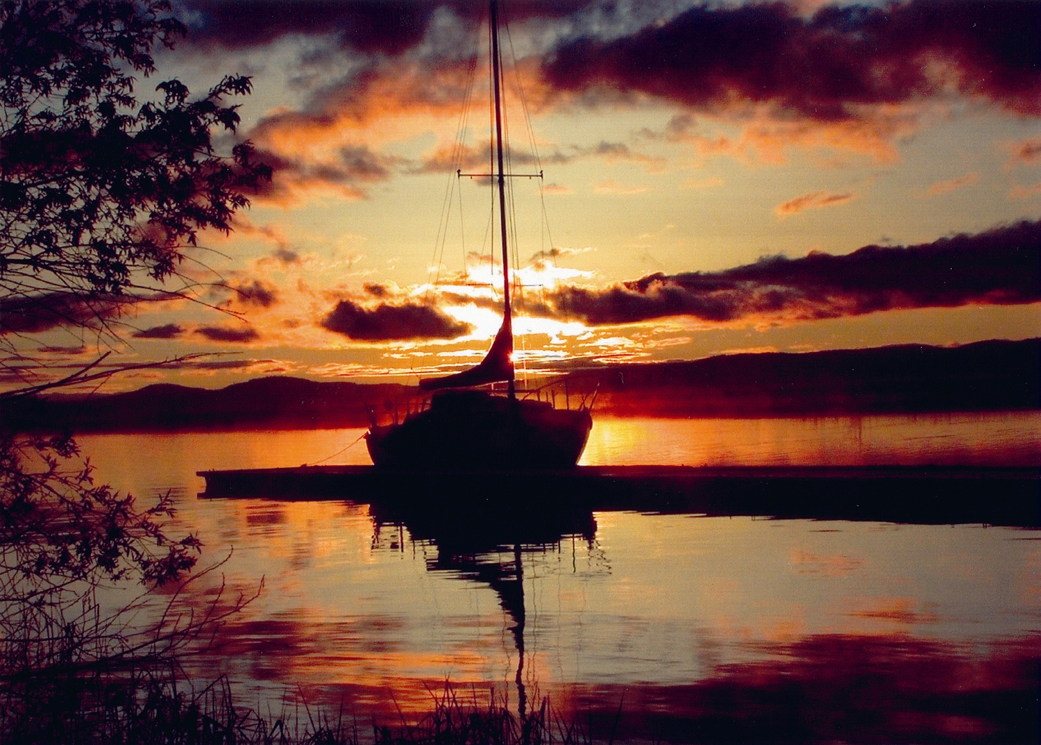
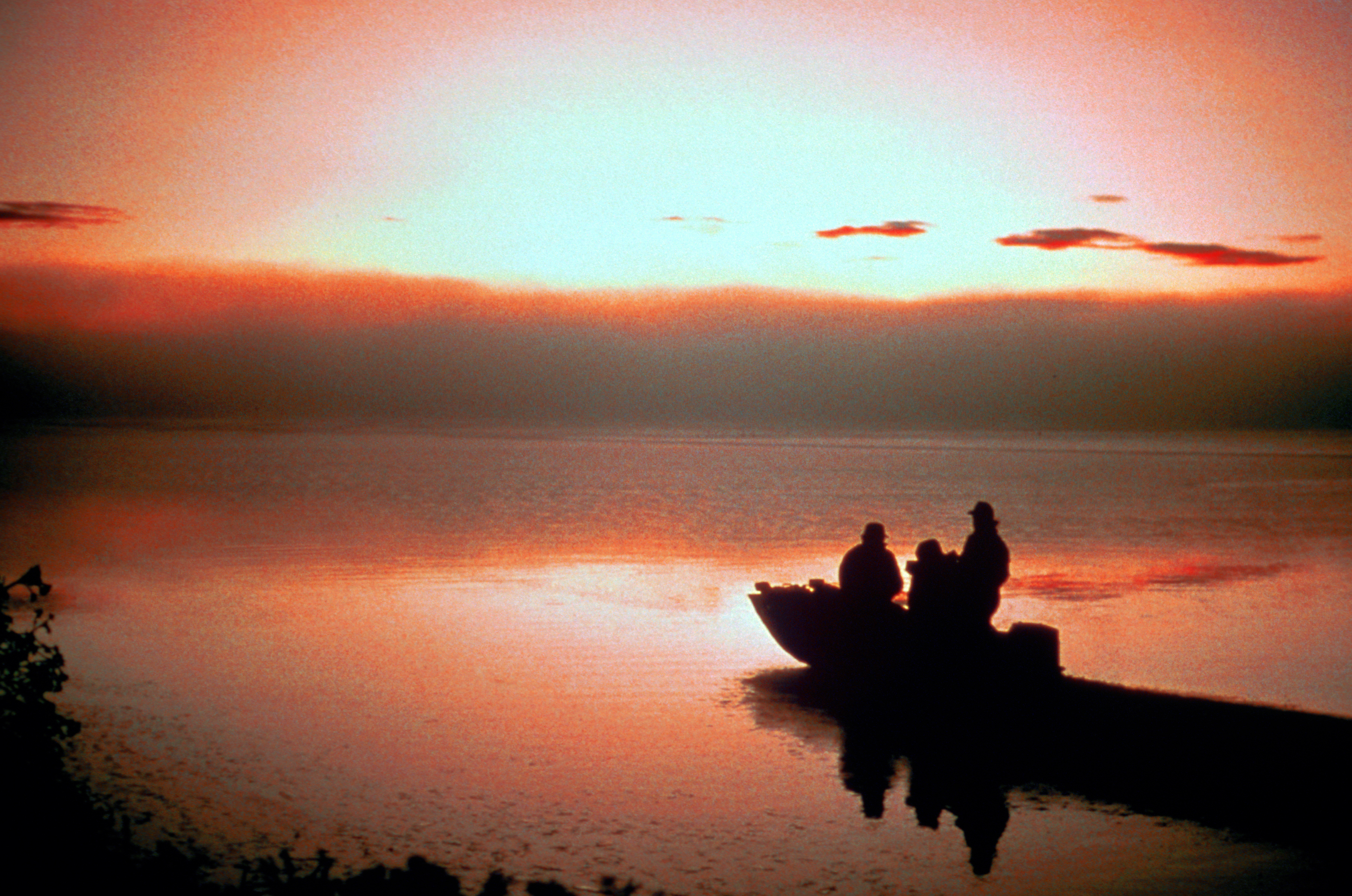
Silhouetted against the sunset, a sailboat awaits another fine day of sailing on Upper Klamath Lake in Oregon.
Public Domain.
Download Original (1500 x 1073 pixels, 1377.1 MB)
-
A walk through Captain Jack's Stronghold is a unique experience. The spirit of the Modoc people can still be felt. The traditional culture of many people was lost here, yet a modern culture of their descendants still survives. The spirituality of the Modoc culture permeates the whole region and captures the hearts of many visitors, calling them back year after year.
Public Domain. National Park Service, 1992
Download Original (3568 x 2377 pixels, 7531.0 MB)
-
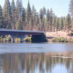
The Topsy Bridge now crosses the Klamath River west of Keno, Oregon, near where settlers once crossed on the Applegate Trail.
Public Domain. Photo by A. E. Crane
Download Original (2256 x 1496 pixels, 909.9 KB)
-
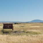
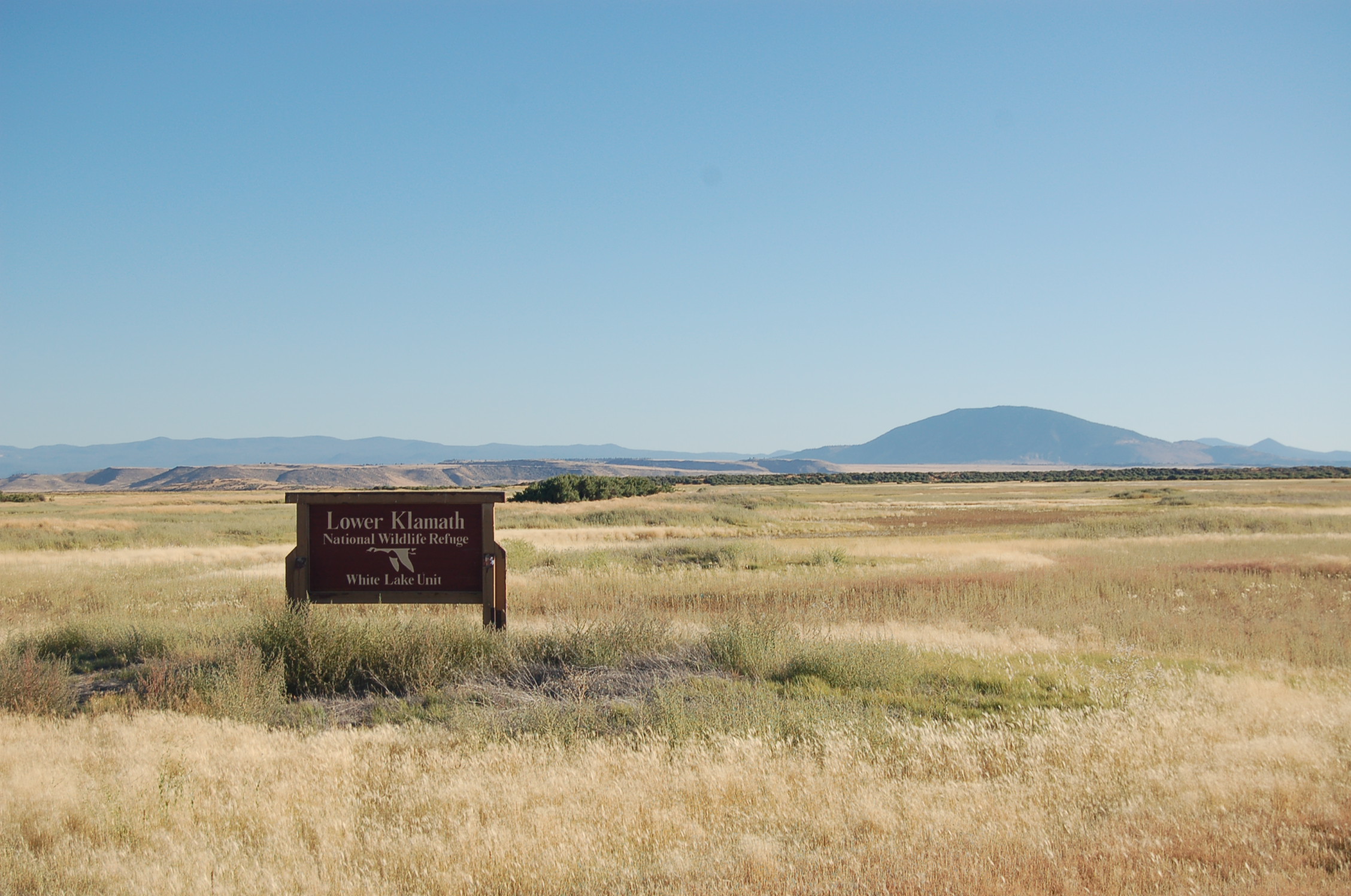
In September, dry grasses coat the fields of the Lower Klamath National Wildlife Refuge's White Lake Unit just south of Stateline Road in California.
Public Domain. Photo by A. E. Crane
Download Original (2256 x 1496 pixels, 712.5 KB)
-
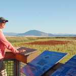
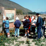
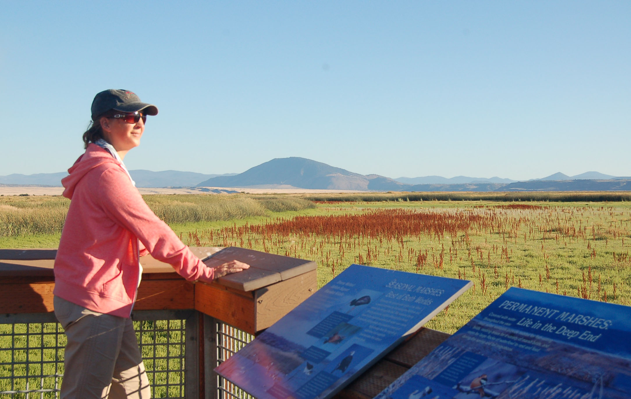
A visitor to Lower Klamath National Wildlife Refuge in California looks out from a wildlife viewing station.
Public Domain. Photo by A. E. Crane
Download Original (2169 x 1374 pixels, 380.9 KB)
-
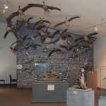
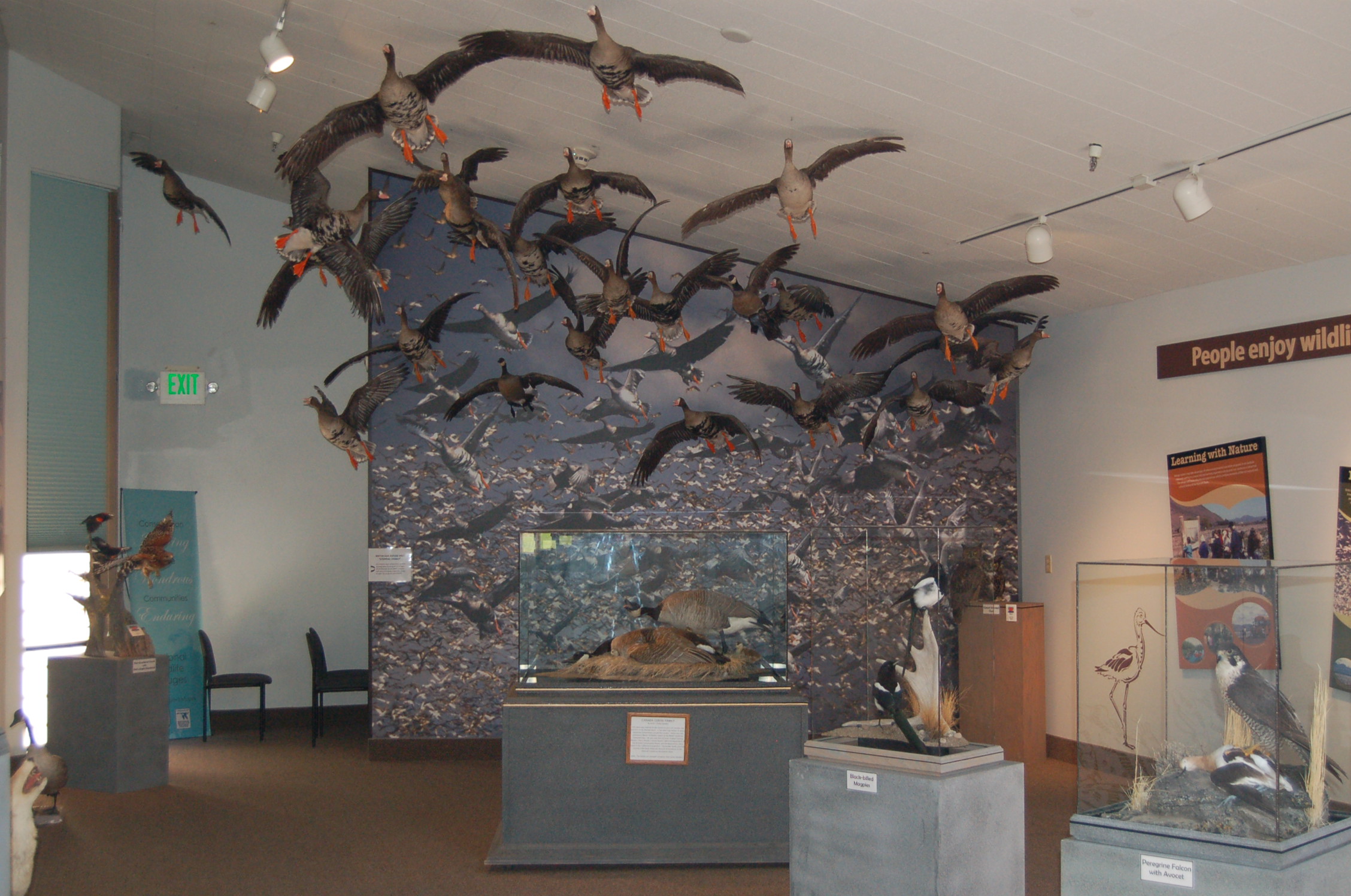
Models of birds appear to fly over the exhibits inside the Klamath Basin Refuges Visitor Center on Hill Road.
Public Domain. Photo by A. E. Crane
Download Original (2256 x 1496 pixels, 741.8 KB)
-
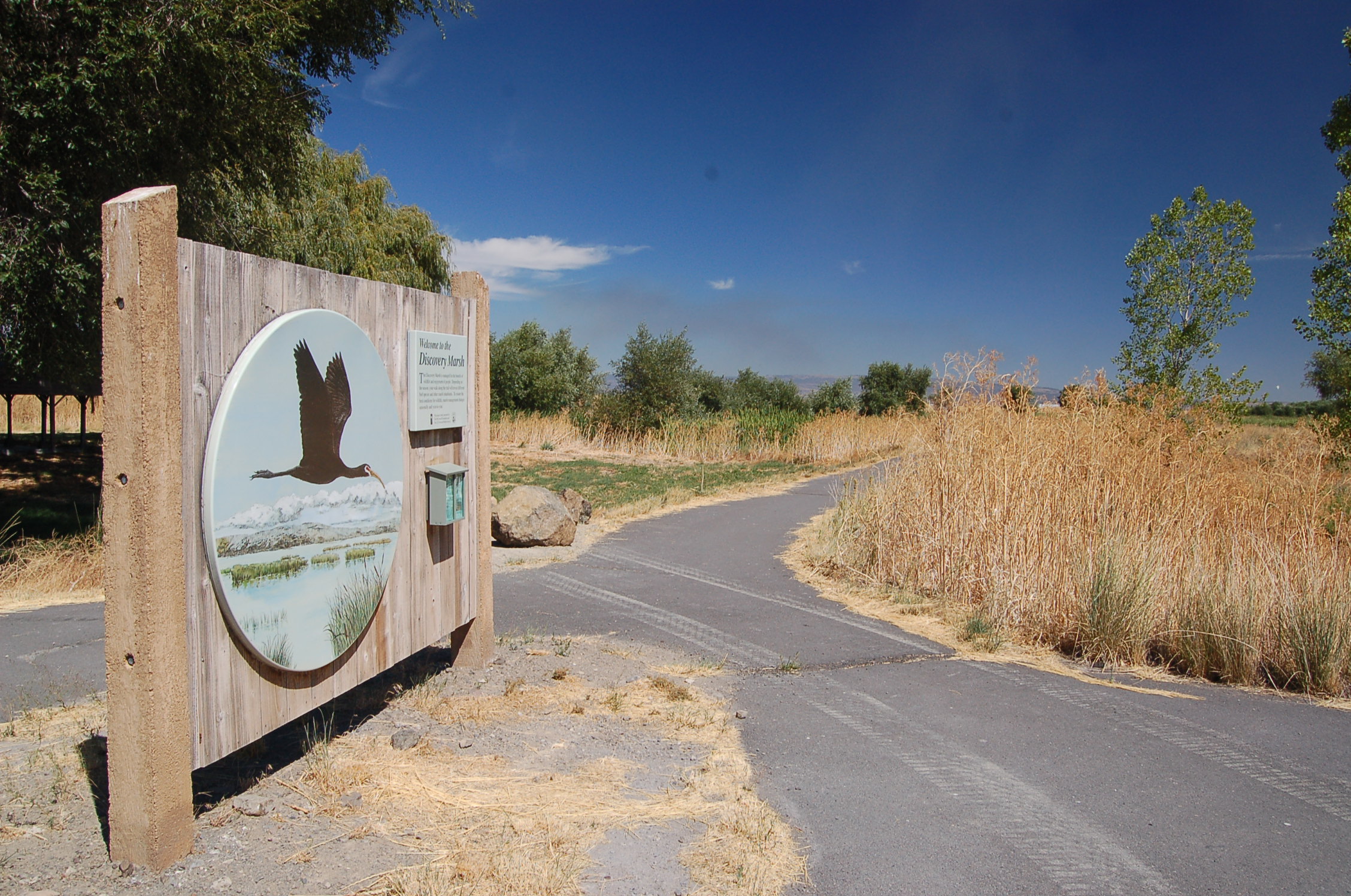
A sign and bin with handouts stand at the trailhead to the Discovery Marsh interpretive trail at the Klamath Basin Visitor Center on Hill Road.
Public Domain. Photo by A. E. Crane
Download Original (2256 x 1496 pixels, 911.8 KB)
-
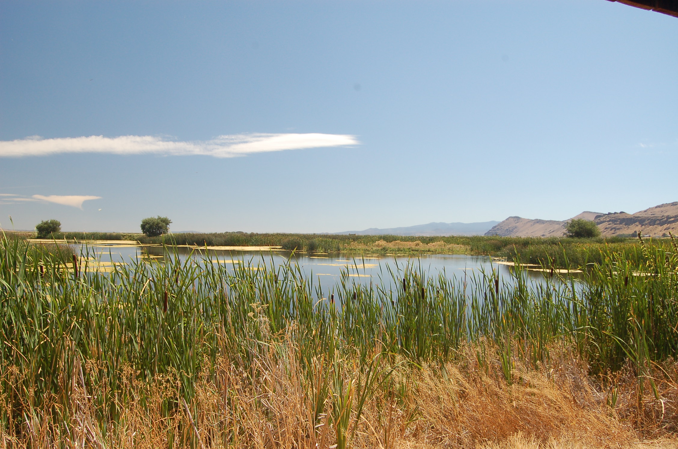
Tall grasses and other wetland plants line the open waters of Discovery Marsh just across the road from the Klamath Basin National Wildlife Refuges Visitor Center on Hill Road.
Public Domain. Photo by A. E. Crane
Download Original (2256 x 1496 pixels, 892.1 KB)
-
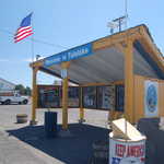
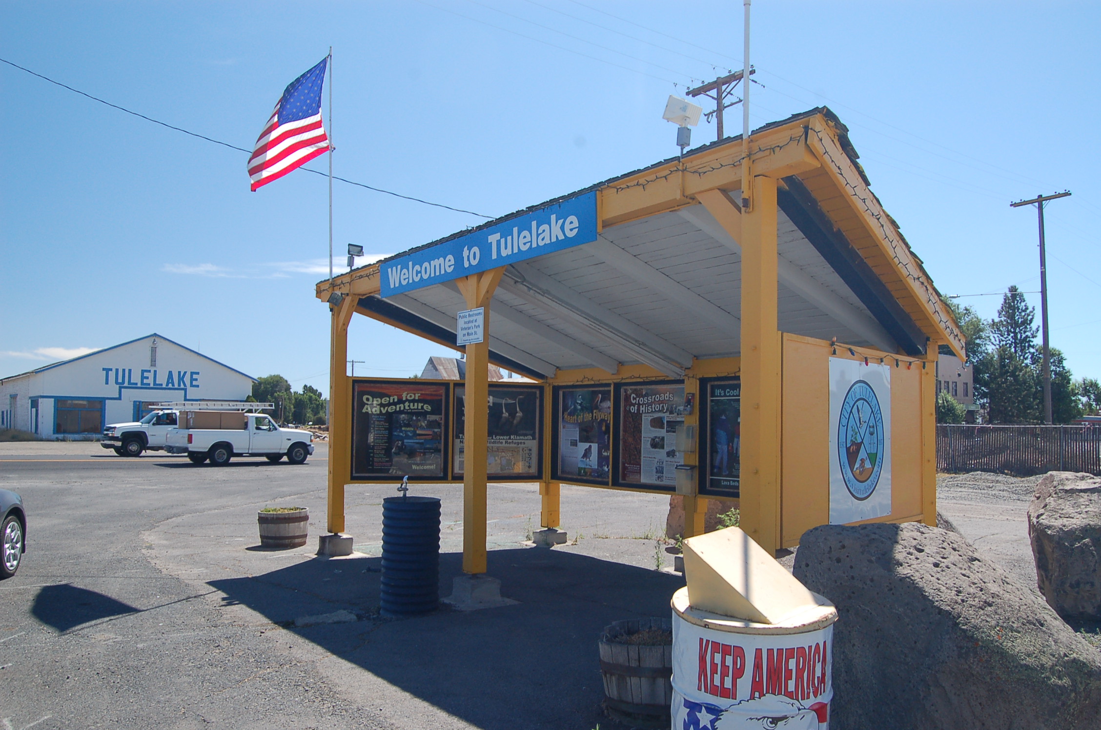
A vibrant yellow visitor kiosk in Tulelake features information about the area's attractions.
Public Domain. Photo by A. E. Crane
Download Original (2256 x 1496 pixels, 758.4 KB)
-
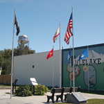
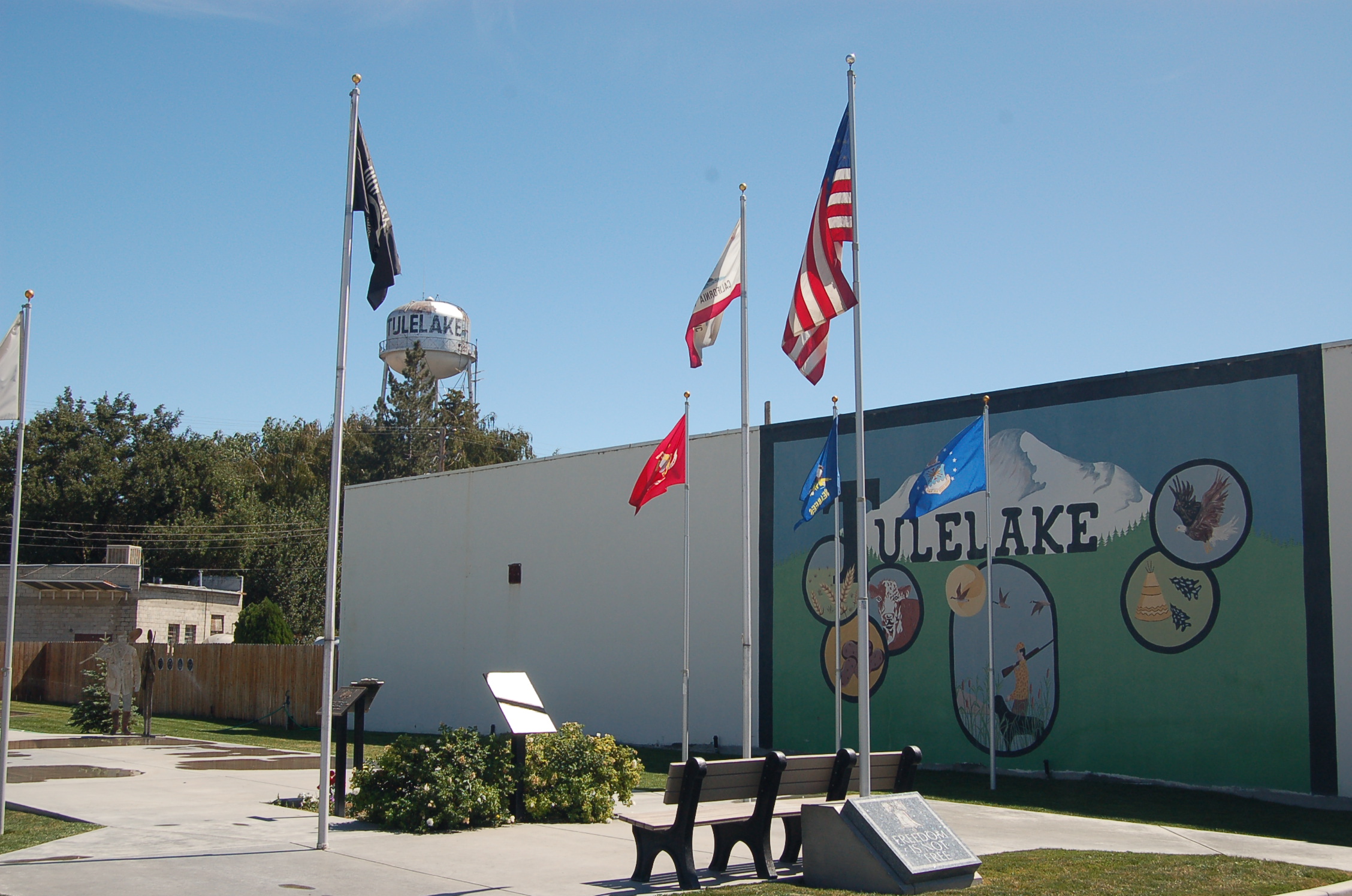
A small park in Tulelake holds memorials to the veterans of foreign wars, as well as flags, a mural, a bench and restrooms.
Public Domain. Photo by A. E. Crane
Download Original (2256 x 1496 pixels, 901.4 KB)
-
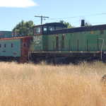
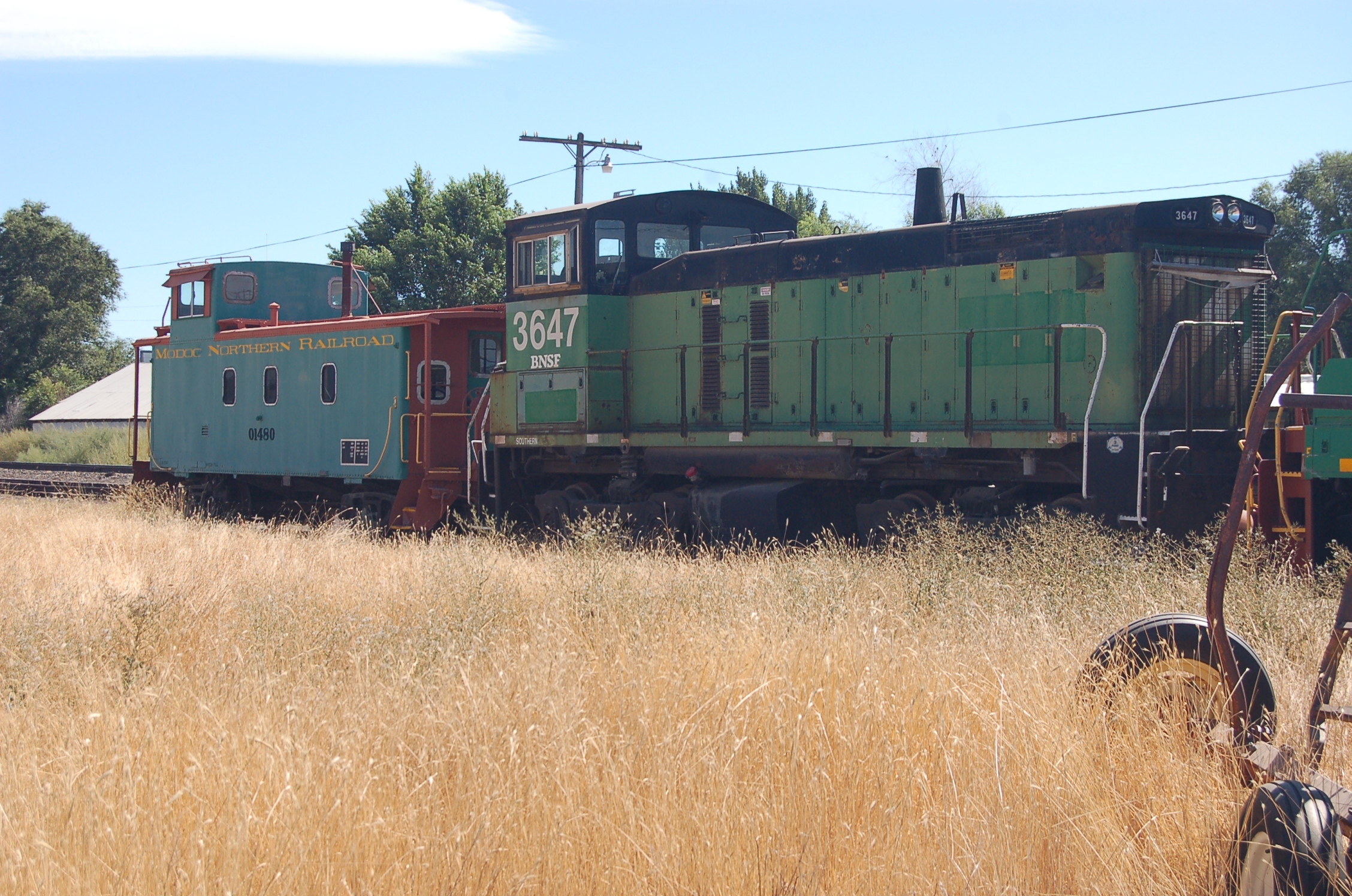
Several green railroad cars with yellow and red trim, possibly a restored caboose and an engine of the Modoc Northern Railroad, stand on tracks beside the highway in the town of Tulelake.
Public Domain. Photo by A. E. Crane
Download Original (2256 x 1496 pixels, 974.1 KB)
-
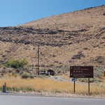
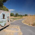
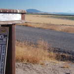
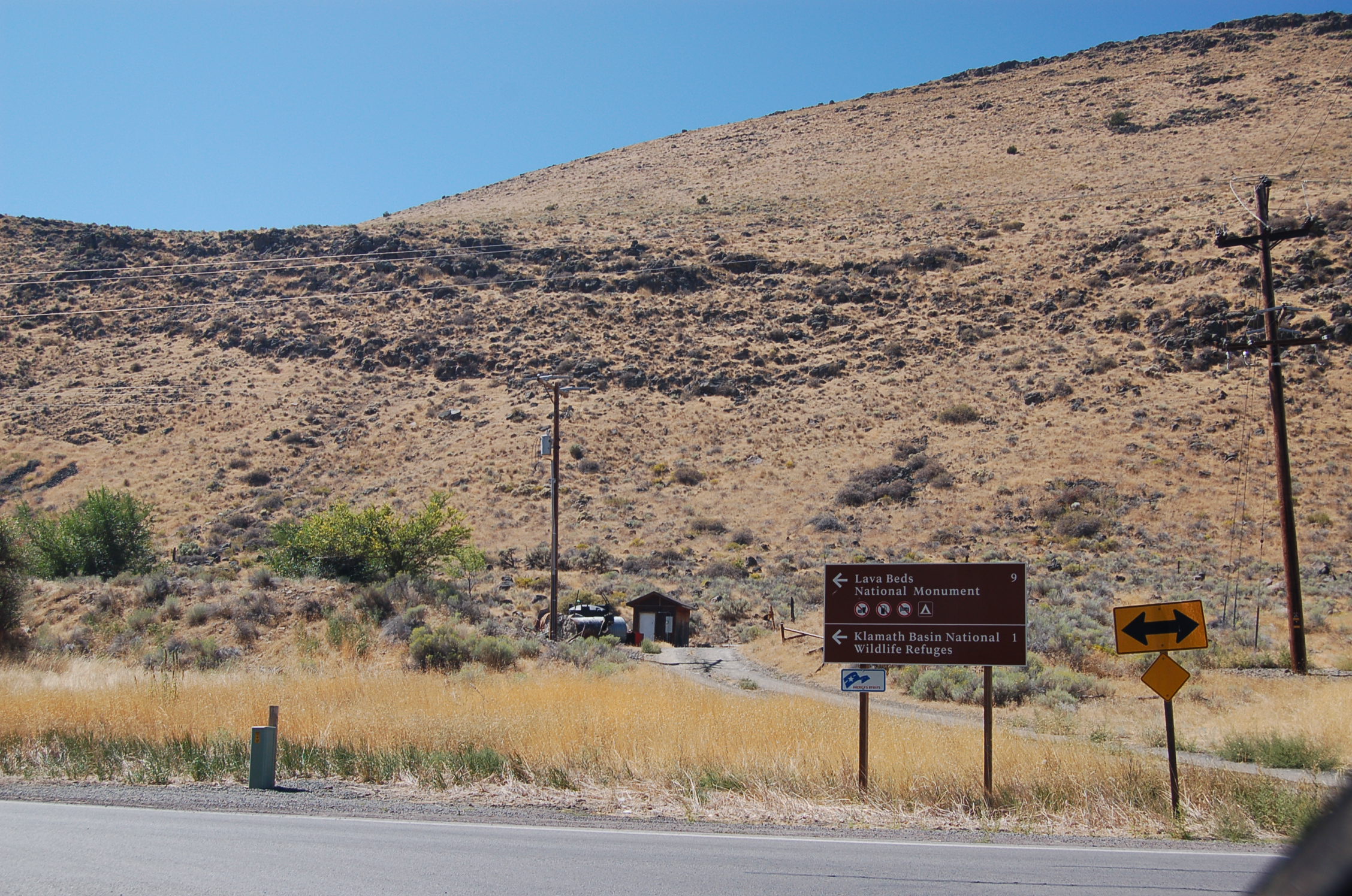
A ridge made of an ancient lava flow rises behind a set of signs directing travelers on the Volcanic Legacy Scenic Byway to Lava Bed National Monument and the Klamath Basin National Wildlife Refuges (namely, its visitor center.) The post also includes an America's Byways roadsign.
Public Domain. Photo by A. E. Crane
Download Original (2256 x 1496 pixels, 917.5 KB)
-
A cluster of pelicans swim away from the Hill Road shoreline of Tule Lake National Wildlife Refuge at dusk.
Public Domain. Photo by A. E. Crane
Download Original (2256 x 1496 pixels, 773.9 KB)
-
A visitor marvels at the striated mountain that forms Petroglyph Point.
© August 2011 A. E. Crane.
Download Original (2256 x 1496 pixels, 938.2 KB)
-
The rock formation known as 'The Peninsula' rises above the dry landscape of southern Oregon, as seen from the top of Petroglyph Point in Lava Beds National Monument. A car is parked at the trailhead on the road below.
Public Domain. Photo by A. E. Crane
Download Original (2256 x 1496 pixels, 806.5 KB)
-
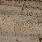
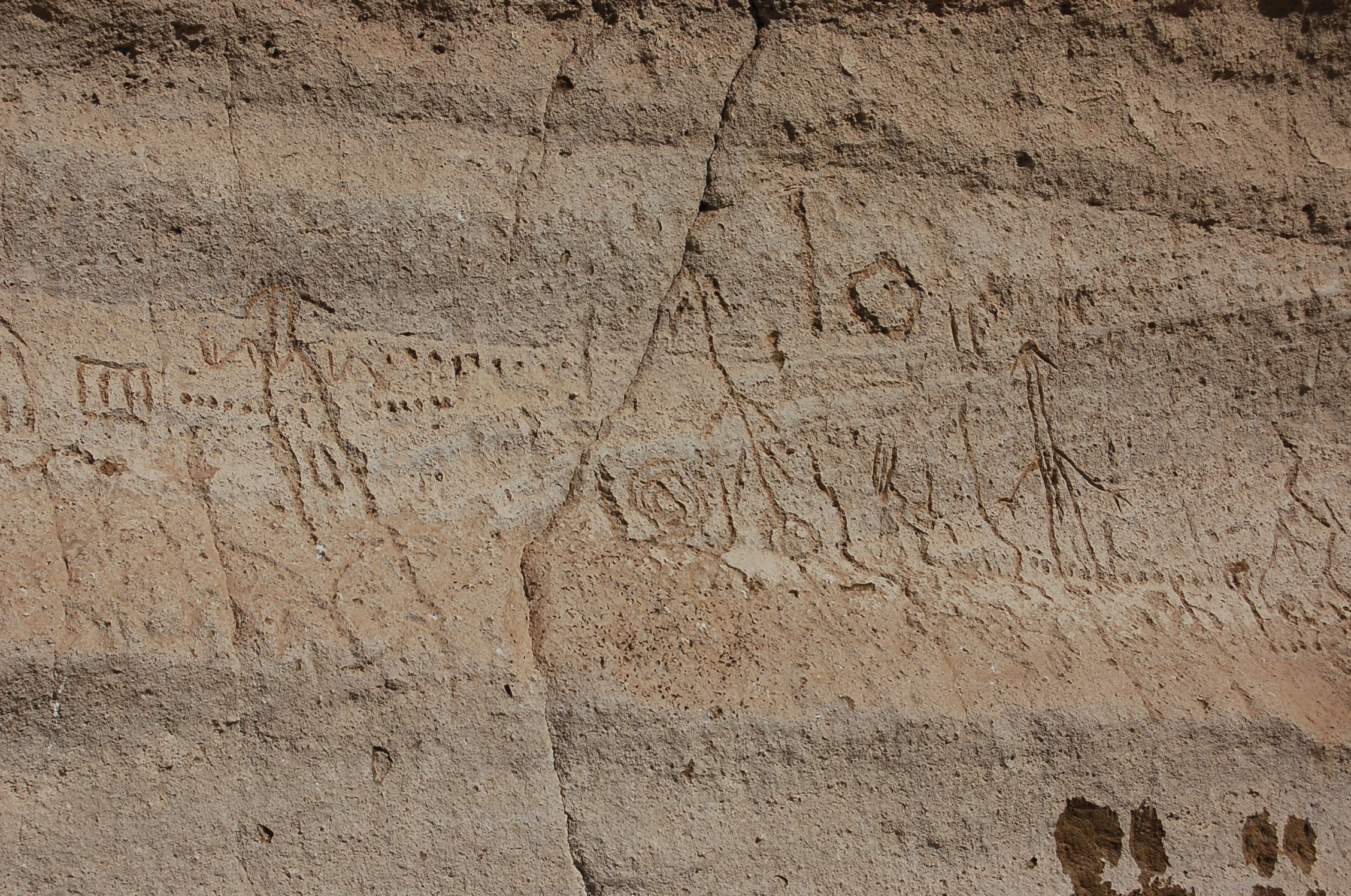
Elaborate geometric designs and manlike figures line the base of Petroglyph Point in Lava Beds National Monument.
Public Domain. Photo by A. E. Crane
Download Original (2256 x 1496 pixels, 954.8 KB)
-
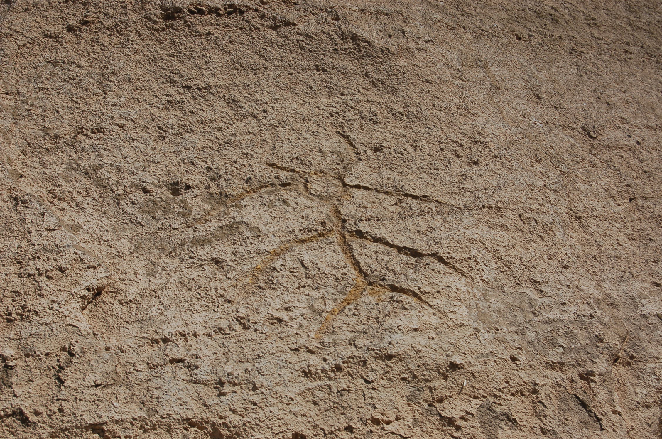
A man-like figure with what looks like a spear through its head is one of the curious and intriguing petroglyphs at Petroglyph Point in Lava Beds National Monument.
Public Domain. Photo by A. E. Crane
Download Original (2256 x 1496 pixels, 967.7 KB)
-
A woman looks closely at the lava rock walls of Skull Cave in Lava Beds National Monument. The height of this segment of Skull Cave is a result of three lava tubes having collapsed into one huge cave. This cave contains year-round ice deposits within its depths.
© August 2011 A. E. Crane.
-
Jumbled black lava forms the aptly-named "Devil's Homestead" section of Lava Beds National Monument.
Public Domain. Photo by A. E. Crane
Download Original (2256 x 1496 pixels, 920.9 KB)
-
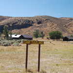
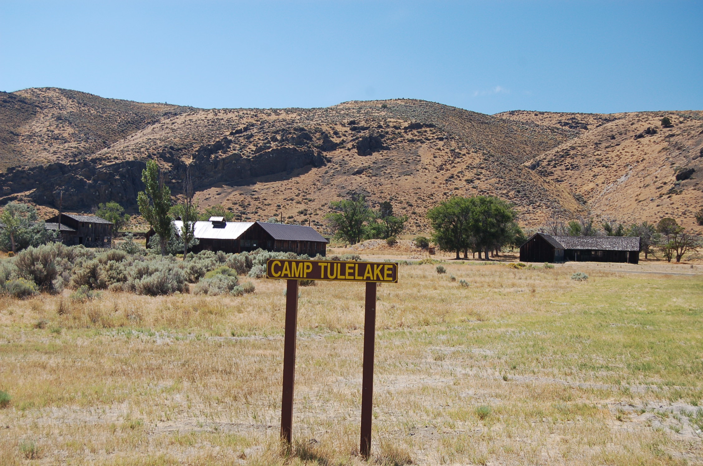
Several wooden buildings next to Hill Road west of Tulelake are part of the Tulelake Segregation Center where "disloyal" American citizens of Japanese descent were kept separate from the main Tulelake Internment Center in Newell during World War II in 1943. This site also housed CCC volunteers during the Depression, and Italian and German P.O.W.s from 1944-1946.
Public Domain. Photo by A. E. Crane
Download Original (2256 x 1496 pixels, 921.2 KB)
-
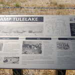
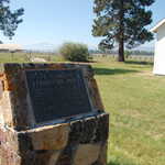
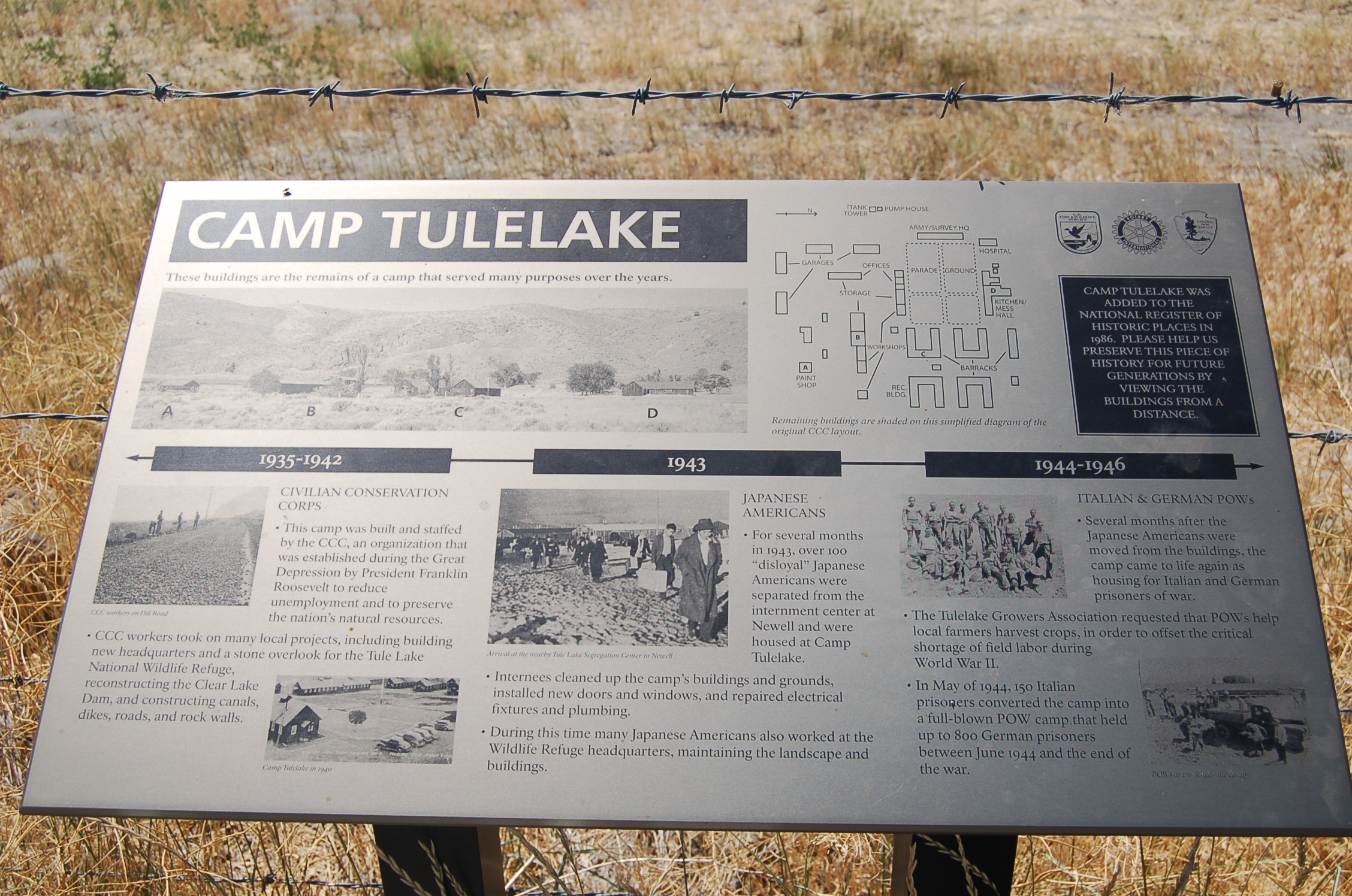
A plaque at Camp Tulelake describes the history of the site and its use during the year before, during and after WWII as a CCC work camp, a Japanese internment camp and a P.O.W. camp.
Public Domain. Photo by A. E. Crane
Download Original (2256 x 1496 pixels, 993.7 KB)
-
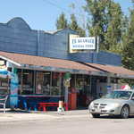
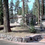
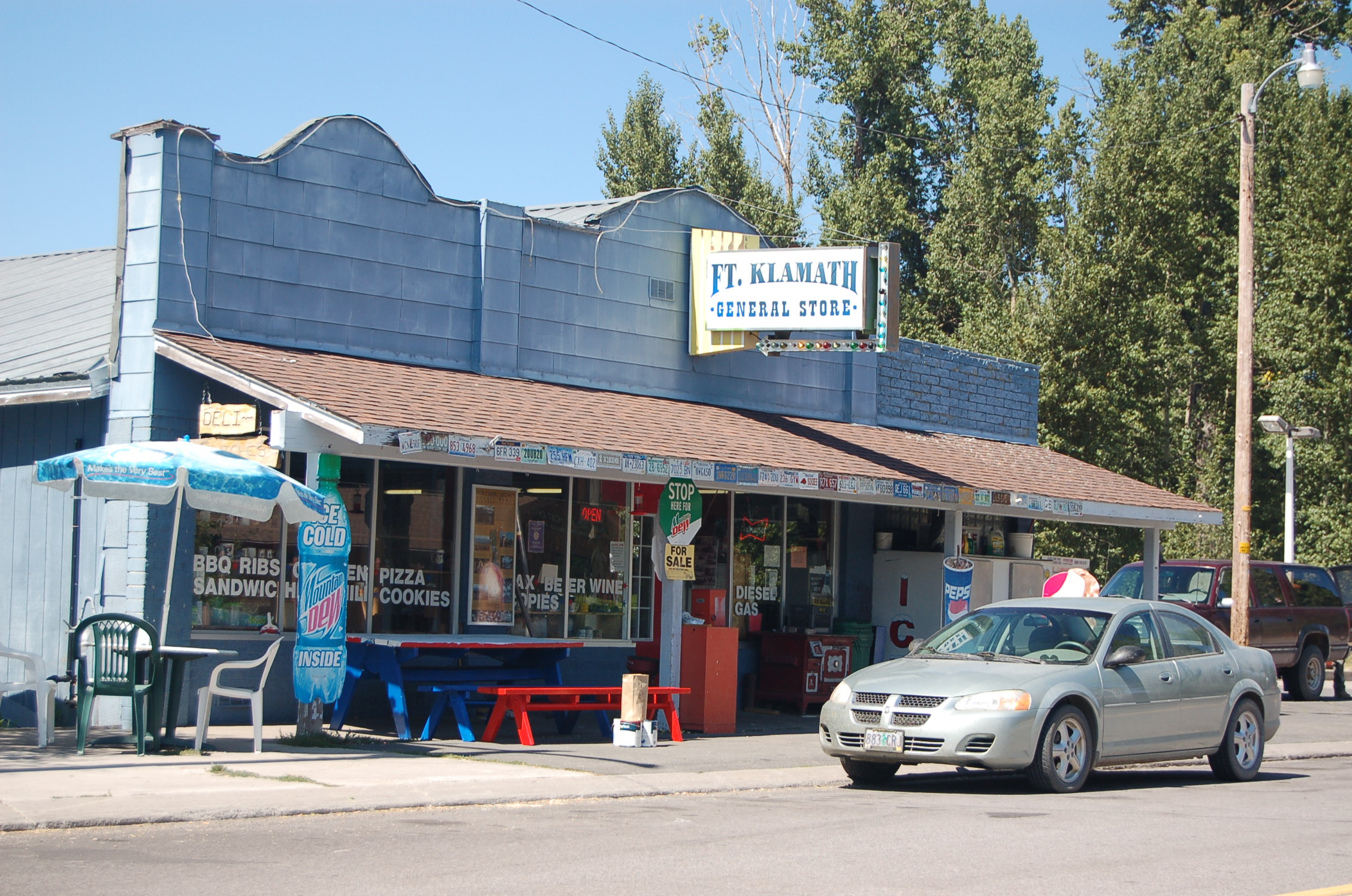
The Fort Klamath General Store stands next to the highway, offering groceries, snacks and supplies to people traveling to and from Crater Lake National Park.
Public Domain. Photo by A. E. Crane
Download Original (2256 x 1496 pixels, 901.7 KB)
-
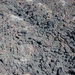
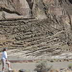
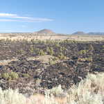
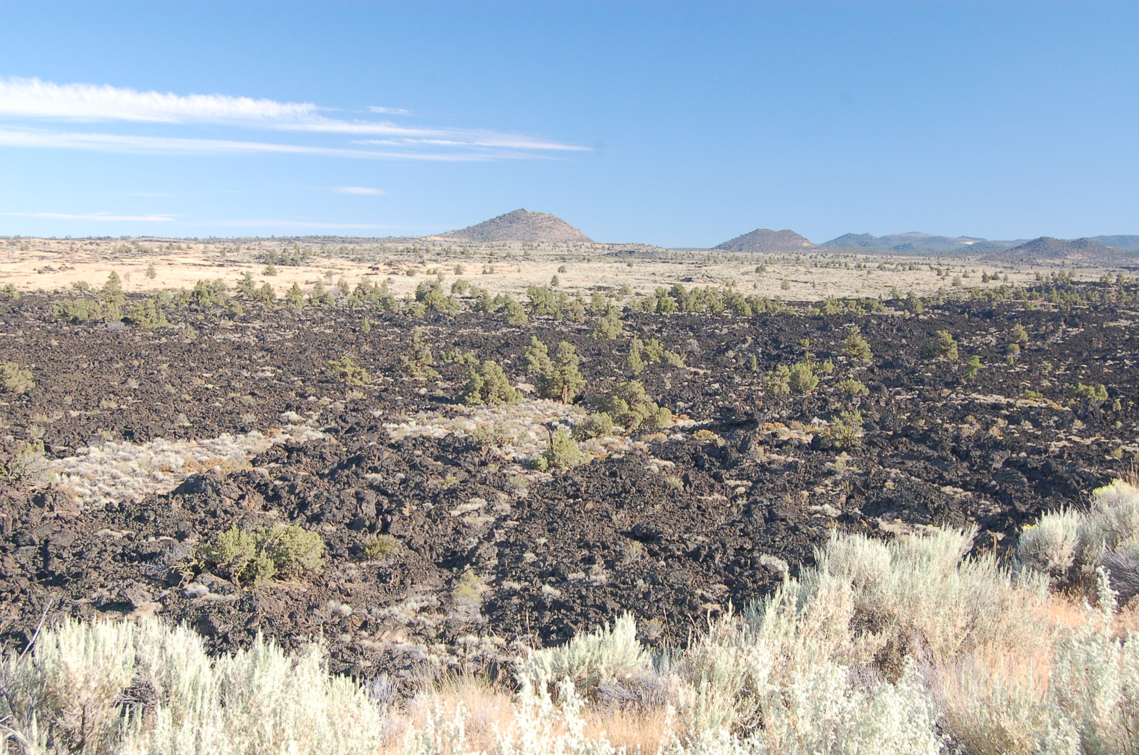
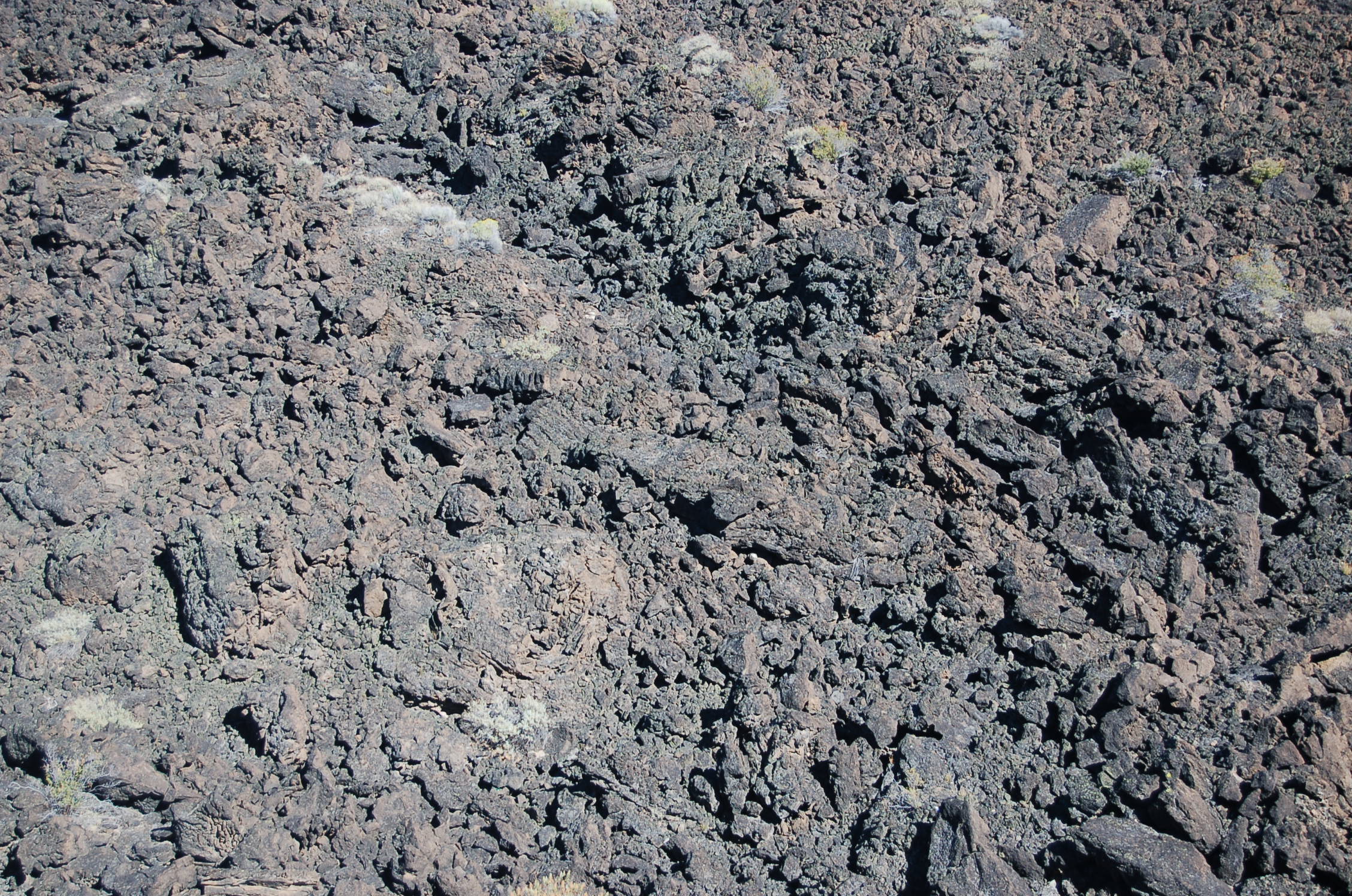
The lava flow at Devil's Homestead is comprised of rocky a'a lava: rough, black and treacherous.
Public Domain. Photo by A. E. Crane
Download Original (2256 x 1496 pixels, 974.4 KB)
-
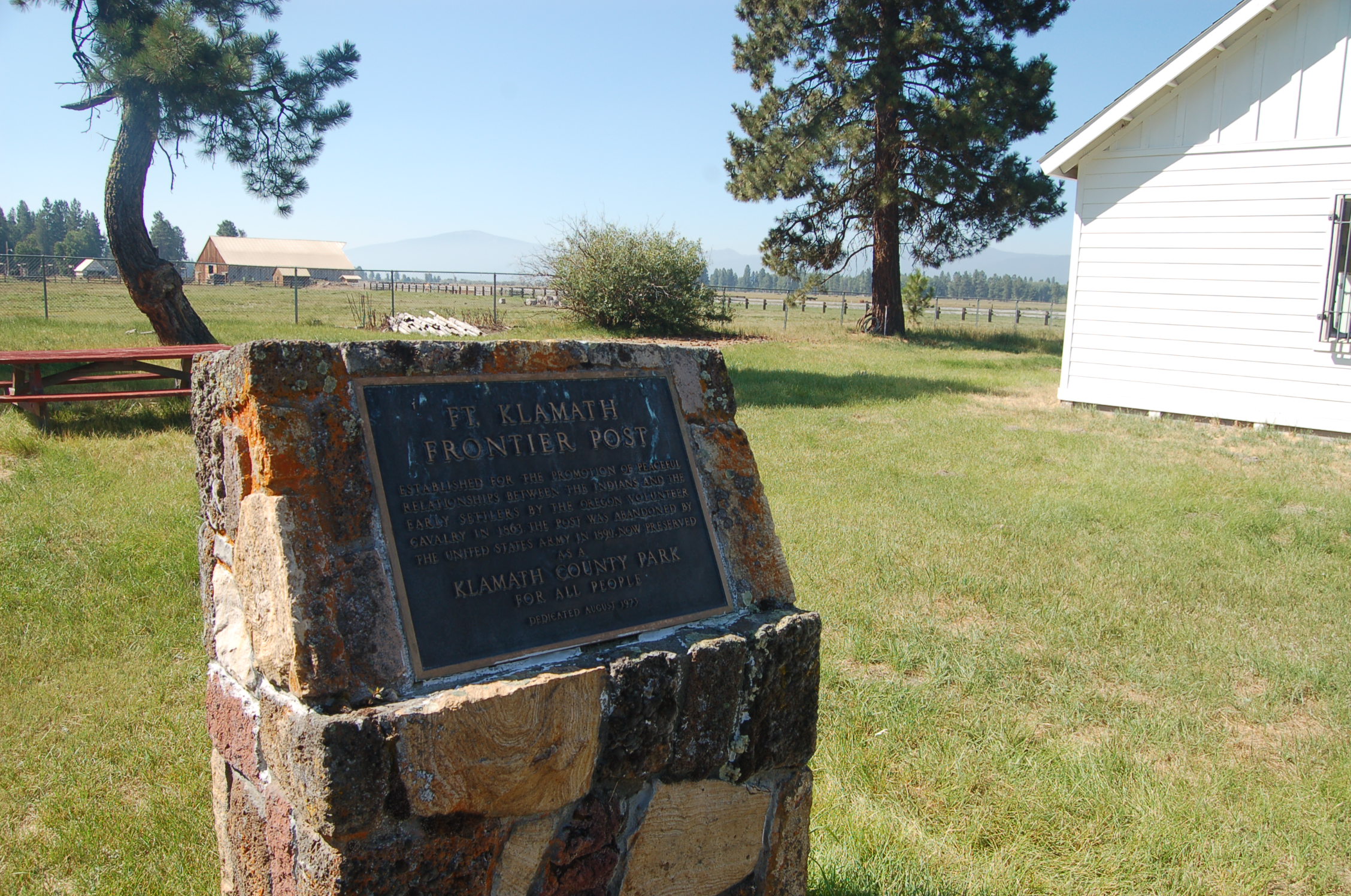
The marker at historic Fort Klamath reads:
"Fort Klamath Frontier Post. Established for the promotion of peaceful relationships between the Indians and the early settlers by the Oregon Volunteer Cavalry in 1863, the post was abandoned by the United States Army in 1890. Now preserved as a Klamath County Park for all people. Dedicated August 1973."Public Domain.
Download Original (2256 x 1496 pixels, 919.9 KB)
-
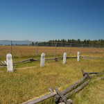
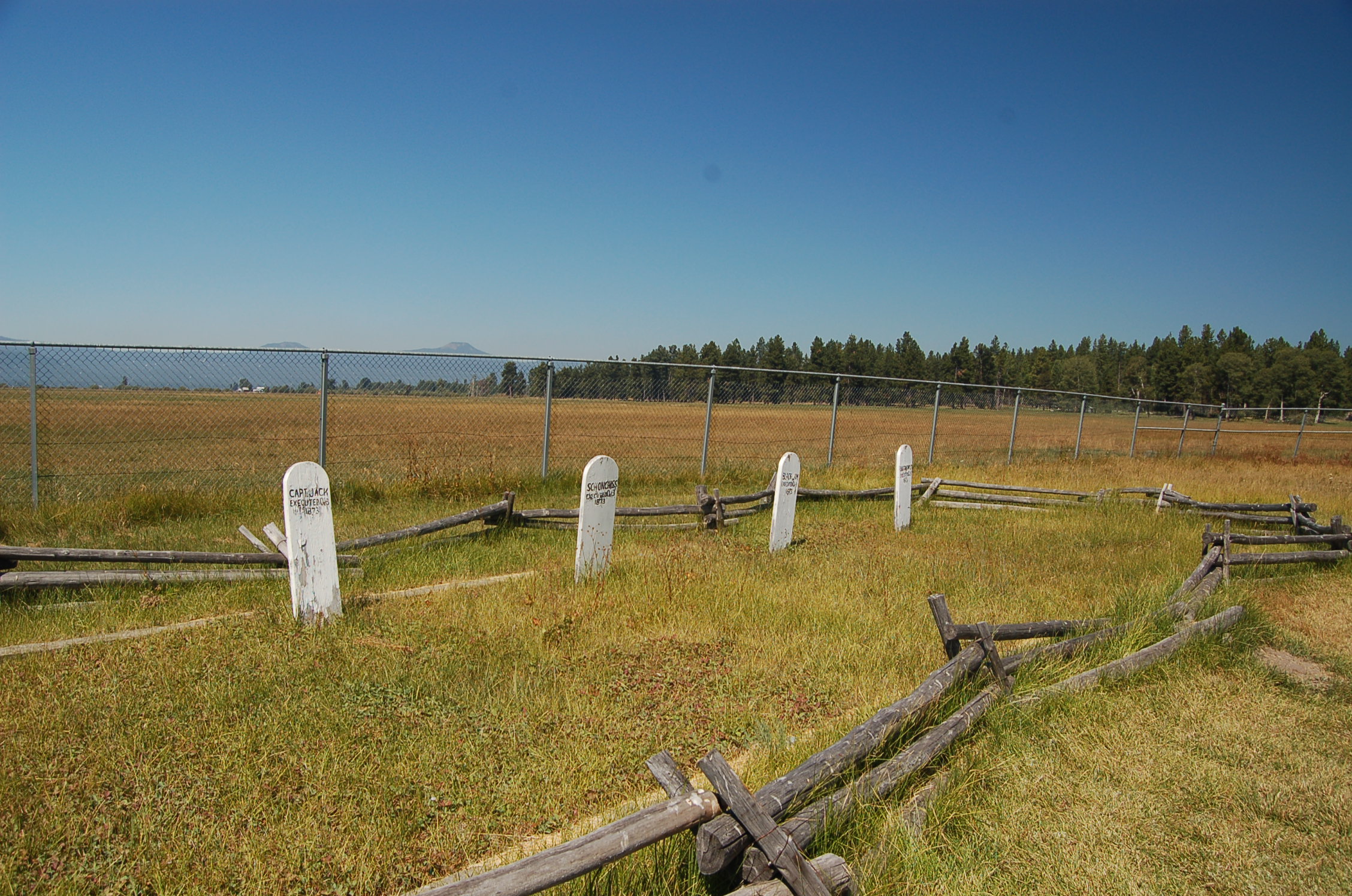
White stones marking the actual graves of captured Indian leaders of the Modoc War -- Captain Jack, Boston Charley, Schonchin John and Black Jim -- lie in a row at Historic Fort Klamath. These men were hanged October 3, 1873.
Public Domain. Photo by A. E. Crane
Download Original (2256 x 1496 pixels, 926.4 KB)
-
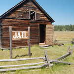
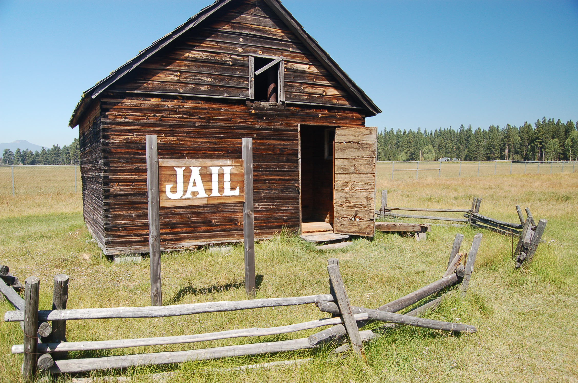
A 1900s frontier jailhouse stands on the grounds of the historic Fort Klamath County Park. It was moved here from another site, and was not part of the original Army Post.
Public Domain. Photo by A. E. Crane
Download Original (2256 x 1496 pixels, 915.7 KB)
-
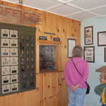
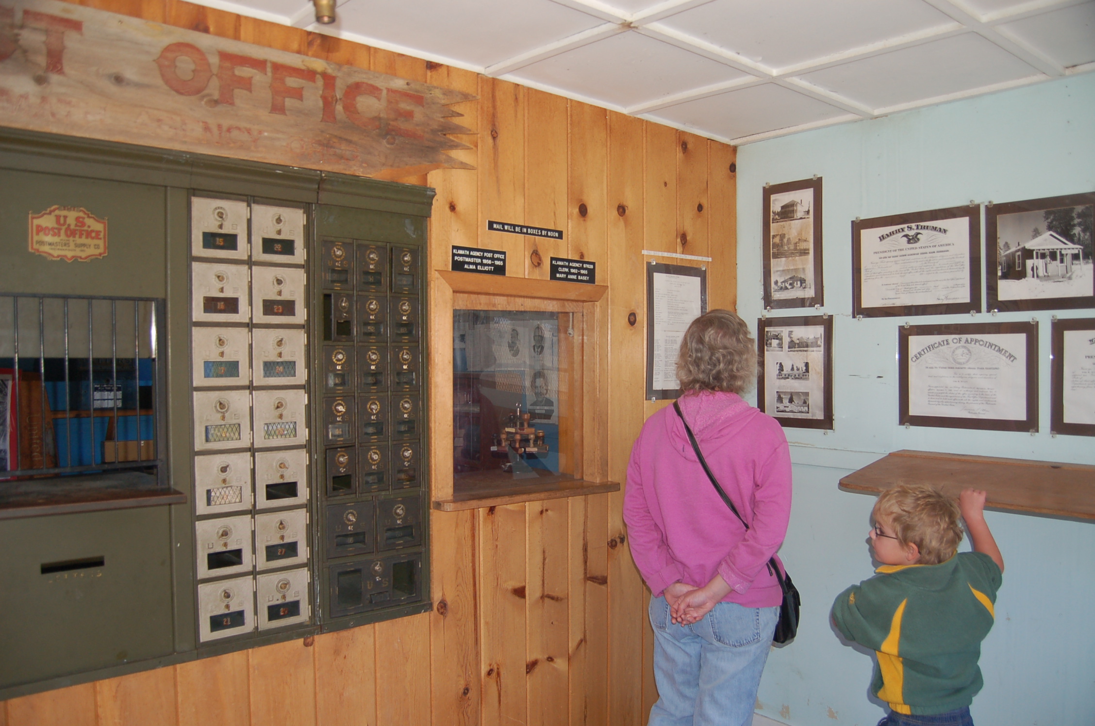
One of the historic buildings relocated to Fort Klamath County Park is the old Fort Klamath Post Office. A mother and young boy look at awards and historic photos on the wall inside.
Public Domain. Photo by A. E. Crane
Download Original (2256 x 1496 pixels, 884.2 KB)
-
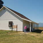
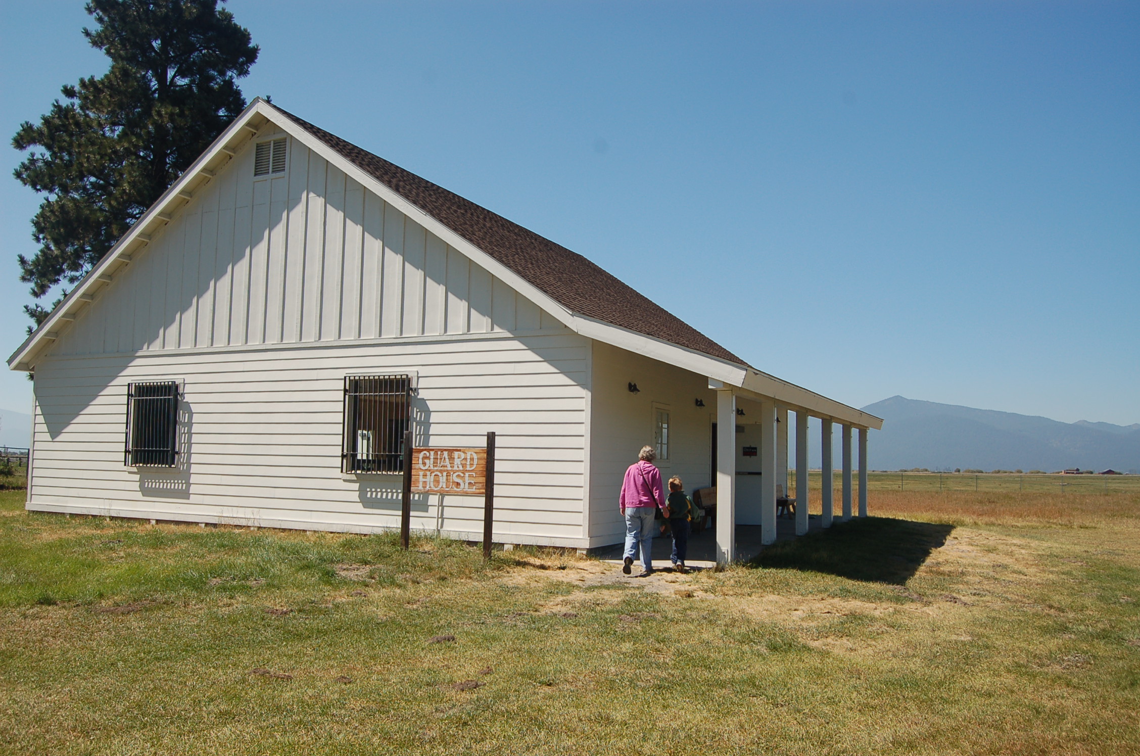
Two people walk toward a reconstruction of the Fort Klamath's guard house, which hosts a small museum and visitor center.
Public Domain. Photo by A. E. Crane
Download Original (2256 x 1496 pixels, 926.2 KB)
-
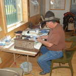
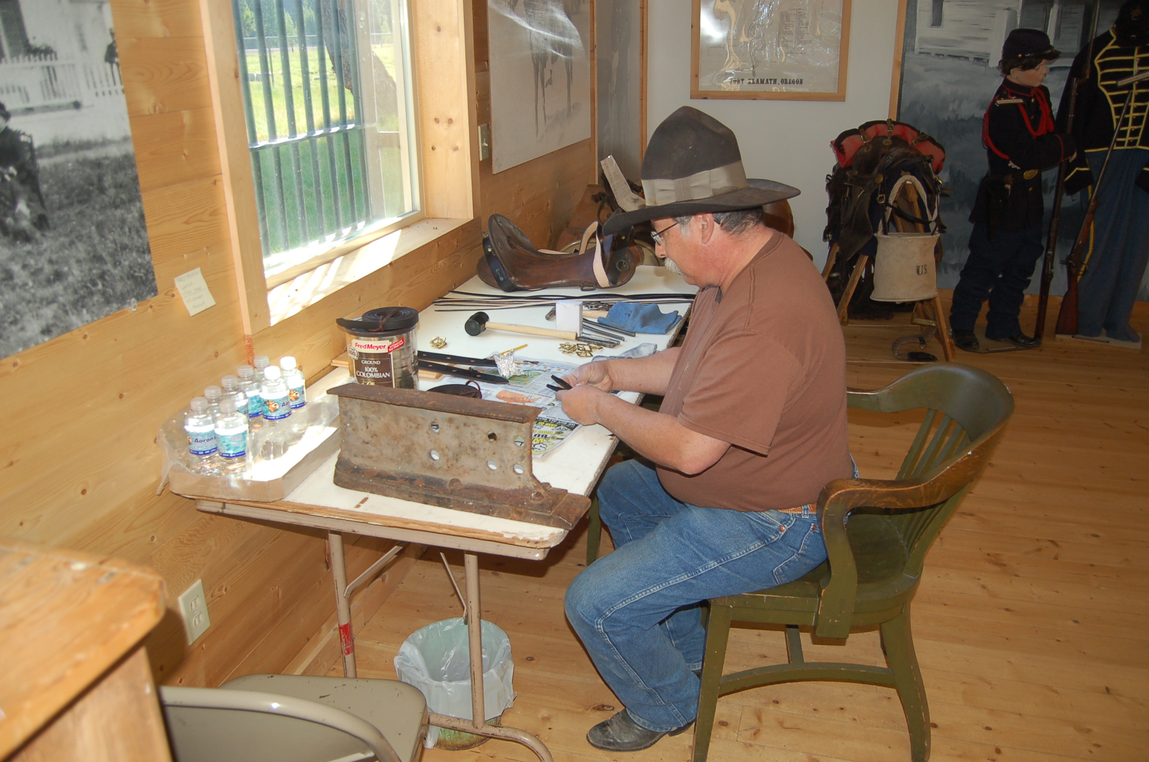
Inside the Guard House at Fort Klamath County Park and Museum, Kevin Fields, a museum volunteer and military history enthusiast, repairs an old Civil War era saddle.
Public Domain. Photo by A. E. Crane
Download Original (2256 x 1496 pixels, 694.2 KB)
-
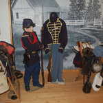
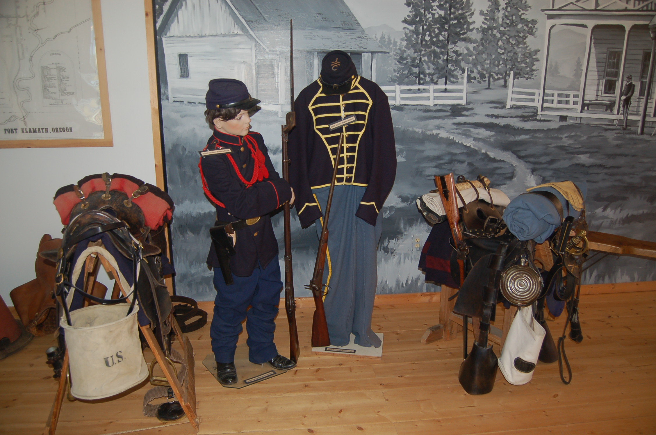
Civil War-era uniforms are displayed inside the Guard House at historic Fort Klamath. One saddle is a Confederate McClellan saddle from the 1860s. The other is an 1872 McClellan. The boy figure is wearing 1890 artillery dress uniform and holding an 1884 Springfield trapdoor rifle. The headless figure is wearing a blue 1863 cavalry bugler uniform with an 1856 Springfield musket rifle.
Public Domain. Photo by A. E. Crane
Download Original (2256 x 1496 pixels, 722.3 KB)
-
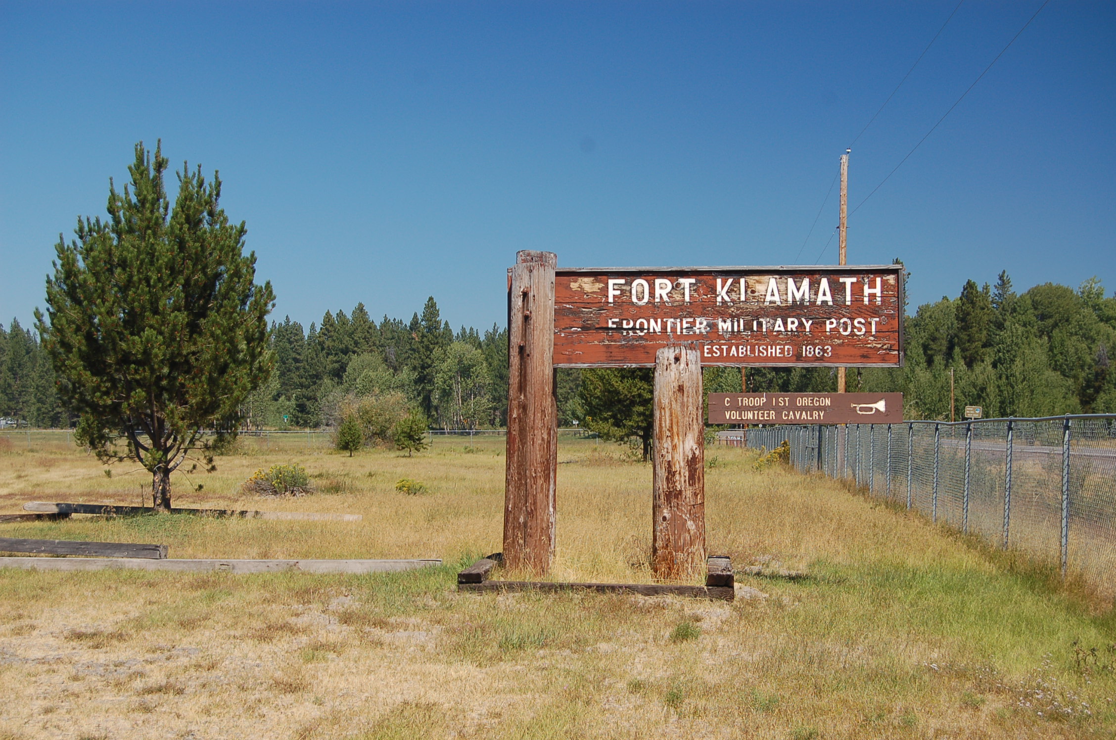
A well-weathered wooden sign greets visitors to Fort Klamath Frontier Military Post, once home of C Troop of the Oregon First Volunteer Cavalry.
Public Domain. Photo by A. E. Crane
Download Original (2256 x 1496 pixels, 903.5 KB)
-
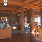
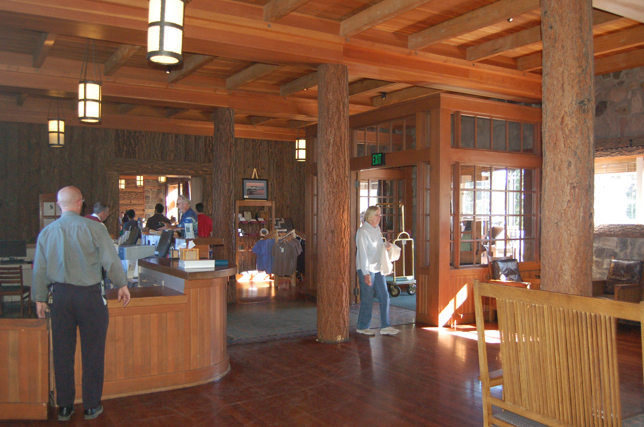
The high ceilings, wooden beams and wooden panels give the lobby of Crater Lake Lodge at Crater Lake National Park a warm, welcoming feeling.
Public Domain. Photo by A. E. Crane
Download Original (2256 x 1496 pixels, 876.2 KB)
-
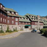
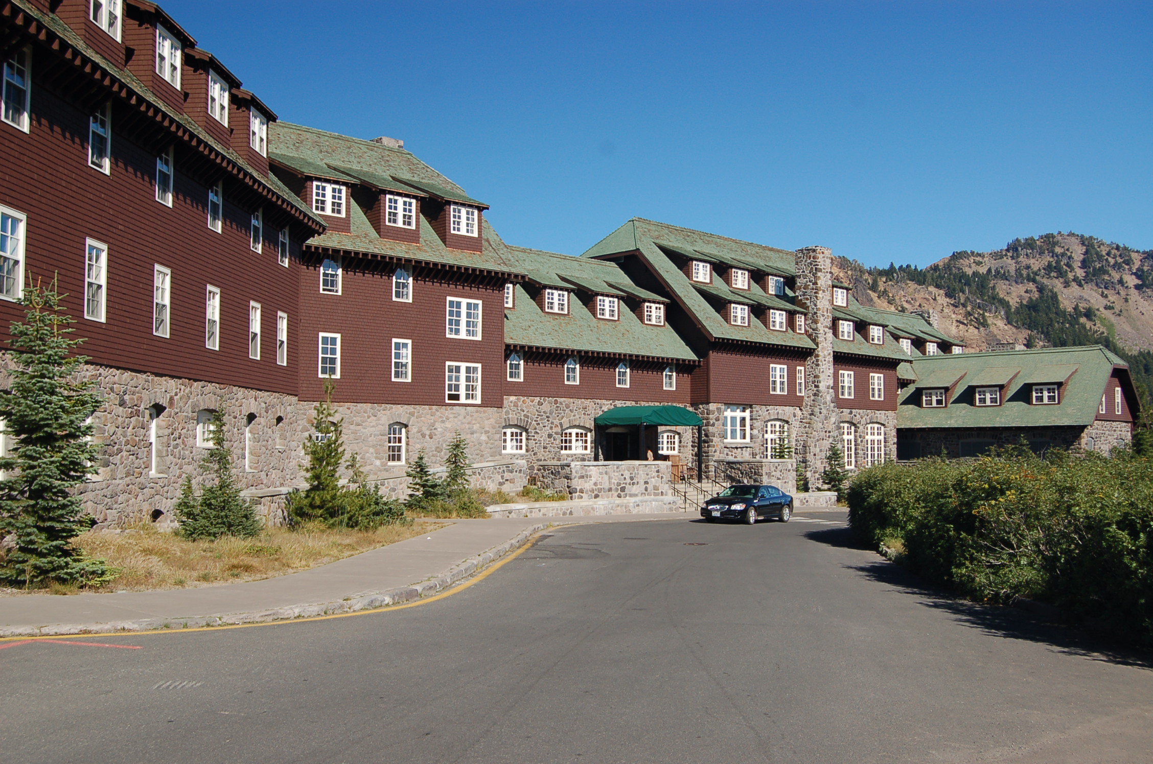
A road sweeps up to the unassuming entrance to the historic Crater Lake Lodge in Crater Lake National Park.
Public Domain. Photo by A. E. Crane
Download Original (2256 x 1496 pixels, 979.4 KB)
-
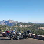
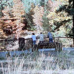
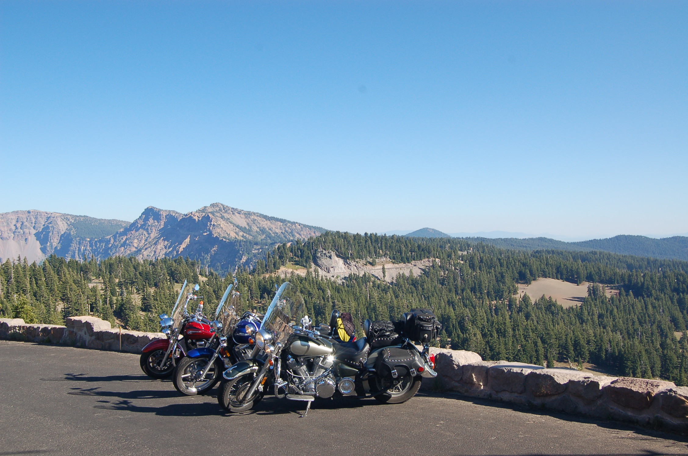
A row of motorcycles await their owners at one of the overlooks on the Crater Rim Drive.
Public Domain. Photo by A. E. Crane
Download Original (2256 x 1496 pixels, 832.5 KB)
-
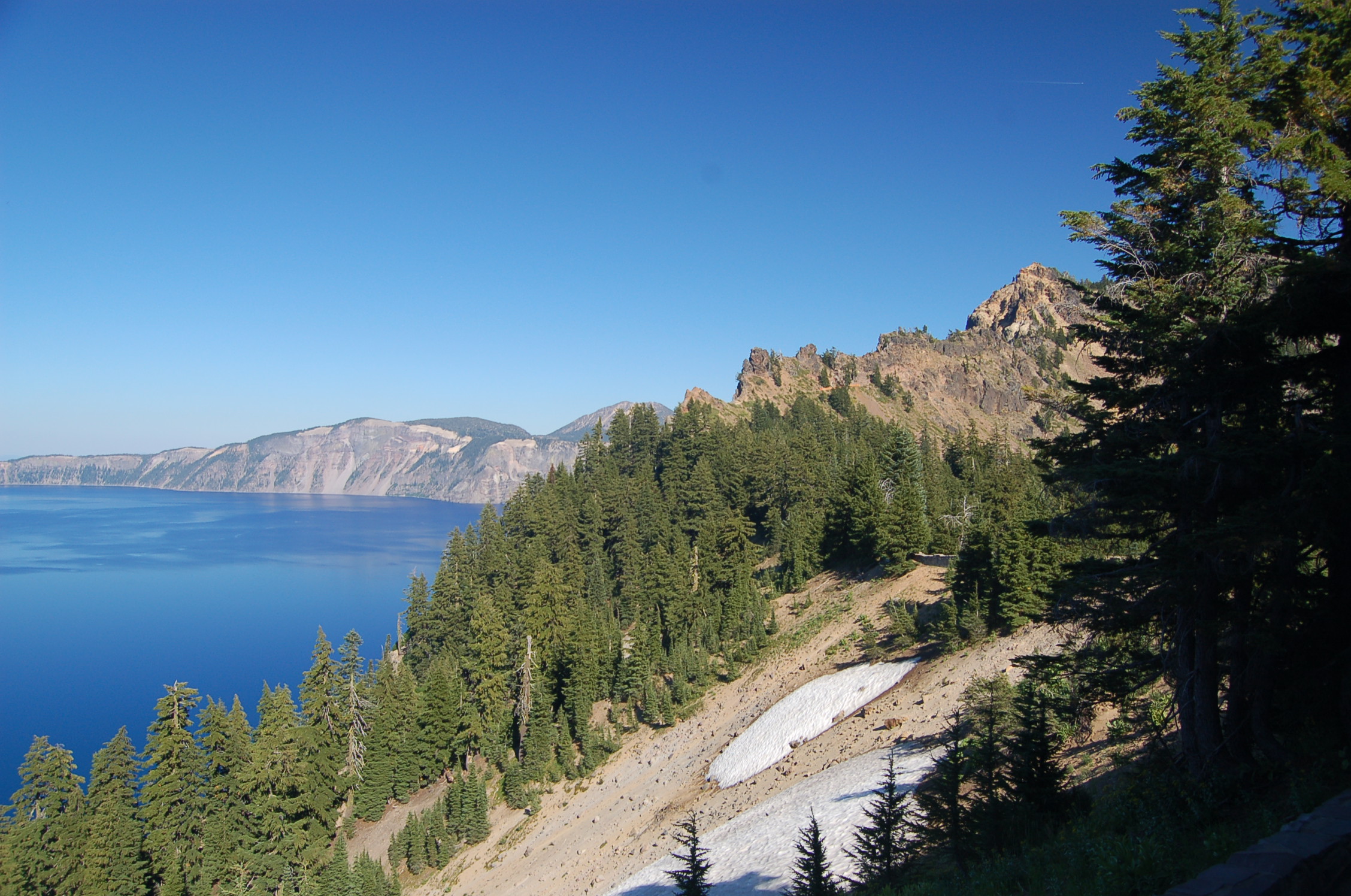
Snow lingers on the slopes of Mt. Mazama's caldera above the blue waters of Crater Lake as seen from Crater Lake Lodge, looking east.
Public Domain. Photo by A. E. Crane
Download Original (2256 x 1496 pixels, 916.0 KB)
-
The tour boat passes Wizard Island late one afternoon in early September, as seen from Crater Lake Lodge.
Public Domain. Photo by A. E. Crane
Download Original (2256 x 1496 pixels, 702.1 KB)
-
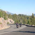
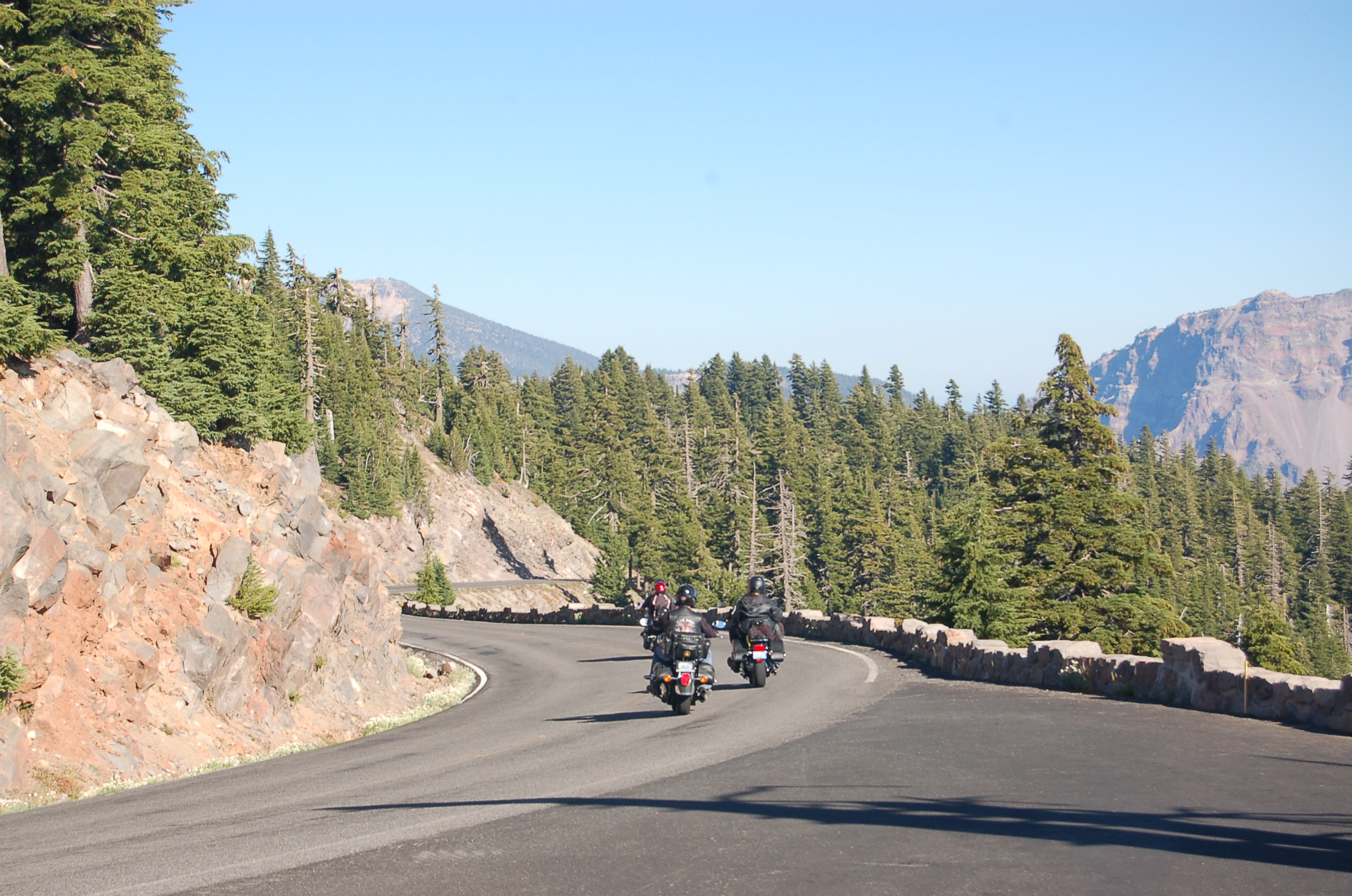
A group of motorcyclists pass an overlook on their way down curvy Rim Drive with its stone barrier fence in Crater Lake National Park.
Public Domain. Photo by A. E. Crane
Download Original (2256 x 1496 pixels, 898.4 KB)
-
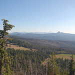
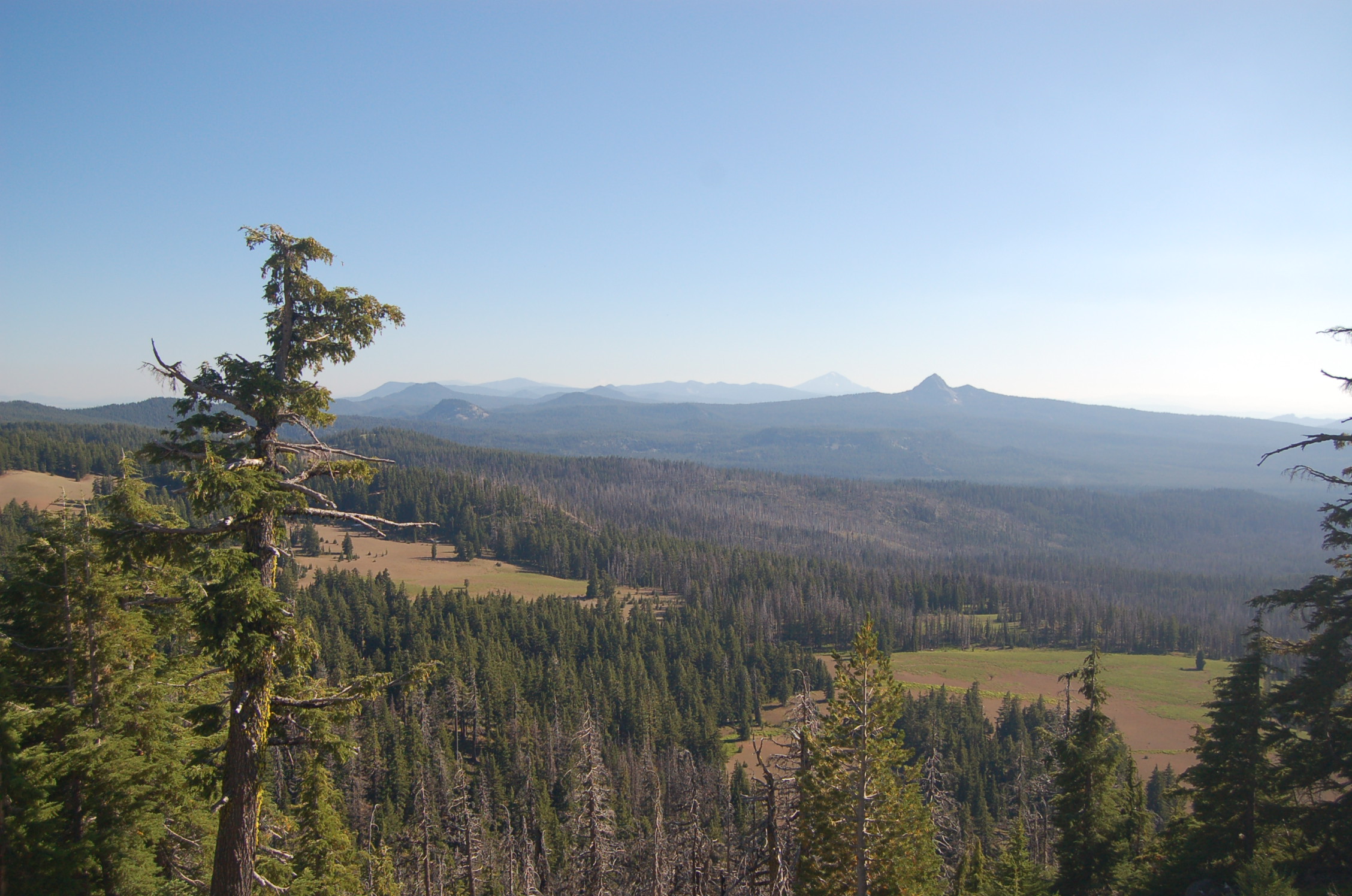
California's Mount Shasta can barely be seen on the horizon from an overlook on Crater Lake National Park's Rim Drive. Other volcanic peaks and cones in the Cascade Range are more visible.
Public Domain. Photo by A. E. Crane
Download Original (2256 x 1496 pixels, 782.7 KB)
-
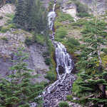
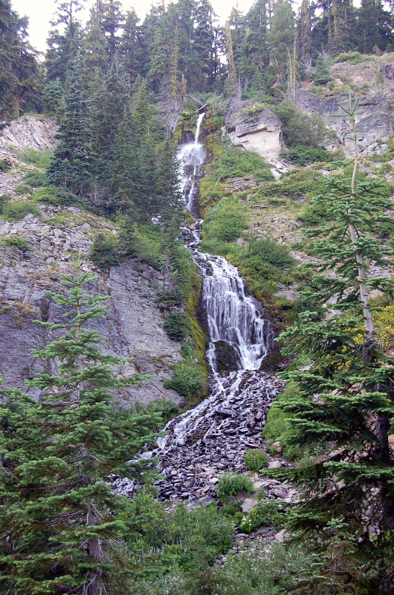
The lacy streams of Vidae Falls cascade down the eastern rim of Crater Lake National Park next to Rim Drive.
Public Domain. Photo by A. E. Crane
Download Original (1496 x 2256 pixels, 949.2 KB)
-
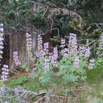
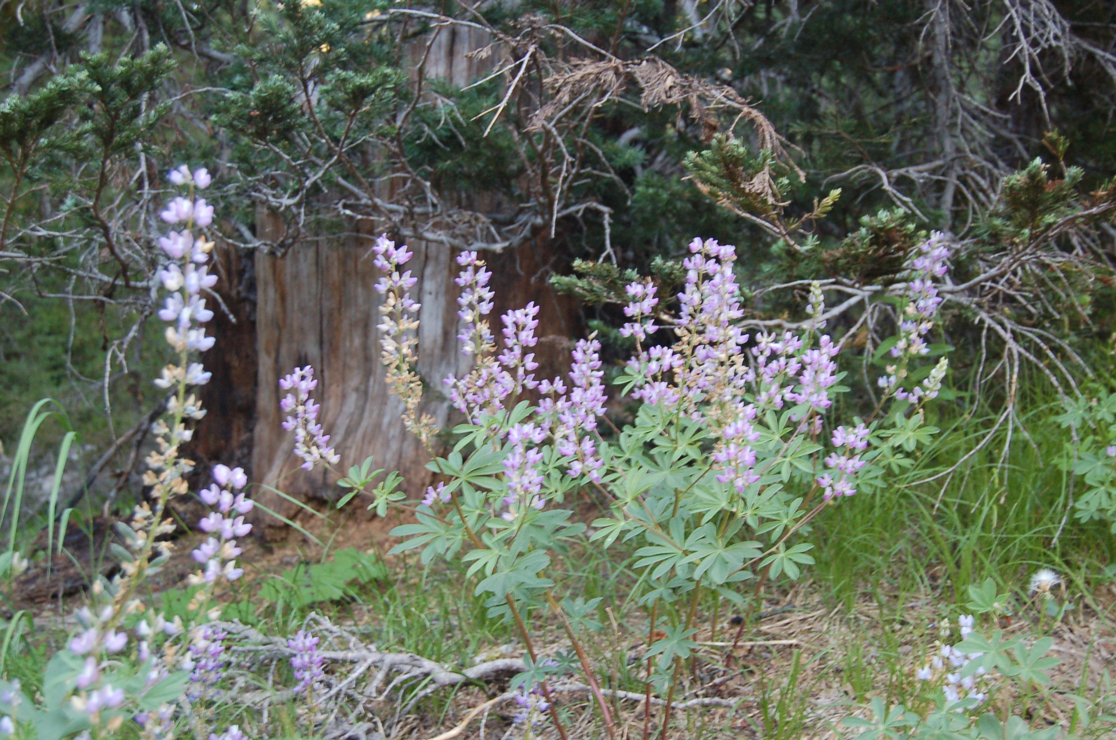
White and purple lupine make a brave show in early September on the Castle Crest Trail in Crater Lake National Park.
Public Domain. Photo by A. E. Crane
Download Original (2256 x 1496 pixels, 900.0 KB)
-
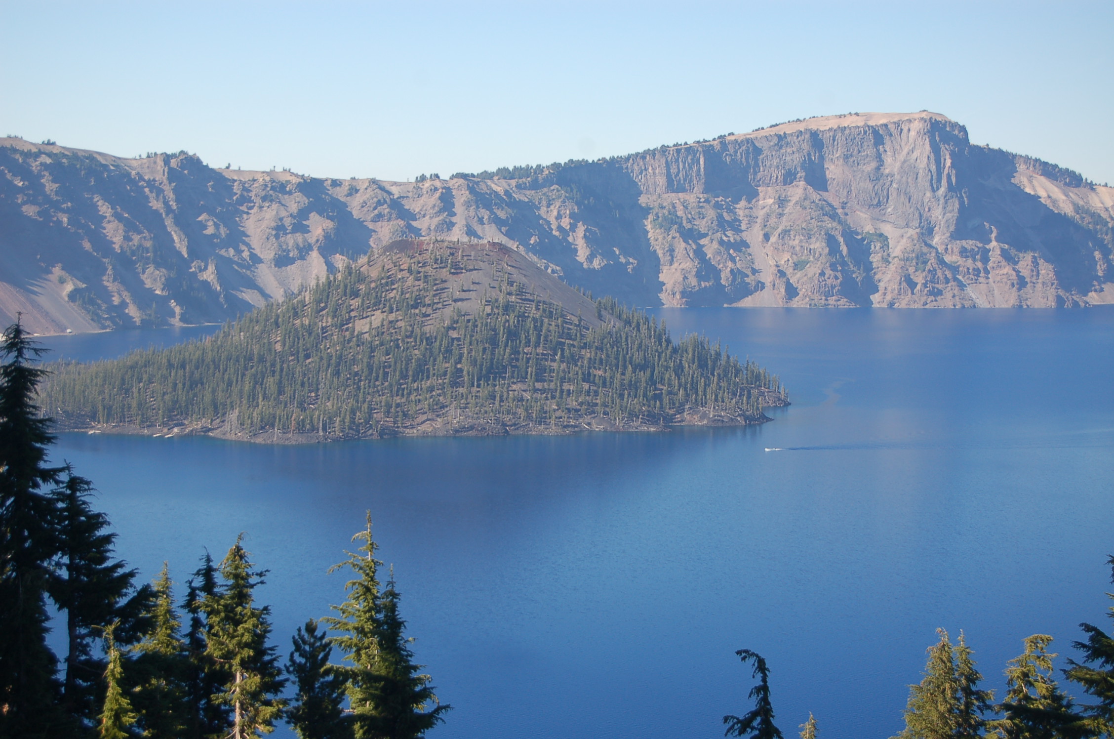
Wizard Island lies nestled in the blue waters of Crater Lake as seen from the Watchman Overlook on Rim Drive on the west side of the park.
Public Domain. Photo by A. E. Crane
Download Original (2256 x 1496 pixels, 721.9 KB)
-
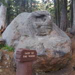
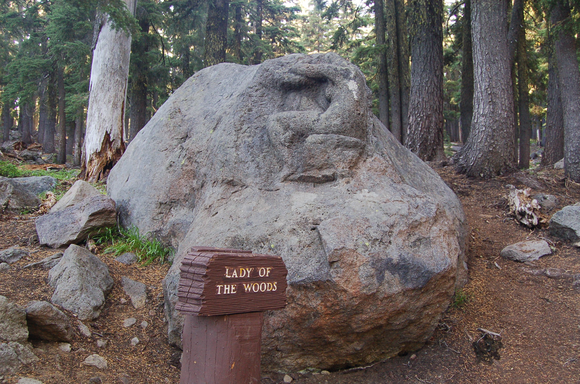
The sculpture of a curled, sitting nude carved into a boulder is one of the unexpected features of a hiking trail in the forest at Steed Visitor Center in Crater Lake National Park.
Public Domain. Photo by A. E. Crane
Download Original (2256 x 1496 pixels, 930.9 KB)
-
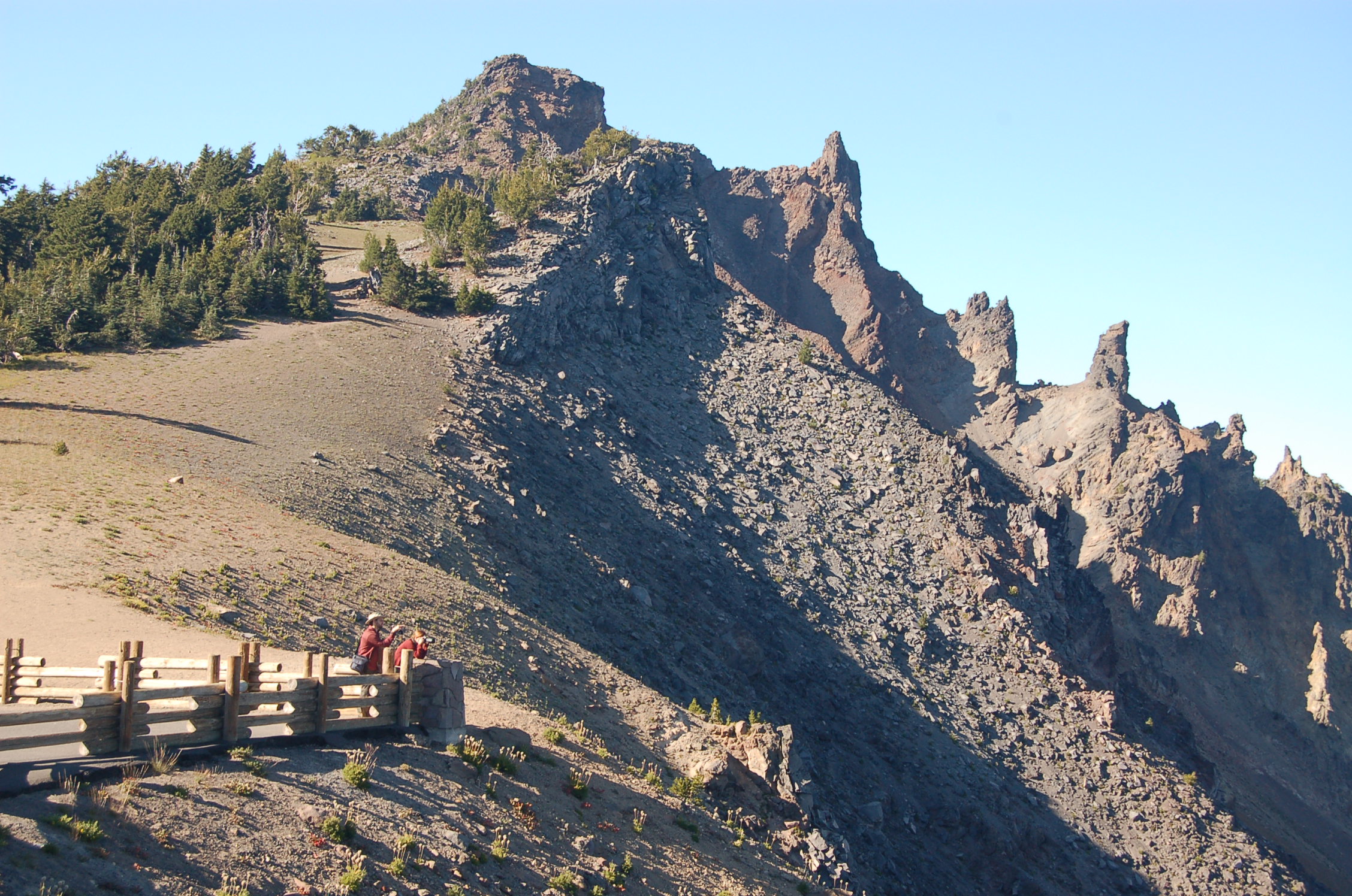
People at the Watchman Overlook stand behind a guard rail and look to the lake below. Above them, the jagged lava teeth of the Devil's Backbone formation jab into the sky along the edge of Crater Lake.
Public Domain. Photo by A. E. Crane
Download Original (2256 x 1496 pixels, 918.6 KB)
-
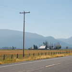
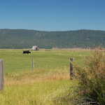
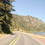
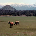
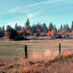
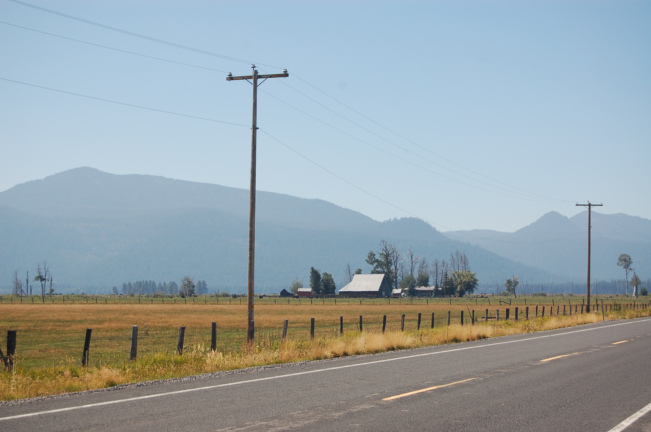
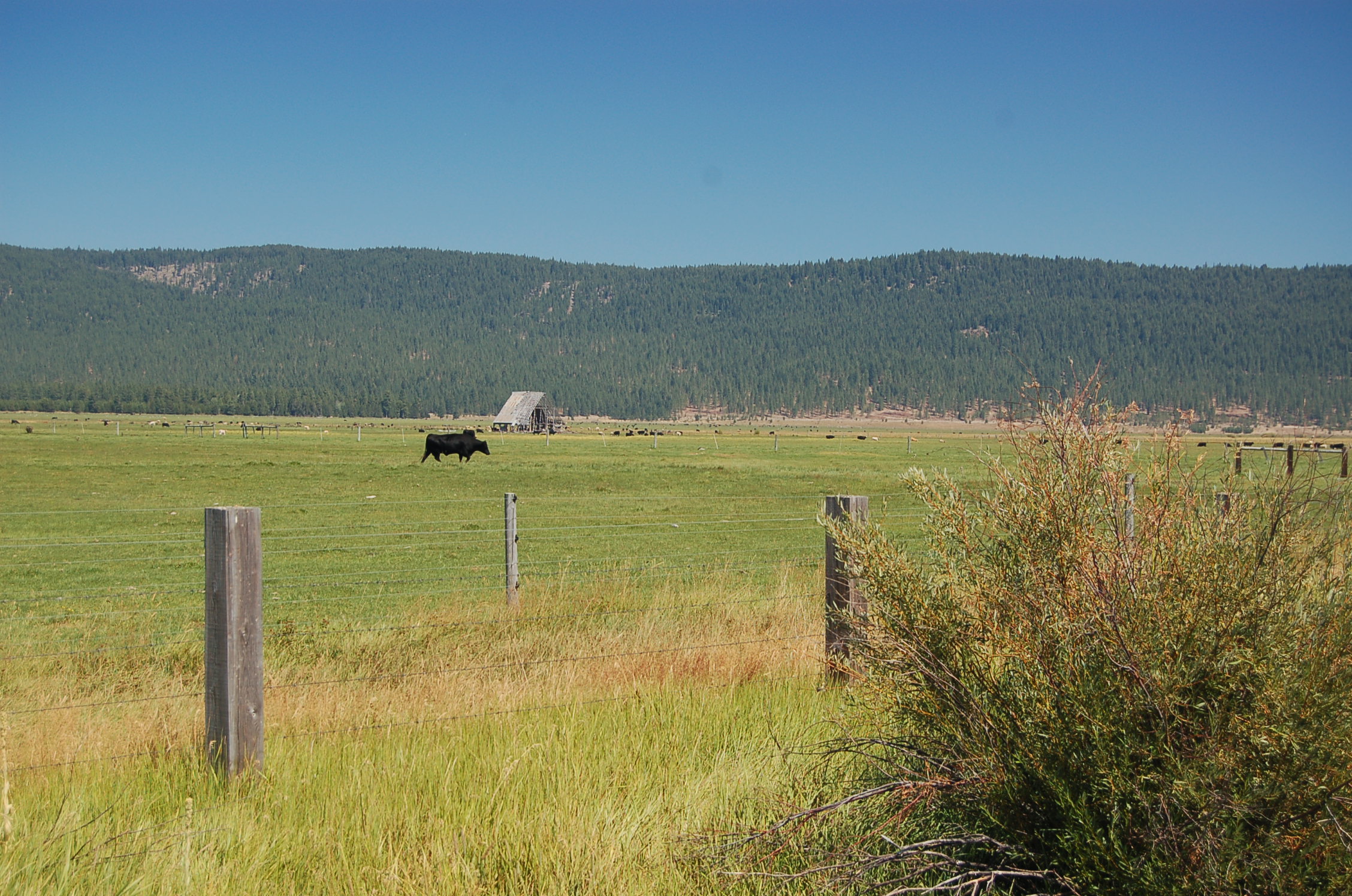
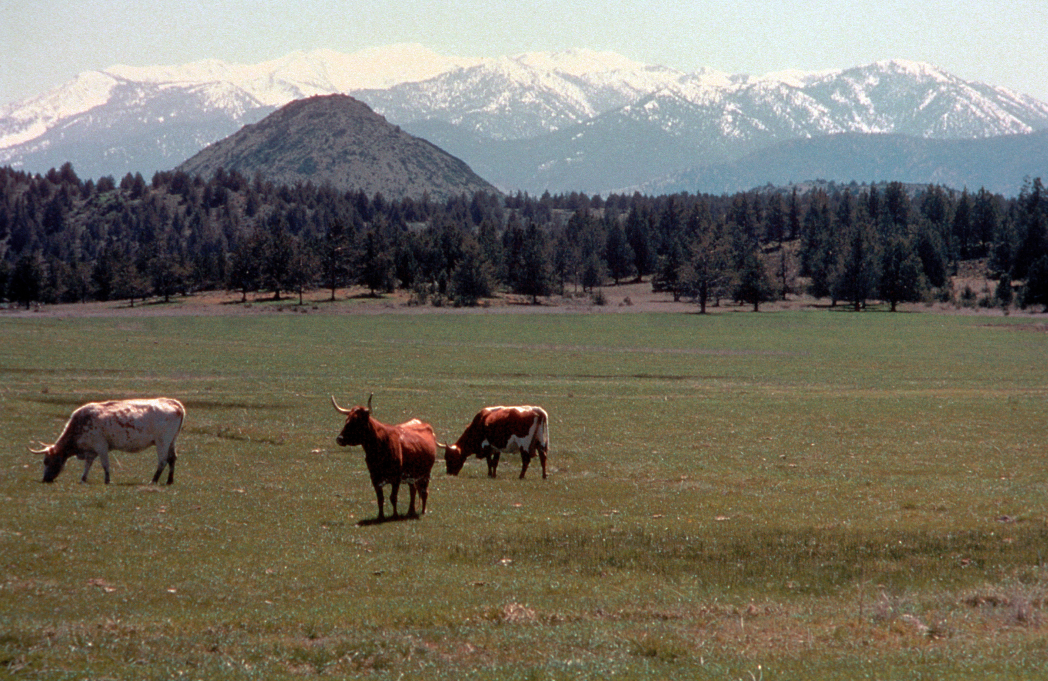
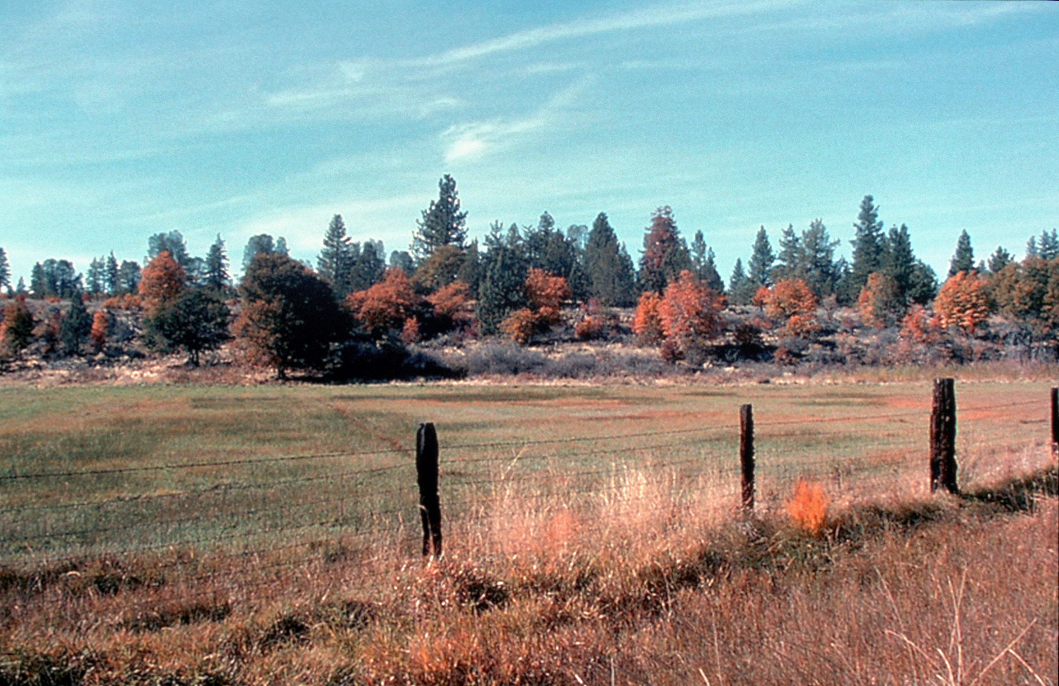
Mountains serve as the backdrop to a small ranch built along the Crater Lake Highway in Klamath County, Oregon.
Public Domain. Photo by A. E. Crane
Download Original (2256 x 1496 pixels, 934.7 KB)
-
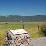
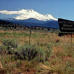
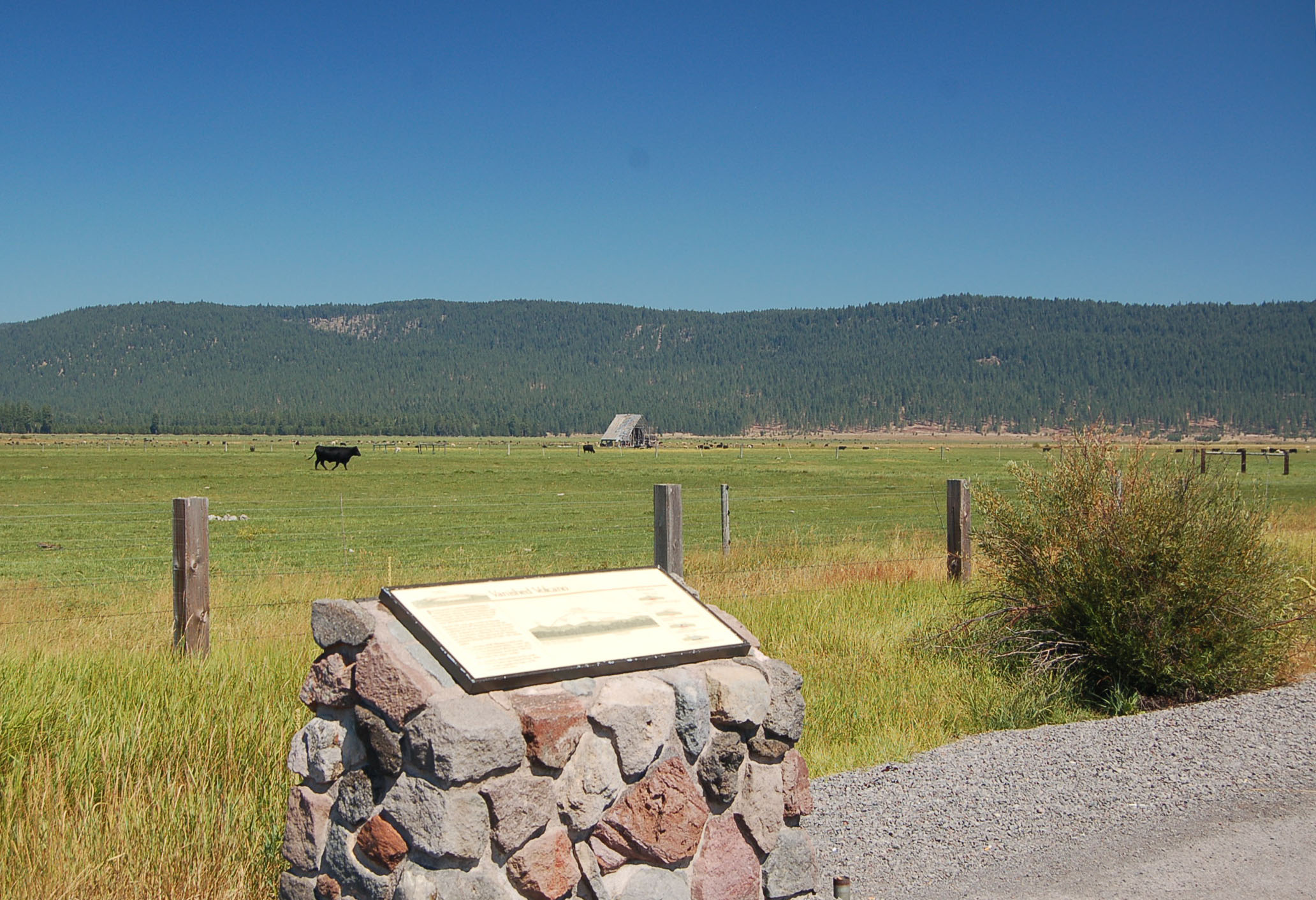
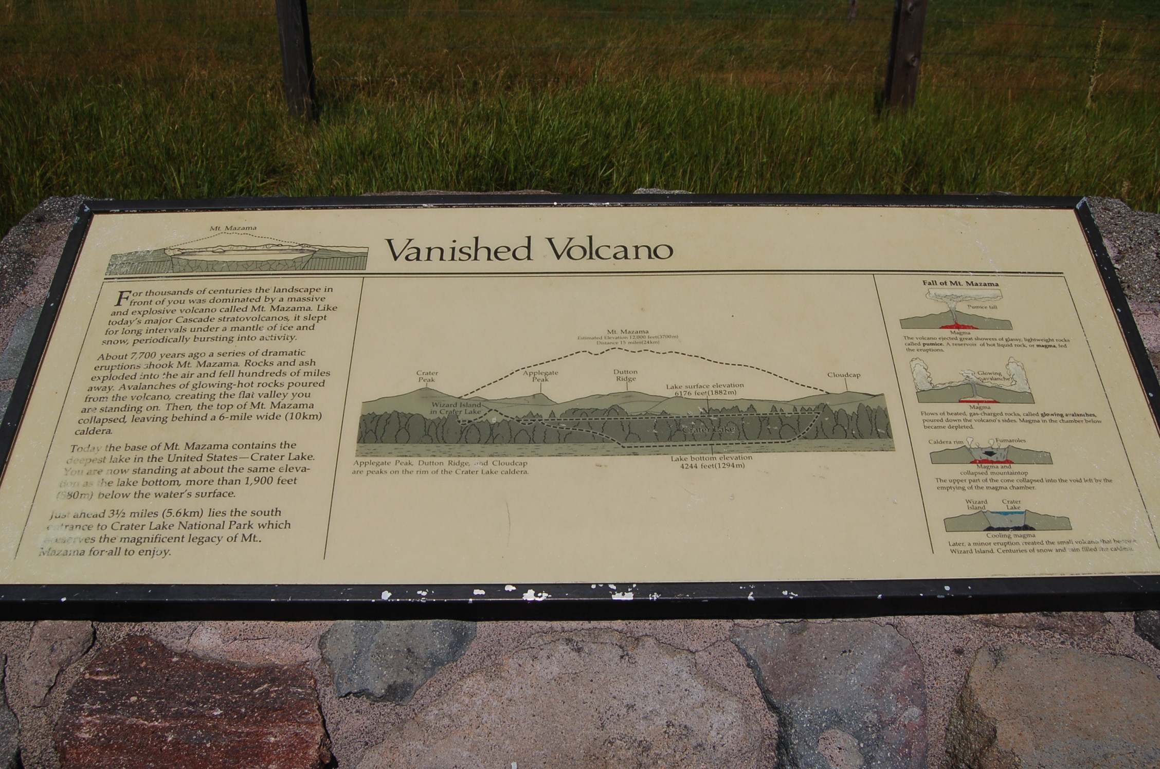
An interpretive sign at a pullout in ranchland alongside the Volcanic Legacy Scenic Byway tells about Mt. Mazama, a massive shield volcano that once filled the horizon to the north here.
Public Domain. Photo by A. E. Crane
Download Original (2064 x 1412 pixels, 560.3 KB)
-
An interpretive sign at a pullout in ranchland alongside the Volcanic Legacy Scenic Byway tells about Mt. Mazama, a massive shield volcano that once filled the horizon to the north here.
Public Domain. Photo by A. E. Crane
Download Original (2064 x 1412 pixels, 560.3 KB)
-
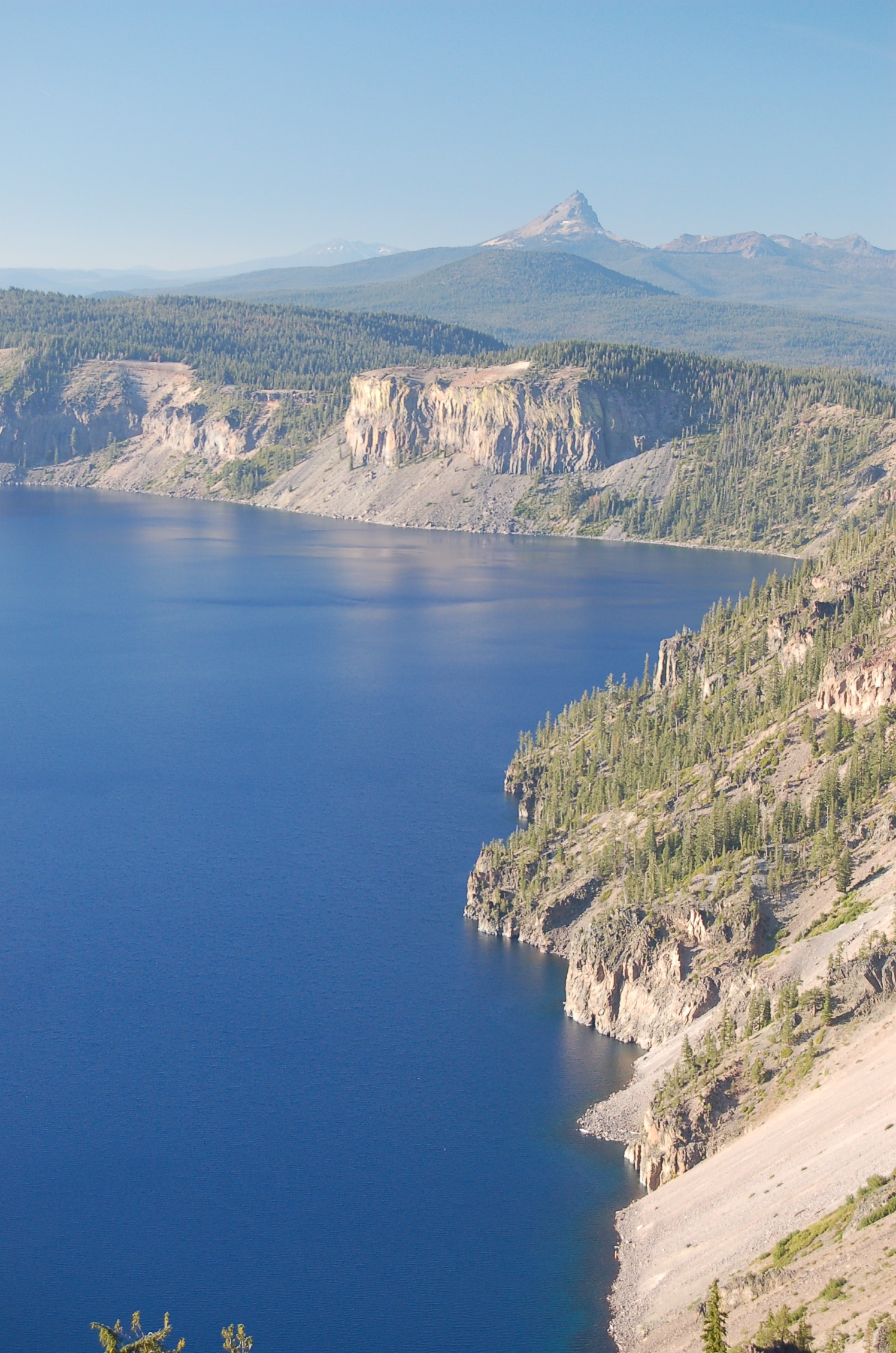
The sharp peak of Mt. Thielson pokes up from the mountains surrounding Crater Lake.
Public Domain. Photo by A. E. Crane
Download Original (1496 x 2256 pixels, 751.7 KB)
-
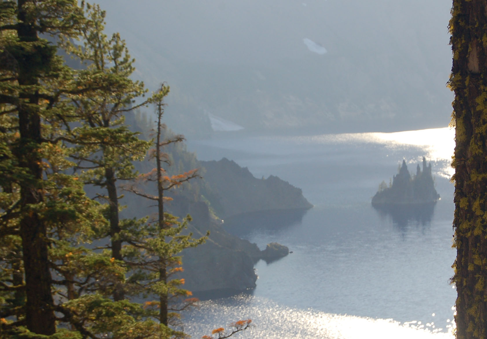
The island known as the 'Phantom Ship' floats as a dark shadow against the western sun in Crater Lake.
Public Domain. Photo by A. E. Crane
Download Original (1683 x 1171 pixels, 231.6 KB)
-
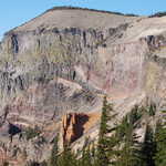
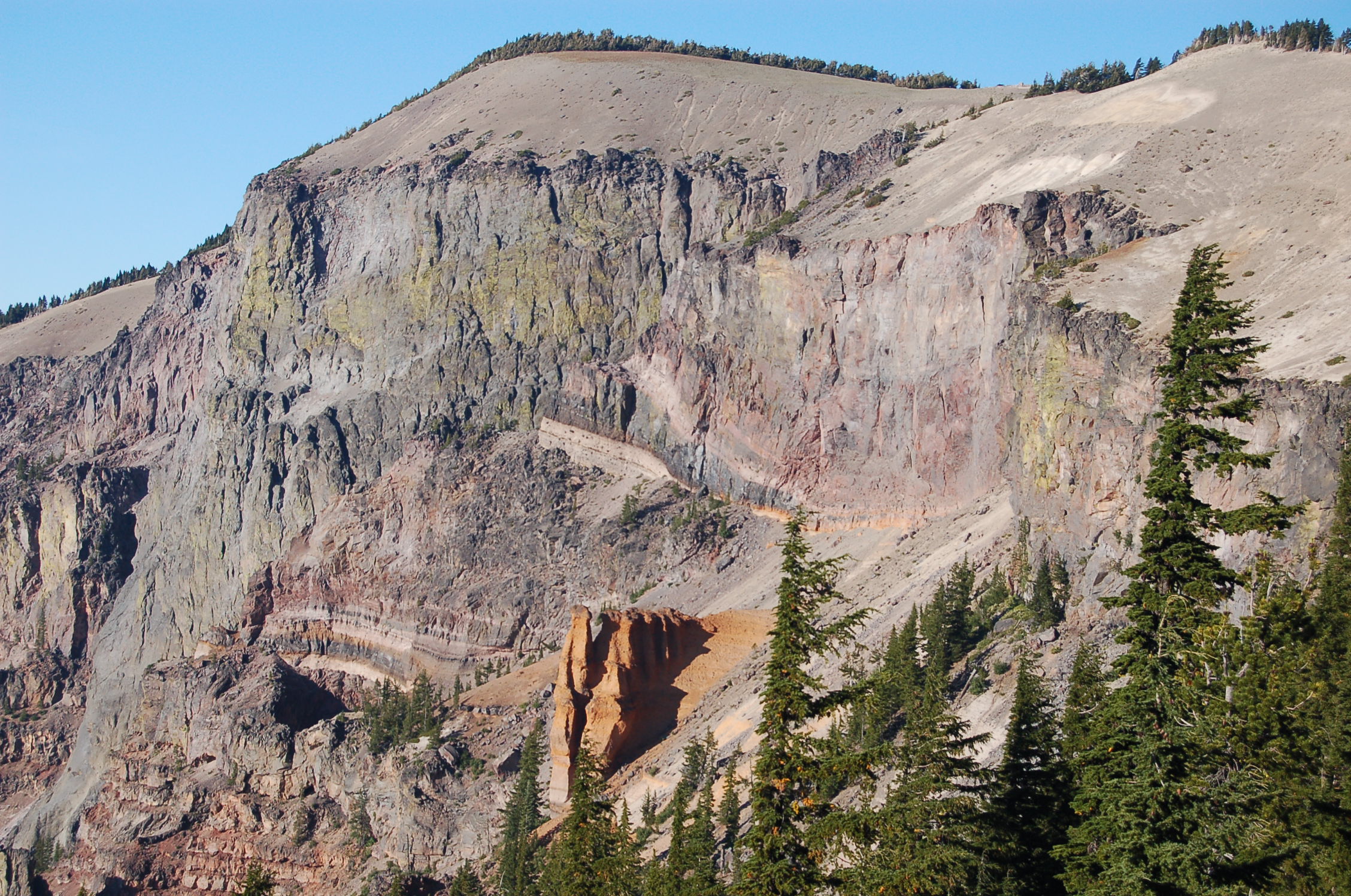
Orange, yellow, gray, blue and green make up the rainbow of colors on the 'Pumice Castle' cliffs of Crater Lake.
Public Domain. Photo by A. E. Crane
Download Original (2256 x 1496 pixels, 933.8 KB)
-
Cattle graze in a pasture alongside the Crater Lake Highway north of Fort Klamath. The tree-covered ridge in the background is part of an old lava flow (as are much of the mountains and ridges in the area.)
Public Domain. Photo by A. E. Crane
Download Original (2256 x 1496 pixels, 913.4 KB)
-
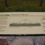
An interpretive panel at the Vanished Volcano roadside pullout on SR 62 shows the extent of the Mt. Mazama shield volcano before the massive eruption that eventually formed Crater Lake.
Public Domain. Photo by A. E. Crane
Download Original (2256 x 1496 pixels, 882.4 KB)
-
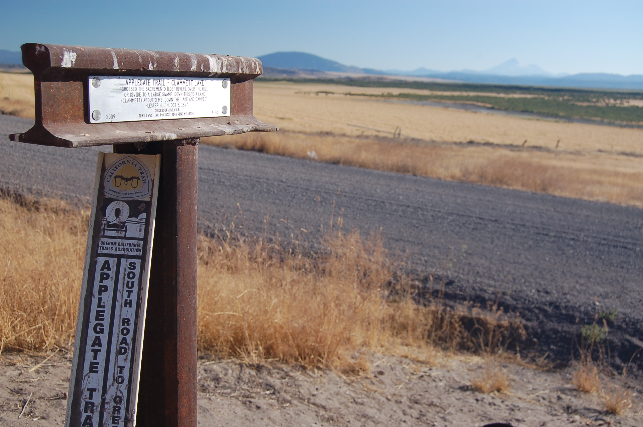
A railroad tie forms a trail marker for the Applegate Trail just south of the California-Oregon border by "Clammett Lake" (probably a version of "Klamath Lake") and the Klamath Basin National Wildlife Refuges.
Public Domain. Photo by A. E. Crane
Download Original (2256 x 1496 pixels, 895.2 KB)
-
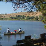
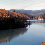
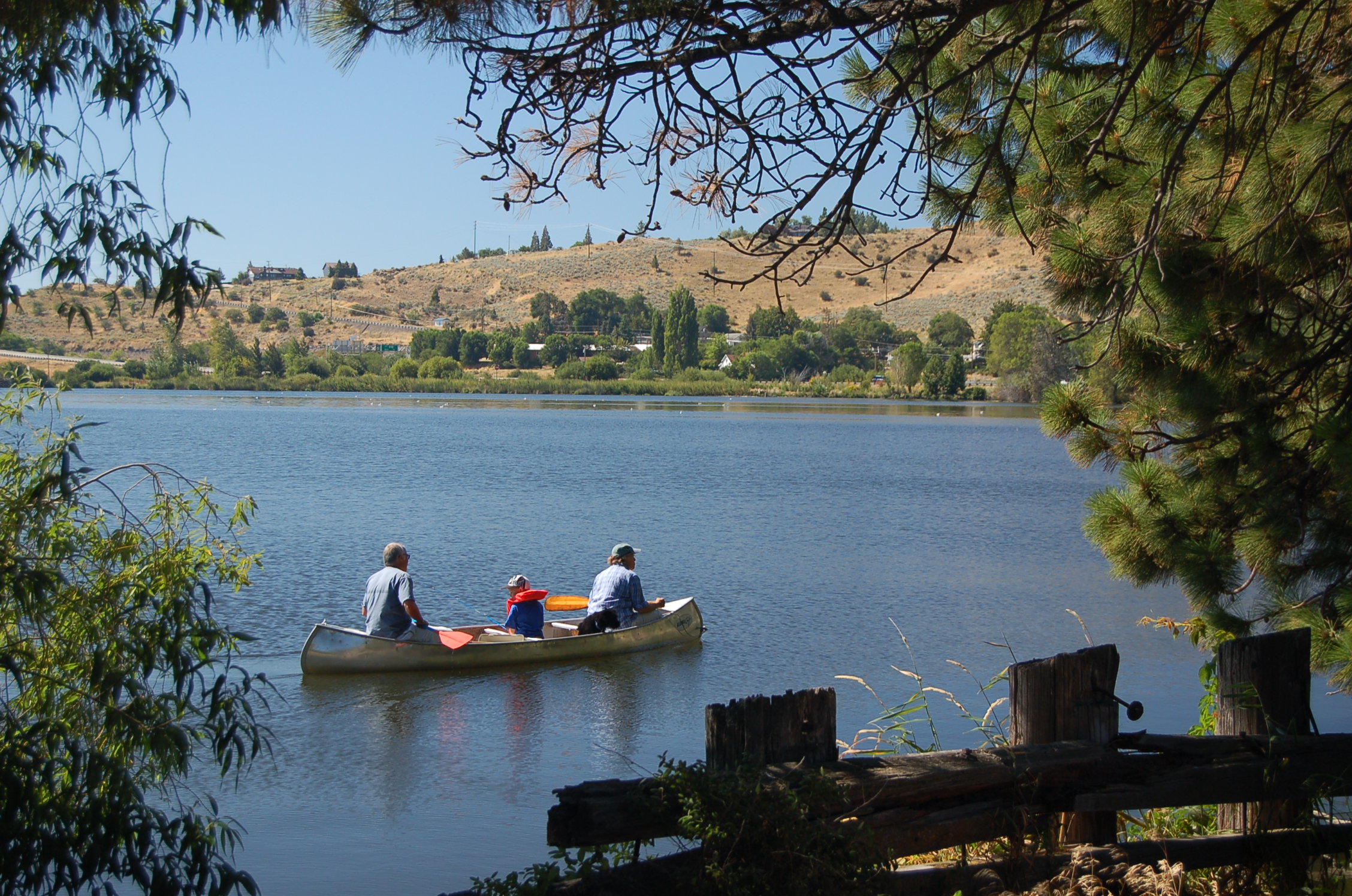
A family canoes on Lake Ewauna past Veteran's Memorial Park in Klamath Falls.
Public Domain. Photo by A. E. Crane
Download Original (2256 x 1496 pixels, 917.1 KB)
-
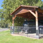
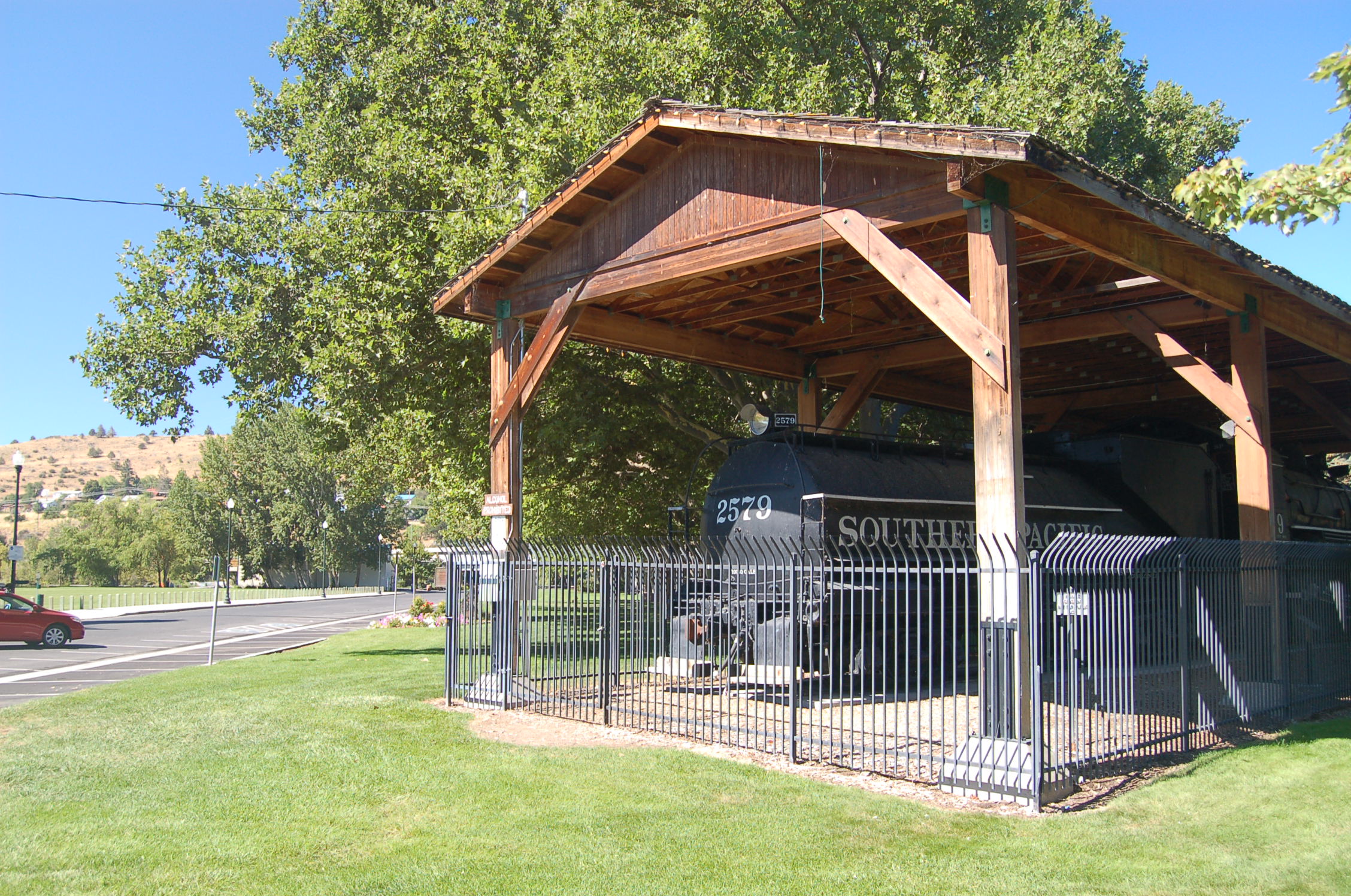
An old train engine is on display under a pavilion in Veteran's Memorial Park by Lake Ewauna in historic Klamath Falls.
Public Domain. Photo by A. E. Crane
Download Original (2256 x 1496 pixels, 933.1 KB)
-

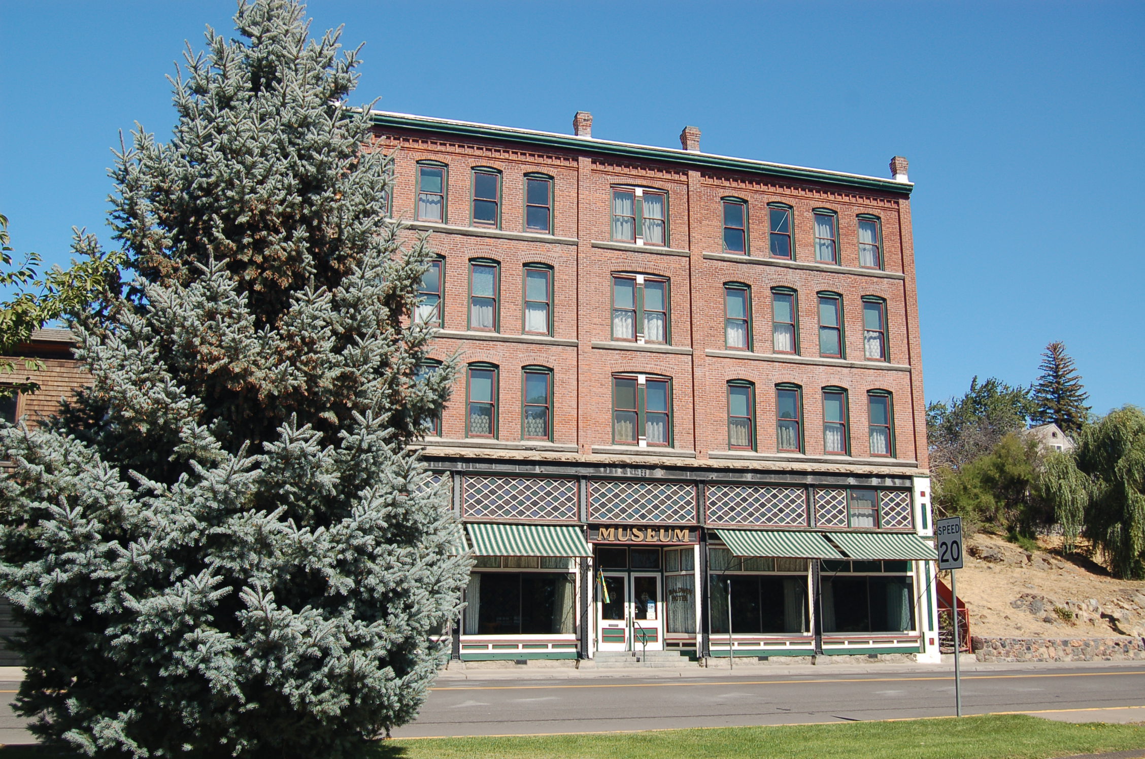
The historic Baldwin Hotel, once a furniture store and hotel, and now a museum, stands on Main Street (US 97) near Lake Ewauna in Klamath Falls.
Public Domain. Photo by A. E. Crane
Download Original (2256 x 1496 pixels, 911.2 KB)
-
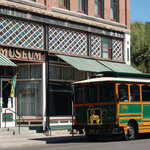
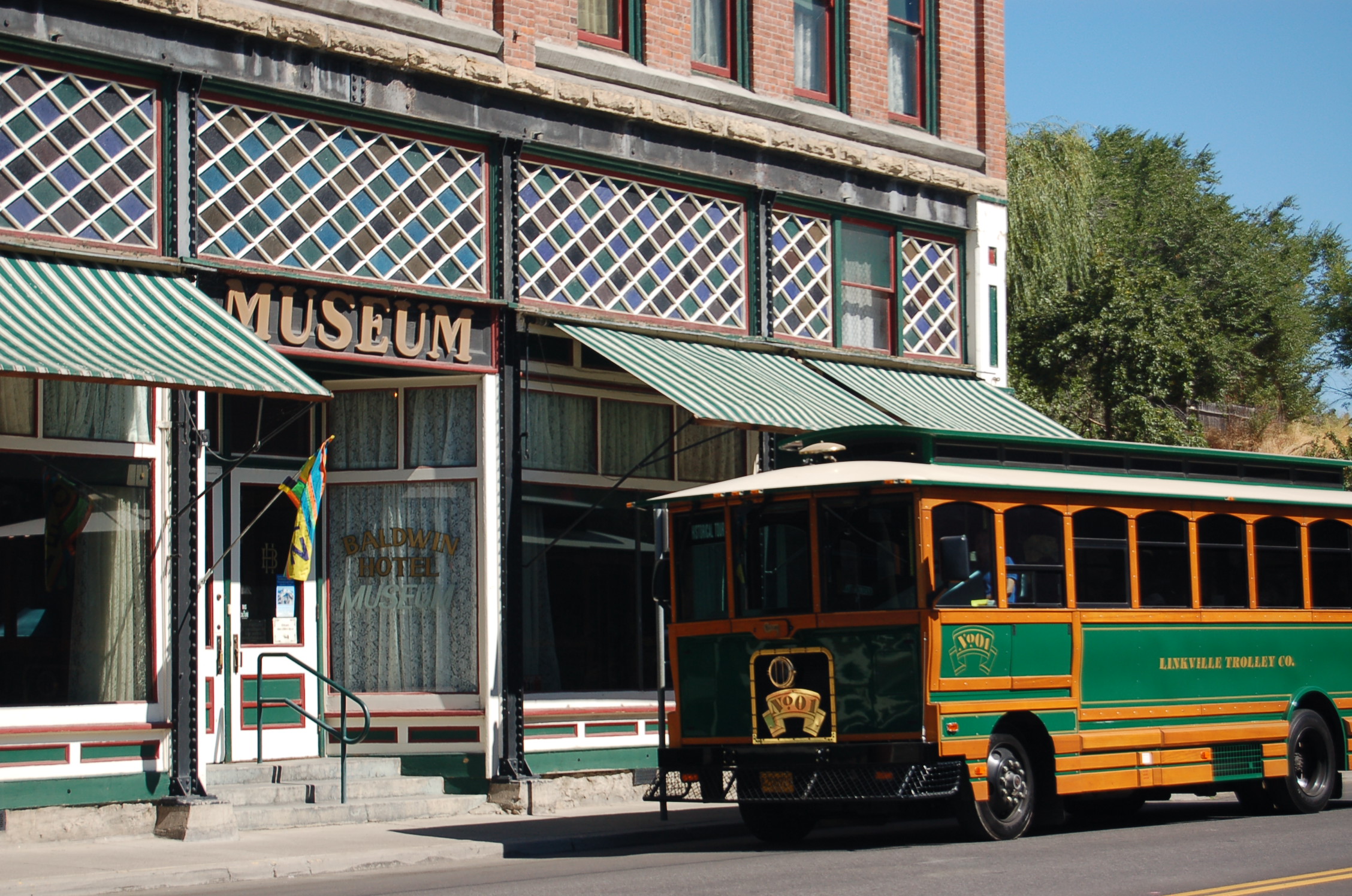
The Klamath Falls Trolley stops before the Baldwin Hotel Museum.
Public Domain. Photo by A. E. Crane
Download Original (2256 x 1496 pixels, 955.0 KB)
-
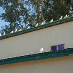
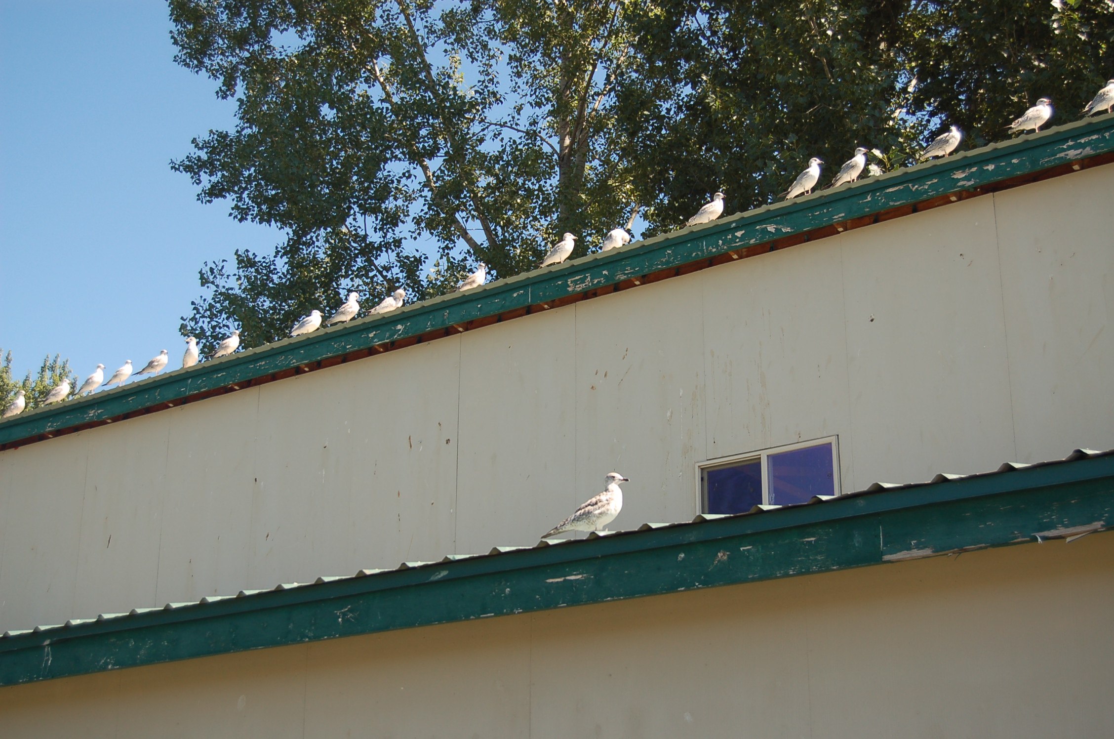
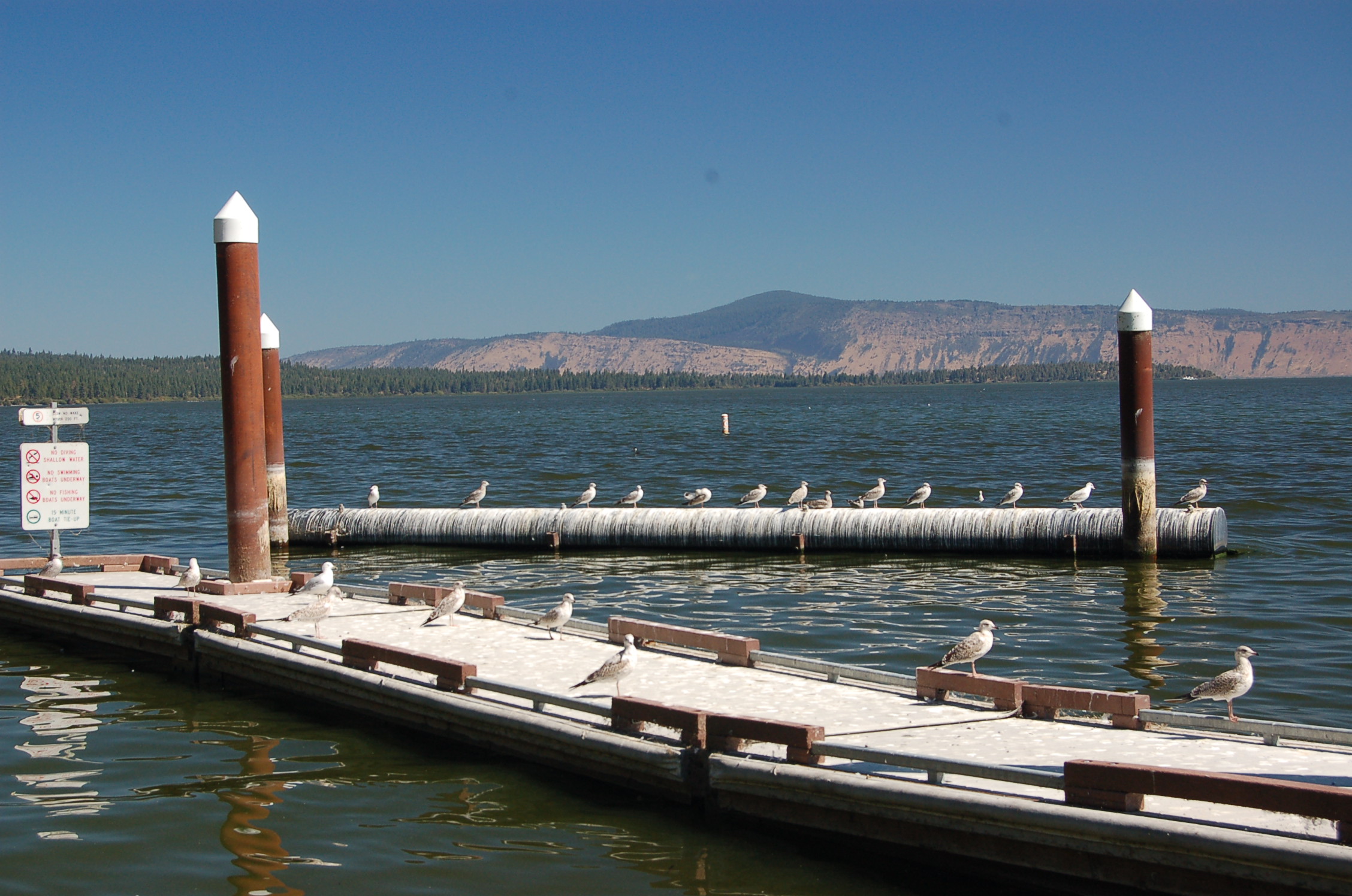
A line of seagulls perches on the roof of the information center in Veteran's Memorial Park in Klamath Falls by Lake Ewauna.
Public Domain. Photo by A. E. Crane
Download Original (2256 x 1496 pixels, 758.2 KB)
-
The snow-covered peak of Mt. Shasta peeks over the hilly horizon and open water of the Lower Klamath National Wildlife Refuge in California.
Public Domain. Photo by A. E. Crane
Download Original (2256 x 1496 pixels, 917.8 KB)
-
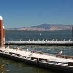
Seagulls perch along the pier at the wayside named "Wocus Bay" on OR-140 by Howard Bay on Upper Klamath Lake.
Public Domain. Photo by A. E. Crane
Download Original (2256 x 1496 pixels, 757.2 KB)
-
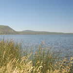
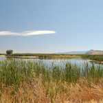
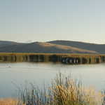
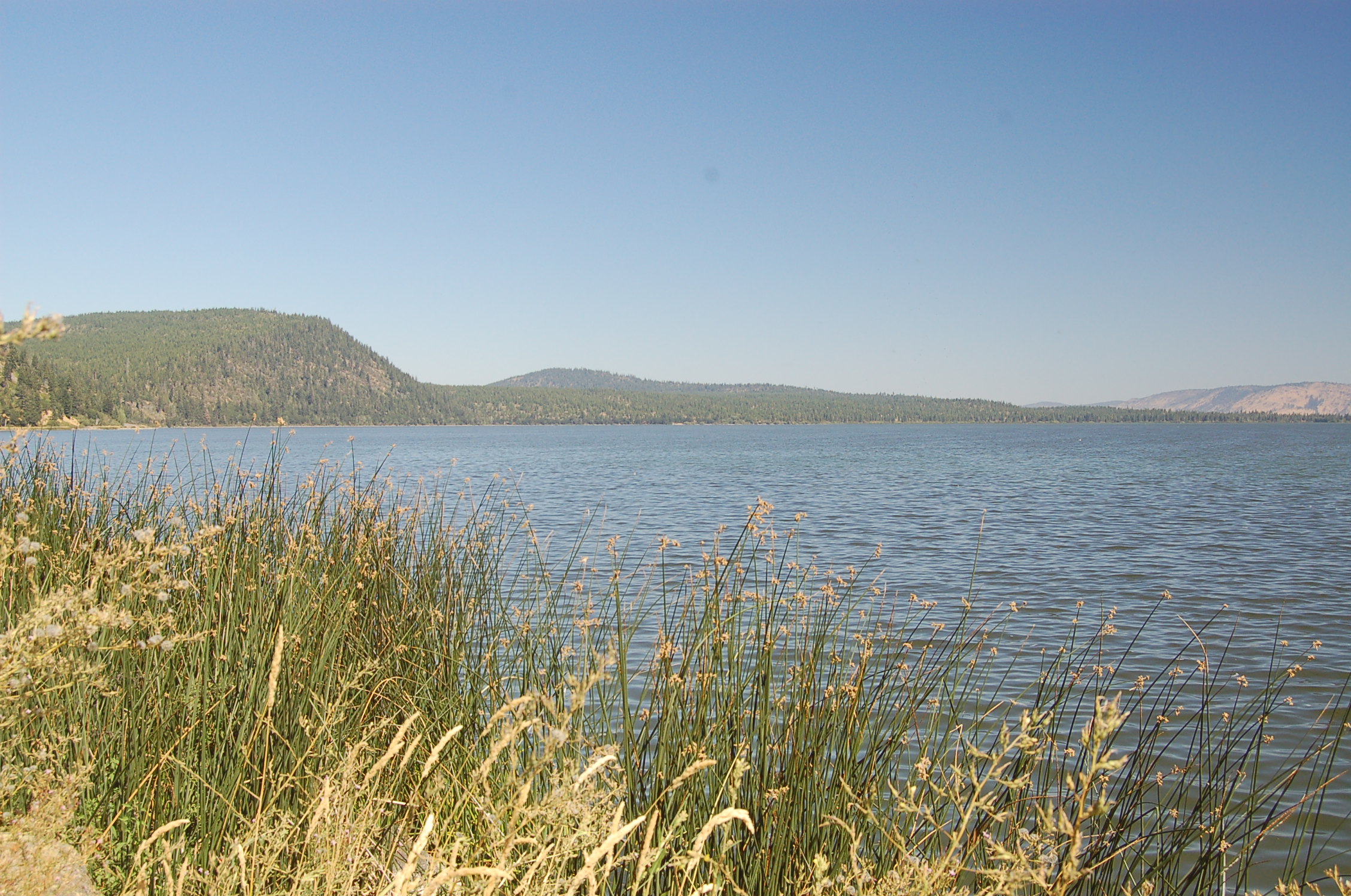
Grasses wave in the breeze alongside the blue waters of Upper Klamath Lake.
Public Domain. Photo by A. E. Crane
Download Original (2256 x 1496 pixels, 914.5 KB)
-
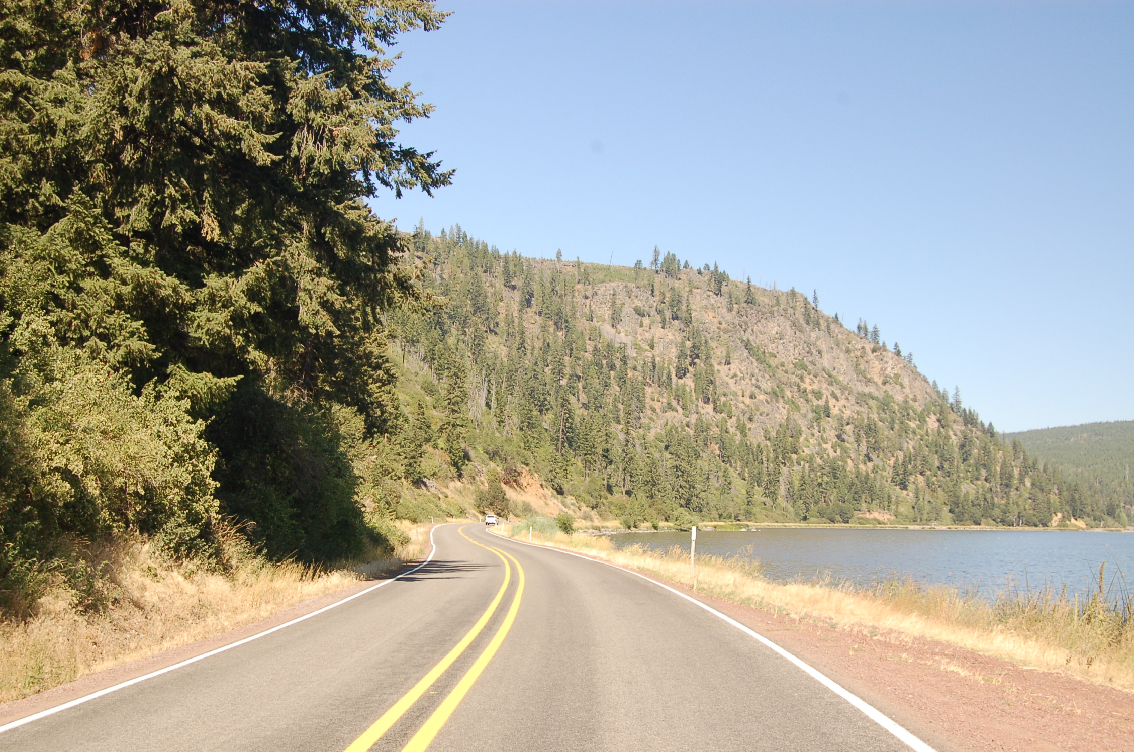
Trees and shoreline shrubs decorate the landscape along Oregon State Highway 140 past Upper Klamath Lake.
Public Domain. Photo by A. E. Crane
Download Original (2256 x 1496 pixels, 898.0 KB)
-
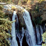
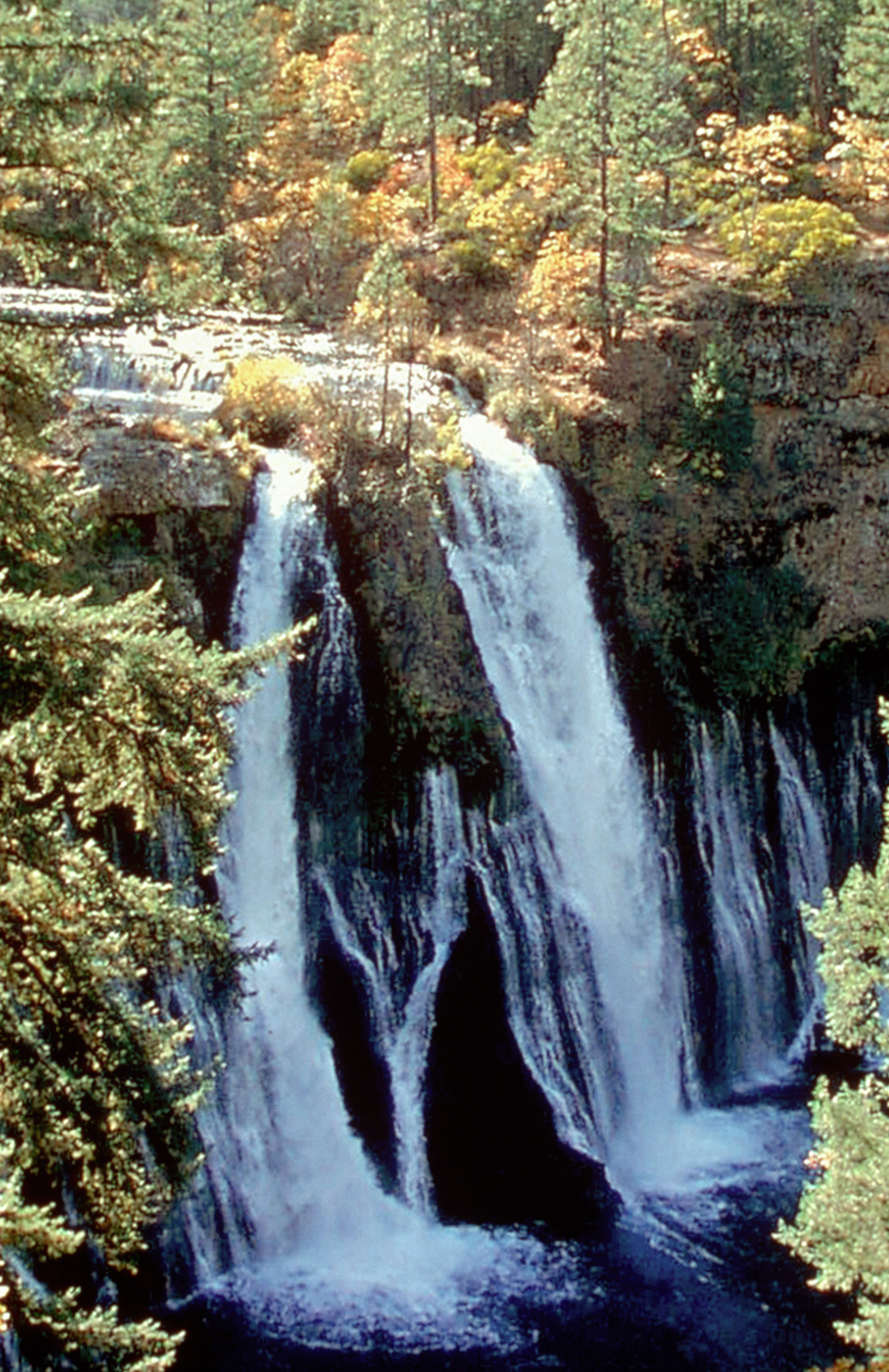
Trees frame this lovely view of the twin waterfalls of Burney Falls State Park.
Public Domain.
Download Original (480 x 640 pixels, 102.7 KB)
-
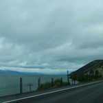
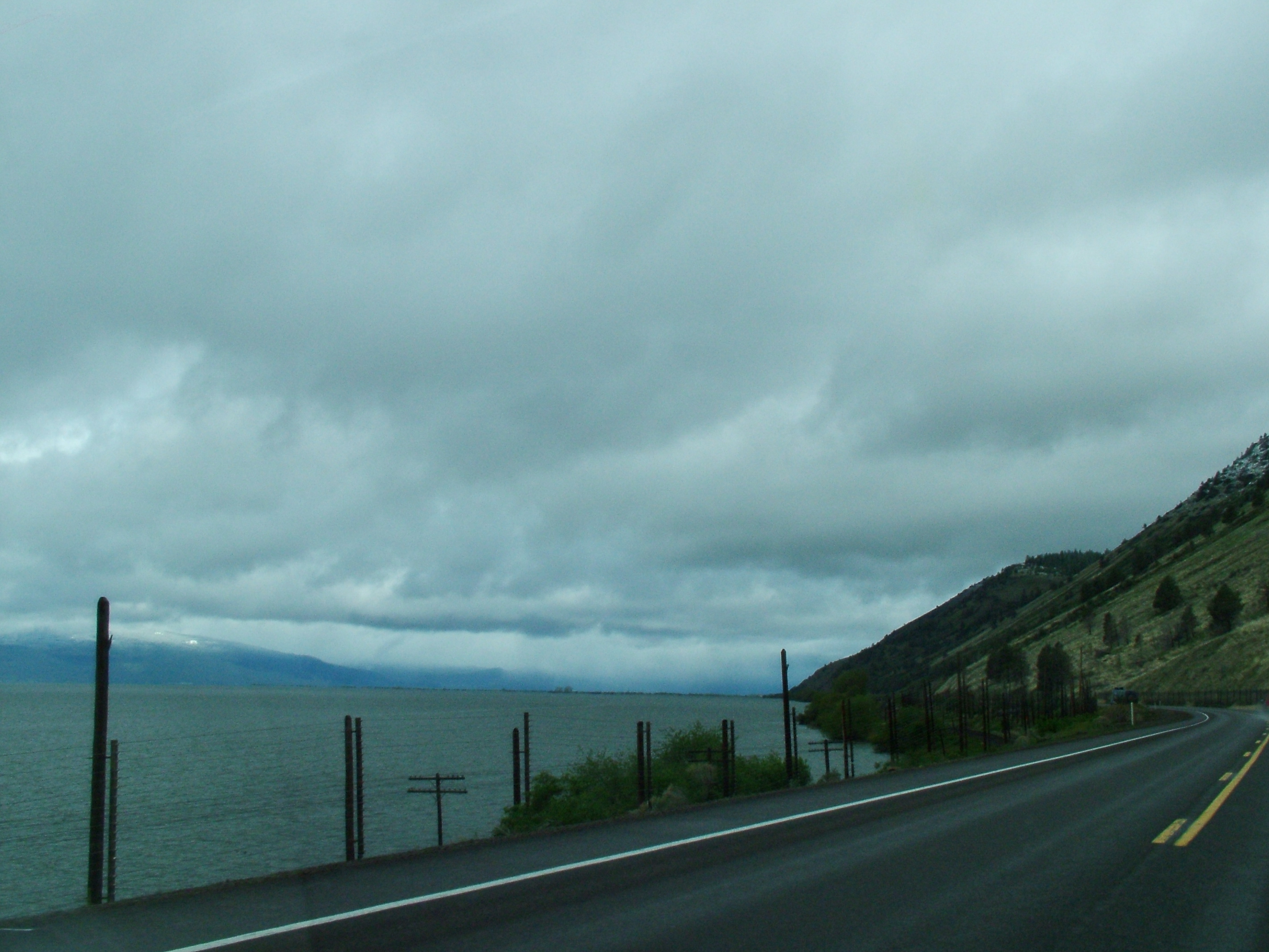
A scenic drive curves along the lake at Klamath Falls on an overcast day.
© May 2005 Joseph Varghese.
Download Original (2848 x 2136 pixels, 1548.1 MB)
-

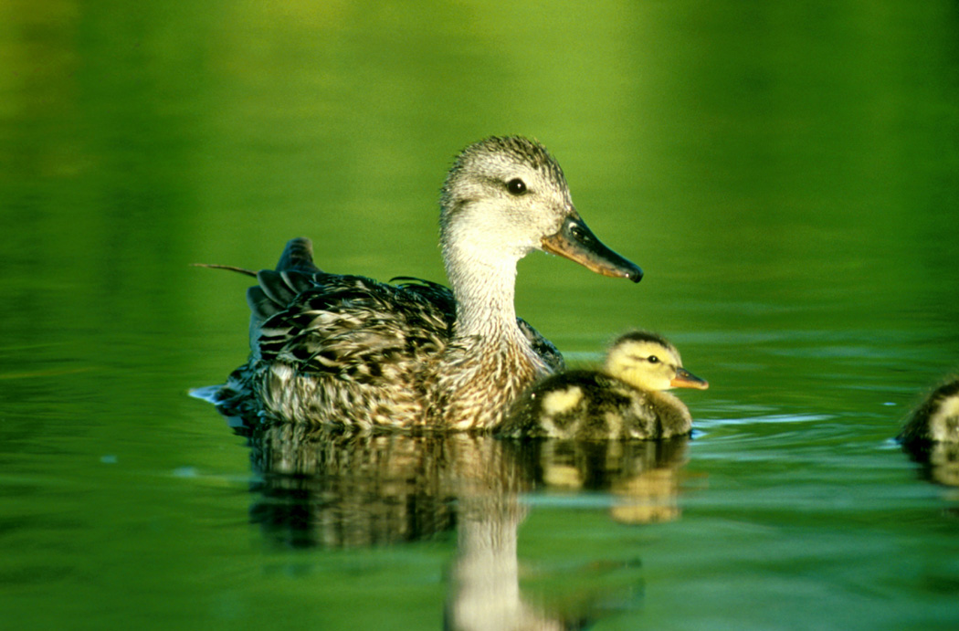
Bright green reflects on the water's surface as an adult Gadwall Duck and a duckling float by near Volcanic Legacy Scenic Byway.
Public Domain. USFWS photo by Dave Menke
Download Original (1050 x 691 pixels, 238.1 KB)
-
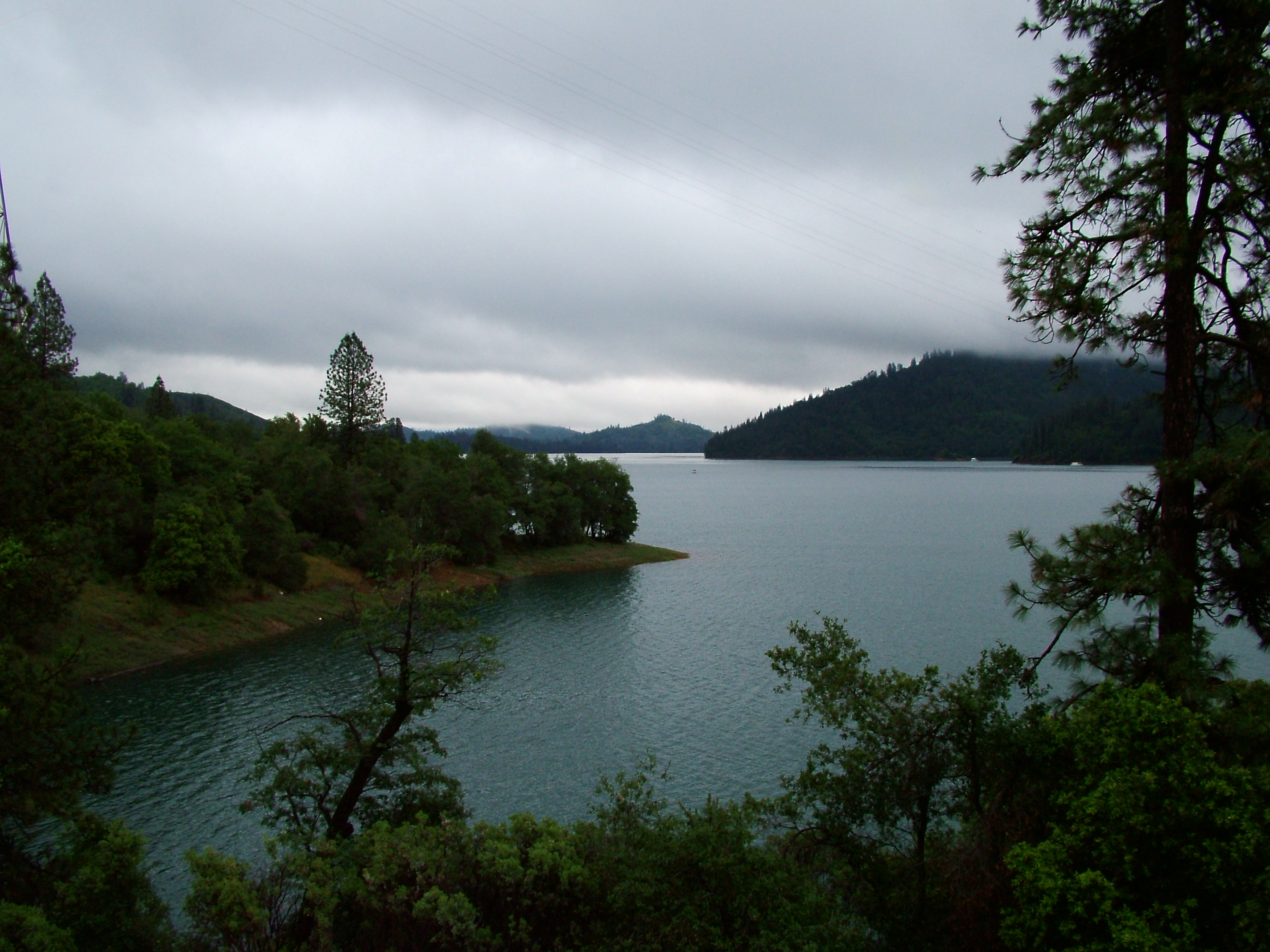
Lake Shasta looks dramatic on an overcast morning.
© May 2005 Joseph Varghese.
Download Original (2848 x 2136 pixels, 1668.6 MB)
-
Redwoods line the road at the entrance to Crater Lake National Park.
© May 2005 Joseph Varghese.
Download Original (2848 x 2136 pixels, 1558.2 MB)
-
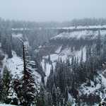
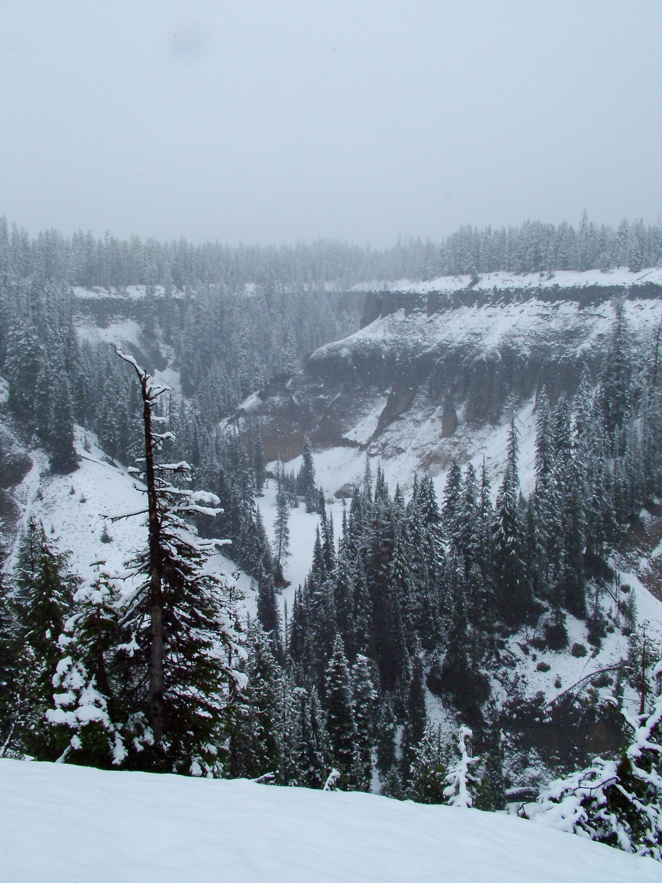
Snow dusted cliffs and trees provide an interesting formation near Crater Lake.
© May 2005 Joseph Varghese.
Download Original (2136 x 2848 pixels, 872.8 KB)
-
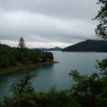
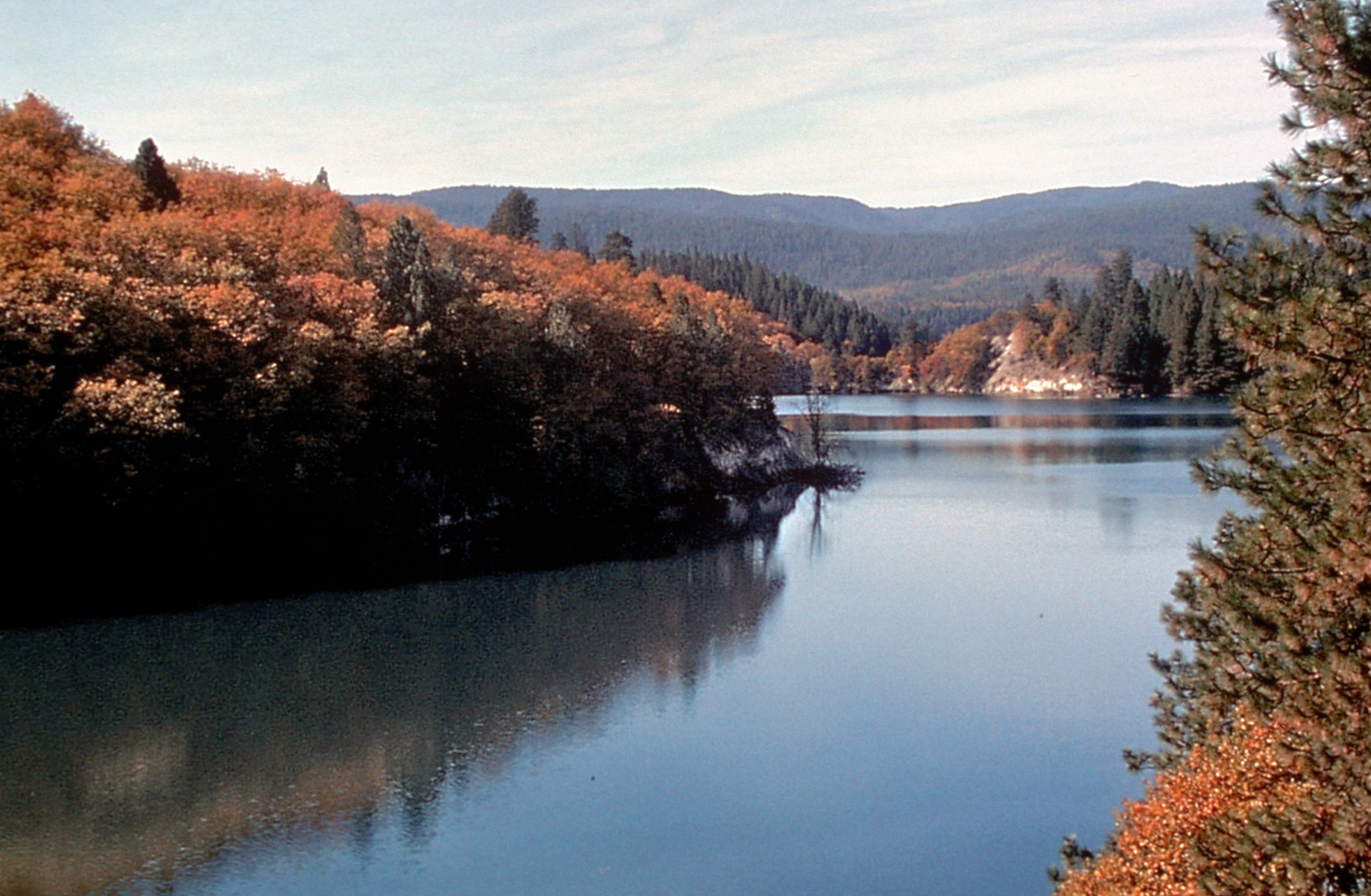
Lake Britton is a beautiful lake which offers many recreational acitivites including swimming along the beaches of the lake, boating, and fishing. The byway travels over the lake via a bridge, thus allowing scenic views from both sides.
Public Domain. Courtesy of Siskiyou County Visitors Bureau
Download Original (3628 x 2371 pixels, 7081.8 MB)
-
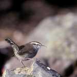
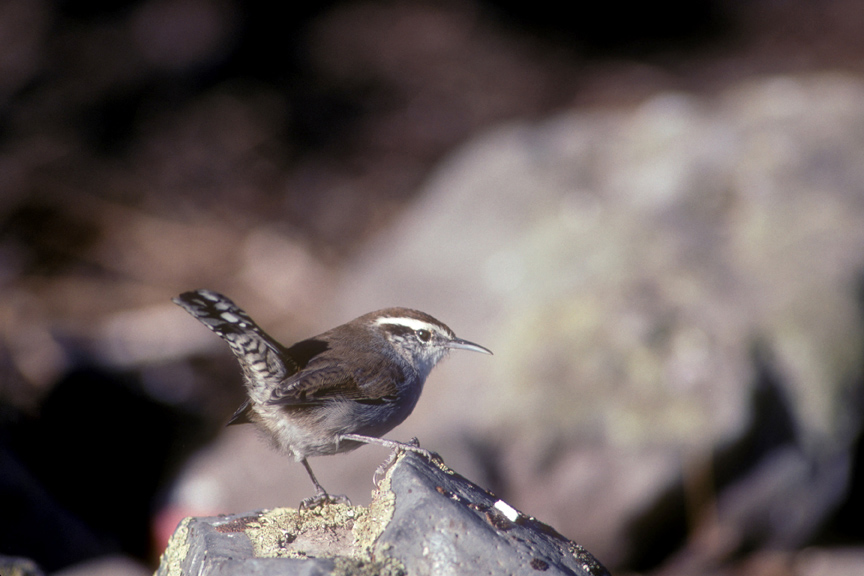
A Bewick's Wren perches on a gray, lichen-specked volcanic rock on Volcanic Legacy Scenic Byway.
Public Domain.
Download Original (864 x 576 pixels, 213.6 KB)
-
The Tule Lake Wildlife Refuge offers a wonderful opportunity for a variety of recreational activites. These include wildlife viewing, an auto tour, and fishing.
Public Domain. Courtesy of Dave Menke and U.S.Fish and Wildlife Service
Download Original (3599 x 2385 pixels, 9023.6 MB)
-
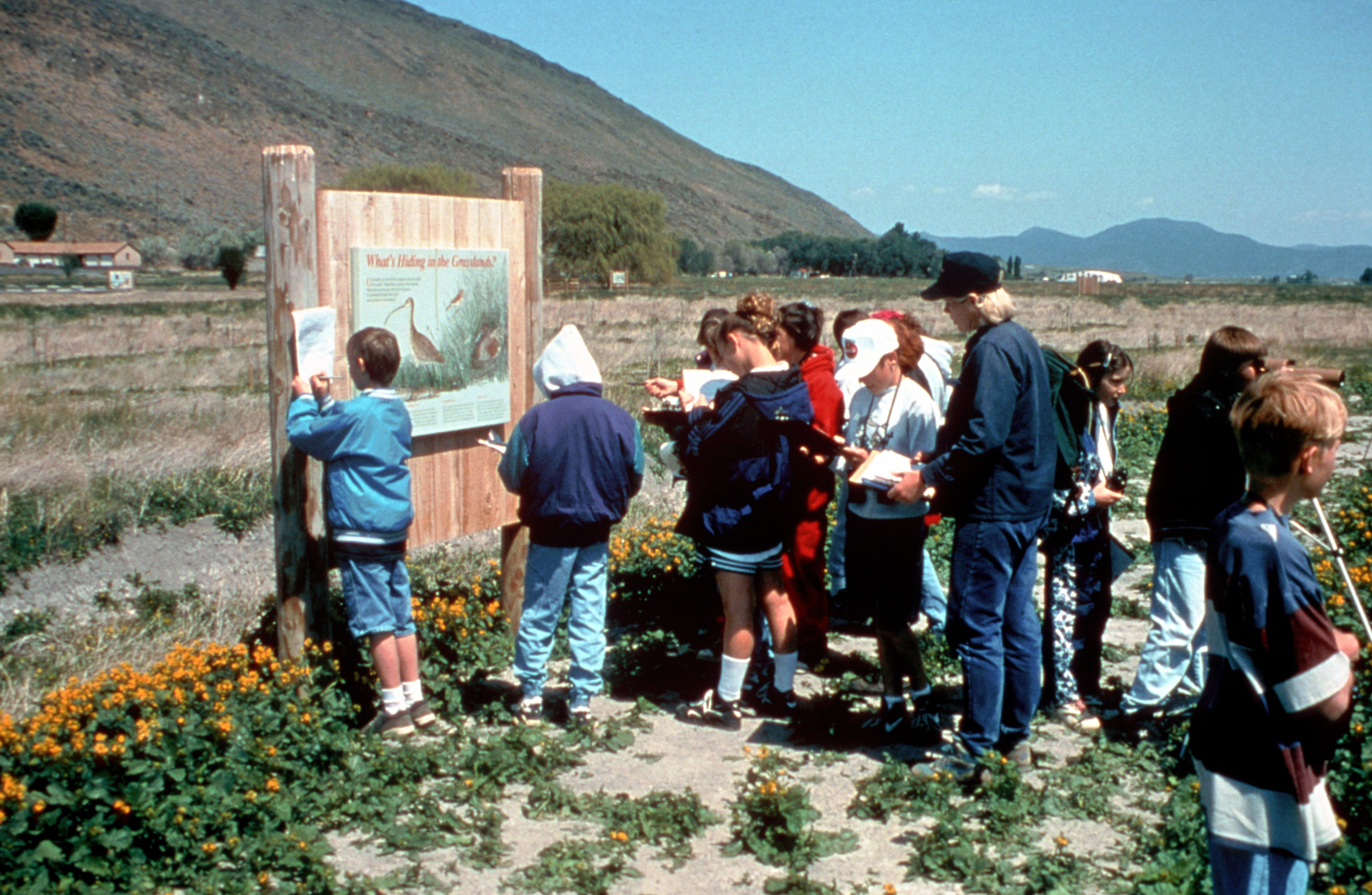
Intrinsic qualities along the byway can continue to be preserved and enhanced through stewardship and education. Providing children with knowledge about conservation will help them understand the importance and true value of our resources.
Public Domain. Dave Menke and United States Fish and Wildlife Service, 2001
Download Original (3652 x 2383 pixels, 7306.1 MB)
-
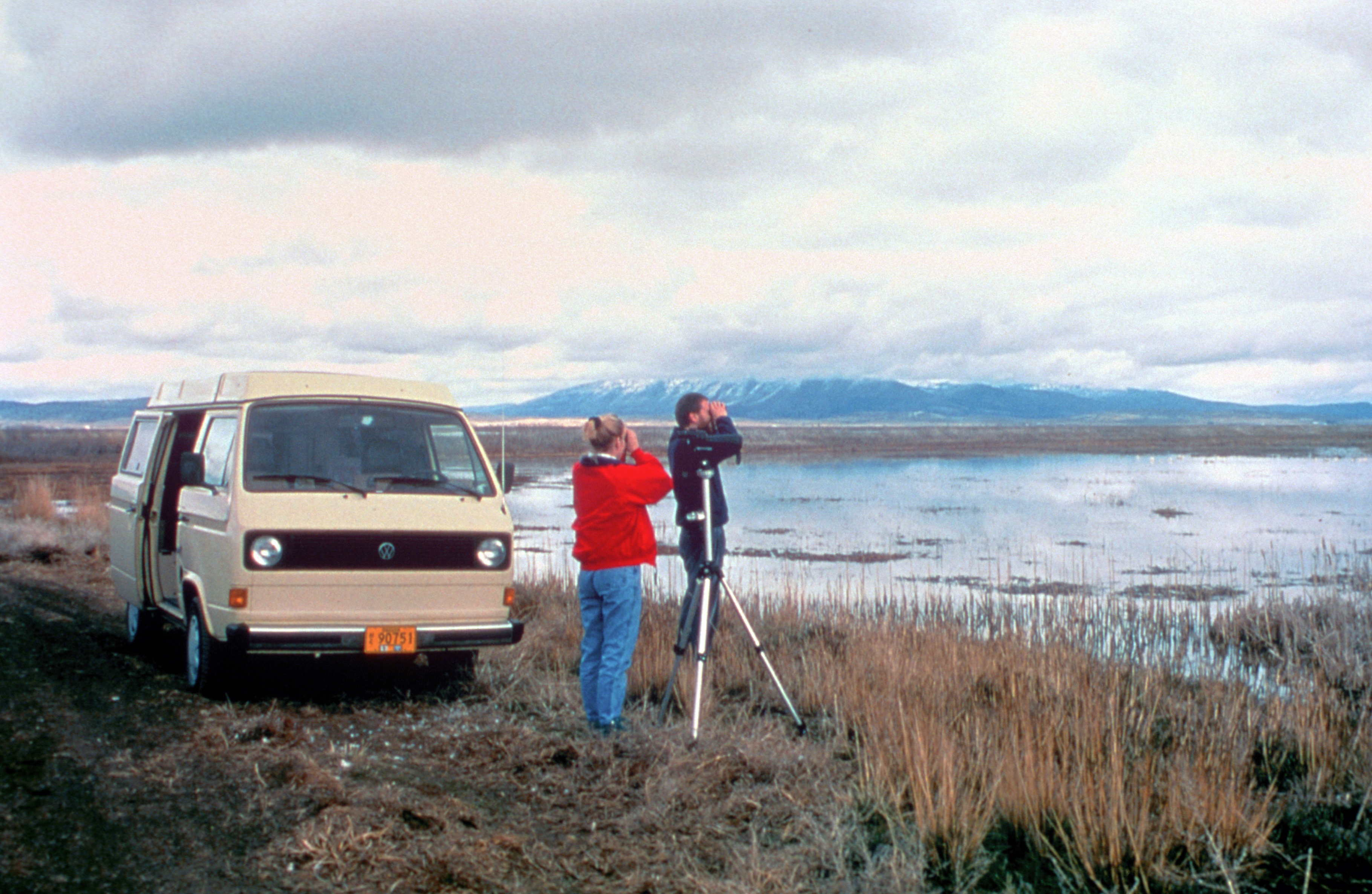
Wildlife viewing is a popular activity at Lower Klamath Falls National Wildlife Refuge. This refuge is home to the largest concentration of bald eagles in the lower 48 states. It's wetlands and marshes are home to millions of migrating birds and ducks including American white pelicans, white-faced ibises, western and eared grebes, Ross geese, and pintail, mallard, and canvasback ducks.
Public Domain. Tom VandenBerg and United States Fish and Wildlife Service, 2001
Download Original (3640 x 2371 pixels, 7798.9 MB)
-
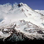
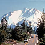
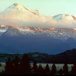
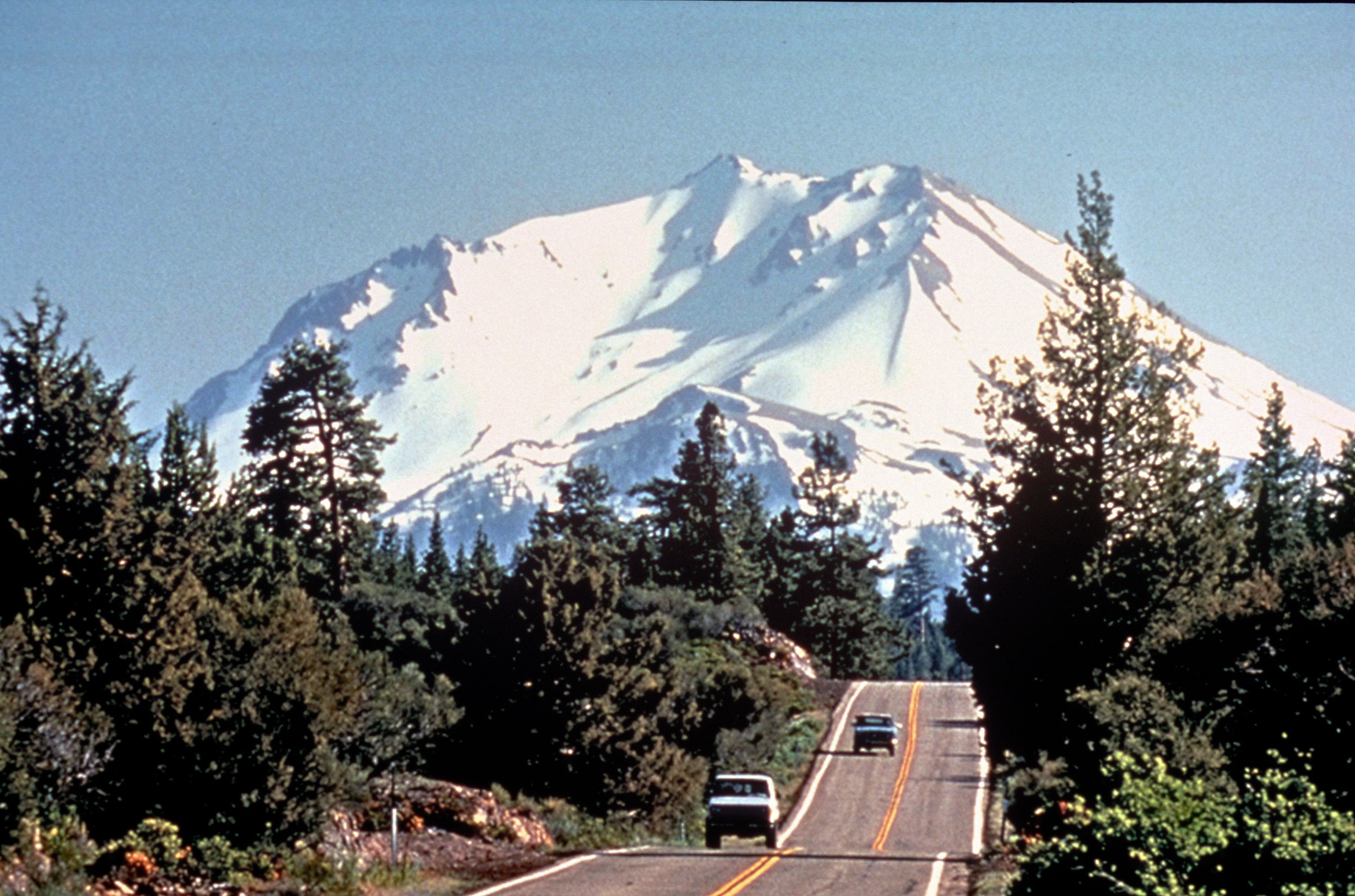
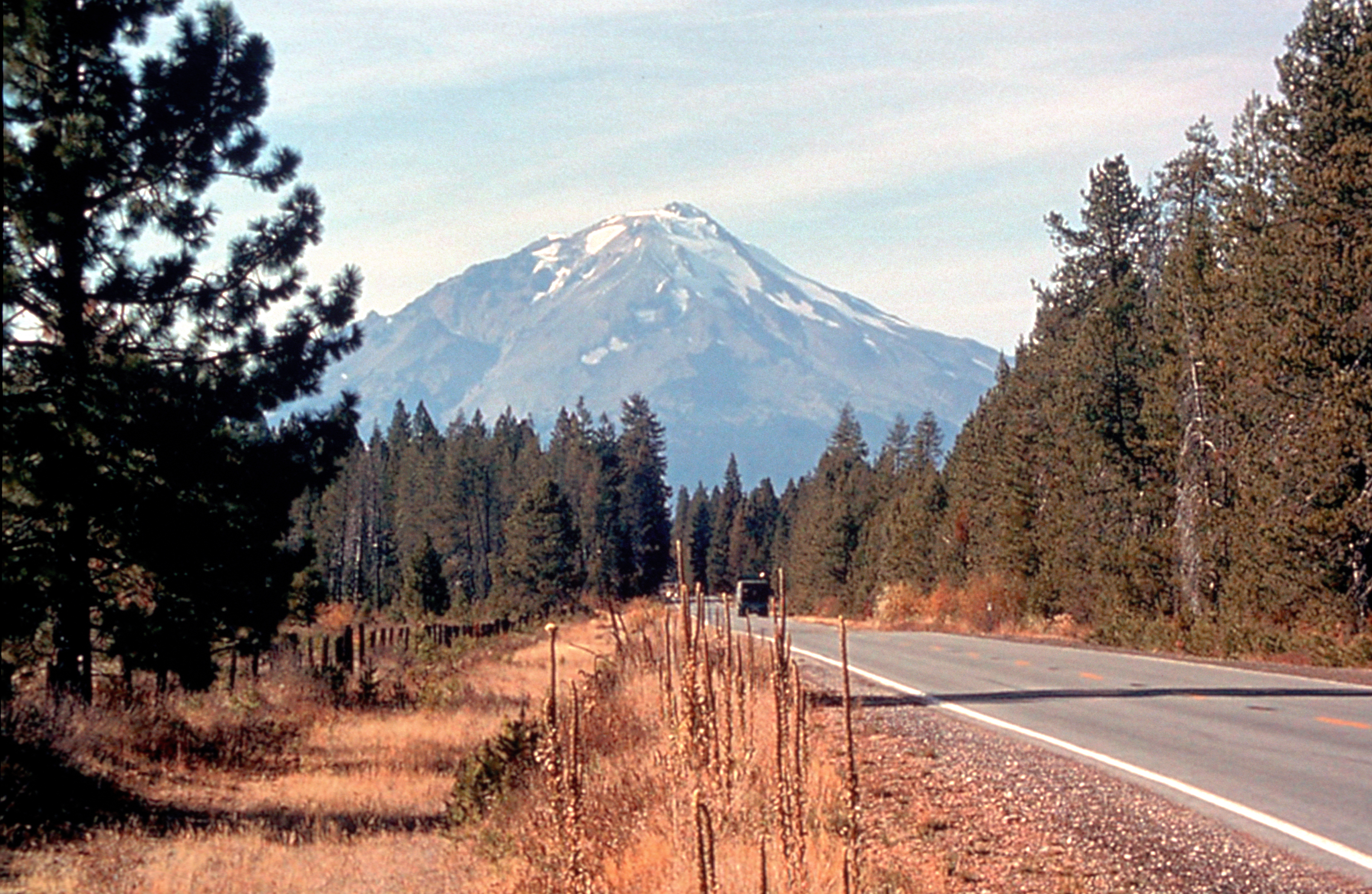
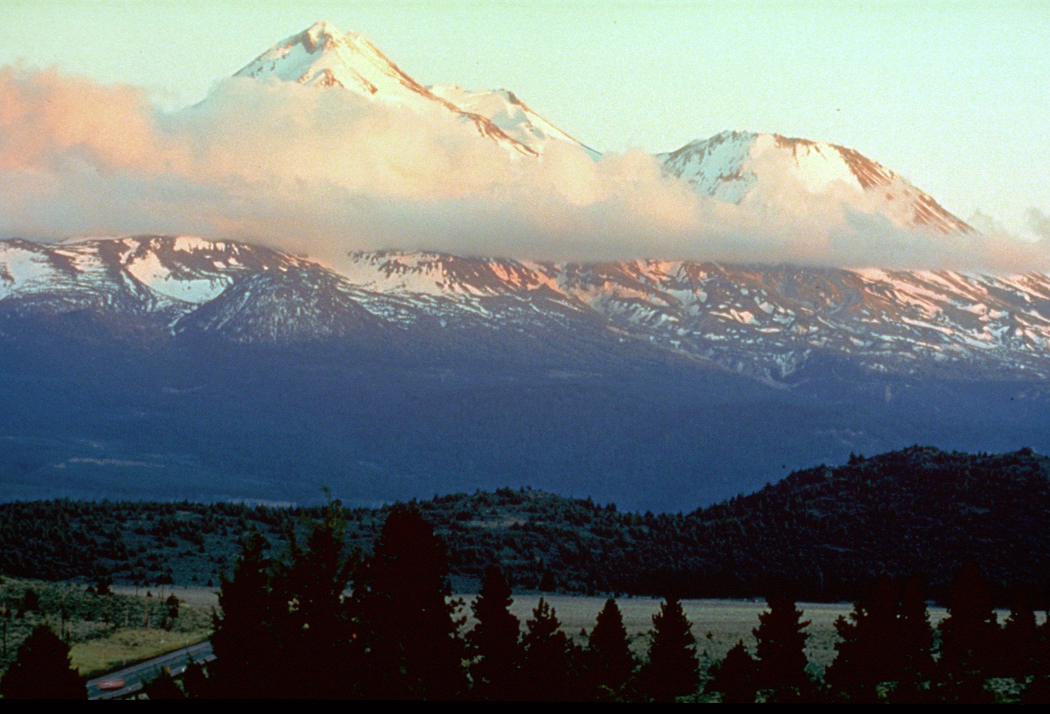
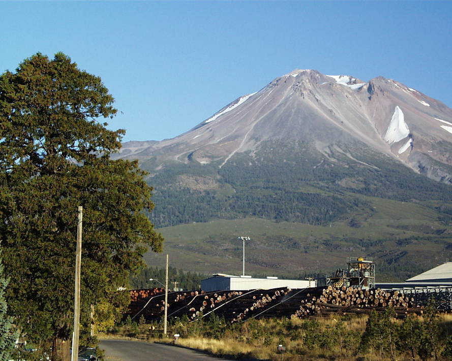
Mount Shasta is visible from hundreds of miles away, appearing like an island in the sky. The sheer vastness of Mount Shasta along the byway is enough to capture the traveler's attention for awhile, but this is only one of the many experiences the byway offers.
Public Domain. Caia Cupito and Ore-Cal RC&D, 2001
Download Original (3640 x 2371 pixels, 7899.9 MB)
-
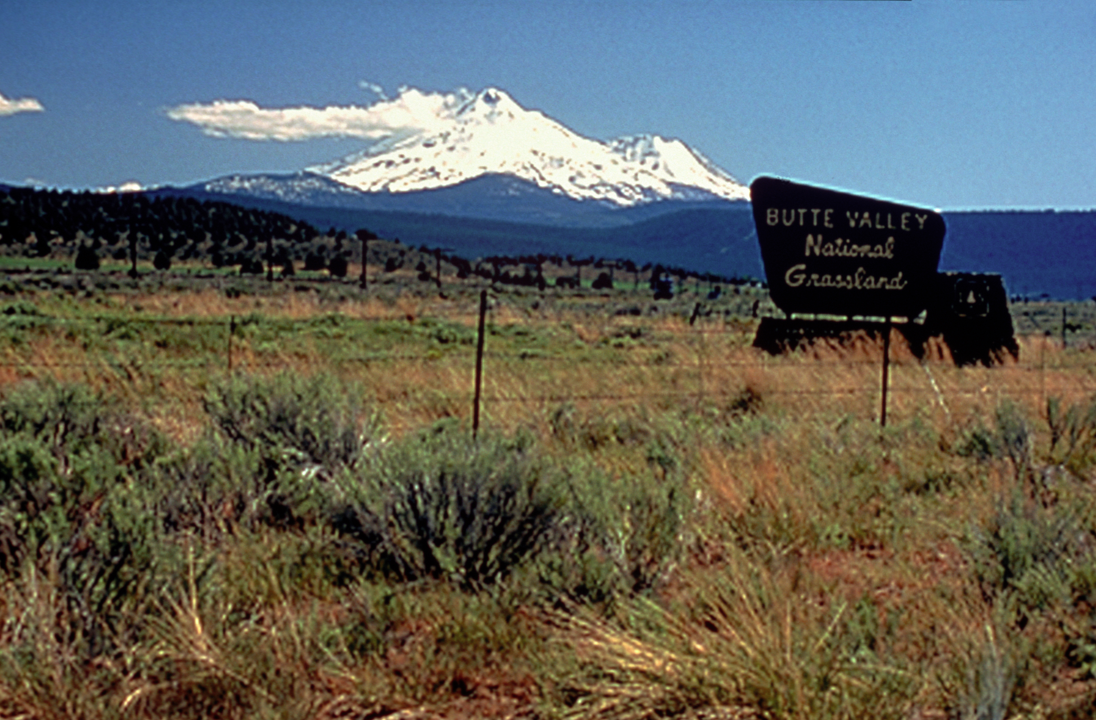
Butte Valley National Grasslands is the only national grassland in California. It provides wetland habitat for many wildlife species. The grasslands also contribute to the diversity of landscapes along the byway.
Public Domain. Caia Cupito and Ore-Cal RC&D, 2001
Download Original (3628 x 2383 pixels, 6687.7 MB)
-
Agriculture is an important cultural lifestyle of the region, contributing to its economic vitality. Farming activities provide an opportunity to showcase best practices related to land management to byway travelers.
Public Domain. Tupper Ansel Blake and United States Fish and Wildlife Service, 2001
Download Original (3628 x 2359 pixels, 8421.6 MB)
-
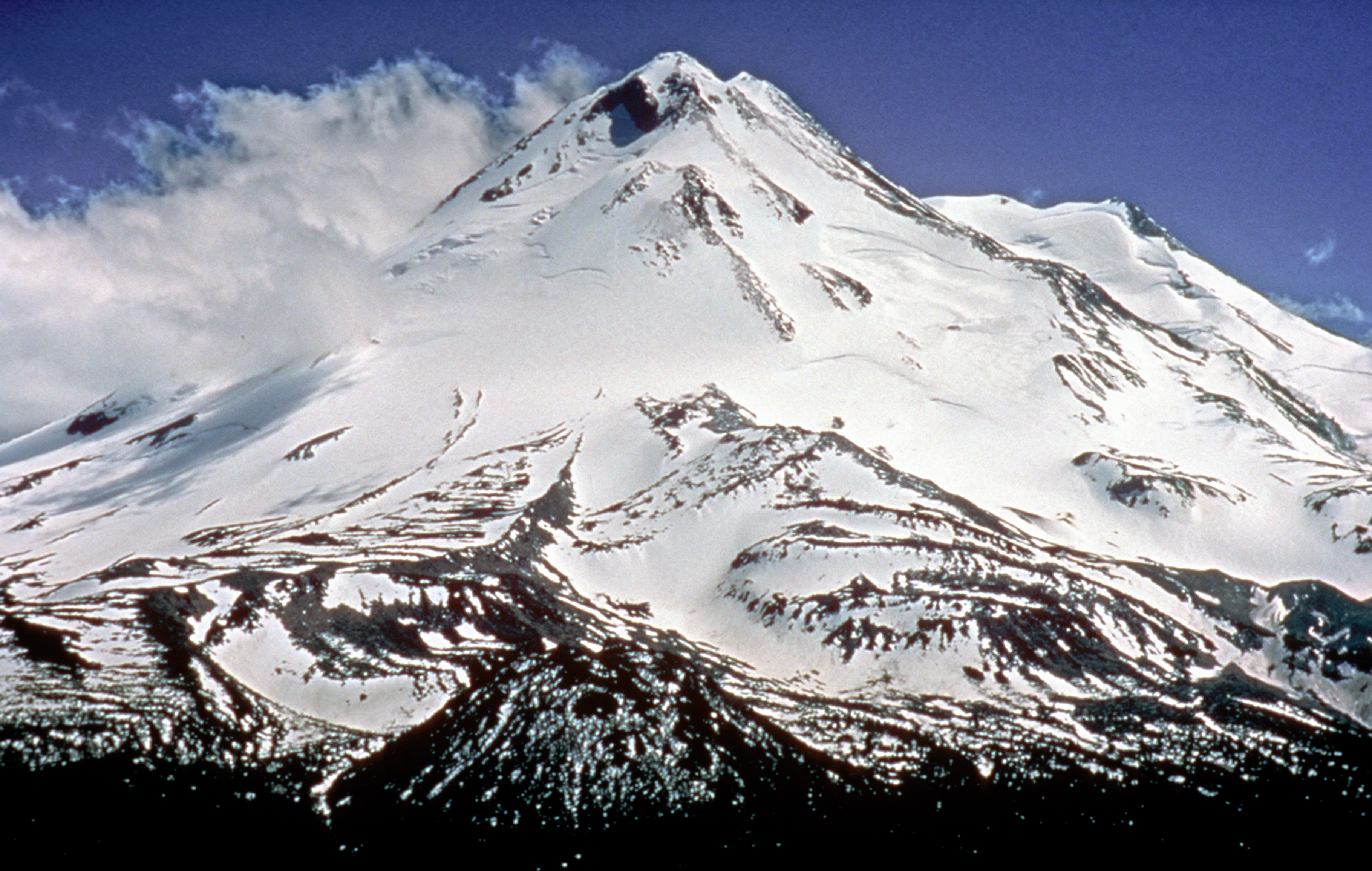
"I consider the evening twilight on Mount Shasta one the grandest sights I have ever witnessed." - Theodore Roosevelt, 1908. Mount Shasta is a world class recreational destination that offers over 150 miles of trails, camping, and backbacking.
Public Domain. Courtesy of Caia Cupito and Ore-Cal RC&D
Download Original (3592 x 2443 pixels, 8267.9 MB)
-
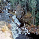
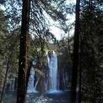
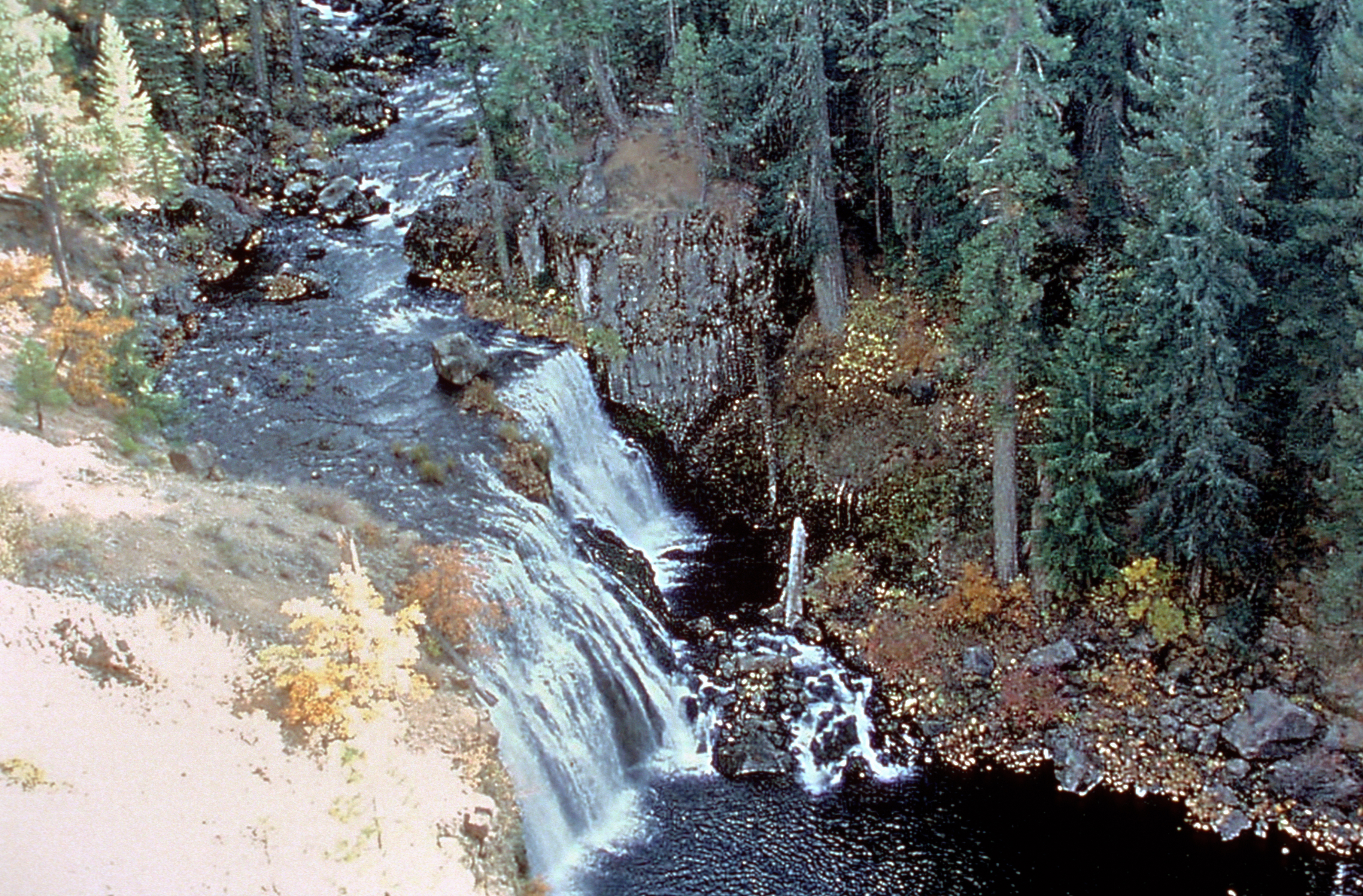
Middle McCloud Falls is one of three falls located on the McCloud River. All three falls are accessible by a one-mile trail. Adventurous swimmers take a plunge into the falls, and areas nearby are also great fishing destinations.
Public Domain. Siskiyou County Visitors Bureau, 2001
Download Original (3640 x 2395 pixels, 8576.2 MB)
-
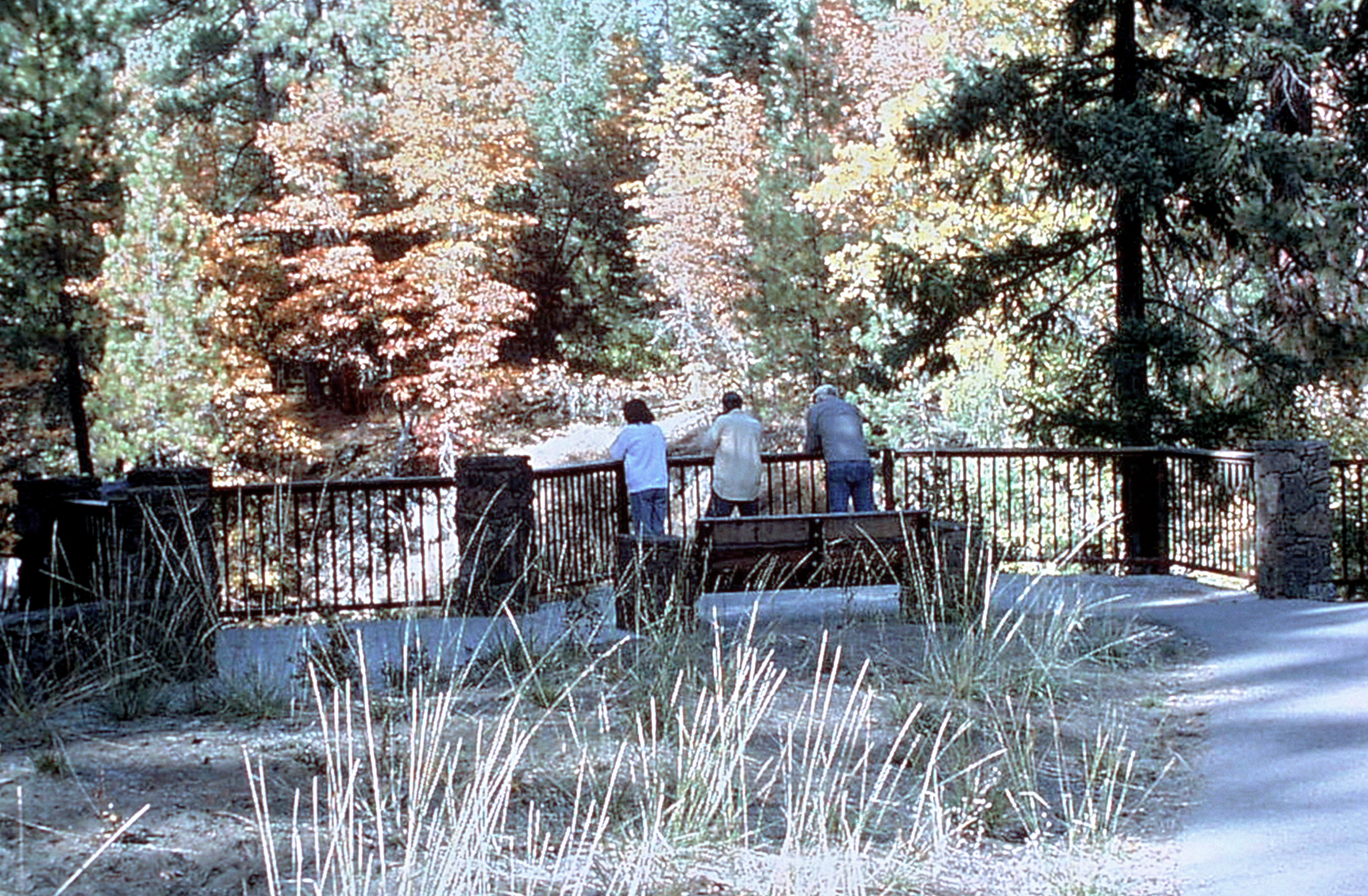
The existing overlooks along the byway provide a wonderful opportunity for visitors of all ages and abilities to view the wonderful intrinsic qualities offered along the byway. This overlook allows visitors to view Lower McCloud Falls.
Public Domain. Siskiyou County Visitors Bureau, 2001
Download Original (3640 x 2383 pixels, 9131.5 MB)
-
Burney Falls is a 129-foot waterfall. These falls flow at the same rate all year long - 100 million gallons of water every day. While the waterfall is the centerpiece of the park, it also offers five miles of hiking trails and 128 developed campsites with showers, toilets, and picnic areas.
Public Domain. Siskiyou County Visitors Bureau, 2001
Download Original (2359 x 3640 pixels, 7460.4 MB)
-
Managed agriculture and timber lands are important attributes of the byway, offering travelers glimpes into the rural lifestyle and culture of the region. The Volcanic Legacy Scenic Byway is a place where the ever-changing worlds of the past and present unite in harmony.
Public Domain. Siskiyou County Visitors Bureau, 2001
Download Original (3640 x 2359 pixels, 7970.0 MB)
-
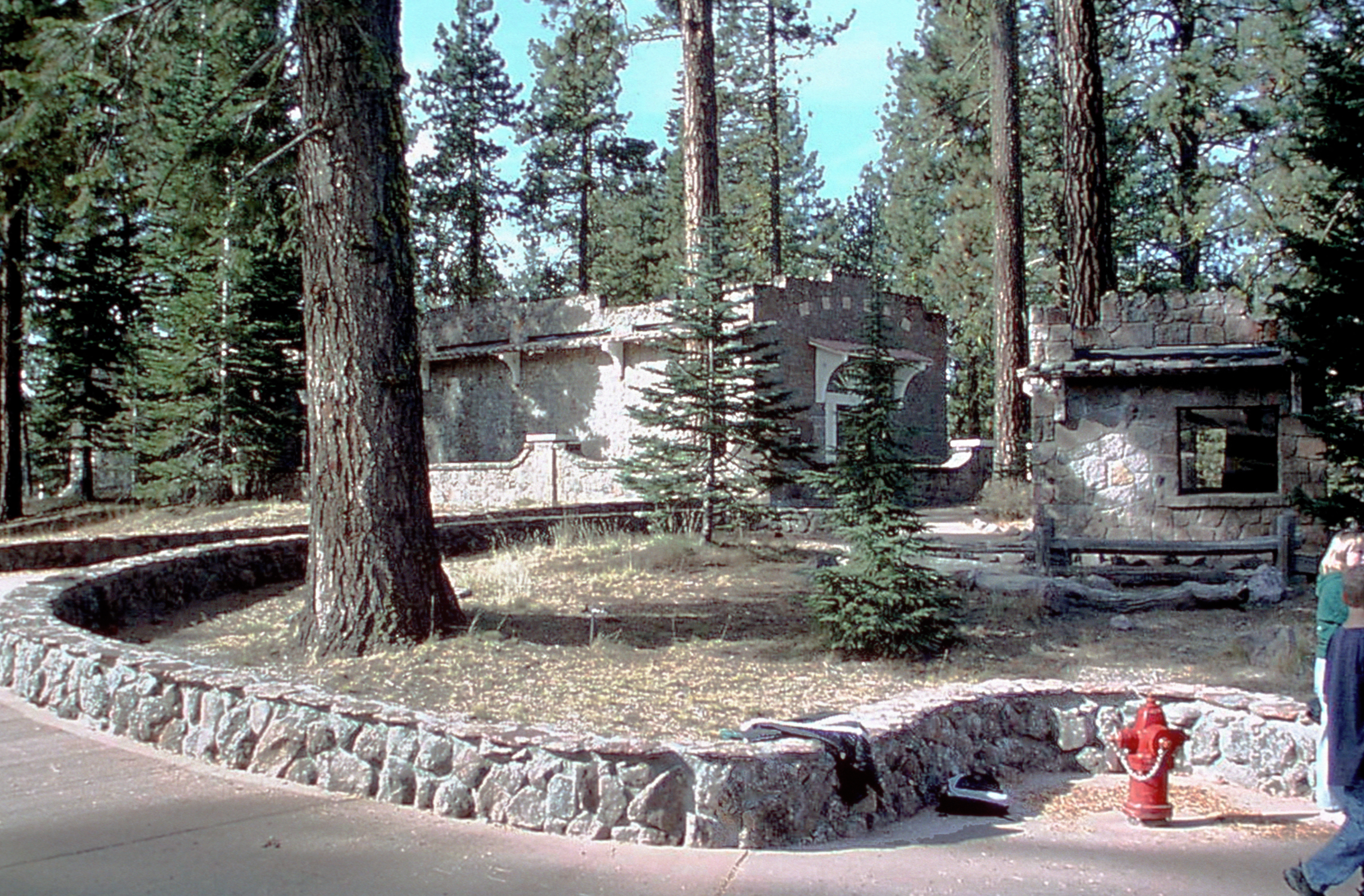
Visitor centers, such as this one near Lassen Volcanic National Park, contain information, National Park Service publications, road and trail maps, and activities for children. These facilities offer travelers wayfinding information for nearby intrinsic qualities along the byway.
Public Domain. Siskiyou County Visitors Bureau, 2001
Download Original (3628 x 2383 pixels, 7965.9 MB)
-
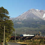
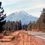
The logging town of Weed, in front of Mt. Lassen along the Volcanic Legacy Scenic Byway, was built in 1897.
Public Domain. Siskiyou County Visitors' Bureau, July 2002
Download Original (889 x 711 pixels, 621.6 KB)
-
The Klamath Basin National Wildlife Refuges spanning both Oregon and California along the Volcanic Legacy, provides an important habitat for many species including this flock of Ross Geese. Canada, snow, and white-fronted geese also enjoy the refuge's safety.
Public Domain. Photo by Tupper Ansel Blake of US Fish and Wildlife Service
Download Original (3652 x 2383 pixels, 8650.0 MB)
-

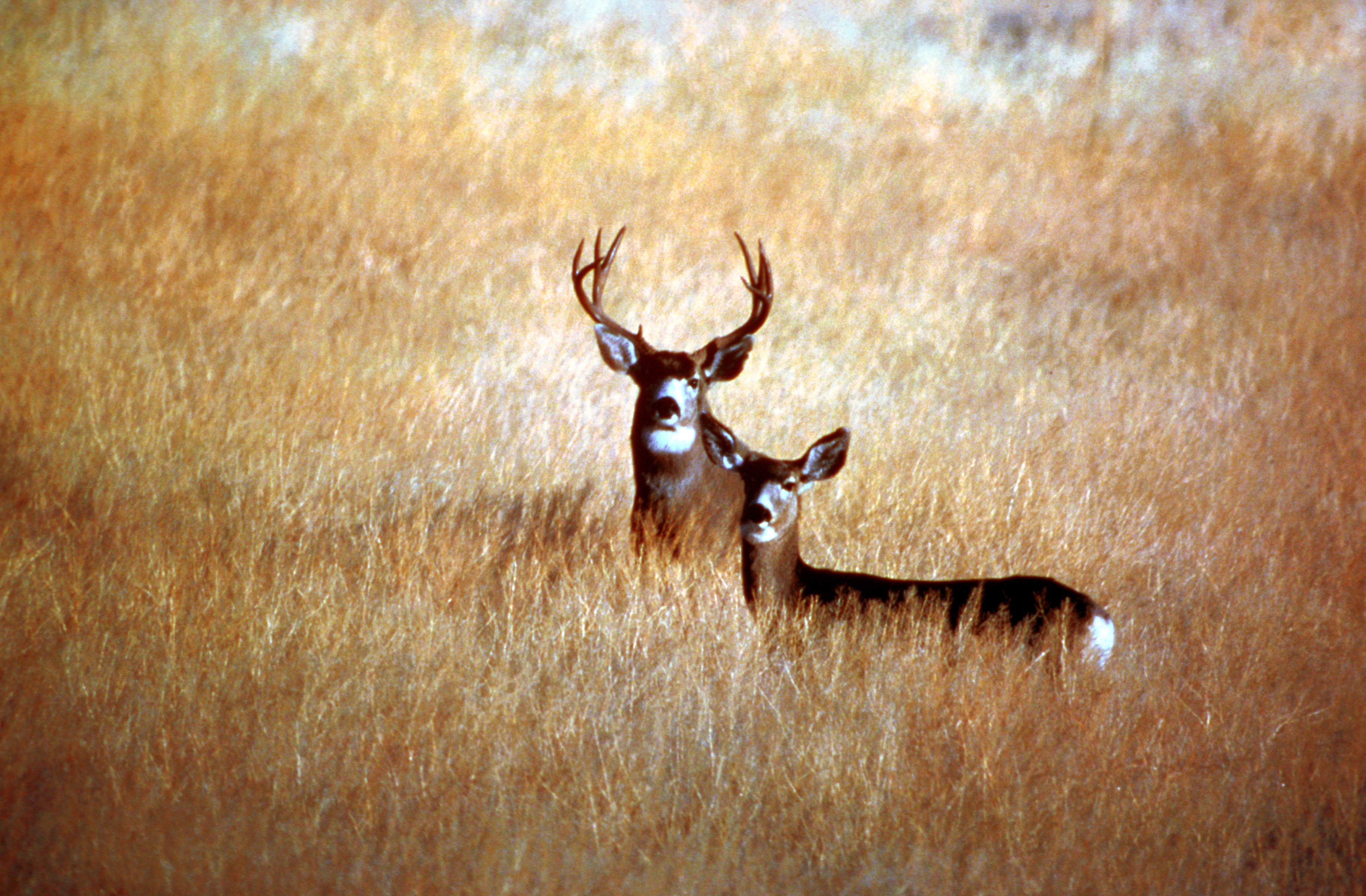
Areas adjacent to the byway like national forests and national parklands provide travelers with the opportunity to view an abundance of wildlife species. The Mule Deer is just one of them.
Public Domain. Tupper Ansel Blake and United States Fish and Wildlife Service, 2001
Download Original (3635 x 2384 pixels, 10917.5 MB)
-
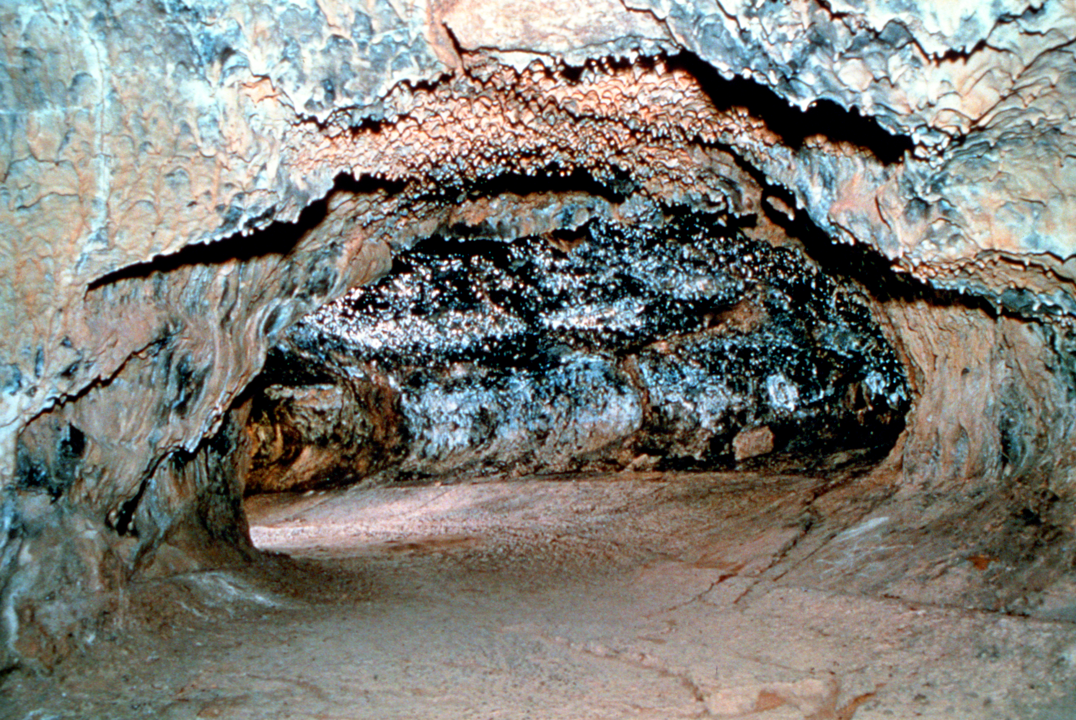
Subway Cave, a lava tube north of Lassen Volcanic National Park, on Hwy. 89. Lava Beds National Monument encompasses over 46,500 acres and contains the largest concentration of lava tube caves in the United States. While lava tubes are not unusual in volcanic areas, the vast quantity found at Lava Beds is.
Public Domain. National Park Service, 1964
Download Original (3564 x 2385 pixels, 10359.2 MB)
-

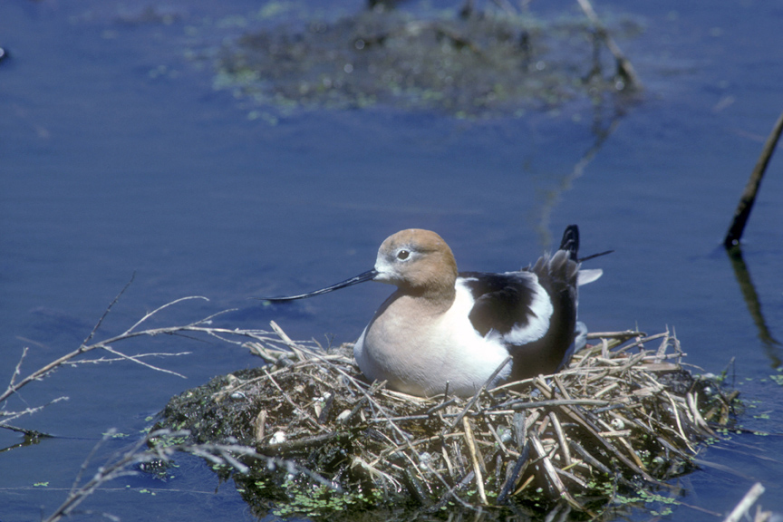
With its distinct curving bill, this American Avocet settles into its nest along Volcanic Legacy Scenic Byway.
Public Domain. USFWS photo by Dave Menke
Download Original (864 x 576 pixels, 277.1 KB)
-

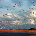
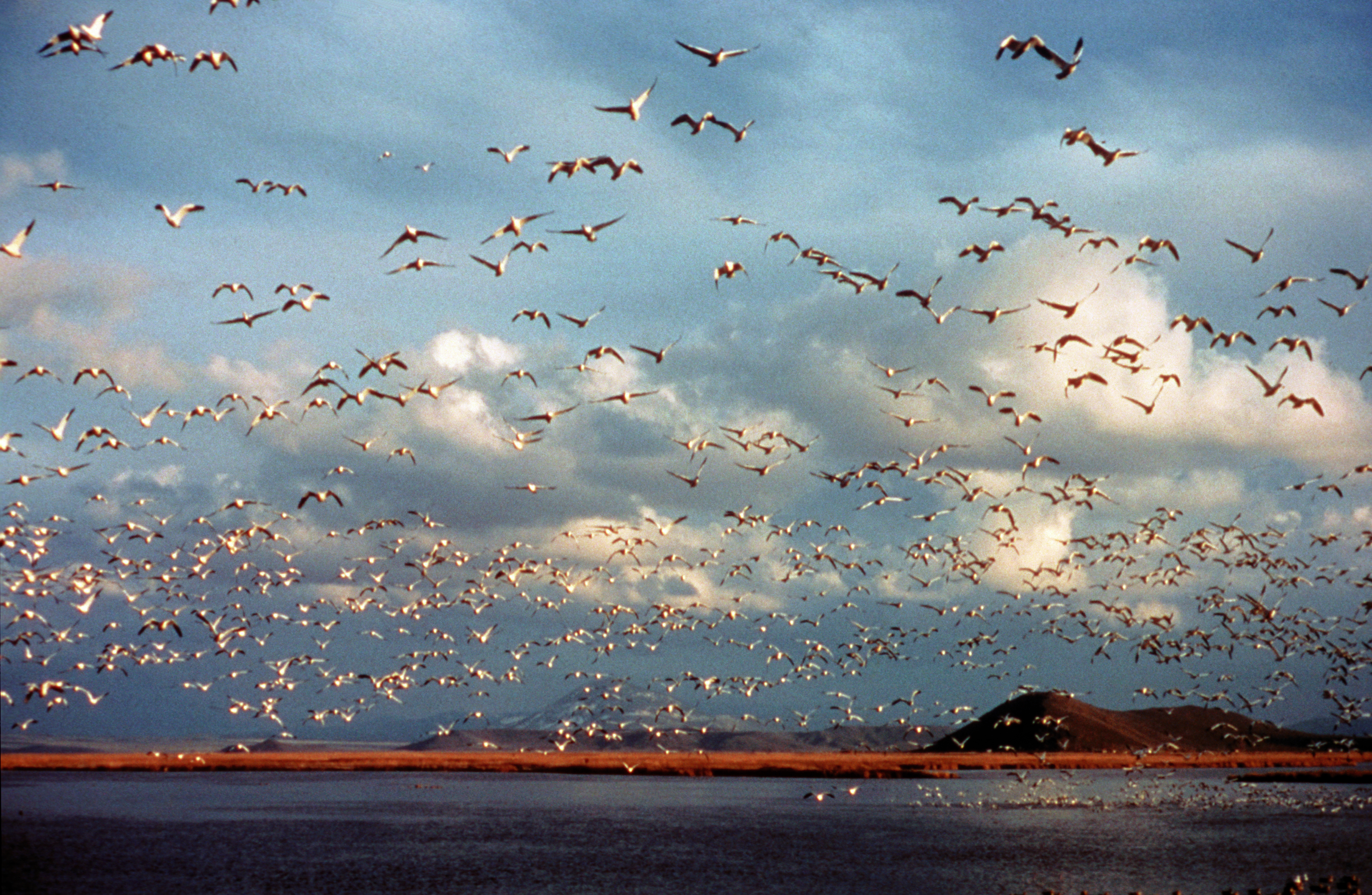
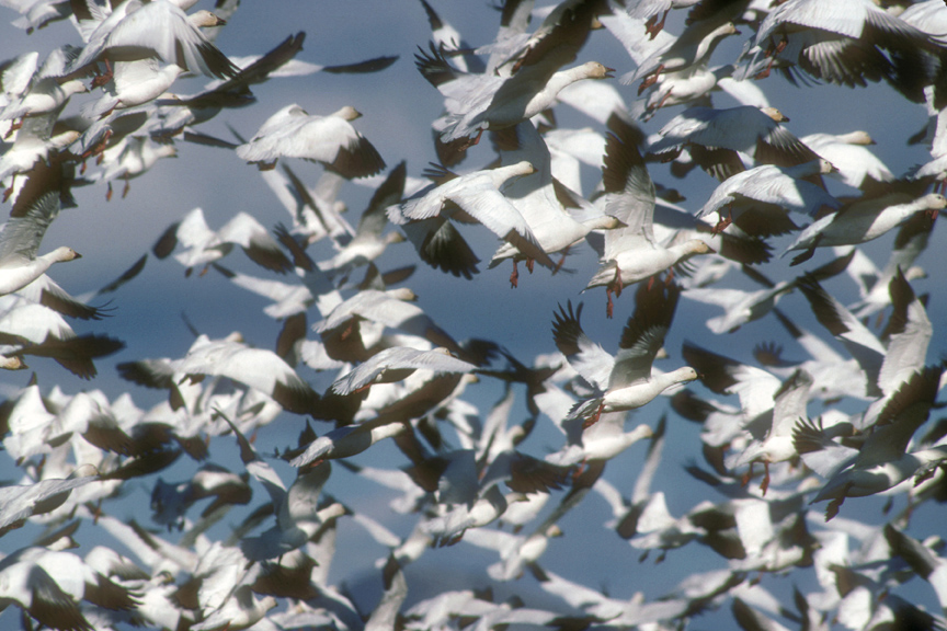
A cloud of Snow Geese fills the sky above Volcanic Legacy Scenic Byway.
Public Domain. USFWS photo by Dave Menke
Download Original (864 x 576 pixels, 323.7 KB)
-

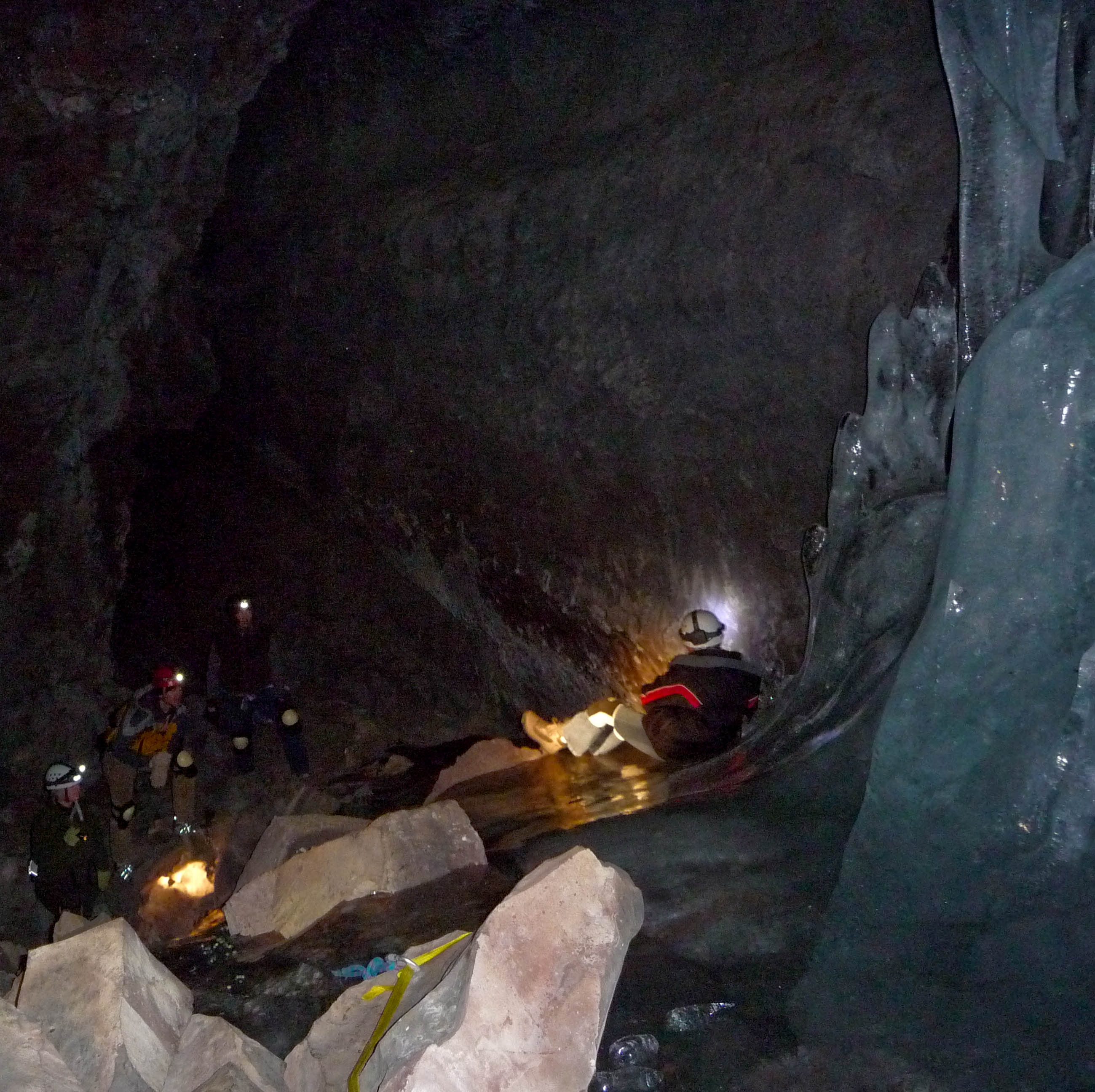
A group of cavers watch as a boy slides down the ice in Crystal Ice Cave at Lava Beds National Monument.
 © January 2009 Michael McCullough.
Download Original (2599 x 2592 pixels, 743.3 KB)
-
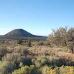
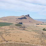
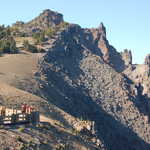
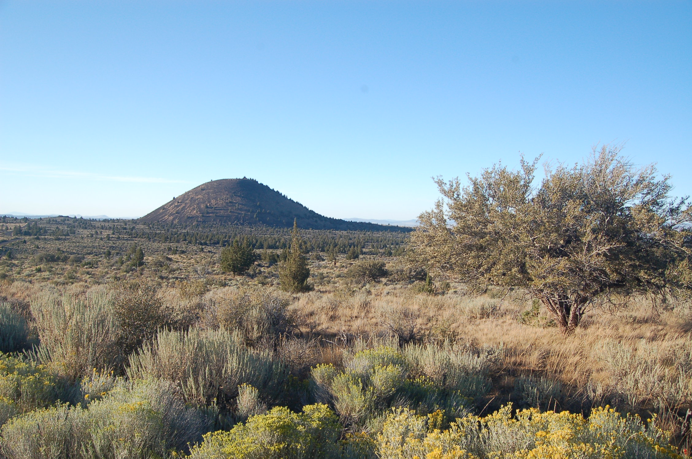
A prominent cinder cone northwest of the visitor center, Schonchin Butte is a major landmark of Lava Beds National Monument. There is a trail to the top, where hikers will find an old lookout station.
 © August 2011 A. E. Crane.
Download Original (2256 x 1496 pixels, 928.2 KB)
-

California's representatives for the Volcanic Legacy Scenic Byway receives their designation plaque at the Designation 2002 event at Union Station in Washington DC.
 © June 2002 FHWA-NSB.
Download Original (1536 x 1024 pixels, 435.7 KB)
-

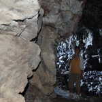
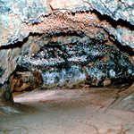
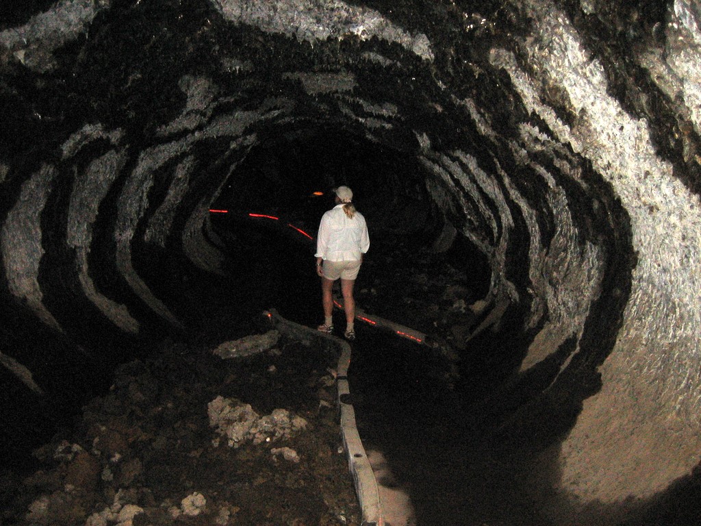
A tourist walks along the path of Mushpot Cave.
© May 2008 Lance and Erin Willett.
Download Original (1024 x 768 pixels, 269.3 KB)