
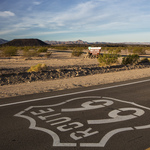
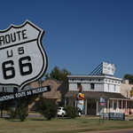
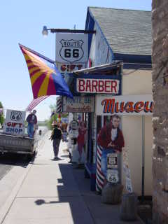
Historic Route 66
All Photos (171)
-
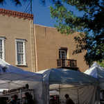
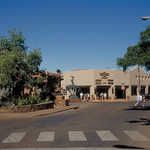
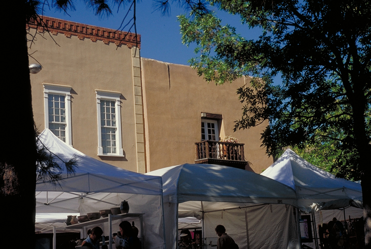
Street vendors on the Santa Fe Plaza keep cool under shaded tents while they sell their wares.
Public Domain. Photo by Dennis Adams
Download Original (734 x 493 pixels, 384.8 KB)
-
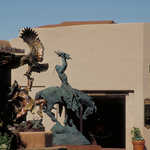
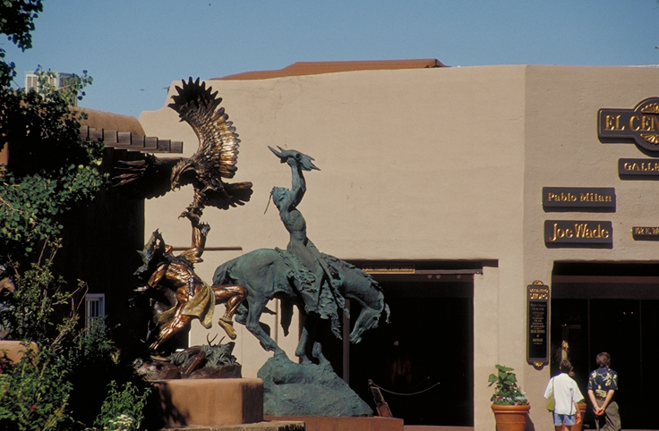
The culture of Native Americans is revered in these works of sculpture depicting Native Americans in action.
Public Domain. Photo by Dennis Adams
Download Original (736 x 482 pixels, 322.2 KB)
-
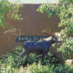
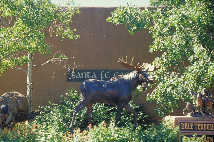
A sculpture of a moose decorates the streets of Santa Fe.
Public Domain. Photo by Dennis Adams
Download Original (731 x 488 pixels, 467.3 KB)
-
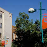
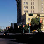
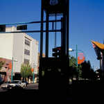
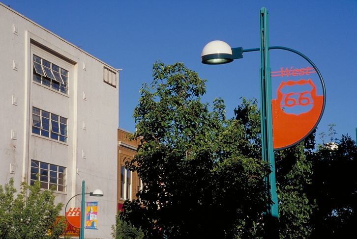
Even streetlights celebrate the fame of Historic Route 66.
Public Domain. Photo by Dennis Adams
Download Original (726 x 487 pixels, 368.9 KB)
-
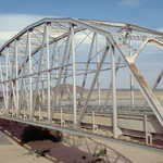
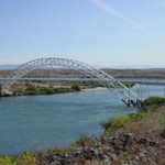
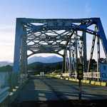
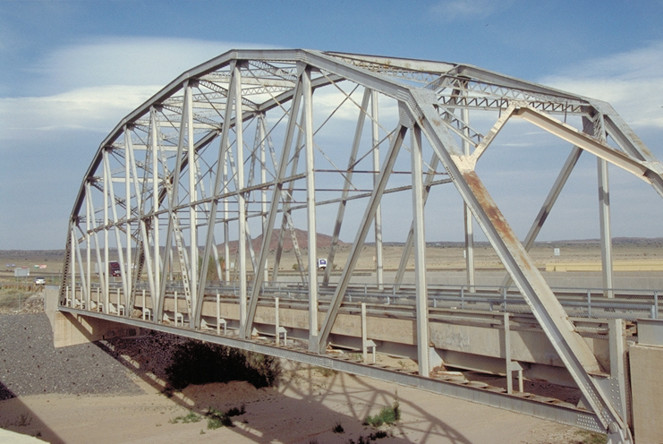
One of the longest steel truss spans in the country, the 250-foot Rio Puerco Bridge was built in 1933.
Public Domain. Photo by Dennis Adams
Download Original (741 x 496 pixels, 350.3 KB)
-
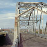
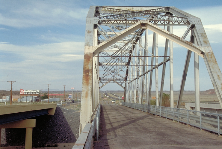
One of the longest steel truss spans in the country, the 250-foot Rio Puerco Bridge was built in 1933.
Public Domain. Photo by Dennis Adams
Download Original (741 x 496 pixels, 335.3 KB)
-
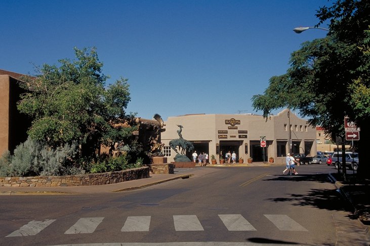
Historic Route 66 passes through Santa Fe where visitors can see a sculpture of a Native American Brave on horseback.
Public Domain. Photo by Dennis Adams
Download Original (731 x 487 pixels, 362.3 KB)
-
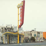
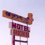
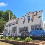
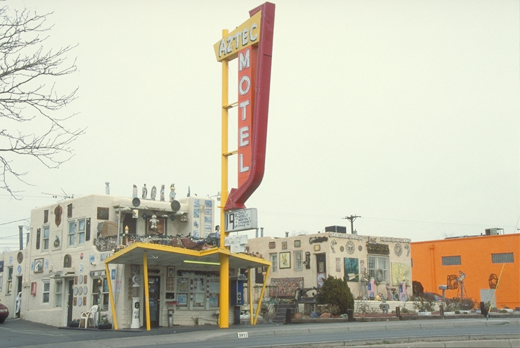
A neon sign points weary travelers to the Aztec Motel on Historic Route 66.
Public Domain. Photo by Dennis Adams
Download Original (750 x 502 pixels, 291.0 KB)
-
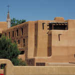
The adobe walls and flat roofs characteristic of pueblo-style architecture dominate the University of New Mexico campus.
Public Domain. Photo by Dennis Adams
Download Original (691 x 497 pixels, 323.6 KB)
-
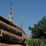
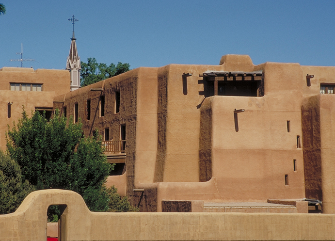
A church steeple rises behind adobe walls in Santa Fe.
Public Domain. Photo by Dennis Adams
Download Original (729 x 483 pixels, 341.6 KB)
-
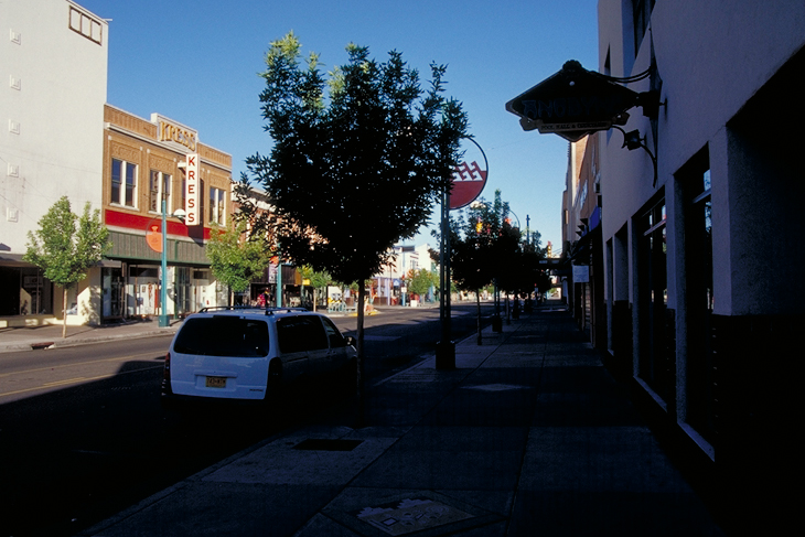
The historic Kress Building still graces Central Avenue in Albuquerque.
Public Domain. Photo by Dennis Adams
Download Original (730 x 487 pixels, 316.8 KB)
-
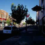
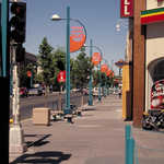
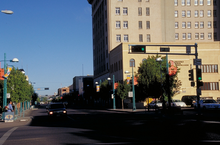
There's plenty to do on 2nd Street in downtown Albuquerque. Look for great restaurants and hip clubs.
Public Domain. Photo by Dennis Adams
Download Original (729 x 482 pixels, 315.7 KB)
-

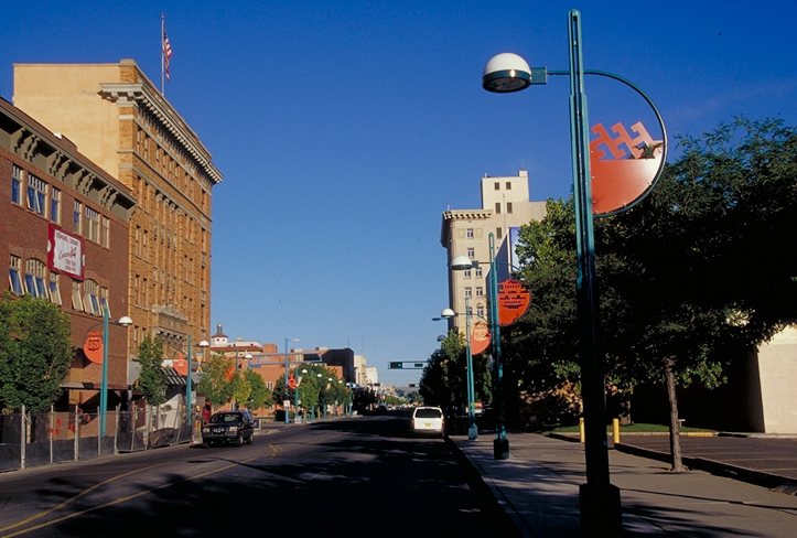
Colorful facades and street signs help to create a festive atmosphere in downtown Albuquerque.
Public Domain. Photo by Dennis Adams
Download Original (723 x 488 pixels, 362.3 KB)
-
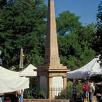
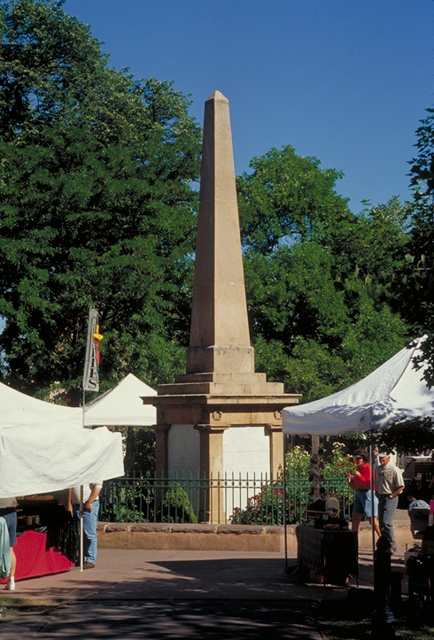
White canopies of a festival flank a memorial in the middle of a Santa Fe plaza.
Public Domain. Photo by Dennis Adams
Download Original (490 x 723 pixels, 423.8 KB)
-
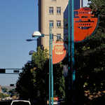
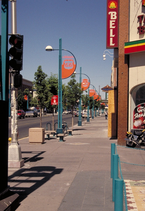
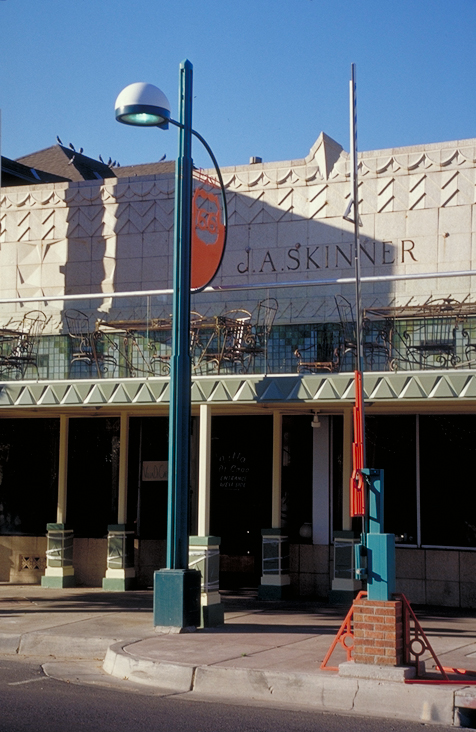
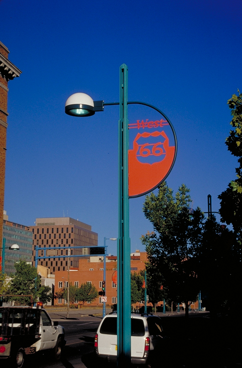
Cut-metal roadsigns on Albuquerque lampposts declare the historic path of Route 66. In this streetscene, sidewalk street furniture waits below an array of orange Route 66 lamppost signs.
Public Domain. Photo by Dennis Adams
Download Original (489 x 713 pixels, 361.2 KB)
-
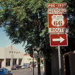
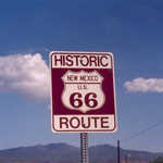
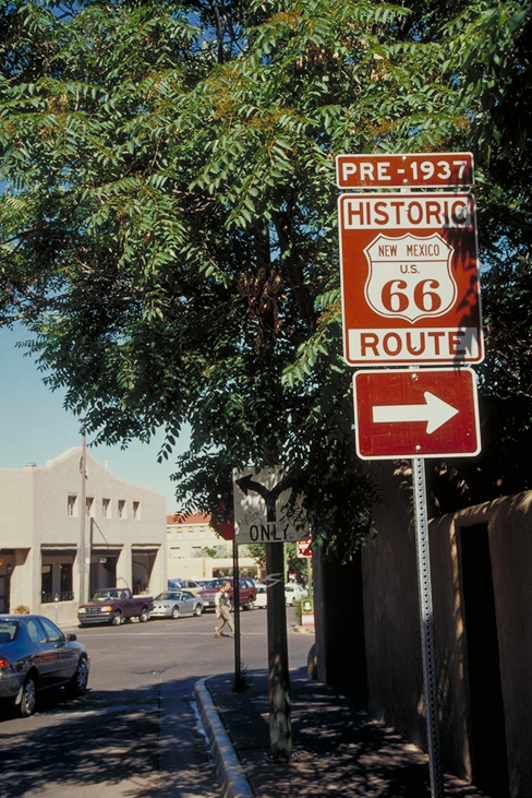
A brown and white roadsign not only points the way to Route 66 in Santa Fe, but indicates which particular routing it is (pre-1937.)
Public Domain. Photo by Dennis Adams
Download Original (488 x 731 pixels, 476.7 KB)
-
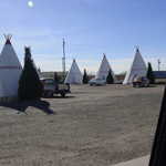
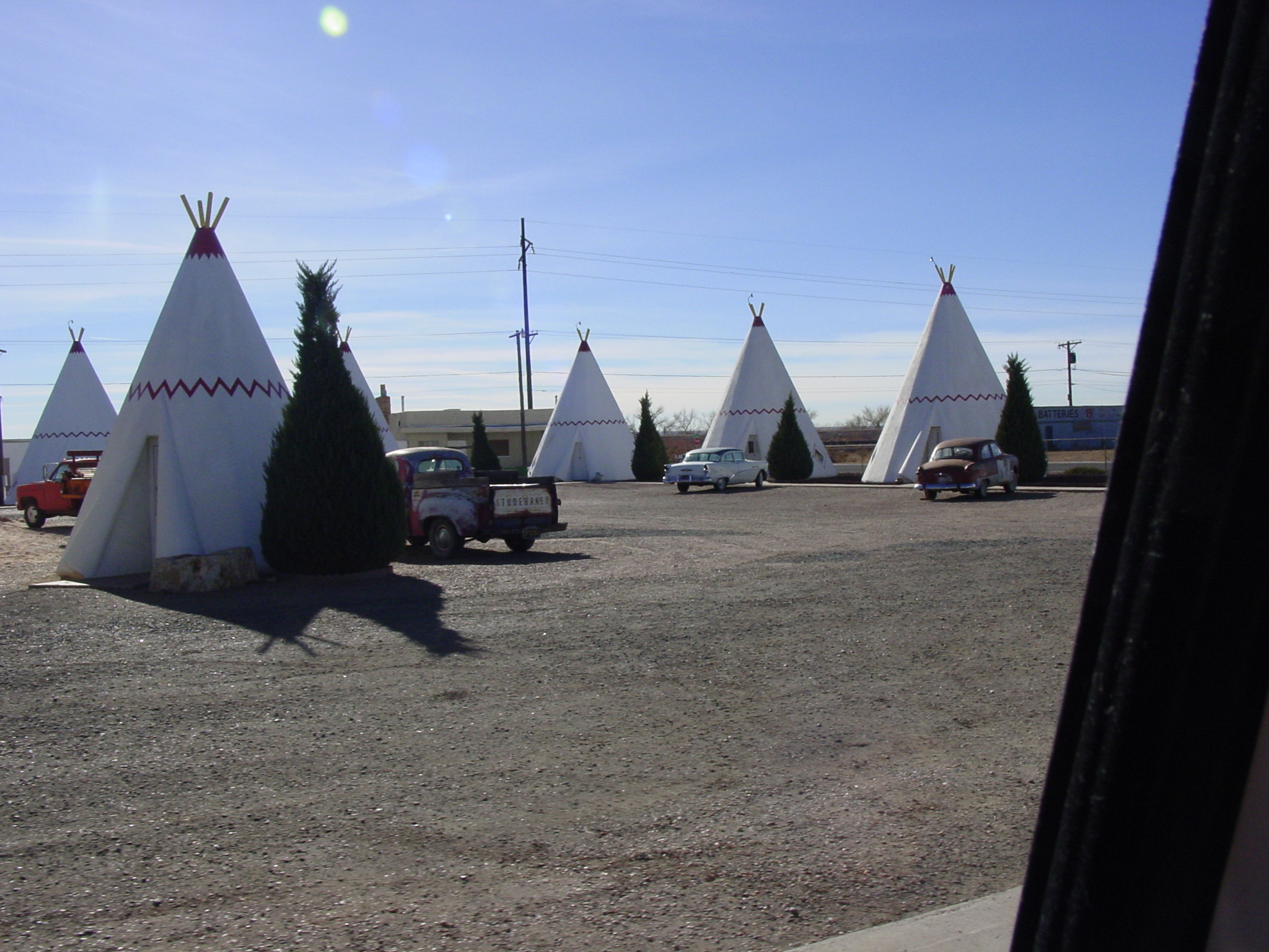
Along Historic Road 66, adventurous visitors can take the chance to bunk down in a wigwam.
© 2004 Georgia D. Griffiths.
Download Original (2048 x 1536 pixels, 1356.9 MB)
-
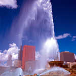
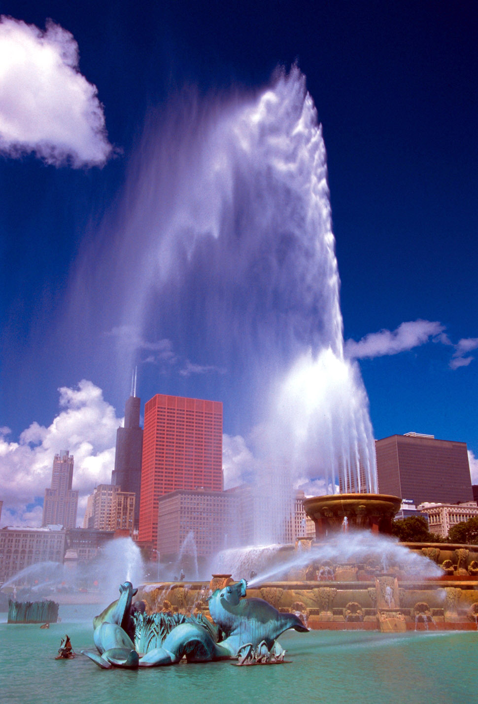
One of the world's most fabulous fountains serves as one of the first sites along the Illinois 66 byway corridor. The fountain, captured here in full force, sends a massive stream of water into the air during one of its spectular shows.
Public Domain.
Download Original (970 x 1427 pixels, 262.9 KB)
-
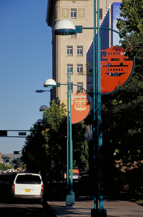
Cut-metal roadsigns on Albuquerque lampposts declare the historic path of Route 66.
Public Domain. Photo by Dennis Adams
Download Original (476 x 732 pixels, 323.4 KB)
-
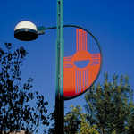
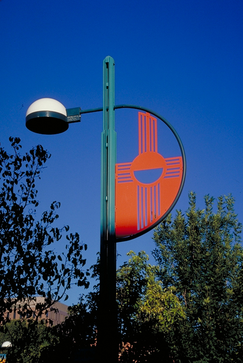
Cut-metal roadsigns on Albuquerque lampposts declare the historic path of Route 66. This one is of a four-rayed American Indian symbol.
Public Domain. Photo by Dennis Adams
Download Original (487 x 728 pixels, 399.4 KB)
-
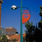
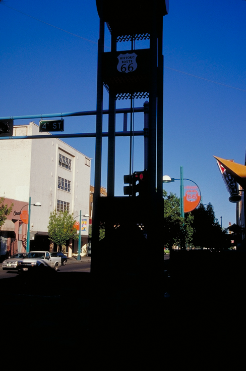
The traditional black-and-white Route 66 sign can be seen in downtown Albuquerque in many places.
Public Domain. Photo by Dennis Adams
Download Original (488 x 735 pixels, 246.9 KB)
-
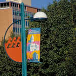
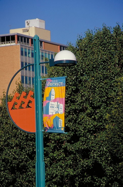
Some streetlights on Central Ave in Albuquerque not only celebrate Route 66 with innovative signs, but flaunt colorful banners declaring city regions and neighbors.
Public Domain. Photo by Dennis Adams
Download Original (484 x 733 pixels, 464.5 KB)
-
Cut-metal roadsigns on Albuquerque lampposts declare the historic path of Route 66.
Public Domain. Photo by Dennis Adams
Download Original (485 x 736 pixels, 330.6 KB)
-
Cut-metal roadsigns on Albuquerque lampposts declare the historic path of Route 66.
Public Domain. Photo by Dennis Adams
Download Original (485 x 735 pixels, 347.5 KB)
-
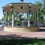
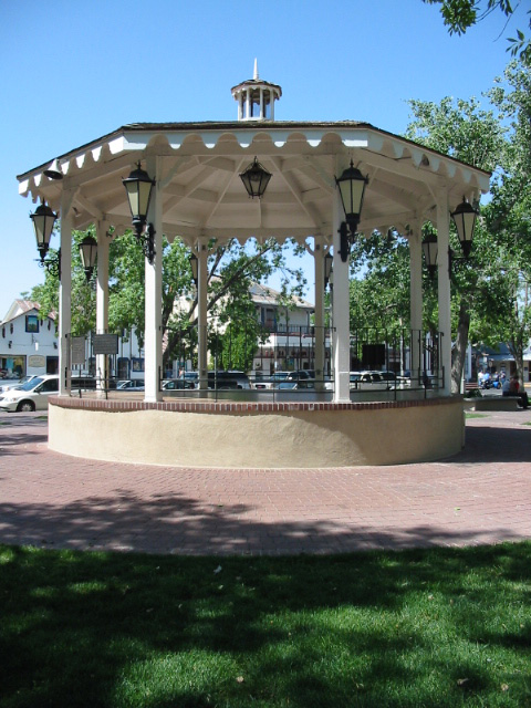
A gazebo in the middle of the plaza provides shade from the sun at Old Town Albuquerque.
© July 2003 Fox J. Mahnken.
Download Original (480 x 640 pixels, 164.5 KB)
-
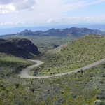
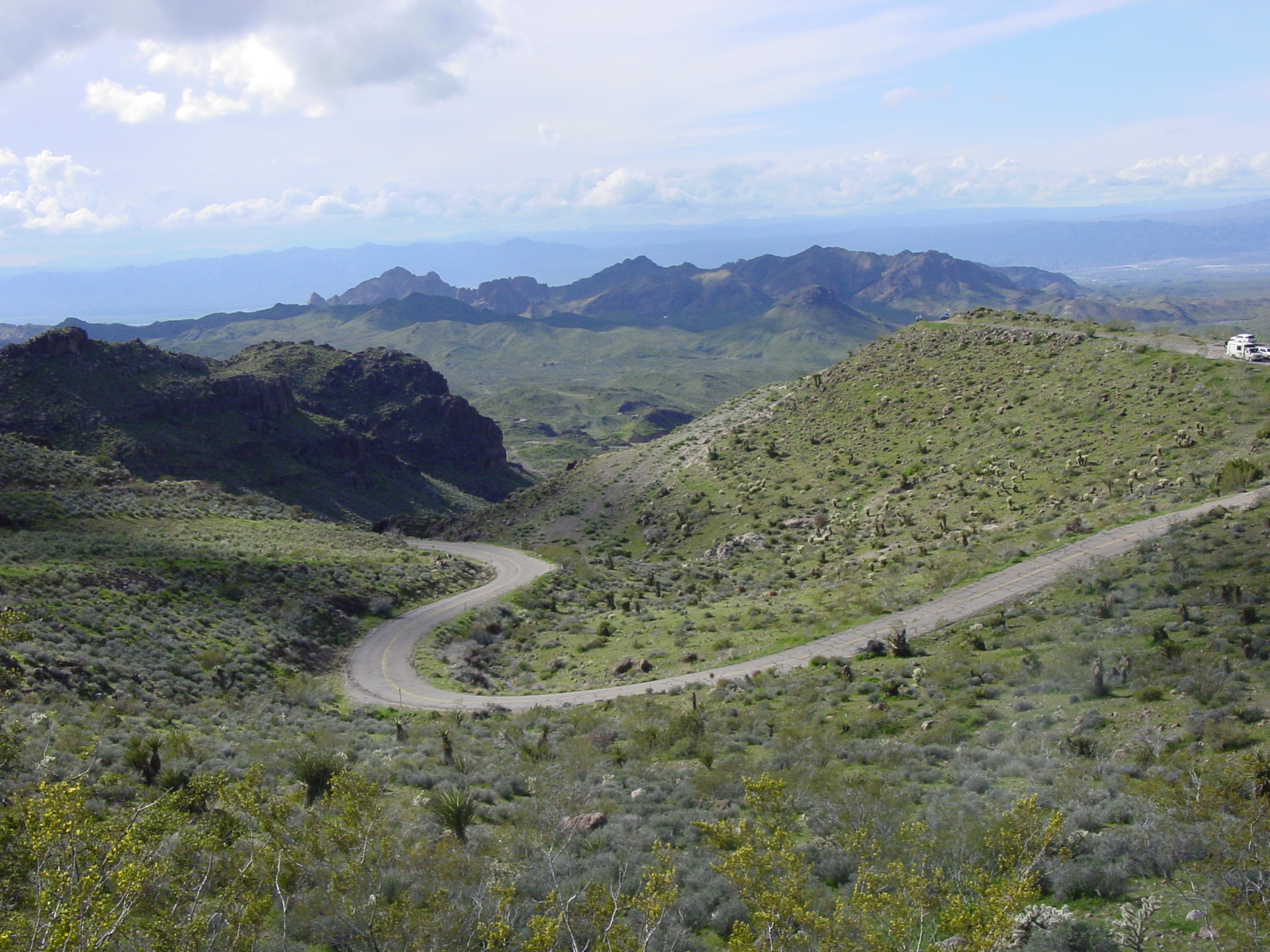
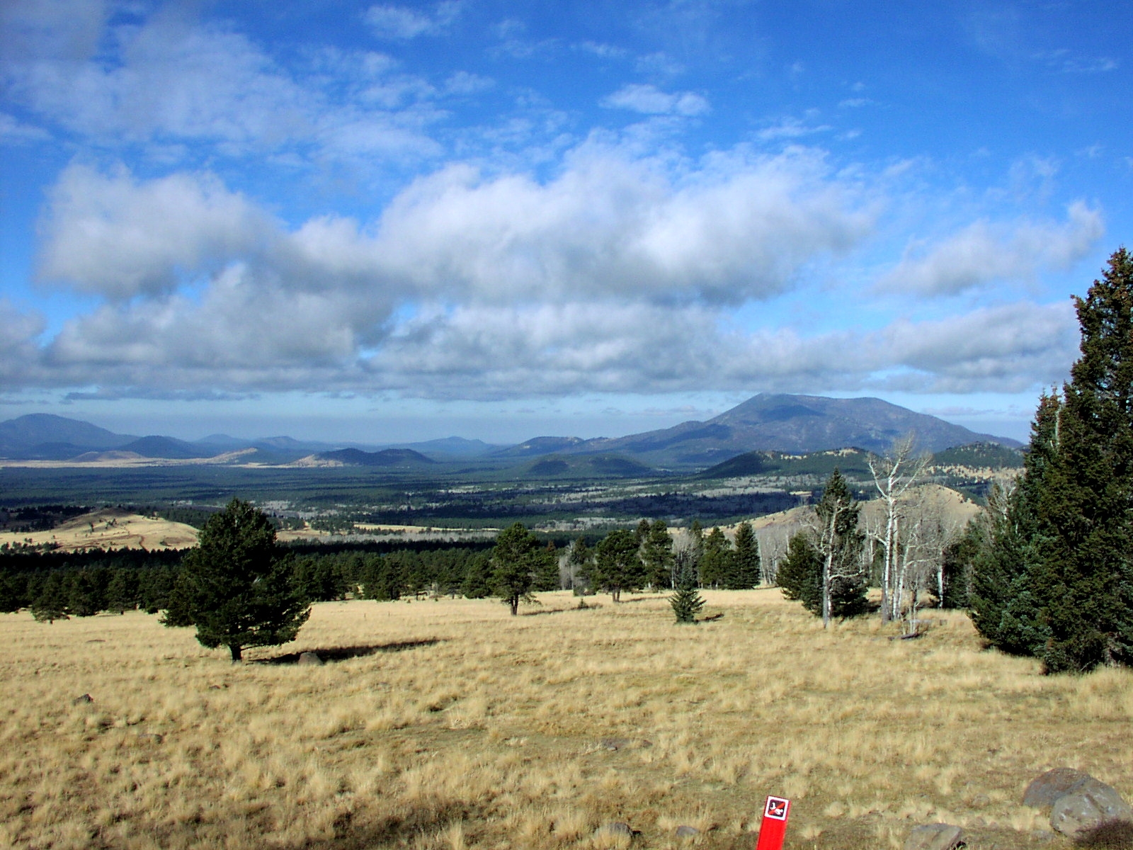
Gently sloping hills covered with natural vegetation surround Historic Route 66 in western Arizona.
© March 2005 Georgia D. Griffiths.
Download Original (2048 x 1536 pixels, 1389.9 MB)
-
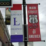
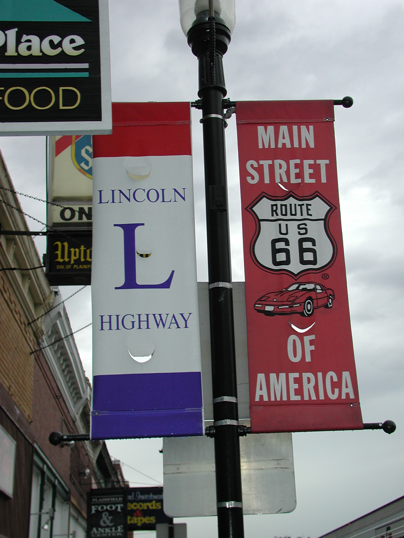
Two street banners proclaim to all that two historic highways, Historic Route 66 and the Lincoln Highway, meet at this town in Illinois.
© 2001 Illinois Lincoln Highway Association.
Download Original (1536 x 2048 pixels, 691.5 KB)
-
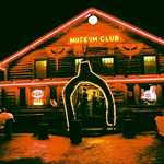
Neon and music is just another part of the classic charm of Route 66.
Public Domain. Photo by Leslie Connell
Download Original (864 x 583 pixels, 328.2 KB)
-
A sign for the legendary highway is pictured against the New Mexico sky.
Public Domain. Photo by Kellie Thorne of NSBO
Download Original (1108 x 764 pixels, 43.9 KB)
-
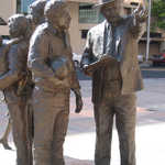
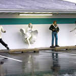
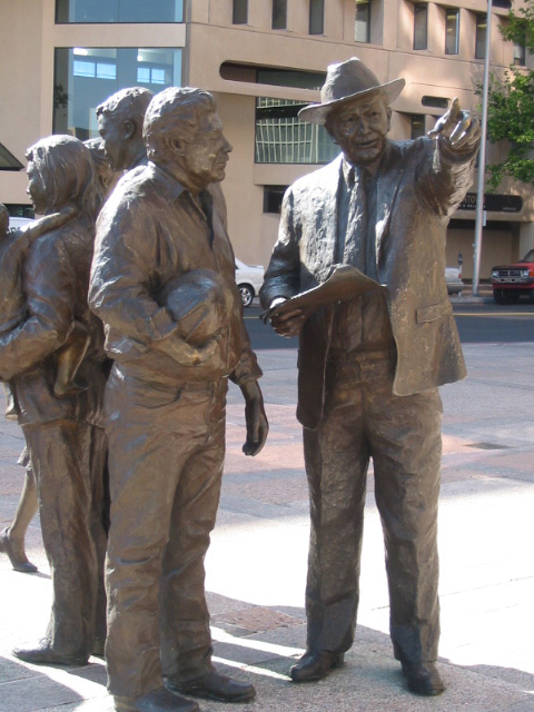
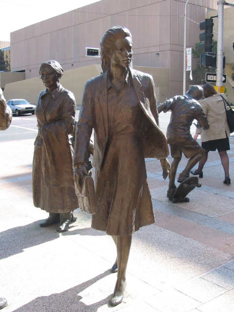
A man points out the right direction for a construction worker in this detail from a group of life-size statues found in Albuquerque.
© July 2003 Fox J. Mahnken.
Download Original (480 x 640 pixels, 140.6 KB)
-

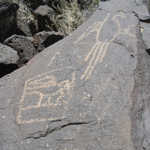
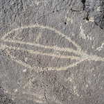
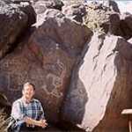
This startlingly human piece of rock art seems to look back from the past at visitors to Petroglyph National Monument.
© July 2003 Fox J. Mahnken.
Download Original (480 x 640 pixels, 168.4 KB)
-
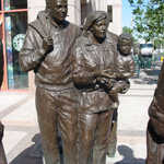
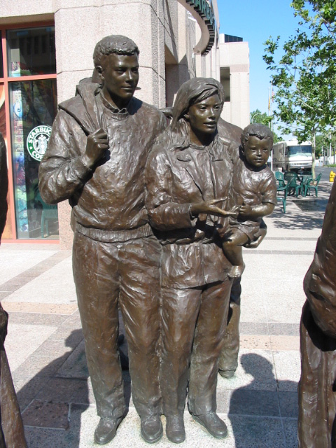
A statue of a mother and father chat while holding their child in this detail from a cluster of life-size statues in Albuquerque.
© July 2003 Fox J. Mahnken.
Download Original (480 x 640 pixels, 182.9 KB)
-
A bird takes flight across a canvass of stone at Petroglyph National Monument.
© July 2003 Fox J. Mahnken.
Download Original (480 x 640 pixels, 188.2 KB)
-
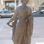
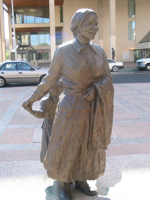
A Native American woman smiles and holds her daughter's hand in this detail from a group of life-size statues in Albuquerque.
© July 2003 Fox J. Mahnken.
Download Original (480 x 640 pixels, 136.3 KB)
-
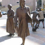
A businesswoman strides purposefully through the crowd in this detail from a cluster of life-size statues in Albuquerque.
© July 2003 Fox J. Mahnken.
Download Original (480 x 640 pixels, 132.8 KB)
-
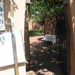
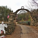
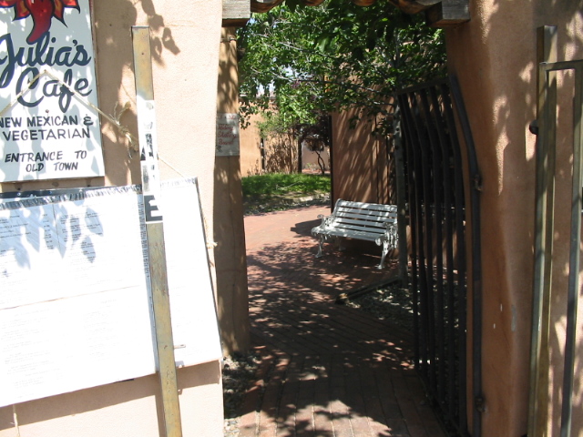
Through gated entries, visitors can get a glimpse of Old Town's many hidden courtyards.
© July 2003 Fox J. Mahnken.
Download Original (640 x 480 pixels, 185 KB)
-
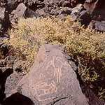
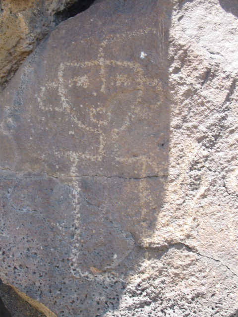
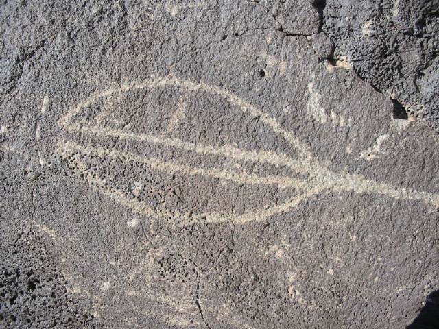
This ellliptical design is just one example of the rock art visitors can view at Petroglyph National Monument.
© July 2003 Fox J. Mahnken.
Download Original (640 x 480 pixels, 298.1 KB)
-
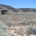
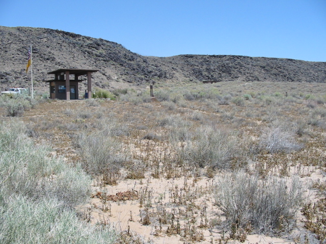
Visitors to Petroglyph National Monument can find respite from the sun at this convenient rest area.
© July 2003 Fox J. Mahnken.
Download Original (640 x 480 pixels, 230.6 KB)
-
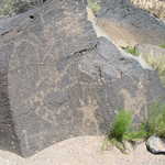
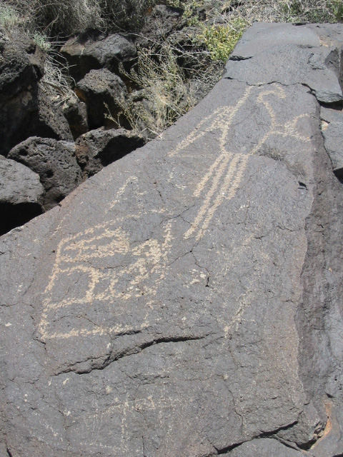
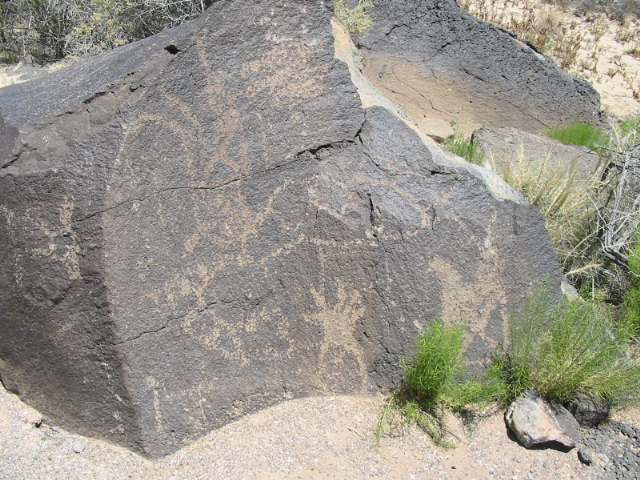
Visitors can see a large variety of rock art around every corner at Petroglyph National Monument.
© July 2003 Fox J. Mahnken.
Download Original (640 x 480 pixels, 259.1 KB)
-
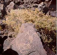
Bird-like petroglyphs are etched into black rocks at Petroglyph National Monument.
© 2000 A. E. Crane.
Download Original (188 x 181 pixels, 23.5 KB)
-
A photo of the strange "starman" petroglyphs at Petroglyph National Monument.
© 2000 A. E. Crane.
-

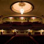
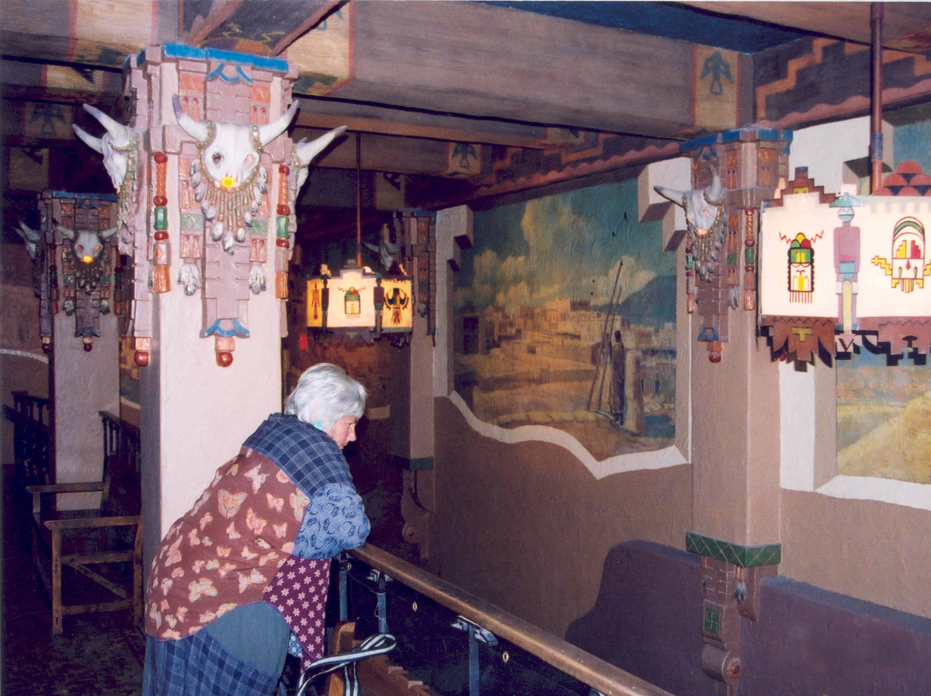
A theater patron admires the Kimo Theater lobby from the balcony.
Public Domain. Photo by A. E. Crane
Download Original (3100 x 2317 pixels, 965.7 KB)
-
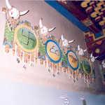
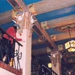
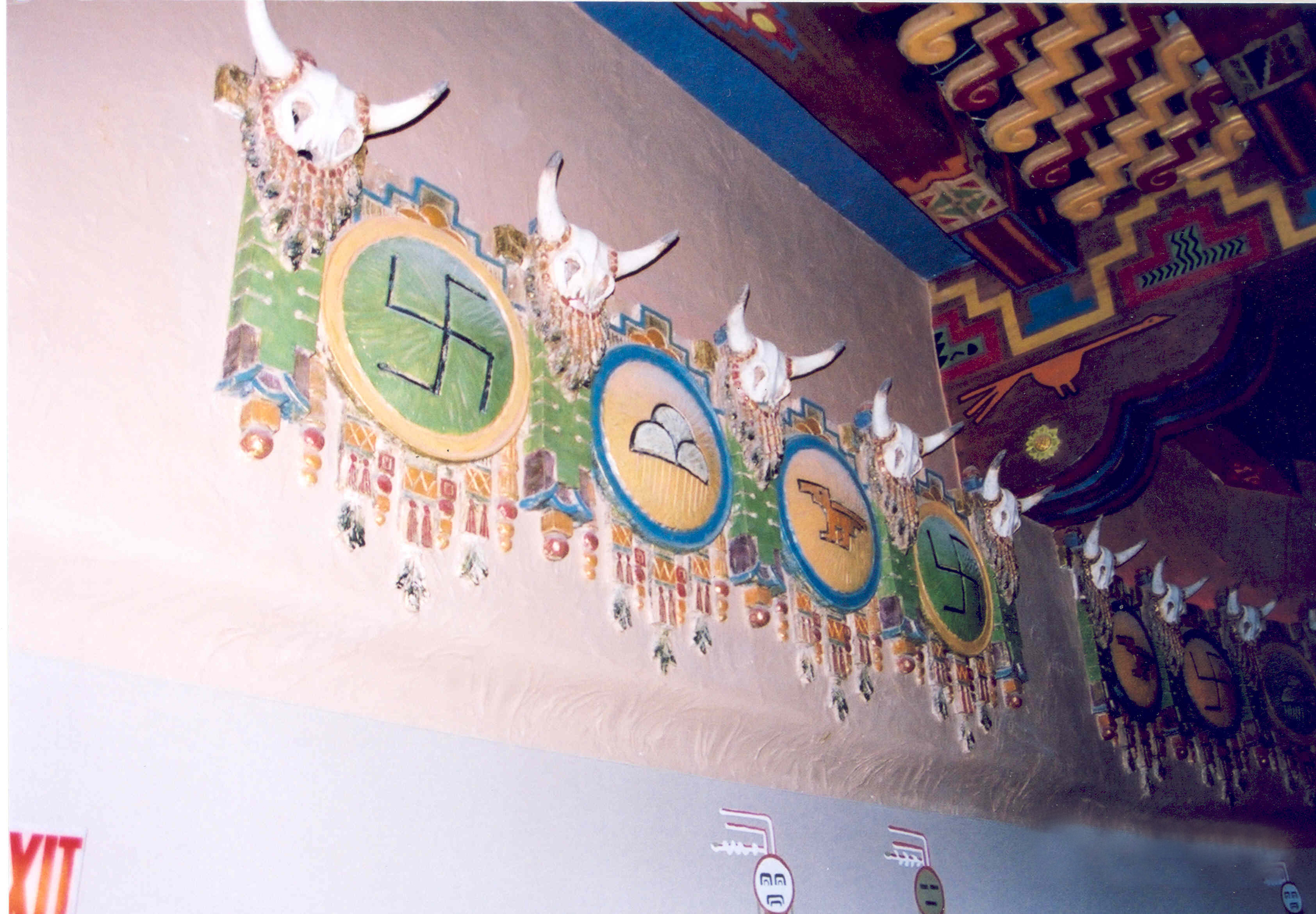
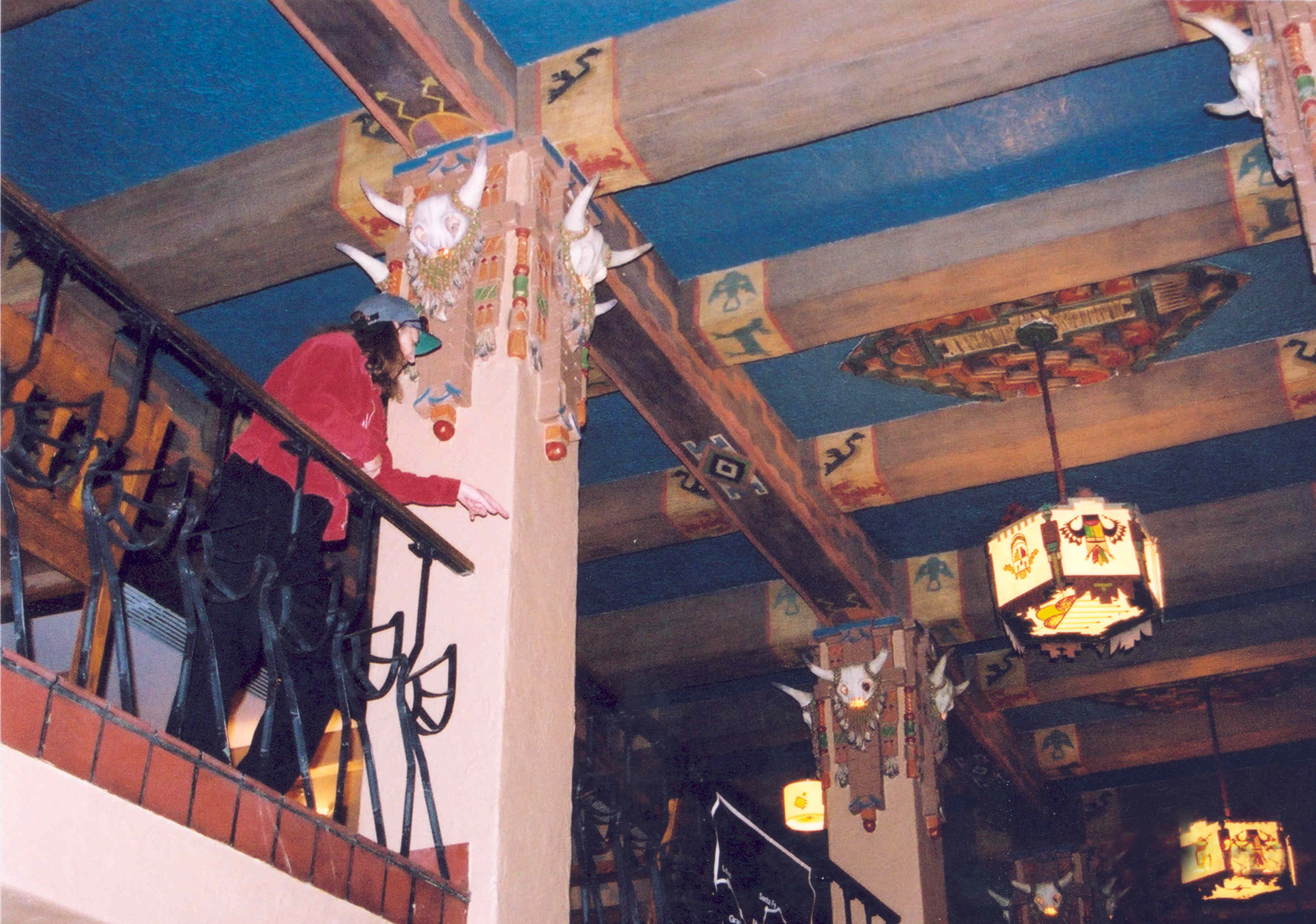
Buffalo skulls and Indian medallions adorn the walls of the KiMo Theatre on Historic Route 66 in downtown Albuquerque.
Public Domain. Photo by A. E. Crane
Download Original (3299 x 2291 pixels, 4149.0 MB)
-
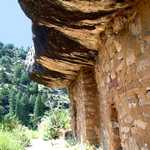
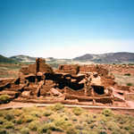
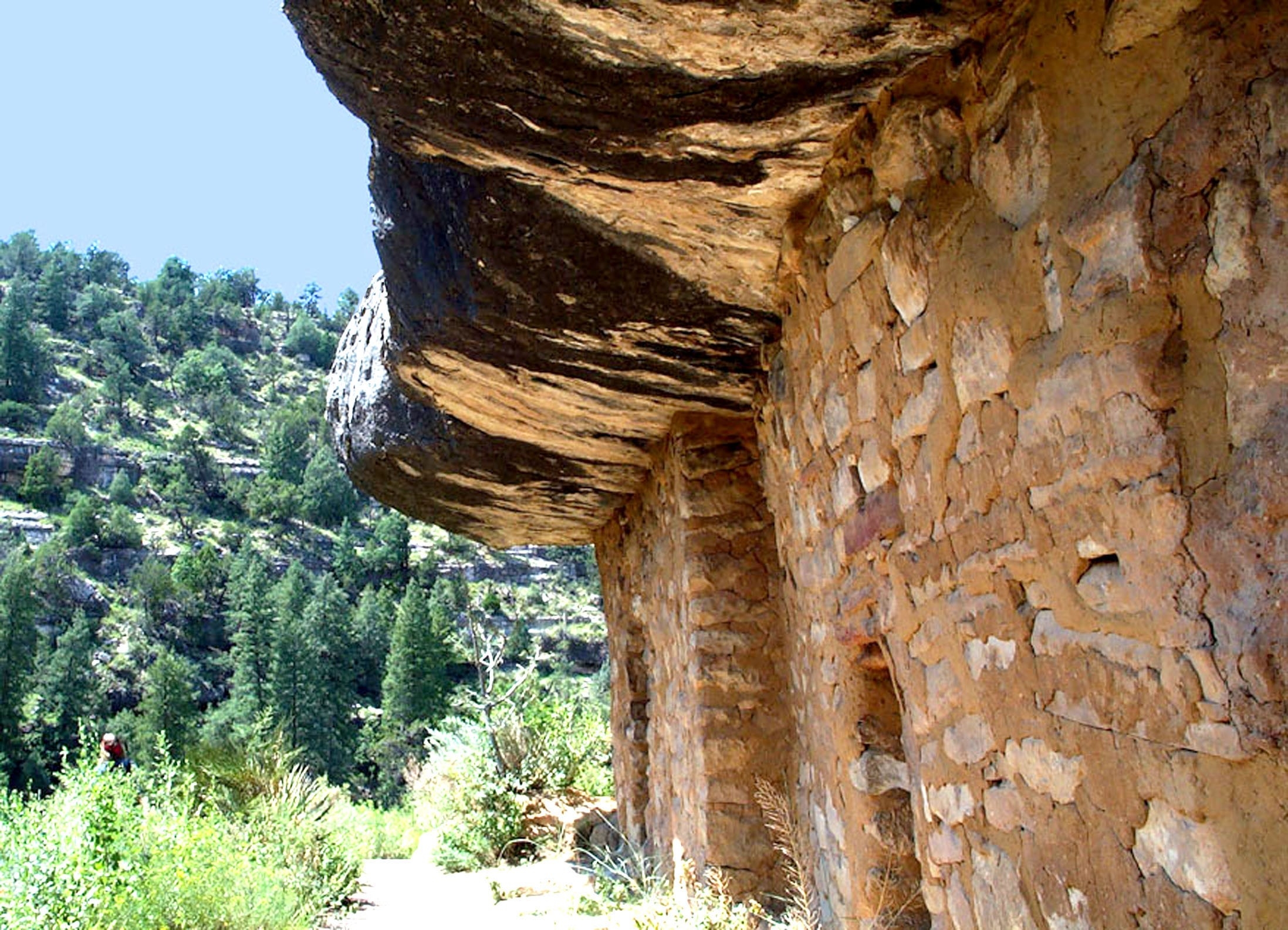
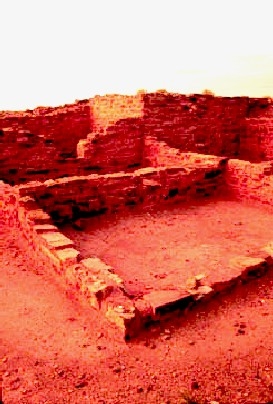
Sandstone dwellings perched on the sides of cliffs stand testament to the passage of time.
Public Domain. Courtesy of Leslie Connell
Download Original (2195 x 1585 pixels, 1726.2 MB)
-
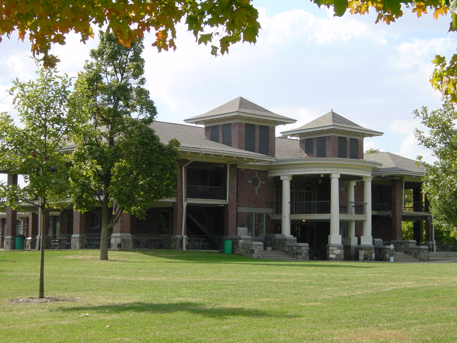
This grand historic pavilion, designed by noted architect George H. Miller, serves as the centerpiece for one of the most interesting parks along Illinois 66. Designed in 1898, the building overlooks four distinctly designed areas within the park's parameters. In addition to historic monuments and bridges, the park features a wonderful zoo.
Public Domain. Courtesy of the Bloomington Parks and Recreatoin Department
Download Original (1517 x 1138 pixels, 1417.3 MB)
-
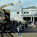
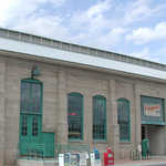
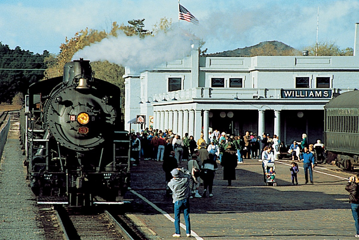
An old fashioned engine chugs into the Williams Depot.
Public Domain. Courtesy of the Grand Canyon Railroad
Download Original (1200 x 804 pixels, 652.5 KB)
-
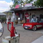
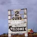
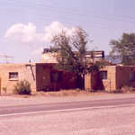
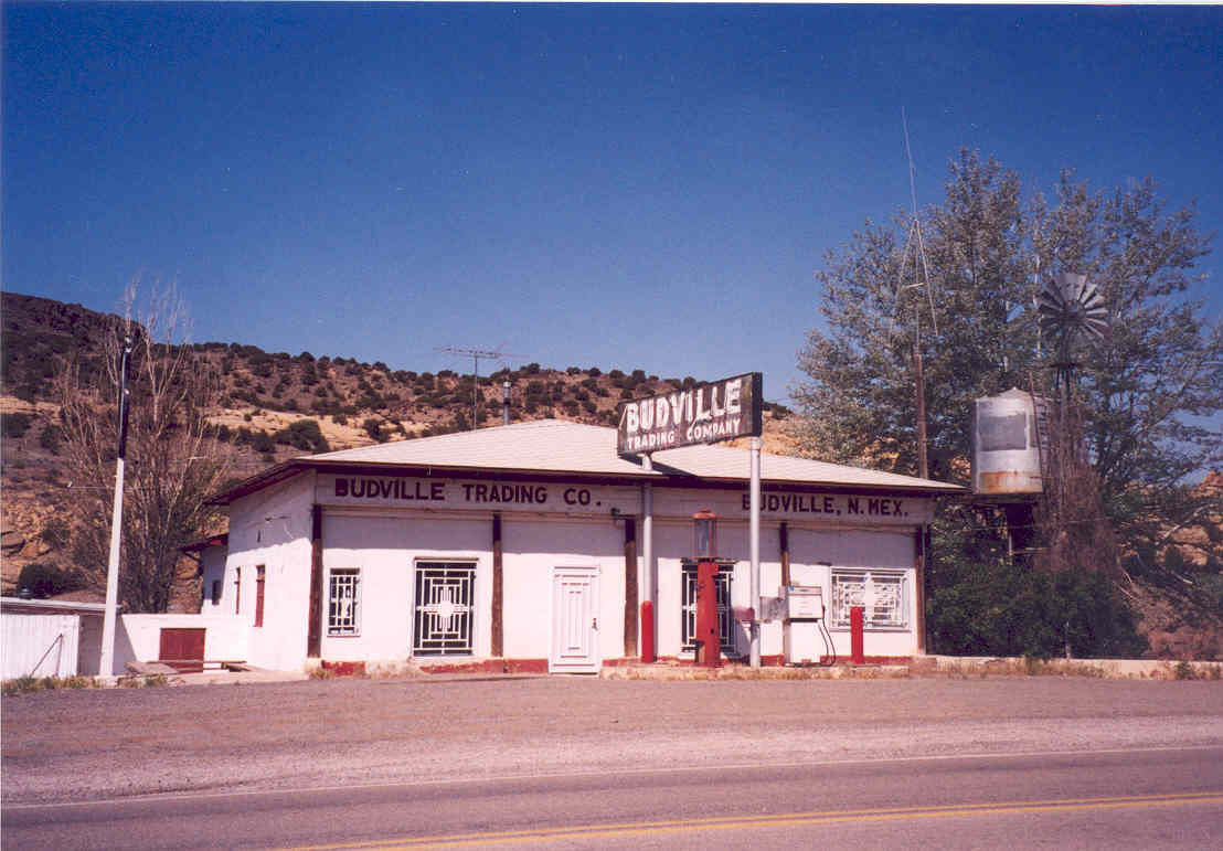
Literally the only game in town, the Budville Trading post is as rich in colorful history as Route 66.
Public Domain. Photo by Kellie Thorne of NSBO
Download Original (1108 x 771 pixels, 80.0 KB)
-
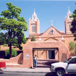
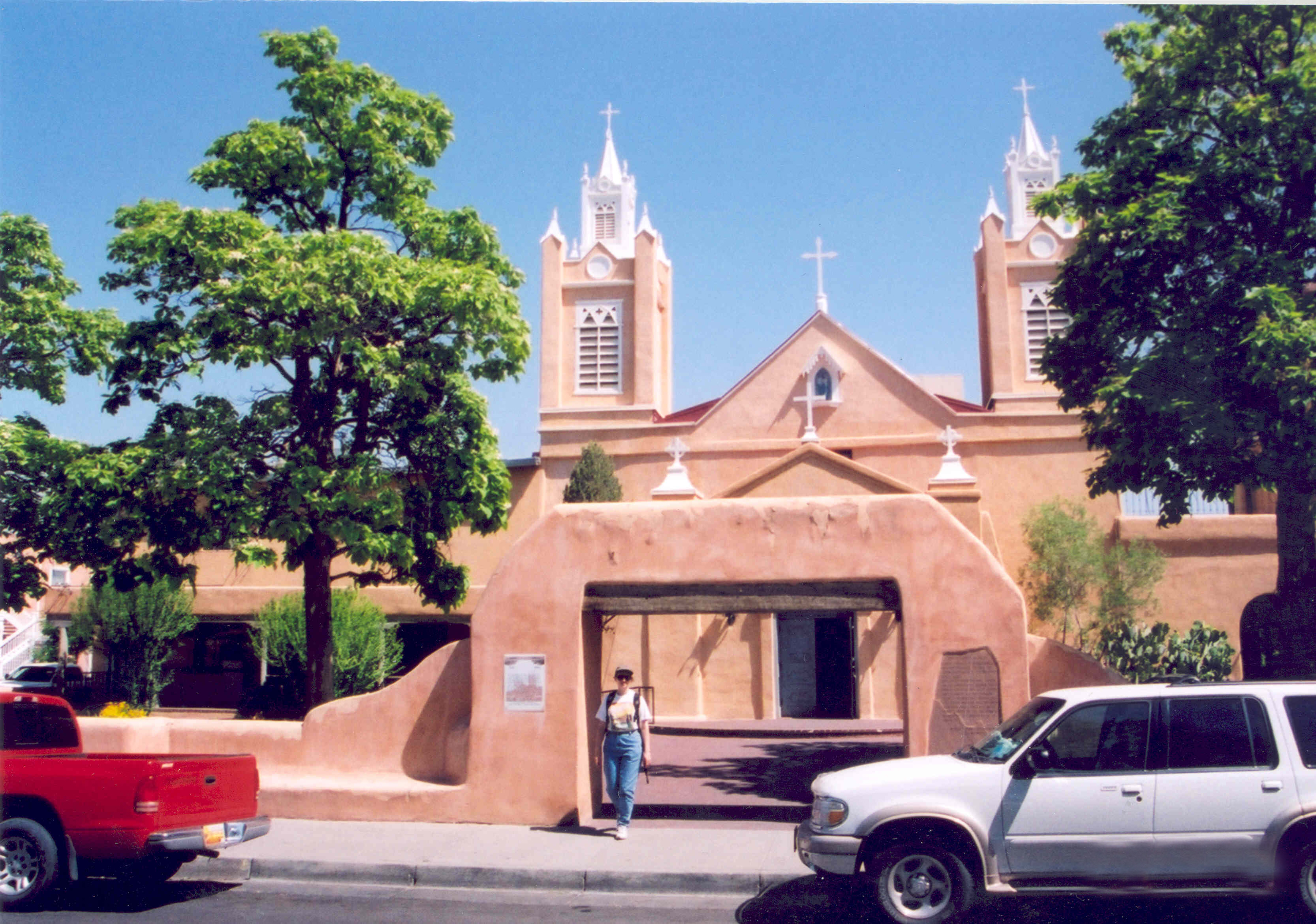
A visitor poses in front of the Roman Catholic church in Old Town, just off Historic Route 66.
Public Domain. Photo by A. E. Crane
Download Original (3299 x 2317 pixels, 4679.9 MB)
-
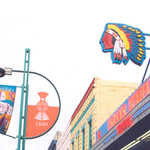
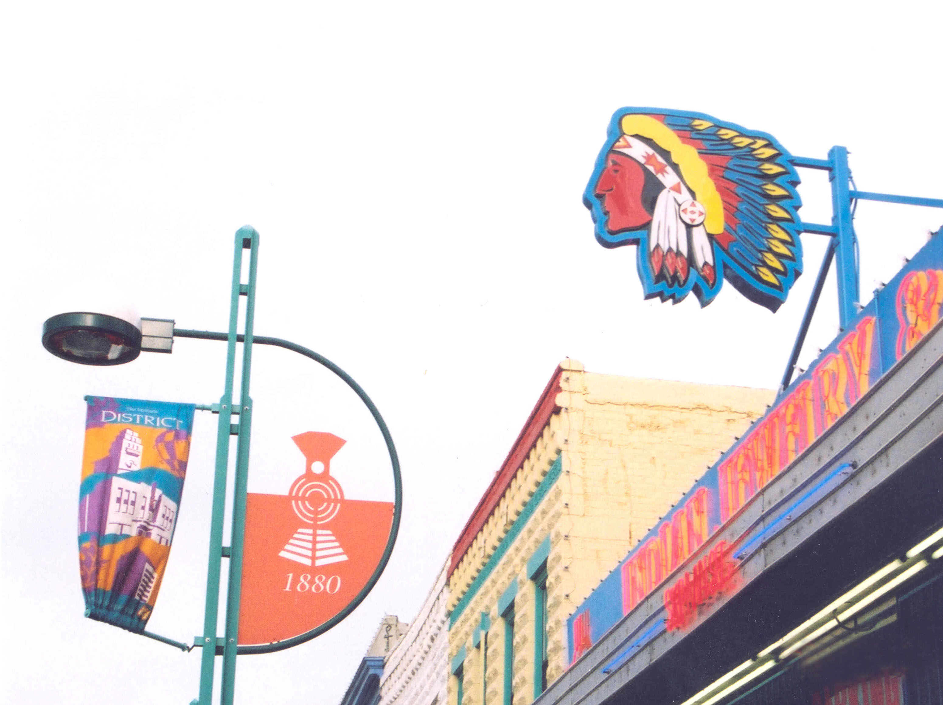
An old, neon Indian sign and Route 66 roadsigns are seen on Historic Route 66 in downtown Albuquerque.
Public Domain. Photo by A. E. Crane
Download Original (3100 x 2317 pixels, 641.7 KB)
-
A visitor marvels at the Pueblo Deco style found in the KiMo Theatre.
Public Domain. Photo by A. E. Crane
Download Original (3299 x 2317 pixels, 4853.4 MB)
-
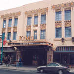
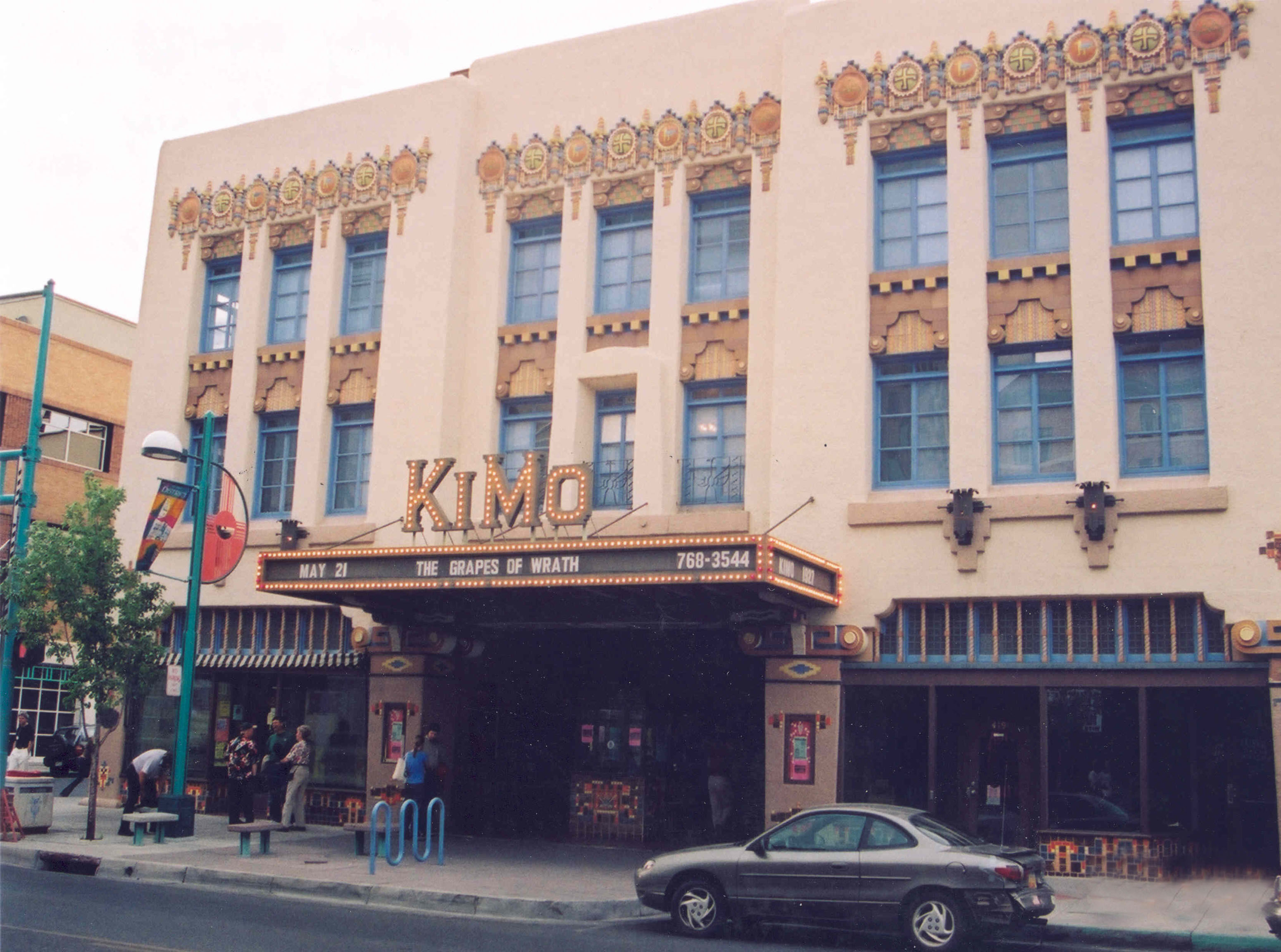
The restored, historic Kimo Theater can be seen on Historic Route 66 in Albuquerque, New Mexico.
Public Domain. Photo by A. E. Crane
Download Original (3100 x 2305 pixels, 789.2 KB)
-
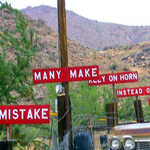
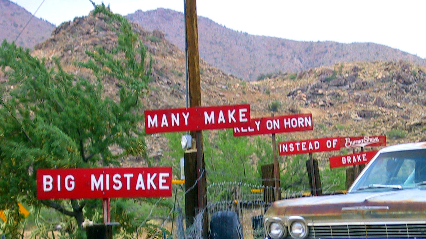
Red signs bearing sage advice lined highways across America from the 1920s to 1961, and a set is preserved here for modern visitors.
Public Domain. Photo by Ken Koehler
Download Original (1396 x 783 pixels, 233.1 KB)
-
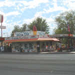
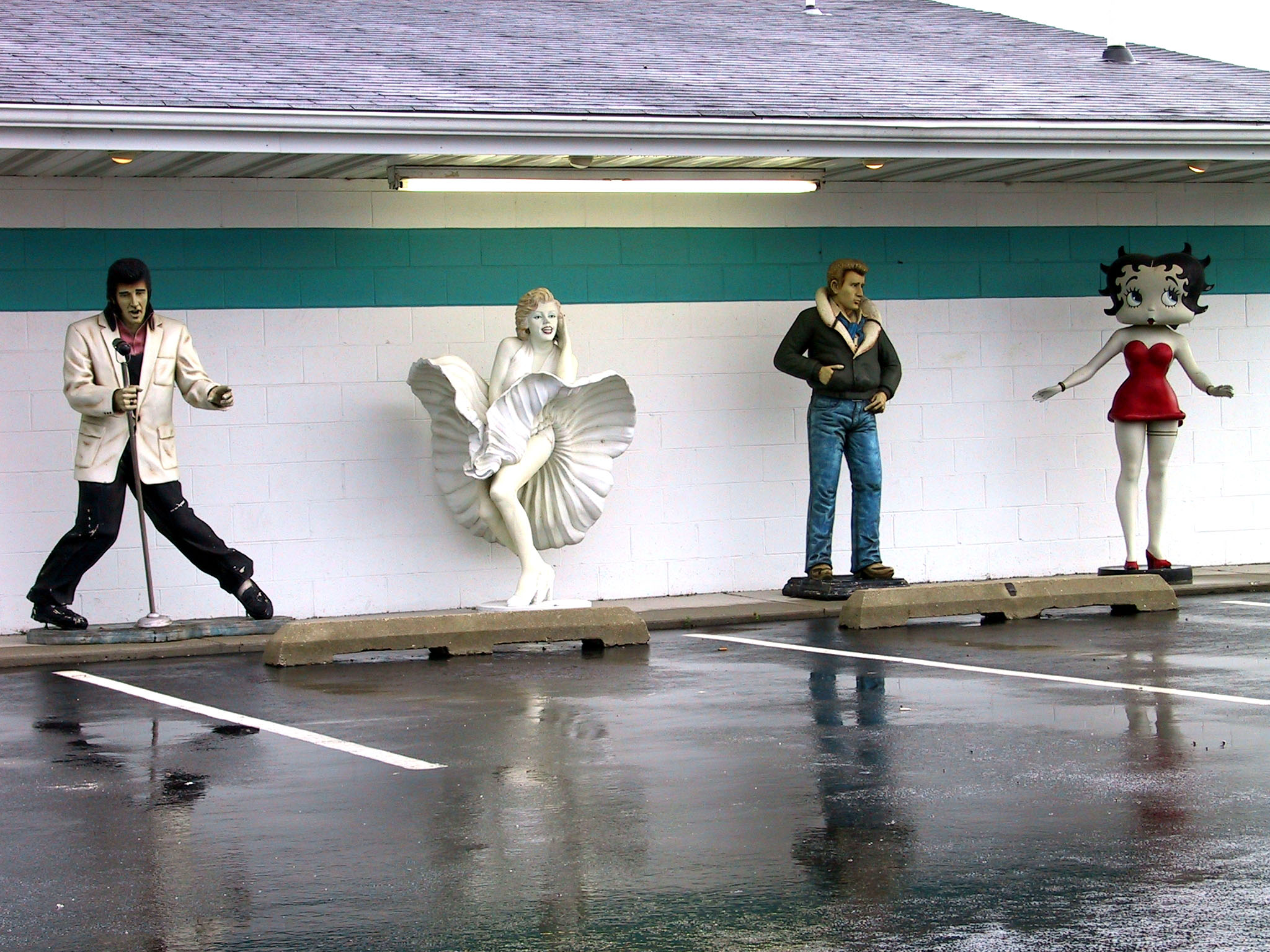
Elvis, Marilyn Monroe, James Dean, and Betty Boop line up outside the Polk-A-Dot Drive In, a nostalgic restaurant along Route 66.
Public Domain. Photo by Ken Koehler
Download Original (2048 x 1536 pixels, 597.2 KB)
-

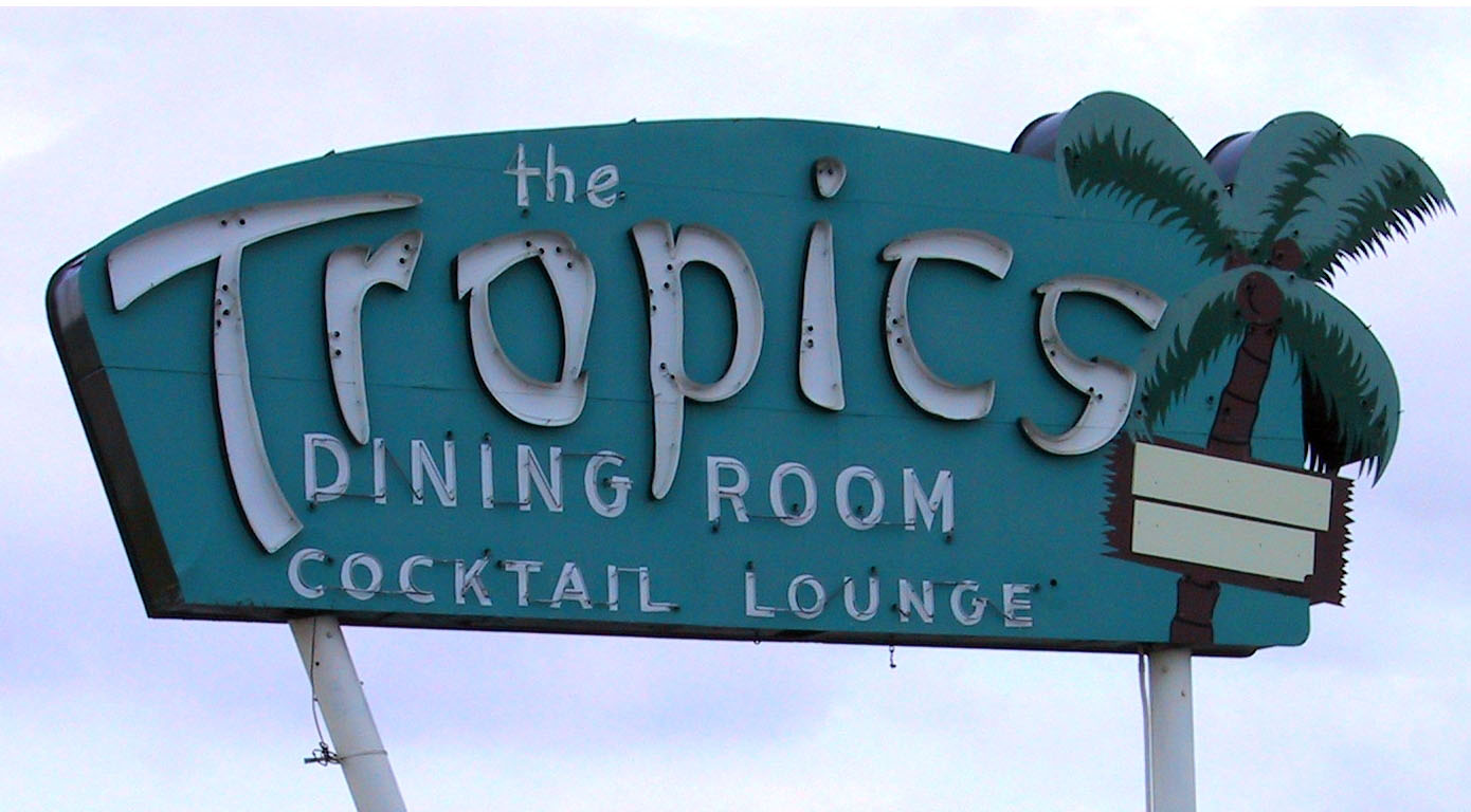
Along Route 66, several Googie-style signs have been preserved. The bold strokes and Polynesian theme of the Tropics sign set it apart.
Public Domain. Photo by Ken Koehler
Download Original (1390 x 768 pixels, 153.8 KB)
-
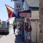
The Delgado brothers were responsible for starting the movement for the revival of Route 66 in Arizona.
© 2005 Georgia Dale Griffiths.
Download Original (240 x 320 pixels, 14.5 KB)
-
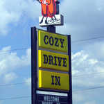
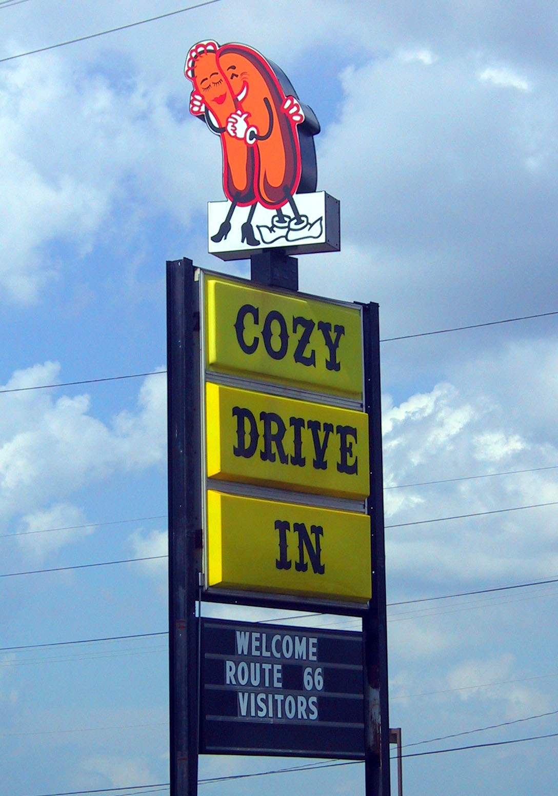
The cuddling hot dogs welcome Route 66 visitors to the Cozy Dog Drive In.
Public Domain. Photo by Ken Koehler
Download Original (1088 x 1552 pixels, 234.6 KB)
-
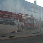
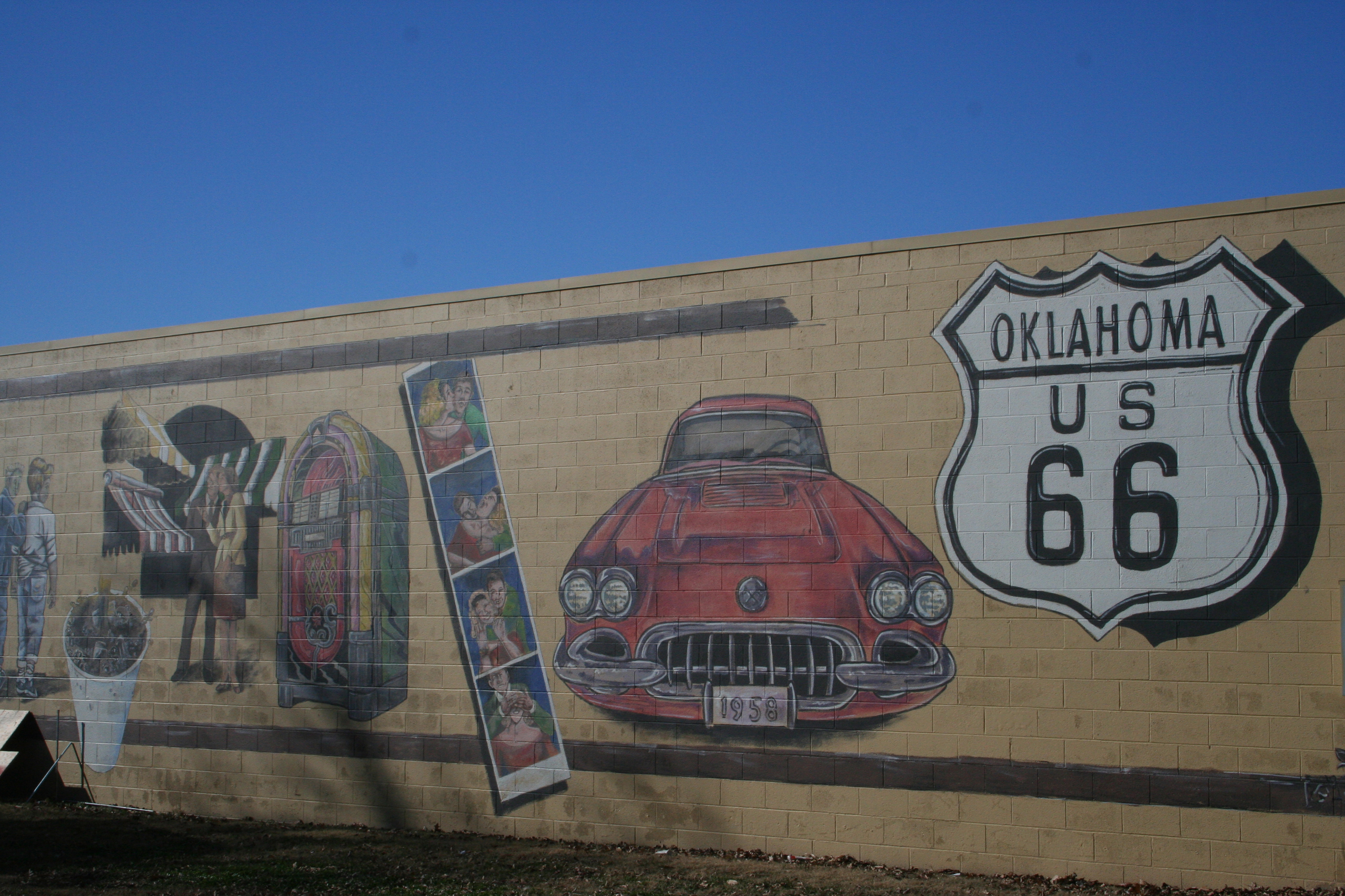
Murals such as this are located in communities all along Route 66.
Public Domain.
Download Original (3200 x 2133 pixels, 4429.8 MB)
-
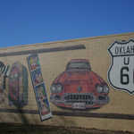
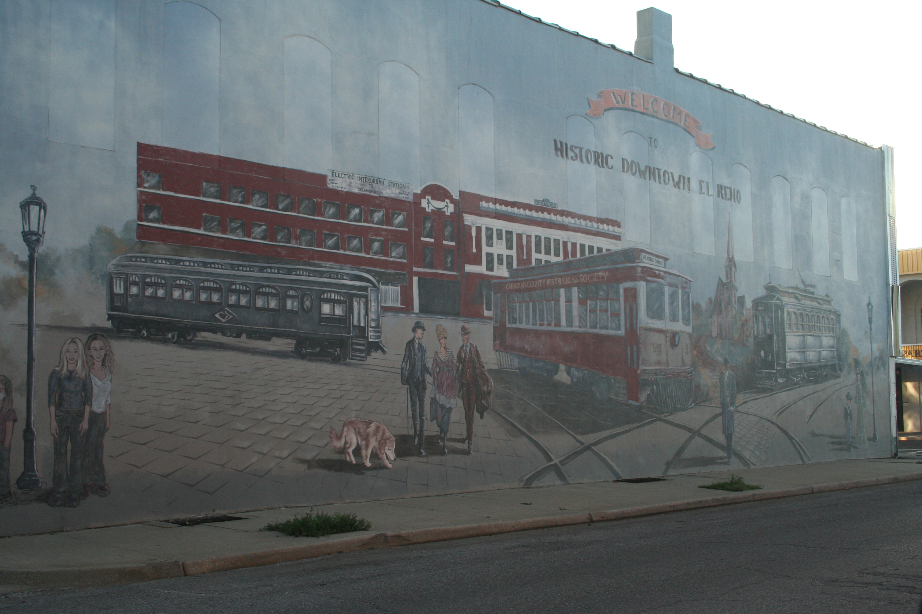
Art murals such as this, which depict scenes that represent the rich history behind Route 66, can be found in many Route 66 communities.
Public Domain.
Download Original (3200 x 2133 pixels, 3866.0 MB)
-
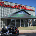
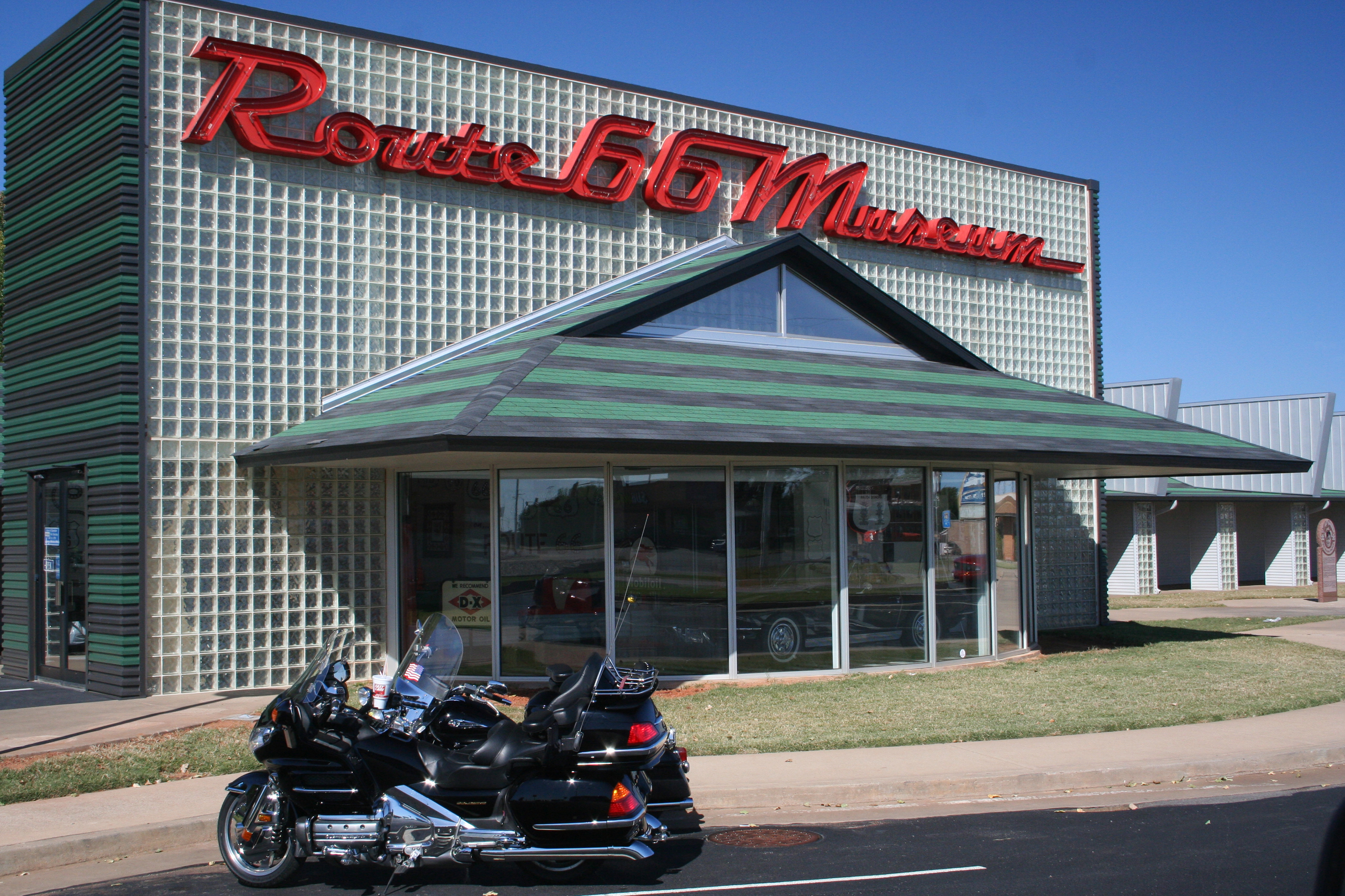
A pair of motorcycles parked in front of the Route 66 Museum adds an ideal image to this building that's dedicated the free spirit represented all along the Mother Road.
Public Domain.
Download Original (3200 x 2133 pixels, 4978.8 MB)
-
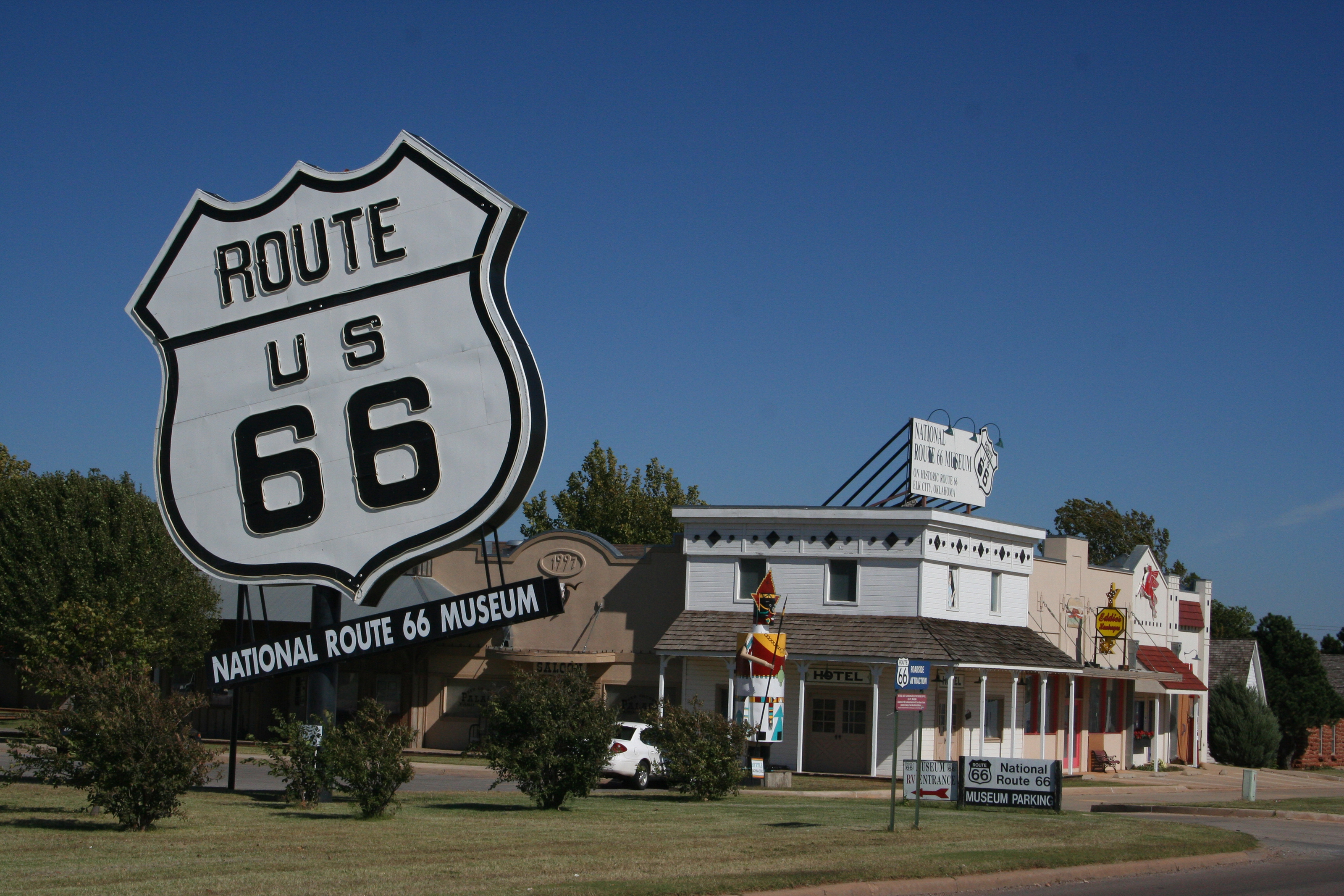
Located in Elk City, the National Route 66 Museum and the nearby Old Town Museum Complex offer a great opportunity to brush up on Route 66 history and see some interesting memorabilia.
Public Domain.
Download Original (3200 x 2133 pixels, 4395.7 MB)
-
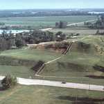
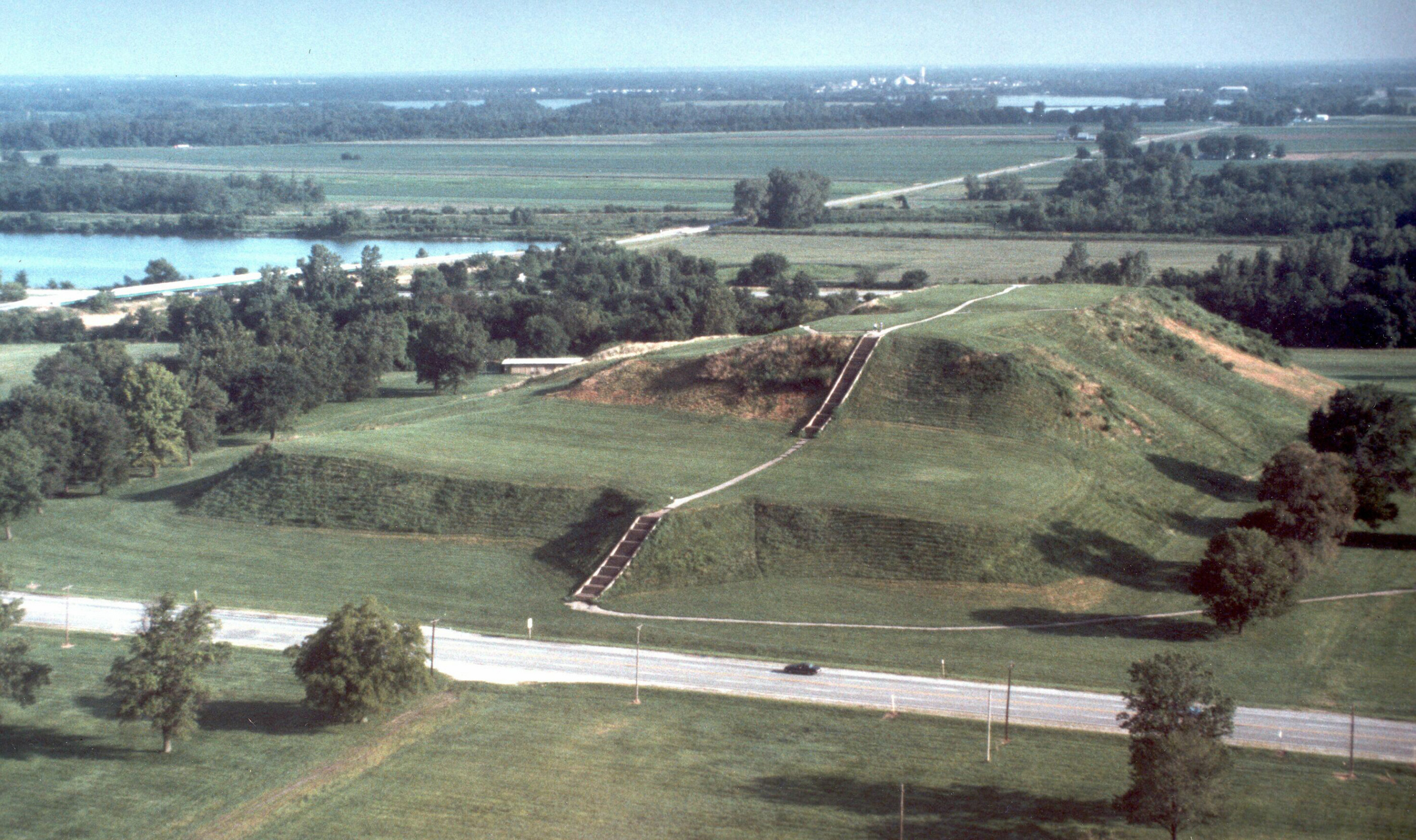
This aerial view reveals the astonishingly large Monks Mound, located at Cahokia Mounds State Historic Site.
Public Domain. Cahokia Mounds State Historic Site
Download Original (4206 x 2496 pixels, 2372.4 MB)
-
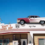
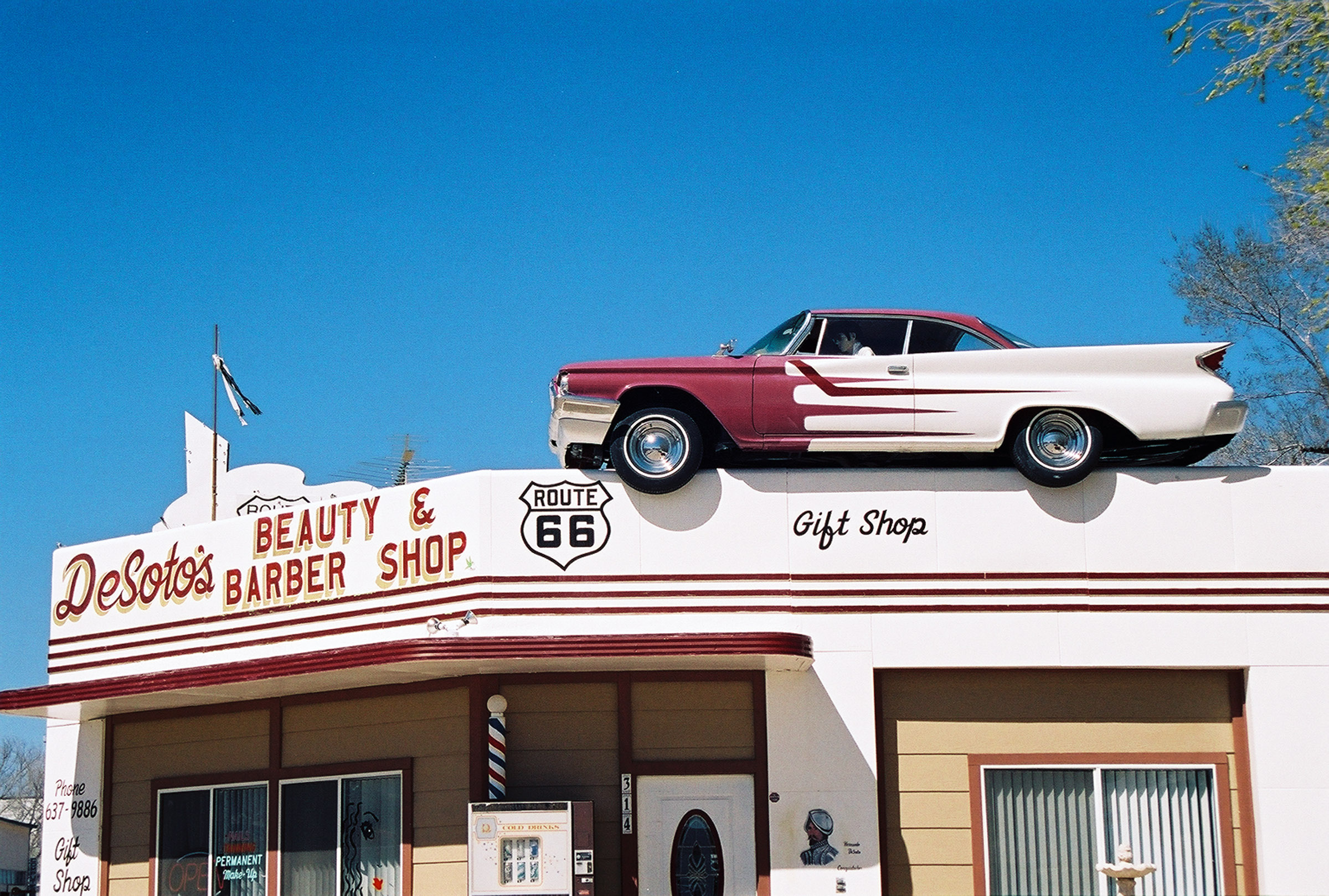
A full-size, brightly painted old DeSoto automobile rests on top of the front of the DeSoto Barbershop building against a backdrop of clear blue sky in Ash Fork, Arizona.
Public Domain. Leslie Connel
Download Original (2400 x 1620 pixels, 910.7 KB)
-
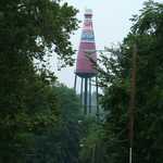
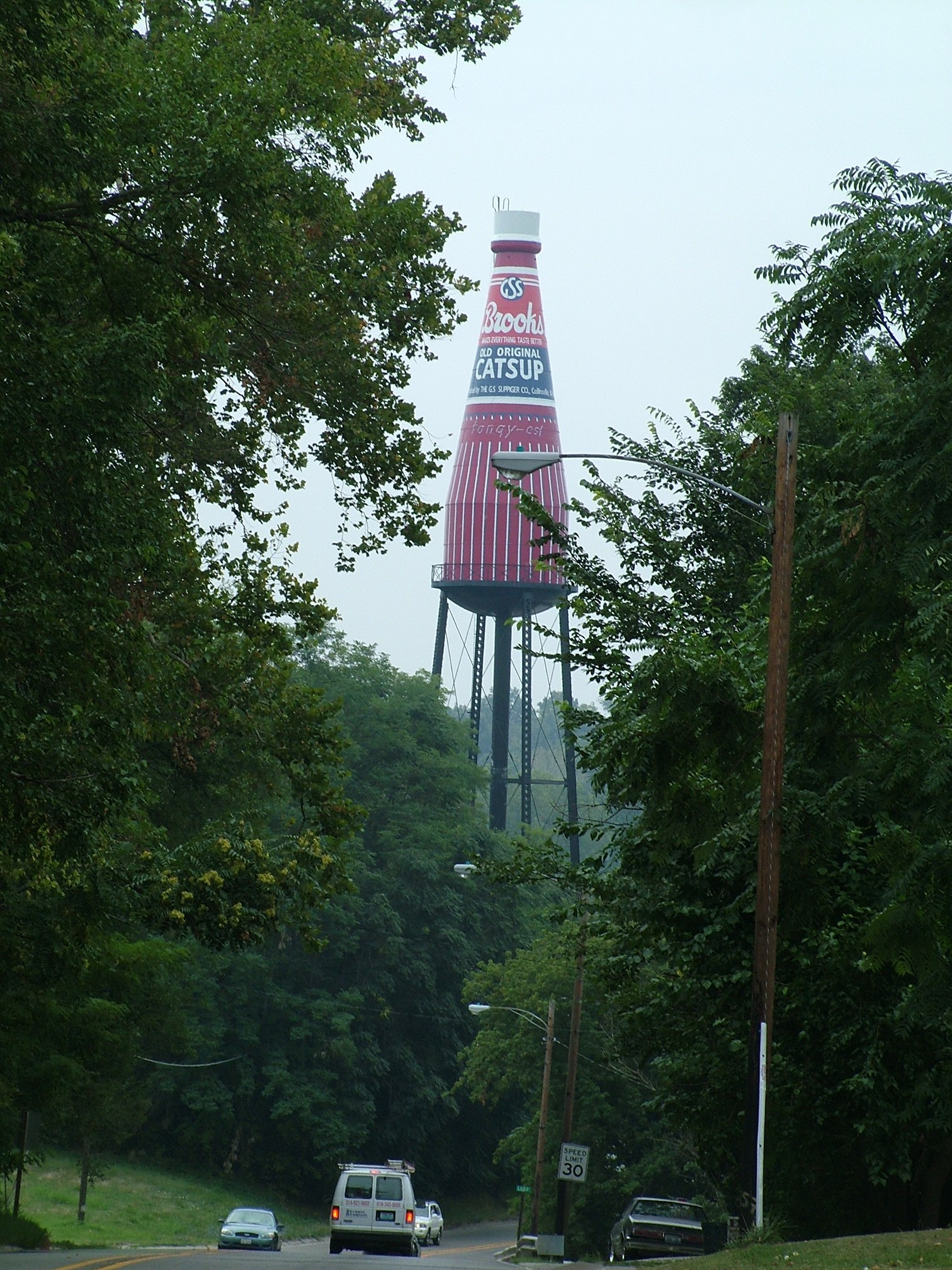
A giant catsup (ketchup) bottle water tower perches above tall, green trees as a road winds around the landmark.
Public Domain. Courtesy of William Kelly
Download Original (1512 x 2016 pixels, 743.1 KB)
-
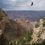
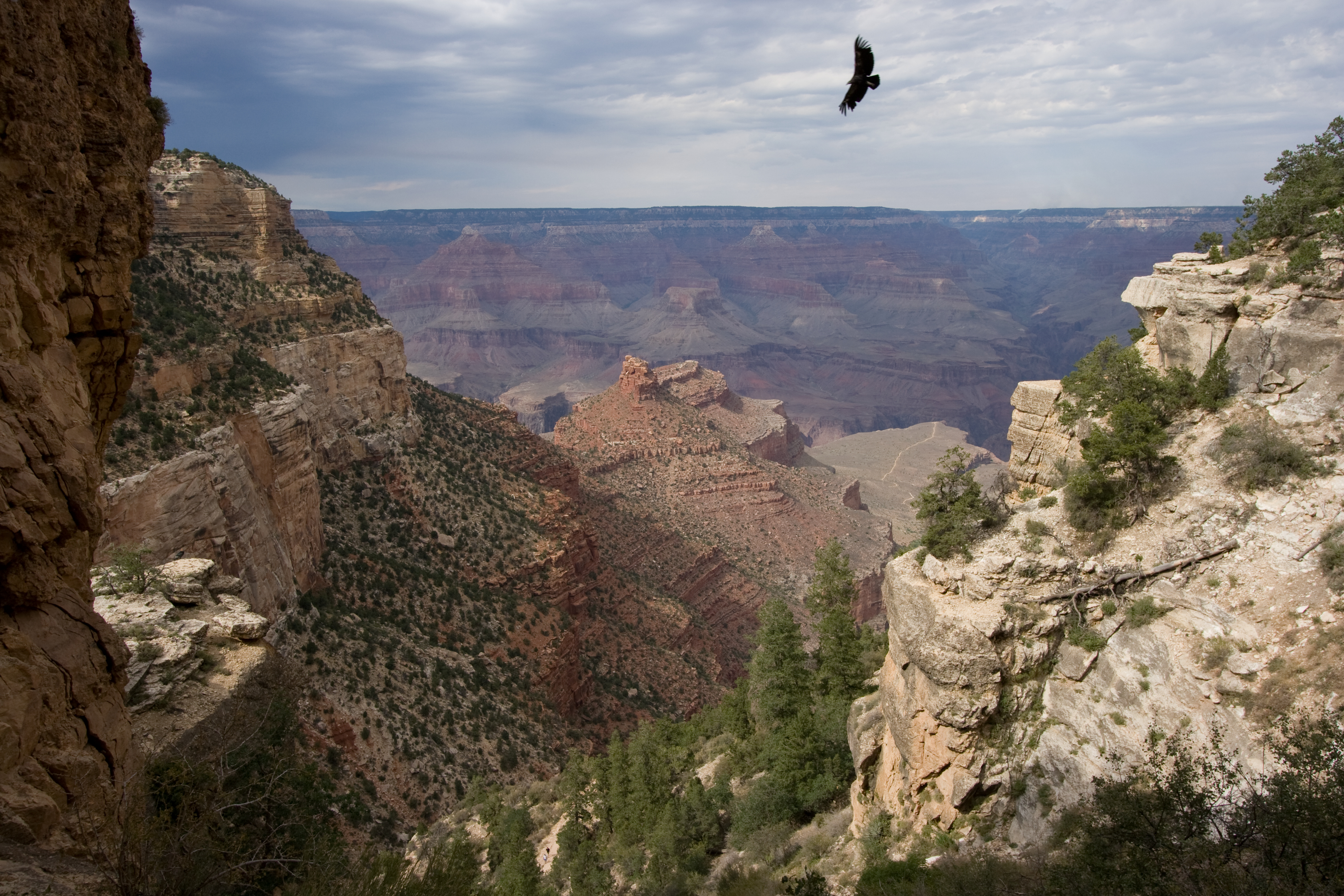
A California Condor soars on thermals above the deep gorges of the Grand Canyon.
 © August 2009 Chris M. Richards.
Download Original (3888 x 2592 pixels, 6150.9 MB)
-
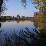
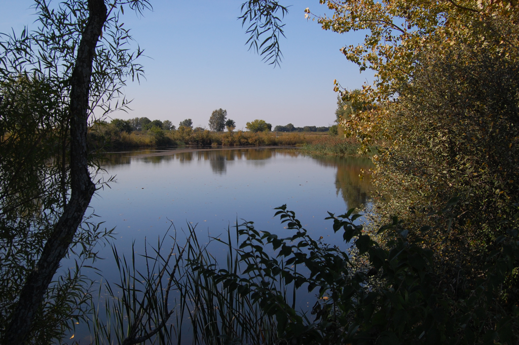
The calm waters of Turtle Pond reflect surrounding green trees and cloudless, blue sky.
© September 2008 reallyboring of flickr.com.
Download Original (1024 x 681 pixels, 972.3 KB)
-

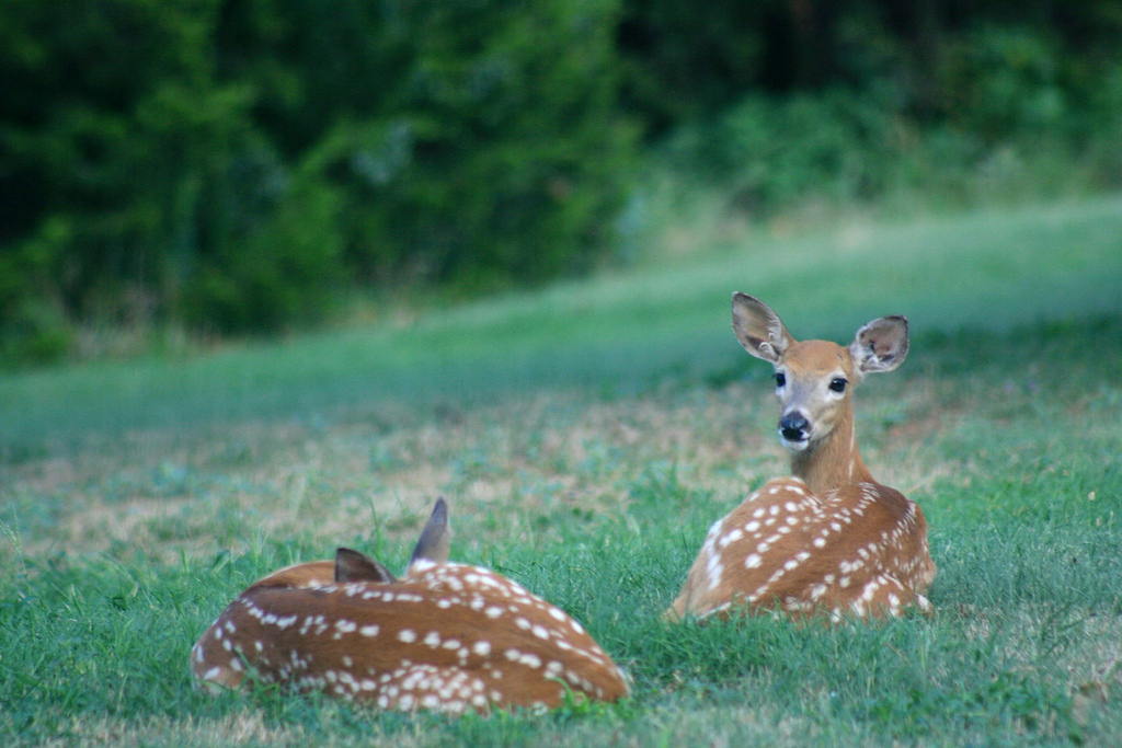
Fawns relax on a beautiful August day in Washita National Wildlife Refuge.
 © August 2011 USFWS Headquarters.
Download Original (1024 x 683 pixels, 308.9 KB)
-

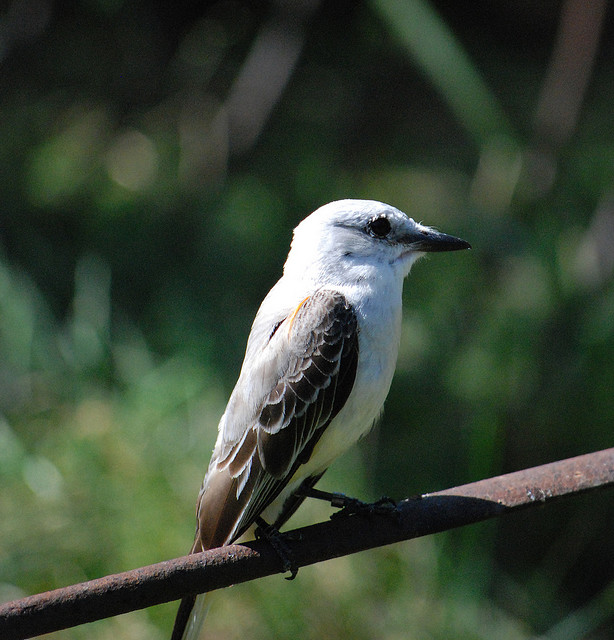
A curious Western Tanager sits on top of an Arizona rock.
 © May 2008 Carla Kishinami.
Download Original (1275 x 857 pixels, 285.7 KB)
-

A Rough-legged Hawk soars high among the clouds searching for the next meal.
© February 2005 Aaron Martin.
Download Original (700 x 465 pixels, 171.4 KB)
-

A Northern Pintail, still wet from a dip in the pond, glides across pristine water.
© March 2008 Brendan Lally.
Download Original (1024 x 707 pixels, 237.0 KB)
-
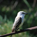
A Scissor-tailed Flycatcher enjoys a quiet moment while perching on a branch.
© June 2008 Matt Grimm.
Download Original (614 x 640 pixels, 113.1 KB)
-
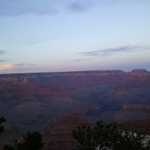
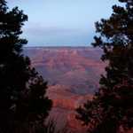
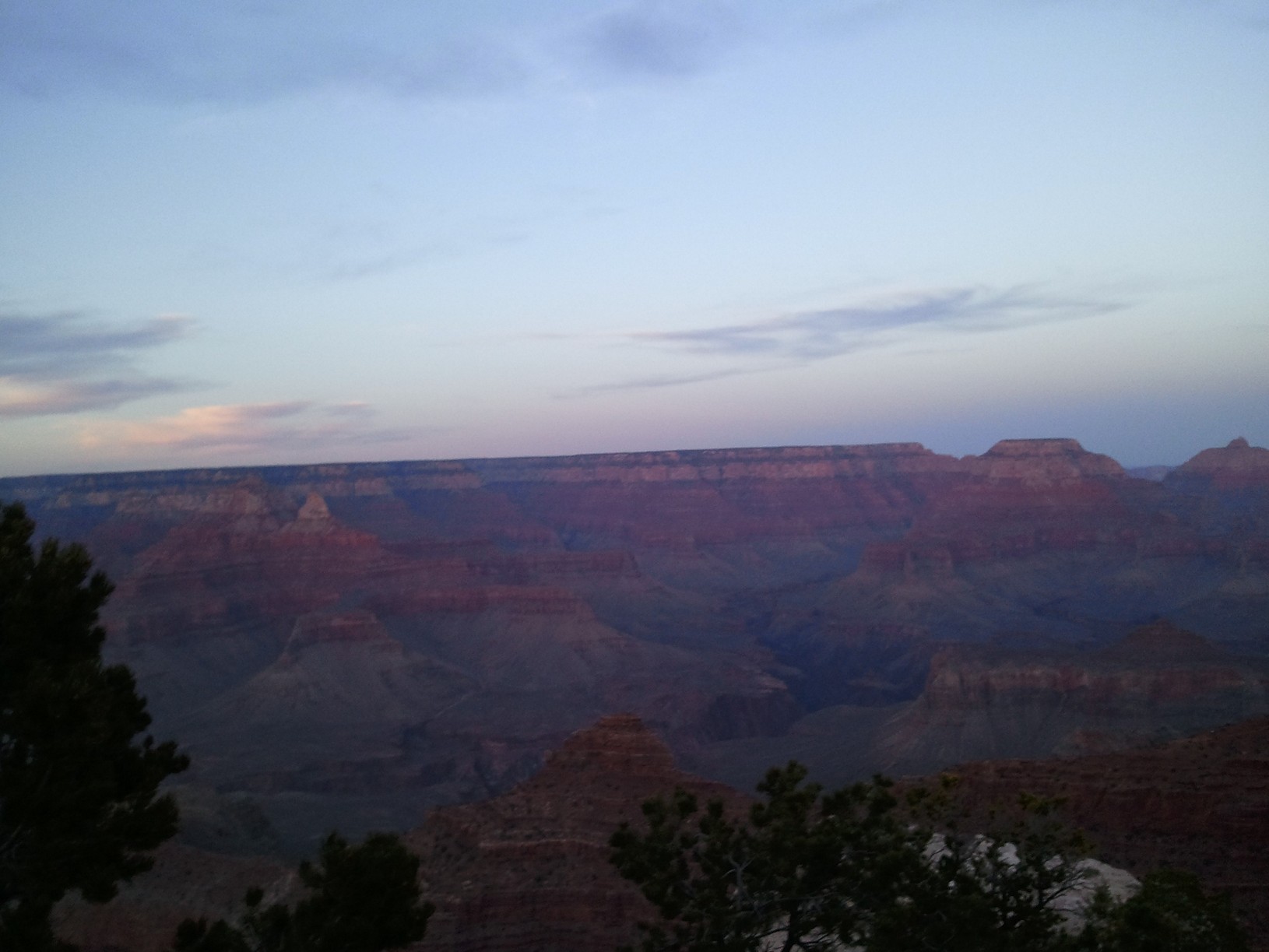
Rich reds and blues stand out in the rocks of Grand Canyon National Park at dusk, as seen from the southern rim.
Public Domain. Jill Bowers
Download Original (1630 x 1223 pixels, 243.5 KB)
-
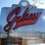
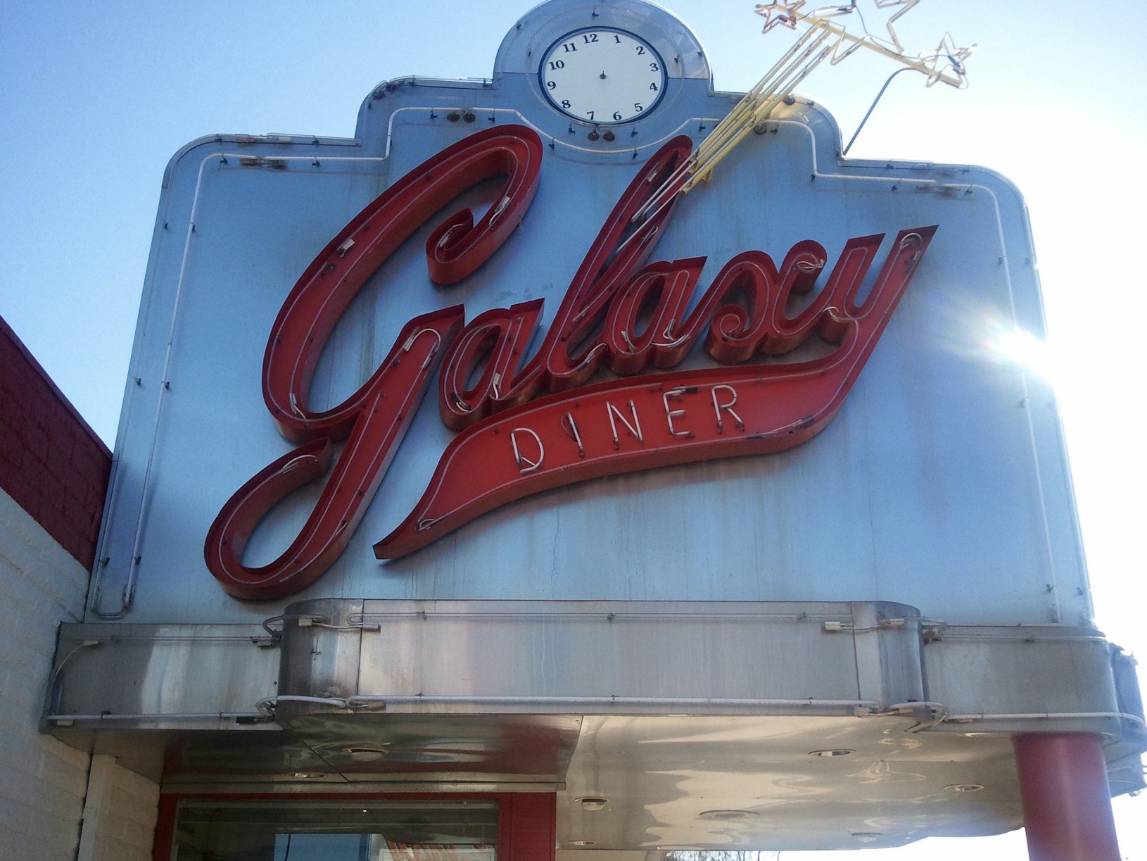
The Galaxy Diner is one of the famous local restaurants in Flagstaff, Arizona. Its red and chrome sign, pictured here, stands out brilliantly against a clear blue sky.
Public Domain. Jill Bowers
Download Original (1630 x 1223 pixels, 367.1 KB)
-
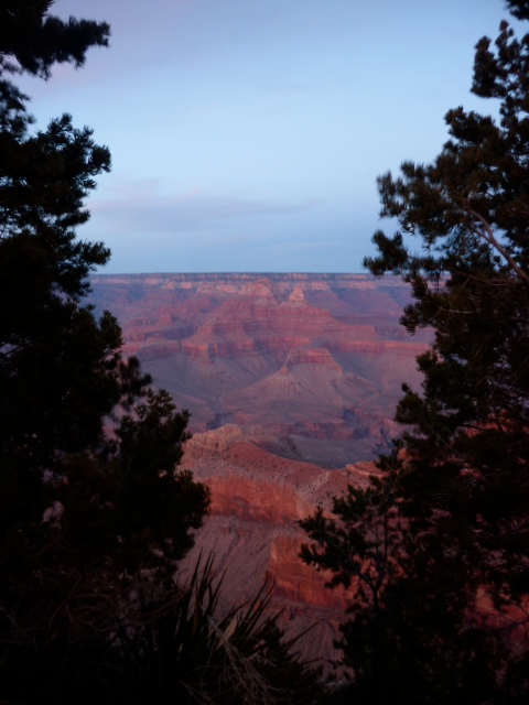
Oranges and reds jump out of the rock in contrast to the light blue skies at Grand Canyon National Park.
Public Domain. Jill Bowers
Download Original (480 x 640 pixels, 100.4 KB)
-
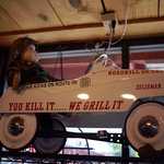
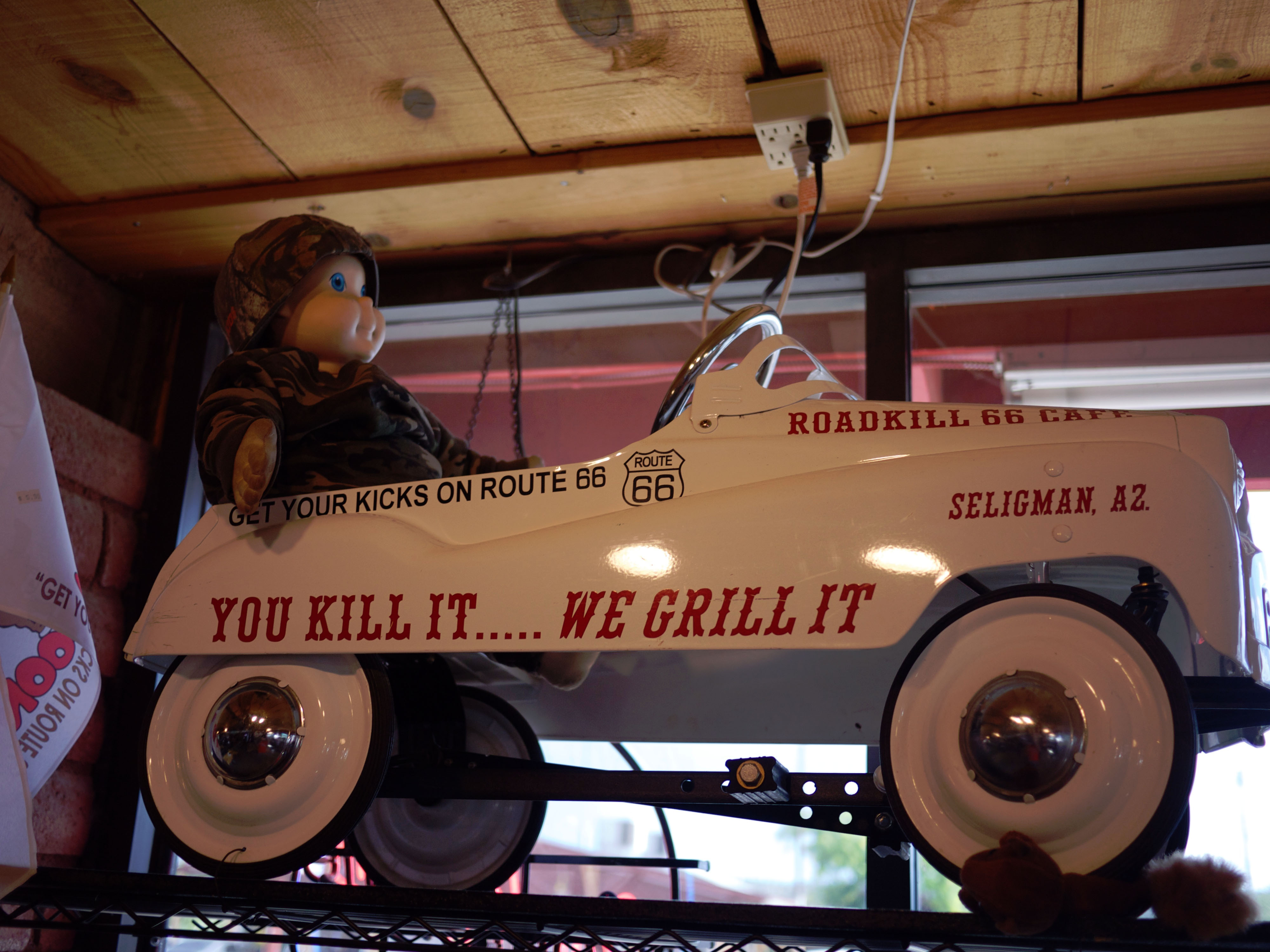
A white car with the cafe's slogan, "You Kill It...We Grill It" adds to the whimsical decor of the Roadkill Cafe in Seligman, Arizona.
© August 1, 2011 bmeabroad of flickr.com.
Download Original (4000 x 3000 pixels, 997.4 KB)
-
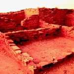
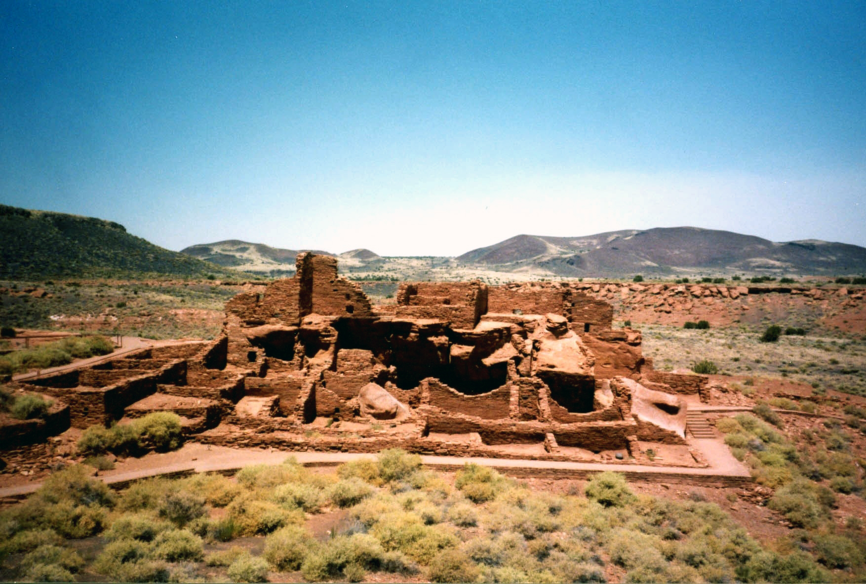
Pieces of the past sacred to the Hopi Indians and the Anasazi can be seen here.
Public Domain.
Download Original (273 x 404 pixels, 89.3 KB)
-
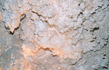
Rough limestone walls with myraid formations rest in the bowels of the earth at Chapel of the Ages in Arizona.
Public Domain.
Download Original (352 x 226 pixels, 77.1 KB)
-
This historic, graceful Rt. 66 bridge was built in 1916 to carry vehicles across the Colorado River.
© May 2005 Georgia D. Griffiths.
Download Original (320 x 240 pixels, 15.4 KB)
-
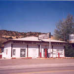
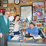
The Hackman General Store has a great little Rt. 66 museum.
© 2005 Georgia Dale Griffiths.
Download Original (320 x 240 pixels, 15.4 KB)
-
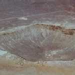
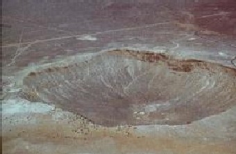
Roosting with the birds gives visitors the best view of Meteor Crater.
Public Domain.
Download Original (340 x 223 pixels, 43.0 KB)
-
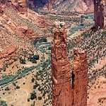
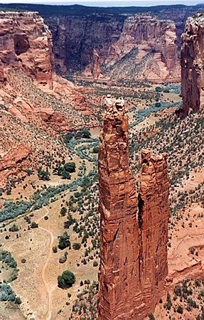
This mulit-colored rock is just one of the many in the painted deserts at Canyon de Chelly.
Public Domain.
Download Original (287 x 450 pixels, 176.2 KB)
-
A sign is all that remains of a cowboy legend.
Public Domain.
Download Original (300 x 400 pixels, 75.7 KB)
-
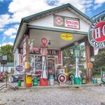
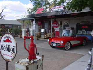
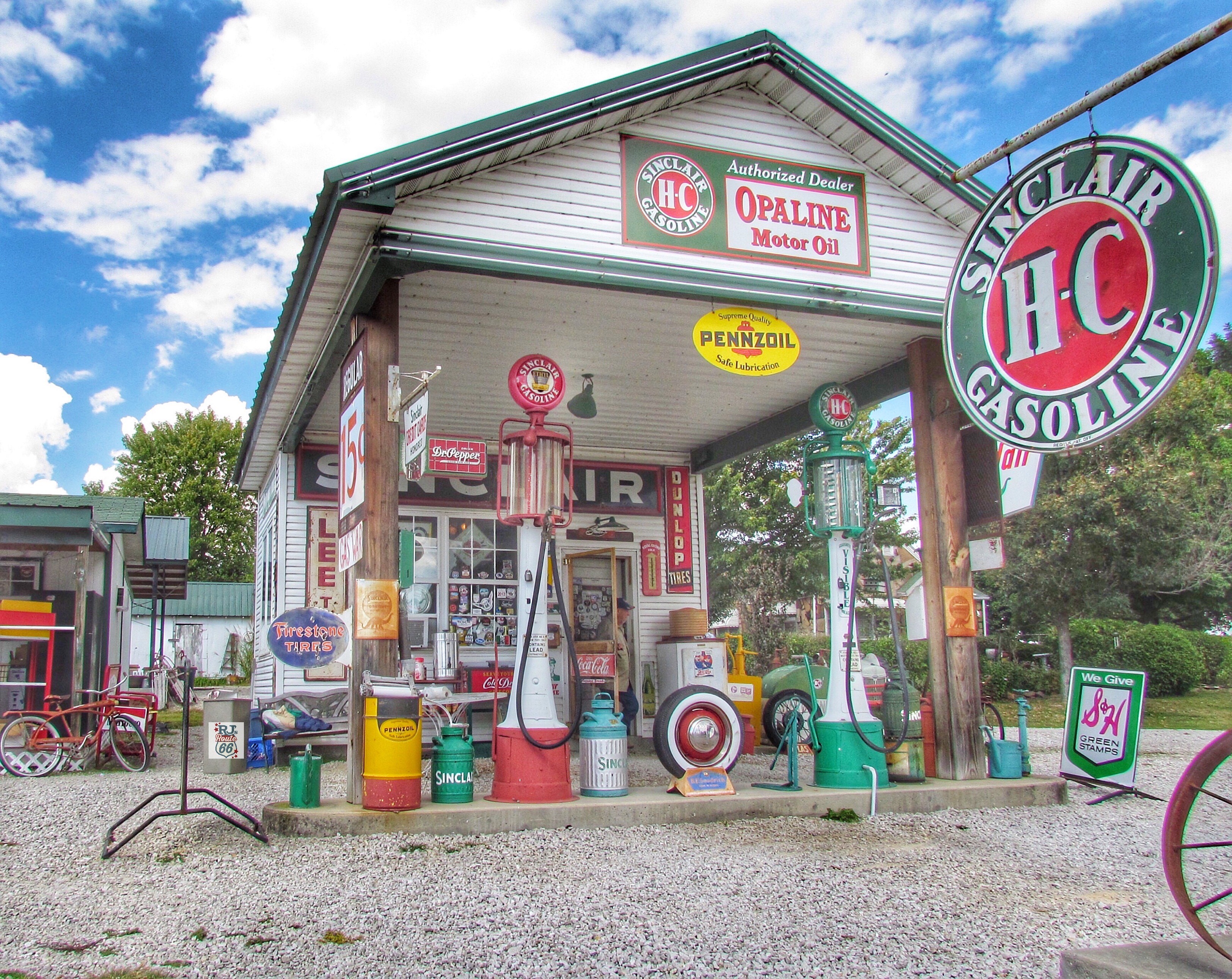
Visitors can pull into this classic gas station at the old General Store along the road in Hackberry, Arizona where you never have to leave your car.
Public Domain.
Download Original (1600 x 1200 pixels, 1154.0 MB)
-
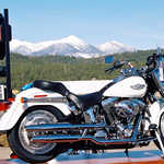
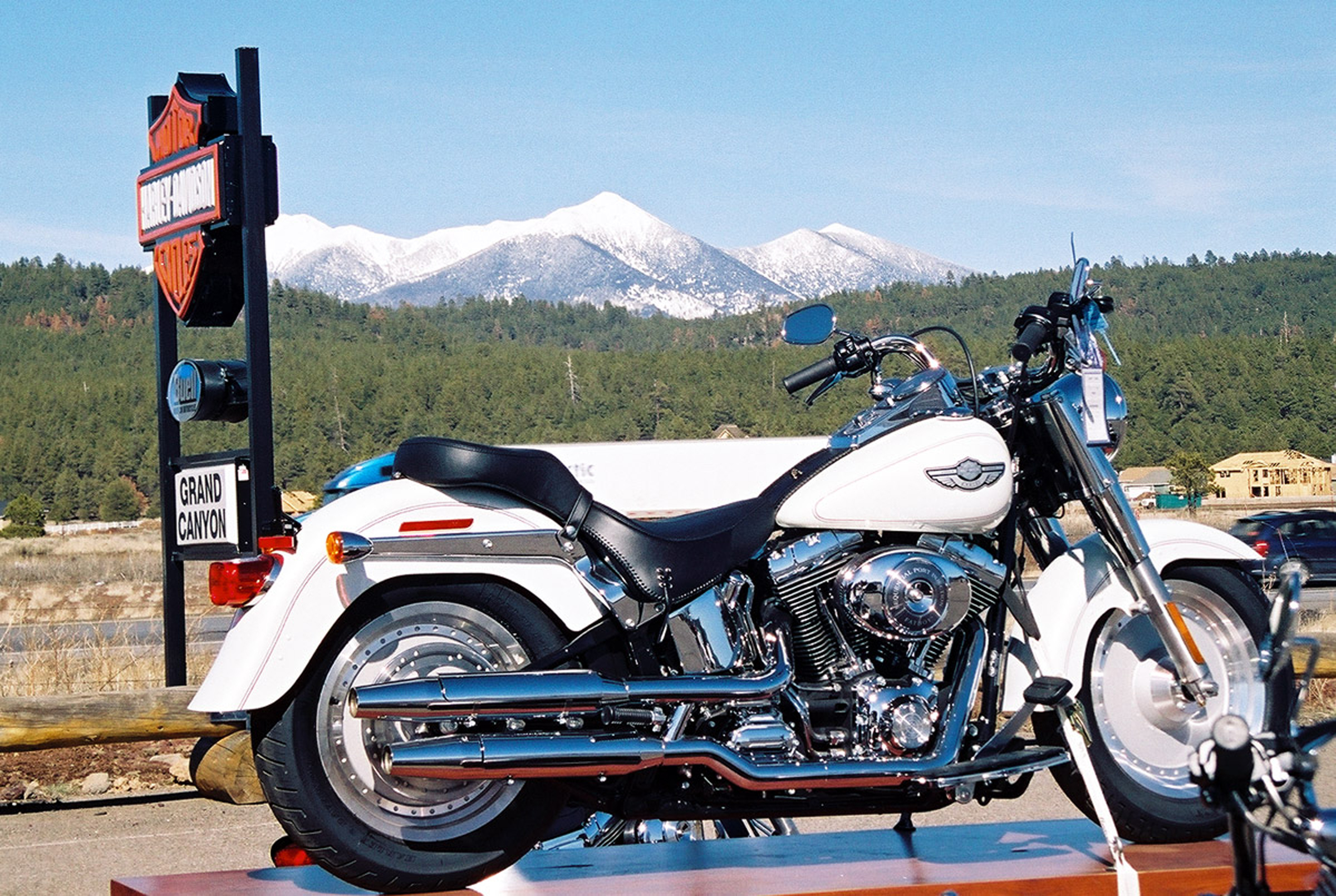
A classic Harley Davidson motorcycle stands on display as snow covered peaks rise in the background.
Public Domain.
Download Original (2400 x 1610 pixels, 2219.5 MB)
-
The simple brick facade hides a mulitude of items that are a must see along Route 66.
Public Domain.
Download Original (2400 x 1573 pixels, 1713.9 MB)
-
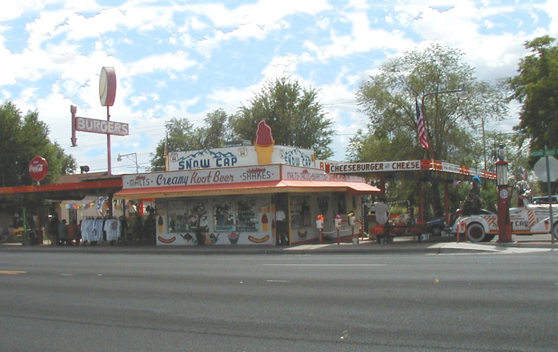
The classic Snow Cap diner provides more than just food - it's a classic stop along this historic route.
Public Domain.
Download Original (1116 x 704 pixels, 270.6 KB)
-
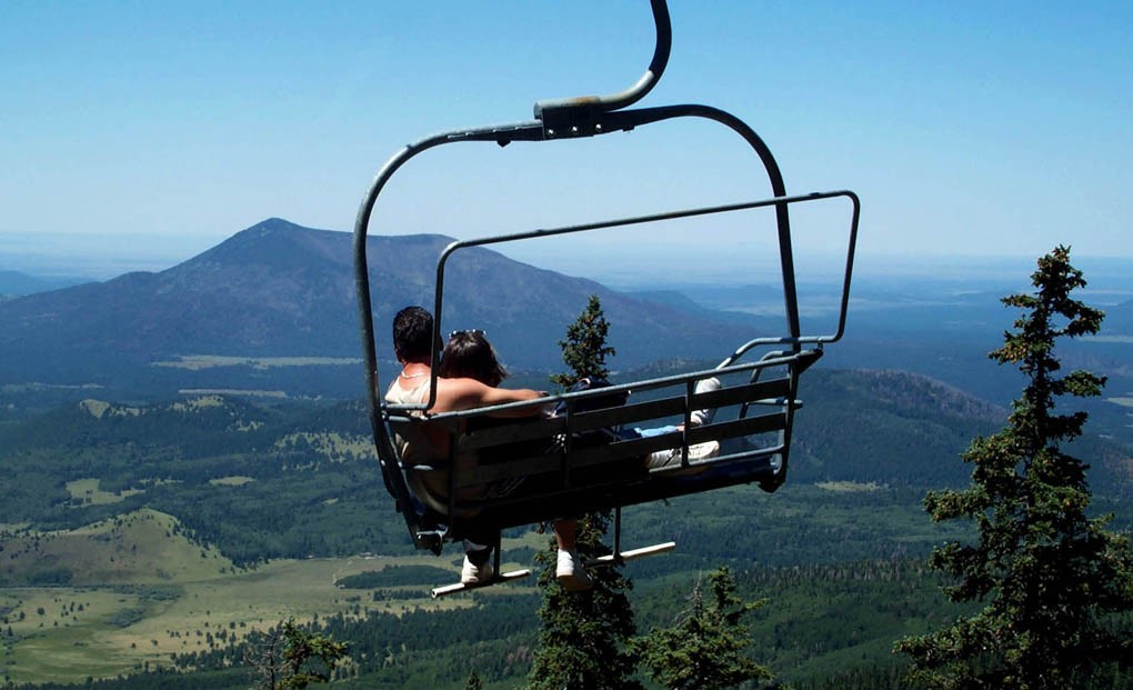
Hanging above the Coronado forest provides visitors with an awe-inspiring view of the land spread out below.
Public Domain.
Download Original (1020 x 621 pixels, 118.8 KB)
-
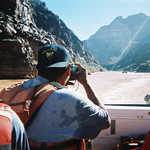
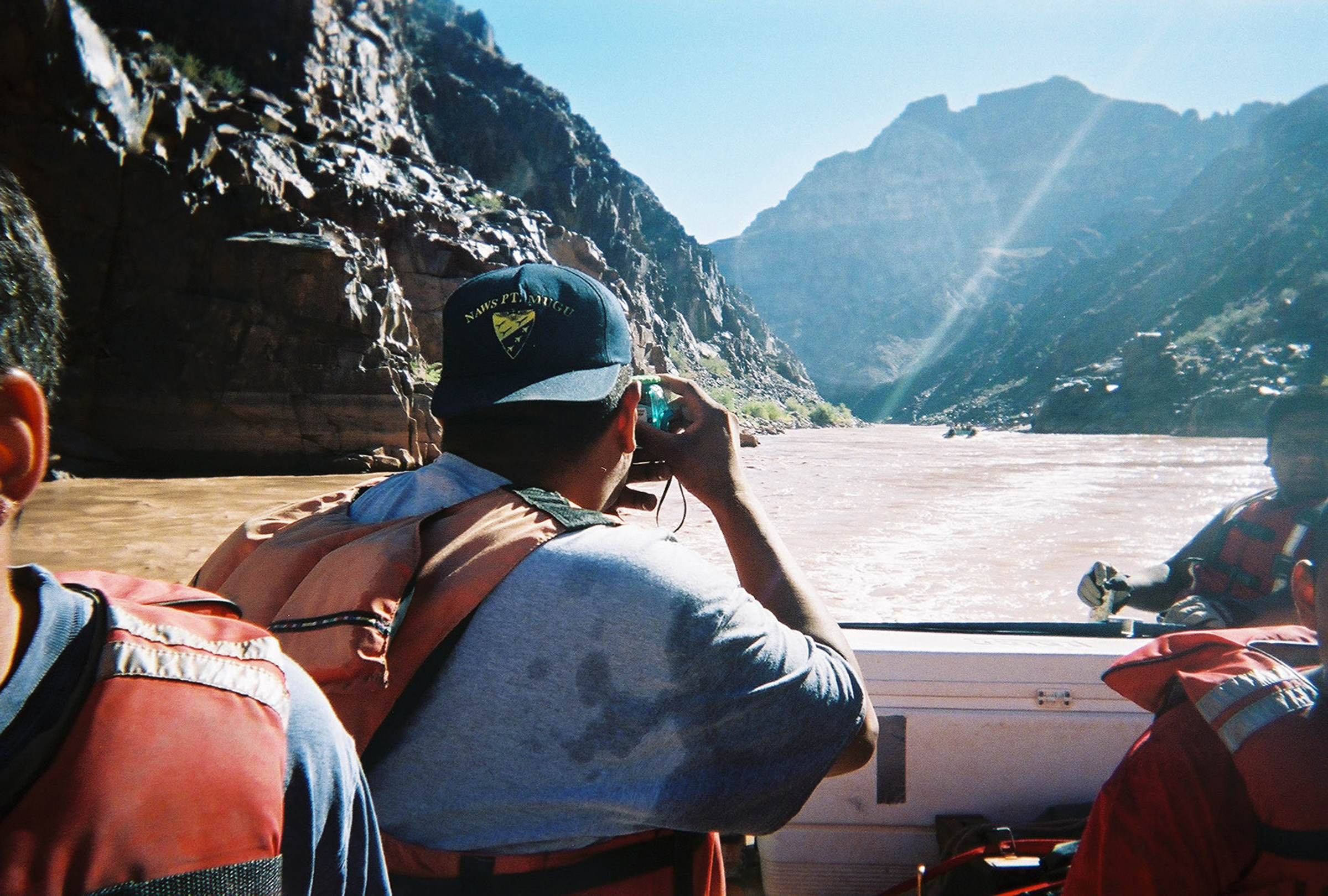
Misty waters provide a refreshing spray for visitors who travel along the Colorado River.
Public Domain.
Download Original (2400 x 1620 pixels, 1102.4 MB)
-
In the sage brush lands of the Arizona desert, visitors can gaze upon this piece of the past.
Public Domain.
Download Original (1754 x 1183 pixels, 967.1 KB)
-

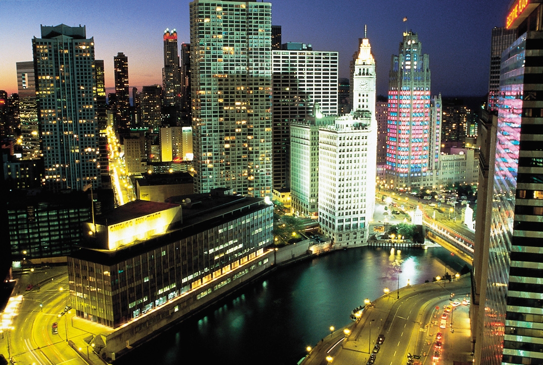
The glowing towers of skyscrapers highlight downtown Chicago against the sunset.
Public Domain.
Download Original (1098 x 739 pixels, 867.1 KB)
-

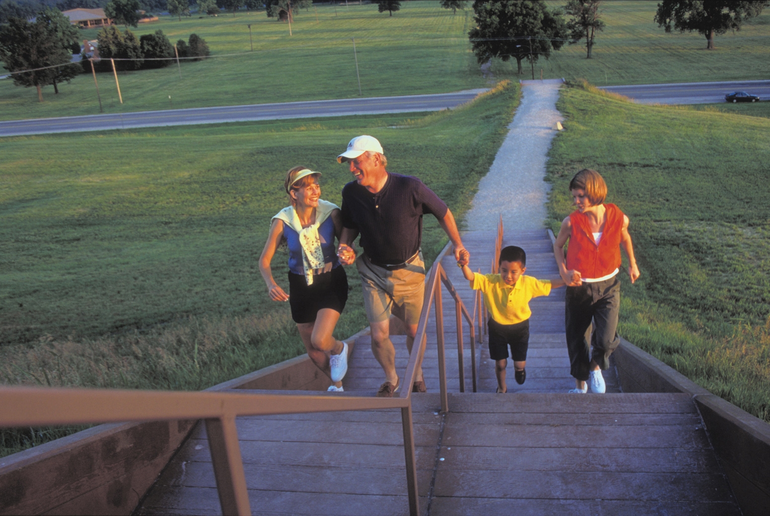
This group of byway visitors laugh as they climb the stairs to Cahokia Mounds, the remains of the most sophisticated prehistoric native civilization north of Mexico.
Public Domain.
Download Original (1551 x 1039 pixels, 1017.6 MB)
-
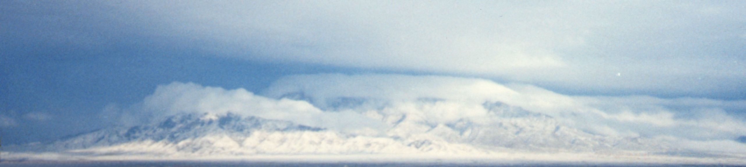
A panoramic view of the Sandia Mountains after a heavy snow storm.
© August 2001 Tony Dutson Photo Gallery.
Download Original (2563 x 575 pixels, 147.2 KB)
-
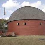
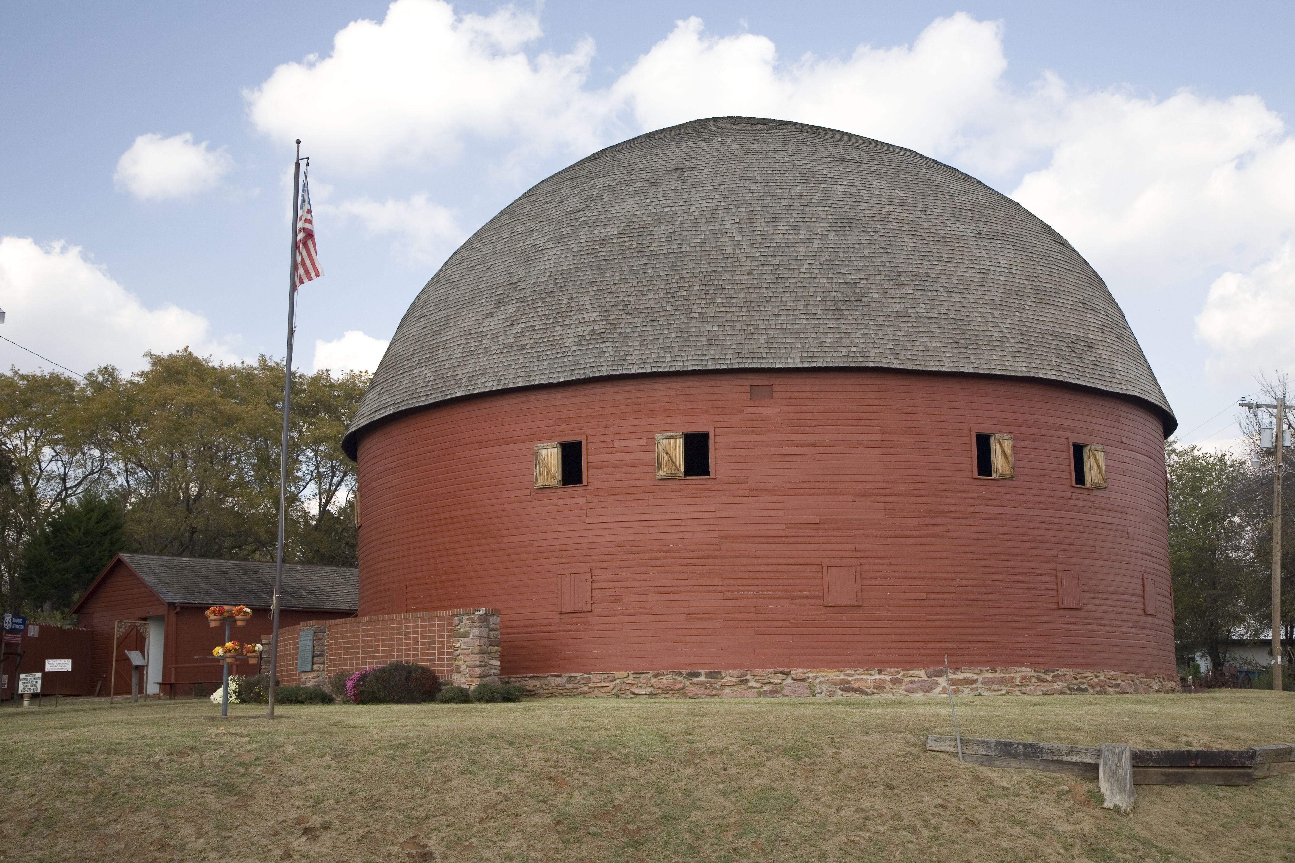
Still standing after over 100 years, the round barn's picturesque form compliments a blue sky filled with billowy white clouds.
Public Domain.
Download Original (4350 x 2900 pixels, 1950.6 MB)
-
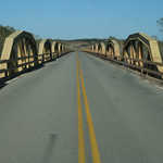
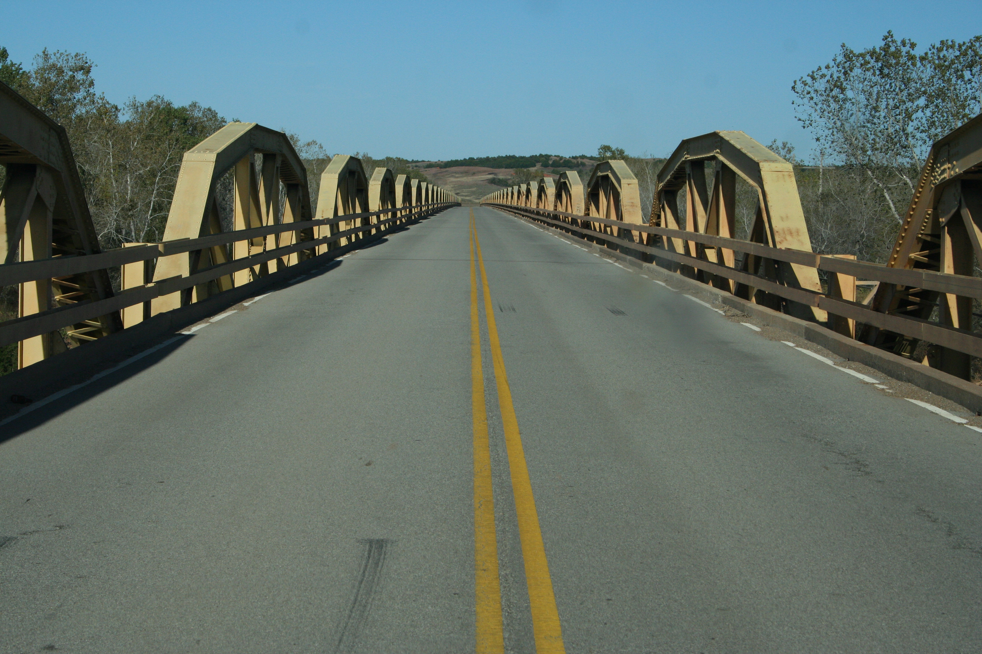
This bridge, which was featured in the movie, "The Grapes of Wrath," is 3,944.33 feet long and contains 38 pony trusses.
Public Domain.
Download Original (3200 x 2133 pixels, 4567.9 MB)
-
Abandoned neon signs such as this are indicative of the 1950s-era that Route 66 embodies.
Public Domain. Photo by Kellie Thorne
Download Original (3322 x 2256 pixels, 307.9 KB)
-
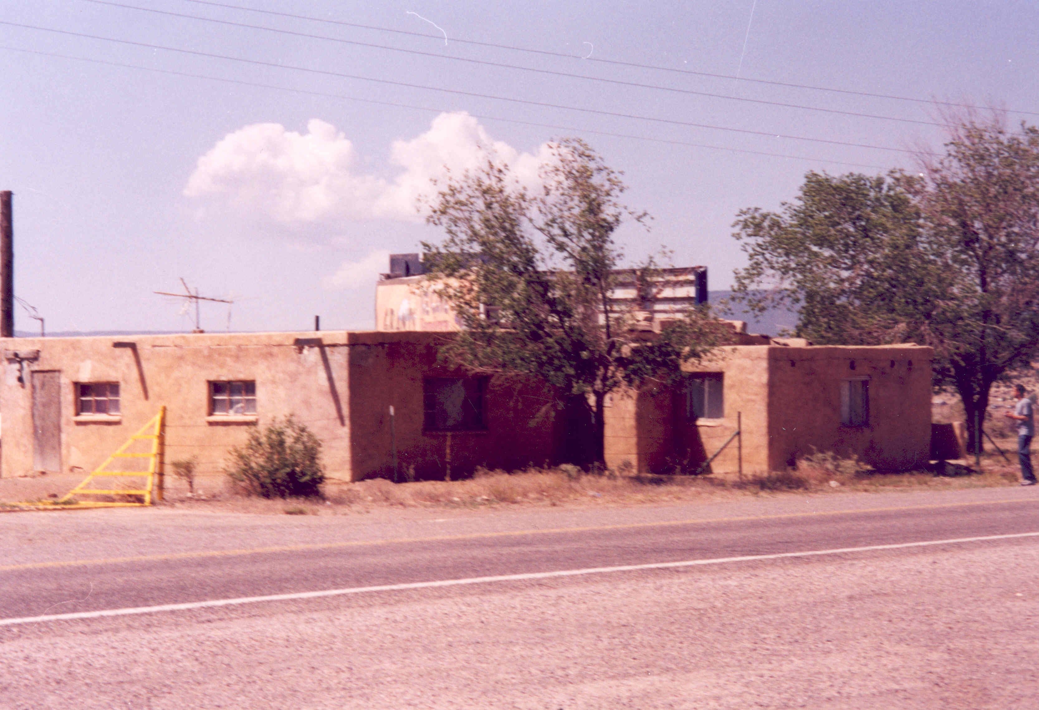
An abandoned motel on Route 66 stands today to represent an era of mobility and change.
Public Domain. Photo by Kellie Thorne
Download Original (3334 x 2278 pixels, 452.7 KB)
-
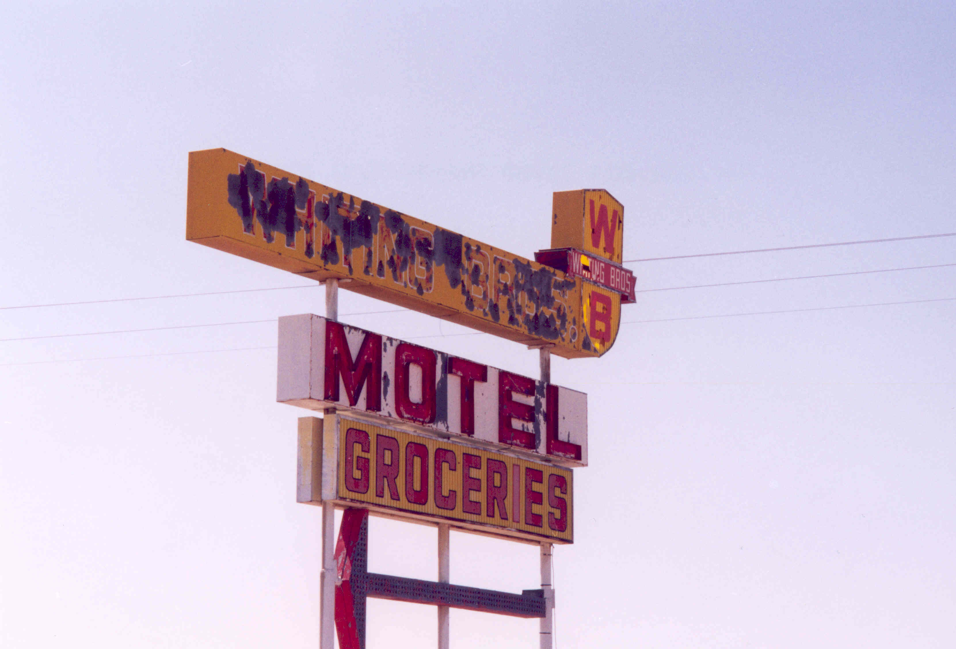
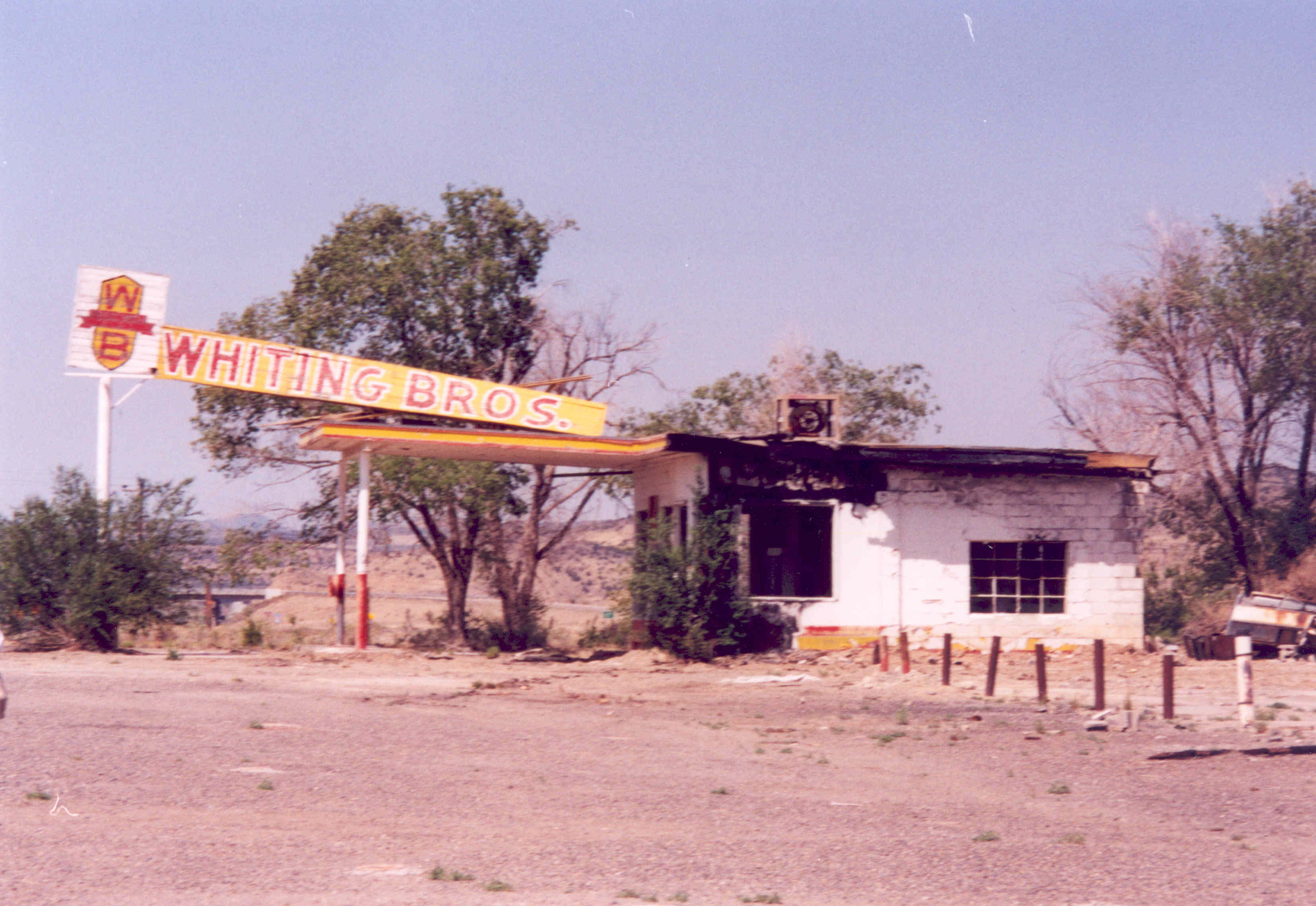
Though abandoned years ago due to fire damage, historic buildings such as Whiting Brothers are fought for to be protected in their current conditions.
Public Domain. Photo by Kellie Thorne, taken May 2003
Download Original (3310 x 2278 pixels, 448.7 KB)
-
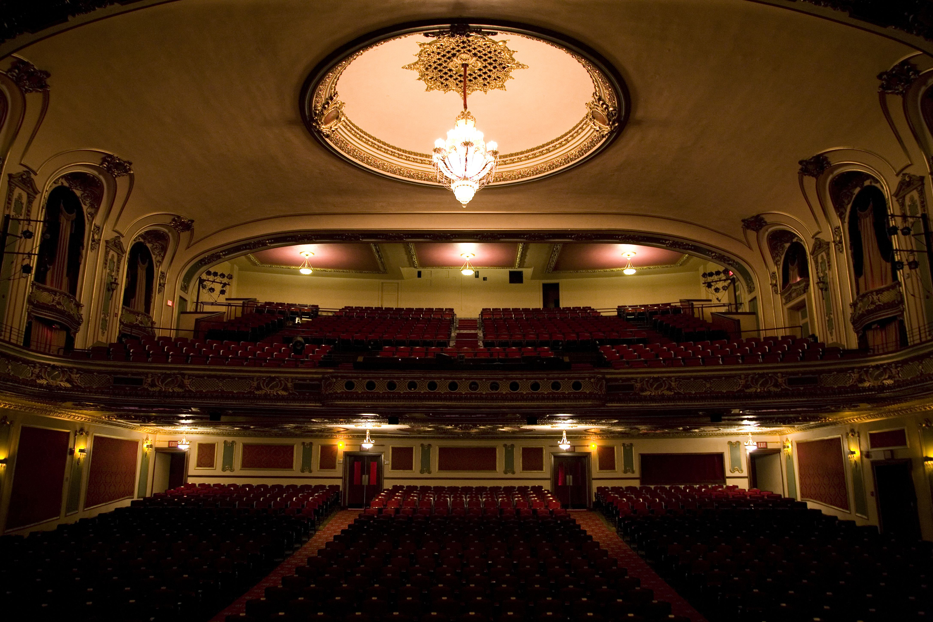
The ornate interior of the Coleman Theatre creates an scene of perfect symmetry and beauty.
Public Domain.
Download Original (3200 x 2133 pixels, 4244.6 MB)
-
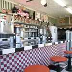
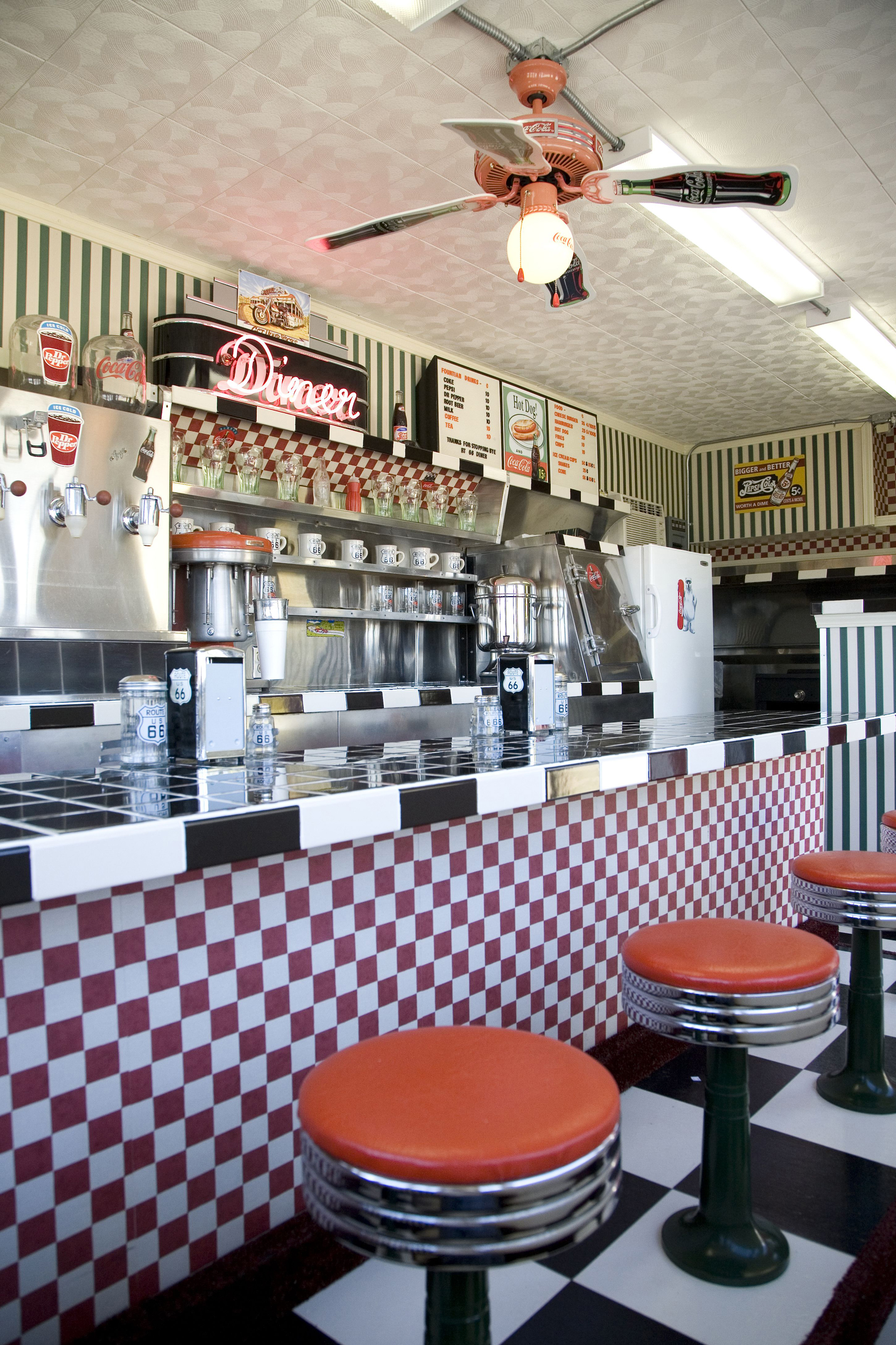
Checkered countertops and red stools accentuate the 50s-era feel of Lucille's Roadhouse.
Public Domain.
Download Original (2133 x 3200 pixels, 4251.3 MB)
-
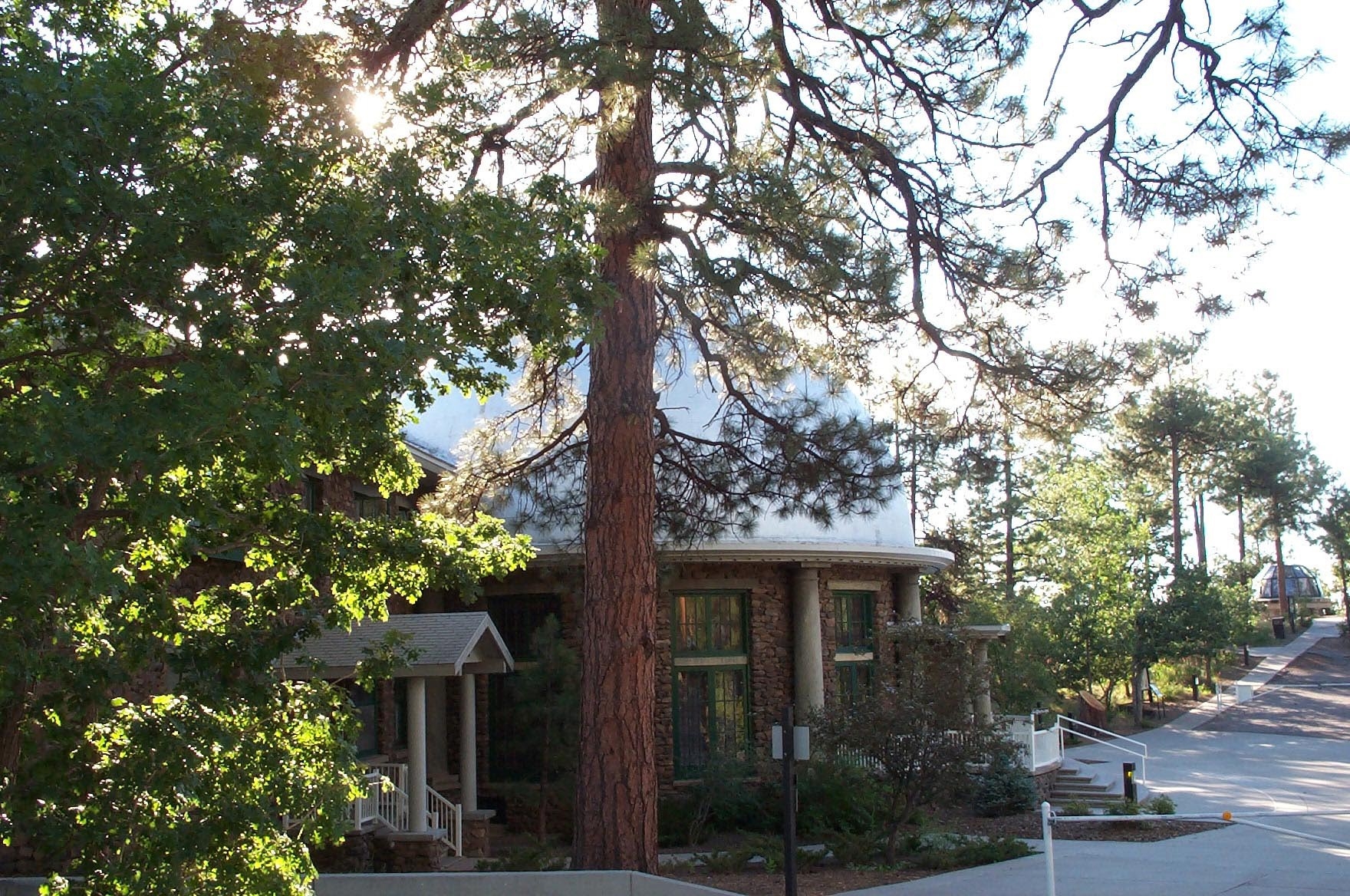
Framed by sun dappled leaves and shadows, the Lowell Observatory provides scenic beauty and scientific wonder.
Public Domain. Photo by Leslie Connell
Download Original (1760 x 1168 pixels, 1499.1 MB)
-
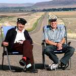
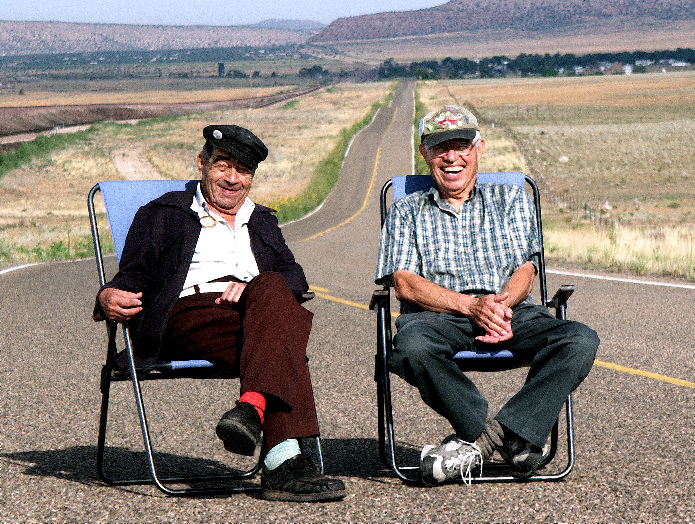
Sitting in lawn chairs along a stretch of Arizona's Historic Route 66 All American Road with miles of blue skies and high desert scrub brush as the backdrop, are brothers Juan and Angel Delgadillo, who, with a few other Route 66 believers, are responsible for the rebirth of Route 66. Angel, now 81 years old (as of 2008 or so), proved that one man can change the world. After Route 66 was bypassed by Interstate 40, he watched his community struggle to survive, all the while believing that the way to bring back the economy of his town and others along the Route was to build it on the heritage of Route 66 itself. Thirty years later Juan, who always wore mismatched socks, and Angel sit casually beside the road with smiles from ear to ear and a twinkle in their eyes. Juan and Angel built successful businesses around the Route 66 theme, and are proud that the world believed in their vision.
Public Domain. Photo by Bill Leverton
Download Original (2438 x 1838 pixels, 4216.5 MB)
-

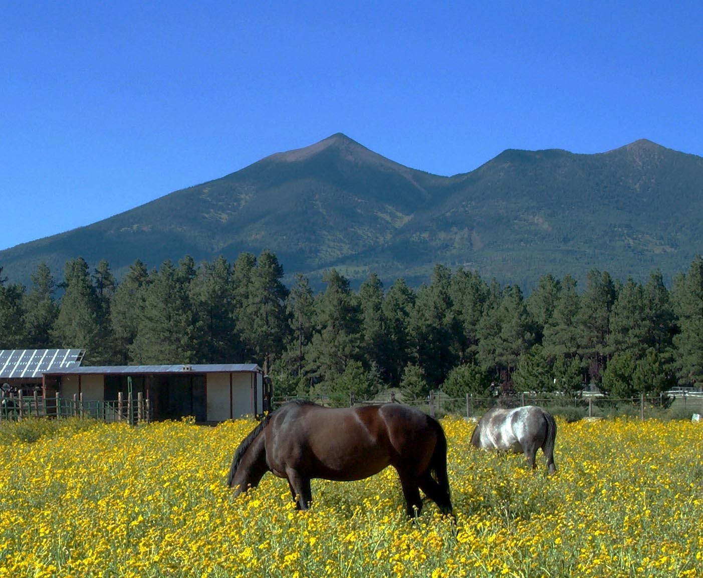
Mountains provide a stunning backdrop as horses graze for food in the bright yellow flowers.
Public Domain. Photo by Leslie Connell
Download Original (1403 x 1153 pixels, 783.6 KB)
-
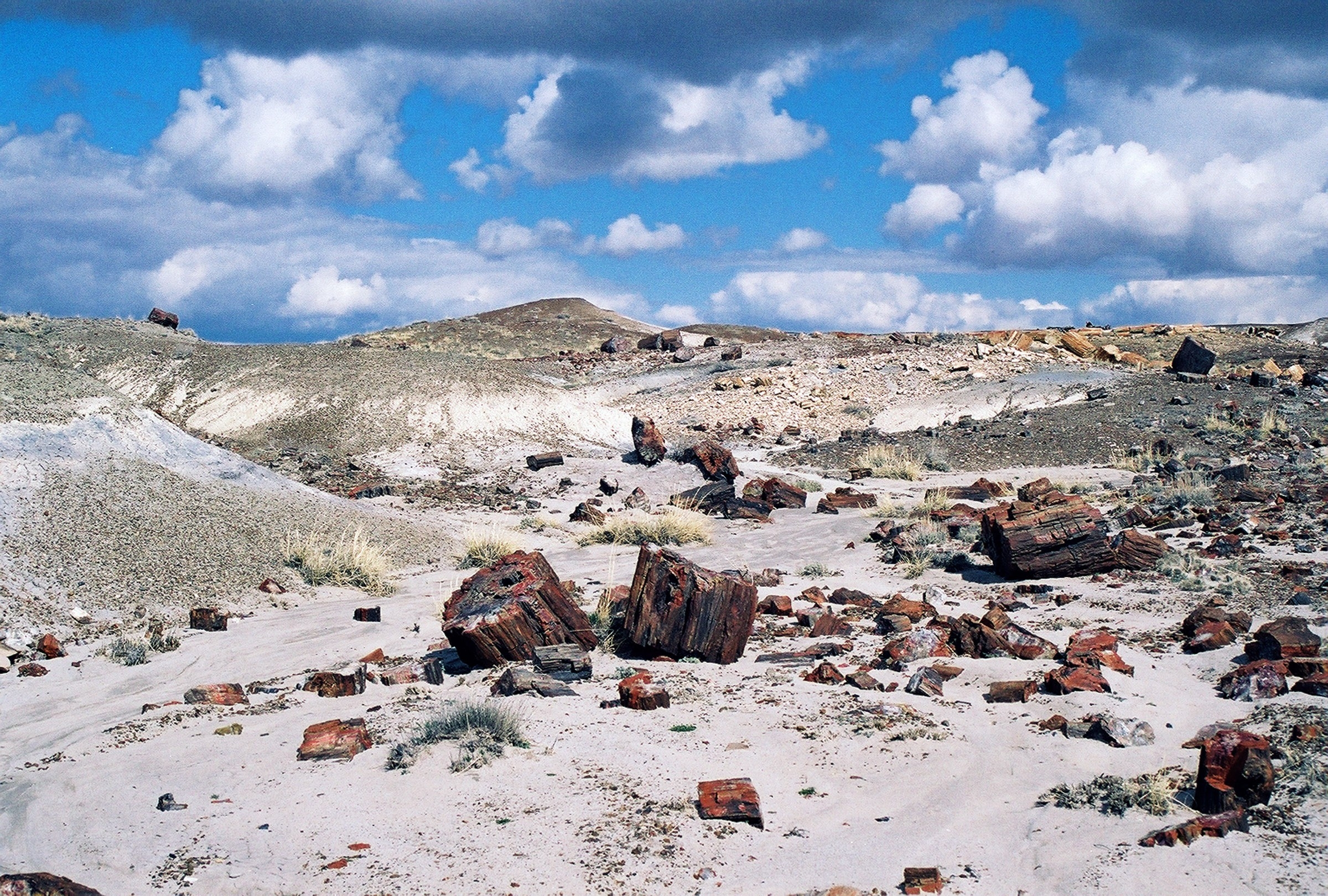
A few broken logs remain scattered along the edges of the Petrified Forest.
Public Domain. Photo by Leslie Connell
Download Original (2400 x 1620 pixels, 2956.2 MB)
-
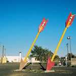
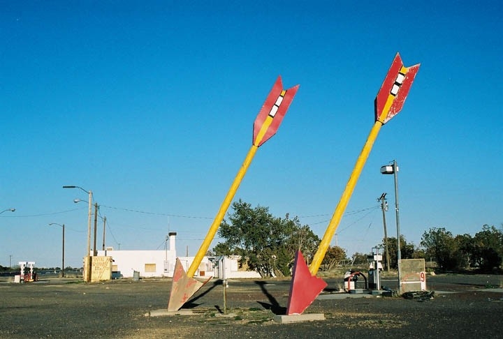
Twins arrows grace the roadway, seemingly shot from the sky.
Public Domain. Photo by Leslie Connell
Download Original (720 x 486 pixels, 155.2 KB)
-
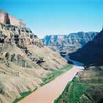
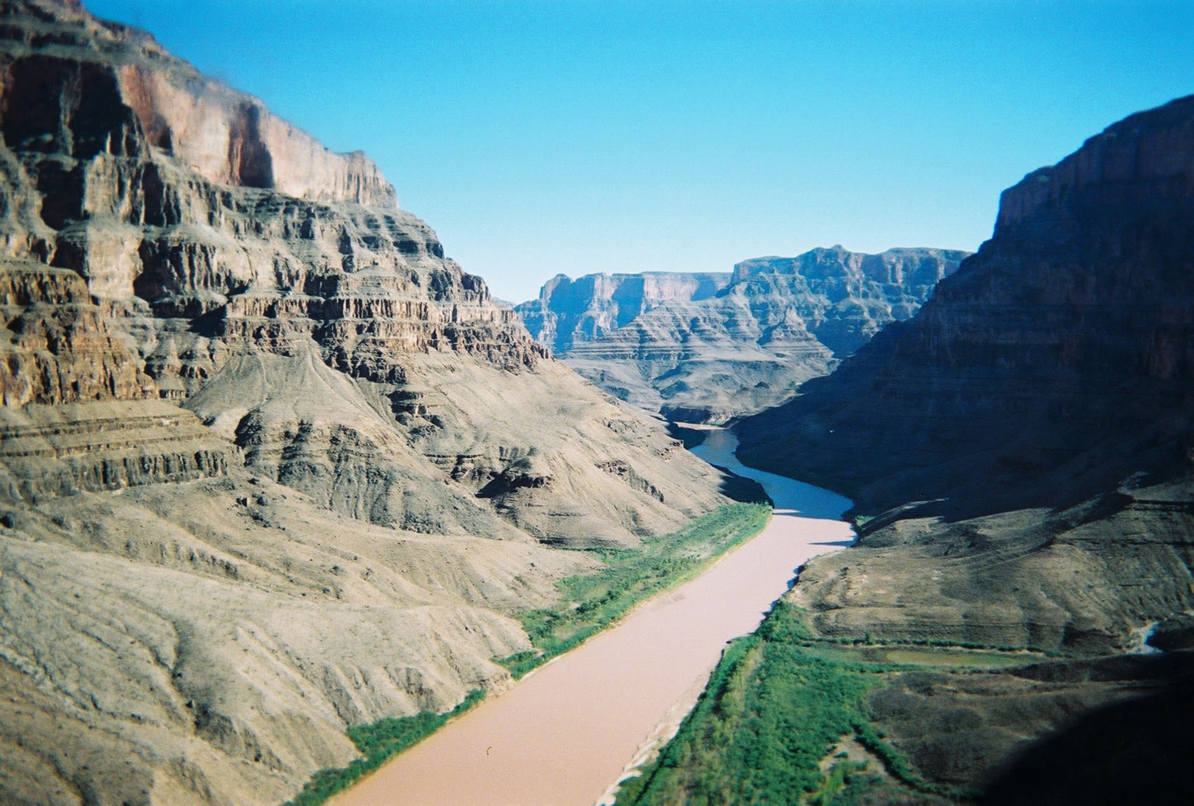
Sloping cliffs and verdant green grass encloses the silty waters of the West Colorado River.
Public Domain. Photo by Leslie Connell
Download Original (2400 x 1620 pixels, 2277.1 MB)
-
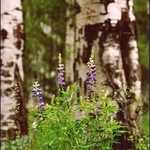
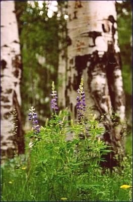
Vibrant purple flowers bloom at the trunk of an aspen tree.
Public Domain. Photo by Leslie Connell
Download Original (264 x 400 pixels, 74.4 KB)
-
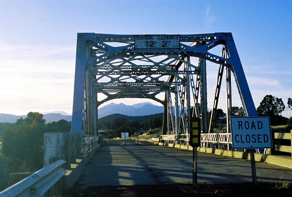
No longer accessible by car, visitors can enjoy the view as they walk up to this important part of Route 66's history.
Public Domain. Photo by Leslie Connell
Download Original (960 x 648 pixels, 332.0 KB)
-
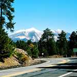
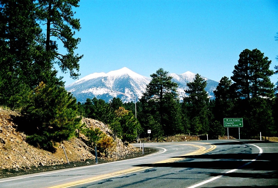
Visitors drive towards snowcapped mountains along the Route 66 in Arizona.
Public Domain. Photo by Leslie Connell
Download Original (960 x 648 pixels, 517.3 KB)
-
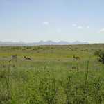
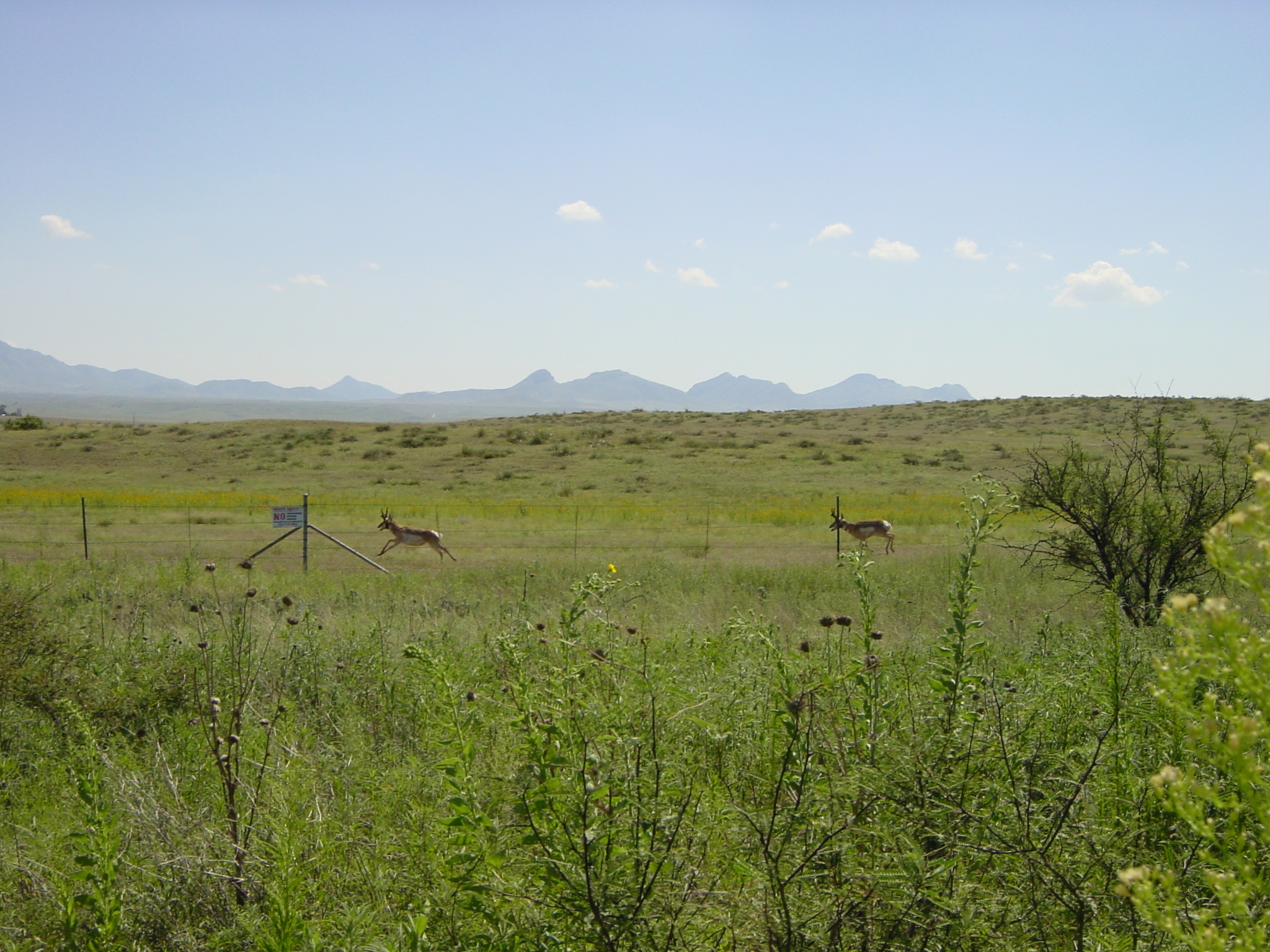
Antelope run freely in the spacious green fields.
Public Domain. Photo by Mark Turner
Download Original (2048 x 1536 pixels, 2040.8 MB)
-

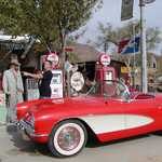
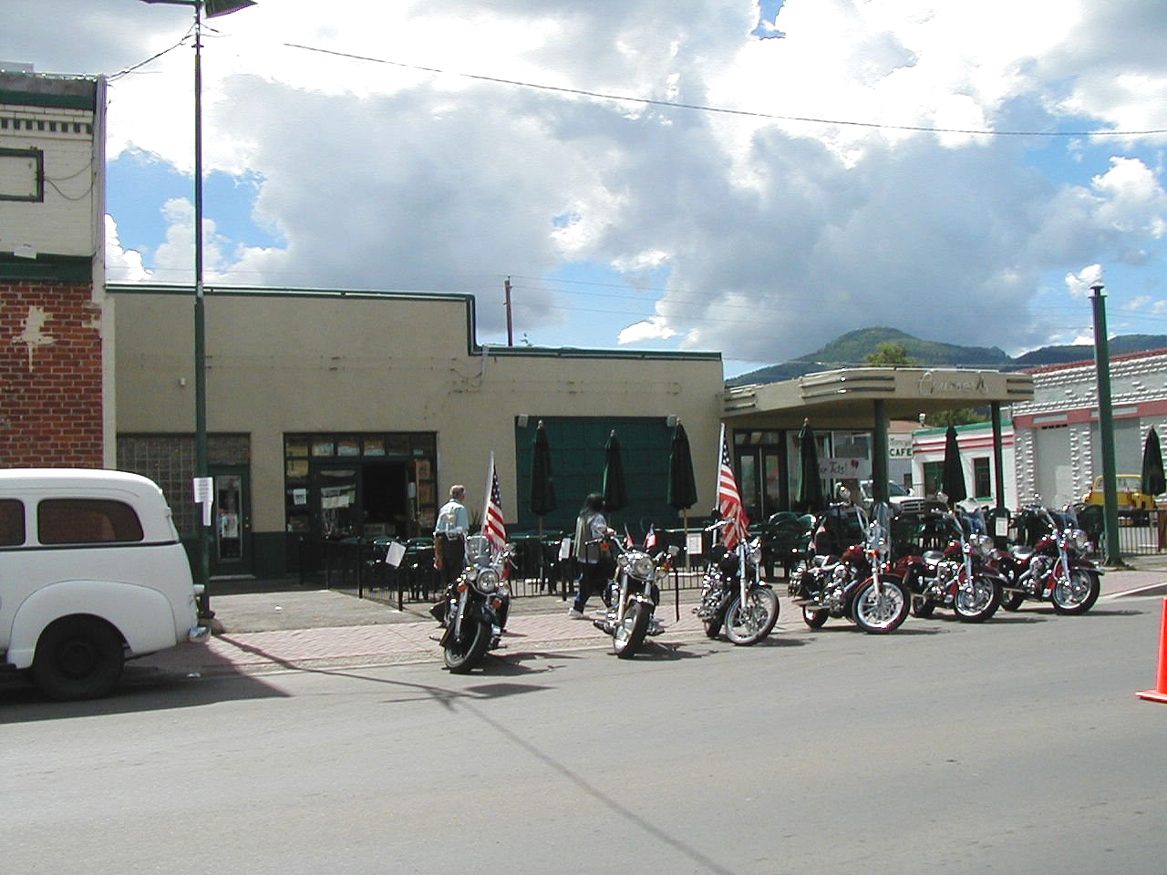
Route 66 brings in travelers on all set of wheels.
Public Domain. Photo by Mark Turner
Download Original (1280 x 960 pixels, 561.4 KB)
-
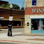
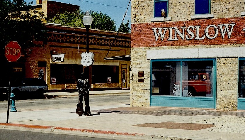
In Winslow, visitors get the unique chance to become part of a song.
Public Domain. Photo by Mark Turner
Download Original (836 x 477 pixels, 389.6 KB)
-

Wide open spaces are still common in this part of the West.
Public Domain. Photo by Mark Turner
Download Original (1600 x 1200 pixels, 1107.8 MB)
-
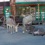
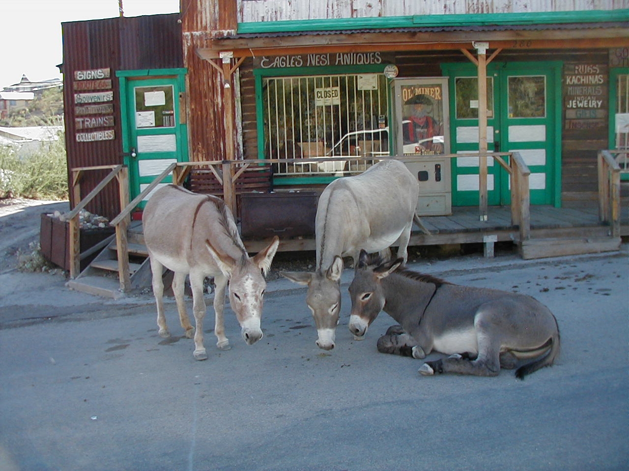
Burros wait to carry more visitors along the trails.
Public Domain. Photo by Mark Turner
Download Original (1280 x 960 pixels, 605.2 KB)
-
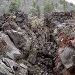
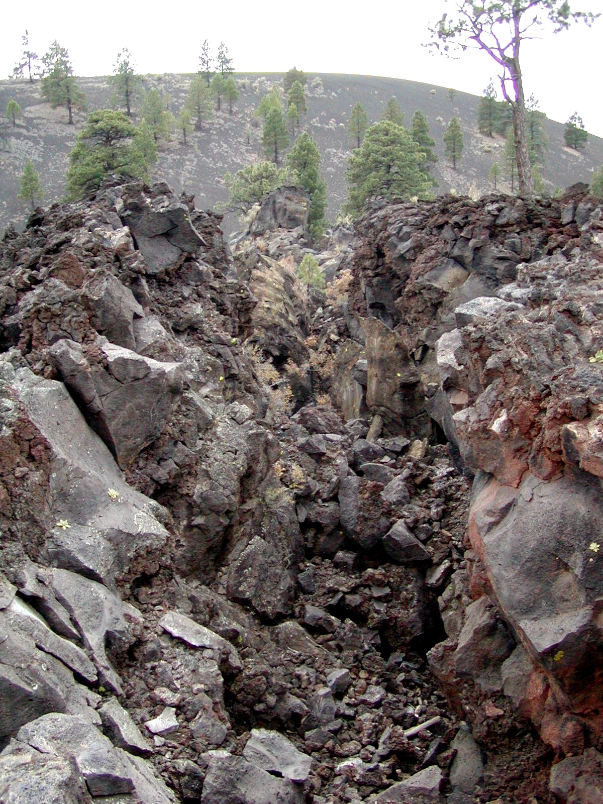
The rocky terrtain is all that remains of a six-million-year-old volcanic explosion.
Public Domain. Photo by Mark Turner
Download Original (1200 x 1600 pixels, 1279.1 MB)
-
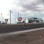
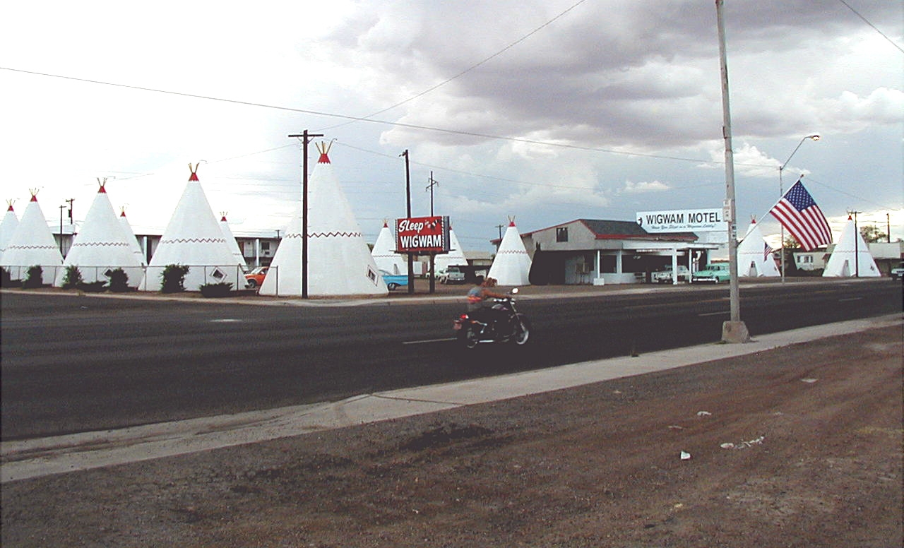
Along the route, visitors can see a sign from earlier times at the Wigwam Motel.
Public Domain. Photo provided by Baker and Associates
Download Original (1280 x 776 pixels, 459.2 KB)
-
Visitors can step into the past at the Hubbell Trading Post as they buy items that Indians once traded for centuries ago.
Public Domain. Photo provided by Leslie Connell
Download Original (449 x 226 pixels, 79.1 KB)
-
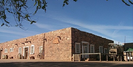
Mom and Pop stores still exist along Historic Route 66.
Public Domain. Photo provided by Leslie Connell
Download Original (1200 x 658 pixels, 577.7 KB)
-
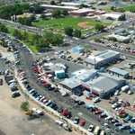
From the skies, you can see a perfect view of the route below.
Public Domain. Photo provided by the Kingman Police Department
Download Original (1792 x 1200 pixels, 1636.2 MB)
-
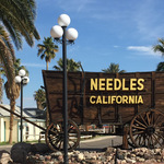
This old wooden freight wagon welcomes visitors to the town of Needles, the eastern gateway to California Route 66
Public Domain.
Download Original (3264 x 2448 pixels, 1818.9 MB)
-

The Route 66 shield on the highway near the desert town of Amboy, California
Public Domain.
Download Original (2400 x 1600 pixels, 2334.4 MB)
-
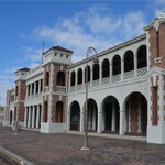
The Harvey House complex in Barstow includes two museums as well as the beautifully-restore Casa del Desierto Harvey House.
Public Domain.
Download Original (1121 x 666 pixels, 152.2 KB)
-
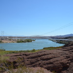
From a rocky knoll, the Colorado River gently flows downstream with the magnificent Trails Arch Bridge in the background. The River forms the natural boundary separating Arizona and California. Once on the
California side, Route 66 travelers could rest and prepare themselves for an incredible and dangerous journey. Looking forward a once-in-a-lifetime adventure on Route 66 across the desolate but beautiful Mojave Desert.
Looking back, the graceful, refreshing waters of the Colorado River.Public Domain.
Download Original (4928 x 3264 pixels, 4162.6 MB)
-
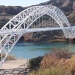
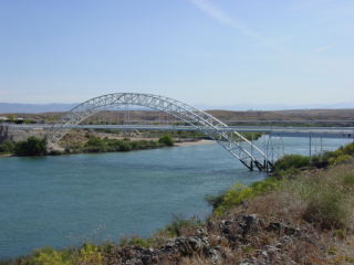
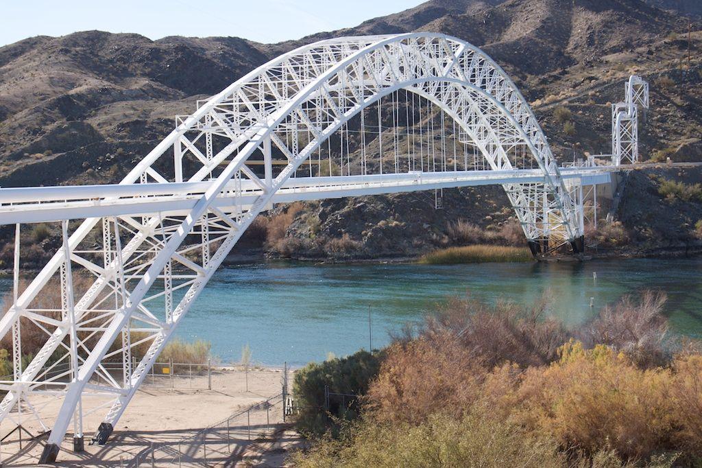
The Trails Arch Bridge was built in 1916 and spans the Colorado River. The 800-foot bridge is painted white and features a graceful curved arch. The Trails Arch Bridge is considered a landmark of American civil engineering. At the time when it was built, it was the longest arched bridge in America. It features a pair of giant steel arches with a span of 600 feet, anchored on each bank of the River. The bridge is supported with suspension cables.
Public Domain.
Download Original (1024 x 682 pixels, 172.7 KB)
-
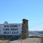
With the Colorado River and Trails Arch Bridge as a backdrop, the City of Needles welcomes west bound travelers to Route 66 in California with its iconic sign. The sign is almost six feet in height and fifteen feet wide. It
has a white stucco finish and a five-foot-high “Historic Route 66” shield. “Welcome! Turn Right Next Exit” is painted in big black letters. The billboard is supported on a river rock base with two rock-lined concrete towers on each end with Spanish-style red tiles.Public Domain.
Download Original (916 x 451 pixels, 632.2 KB)
-
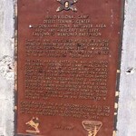
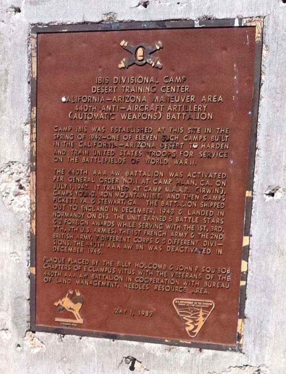
The Ibis Divisional Camp Plaque is a cast bronze plate inset into a cement monument, which stands about five feet tall. The monument is located at the entrance to Camp Ibis. The plaque pays tribute to one of the most extraordinary achievements in U.S. military history, and honors the vision and leadership of General George Patton, and the tenacity of the more than one million soldiers who trained at Desert Training Center.
Public Domain.
Download Original (586 x 765 pixels, 165.2 KB)
-
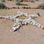
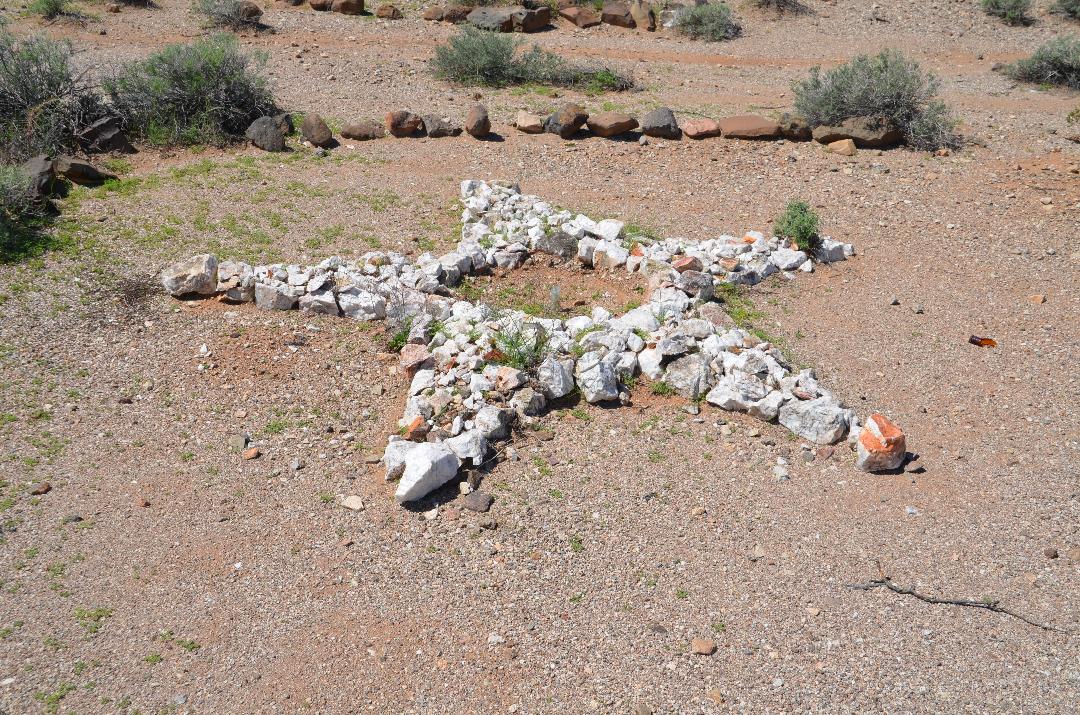
This Camp Ibis command star signifies camp headquarters. The command star has five points and is approximately ten feet in diameter. Each point is about two feet wide at the base and tapers to a point, which is about three to four feet long. Each point is outlined and filled with white quartz and desert rocks that have a red varnish color. One tip of the Star has a red cap stone. The center of the star is hollow – not filled with rocks - and is about three to four feet in diameter.
Public Domain.
Download Original (1080 x 715 pixels, 283.8 KB)
-
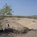
A 500,000-gallon reservoir at Camp Ibis is a solid concrete oval shaped basin
approximately the size of a football field. The walls slope to the bottom of the
reservoir. When full, the reservoir may have been 30-40 feet deep. The bottom
of the reservoir has an estimated three-foot wide by 15-foot-long trench that
housed pumps that siphoned water from the desert aquifer. It is not known how
deep the wells were drilled to reach the aquifer. A lone mesquite tree is seen at
the left of the photoPublic Domain.
Download Original (1058 x 696 pixels, 1454.5 MB)
-
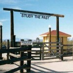
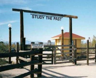
This photo shows the entry gate to the Goffs School house and property. Tall
wooden poles support a crossbar from which hang large metal cut out letters,
“Study the Past.” The entry gate is flanked by a wooden rail fence. Behind the
gate is a small restored building that once served as a communication shed for
the Santa Fe RailroadPublic Domain.
Download Original (316 x 257 pixels, 24.2 KB)
-
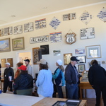
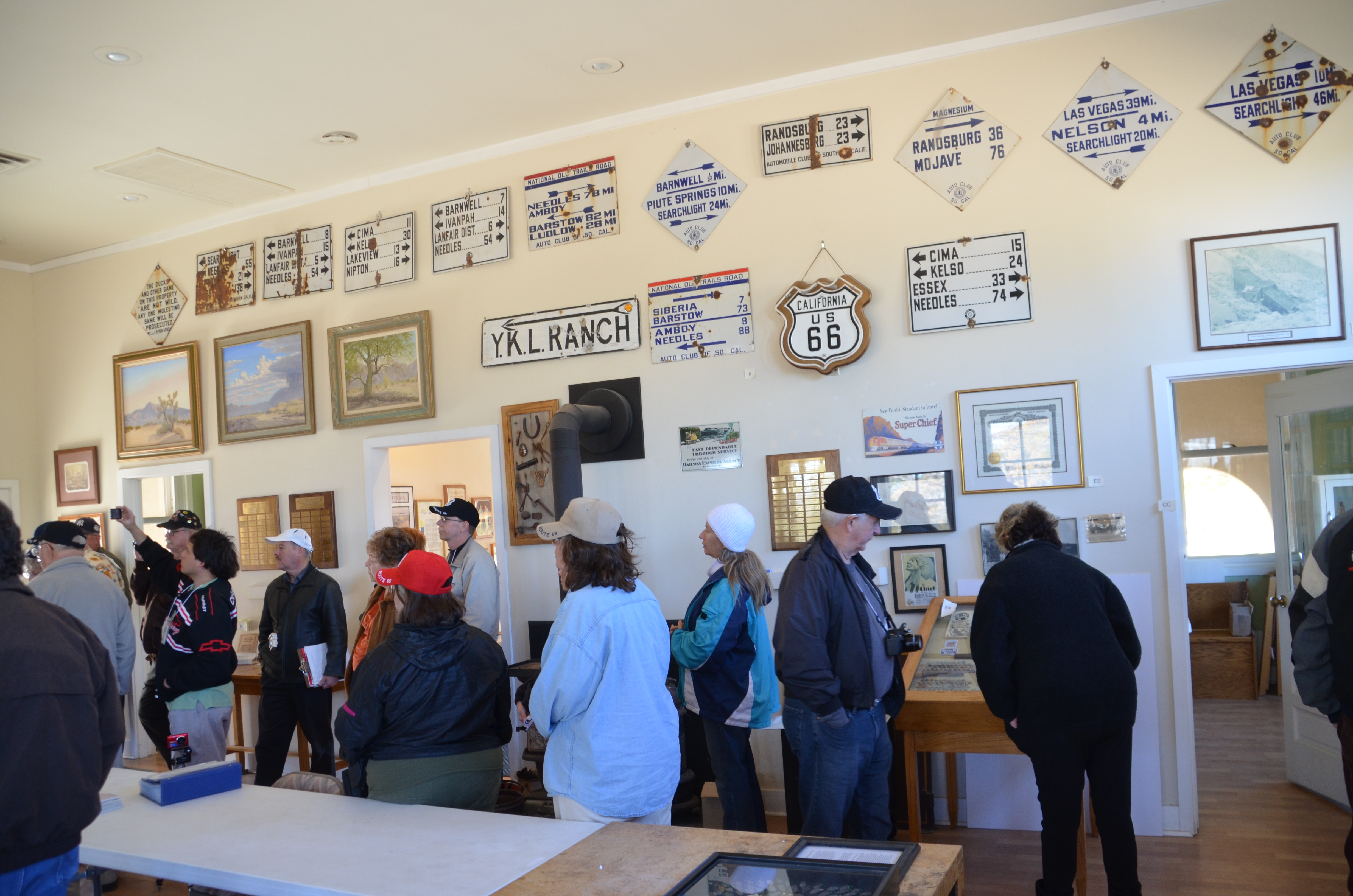
The Goffs Schoolhouse is a popular attraction for Route 66 visitors. This photo
shows a tour group of 14 people looking at memorabilia on the walls of the
Schoolhouse. There are fourteen antique roadway directional signs with mileage
listed to other desert towns. Framed oil paintings feature the desert landscape.
A California Route 66 shield and area maps are also displayed.Public Domain.
Download Original (4928 x 3264 pixels, 4059.7 MB)
-
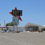
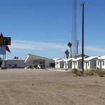
The 50-foot tall Roy’s sign is prominent in the center of the photo. The name
“Roy’s” appears in large letters against a rectangular sign. Behind the sign a
large arrow shape points down. The words “vacancy”, “motel,” and “café” are
also featured. In the background is the lobby of the now-vacant motel. The
inverted V shaped roof is a signature of Googie architecture. Five cars are
parked outside the café located behind the sign. A long flat roof provides
shade for gas pumps.Public Domain.
Download Original (1080 x 715 pixels, 85.8 KB)
-
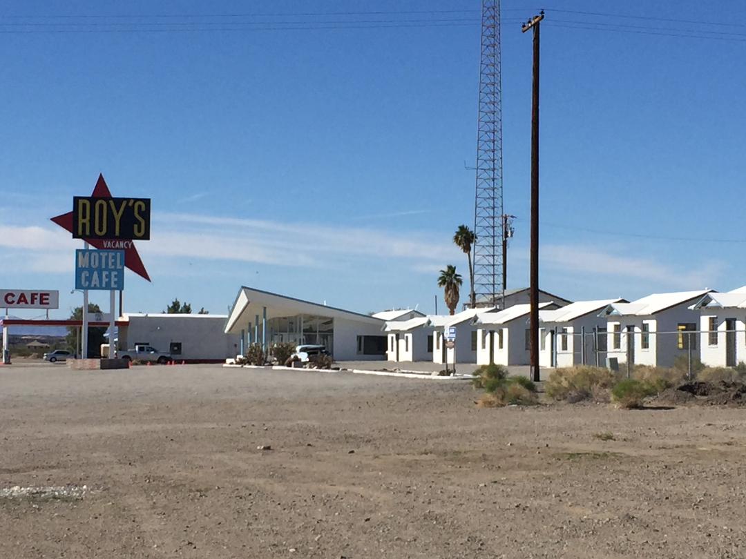
The large Roy’s sign is seen against a clear sky with a few wispy clouds. The
Roy’s Café and motel lobby are featured to the right of the sign. A very tall
metal tower extends up beyond the photo. Two palm trees and a tall electric
pole are visible. Six identical small white cabins are lined up side by side from
the center to the right side of the photo. A large expanse of desert dirt and
some low bushes are in the bottom part of the photo.Public Domain.
Download Original (1080 x 810 pixels, 98.7 KB)
-
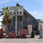
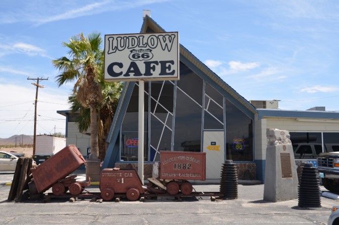
The Ludlow Historic Route 66 Café is an A-frame restaurant approximately 30-
feet tall. The front wall/entry is solid glass that bathes the interior of the café in
light. In front of the entrance to the café are three vintage rusty mineral ore
carts. A five-foot tall concrete monument with a bronze plaque titled “Project
Carryall” commemorates an Atomic Energy Commission project to use nuclear
explosives to cut an alignment of I-40 and a new rail line. This proposal was
abandonedPublic Domain.
Download Original (674 x 447 pixels, 75.8 KB)
-
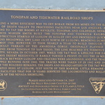
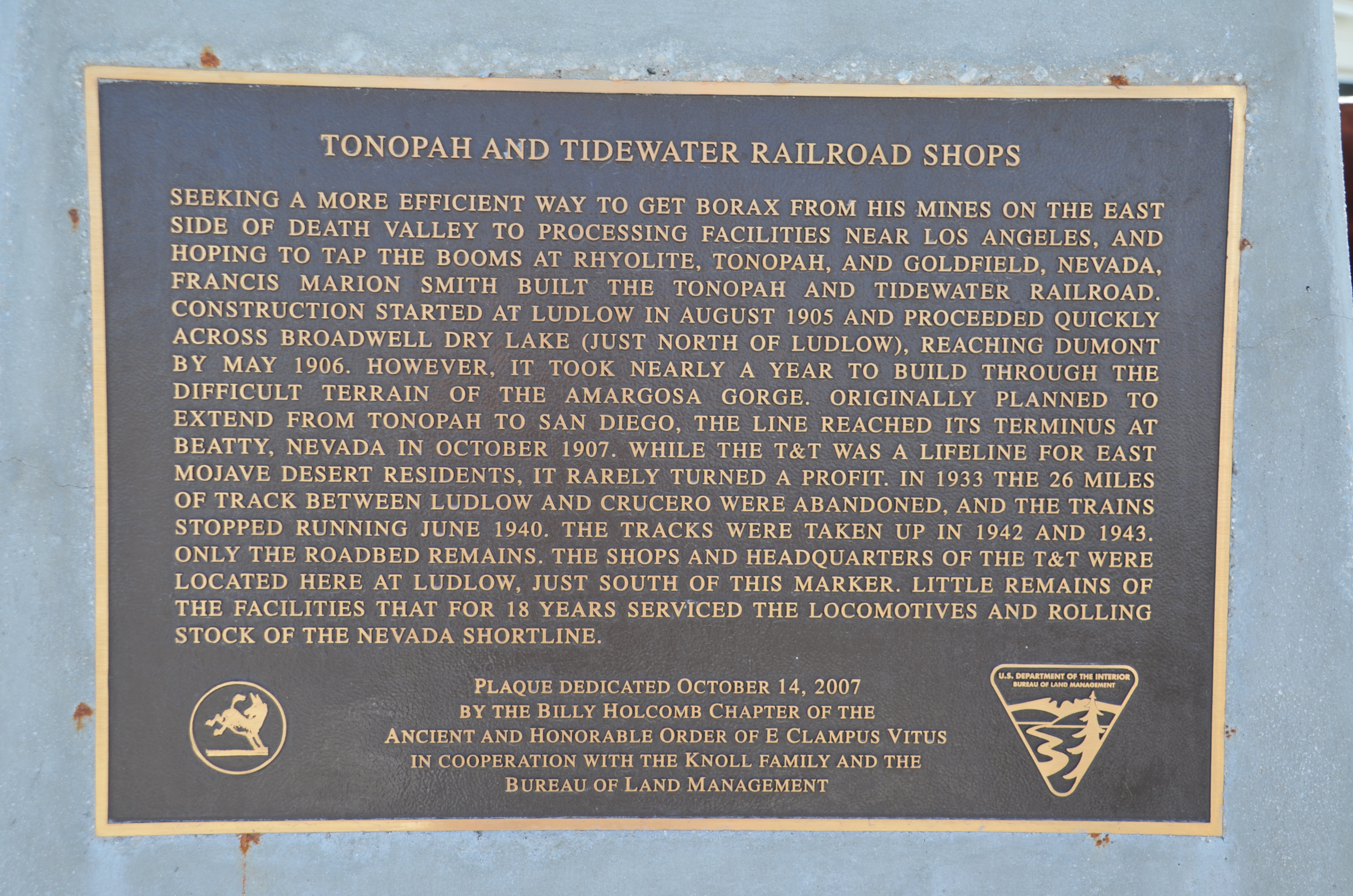
The Tonopah and Tidewater Railroad Shops plaque is placed on a concrete
monument about five-feet tall located outside of the Ludlow Café. The plaque
details the history of the railroad that began construction of track in Ludlow in
1905, to transport ore from mines in Nevada. The terminus in Beatty, Nevada
was reached in 1907. The shops and headquarters of the railroad were located
here in Ludlow and serviced the locomotives for 18 years.Public Domain.
Download Original (4928 x 3264 pixels, 4147.0 MB)
-
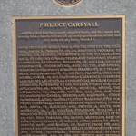
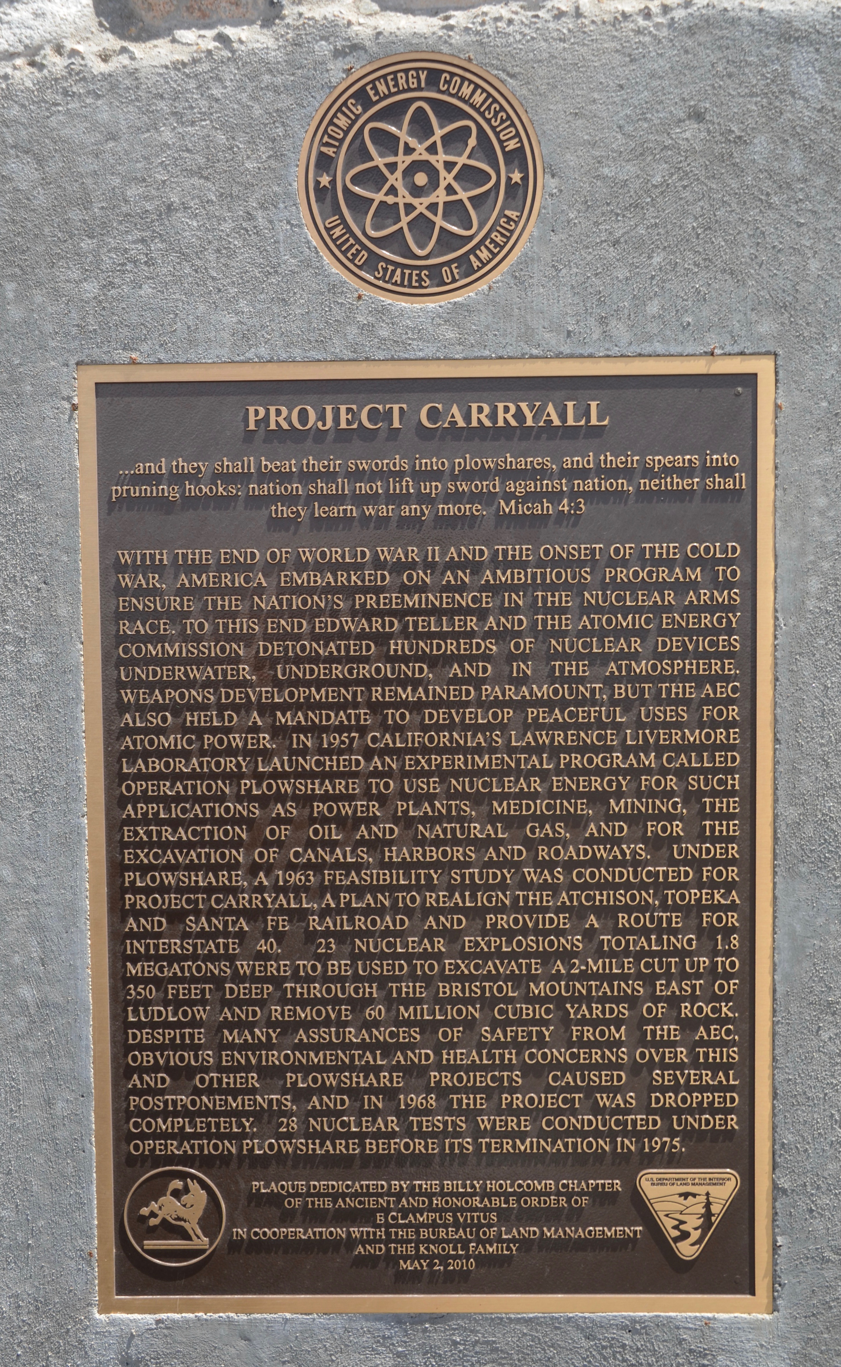
A brass plaque on a concrete base approximately five-feet tall commemorates
Project Plowshare, a proposal of the Atomic Energy Commission. Under Project
Plowshare, a feasibility study was conducted for Project Carryall in 1963. The
plan was to detonate 22 nuclear explosions totaling 1.8 megatons to excavate a
cut for construction of Interstate 40 and a new rail line. The project was dropped
in 1968.Public Domain.
Download Original (2901 x 4714 pixels, 3783.6 MB)
-
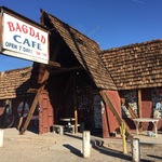
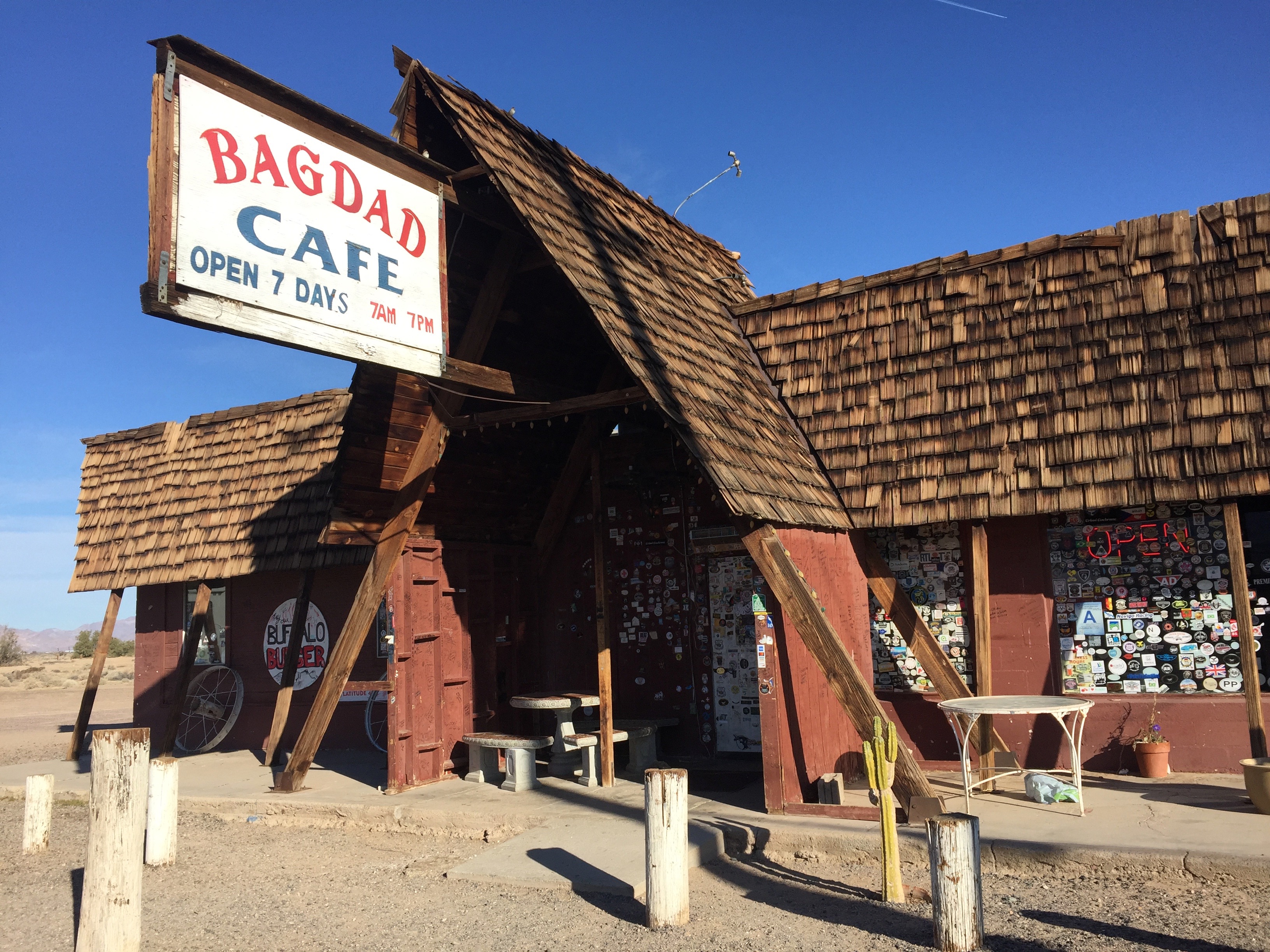
The Bagdad Café is a single-story building with an A-frame entry way and a
wood-shingled roof. A prominent sign jutting out from the A-frame includes
the name of the café and the hours of operation. The windows are covered
with hundreds of decals placed by visitors from all over the world.Public Domain.
Download Original (3264 x 2448 pixels, 2406.3 MB)
-
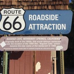
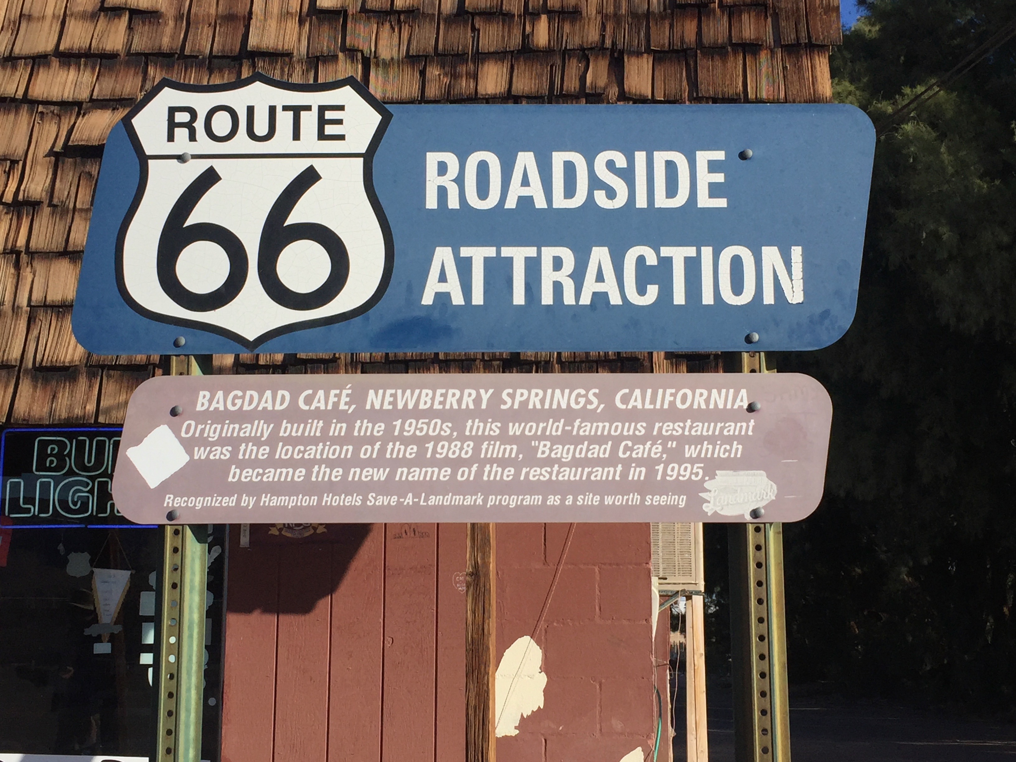
A large “Route 66 Roadside Attraction” sign is featured in front of the
Bagdad Café. This sign includes a large Route 66 shield. The sign was
placed by Hampton Hotels as part of their Save-A-Landmark program. The
sign attests to the world-wide notoriety of the Bagdad Café.Public Domain.
Download Original (3264 x 2448 pixels, 1469.8 MB)
-
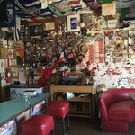
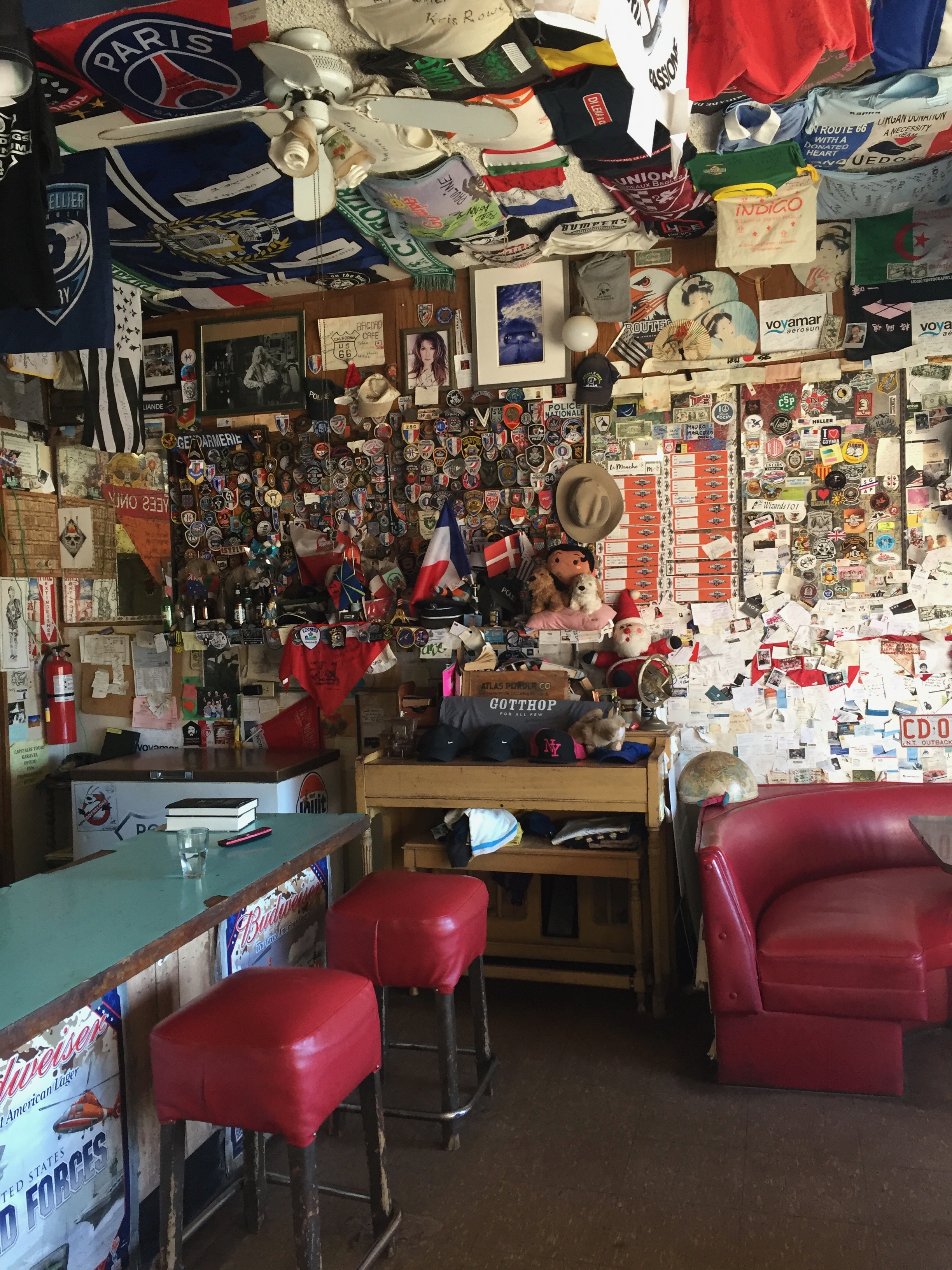
The Bagdad Café attracts visitors from around the world. This photo shows
the inside of the café. The walls are covered with mementos left by Route 66
travelers. Included are foreign currency, medals, souvenir pins, small flags,
decals and more. The ceiling is covered with t-shirts, banners, and flags
from many different countries. Two stools face the narrow lunch counter. A
portion of a booth is also in the photo.Public Domain.
Download Original (2448 x 3264 pixels, 2300.2 MB)
-
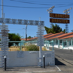
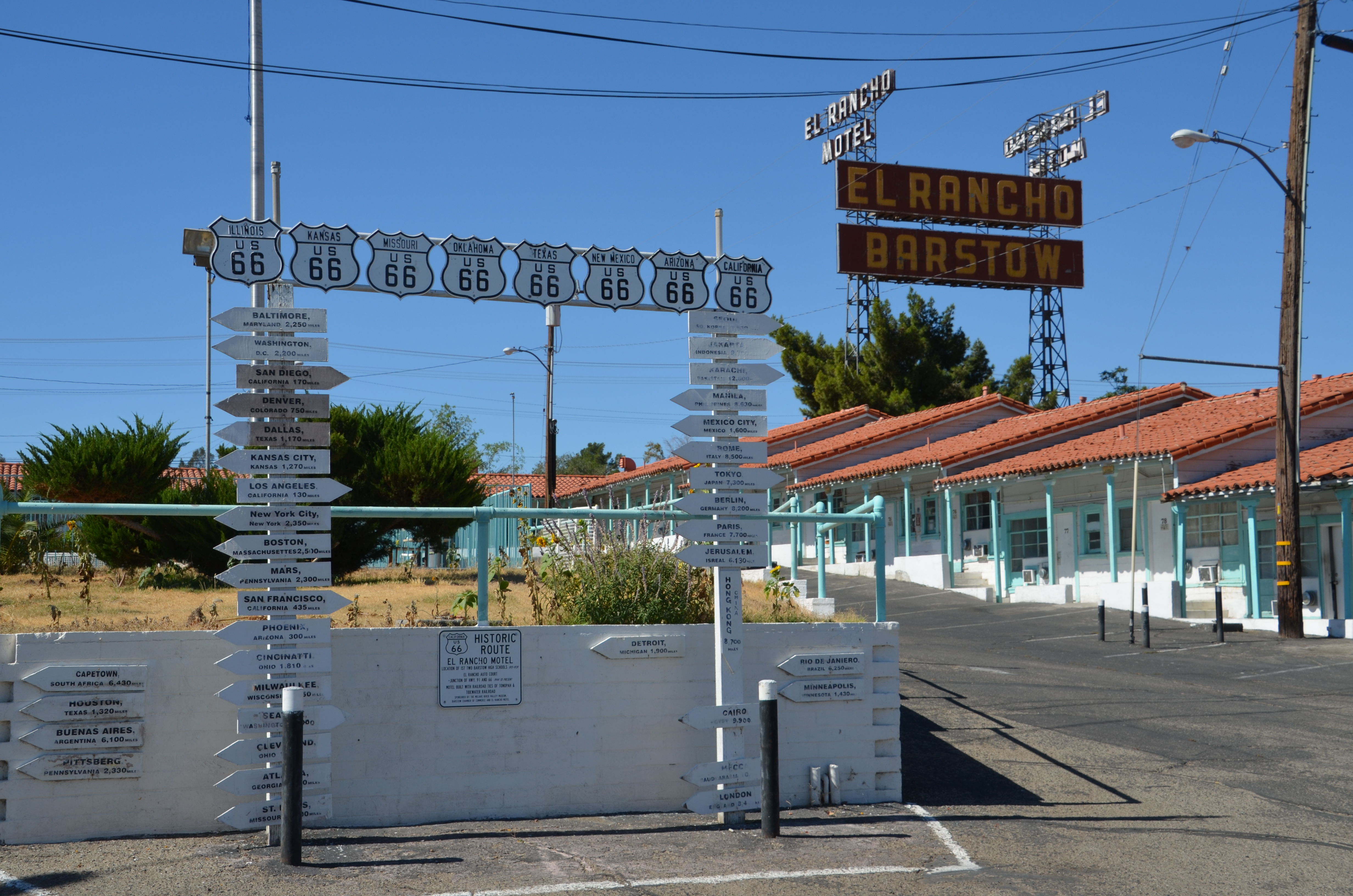
The historic El Rancho Motor Motel is built in the classic U shape that
was common in motels of the era when it was built. This photo shows
one wing of rooms with overhanging tile roofs and wooden upright
supports. In the front of the photo is an inverted U shape sign with Route
66 shields from each of the eight Route 66 states and directional arrows
with mileage to 38 towns in the United States and across the globe. In
the background is the 100-foot tall iconic El Rancho Barstow sign.Public Domain.
Download Original (4928 x 3264 pixels, 4604.0 MB)
-
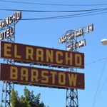
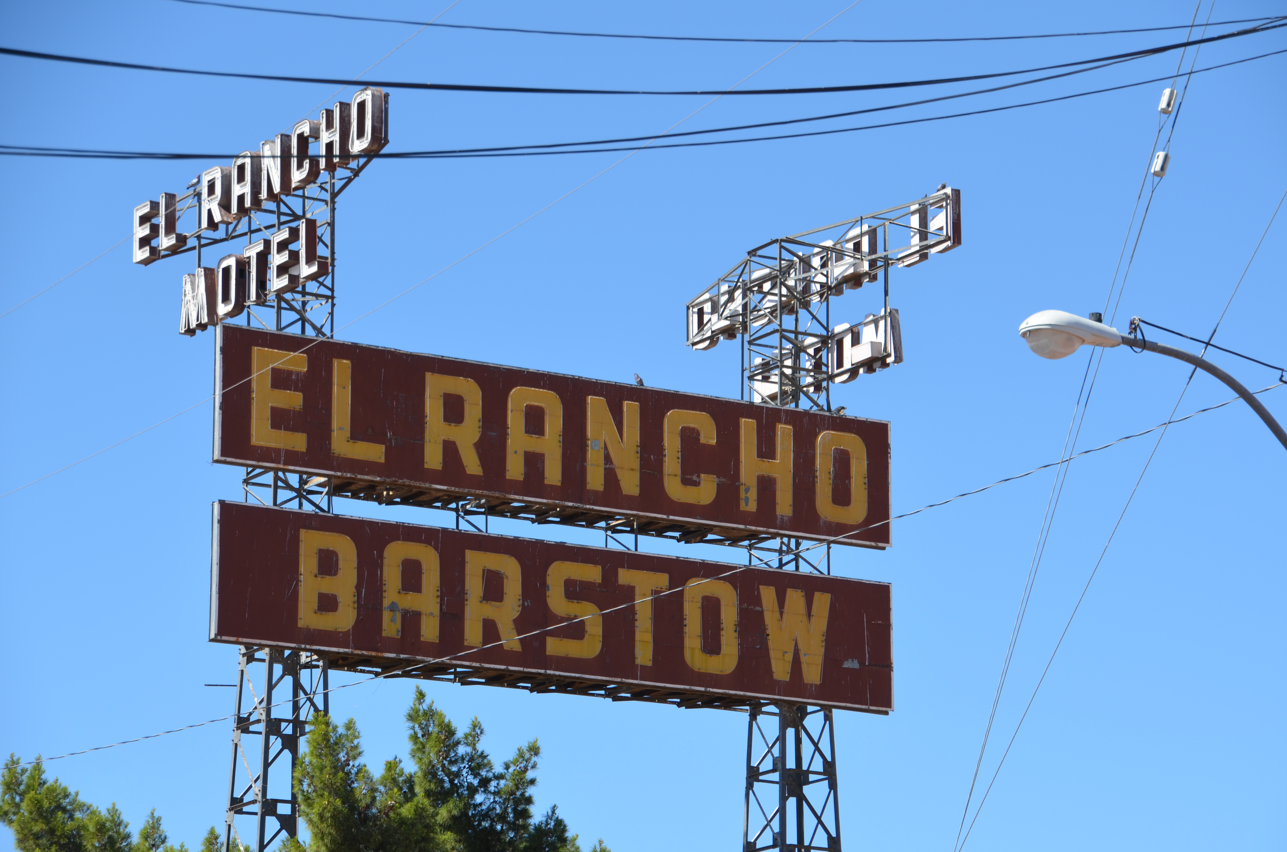
The El Rancho Motor Court neon sign is approximately 100 feet tall with
the words “El Rancho” on the top line and “Barstow” on the bottom line.
Smaller versions of the sign are placed perpendicular to the right and left
of the main sign. The signs are supported by tall metal upright supports
with horizontal and diagonal bracing.Public Domain.
Download Original (4928 x 3264 pixels, 3368.9 MB)
-
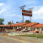
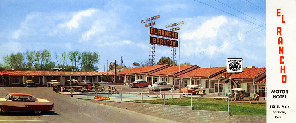
This vintage postcard is rectangular in shape and served as an
advertisement for the El Rancho Motor Motel. The name and address
are featured on the far-right edge of the postcard. The “AAA Approved”
seal is included. Seven automobiles from the 1950s are parked in front of
some of the rooms. A small group of women relax under an umbrella on
the lawn. Another group of guests are seated at the far end of the
swimming pool, which is located in the center of the parking lot.Public Domain.
Download Original (1023 x 426 pixels, 122.9 KB)
-
The entry to the Mother Road Route 66 Museum is featured in
this photo. The museum is located on the back side of the Casa
del Desierto Harvey House. The museum is located on the first
floor of the two-story building. Three flags outside the museum
are blowing in the wind: the American flag, a Route 66 flag with a
map and car, and a flag indicating that the museum is open.
There is a sign identifying the museum and a Route 66 Roadside
Attraction sign.Public Domain.
Download Original (1038 x 574 pixels, 1241.8 MB)
-
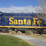
A close-up shot of Santa Fe railroad car #1460 fills this photo.
The car is brightly painted blue with the large words “Santa Fe” in
yellow across almost the entire car. The setting for the photo is
the exterior area of the Western America Railroad Museum
located in the Casa del Desierto Harvey House. A cloud-filled sky
is in the background and a leafless tree is in front of the rail car.Public Domain.
Download Original (1032 x 678 pixels, 1555.2 MB)
-
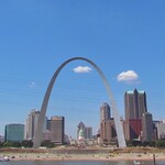
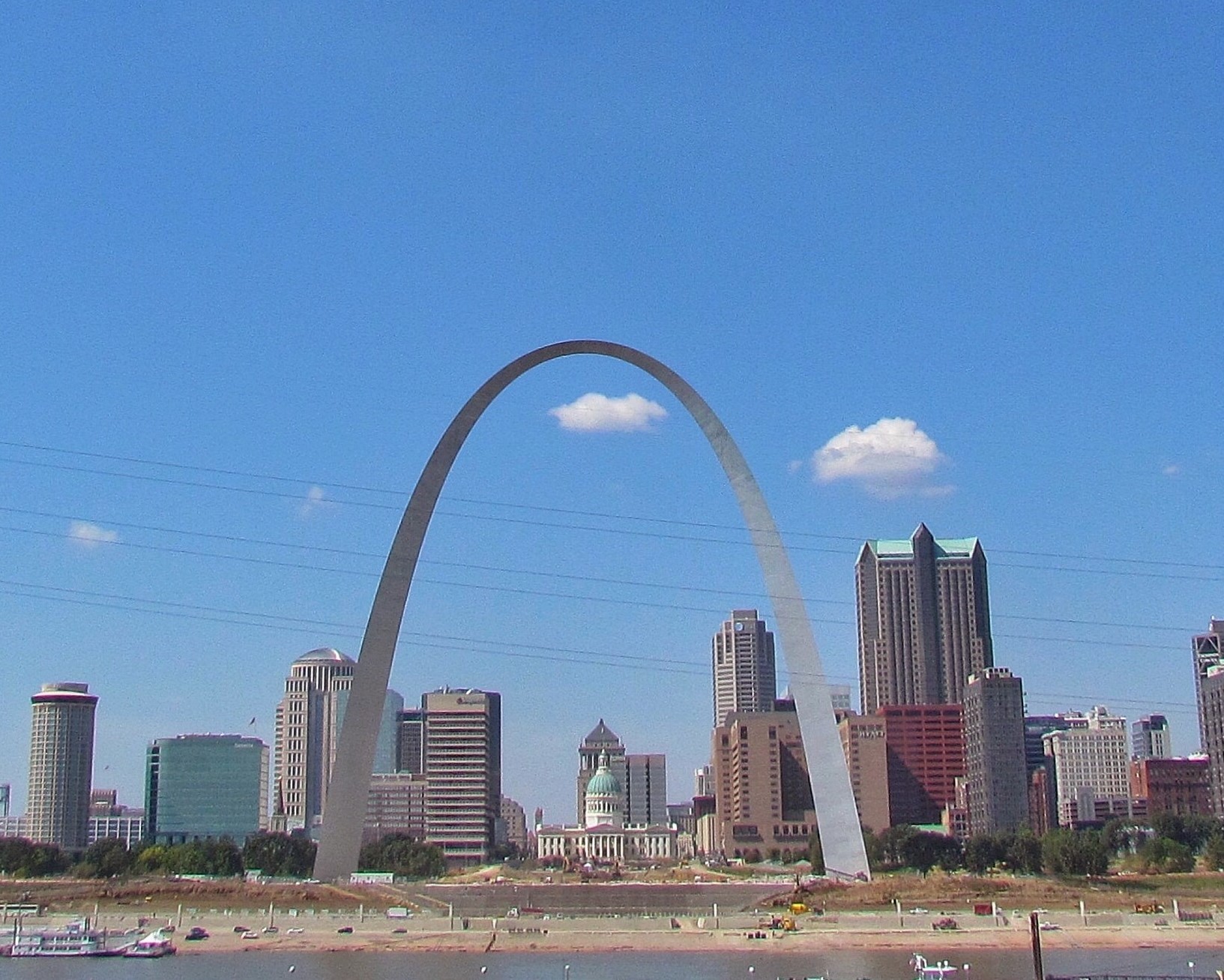
Standing on the banks of the Mississippi river approximately one-half mile from Route 66, the Gateway Arch is a 630-foot tall monument in Saint Louis, Missouri. Symbolizing the gateway to the American West, the Gateway Arch is the world's tallest arch and the tallest man-made monument in the Western Hemisphere.
Public Domain. Judy Walker
Download Original (1633 x 1307 pixels, 495.8 KB)
-
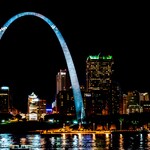
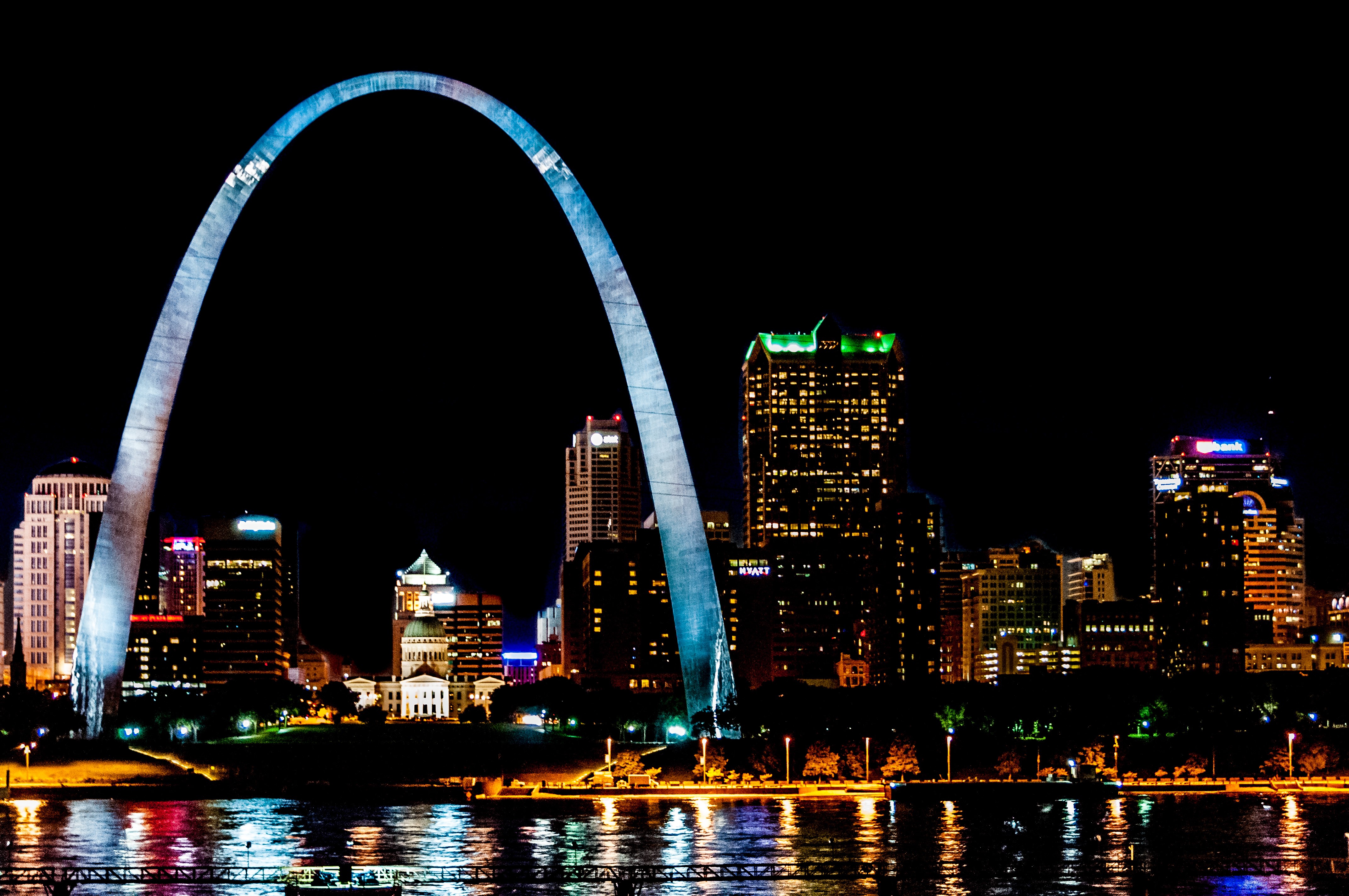
Looking west across the Mississippi River at night, the lights of the Saint Louis skyline reflect off the water and the stainless steel of the Gateway Arch, the “Gateway to the West”.
Public Domain. Jax Welborn
Download Original (4288 x 2848 pixels, 2067.0 MB)
-
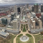
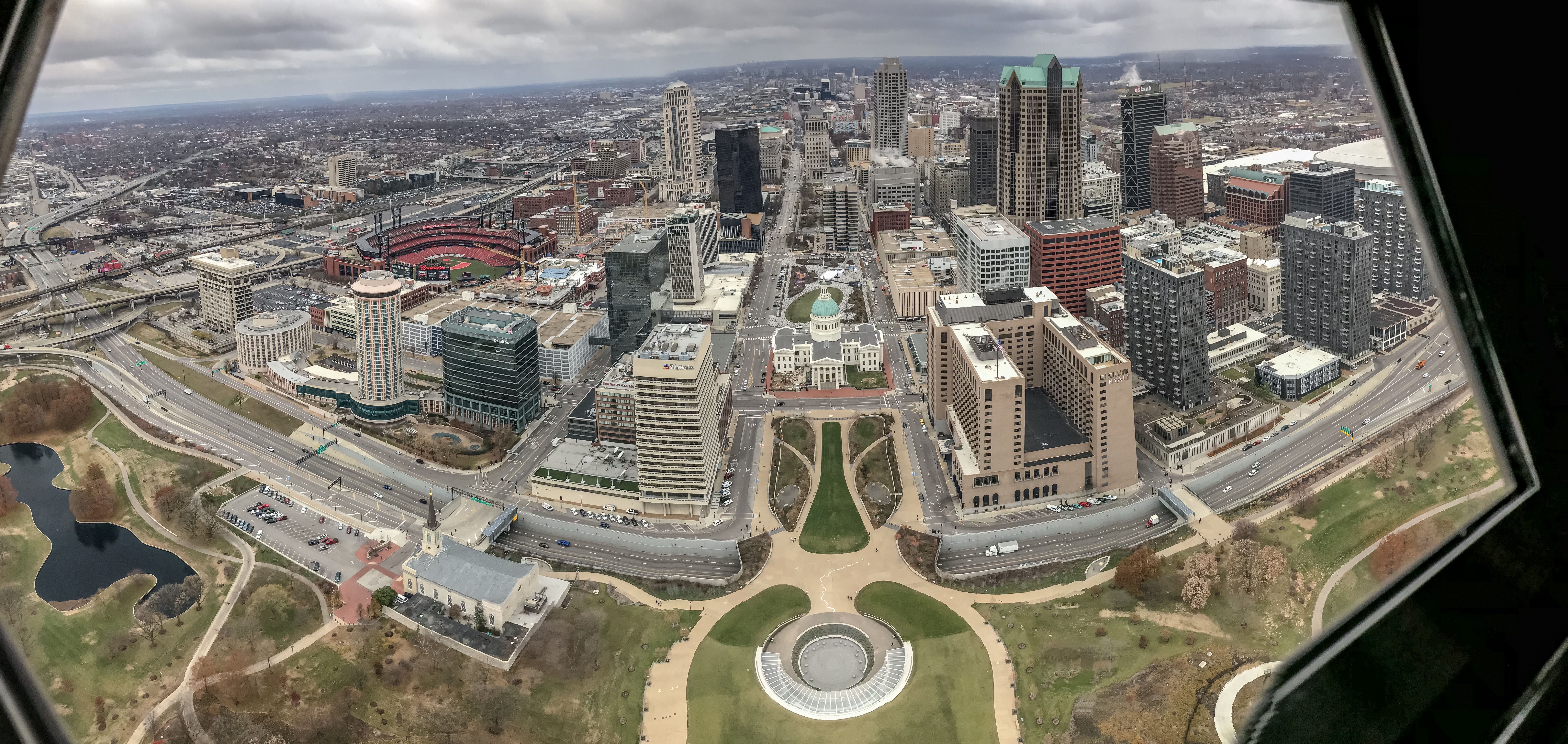
Looking out a window from the top of the 630-foot tall Gateway Arch reveals the Arch grounds, the Historic Courthouse, and the city to the west.
Public Domain. Jax Welborn
Download Original (7980 x 3790 pixels, 8398.3 MB)
-
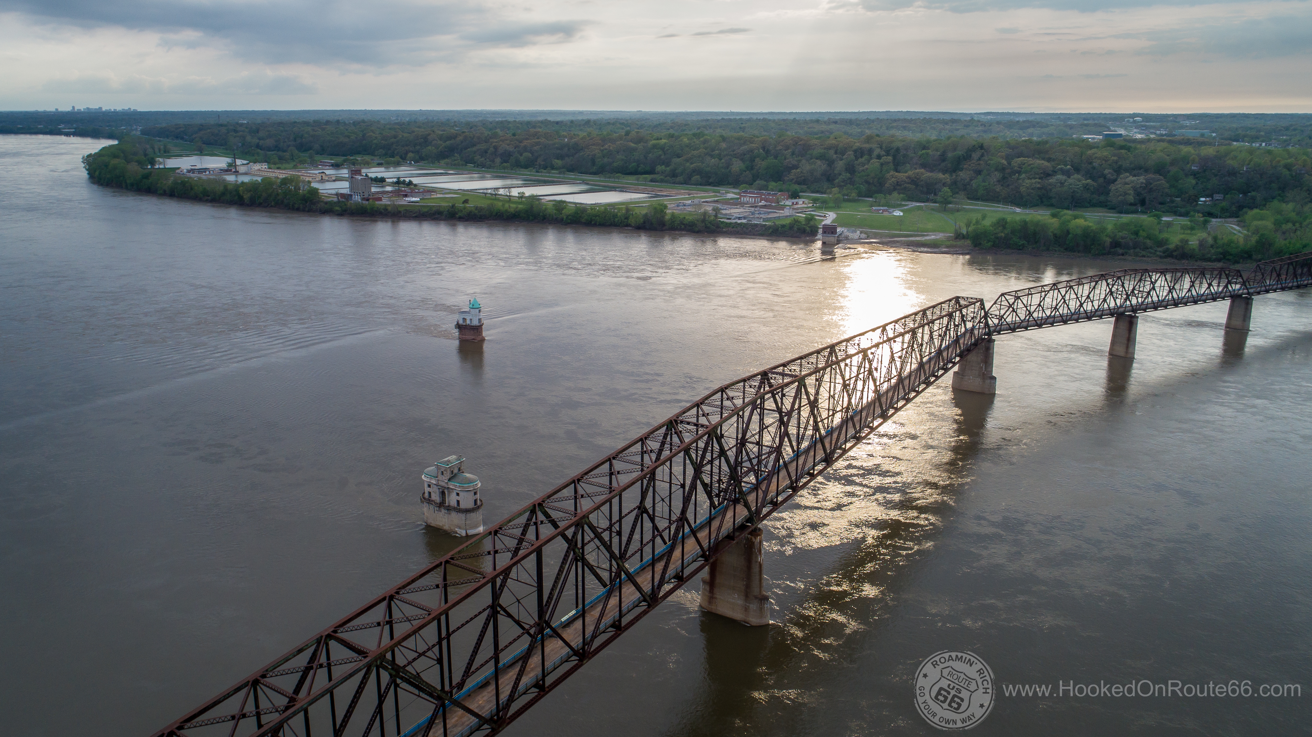
From a bird’s eye perspective view of the old Chain of Rocks Bridge crossing the Mississippi river, both historic water intake structures are seen.
Public Domain. Roamin Rich Dinkela
Download Original (5054 x 2840 pixels, 9410.1 MB)
-
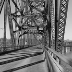
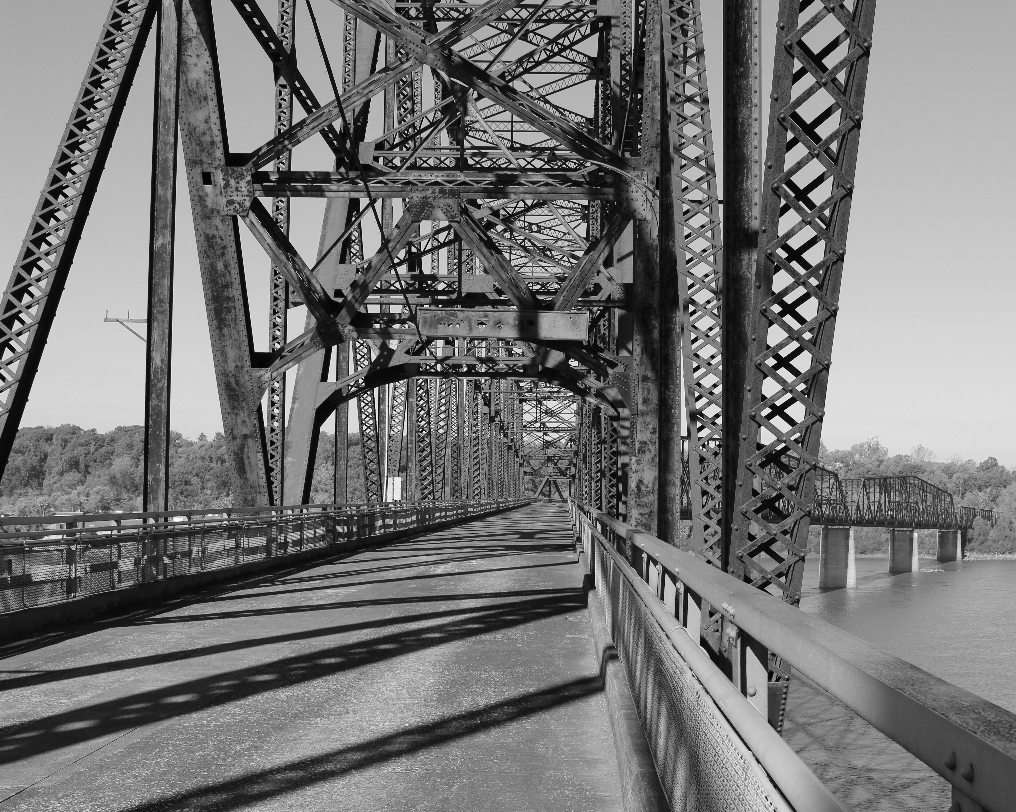
Walking on the 91-year-old bridge structure the unique 22-degree bend is evident.
Public Domain. Judy Walker
Download Original (4321 x 3456 pixels, 3312.7 MB)
-
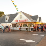
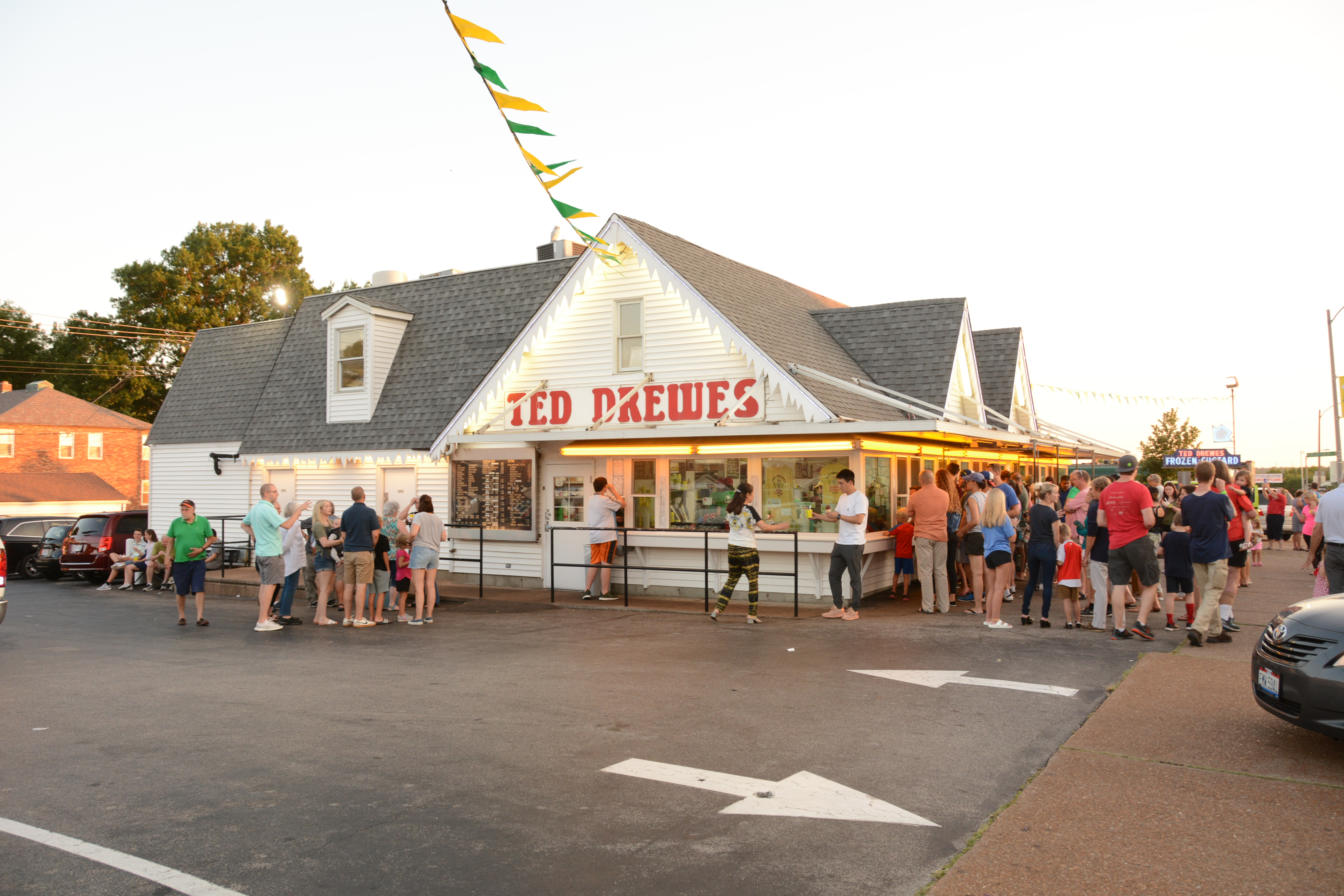
Visitors to Ted Drewes Frozen Custard wait in line to get a taste of this Historic Route 66 Missouri favorite.
Public Domain. Roamin Rich Dinkela
Download Original (6000 x 4000 pixels, 8179.1 MB)
-
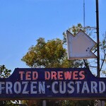
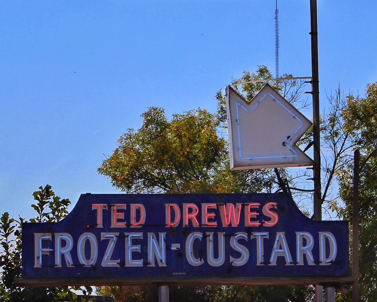
The restored original Ted Drewes Frozen Custard neon sign points the way to the ‘Best Ice Cream in the World’.
Public Domain. Judy Walker
Download Original (1315 x 1052 pixels, 307.2 KB)
-

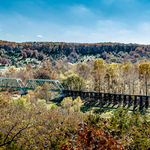
Looking down Historic Route 66 to the west from a bird’s eye perspective, Jensen’s Point Overlook seems to float at the top of the trees that are changing color in early fall.
Public Domain. Roamin Rich Dinkela
Download Original (2048 x 1152 pixels, 506.5 KB)
-
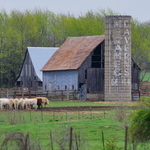
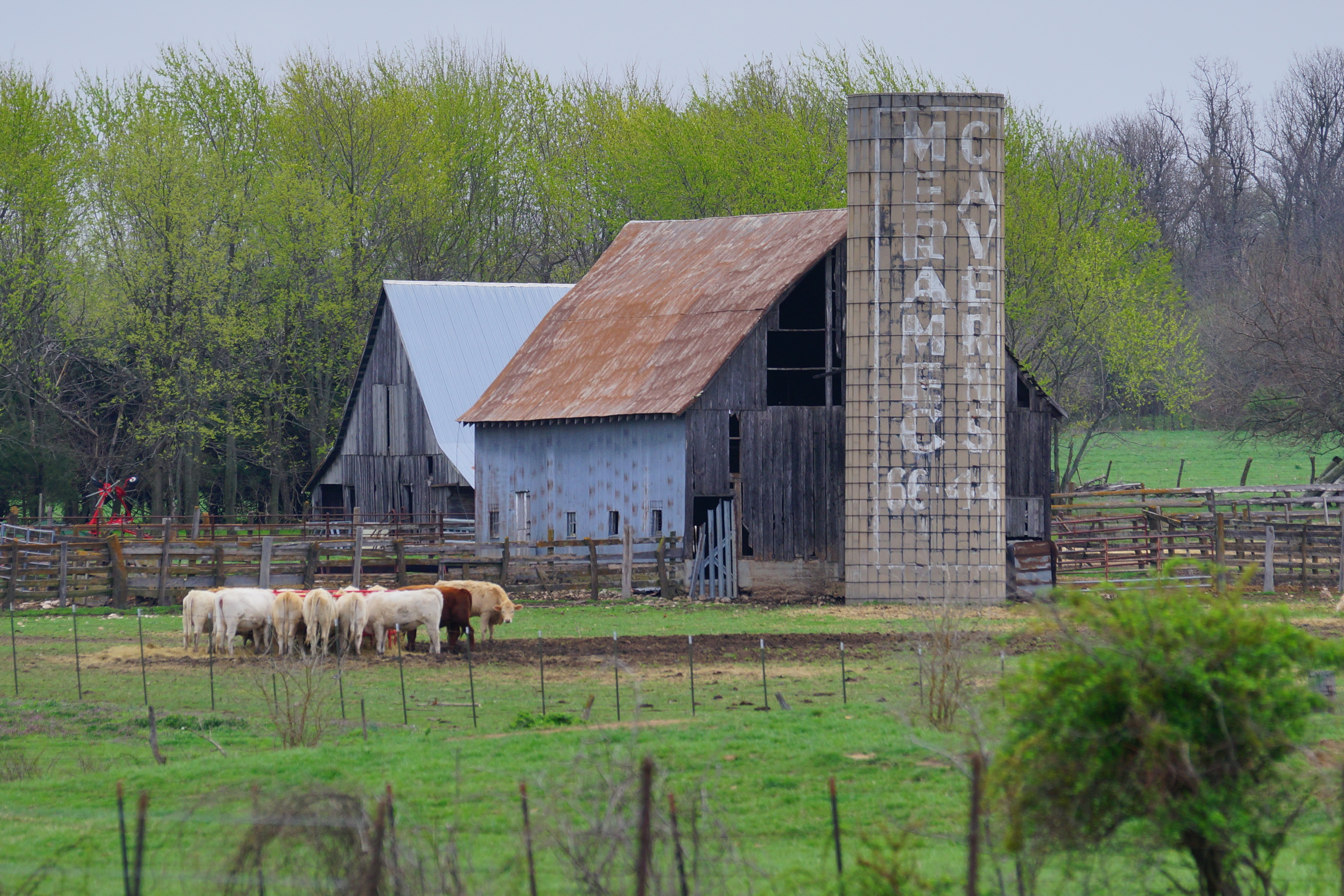
The ad for Meramec Caverns painted on this typical Missouri barn silo is both quirky and practical.
Public Domain. Roamin Rich Dinkela
Download Original (3936 x 2624 pixels, 9632 MB)
-
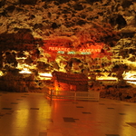
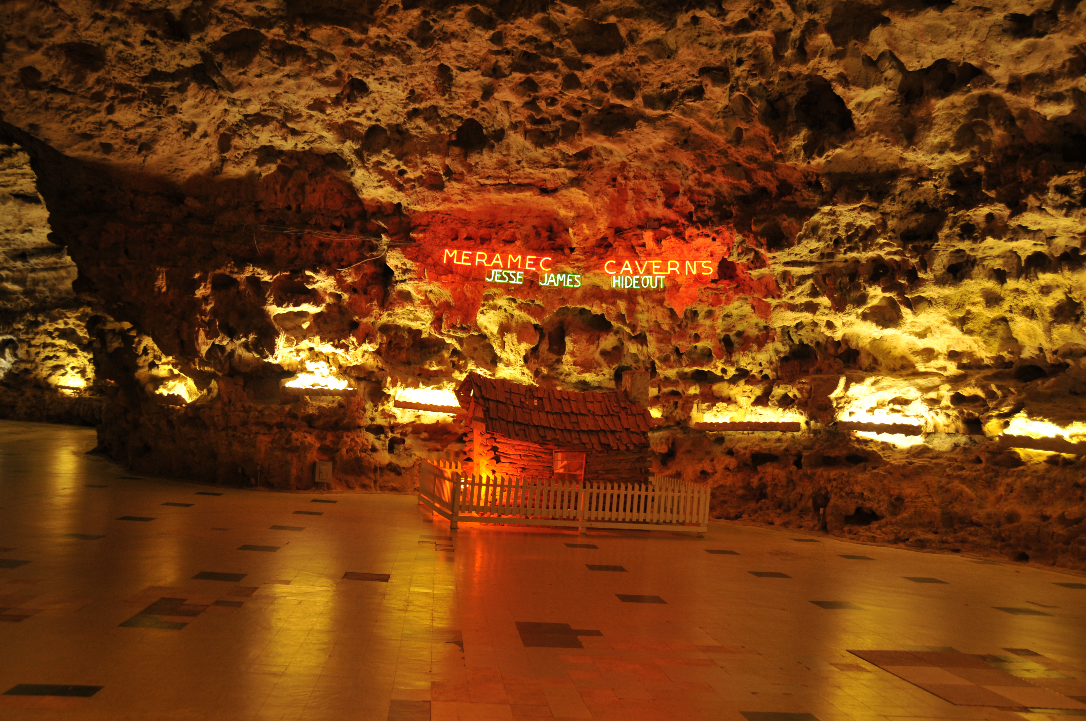
The contrast of the natural wonder of a million-year-old Cavern with a neon sign identifying the infamous Jesse James hideout is one reason why so many people visit Meramec Caverns
Public Domain. David Eslick
Download Original (4288 x 2848 pixels, 6550.0 MB)
-
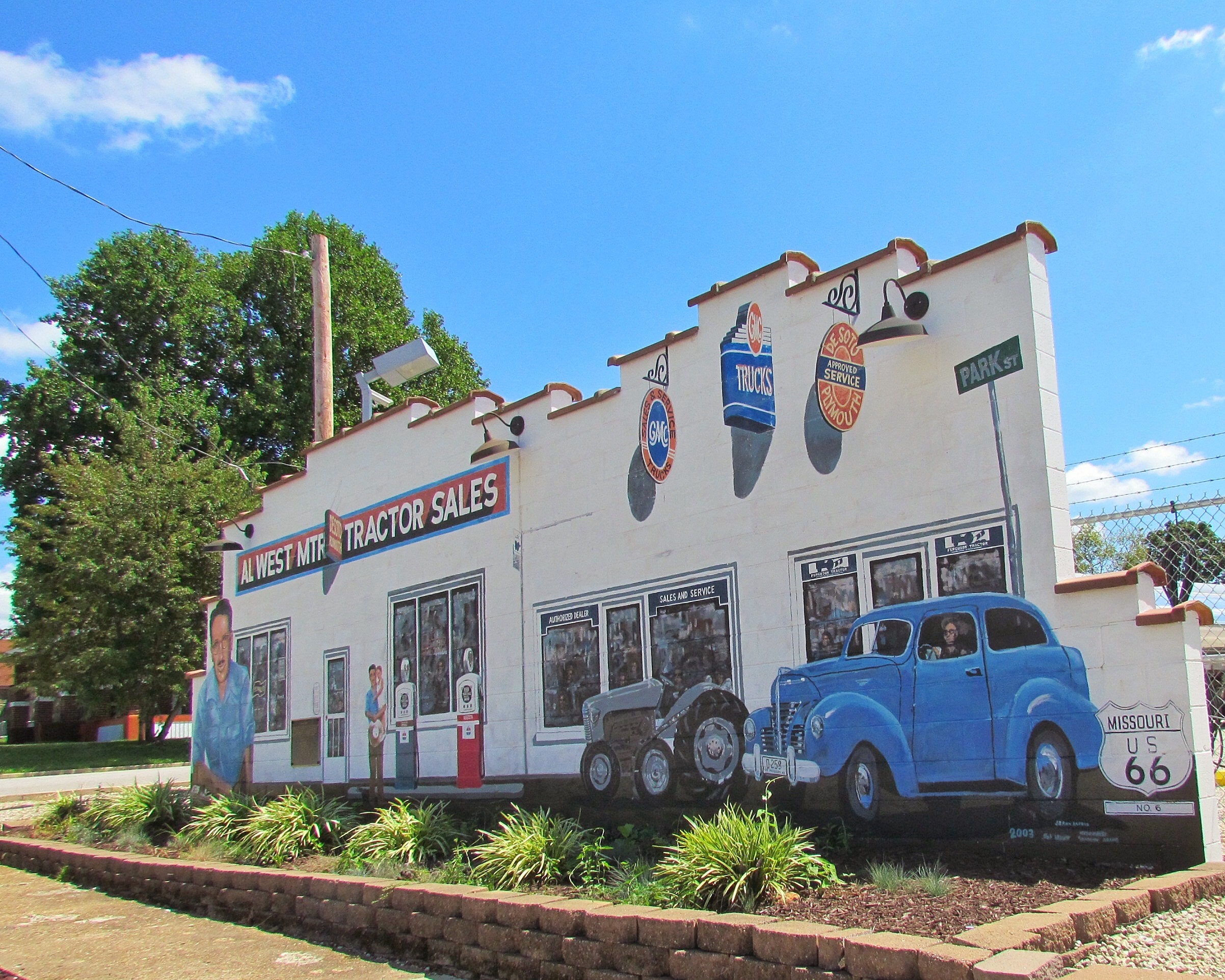
The mural depicting a beloved mayor who governed for 20 years, is shown in front of his tractor sales business on Historic Route 66.
Public Domain. Judy Walker
Download Original (2404 x 1923 pixels, 1219.0 MB)
-
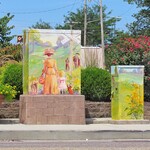
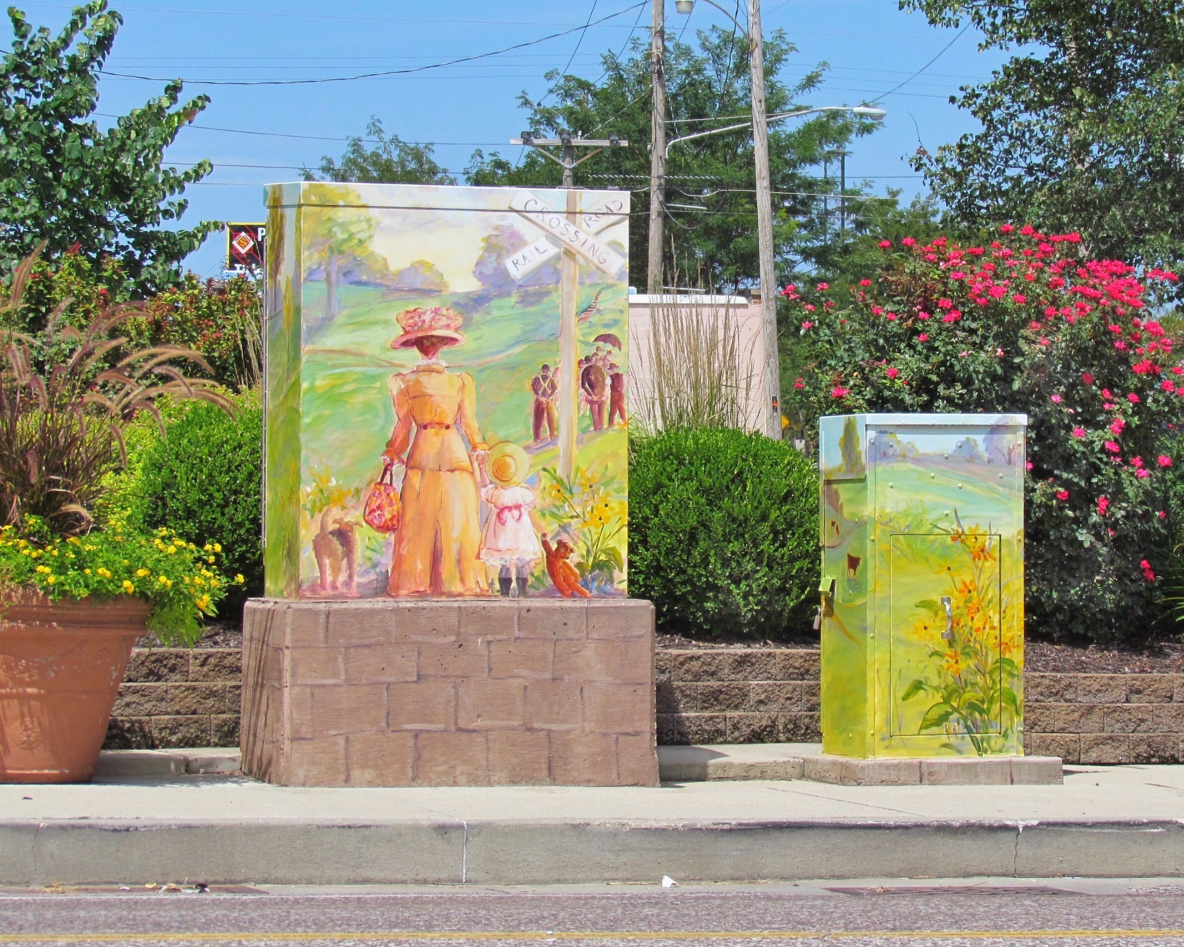
Utility boxes are the canvas for mini murals that depict scenes from historic Cuba.
Public Domain. Judy Walker
Download Original (2375 x 1900 pixels, 1491.7 MB)
-

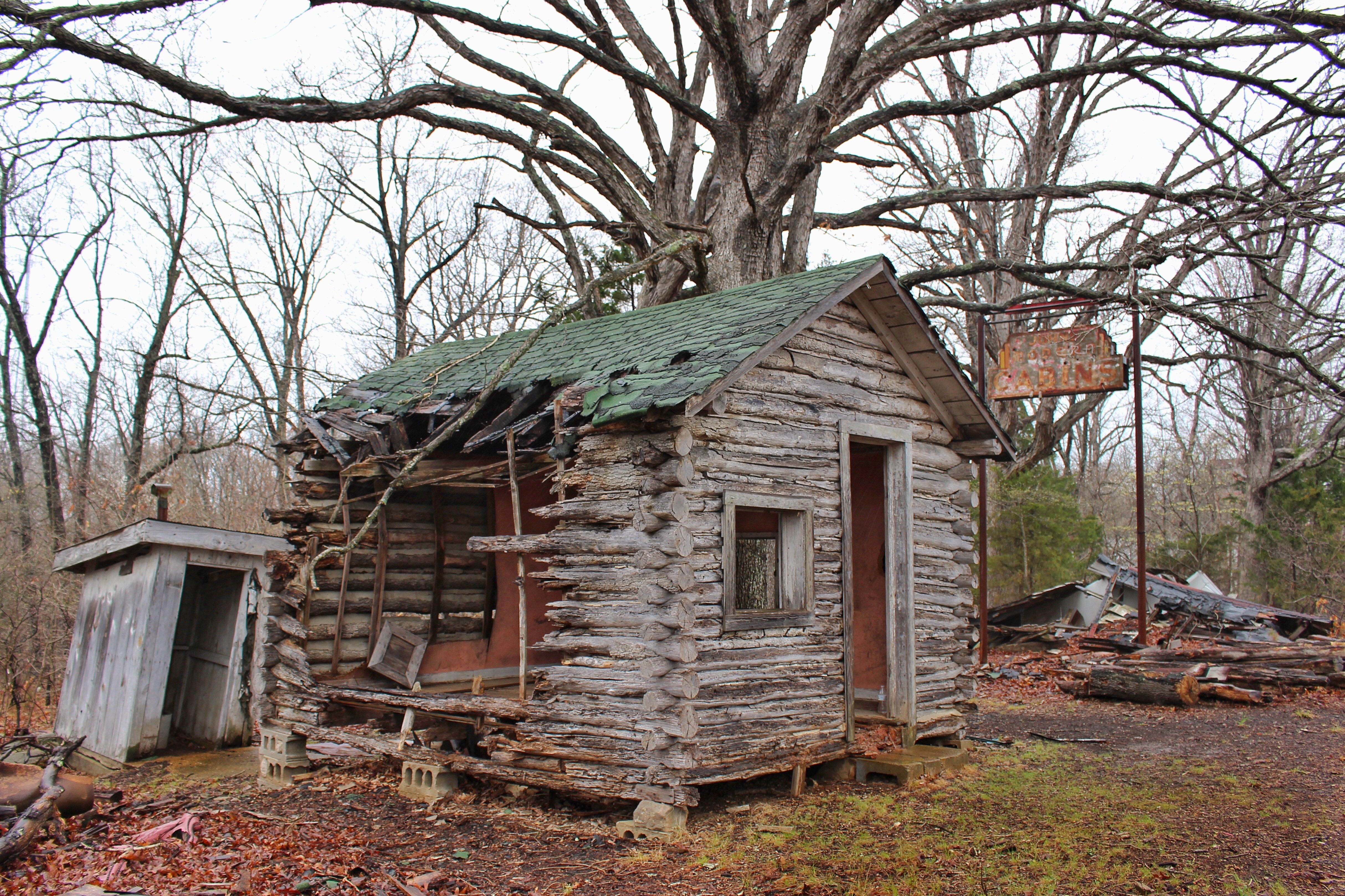
John’s Modern Cabins slowly give way to the elements of time while the original sign outhouse look on.
Public Domain. David Eslick
Download Original (4856 x 3237 pixels, 4348.1 MB)
-
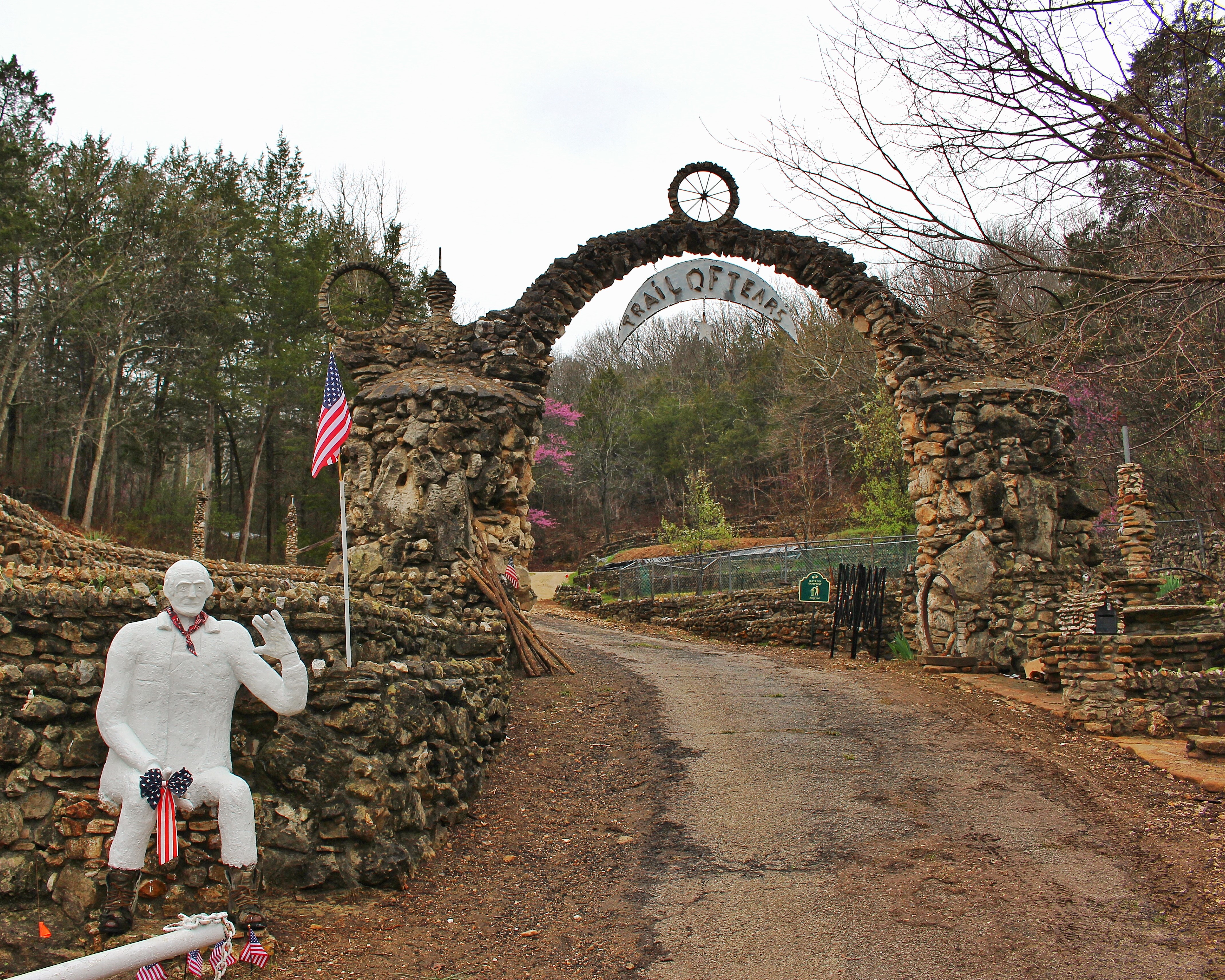
A statue of Larry Baggett at the entrance to the Trail of Tears welcomes Historic Route 66 travelers to pay tribute to the Cherokee Trail of Tears.
Public Domain. Judy Walker
Download Original (4279 x 3424 pixels, 4913.7 MB)
-
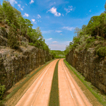
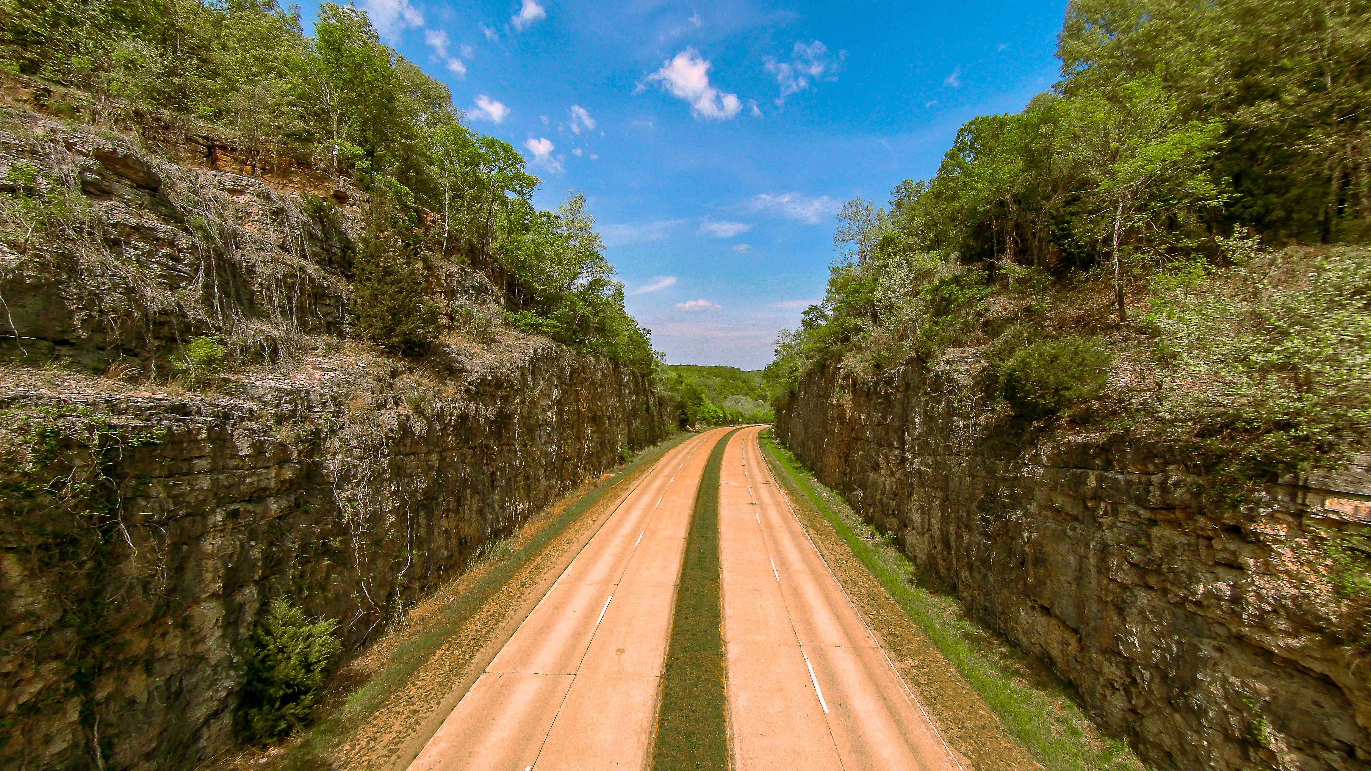
The four-lane, sloped curb section of Historic Route 66 travels through the dramatic 90-foot deep Hooker Cut.
Public Domain. Roamin Rich Dinkela
Download Original (4608 x 2592 pixels, 15195.0 MB)
-

The Christmas lights on the Devil’s Elbow bridge highlight the historic structure and welcome travelers to the holidays.
Public Domain. Jax Welborn
Download Original (3474 x 2248 pixels, 7225.3 MB)
-
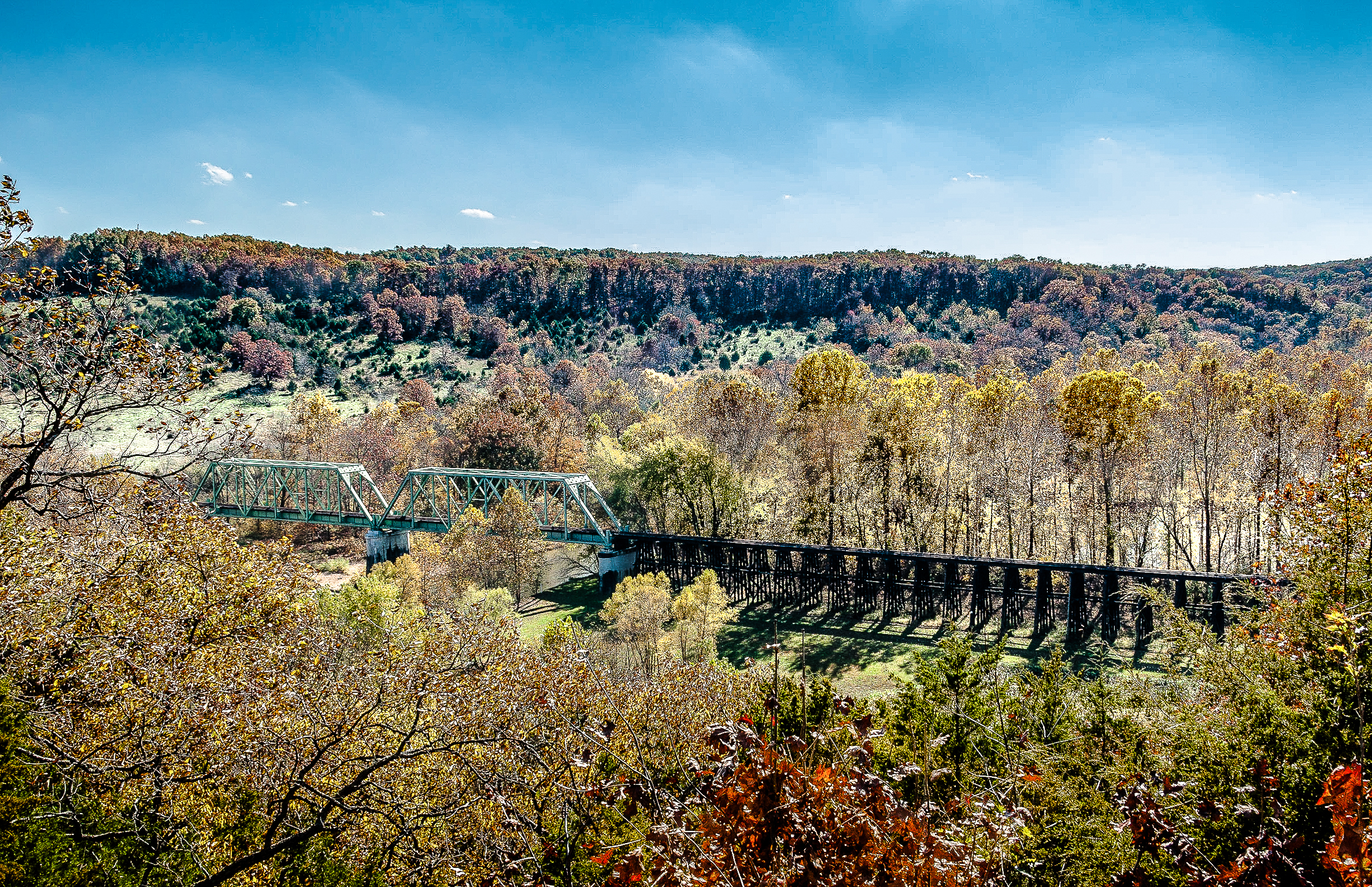
The old railroad bridge that crosses the Big Piney River can be seen from a scenic overlook located just west of the town.
Public Domain. Jax Welborn
Download Original (2373 x 1535 pixels, 6284.1 MB)
-
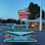
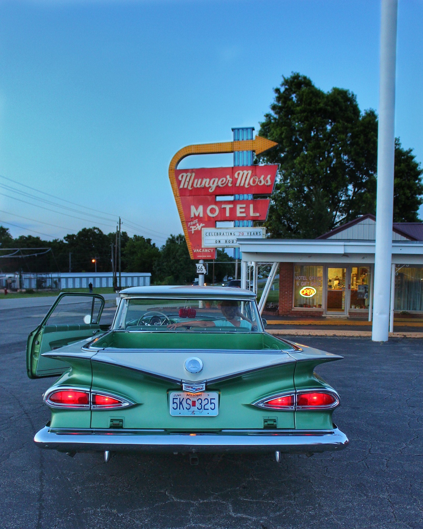
The vintage car parked in front of the Munger Moss Motel in Lebanon, Missouri is waiting to continue to travel down Historic Route 66.
Public Domain. Judy Walker
Download Original (1636 x 2046 pixels, 796.8 KB)
-
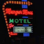
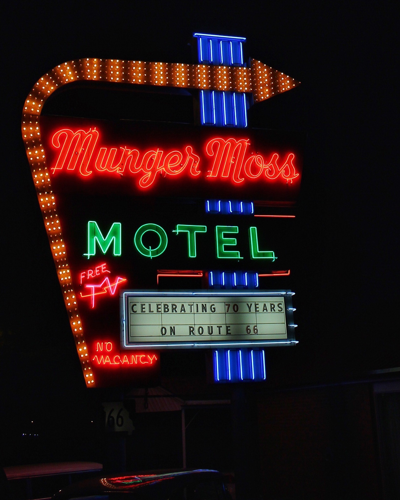
The refurbished neon sign of the Munger Moss Motel lights up the night in Lebanon, Missouri where it is celebrating 70 years on Historic Route 66 in Missouri.
Public Domain. Judy Walker
Download Original (1638 x 2048 pixels, 479.9 KB)
-
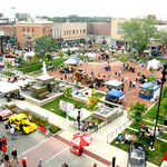
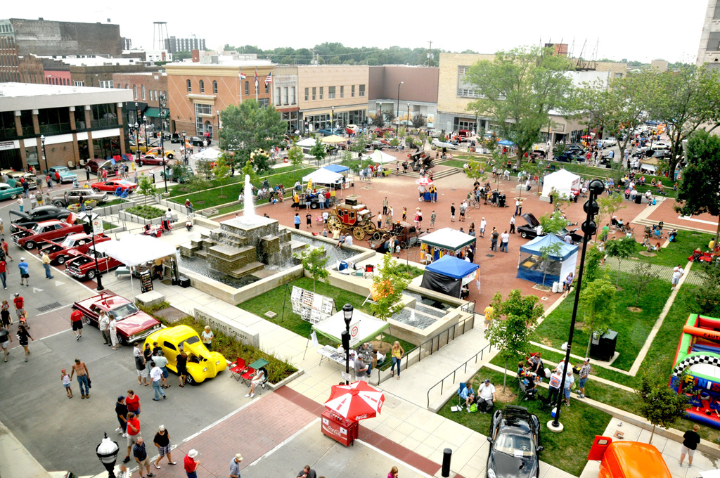
The central gathering space for the Springfield Route 66 Birthplace Festival, Park Central Square has food and craft exhibits among the historic cars at the car show.
Public Domain. David Eslick
Download Original (1024 x 680 pixels, 447.1 KB)
-
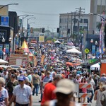
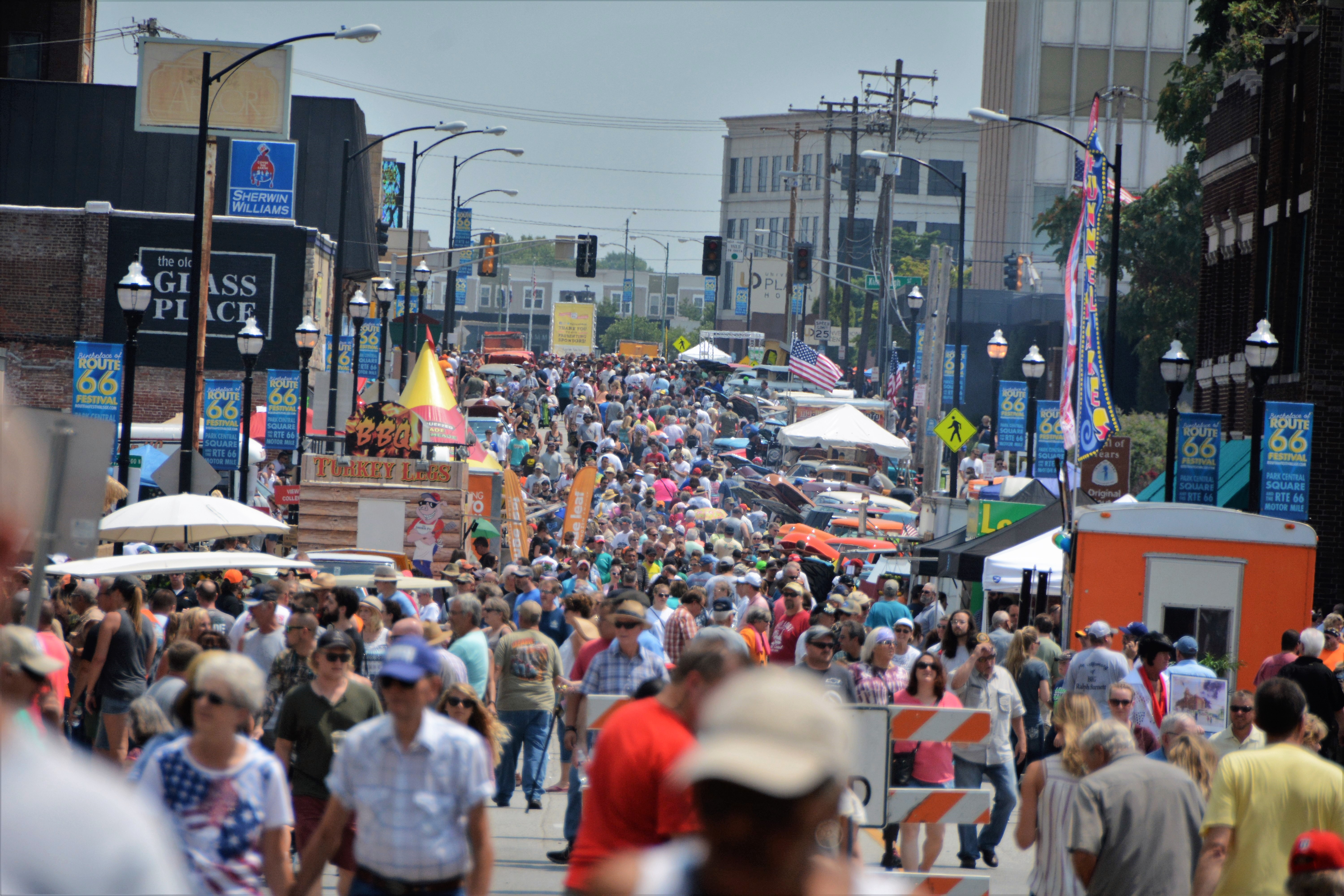
People from around the world gather at the Springfield Birthplace Festival on Historic Route 66 in Springfield, MO
Public Domain. David Eslick
Download Original (6000 x 4000 pixels, 3568.4 MB)
-
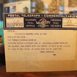
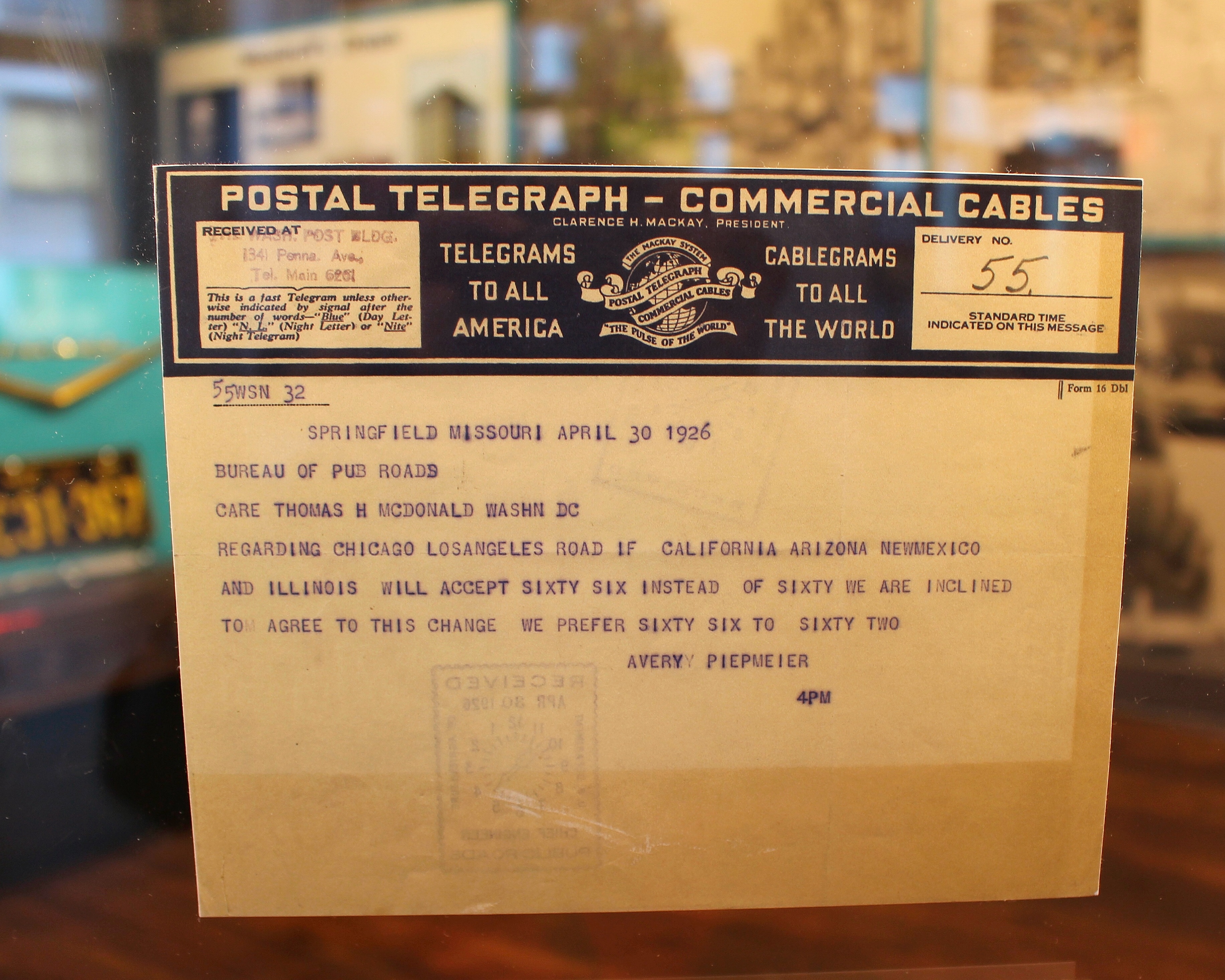
The original telegram composed at a meeting of highway officials and sent from Springfield, Missouri on April 30, 1926 naming the highway U.S. 66 is on display at the History Museum located on Park Central Square.
Public Domain. Judy Walker
Download Original (3666 x 2933 pixels, 3434.1 MB)
-
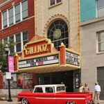
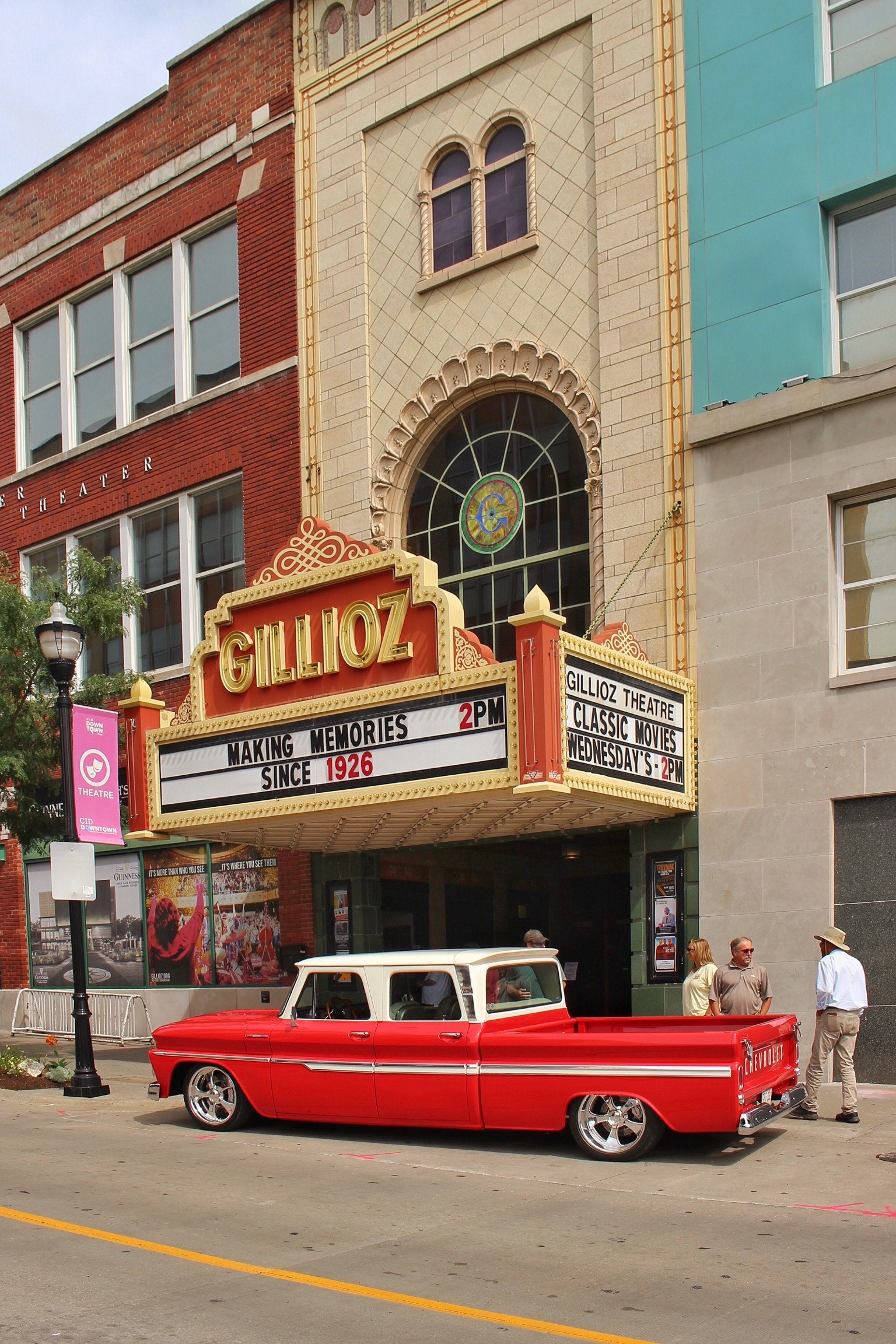
A vintage truck sits in front of the Gillioz Theater under the marque on Historic Route 66 just east of the Park Central Square.
Public Domain. Judy Walker
Download Original (1536 x 2304 pixels, 992.0 KB)
-
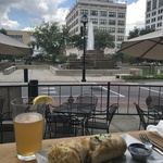
A traveler enjoys a pre-concert meal on Park Central Square before attending a concert at the Gillioz Theater.
Public Domain. Judy Walker
Download Original (4032 x 3024 pixels, 2577.7 MB)
-
The bright “pop art” of Gay Parita, the re-created 1930’s Sinclair Station in Paris Springs, MO, entices travelers to stop in for a visit and a photo opportunity.
Public Domain. Judy Walker
Download Original (3248 x 2581 pixels, 2430.0 MB)
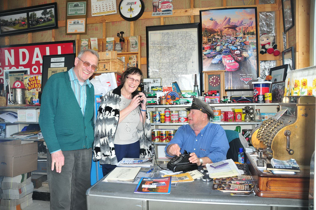
-
The late Gary Turner entertains and informs these international travelers of Historic Route 66.
Public Domain. David Eslick
Download Original (1024 x 680 pixels, 366.0 KB)
-
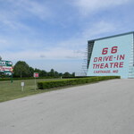
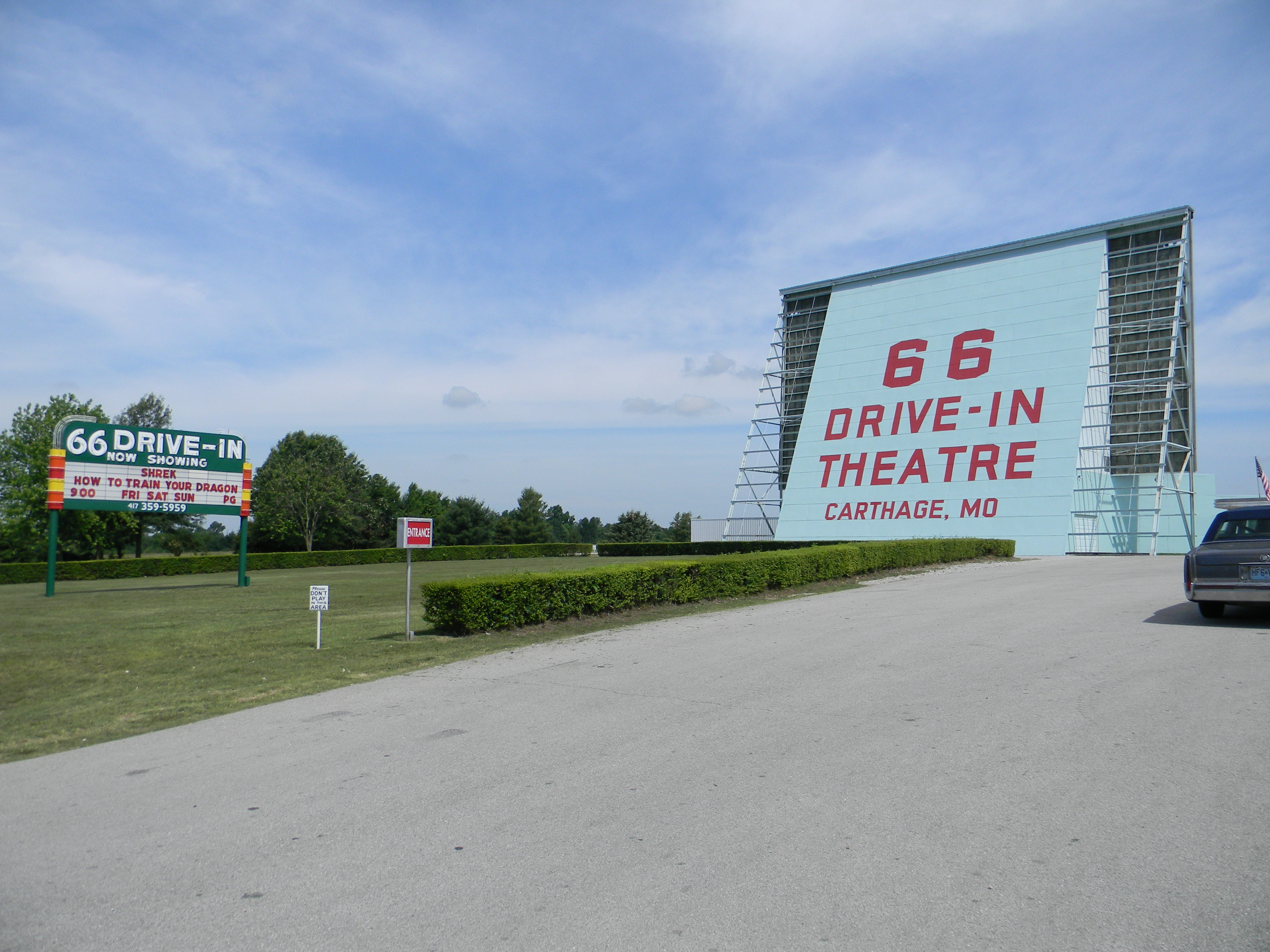
The 66 Drive-In is a landmark that is easily seen from Historic Route 66 in Carthage, Missouri.
Public Domain. David Eslick
Download Original (4000 x 3000 pixels, 2740.4 MB)
-
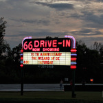
The refurbished neon sign of the 66 Drive-In glows against the sky at dusk in Carthage, Missouri on Historic Route 66.
Public Domain. Judy Walker
Download Original (2968 x 2374 pixels, 1501.7 MB)
-

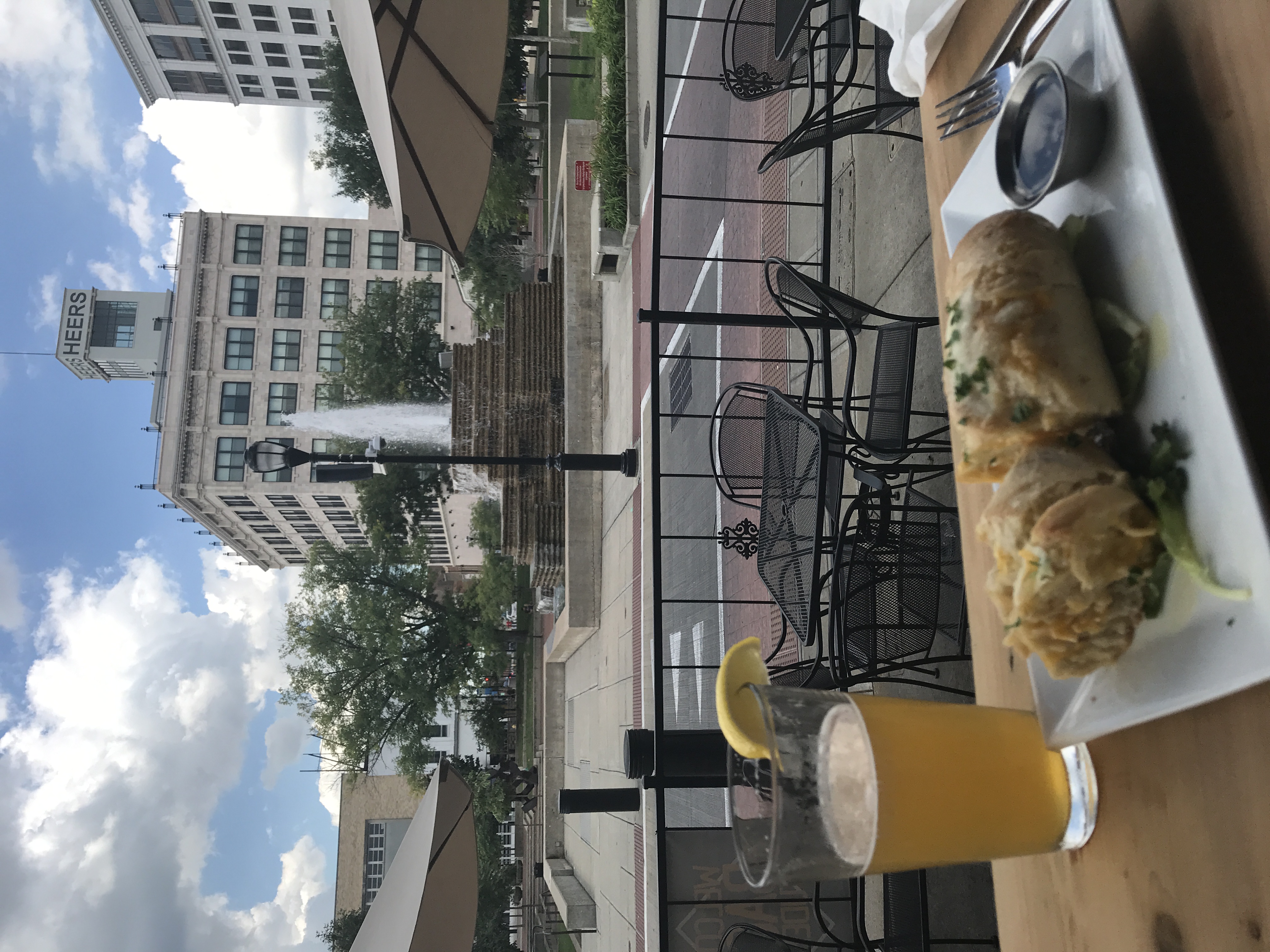
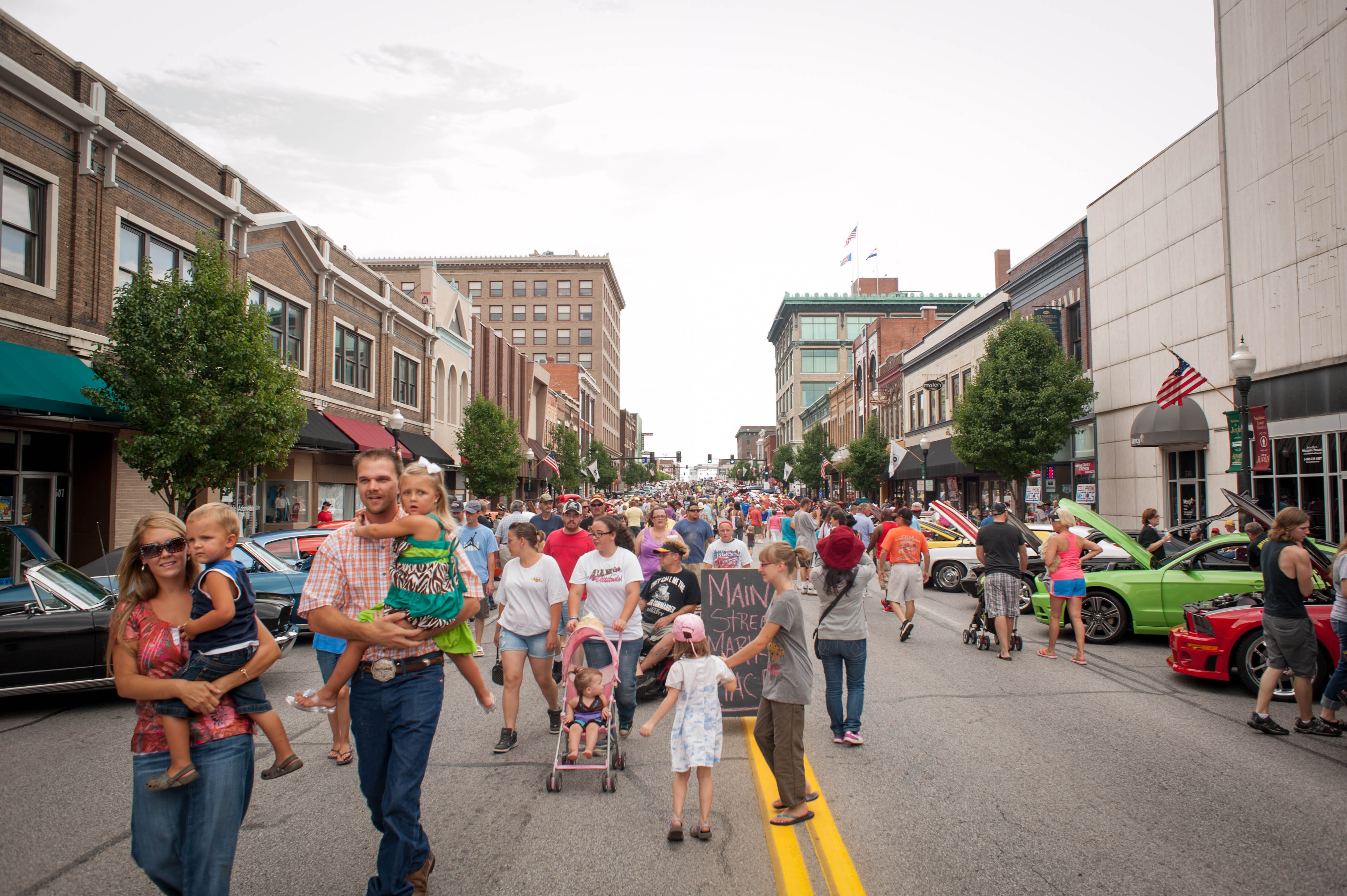
Main Street in Joplin is the “Main Street of America”, Historic Route 66, where crowds gather at the Joplin Route 66 Festival every third Thursday March through October.
Public Domain. Visit Joplin
Download Original (4063 x 2704 pixels, 1207.9 MB)
-
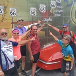
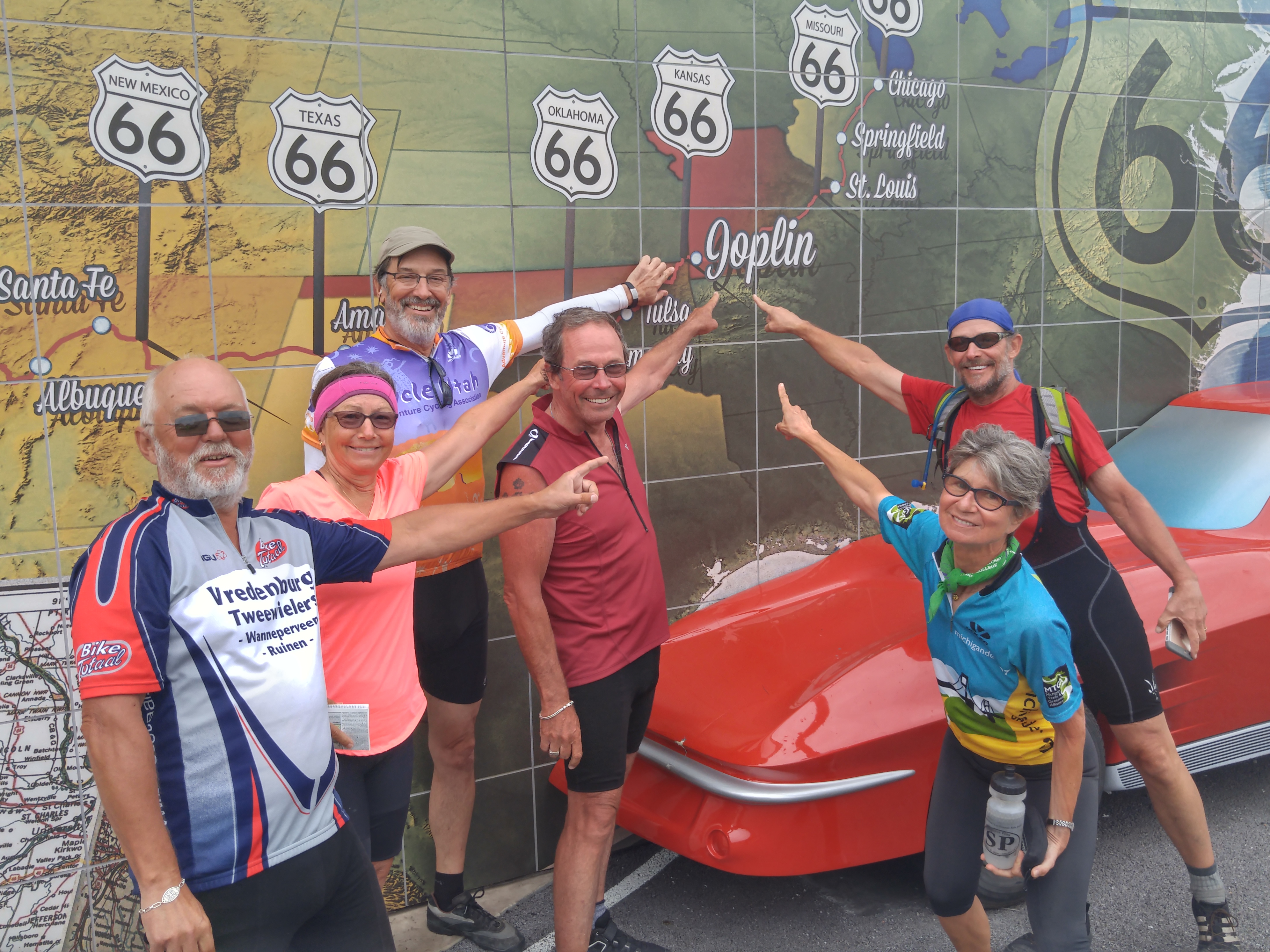
This international bicycle group is enjoying their stop at the Route 66 Mural Park in Joplin on Main Street, Historic Route 66.
Public Domain. Visit Joplin
Download Original (3984 x 2988 pixels, 3843.5 MB)