
Flaming Gorge - Green River Basin Scenic Byway
All Photos (48)
-
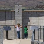
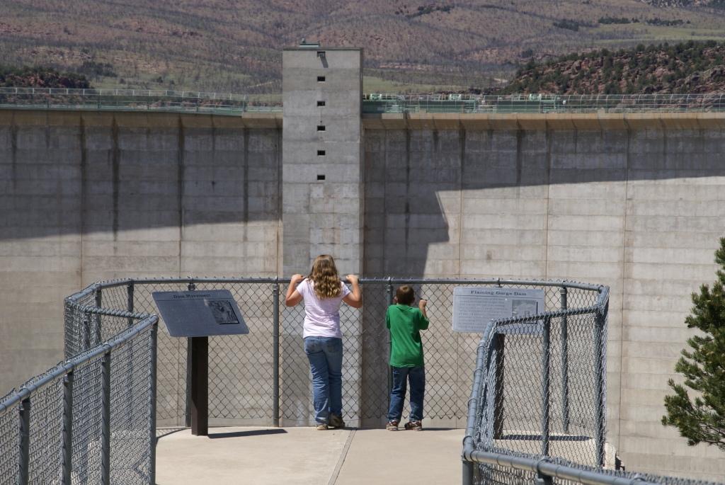
Flanked by interpretive signs, two youngsters stand on the overlook before the great wall of the Flaming Gorge Dam.
Public Domain. Courtesy of Ashley National Forest
Download Original (1024 x 685 pixels, 141.4 KB)
-
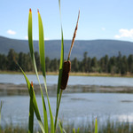
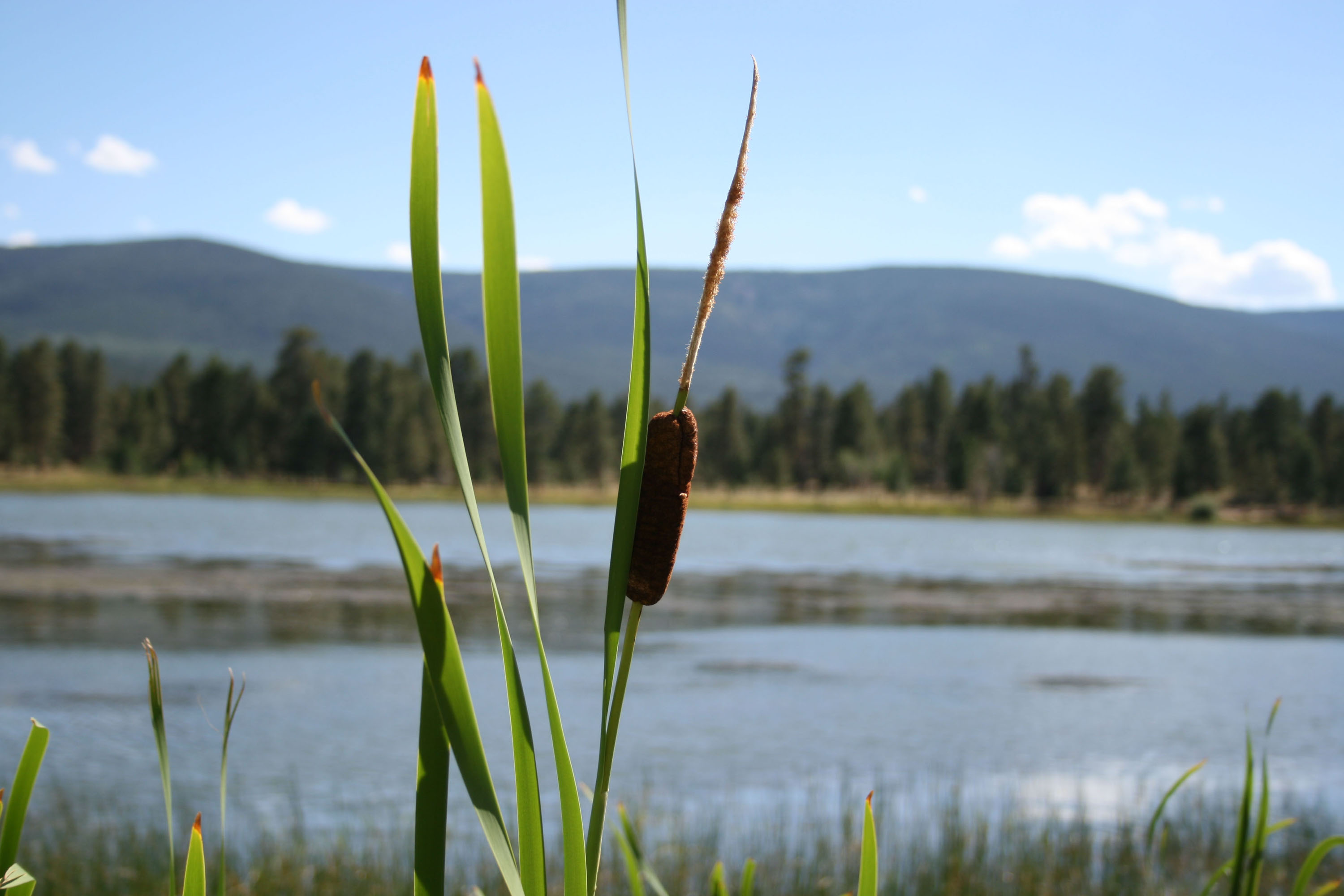
Reeds ring tiny West Green Lake near Red Canyon Visitors Center and Overlook.
© 2007 Matt Howard.
Download Original (3000 x 2000 pixels, 397.1 KB)
-
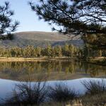
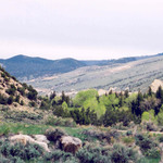
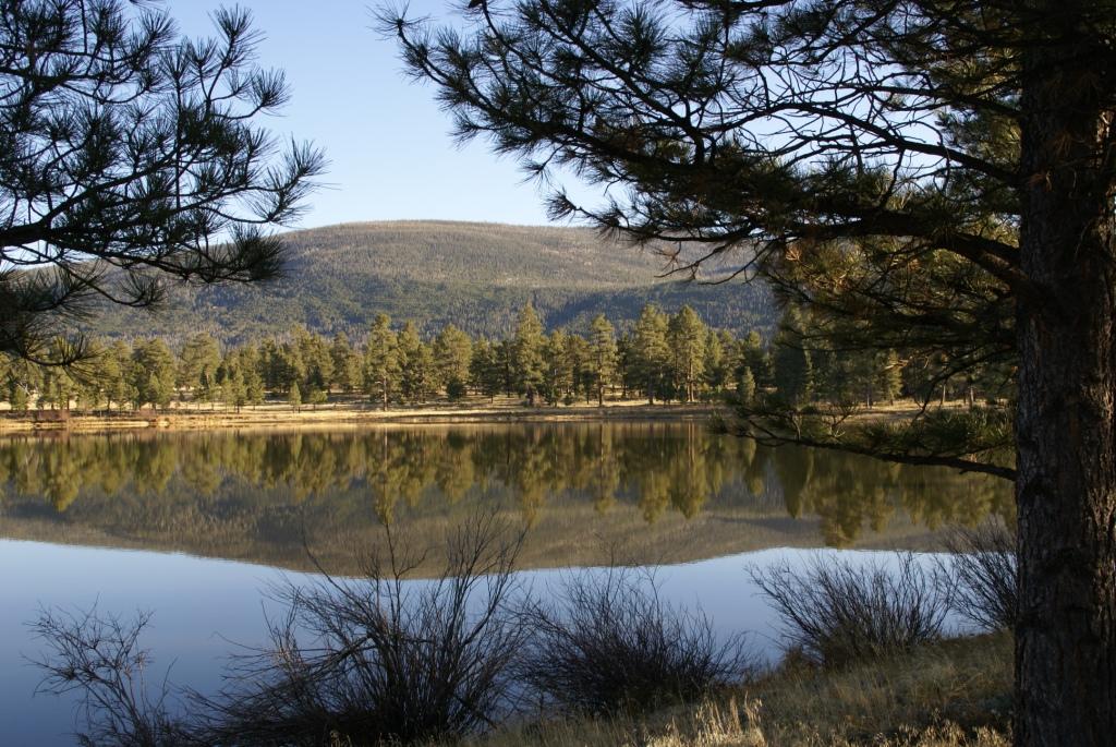
Framed by pine trees, the still waters of West Greens Lake reflect the trees and mountains of Ashley National Forest.
Public Domain. Courtesy of Ashley National Forest
Download Original (1024 x 685 pixels, 181.9 KB)
-
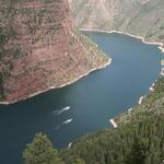
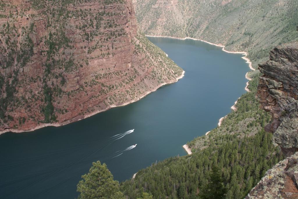
Two boats race along the blue waters of Flaming Gorge Reservoir, flanked by the brilliant red walls of Red Canyon.
Public Domain. Courtesy of Ashley National Forest
Download Original (1024 x 685 pixels, 140.2 KB)
-
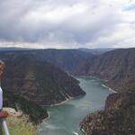
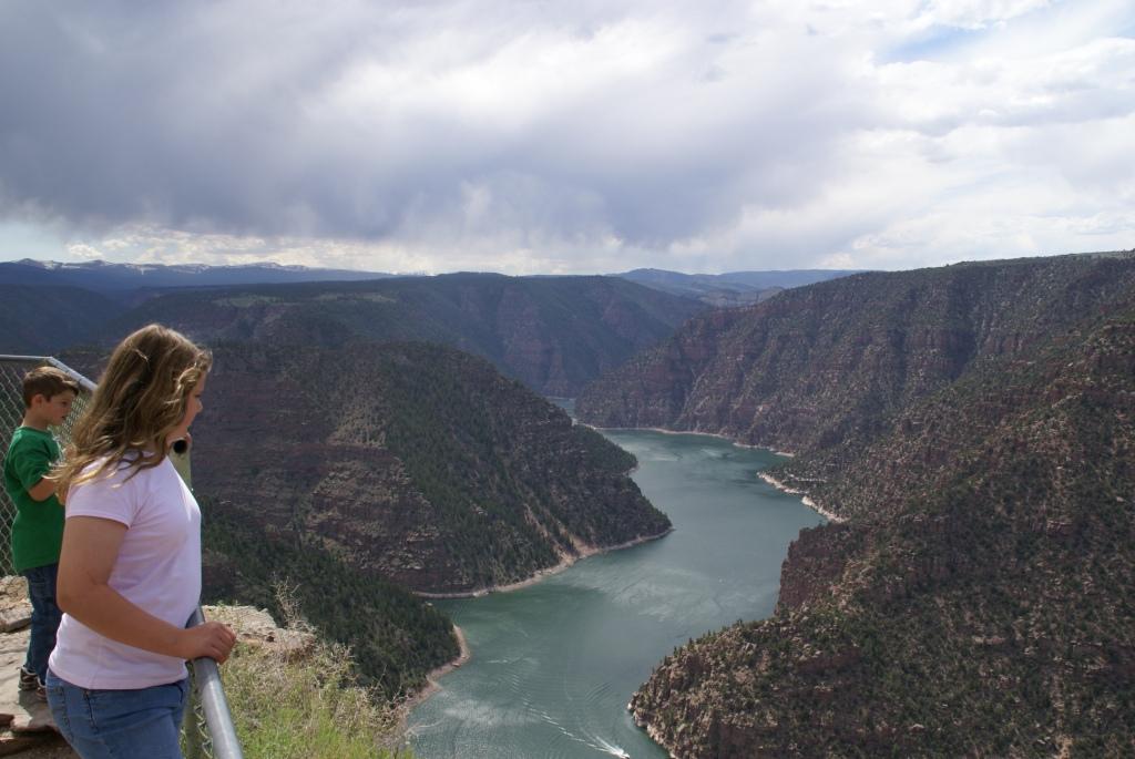
Two youngsters look down into the gray waters and red cliffs of Flaming Gorge's Red Canyon on a stormy day.
Public Domain. Courtesy of Ashley National Forest
Download Original (1024 x 685 pixels, 106.2 KB)
-
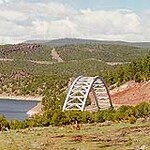
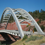
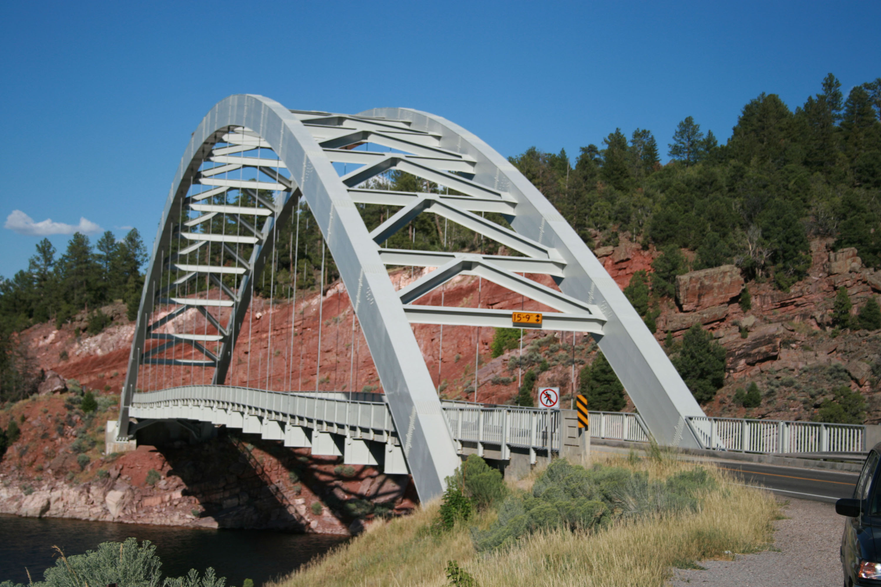
A bridge delicately arches over the smooth blue waters of Flaming Gorge Reservoir.
Public Domain.
Download Original (407 x 266 pixels, 98.7 KB)
-
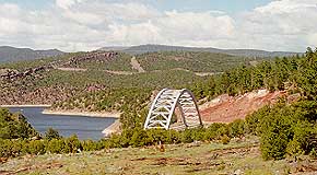
This view of Creek Bridge can be seen from Highway 91.
Public Domain. Photo by A. E. Crane
Download Original (290 x 160 pixels, 21.0 KB)
-
This view is looking east from Sheep Creek Canyon on the Flaming Gorge-Uintas Scenic Byway.
Public Domain. Photo by A. E. Crane
Download Original (3299 x 2322 pixels, 1081.2 MB)
-
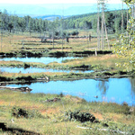
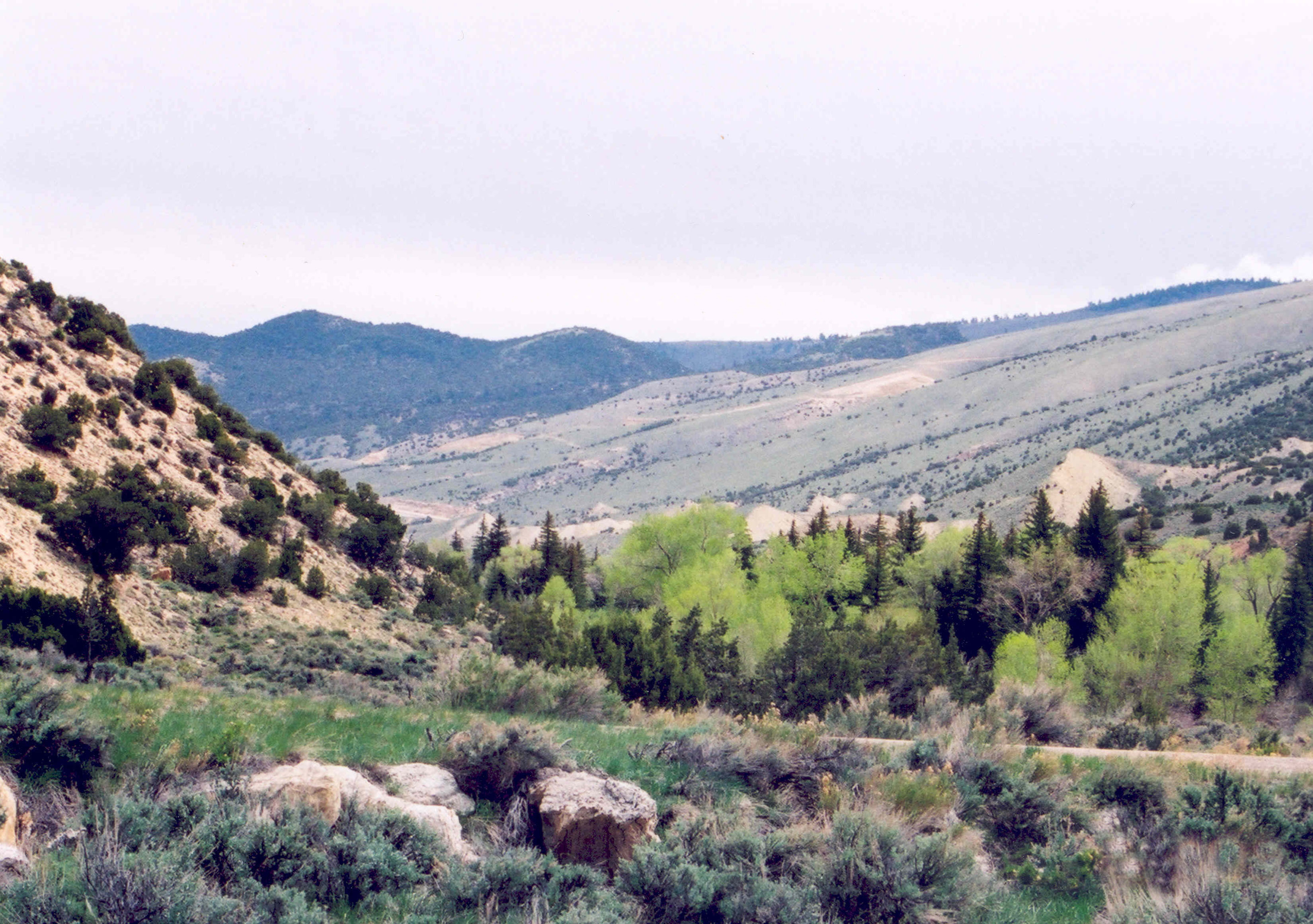
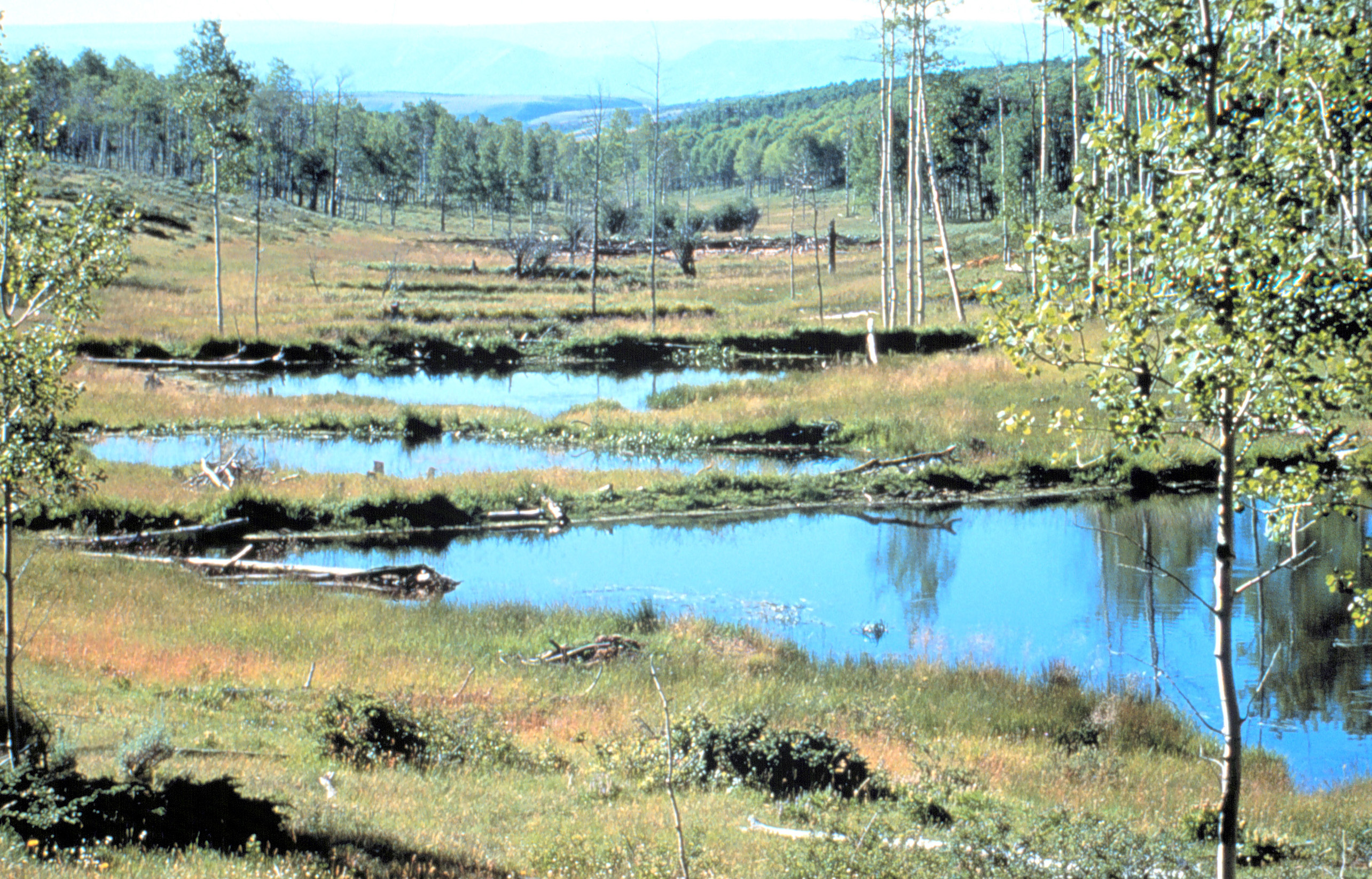
Beaver ponds sit on the east side of US-191, reflecting the landscape in their smooth pools.
Public Domain.
Download Original (2569 x 1646 pixels, 1676.8 MB)
-
These deep gorges plunge downward towards the earth, creating spectacular sights.
Public Domain. Photo by K. Armstrong
Download Original (2370 x 3413 pixels, 596.8 KB)
-

Public Domain.
Download Original (2100 x 1400 pixels, 526.8 KB)
-
Public Domain.
Download Original (2100 x 1400 pixels, 441.9 KB)
-
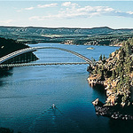
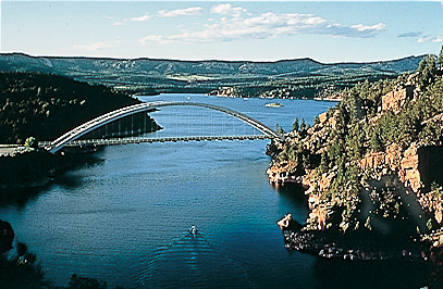
A well-known site at the Flaming Gorge area, this bridge spans the reservoir's blue waters.
© 2007 Matt Howard.
Download Original (3000 x 2000 pixels, 702.9 KB)
-

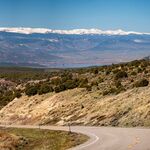
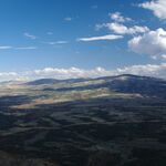
The Flaming Gorge – Green River Basin Scenic Byway is bordered by desert scrub as it dips and bends in this view looking south with the Flaming Gorge Reservoir, red canyon walls, and the snow-capped peaks of the east-west trending Uinta Mountains visible in the distance.
Public Domain. Flaming Gorge - Green River Basin Scenic Byway
-
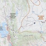
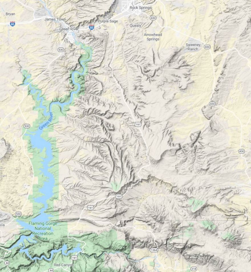
This topographic map shows the southeastern corner of Wyoming and the adjacent states and the relationship of the Wyoming Basin Physiographic Region with other regions in the west including the Great Basin covering Utah and Nevada and the Rocky Mountain Region stretching from Canada to Mexico. Flaming Gorge Reservoir and the adjacent byway roads are in the center of the Wyoming Basin region and on the right side of this map view.
Public Domain. Flaming Gorge - Green River Basin Scenic Byway
-
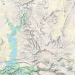
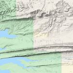
This terrain map illustrates the rugged nature of the landscape in this part of the Wyoming Basin Physiographic Region with deep valleys and pronounced ridges.
Public Domain. Flaming Gorge - Green River Basin Scenic Byway
Download Original (880 x 952 pixels, 149.8 KB)
-
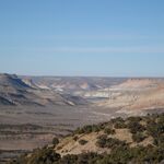
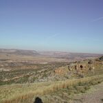
The view from US 191 near the Little Firehole Canyon Overlook of the deep valley and canyons with and multi-colored cliffs, blue sky, and a distant view of water.
Public Domain. Flaming Gorge - Green River Basin Scenic Byway
-
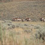
A herd of Pronghorn antelope graze on rolling hills of high desert sagebrush scrub. The Wyoming Sublette antelope herd is one of state’s largest herds and migrates to this area each winter.
Public Domain. Flaming Gorge - Green River Basin Scenic Byway
-
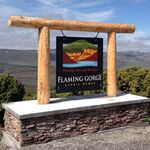
A large, rustic byway gateway sign utilizing the Flaming Gorge Scenic Byway logo sits on the edge of an overlook with long-distance views of the valley and canyons below.
Public Domain. Flaming Gorge - Green River Basin Scenic Byway
-
Color abounds in the rock layers of cliffs and sagebrush scrub of this long-distance view from the Little Firehole Canyon overlook. Millions of years of geology is on display and waits to be explored.
Public Domain. Rock Springs Chamber
-
The Art Gallery of Time interpretive panel located at the Little Firehole Overlook describes the area’s vivid and colorful rock formations which are on display in the view behind the panel.
Public Domain. Rock Springs Chamber
-
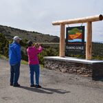
Byway travelers photograph the large, rustic byway gateway sign utilizing the Flaming Gorge Scenic Byway logo that sits on the edge of the Little Firehole overlook on US 191.
Public Domain. Rock Springs Chamber
-
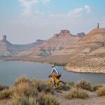
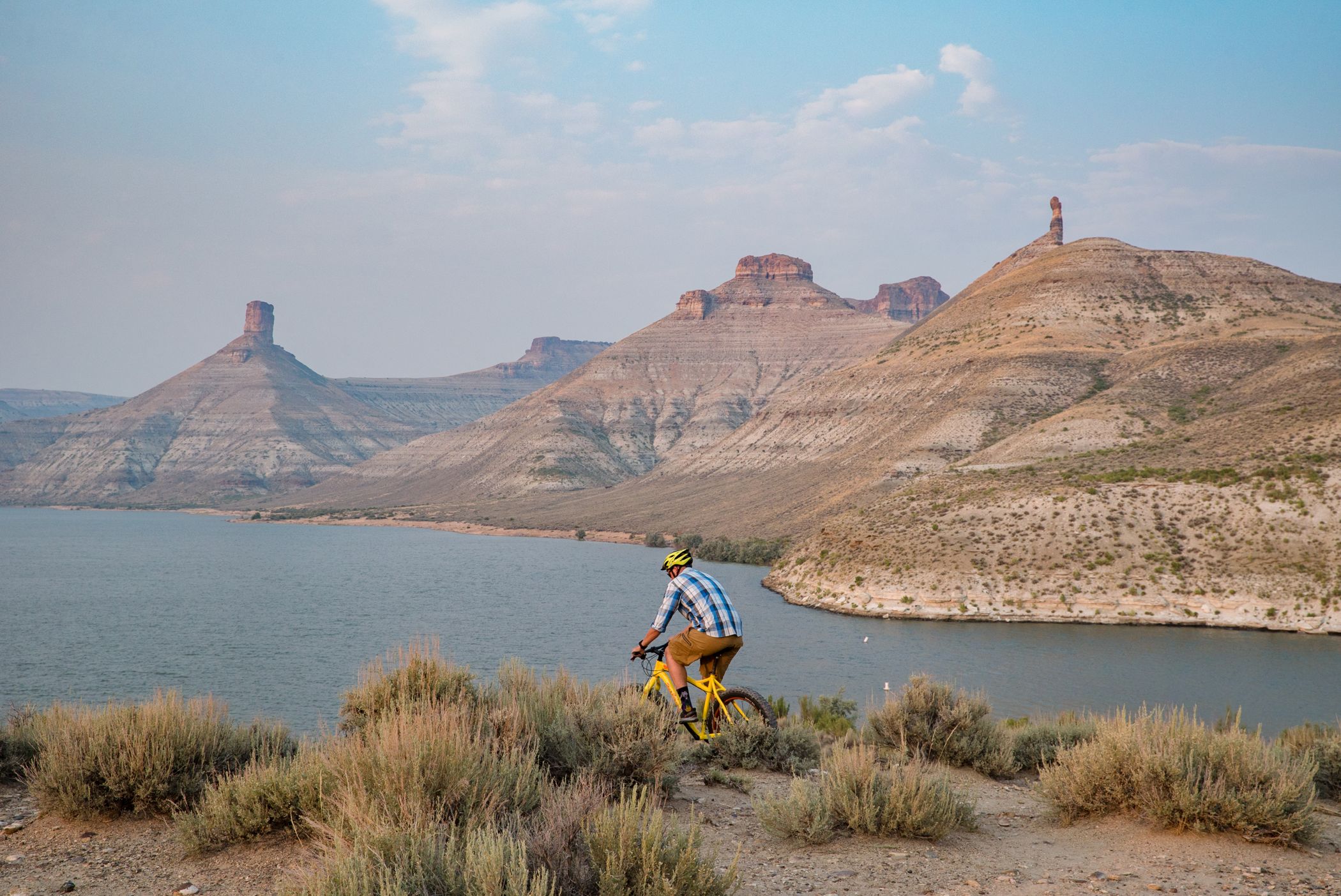
A mountain biker rides along a ridge overlooking the Flaming Gorge Reservoir with a view of Big Firehole Canyon in the distance that includes tall pinnacled buttes North and South Chimney Rock.
Public Domain. Rock Springs Chamber
Download Original (2100 x 1403 pixels, 501.0 KB)
-
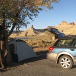
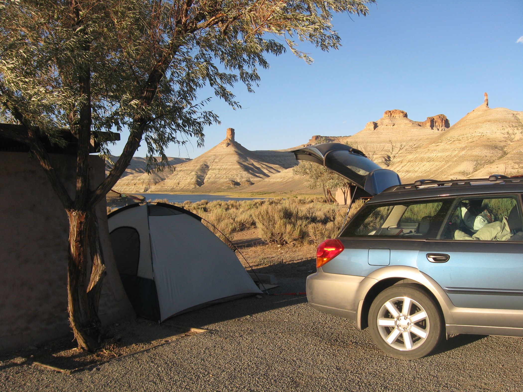
A car parked next to a tent and campsite in the Flaming Gorge National Recreation Area. The view from the campsite is Big Firehole Canyon.
Public Domain. Rock Springs Chamber
Download Original (2100 x 1575 pixels, 728.8 KB)
-
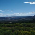
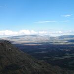
This typical view from US 191 includes sagebrush in the foreground and a distant view extending 50 miles or more of valley, canyons, blue sky, and the byway winding south.
Public Domain. Flaming Gorge - Green River Basin Scenic Byway
-
This view from US 191 looks east into the Clay Basin where views extend into Utah and Colorado.
Public Domain. Flaming Gorge - Green River Basin Scenic Byway
-
This view of US 191 facing south includes grasslands that are typical of the drive north of the Raptor Overlook and also previews in the distance the more rugged terrain that emerges as the byway traveler approaches Utah.
Public Domain. Flaming Gorge - Green River Basin Scenic Byway
-
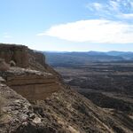
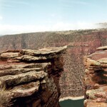
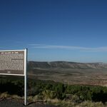
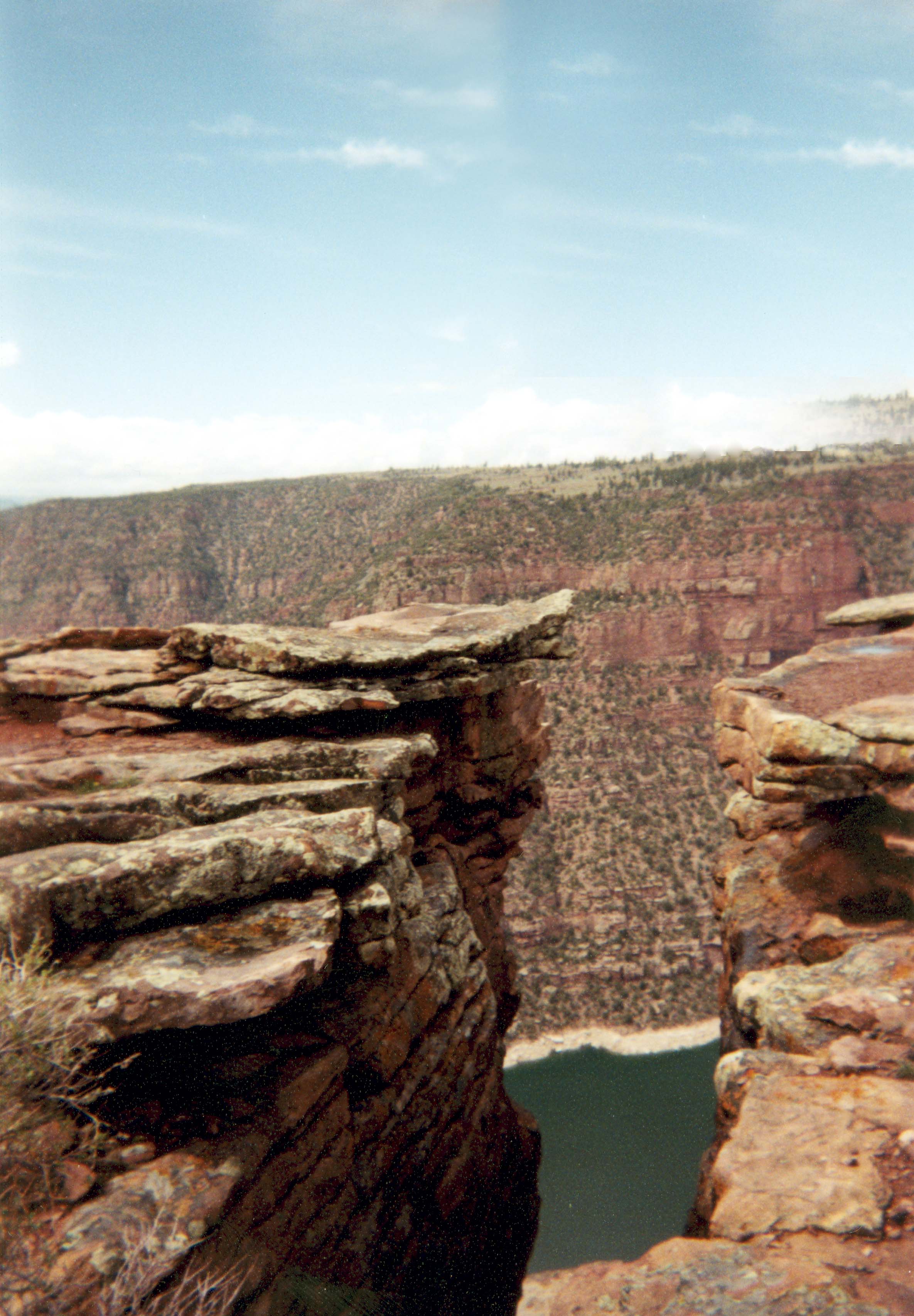
The 800-foot vertical cliff at the Raptor Overlook on US 191 overlooks the Clay Basin that stretches south and east into Colorado and Utah.
Public Domain. Flaming Gorge - Green River Basin Scenic Byway
-
A view of the 800-foot cliff at Raptor Overlook taken looking northeast across Clay Basin.
Public Domain. Flaming Gorge - Green River Basin Scenic Byway
-
This terrain map illustrates the geologic gap in the mountain known as Minnie’s Gap on US 191 and the uplift that extends west from the gap and disappears under the Flaming Gorge Reservoir.
Public Domain. Google
-

Minnie’s Gap on US 191 is geologic gap in the mountain serves as a gateway between Wyoming and Utah.
Public Domain. Flaming Gorge - Green River Basin Scenic Byway
-
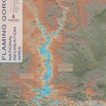
The official map of the Flaming Gorge National Recreation Area illustrates the relationship between the reservoir, landscape and boundaries of the NRA.
Public Domain. United States Forest Service
-
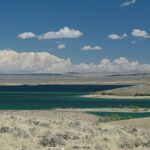
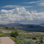
A view looking east from WY 530 extends past vast grasslands in the foreground that descend into the emerald water of the reservoir and beyond to the eastern shore of the reservoir.
Public Domain. Flaming Gorge - Green River Basin Scenic Byway
-
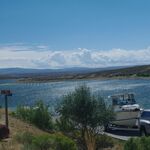
A trailered boat waiting to be launched into the sparkling Flaming Gorge Reservoir at a launch site with access from WY 530.
Public Domain. Flaming Gorge - Green River Basin Scenic Byway
-
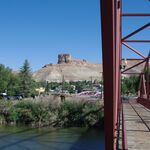
A pedestrian bridge connects visitors to Expedition Island in the Green River with a view of Castle Rock in the distance.
Public Domain. Flaming Gorge - Green River Basin Scenic Byway
-
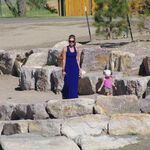
A woman and small child enjoy a stroll along the Green River in Expedition Island Park that celebrates explorer John Wesley Powell.
Public Domain. Flaming Gorge - Green River Basin Scenic Byway
-
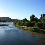
A view of the channel of the Green River that flows past high cliffs on one side, and the tree-covered island on the other.
Public Domain. Rock Springs Chamber
-
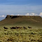
A herd of wild horses gallop past Pilot Butte.
Public Domain. Rock Springs Chamber
-
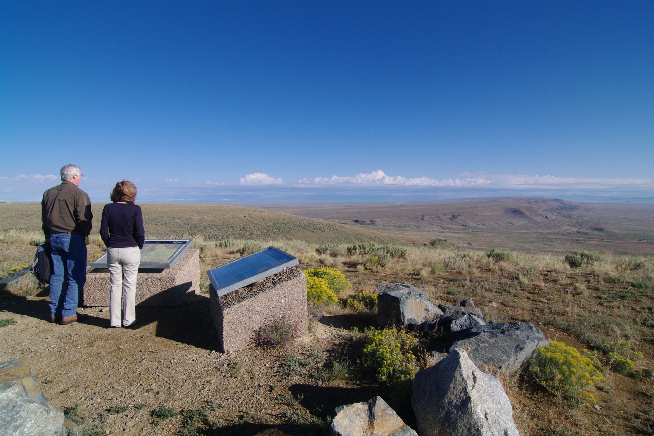
Travelers view interpretive panels along the Wild Horse Scenic Loop at a site with long-distance views southeast into the Red Desert.
Public Domain. Flaming Gorge - Green River Basin Scenic Byway
Download Original (2100 x 1400 pixels, 526.8 KB)
-
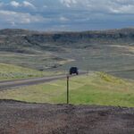
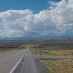
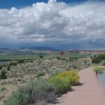
A car sits on a simple pull off on WY 530 with a view west is of broad grasslands and typical billowing afternoon clouds.
Public Domain. Flaming Gorge - Green River Basin Scenic Byway
-
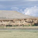
The Black’s Fork River and grassy floodplain, and a newly formed sand dune on a distant bluff.
Public Domain. Flaming Gorge - Green River Basin Scenic Byway
-
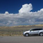
A view south on WY 530 with a distant view of the east-west trending Uinta Mountains and a cloud-filled sky.
Public Domain. Flaming Gorge - Green River Basin Scenic Byway
-
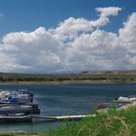
Boaters stand under sunny skies on a typical marina dock lined with watercraft on the Flaming Gorge Reservoir.
Public Domain. Flaming Gorge - Green River Basin Scenic Byway
-
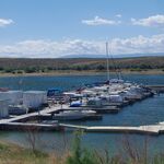
A typical boating complex with a dock for small personal watercraft along the shore of the Flaming Gorge Reservoir with a long distance view across a flat plain to treeless mountains.
Public Domain. Flaming Gorge - Green River Basin Scenic Byway
-

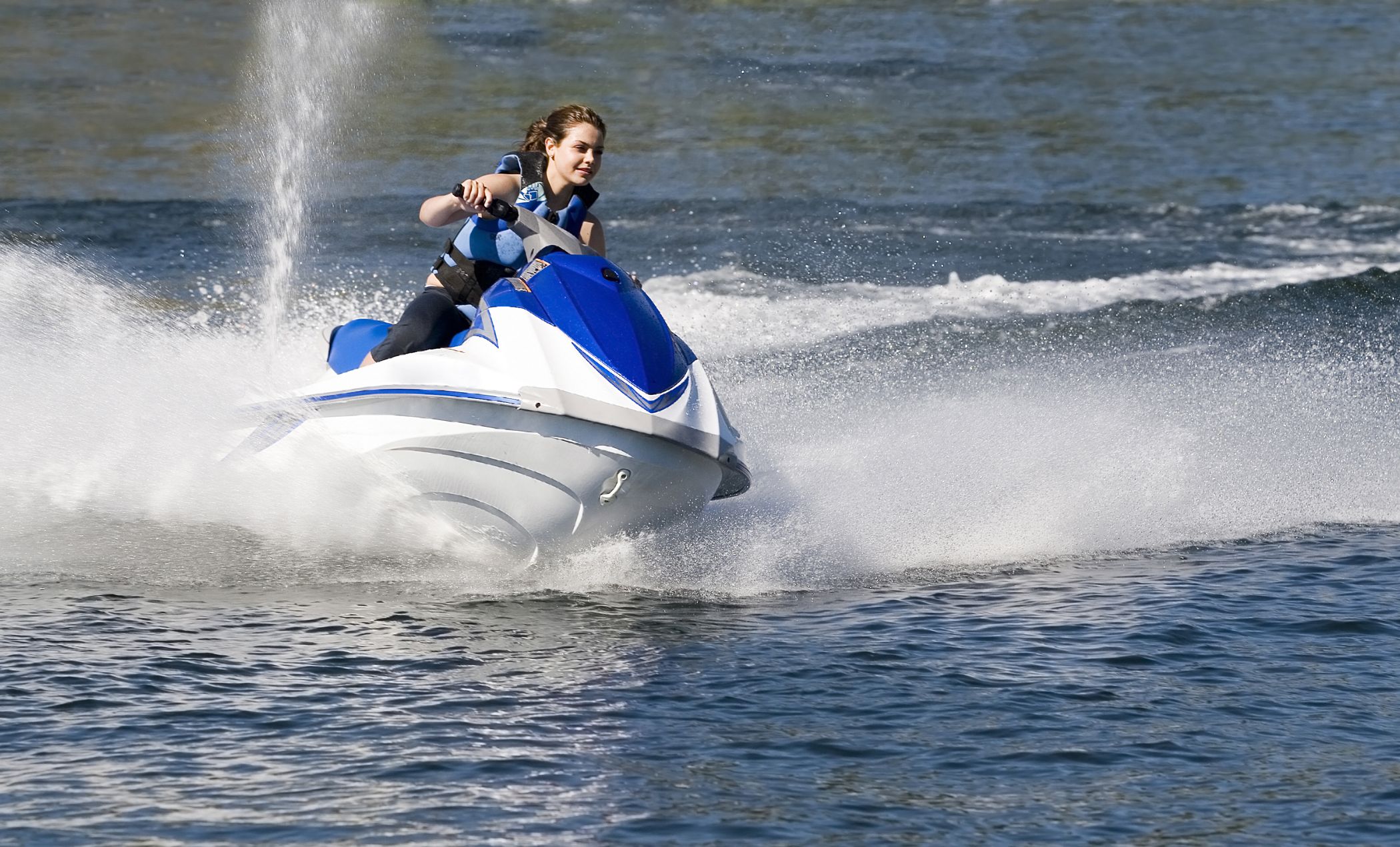
A rider makes a turn on a personal watercraft in the Flaming Gorge Reservoir near Buckboard Marina.
Public Domain. Rock Springs Chamber
Download Original (2100 x 1270 pixels, 453.3 KB)
-

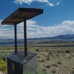
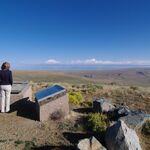
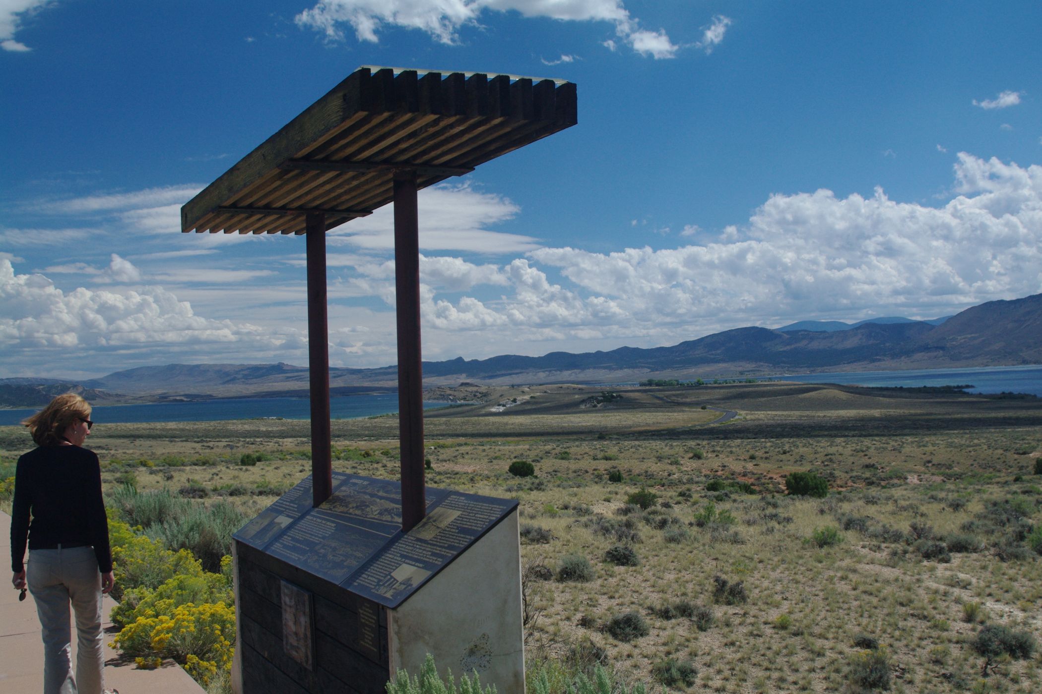
A traveler views an interpretive panel at Henry’s Fork Wetlands overlook on WY 530 with a distant view that includes the reservoir and Lucerne Valley Marina in the Flaming Gorge National Recreation Area.
Public Domain. Flaming Gorge - Green River Basin Scenic Byway
Download Original (2100 x 1400 pixels, 441.9 KB)
-
A view from the Henry’s Fork Wetlands overlook on WY 530 looking east and south toward the Red Canyon uplift along the horizon.
Public Domain. Flaming Gorge - Green River Basin Scenic Byway
-
Looking southwest across the Henry’s Fork Wetlands complex with Manila, Utah, in the distance and the Uinta Mountains on the horizon.
Public Domain. Flaming Gorge - Green River Basin Scenic Byway