
Death Valley Scenic Byway
All Photos (121)
-
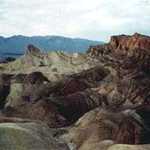
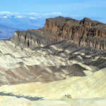
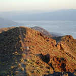
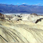
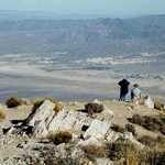
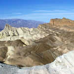
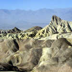
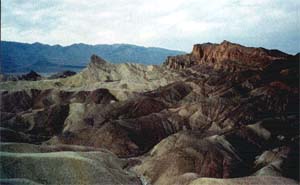
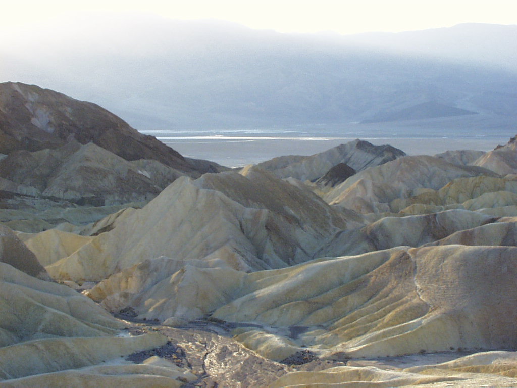
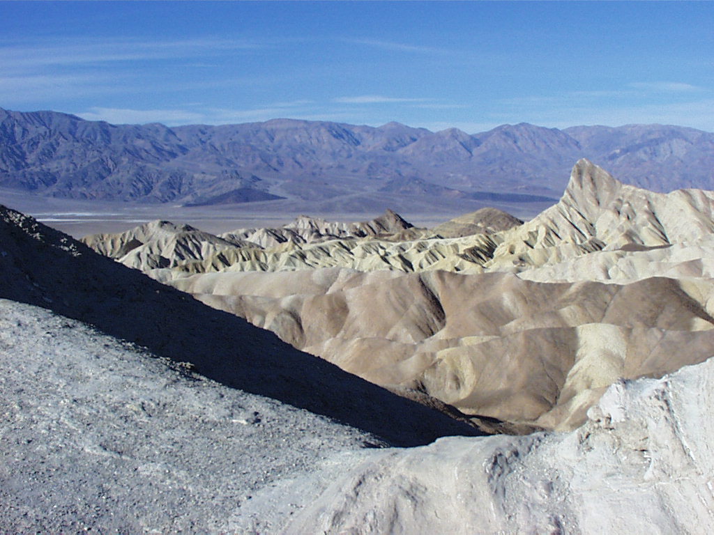
The view from Zabriskie Point is worth stopping for.
© 1999 Marian Harmon.
Download Original (300 x 185 pixels, 16.0 KB)
-
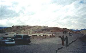
Travelers make their way up to Zabriskie Point.
© 1999 Marian Harmon.
Download Original (300 x 185 pixels, 13.0 KB)
-
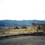
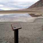
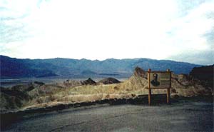
The interpretive sign describes the history of Zabriskie Point.
© 1999 Marian Harmon.
Download Original (300 x 185 pixels, 13.1 KB)
-
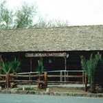
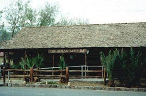
A look at the entrance to Death Valley's Borax Museum.
© 1999 Marian Harmon.
Download Original (300 x 198 pixels, 22.5 KB)
-
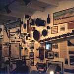
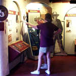
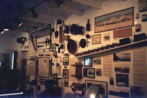
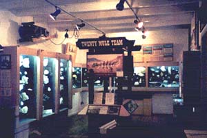
Exhibits line the walls within the Borax Museum.
© 1999 Marian Harmon.
Download Original (300 x 201 pixels, 24.1 KB)
-

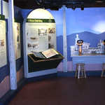
Exhibits line the walls within the Borax Museum.
© 1999 Marion Harmon.
Download Original (300 x 201 pixels, 21.1 KB)
-
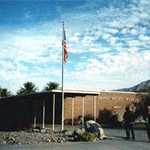
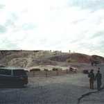
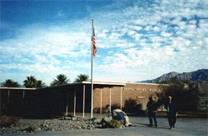
A group stands before the Death Valley Museum and Visitor Center.
© 1999 Marian Harmon.
Download Original (300 x 196 pixels, 18.3 KB)
-
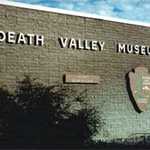
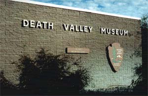
This is a shot of the front wall of Death Valley Museum and visitor center.
© 1999 Marian Harmon.
Download Original (300 x 196 pixels, 19.7 KB)
-
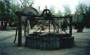
The Gold Arrastra stands outside the Borax Museum.
© 1999 Marion Harmon.
Download Original (300 x 184 pixels, 18.5 KB)
-
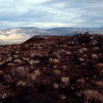
This view shows Rainbow Canyon and the Argus Mountain Range as seen to the west at milepost 45.00.
Public Domain. Courtesy of the National Park Service
Download Original (3608 x 2409 pixels, 9799.3 MB)
-
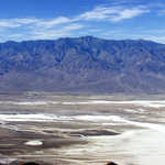
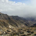
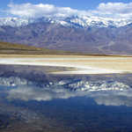
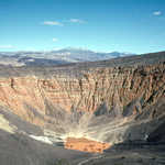
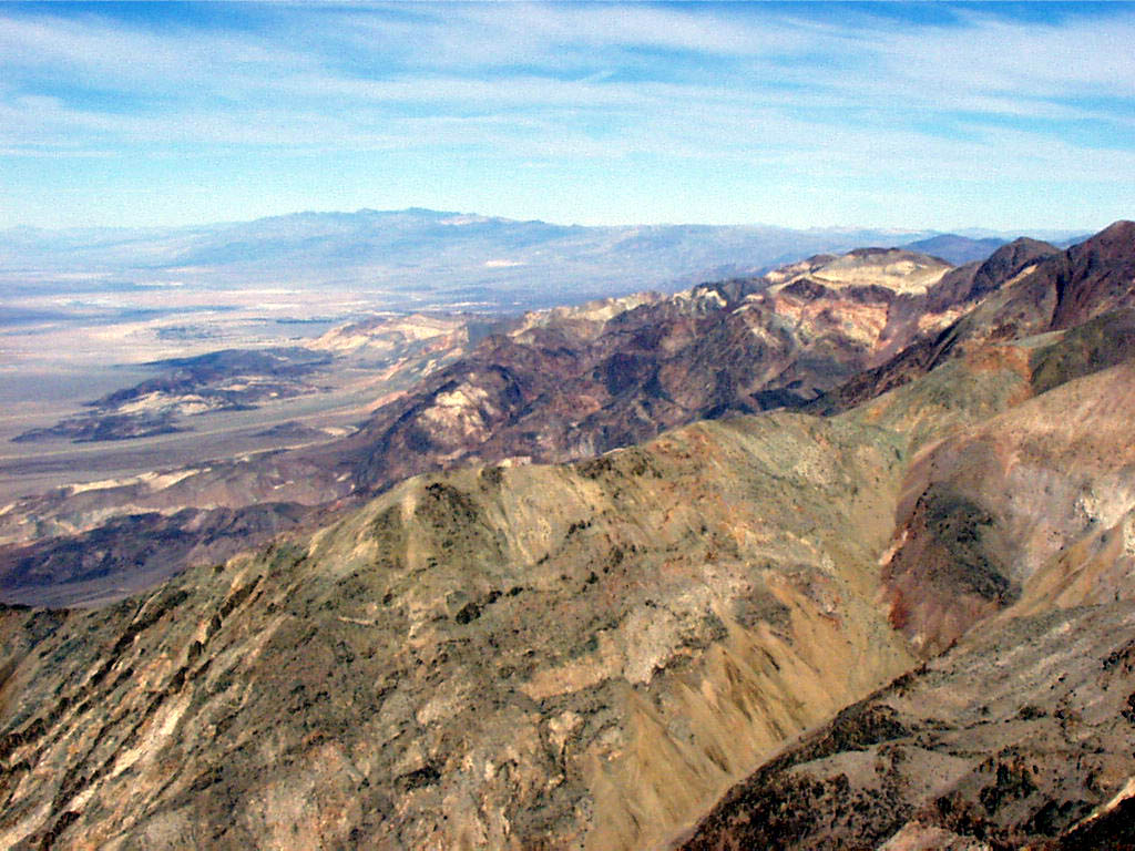
Colorful and crystal-clear views of the entire valley are captured from Dante's View.
Public Domain. Photo from National Park Service
Download Original (1024 x 768 pixels, 174.3 KB)
-
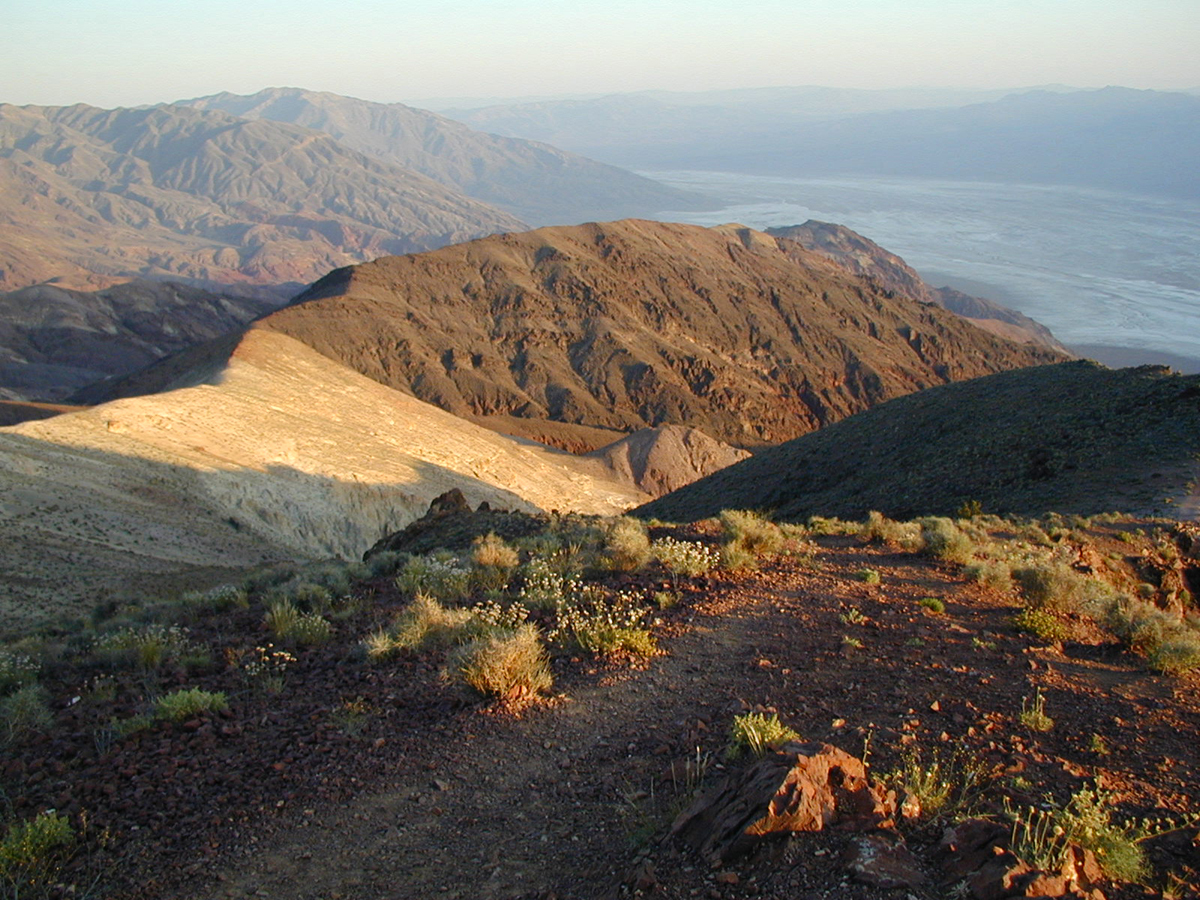
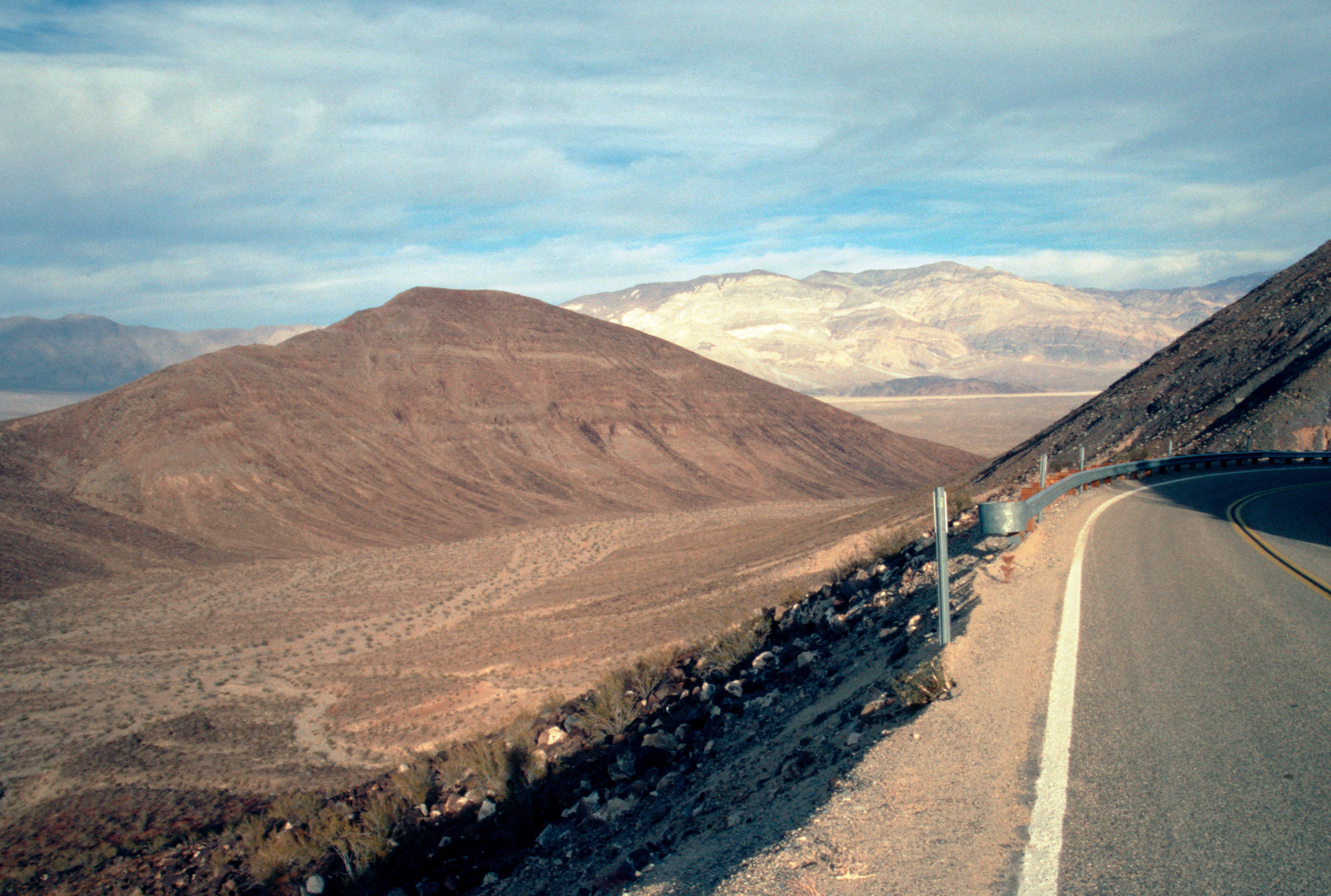
The curves and hills of the Black Mountains can be captured from a high peak above known as Dante's View.
Public Domain. Photo from National Park Service
Download Original (1200 x 900 pixels, 941.7 KB)
-
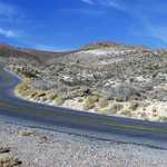
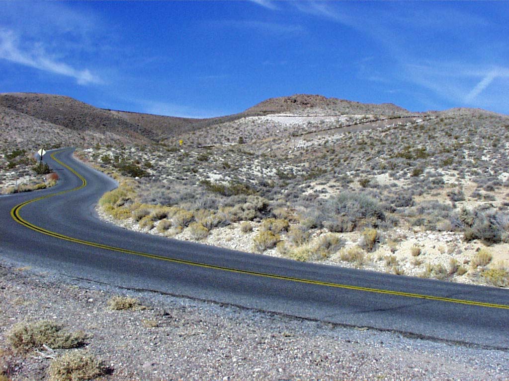
Follow this windy road through the Black Mountains to reach Dante's View.
Public Domain. Photo from National Park Service
Download Original (1024 x 768 pixels, 156.1 KB)
-
Far across a mineral-strewn valley from Dante's View, one can see Telescope Peak, the highest point in the Panamint Mountains.
Public Domain. Photo from National Park Service
Download Original (1024 x 768 pixels, 143.2 KB)
-
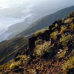
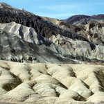
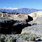
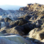
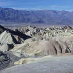
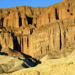
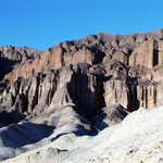
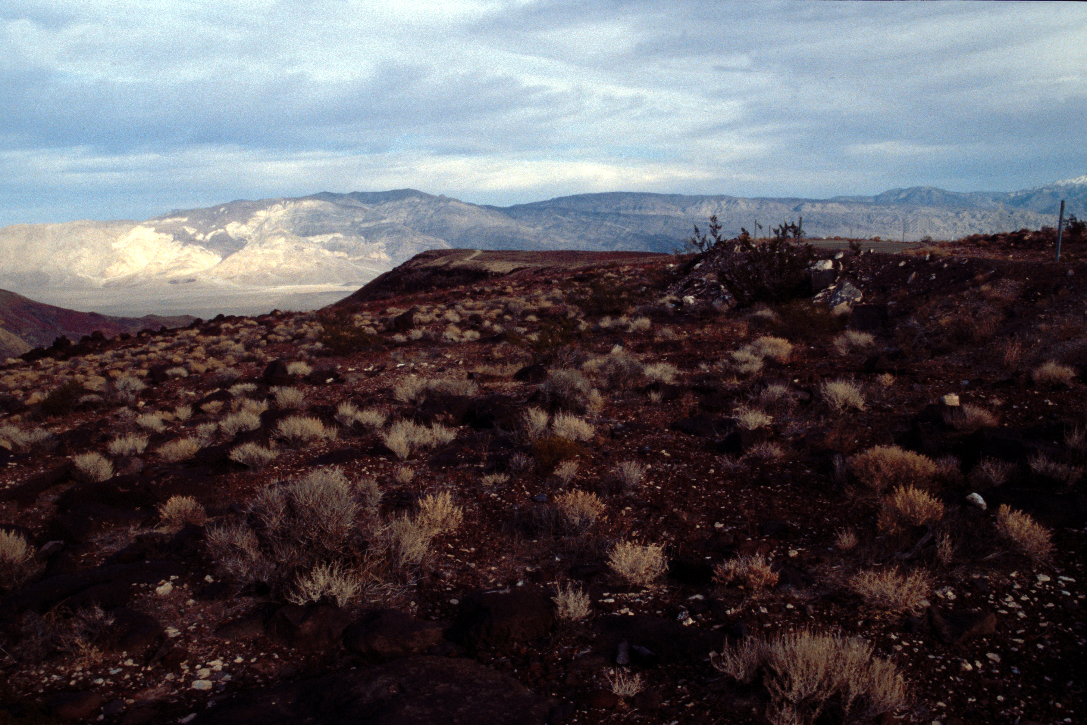
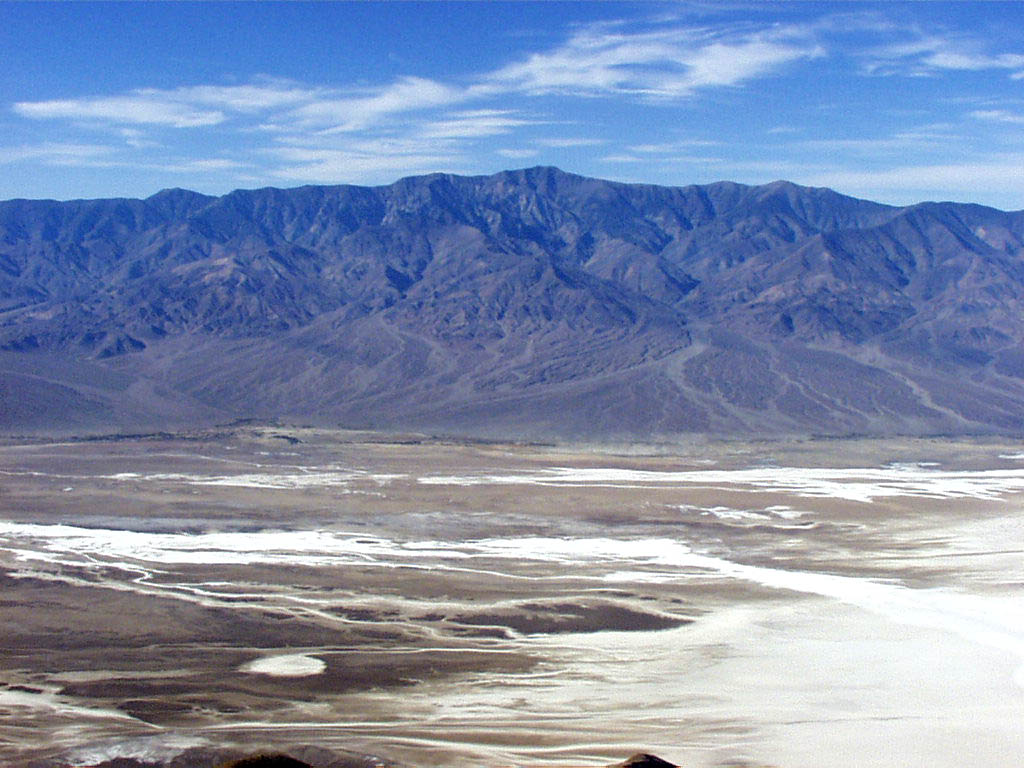
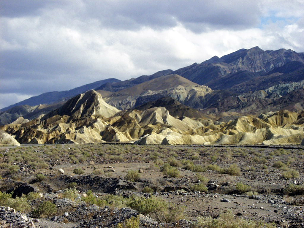
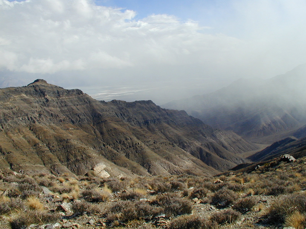
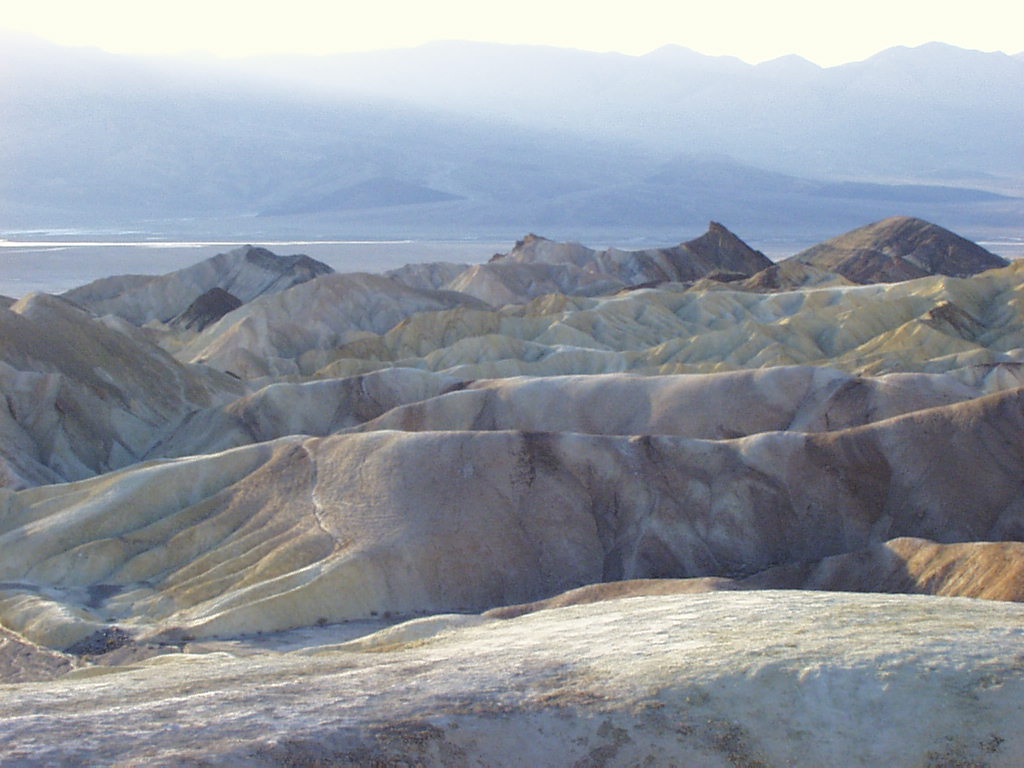
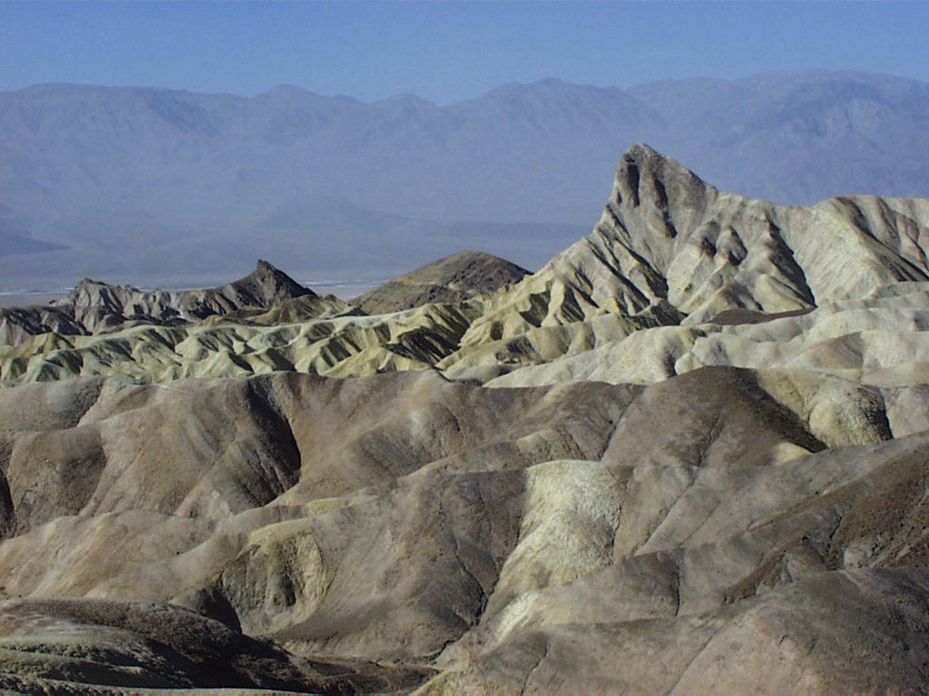
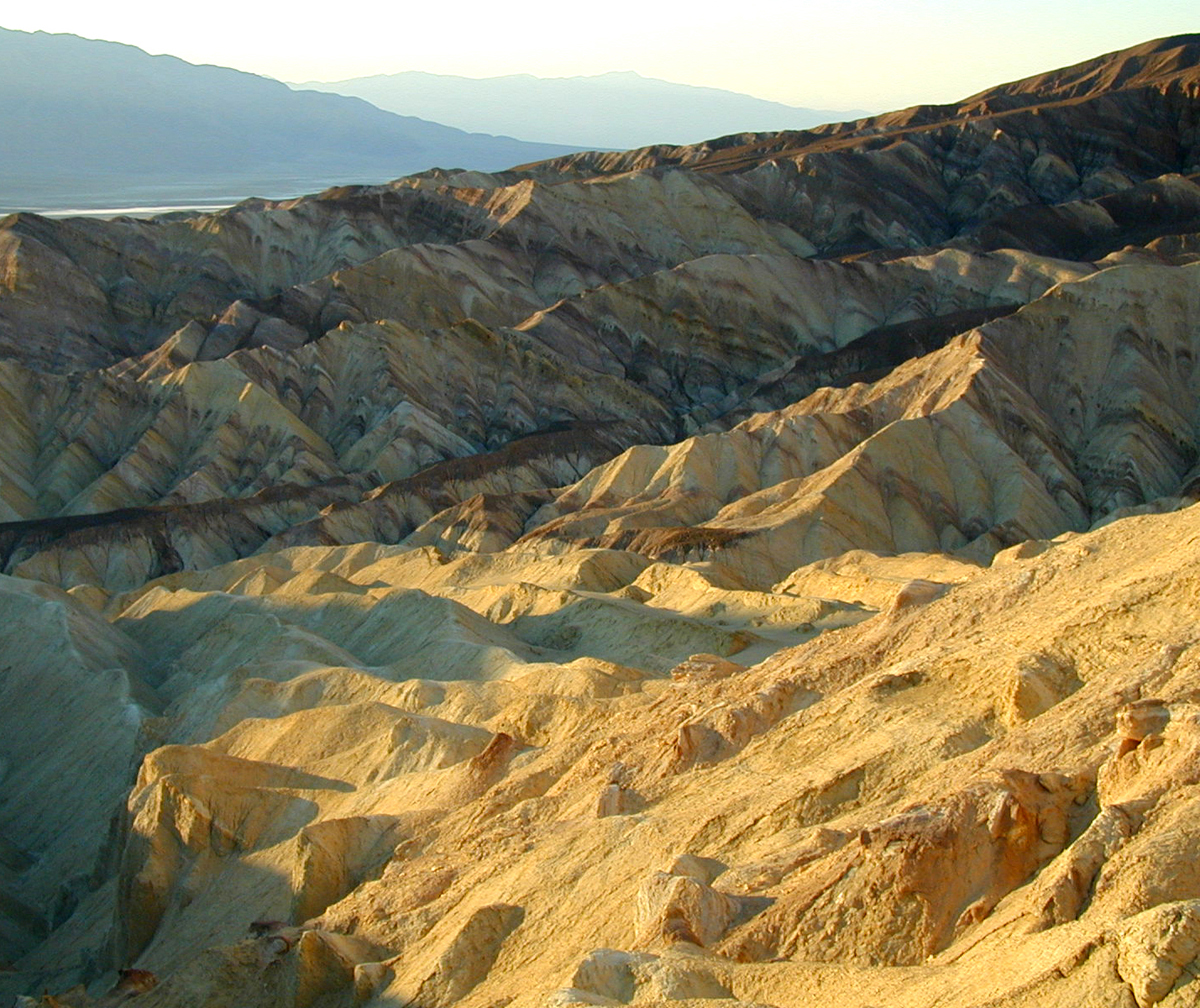
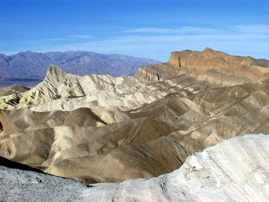
The erratic, wavy patterns of the Furnace Creek Badlands are visable from this point high above.
Public Domain. Photo from National Park Service
Download Original (1024 x 768 pixels, 150.8 KB)
-
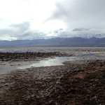
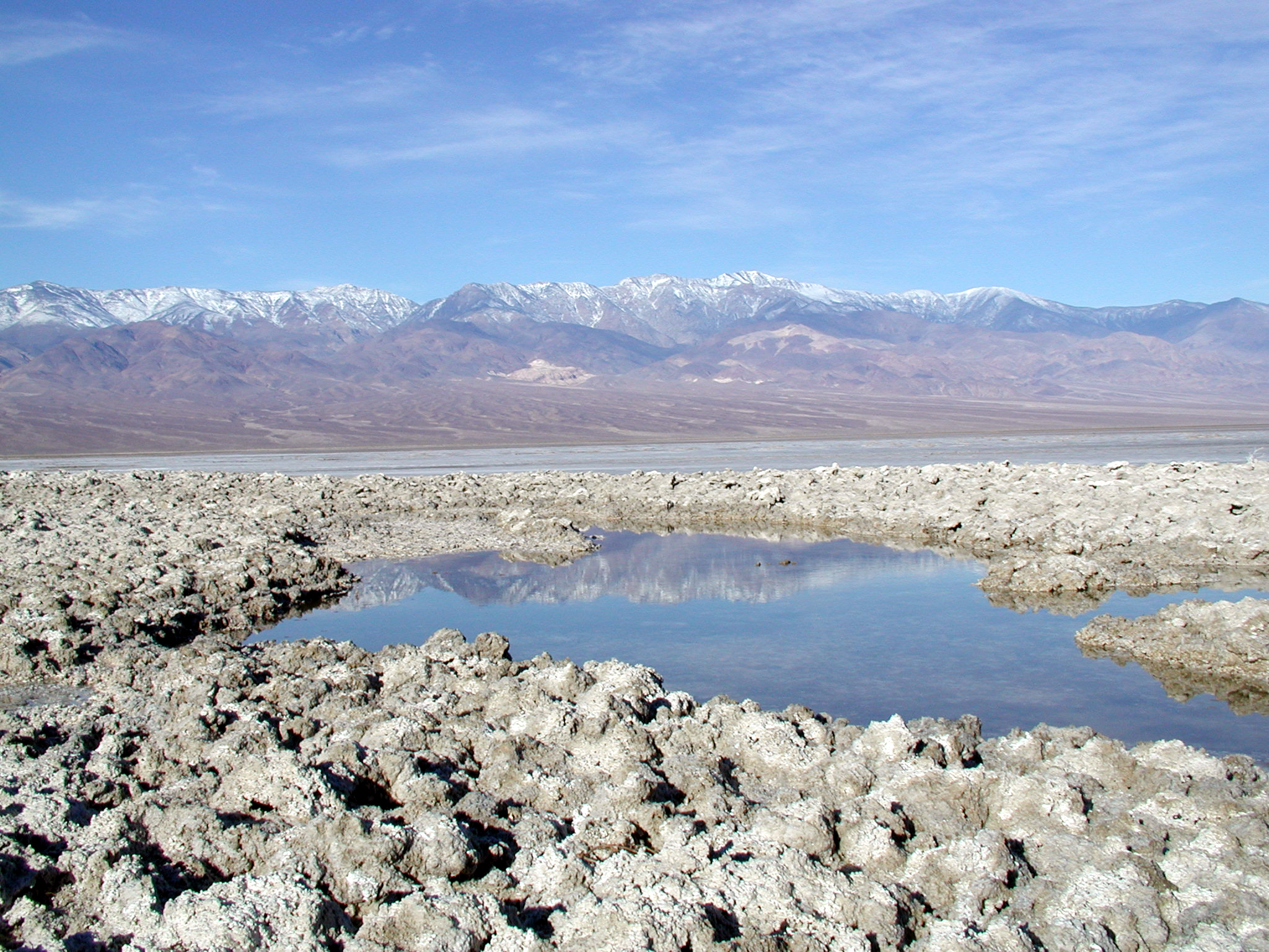
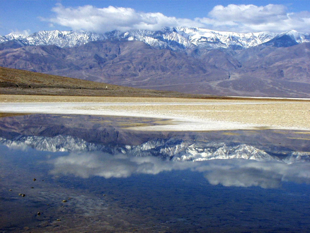
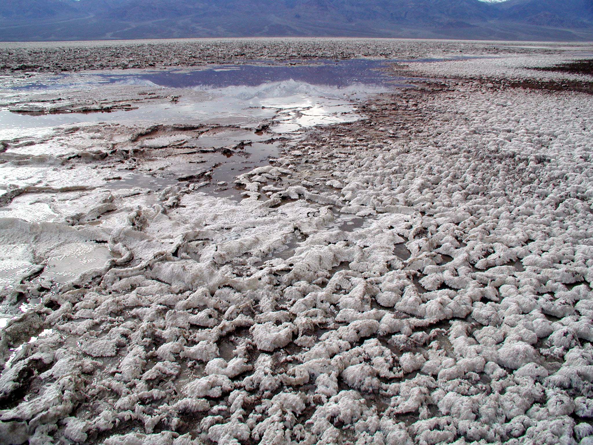
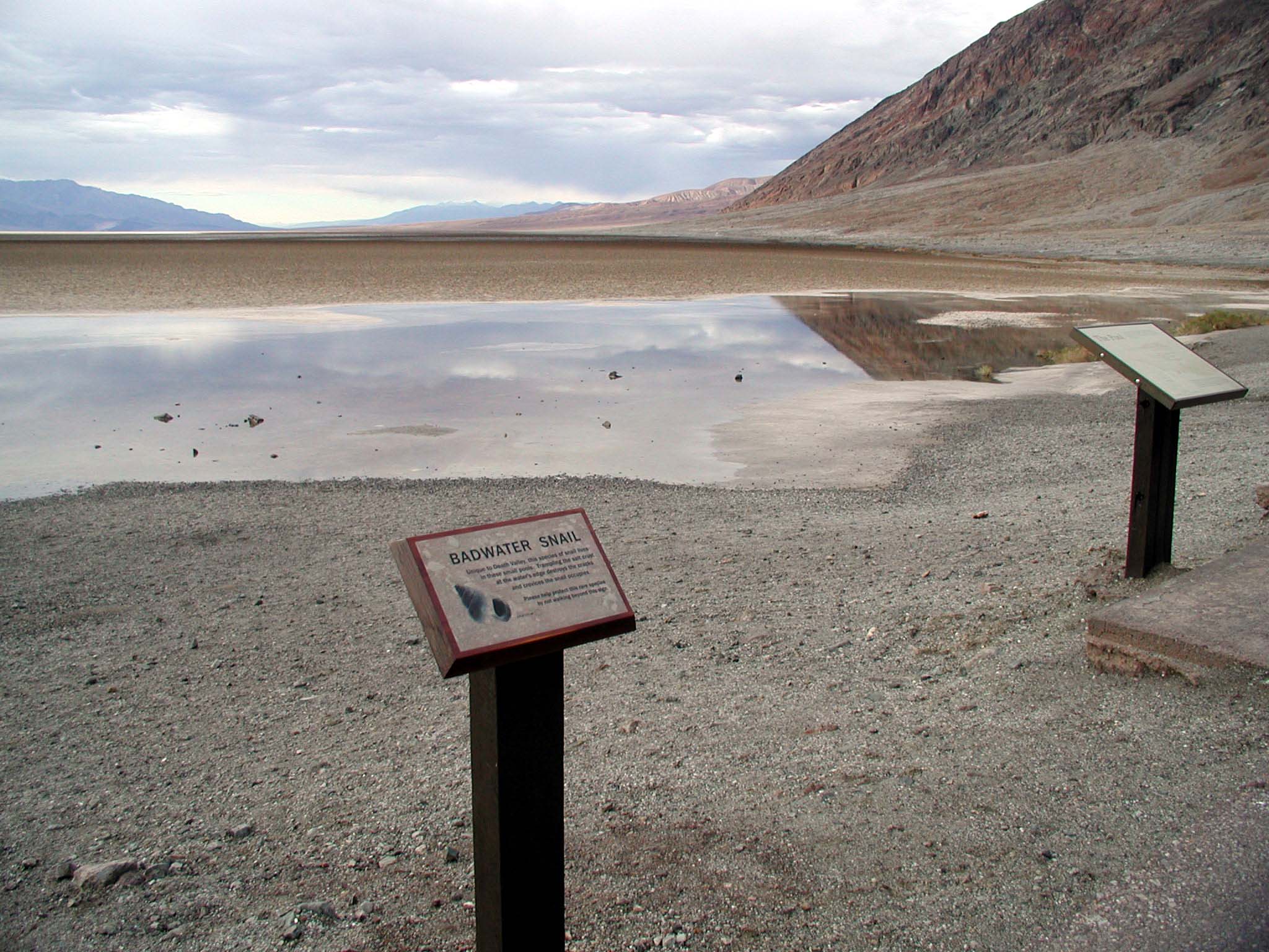
Small pools of water are located in Badwater, at an astounding 279 feet below sea level!
Public Domain. Photo from National Park Service
Download Original (1024 x 768 pixels, 160.4 KB)
-
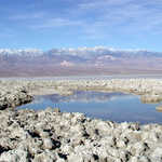
A small spring in the middle of the salt flats does little to provide relief on a scorching Death Valley day- the water isn't drinkable.
Public Domain. Photo from National Park Service
Download Original (2048 x 1536 pixels, 1948.5 MB)
-
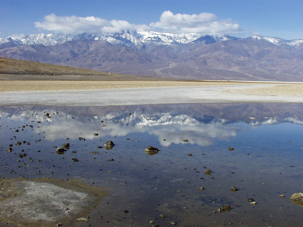
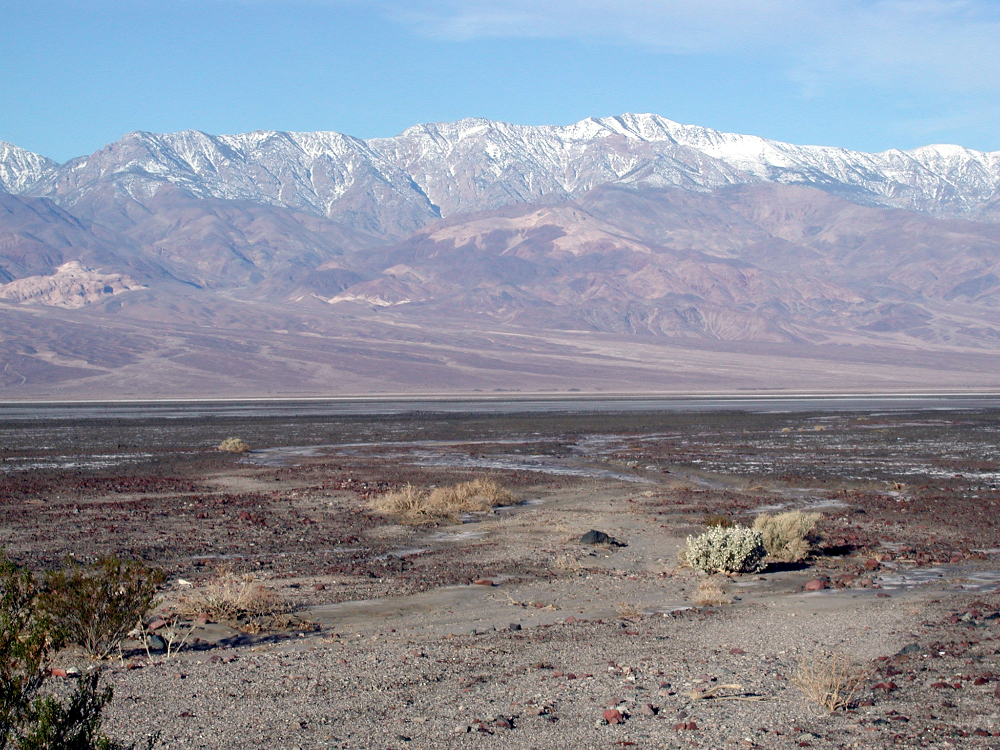
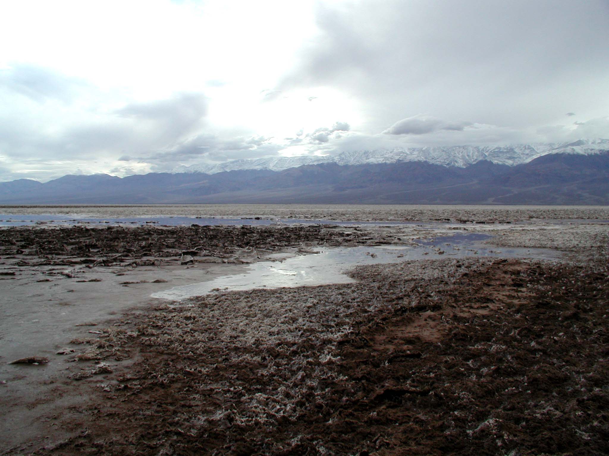
An astounding view of the Panamint Mountains can be witnessed from Badwater.
Public Domain. Photo from National Park Service
Download Original (2048 x 1536 pixels, 2093.5 MB)
-
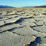
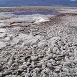
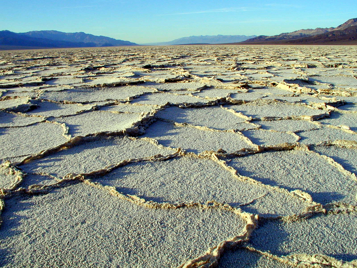
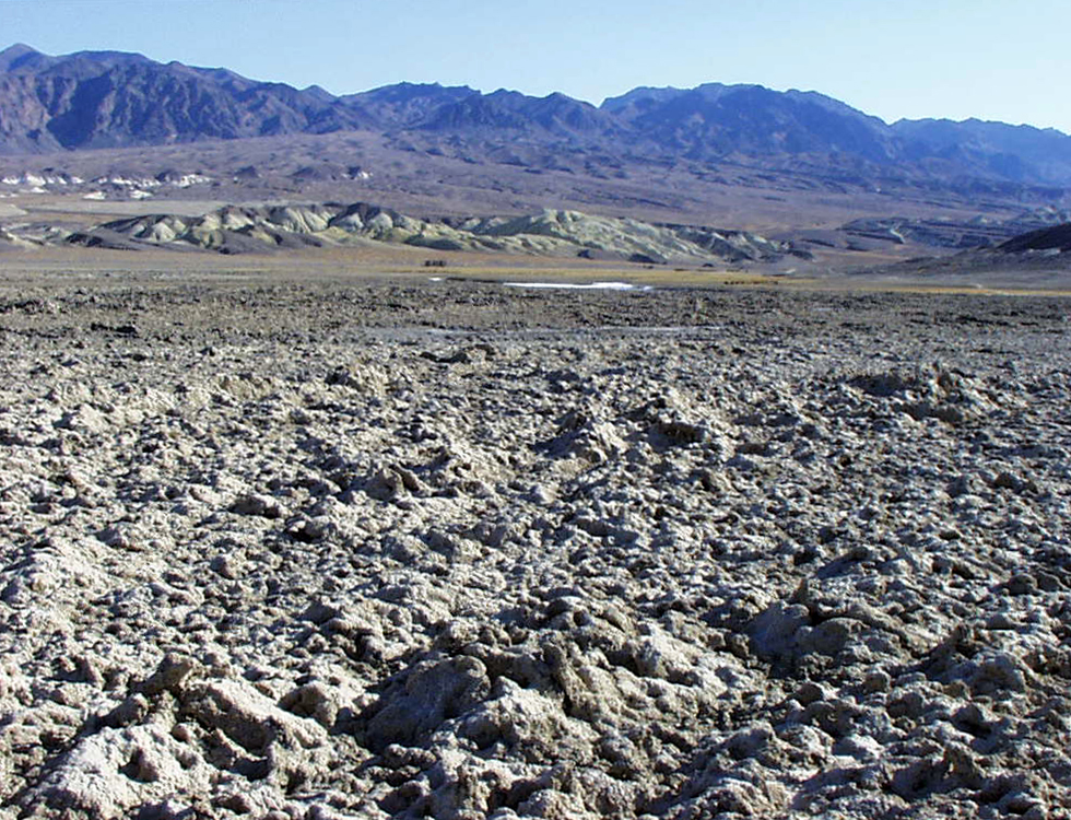
One of the most fascinating aspects of Death Valley are the geometric patterns and feeling of desolation you will find on the Salt Flats.
Public Domain. Photo from National Park Service
Download Original (1200 x 900 pixels, 1333.5 MB)
-
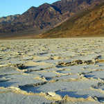
Composed of 1,000 foot thick chlorides and sediments, the Salt Flats are eerily desolate.
Public Domain. Photo from National Park Service
Download Original (900 x 1200 pixels, 1122.4 MB)
-
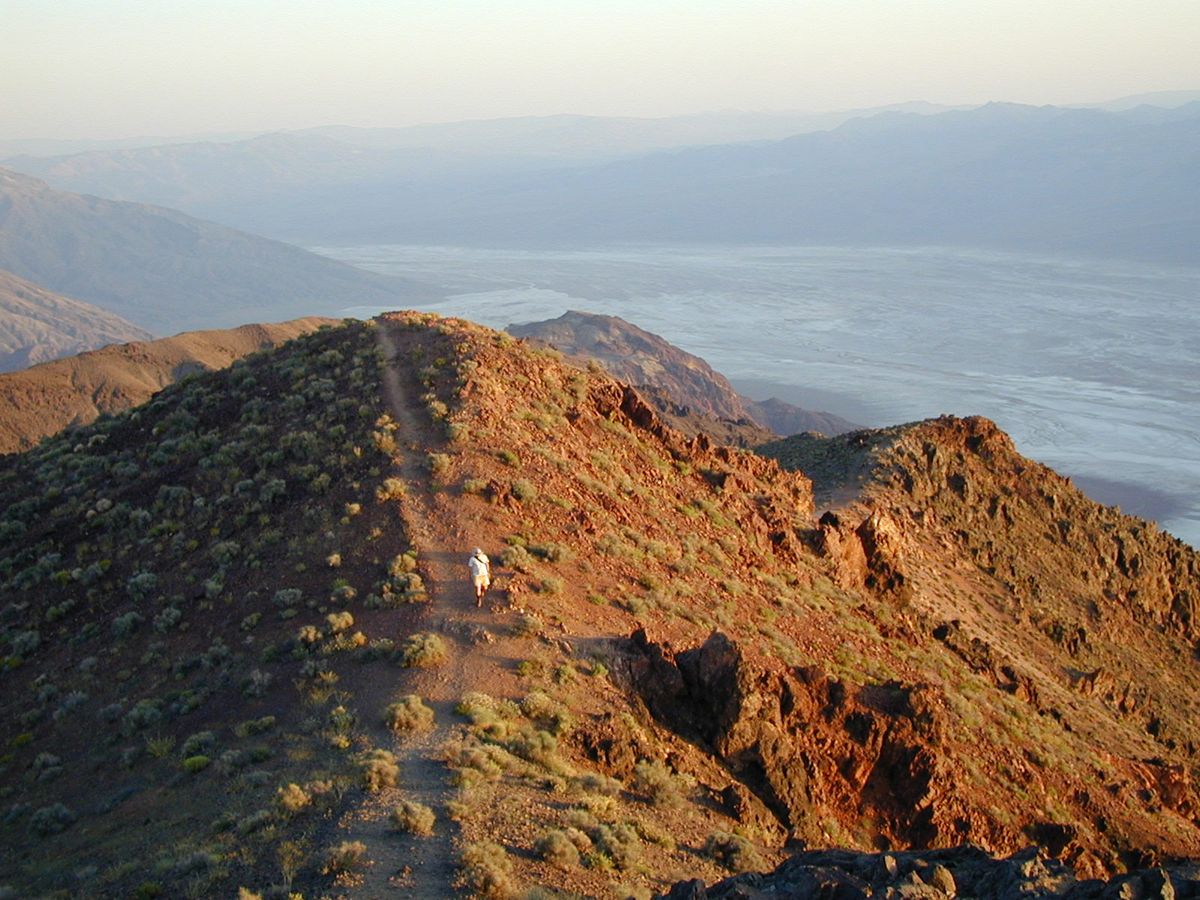
Dante's View in the Black Mountains is considered the most magnificent view of Death Valley.
Public Domain. Photo from National Park Service
Download Original (1200 x 900 pixels, 900.5 KB)
-
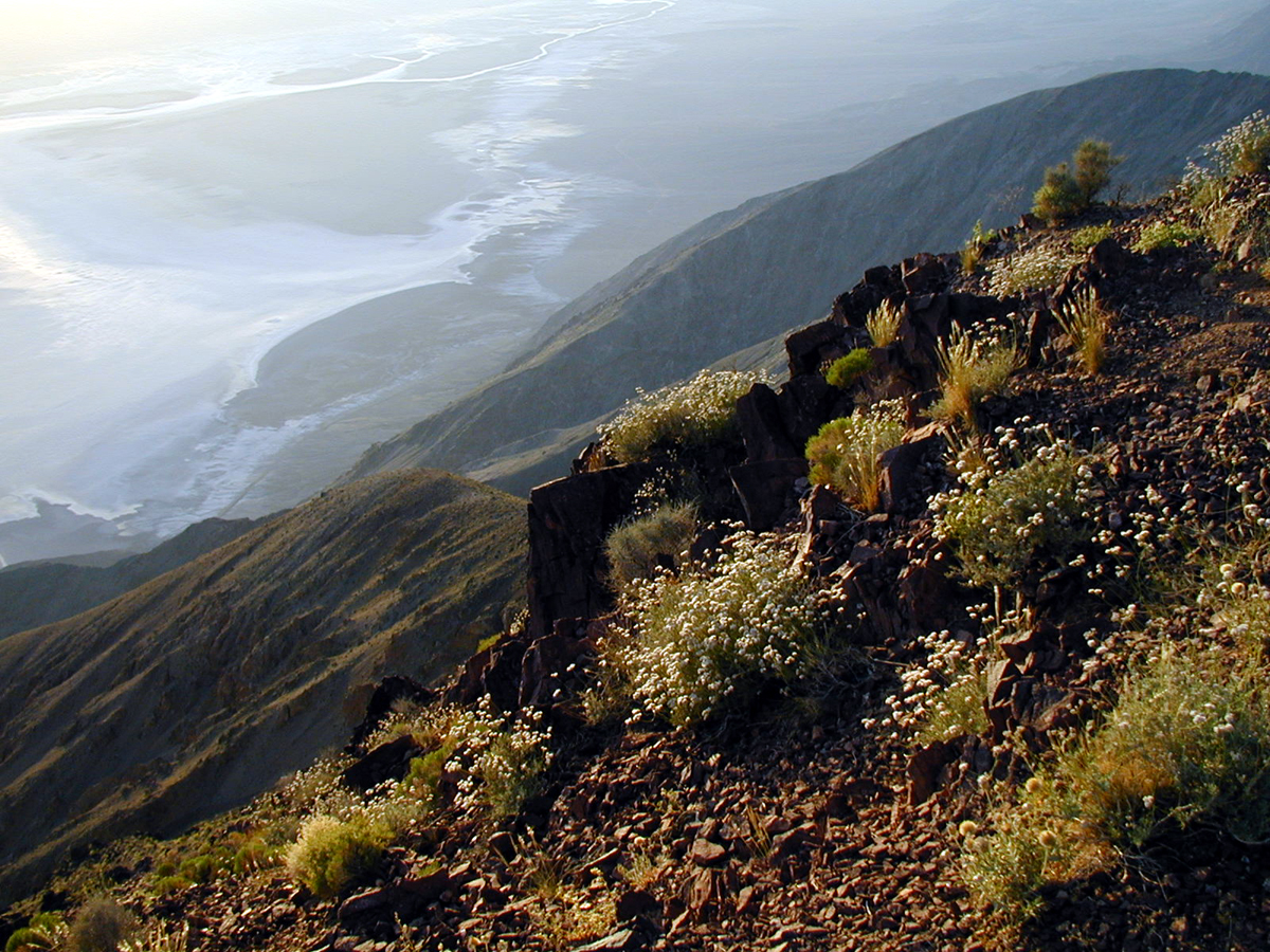
Badwater, 282 feet below sea-level, can be seen in its entirety from Dante's View.
Public Domain. Photo from National Park Service
Download Original (1200 x 900 pixels, 1043.2 MB)
-
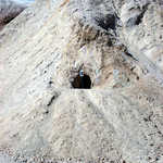
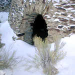
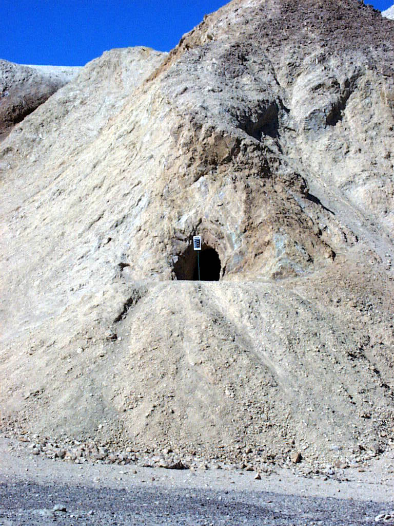
An old Borax prospect from the 1800s is still open today near Furnace Creek.
Public Domain. Photo from National Park Service
Download Original (768 x 1024 pixels, 211.5 KB)
-
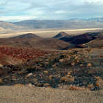
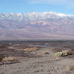
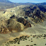
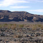
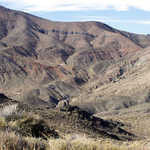
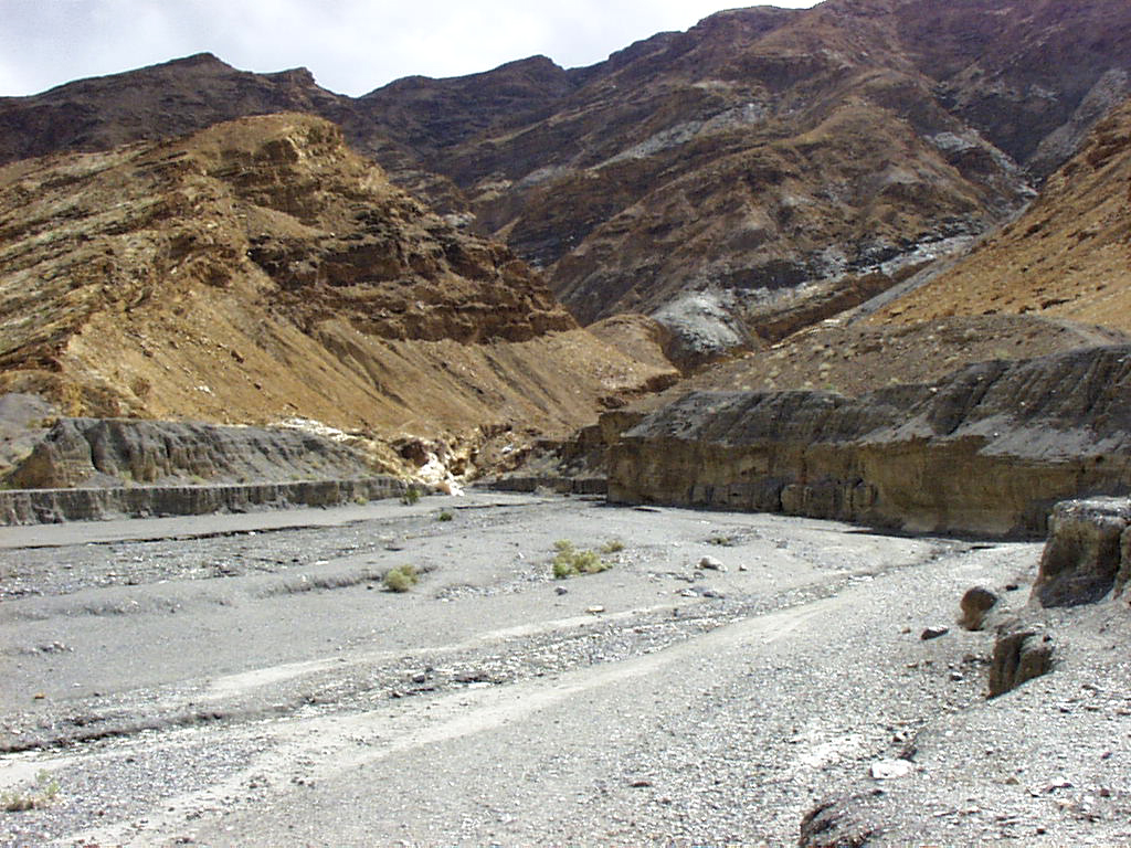
The parched earth and distant hills of Furnace Creek Wash make up some of the most fascinating landscapes of Death Valley.
Public Domain. Photo from National Park Service
Download Original (1024 x 768 pixels, 527.0 KB)
-
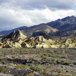
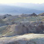
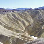
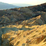
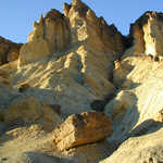
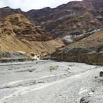
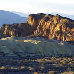
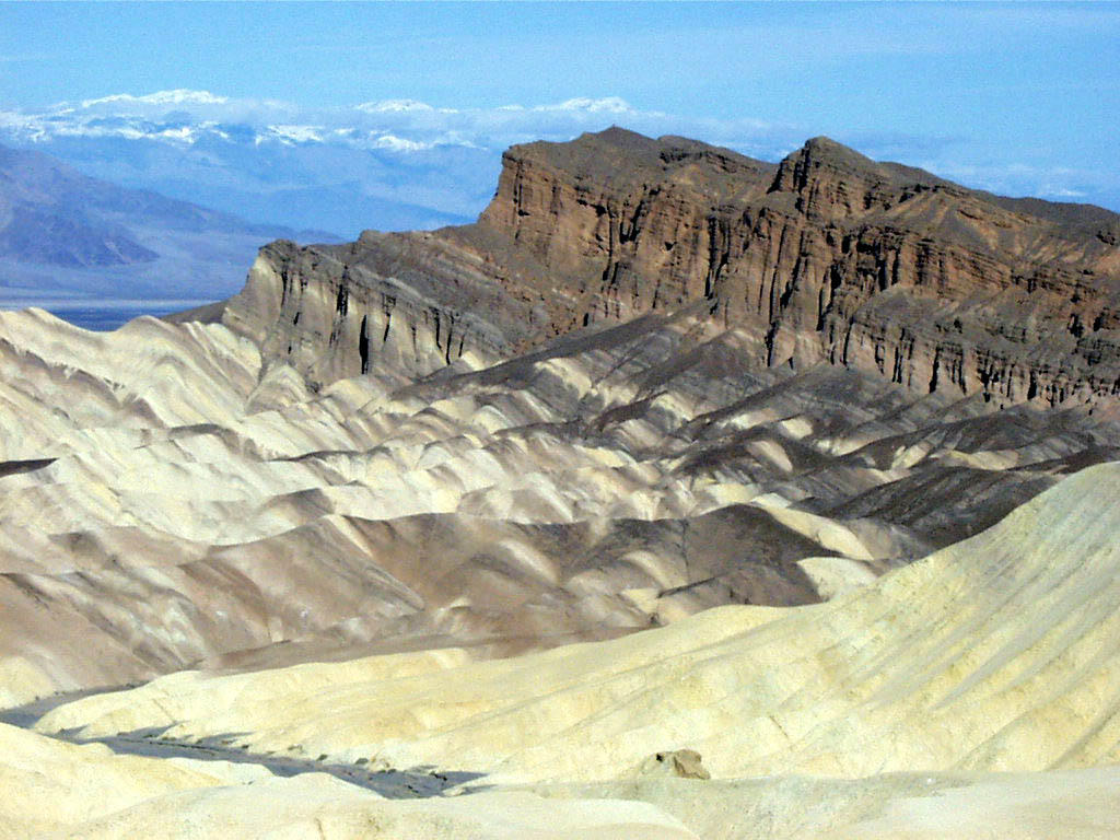
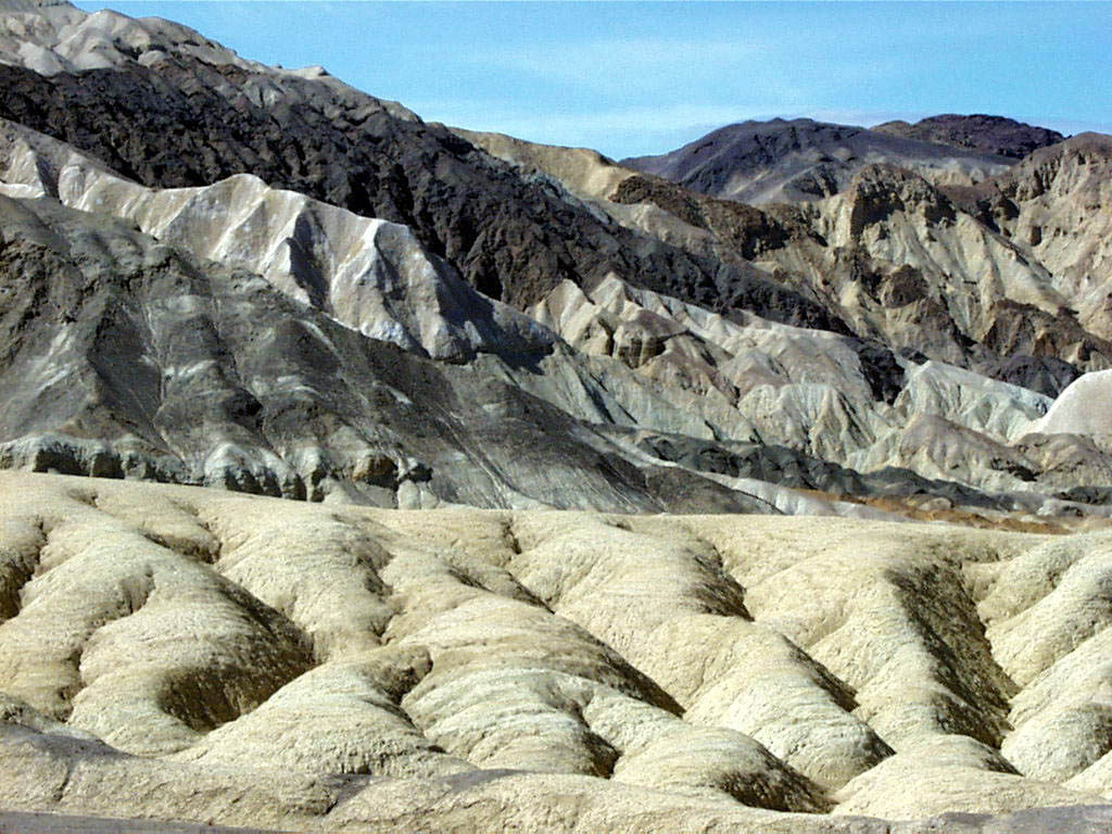
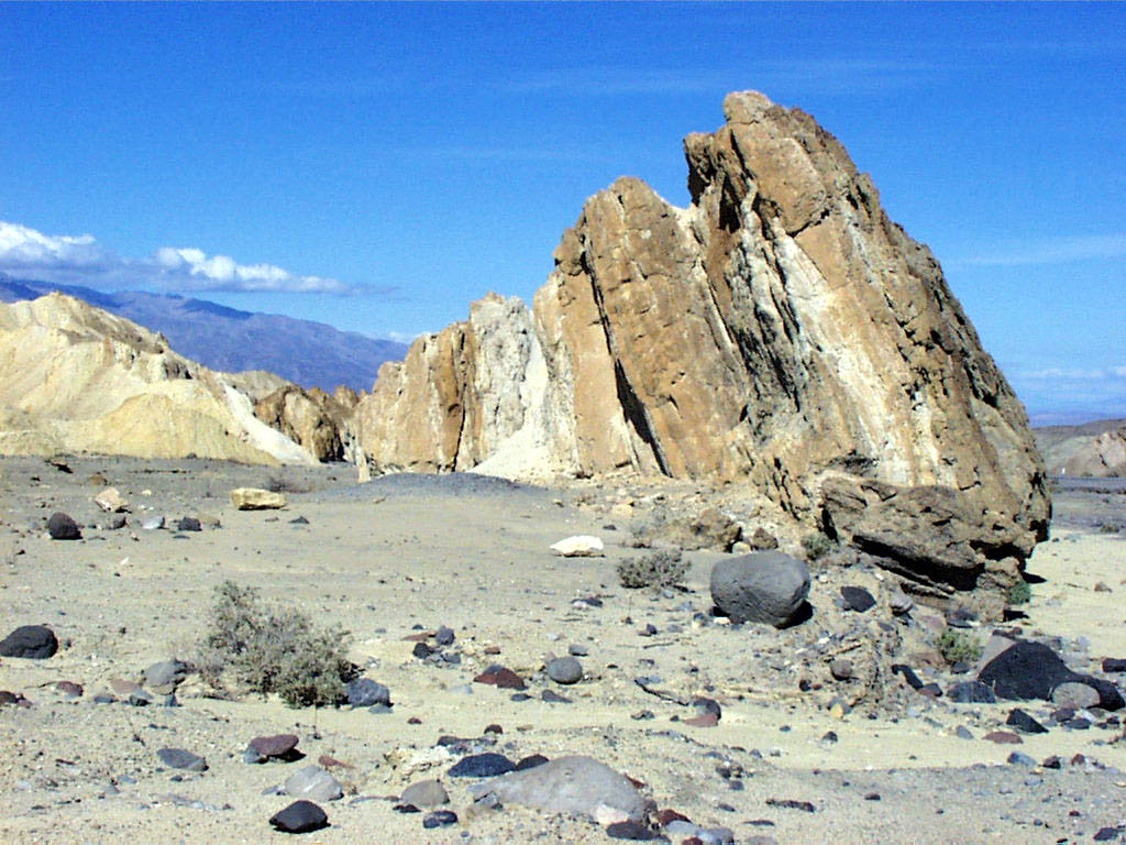
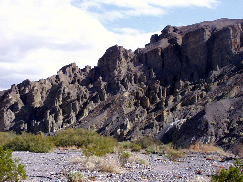
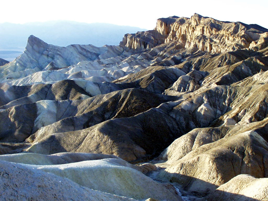
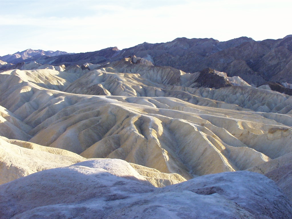
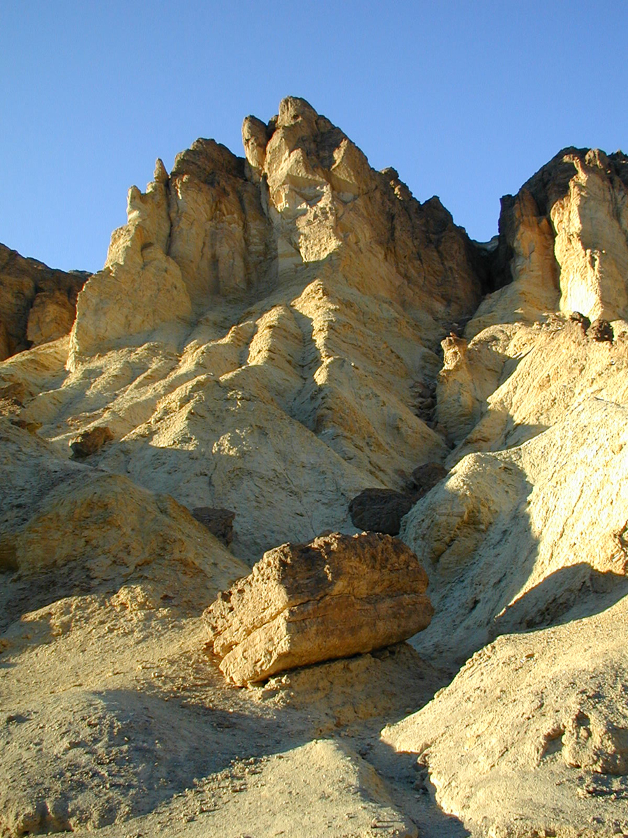
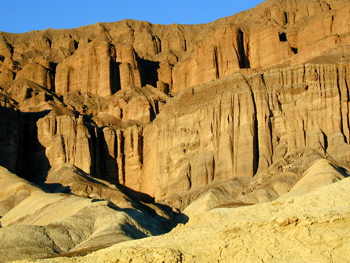
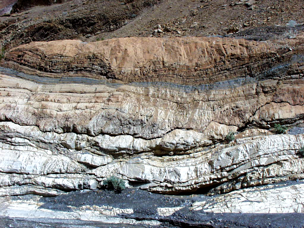
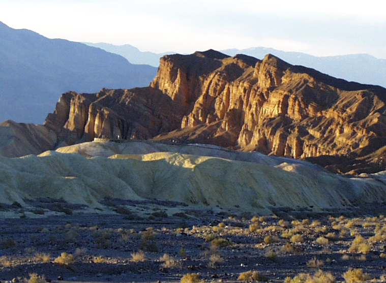
The Furnace Creek Badlands illustrate the geologic wonders of Death Valley nicely.
Public Domain. Photo from National Park Service
Download Original (1024 x 768 pixels, 187.6 KB)
-
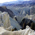
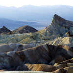
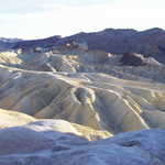
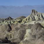
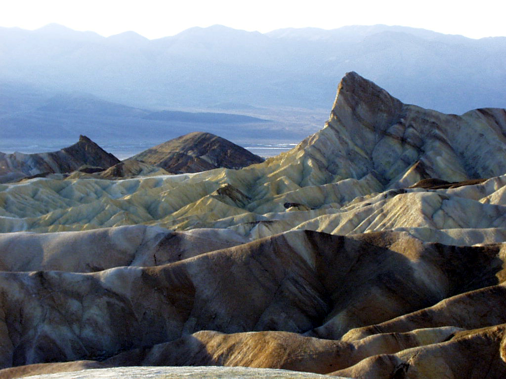
The peaks and points of the Furnace Creek Badlands are captured beautifully from this vantage point.
Public Domain. Photo from National Park Service
Download Original (1024 x 768 pixels, 428.3 KB)
-
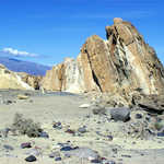
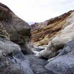
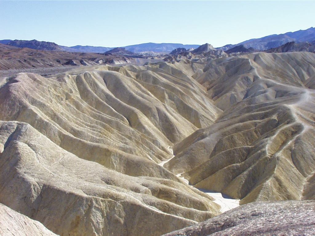
Scattered formations and rocks dot the Furnace Creek Badlands.
Public Domain. Photo from National Park Service
Download Original (1024 x 768 pixels, 175.5 KB)
-
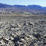
Wind-smoothed rocky terrain and bright blue sky create a spectacular backdrop for an unforgettable drive.
Public Domain. Photo from National Park Service
Download Original (1024 x 768 pixels, 164.8 KB)
-
The Furnace Creek Cut leads the eye into the distant mountains.
Public Domain. Photo from National Park Service
Download Original (1024 x 768 pixels, 190.3 KB)
-
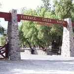
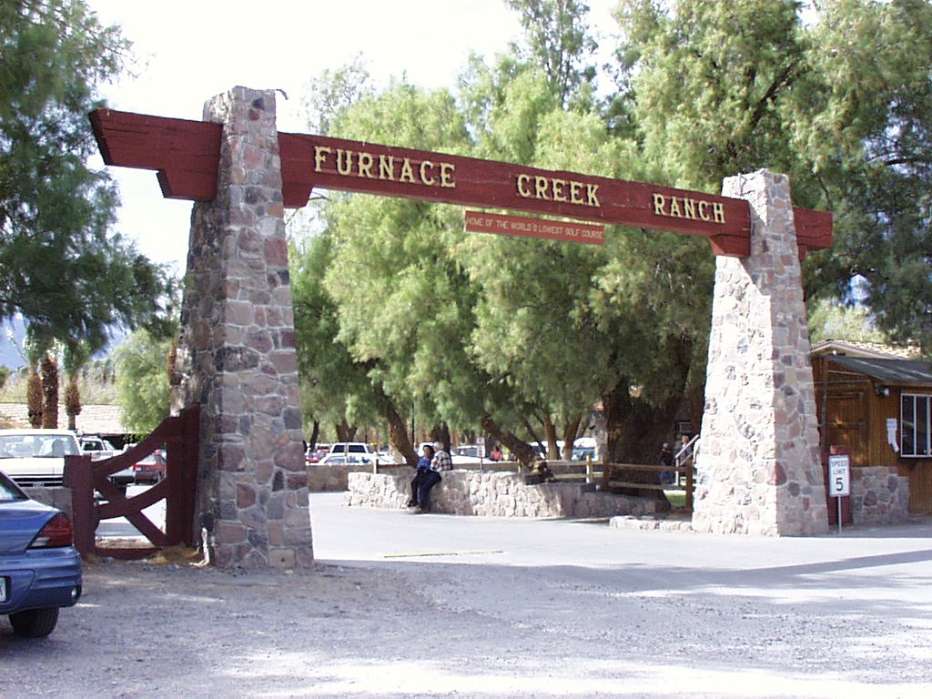
The entrance to the Furnace Creek Ranch invites visitors to the Furnace Creek area.
Public Domain. Photo from National Park Service
Download Original (1024 x 768 pixels, 178.3 KB)
-
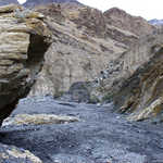
Dark, rough terrain makes up the landscape of Lower Furnace Creek Wash.
Public Domain. Photo from National Park Service
Download Original (1024 x 768 pixels, 179.4 KB)
-
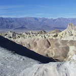
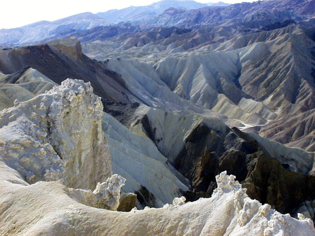
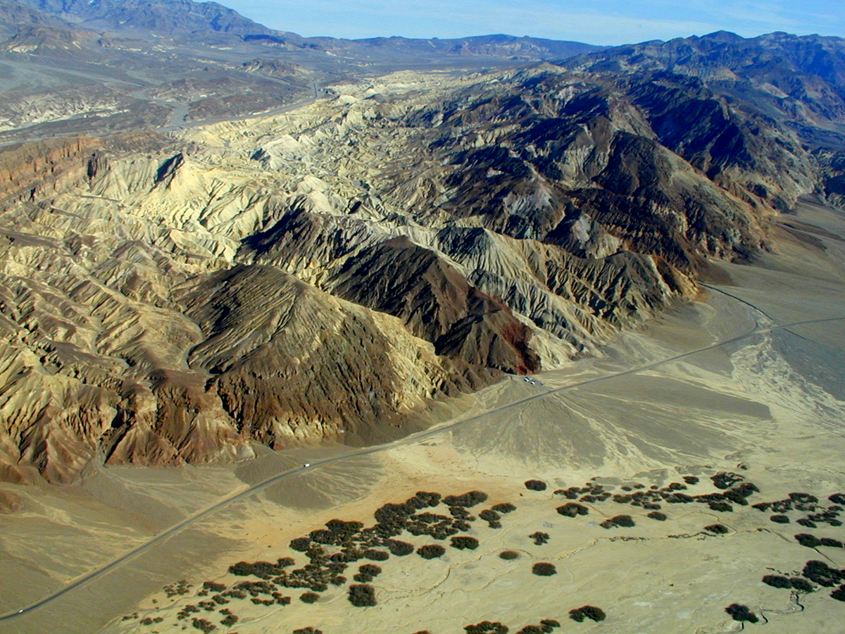
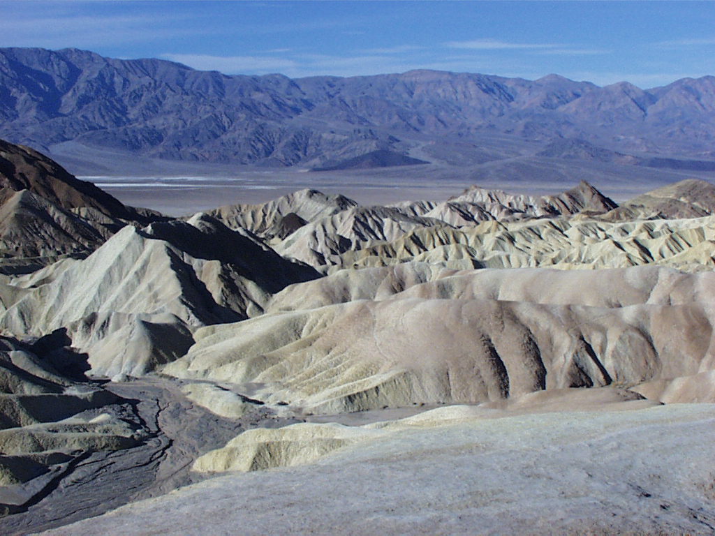
An aerial view of the Furnace Creek Badlands captures the shapes and patterns of the valley.
Public Domain. Photo from National Park Service
Download Original (1200 x 900 pixels, 1093.7 MB)
-
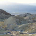
Fantastic views of Death Valley are seen from this vantage point high above Furnace Creek.
Public Domain. Photo from National Park Service
Download Original (1200 x 900 pixels, 828.7 KB)
-
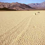
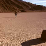
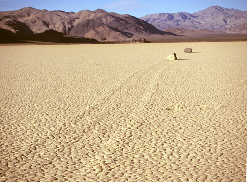
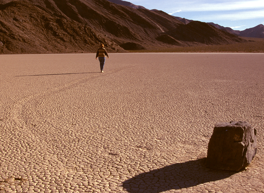
One of the apparent mysteries of Death Valley is that of the sliding rocks on Racetrack Playa. How the rocks slide across the completely level, dry surface is the subject of countless hypotheses.
Public Domain. Photo from National Park Service
Download Original (800 x 591 pixels, 428.4 KB)
-
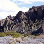
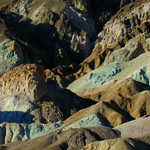
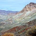
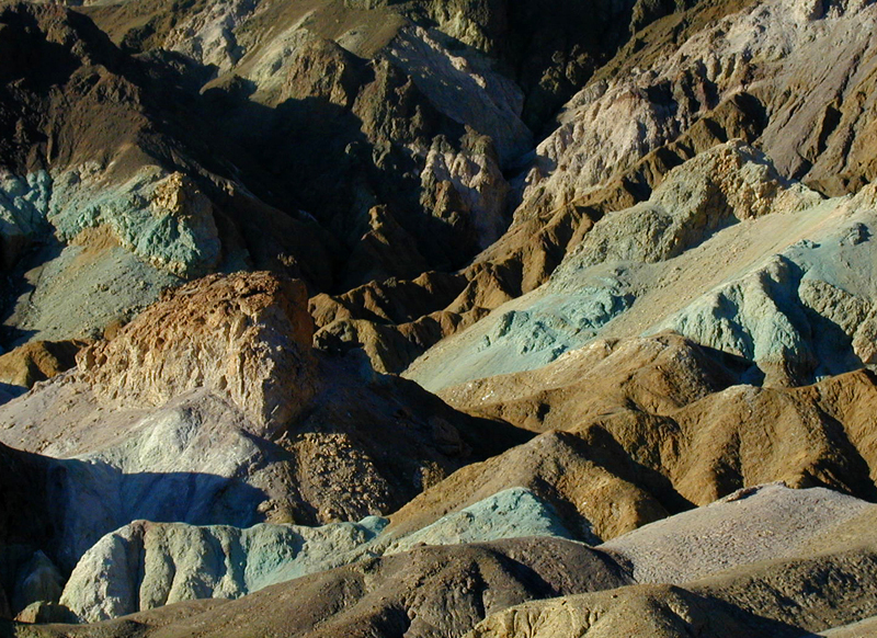
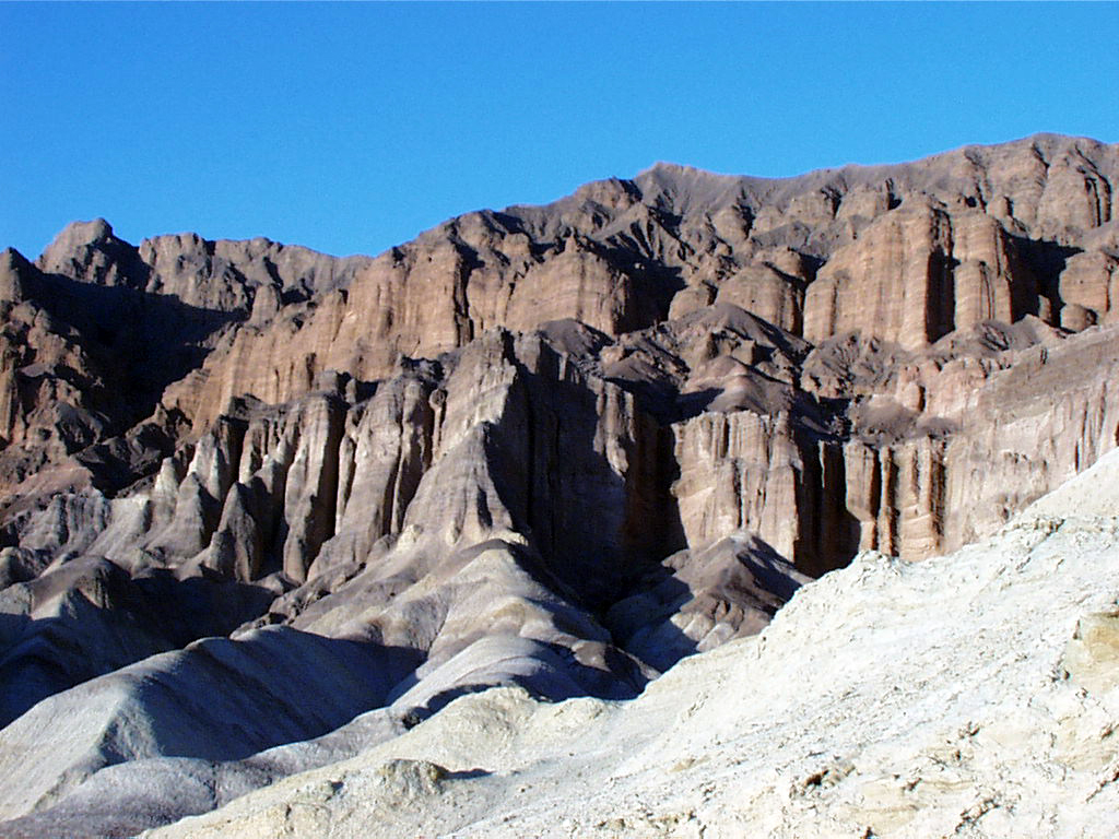
Chemically altered limestone and hematite provide eerily beautiful landscapes in the Black Mountains.
Public Domain. Photo from National Park Service
Download Original (900 x 675 pixels, 236.7 KB)
-
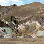
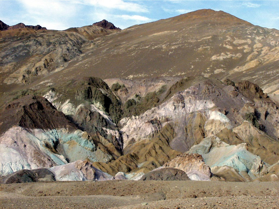
Artist's Drive is shaded in colors created by lime deposits and chemicals in the soil. Here, greens and blues tint the Black Mountains.
Public Domain. Photo from National Park Service
Download Original (800 x 582 pixels, 569.9 KB)
-
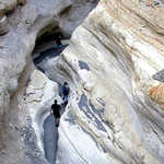
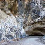
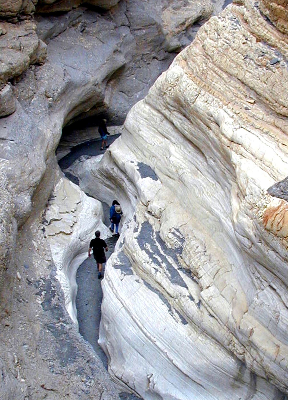
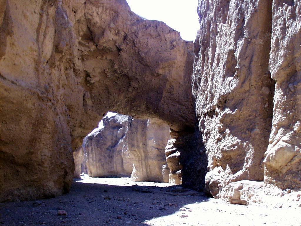
A hiker winds through the canyon narrows.
Public Domain. Photo from National Park Service
Download Original (1200 x 1667 pixels, 1247.0 MB)
-
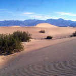
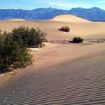
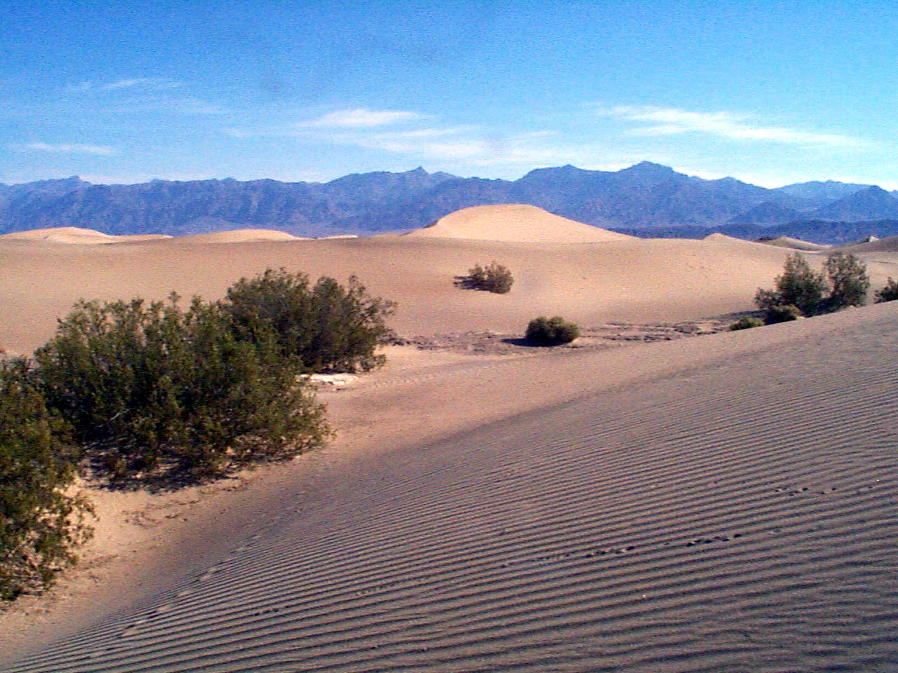
The wind changes the surface of the sand dunes each day.
Public Domain. Photo from National Park Service
Download Original (1280 x 960 pixels, 492.4 KB)
-
Layers and layers of rock lead to the distant Red Cathedral, shown on the right.
Public Domain. Photo from National Park Service
Download Original (1024 x 768 pixels, 564.8 KB)
-
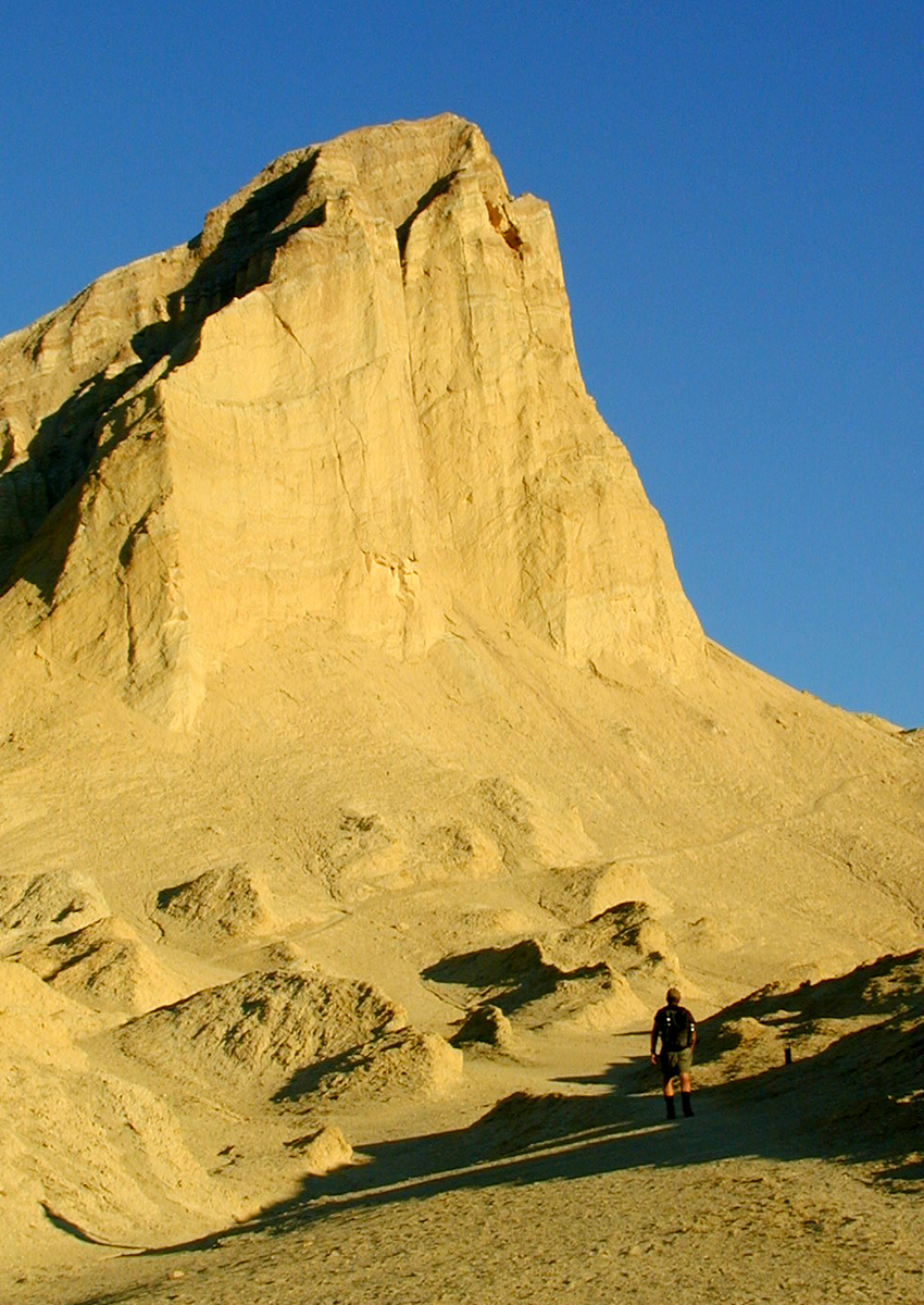
Manly Beacon was named after two men named Manly and Rogers who hiked 500 miles to Los Angeles and back to get help for stranded emigrants in Death Valley.
Public Domain. Photo from National Park Service
Download Original (1024 x 768 pixels, 431.6 KB)
-
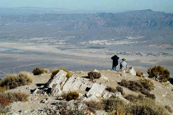
Visitors to Death Valley take in the impressive views from Aguereberry Point.
Public Domain. Photo from National Park Service
Download Original (600 x 400 pixels, 84.6 KB)
-
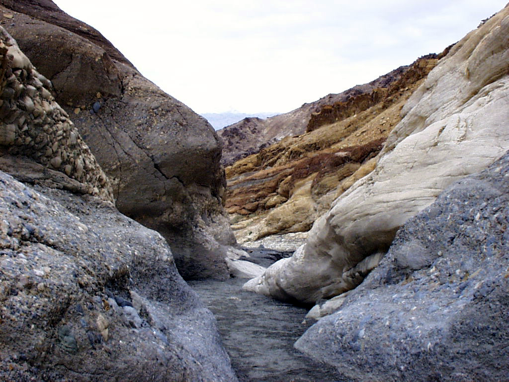
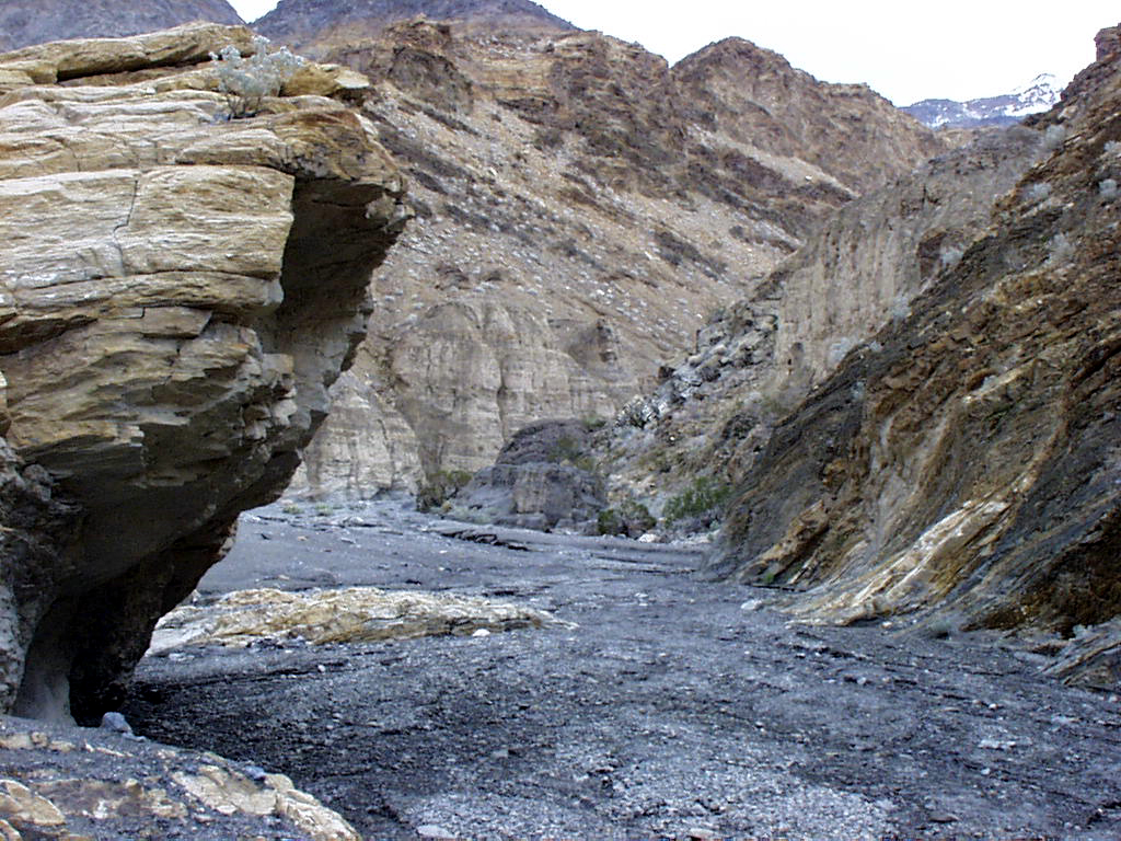
View the rugged geology of Gower Gulch from many vantage points above the Badlands.
Public Domain. Photo from National Park Service
Download Original (1024 x 768 pixels, 164.6 KB)
-
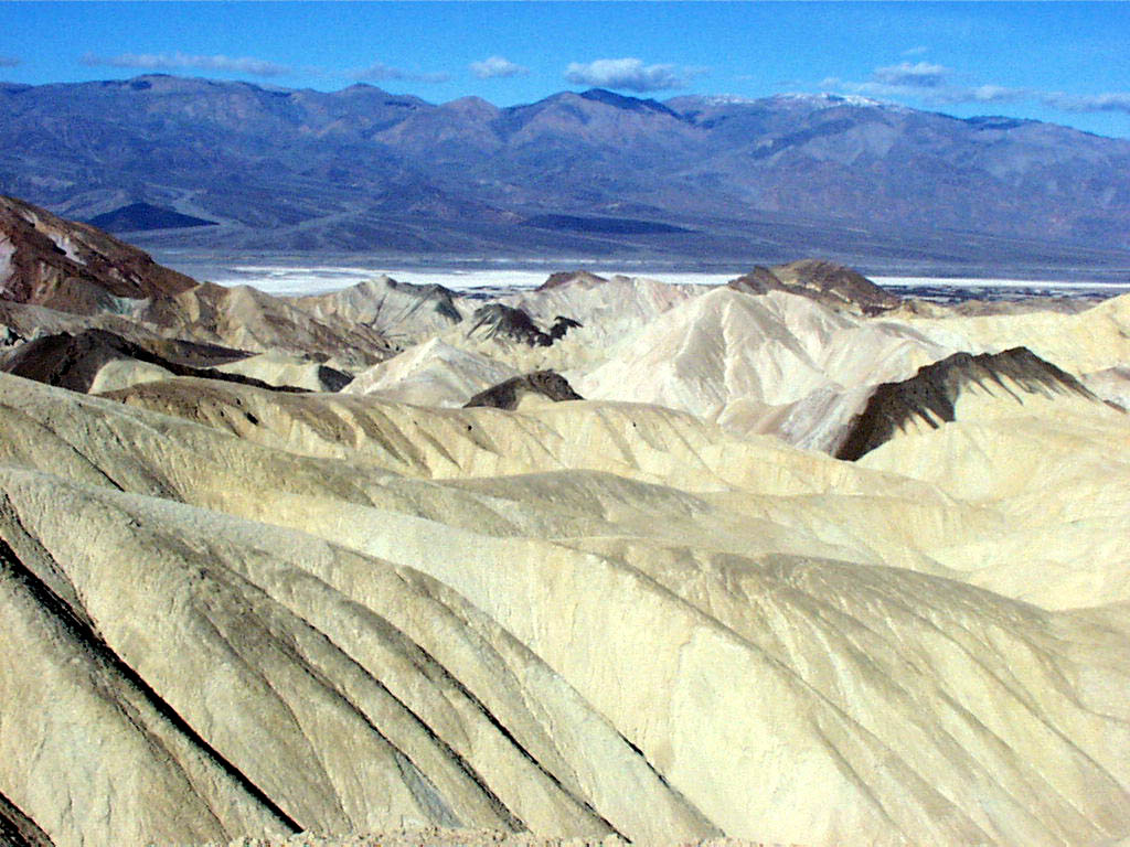
Late afternoon creeps over the pastel-colored Badlands of Death Valley.
Public Domain. Photo from National Park Service
Download Original (1024 x 768 pixels, 127.3 KB)
-
Colorful rock formations shaped by wind and weather create a subdued landscape in the Badlands in Death Valley.
Public Domain. Photo from National Park Service
Download Original (1024 x 768 pixels, 153.9 KB)
-
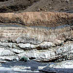
Badlands Wash is composed of layers and patterns of weather-beaten rock.
Public Domain. Photo from National Park Service
Download Original (1024 x 768 pixels, 508.5 KB)
-
Late afternoon casts sunrays over the muted yellows and oranges of Gower Gulch.
Public Domain. Photo from National Park Service
Download Original (1024 x 768 pixels, 120.9 KB)
-
Named after a legendary gold seeker William Manly, who helped his party survive being lost in Death Valley, Manly Beacon is located at Golden Canyon.
Public Domain. Photo from National Park Service
Download Original (1024 x 768 pixels, 535.1 KB)
-
A lovely view of Manly Beacon can be seen from the Badlands.
Public Domain. Photo from National Park Service
Download Original (1024 x 768 pixels, 166.5 KB)
-
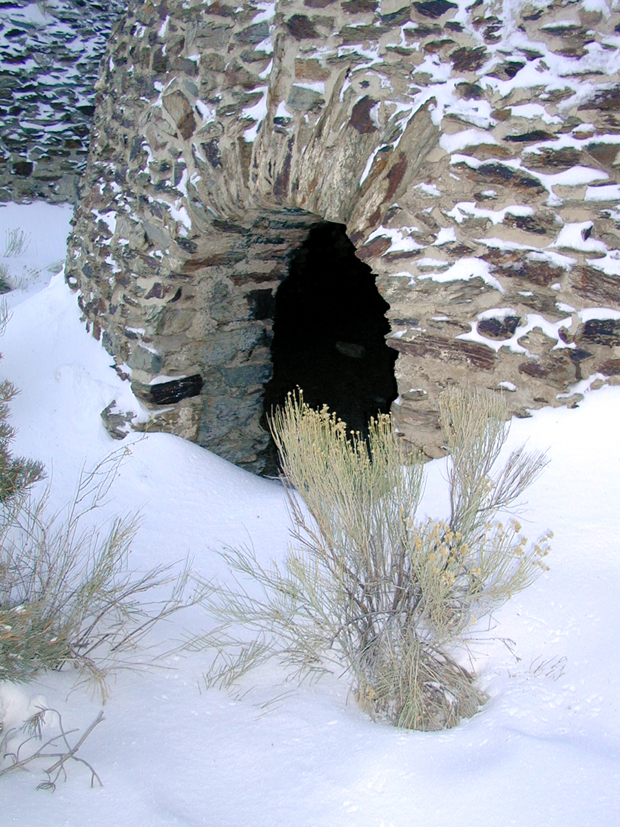
An old charcoal kiln from the silver mining era of Death Valley still stands despite harsh weather and wind.
Public Domain. Photo from National Park Service
Download Original (900 x 1200 pixels, 985.1 KB)
-
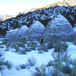
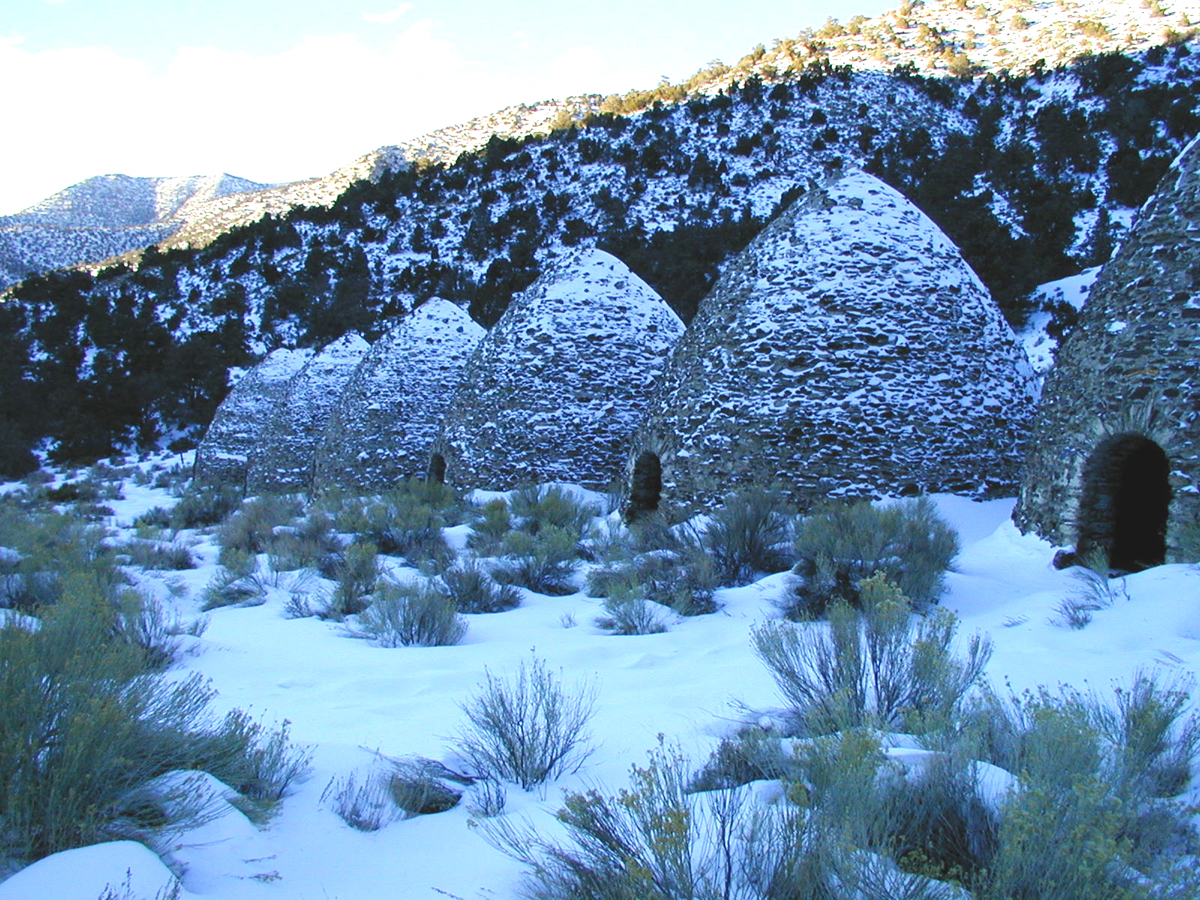
Snow dusts a line of charcoal kilns in Death Valley. During silver and Borax mining in the 1800s, these kilns were used to turn pinon pine to coal to run the smelters at the Modoc Mine.
Public Domain. Photo from National Park Service
Download Original (1200 x 900 pixels, 1158.0 MB)
-
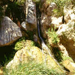
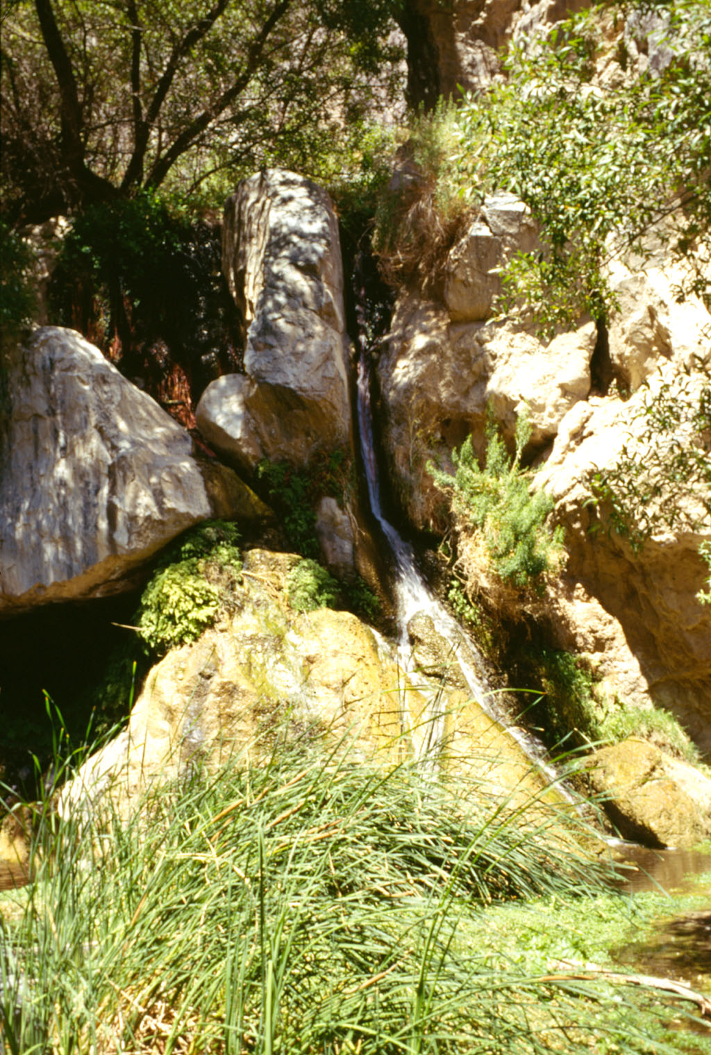
Astoundingly lush and green compared to other Death Valley landscapes, the 30 foot Darwin Falls in the Panamint region is one stop travelers must take.
Public Domain. Photo from National Park Service
Download Original (1024 x 1520 pixels, 423.7 KB)
-
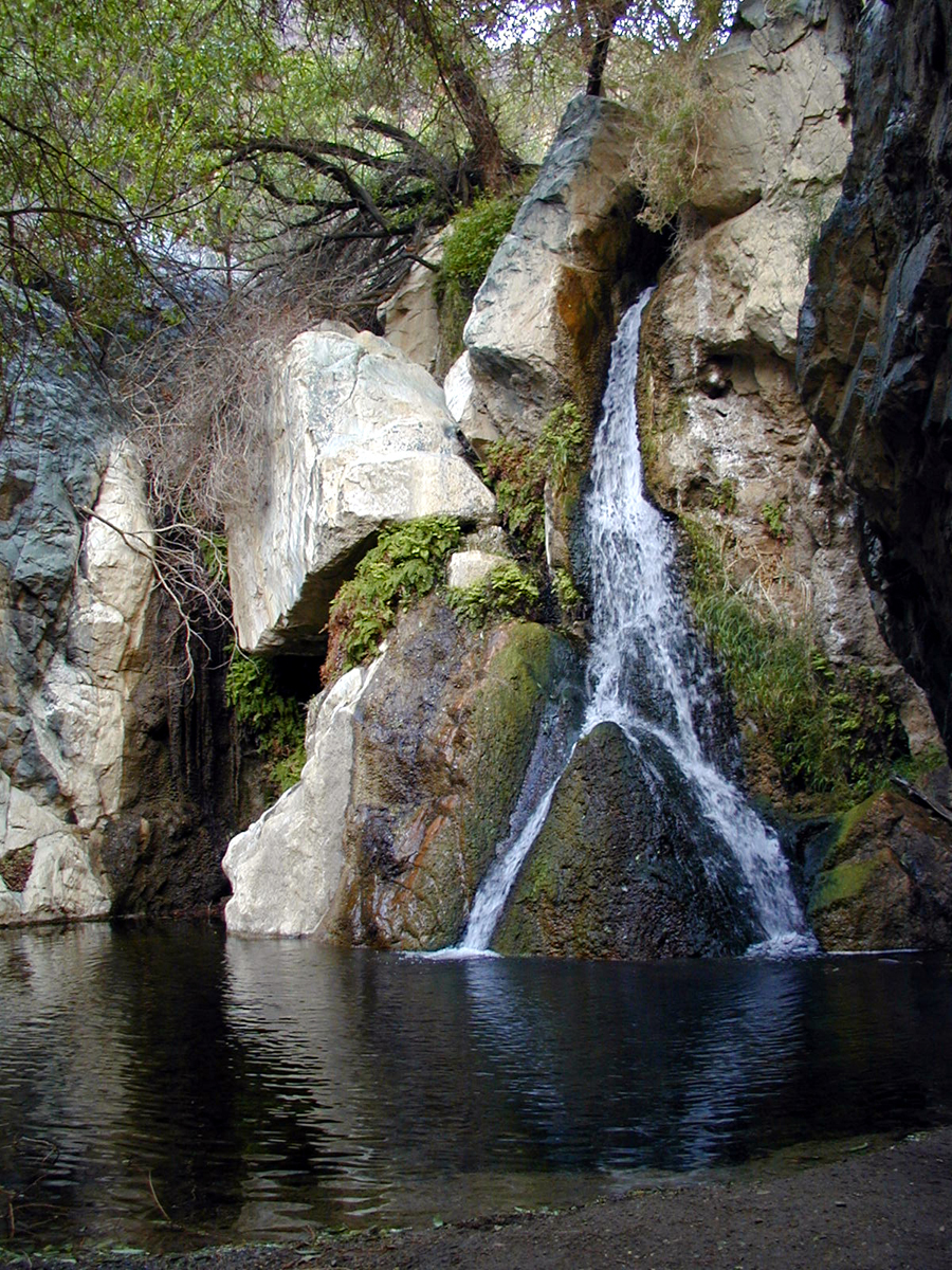
A mere half-hour hike from the road, Darwin Falls is a surprise to travelers who have seen the rest of the dry Death Valley landscape.
Public Domain. Photo from National Park Service
Download Original (900 x 1200 pixels, 1132.8 MB)
-
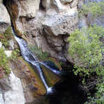
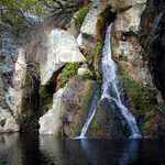
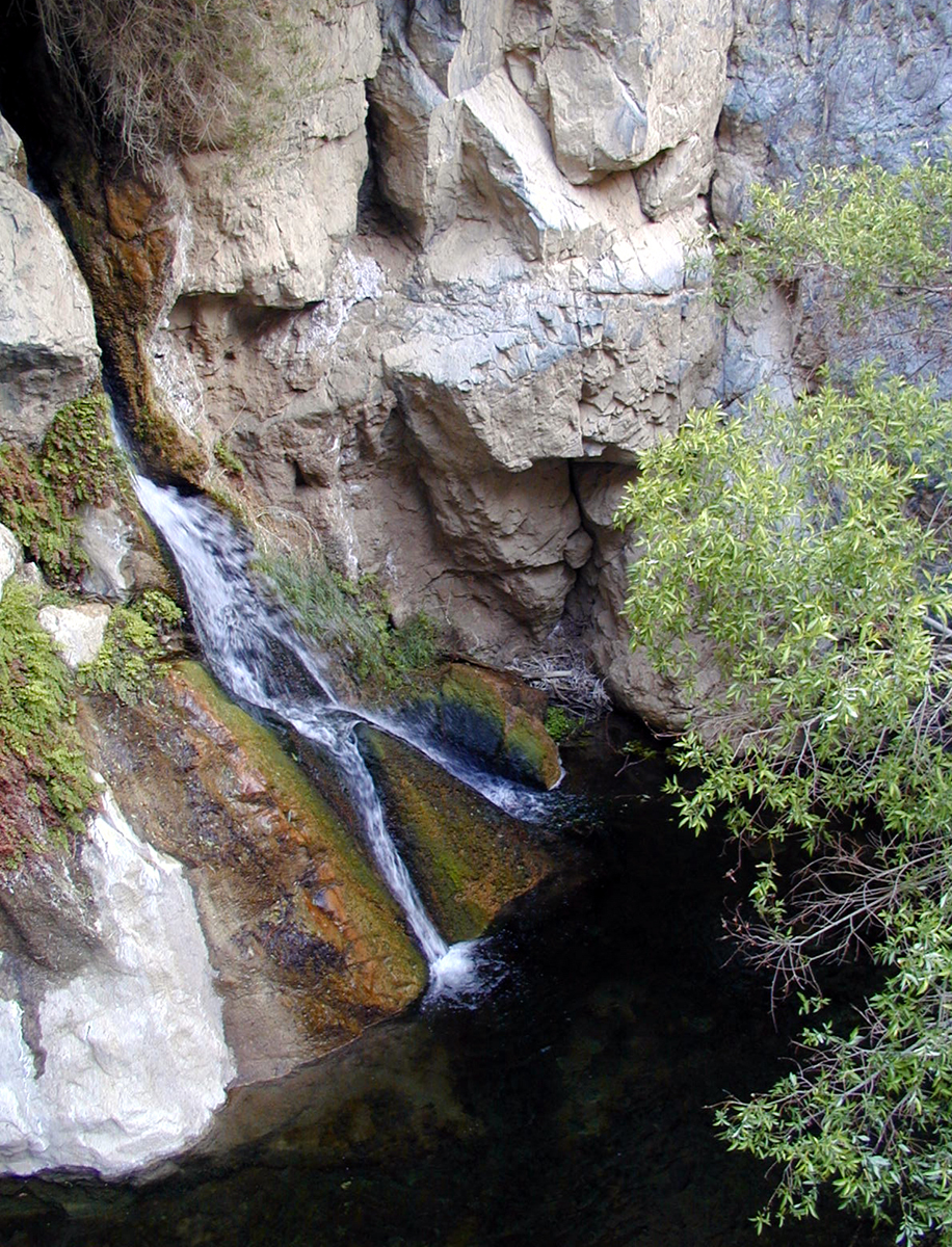
Darwin Falls cascades over craggy rocks year-round.
Public Domain. Photo from National Park Service
Download Original (916 x 1200 pixels, 1151.3 MB)
-
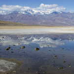
An ancient lakeshore is located near Mormon Point in Badwater.
Public Domain. Photo from National Park Service
Download Original (2048 x 1536 pixels, 2064.4 MB)
-
Visitors may be surprised to find water in Death Valley, but don't drink it! The taste lives up to its name in Badwater!
Public Domain. Photo from National Park Service
Download Original (1024 x 768 pixels, 209.2 KB)
-
The sun begins to light up Golden Canyon, bringing out the rich tones of the rock.
Public Domain. Photo from National Park Service
Download Original (1200 x 1008 pixels, 1088.2 MB)
-
Best when viewed in the afternoon, Golden Canyon's namesake is realized when its golden hues are brought out by sunshine.
Public Domain. Photo from National Park Service
Download Original (900 x 1200 pixels, 1035.9 MB)
-
The gold-hued Manly Beacon contrasts brilliantly with the blue sky at Golden Canyon.
Public Domain. Photo from National Park Service
Download Original (850 x 1200 pixels, 902.4 KB)
-
400-foot high Red Cathedral in Golden Canyon is stained red from iron-oxide and contrasts fantastically with the yellow-hued Golden Canyon below and blue skies above.
Public Domain. Photo from National Park Service
Download Original (1200 x 900 pixels, 1154.7 MB)
-
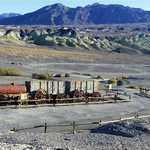
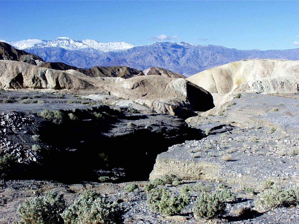
These vast salt flats, called Cottonball Marsh, make up the view from the Harmony Borax Mines.
Public Domain. Photo from National Park Service
Download Original (980 x 750 pixels, 762.5 KB)
-
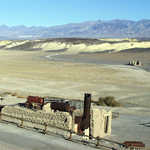
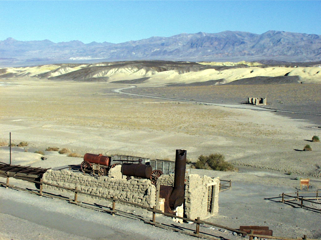
Once the life blood of the Death Valley region, Borax mining was highly dependent on the Harmony Borax Works, which was made up of several industrial buildings.
Public Domain. Photo from National Park Service
Download Original (1024 x 768 pixels, 534.6 KB)
-
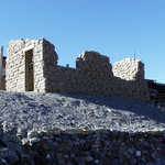
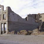
The ruins of Harmony Borax tell the story of the Borax mining industry which makes up so much of the history of Death Valley.
Public Domain. Photo from National Park Service
Download Original (1024 x 768 pixels, 513.8 KB)
-
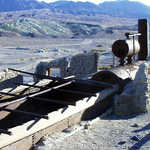
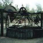
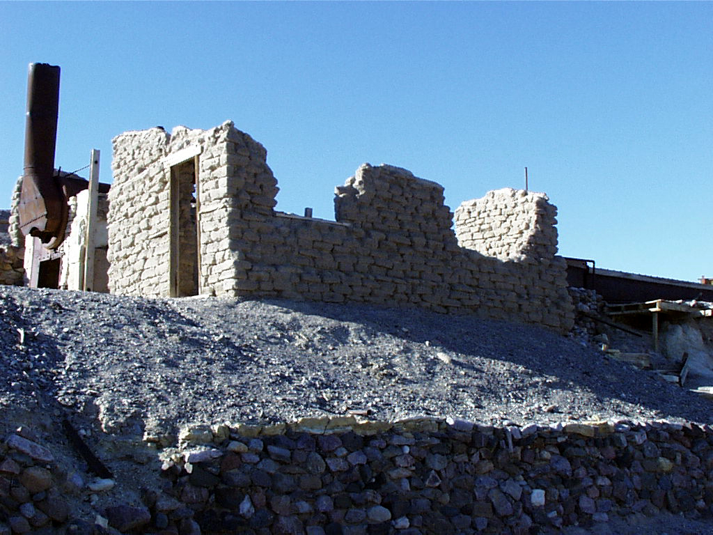
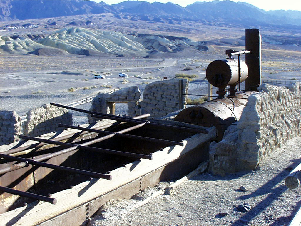
Located at the abandoned works is some of the old equipment used to mine Borax. Look for interpretive signs at the site to learn more about the uses for some of the curious equipment.
Public Domain. Photo from National Park Service
Download Original (1024 x 768 pixels, 571.0 KB)
-
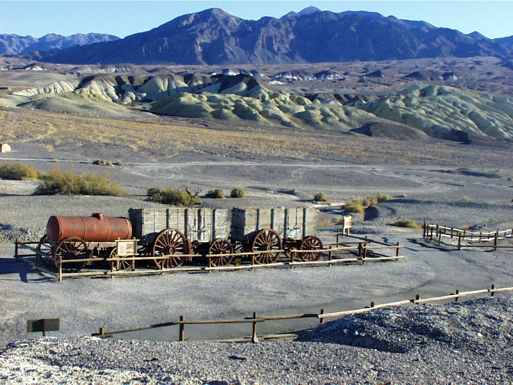
One of the most important parts of the mining process was hauling Borax to the railhead at Mojave for transport. A team of 20 mules had to pull this enormous wagon to get the product onto the train.
Public Domain. Photo from National Park Service
Download Original (1024 x 768 pixels, 582.7 KB)
-
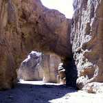
The mouth of Mosaic Canyon entices hikers to visit Tucki Mountain.
Public Domain. Photo from National Park Service
Download Original (1024 x 768 pixels, 551.7 KB)
-
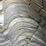
Years of weather have smoothed the layers of sediment rock in Mosaic Canyon.
Public Domain. Photo from National Park Service
Download Original (1024 x 768 pixels, 571.8 KB)
-
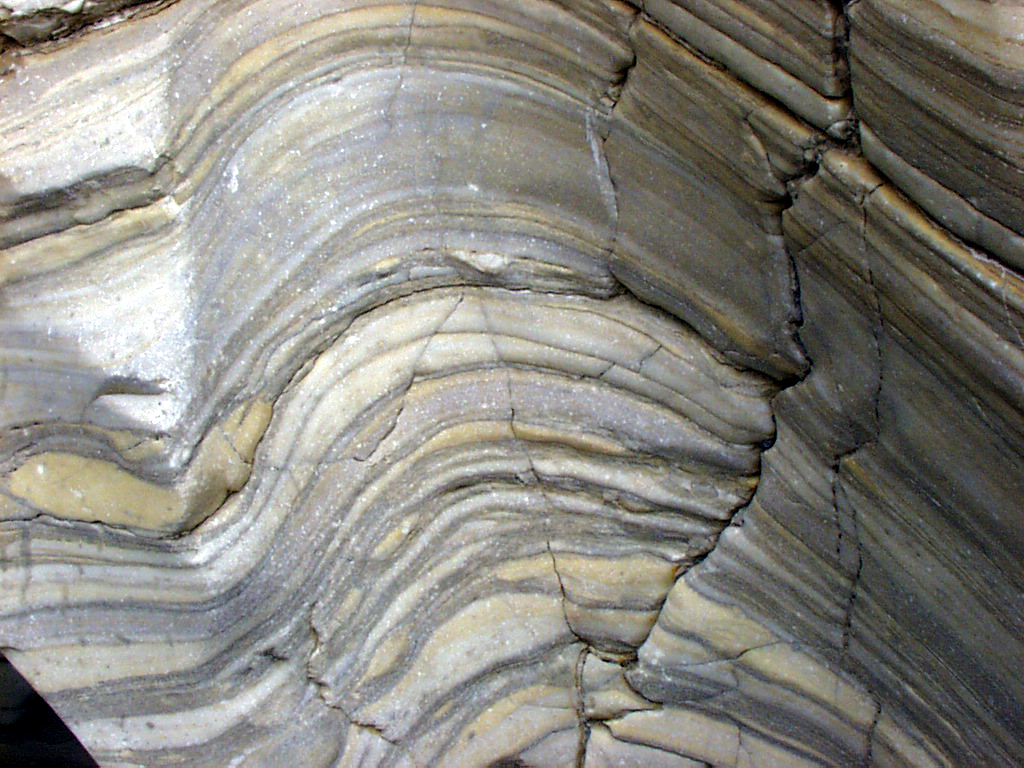
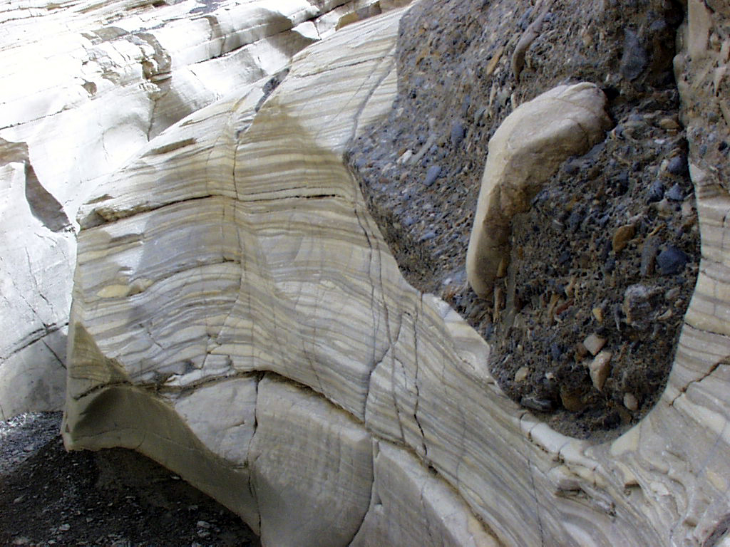
Layers of rock sediments in various hues make the "walls" of the narrows.
Public Domain. Photo from National Park Service
Download Original (1024 x 768 pixels, 527.2 KB)
-
Layers of earth and sediments comprise the stripey walls of Mosaic Canyon.
Public Domain. Photo from National Park Service
Download Original (1024 x 768 pixels, 499.2 KB)
-
Stratum of sediments and minerals make up the fascinating geology of Mosaic Canyon.
Public Domain. Photo from National Park Service
Download Original (1024 x 768 pixels, 685.2 KB)
-
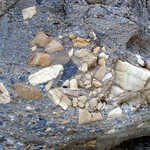
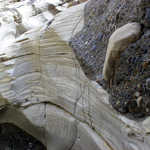
Mosaic Canyon gained its name from these fascinating mosaics of rock fragments that cemented themselves to canyon walls during a rainstorm flood.
Public Domain. Photo from National Park Service
Download Original (1024 x 768 pixels, 646.2 KB)
-
Hikers will reach upper Mosaic Canyon by way of trails comprised of smooth marble and breccia walls and formations carved out of layers of sediment and minerals.
Public Domain. Photo from National Park Service
Download Original (1024 x 768 pixels, 556.9 KB)
-
This natural bridge in Natural Bridge Canyon is only one of many geological wonders in Death Valley.
Public Domain. Photo from National Park Service
Download Original (1024 x 768 pixels, 149.8 KB)
-
A visitor wonders at the puzzle of a sliding rock that makes a curved trail on Racetrack Playa.
Public Domain. Photo from National Park Service
Download Original (1024 x 748 pixels, 710.7 KB)
-
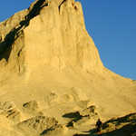
Manly Beacon, towering over the Furnace Creek Badlands, served as a natural compass for lost miners.
Public Domain. Photo from National Park Service
Download Original (1024 x 768 pixels, 501.0 KB)
-
Composed of cemented gravel and weathered to exist in its current state, Red Cathedral is one of the most fascinating sites in Death Valley.
Public Domain. Photo from National Park Service
Download Original (1024 x 768 pixels, 519.2 KB)
-
Red Cathedral is caught in afternoon light, bringing out the rich crimsons and coppers of the rock.
Public Domain. Photo from National Park Service
Download Original (759 x 557 pixels, 379.7 KB)
-
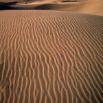
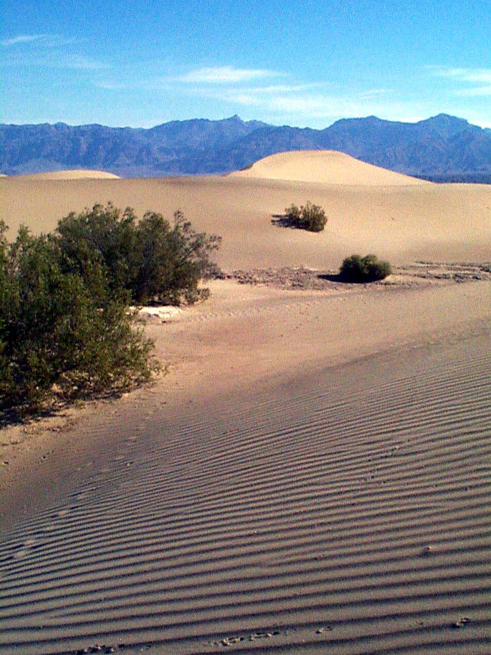
The wind makes striking wave patterns in the golden sand dunes of Death Valley.
Public Domain. Photo from National Park Service
Download Original (1367 x 2028 pixels, 958.5 KB)
-
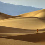
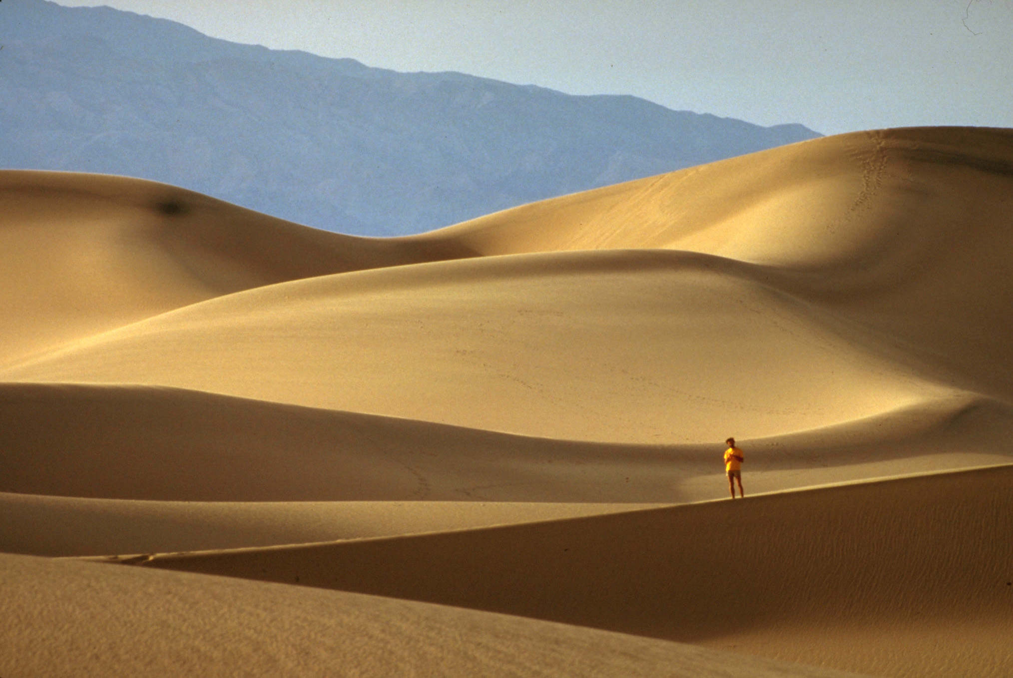
A visitor walks through the golden sand dunes at Death Valley.
Public Domain. Photo from National Park Service
Download Original (2028 x 1358 pixels, 592.8 KB)
-
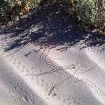
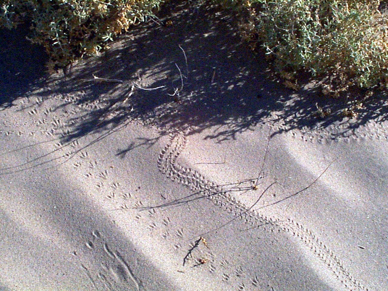
Tracks of insects, lizards and birds are left on the surface of the white sand dunes.
Public Domain. Photo from National Park Service
Download Original (1280 x 960 pixels, 271.0 KB)
-
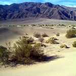
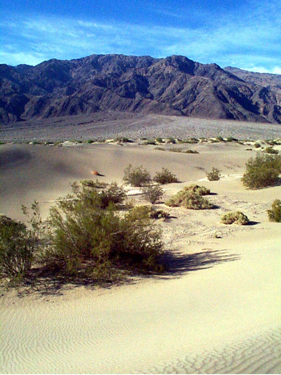
Desert foliage breaks up the vast sand fields of Death Valley.
Public Domain. Photo from National Park Service
Download Original (960 x 1280 pixels, 206.0 KB)
-
The surface of the sand dunes are constantly changing due to wind and weather.
Public Domain. Photo from National Park Service
Download Original (960 x 1280 pixels, 217.4 KB)
-
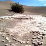
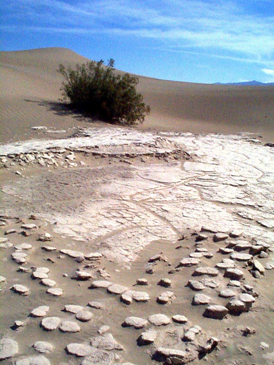
When the surface of the dunes get wet, the rapid drying causes the earth to become marked in unusual geometric patterns.
Public Domain. Photo from National Park Service
Download Original (960 x 1280 pixels, 209.9 KB)
-
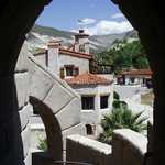
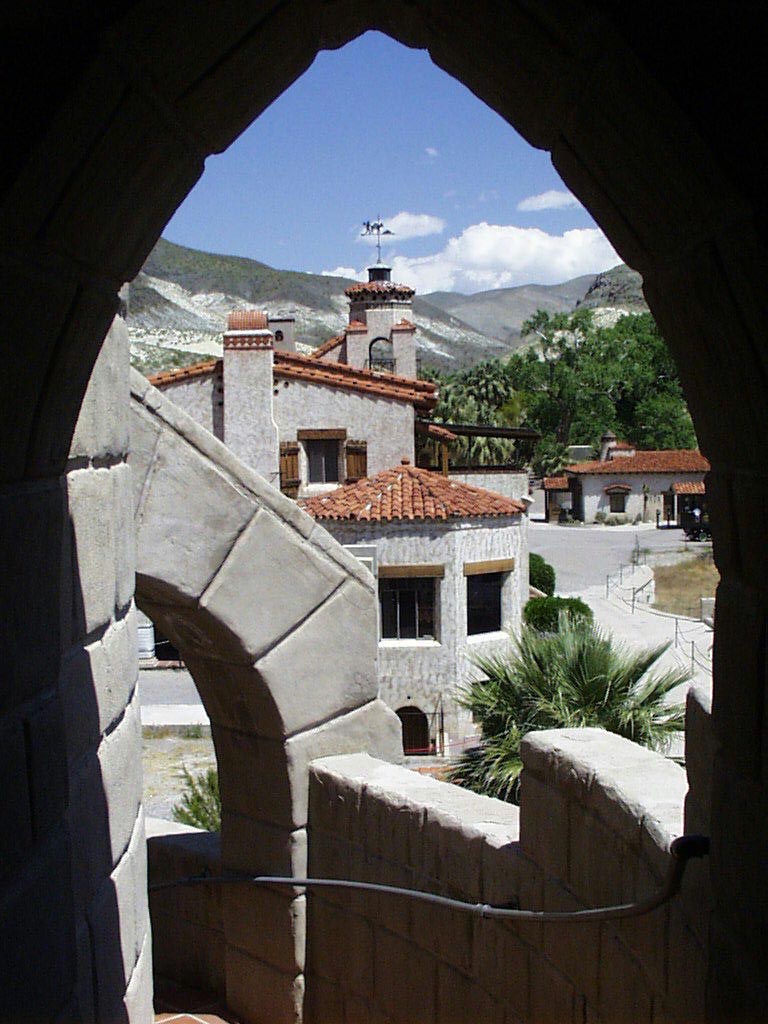
The grounds of Scotty's Castle are depicted from a window in the Power House.
Public Domain. Photo from National Park Service
Download Original (768 x 1024 pixels, 133.0 KB)
-
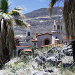
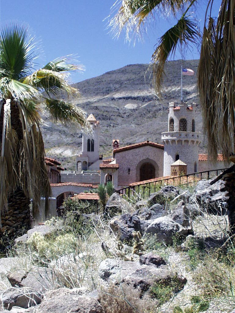
Built by a flamboyant mine promoter in the early 1900s, Scotty's Castle is open for "living history" tours offered by the Park Service.
Public Domain. Photo from National Park Service
Download Original (768 x 1024 pixels, 247.2 KB)
-

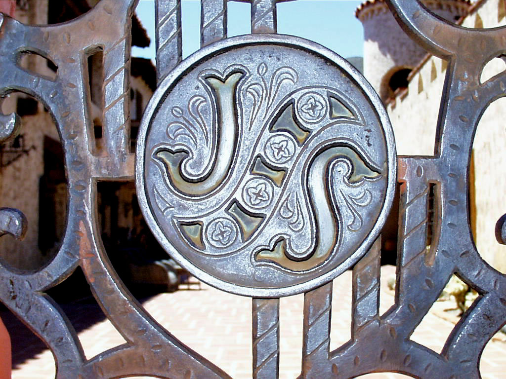
The "J" on the gate stands for Albert Johnson, a wealthy insurance man who funded one of Scotty's goldmines. The "S" stands for Walter Scott, better known as "Death Valley Scotty."
Public Domain. Photo from National Park Service
Download Original (1024 x 768 pixels, 227.4 KB)
-
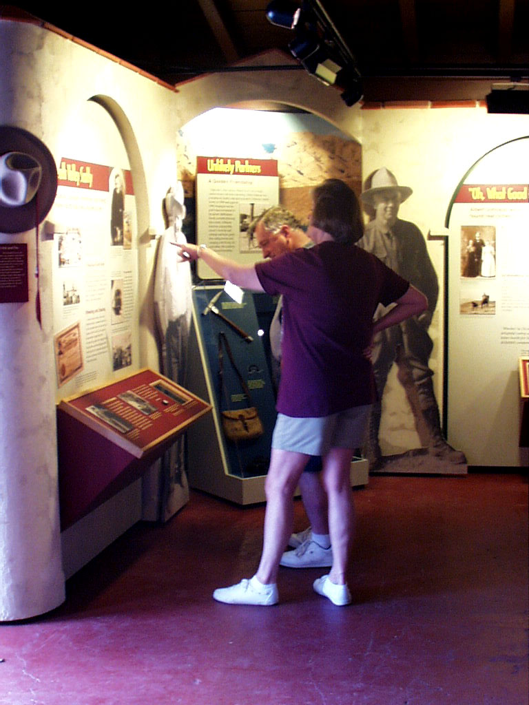
Visitors wander inside the castle museum and learn about the legend of Scotty's Castle .
Public Domain. Photo from National Park Service
Download Original (768 x 1024 pixels, 156.6 KB)
-
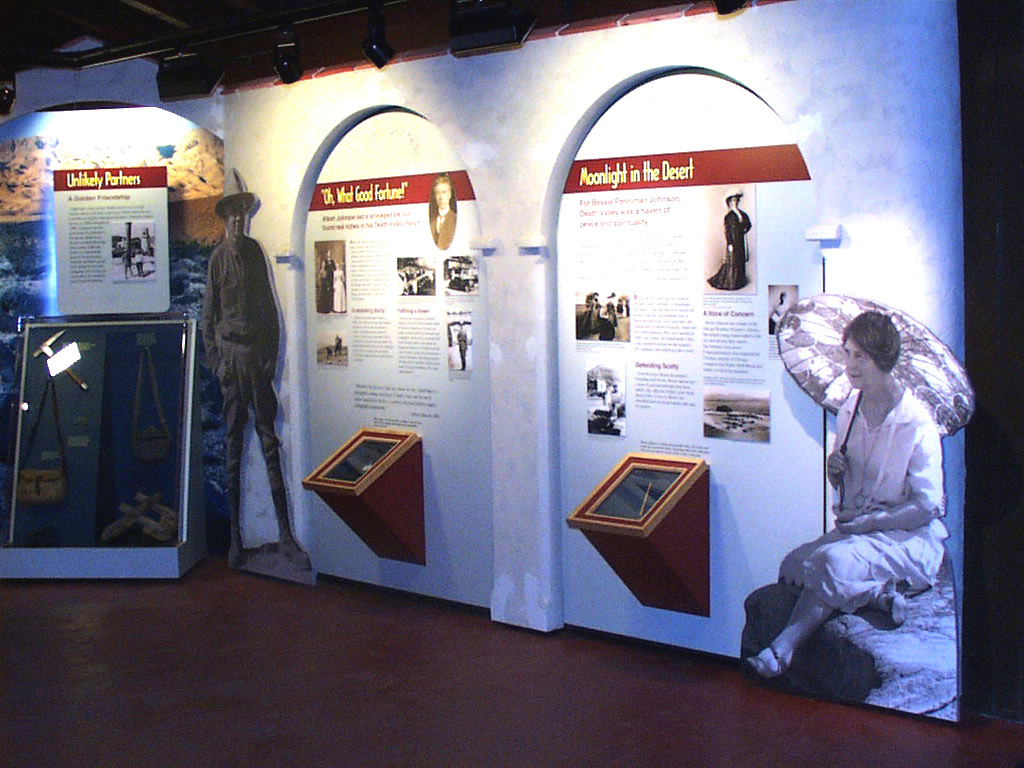
An exhibit at the Scotty's Castle museum showcases the history of the man behind the castle and artifacts from the castle collection.
Public Domain. Photo from National Park Service
Download Original (980 x 750 pixels, 169.8 KB)
-

Interpretive displays inside the museum discuss the significance of Scotty's Castle to the history of Death Valley.
Public Domain. Photo from National Park Service
Download Original (1024 x 768 pixels, 166.2 KB)
-
Shallow pools of water exist for only days in Death Valley. Most water evaporates as quickly as it comes.
Public Domain. Photo from National Park Service
Download Original (2048 x 1536 pixels, 249.9 KB)
-
Carbonates, sulfates, and chlorides compose the surface of the Salt Flats. Strange formations and bumps are sculpted by wind and rain.
Public Domain. Photo from National Park Service
Download Original (2048 x 1536 pixels, 551.5 KB)
-
Learning about the creation of the interesting features of the valley is one of the most exciting parts of the Death Valley experience.
Public Domain. Photo from National Park Service
Download Original (2048 x 1536 pixels, 360.1 KB)
-

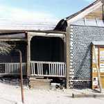
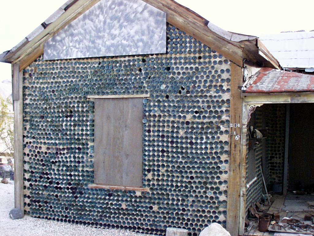
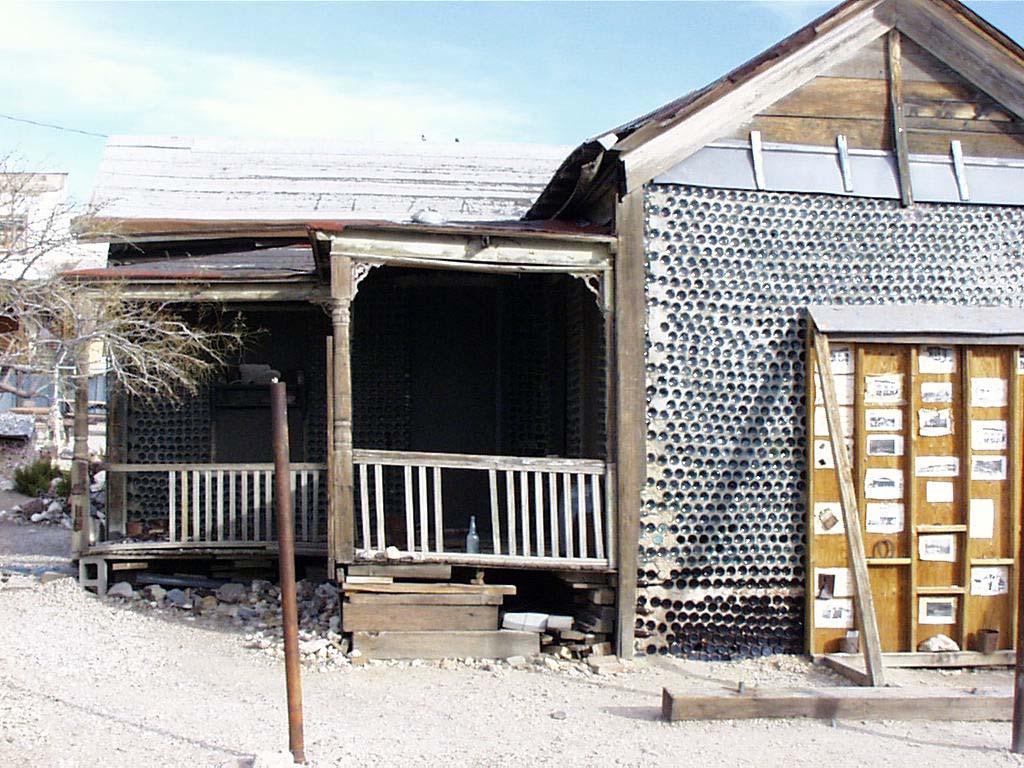
A trip to Rhyolite's famous bottle house is well-worth the side trip from Death Valley.
Public Domain. Photo from National Park Service
Download Original (1024 x 768 pixels, 165.5 KB)
-

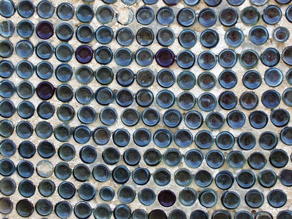
Stucco slabs composed of bottlecaps form the walls of the Bottle House in Rhyolite, NV.
Public Domain. Photo from National Park Service
Download Original (1024 x 768 pixels, 178.4 KB)
-
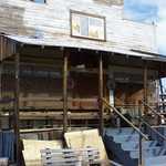
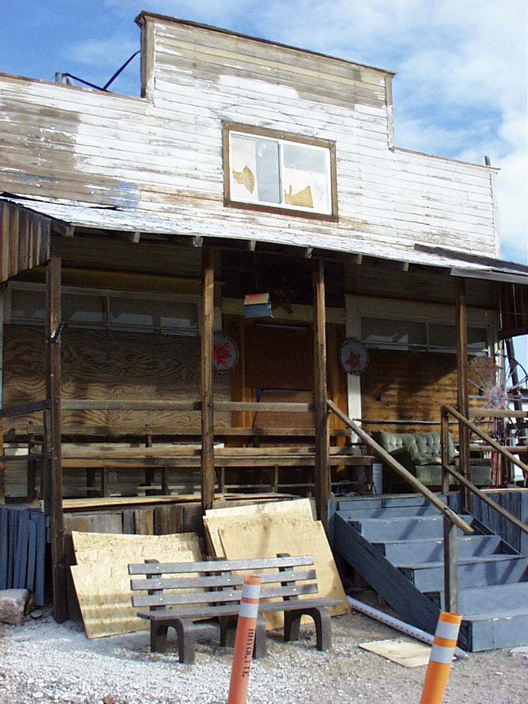
This turn-of-the-century mining town has been abandoned for years, but still provides an intriguing glimpse into the lives of miners who populated this town.
Public Domain. Photo from National Park Service
Download Original (768 x 1024 pixels, 144.4 KB)
-
The quirkiest attraction in Rhyolite, the Bottle House will be sure to catch your attention.
Public Domain. Photo from National Park Service
Download Original (1024 x 768 pixels, 166.3 KB)
-
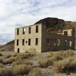
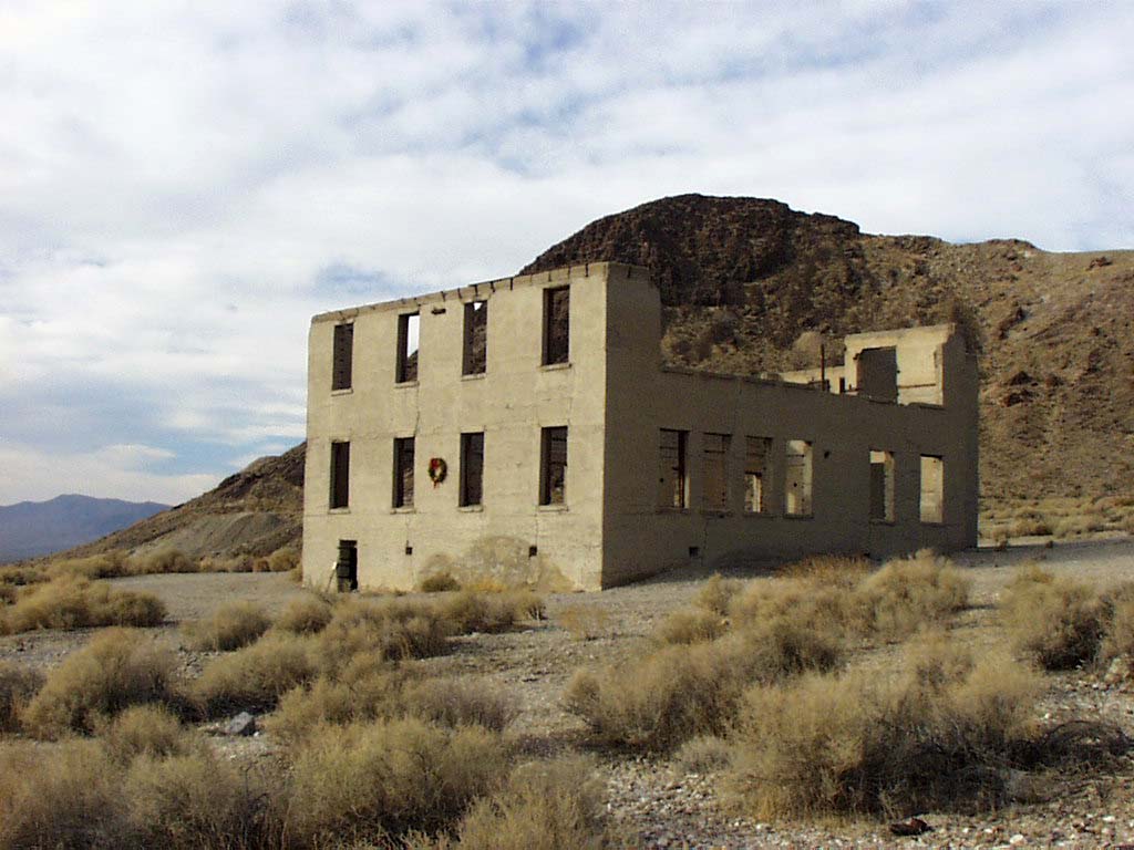
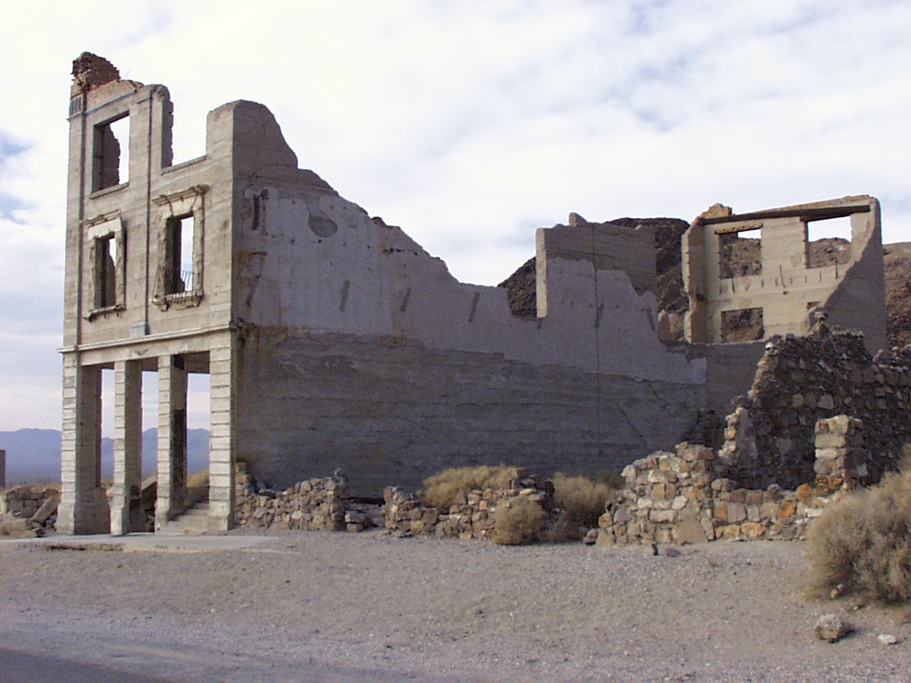
Just east of Death Valley is Rhyolite, NV, one of the largest ghost mining towns in the country.
Public Domain. Photo from National Park Service
Download Original (1024 x 768 pixels, 109.7 KB)
-
Once the center of mining and commerce, Rhyolite now tells the story of the emergence-- and conclusion-- of the mining boom of Death Valley.
Public Domain. Photo from National Park Service
Download Original (1024 x 768 pixels, 151.9 KB)
-
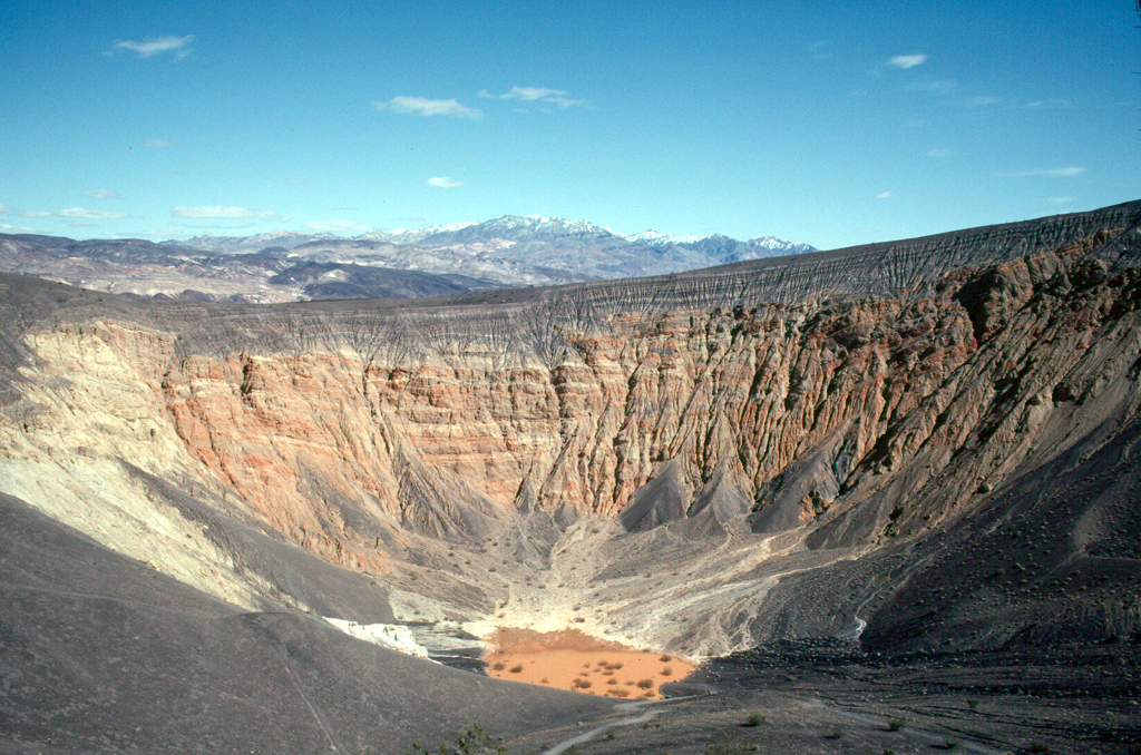
A 500-foot deep hole created by bulging magma underneath the surface of the earth now gives this section of Death Valley an otherwordly appearance.
Public Domain. Photo from National Park Service
Download Original (1024 x 678 pixels, 929.8 KB)
-
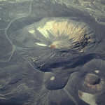
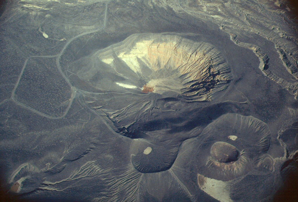
An aerial shot of the Ubehebe Crator looks like a view of another planet entirely.
Public Domain. Photo from National Park Service
Download Original (1024 x 693 pixels, 987.9 KB)
-
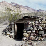
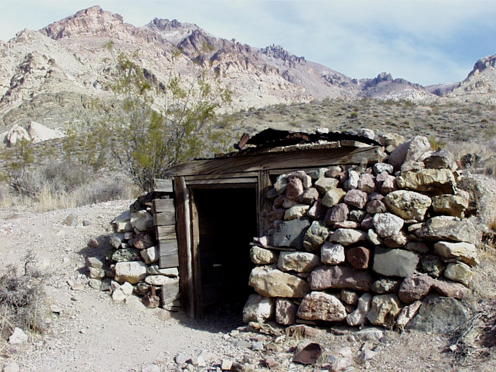
This stone, dirt and wood dugout in Leadfield is evidence of past lead mining in Death Valley.
Public Domain. Photo from National Park Service
Download Original (1024 x 768 pixels, 229.8 KB)
-
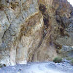
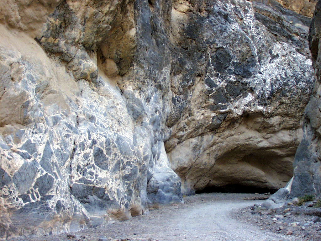
Fascinating geology lines this trail in Titus Canyon.
Public Domain. Photo from National Park Service
Download Original (1024 x 768 pixels, 236.0 KB)
-
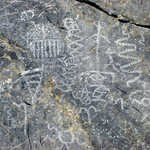
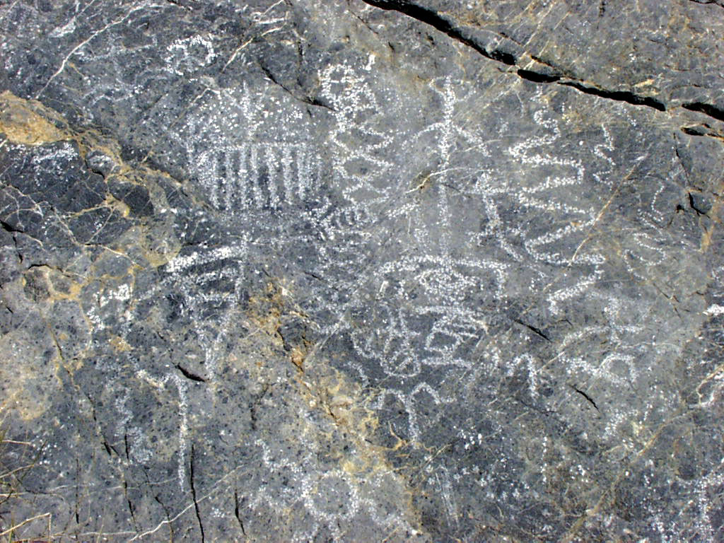
Ancient petroglyphs on the walls of Klare Spring in Death Valley's Titus Canyon are still well preserved for visitors to see.
Public Domain. Photo from National Park Service
Download Original (1024 x 768 pixels, 259.6 KB)
-
A view of Red Canyon switchbacks from Titus Canyon shows off more of the fascinating shape and color of Death Valley's geography.
Public Domain. Photo from National Park Service
Download Original (1024 x 768 pixels, 228.4 KB)
-
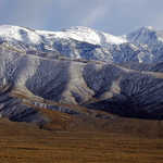
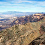
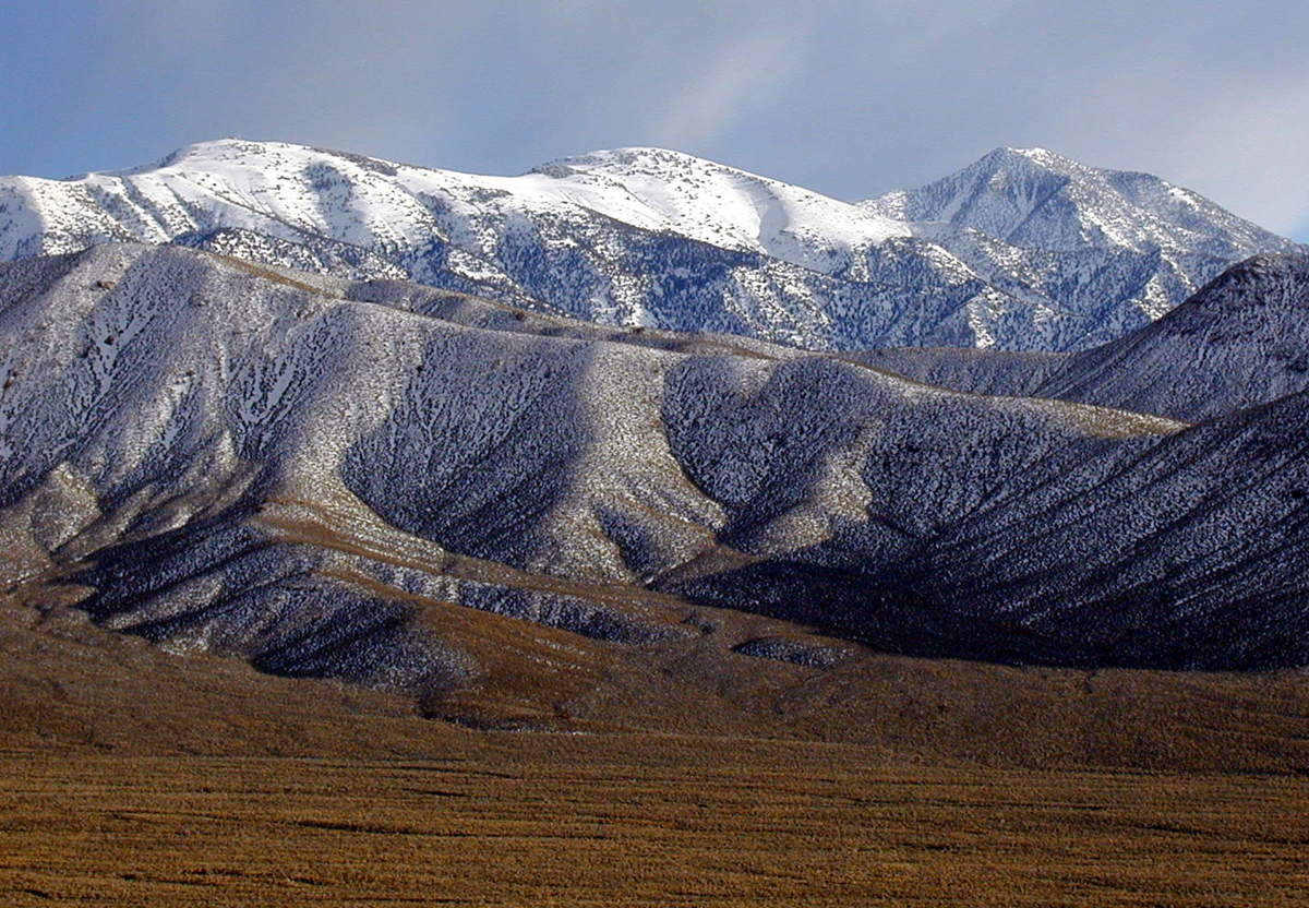
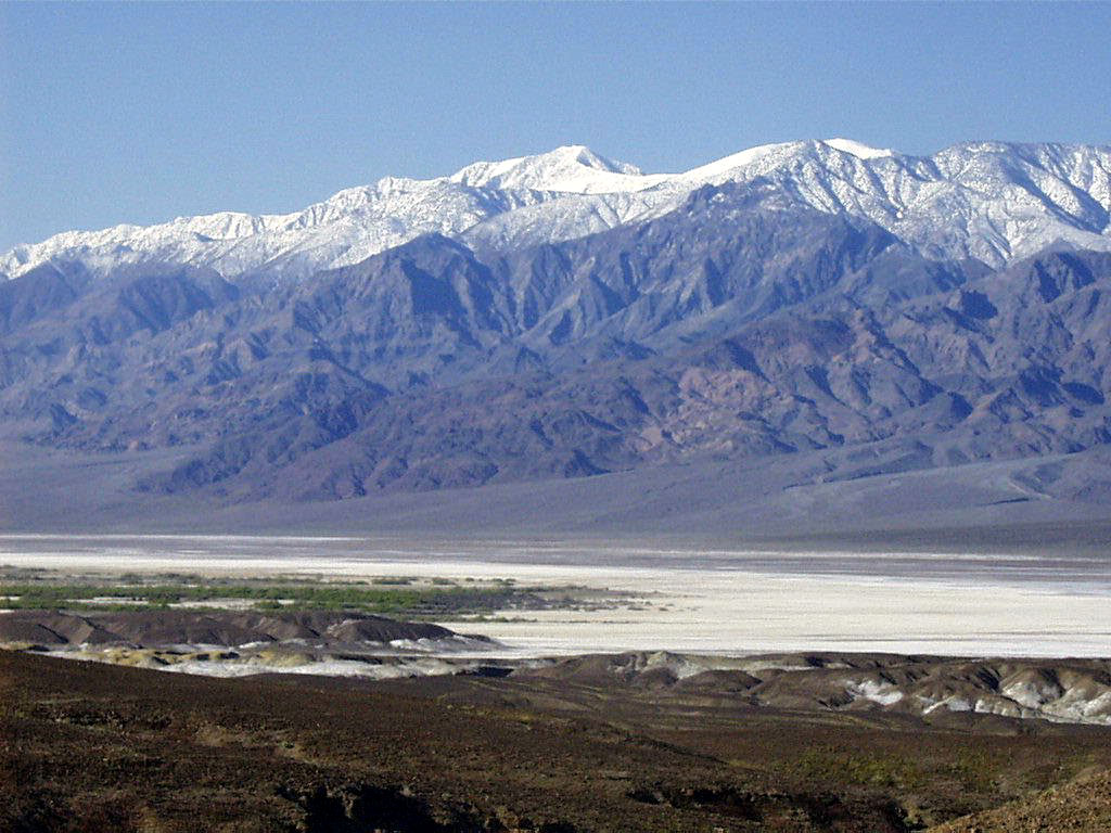
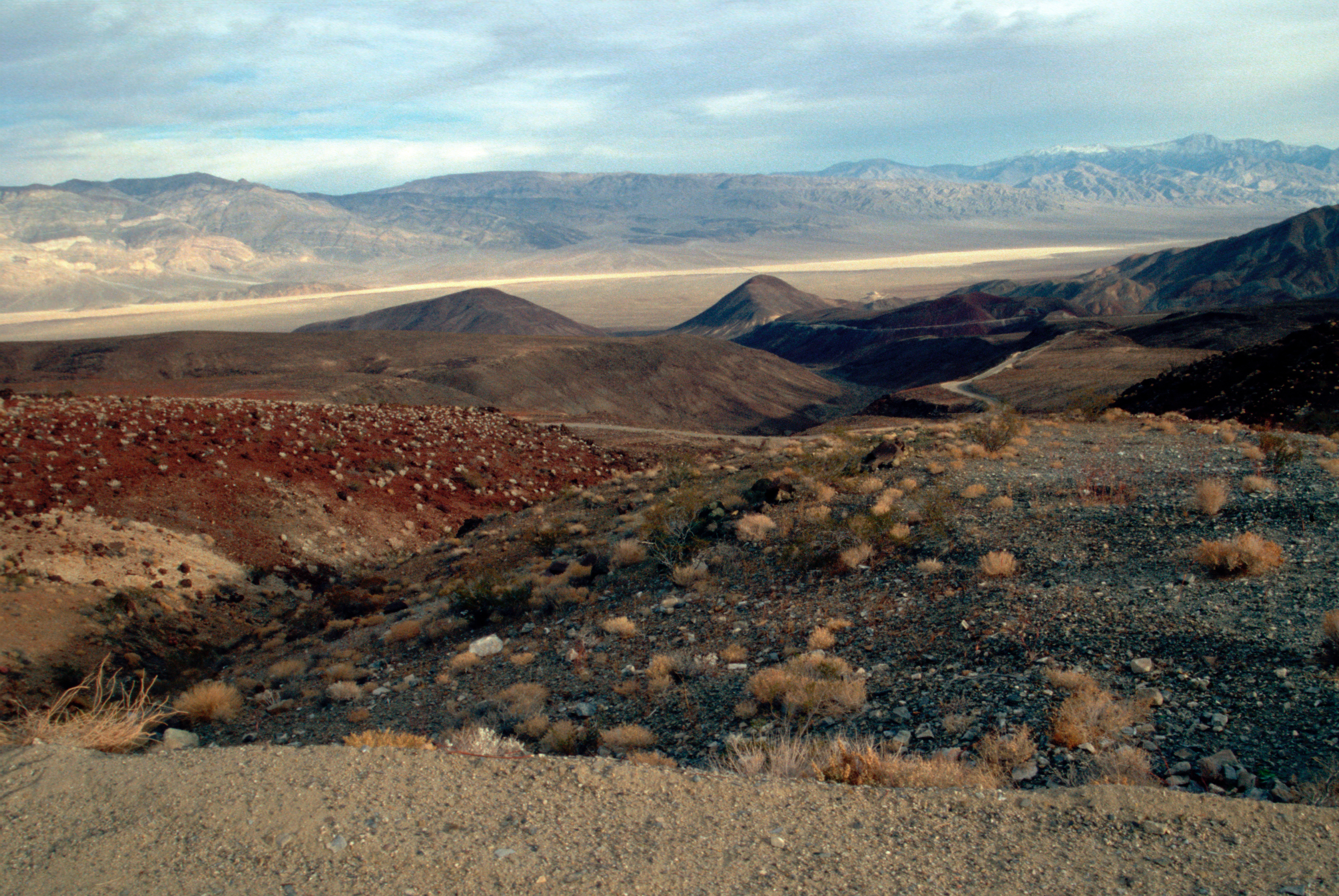
Three of the highest peaks in the Panamint Mountains can be seen from across the valley at Dante's View.
Public Domain. Photo from National Park Service
Download Original (1200 x 832 pixels, 1030.6 MB)
-
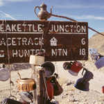
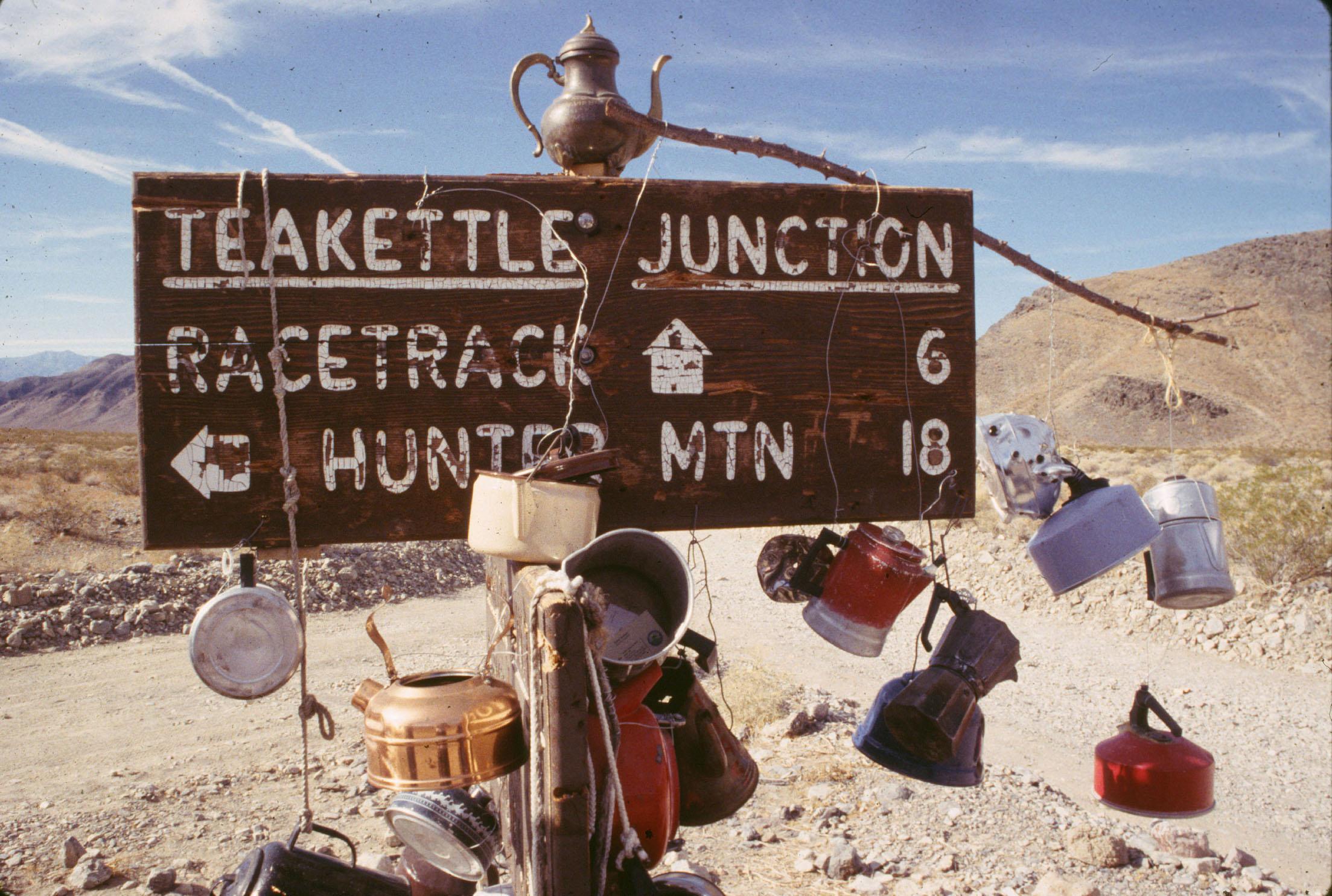
This junction sign was started by one visitor who hung a teakettle and a note to other travelers.
Public Domain. Photo from National Park Service
Download Original (2207 x 1485 pixels, 593.9 KB)
-
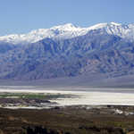
Telescope Peak, one of the highest points in the Panamint Range, can be seen from Dante's View.
Public Domain. Photo from National Park Service
Download Original (1024 x 768 pixels, 181.8 KB)
-
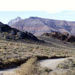
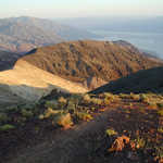
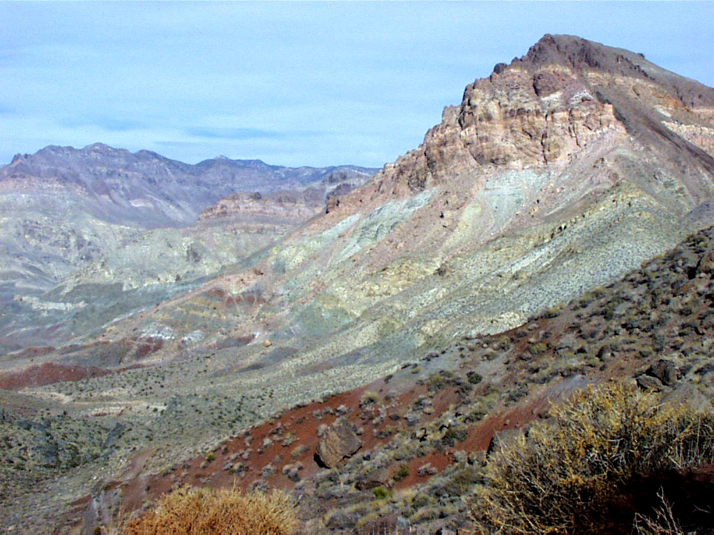
The unusual colors and patterns of Thimble Peak are illustrated in this view from White Pass.
Public Domain. Photo from National Park Service
Download Original (1024 x 768 pixels, 193.6 KB)
-
The walls of Titus Canyon are composed of layers of condensed sediments.
Public Domain. Photo from National Park Service
Download Original (1024 x 768 pixels, 218.1 KB)
-
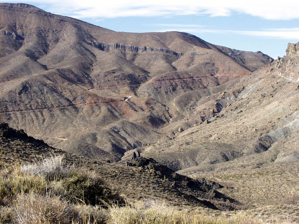
The view from Red Pass shows the layers of mountains, hills, and formations you will see from a day-hike through Titus Canyon.
Public Domain. Photo from National Park Service
Download Original (1024 x 768 pixels, 213.1 KB)
-
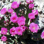
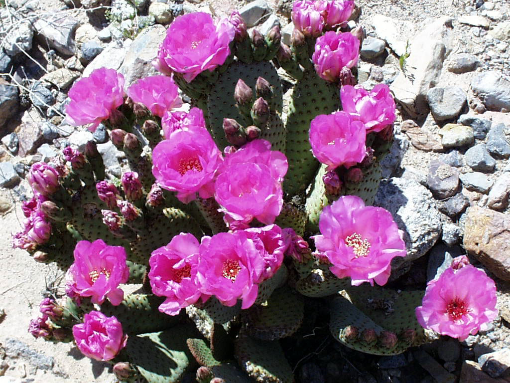
The shallow roots of the Beavertail Cactus have allowed it to flourish in the dry Death Valley earth.
Public Domain. Photo from National Park Service
Download Original (1024 x 768 pixels, 241.3 KB)
-
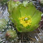
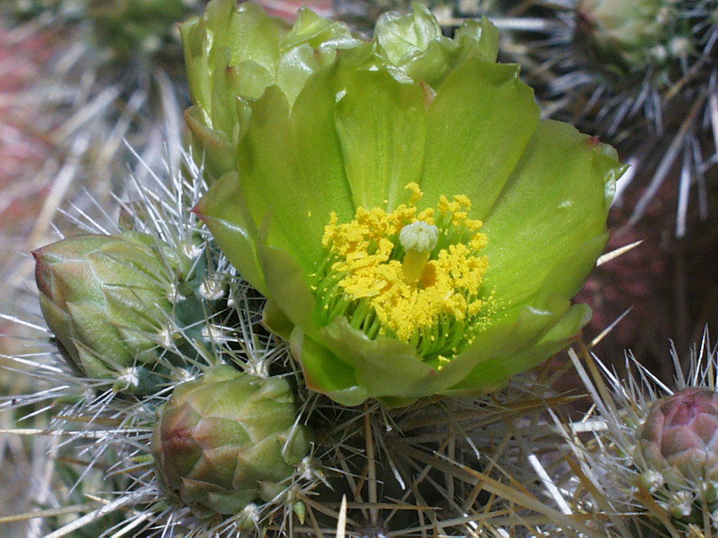
One of the most common forms of cacti in the Death Valley region is the Cholla Cactus, most notable for its green flowers.
Public Domain. Photo from National Park Service
Download Original (1024 x 768 pixels, 141.7 KB)
-
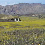
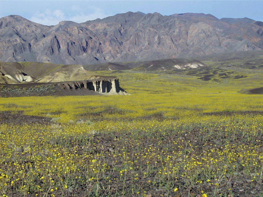
Fields of yellow flowers extend to the distant mountains.
Public Domain. Photo from National Park Service
Download Original (1024 x 768 pixels, 169.5 KB)
-
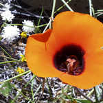
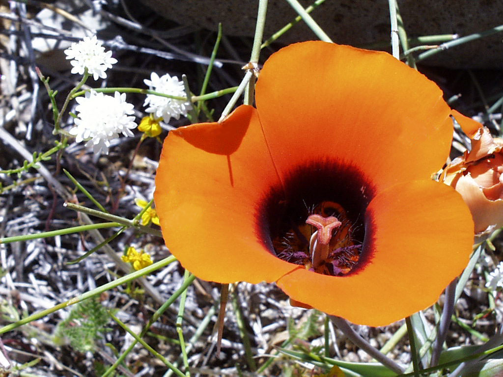
A brilliant orange Mariposa blossom contrasts nicely with its drab surroundings.
Public Domain. Photo from National Park Service
Download Original (1024 x 768 pixels, 188.5 KB)
-
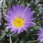
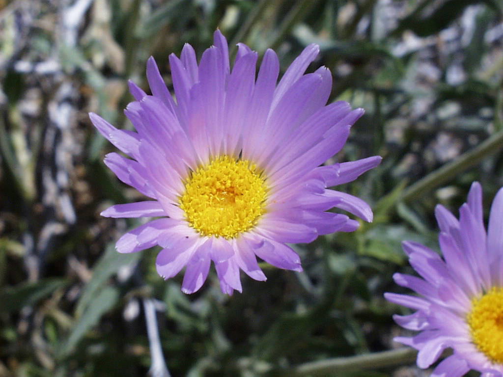
Purple Mojave Asters are common in even the driest areas of Death Valley.
Public Domain. Photo from National Park Service
Download Original (1024 x 768 pixels, 86.8 KB)
-
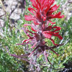
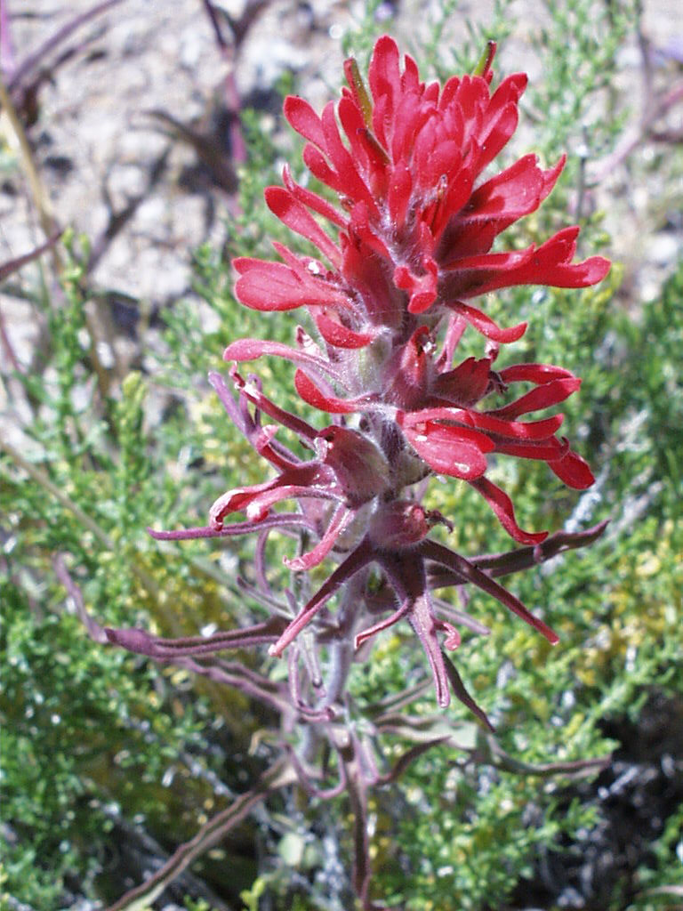
The brilliant red of the Indian Paintbrush stands out against the surrounding rock.
Public Domain. Photo from National Park Service
Download Original (768 x 1024 pixels, 202.6 KB)
-
One of the many views you can see from Zabriskie Point is this perspective of Manly Beacon.
Public Domain. Photo from National Park Service
Download Original (1024 x 768 pixels, 191.5 KB)
-
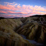
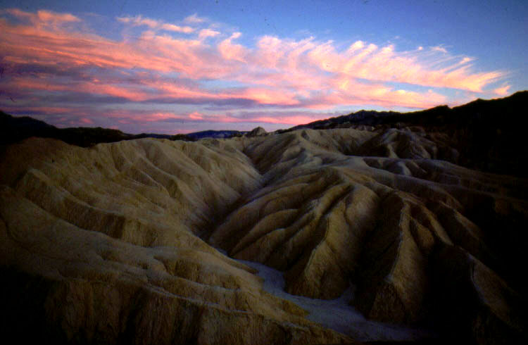
A fantastic desert sunset illuminates the sky above Death Valley.
Public Domain. Photo from National Park Service
Download Original (750 x 490 pixels, 60.2 KB)
-
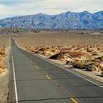
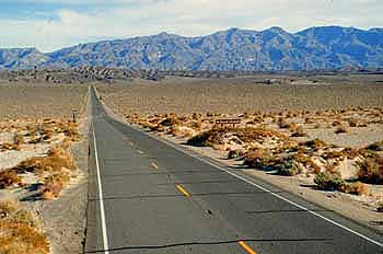
A straight highway in Death Valley seems to stretch forever.
© 1999 Marian Harmon.
Download Original (350 x 232 pixels, 20.6 KB)
-

This view shows the Argus Mountain Range and Panamint Valley from Father Crowley Point.
Public Domain. Courtesy of the National Park Service
Download Original (3624 x 2425 pixels, 10191.1 MB)
-
This view looks at the Panamint Valley. It can be seen to the east of milepost 48.6.
Public Domain. Courtesy of National Park Service
Download Original (3610 x 2431 pixels, 10199.3 MB)
-

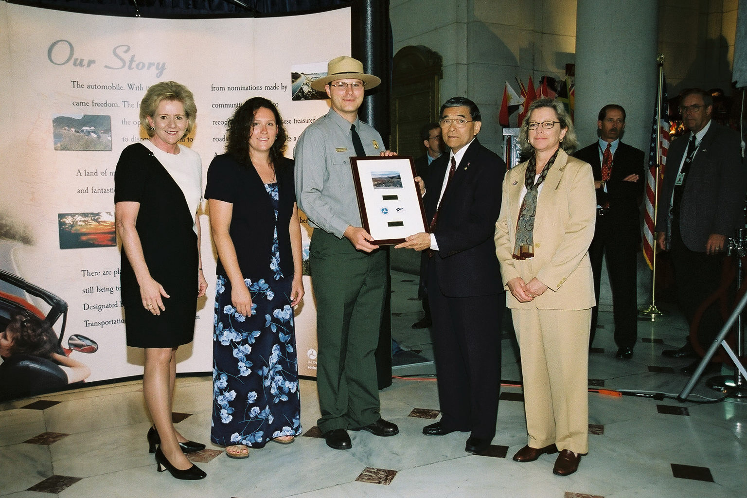
California's Death Valley Scenic Byway receives their designation plaque at the Designation 2002 event at Union Station in Washington DC.
 © June 2002 FHWA-NSB.
Download Original (1536 x 1024 pixels, 454.7 KB)