
Rogue-Umpqua Scenic Byway
All Photos (84)
-
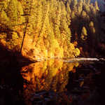
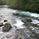
Sunlight falls on Whistler's Bend Park, reflecting off the lucid water. Trees line a hill in the background and offset the rocky riverscape.
Public Domain. Michael Lore
Download Original (2560 x 1920 pixels, 2023.0 MB)
-
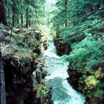
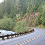
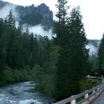
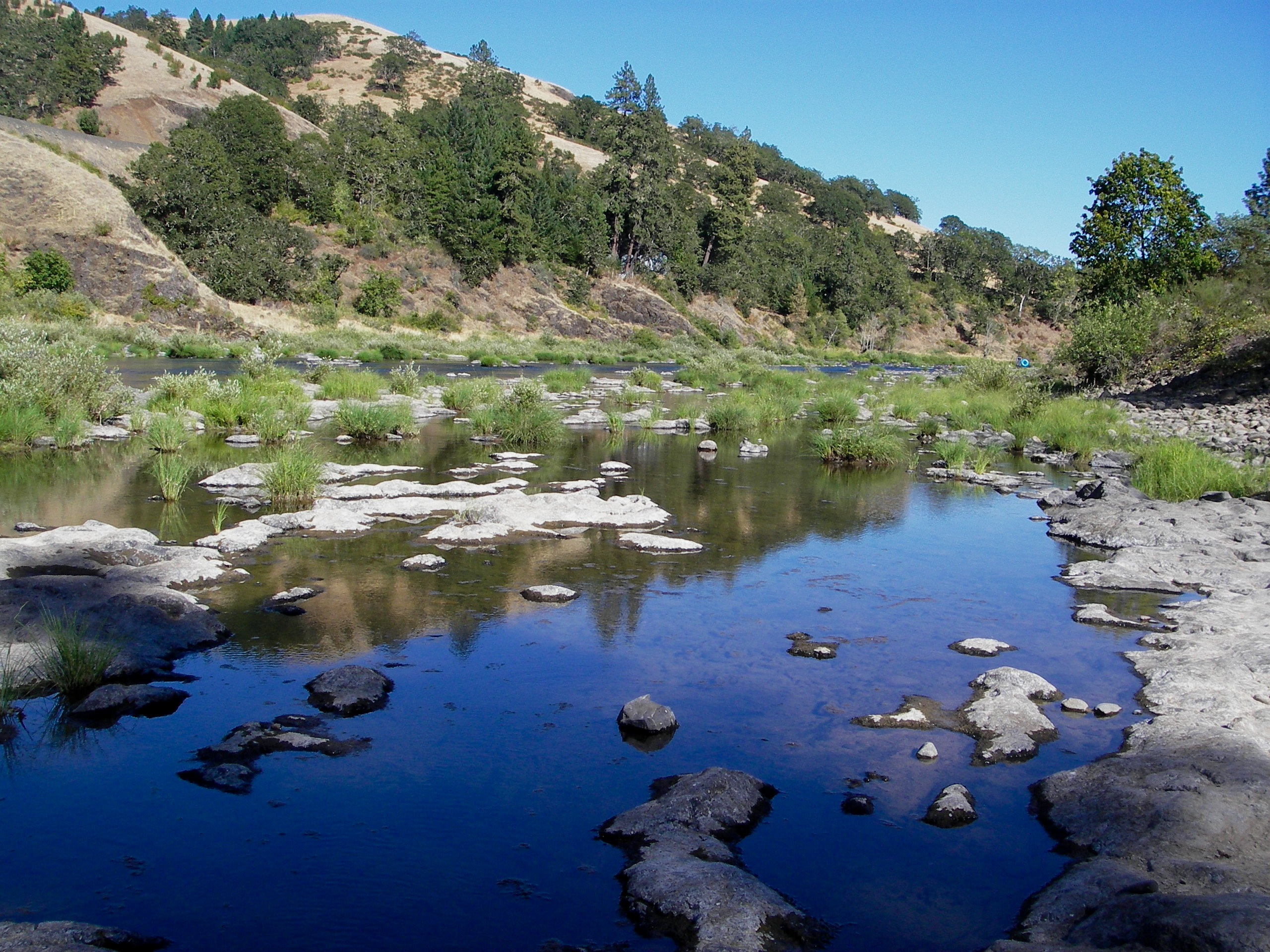
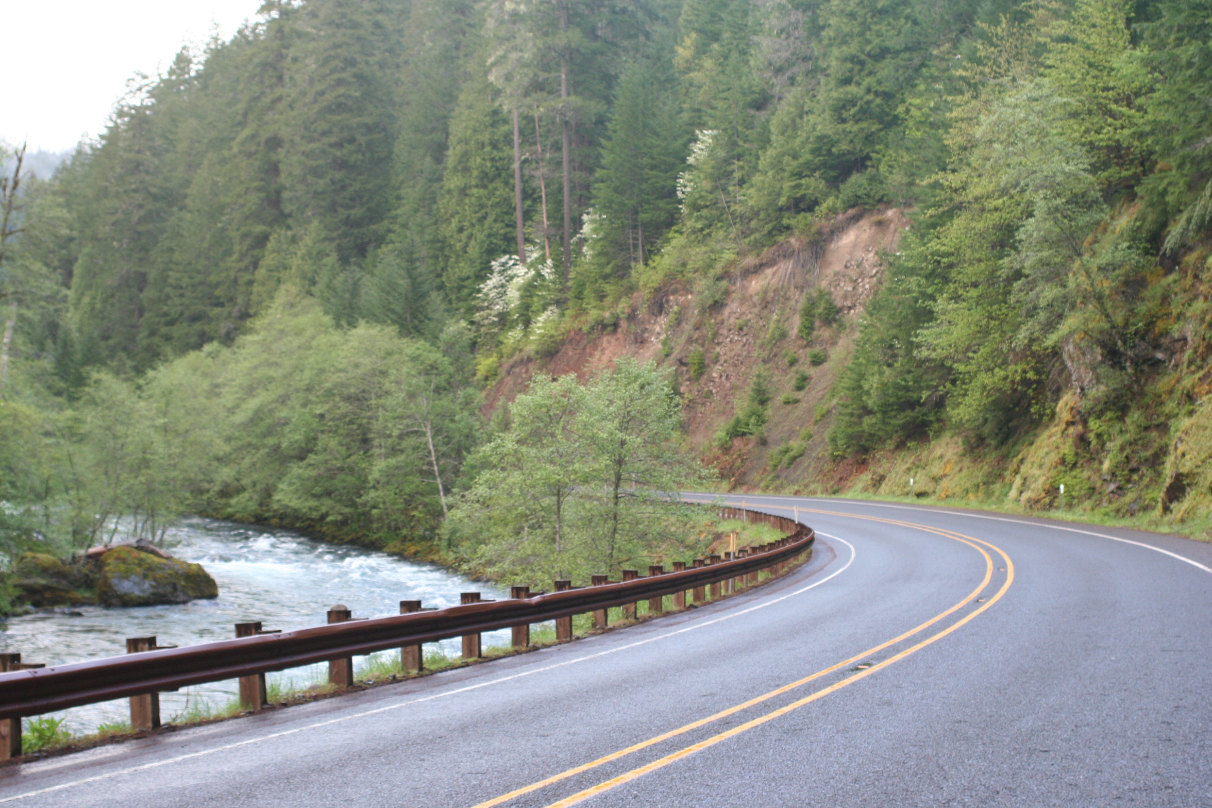
Rogue Umpqua National Scenic Byway skirts the cool waters of the North Umpqua River.
© May 2007 Christina Lilienthal.
Download Original (2496 x 1664 pixels, 2394.8 MB)
-
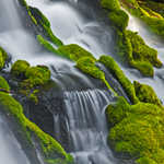
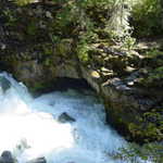
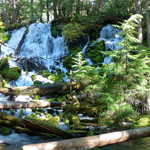
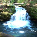
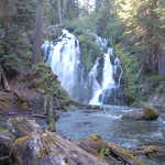
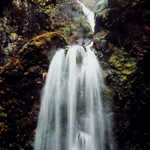
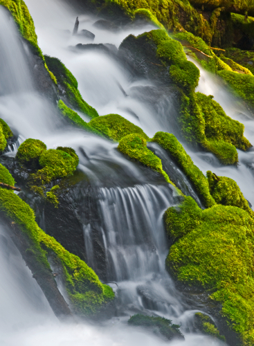
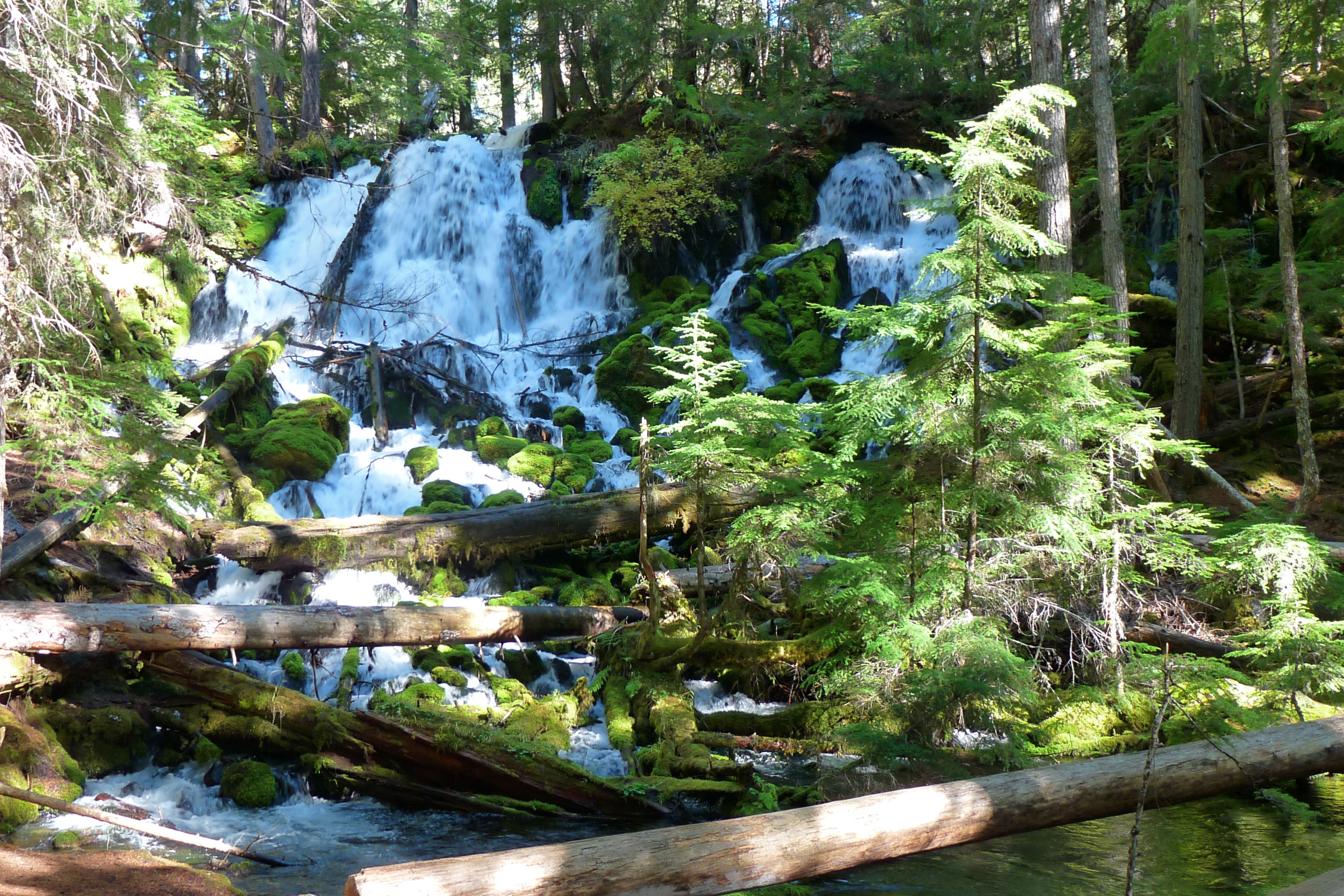
Clearwater Falls cascades down rocks covered in effulgent emerald moss.
Public Domain. Larry Andreasen
Download Original (367 x 500 pixels, 241.9 KB)
-
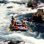
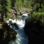
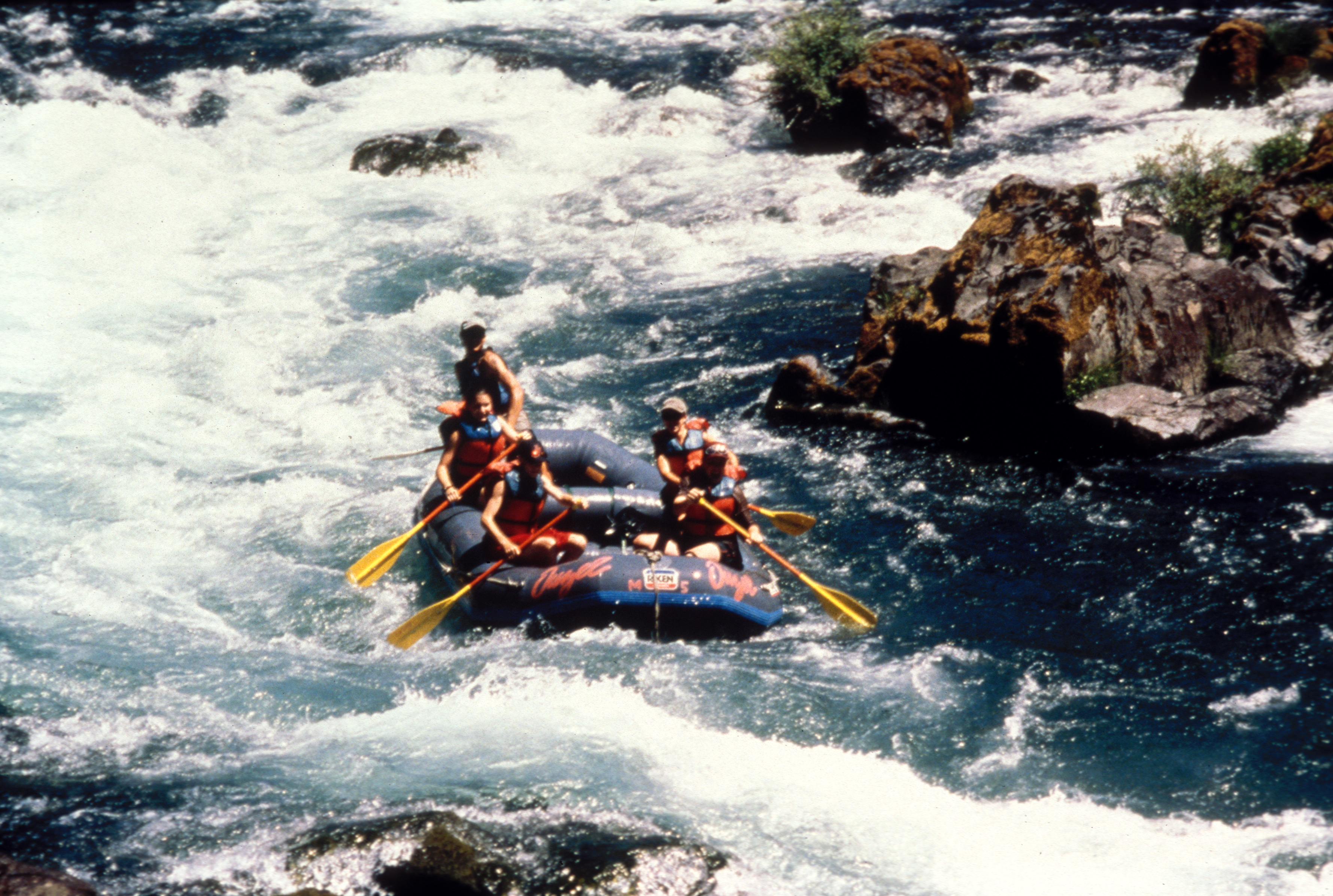
The North Umpqua Wild & Scenic River offers challenging and exciting whitewater rafting. Dozens of Class III and one Class IV rapids provide an array of whitewater experiences for intermediate to advanced boaters.
Public Domain. Photo by Ron Murphy of BLM
Download Original (3560 x 2393 pixels, 6918.1 MB)
-
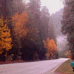
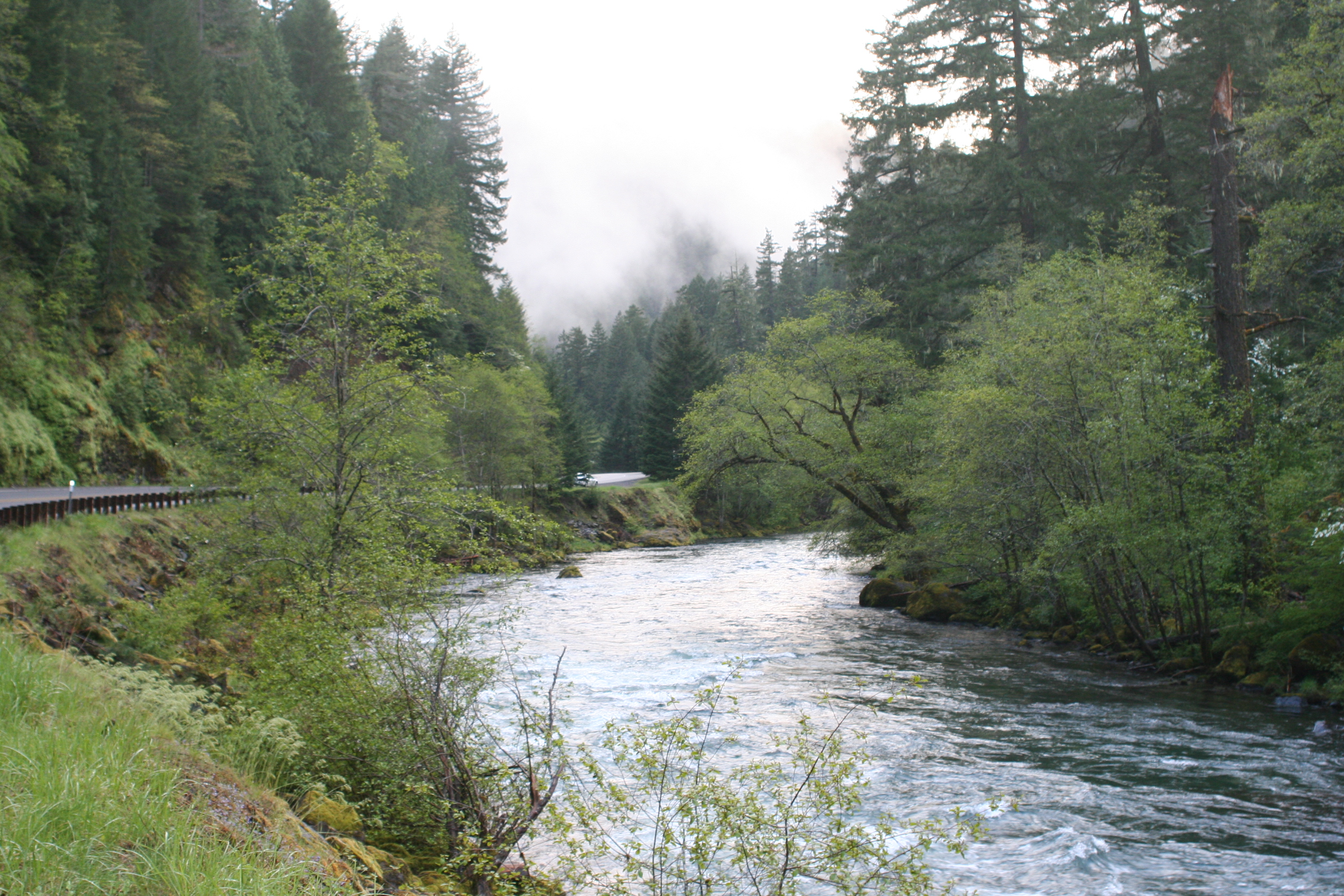
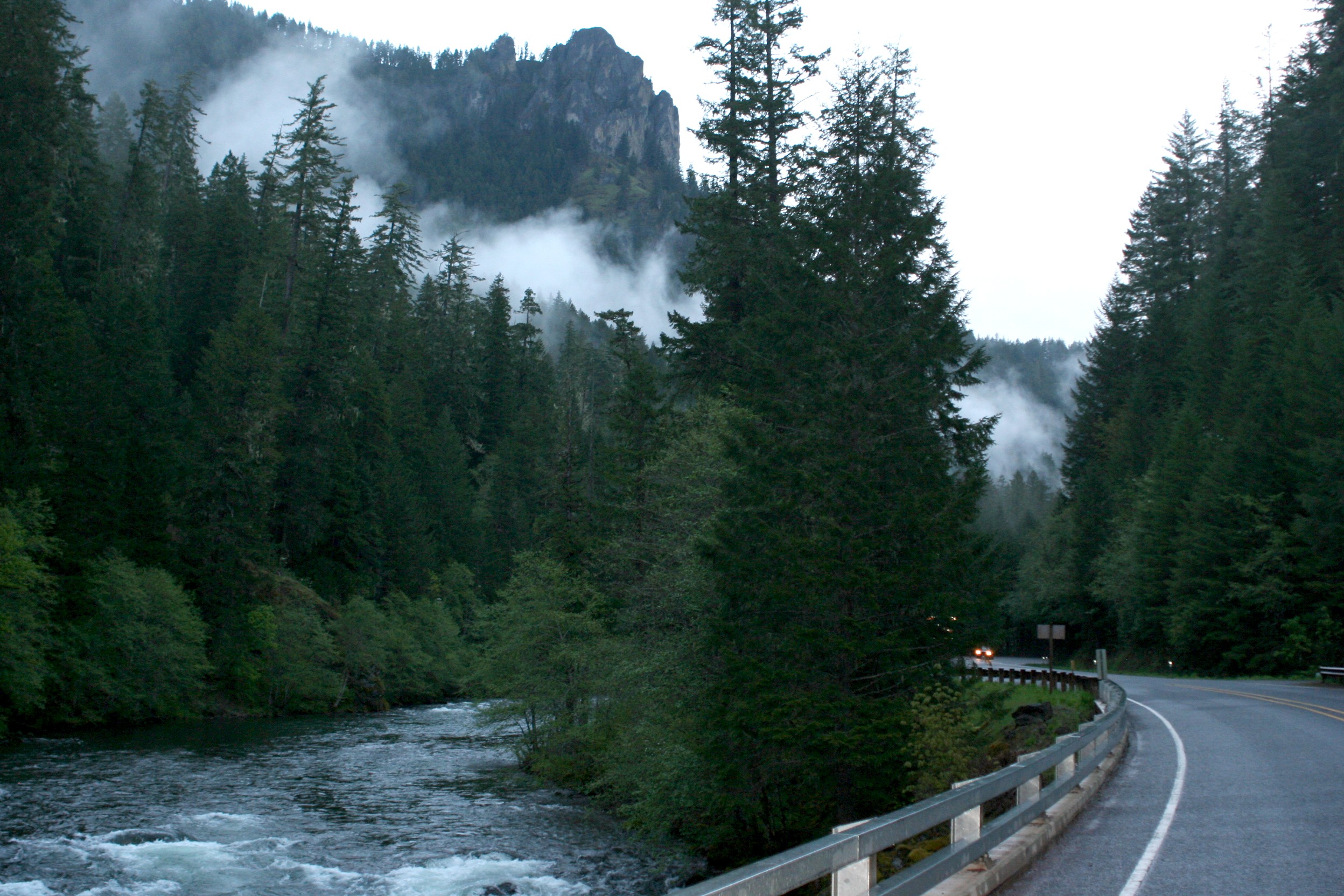
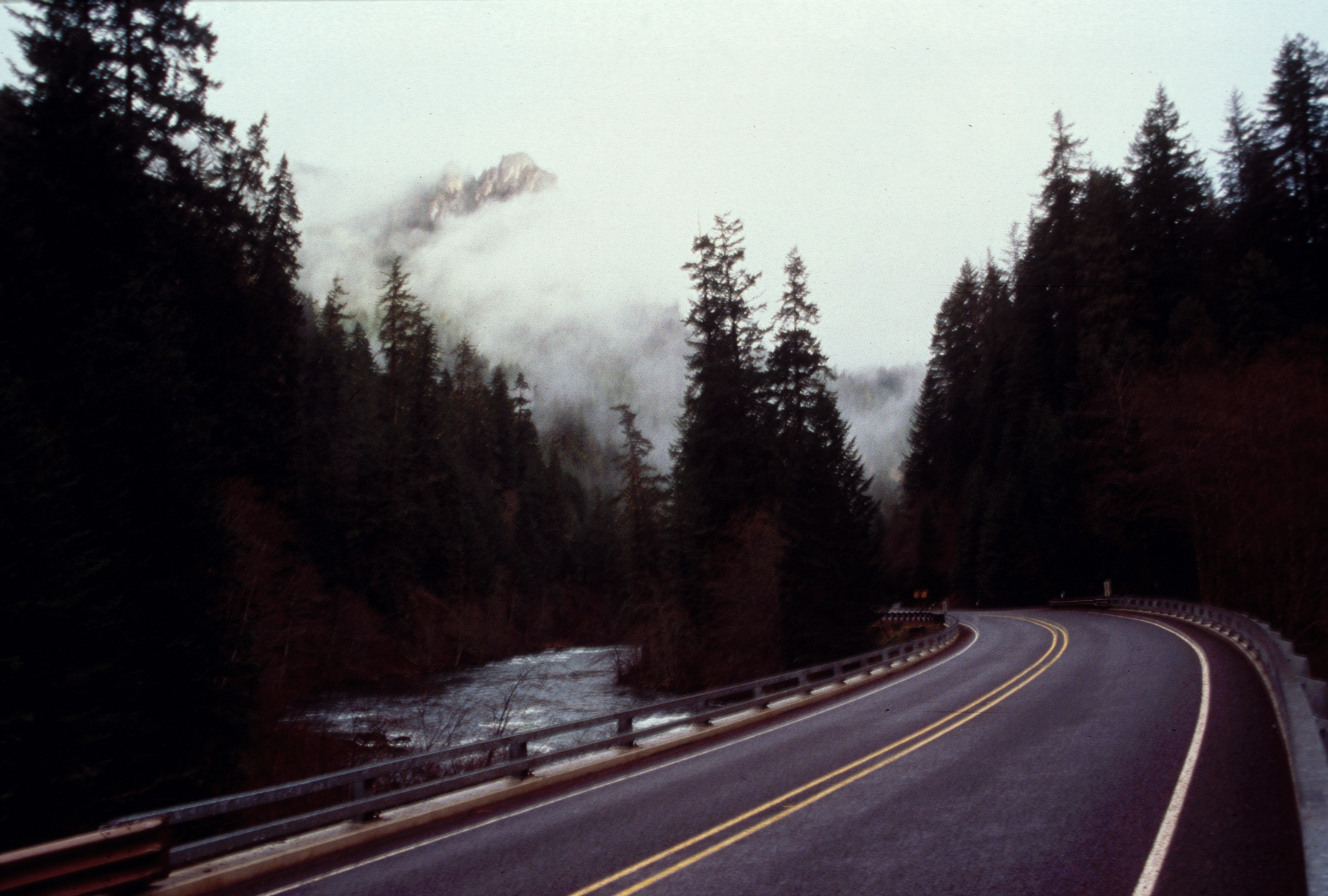
Located in the heart of the Western Oregon Cascade Mountains, this recreation site is one of the most accessible sites managed by the Bureau of Land Management for people with disabilities . Travel is enjoyable in any season and frequent mist creates captivating views.
Public Domain. Courtesy of Ron Murphy of the BLM
Download Original (3514 x 2149 pixels, 6061.7 MB)
-
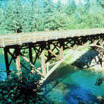
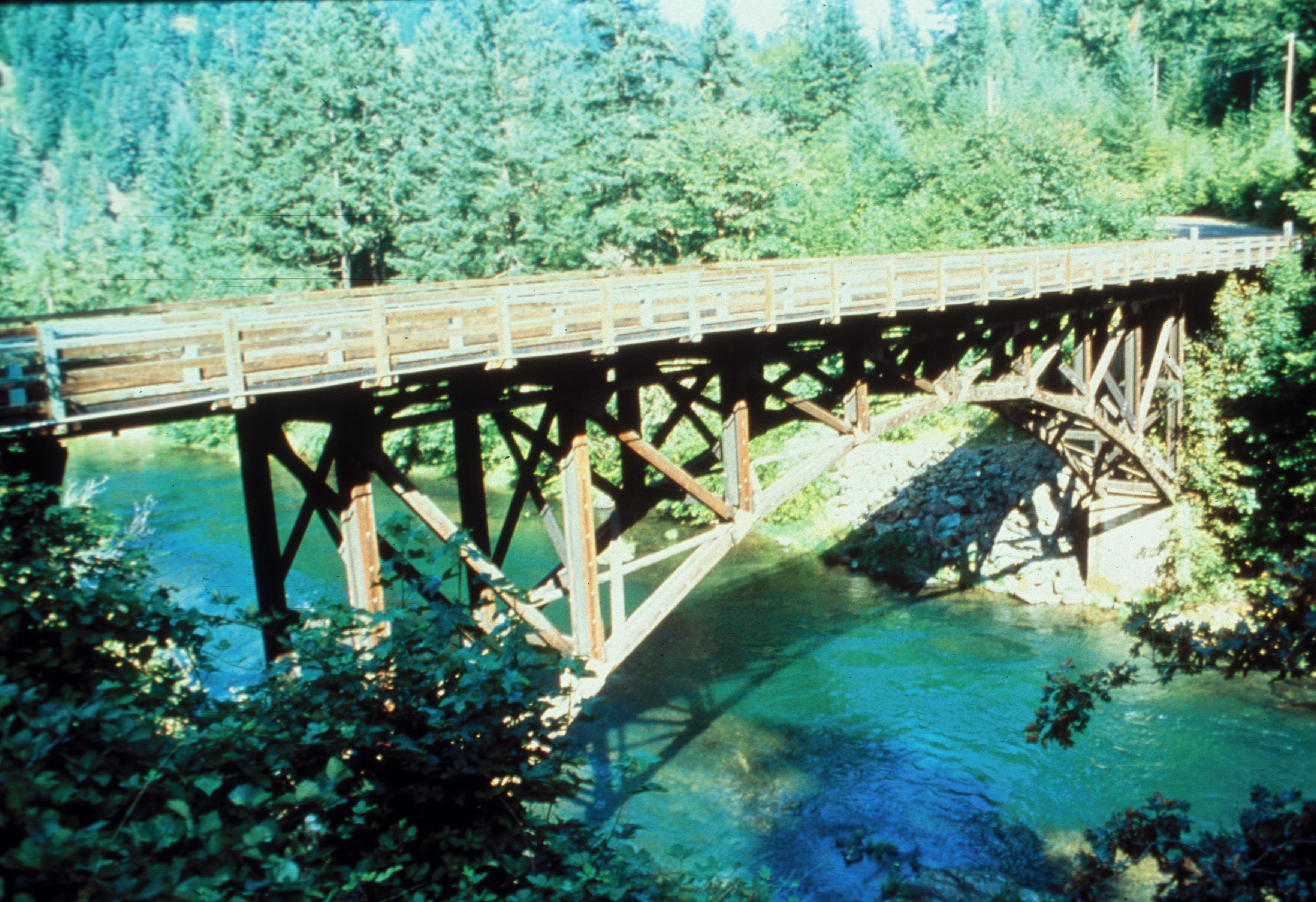
The Mott Bridge, built in 1935-36 by the Civilian Conservation Corps (CCC), is eligible for the National Register of Historic Places and is an Oregon Civil Engineering Historic Landmark. This three-spandral arch bridge is the only surviving example of three such structures built at that time in the Pacific Northwest. It provides access to the 79-mile North Umpqua Trail and an interpretive information kiosk across the river from State Highway 138.
Public Domain. Courtesy of G. Williams
Download Original (3512 x 2409 pixels, 6694.1 MB)
-
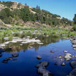
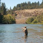
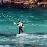
Fishing holes abound along this stretch of the North Umpqua River, enticing anglers for a relaxing afternoon of fly fishing.
© May 2007 Christina Lilienthal.
Download Original (2496 x 1664 pixels, 1330.8 MB)
-
A bend in Rogue Umpqua National Scenic Byway takes you through deep green trees along the North Umpqua River.
© May 2007 Christina Lilienthal.
Download Original (2496 x 1664 pixels, 2089.5 MB)
-
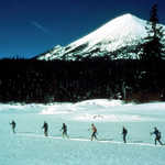
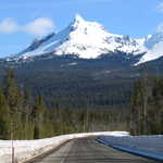
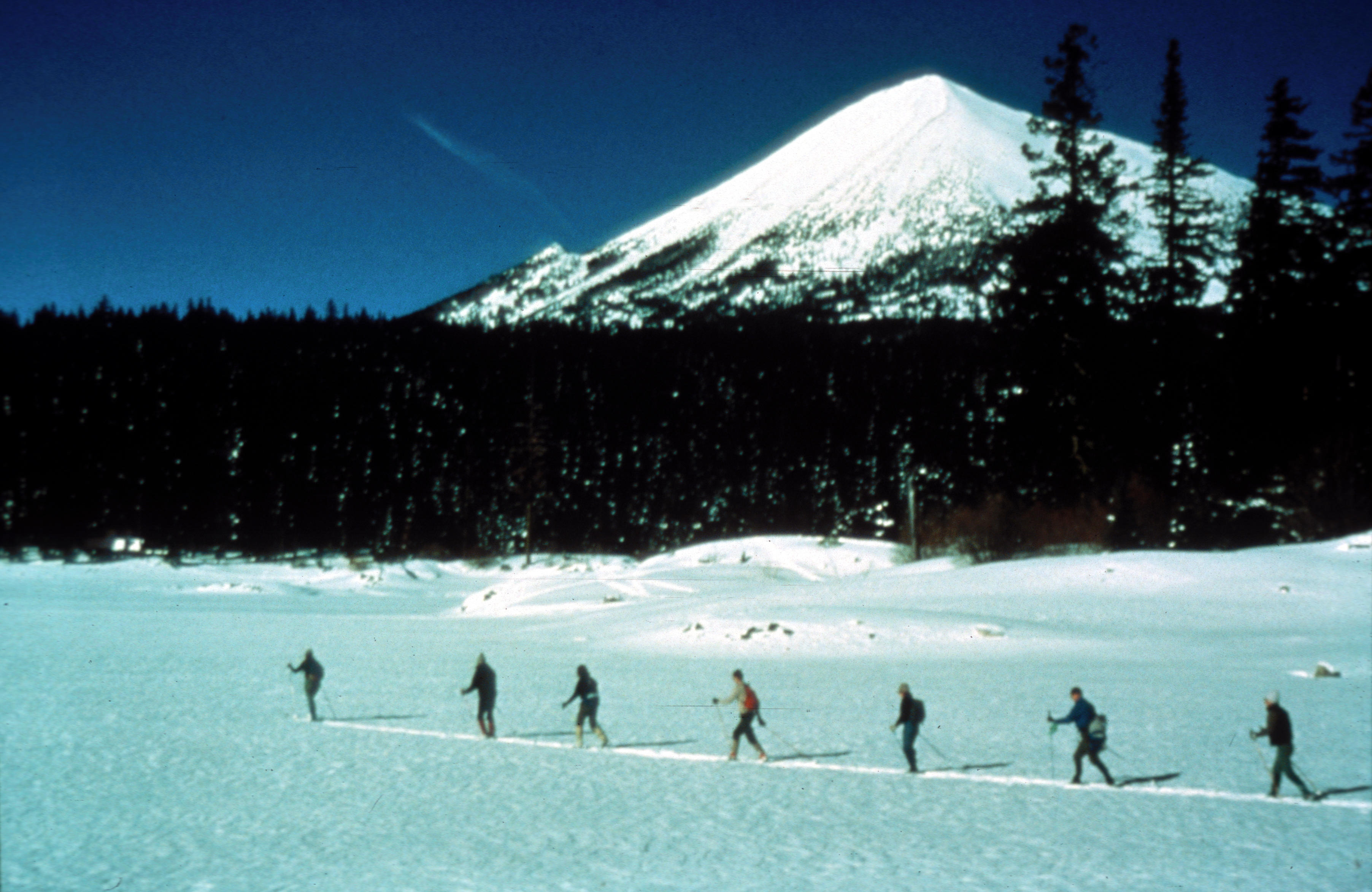
Cross-country skiing is a favorite pastime in the Upper Rogue country with an "active" volcano, Mt. McLoughlin, towering nearby.
Public Domain. Courtesy of U.S. Forest Service
Download Original (3608 x 2345 pixels, 5785.9 MB)
-
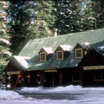
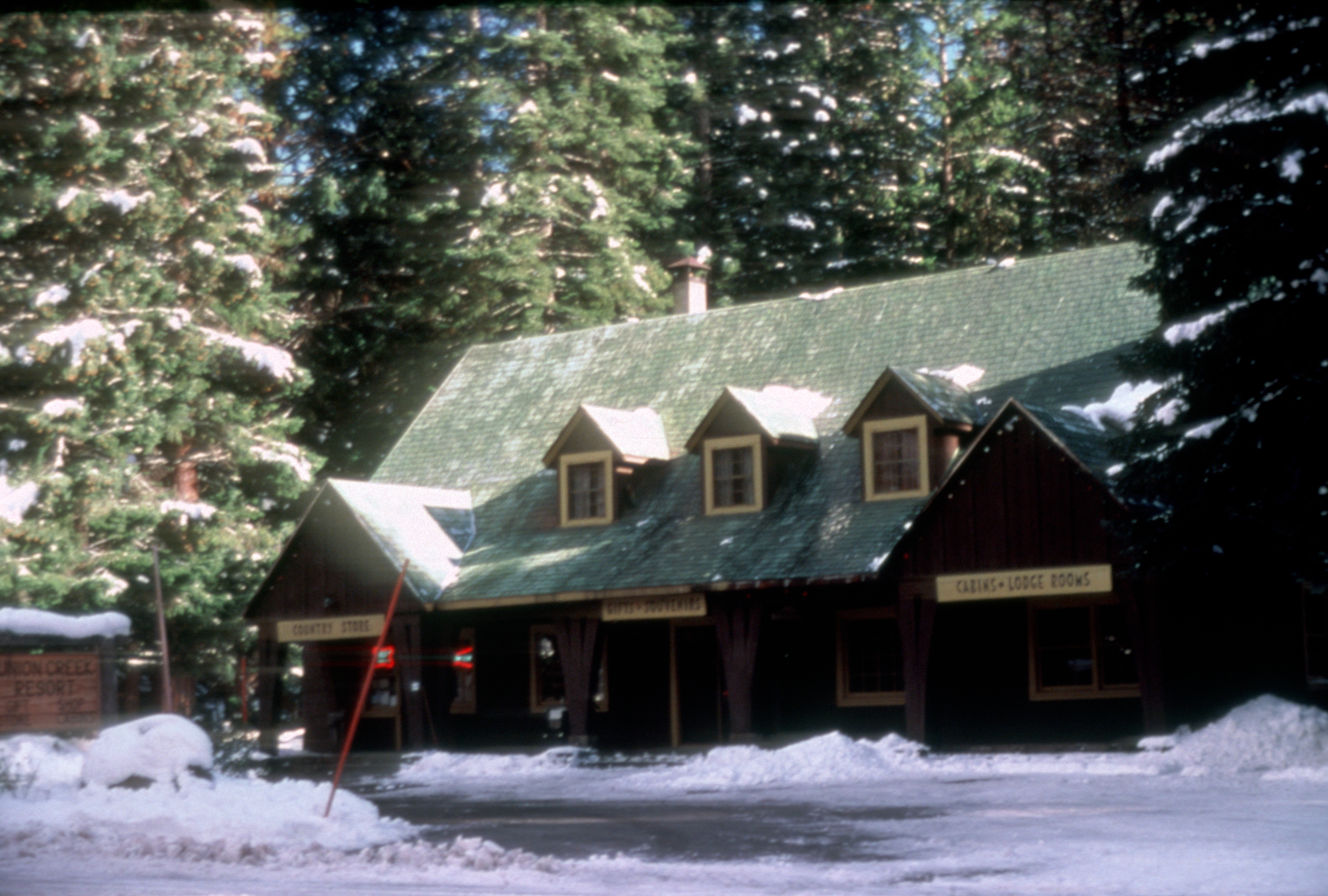
Enjoy the ambience of the 1930's Civilian Conservation Corps era in this small community in the woods. Listed on the Register of Historic Places, the Union Creek Resort is part of the Union Creek Historic District.
Public Domain. Courtesy of U.S. Forest Service
Download Original (3610 x 2437 pixels, 6266.5 MB)
-
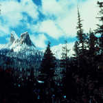
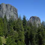
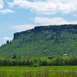
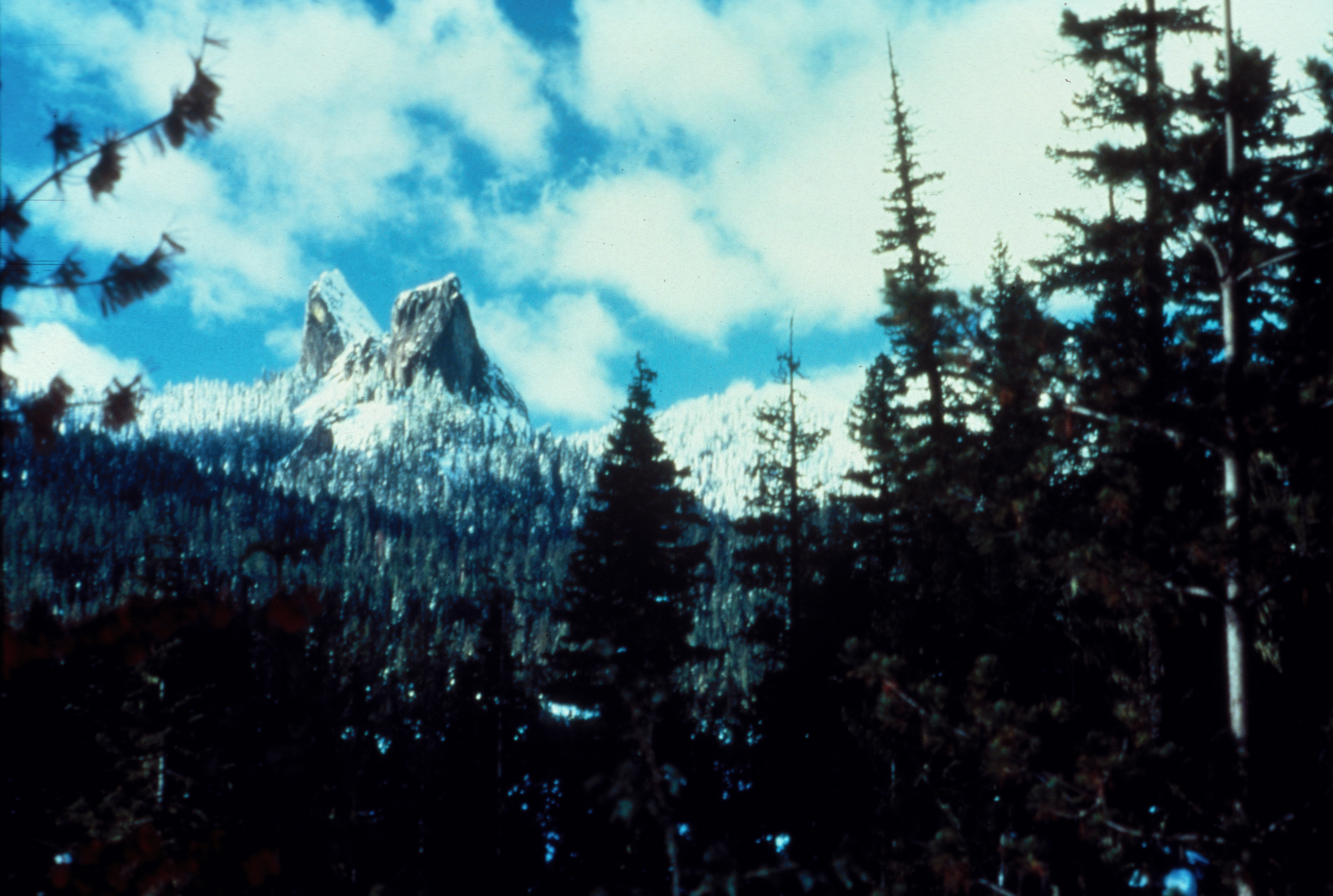
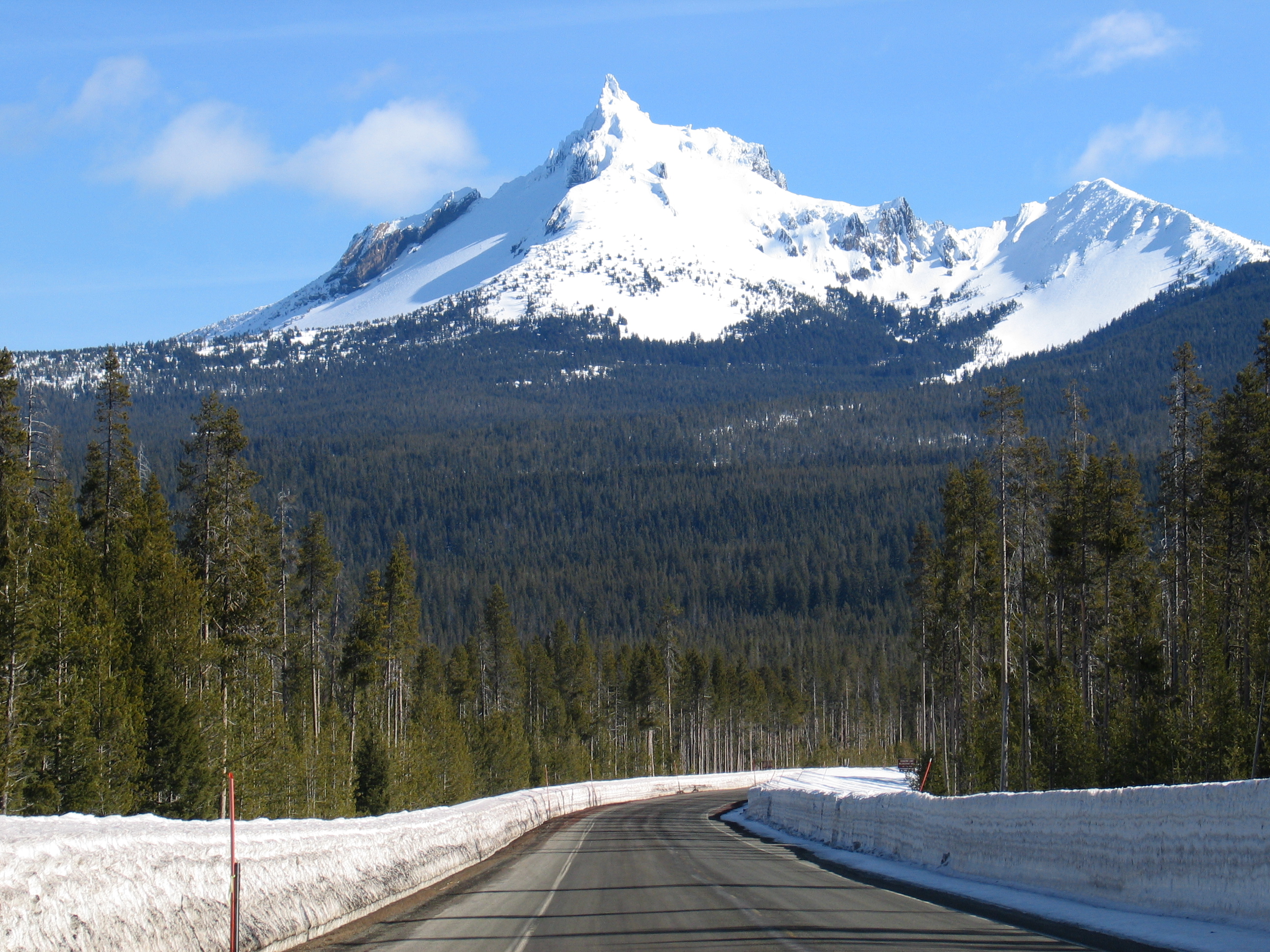
Geologists speculate that the unique twin shapes were once part of a large caldera.
Public Domain. USFS Photo, 541-858-2214
Download Original (3512 x 2361 pixels, 4915.8 MB)
-

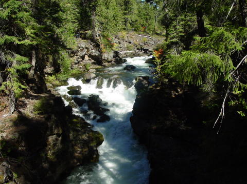
See the Rogue River carve its way through narrow basalt canyons and lava tubes at two geologic interpretive sites less than one mile apart. The rushing river cuts through 1.25 million year old hardened lava flows, forming natural bridges and gorges. "First you see it, then you don't."
© 2002 Donna Ikenberry.
Download Original (2441 x 3608 pixels, 7319.2 MB)
-
Pine trees line the edge of the Rogue River as it tumbles down the rocky hills.
Public Domain. Courtesy of Dale Sandberg
Download Original (480 x 359 pixels, 50.5 KB)
-
A graceful looking rock bridge arches over the rushing waters of the Rogue River.
Public Domain. Courtesy of Dale Sandberg
Download Original (480 x 359 pixels, 48.8 KB)
-
A forest of pine trees lines the edges of the Rabbit Ears mountains.
Public Domain. Courtesy of Dale Sandberg
Download Original (480 x 359 pixels, 42.0 KB)
-
From the ground is a truly magnificent view of the tall peaks of the Rabbit Ears.
Public Domain. Courtesy of Dale Sandberg
Download Original (270 x 360 pixels, 36.0 KB)
-
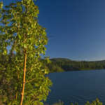
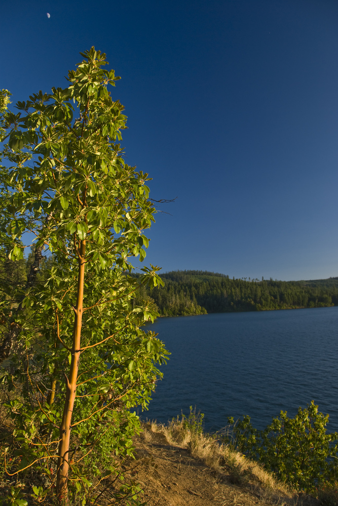
The sun sets on a tree in the Joseph H. Stewart State Park. The green leaves are drowned in golden light and the lake in the background mirrors the clear azure sky.
Public Domain. Karl S Johnson, http://karlsjohnson.com
Download Original (685 x 1024 pixels, 473.9 KB)
-

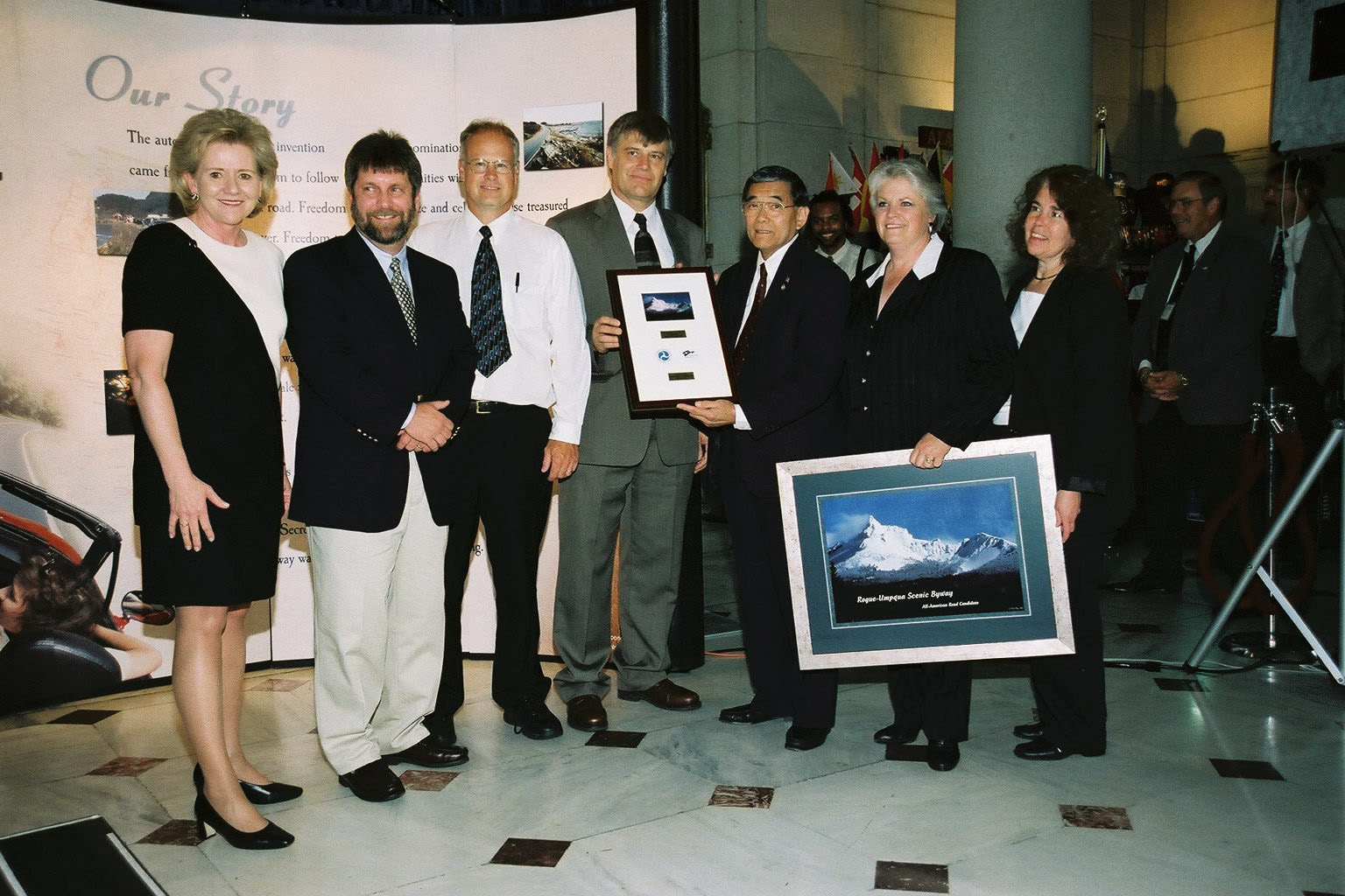
Oregon's Rogue-Umpqua Scenic Byway receives their designation plaque at the Designation 2002 event at Union Station in Washington DC.
 © June 2002 FHWA-NSB.
Download Original (1536 x 1024 pixels, 419.5 KB)
-
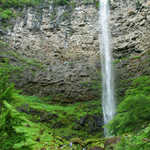
Take a short walk and feel the crystal clear, frigid water of the Clearwater River as it cascades over moss-covered rocks at Clearwater Falls.
Public Domain. Courtesy of John Sloan
Download Original (3072 x 2048 pixels, 3194.0 MB)
-

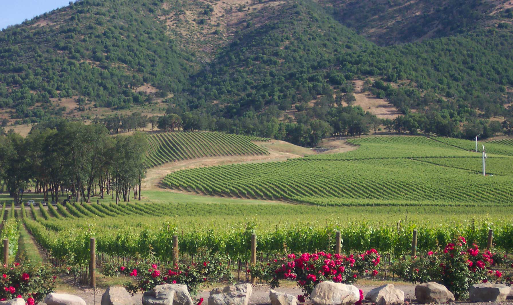
Roses bloom in front of the rolling vineyard of Del Rio Vineyards.
Public Domain. Photo courtesy of Del Rio Vineyards
Download Original (1792 x 1066 pixels, 279.3 KB)
-
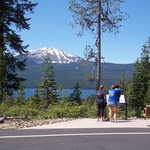
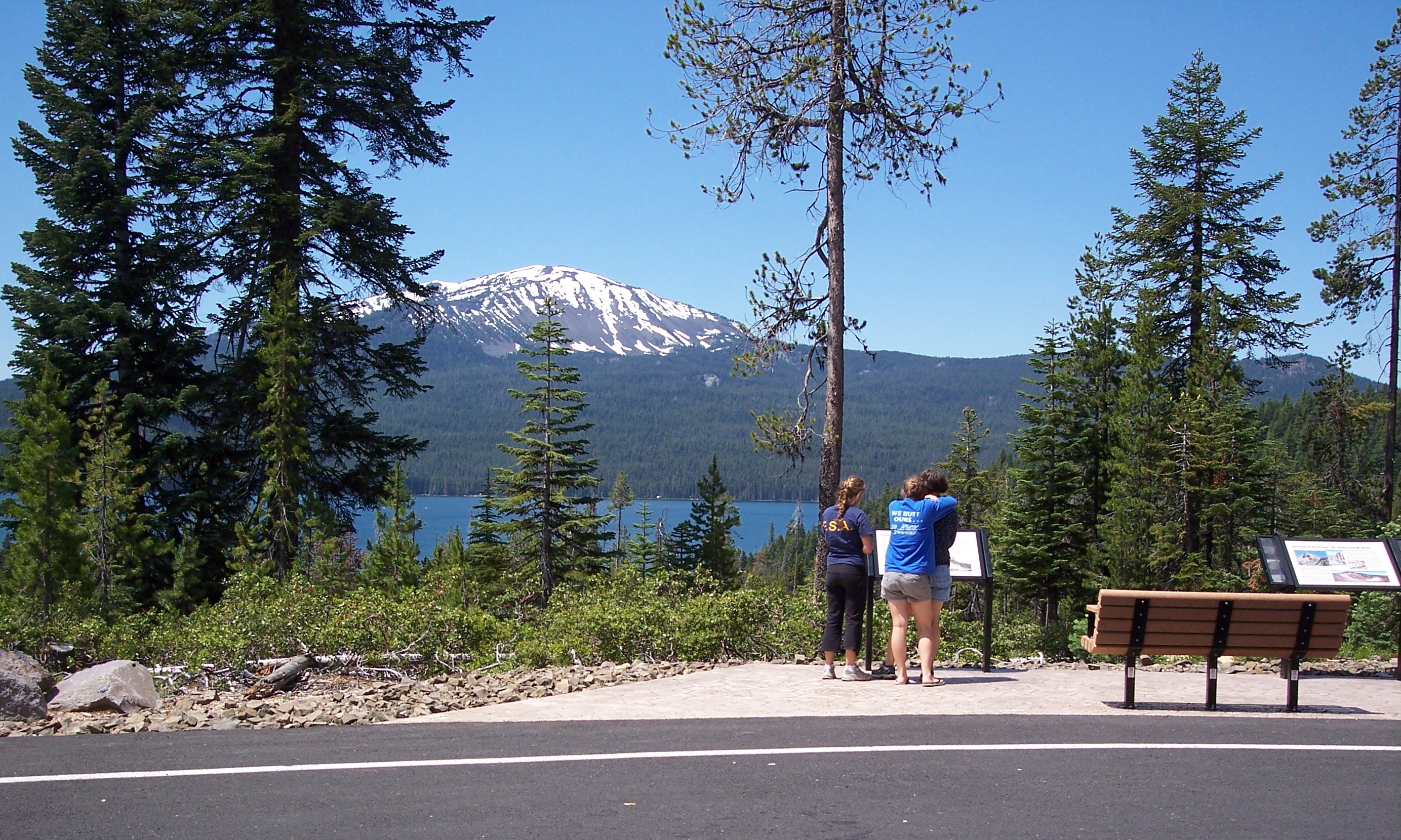
View year-round recreation playground Diamond Lake from the new viewpoint along Highway 138. Across the lake is Mt. Bailey, an ancient volcano towering at 8,375-feet high.
Public Domain. Photo courtesy of Bill Blackwell of the US Forest Service
Download Original (2767 x 1660 pixels, 2593.7 MB)
-
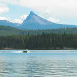
A boat tows a water skier on Lemolo Lake with Mt. Thielson in the background. A lodgepole pine forest surrounds a small resort, day-use area, and campgrounds.
Public Domain. Photo courtesy of Gregg Morgan of BLM
Download Original (1600 x 1200 pixels, 491.3 KB)
-
Hike up one of the two scenic mesas, Lower and Upper Table Rocks, for a panoramic view of the Rogue Valley and surrounding mountains.
Public Domain. Photo courtesy of John Sloan
Download Original (3072 x 2048 pixels, 2161.9 MB)
-
Stop at the Mt. Thielsen Viewpoint along Highway 230 and see this ancient volcano towering at 9,182-feet high.
Public Domain. Photo courtesy of Gregg Morgan of BLM
Download Original (2592 x 1944 pixels, 2590.6 MB)
-
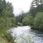
This is a relatively calm section of the North Umpqua River on a fall day, as seen from Boulder Flat Campground in the Umpqua National Forest.
Public Domain. Photo courtesy of John Sloan
Download Original (3072 x 2048 pixels, 3537.6 MB)
-
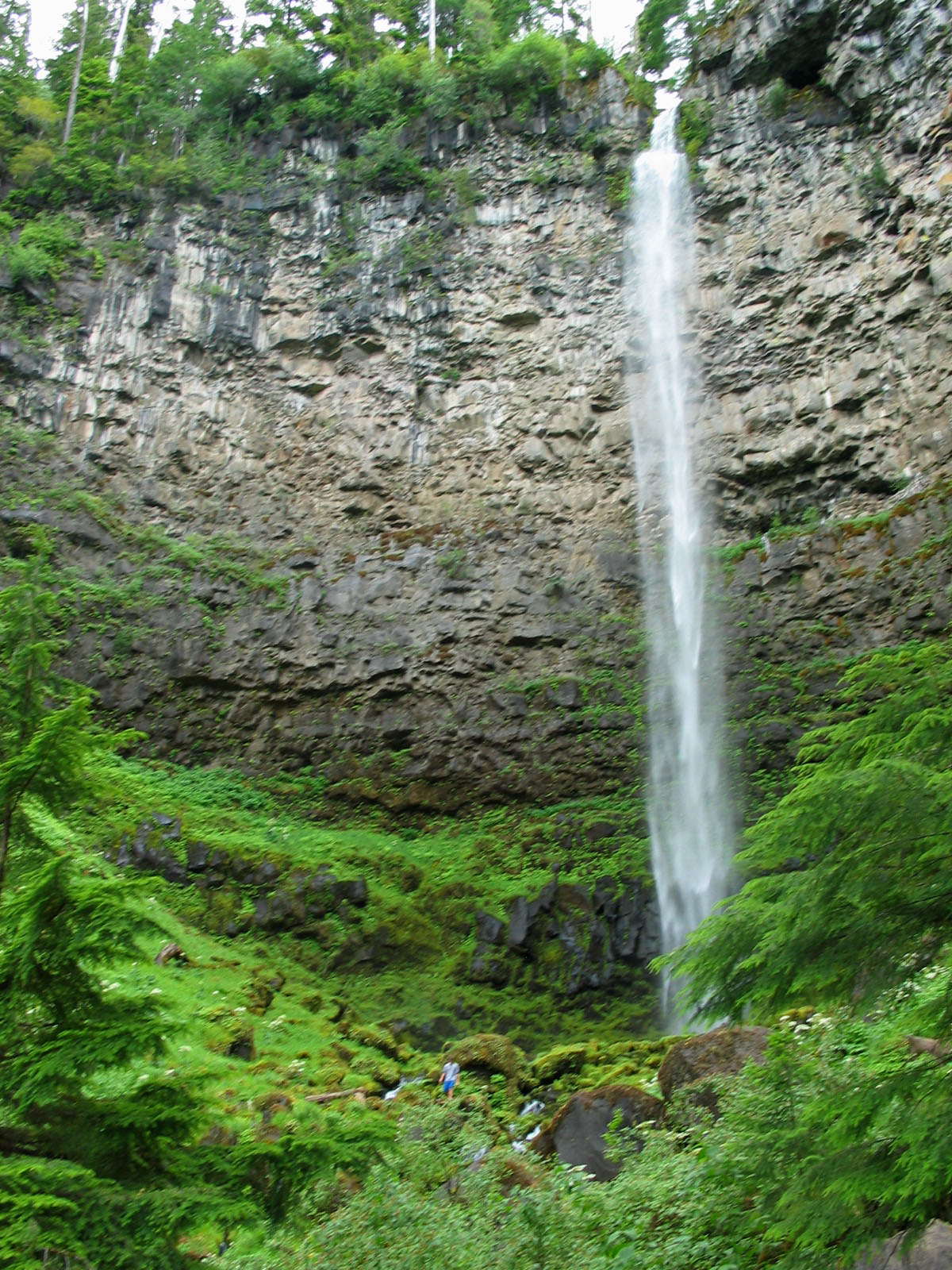
About 750,000 years ago, volcanic eruptions produced a hot molten lava flow that filled this valley hundreds of feet deep with basaltic rock. Watson Creek spills over the northern edge of this flow to form Watson Falls.
Public Domain. Photo courtesy of Gregg Morgan of BLM
Download Original (1200 x 1600 pixels, 515.9 KB)
-
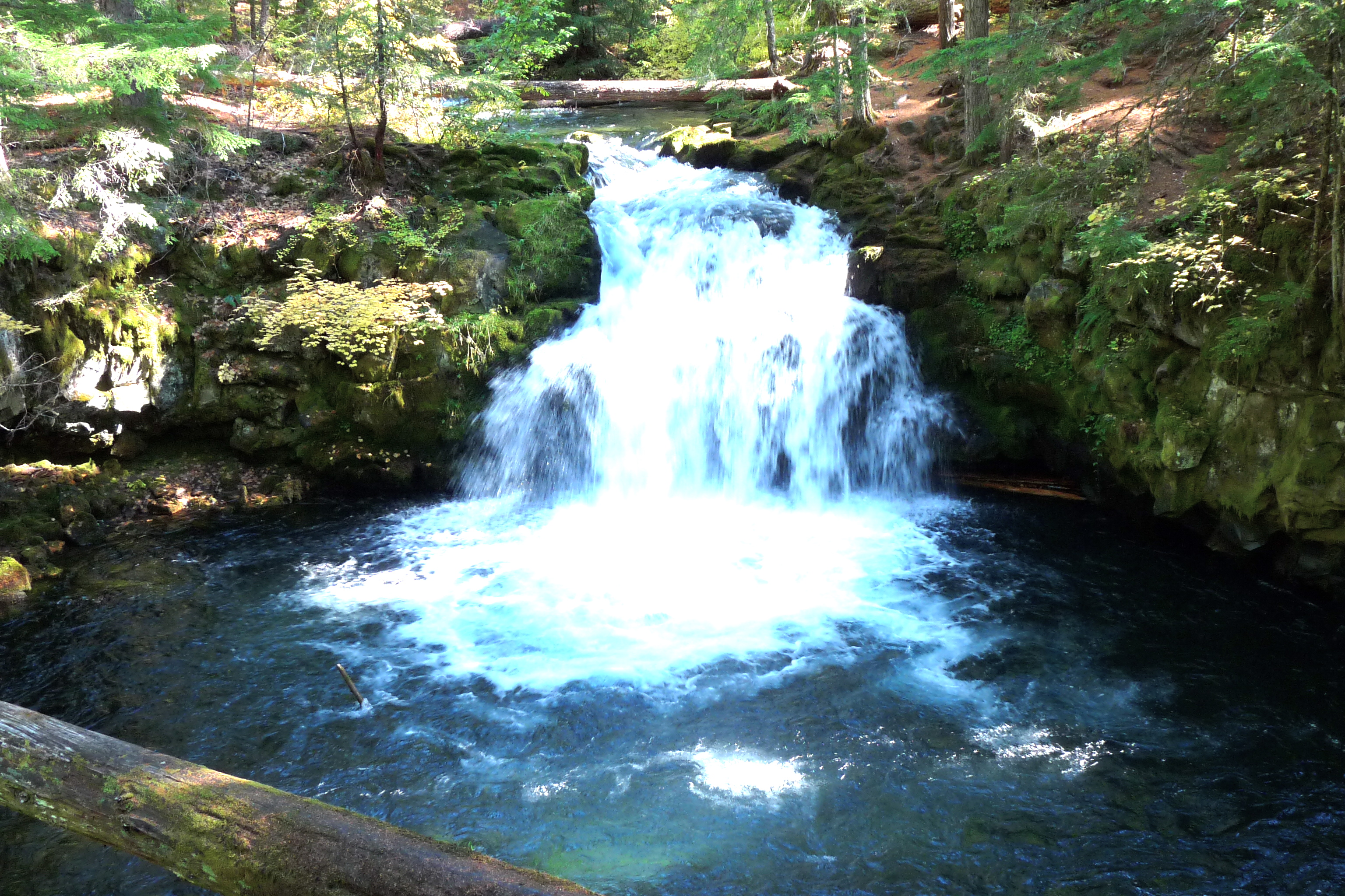
This waterfall tumbles 15 feet into a punchbowl, providing a relaxing setting to sit and enjoy the scenery.
Public Domain. Photo courtesy of John Sloan
Download Original (3072 x 2048 pixels, 3073.6 MB)
-
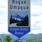
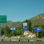
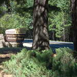
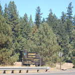
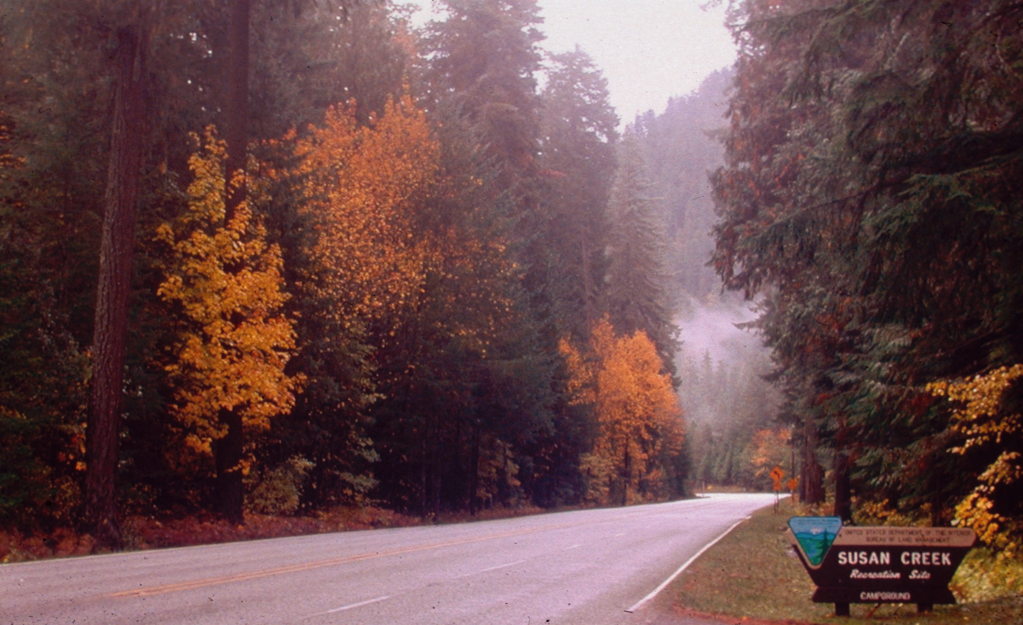
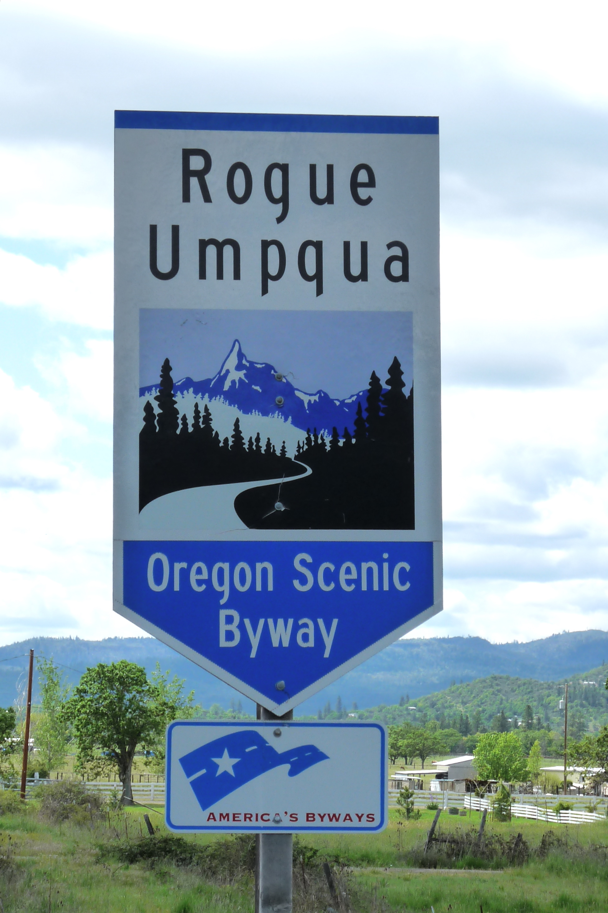
This road sign is used to help travelers find the Rogue-Umpqua Scenic Byway.
Public Domain. Photo courtesy of John Sloan
Download Original (1955 x 2933 pixels, 1238.7 MB)
-
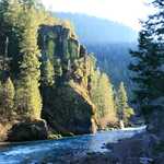
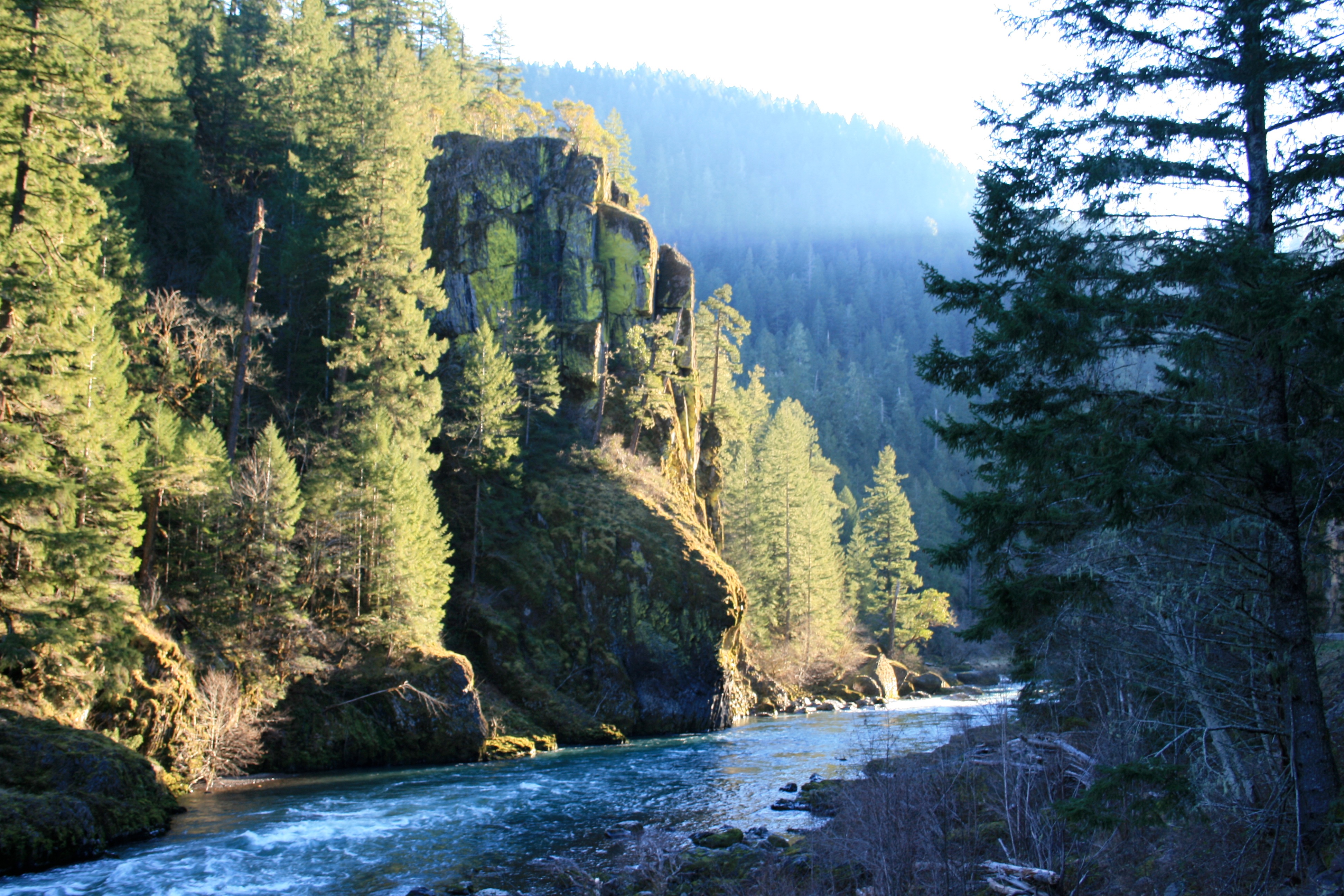
This is Elevation Rock in the afternoon. Also visible is the North Umpqua river, which flows along the route of the Rogue-Umpqua Scenic Byway.
Public Domain. Photo courtesy of Gregg Morgan of BLM
Download Original (3888 x 2592 pixels, 2468.9 MB)
-
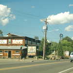
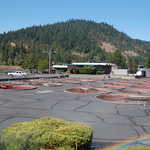
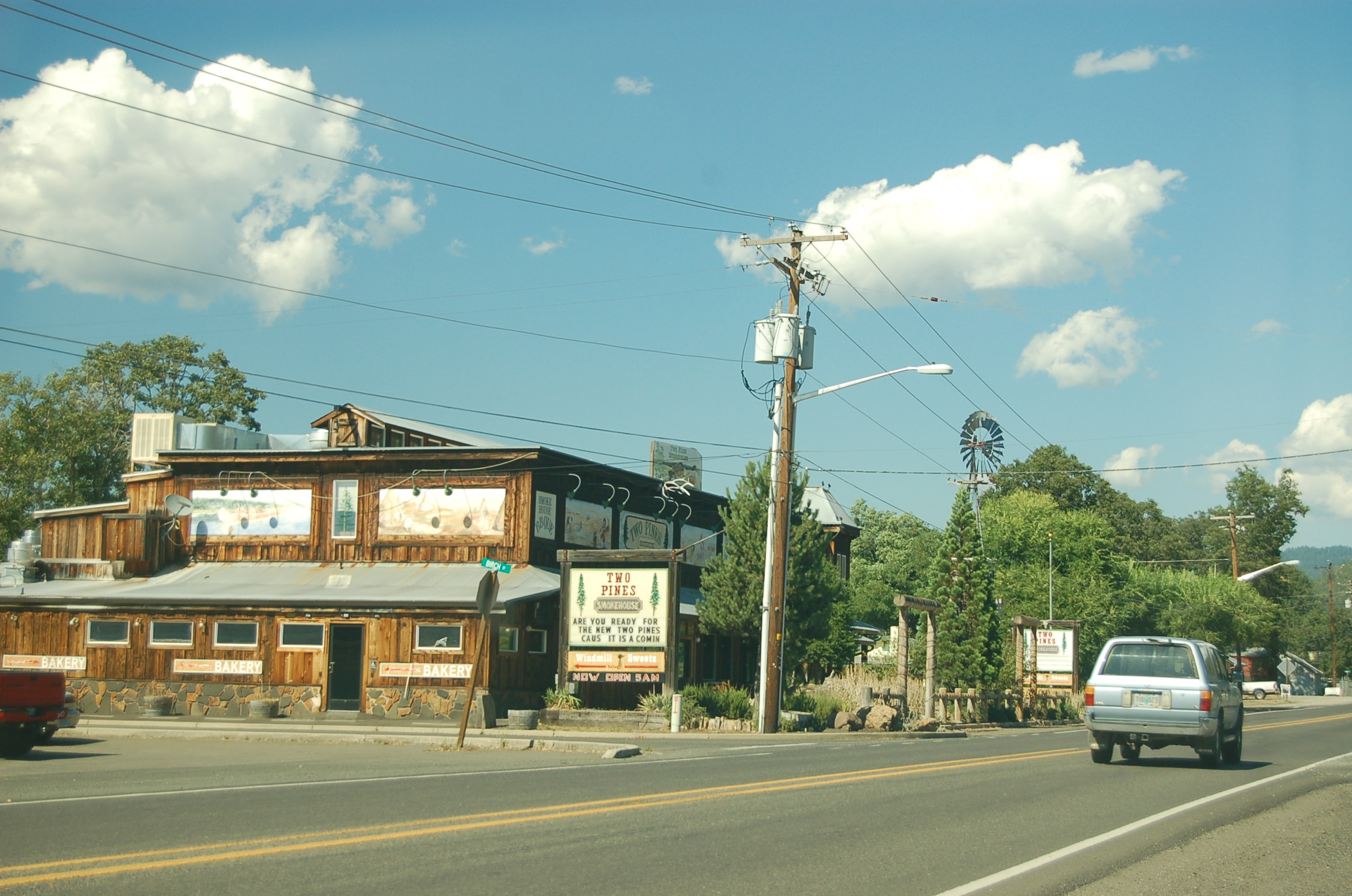
A windmill rises over a restaurant and shopping complex on the Rogue-Umpqua Scenic Byway in Shady Cove.
Public Domain. Photo by A. E. Crane
Download Original (2256 x 1496 pixels, 753.5 KB)
-
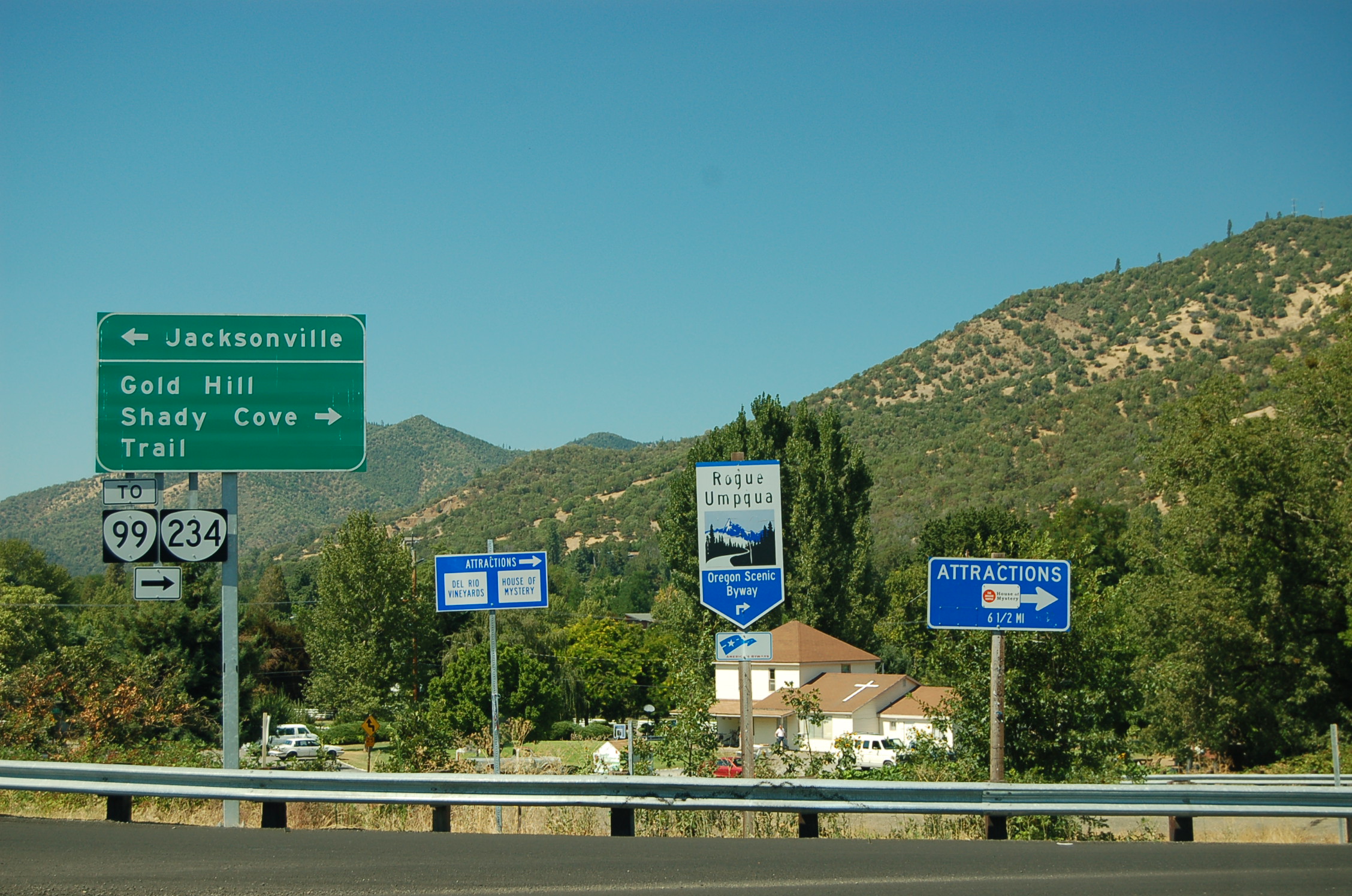
An Oregon state byway sign and an America's Byways sign mark the southwestern terminus to the Rogue-Umpqua Scenic Byway.
Public Domain. Photo by A. E. Crane
Download Original (2256 x 1496 pixels, 922.1 KB)
-
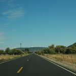
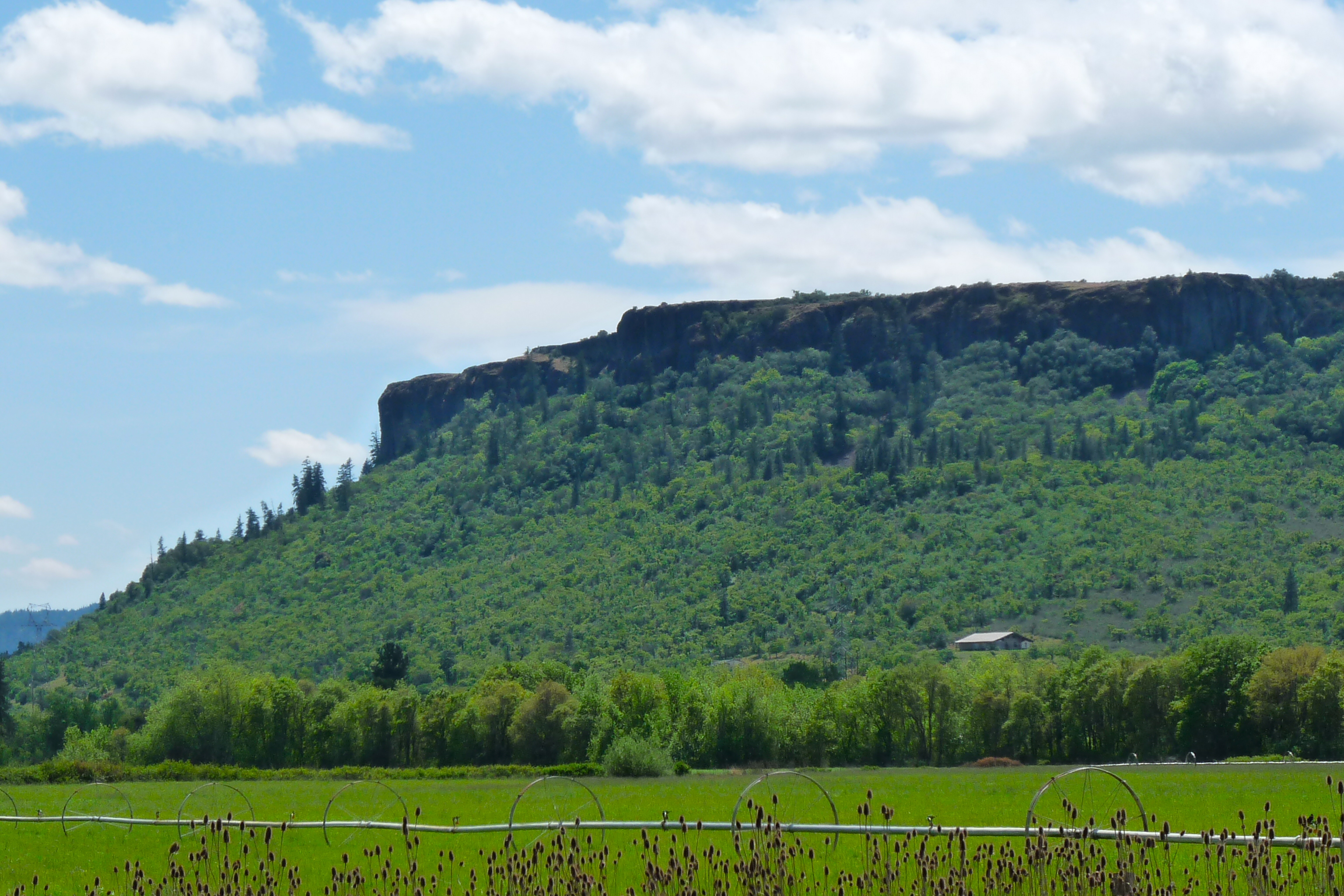
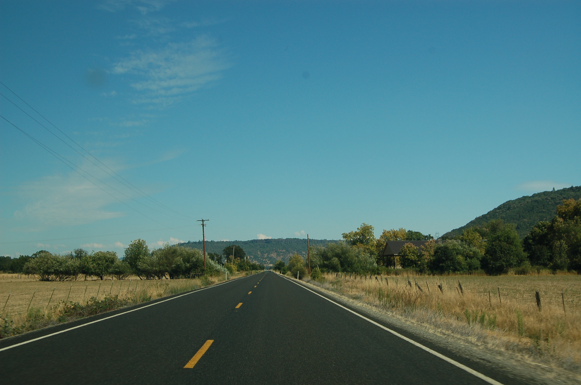
The Rogue-Umpqua Scenic Byway (SR 234) runs straight and smooth through the farm and ranchland past both Table Rocks.
Public Domain. Photo by A. E. Crane
Download Original (2256 x 1496 pixels, 928.1 KB)
-
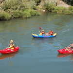
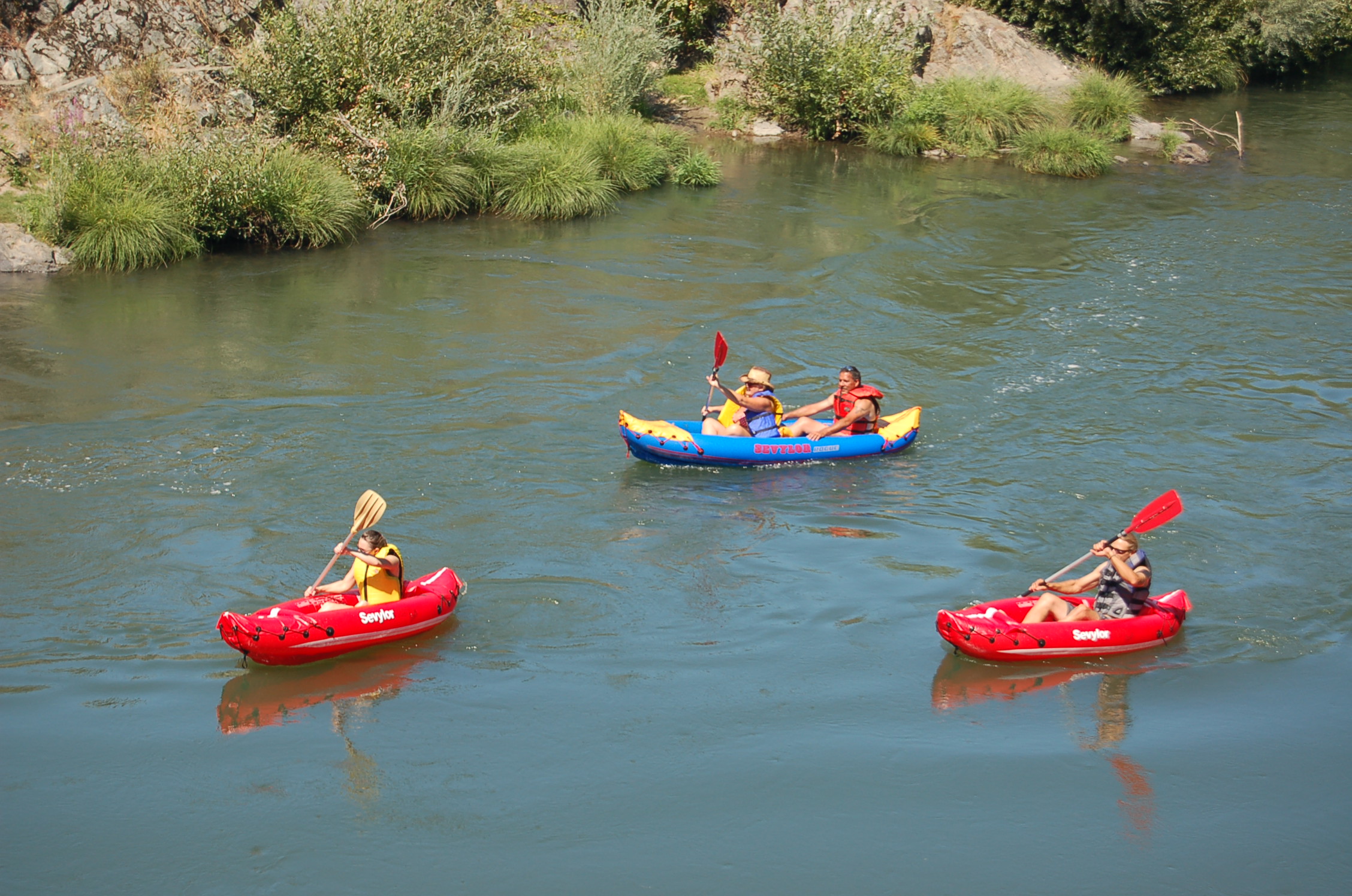
Three boats drift lazily down a calmer stretch of the Rogue River by the town of Gold Hill.
Public Domain. Photo by A. E. Crane
Download Original (2256 x 1496 pixels, 861.9 KB)
-
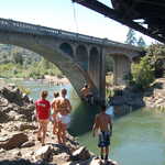
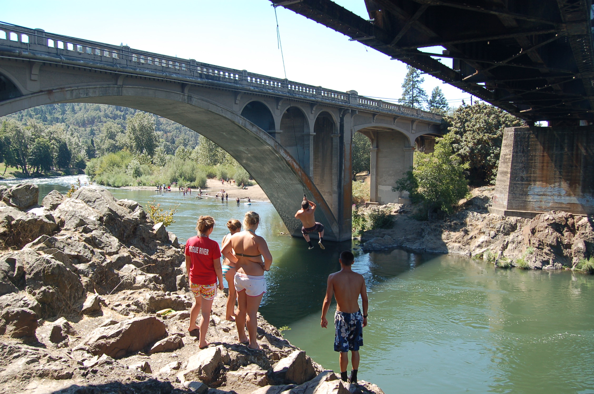
A teenage boy sails out over the Rogue River from a rope dangling off a bridge, about to drop into the waters below. Others watch, waiting their turn to cool off.
Public Domain. Photo by A. E. Crane
Download Original (2256 x 1496 pixels, 906.6 KB)
-
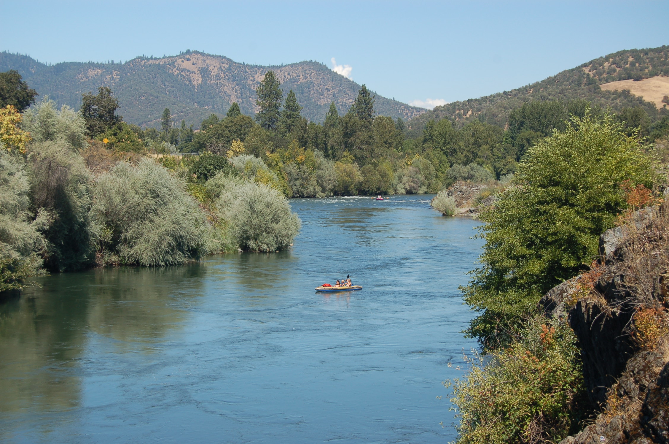
A single boat floats down the gentle waters of the Rogue River gorge by Gold Hill, Oregon.
Public Domain. Photo by A. E. Crane
Download Original (2256 x 1496 pixels, 903.8 KB)
-
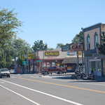
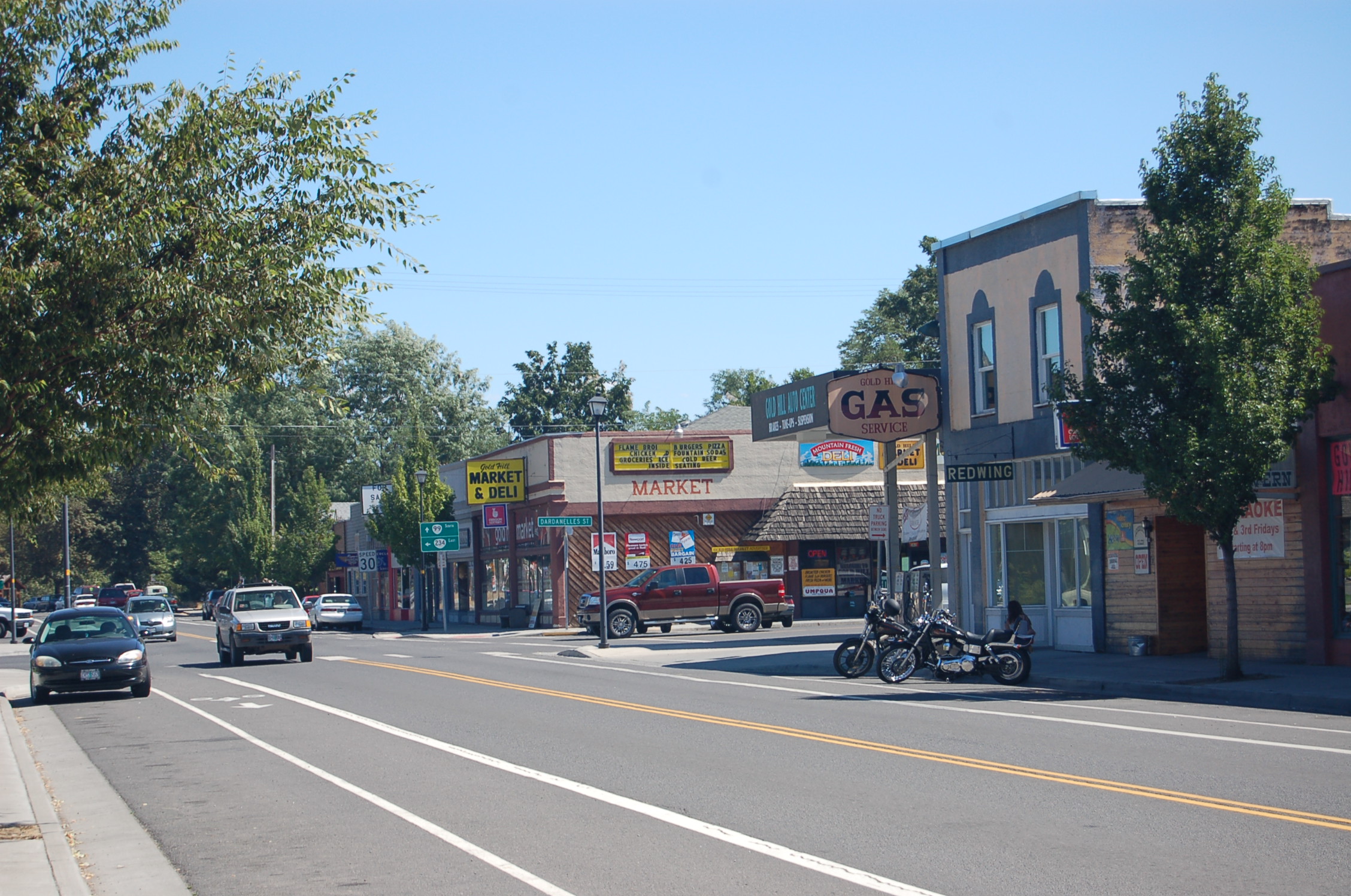
Refurbished shops, many with Old West-style fronts, line the main street through Gold Hill, Oregon.
Public Domain. Photo by A. E. Crane
Download Original (2256 x 1496 pixels, 897.5 KB)
-
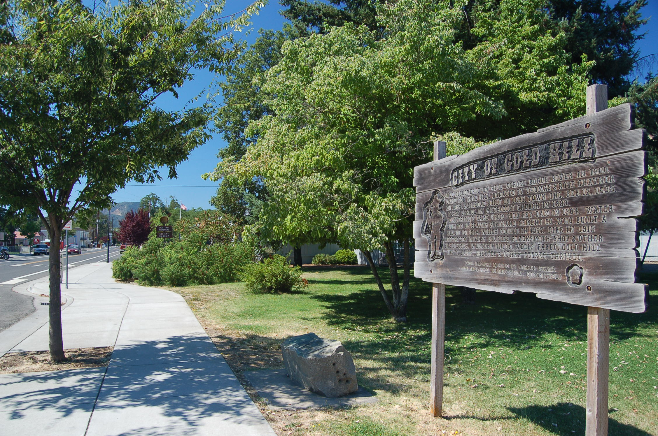
A rustic wooden sign in downtown Gold Hill tells of the small town's exciting gold rush days.
Public Domain. Photo by A. E. Crane
Download Original (2256 x 1496 pixels, 944.2 KB)
-

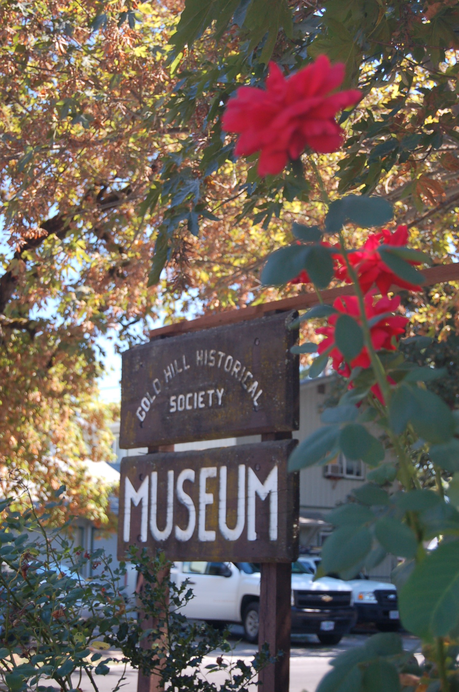
A red rose frames the wooden sign in front of the Gold Hill Historical Society Museum in downtown Gold Hill.
Public Domain. Photo by A. E. Crane
Download Original (1496 x 2256 pixels, 752.2 KB)
-
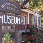
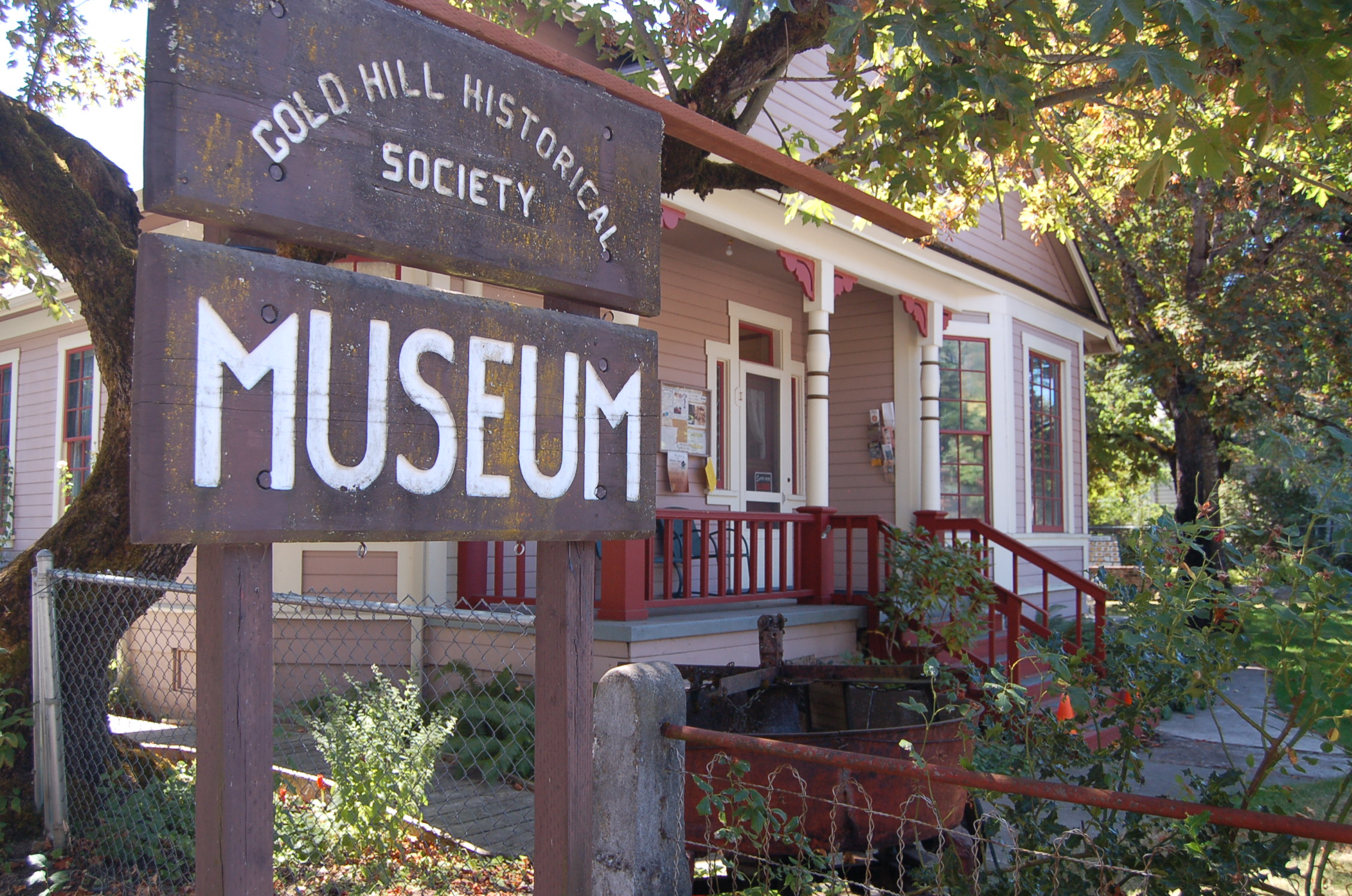
Red-painted banisters and white trim highlight the small frame house that houses the Gold Hill Historical Society Museum.
Public Domain. Photo by A. E. Crane
Download Original (2256 x 1496 pixels, 918.4 KB)
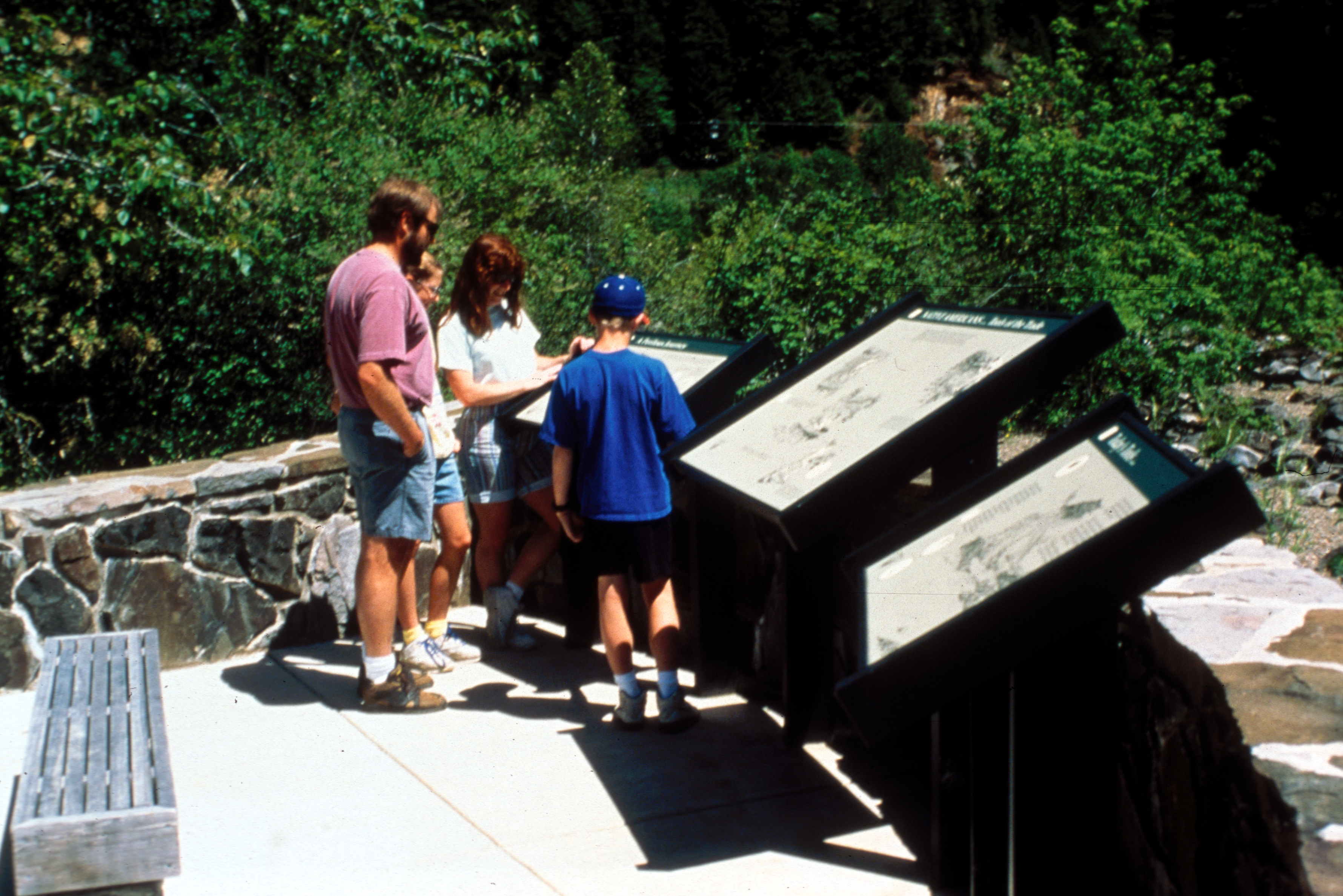
-
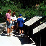
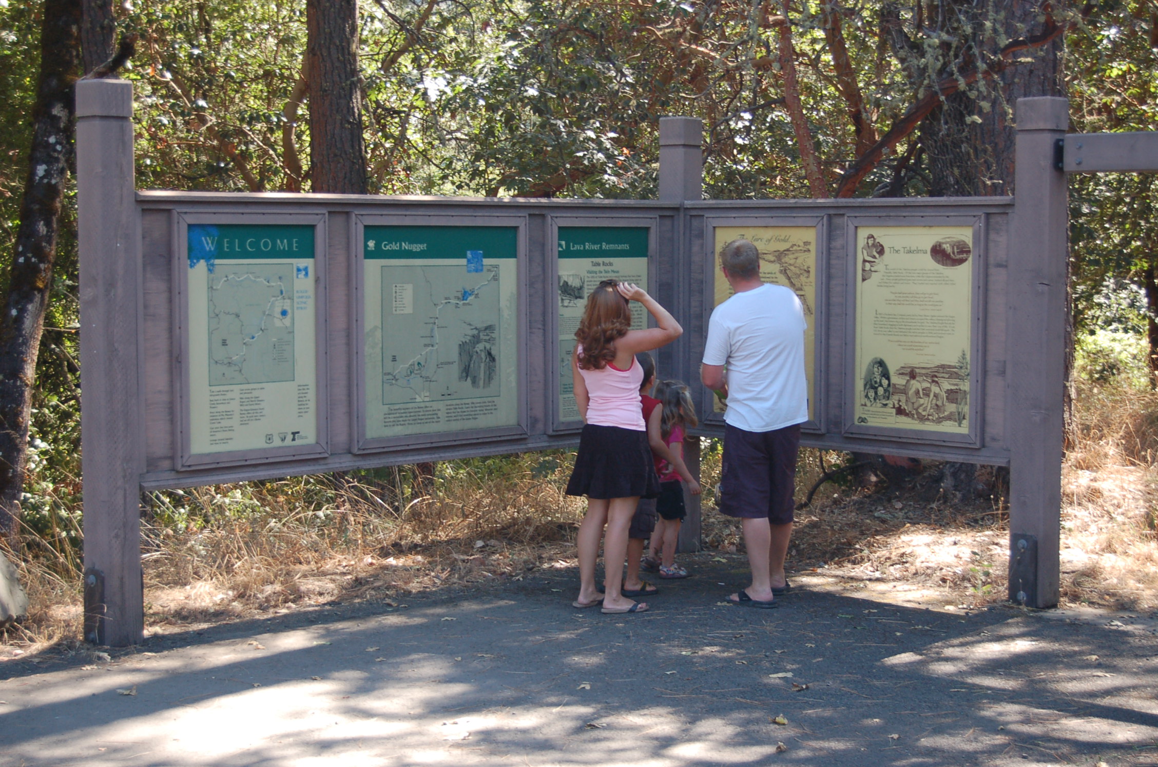
At the Gold Nugget Recreation Site, a family reads about the Gold Rush days along the Rogue River.
Public Domain. Photo by A. E. Crane
Download Original (2256 x 1496 pixels, 904.9 KB)
-
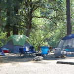
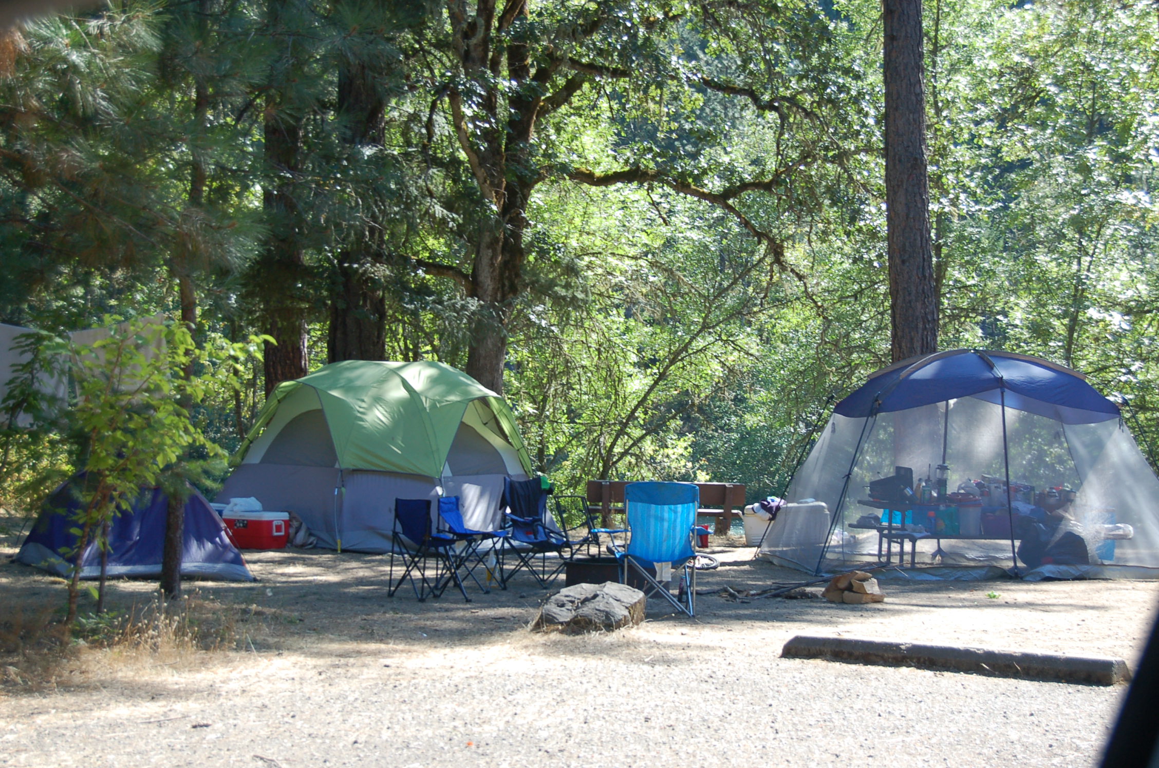
Campers take advantage of the shady campsites at the Rogue Elk County Park.
Public Domain. Photo by A. E. Crane
Download Original (2256 x 1496 pixels, 925.2 KB)
-
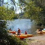
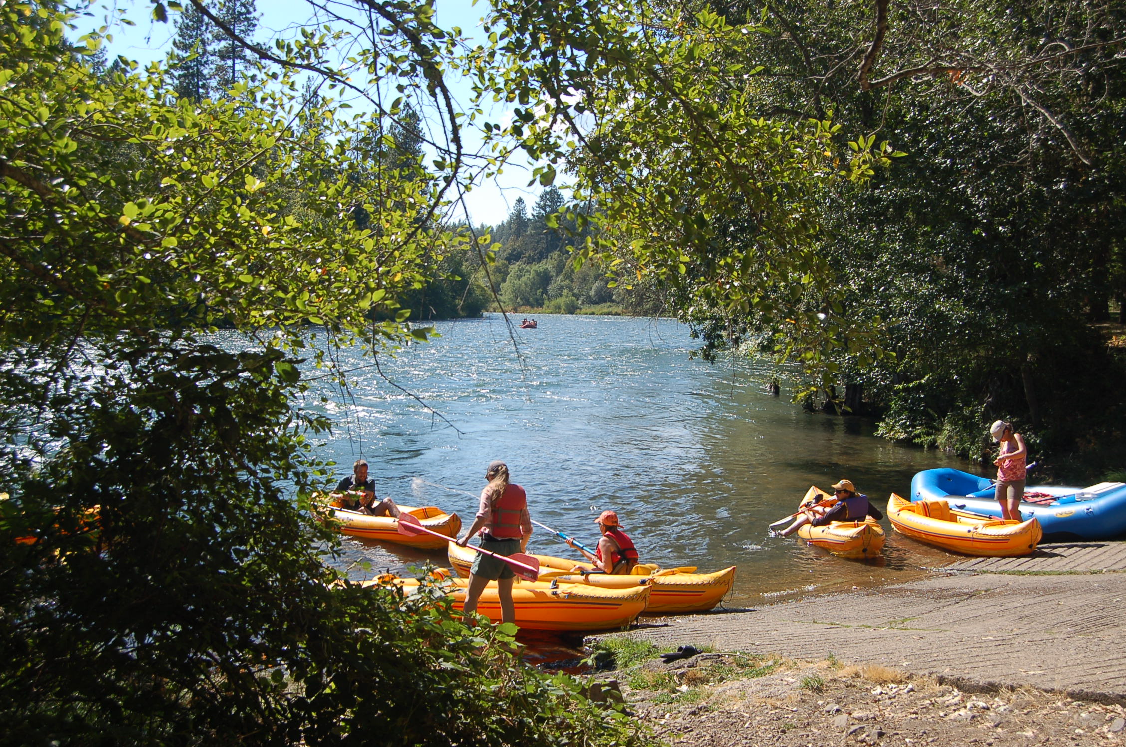
Travelers utilize one of several boat launch areas to begin their float down the Rogue River in Rogue Elk County Park.
Public Domain. Photo by A. E. Crane
Download Original (2256 x 1496 pixels, 952.5 KB)
-
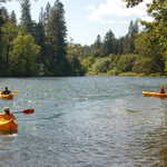
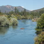
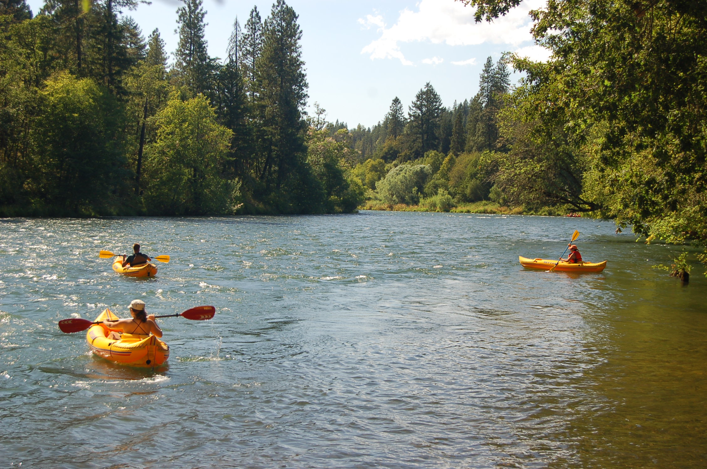
Rafters enjoy floating along a calm stretch of the Rogue River near Rogue Elk County Park.
Public Domain. Photo by A. E. Crane
Download Original (2256 x 1496 pixels, 919.9 KB)
-
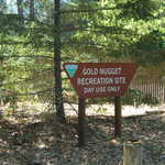
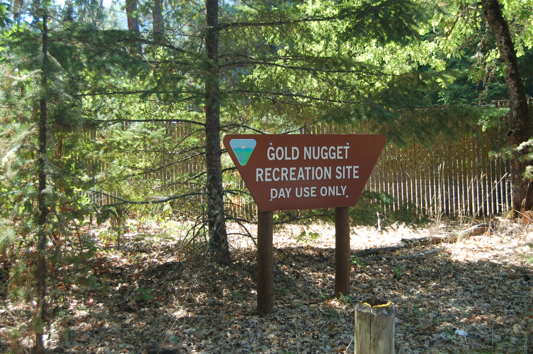
A sign about the Gold Nugget Recreation Area sits amidst evergreens.
Public Domain. Photo by A. E. Crane
Download Original (2256 x 1496 pixels, 944.3 KB)
-
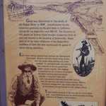
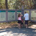
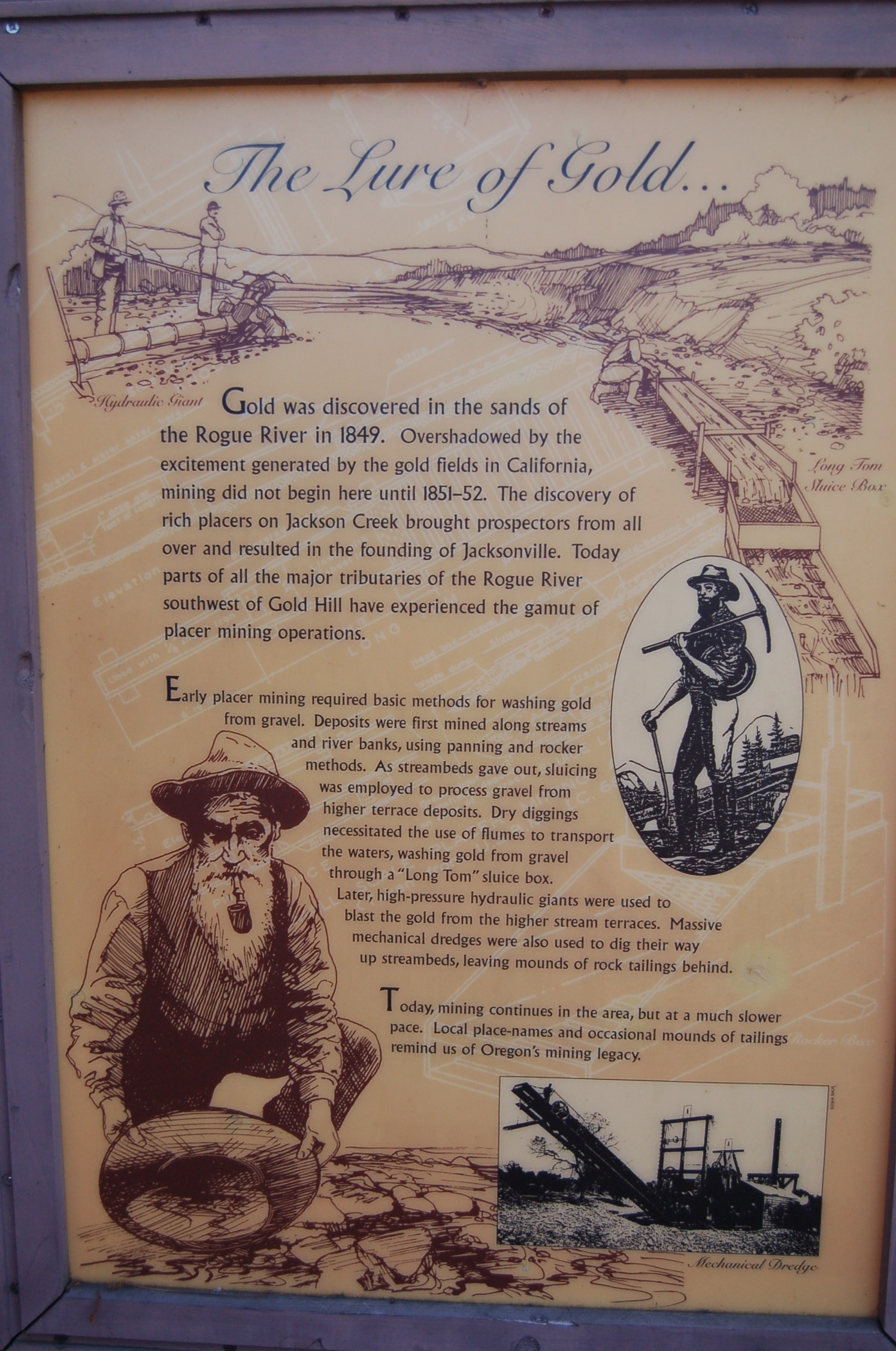
An informational sign at the Gold Nugget Wayside Area explains the "Lure of Gold" in the area in 1849.
Public Domain. Photo by A. E. Crane
Download Original (1496 x 2256 pixels, 723.8 KB)
-
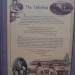
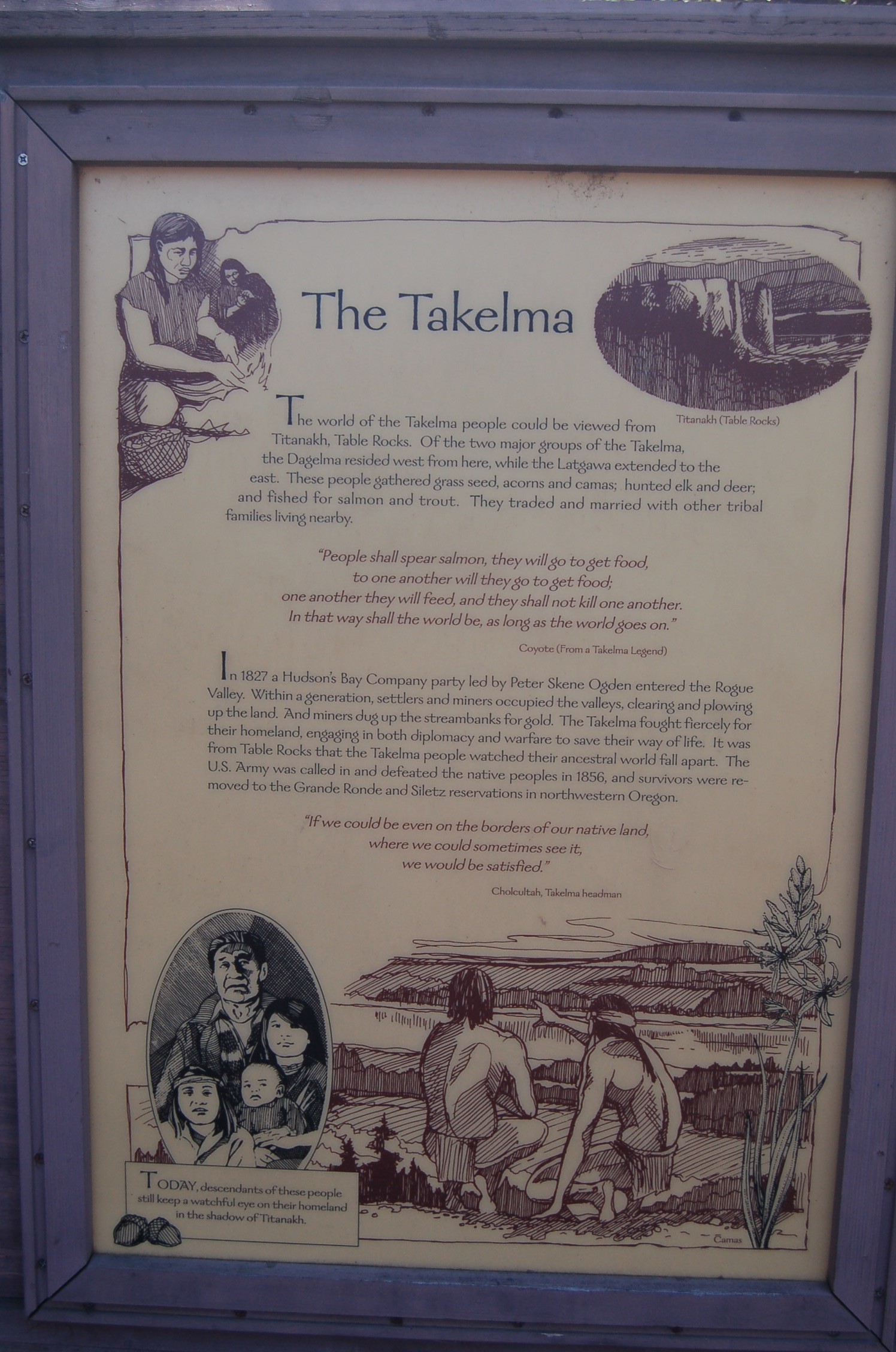
An informational sign at the Gold Nugget Wayside Recreation Area recounts the history of the Takelma people in the area.
Public Domain. Photo by A. E. Crane
Download Original (1496 x 2256 pixels, 654.6 KB)
-
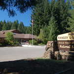
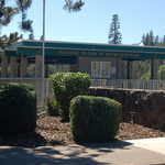
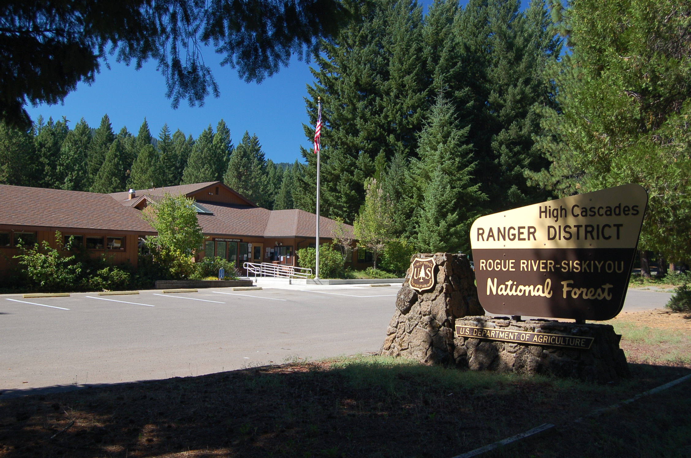
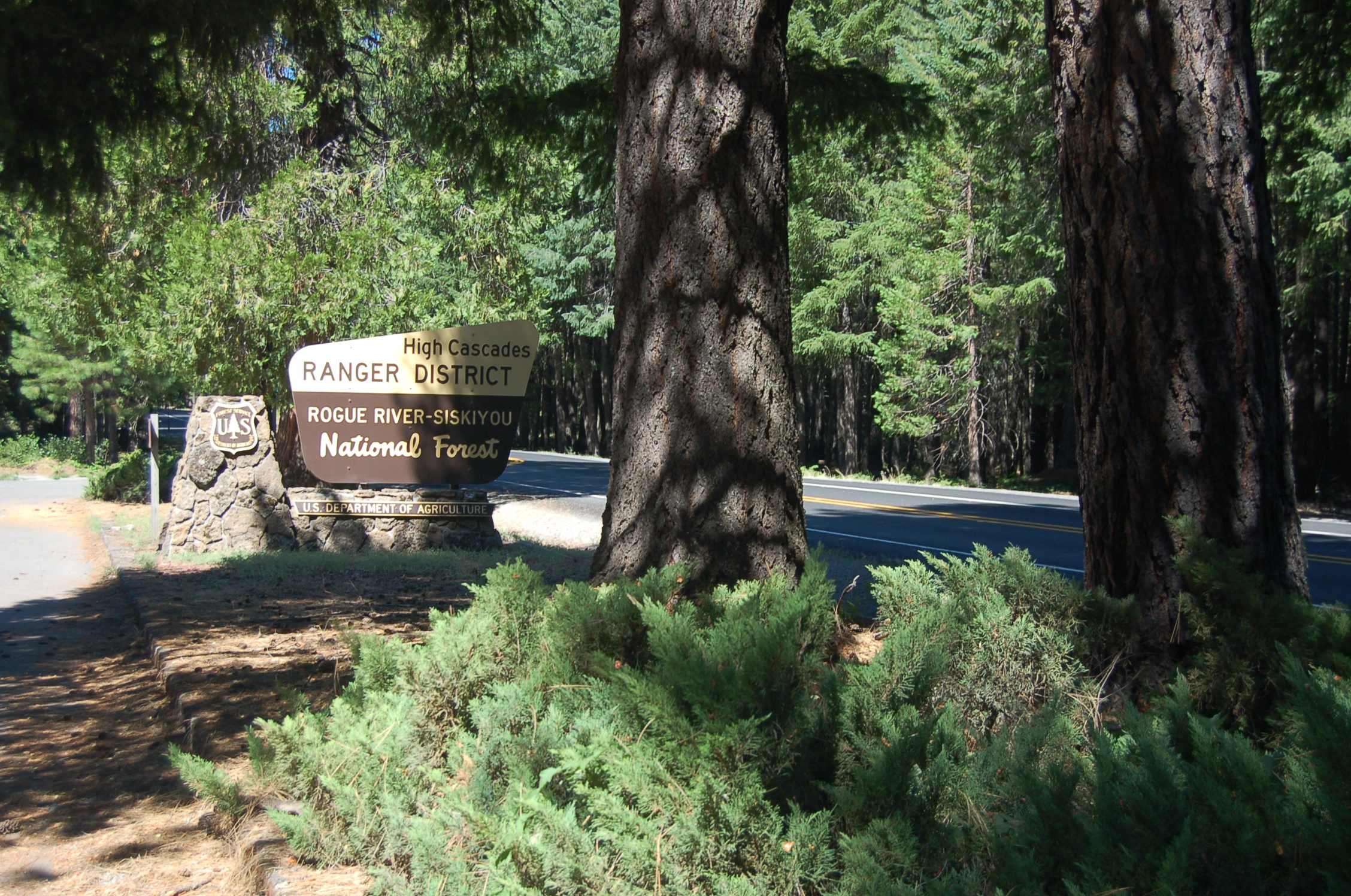
The brown and gold USFS sign and logo stands on its stone base outside the long and low building housing the High Cascades Ranger Station in the Rogue River - Siskiyou National Forest of southern Oregon.
Public Domain. Photo by A. E. Crane
Download Original (2256 x 1496 pixels, 906.8 KB)
-
A brown and gold sign next to the road outside the High Cascades Ranger Station names the forest as the Rogue River - Siskiyou National Forest.
Public Domain. Photo by A. E. Crane
Download Original (2256 x 1496 pixels, 922.3 KB)
-
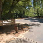
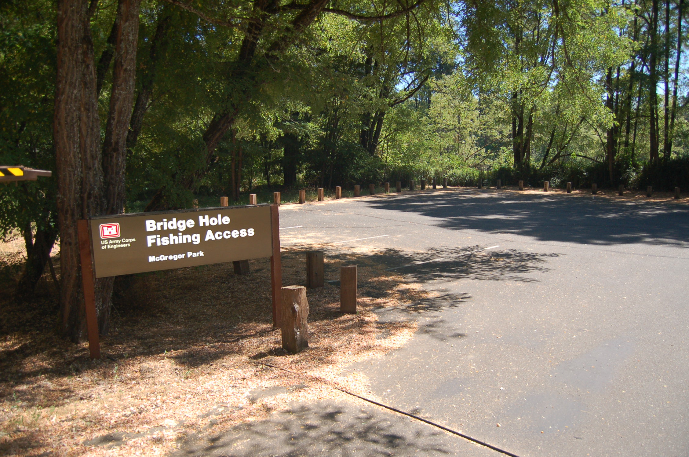
One of the features of McGregor Park near Lost Creek Reservoir is a simple fishing area near SR 62 and Takelma Drive, which has paths to the river, a latrine and paved parking.
Public Domain. Photo by A. E. Crane
Download Original (2256 x 1496 pixels, 905.8 KB)
-
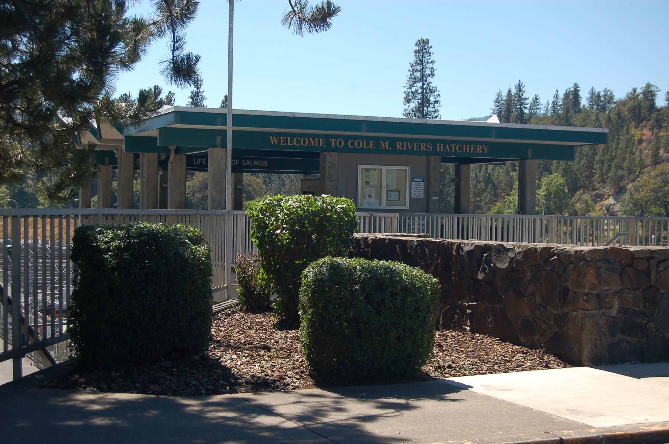
A small enclosure overlooking the Cole M. Rivers Fish Hatchery includes interpretive signs explaining about the purpose and mission of the facility.
Public Domain. Photo by A. E. Crane
Download Original (2256 x 1496 pixels, 889.8 KB)
-
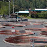
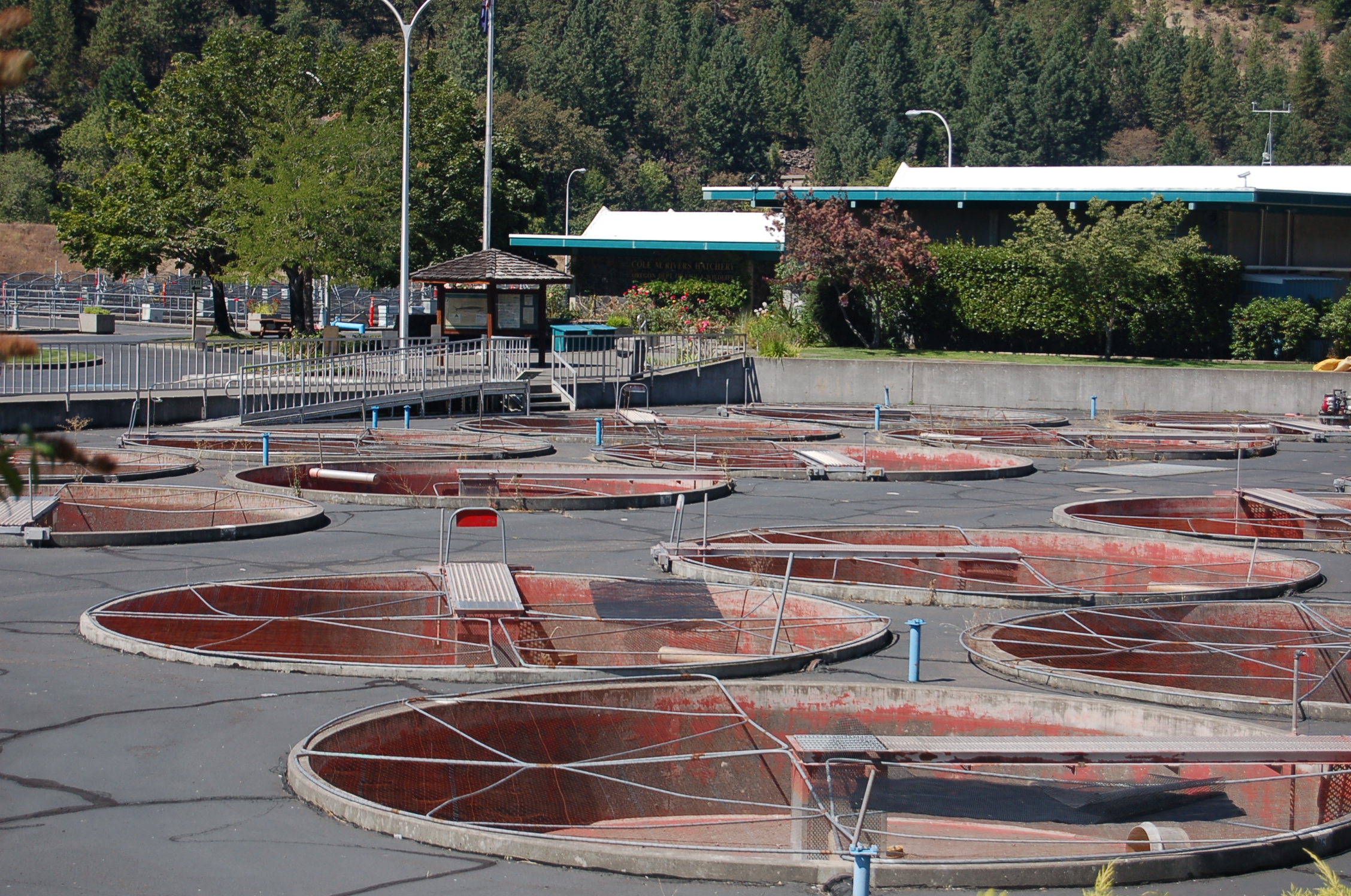
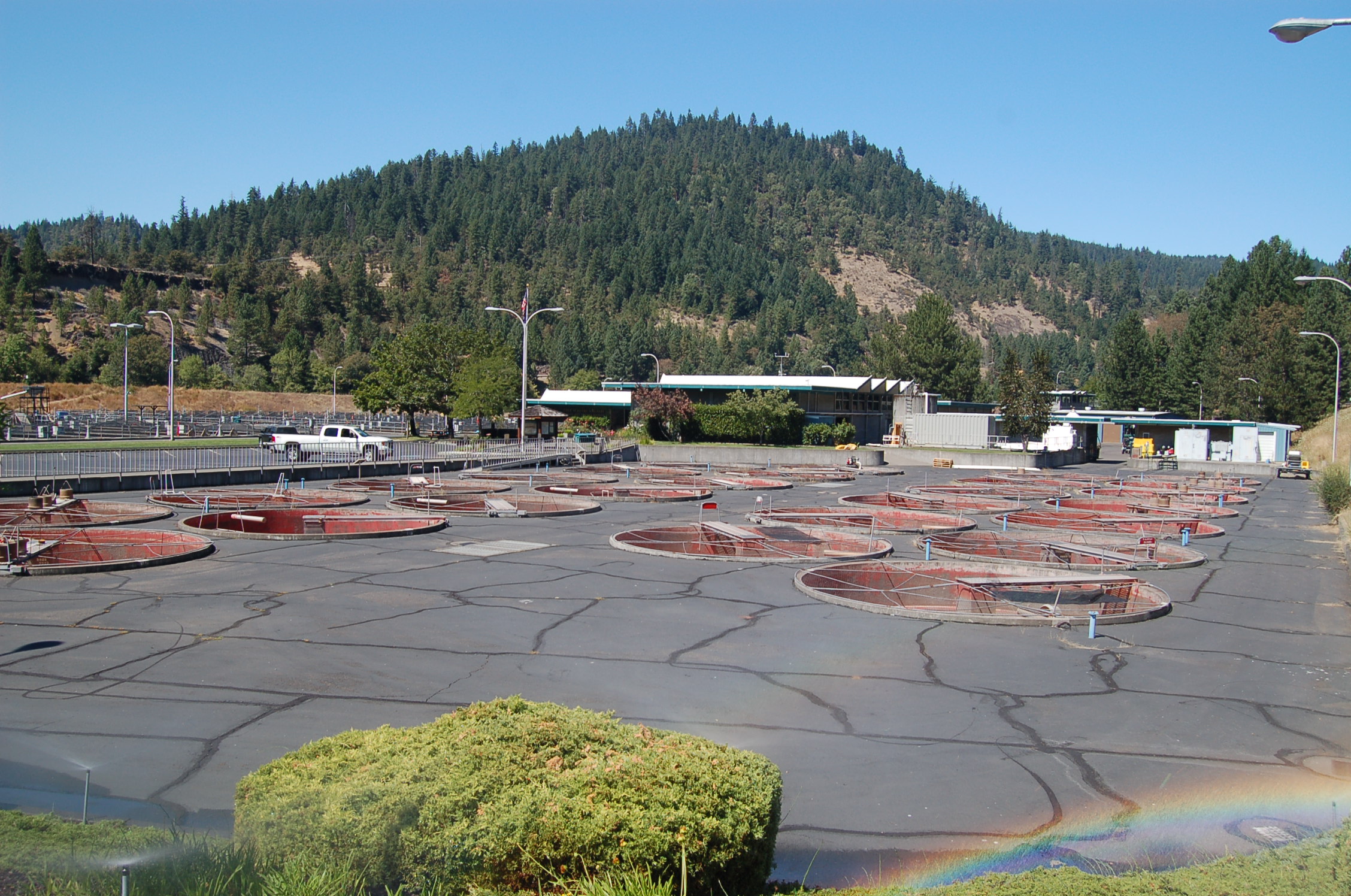
Large circular tanks dot the foreground at the Cole M. Rivers Fish Hatchery at Lost Creek Dam.
Public Domain. Photo by A. E. Crane
Download Original (2256 x 1496 pixels, 912.7 KB)
-
Rows of large tanks dot the concrete field south of the Cole M. Rivers Fish Hatchery building.
Public Domain. Photo by A. E. Crane
Download Original (2256 x 1496 pixels, 900.6 KB)
-
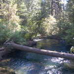
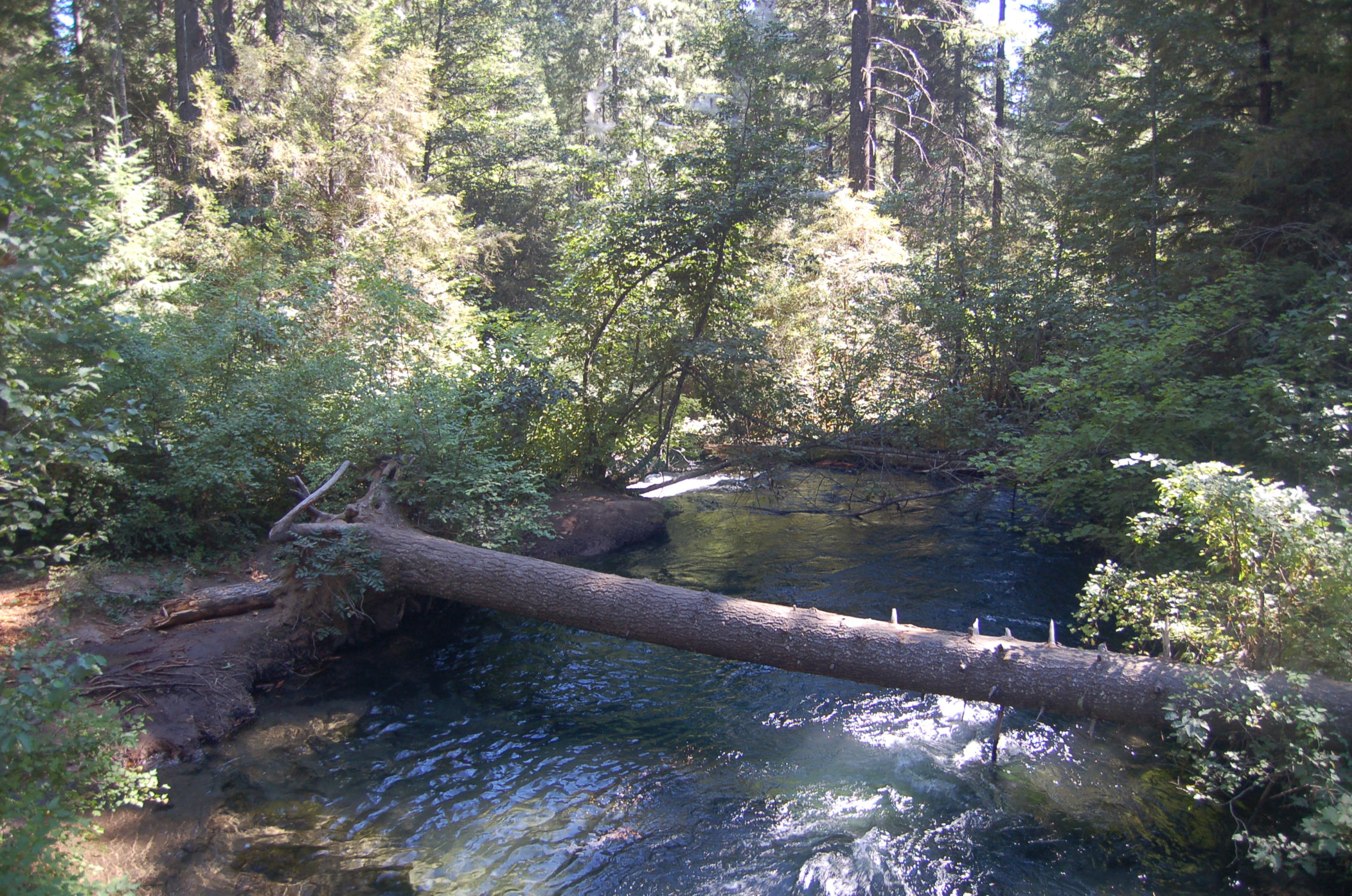
A fallen log forms a bridge across Mill Creek near Mill Creek Campground in the Rogue River National Forest.
Public Domain. Photo by A. E. Crane
Download Original (2256 x 1496 pixels, 934.5 KB)
-
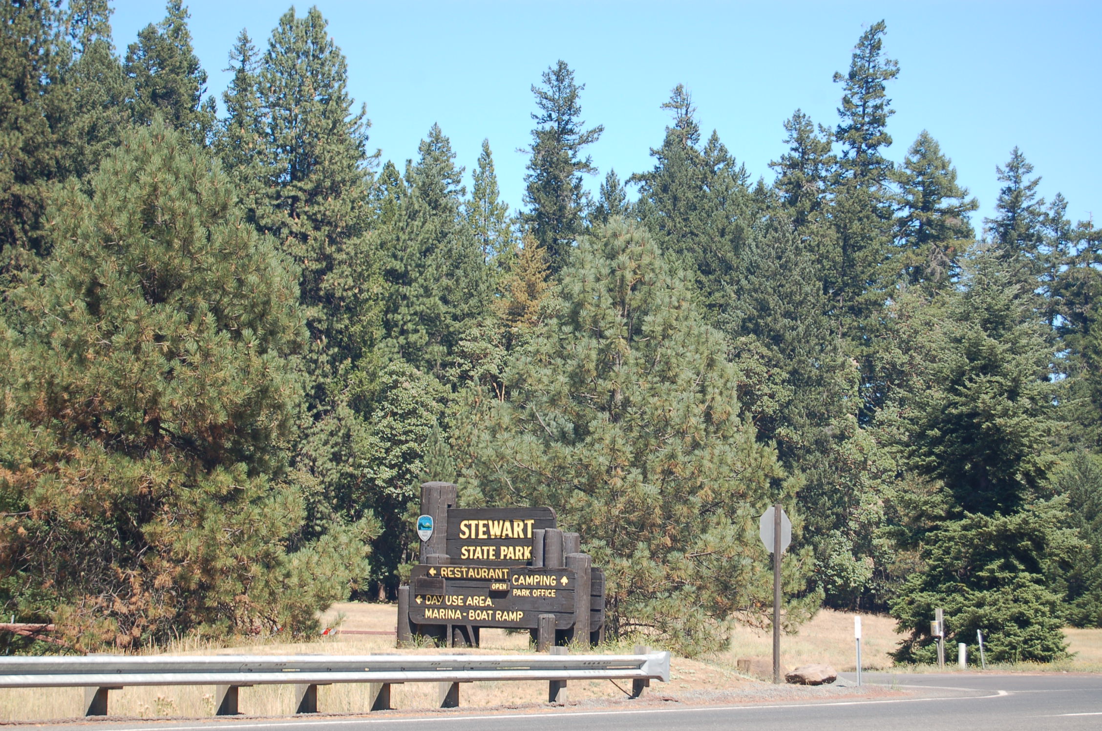
A brown and gold sign highlighted by the blue logo of the Oregon State Parks Program stands out against the tall conifers at the road leading to Joseph Stewart State Park.
Public Domain. Photo by A. E. Crane
Download Original (2256 x 1496 pixels, 939.4 KB)
-
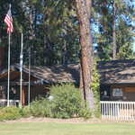
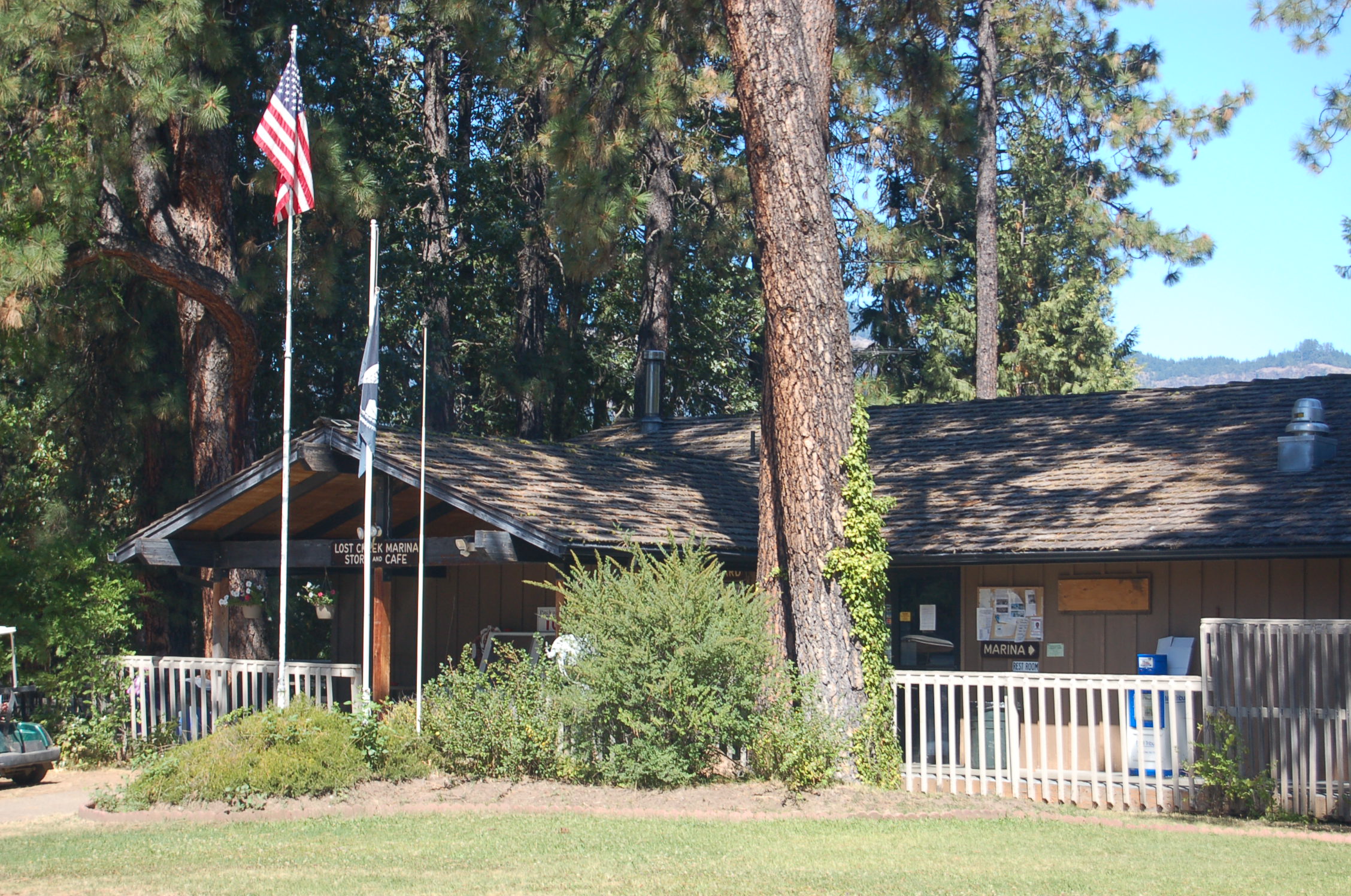
A rustic store and cafe at the marina provides meals, supplies, equipment and other necessities to the visitors to Joseph Stewart State Park.
Public Domain. Photo by A. E. Crane
Download Original (2256 x 1496 pixels, 923.5 KB)
-
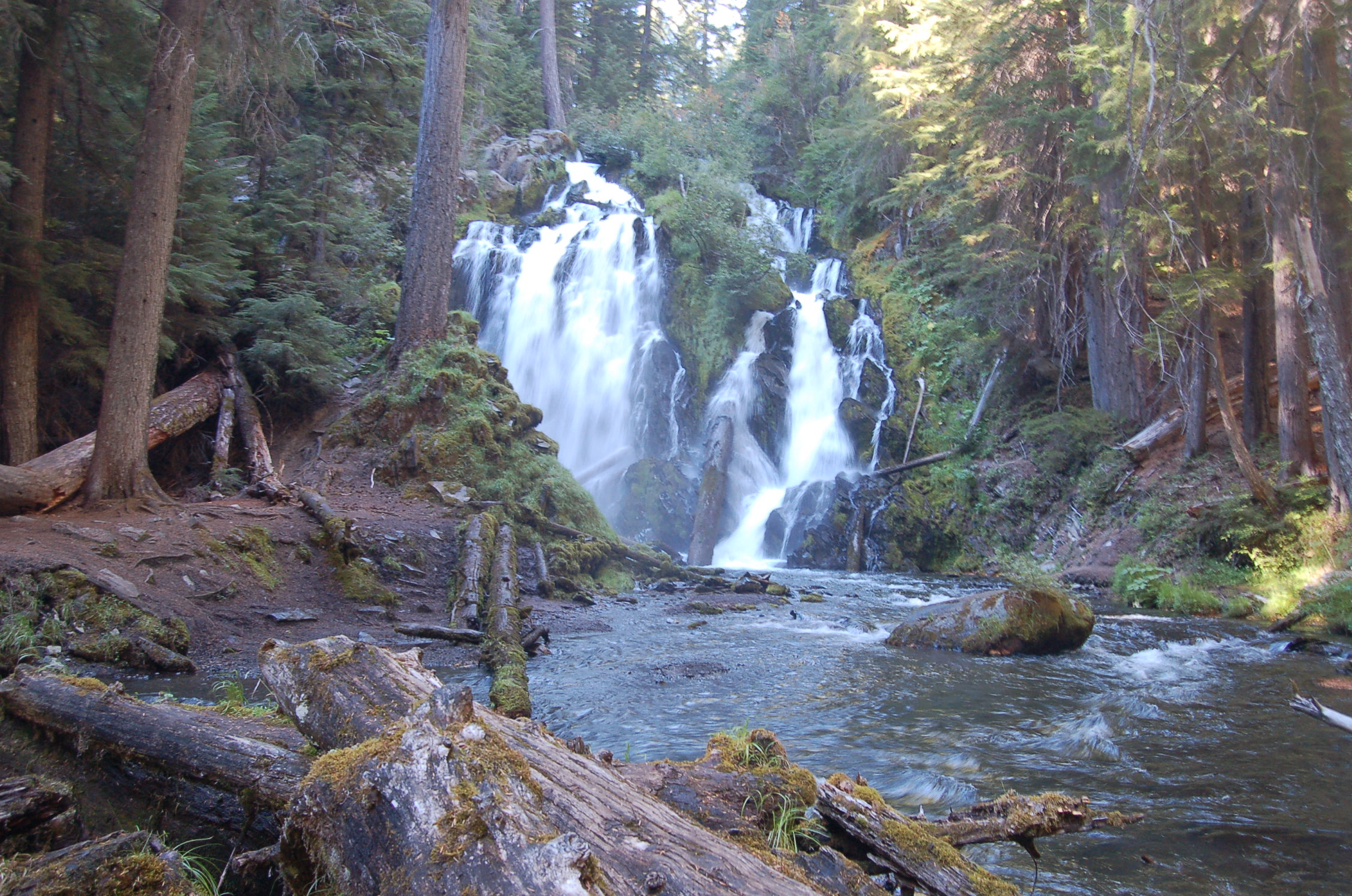
A makeshift log bridge makes a handy spot from which to view the multiple streams of National Creek Falls.
Public Domain. Photo by A. E. Crane
Download Original (2256 x 1496 pixels, 916.9 KB)
-
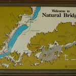
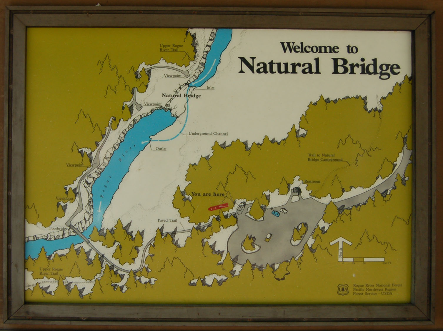
A map at the beginning of the hike to Natural Bridge in the Rogue River-Siskiyou National Forest orients travelers to the upcoming natural attraction.
Public Domain. Photo by A. E. Crane
Download Original (1506 x 1125 pixels, 245.1 KB)
-
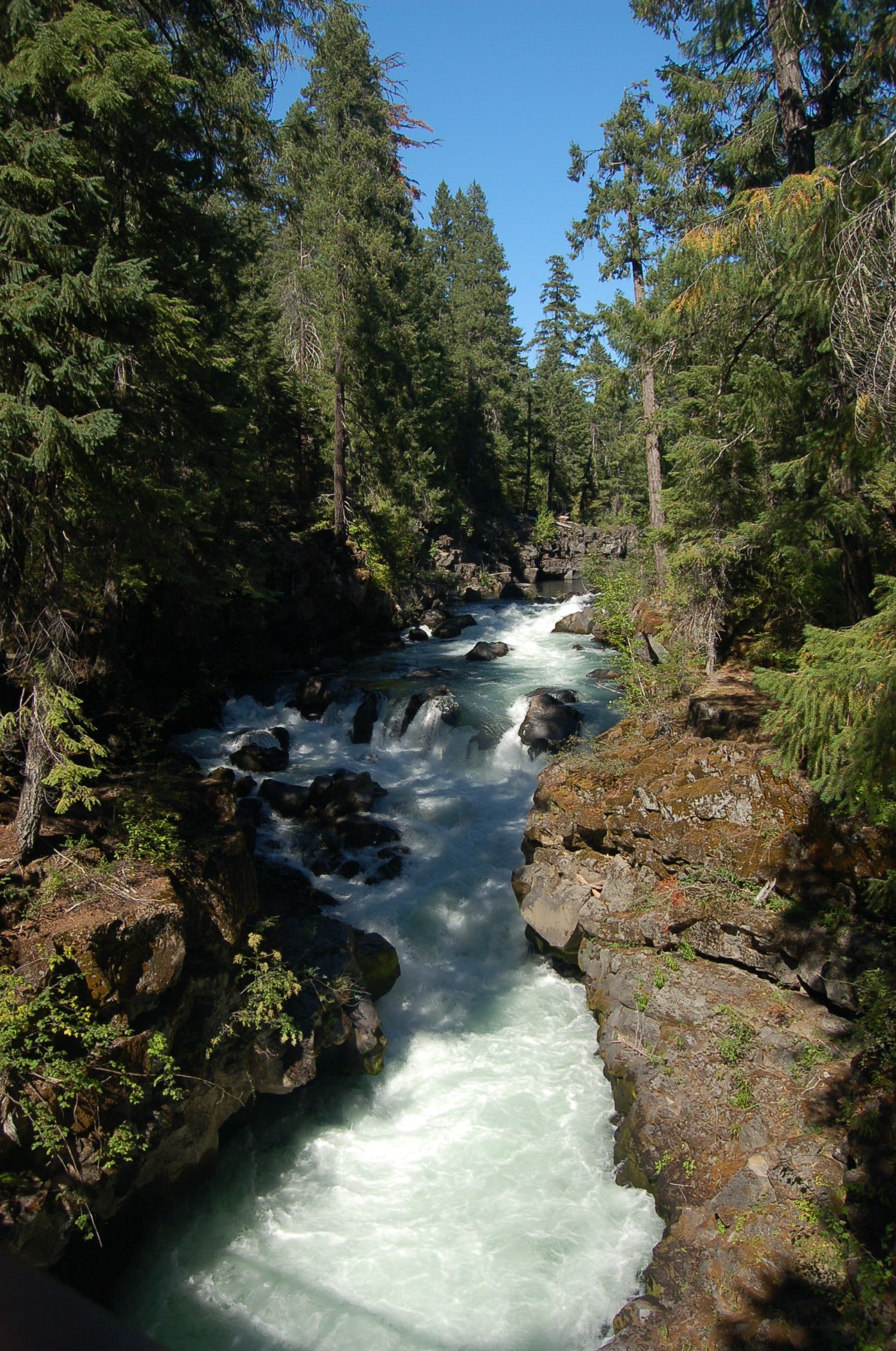
Viewed from the pedestrian (non-natural) bridge, the Rogue River plunges through a lava gorge on the Natural Bridge Trail.
Public Domain. Photo by A. E. Crane
Download Original (1496 x 2256 pixels, 819.2 KB)
-
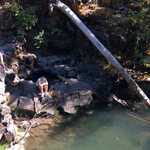
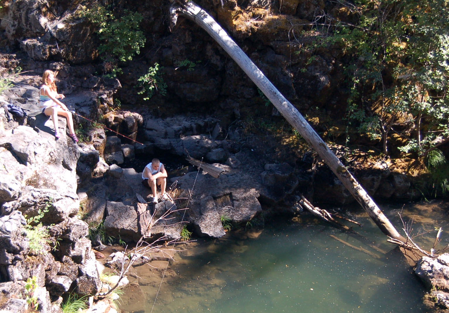
Two youngsters fish from the rocky lava flow cliffs at Natural Bridge.
Public Domain. Photo by A. E. Crane
Download Original (1533 x 1068 pixels, 408.0 KB)
-
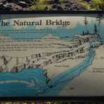
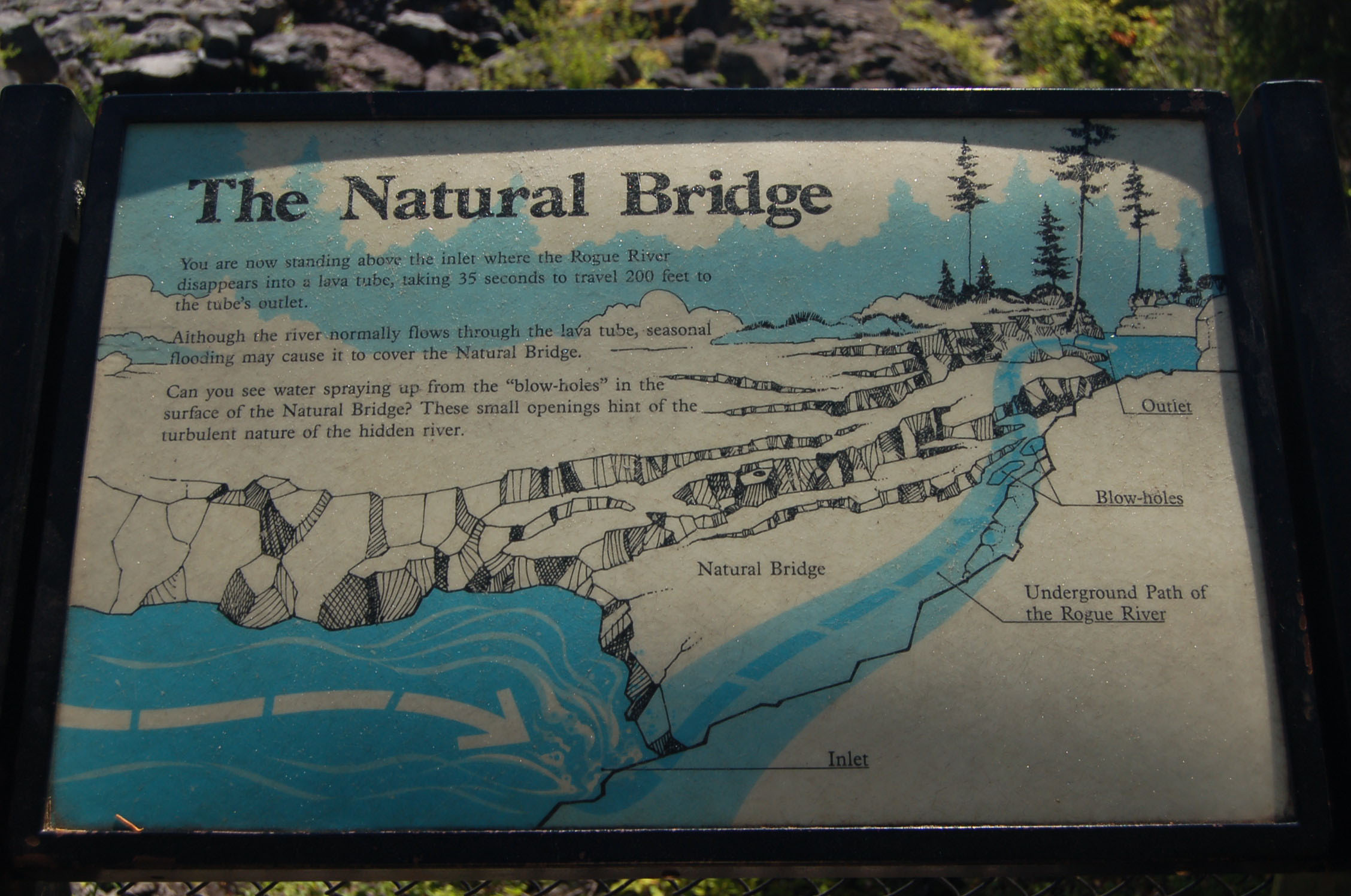
An interpretive sign on the hiking trail to the Natural Bridge explains how the hidden river vanishes into the lava tube for 200 feet, forming the natural bridge.
Public Domain. Photo by A. E. Crane
Download Original (2256 x 1496 pixels, 444.6 KB)
-

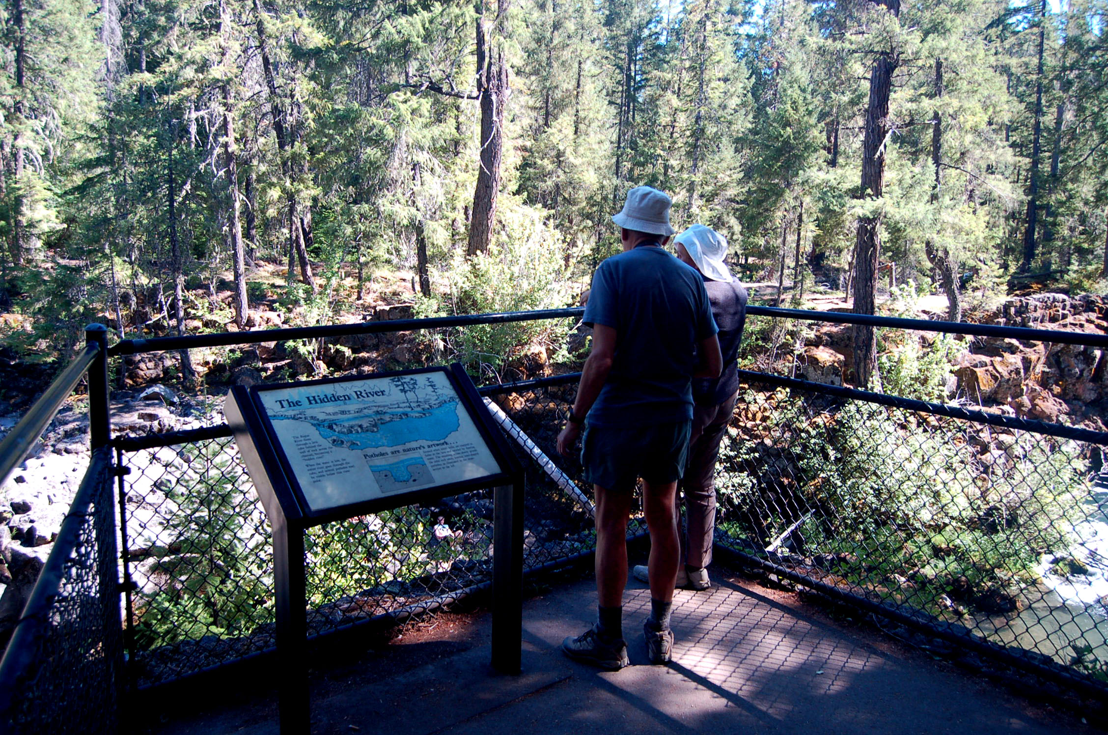
Two senior citizens look out over the Rogue River on the Natural Bridge hiking trail.
Public Domain. Photo by A. E. Crane
Download Original (2256 x 1496 pixels, 1012.6 MB)
-
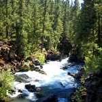
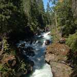
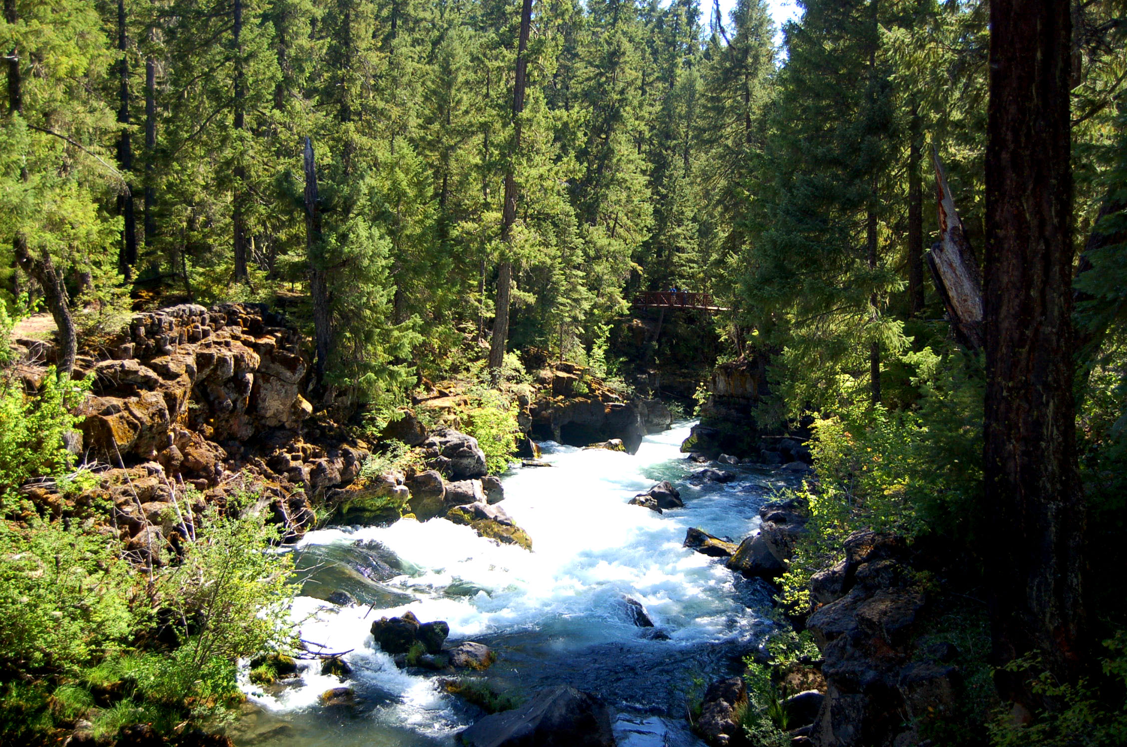
The whitewater of the Rogue River rushes through the Rogue River gorge's lava flow on the Natural Bridge hiking trail.
Public Domain. Photo by A. E. Crane
Download Original (2256 x 1496 pixels, 953.4 KB)
-
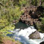
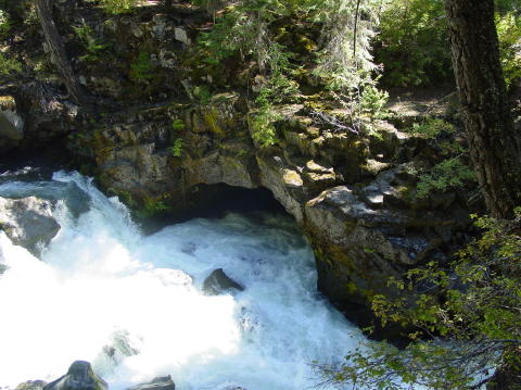
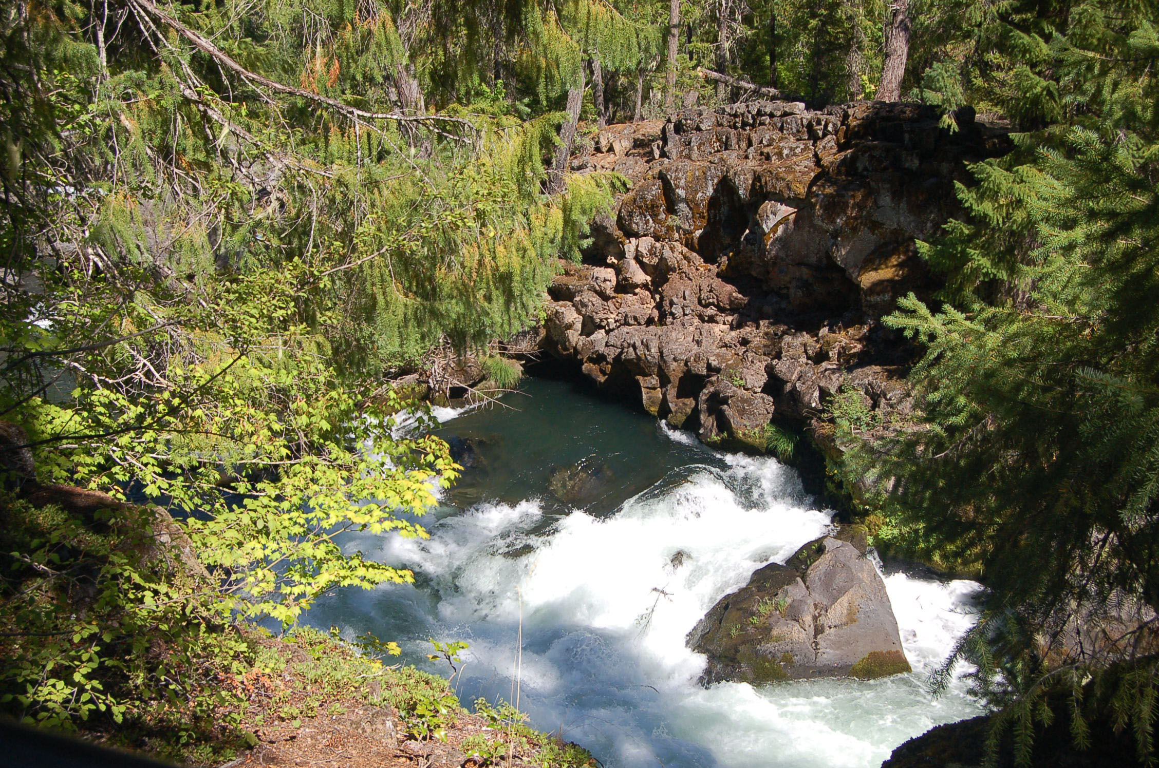
The "Hidden River" emerges from the lava flow that forms the Natural Bridge.
Public Domain. Photo by A. E. Crane
Download Original (2256 x 1496 pixels, 981.2 KB)
-
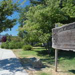
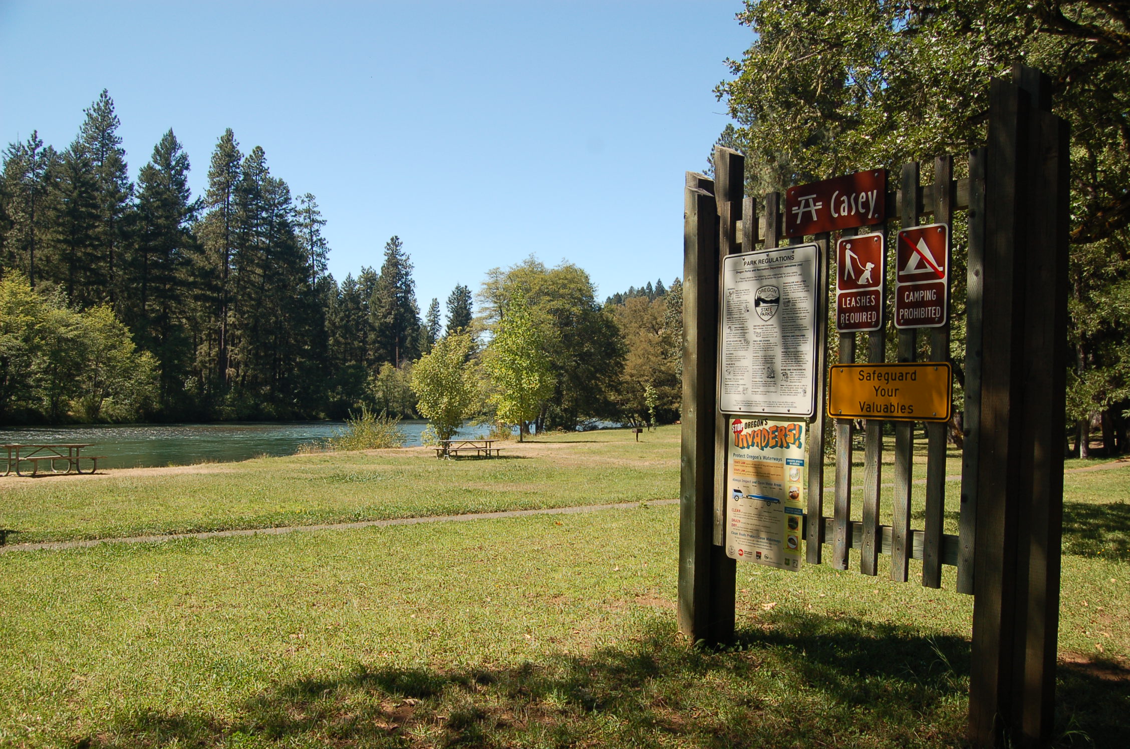
Signs help guide travelers to their destination in the Casey Recreation Area at Rogue Elk County Park.
Public Domain. Photo by A. E. Crane
Download Original (2256 x 1496 pixels, 918.4 KB)
-
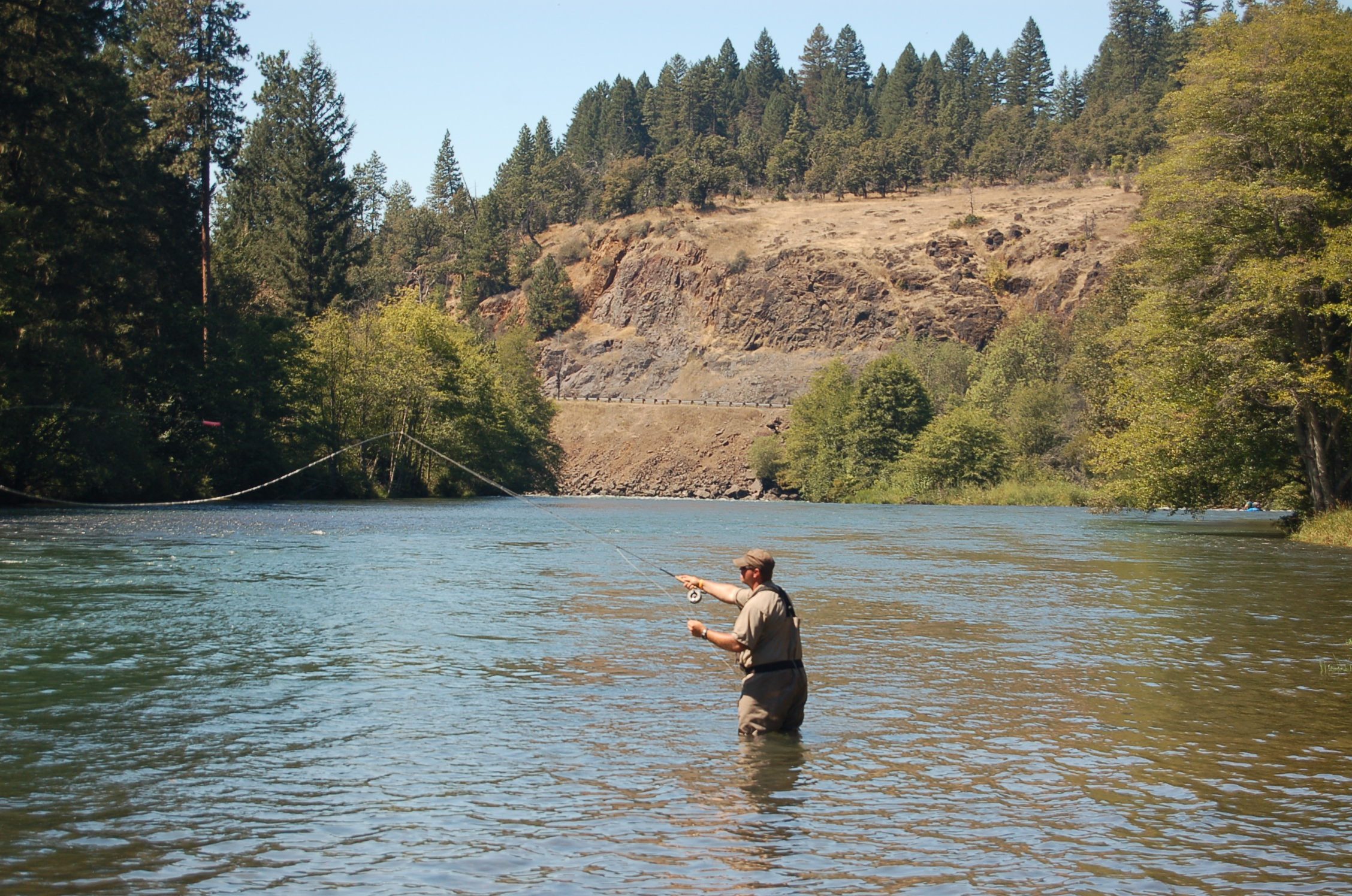
A fisherman casts his line in the shallows of the majestic Rogue River.
Public Domain. Photo by A. E. Crane
Download Original (2256 x 1496 pixels, 920.6 KB)
-
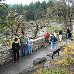
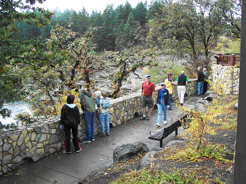
A group of visitors pause at the Colliding Rivers Overlook to view the swiftly flowing waters of the rivers below.
Public Domain. Photo by Christina Lilienthal
Download Original (504 x 378 pixels, 383.9 KB)
-
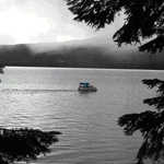
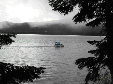
A black and white photo portrays the quiet beauty of Diamond Lake.
Public Domain. Photo by Christina Lilienthal
Download Original (444 x 333 pixels, 142.3 KB)
-
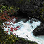
Reds, golds and greens line the white water at Natural Bridge.
Public Domain. Photo by Christine Lilienthal
Download Original (424 x 318 pixels, 237.8 KB)
-
Subdued colors lend a surreal feeling in the early morning air around Crater Lake.
Public Domain. Photo by Christine Lilienthal
Download Original (575 x 383 pixels, 182.0 KB)
-
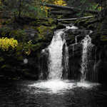
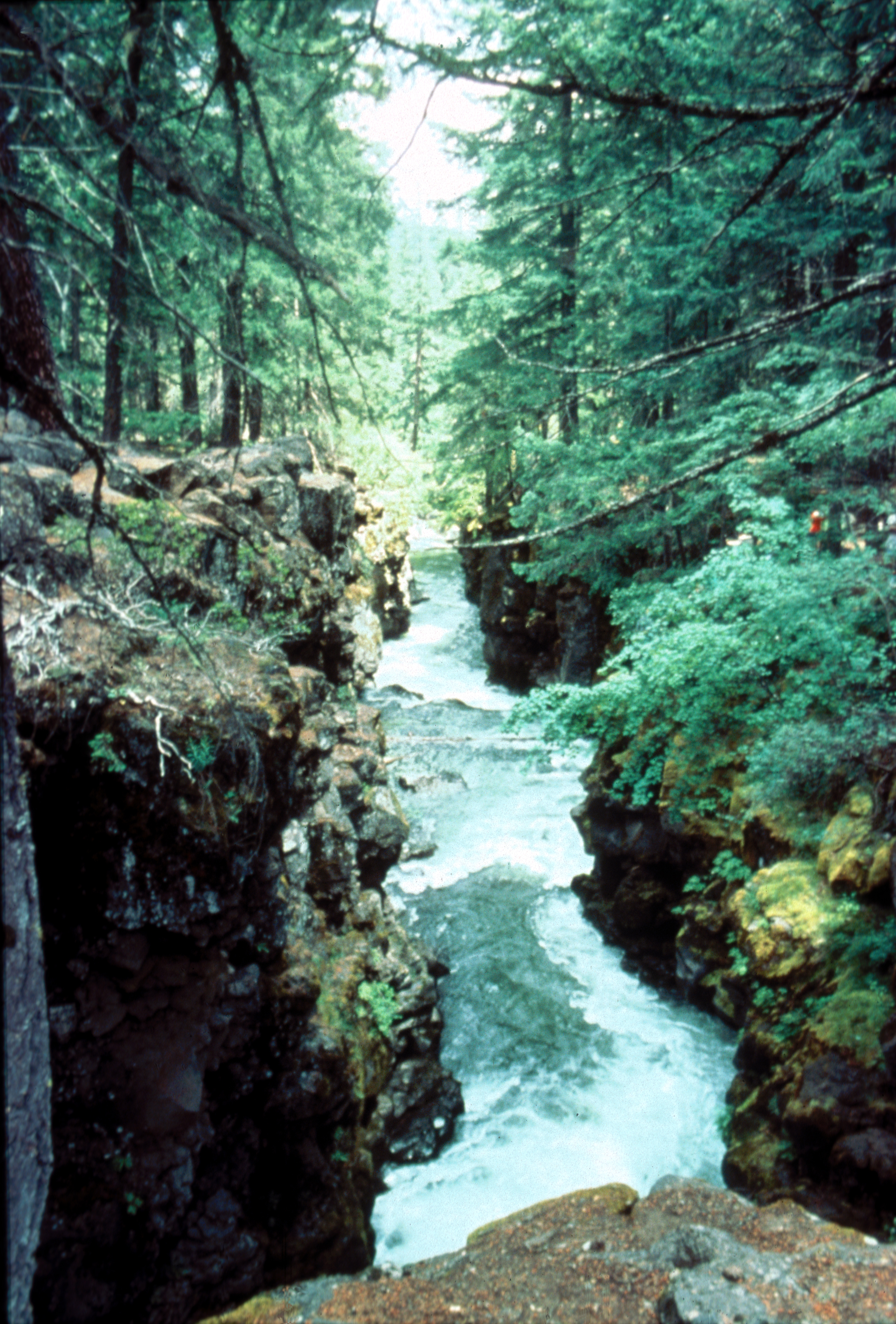
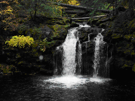
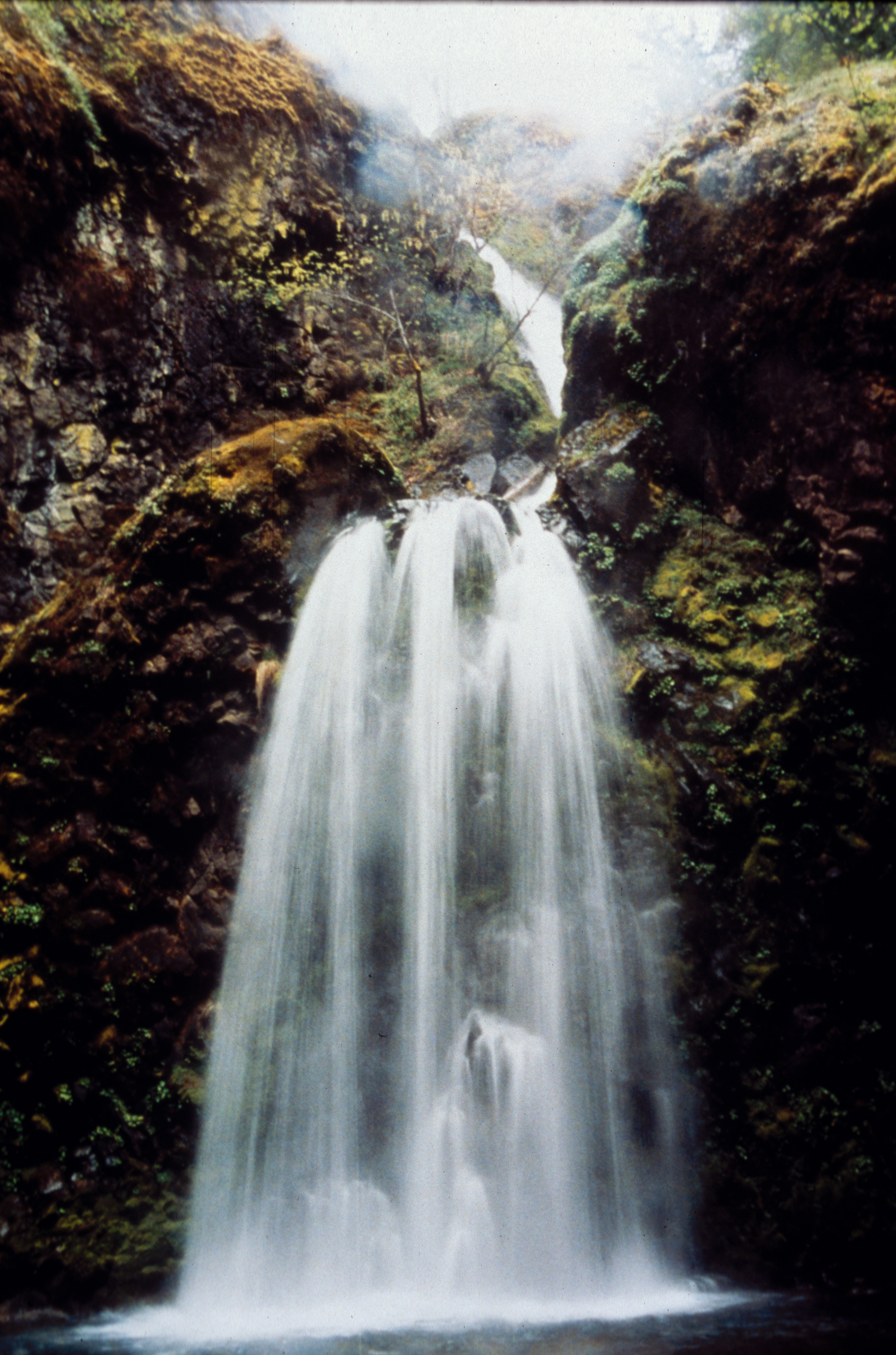
Twin casacdes of water stream gently into the calm waters below lichen-covered walls.
Public Domain. Photo by Christine Lilienthal
Download Original (460 x 345 pixels, 213.4 KB)
-
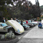
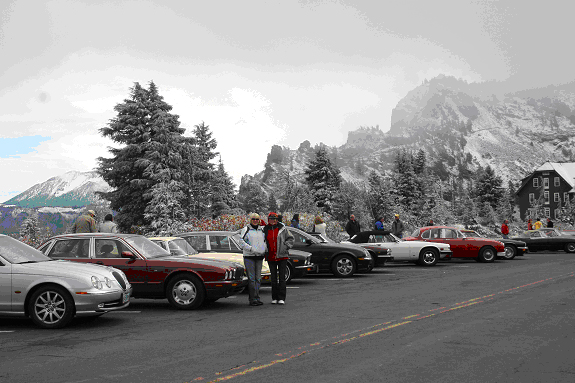
An important part of being a Jaguar enthusiast is to examine all parts of the car.
Public Domain. Photo by Christine Lilienthal
Download Original (372 x 279 pixels, 171.8 KB)
-
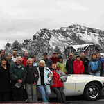
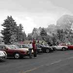
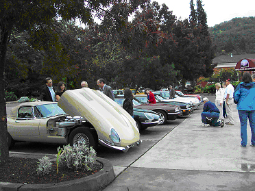
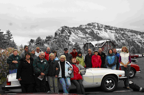
Jag Tour participants pose in front of the snow-covered ridges at Crater Lake.
Public Domain. Photo by Christine Lilienthal
Download Original (505 x 335 pixels, 186.7 KB)
-
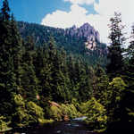
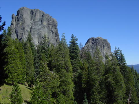
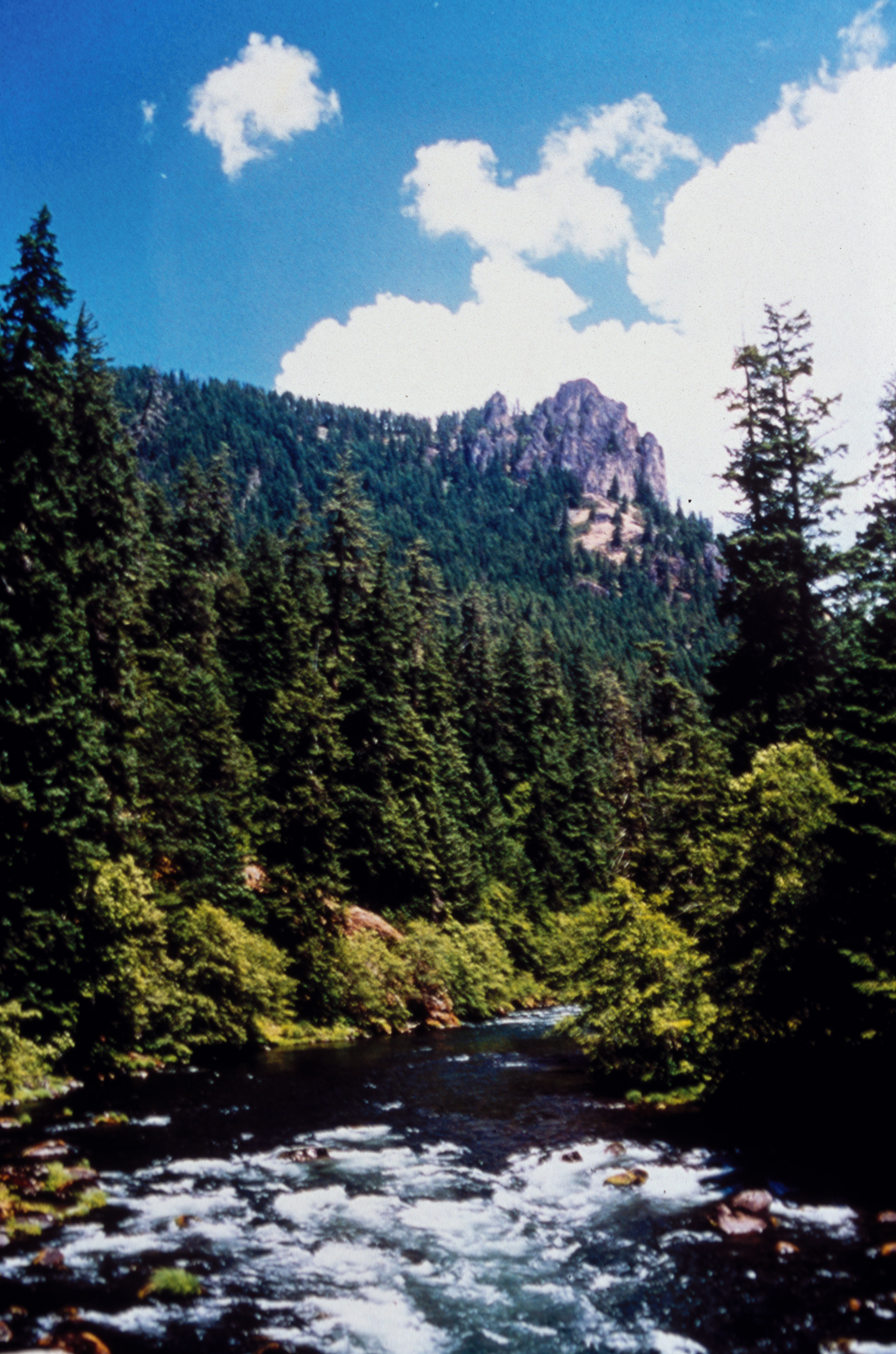
Visitors can experience millions of years of geologic time in just one day while traveling The Rogue-Umpqua Scenic Byway. Eroded remains of volcanic rock has resulted in numerous, jagged, vertical spires. Rattlesnake Rock rises above the North Umpqua River.
Public Domain. Courtesy of Greg Morgan of the BLM
Download Original (2377 x 3592 pixels, 6264.9 MB)
-
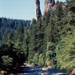
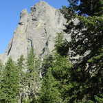
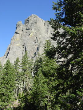
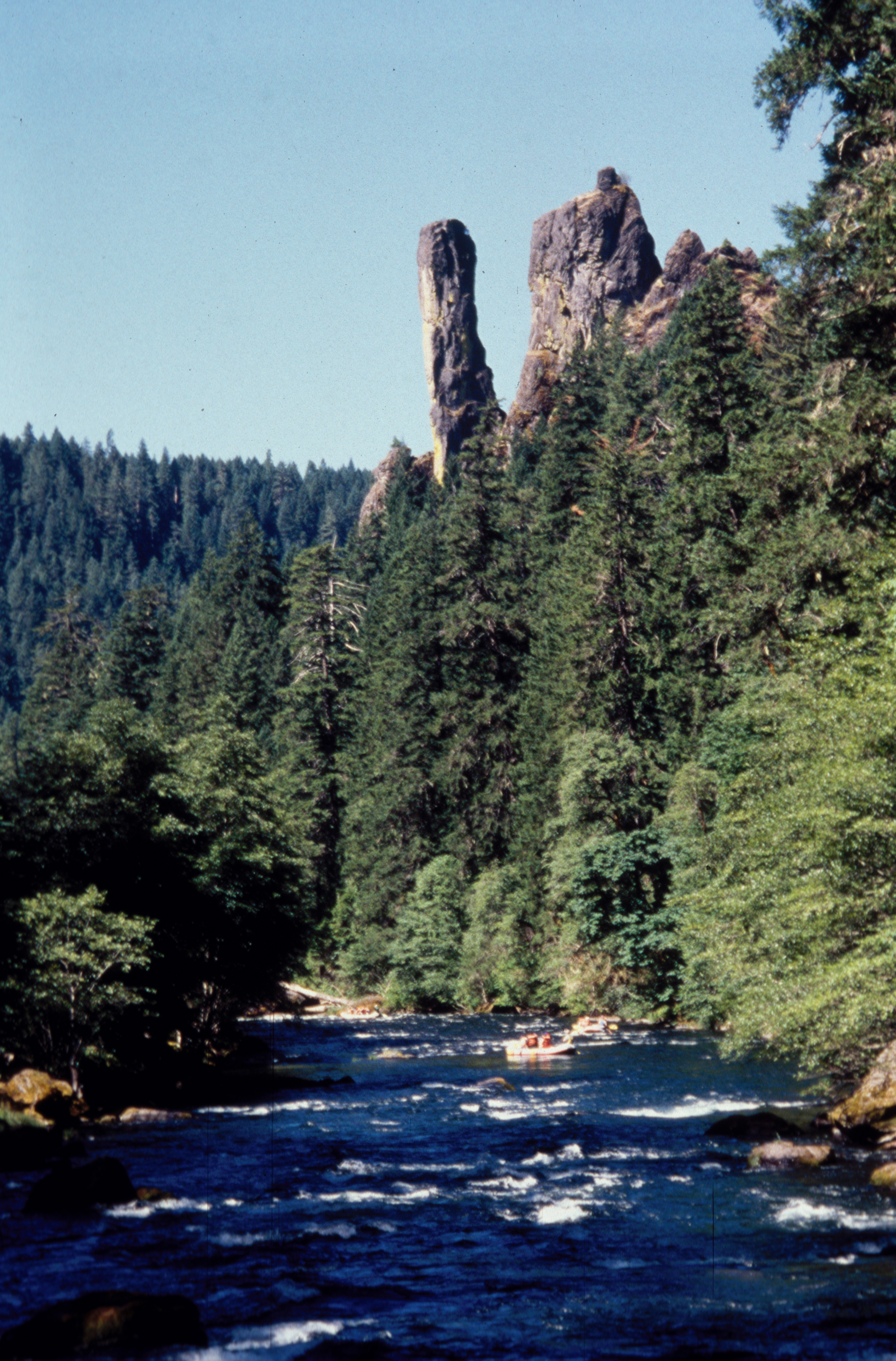
Old Man Rock is one of the unique geologic highlights along the Rogue-Umpqua Scenic Byway. Featured in many publications, this vertical spire lumes over the North Umpqua River and is a favorite photo stop for river and highway travelers.
Public Domain. Courtesy of Ron Murphy of the USFS
Download Original (2345 x 3560 pixels, 6771.5 MB)
-
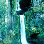
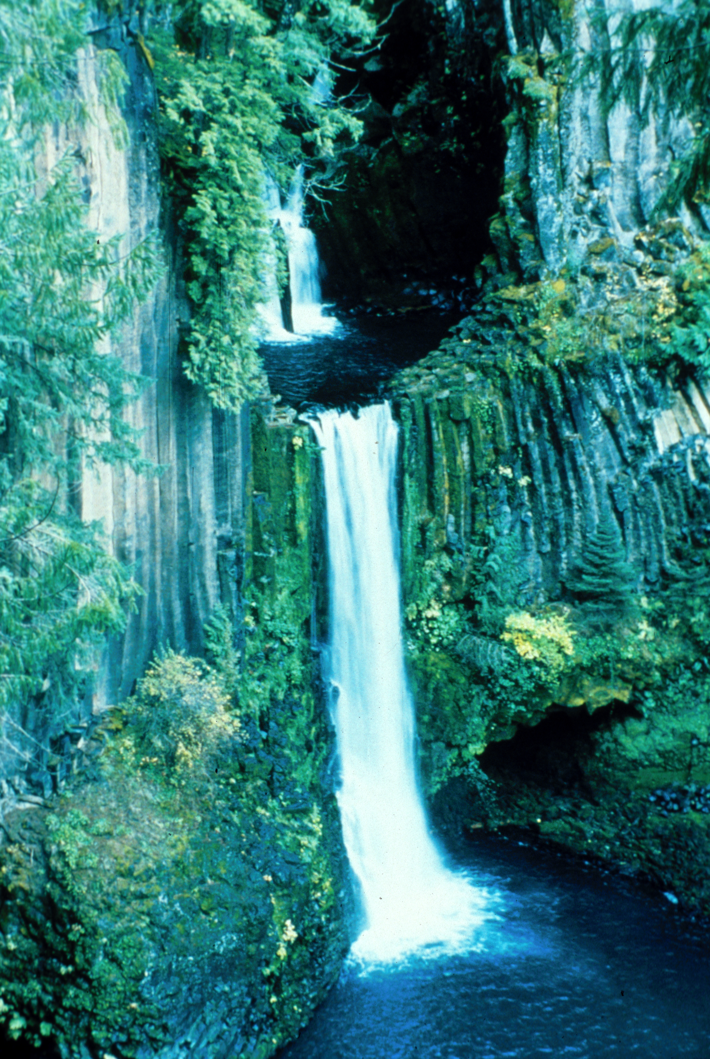
One of the most beautiful of the fifteen waterfalls located along the Rogue-Umpqua Scenic Byway, Toketee Falls is two-tiered with water drops of 40 and 80 feet. Derived from the Chinook language, the word "toketee" means "pretty" or "graceful" - an apt name for this inspiring waterfall. Access to the Falls is four-tenths of a mile over pathway, stone steps, boardwalk and stairs to a viewing platform.
Public Domain. Courtesy of Ron Murphy of the BLM
Download Original (2377 x 3544 pixels, 7488.6 MB)
-
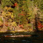
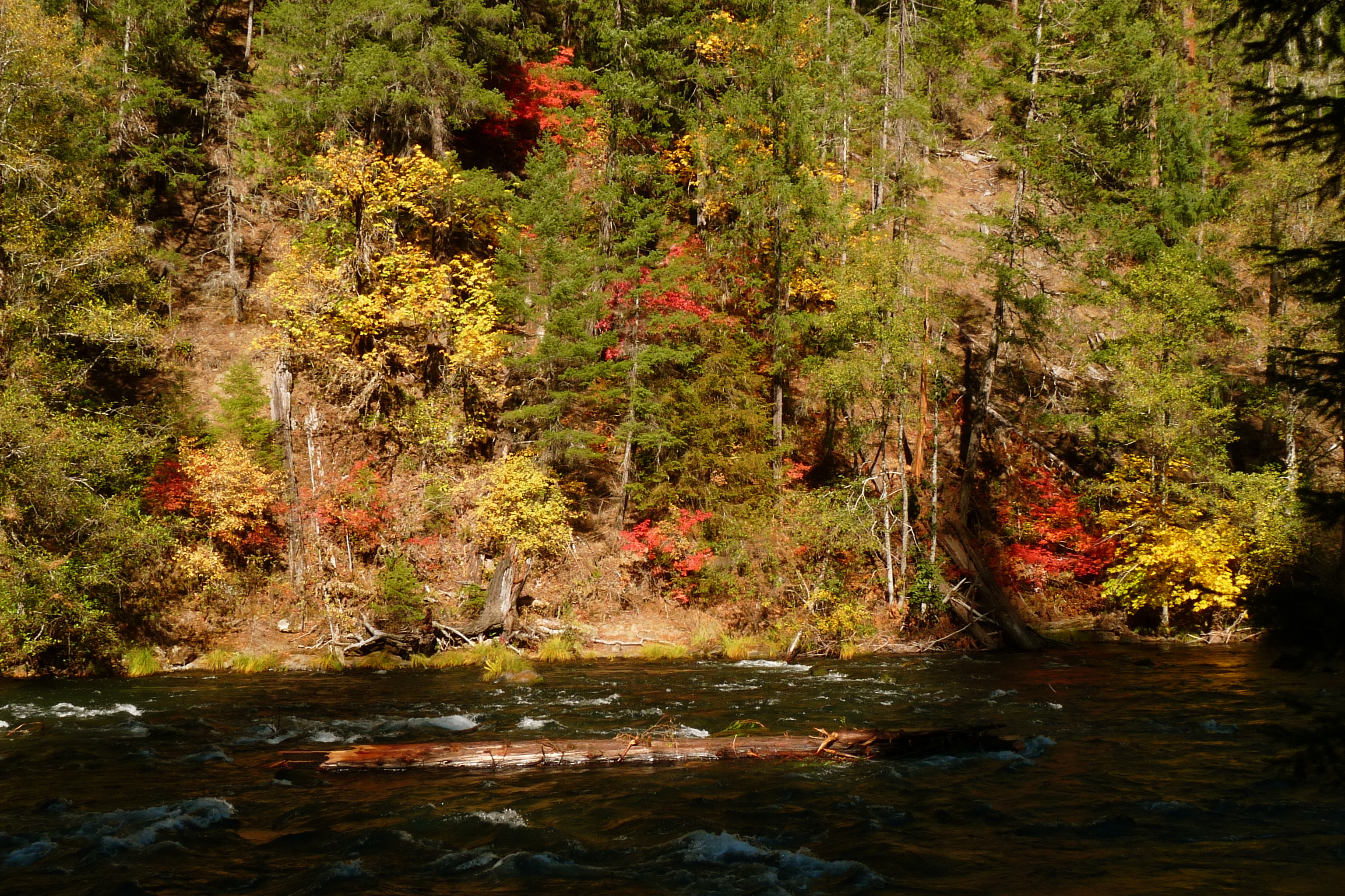
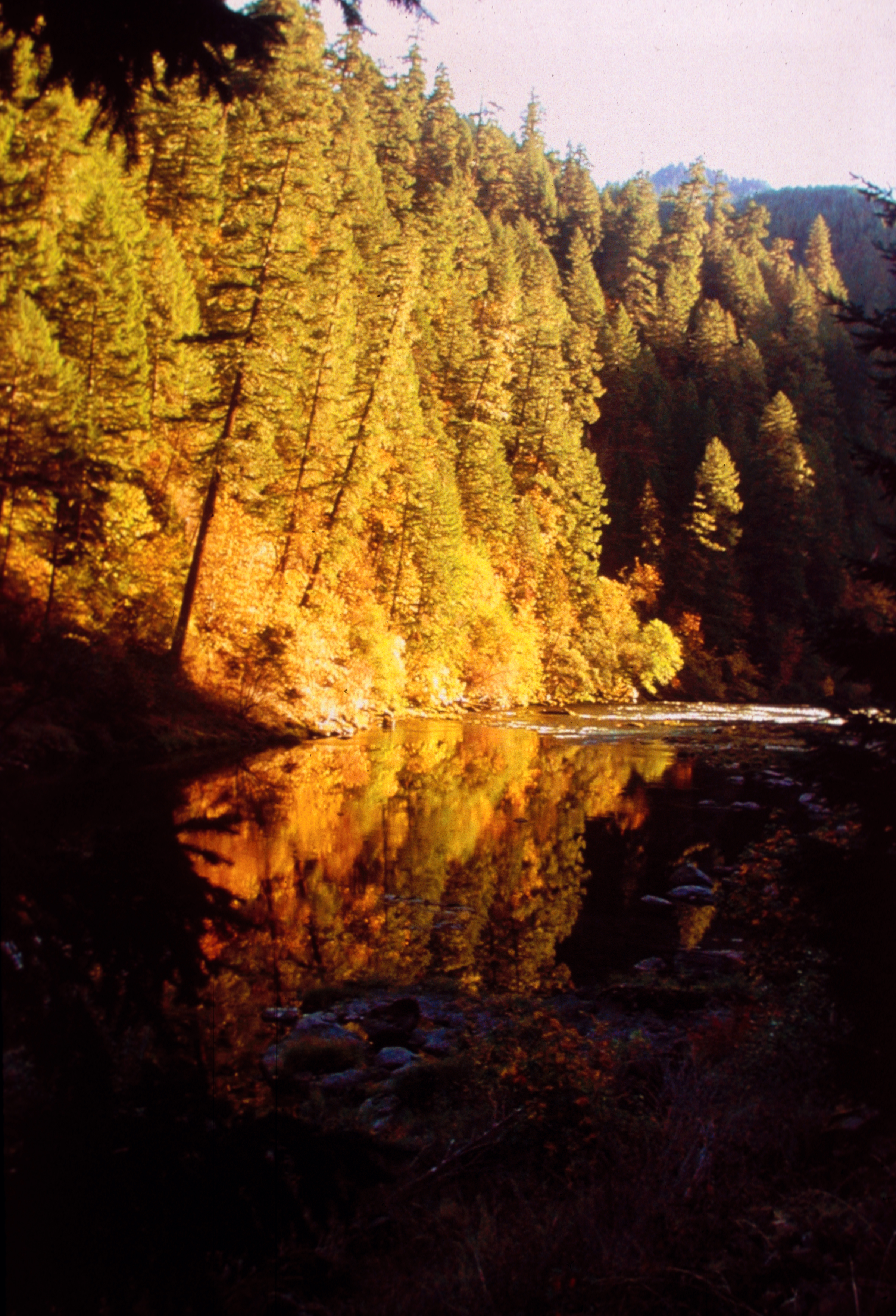
Autumn colors grace the Upper Rogue National Wild & Scenic River at Riverbridge Campground on the Rogue River National Forest.
Public Domain. Photo by Tom Dew of USFS
Download Original (3666 x 2387 pixels, 5785.7 MB)
-
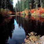
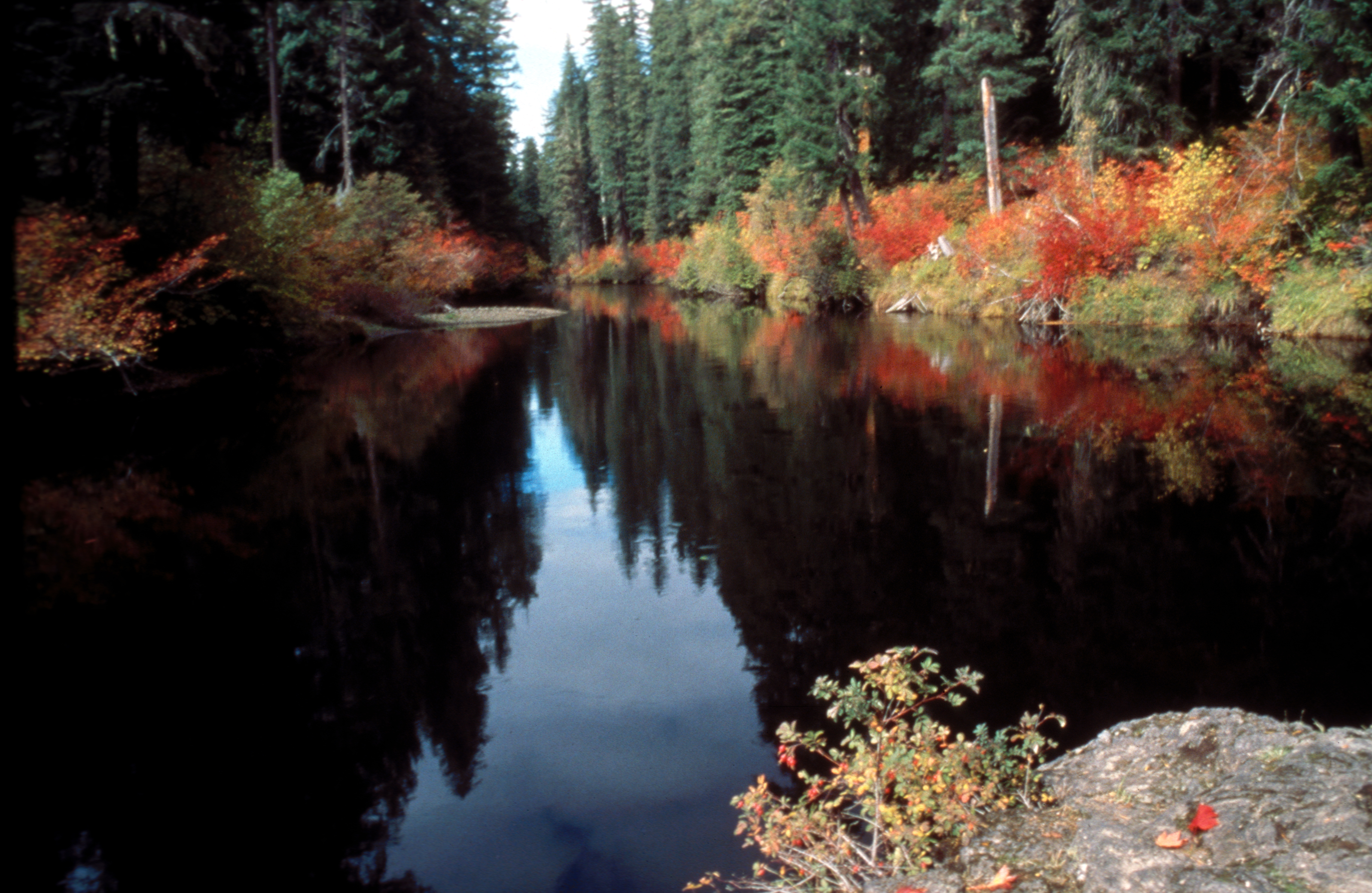
Vibrant autumn color reflects on the pools of the North Umpqua River where beauty is abundant year-round. Pools intermingle with rapids and riffles creating opportunities to watch migrating fish seasonally leap through the fast water stretches and glide effortlessly in the pools.
Public Domain. Courtesy Ron Murphy of the BLM
Download Original (2401 x 3526 pixels, 5810.3 MB)
-
A National Recreation Trail passes through a narrow bedrock crevice and lush vegetation for one mile to reach this double falls with tiers of 35 and 50 feet. The Rogue-Umpqua Scenic Byway features fifteen waterfalls along its 172-mile route.
Public Domain. Photo by Greg Morgan of BLM
Download Original (2409 x 3640 pixels, 6183.0 MB)
-
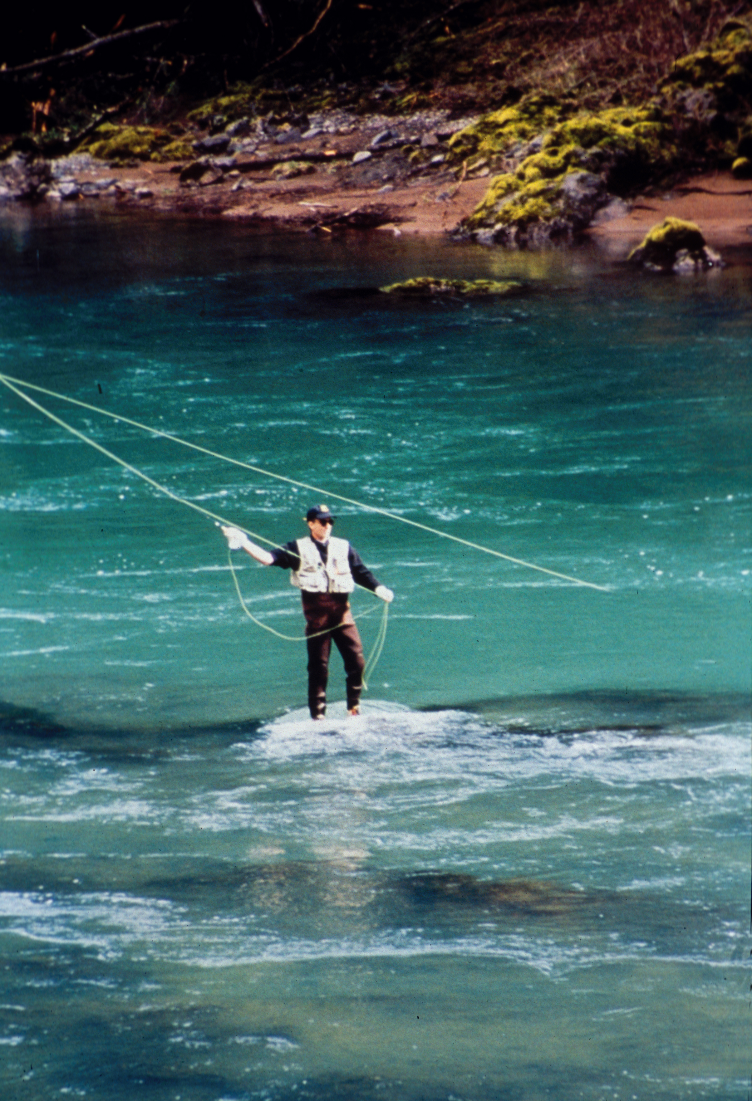
The combination of large summer-run steelhead, "fly-angling only" restriction, magestic scenery and emerald green waters draw anglers world-wide. The North Umpqua is distinguished from other rivers by the large and consistent numbers of native (non-hatchery) summer steelhead and is considered to be one of the most outstanding fisheries in the world.
Public Domain. Photo by Greg Morgan of BLM
Download Original (2409 x 3528 pixels, 6682.8 MB)
-
Morning mist rises above the North Umpqua River beside the Rogue Umpqua Scenic Byway.
© May 2007 Christina Lilienthal.
Download Original (2496 x 1664 pixels, 956.9 KB)
-

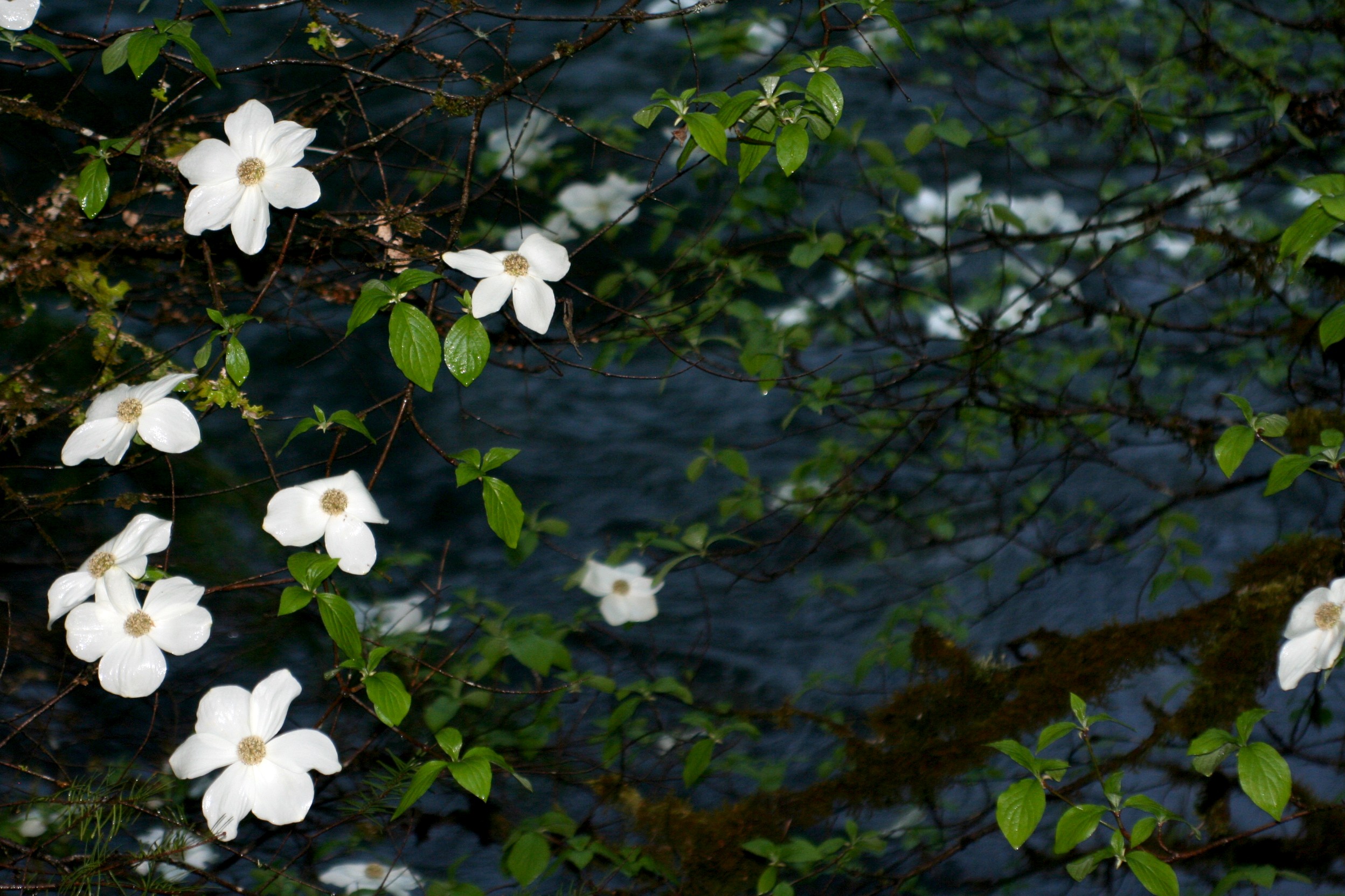
A flowering dogwood tree dominates the foreground as the North Umpqua River rushes past.
© May 2007 Christina Lilienthal.
Download Original (2496 x 1664 pixels, 814.3 KB)
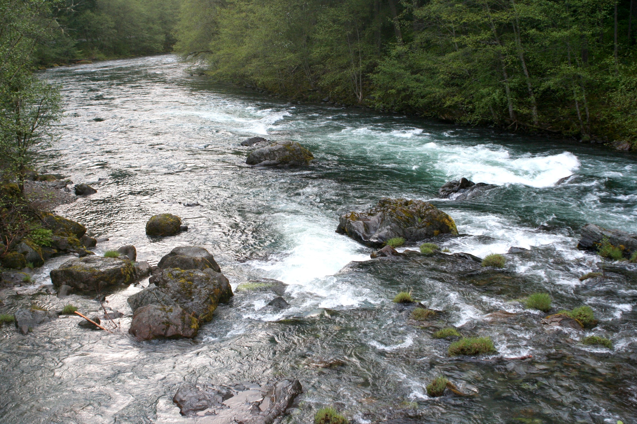
-
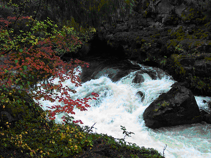
Eddies and pools form in the swiftly rushing waters of the North Umpqua River.
© May 2007 Christina Lilienthal.
Download Original (2496 x 1664 pixels, 1416.0 MB)
-
One of twenty-nine interpretive sites along the Rogue-Umpqua Scenic Byway, Swiftwater features byway orientation and interpretation of anadromous fisheries. This popular spot is accessible and a favorite place to picnic, fish and watch other people fish.
Public Domain. Courtesy of USDI-BLM
Download Original (3560 x 2377 pixels, 5826.3 MB)
-
The Rogue-Umpqua Scenic Byway parallels 73 miles of two national wild and scenic rivers, the Upper Rogue and North Umpqua. Outstanding scenery, high quality access, and diverse recreational opportunities occur in this ideal setting. This particular stretch of road passes through the Umpqua National Forest.
Public Domain. Courtesy of USFS
Download Original (3592 x 2425 pixels, 4992.4 MB)