
Frontier Pathways Scenic and Historic Byway
All Photos (29)
-
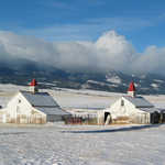
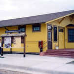
The All Aboard Westcliffe Interpretive Center houses a community room, a video screening theatre, and a room with information on the old narrow gauge train which ran to Westcliffe, along with various historical photographs and books. A visitor guide is usually available to discuss the center and the nearby engine house.
Public Domain. Photo courtesy of Mel Porth
Download Original (432 x 288 pixels, 97.4 KB)
-
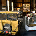
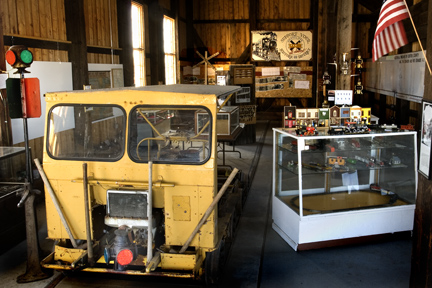
An engine house was used to maintain the narrow gauge train which used to run to Westcliffe. The yellow car was a Section Hand Car which was used by the workers to ride up and down the track to fix the rails.
Public Domain. Photo courtesy of Mel Porth
Download Original (432 x 288 pixels, 96.7 KB)
-
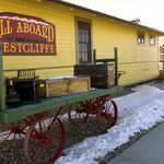
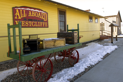
One side of the bright yellow interpretive center shows an old baggage cart and various historic items, such as a trunk and an engine to be shipped to a gold mine located in the Wet Mountains to the east of Westcliffe.
Public Domain. Photo courtesy of Mel Porth
Download Original (432 x 288 pixels, 97.8 KB)
-
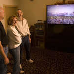
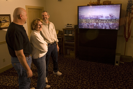
A group of people views historic photographs and a video about train history.
Public Domain. Photo courtesy of Mel Porth
Download Original (432 x 288 pixels, 98.0 KB)
-
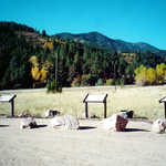
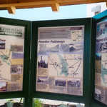
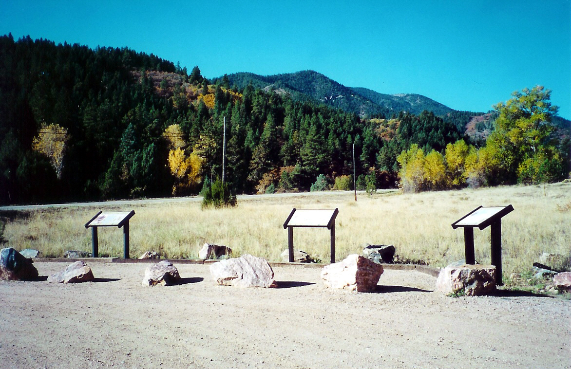
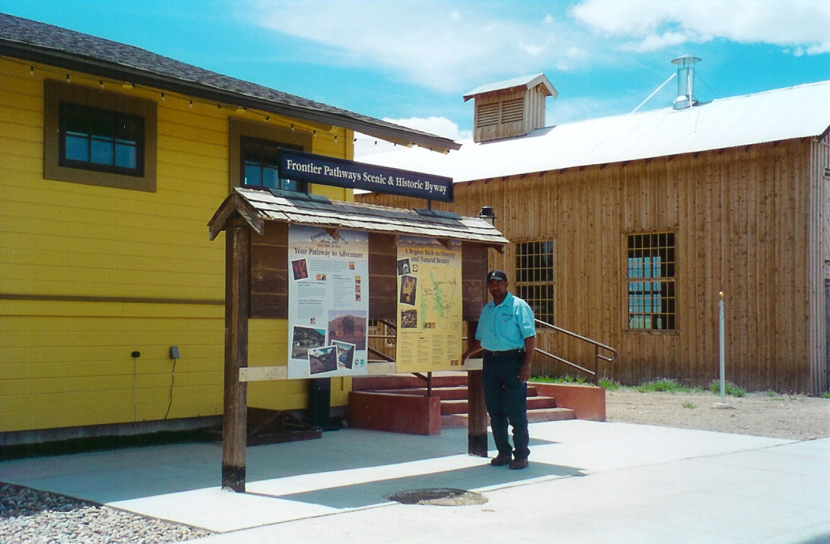
Backdropped by trees and brush, these interpretive signs offer information about Frontier Pathways.
Public Domain. Photo by Sally Pearce
Download Original (1172 x 758 pixels, 705.8 KB)
-
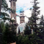
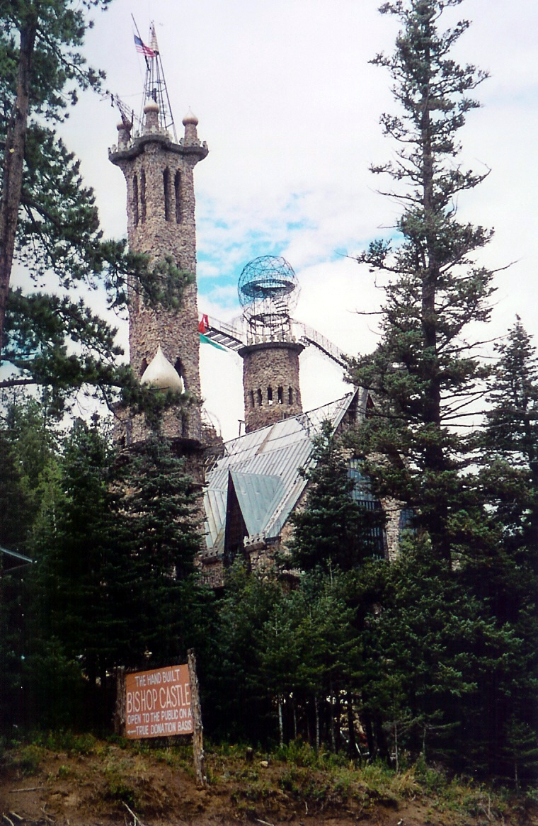
Bishop Castle's towers peek up over the surrounding trees.
Public Domain. Photo by Sally Pearce
Download Original (760 x 1166 pixels, 724.3 KB)
-
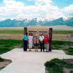
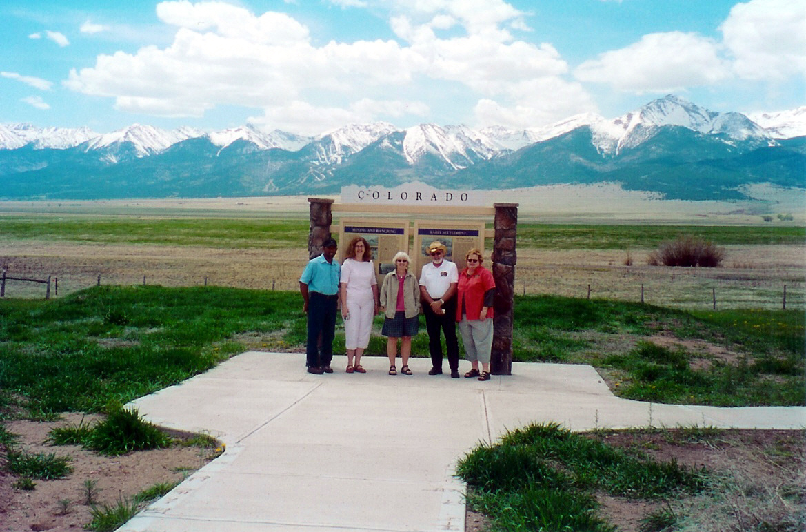
Backdropped by a snow capped mountain range, visitors pose in front of an information kiosk on the Creole Trail in Colorado.
Public Domain. Photo by Sally Pearce
Download Original (1169 x 772 pixels, 647.2 KB)
-
Travelers rest at the El Pueblo Visitor Center.
Public Domain. Photo by Sally Pearce
Download Original (1172 x 766 pixels, 678.8 KB)
-
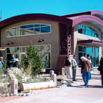
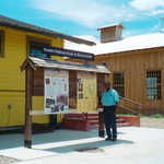
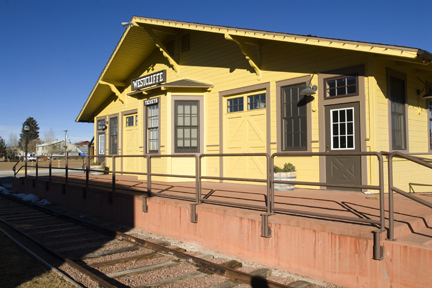
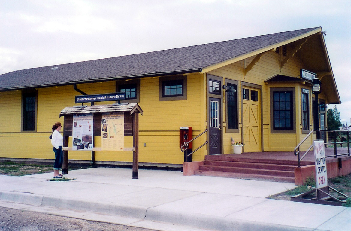
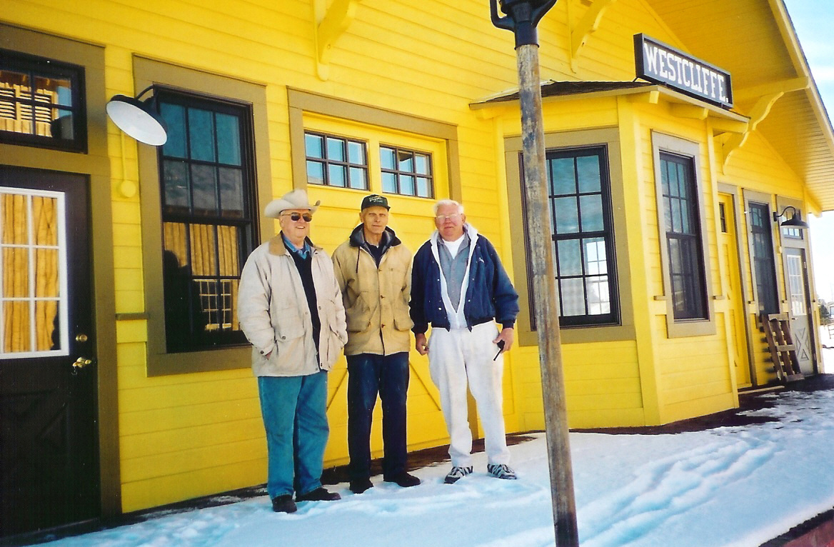
A traveler reads material at a kiosk outside of the bright yellow Westcliffe Information Center.
Public Domain. Photo by Sally Pearce
Download Original (1169 x 772 pixels, 594.4 KB)
-
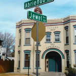
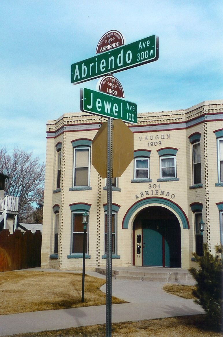
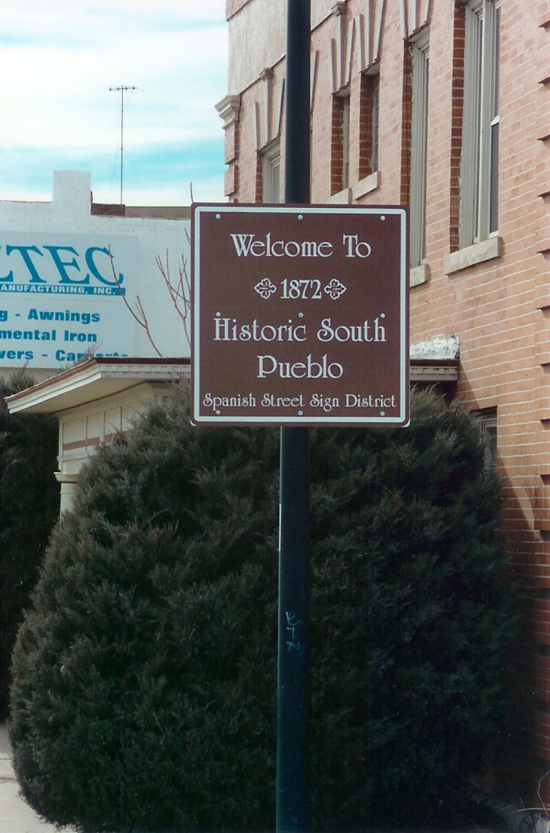
Located in south Pueblo, these sign names serve as a reminder of the region's Hispanic heritage.
Public Domain. Photo by Sally Pearce
Download Original (772 x 1166 pixels, 567.3 KB)
-
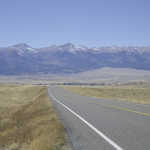
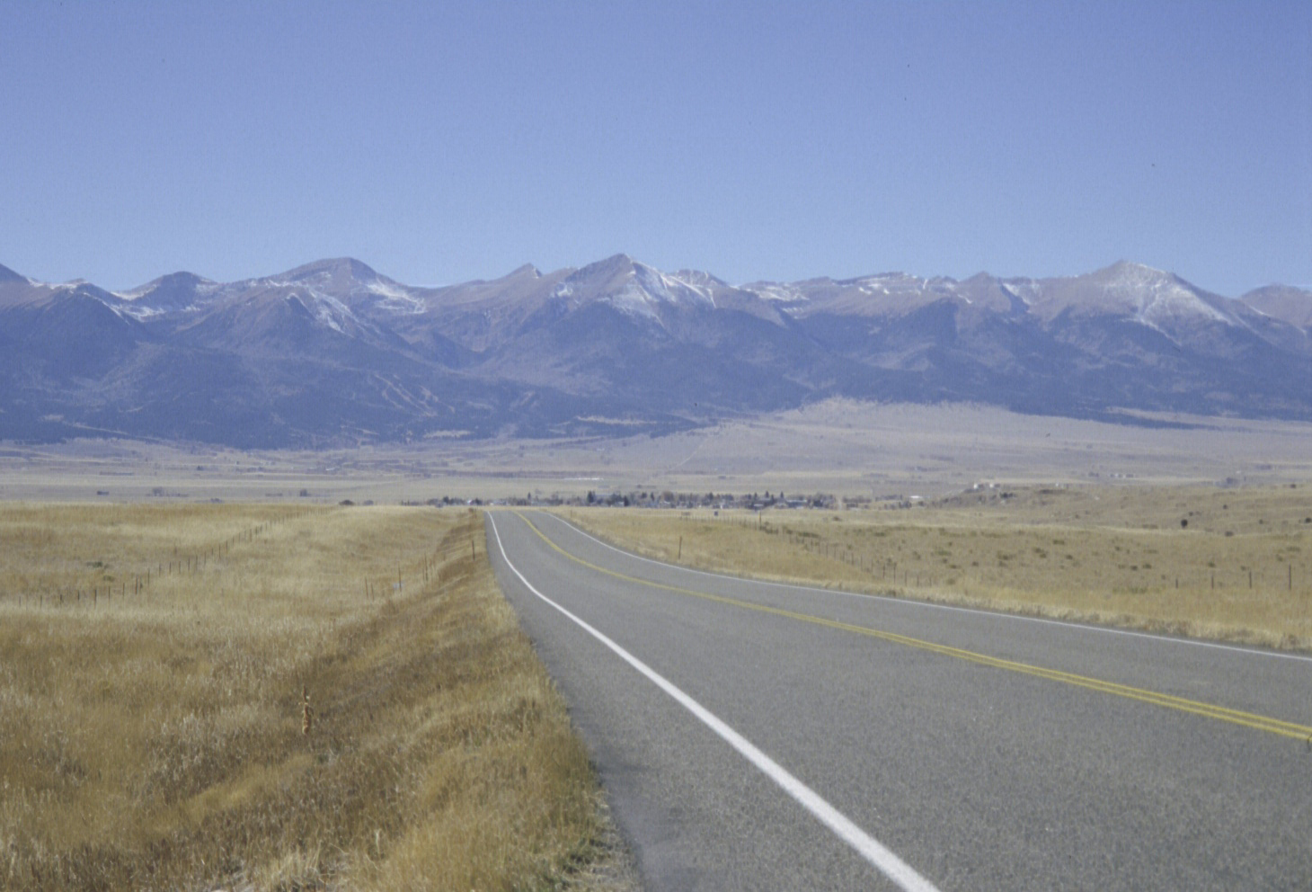
Entering the valley on State Highway 96, the Sangre de Cristo Mountains come into view. Westcliffe sits at the end of the highway.
Public Domain. Photo by Sally Pearce
Download Original (1460 x 992 pixels, 607.8 KB)
-
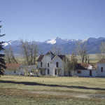
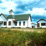
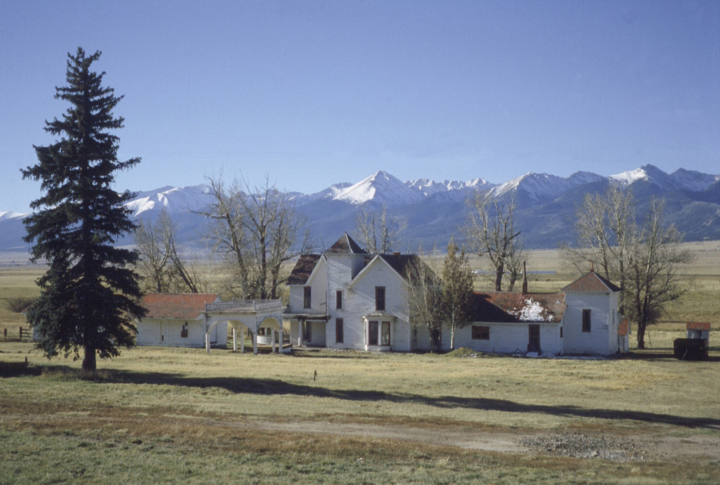
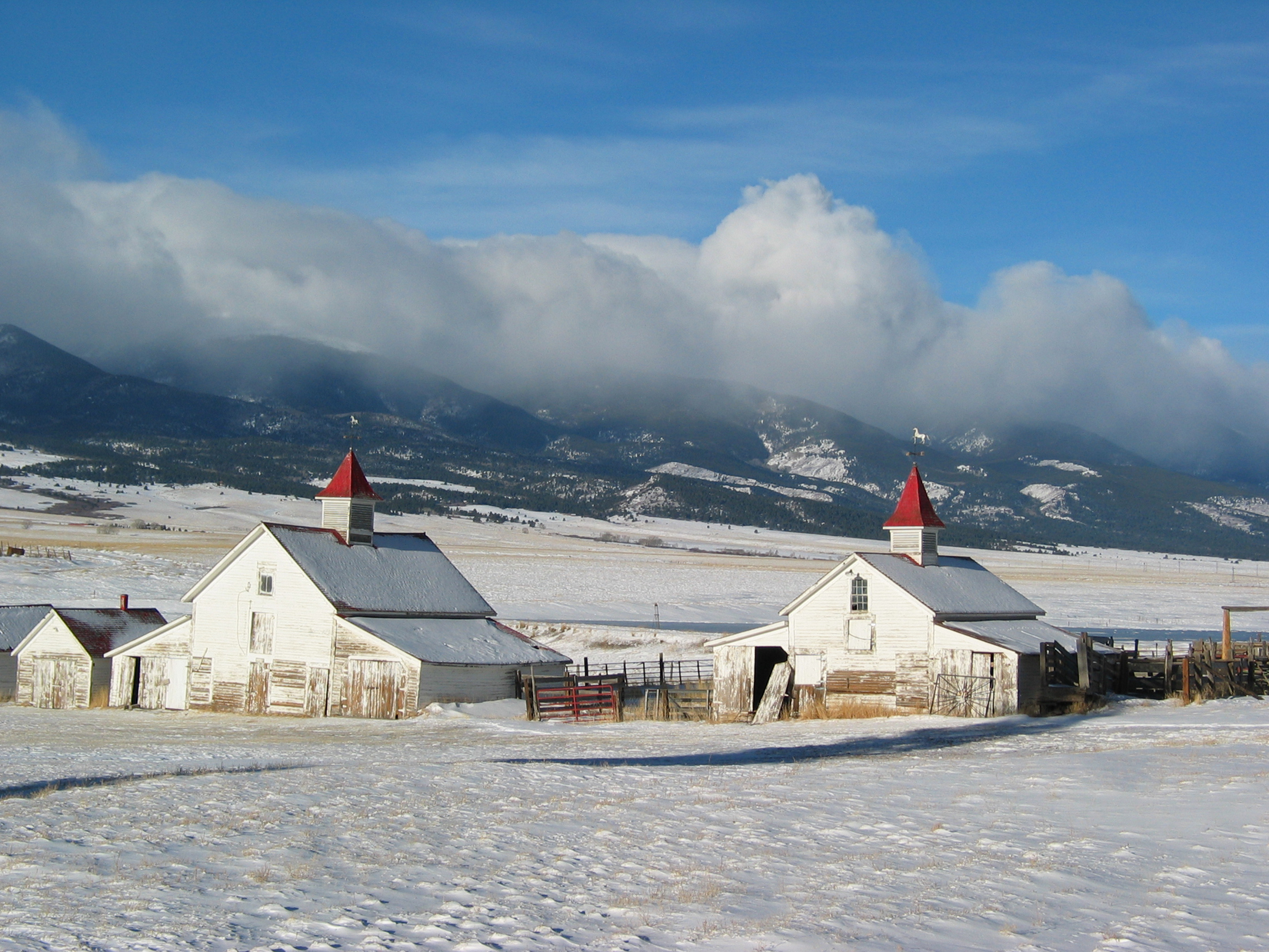
The historic Beckwith Ranch is located in Westcliffe.
Public Domain. Photo by Sally Pearce
Download Original (1472 x 992 pixels, 735.7 KB)
-
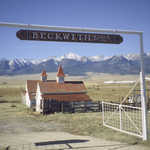
The entrance to Beckwith Ranch offers a great view of the Sangre de Cristo Mountains.
Public Domain. Photo by Sally Pearce
Download Original (1472 x 963 pixels, 897.2 KB)
-
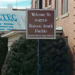
In 2000, Pueblo placed street signs in south Pueblo to mark the historic Hispanic street names.
Public Domain. Photo by Sally Pearce
Download Original (770 x 1166 pixels, 518.7 KB)
-
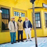
A group poses in front of the Westcliffe Information Center, which serves as a visitor and interpretive center, focusing on the Byway’s railroad history.
Public Domain. Photo by Sally Pearce
Download Original (1168 x 766 pixels, 562.8 KB)
-
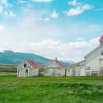
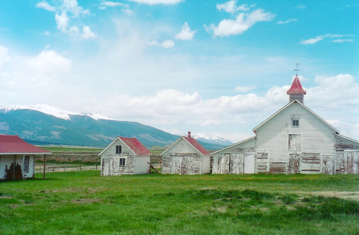
A brilliant sky and green grass surround the white buildings and add to the ambiance of the historic Beckwith Ranch.
Public Domain. Photo by Sally Pearce
Download Original (1167 x 766 pixels, 503.4 KB)
-
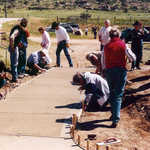
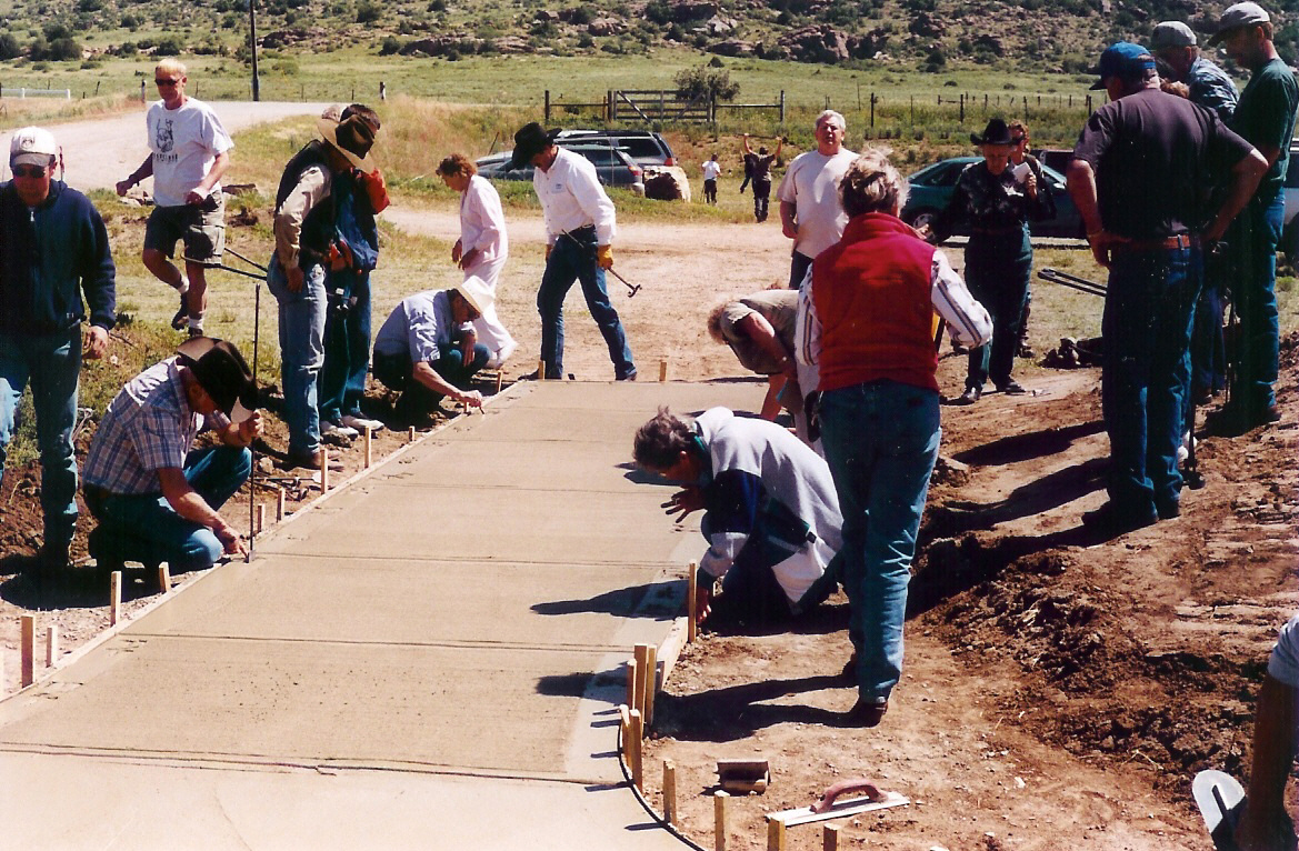
Local ranchers brand the concrete walkway at Beckwith Ranch. Eventually, the site will become a living history ranch.
Public Domain. Photo by Sally Pearce
Download Original (1169 x 766 pixels, 724.3 KB)
-
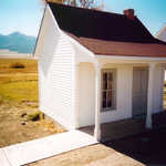
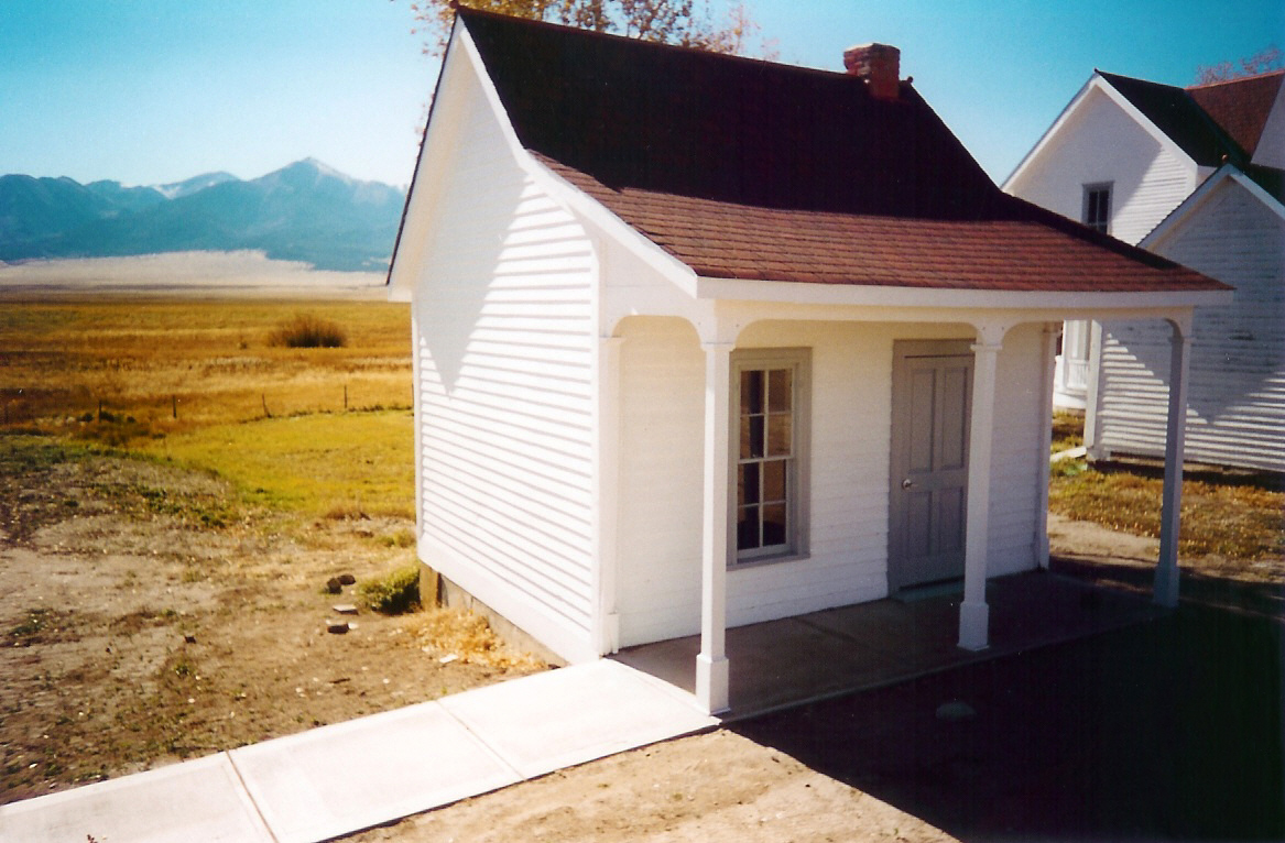
Due to a grant in 2000, Beckwith Ranch built a restroom on the grounds.
Public Domain. Photo by Sally Pearce
Download Original (1167 x 766 pixels, 490.8 KB)
-
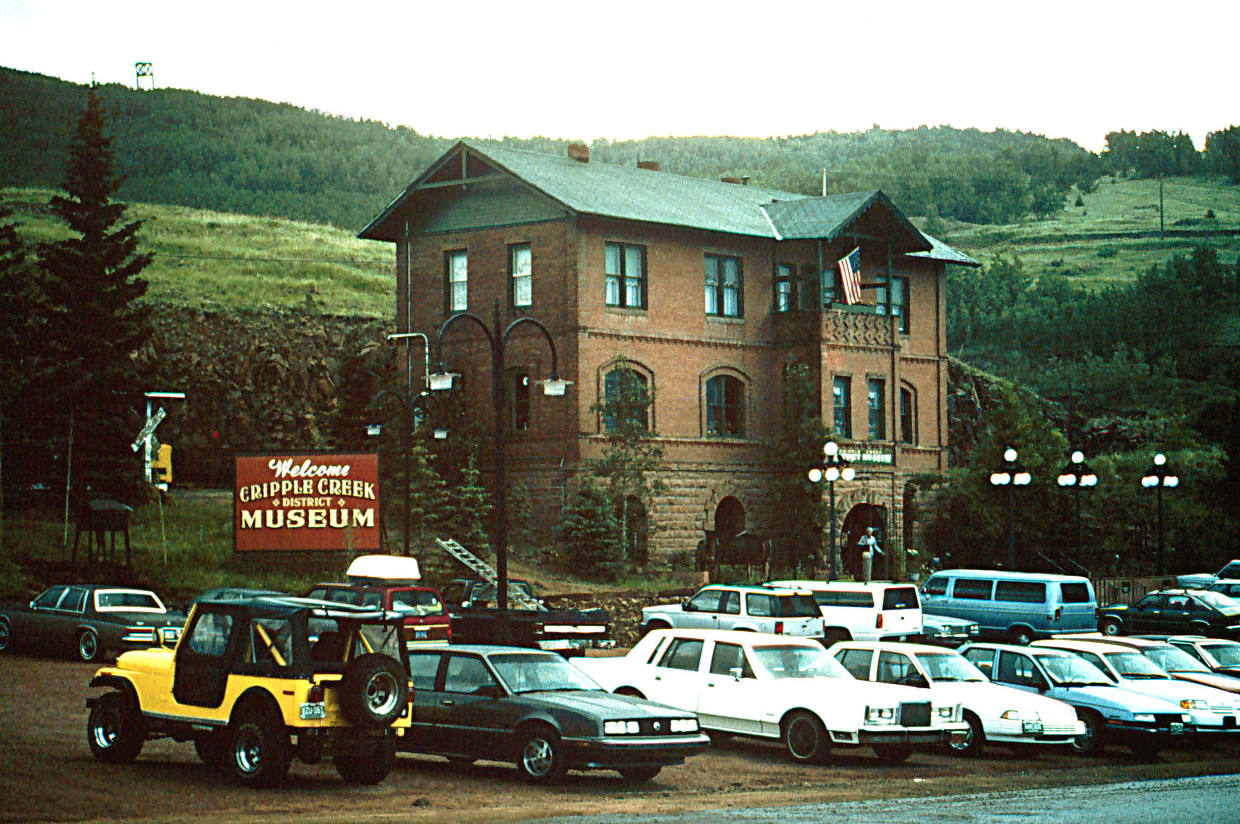
Cripple Creek was the financial and social hub of the Cripple Creek Mining District. Today, many buildings in Cripple Creek's business district have been renovated or restored.
Public Domain. Courtesy of the Bureau of Land Management
Download Original (2635 x 1666 pixels, 949.0 KB)
-

A renovated Beckwith Ranch sits in front of the snowy Sangre de Cristo Mountain range.
Public Domain. Photo by Christopher Markuson
Download Original (1650 x 1238 pixels, 1474.5 MB)
-
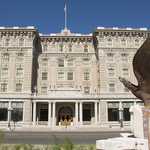
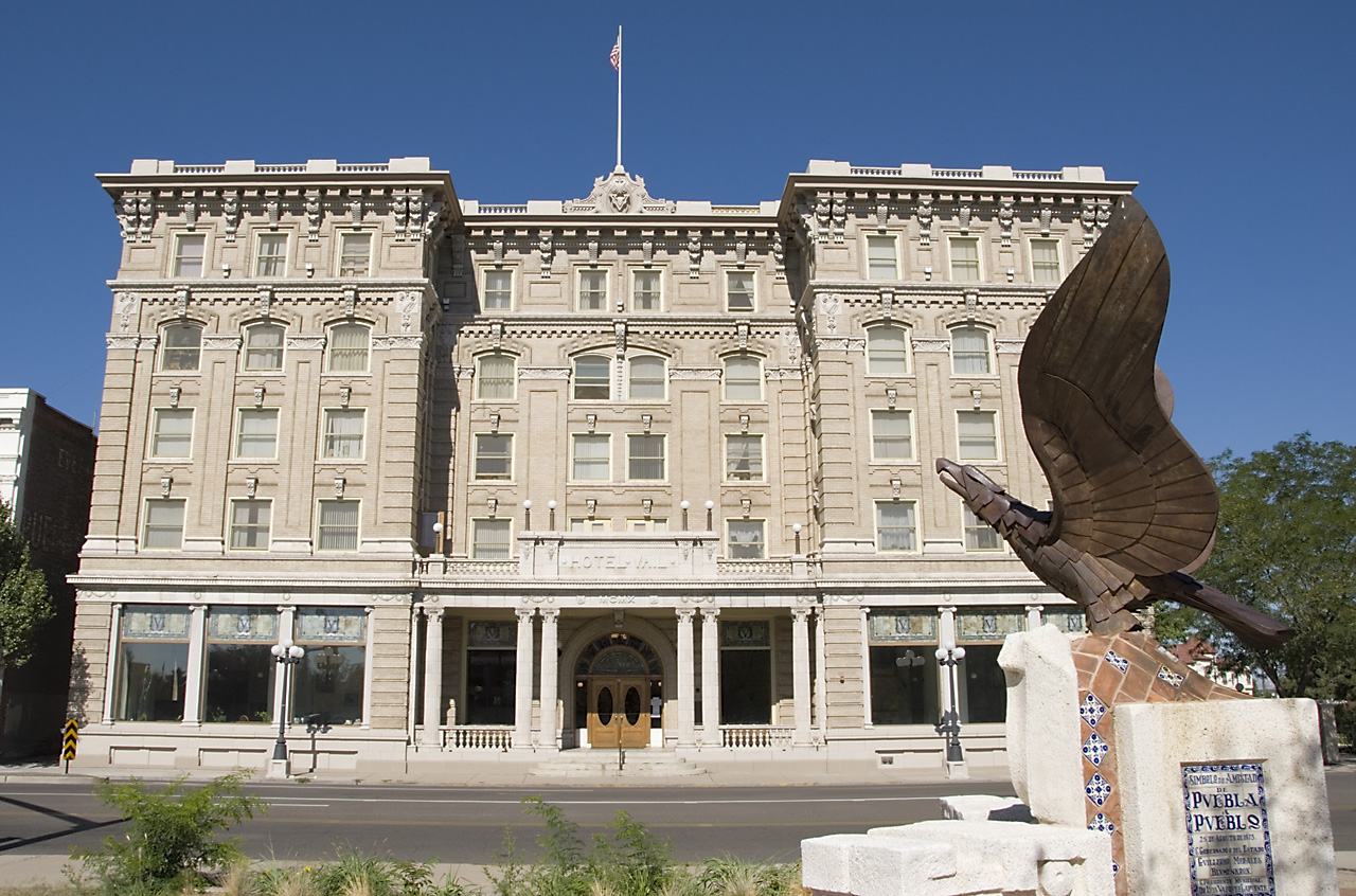
Hotel Vail stands majestically in Pueblo, Colorado.
© August 2006 Neil Li.
Download Original (1280 x 846 pixels, 474.0 KB)
-
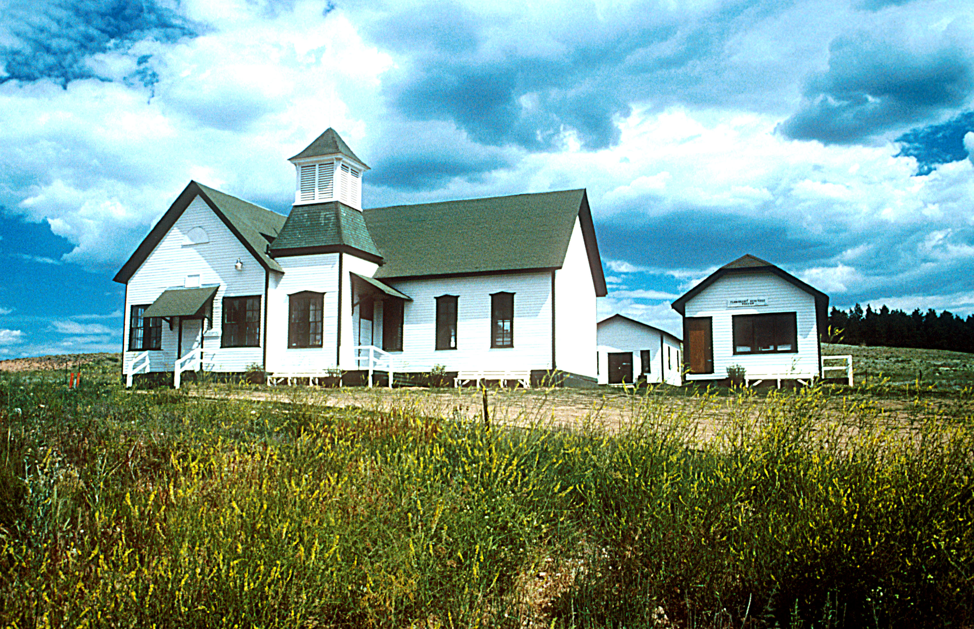
The Florissant Heritage Museum occupies the historic Florissant schoolhouse, a schoolhouse from 1887 to 1960. Today, the museum interprets the history of the area beginning with the Ute Indians. It is on the National Register of Historic Places.
Public Domain. Courtesy of the Bureau of Land Management
Download Original (3413 x 2203 pixels, 1845.6 MB)
-
During the Creole Nature Trail Tour, the staff visited the Westcliffe Information Center.
Public Domain. Photo by Sally Pearce
Download Original (1169 x 766 pixels, 519.1 KB)
-
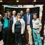
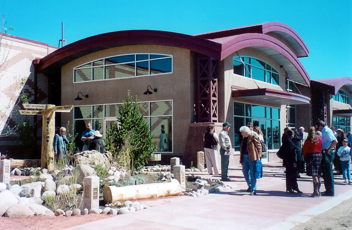
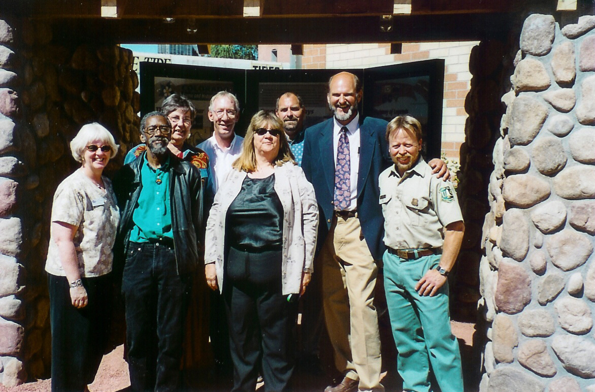
Gathered for the dedication of the El Pueblo Museum, this group includes the state coordinator and representatives from all three byways.
Public Domain. Photo by Sally Pearce
Download Original (1172 x 772 pixels, 606.8 KB)
-
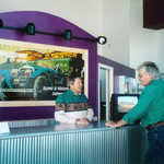
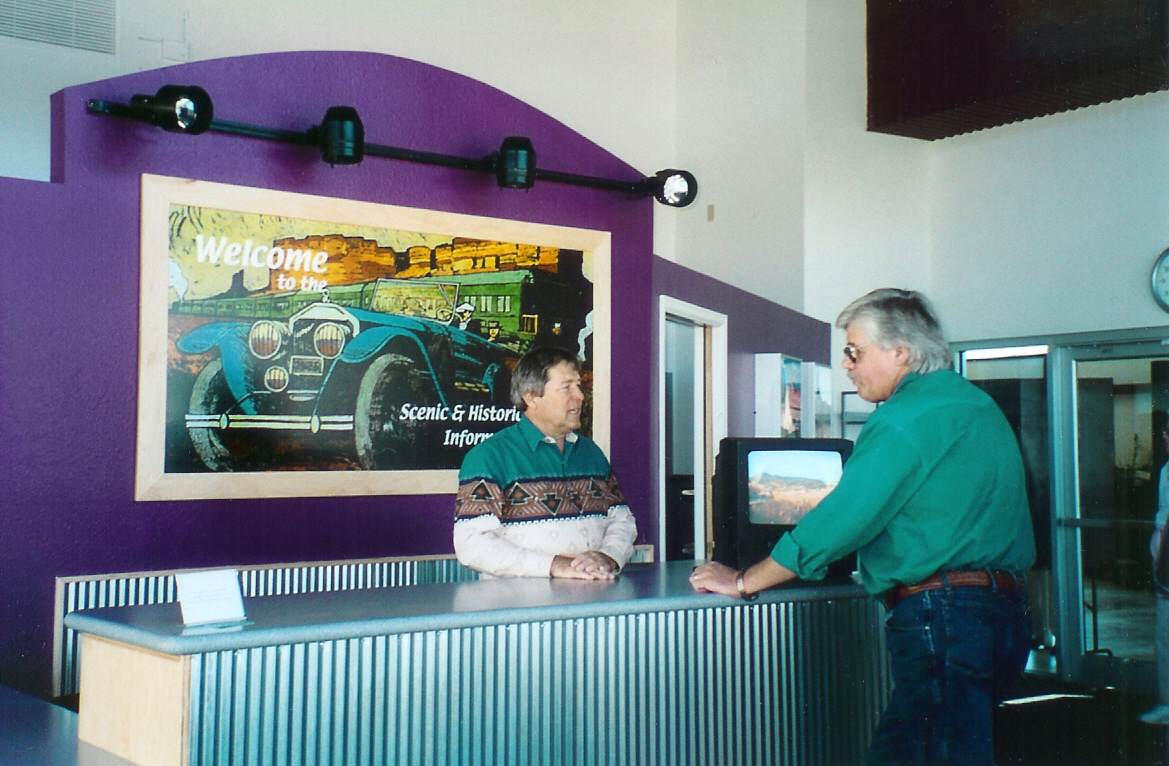
The Frontier Pathways Byway Information Center is located in the El Pueblo Museum's interior.
Public Domain. Photo by Sally Pearce
Download Original (1169 x 766 pixels, 536.8 KB)
-
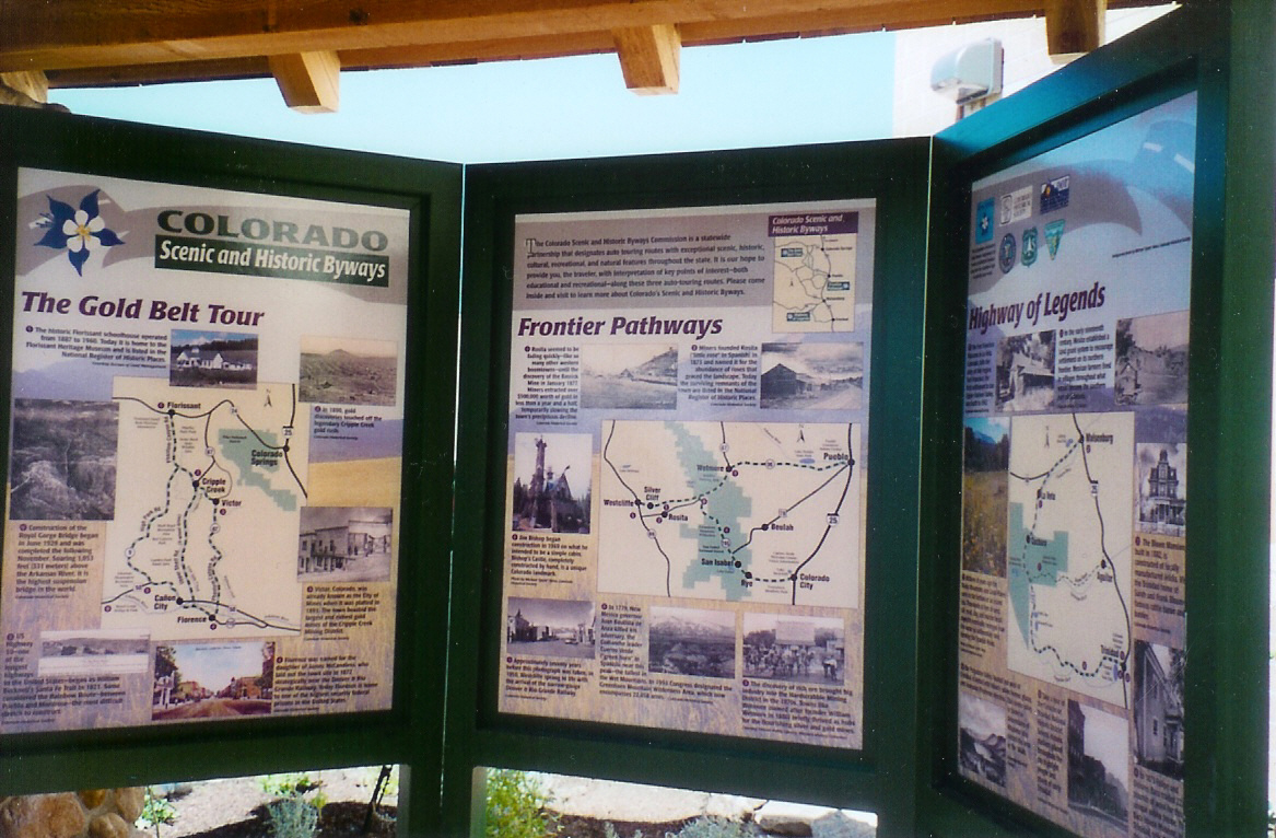
This new new kiosk, located at the El Pueblo Museum, describes the three scenic byways in the area (Frontier Pathways, Gold Belt Tour, and Highway of Legends).
Public Domain. Photo by Sally Pearce
Download Original (1167 x 766 pixels, 567.4 KB)
-
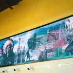
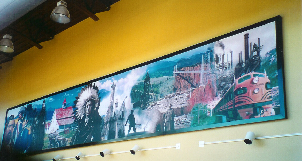
Hanging in the El Pueblo Museum, this mural depicts different themes from the three byways in the region (Frontier Pathways, Gold Belt Tour, and Highway of Legends).
Public Domain. Photo by Sally Pearce
Download Original (1169 x 624 pixels, 440.9 KB)
-
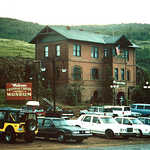
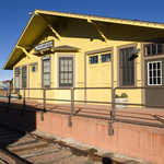
From 1896 to 1949, this building served continuously as a railroad depot. In 1953, it was converted into a private, non-profit museum interpreting Cripple Creek's history.
Public Domain. Bureau of Land Management
Download Original (2501 x 1663 pixels, 875.1 KB)
-
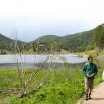
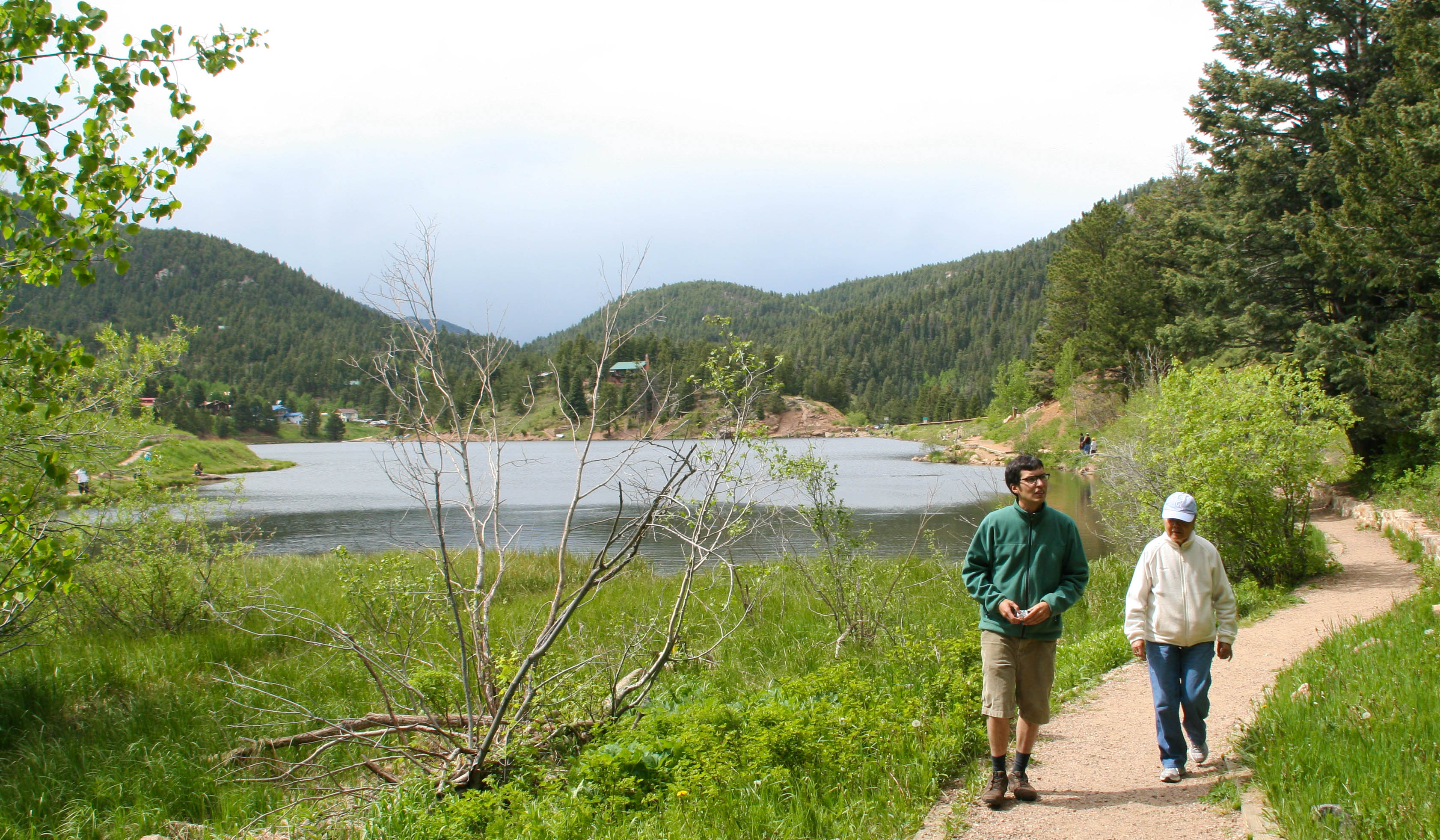
Two hikers walk the beaten path around Lake Isabel.
 © June 2009 Jessica Feis.
Download Original (3365 x 1964 pixels, 1063.9 MB)