
Pioneer Historic Byway
All Photos (116)
-
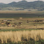
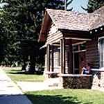
Built in 1904, Franklin's Village Hall resides among shade trees.
© 1999 A. E. Crane.
Download Original (140 x 188 pixels, 18.1 KB)
-
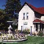
Well kept gardens and lawns surround the Fitzen House, which was built in late 1800's.
© 1999 A. E. Crane.
-
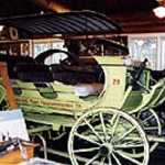
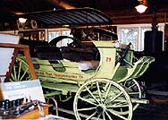
One of the Original Yellowstone Tour Stagecoaches resides in the museum in Franklin, ID.
© 1999 A. E. Crane.
Download Original (188 x 134 pixels, 19.2 KB)
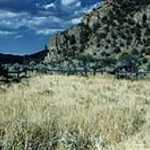
-
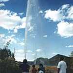
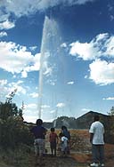
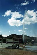
Onlookers watch Soda Spring's cold-water geyser erupt late one afternoon
© 1999 A. E. Crane.
Download Original (128 x 188 pixels, 12.7 KB)
-
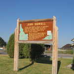
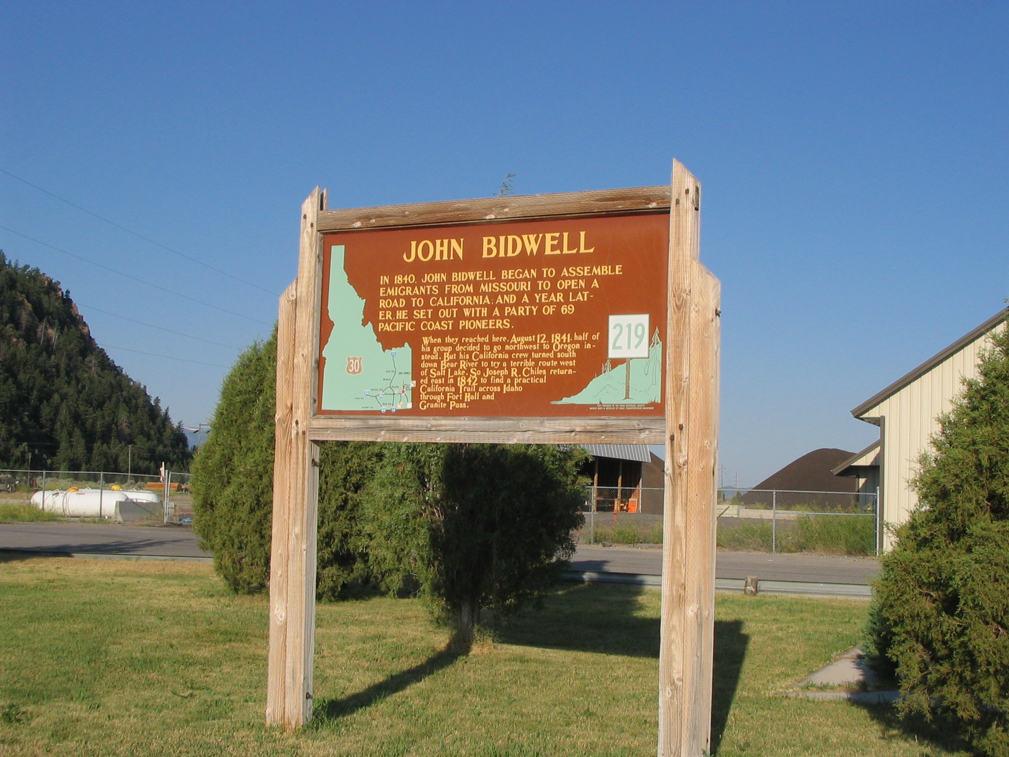
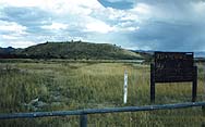
A sign tells of John Bidwell and the party he assembled to travel west.
Public Domain. Photo by Tony Varilone
Download Original (2048 x 1536 pixels, 924.9 KB)
-

Spinning wheel on display inside Franklin's old ZCMI store. (ZCMI stands for Zion Cooperative Merchantile Institution.)
© 1999 A. E. Crane.
-
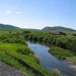
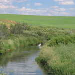
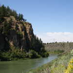
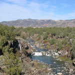
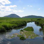
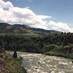
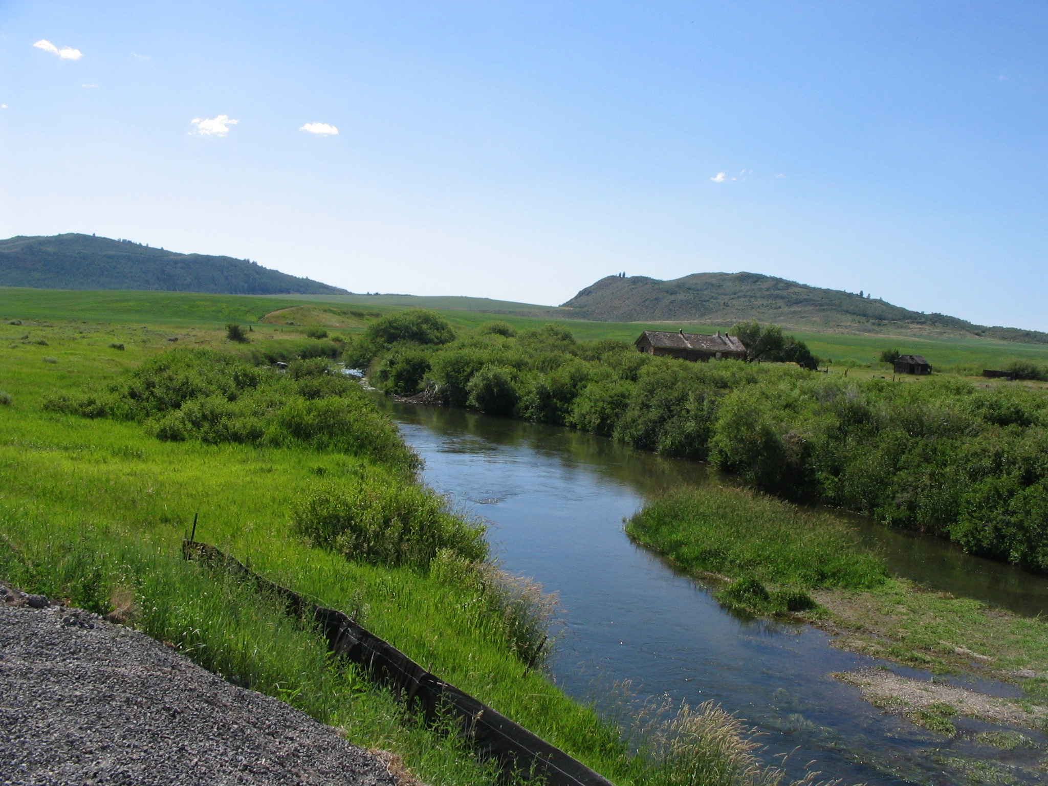
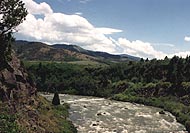
The stream's bright green banks contrast with the dark mountains and blue sky.
Public Domain. Photo taken by Tony Varilone
Download Original (2048 x 1536 pixels, 953.0 KB)
-
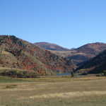
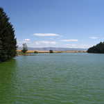
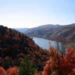
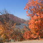
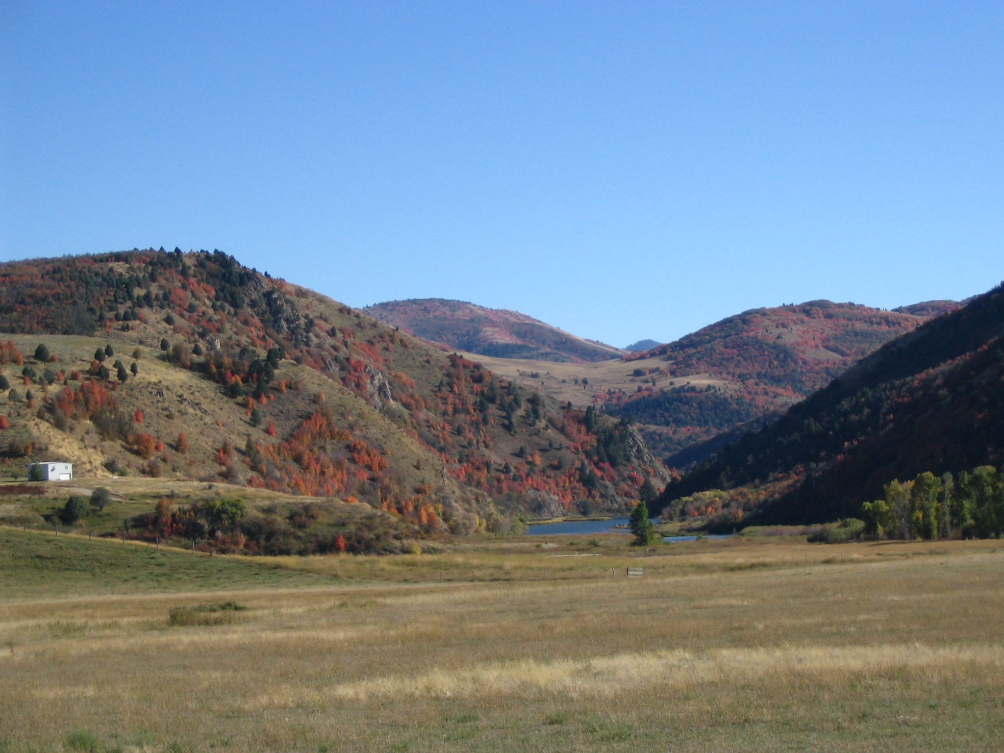
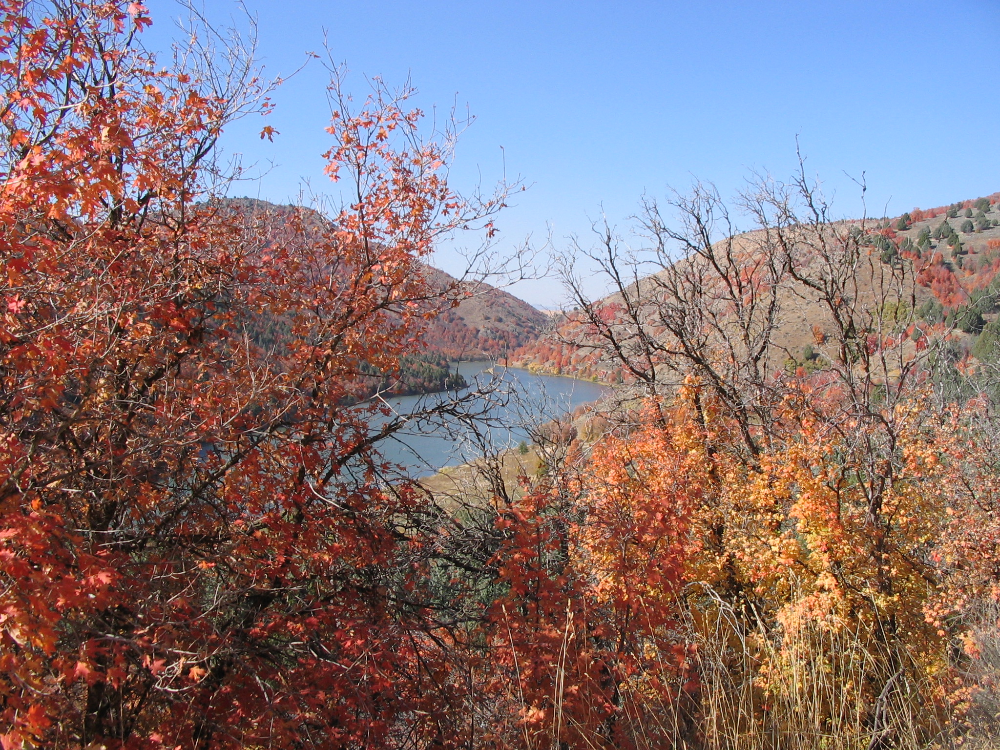
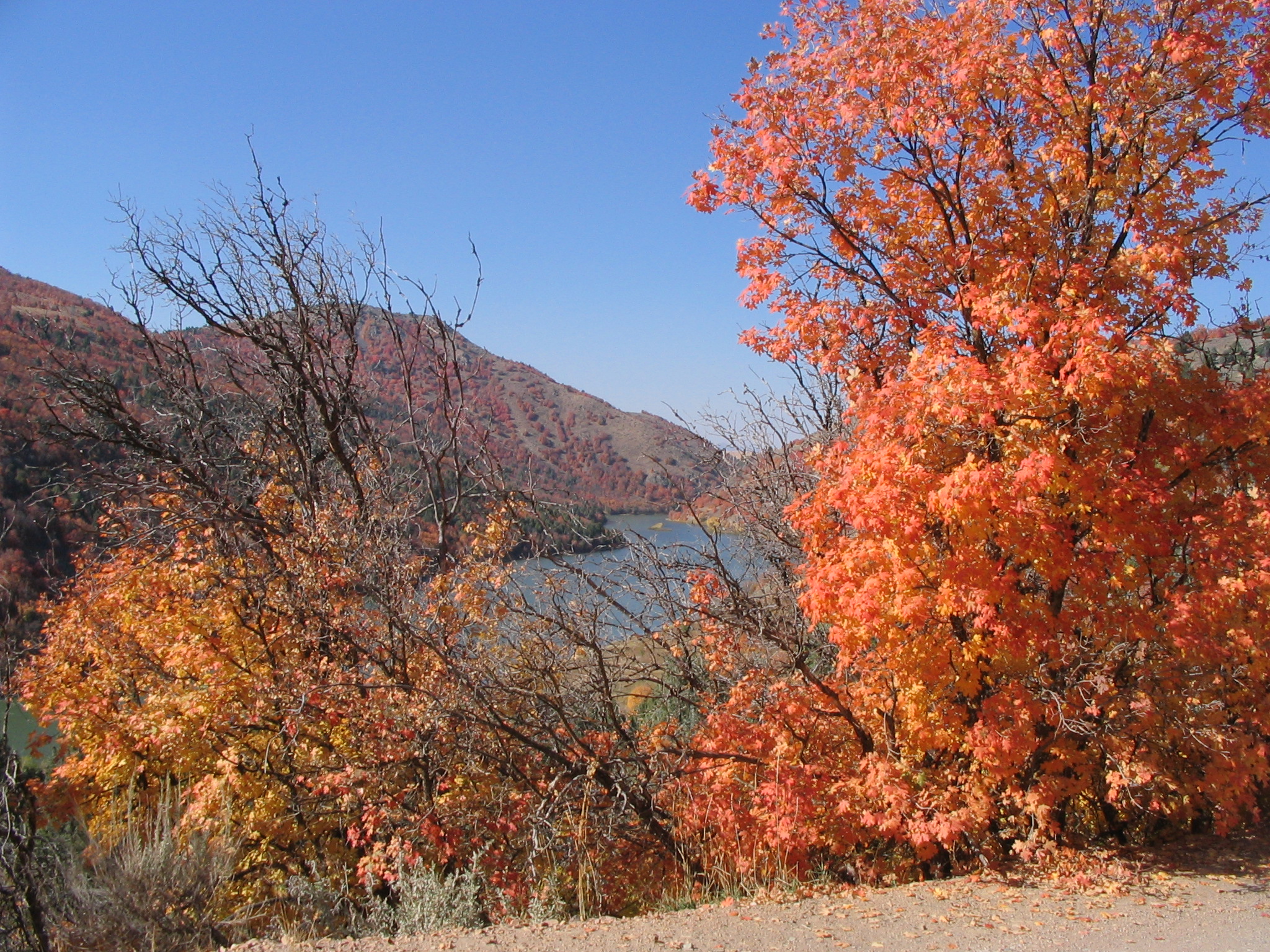
A tiny blue lake lies nestled at the base of mountains covered with bright red and orange trees in autumn.
Public Domain. CD provided by Tony Varilone May 2007
Download Original (2048 x 1536 pixels, 717.0 KB)
-
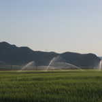
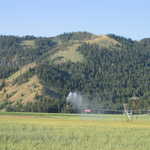
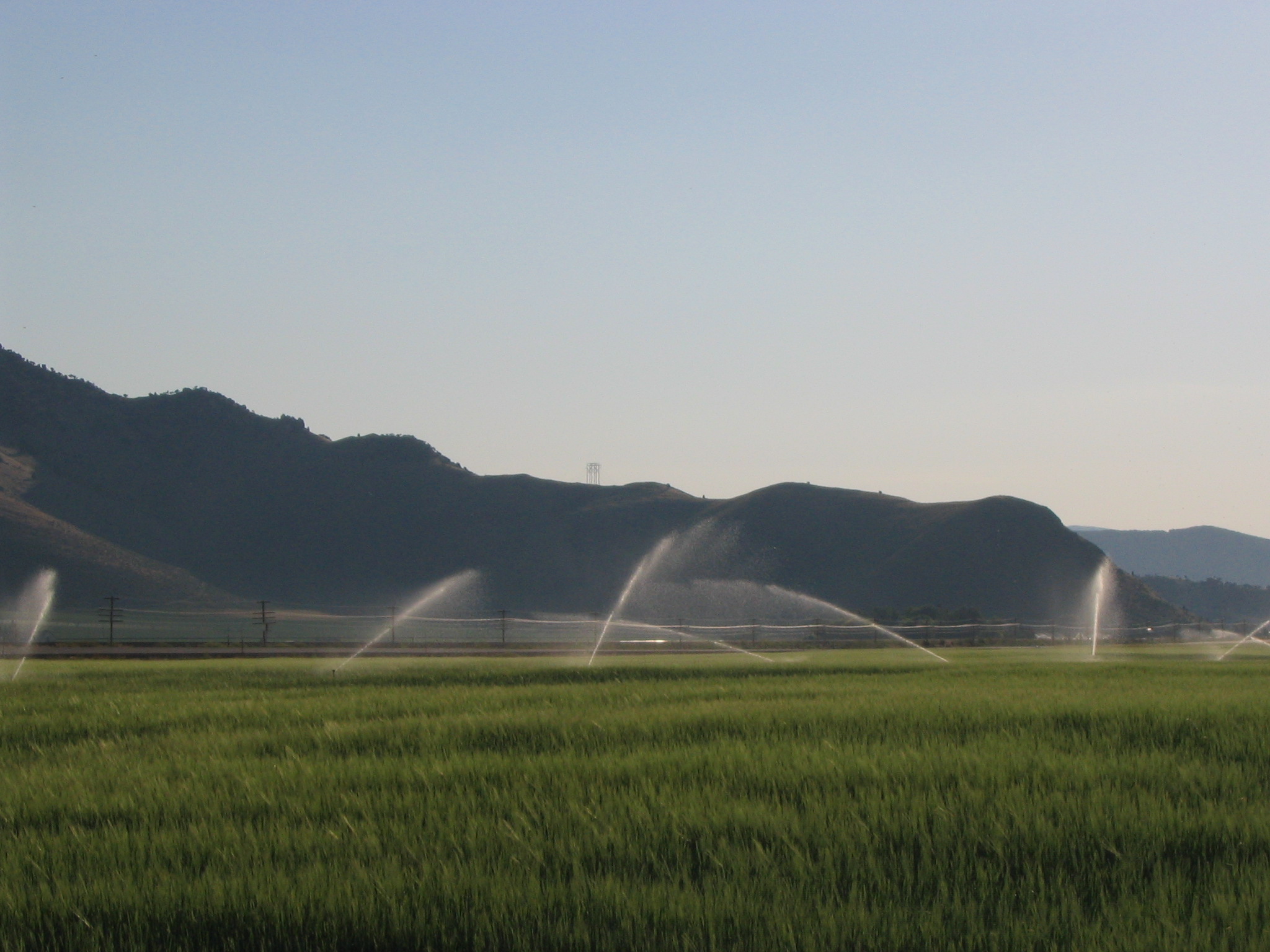
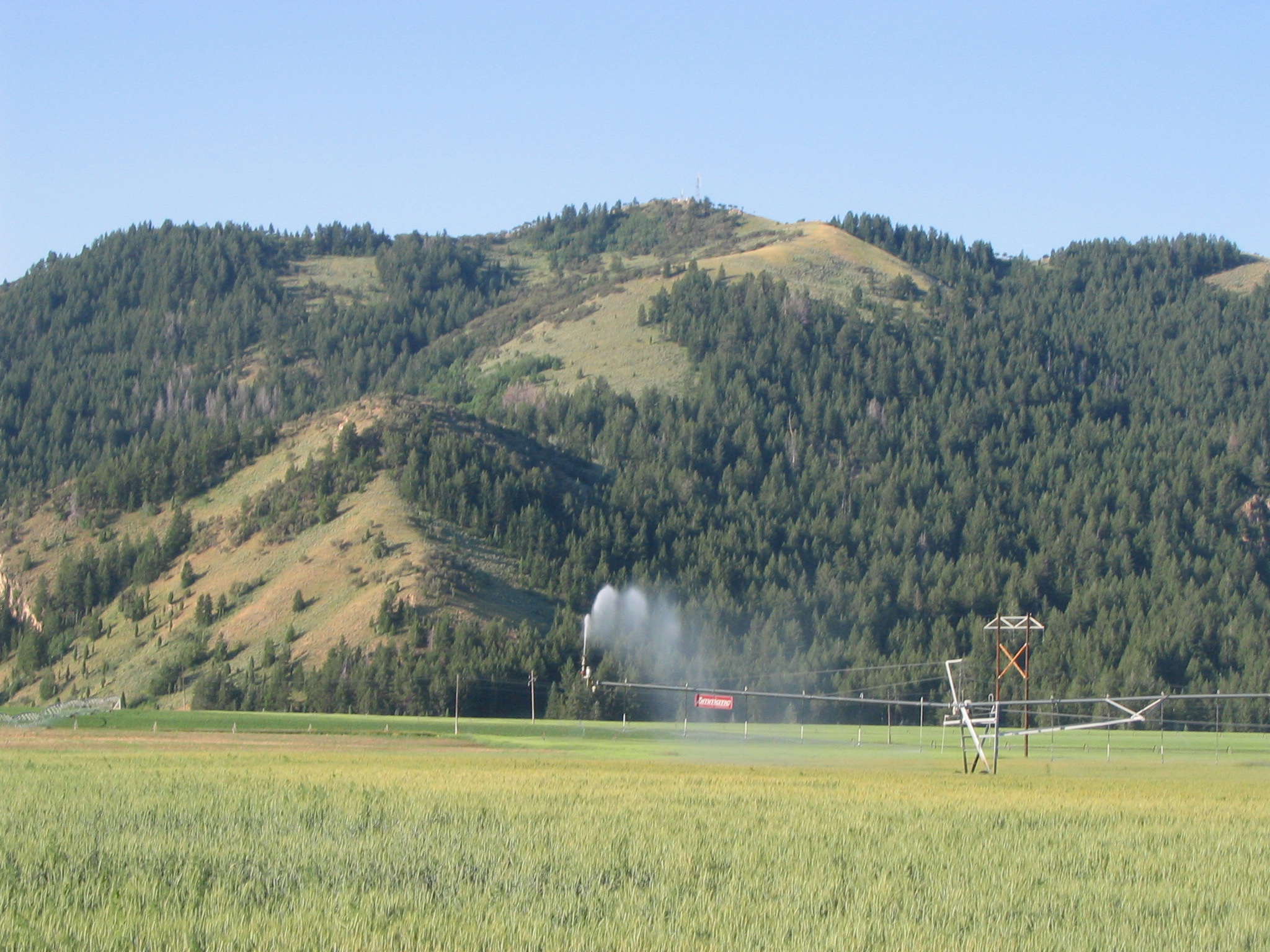
Streams of water on a field between Soda Springs and Sheep Rock irrigate this already green field with showers of water.
Public Domain. Photo by Tony Varilone
Download Original (2048 x 1536 pixels, 589.2 KB)
-
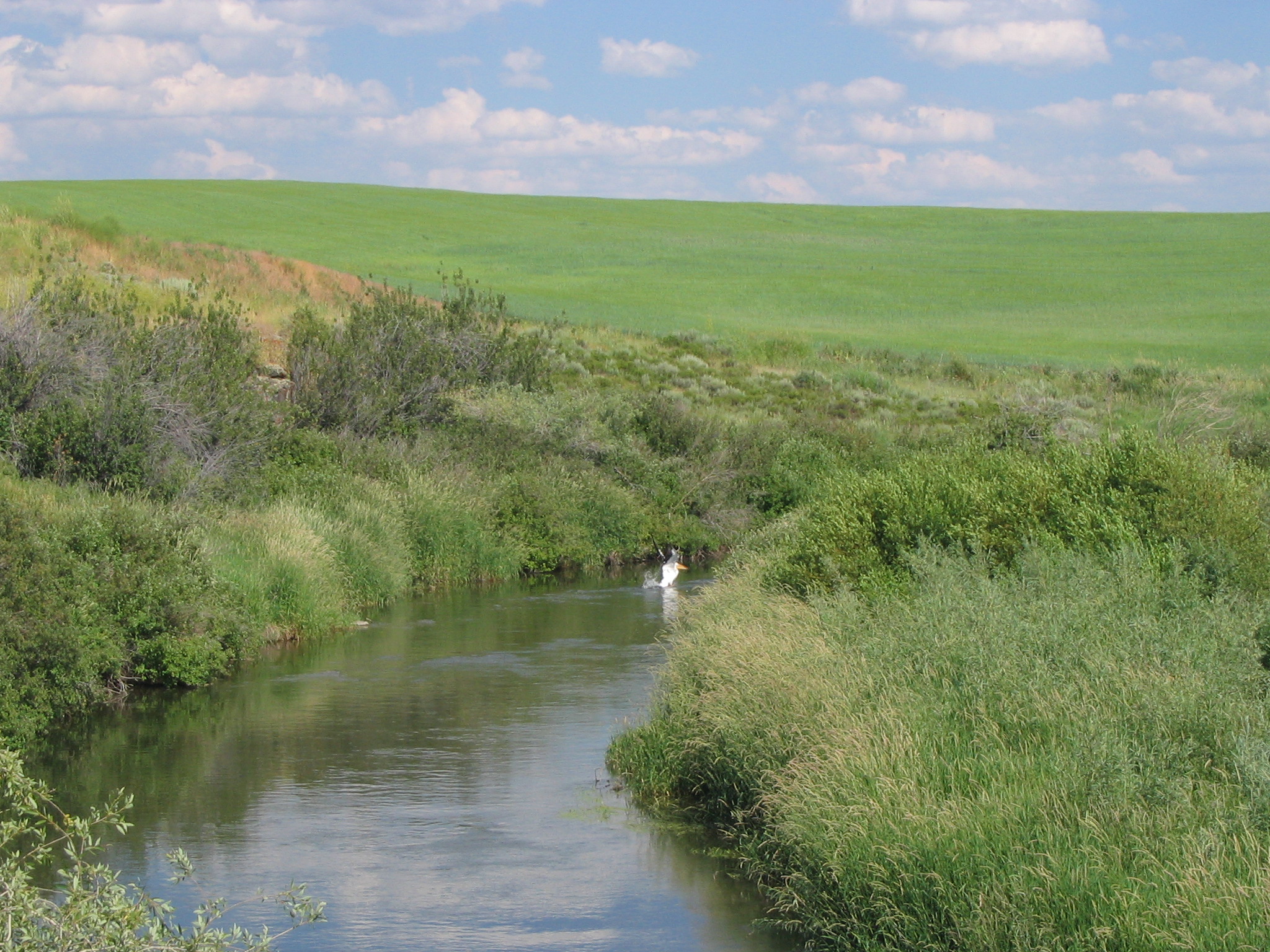
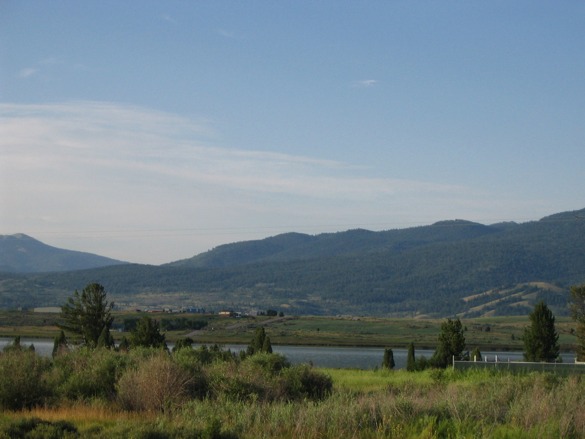
Water fowl float on an irrigation canal in a wide green field in southeastern Idaho.
Public Domain. Photo taken by Tony Varilone
Download Original (2048 x 1536 pixels, 1122.1 MB)
-
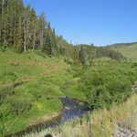
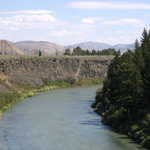
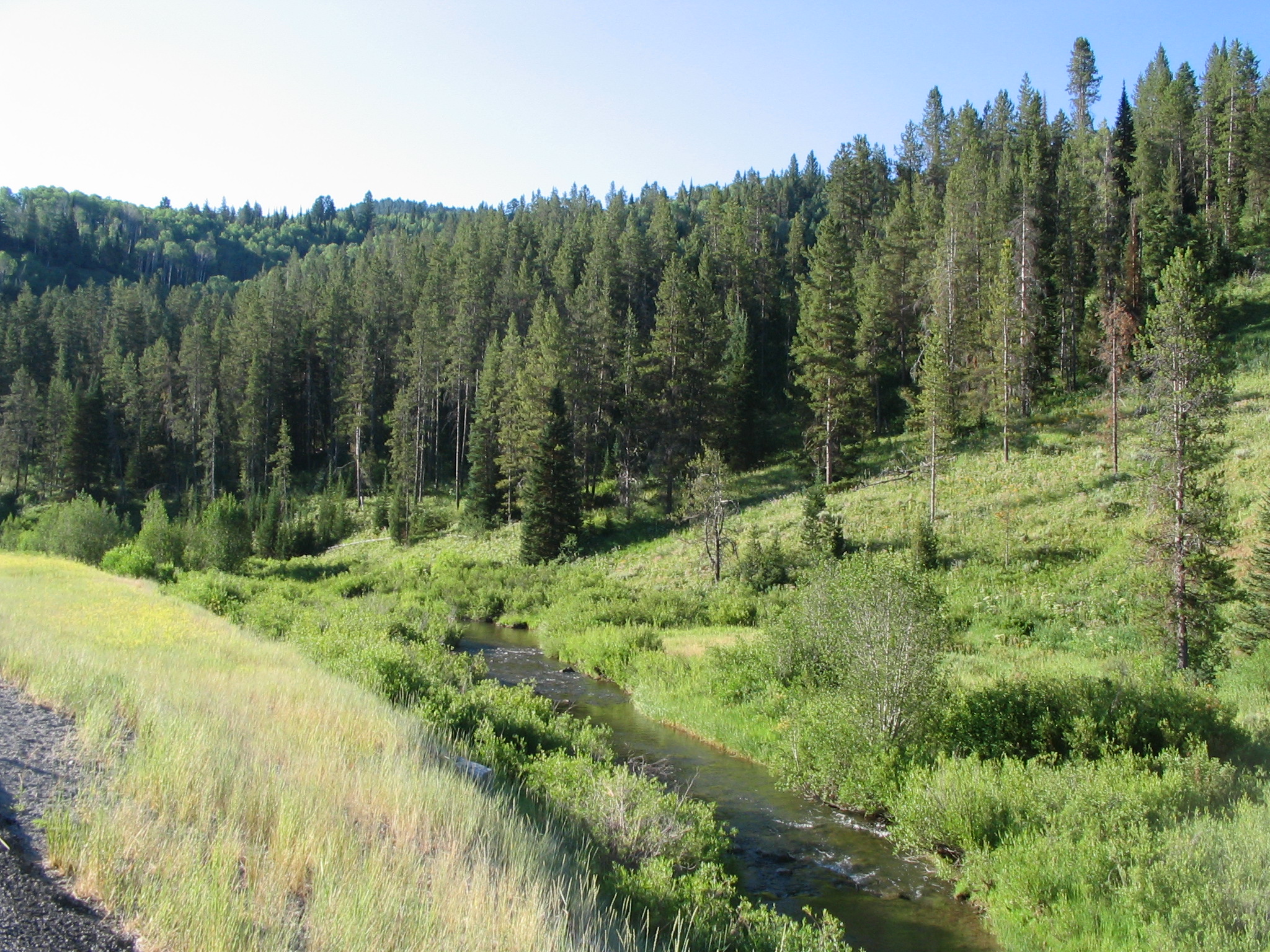
Large pines overlook a mountain stream curving silently with the land.
Public Domain. Photo taken by Tony Varilone
Download Original (2048 x 1536 pixels, 1305.8 MB)
-
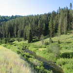
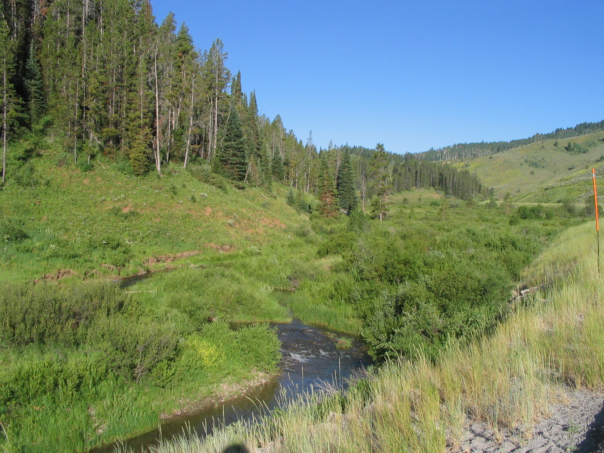
A small creek cuts its way through the mountains as pines stand majestically off to one side.
Public Domain. Photo taken by Tony Varilone
Download Original (2048 x 1536 pixels, 1259.6 MB)
-
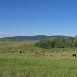
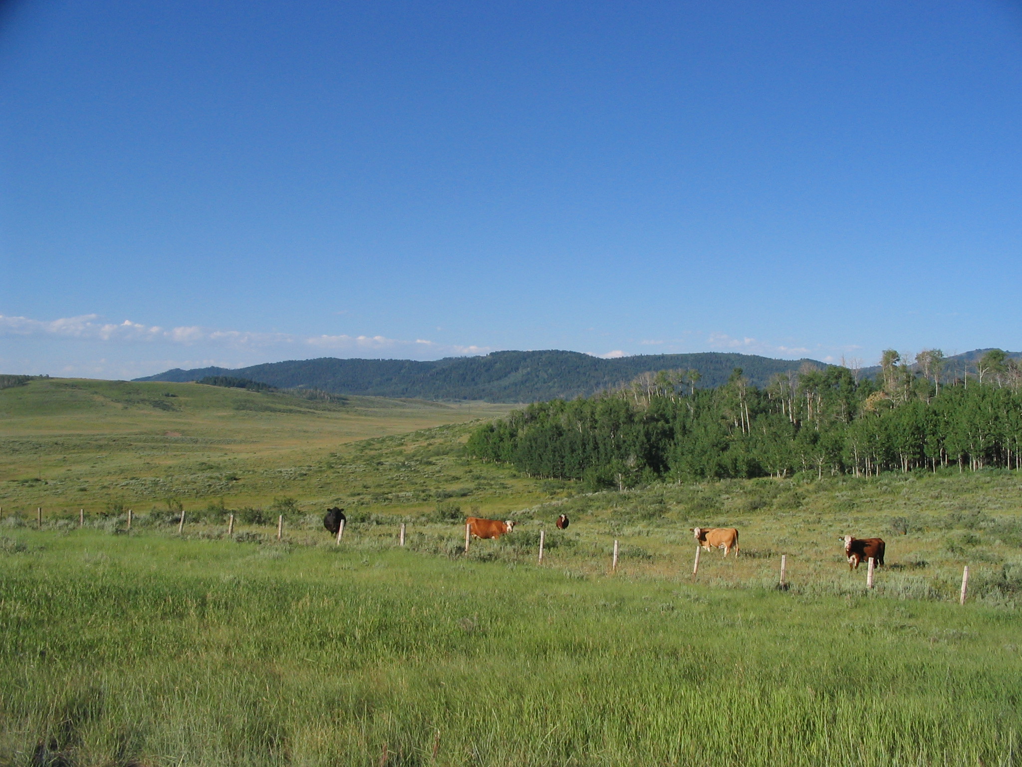
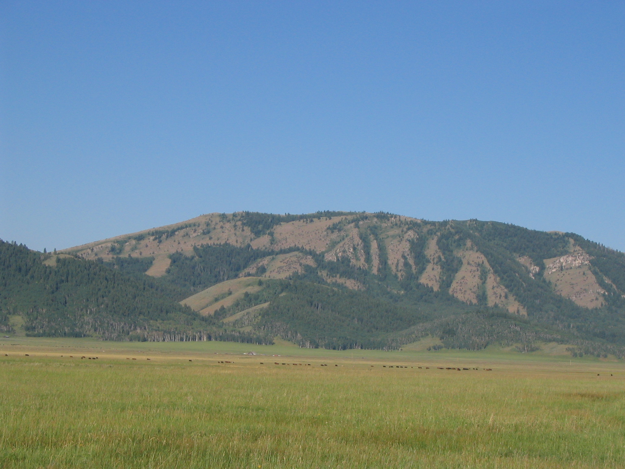
Trees extending from the mountains make a nice temporary home for the cows who pasture in the fields.
Public Domain. Photo taken by Tony Varilone
Download Original (2048 x 1536 pixels, 904.2 KB)
-
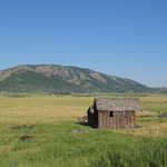
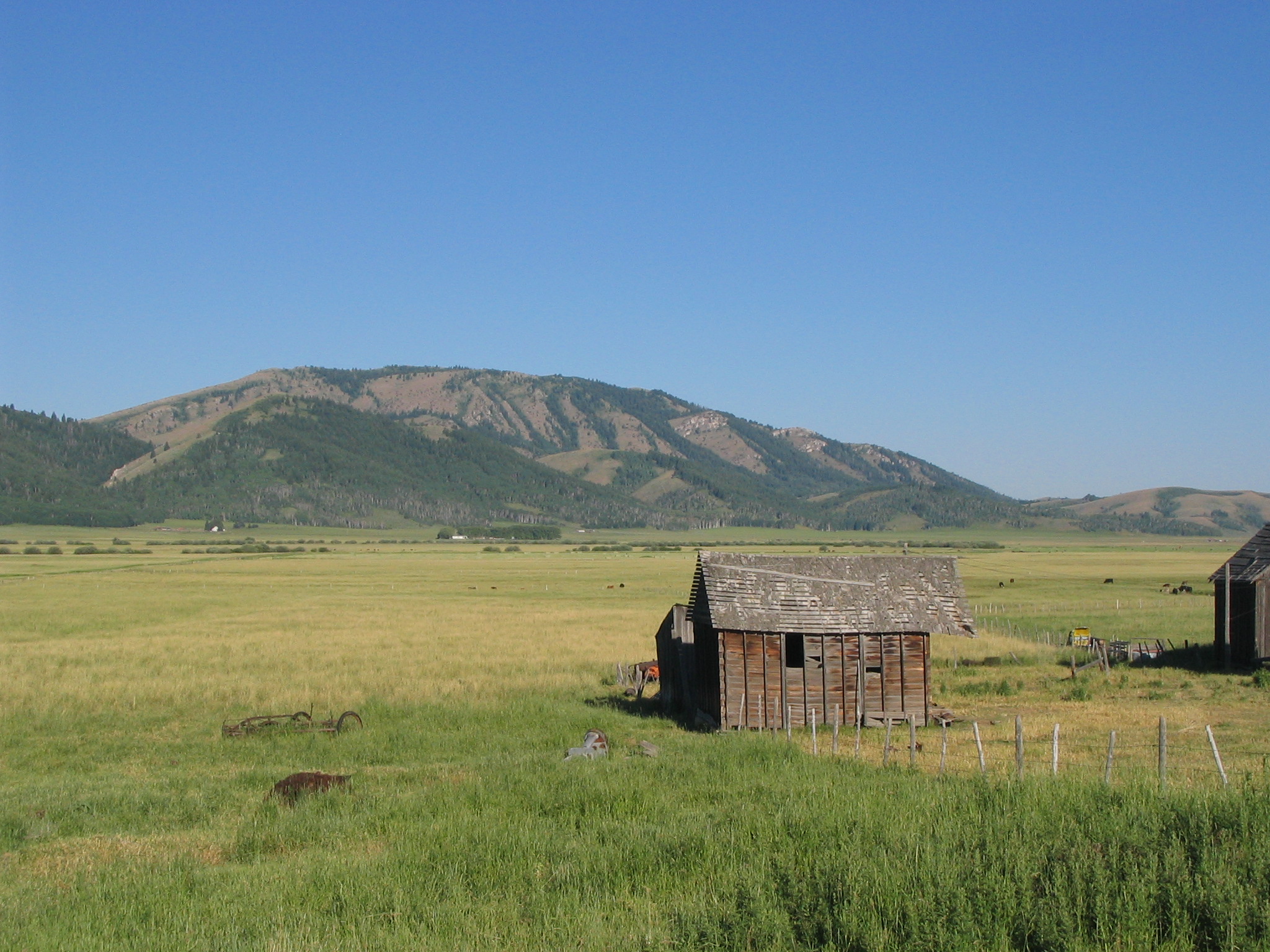
Mountains lay in the distance while in the foreground a quaint old barn stands in the fields of hay.
Public Domain. Photo taken by Tony Varilone
Download Original (2048 x 1536 pixels, 887.2 KB)
-
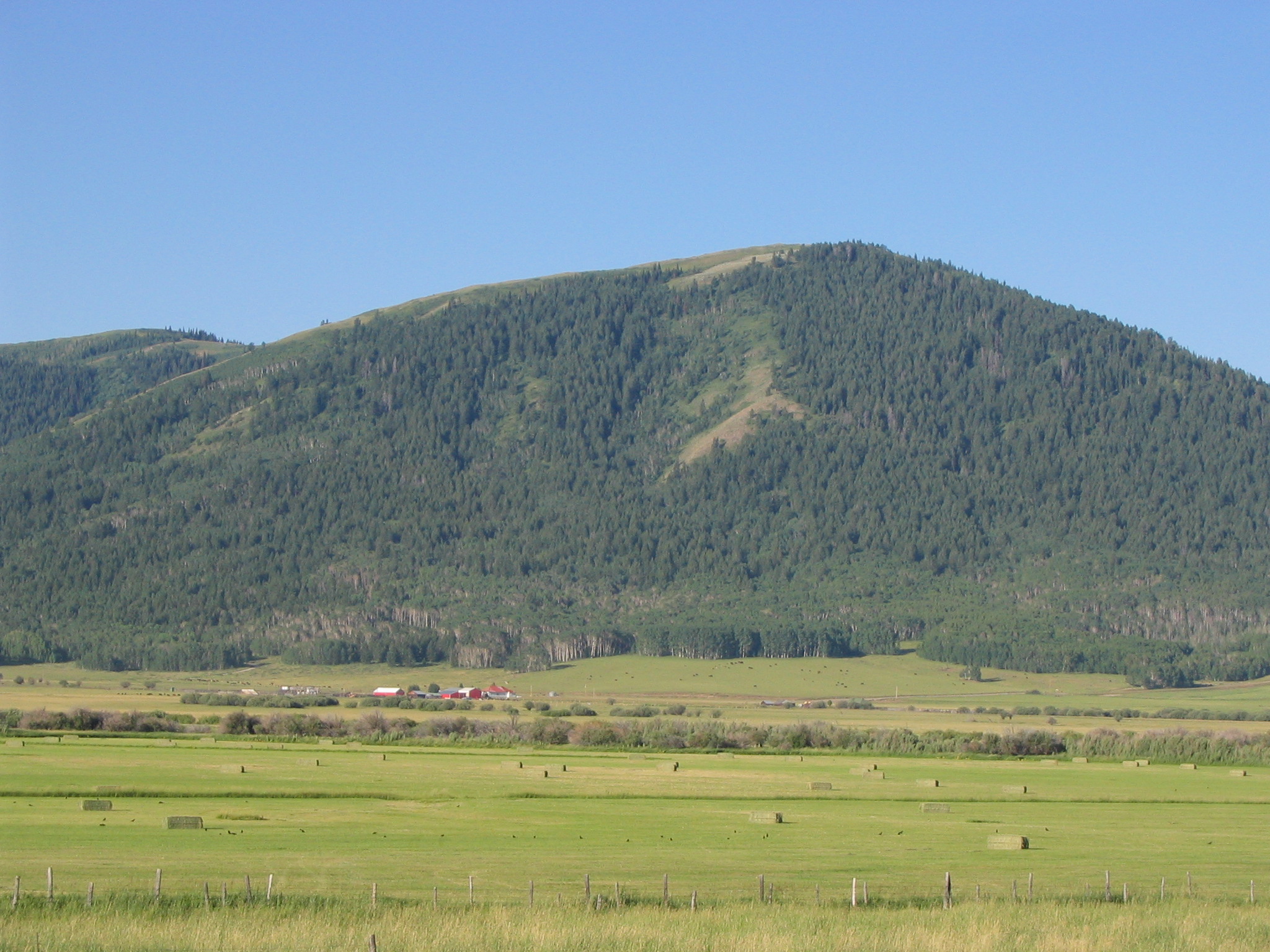
A tiny bright red farm is nestled at the base of this tree covered mountain. Bright blue skies look down on the freshly cut bales of hay in the farmers fields.
Public Domain. Photo taken by Tony Varilone
Download Original (2048 x 1536 pixels, 855.3 KB)
-
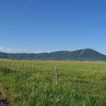
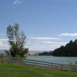
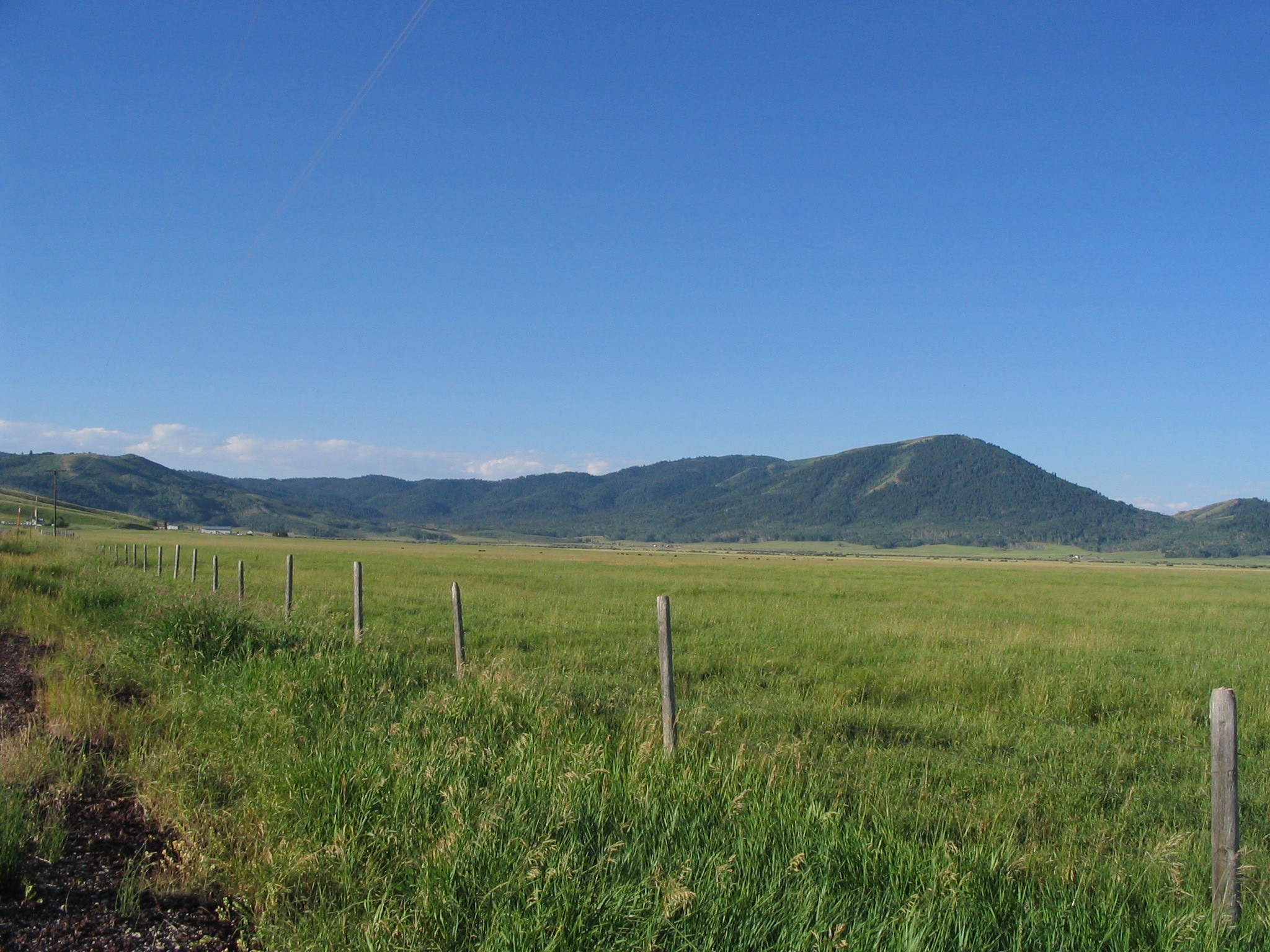
Blue skies look down on a summertime wash of green grasses held in by a fence, and dark mountains sit in the distance.
Public Domain. Photo taken by Tony Varilone
Download Original (2048 x 1536 pixels, 953.2 KB)
-
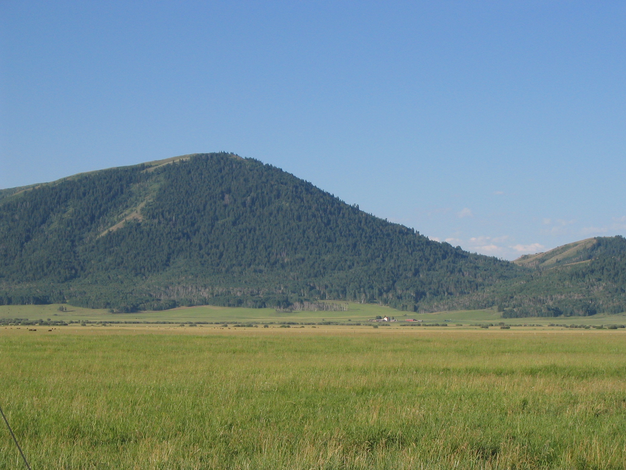
Thick stands of trees cover the rolling hills that sit at the other end of a green field.
Public Domain. Photo taken by Tony Varilone
Download Original (2048 x 1536 pixels, 842.8 KB)
-
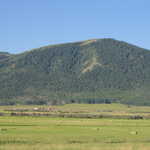
A mountain striped green with forest and brown with summer grass acts as a divider between green pastures and a clear sky.
Public Domain. Photo taken by Tony Varilone
Download Original (2048 x 1536 pixels, 727.8 KB)
-
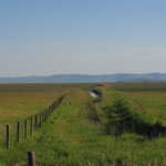
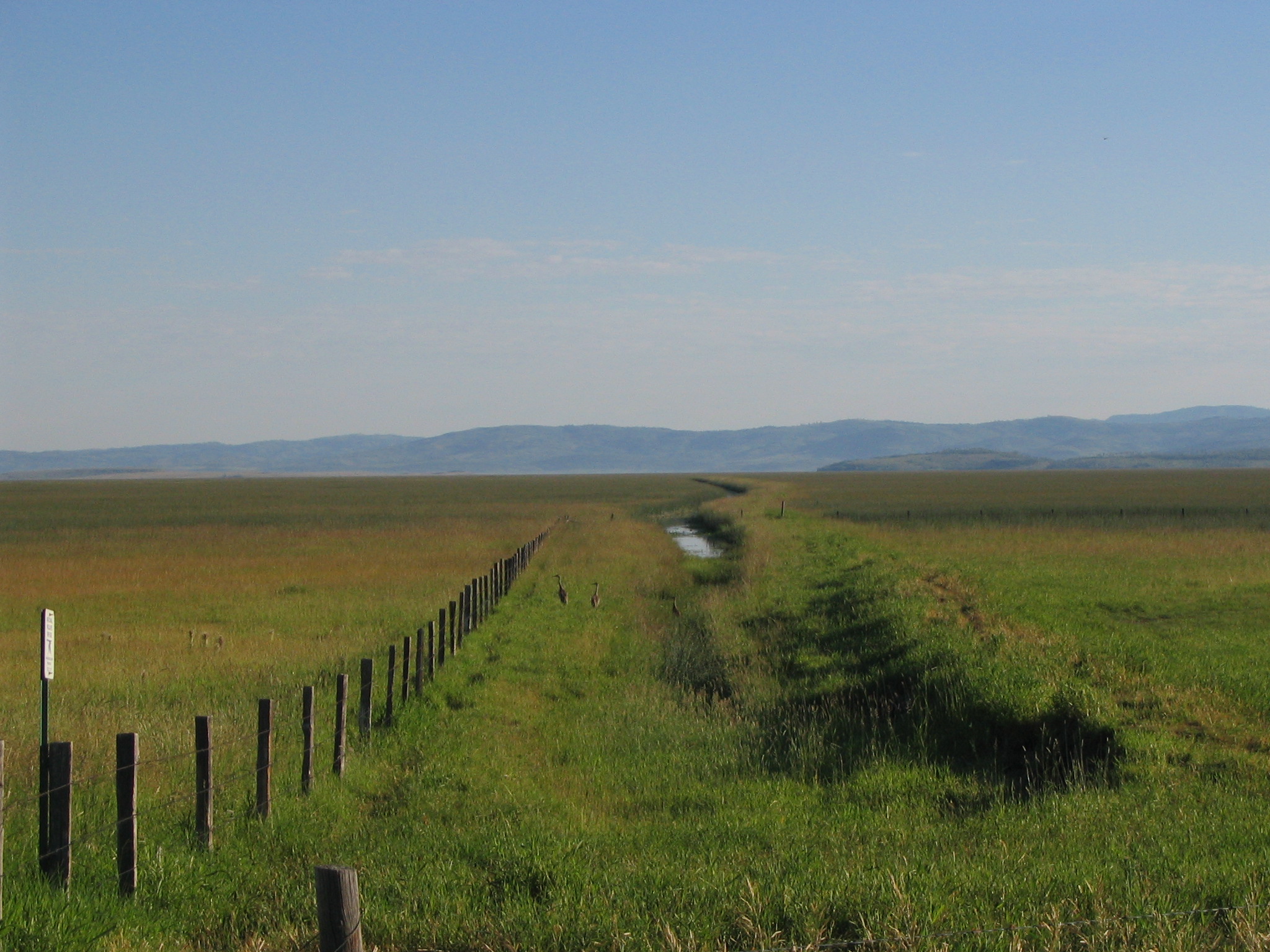
An irrigation channel full of water runs along a post fence in a wide pasture bordered by a hazy mountain range.
Public Domain. Photo taken by Tony Varilone
Download Original (2048 x 1536 pixels, 824.1 KB)
-
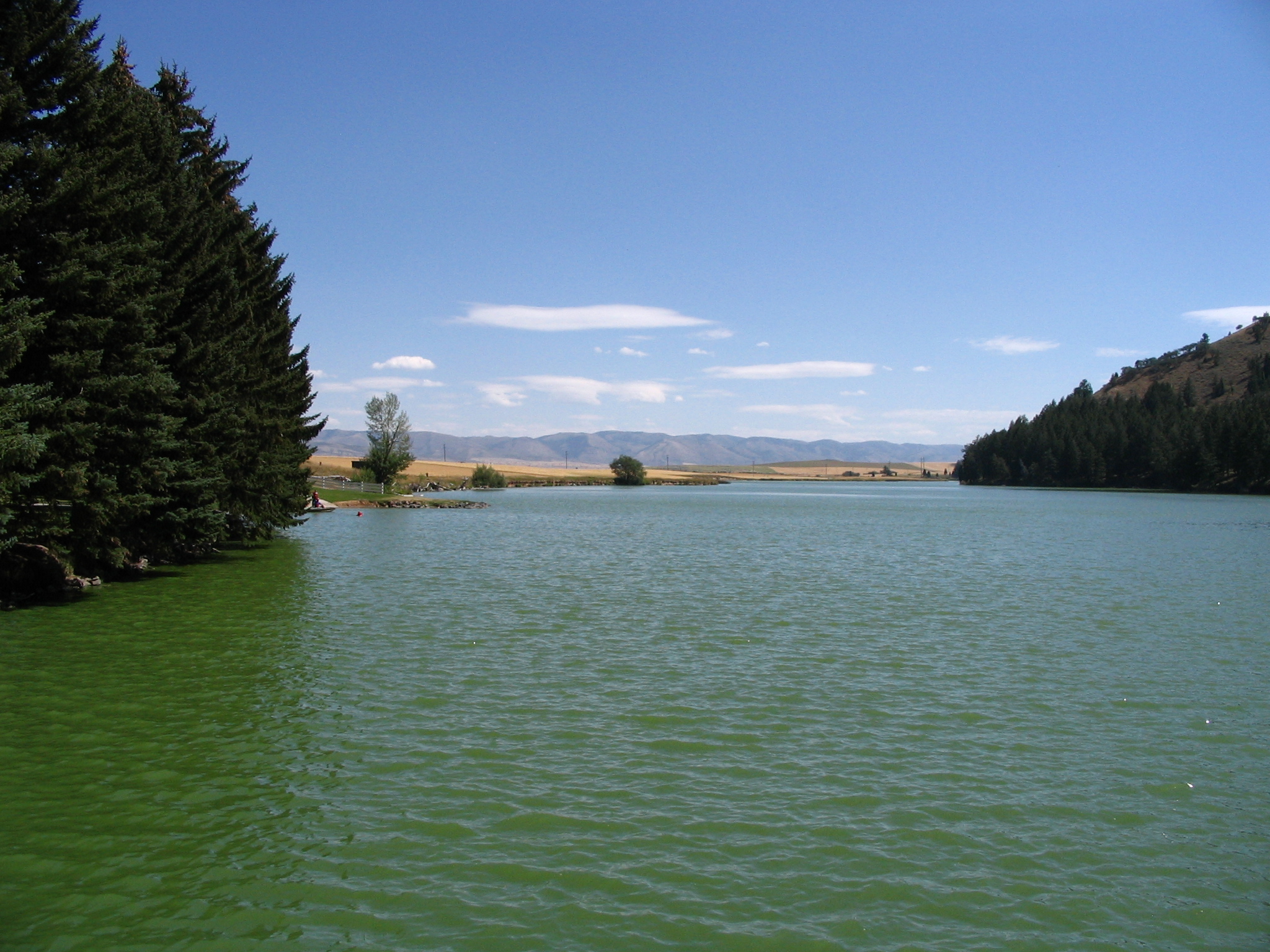
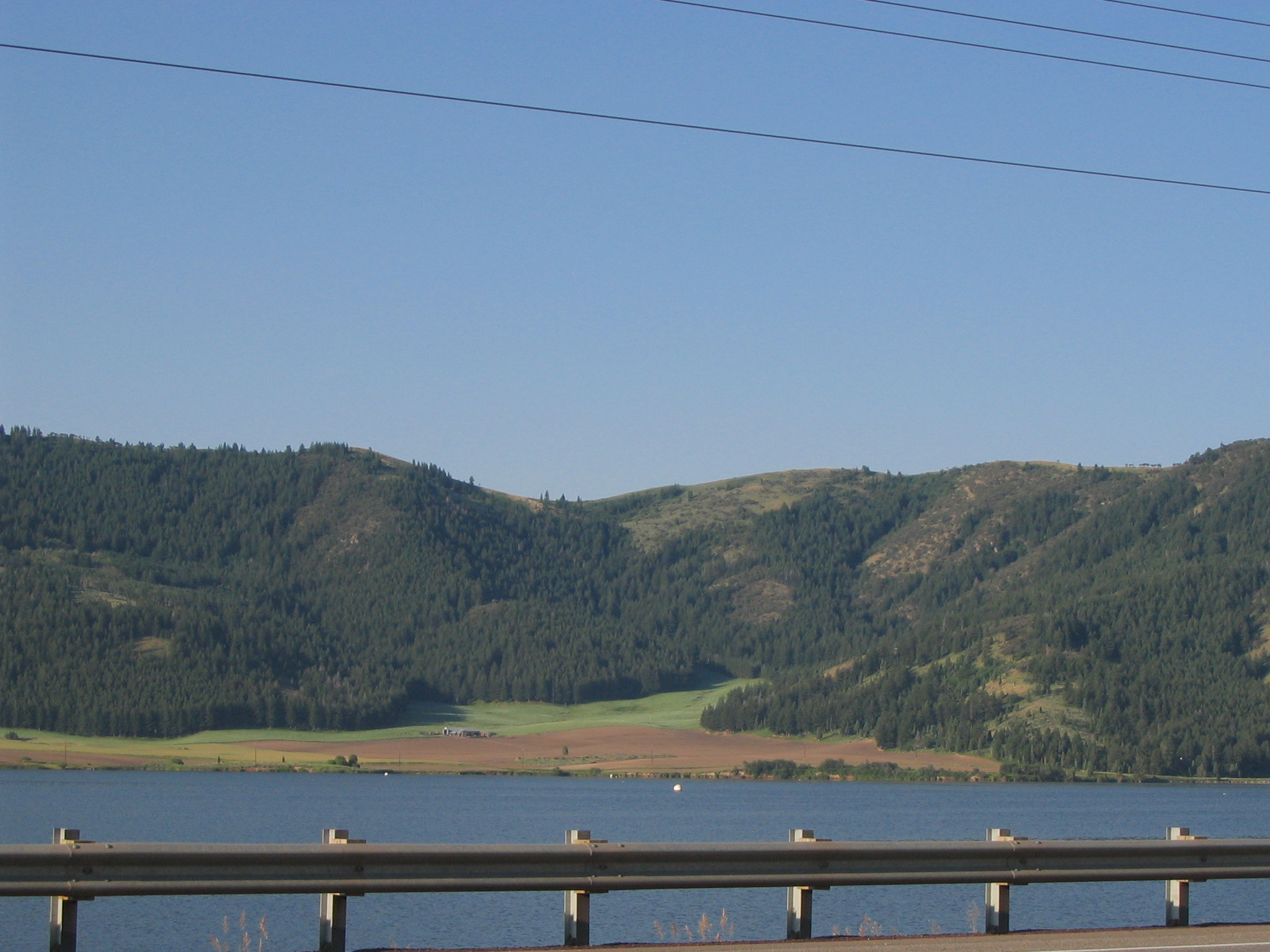
The pines atop this mountain are reflected in the shimmering waters of the reservoir formed by Hells Canyon Dam.
Public Domain. Photo taken by Tony Varilone
Download Original (2048 x 1536 pixels, 1513.1 MB)
-
The calm waters of Hells Canyon Reservoir are overlooked by cliffs and tall green trees.
Public Domain. Photo taken by Tony Varilone
Download Original (2048 x 1536 pixels, 1512.2 MB)
-
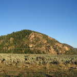
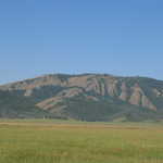
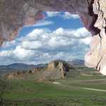
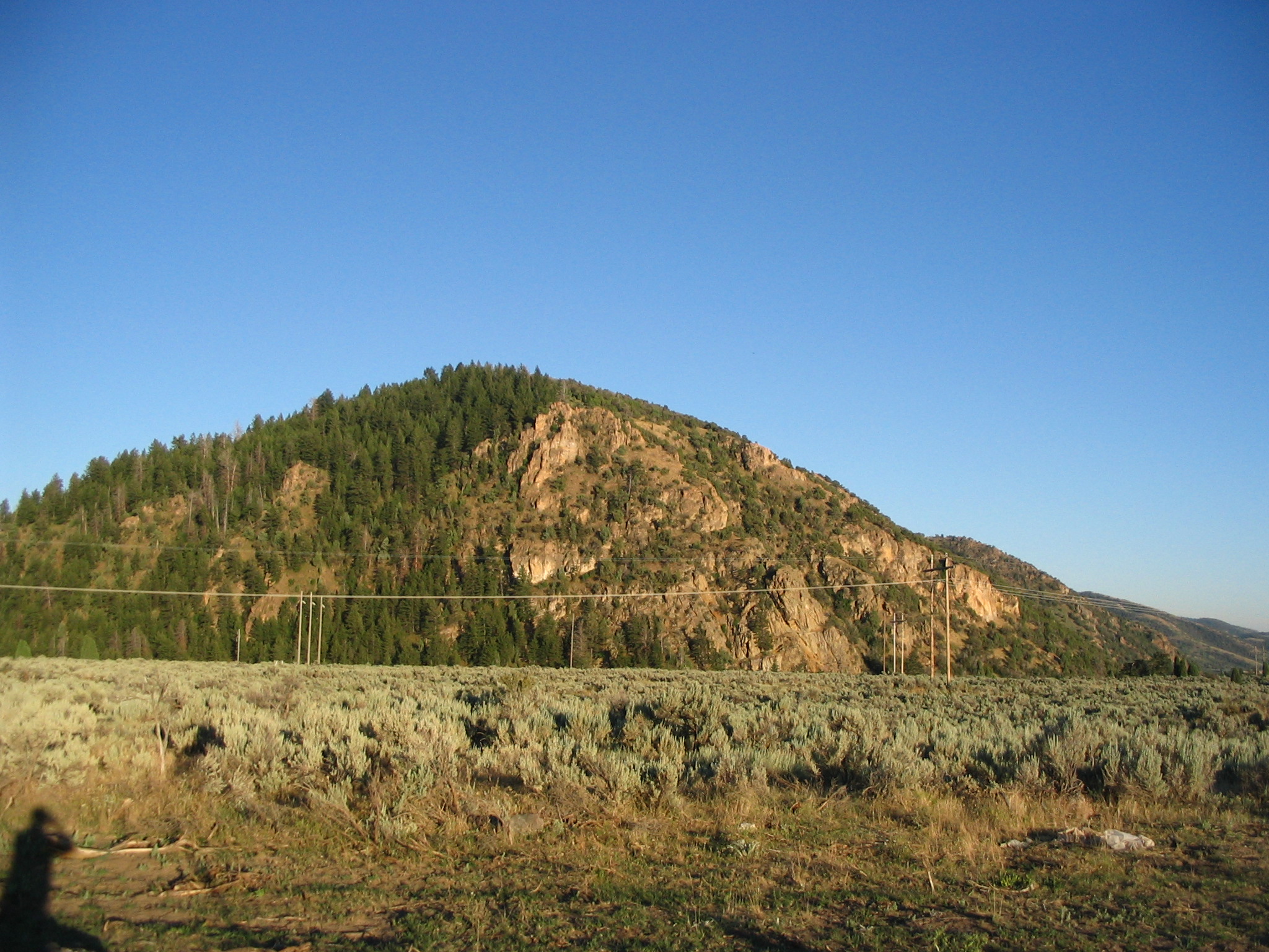
The golden color of Sheep Rock contrasts with the deep blue sky overhead, the green trees covering its surface, and the soft gray-green sagebrush below.
Public Domain. Photo taken by Tony Varilone
Download Original (2048 x 1536 pixels, 985.0 KB)
-
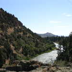
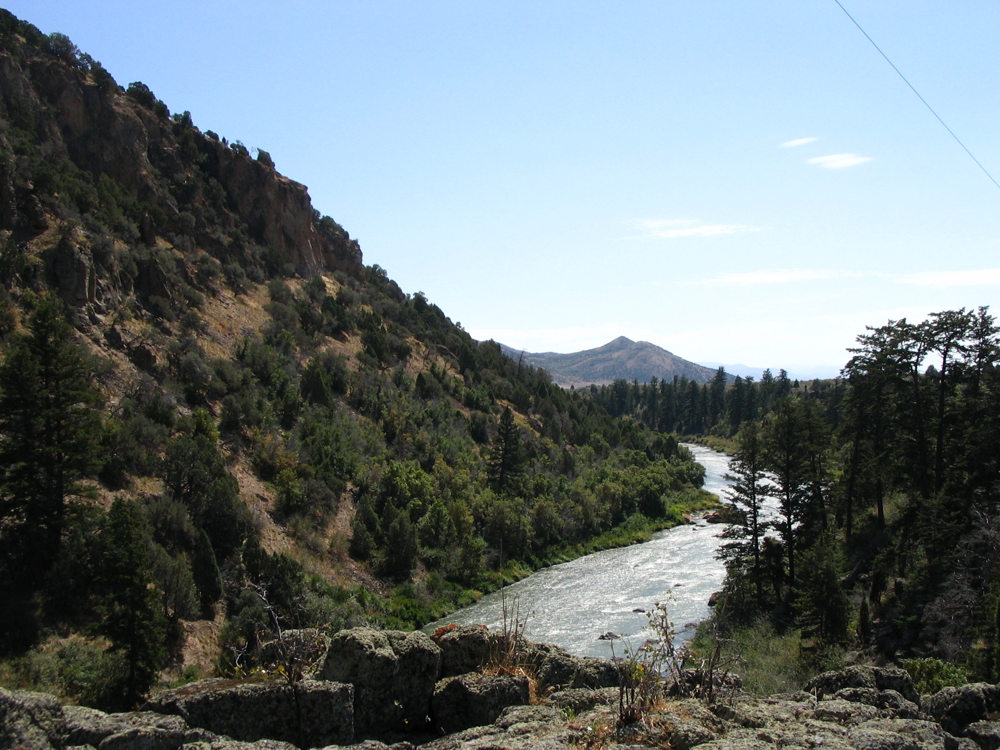
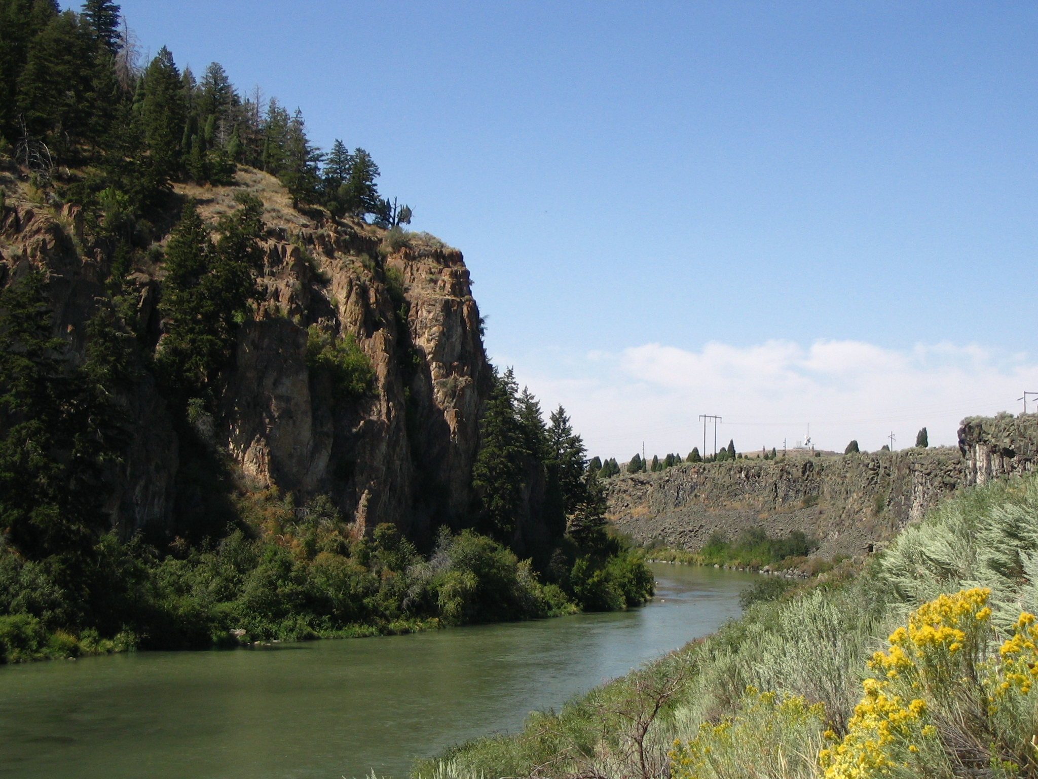
Hells Canyon winds along the base of the mountain from this rocky vantage point above the river.
Public Domain. Photo taken by Tony Varilone
Download Original (2048 x 1536 pixels, 1510.7 MB)
-
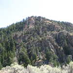
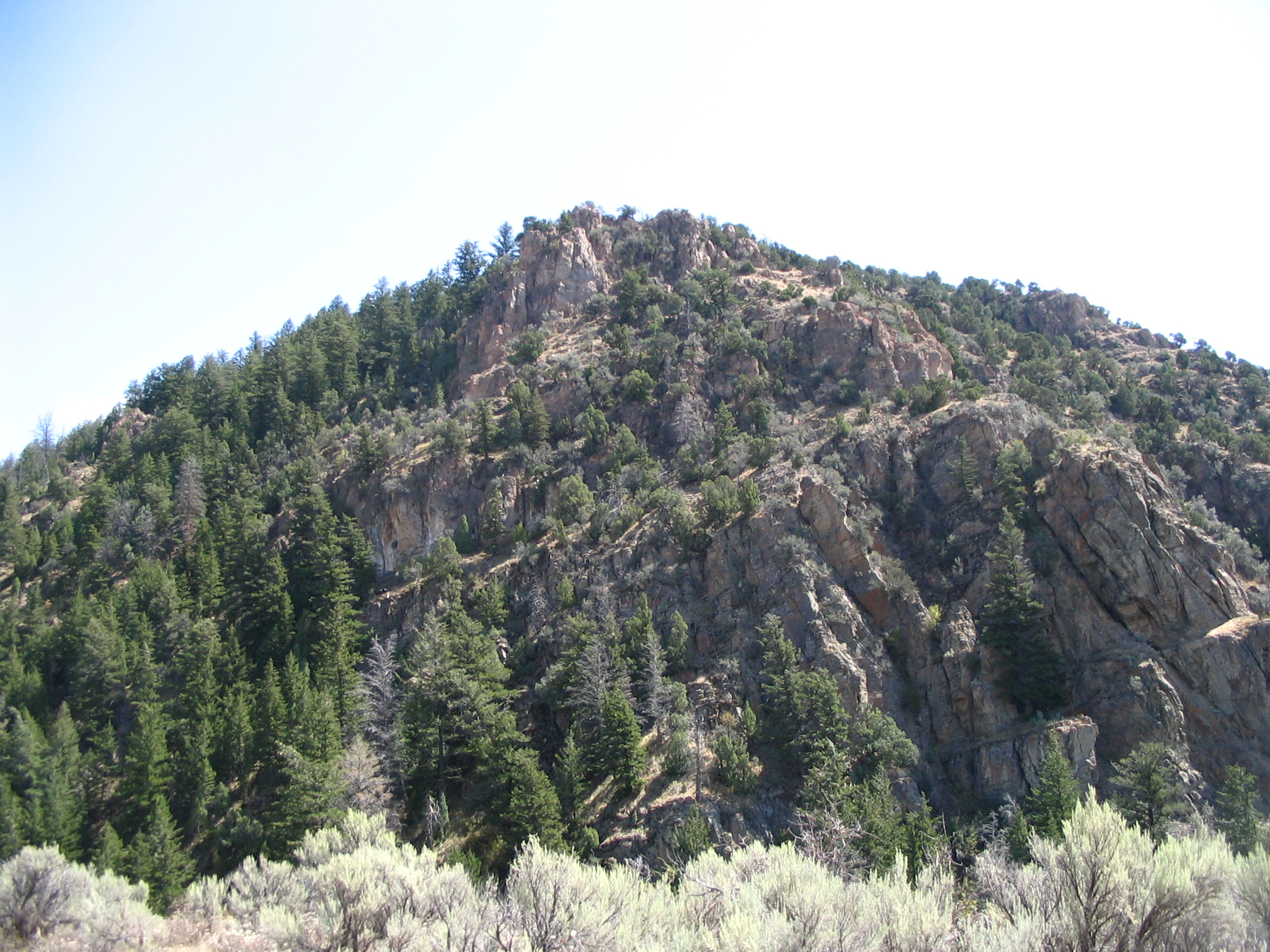
Mighty pines reach up as high as Sheep Rock itself. It seems as if the pines and the mountain compete to reach the sky.
Public Domain. Photo taken by Tony Varilone
Download Original (2048 x 1536 pixels, 1614.3 MB)
-
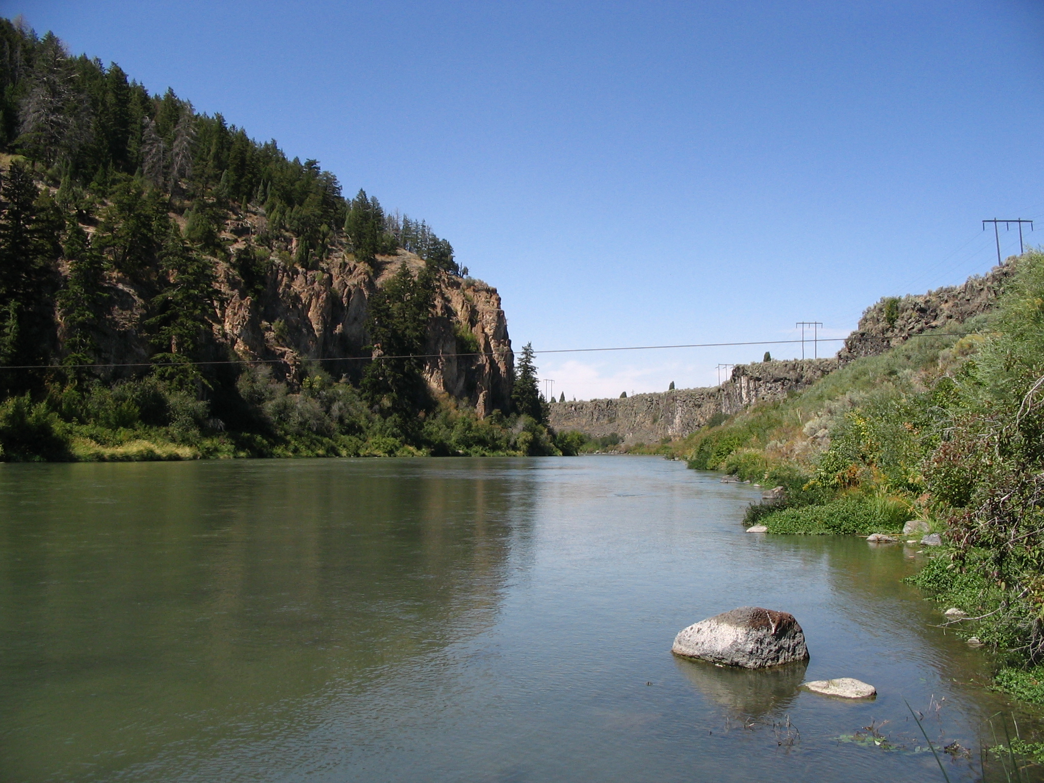
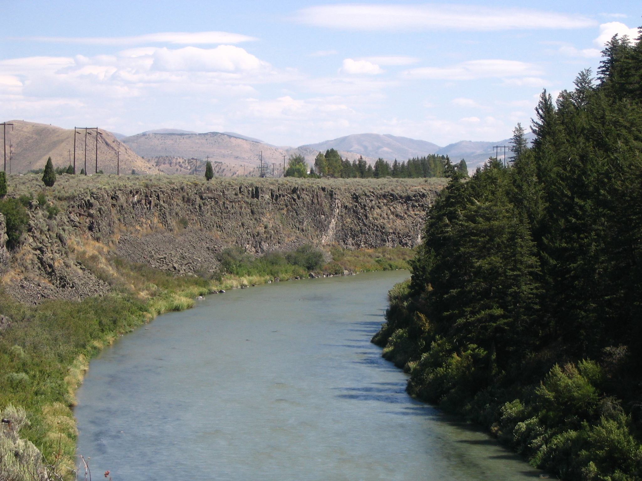
Hells Canyon Reservoir carves its way through the landscape near Sheep Rock. Evergreens fill one riverbank; sloping gray rocks form the other.
Public Domain. Photo taken by Tony Varilone
Download Original (2048 x 1536 pixels, 1448.9 MB)
-
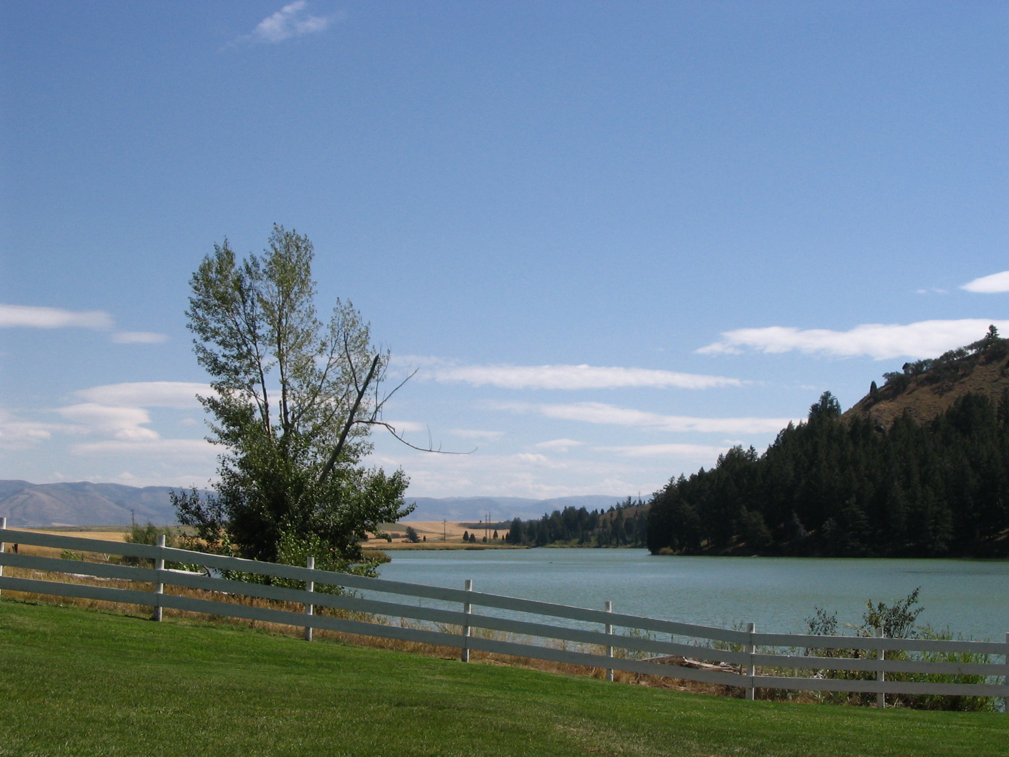
A pasture fence frames the blue waters of the Hells Canyon Reservoir. Blue skies look down upon the scene.
Public Domain. Photo taken by Tony Varilone
Download Original (2048 x 1536 pixels, 1302.8 MB)
-
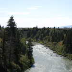
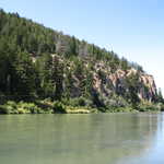
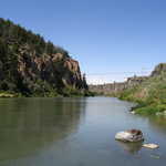
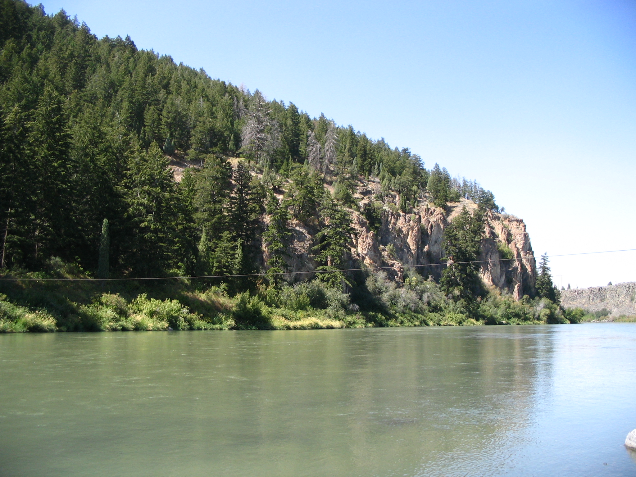
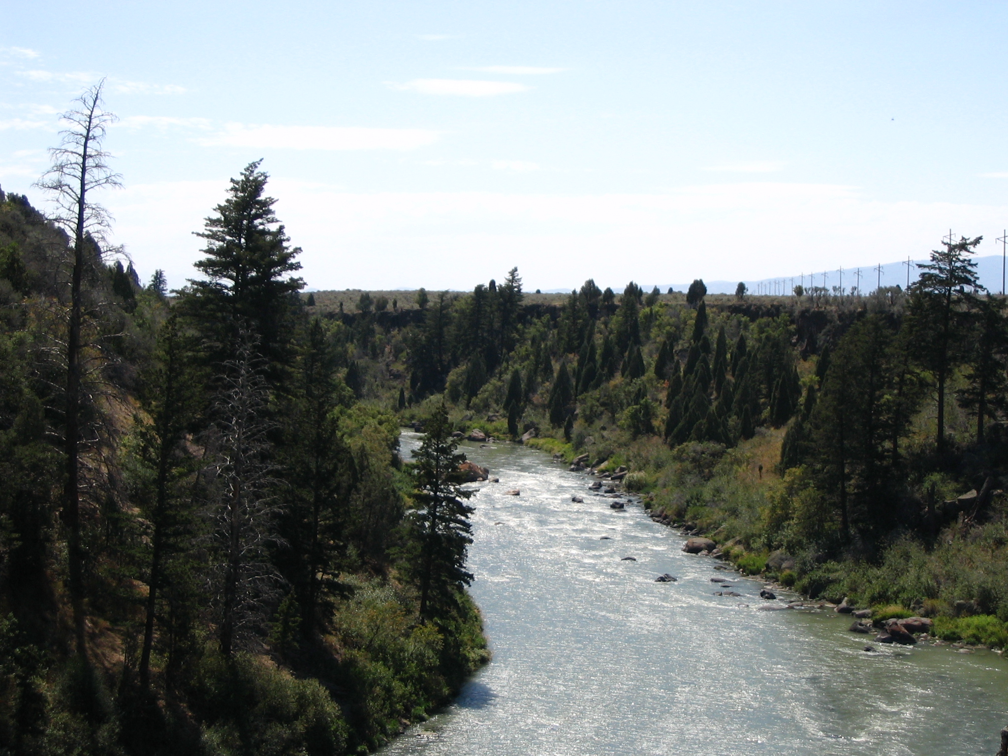
The pines along the edge of this river stand majestically as the water flows through the land near Sheep Rock.
Public Domain. Photo taken by Tony Varilone
Download Original (2048 x 1536 pixels, 1376.7 MB)
-
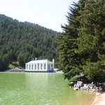
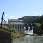
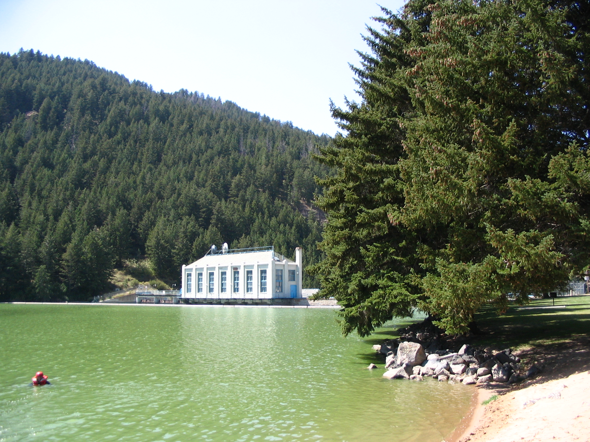
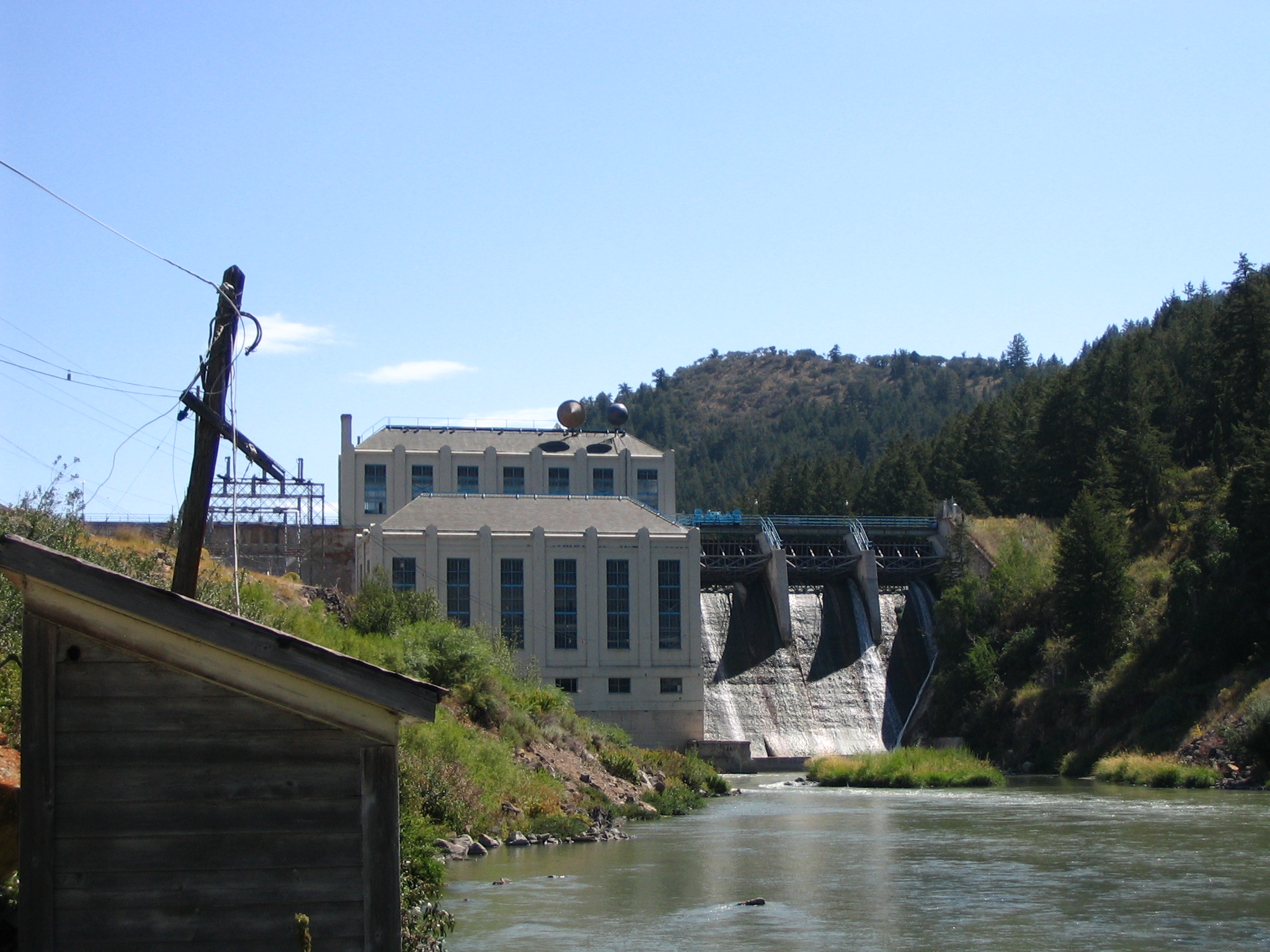
Deep green pines hang over the edges of the green waters. A white building of the dam's power plant stands at the reservoir's far end.
Public Domain. Photo taken by Tony Varilone
Download Original (2048 x 1536 pixels, 1812.0 MB)
-
The sky reflects this water at Hells Canyon Dam. Tall evergreen trees fill the riverbank.
Public Domain. Photo taken by Tony Varilone
Download Original (2048 x 1536 pixels, 1333.6 MB)
-
Hells Canyon Reservoir flows peacefully around the base of the rocks. Wildflowers are blooming in the foreground.
Public Domain. Photo taken by Tony Varilone
Download Original (2048 x 1536 pixels, 1508.5 MB)
-
This dam for Hells Canyon Reservoir regulates the water. Mountains form one side of the river and the white power plant stands beside the dam.
Public Domain. Photo taken by Tony Varilone
Download Original (2048 x 1536 pixels, 1299.5 MB)
-
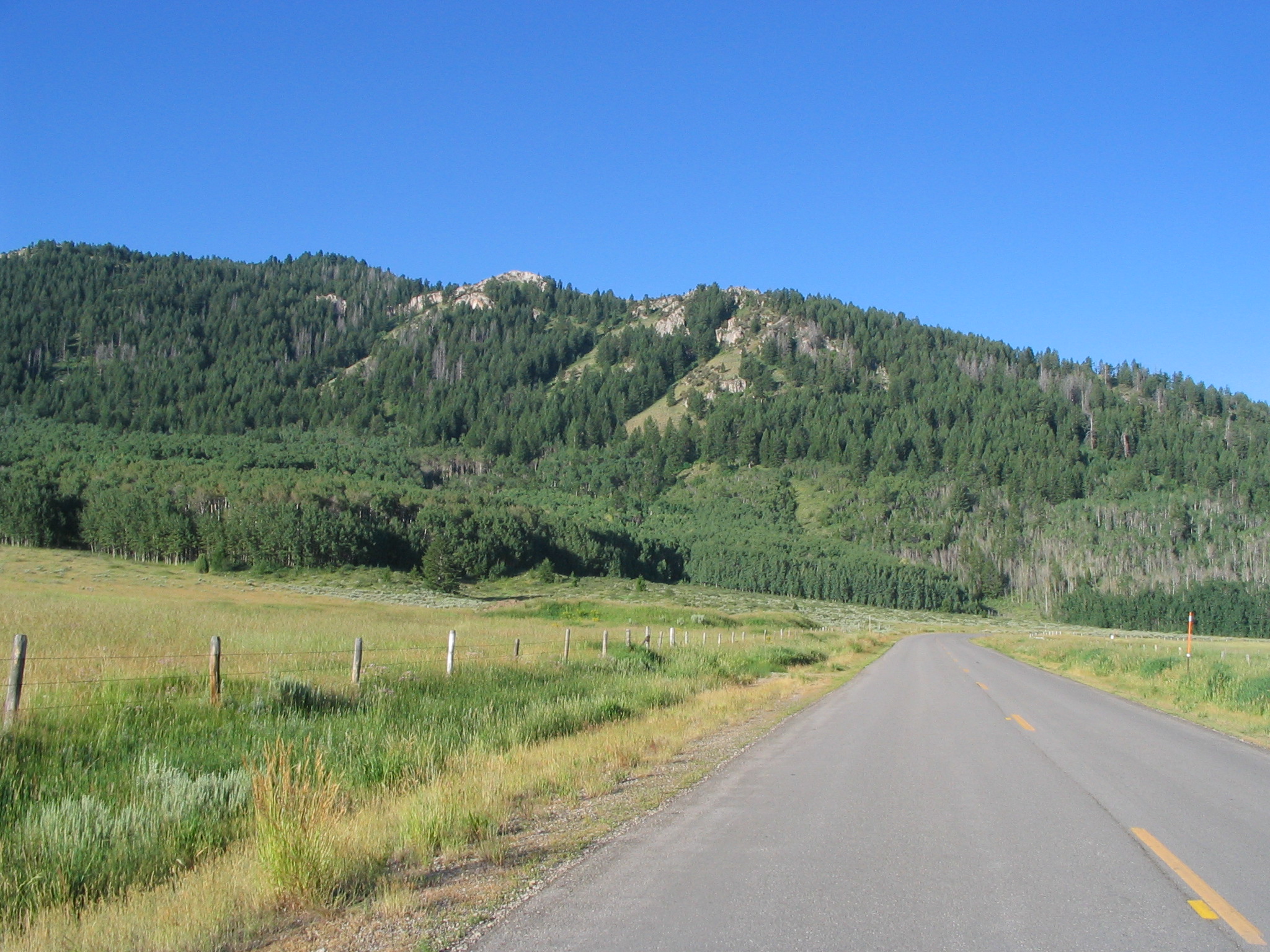
The cutoff to the Oregon Trail can be seen amidst the mountains and pavement of the road. A fence frames the left side of the photo.
Public Domain. Photo by Tony Varilone
Download Original (2048 x 1536 pixels, 987 KB)
-
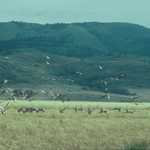
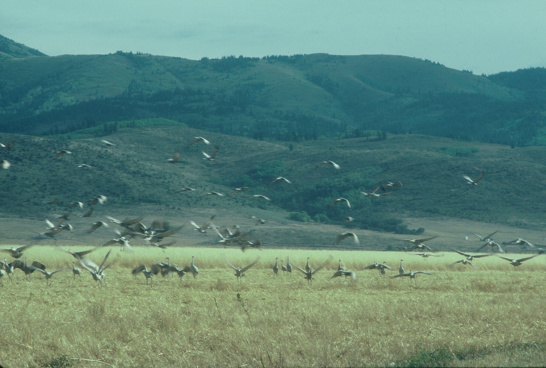
The summer sun beats down as a flock of cranes rise before emerald green mountains.
Public Domain. Photo by Tony Varilone
Download Original (1818 x 1228 pixels, 1146.6 MB)
-
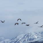
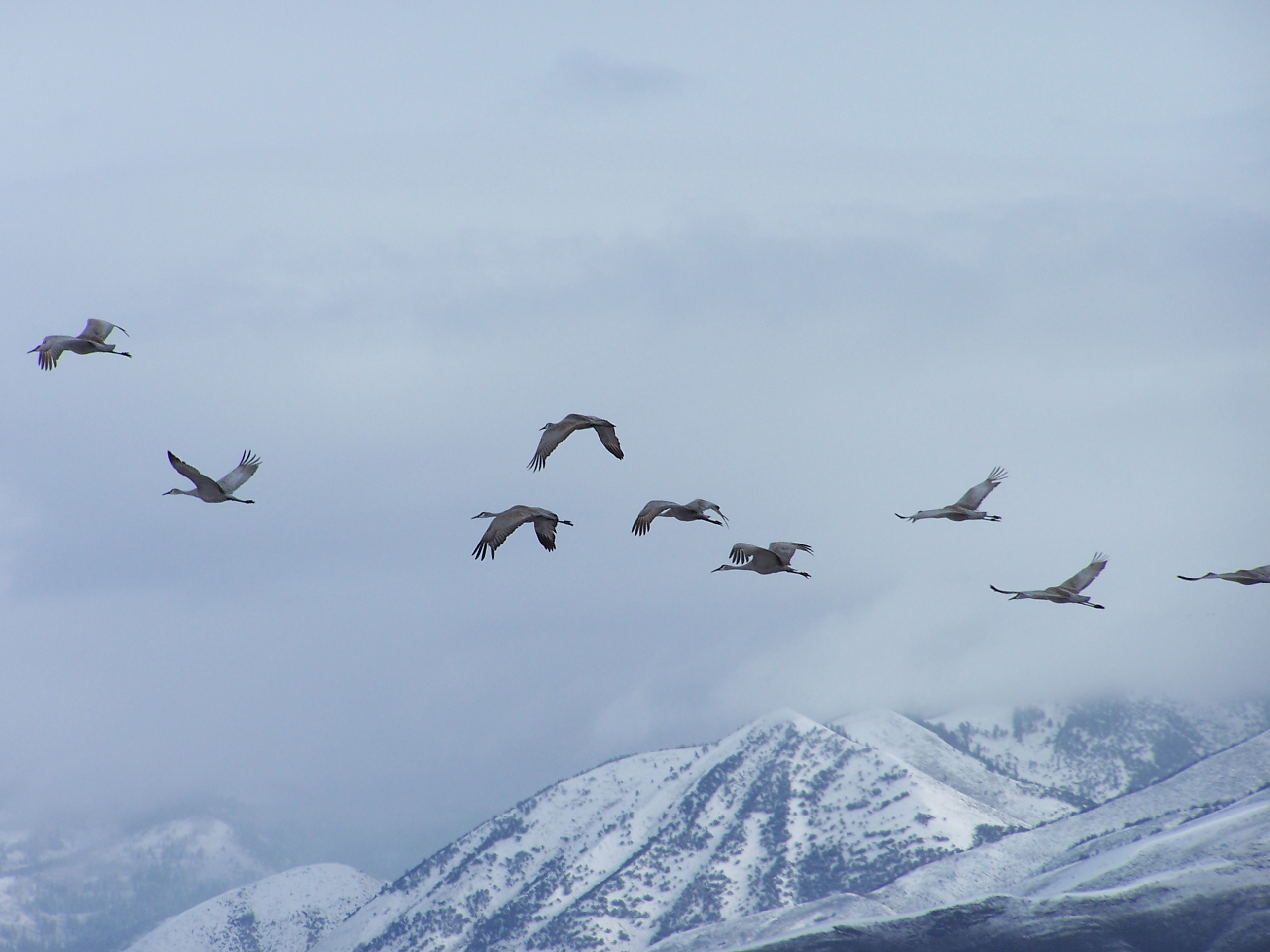
Flocks of birds travel together on a wintry day. Foggy, snow covered mountains stand majestically in the distance.
Public Domain. Photo by Tony Varilone
Download Original (2576 x 1932 pixels, 991.1 KB)
-
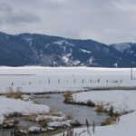
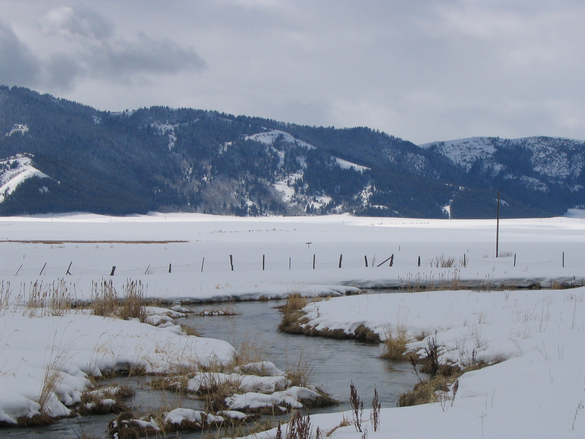
Rickety fences trace the border of a snow-covered pasture between tree-covered mountains and icy stream in winter by Soda Springs, Idaho.
Public Domain. Photo by Tony Varilone
Download Original (2048 x 1536 pixels, 702.3 KB)
-
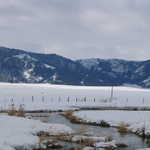
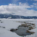
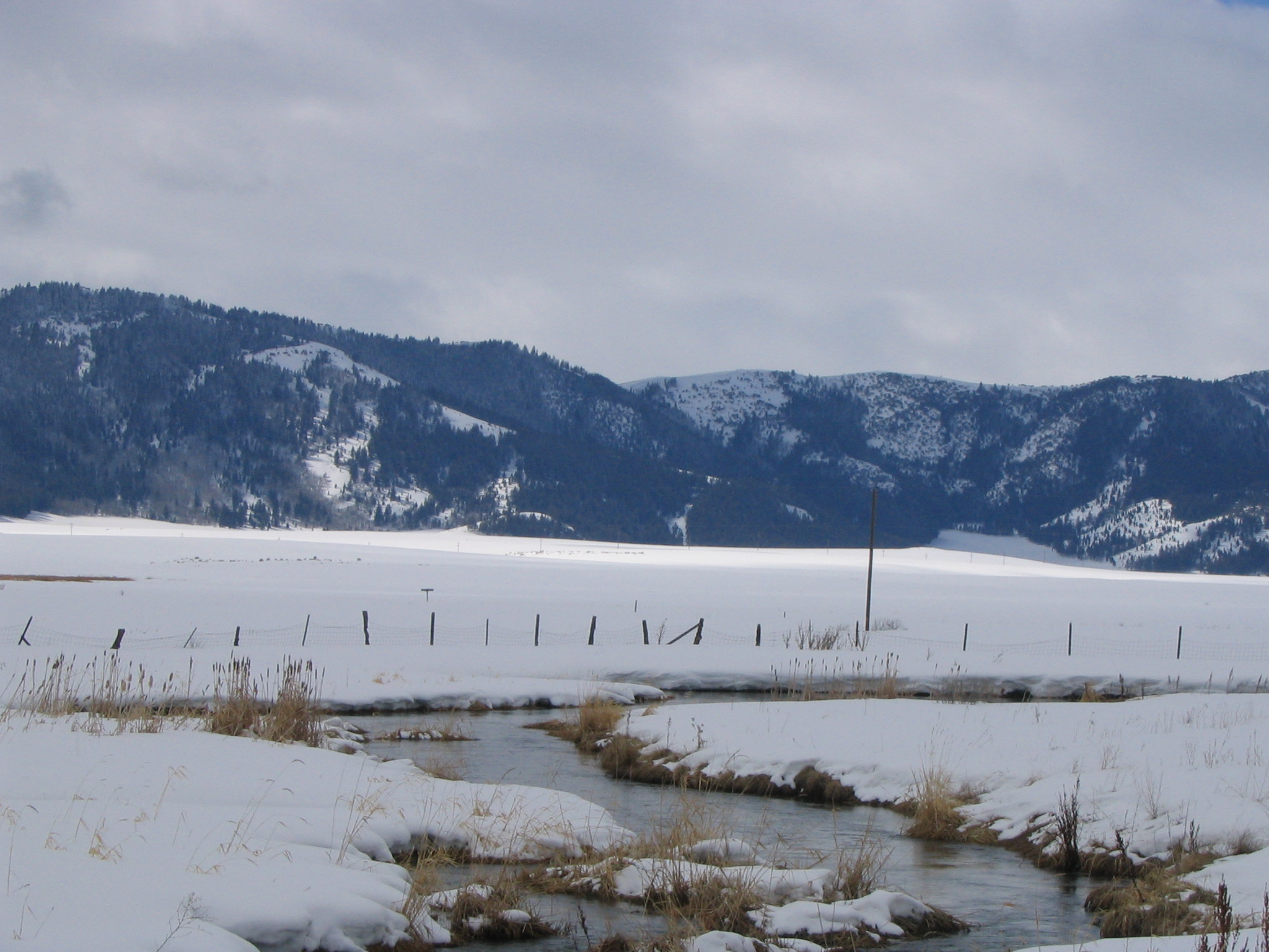
Near Soda Springs snowcapped mountains proudly stand in the distance. A stream flows past a pasture fence in a wintry field.
Public Domain. Photo by Tony Varilone
Download Original (2048 x 1536 pixels, 735.3 KB)
-
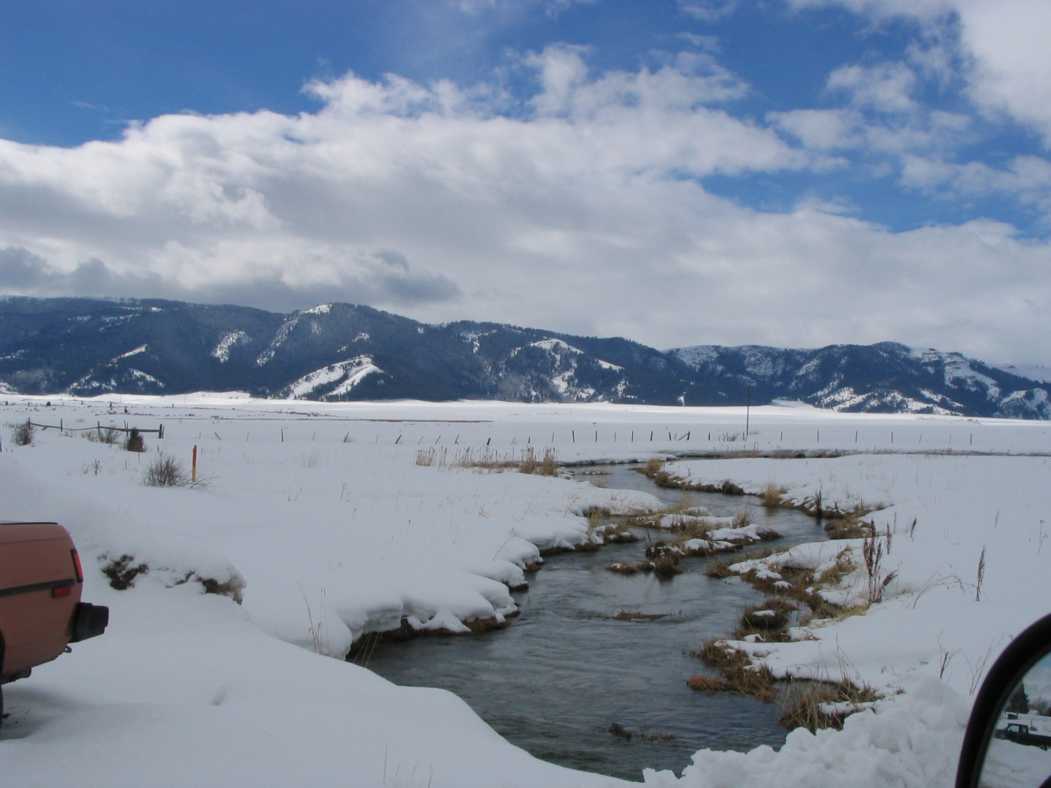
An icy stream flows between banks of snow in the flat, mountain-edged valley of Soda Springs, Idaho.
Public Domain. Photo by Tony Varilone
Download Original (2048 x 1536 pixels, 680.4 KB)
-
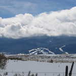
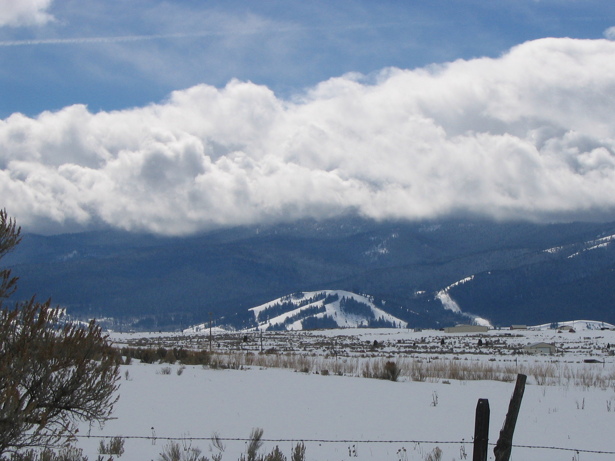
Near Soda Springs, white clouds roll over snow-covered hills and dark forested mountains in winter.
Public Domain. Photo by Tony Varilone
Download Original (2048 x 1536 pixels, 750.1 KB)
-
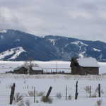
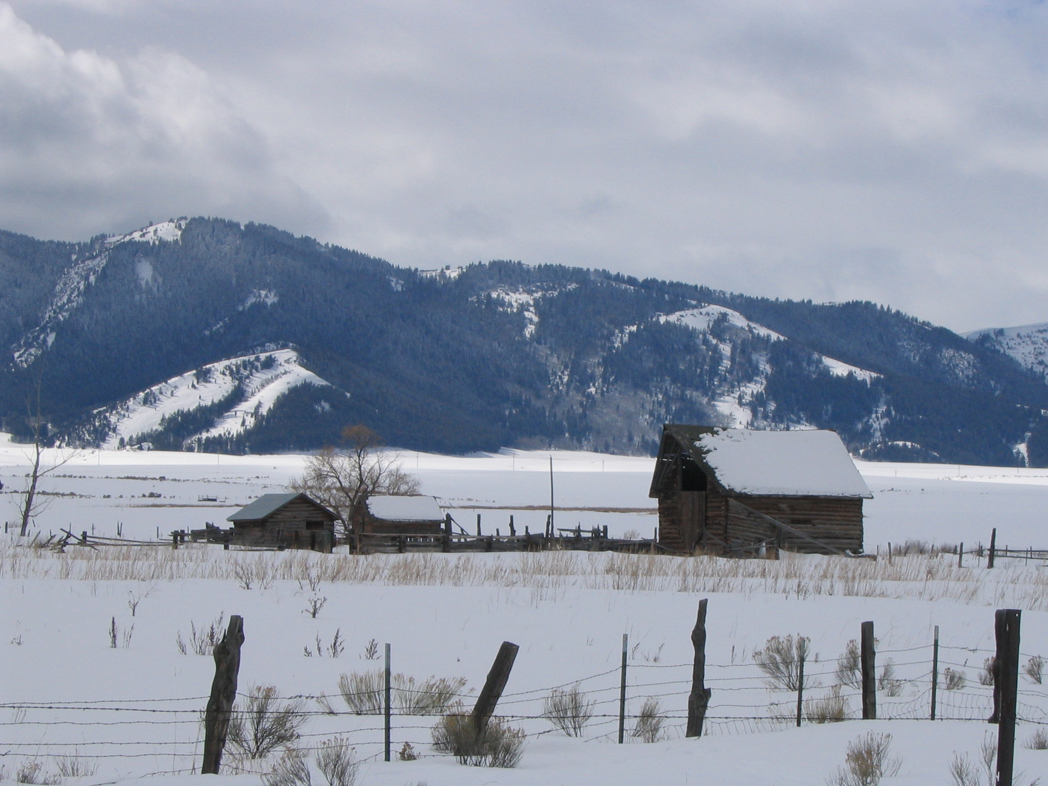
Snow crested mountains overlook snow covered barns and fences near Soda Springs, Idaho.
Public Domain. Photo by Tony Varilone
Download Original (2048 x 1536 pixels, 737.2 KB)
-
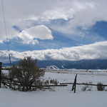
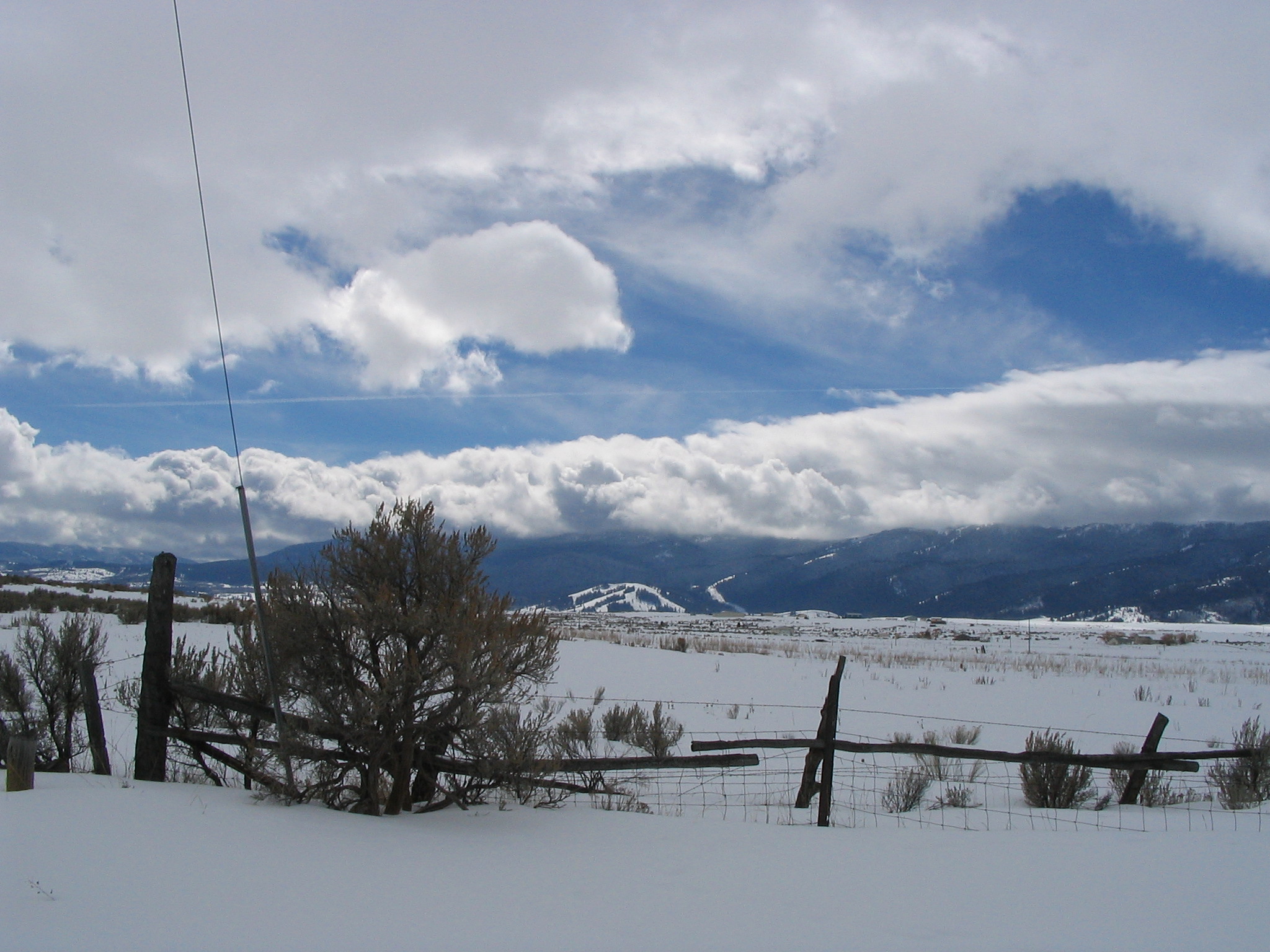
Brilliant skies and dark mountains overlook a fenced, snow-covered field near Soda Springs, Idaho.
Public Domain. Photo by Tony Varilone
Download Original (2048 x 1536 pixels, 742.1 KB)
-
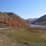
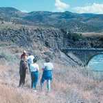
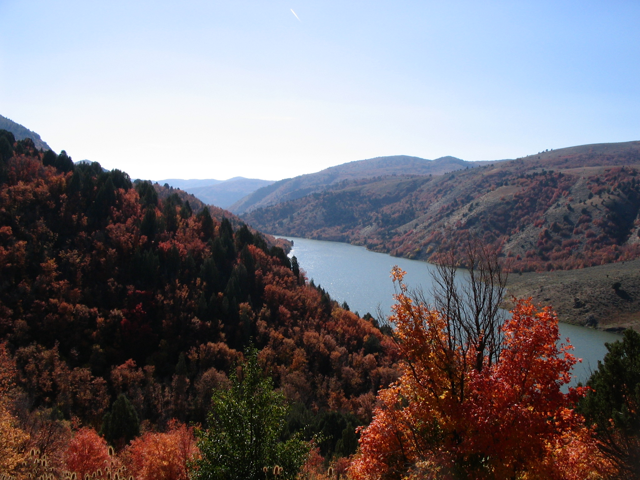
Brilliant fall colors and shimmering water in the mountains of Oneida Narrows are cast in shadows around the lake.
Public Domain. Photo by Tony Varilone
Download Original (2048 x 1536 pixels, 875.2 KB)
-
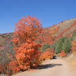
Flashy orange and red colors on the mountainside of Oneida Narrows look like fire, but are actually brilliant maple leaves
Public Domain. Photo by Tony Varilone
Download Original (2048 x 1536 pixels, 1239.1 MB)
-

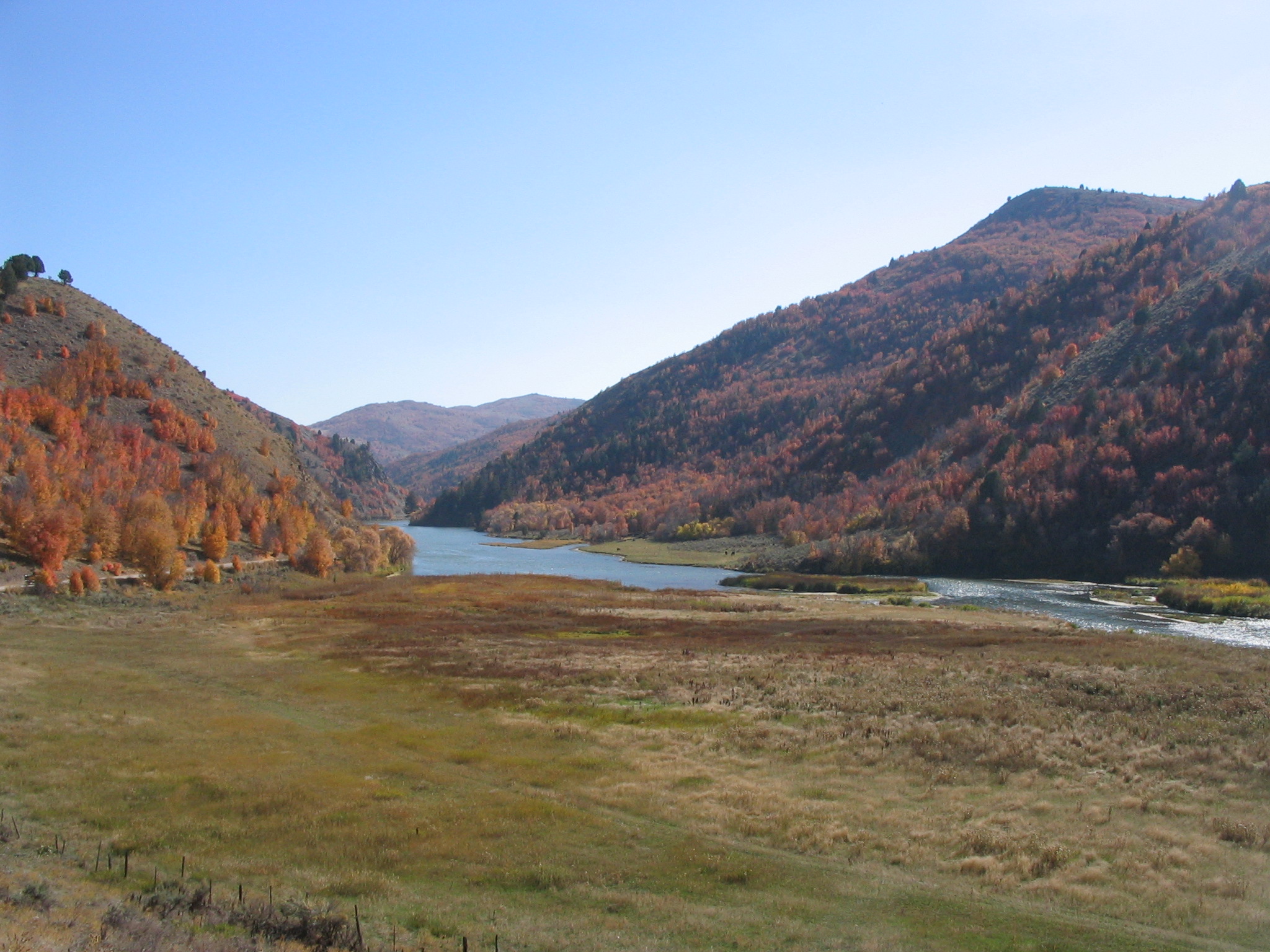
Gorgeous fall trees and mountains in the distance make a perfect frame for this light blue lake at Oneida Narrows.
Public Domain. Photo by Tony Varilone
Download Original (2048 x 1536 pixels, 1585.4 MB)
-
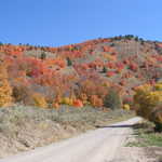
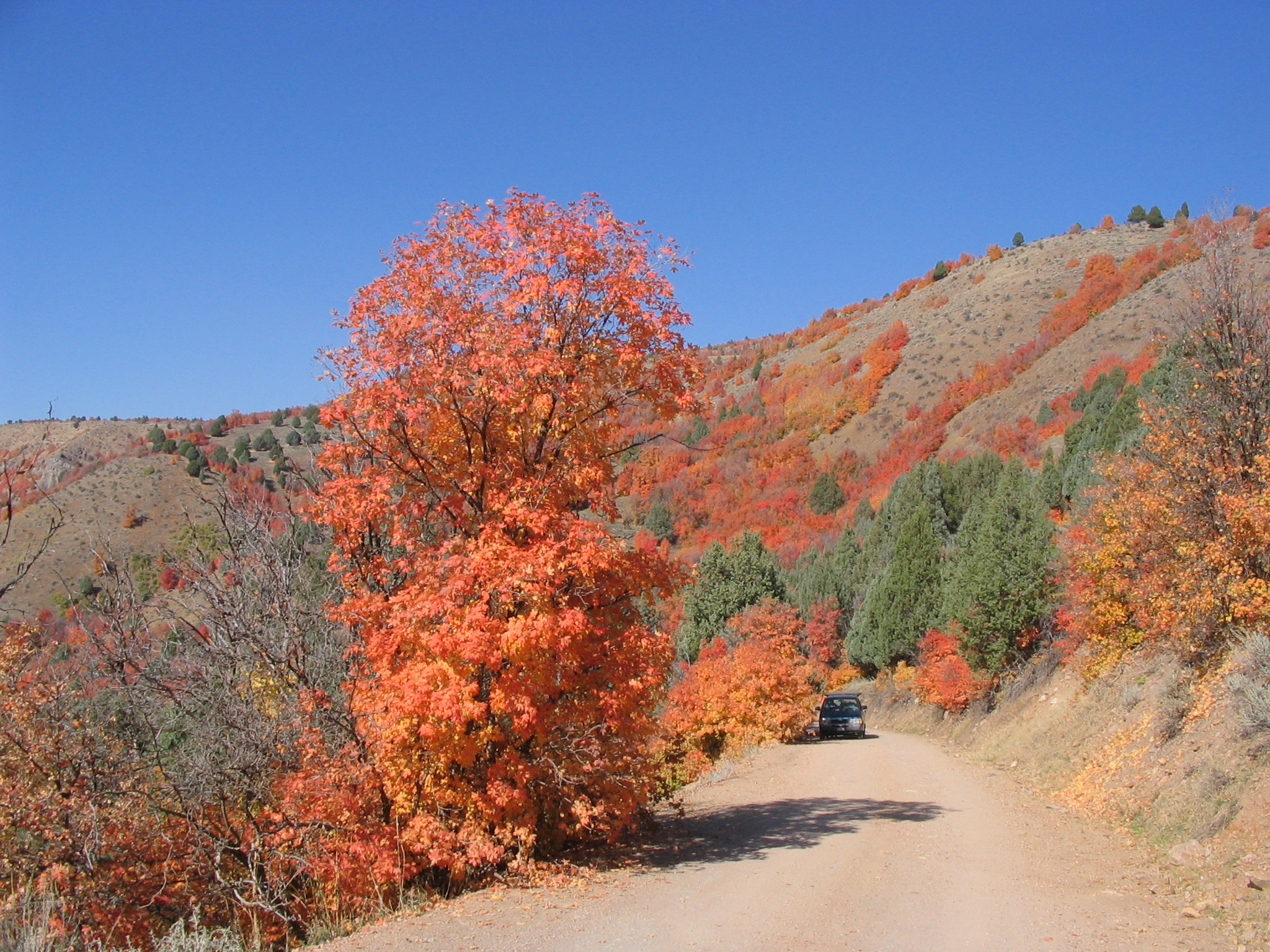
At Oneida Narrows, a dirt road leads into the mountains which are exploding with fall colors.
Public Domain. Photo by Tony Varilone
Download Original (2048 x 1536 pixels, 1192.9 MB)
-

A green valley leads into a beautiful blue lake which lies between autumn-colored mountains.
Public Domain. Photo by Tony Varilone
Download Original (2048 x 1536 pixels, 810.9 KB)
-
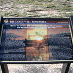
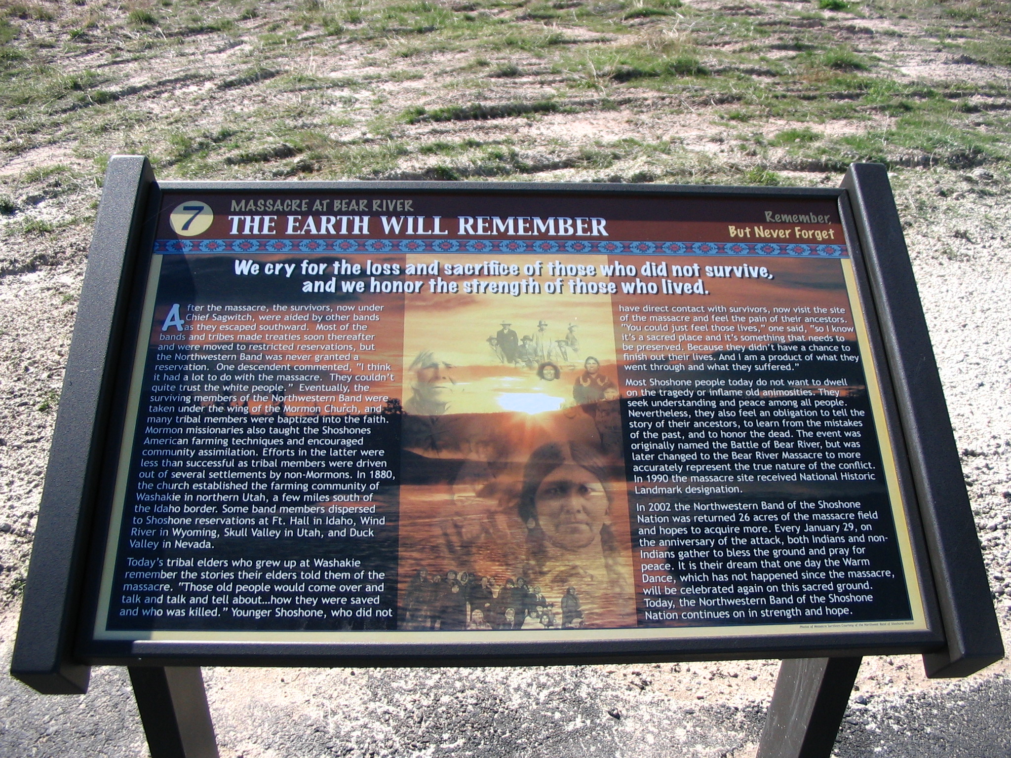
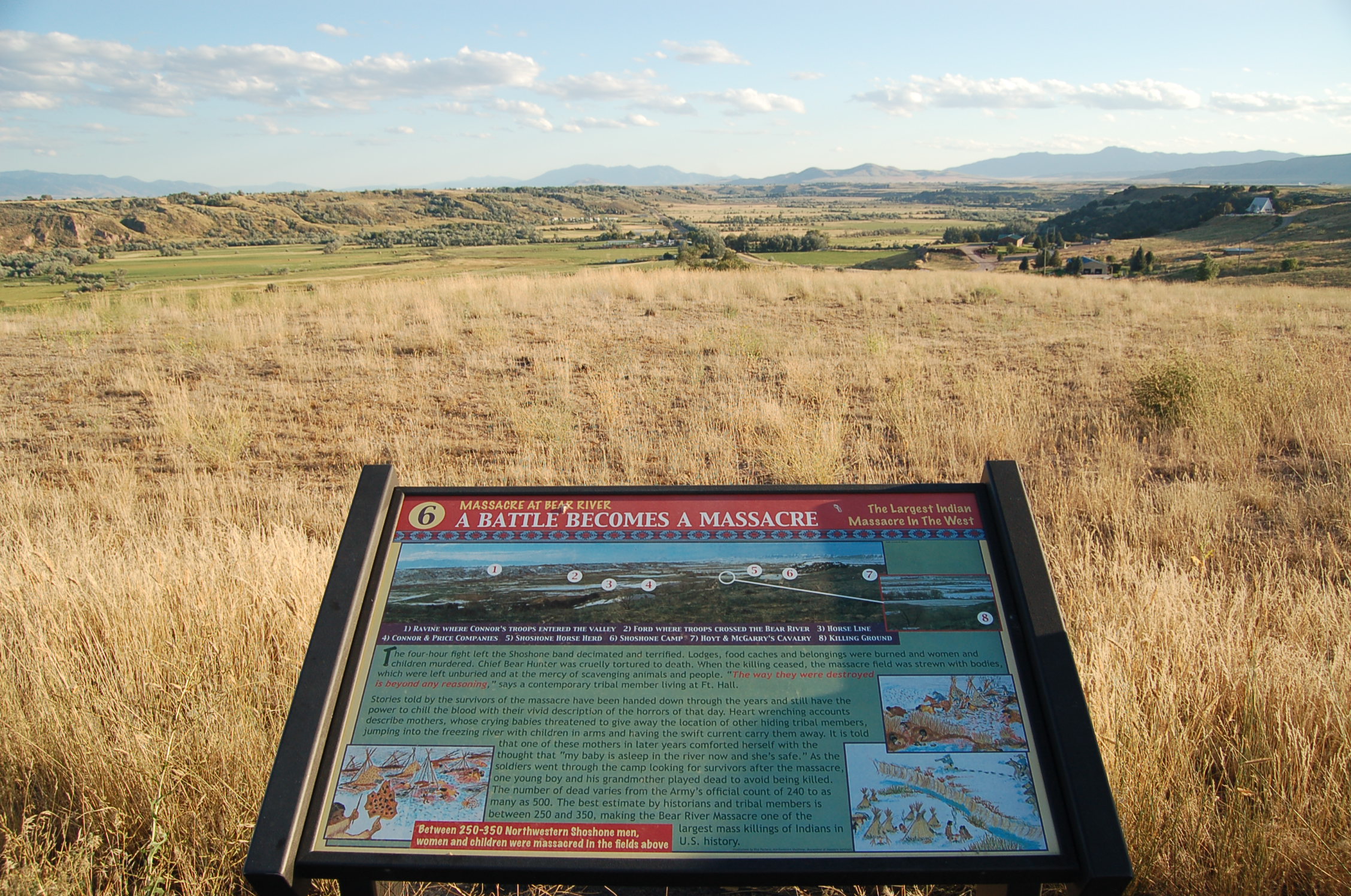
"We cry for the loss and sacrifice of those who did not survive and we honor the strength of those who lived" is the proud declaration on this interpretive sign at the site of the largest Indian massacre in the West. The aftermath of the massacre on the Shoshone is described.
Public Domain. Photo by Tony Varilone
Download Original (2048 x 1536 pixels, 1472.7 MB)
-
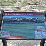
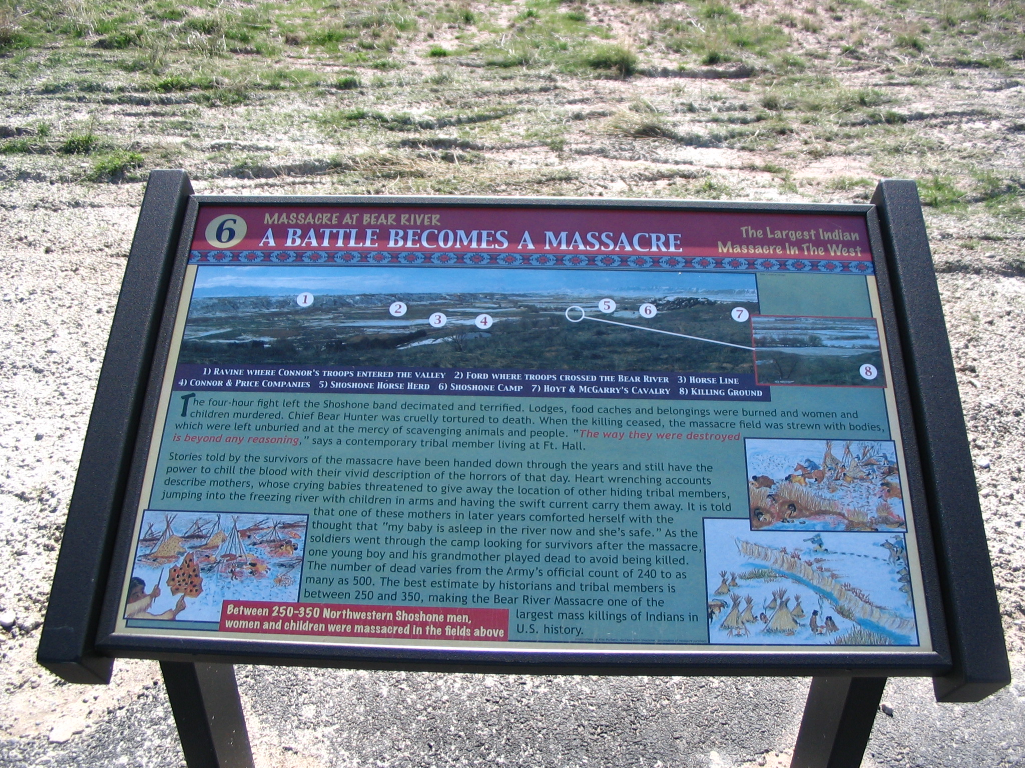
This sign tells of the horror and chilling events of the massacre. Colored sketches depict teepees burning, soldiers firing, and soldiers on horseback riding into the camp.
Public Domain. Photo by Tony Varilone
Download Original (2048 x 1536 pixels, 1410.8 MB)
-
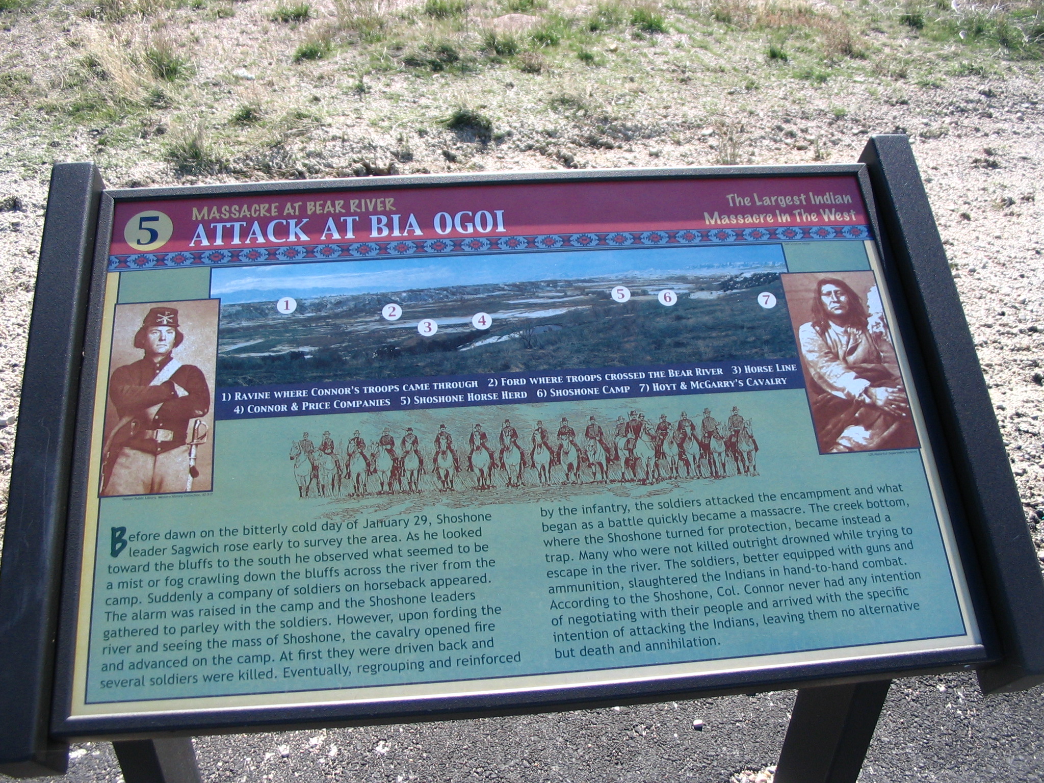
This sign describes the bitter cold day of January 29th, 1863, when the largest Indian massacre in the West occurred. Sepia-toned, historic photos of an army man and a Shoshone man, as well as a map detailing the locations of the main parties in the massacre, are featured on this sign.
Public Domain. Photo by Tony Varilone
Download Original (2048 x 1536 pixels, 1327.0 MB)
-
Nestled between hills covered with majestic fall colors at Oneida Narrows in Idaho is a small lake or reservoir. A truck drives along the dirt road that trails along the mountain.
Public Domain. Photo by Tony Varilone
Download Original (2048 x 1536 pixels, 880.0 KB)
-
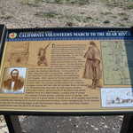
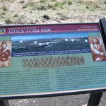
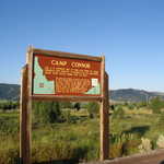
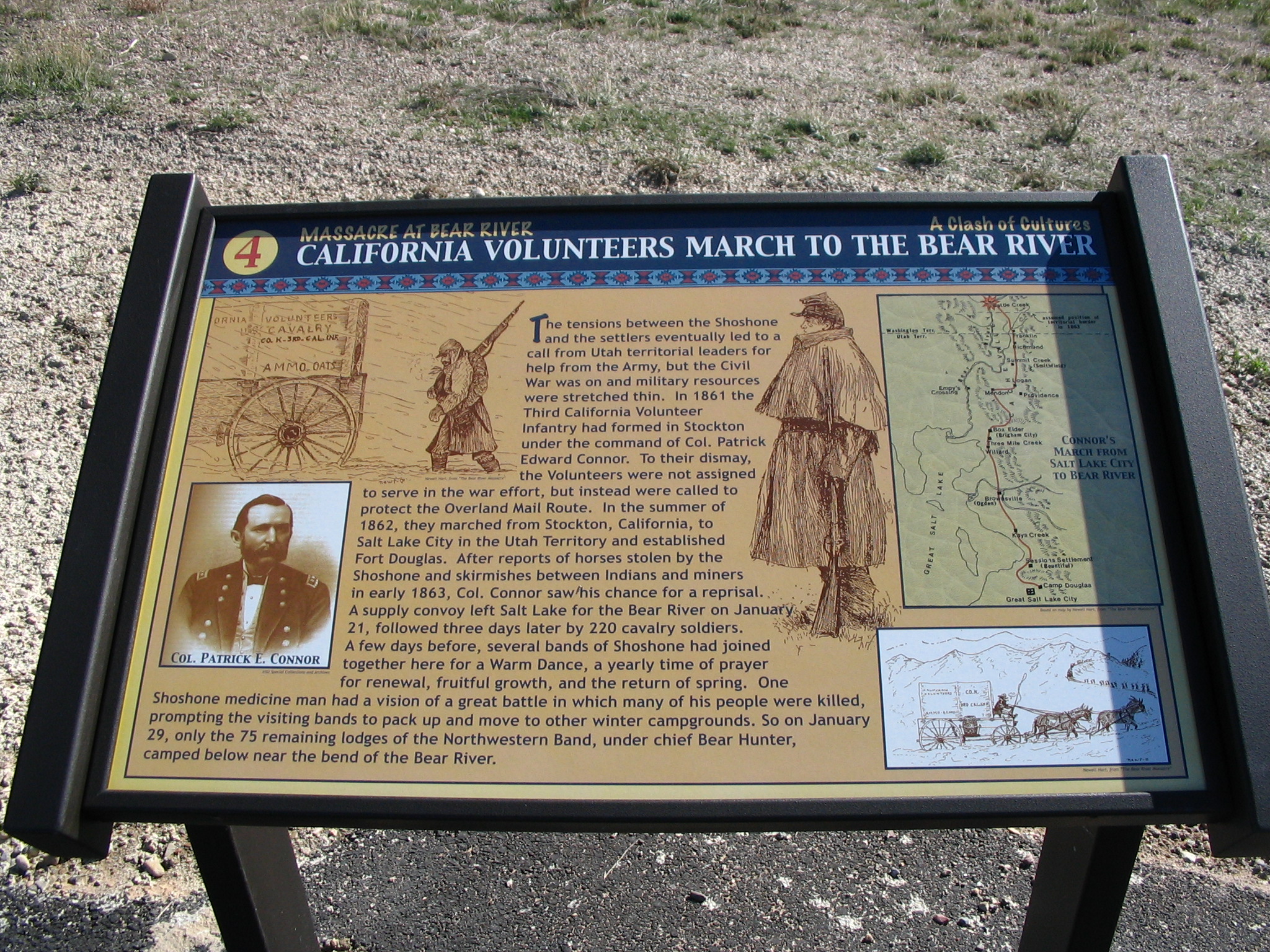
This sign describes the journey of Col. Patrick Edward Conner and volunteers who came from California and participated in this culture clash. Sepia-toned photos of the army and a map are featured on this sign.
Public Domain. Photo by Tony Varilone
Download Original (2048 x 1536 pixels, 1412.5 MB)
-
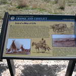
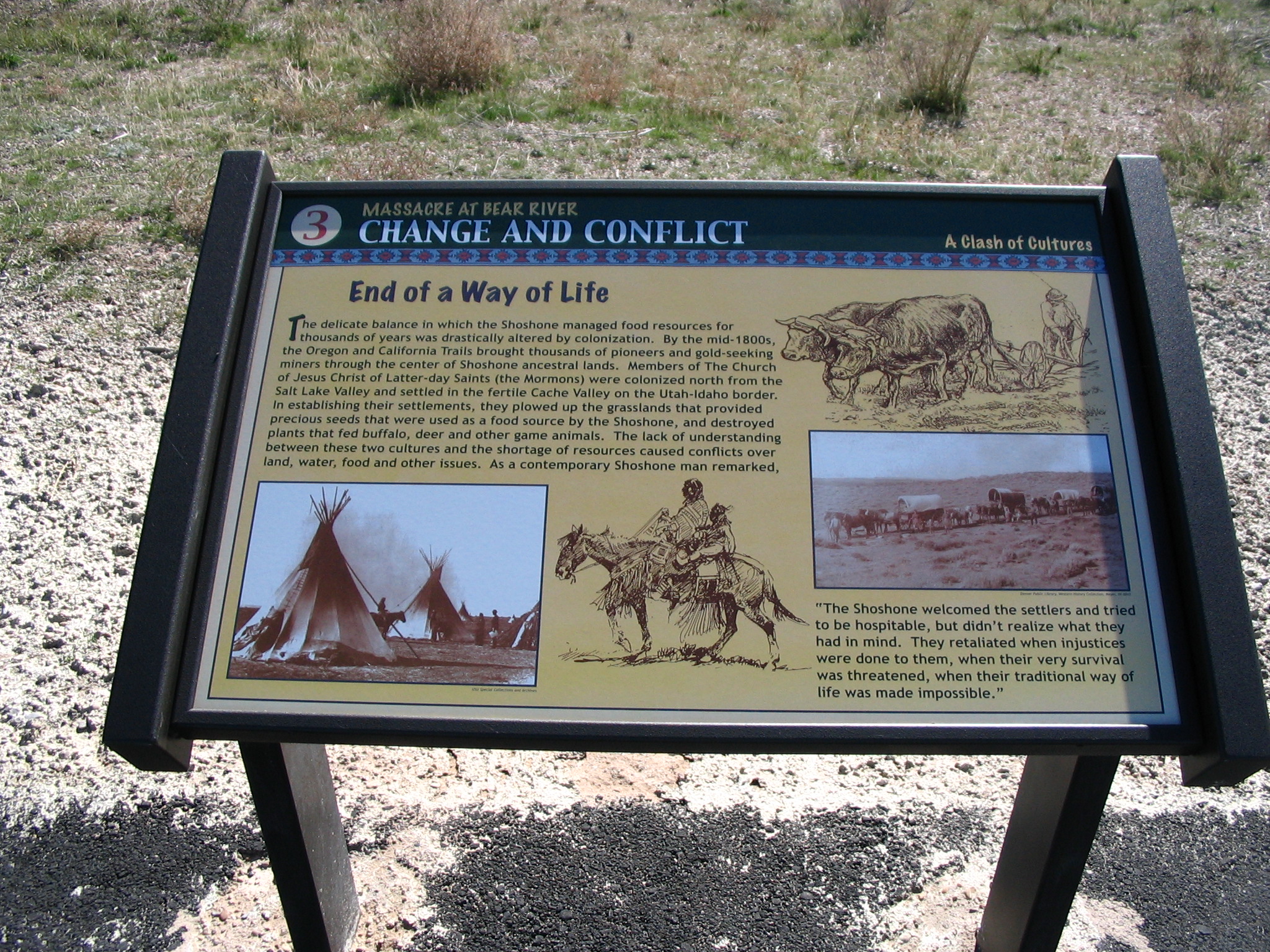
This sign tells of the conflict between the Shoshone people and the Mormon settlers who moved into the area. The settlers were first welcomed but conflicts soon arose as the Shoshone way of life was threatened. This sign includes sepia-toned, historic photos of both the Shoshone and the Mormon settlers.
Public Domain. Photo by Tony Varilone
Download Original (2048 x 1536 pixels, 1390.1 MB)
-
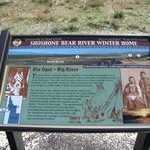
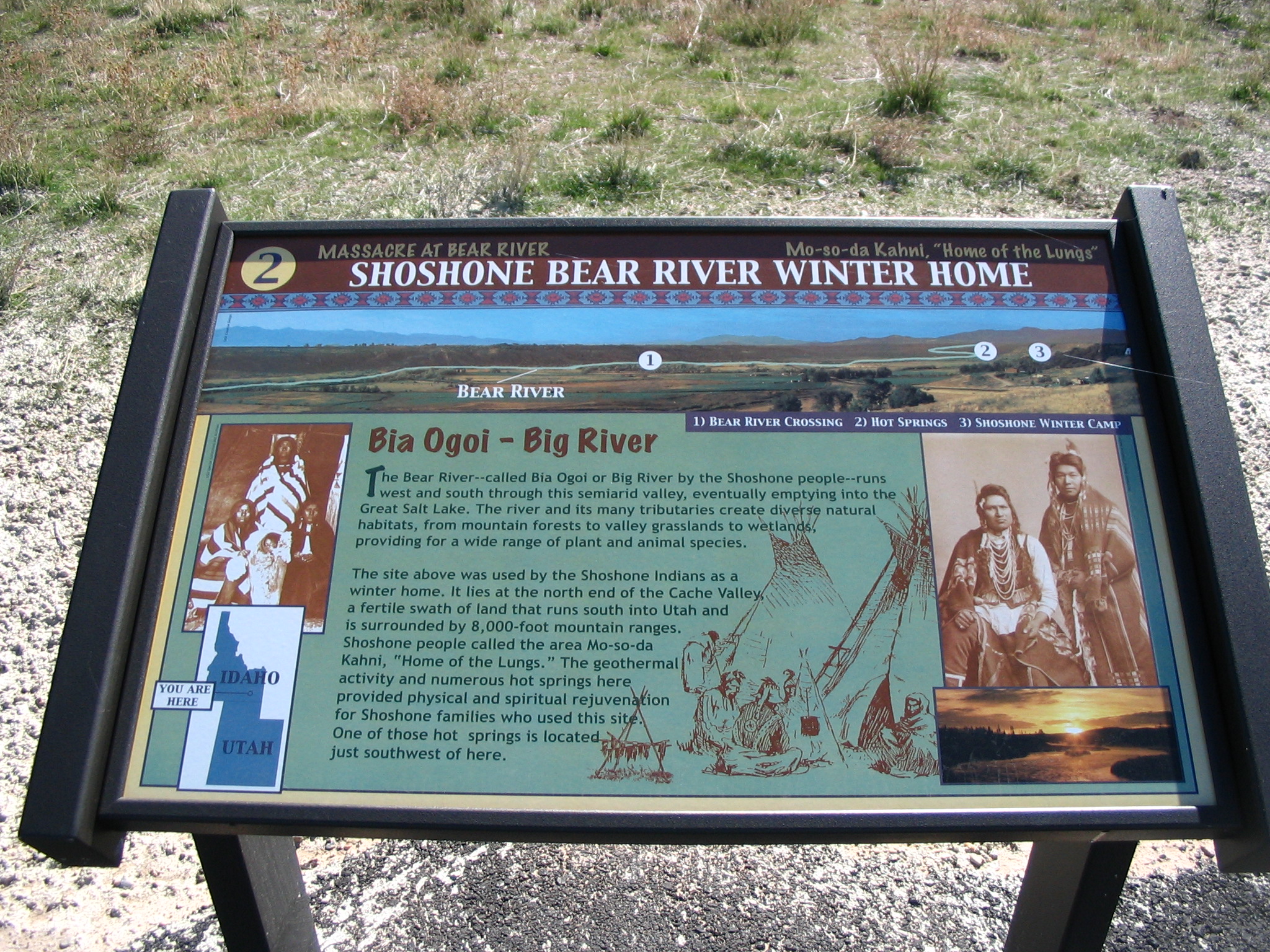
Bia Ogoi or Big River provided a winter home for the Shoshone. The hot springs and a fertile valley were a physical and spiritual rejuvenation for the Shoshone families who lived here. This sign includes sepia toned, historic photos of Shoshone Indians.
Public Domain. Photo by Tony Varilone
Download Original (2048 x 1536 pixels, 1327.7 MB)
-
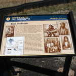
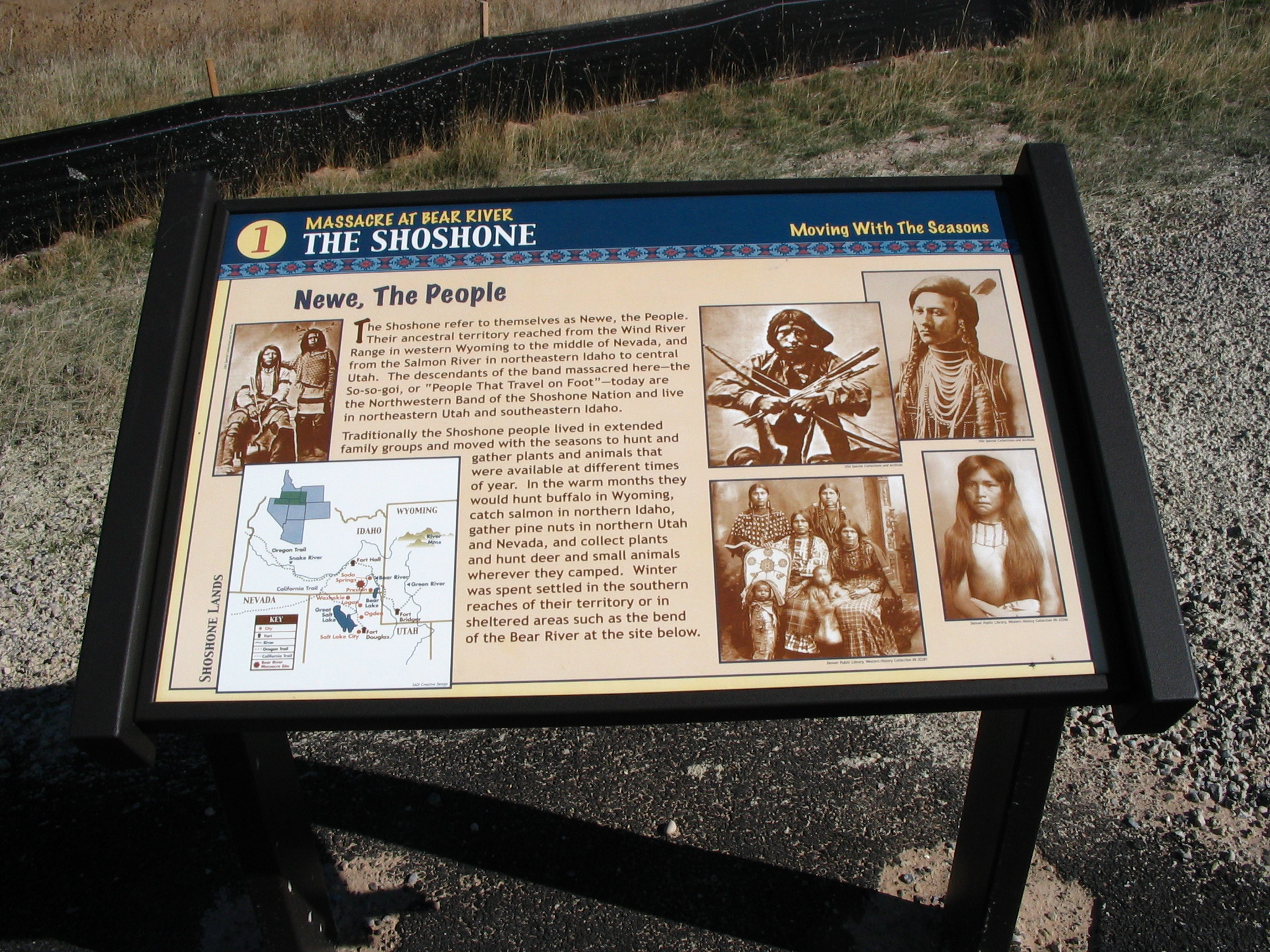
The Shoshone people moved with the seasons and lived in extended families. The descendants of the band massacred at Bear River live in Northeastern Utah and Southeastern Idaho. This sign tells about this and shows sepia-toned, historic pictures of Shoshone Indians. A map is also included on the sign.
Public Domain. Photo by Tony Varilone
Download Original (2048 x 1536 pixels, 1176.2 MB)
-
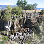
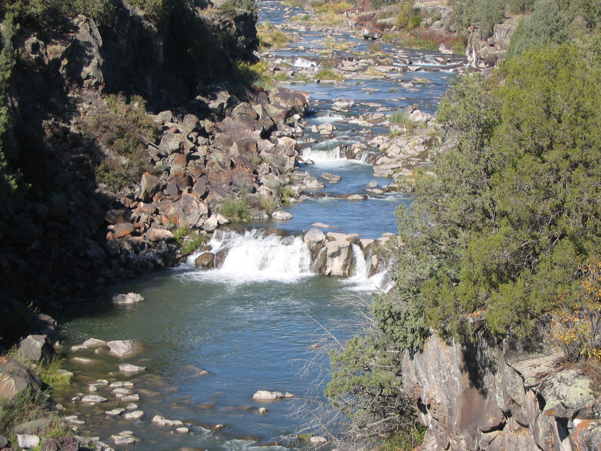
Water flows over rocks at the narrow floor of Black Canyon Gorge. Trees bright with green line the walls of this gorge carved by water in an ancient lava flow.
Public Domain. Photo by Tony Varilone
Download Original (2048 x 1536 pixels, 1295.3 MB)
-
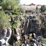
Trees surround Black Canyon Gorge as water flows through the chasm in spring or early summer. Mountains can be seen in the distance.
Public Domain. Photo by Tony Varilone
Download Original (2048 x 1536 pixels, 1197.4 MB)
-
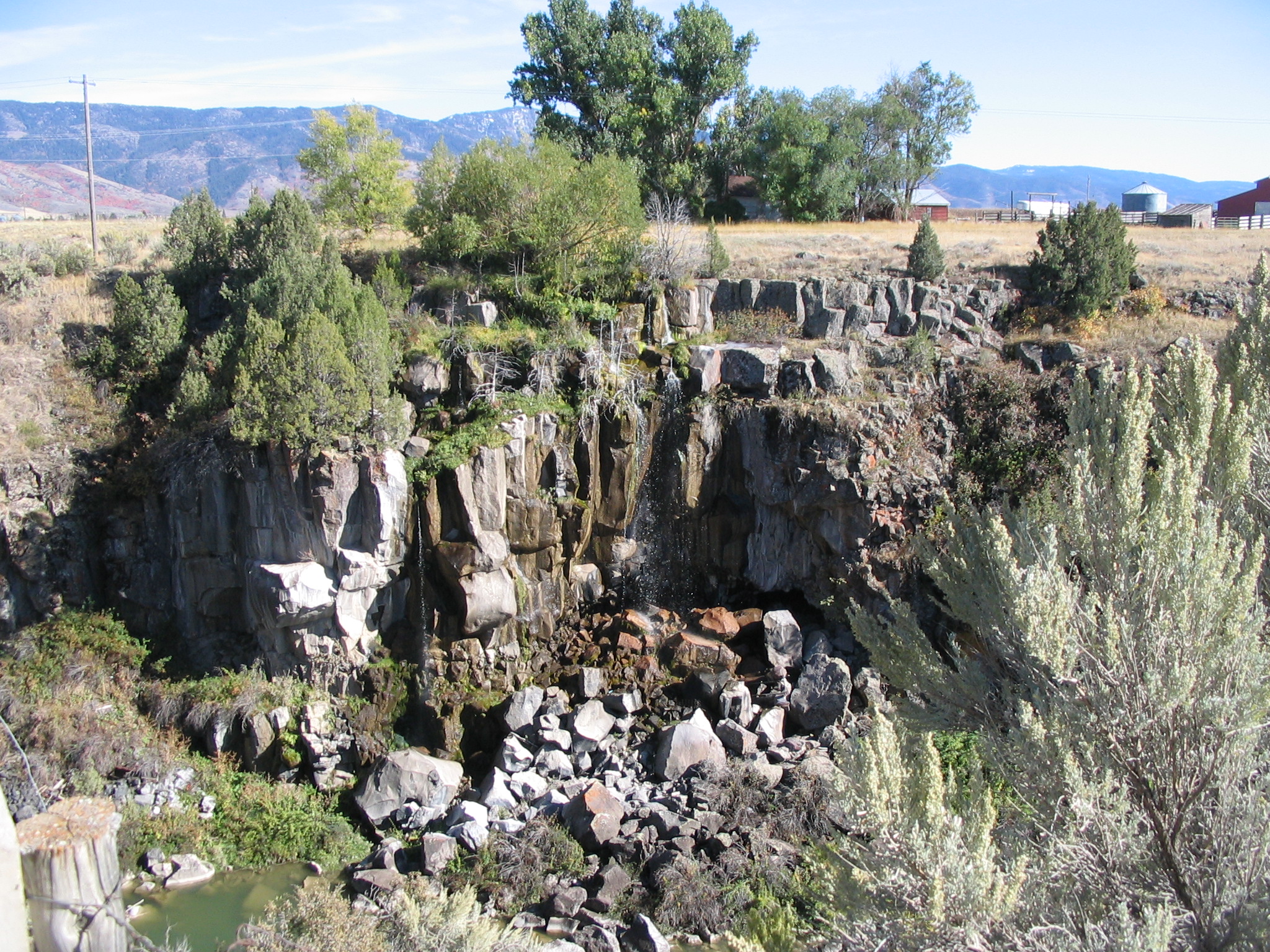
A small ranch is on the horizon beyond this view of the rugged black lava rock walls of Black Canyon Gorge. A tiny trickle of falls onto the pile of fallen rock at the edge of the gorge.
Public Domain. Photo by Tony Varilone
Download Original (2048 x 1536 pixels, 1477.3 MB)
-
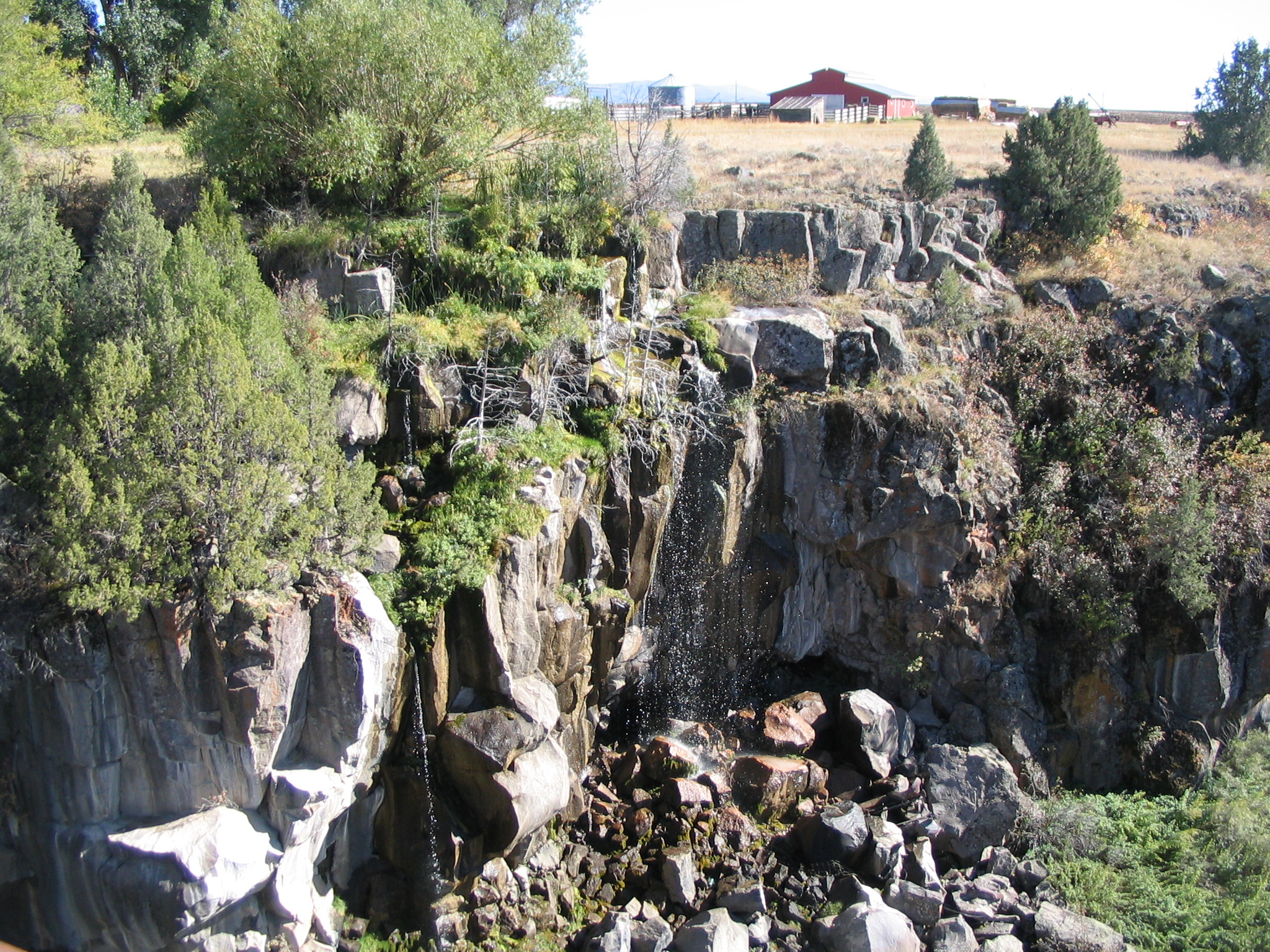
Near Grace, Idaho, water trickles down the rugged black lava cliffs of Black Canyon Gorge.
Public Domain. Photo by Tony Varilone
Download Original (2048 x 1536 pixels, 1496.0 MB)
-
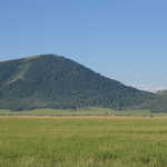
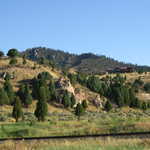
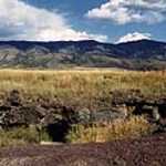
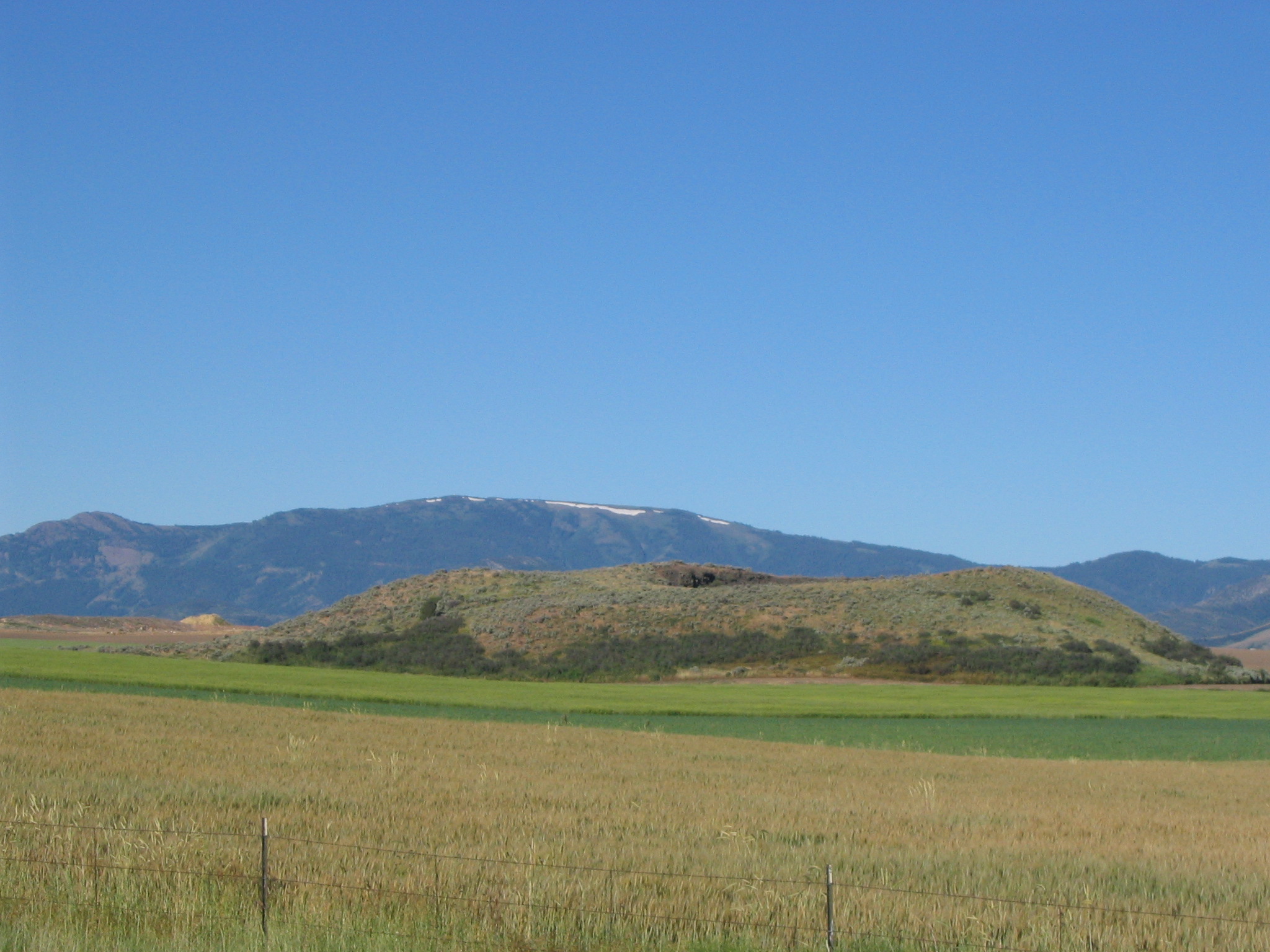
A small cinder cone, remnant of ancient volcanic activity, stands covered by wild grass in fields of alfalfa and wheat in Idaho. Deep blue mountains march across the horizon behind the cone.
Public Domain. Photo by Tony Varilone
Download Original (2048 x 1536 pixels, 688.7 KB)
-
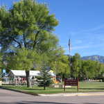
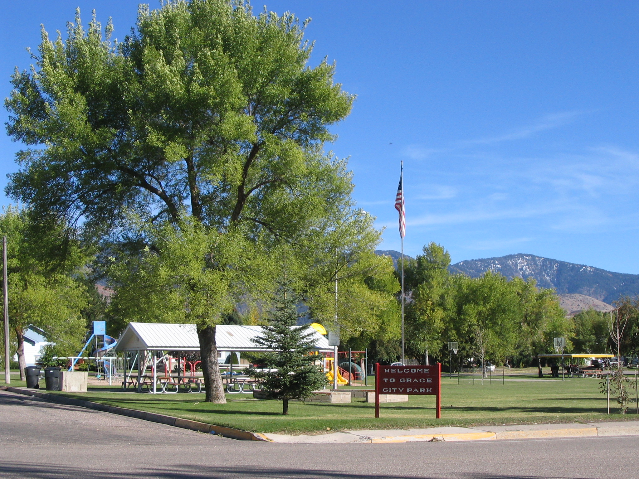
Green trees and green grass adorn Grace City Park. A roofed shelter and a playground provide ample opportunities for lots of fun.
Public Domain. Photo by Tony Varilone
Download Original (2048 x 1536 pixels, 1282.4 MB)
-
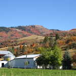
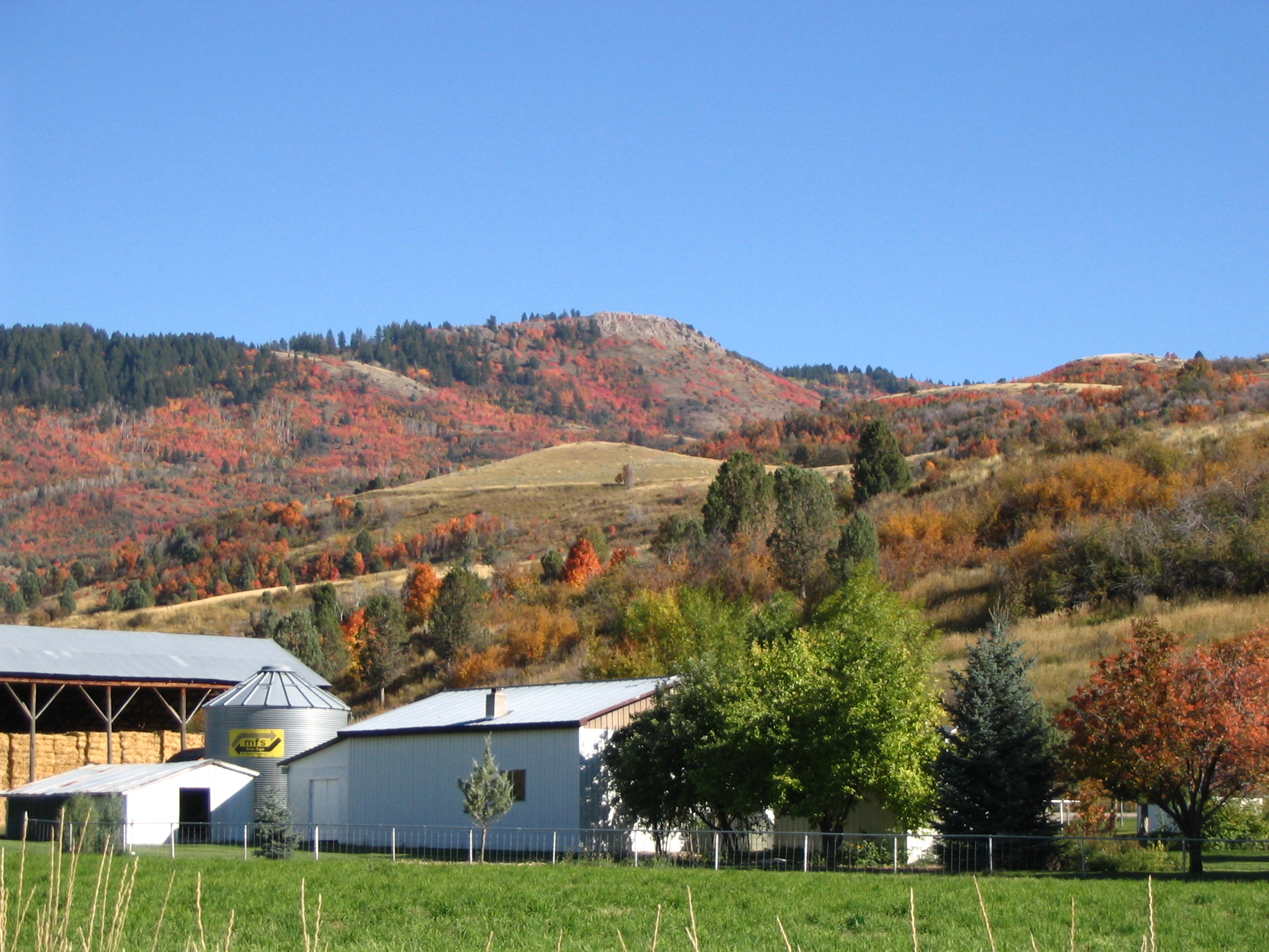
This white farm ranch is quaintly situated at the base of mountains exploding into autumn colors.
Public Domain. CD provided by Tony Varilone May 2007
Download Original (2048 x 1536 pixels, 941.3 KB)
-
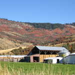
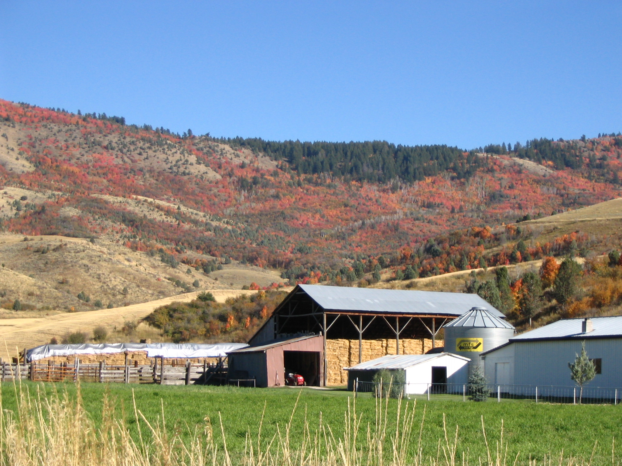
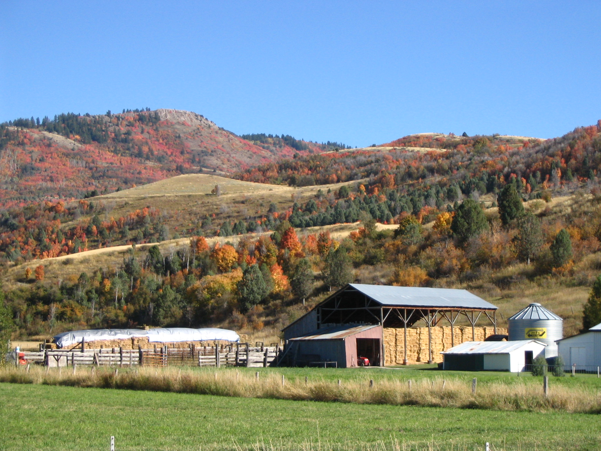
A rich harvest has filled the barn on this ranch with golden hay.
Public Domain. CD provided by Tony Varilone May 2007
Download Original (2048 x 1536 pixels, 982.5 KB)
-
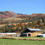
An open-sided western-style barn on a ranch is filled with bales of hay. Trees in the mountains nearby explode in fall color.
Public Domain. CD provided by Tony Varilone May 2007
Download Original (2048 x 1536 pixels, 975.1 KB)
-
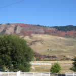
Irrigation makes a farmer's field bright green against the dry golden hills of the valley. Autumn leaves color the mountain range beneath the evergreen forest.
Public Domain. CD provided by Tony Varilone May 2007
Download Original (2048 x 1536 pixels, 882.5 KB)
-
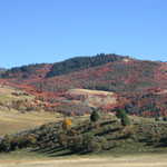
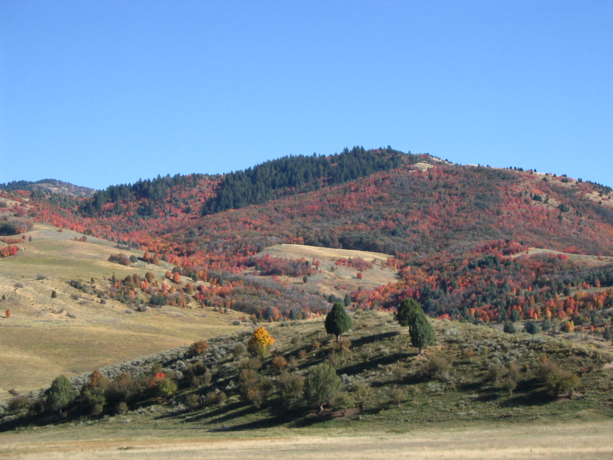
Solitary trees bright in red and orange fall color spill over the rolling autumn hills. This beautiful scenery will catch any traveler's eye.
Public Domain. CD provided by Tony Varilone May 2007
Download Original (2048 x 1536 pixels, 792.1 KB)
-
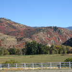
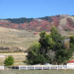
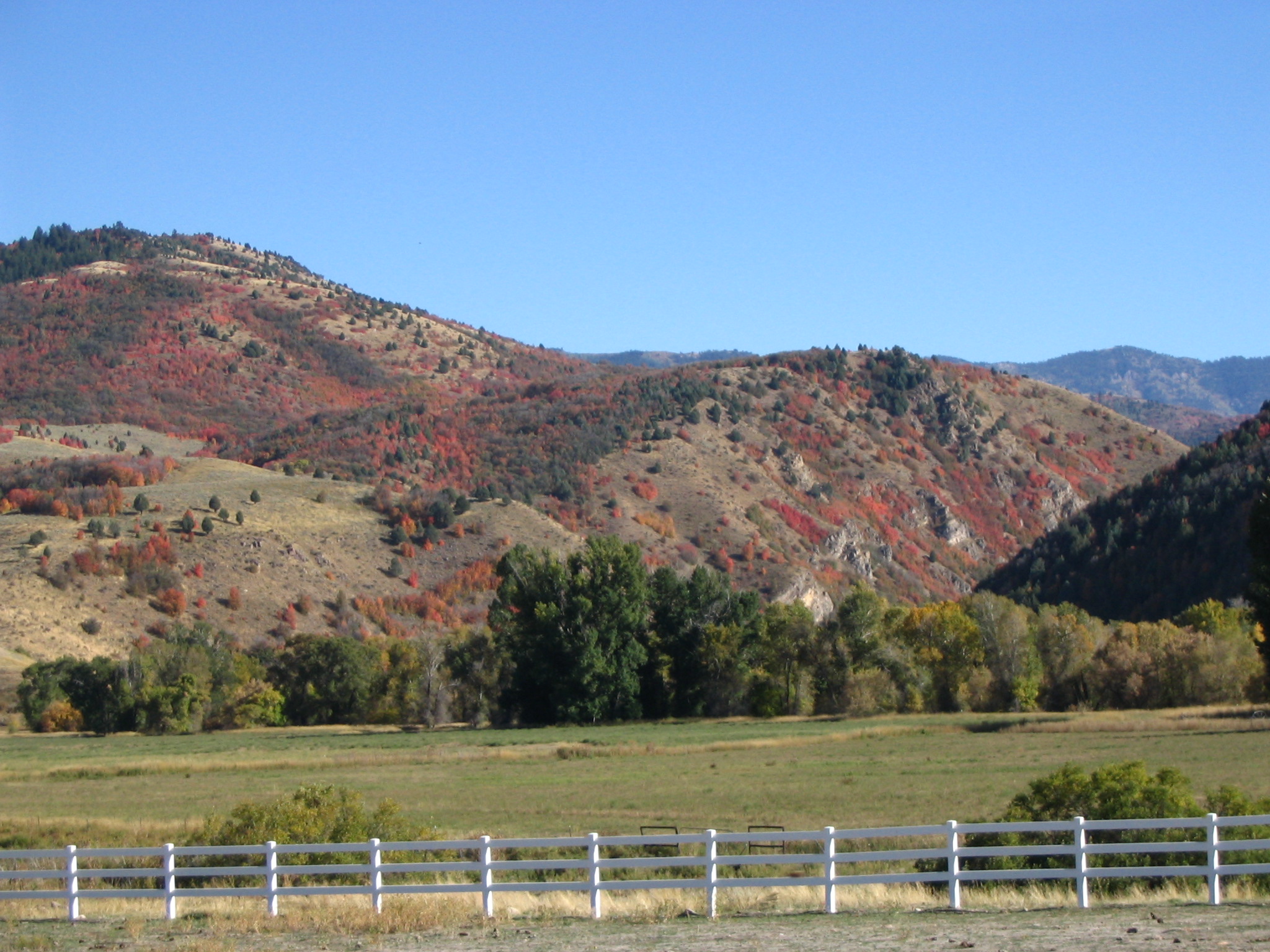
A white horse fence marks the boundary between green fields at the base of a mountain covered with trees bright with red and orange fall color.
Public Domain. CD provided by Tony Varilone May 2007
Download Original (2048 x 1536 pixels, 824.9 KB)
-
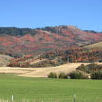
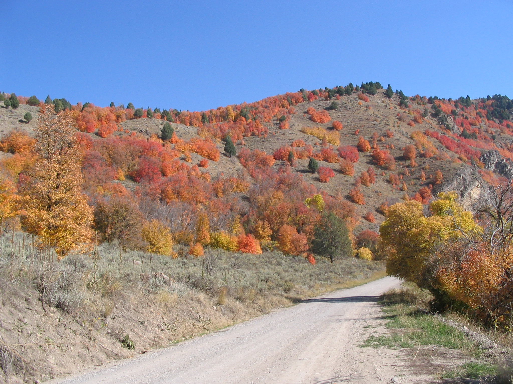
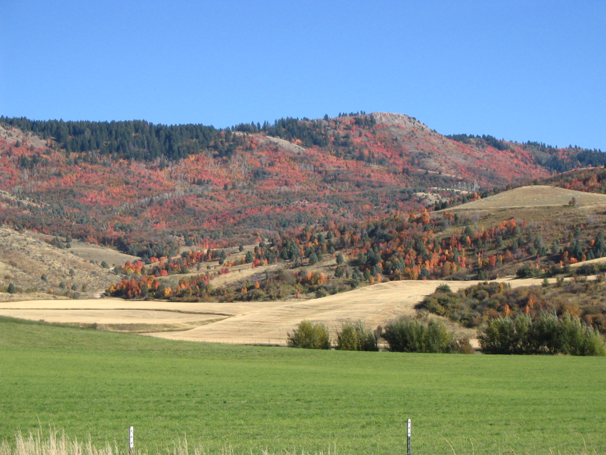
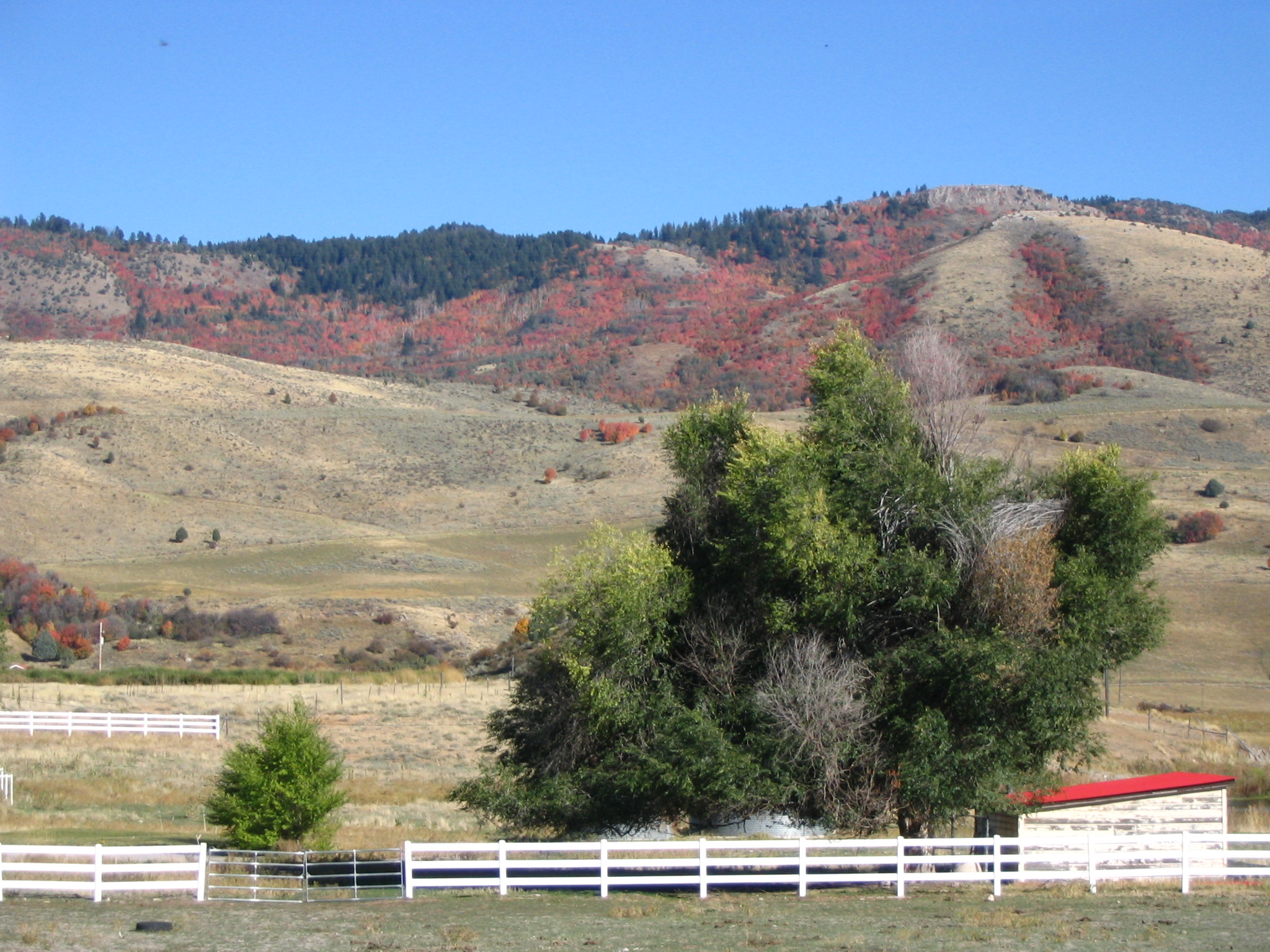
In Fall, colorful trees adorn the mountains between Grace and Preston, Idaho. A white ranch fence and lush green trees provide contrast with the dry brown hillsides.
Public Domain. CD provided by Tony Varilone May 2007
Download Original (2048 x 1536 pixels, 906.3 KB)
-
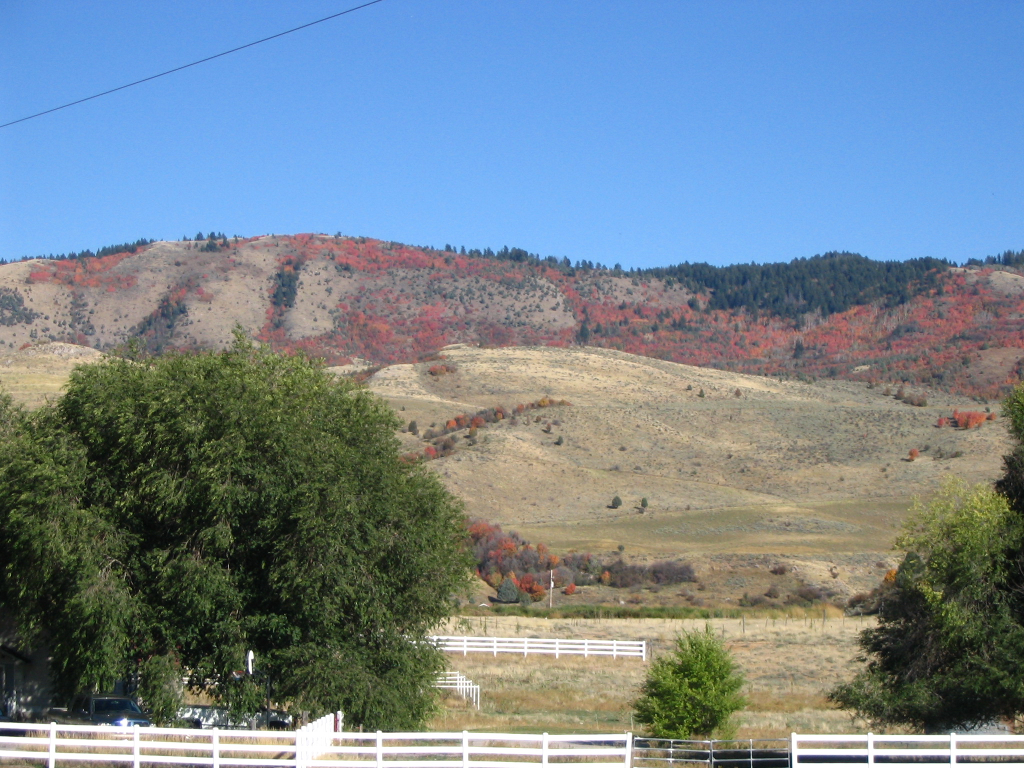
White ranch fences and trees add a touch of home to the stunning fall colors on the mountains between Grace and Preston, Idaho.
Public Domain. CD provided by Tony Varilone May 2007
Download Original (2048 x 1536 pixels, 986.1 KB)
-
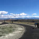
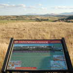
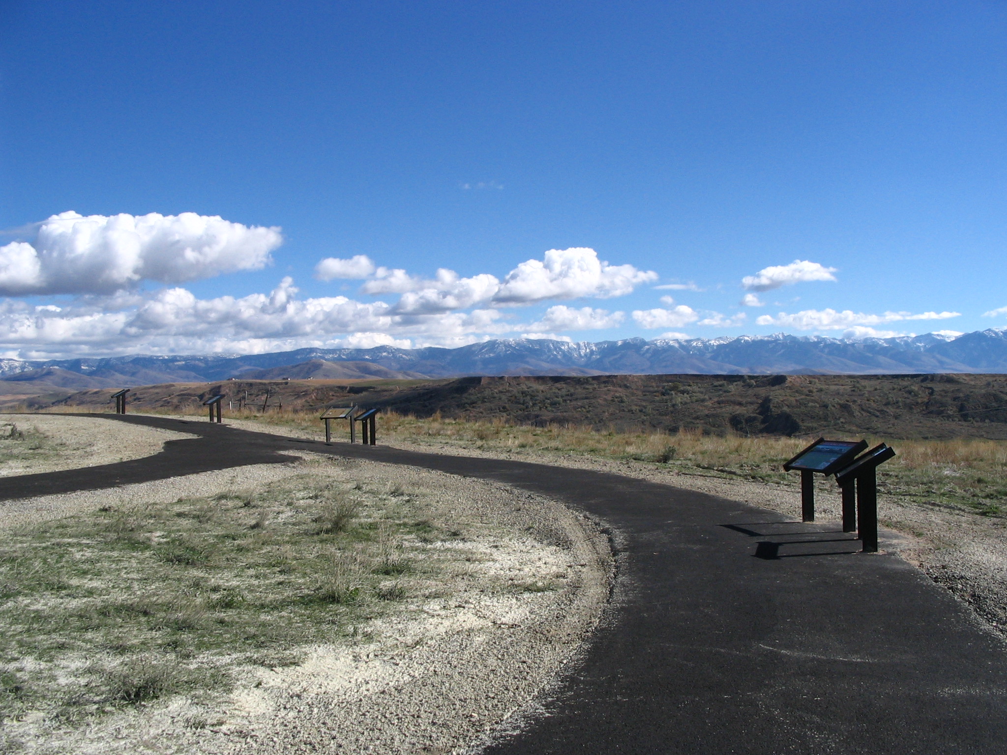
A freshly-laid cinder-ash path curves past several interpretive signs at the Bear River Massacre overlook.
Public Domain. CD provided by Tony Varilone May 2007
Download Original (2048 x 1536 pixels, 987.9 KB)
-
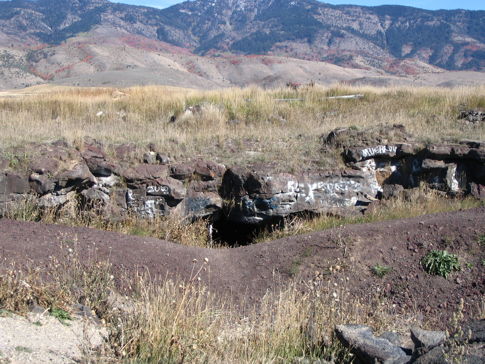
Niter Ice Cave, a lava tube near Grace, Idaho, can be seen in the shadows of the mountains and amidst the tall summer grasses.
Public Domain. Photo by Tony Varilone
Download Original (2048 x 1536 pixels, 2283.6 MB)
-
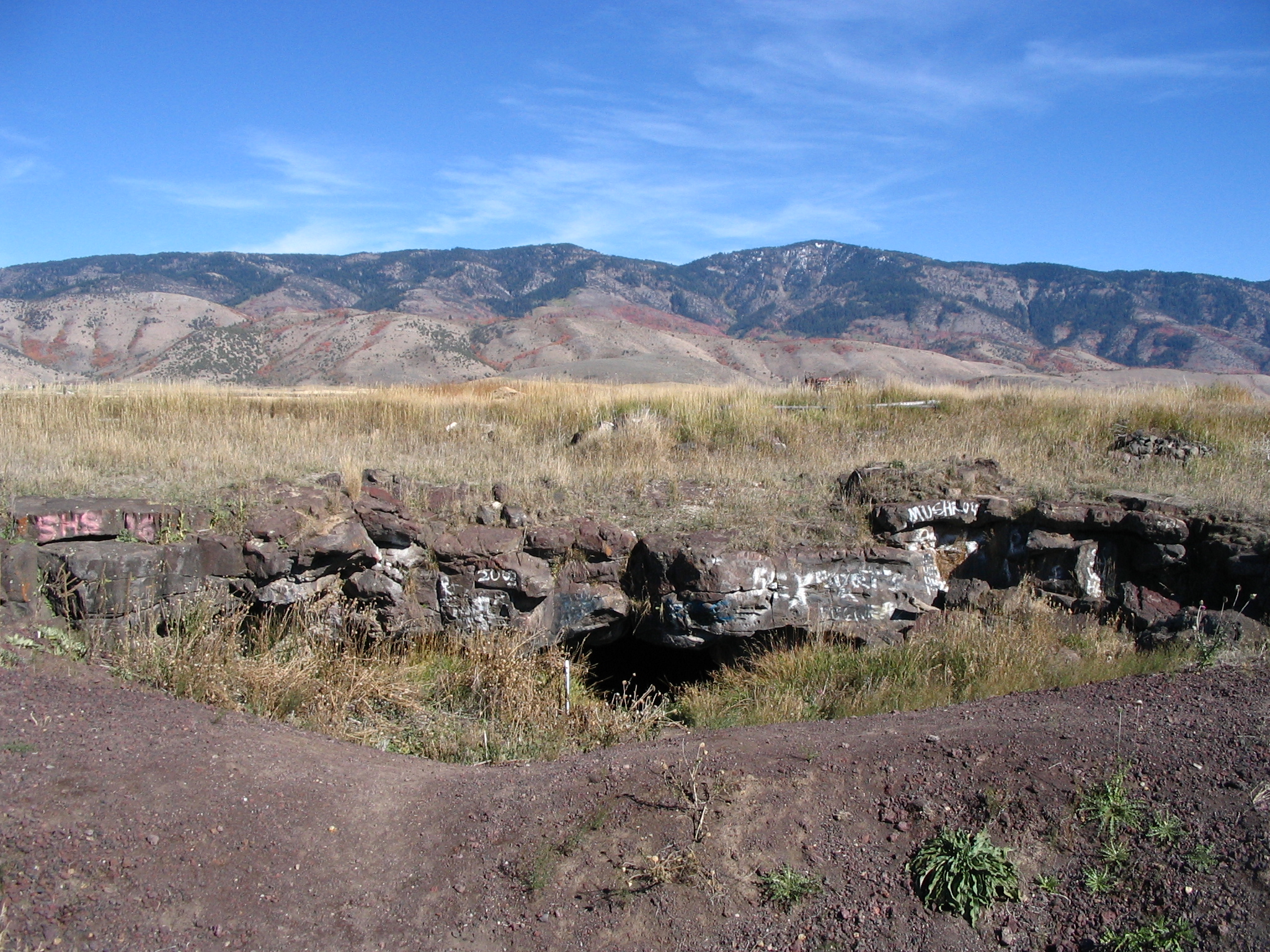
Visitors to Niter Ice Cave will find the entrance amid an array of tall grasses. Mountains can be seen in the distance.
Public Domain. Photo by Tony Varilone
Download Original (2048 x 1536 pixels, 1937.9 MB)
-
In the summer Niter Ice Cave is difficult to pick out among the tall summer grasses and sagebrush. Mountains can be seen in the distance of the entrance.
Public Domain. Photo by Tony Varilone
Download Original (2048 x 1536 pixels, 2378.2 MB)
-
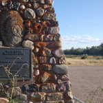
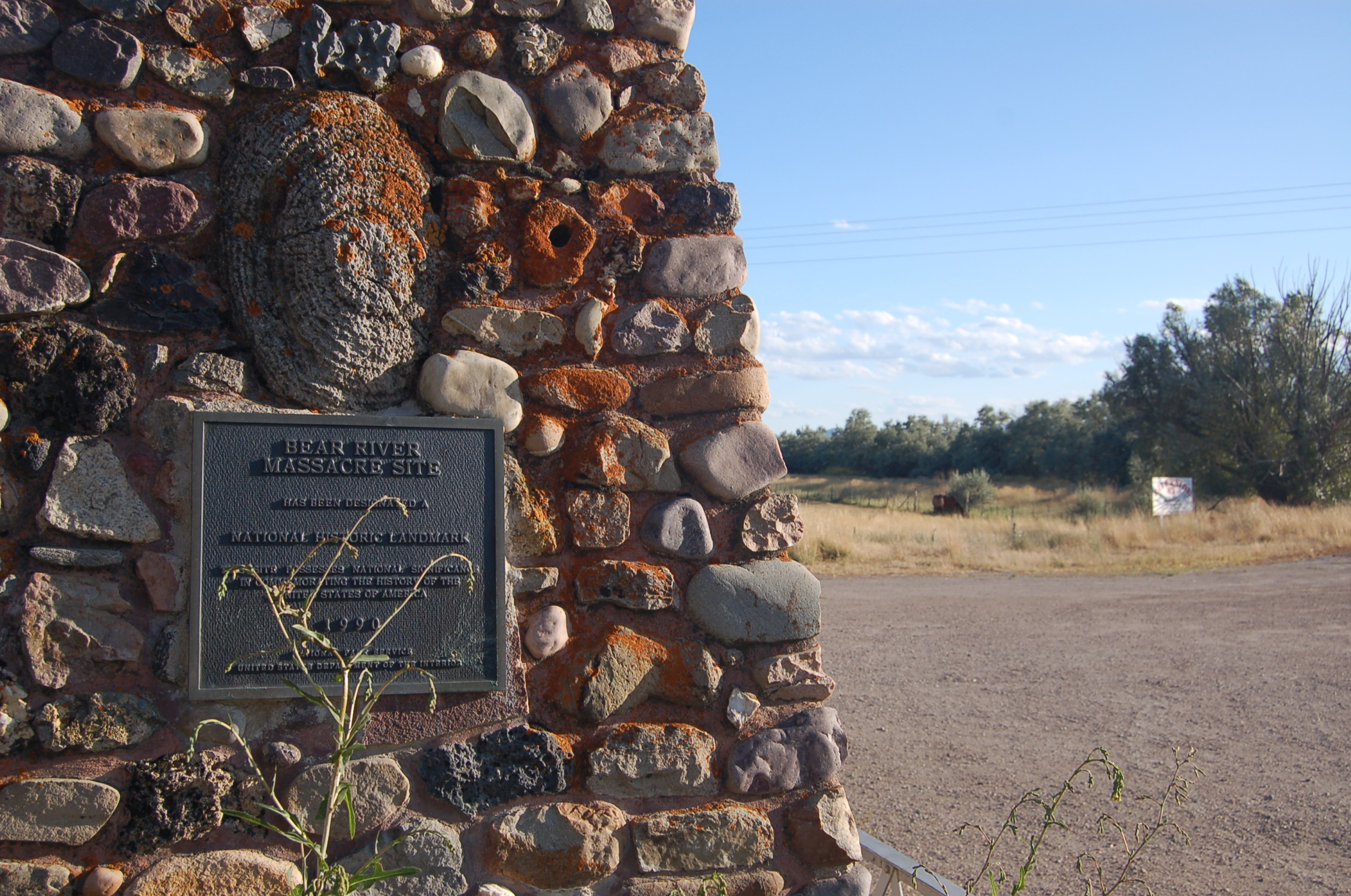
A metal plaque on the side of a rocky pillar commemorates this area as the site of the Bear River Massacre.
Public Domain. Photo by A. E. Crane
Download Original (2256 x 1496 pixels, 1000.9 MB)
-
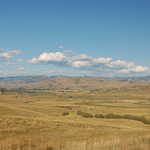
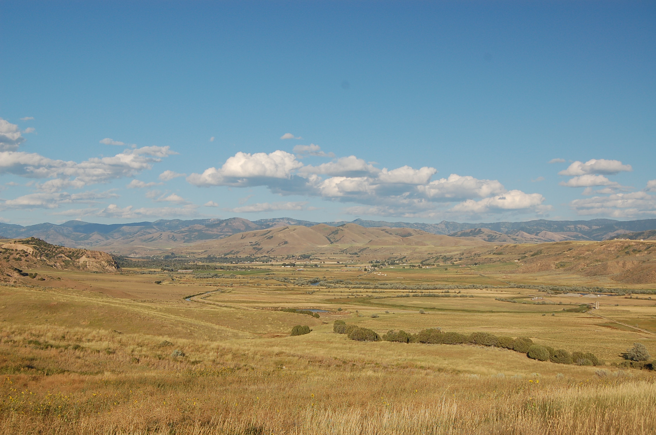
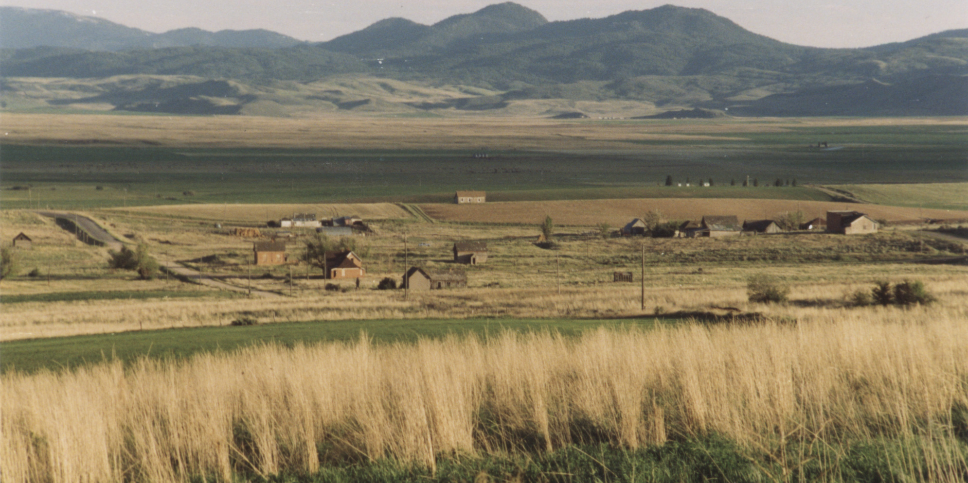
The long valley of the Bear River stretches east toward the mountains, as seen from the upper parking area of the Bear River Massacre National Historic Site.
Public Domain. Photo by A. E. Crane
Download Original (2256 x 1496 pixels, 796.3 KB)
-
A plaque describes the movements of the soldiers and the Indians during the January morning when the attack occurred. The valley behind the plaque is where it happened.
Public Domain. Photo by A. E. Crane
Download Original (2256 x 1496 pixels, 922.2 KB)
-
According to the nearby plaque at the Bear River Massacre National Historic Site, the bright green field below is "the Killing Ground" where the soldiers massacred the Shoshone men, women and children encamped there.
Public Domain. Photo by A. E. Crane
Download Original (2256 x 1496 pixels, 784.1 KB)
-

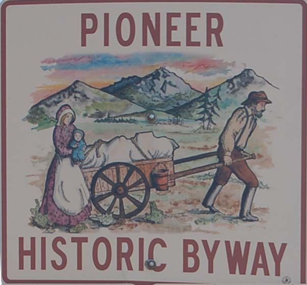
Cropped from a larger image is a closeup of the Pioneer Historic Byway roadsign, showing a handcart family.
Public Domain.
Download Original (603 x 561 pixels, 75.4 KB)
-
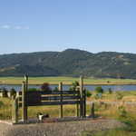
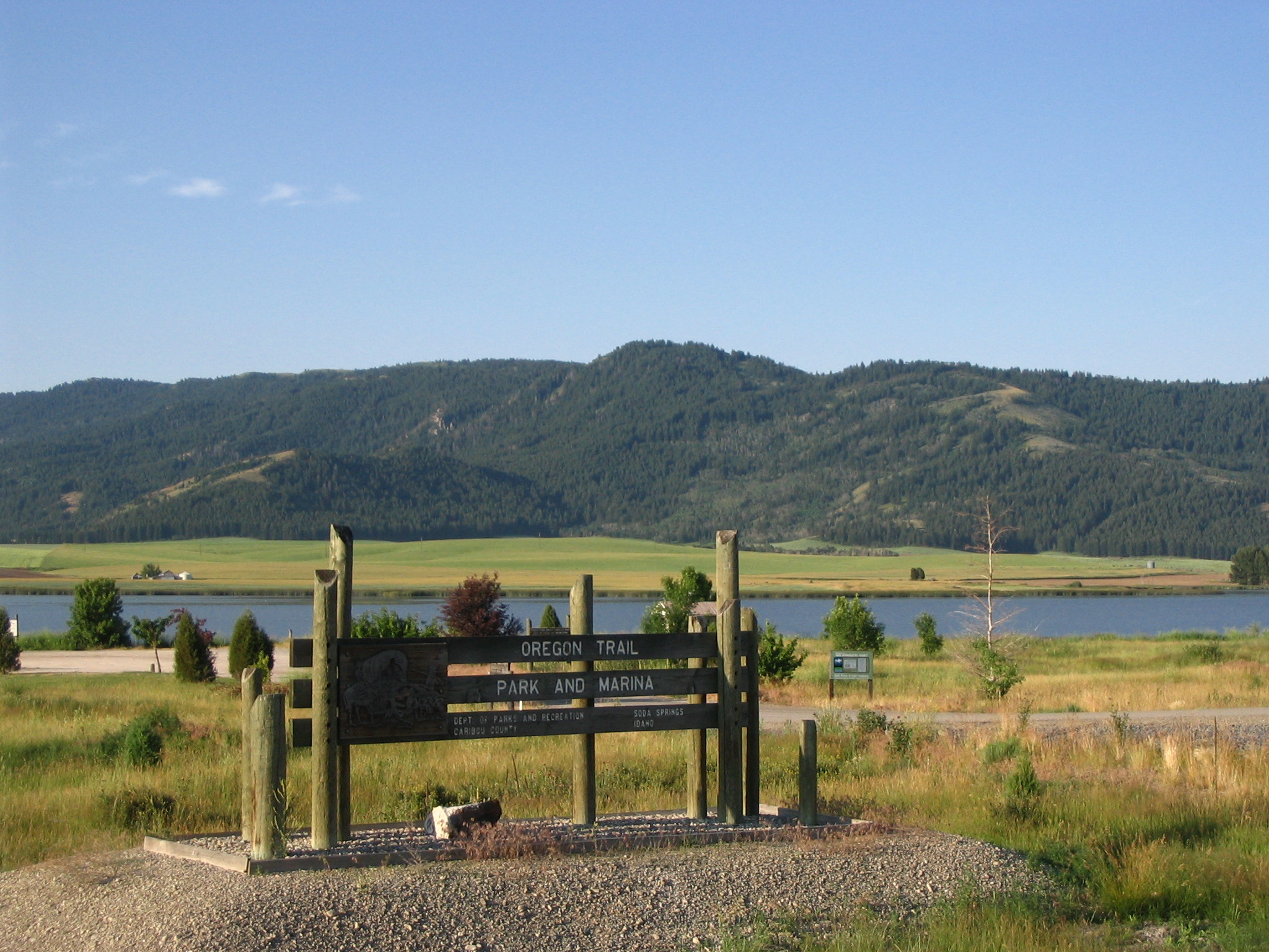
A wooden sign serves as a landmark for the Oregon Trail Park and Marina. Mountains, and the spring sits in the distance beyond the sign.
Public Domain. Photo taken by Tony Varilone
Download Original (2048 x 1536 pixels, 930.1 KB)
-
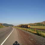
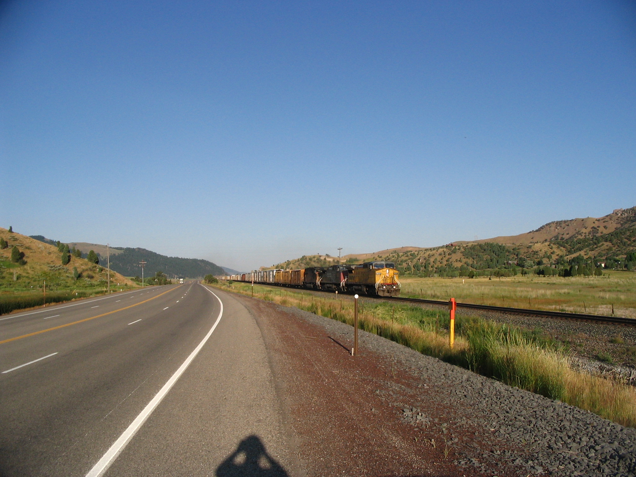
Train tracks run parallel to the highway as a train approaches.
Public Domain. Photo taken by Tony Varilone
Download Original (2048 x 1536 pixels, 870.9 KB)
-
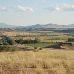
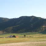
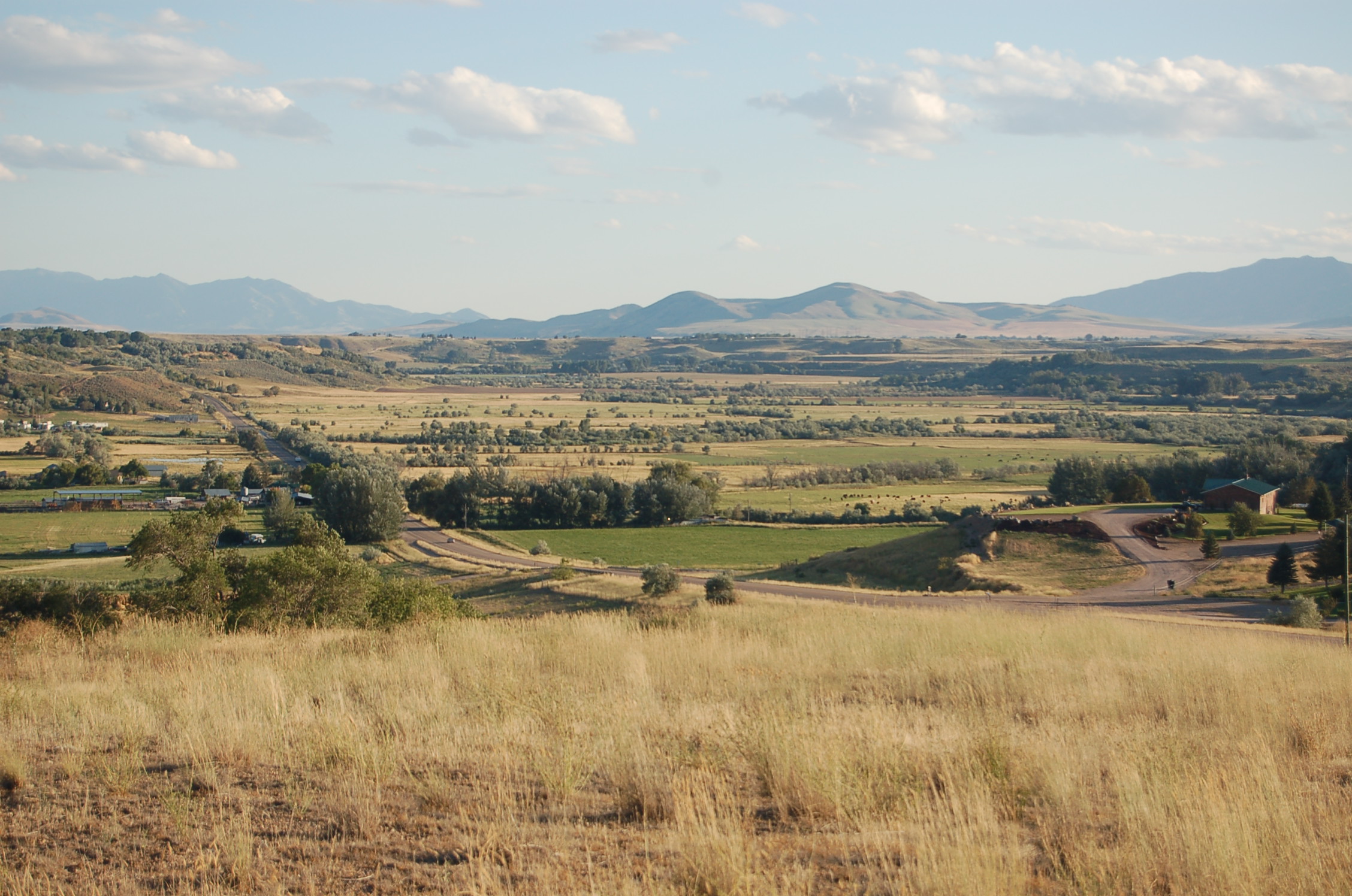
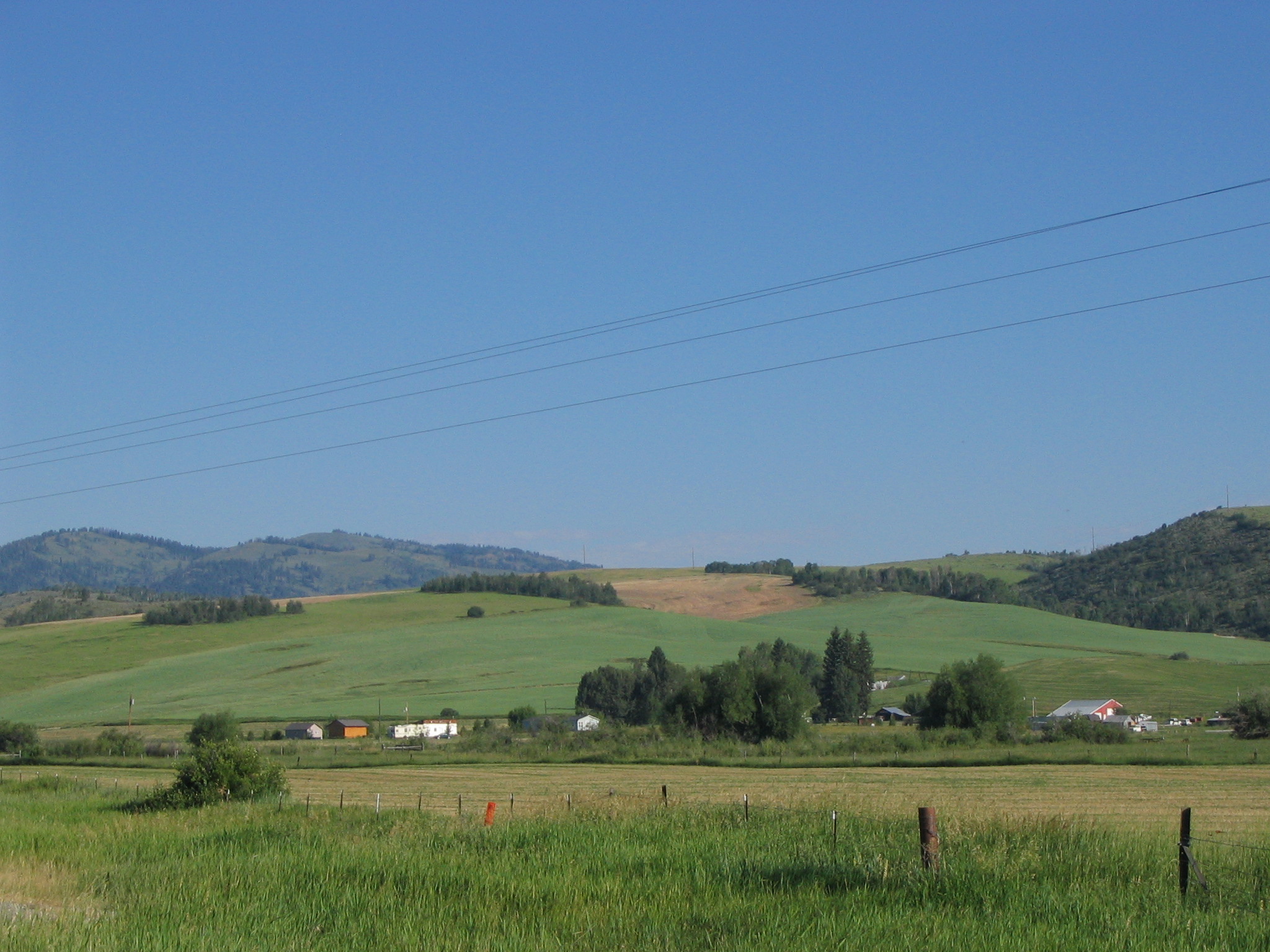
A small farm surrounded by fields of crops resides among rolling hills which eventually connect to the mountain range in the distance.
Public Domain. Photo taken by Tony Varilone
Download Original (2048 x 1536 pixels, 759.8 KB)
-

This photo is a panoramic view of the Chesterfield Townsite and the valley where it is located. There are 27 structures in this Townsite in various stages of restoration.
Public Domain.
Download Original (1990 x 994 pixels, 748.0 KB)
-
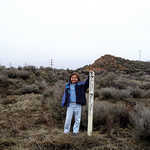
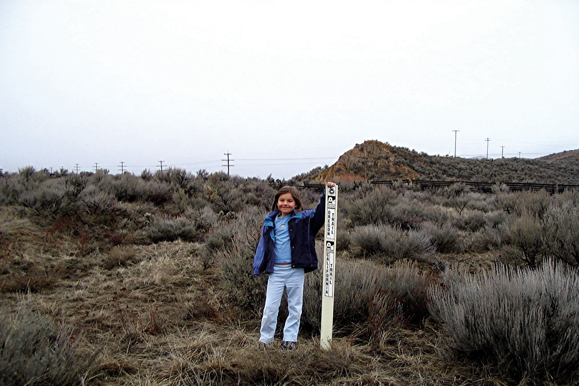
A young girl cheerfully poses next to a marker depicting one of the wagon ruts remaining from west-bound pioneers. This wagon rut is for the main Oregon-California Trail six miles west of Soda Springs and on the north side of US 30. This marker is approximately 200 yards east of the spot where the Hudspeth Cutoff heads west to California and the main route of the Oregon-California Trail heads northwest to Fort Hall. The white Carsonite markers were placed by the Oregon-California Trail Association.
Public Domain.
Download Original (1984 x 1324 pixels, 1693.2 MB)
-
The Last Chance Canal bores straight into a lava-flow cliffside.
© July 2000 A. E. Crane.
-
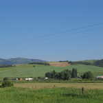
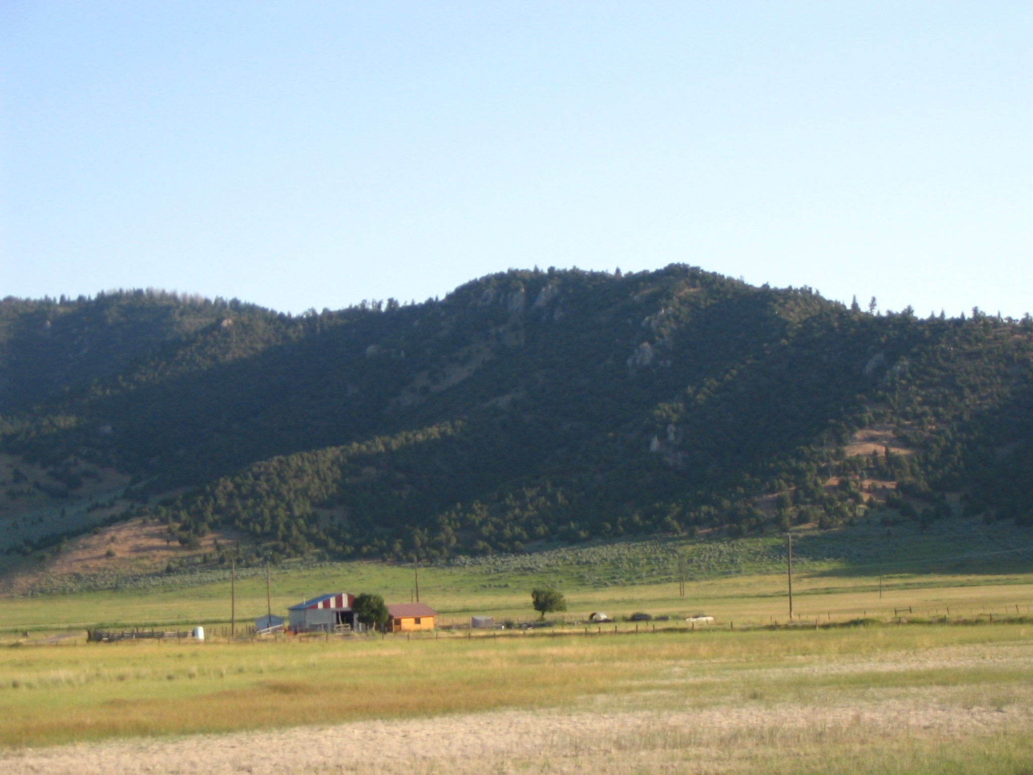
A small farm sits near rolling hills covered with pines, and the fields around the farm contrast with the mountains in shades of light green and tan.
Public Domain. Photo taken by Tony Varilone
Download Original (2048 x 1536 pixels, 614.2 KB)
-
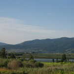
Green foliage and water from Soda Springs are visible in front of deep rolling mountains and mountain homes.
Public Domain. Photo taken by Tony Varilone
Download Original (2048 x 1536 pixels, 719.8 KB)
-
Irrigation pipes faithfully sprinkle water over a field in the foreground of a tree-spotted mountain.
Public Domain. Photo by Tony Varilone
Download Original (2048 x 1536 pixels, 936.1 KB)
-
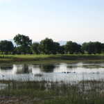
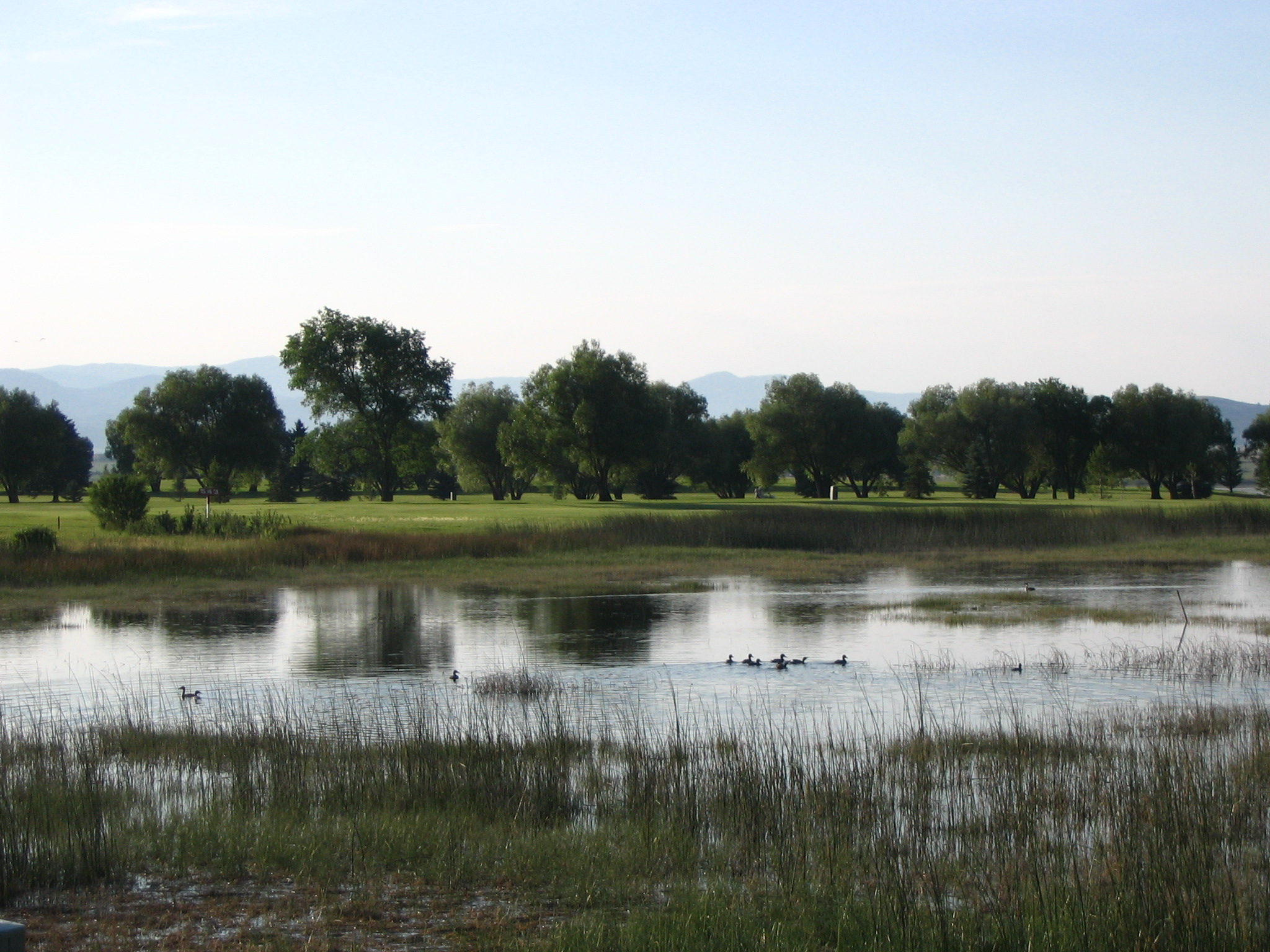
Ducks make their home in the spring which is adjacent to Soda Springs Golf Course. Trees from the course cast shadows in the water.
Public Domain. Photo taken by Tony Varilone
Download Original (2048 x 1536 pixels, 817.3 KB)
-
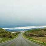
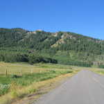
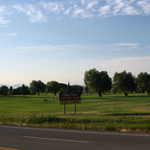
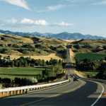
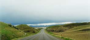
The Pioneer Historic Byway rises up through green hills below a cloudy sky in the early spring.
© 1998 Sarahi Dehesa.
Download Original (295 x 132 pixels, 7.7 KB)
-
Stormy skies glower to the east over a harvested field near Riverdale, Idaho
© Sept. 1999 A. E. Crane.
-
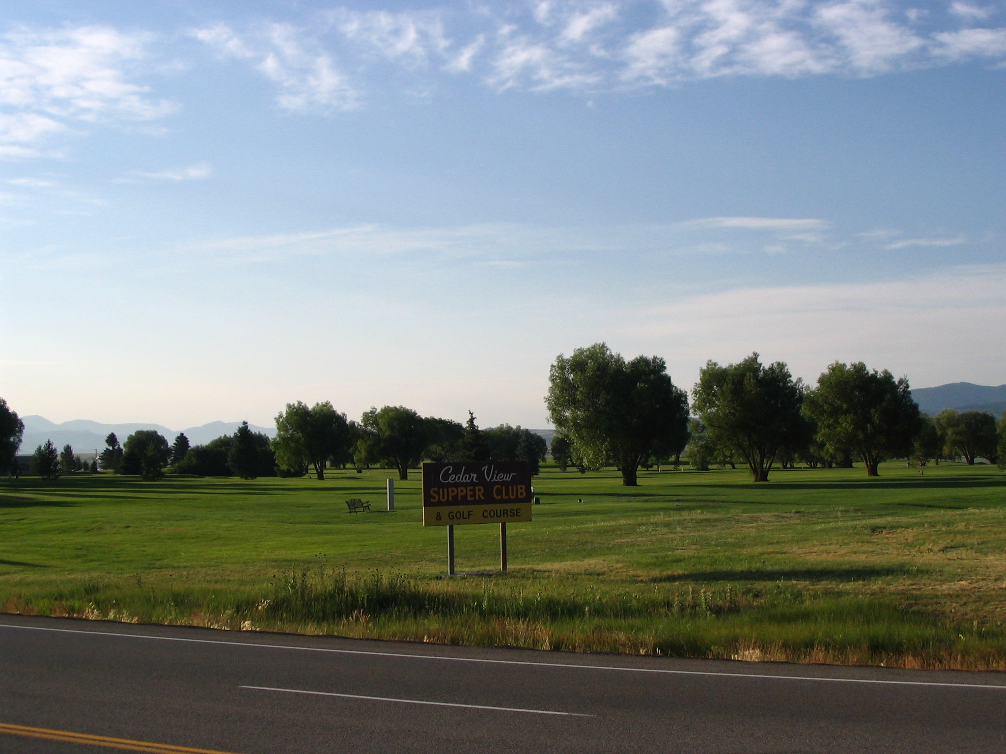
A sign telling of the Cedar View Supper Club and Golf Course sits near the edge of the green golf course.
Public Domain. Photo taken by Tony Varilone
Download Original (2048 x 1536 pixels, 705.9 KB)
-
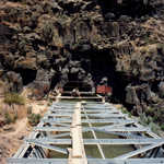
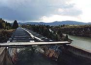
This flume, Last Chance Canal, that carries the water from the Bear River into Gentile Valley turned the valley floor into productive farmland early in the last century. The water is drawn from the Bear River and is first directed into a tunnel cut through a lava rock bluff and then into the flume which straddles the Bear River.
Public Domain. Photo by John Bertram
Download Original (2092 x 1192 pixels, 2239.0 MB)
-
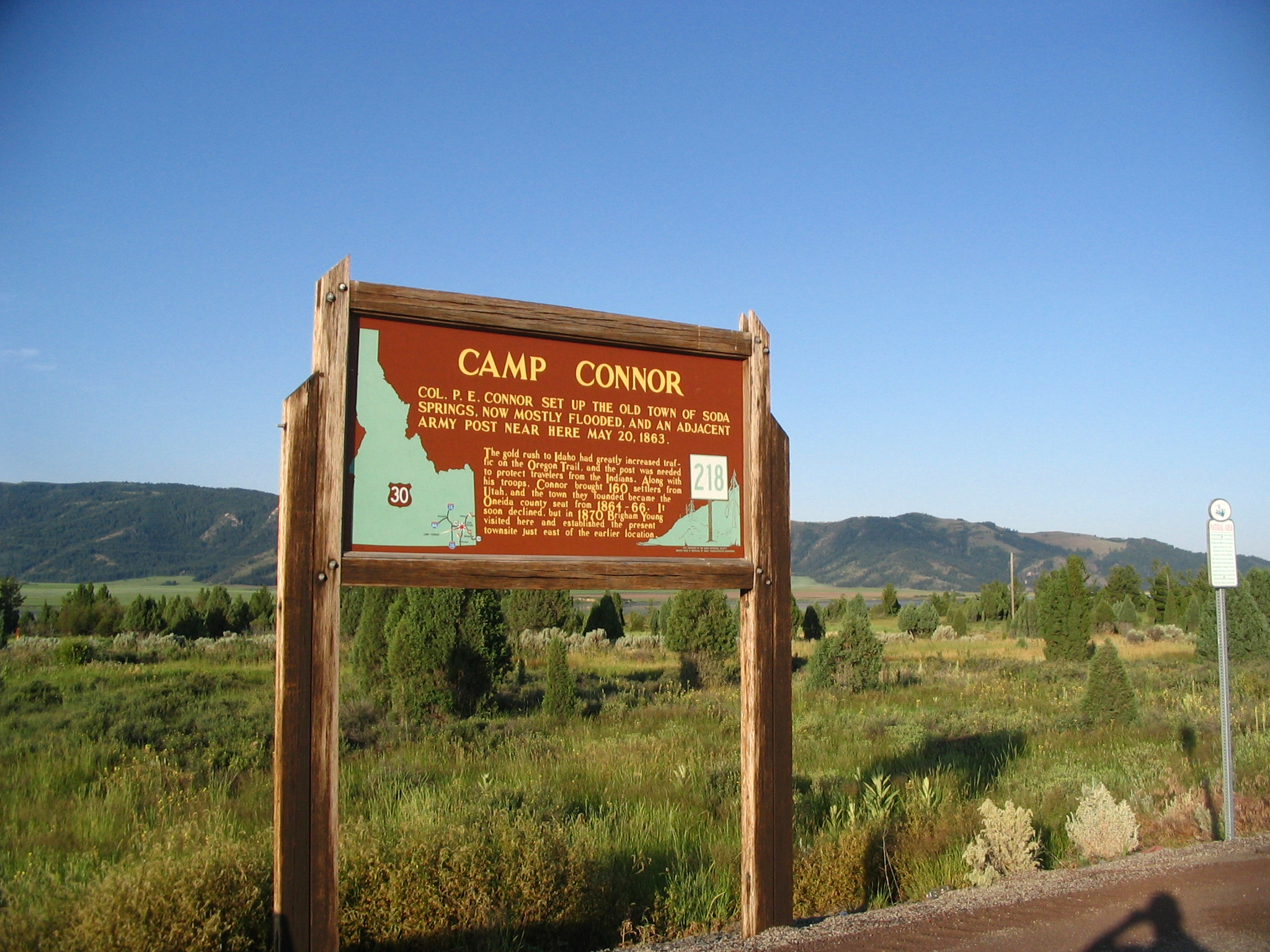
A sign describes the Old Town of Soda Springs and its history. The town was established by Col. P.E. Conner.
Public Domain. Photo taken by Tony Varilone
Download Original (2048 x 1536 pixels, 950.4 KB)
-
Brilliant green fields surround this divided stream while two mountain peaks add dimension to the horizon.
Public Domain. Photo taken by Tony Varilone
Download Original (2048 x 1536 pixels, 852.1 KB)
-
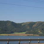
A railing beside the highway seems to hold in the water that surrounds the mountain base.
Public Domain. Photo taken by Tony Varilone
Download Original (2048 x 1536 pixels, 690.1 KB)
-

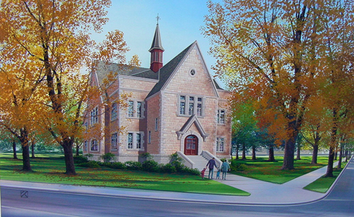
The Oneida Stake Academy is restored in this artist's rendition of it as a visitor center in Benson Park in Preston, Idaho.
Public Domain. Oneida Stake Academy Foundation
Download Original (504 x 310 pixels, 234.5 KB)
-
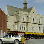
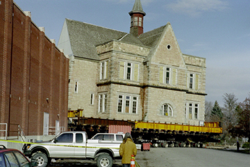
Moving the three-story stone Academy presented quite a challenge, but the movers were up to it.
Public Domain. Oneida Stake Academy Foundation
Download Original (360 x 240 pixels, 103.8 KB)
-
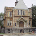
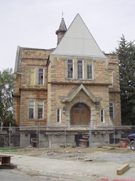
The Academy was successfully moved to its new home at Benson Park in Preston, Idaho. This photo shows it in its unrestored, freshly moved state, as of 2003 or 2004.
Public Domain. Oneida Stake Academy Foundation
Download Original (270 x 360 pixels, 105.9 KB)
-
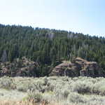
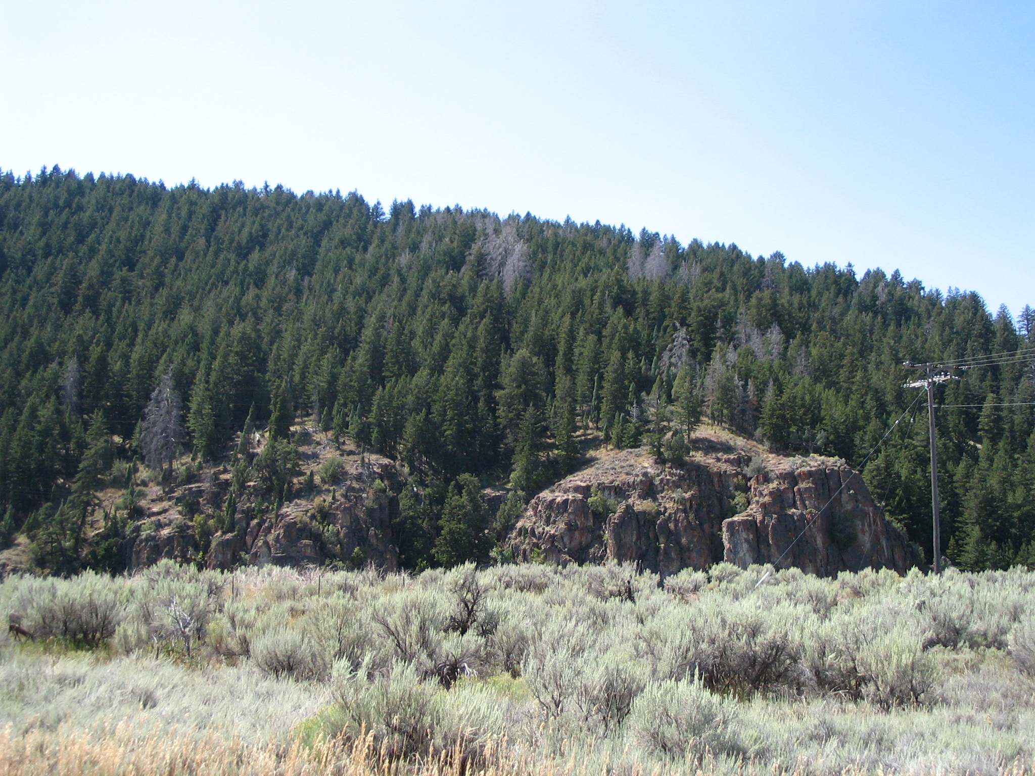
Rough rocks stand out against dark green pines and gray-green sagebrush fields.
Public Domain. Photo taken by Tony Varilone
Download Original (2048 x 1536 pixels, 1708.4 MB)
-
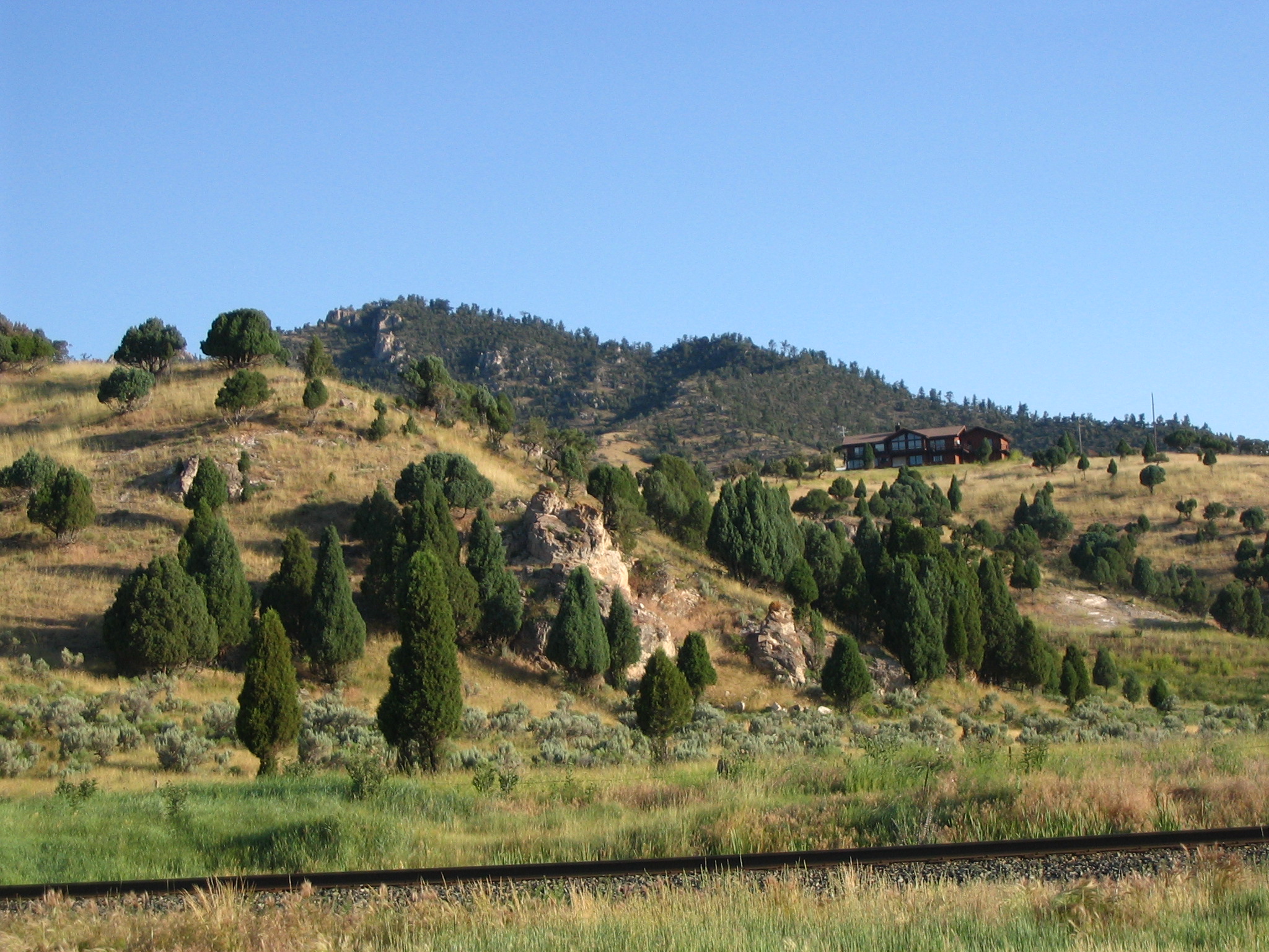
Train tracks run along a mountainside, dotted with juniper and sagebrush. A home sits atop the hill.
Public Domain. Photo taken by Tony Varilone
Download Original (2048 x 1536 pixels, 1006.8 MB)
-
Red Rock Pass is today's remnant of the natural dam at the north end of ancient Lake Bonneville.
Public Domain. Photo by Ann Yearsley
Download Original (437 x 350 pixels, 146.9 KB)
-

Franklin's old ZCMI store - the second oldest in the area.
© 1999 A. E. Crane.
Download Original (188 x 134 pixels, 13.5 KB)
-
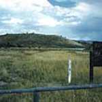
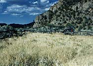
Rail fence marks the boundary of the Emigrant Burial Site near Soda Springs, Idaho
© 1999 A. E. Crane.
Download Original (188 x 133 pixels, 17.4 KB)
-
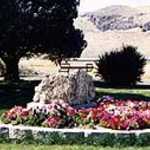
Marker for the Old Yellowstone Highway (the last one still in its original location.) Pink, white and red flowers surround the boulder on which the marker is placed, in a nicely landscaped display. Summer.
© 1999 A. E. Crane.
-
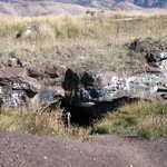
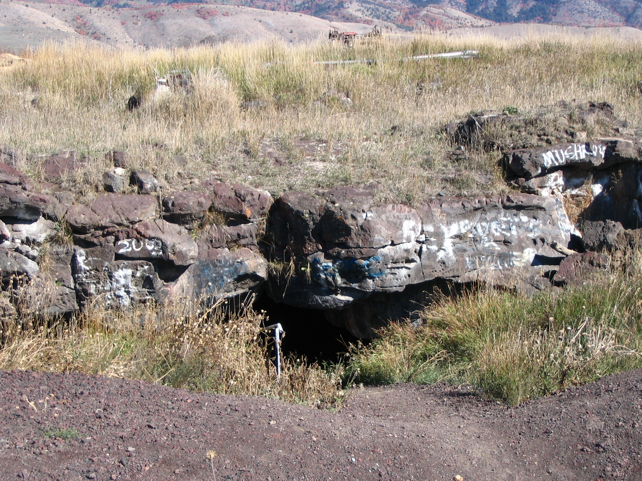
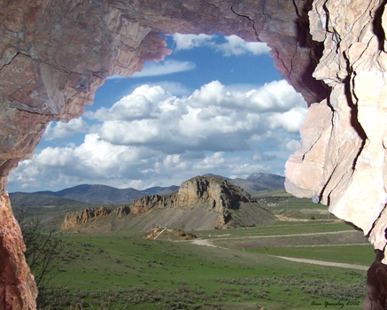
The entrance to the Niter Ice Cave, as seen from above.
© 1999 A. E. Crane.
Download Original (188 x 125 pixels, 15.6 KB)
-
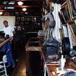
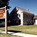
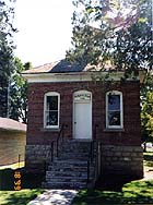
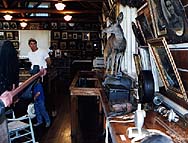
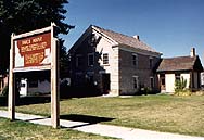
Visitors browse the pioneer relics displayed in Franklin's Relic Hall.
© 1999 A. E. Crane.
Download Original (188 x 143 pixels, 19.5 KB)
-
Volunteer takes a break in front of the historic Relic Hall in Franklin.
© 1999 A. E. Crane.
Download Original (188 x 129 pixels, 18.5 KB)
-
Built with yesterday's skill and perserverance, today's canal supplies water to much of southeastern Idaho's farmlands
© 1999 A. E. Crane.
Download Original (188 x 136 pixels, 13.4 KB)
-
Heading south into the Cub River Valley near Riverdale
© Sept. 1999 A. E. Crane.
-
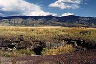
A grassy depression shows one remnant of the Oregon-California trail near Soda Springs, Idaho
© 1999 A. E. Crane.
Download Original (188 x 117 pixels, 11.9 KB)
-
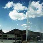
A cold-water geyser erupts one late afternoon in Soda Springs.
© 1999 A. E. Crane.
Download Original (127 x 188 pixels, 12.6 KB)
-
Visitor to Last Chance Canal takes the cliff path
© July 2000 A. E. Crane.
-
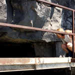
A woman perched on the iron walkway across the canal peers into the tunnel carved into the lava flow.
© July 2000 A. E. Crane.
-
The Cub River flows through ancient lava flows at Last Chance Canal.
© July 2000 A. E. Crane.
Download Original (190 x 133 pixels, 16.3 KB)
-
Maples brilliant with orange leaves overlook the lake at Oneida Narrows.
Public Domain. Photo by Tony Varilone
Download Original (2048 x 1536 pixels, 1492.7 MB)
-
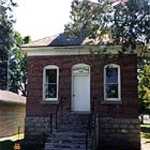
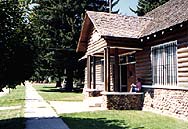
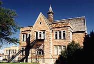
The Hatch House in Franklin was built in 1872 by LDS bishop, Lorenzo Hatch.
 © 1999 A. E. Crane.
Download Original (188 x 129 pixels, 15.6 KB)
-
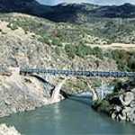
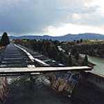
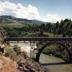
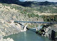
Viewed from the road on a sunny afternoon, the Last Chance Canal bridge spans a river that runs through a black lava flow in southeastern Idaho.
© 1999 A. E. Crane.
Download Original (188 x 135 pixels, 18.7 KB)
-

The Oneida Stake Academy, the oldest Latter Day Saint (LDS or "Mormon") academy, was originally located on the grounds of current-day Preston High School. In 2003/2004 the Academy was relocated to its new home in Benson Park in Preston, after a successful effort by local citizens to save this important piece of local history from demolition. After restoration, it will open to the public as a visitor center for the Pioneer Historic Byway.
 © 1999 A. E. Crane.
Download Original (188 x 129 pixels, 16.6 KB)