
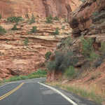
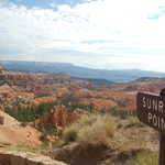
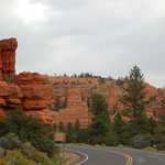
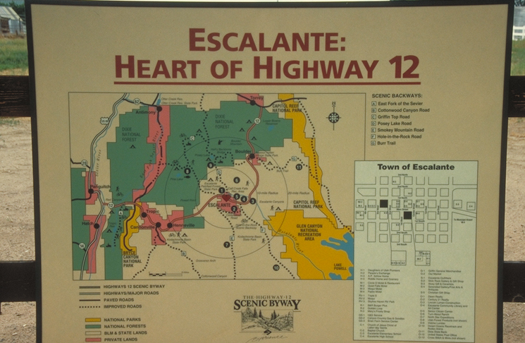
Scenic Byway 12
All Photos (309)
-
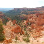
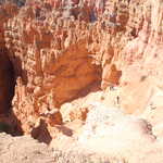
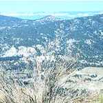
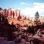
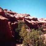
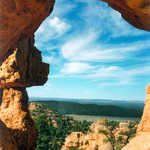
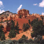
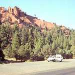
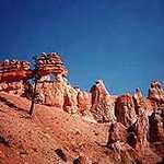
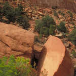
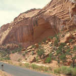
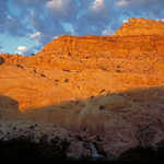
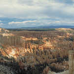
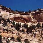
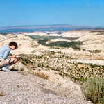
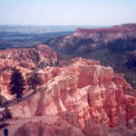
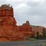
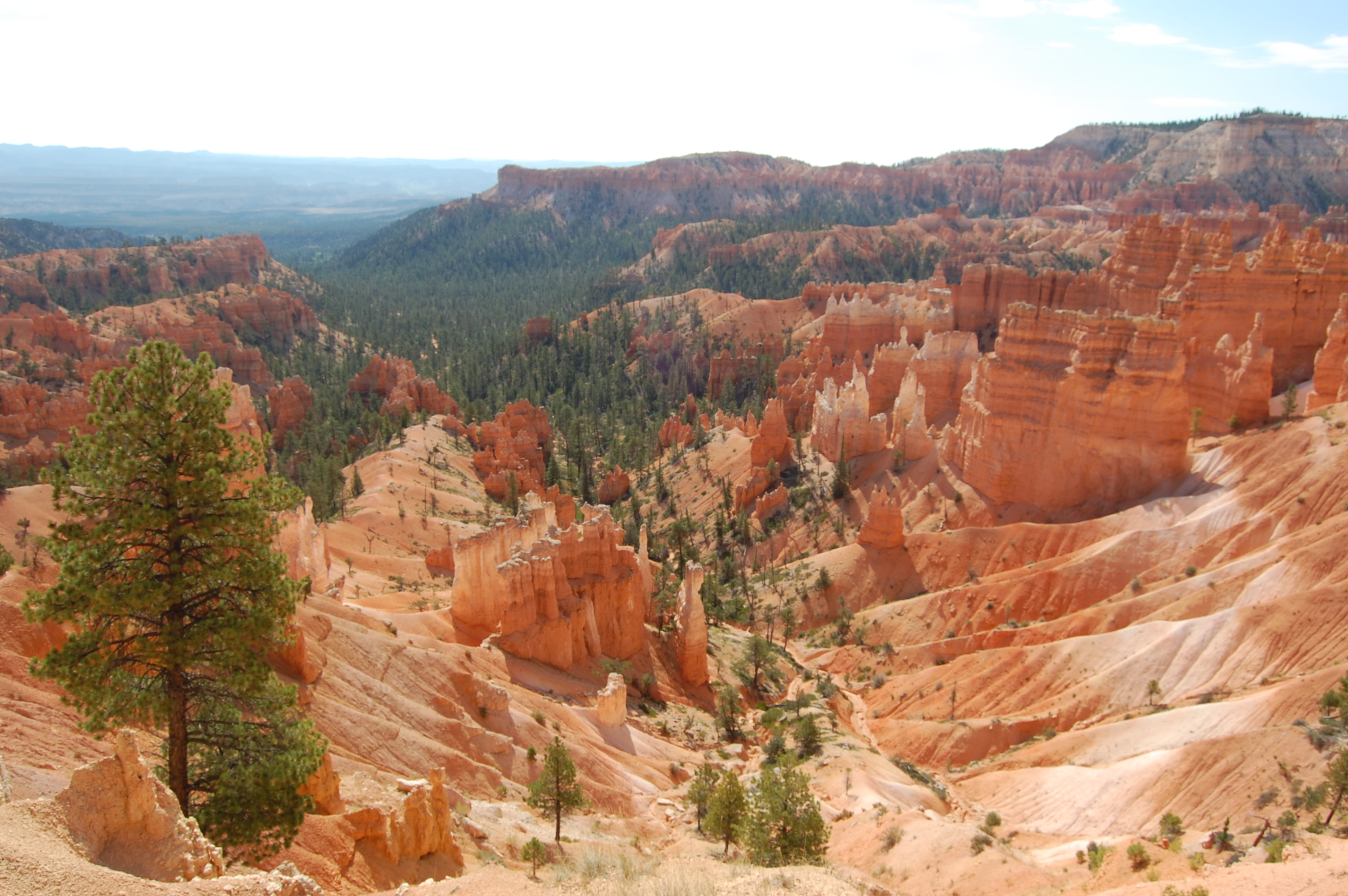
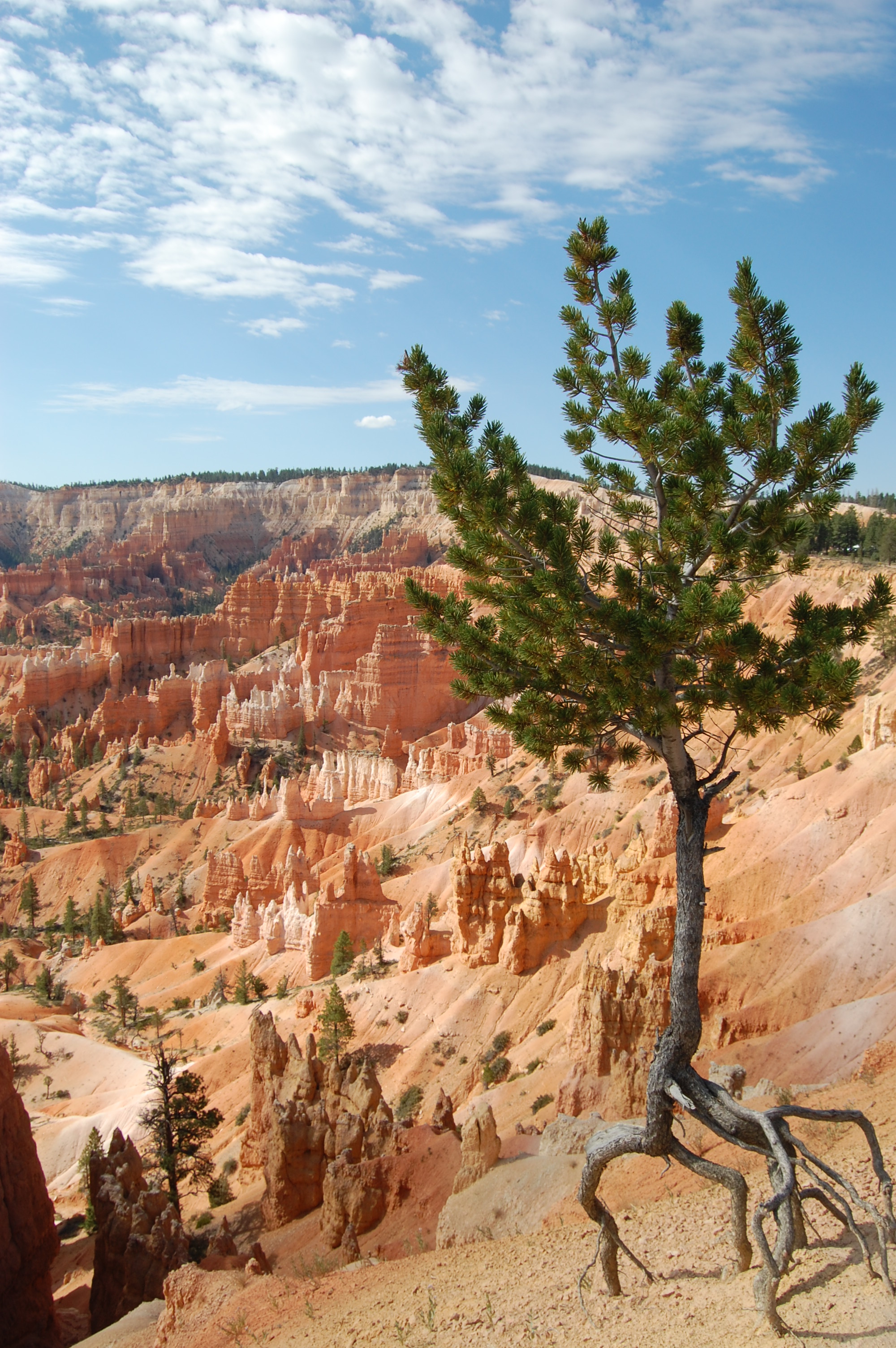
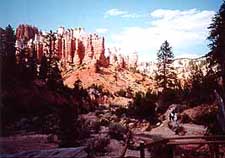
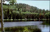
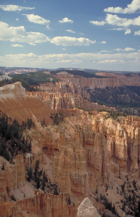
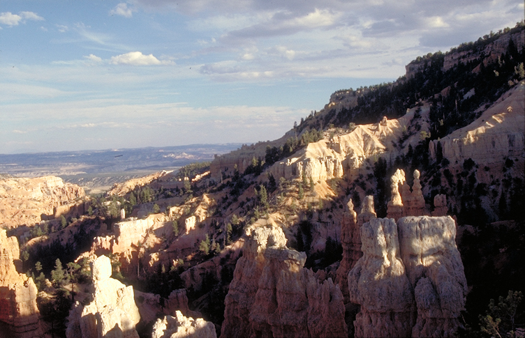
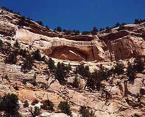
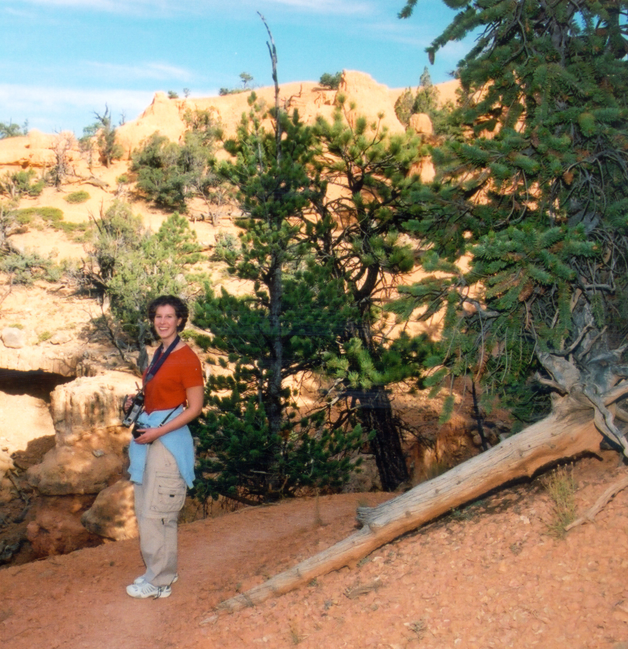
Pine trees thrive where little else can by sending their roots deep into the orange and cream-colored sandstone in the ridges and valleys of Bryce Canyon National Park.
Public Domain. Photo by Jessica Dungan
Download Original (3008 x 2000 pixels, 1454.8 MB)
-
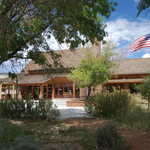
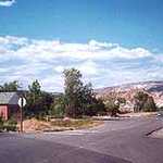
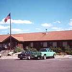
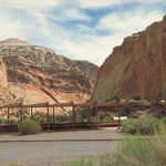
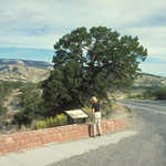
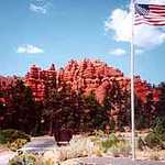
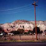
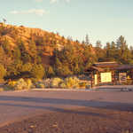
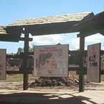
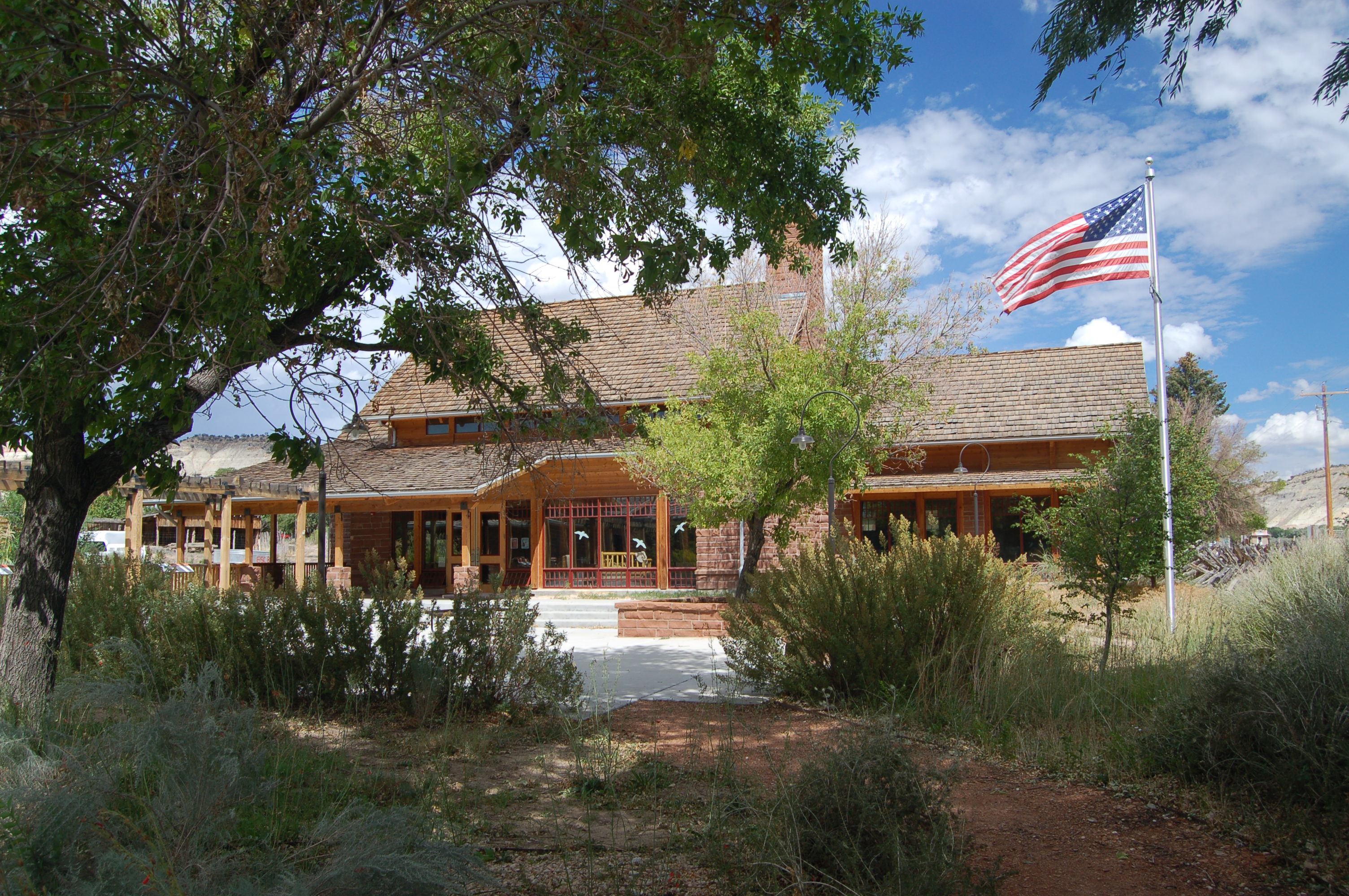
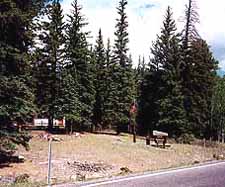
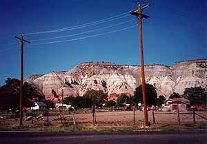
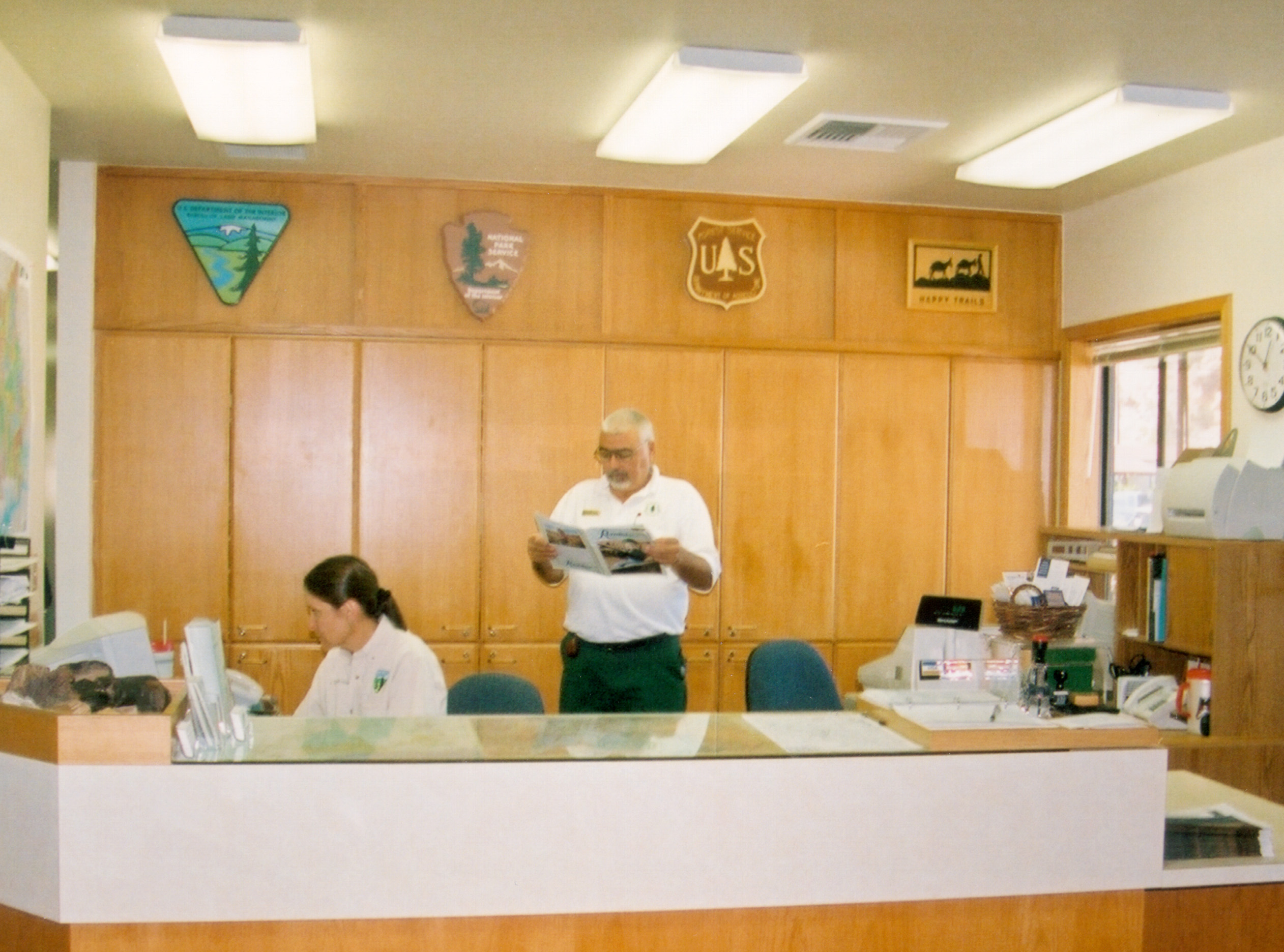
The American flag flies over the shadowed grounds of Cannonville's Grand Staircase-Escalante National Monument Visitor Center in September.
Public Domain. Photo by A. E. Crane
Download Original (3008 x 2000 pixels, 1575.7 MB)
-
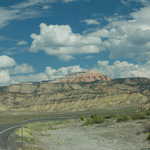
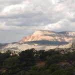
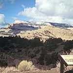
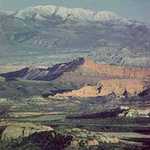
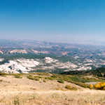
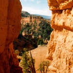
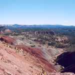
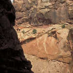
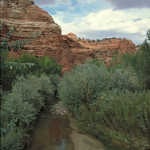
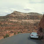
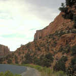
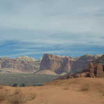
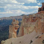
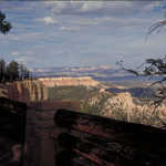
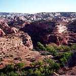
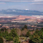
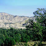
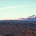
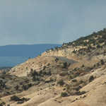
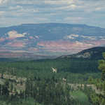
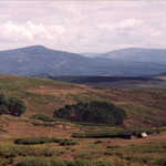
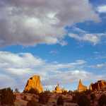
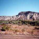
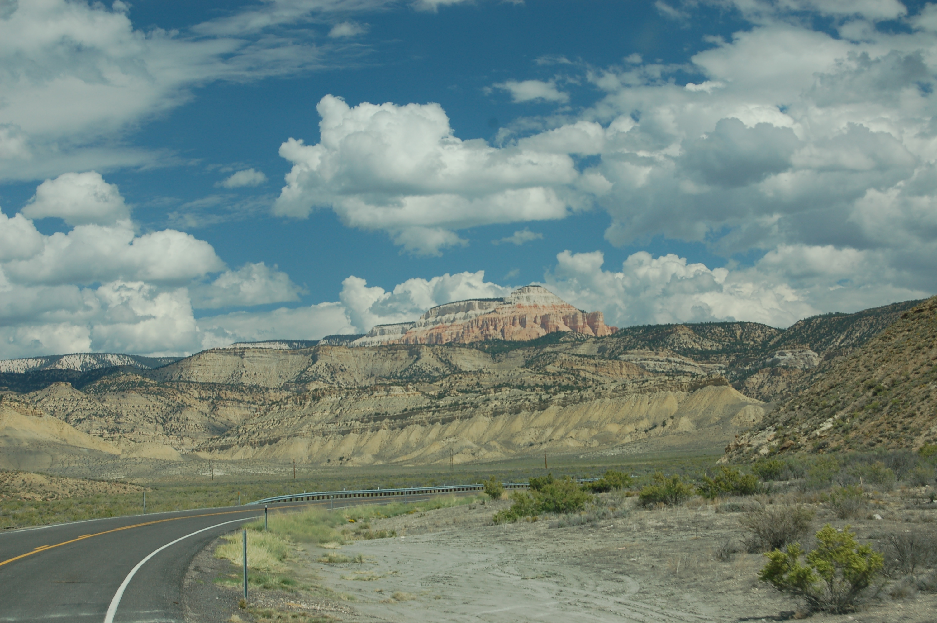
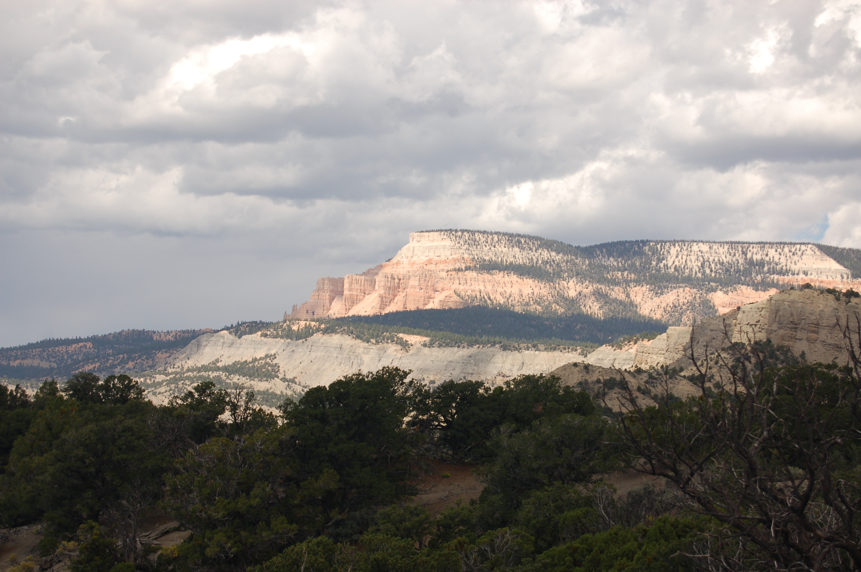
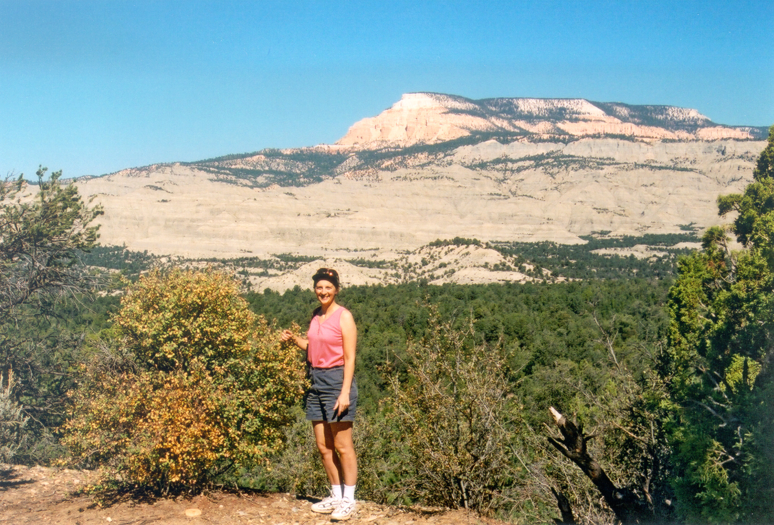
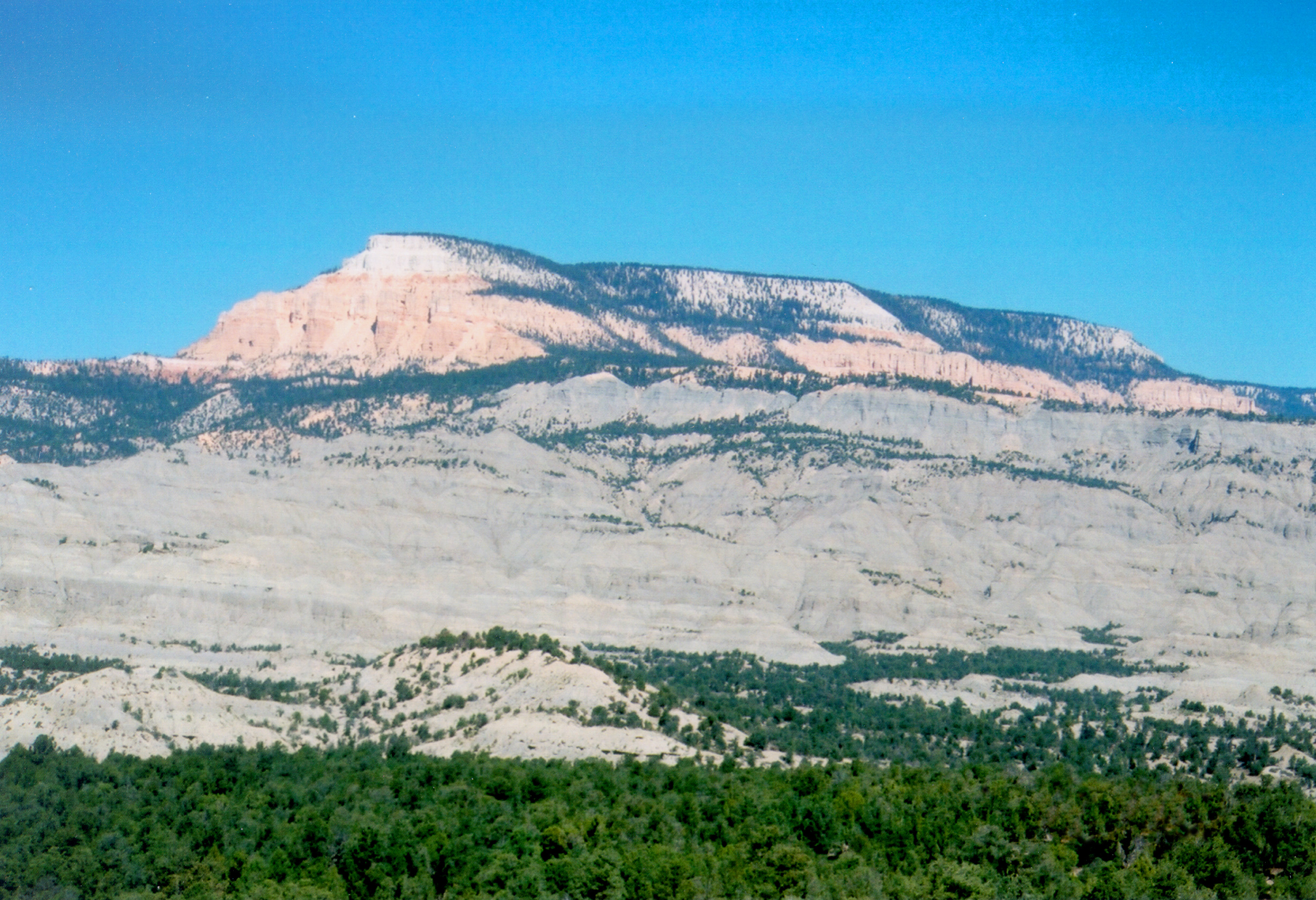
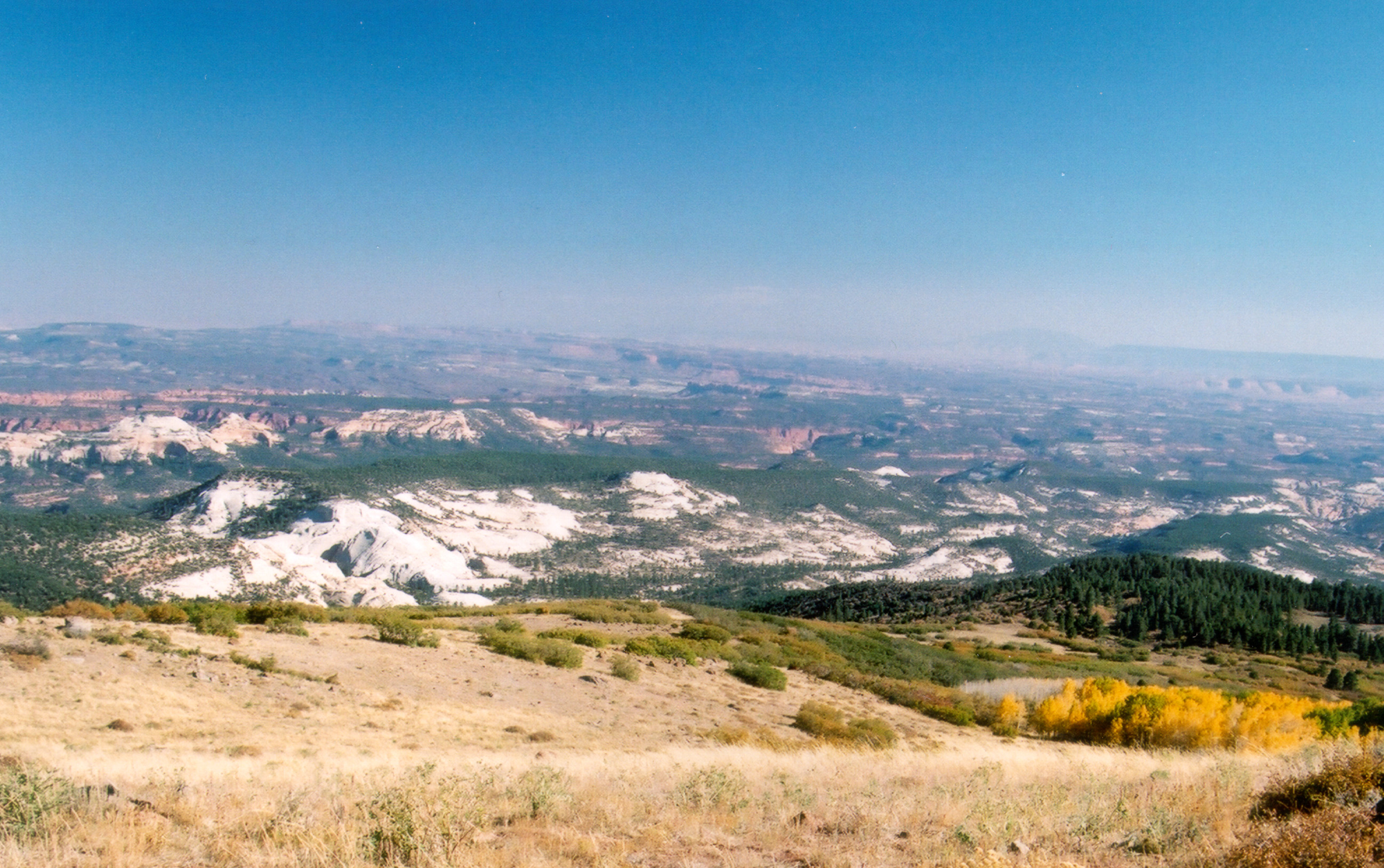
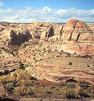
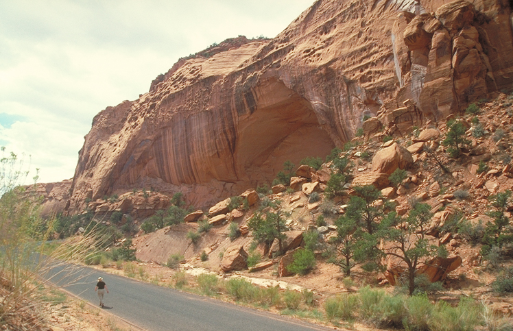
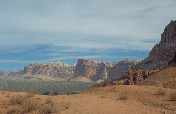
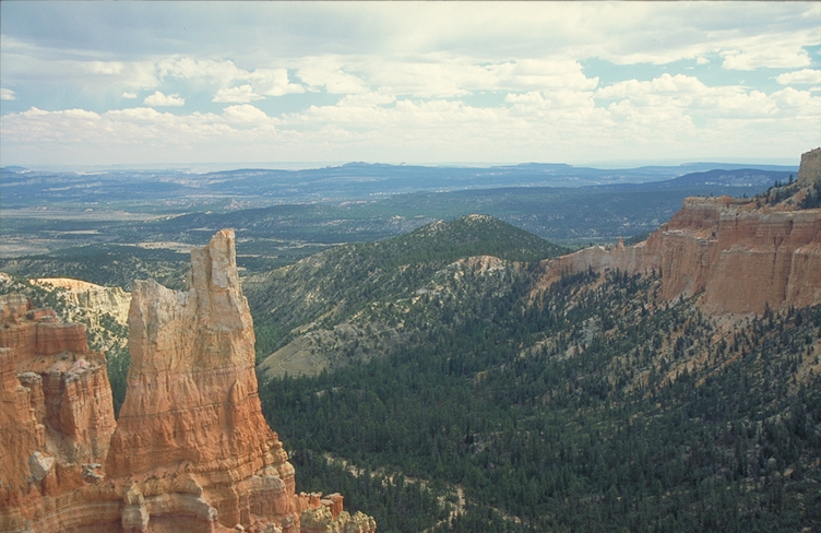
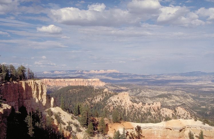
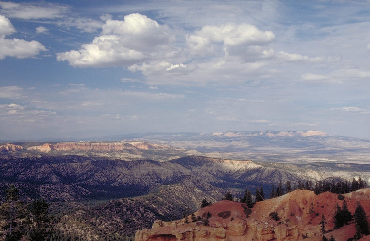
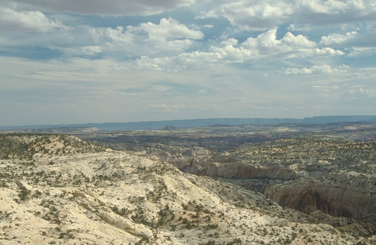
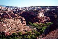
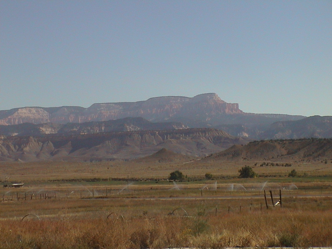
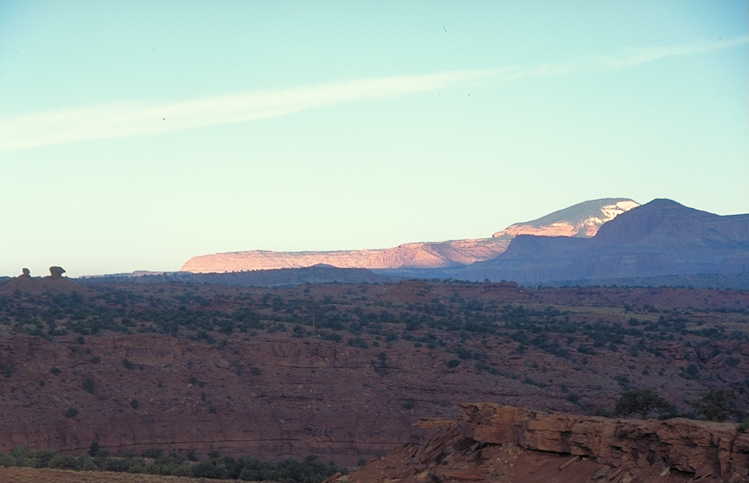
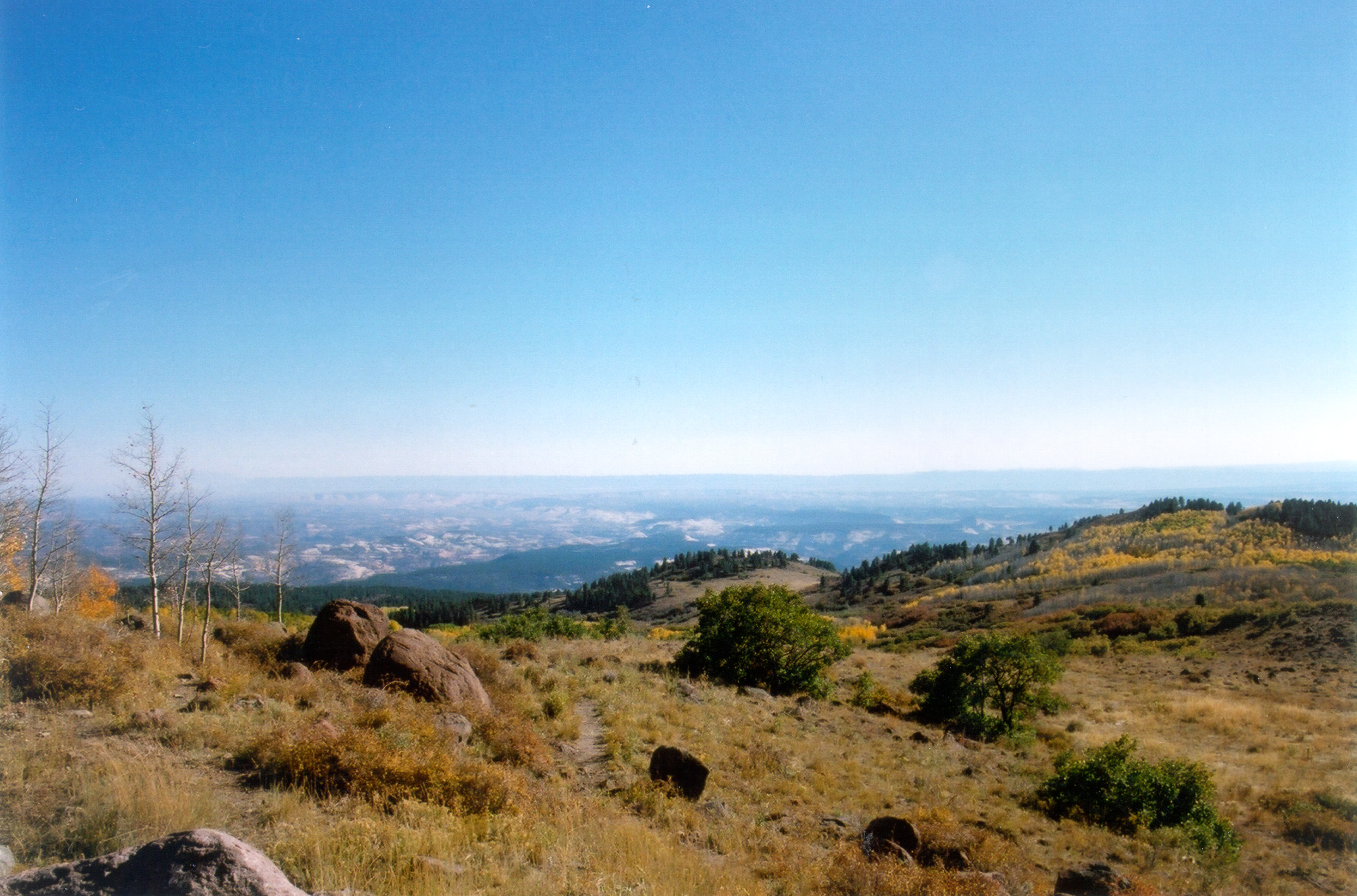
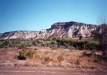
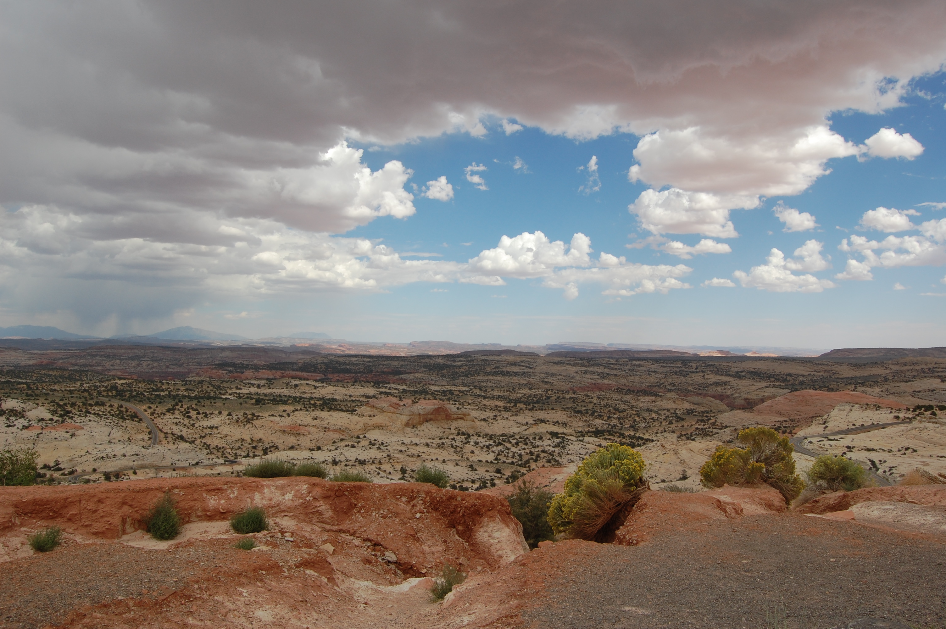
The forest-topped bluff of pink-and-white Powell Point rises above the gold and white buttes and mesas of the Escalante-Grand Staircase area of Scenic Byway 12 between Cannonville and Henrieville.
Public Domain. Photo by A. E. Crane
Download Original (3008 x 2000 pixels, 1551.3 MB)
-
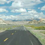
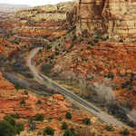
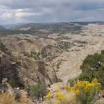
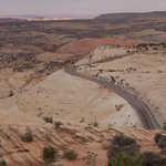
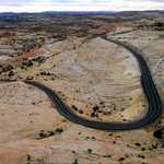
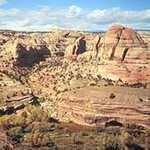
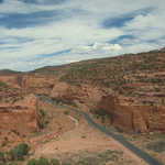
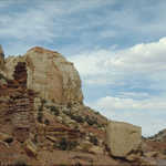
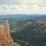
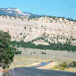
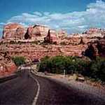
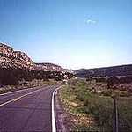
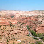
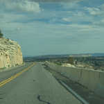
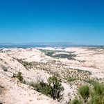
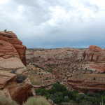
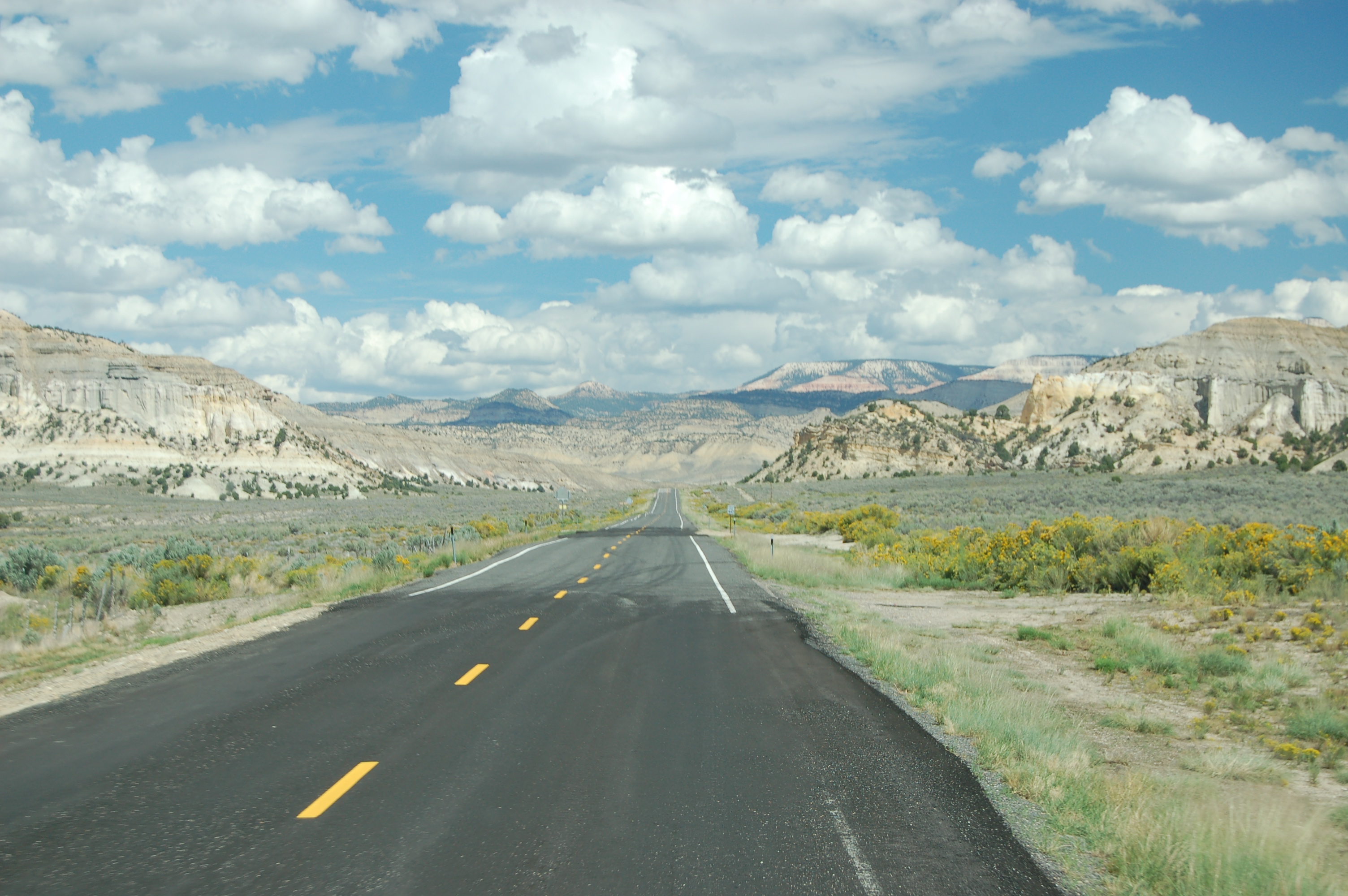
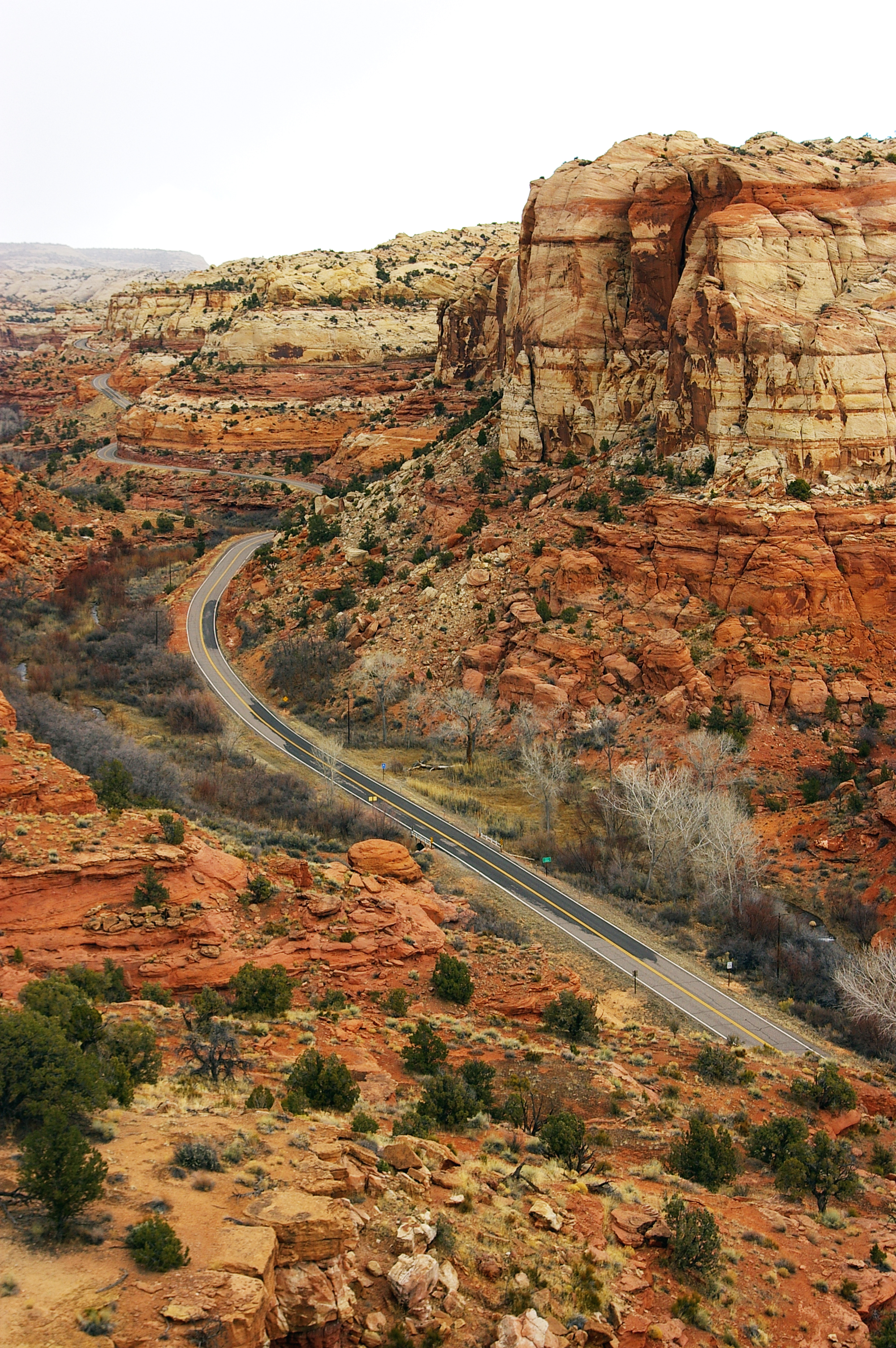
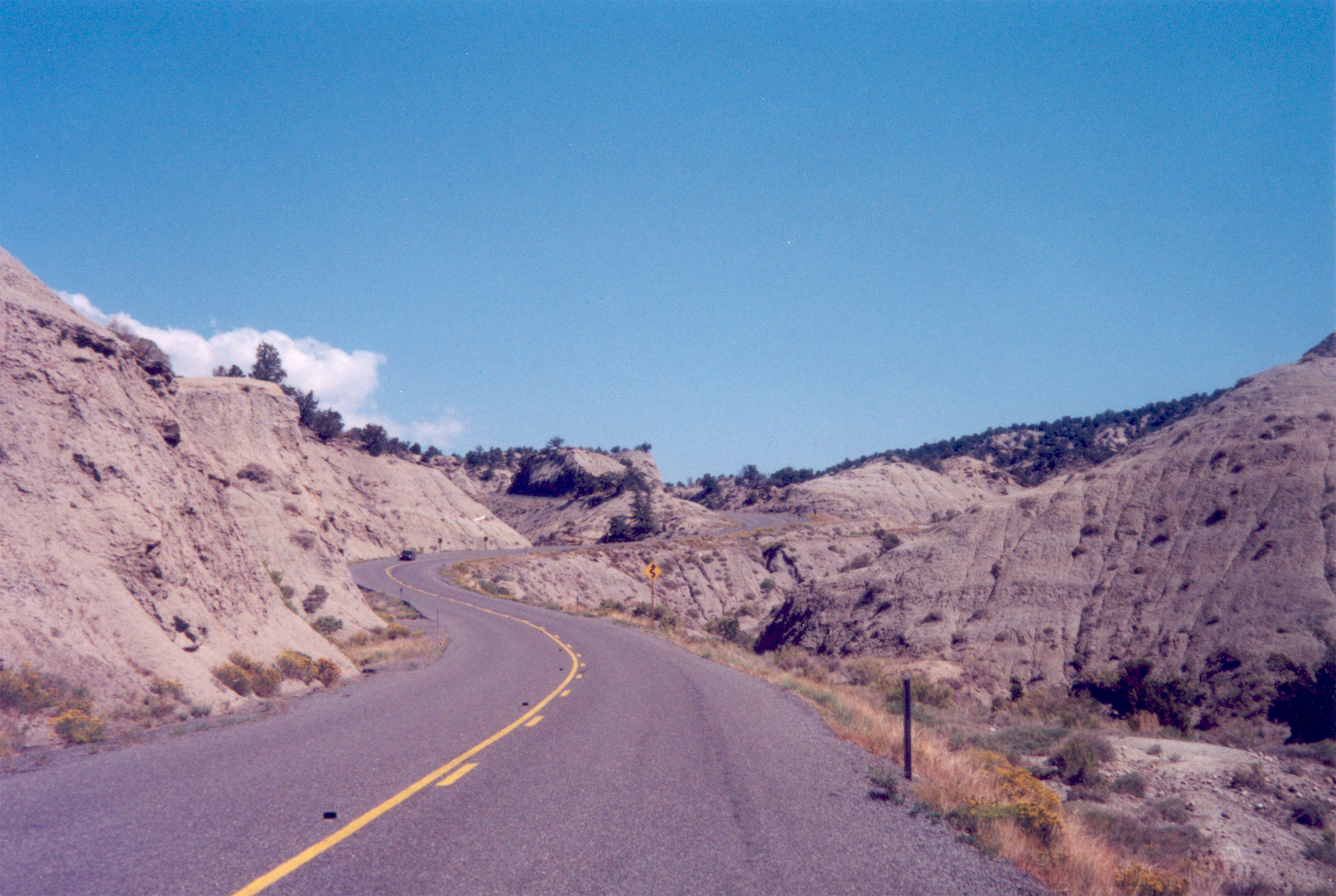
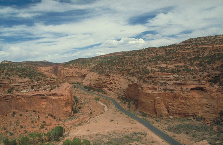
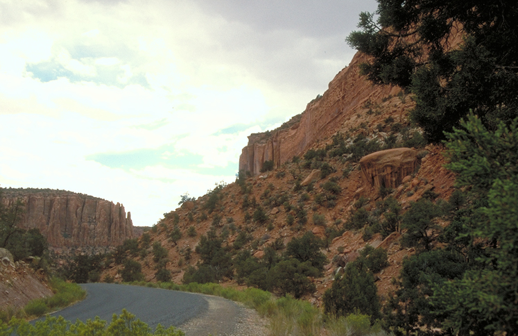
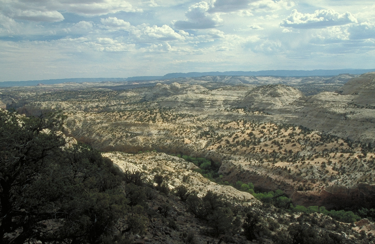
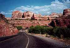
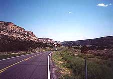
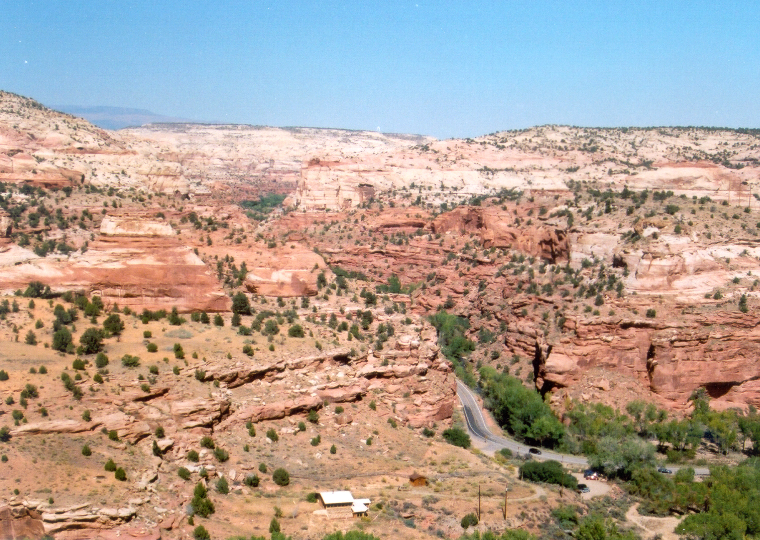
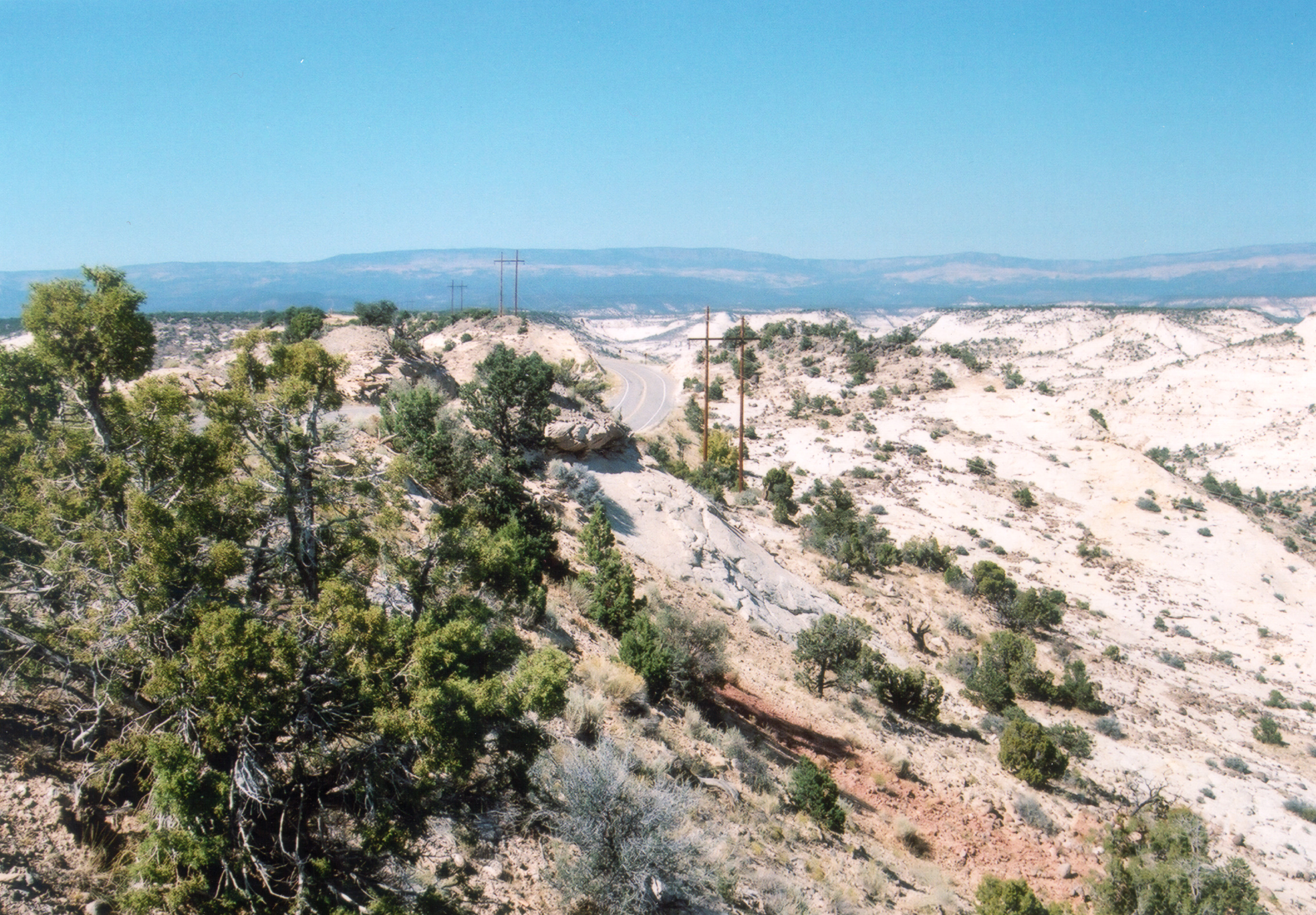
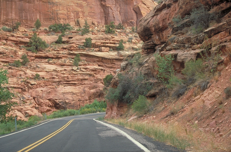
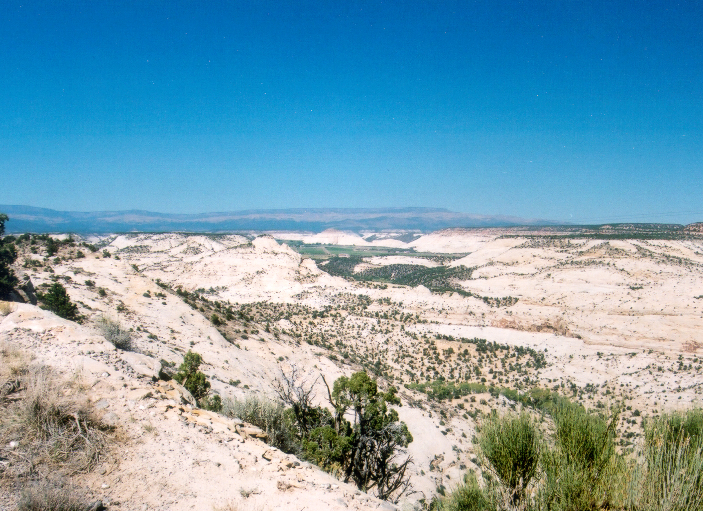
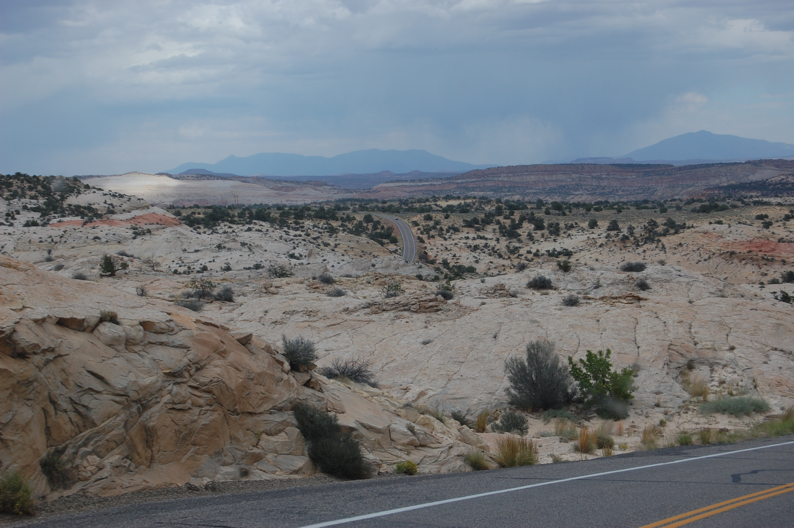
Scenic Byway 12 lies ahead between multicolored buttes and mesas in the Escalante-Grand Staircase National Monument.
Public Domain. Photo by A. E. Crane
Download Original (3008 x 2000 pixels, 1524.5 MB)
-
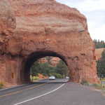
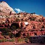
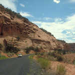
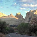
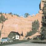
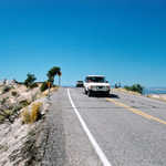
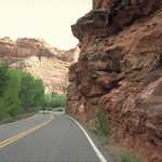
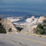
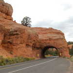
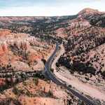
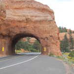
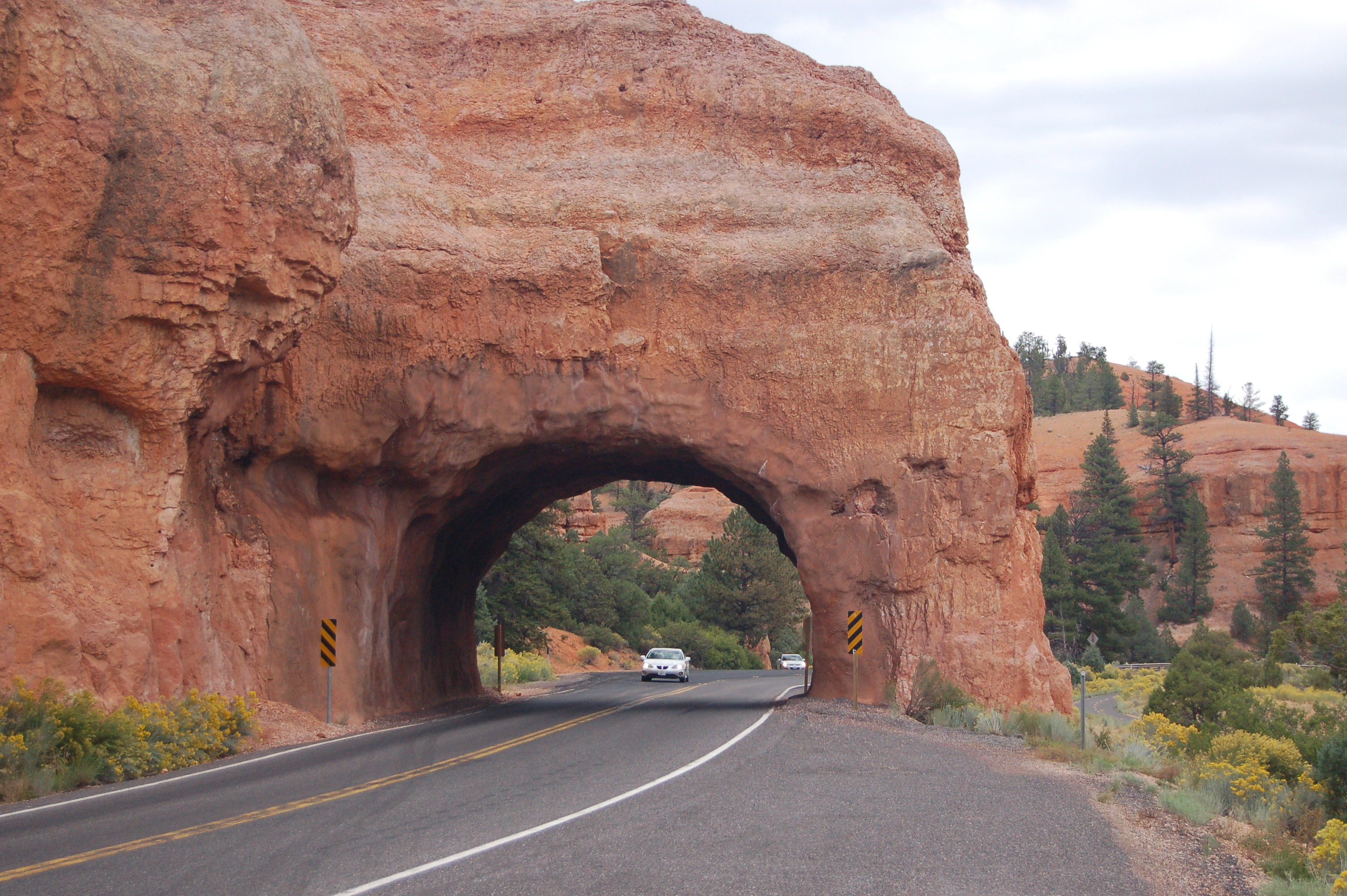
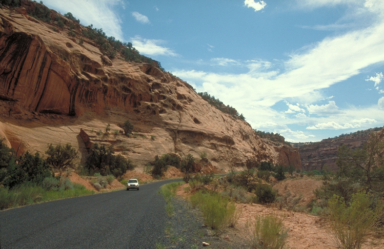
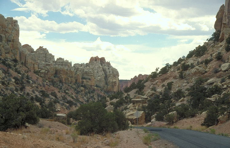
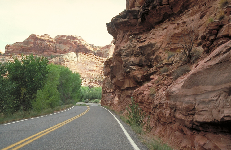
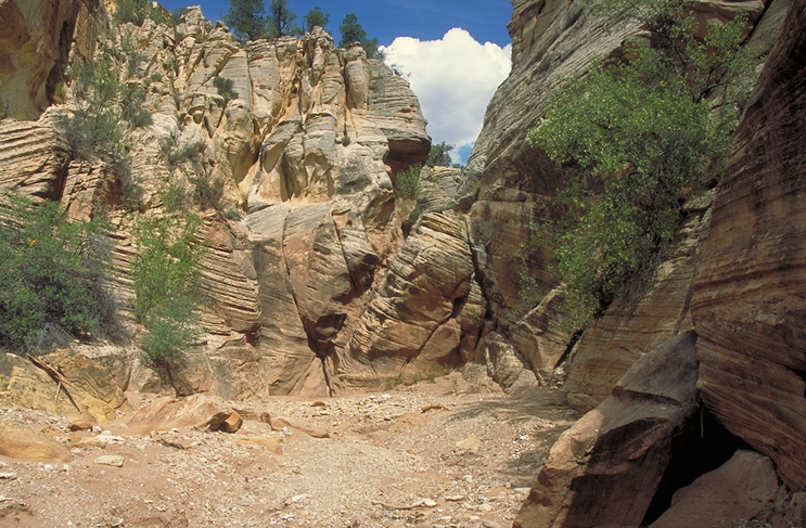
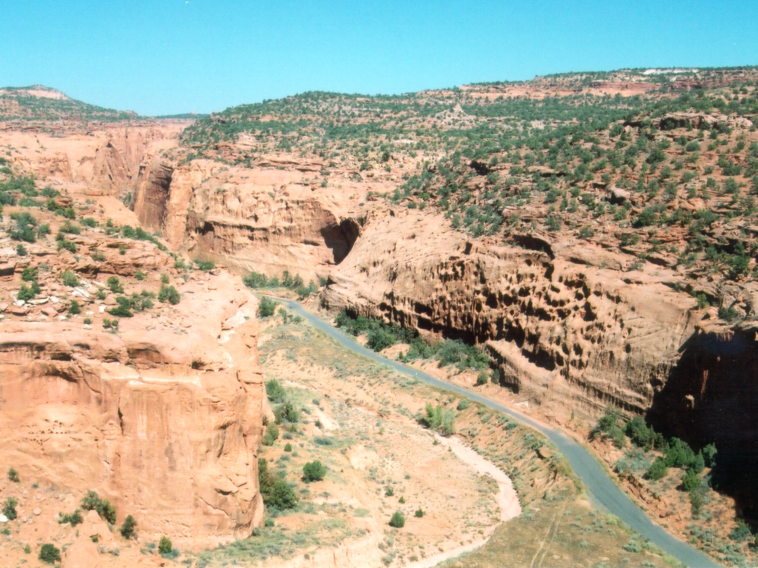
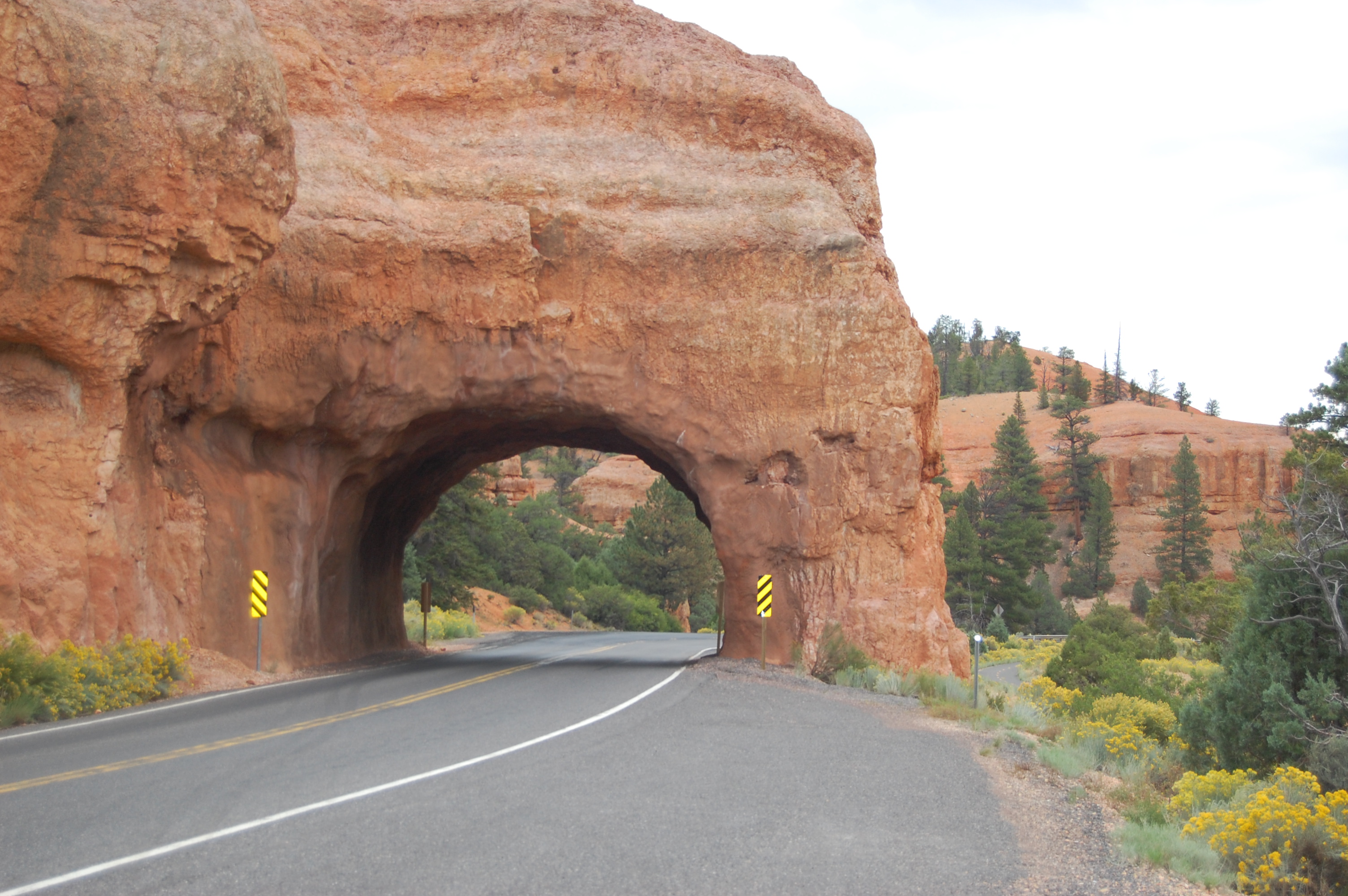
A car is about to drive through one of the tunnels on Scenic Byway 12 in Utah.
Public Domain. Photo by A. E. Crane
Download Original (3008 x 2000 pixels, 1662.9 MB)
-
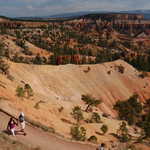
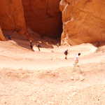
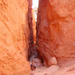
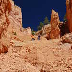
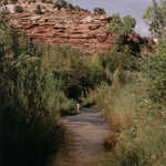
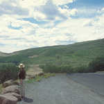
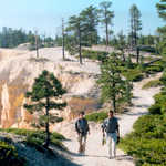
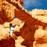
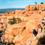
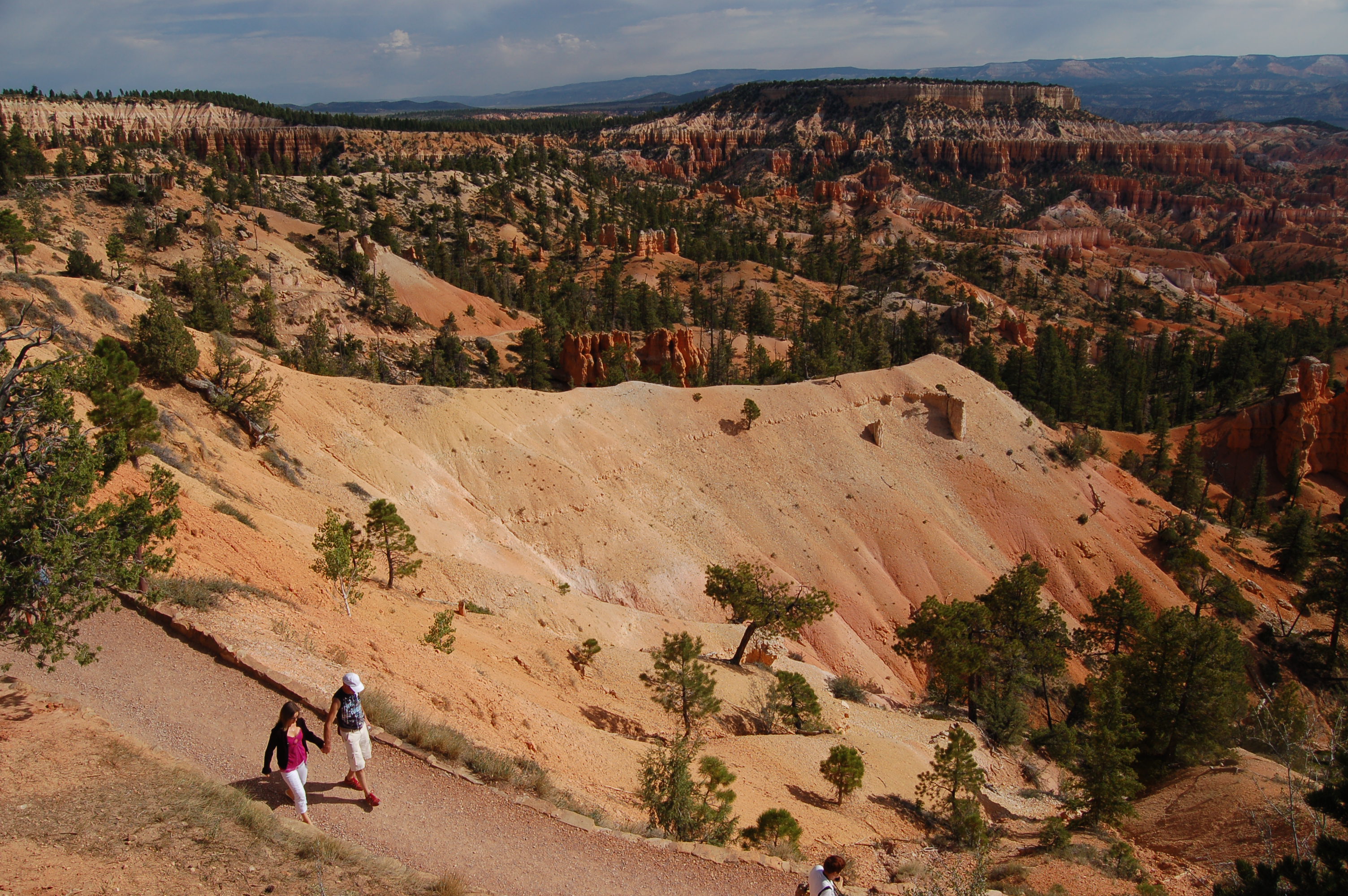
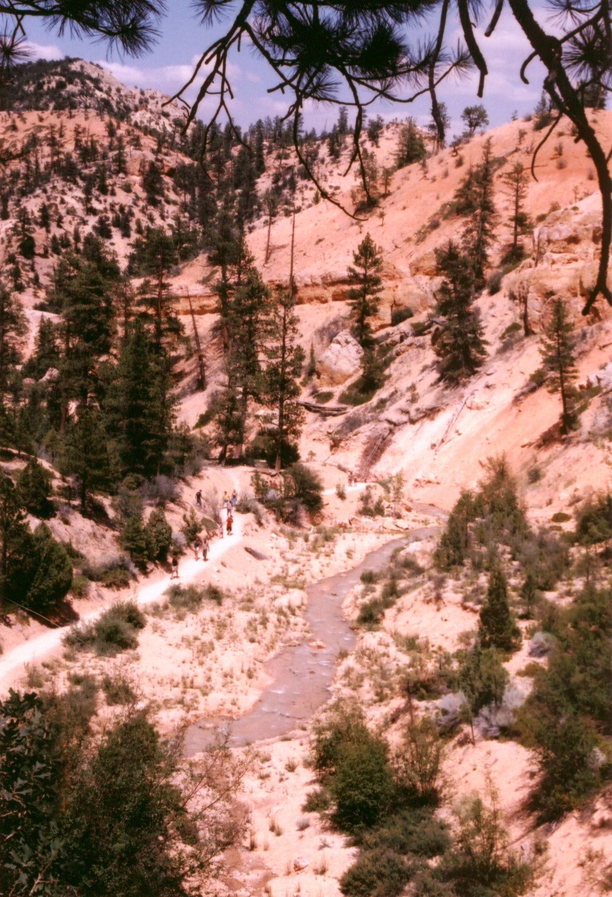
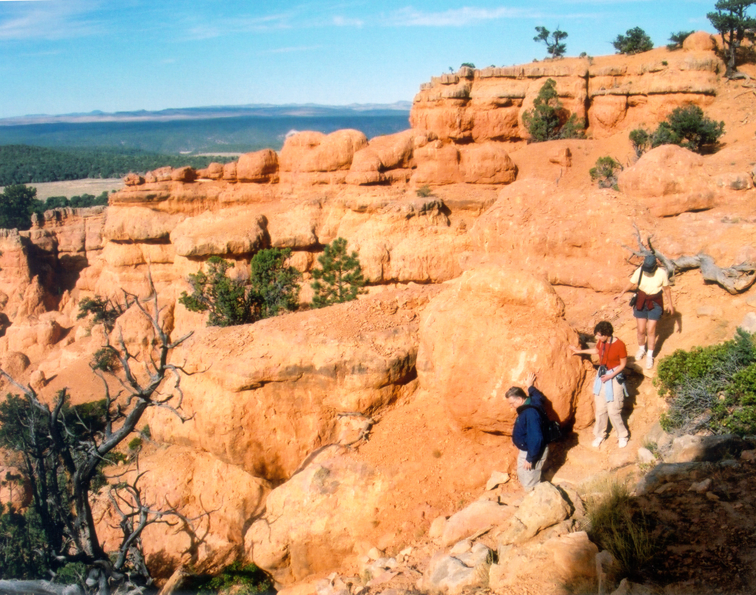
A couple strolls down one of the hiking trails that descend from Sunset Point in Bryce Canyon National Park.
Public Domain. Photo by A. E. Crane
Download Original (3008 x 2000 pixels, 1553.1 MB)
-
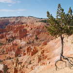
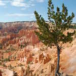
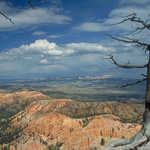
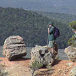
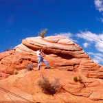
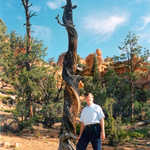
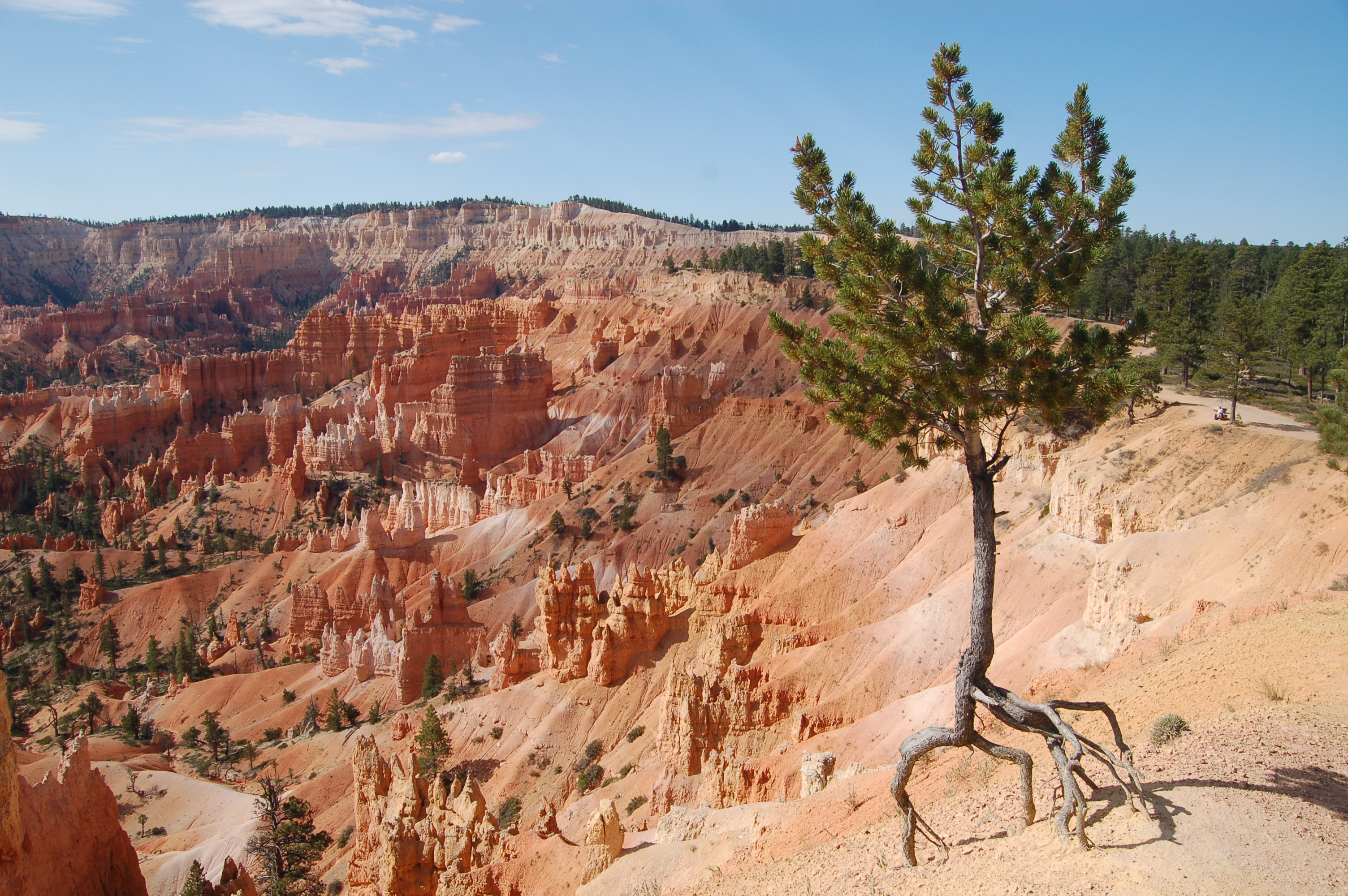
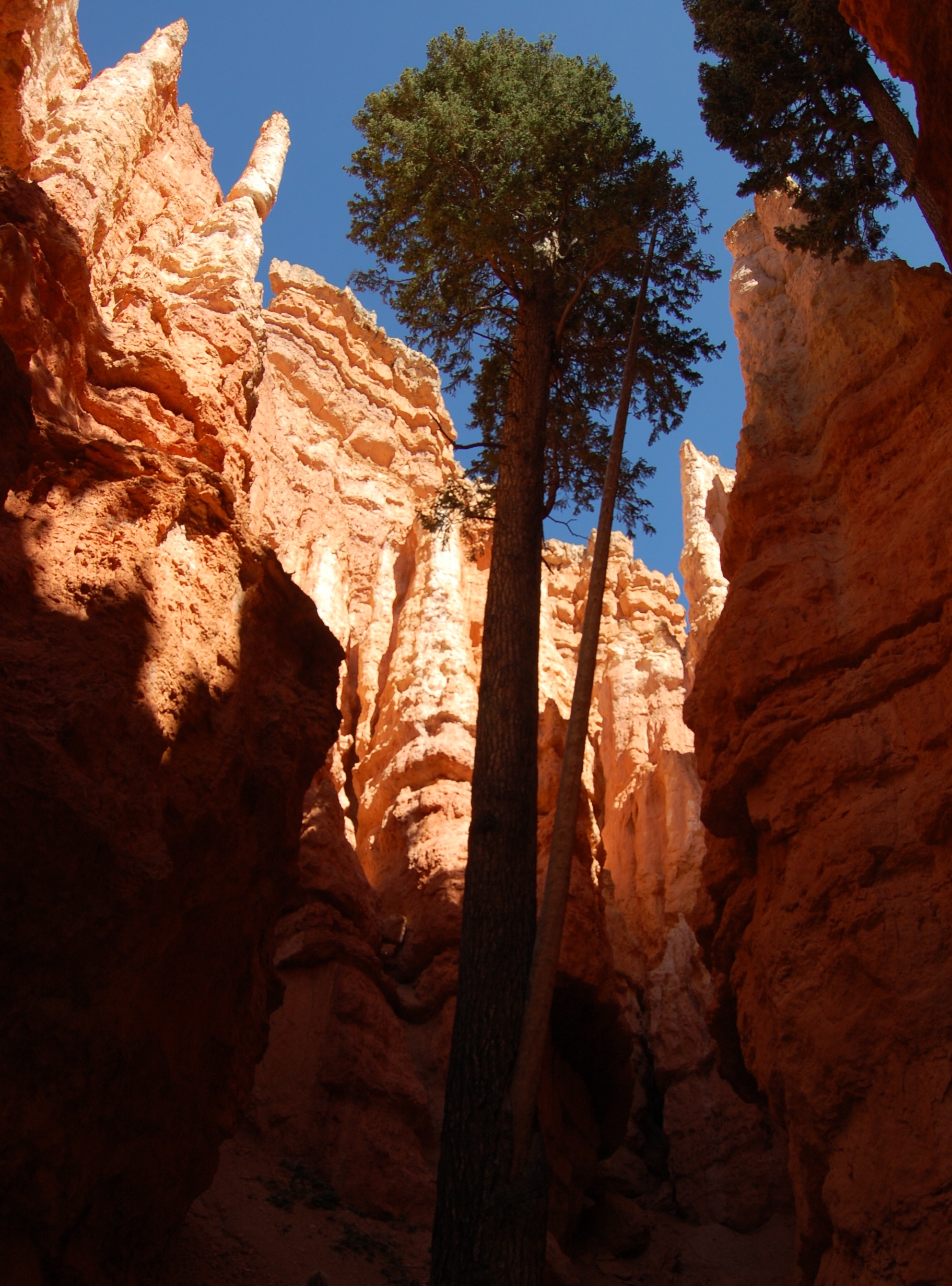
A small pine clings to the rim of Bryce Canyon near Sunset Point.
Public Domain. Photo by A. E. Crane
Download Original (3008 x 2000 pixels, 1566.1 MB)
-
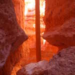
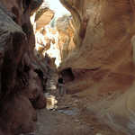
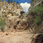
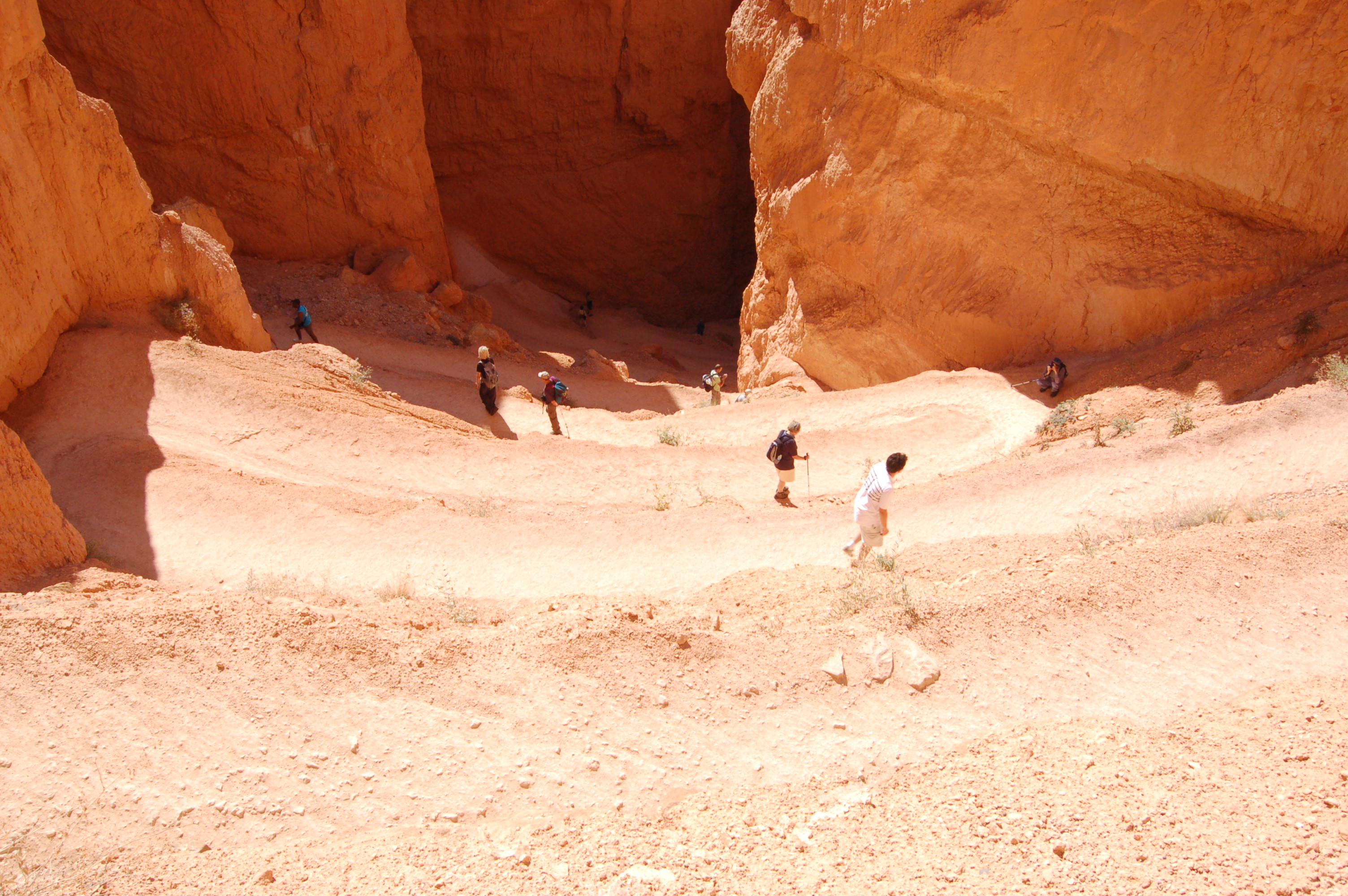
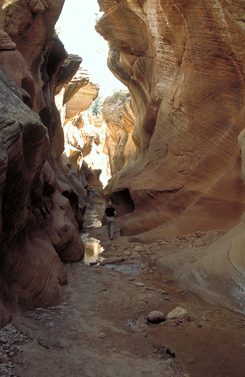
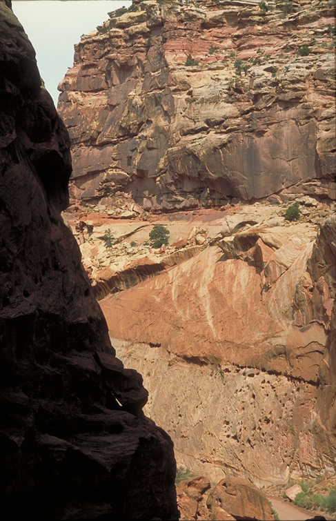
From Sunset Point in Bryce Canyon a trail descends into the canyon by a series of switchbacks. Far below the trail disappears into a shadowed slot canyon.
Public Domain. Photo by A. E. Crane
Download Original (3008 x 2000 pixels, 1537.9 MB)
-
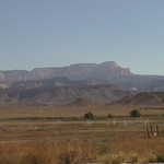
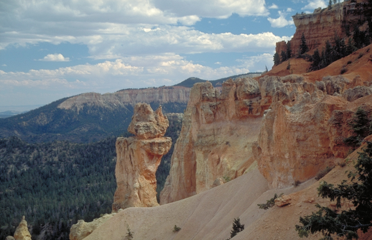
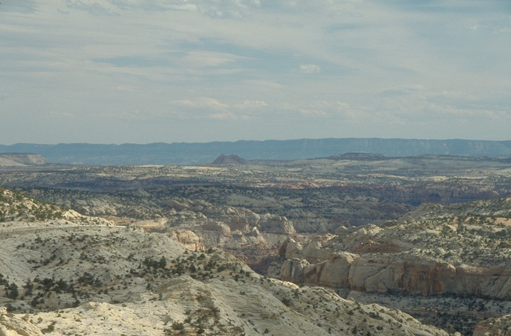
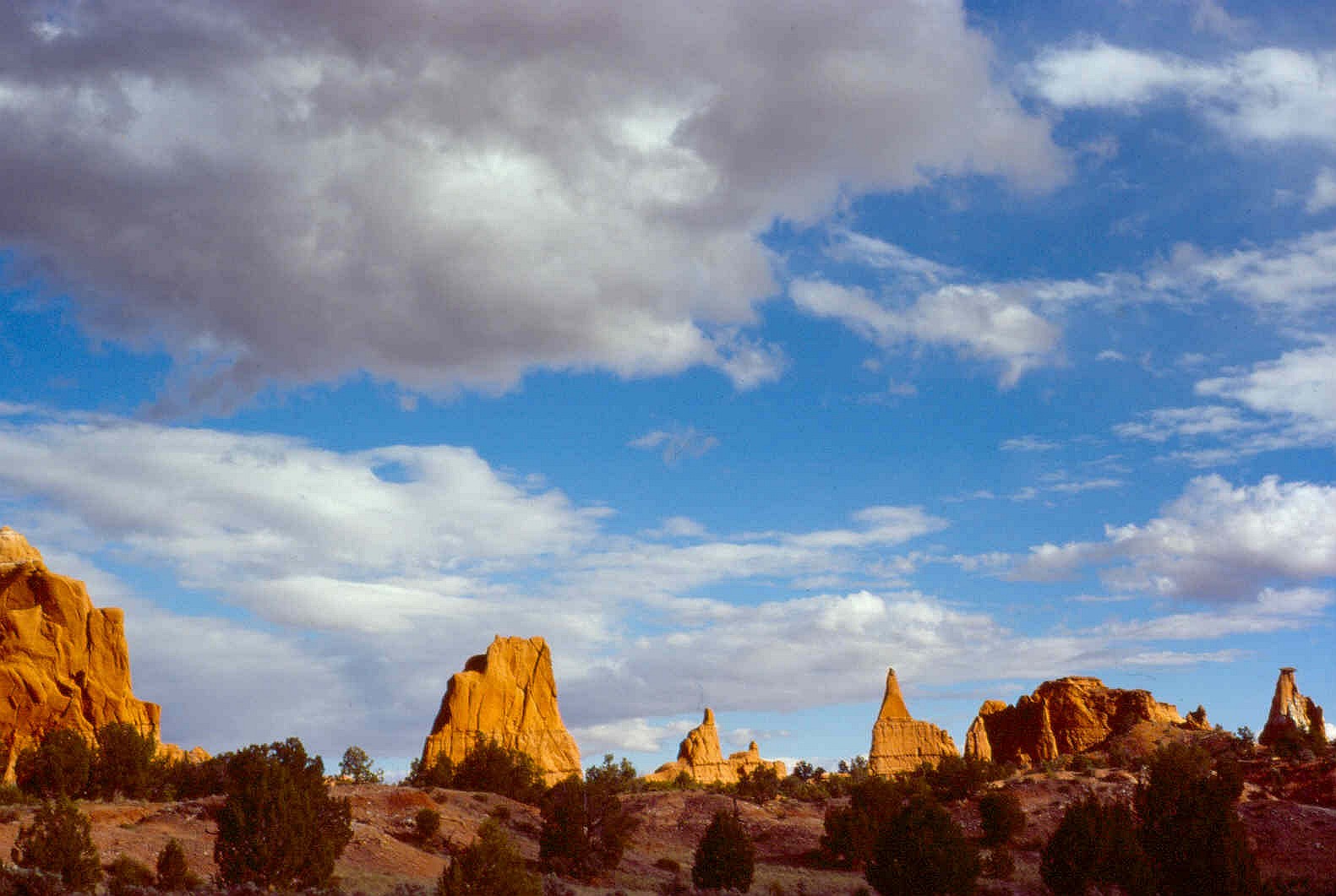
The pink and white formation called Powell Point rises from the gray-blue rock fields called "The Blues."
Public Domain. Photo by A. E. Crane
Download Original (3008 x 2000 pixels, 1529.0 MB)
-
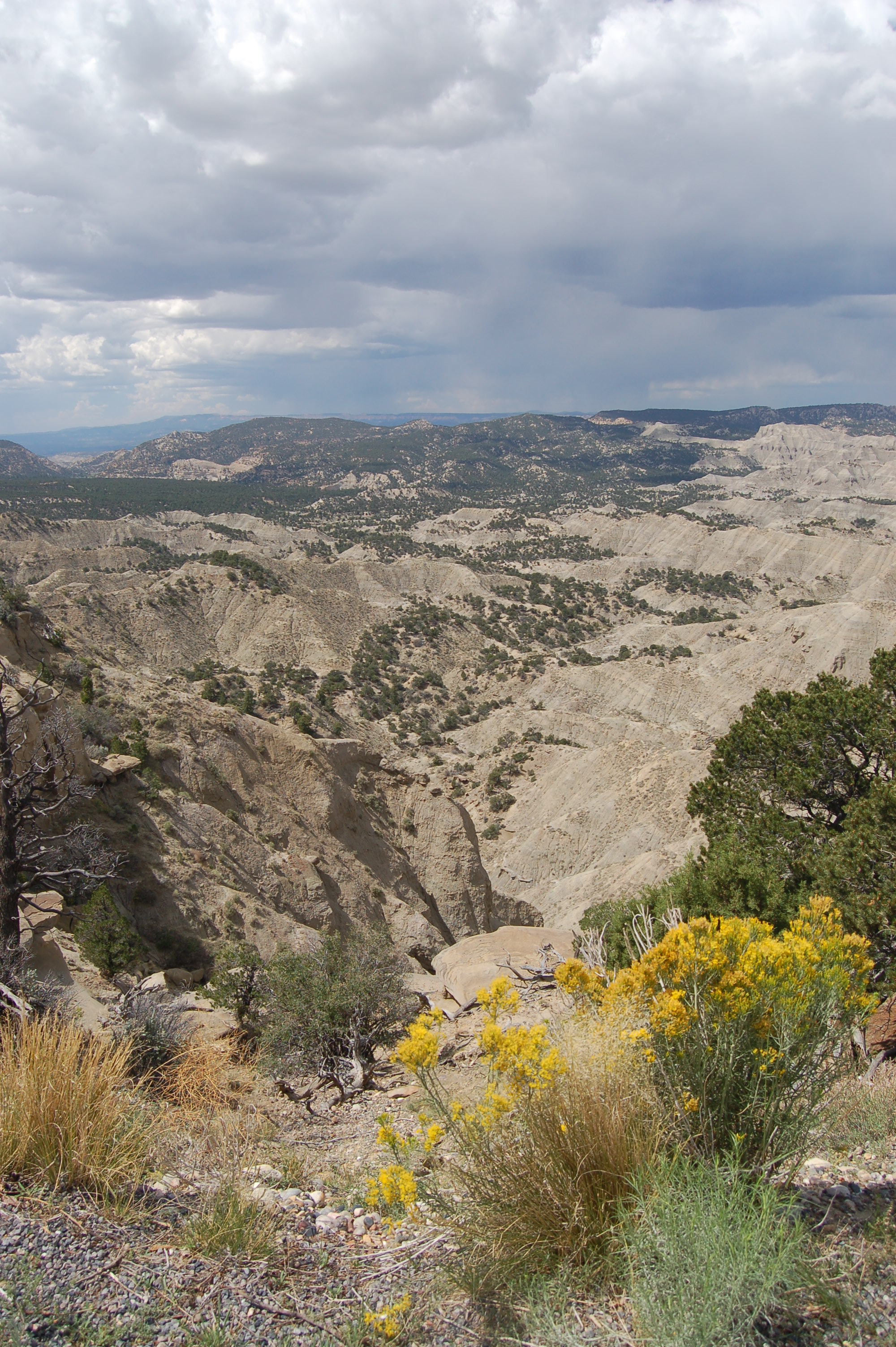
Yellow-flowered rabbitbrush flourishes on the rim of the Blues below Powell Point at the overlook and rest area on Scenic Byway 12.
Public Domain. Photo by A. E. Crane
Download Original (2000 x 3008 pixels, 1549.0 MB)
-
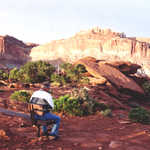
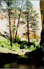
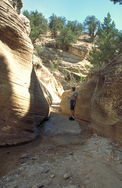
A hiker braves a stormy sky to hike the petrified forest trail at Escalante Petrified Forest State Park.
Public Domain. Photo by A. E. Crane
Download Original (3008 x 2000 pixels, 1413.9 MB)
-
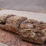
A huge petrified log lies in pieces before the restroom facilities in the campground at Escalante Petrified Forest State Park.
Public Domain. Photo by A. E. Crane
Download Original (3008 x 2000 pixels, 1547.1 MB)
-
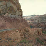
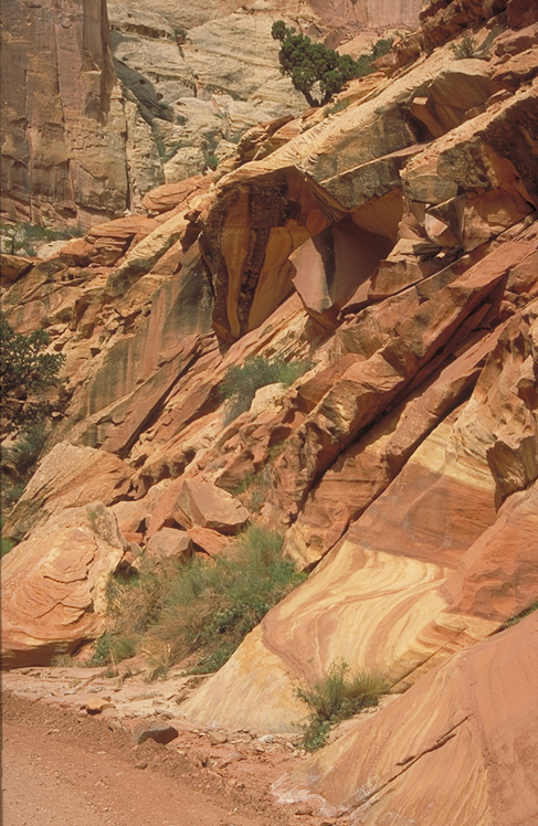
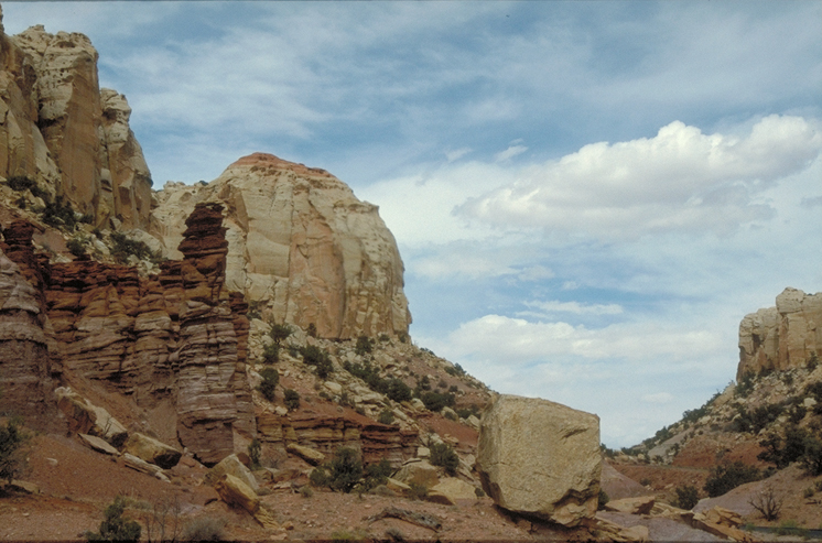
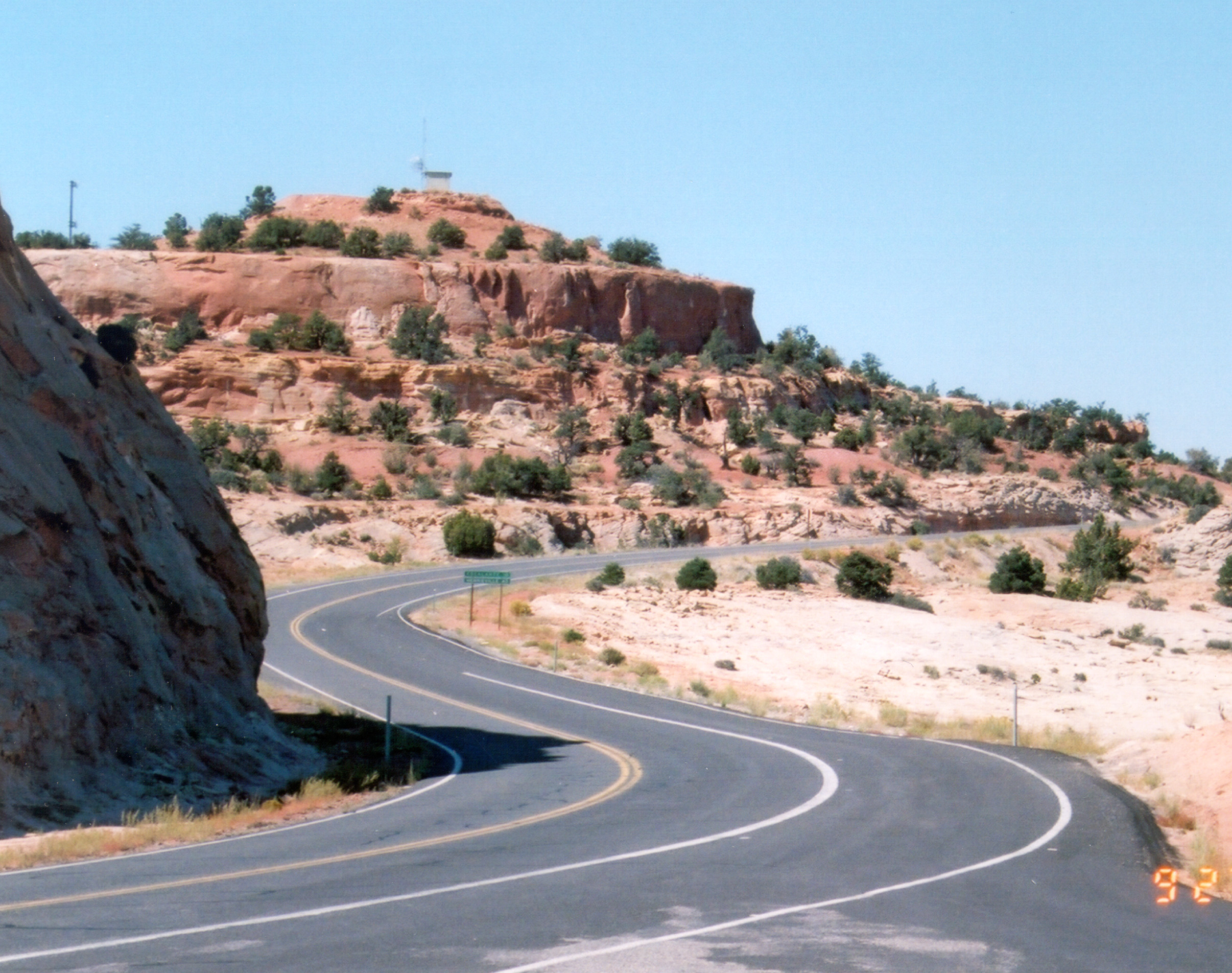
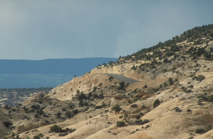
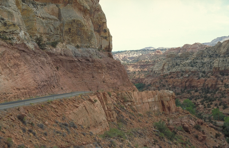
Scenic Byway 12 curves through white and pink Navajo sandstone far below the overlook known as Head of the Rocks.
Public Domain. Photo by A. E. Crane
Download Original (2000 x 3008 pixels, 1415.2 MB)
-
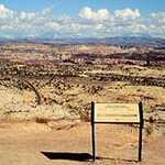
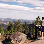
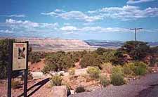
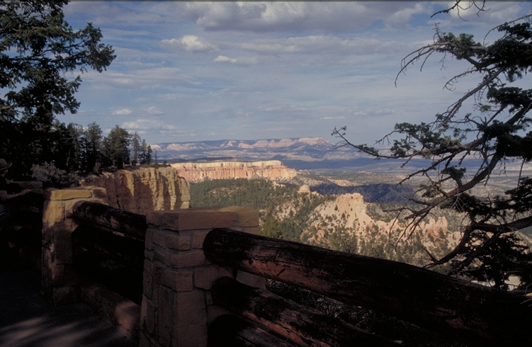
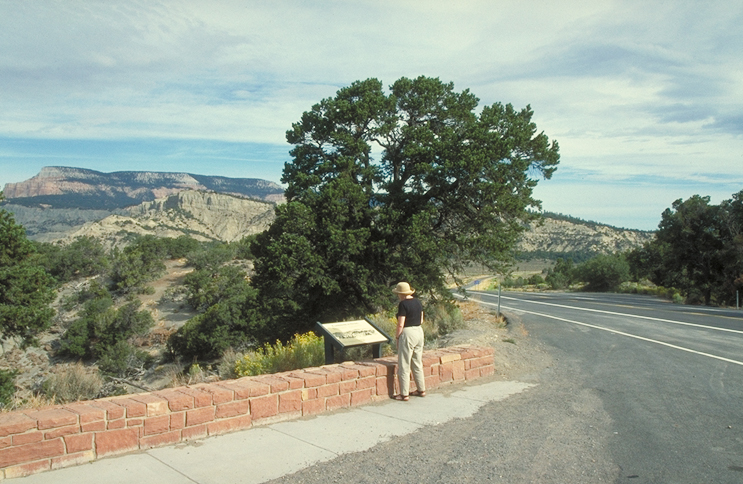
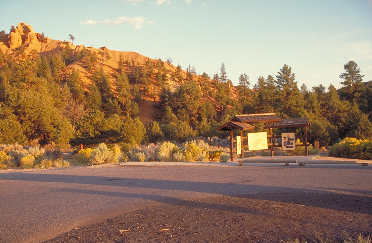
Roadside stop has fine view of Powell Point. An interpretive plaque tells all about it and the slate-gray rock formations of this part of the Grand Staircase, nicknamed "The Blues."
Public Domain.
Download Original (225 x 153 pixels, 15.3 KB)
-
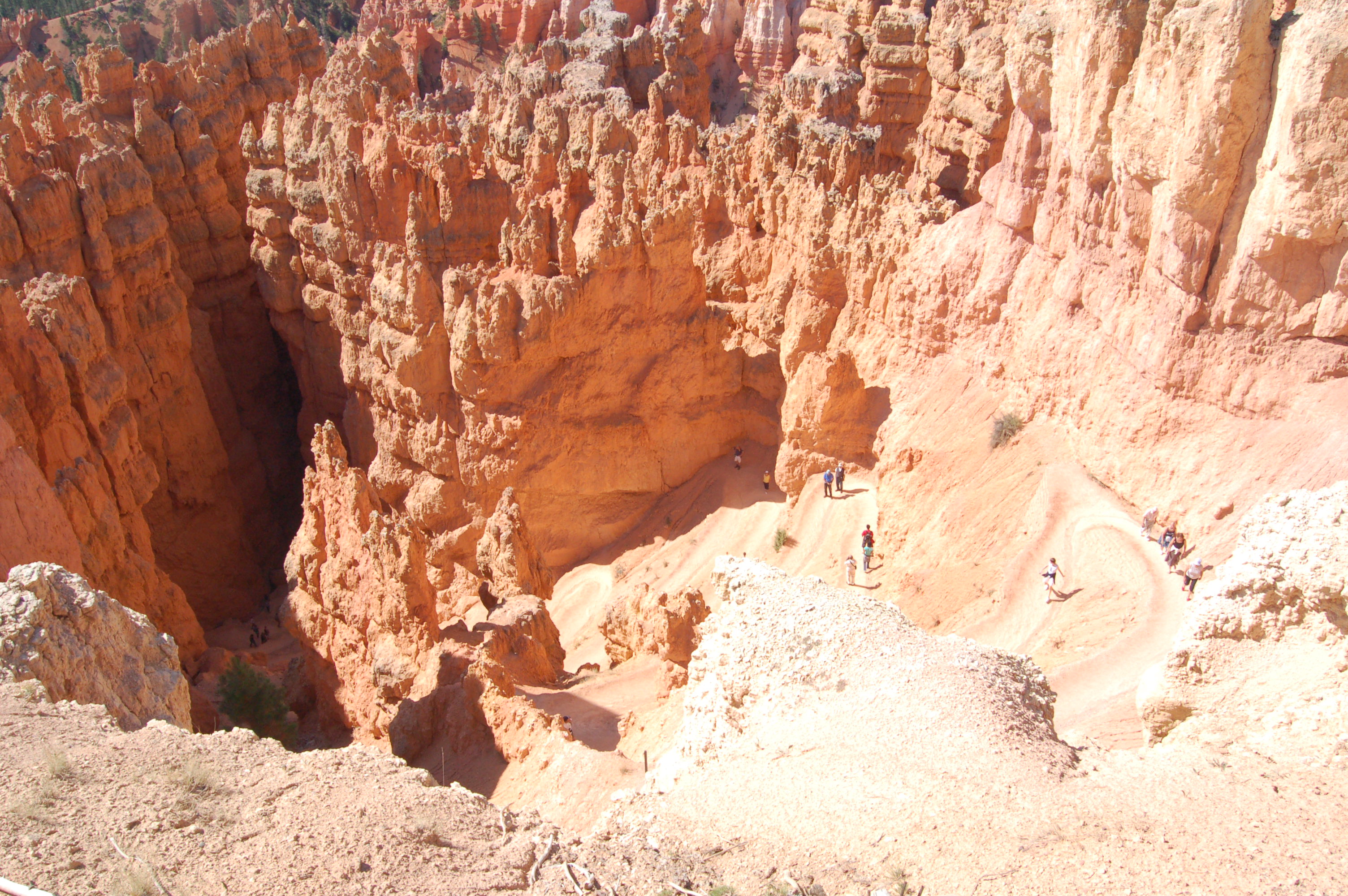
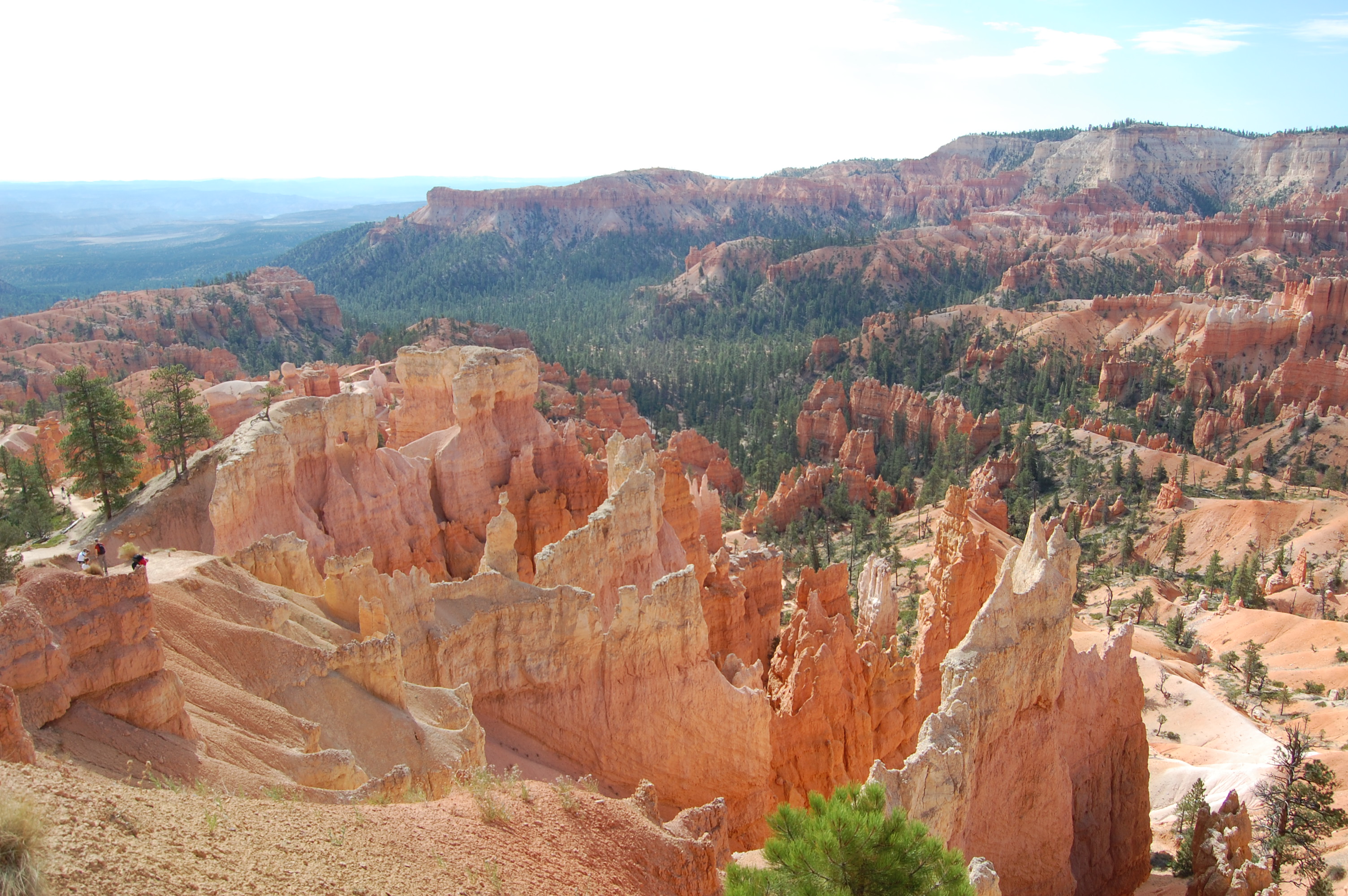
Hikers are scattered along several tiers of switchbacks on the trail below Sunset Point in Bryce Canyon.
Public Domain. Photo by A. E. Crane
Download Original (3008 x 2000 pixels, 1664.8 MB)
-
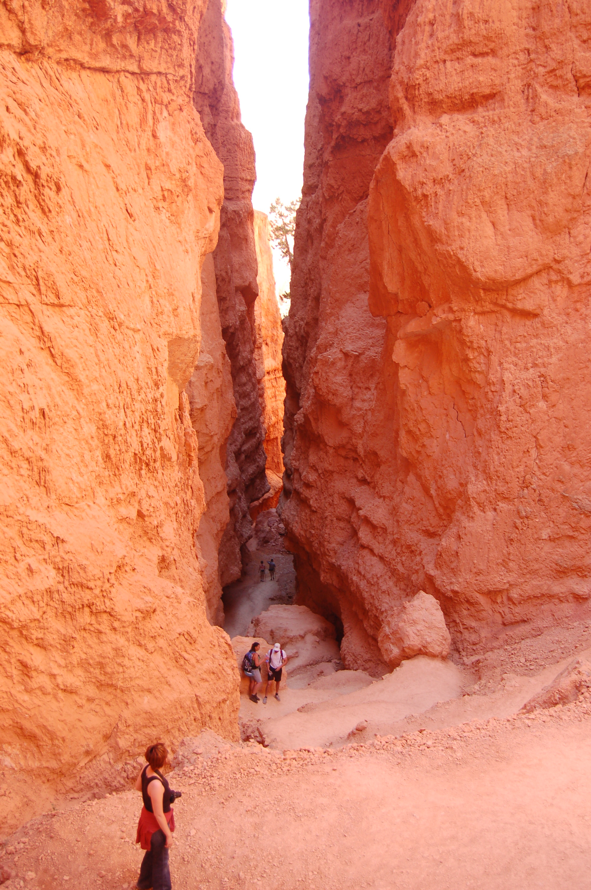
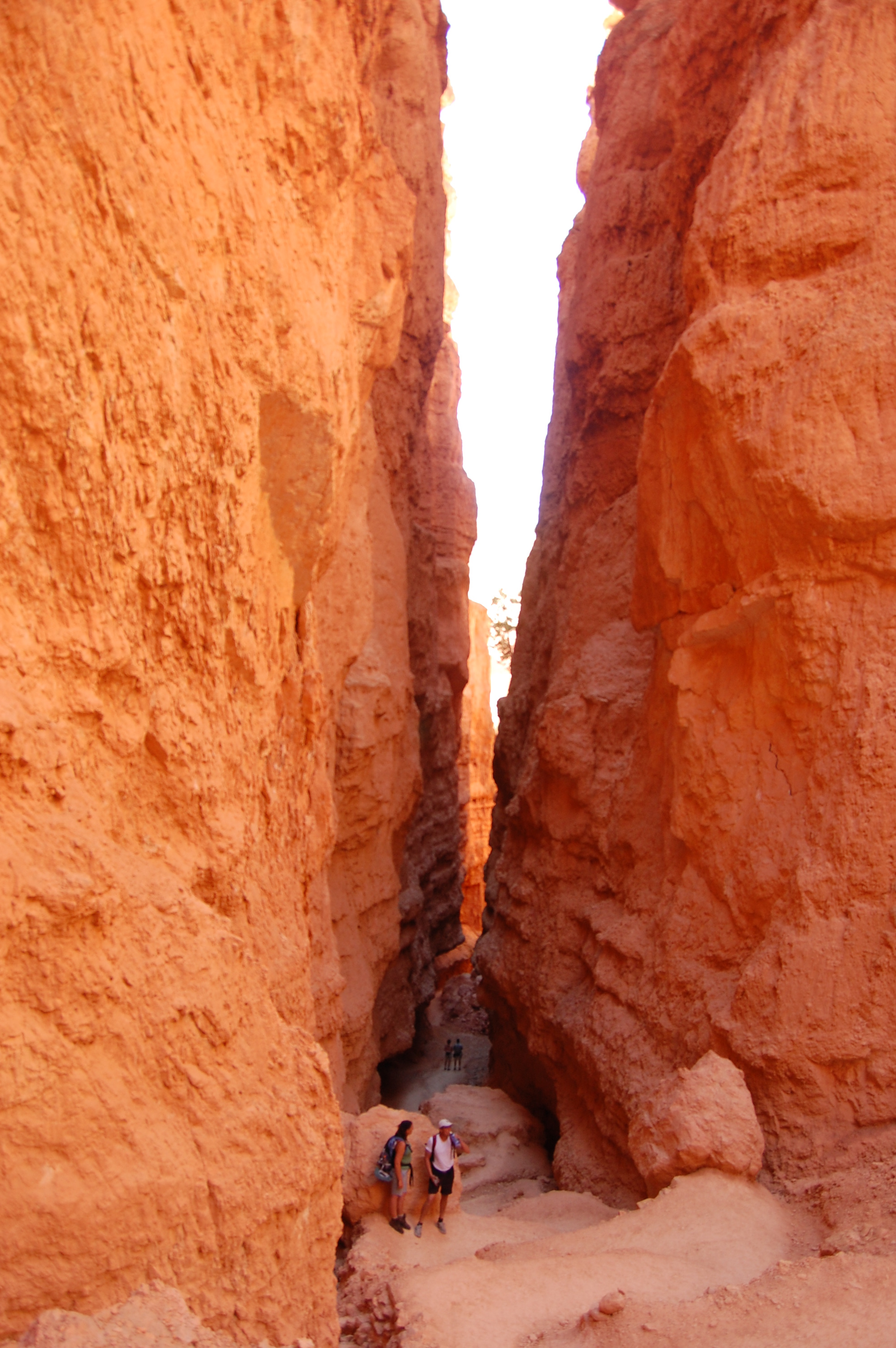
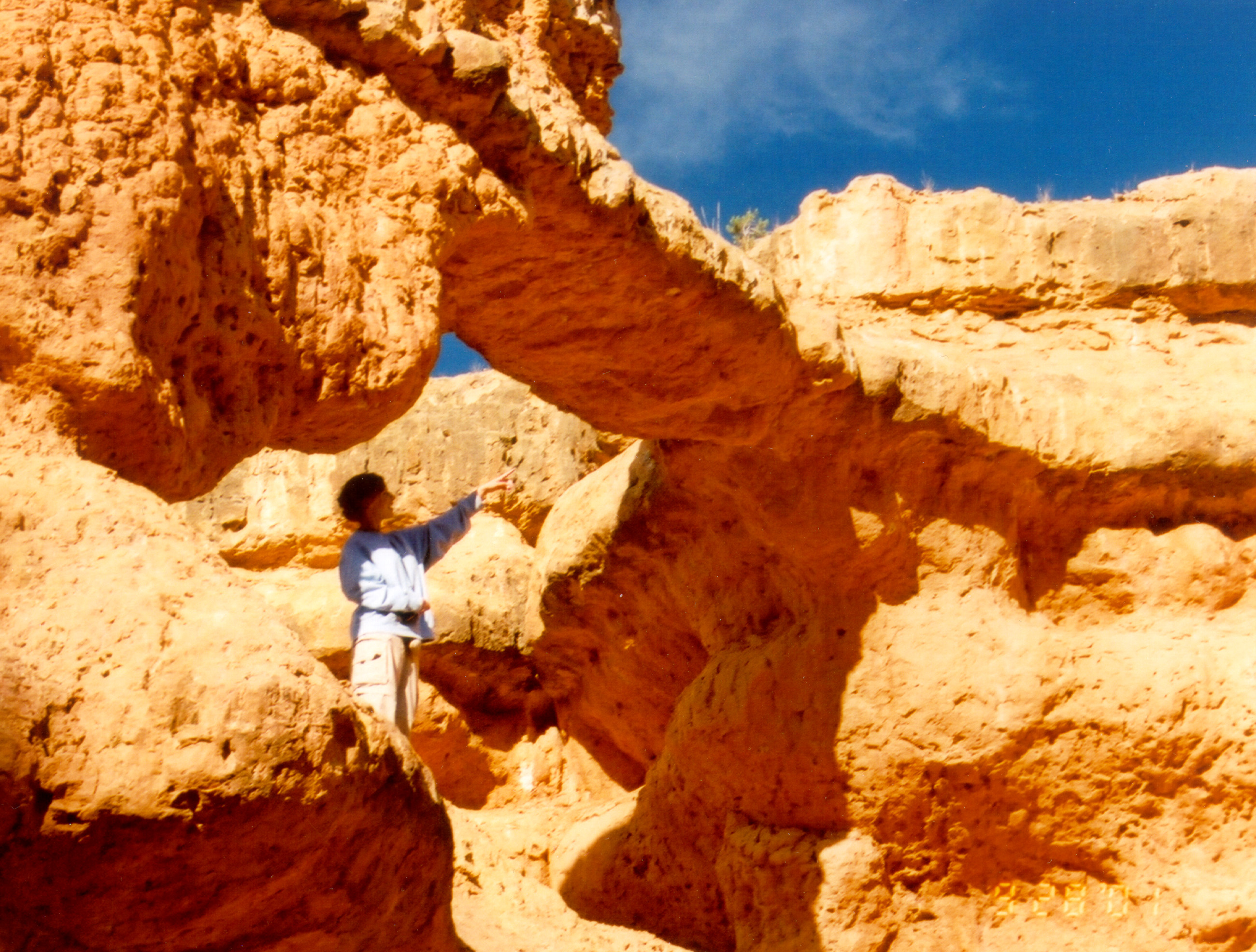
A visitor to Bryce Canyon looks ahead where the bottom of the Sunset Point trail disappears into a slot canyon.
Public Domain. Photo by A. E. Crane
Download Original (2000 x 3008 pixels, 1535.2 MB)
-
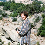
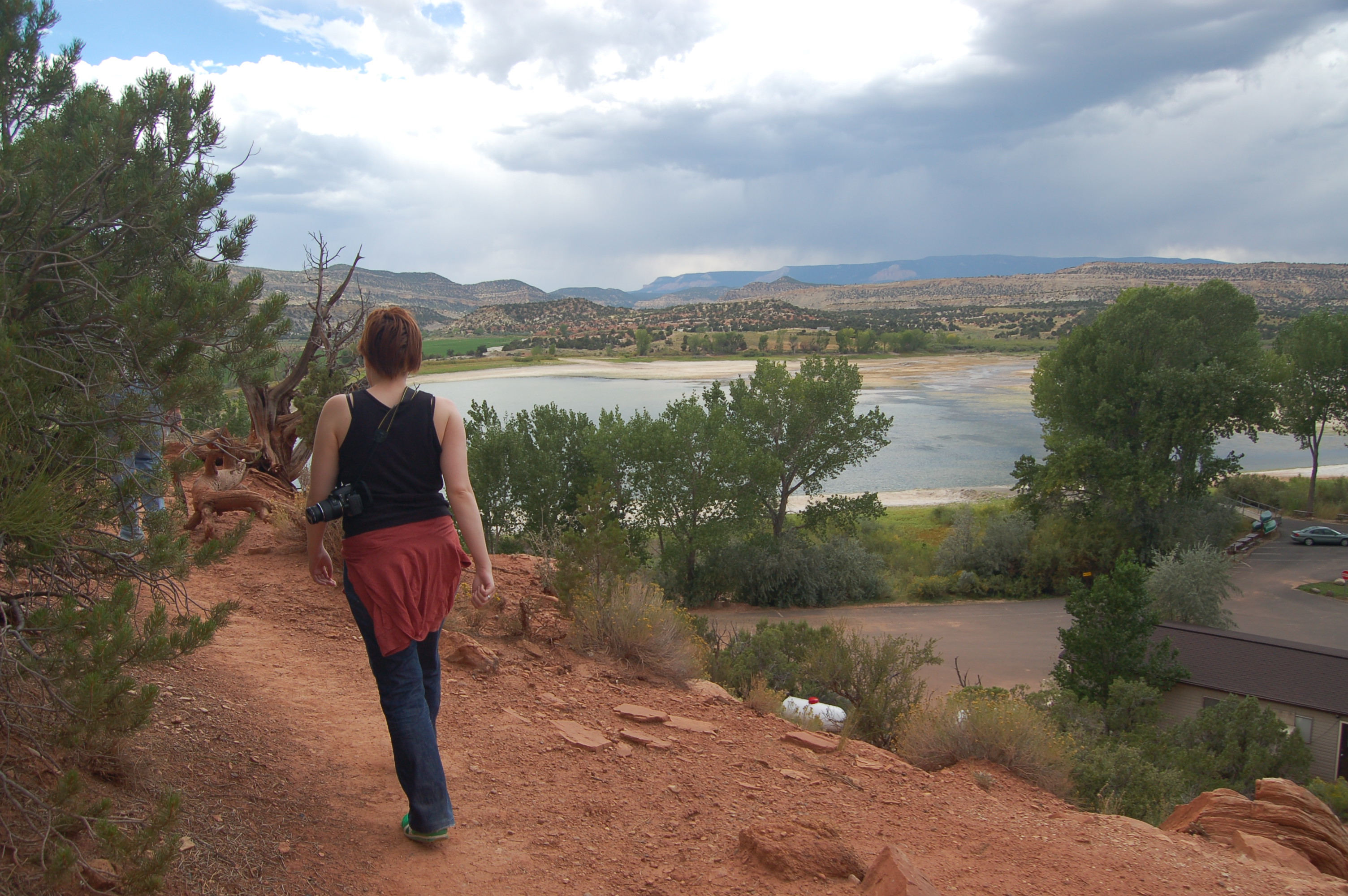
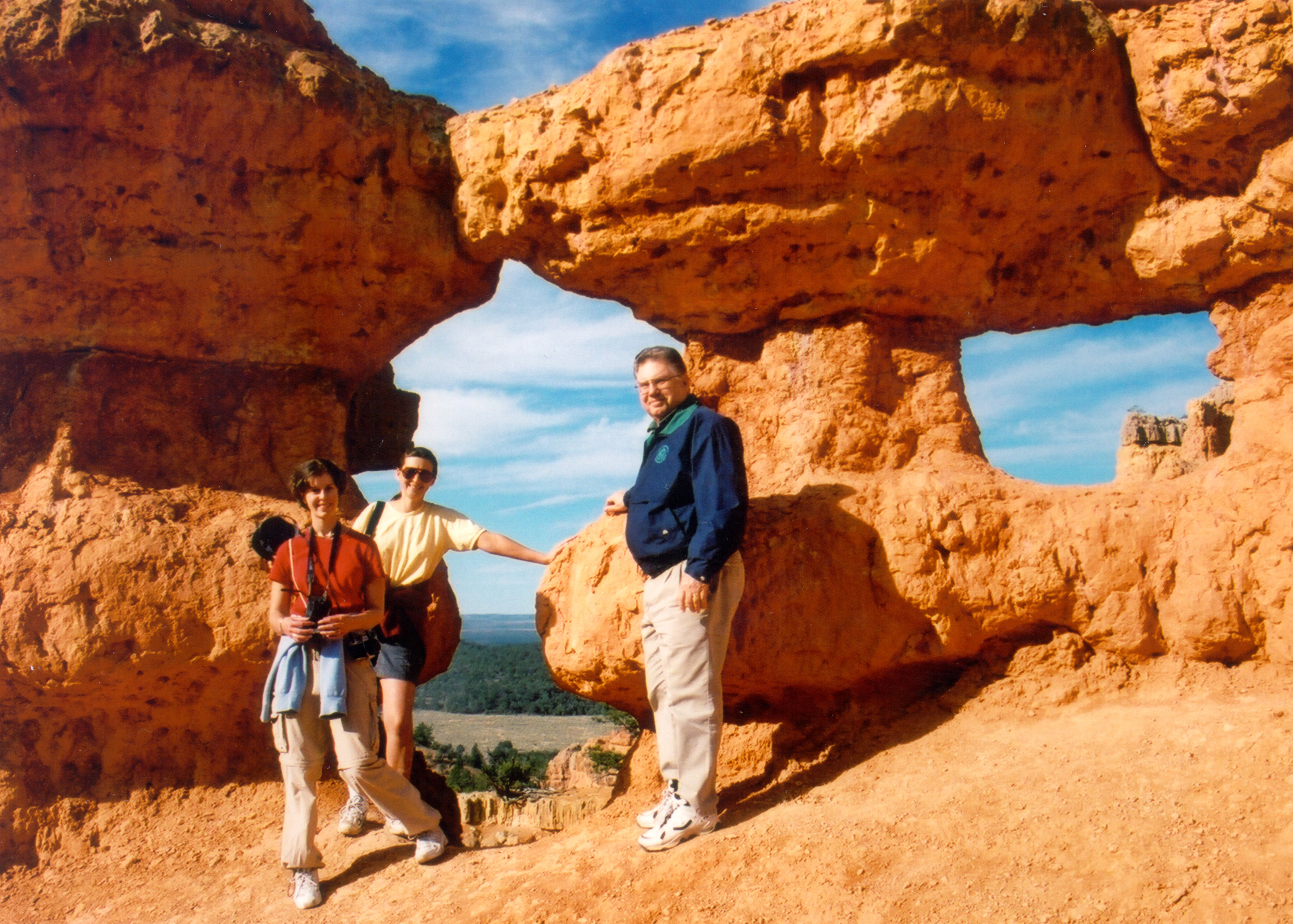
Angel enjoys the sunshine at Powell Point Overlook on Scenic Byway 12 in Utah.
Public Domain. Photo by S. Clyde
Download Original (2700 x 1831 pixels, 1862.5 MB)
-
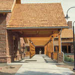
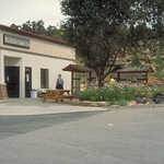
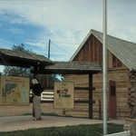
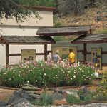
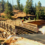
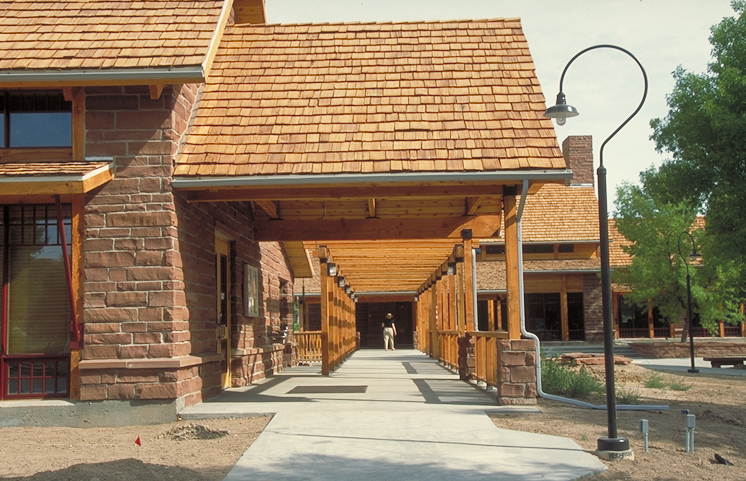
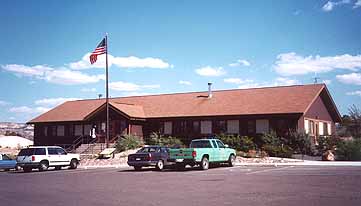
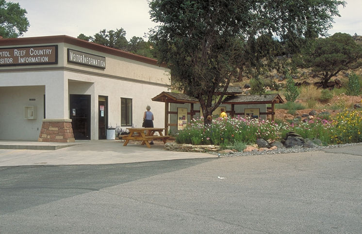
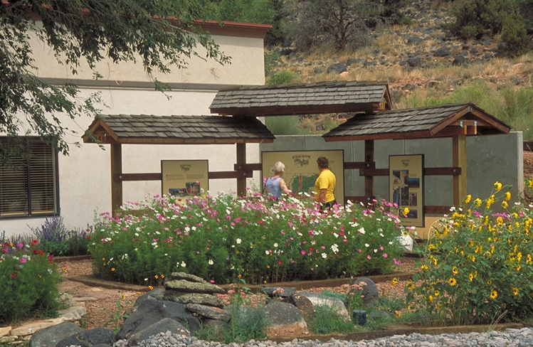
Stone, timber and graceful lampposts are highlights of the newly constructed Escalante/Grand Staircase National Monument Visitor Center built in Cannonville, Utah.
Public Domain. Photo by Dennis Adams
Download Original (746 x 481 pixels, 439.4 KB)
-
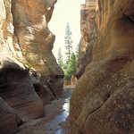
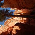
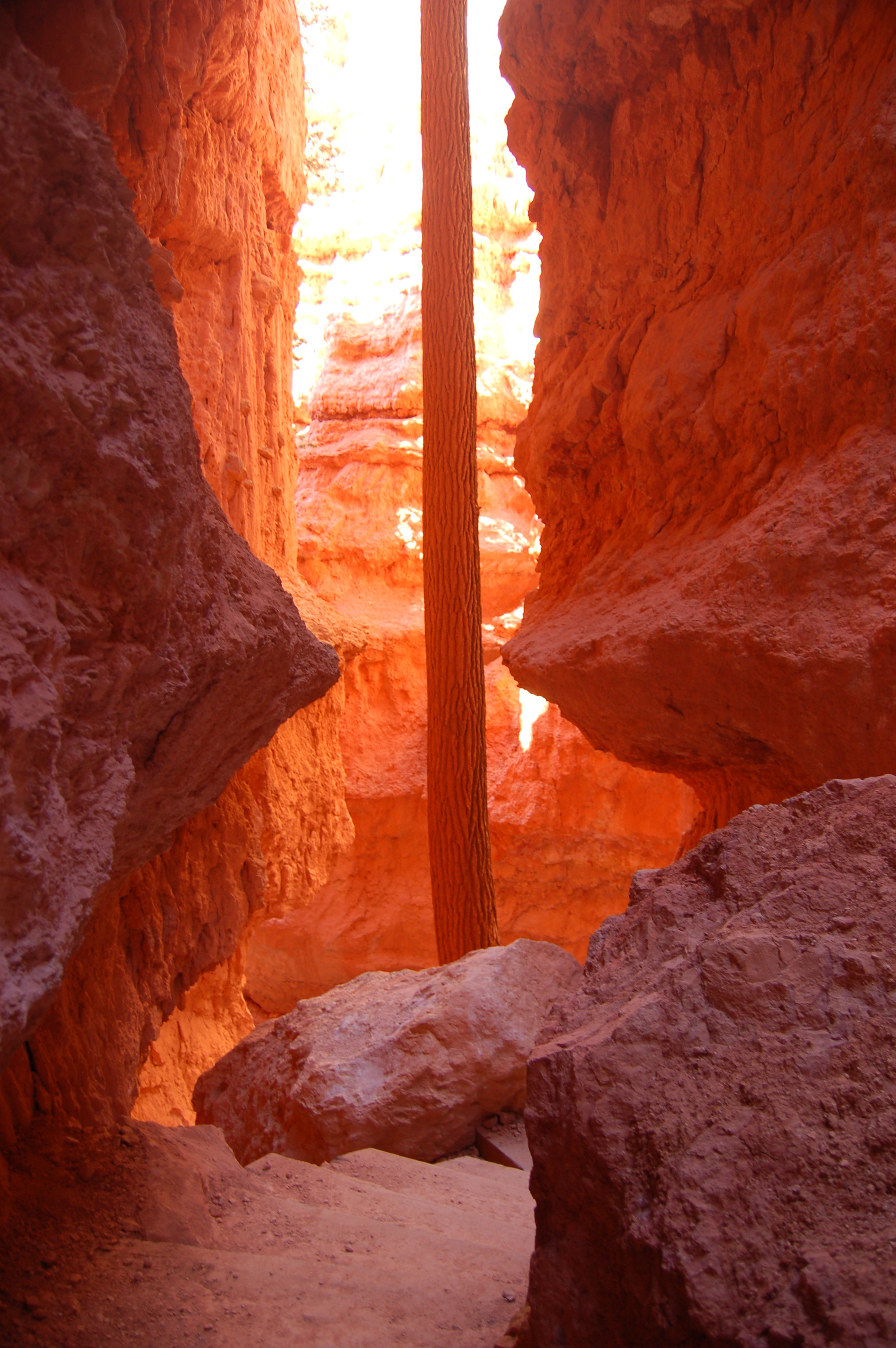
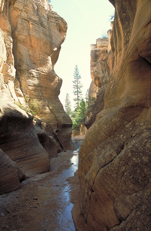
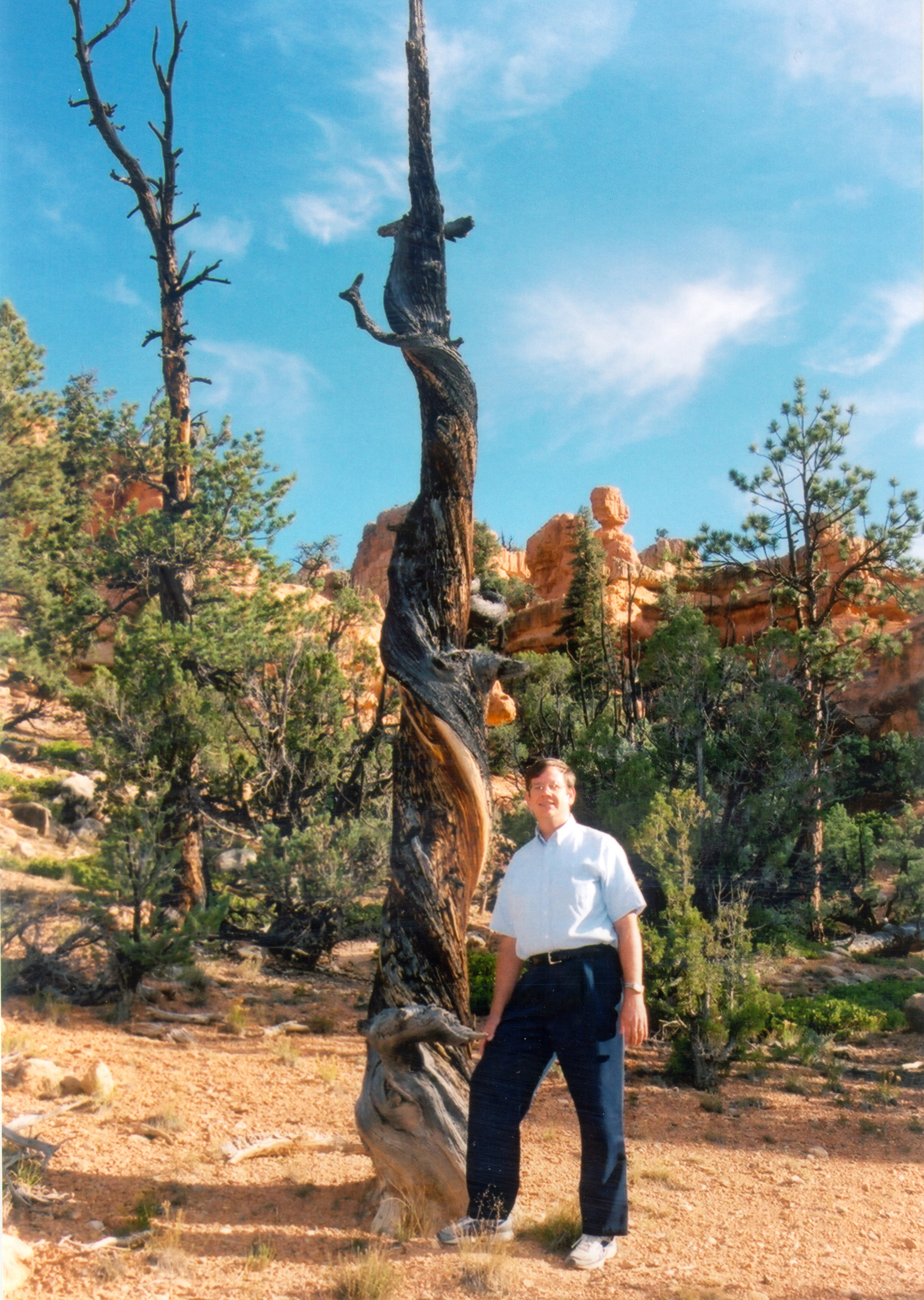
A sturdy, slender tree trunk rises to reach the sunshine high above the convoluted slot canyon in Bryce Canyon below Sunset Point.
Public Domain. Photo by A. E. Crane
Download Original (2000 x 3008 pixels, 1240.7 MB)
-
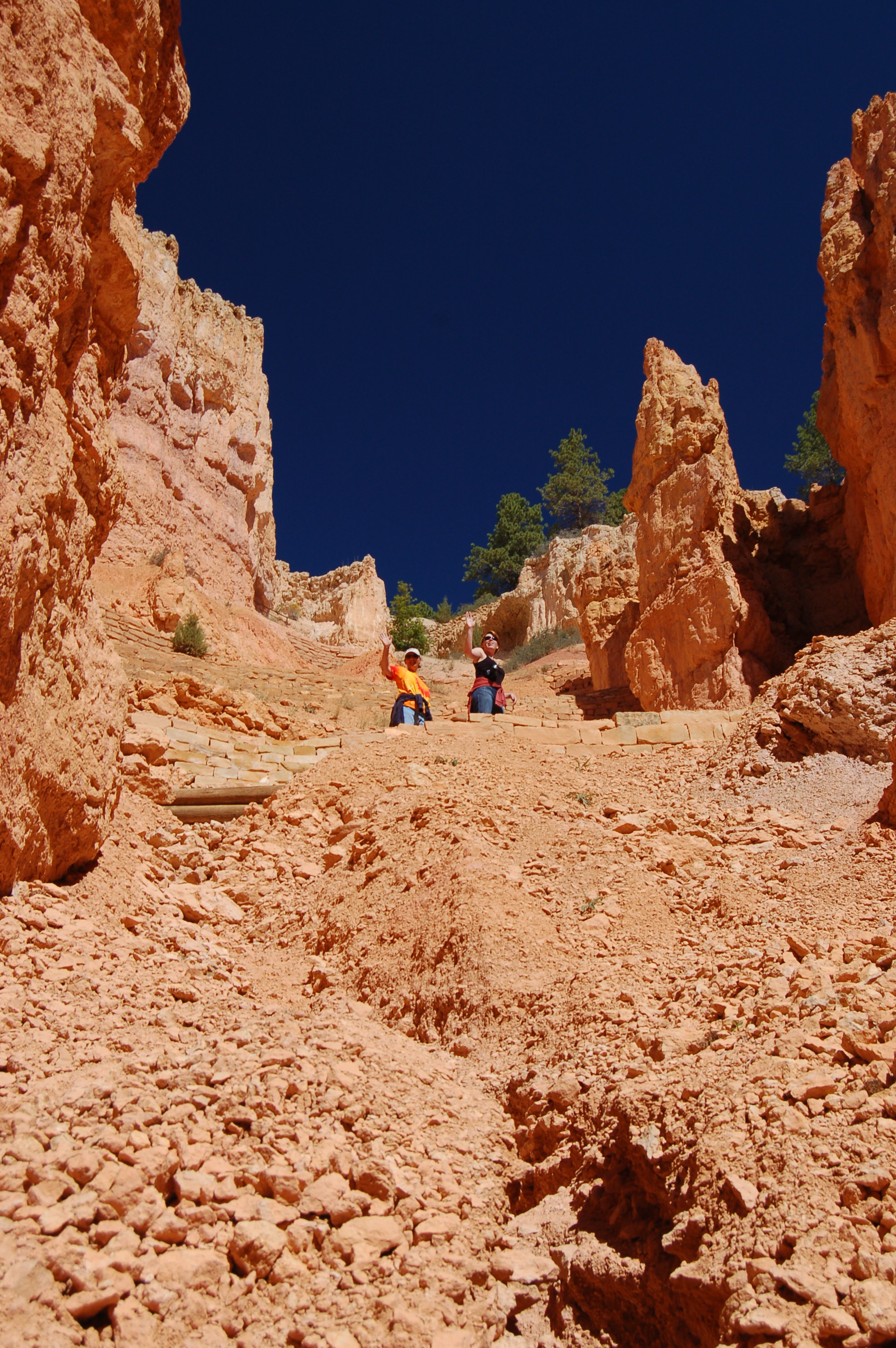
Two hikers on the switchbacks wave at hikers below on the Sunset Point trail in Bryce Canyon National Park.
Public Domain. Photo by A. E. Crane
Download Original (2000 x 3008 pixels, 1510.2 MB)
-
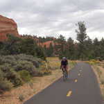
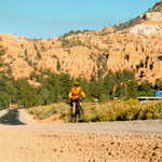
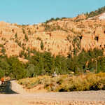
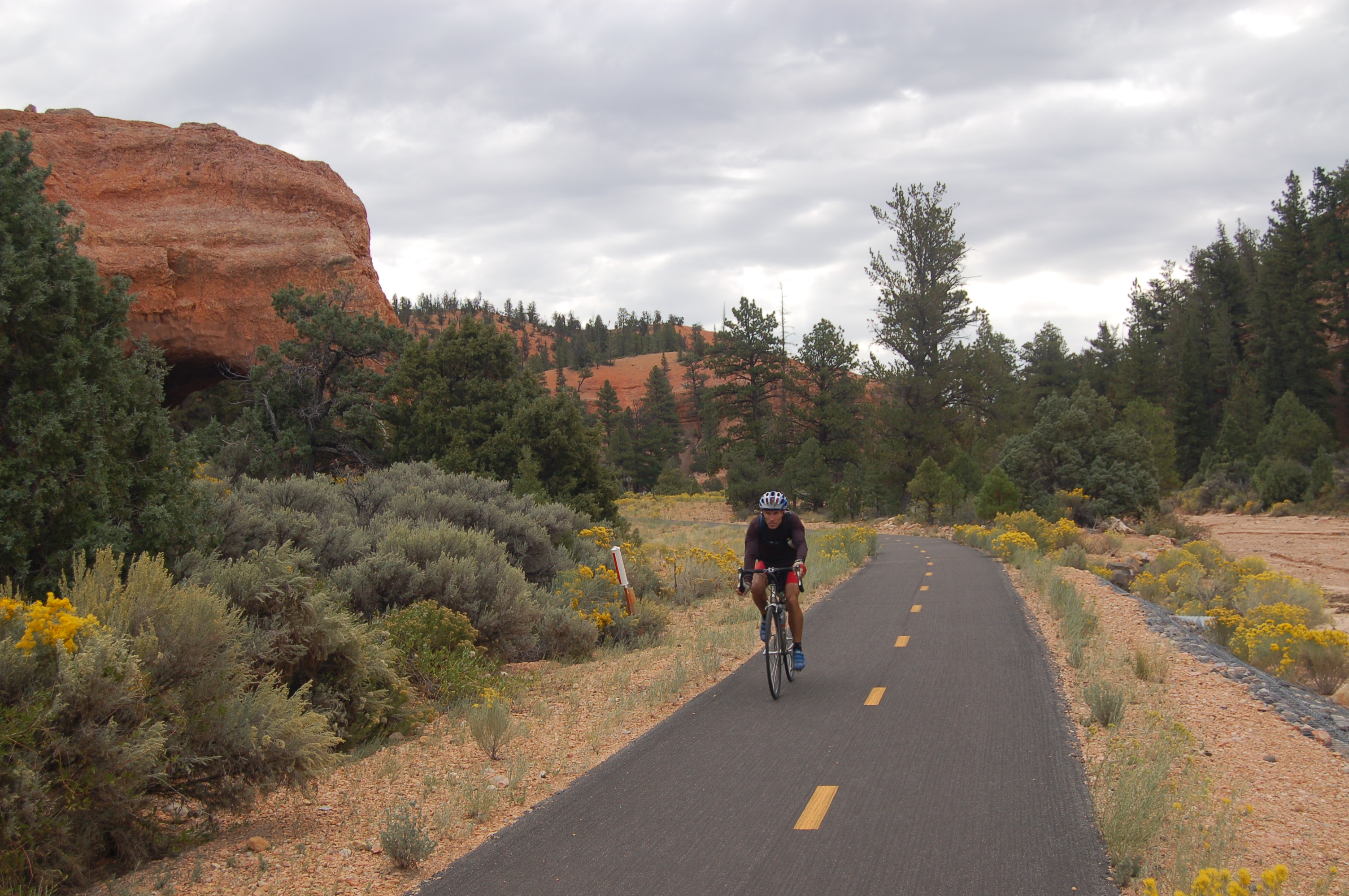
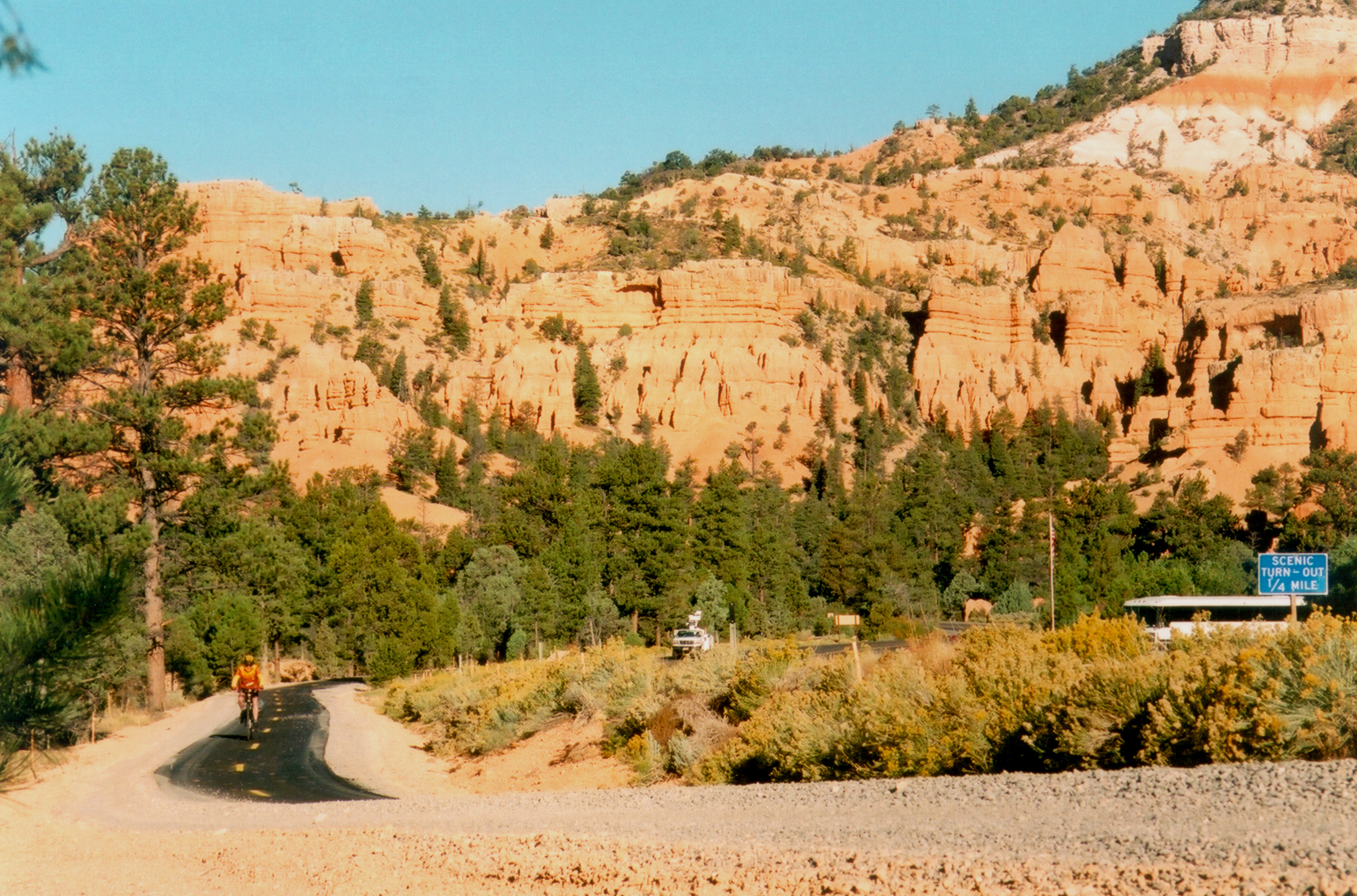
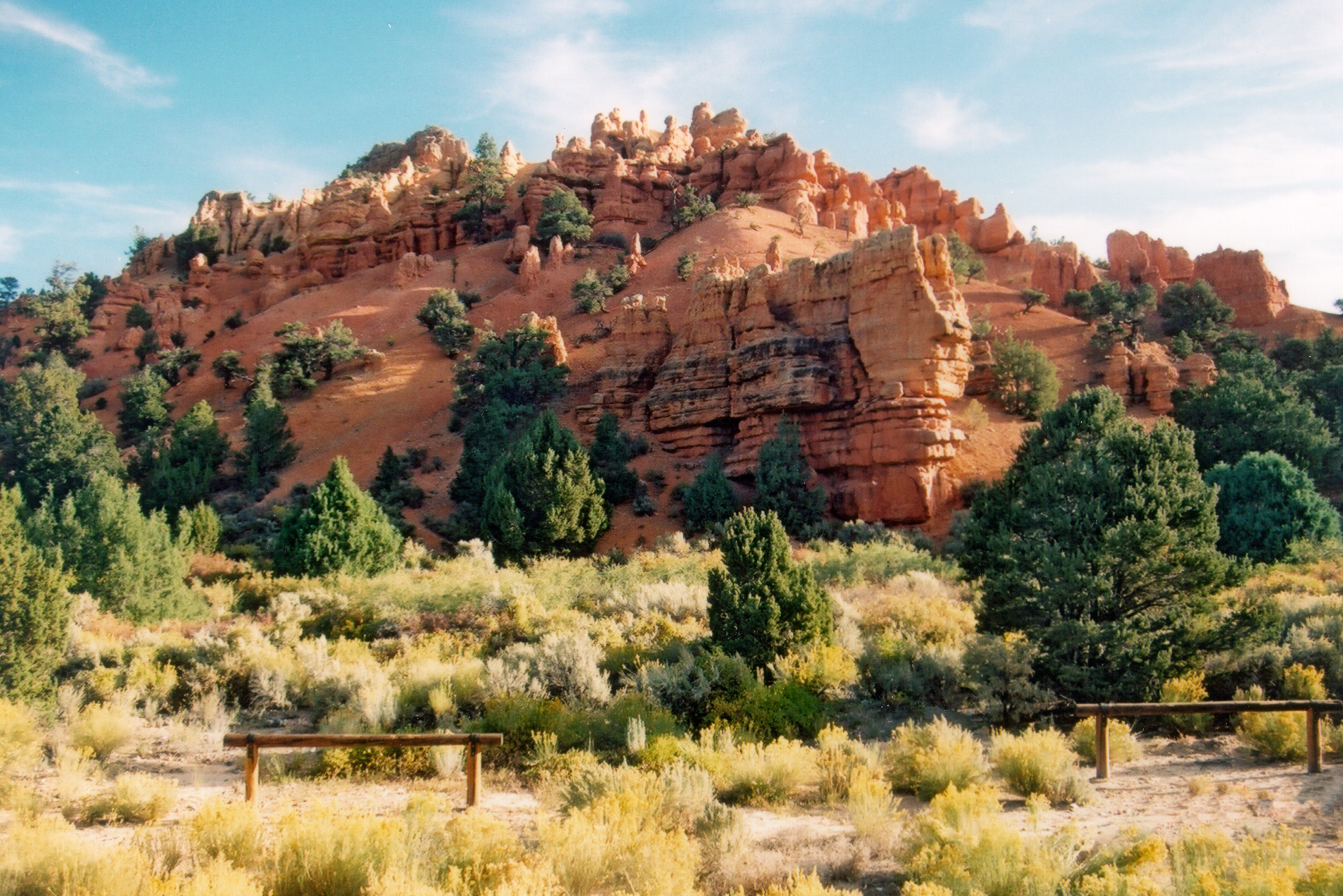
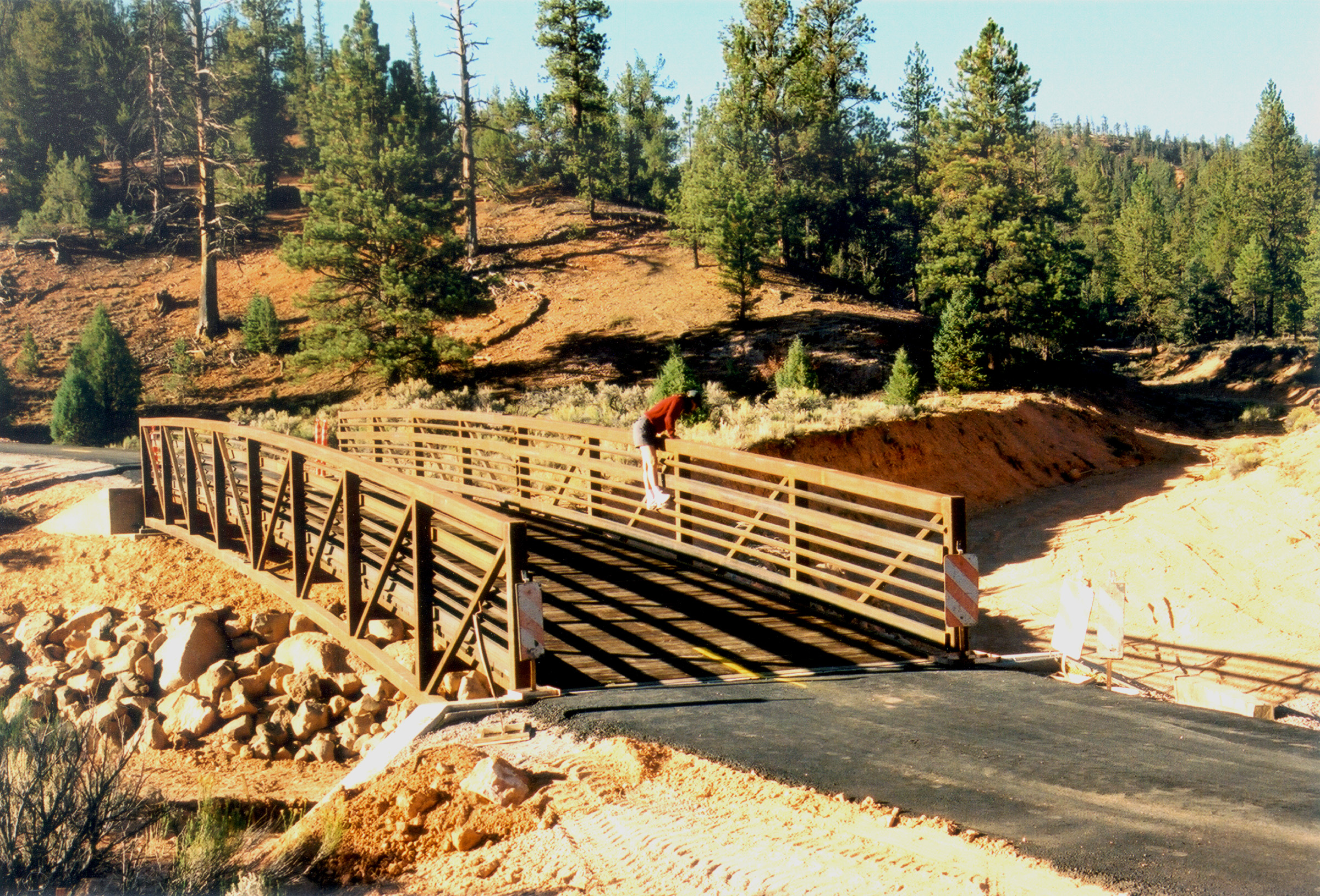
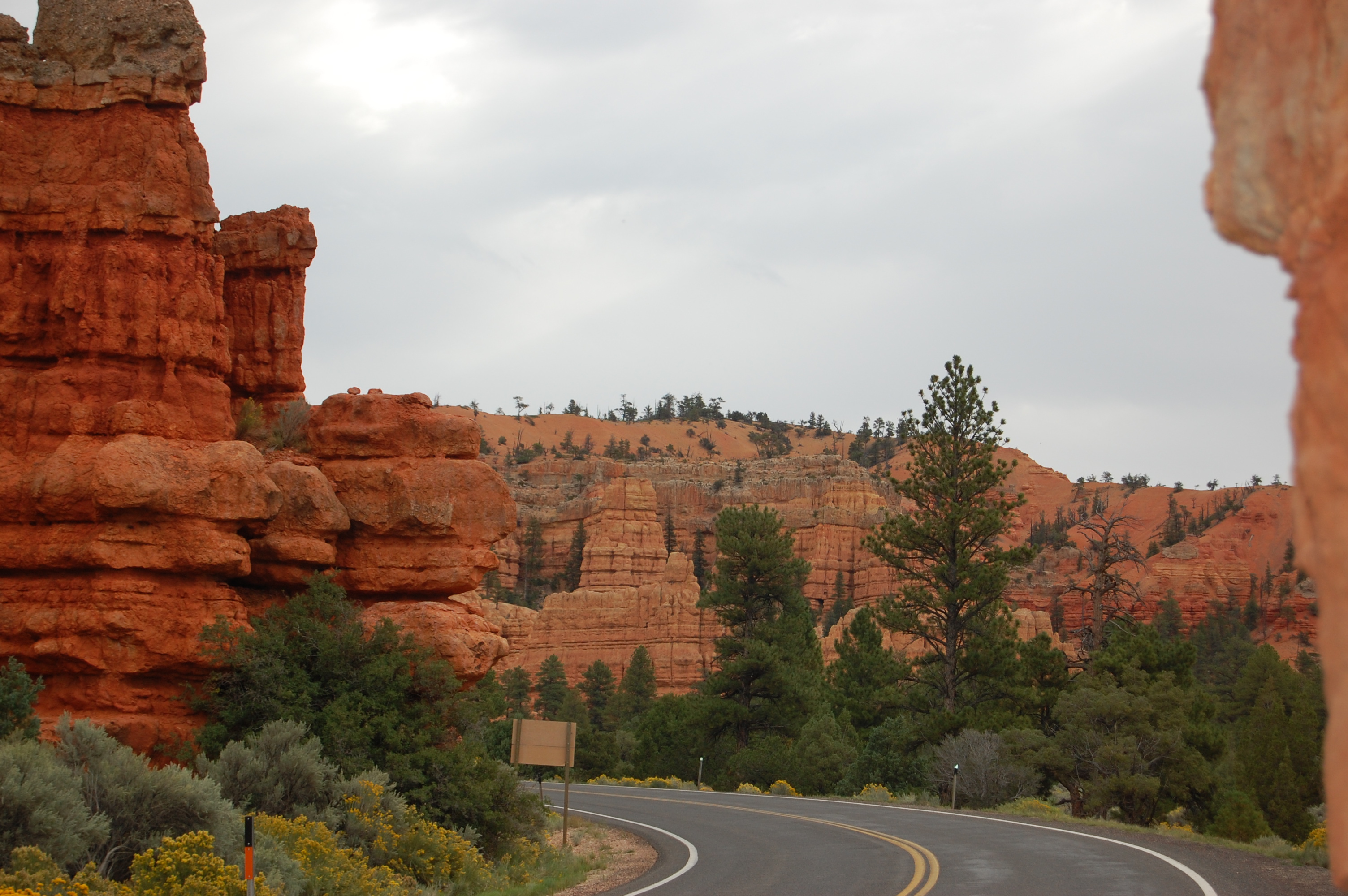
A biker rolls along the Red Canyon Biking Trail under a cloudy sky one morning in Red Canyon on Scenic Byway 12.
Public Domain. Photo by A. E. Crane
Download Original (3008 x 2000 pixels, 1459.3 MB)
-
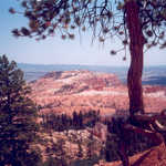
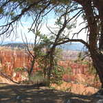
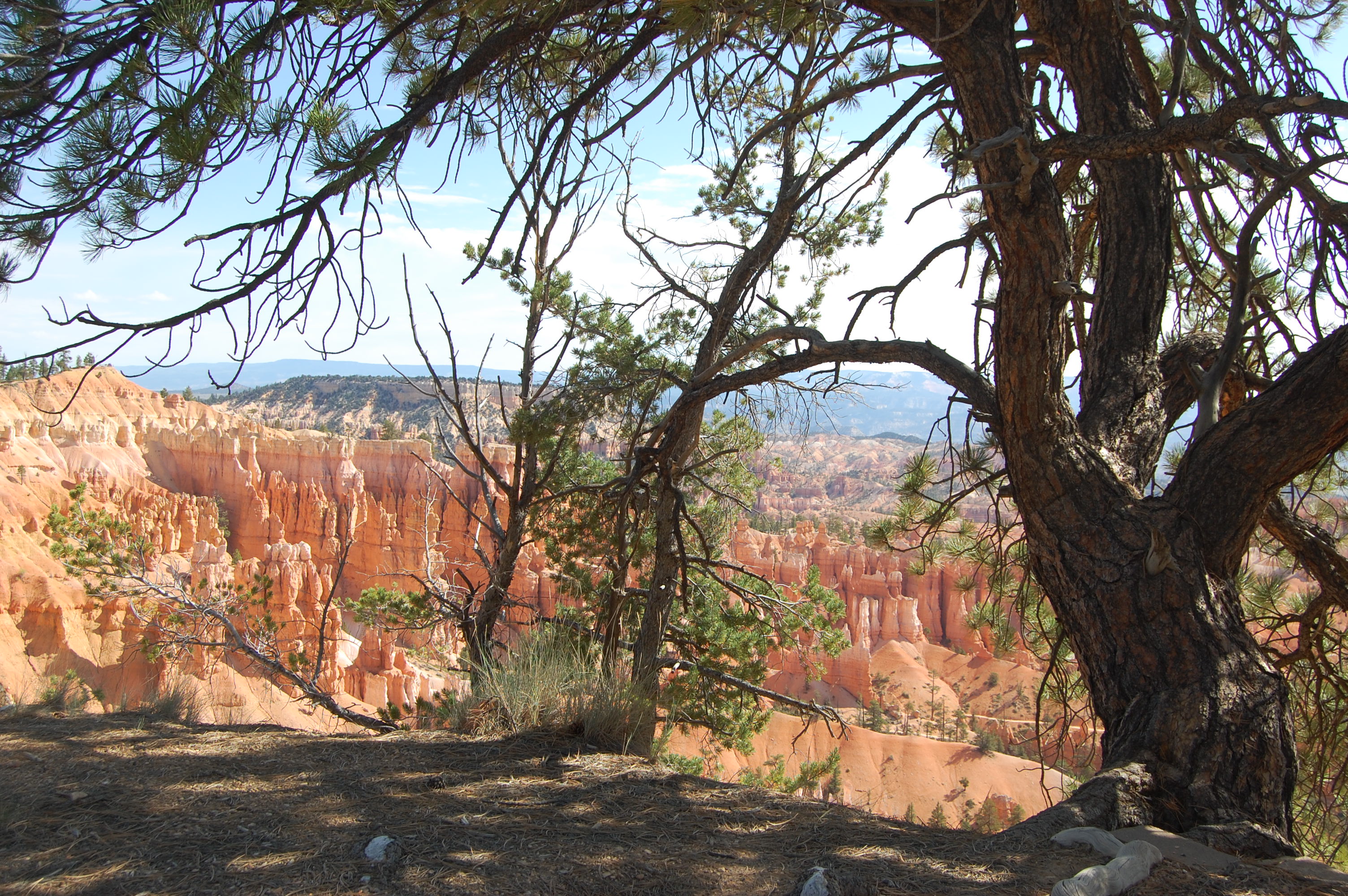
A tree frames a view of Bryce Canyon on a summer afternoon.
© February 2003 A. Crane.
-
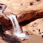
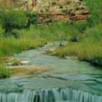
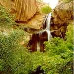
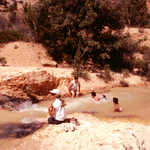
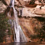
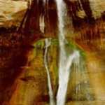
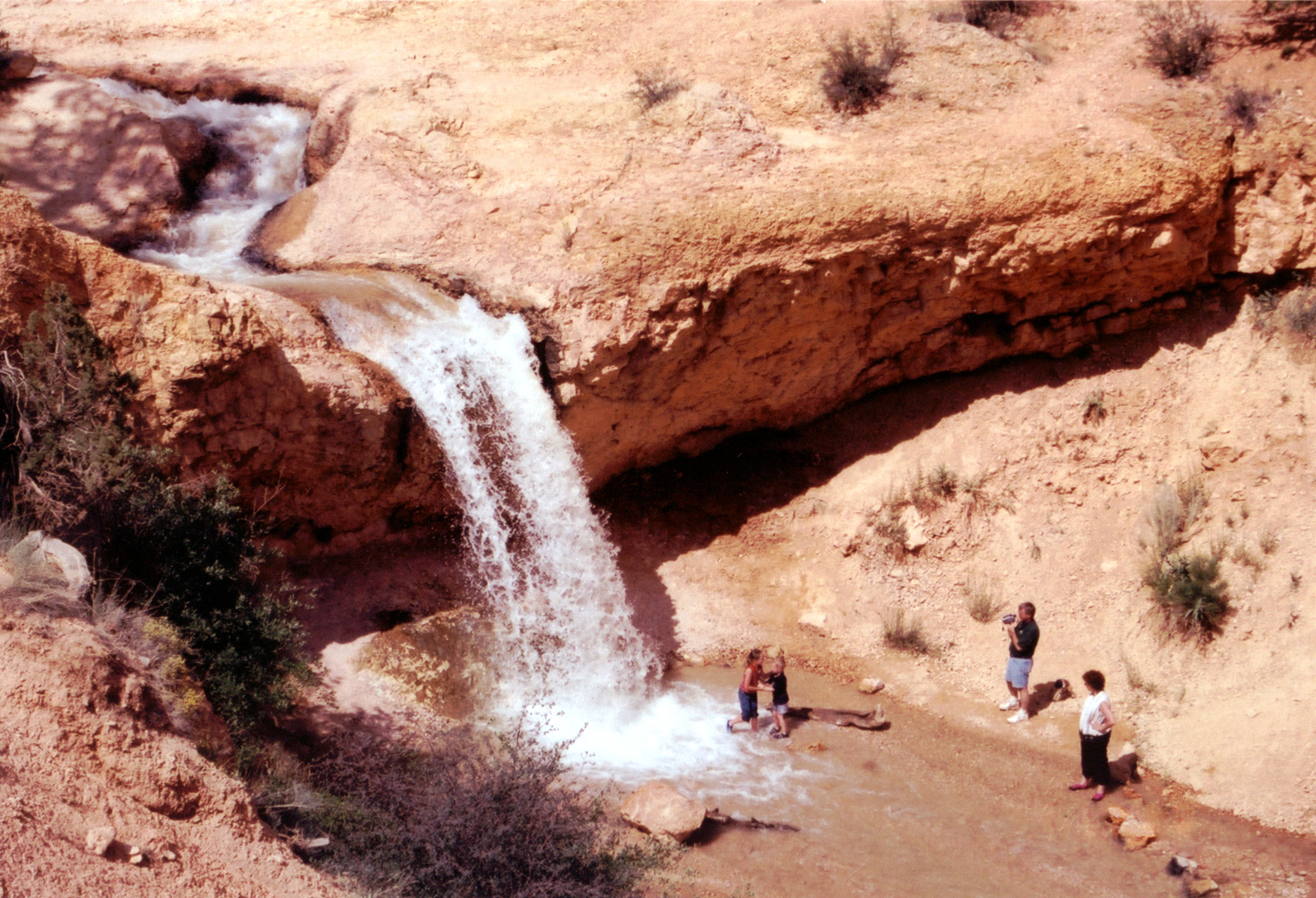
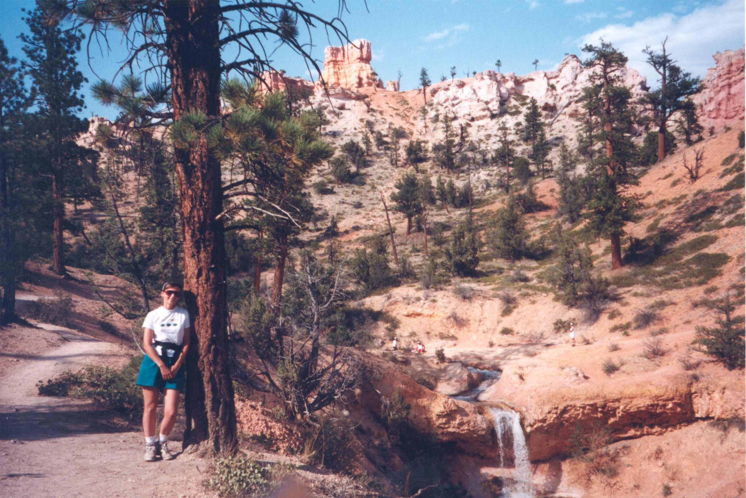
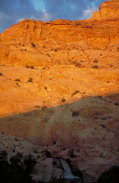
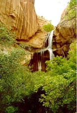
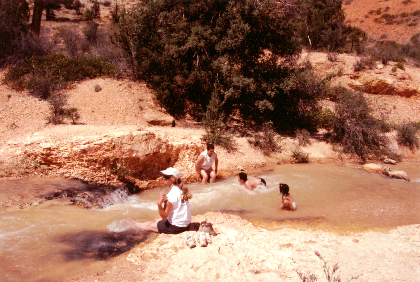
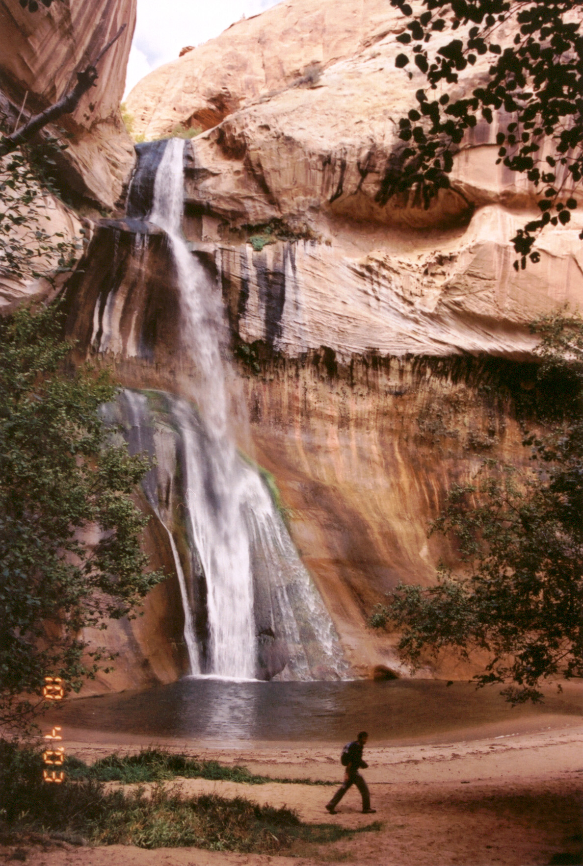
A family enjoys the cool water at the foot of a waterfall on the Mossy Cave Trail (the waterfall branch of the hike.)
Public Domain. Photo by A. E. Crane
Download Original (1752 x 1196 pixels, 820.3 KB)
-

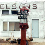
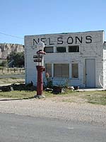
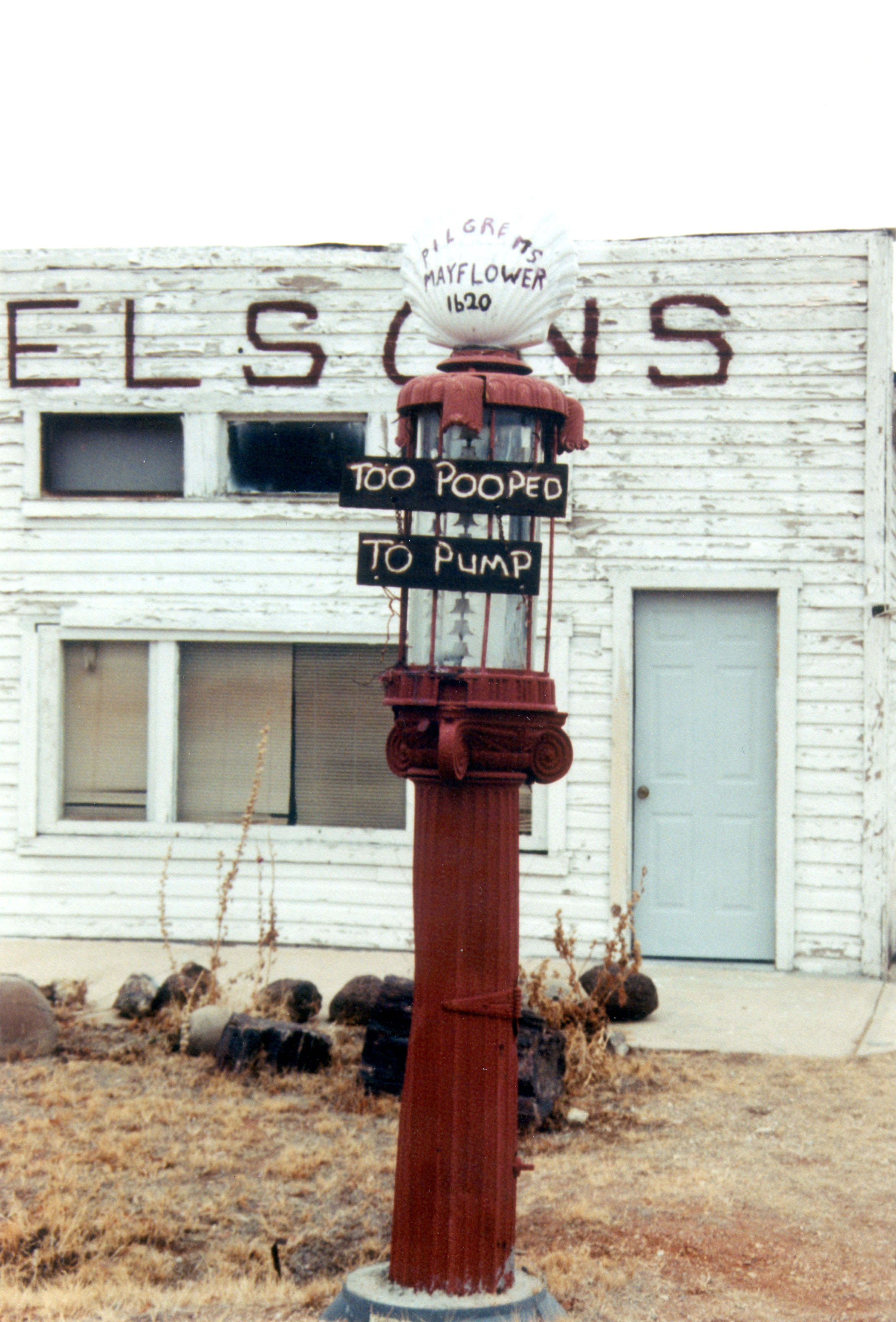
This tongue-in-cheek notice sits above an old gas pump in Cannonville, Utah on the way to Kodachrome State Park.
Public Domain. Photo by Dave Rogers of MDSC
Download Original (150 x 200 pixels, 14.6 KB)
-
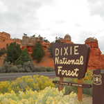
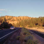
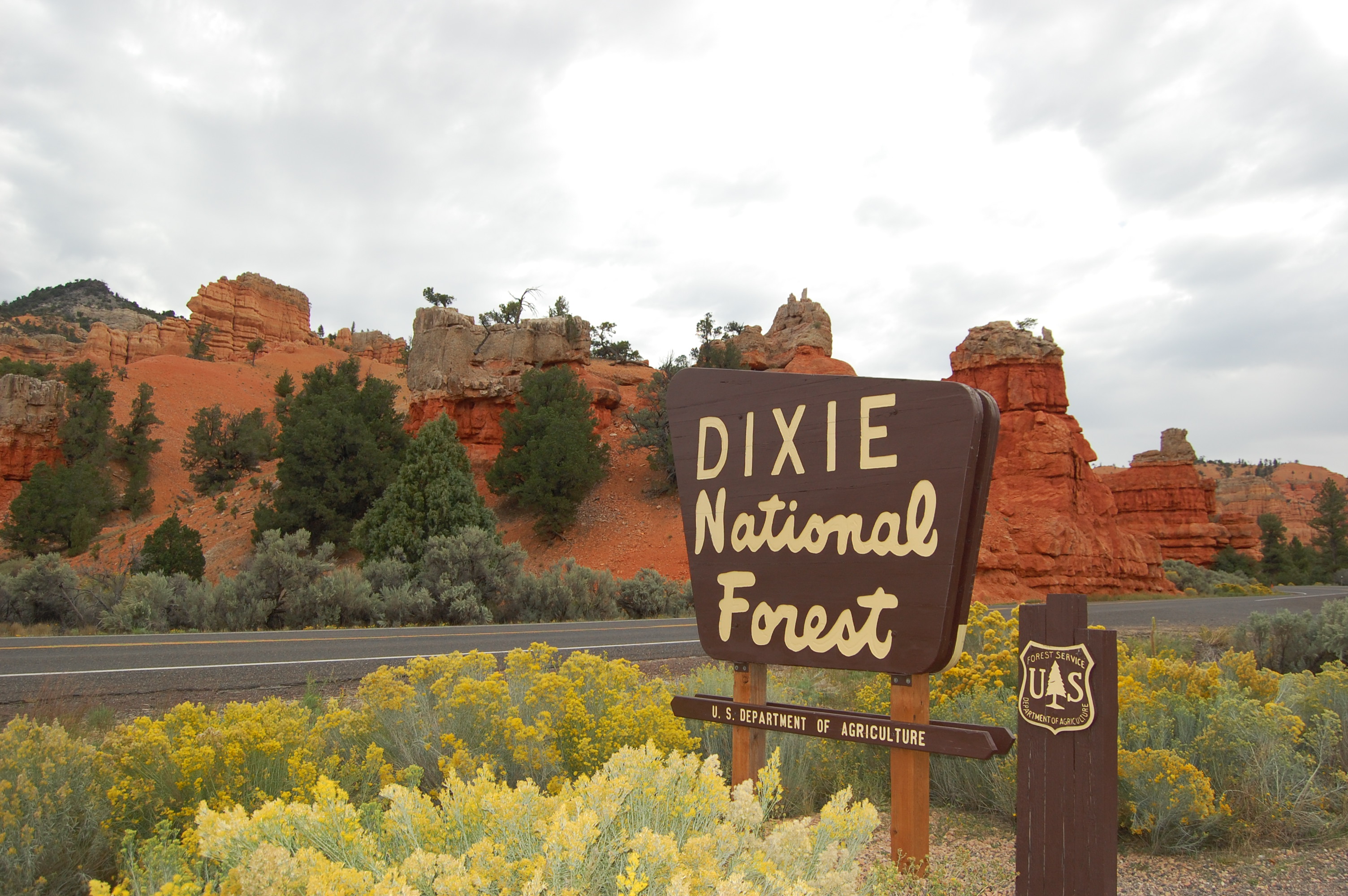
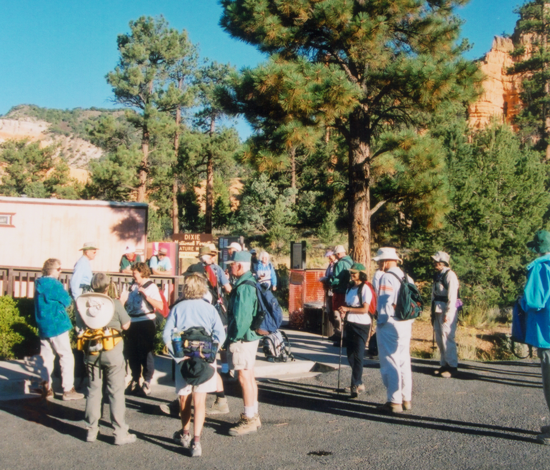
A U.S. Forest Service sign greets visitors to Dixie National Forest in Red Canyon.
Public Domain. Photo by Jessica Dungan
Download Original (3008 x 2000 pixels, 1291.9 MB)
-
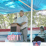
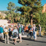
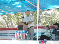
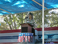
Bruce Fullmer of Garfield County says a few words at the Scenic Byway 12 All-American Road Designation event in Boulder, Utah.
Public Domain. Photo by Dave Rogers of MDSC
Download Original (200 x 150 pixels, 27.4 KB)
-
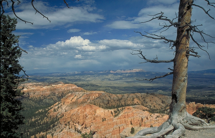
The roots of a small yet resilient pine tree stand exposed on the edge of Bryce Canyon National Park.
Public Domain. Photo by Jessica Dungan
Download Original (2000 x 3008 pixels, 1535.9 MB)
-
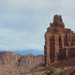
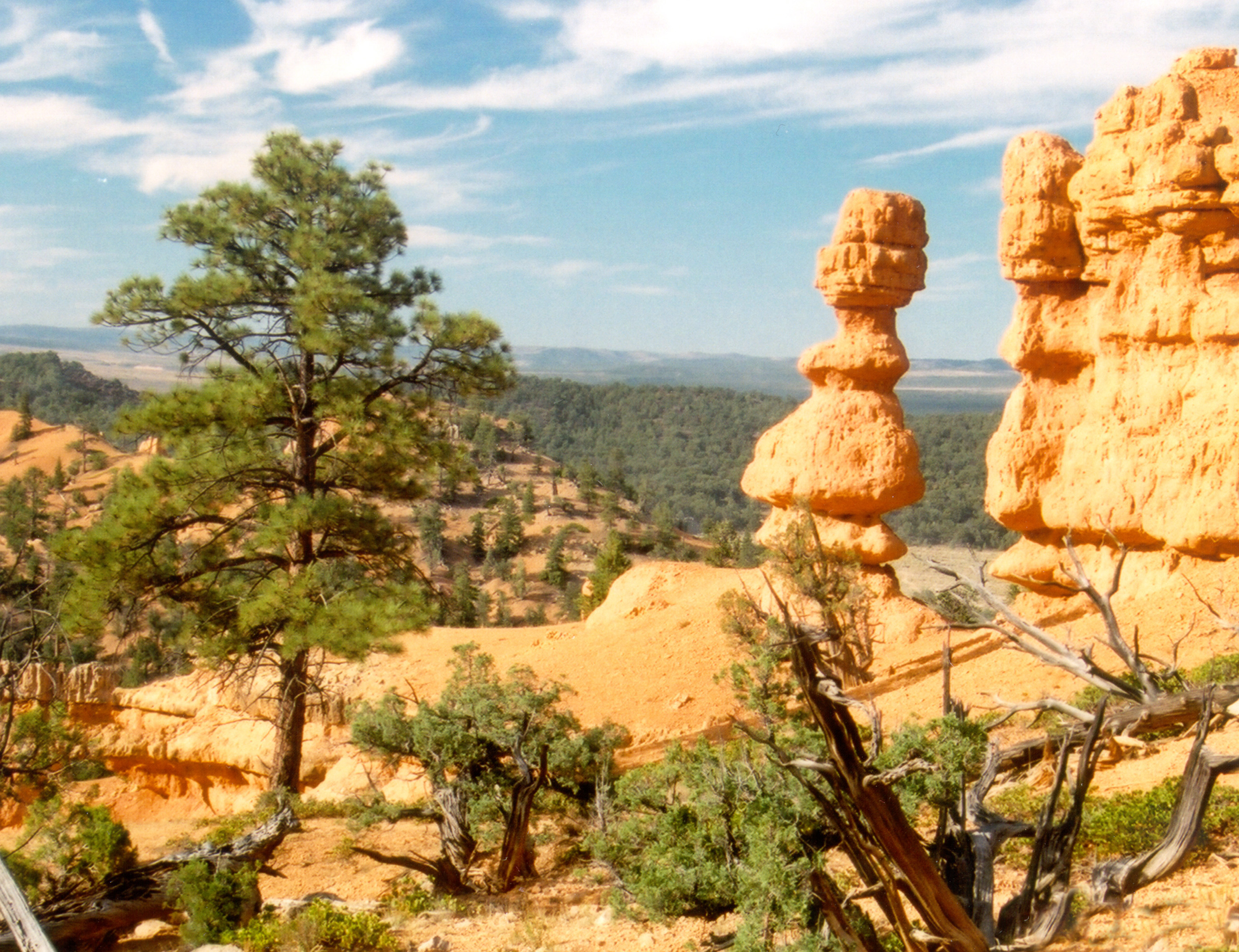
Powell Point, a significant landmark on Scenic Byway 12, is just waiting to be photographed.
Public Domain. Photo by A. E. Crane
Download Original (2691 x 1840 pixels, 1523.1 MB)
-
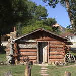
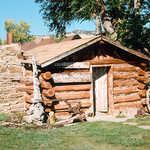
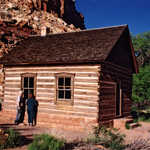
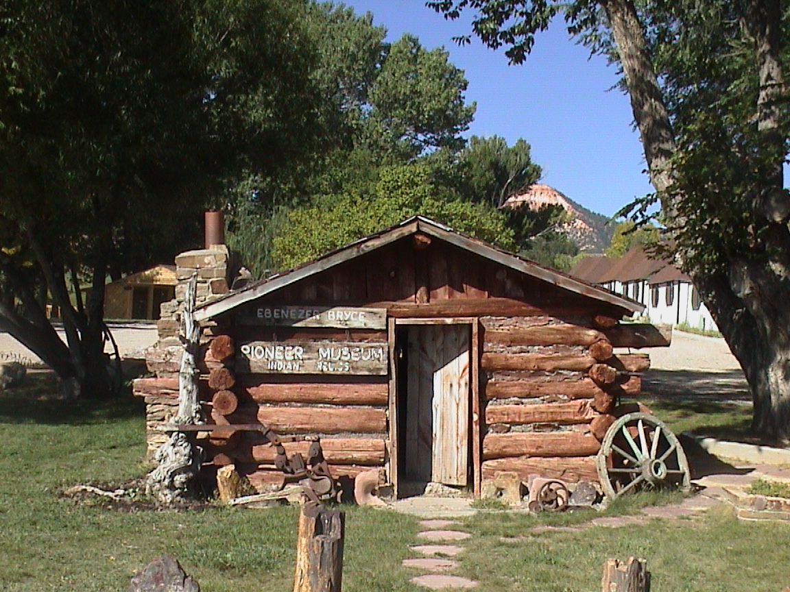
Ebenezer Bryce's quaint cabin resides in the town of Tropic.
Public Domain. Photo by S. Clyde
Download Original (1152 x 864 pixels, 596.4 KB)
-
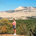
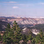
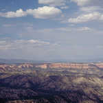
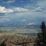
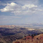
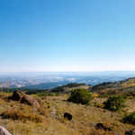
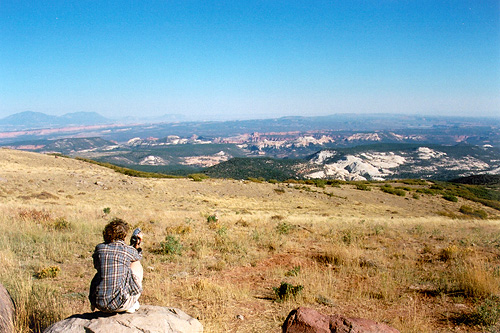
The view from Boulder Mountain looks down upon a varied landscape.
Public Domain.
Download Original (225 x 225 pixels, 15.8 KB)
-
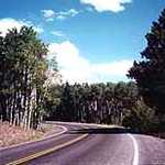
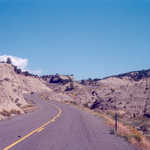
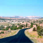
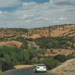
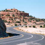
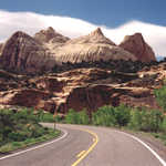
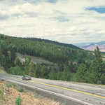
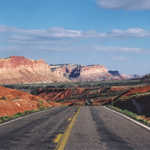
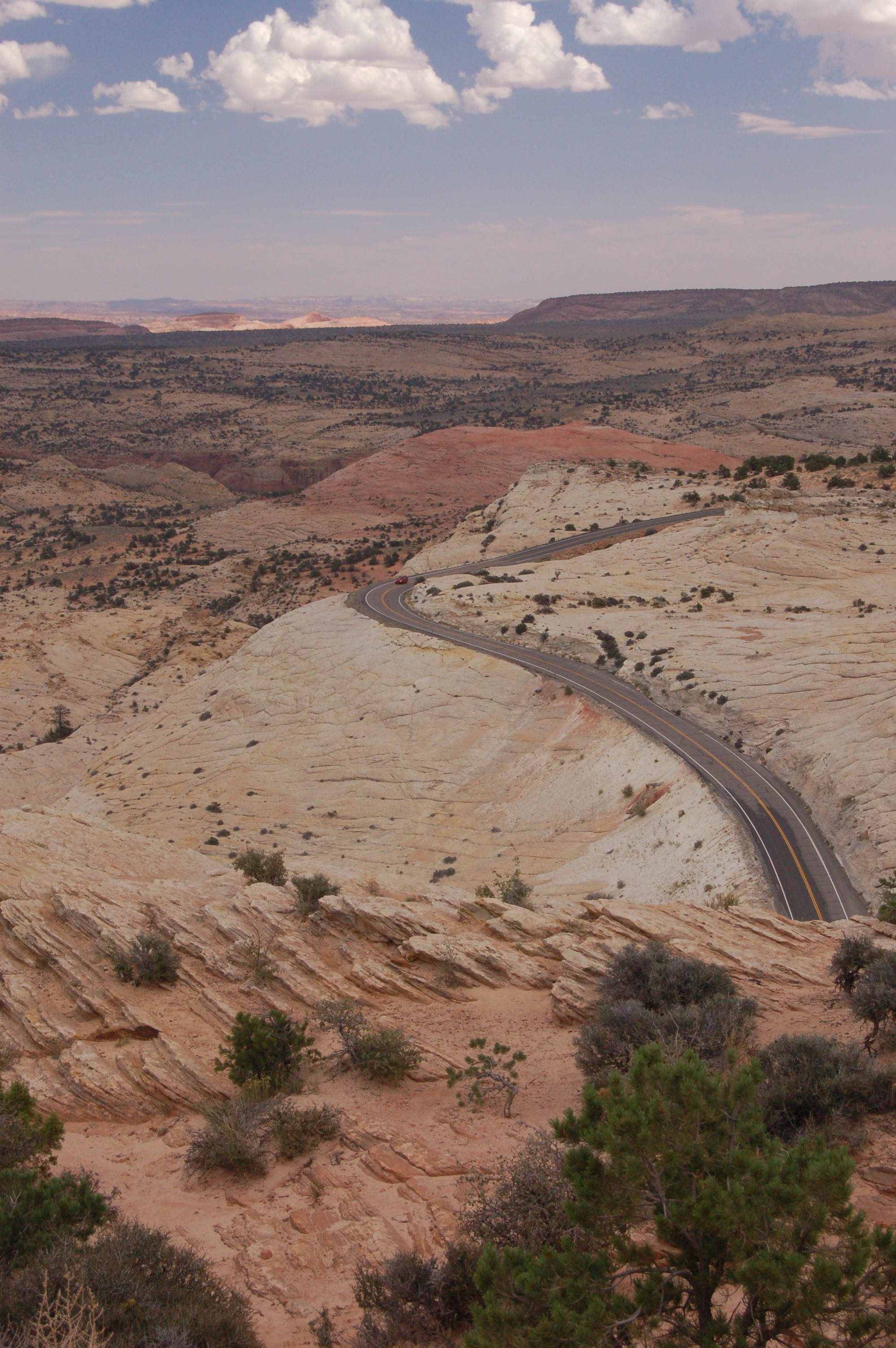
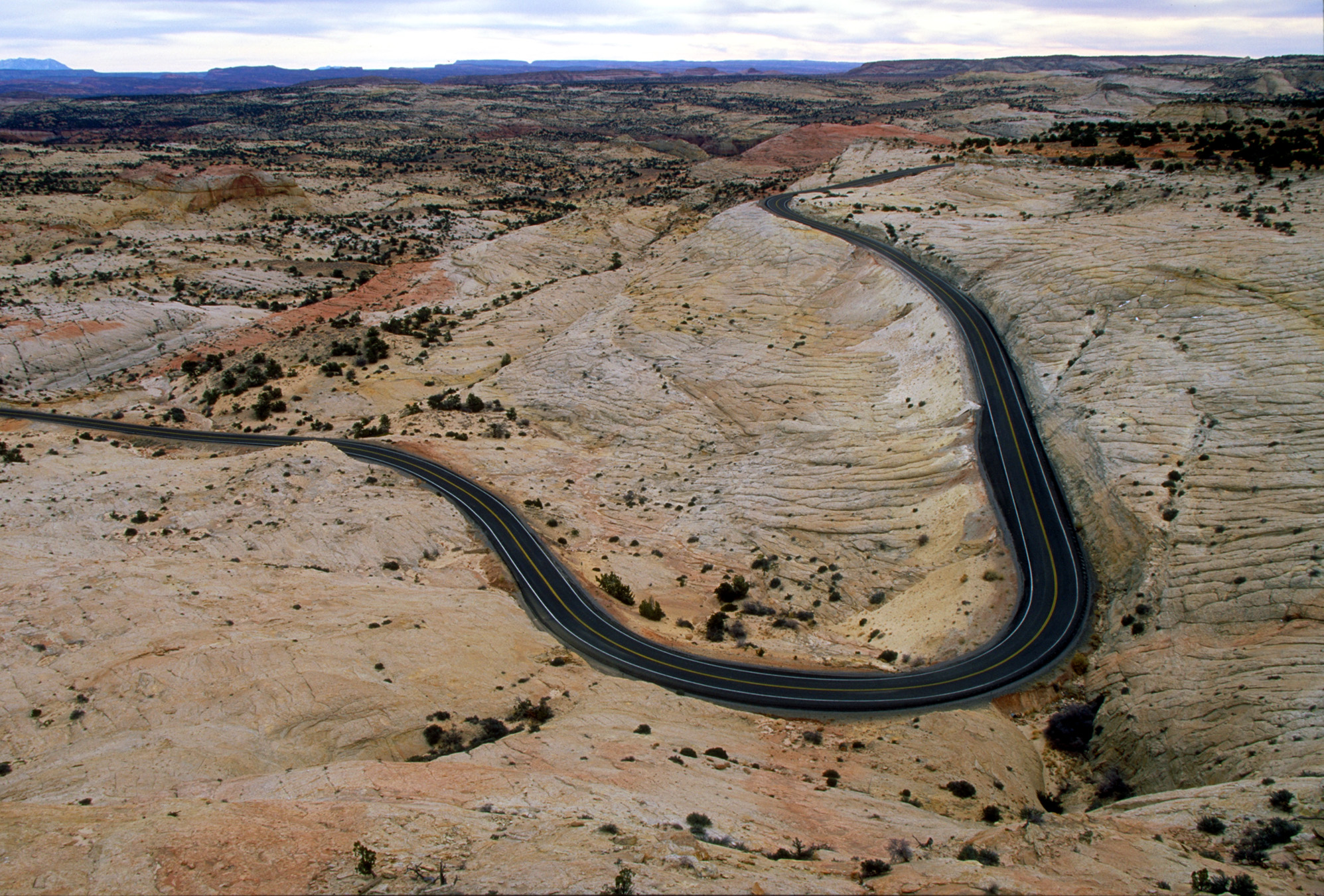
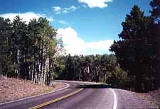
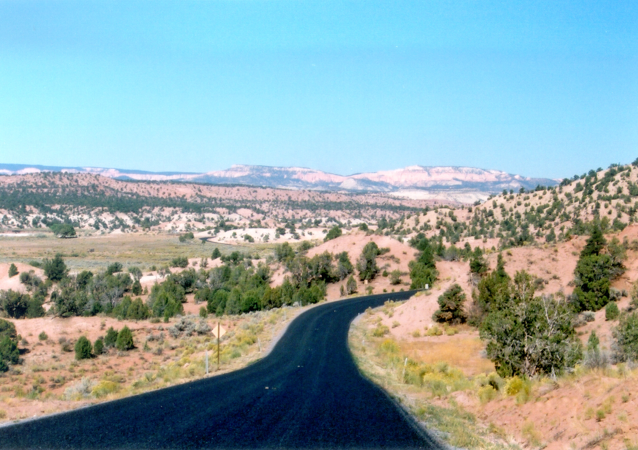
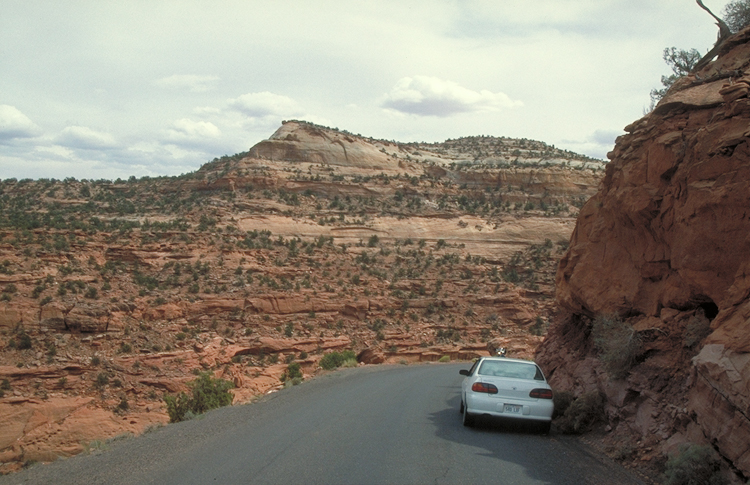
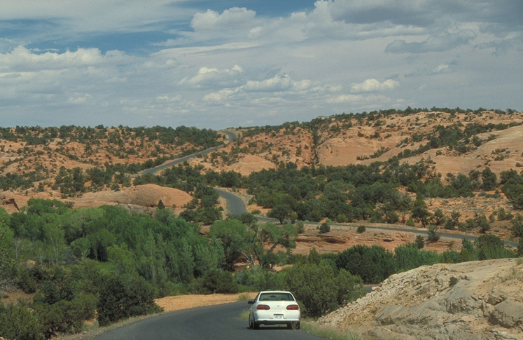
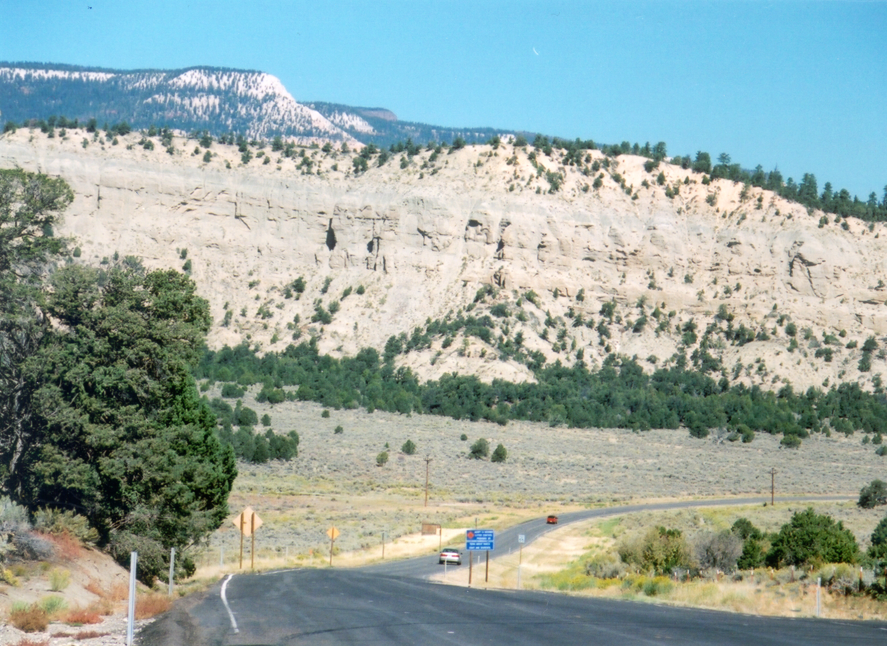
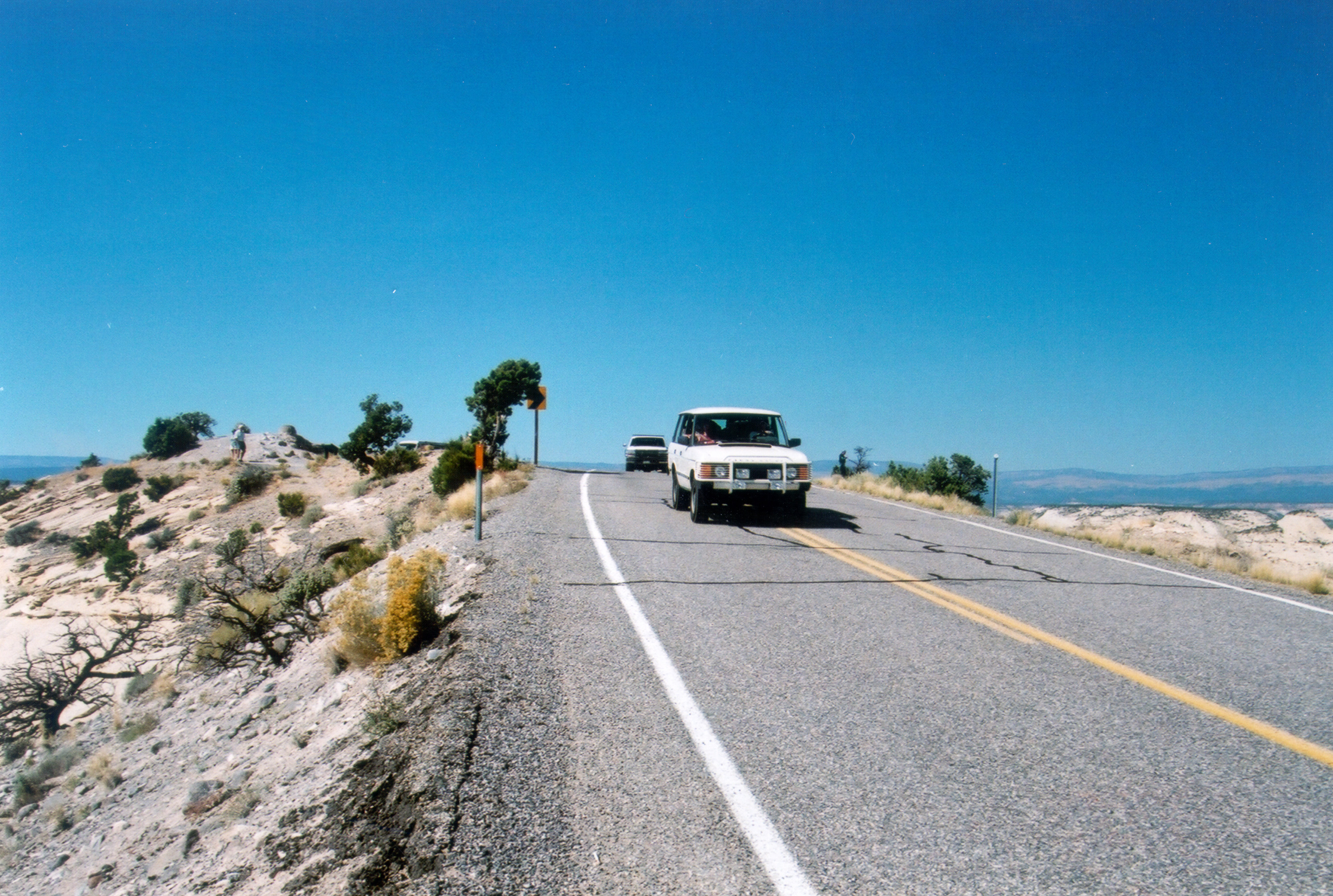
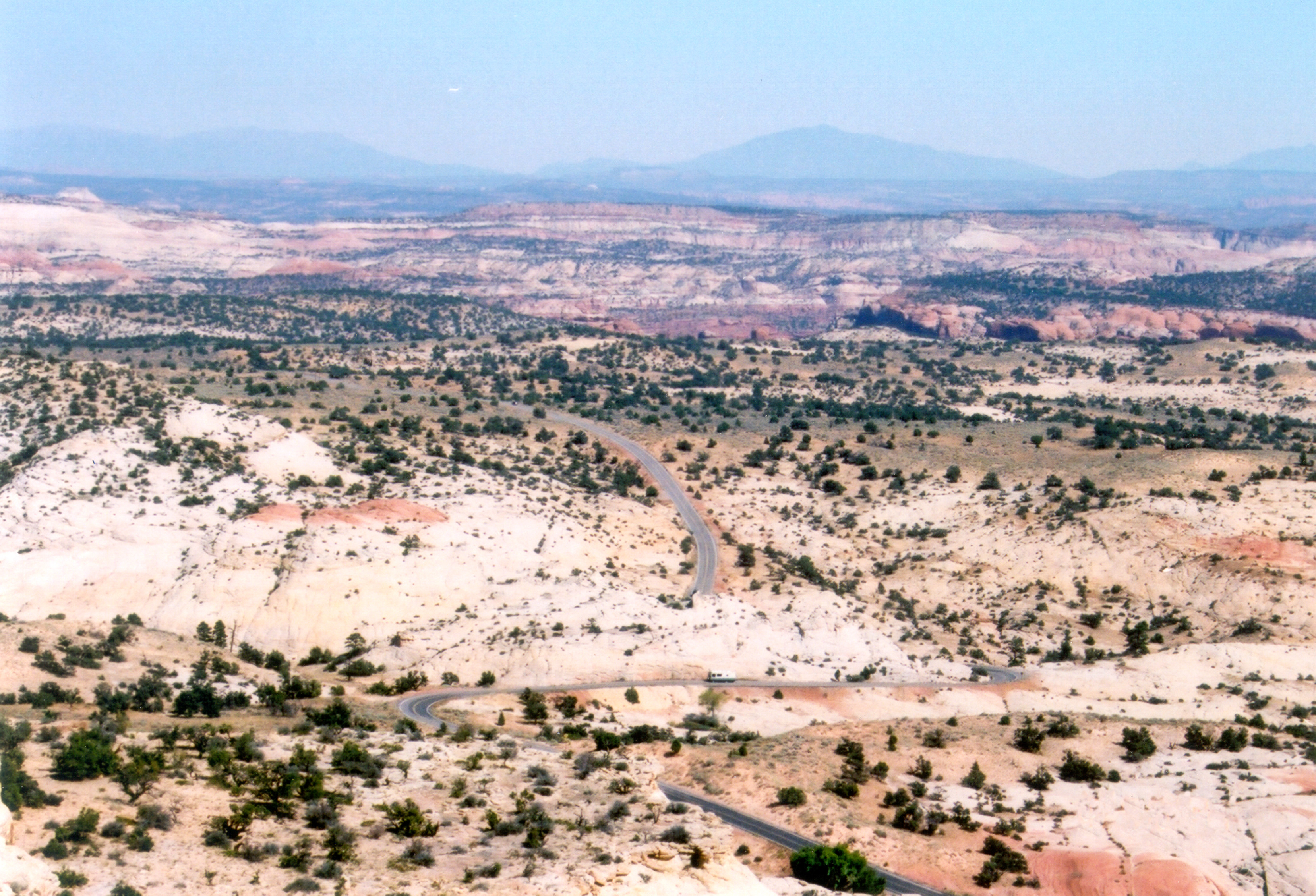
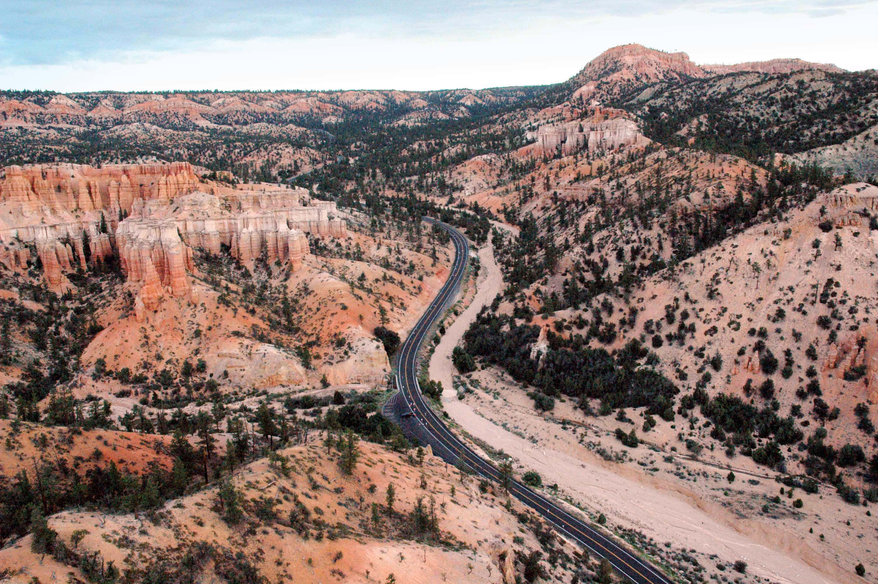
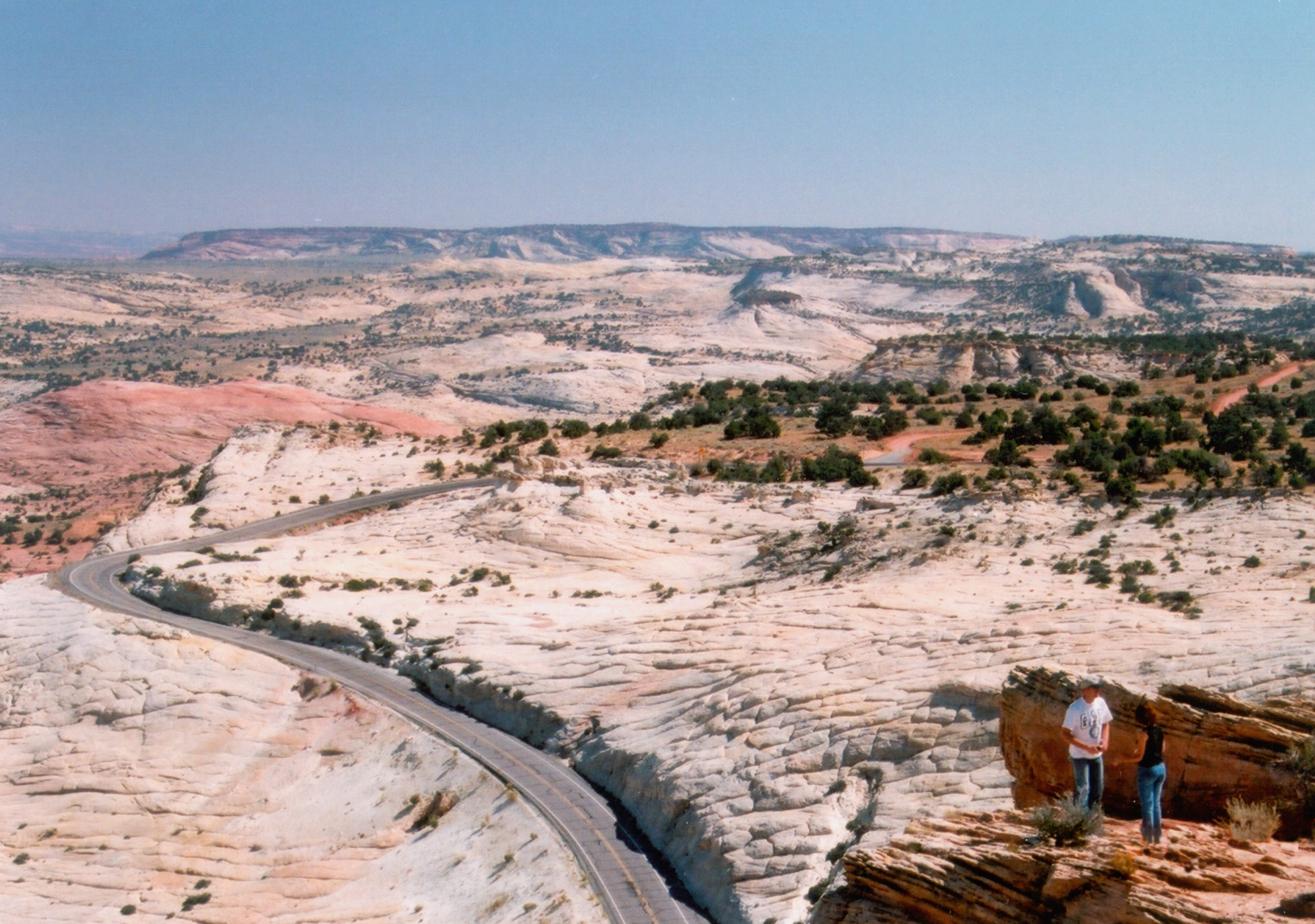
Scenic Byway 12 curves on its way to Panguitch.
Public Domain. Photo by A. E. Crane
Download Original (1000 x 672 pixels, 851.7 KB)
-

Looking down from the Boynton Overlook, Scenic Byway 12 curves, and the Hogsback lays in the distance.
Public Domain. Photo by Allysia Angus
Download Original (2000 x 3008 pixels, 5031.0 MB)
-
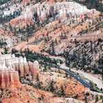
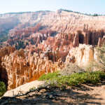
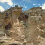
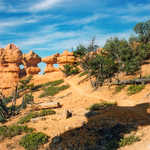
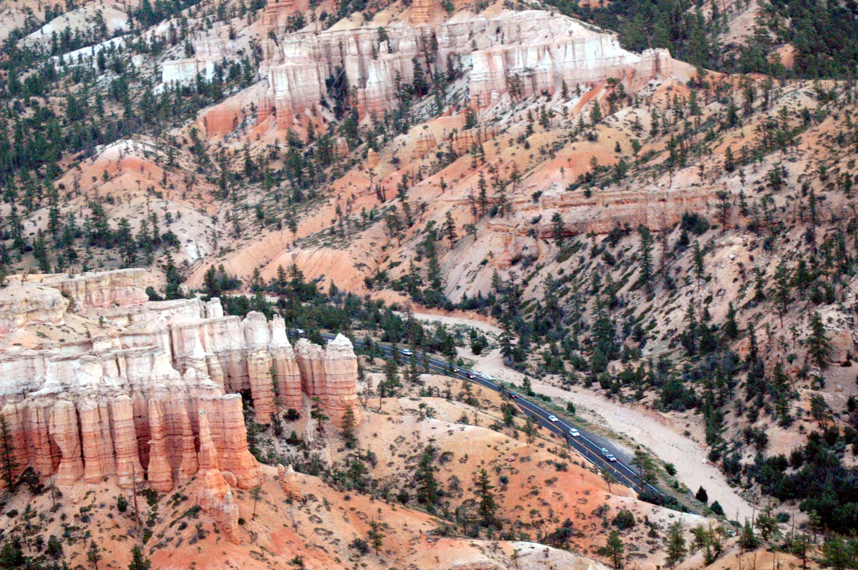
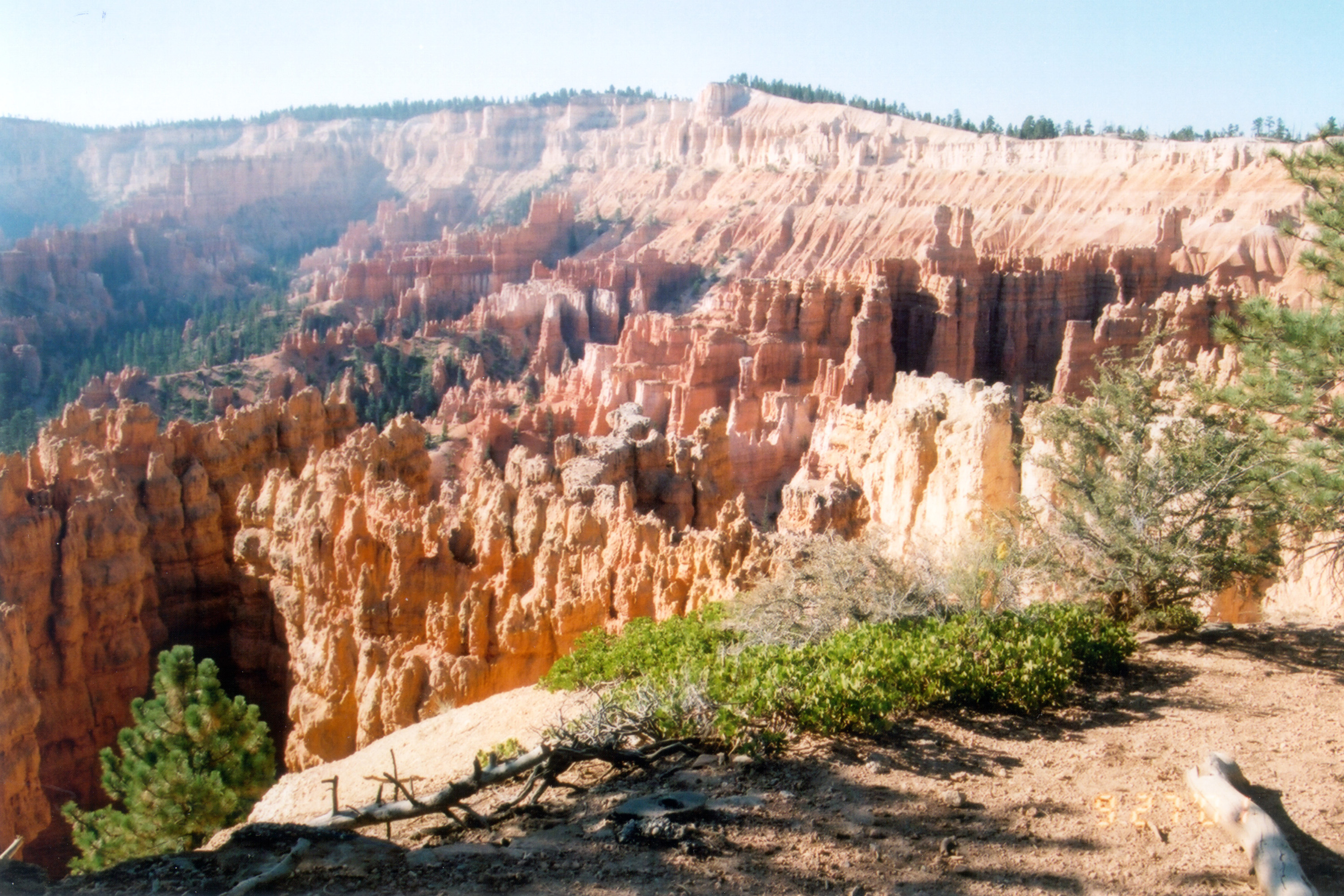
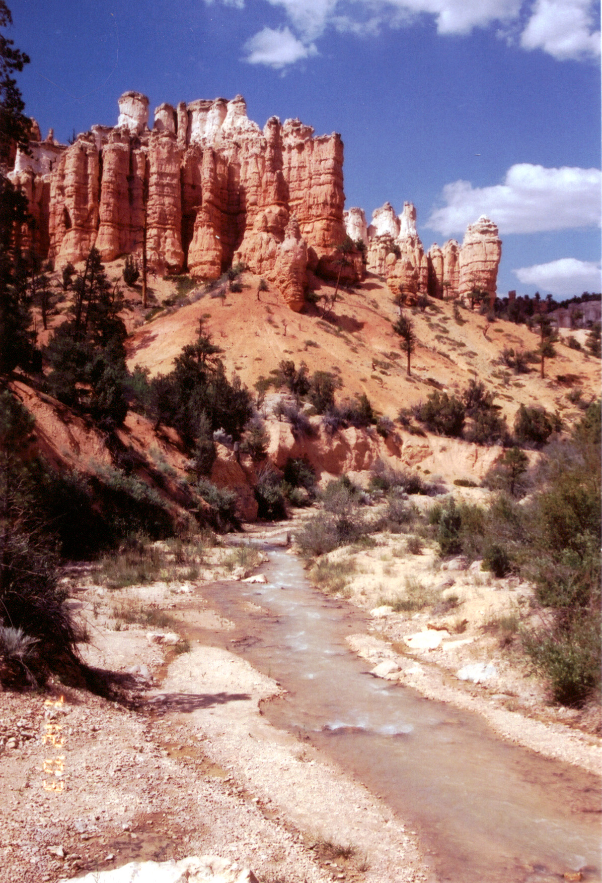
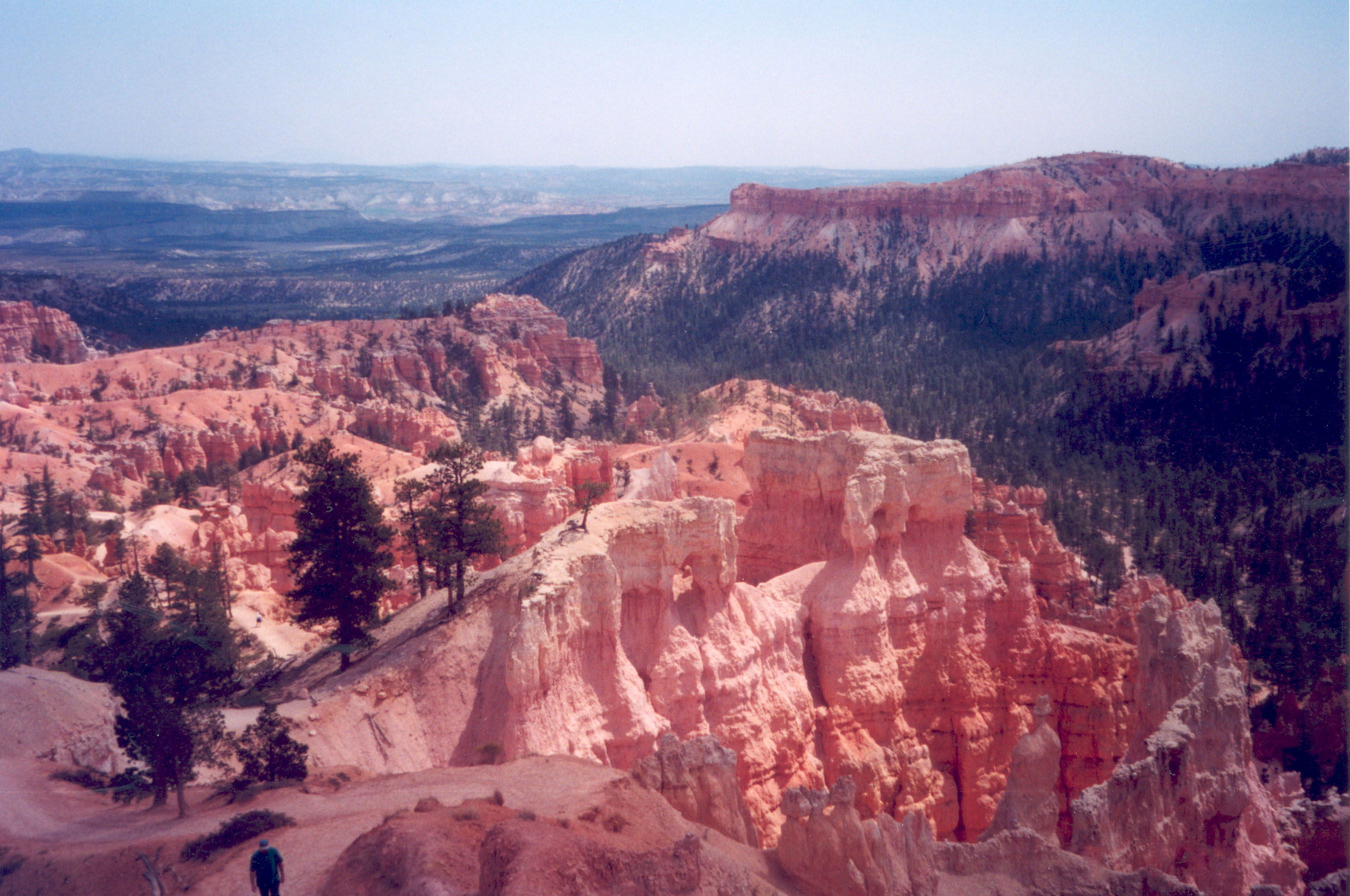
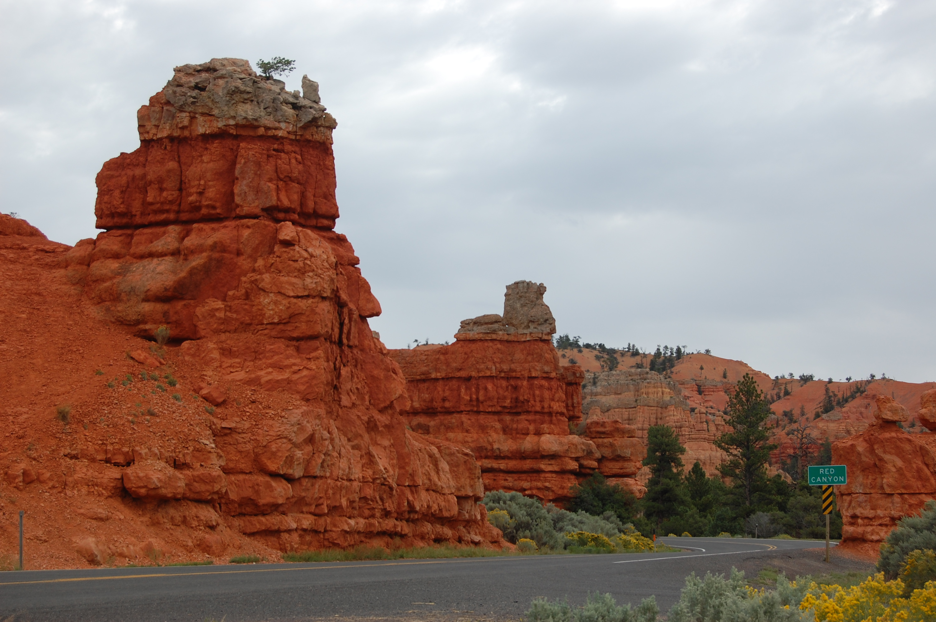
White-tipped orange hoodoos sit on both sides of Scenic Byway 12 as it passes through Bryce Canyon National Park.
Public Domain. Photo by Janet Reffert
Download Original (3008 x 2000 pixels, 757.0 KB)
-
Scenic Byway 12 curves around slickrock, and the black road contrasts the ecru-colored landscape.
Public Domain. Photo by Janet Reffert
Download Original (1995 x 1350 pixels, 1086.3 MB)
-
Redrock sandstone glows in the sunlight through a view on a hiking trail in Bryce Canyon National Park.
Public Domain. Photo by Jessica Dungan
Download Original (3008 x 2000 pixels, 1512.8 MB)
-
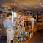
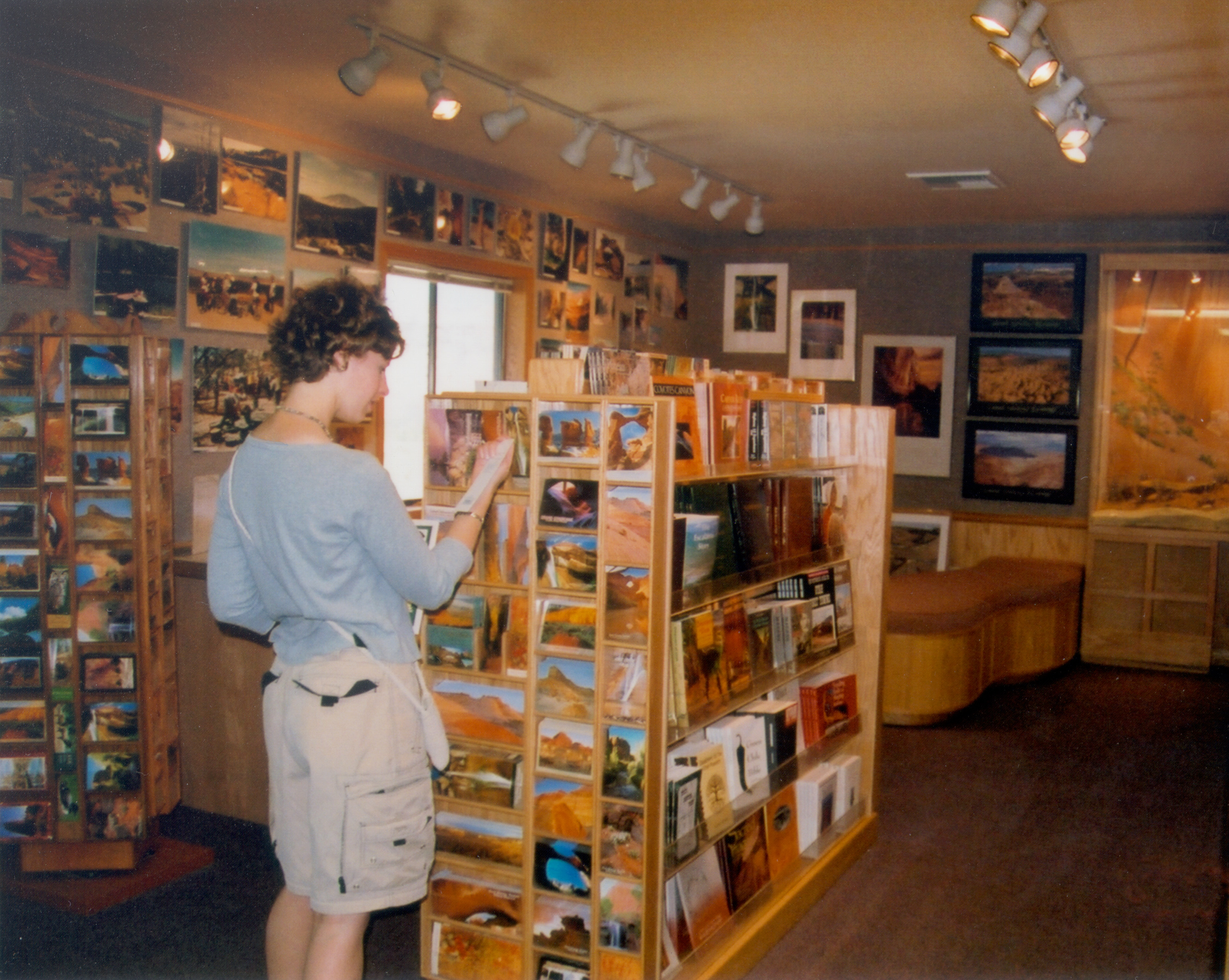
Books, maps, and postcards are available at the Multi Agency Visitor Center in Escalante.
Public Domain. Photo by A. E. Crane
Download Original (2970 x 2370 pixels, 1711.2 MB)
-
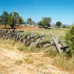
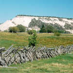
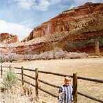
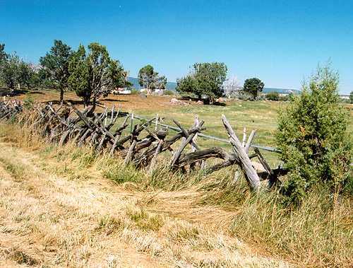
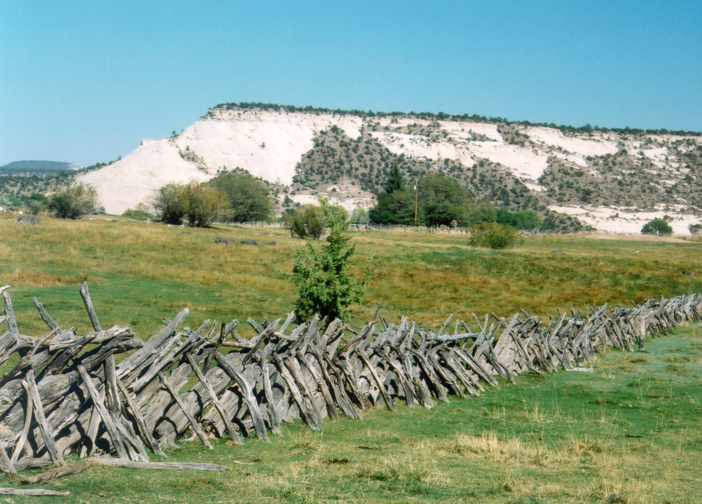
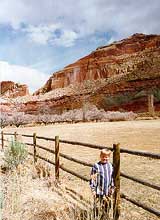
This old pioneer fence remains bordering a field in Boulder.
Public Domain. Photo by A. E. Crane
Download Original (500 x 379 pixels, 168.0 KB)
-
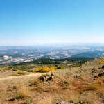
Boulder Mountain provides a view of rugged splendor.
Public Domain. Photo by A. E. Crane
Download Original (2596 x 1628 pixels, 1245.3 MB)
-
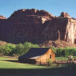
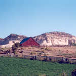
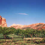
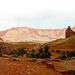
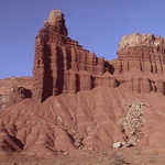
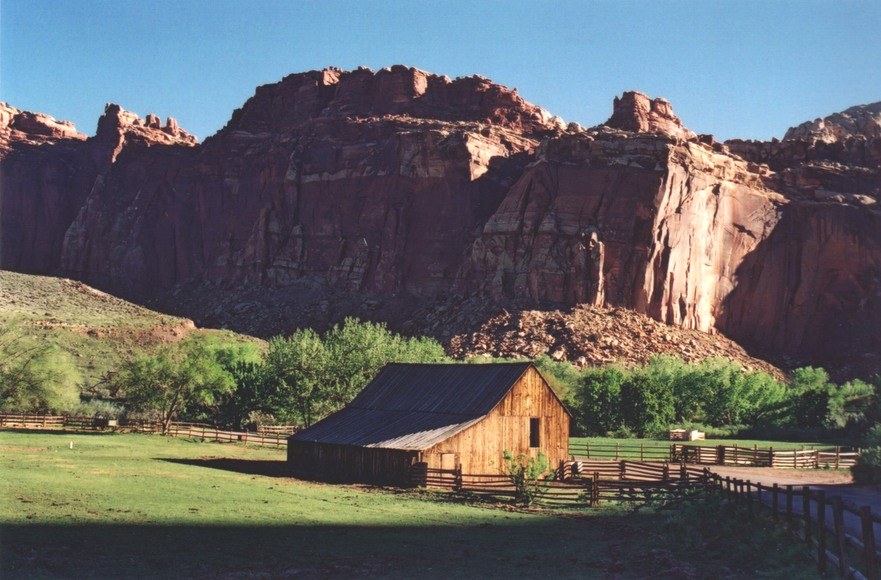
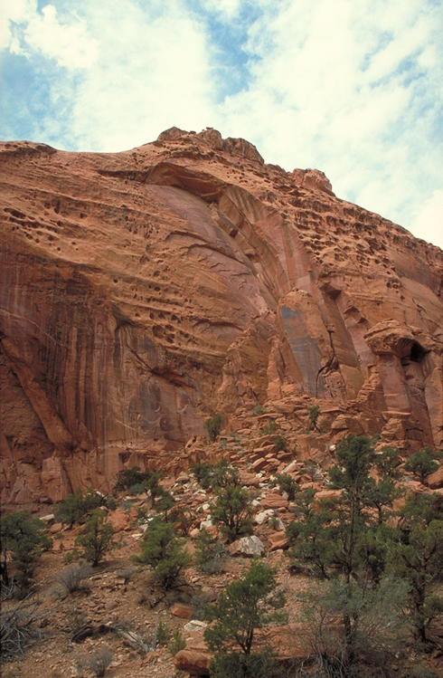
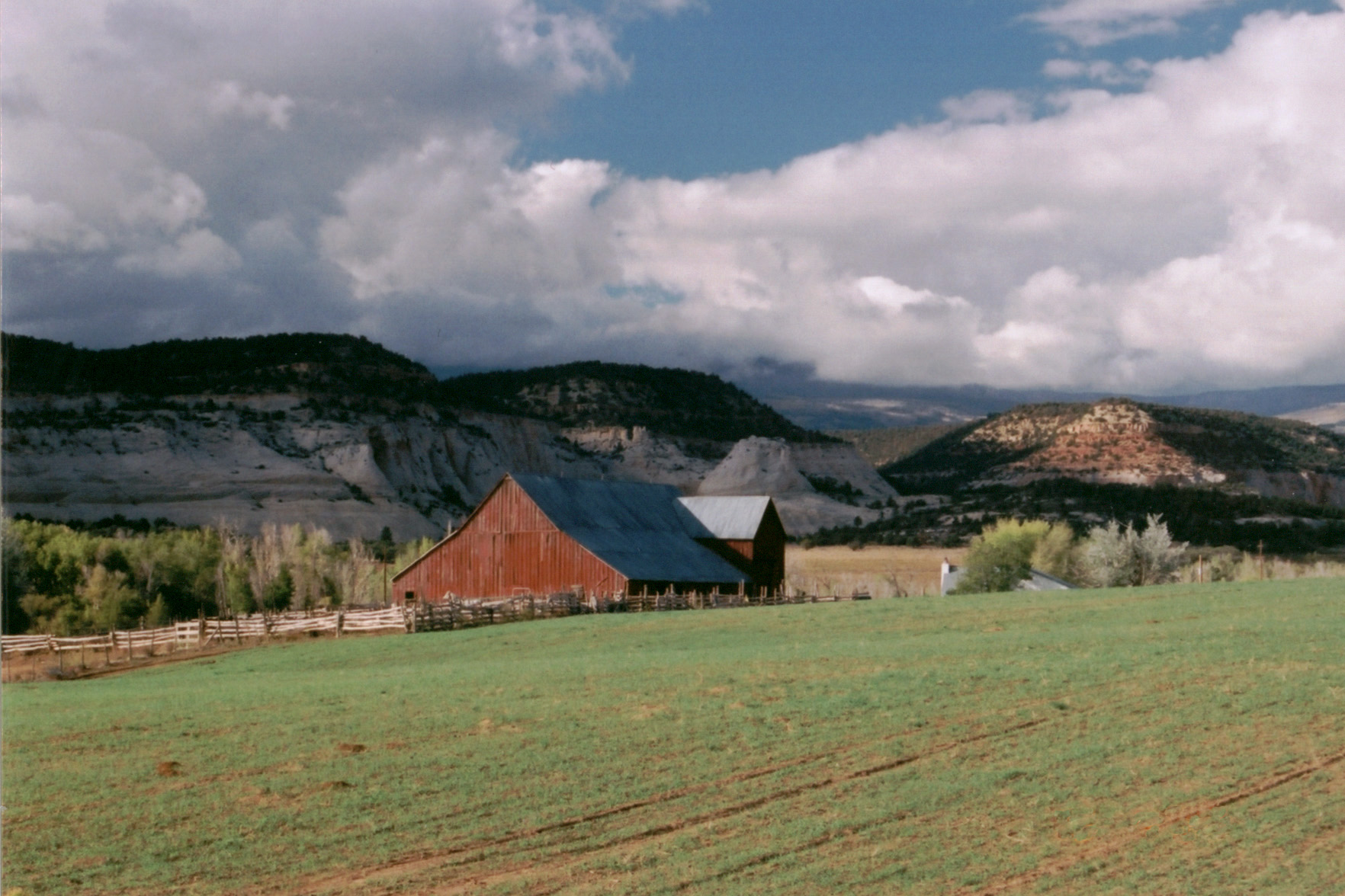
Sunlight strikes the old Hickman homestead barn one spring morning in Fruita, with the orange and cream sandstone cliffs of the Waterpocket Fold behind.
Public Domain. Photo by A. E. Crane
Download Original (1785 x 1177 pixels, 579.4 KB)
-
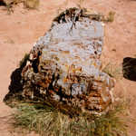
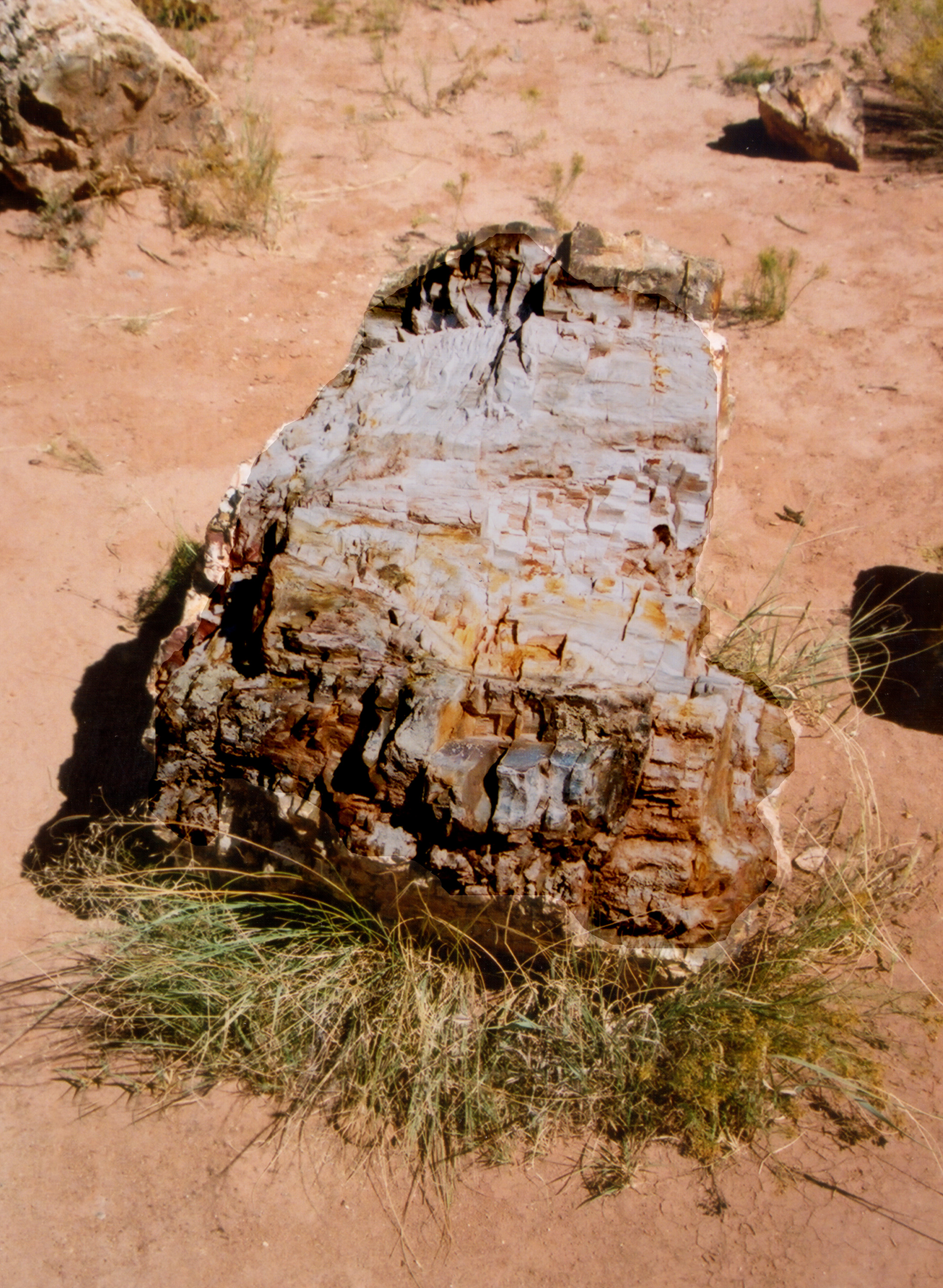
Petrified wood, like this log, is common at Escalante State Park.
Public Domain. Photo by A. E. Crane
Download Original (2217 x 3028 pixels, 1956.4 MB)
-
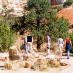
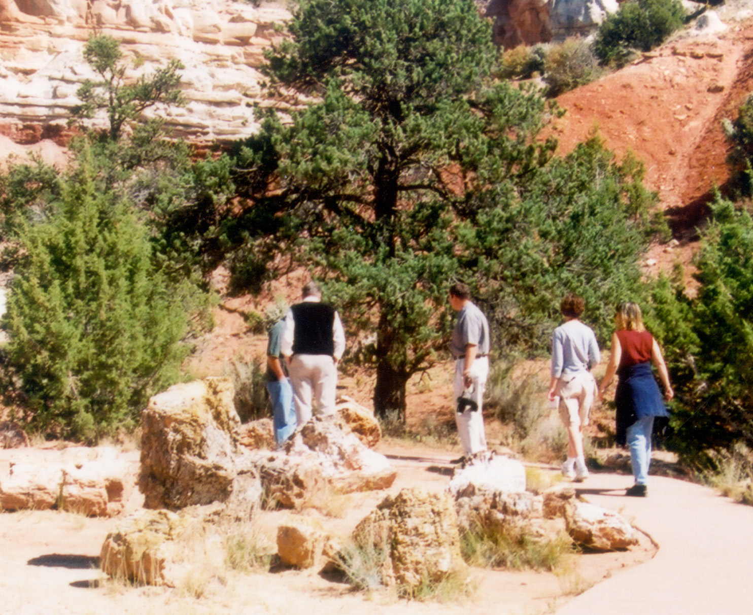
Visitors tour the rock garden of petrified wood at Escalante State Park.
Public Domain. Photo by A. E. Crane
Download Original (1484 x 1212 pixels, 652.6 KB)
-
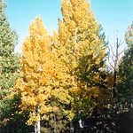
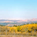
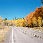
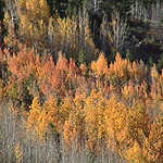
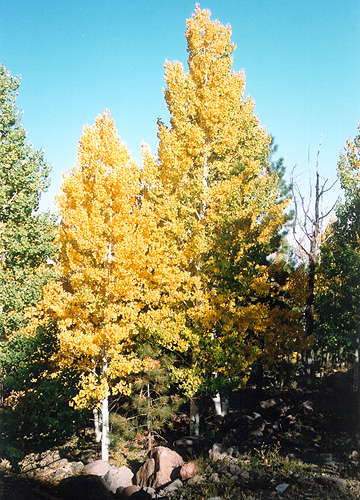
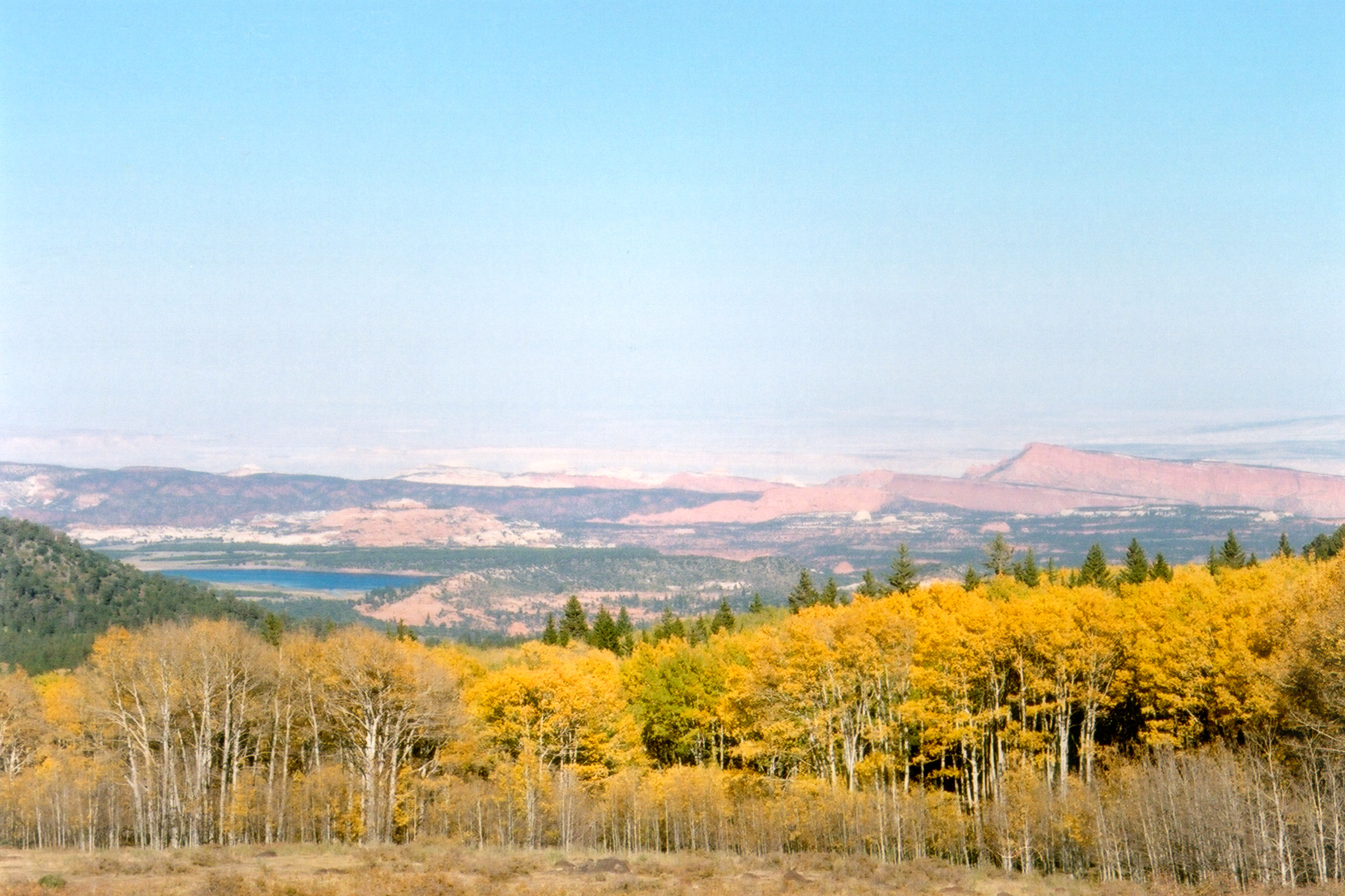
Quaking autumn aspen abounds on Boulder Mountain.
Public Domain. Photo by A. E. Crane
Download Original (360 x 500 pixels, 172.8 KB)
-
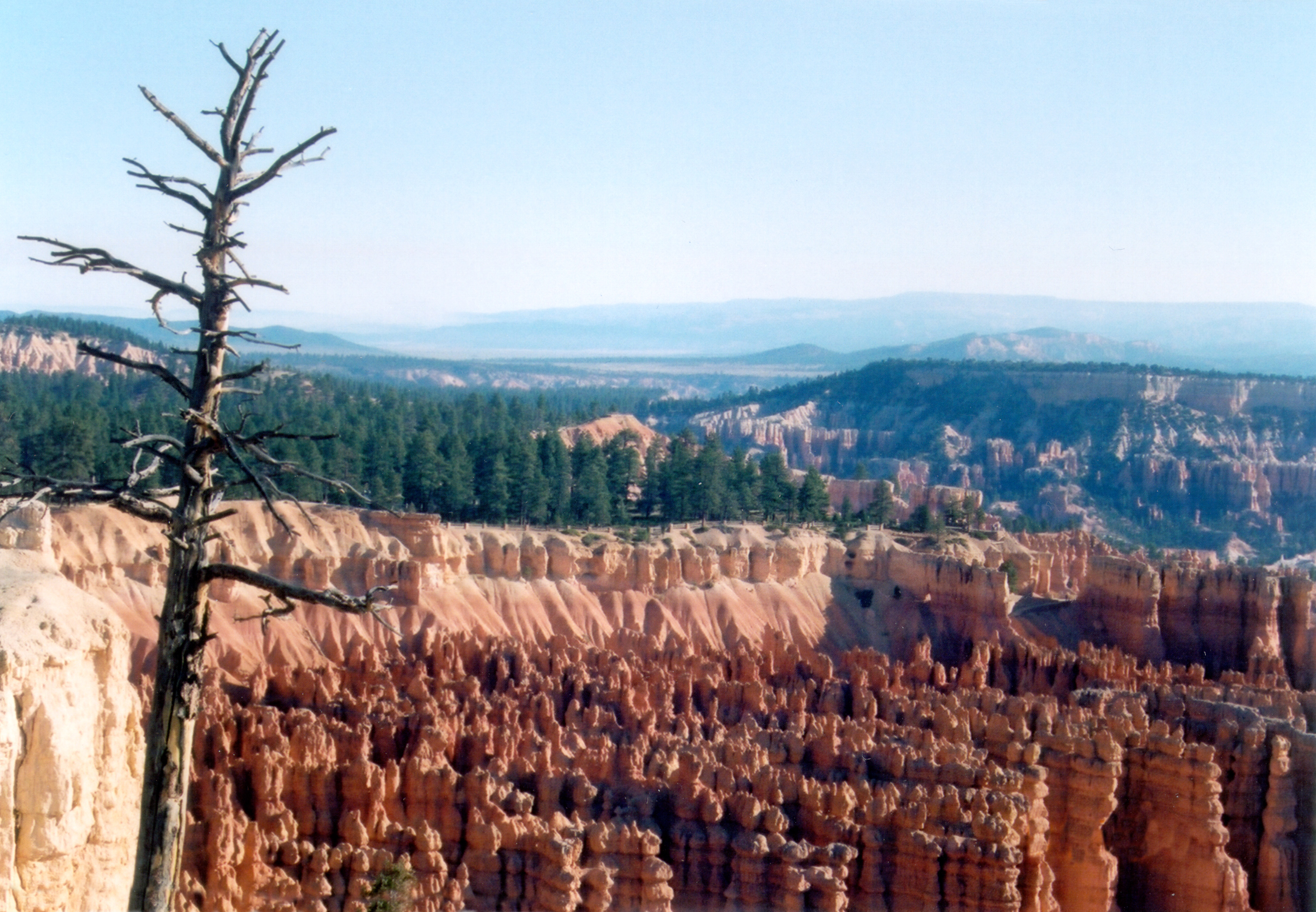
An old tree overlooks Bryce Canyon.
Public Domain. Photo by A. E. Crane
Download Original (3420 x 2370 pixels, 2002.6 MB)
-
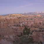
Bryce Canyon's Sunset Point on the day of a prescribed burn in the nearby forest.
Public Domain. Photo by A. E. Crane
Download Original (3000 x 2001 pixels, 1704.1 MB)
-
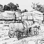
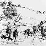
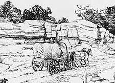
Black and white sketch of wagon on Hole-in-the-Rock Trail.
Public Domain.
Download Original (225 x 162 pixels, 24.6 KB)
-
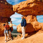
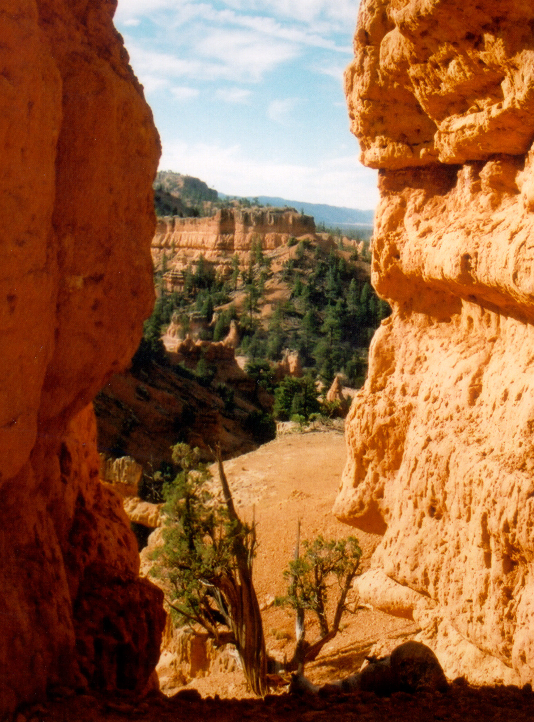
The break in the sandstone walls lends us a taste of a marvelous view on the Arches Trail on Scenic Byway 12.
Public Domain. Photo by S. Clyde
Download Original (1758 x 2376 pixels, 1138.2 MB)
-
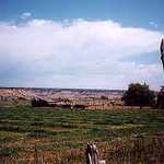
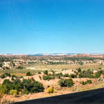
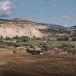
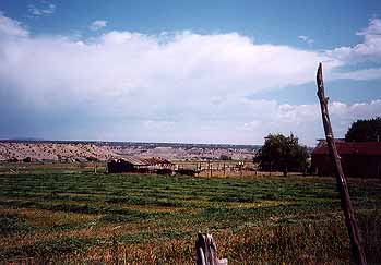
Green fields of a ranch near the road contrast with the rugged sandstone terrain visible on the horizon.
Public Domain. Photo by A. E. Crane
Download Original (349 x 243 pixels, 16.0 KB)
-
Black and white sketch of riders on the Hole-in-the-Rock Trail
Public Domain.
Download Original (225 x 132 pixels, 16.2 KB)
-
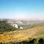
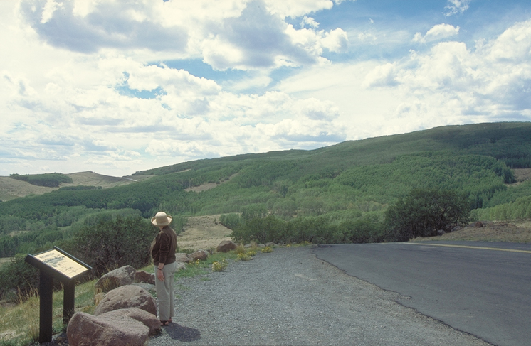
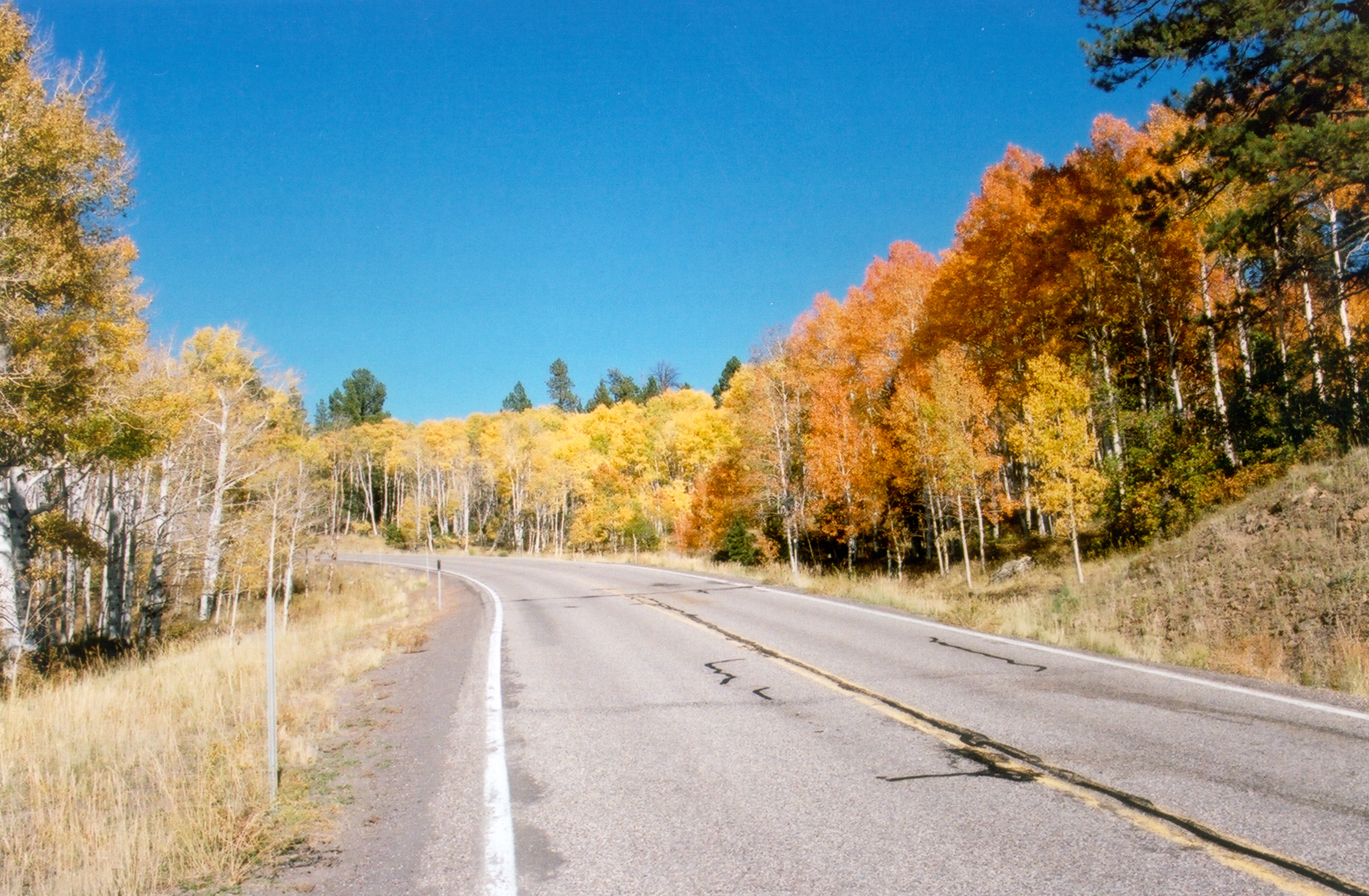
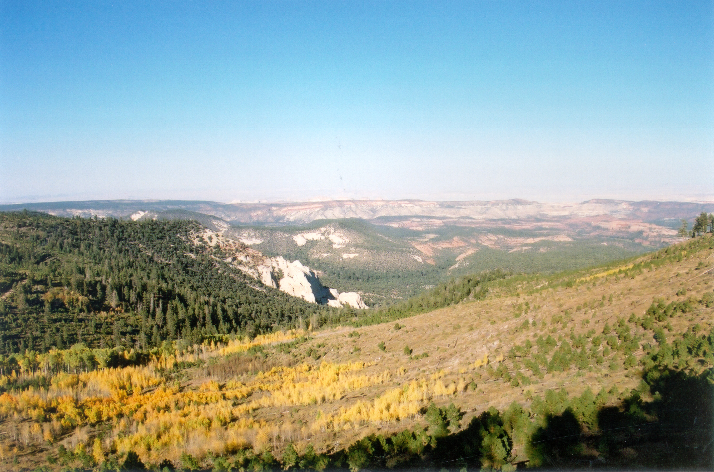
As travelers climb Boulder Mountain they will meet with views of the rocky valley and, in the fall, changing leaves.
Public Domain. Photo by S. Clyde
Download Original (3000 x 1998 pixels, 1674.2 MB)
-
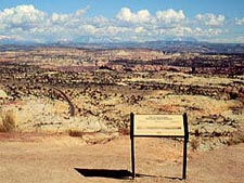
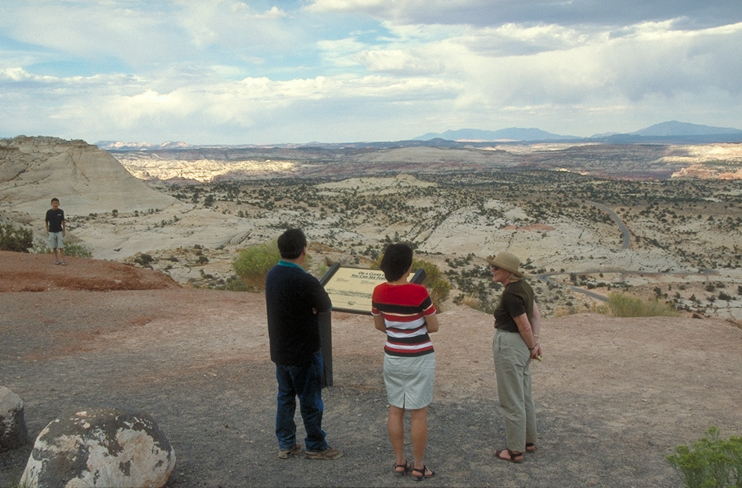
"On a Clear Day" pullout affords a marvelous view that stretches far into the distance.
Public Domain.
Download Original (225 x 169 pixels, 21.3 KB)
-
The aspen on Boulder Mountain change color in September.
Public Domain. Photo by S. Clyde
Download Original (3000 x 2021 pixels, 1579.3 MB)
-
The tilt of the camera makes these jagged uprisings of rock seem even more surreal.
Public Domain.
Download Original (225 x 128 pixels, 13.2 KB)
-
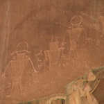
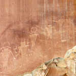
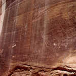
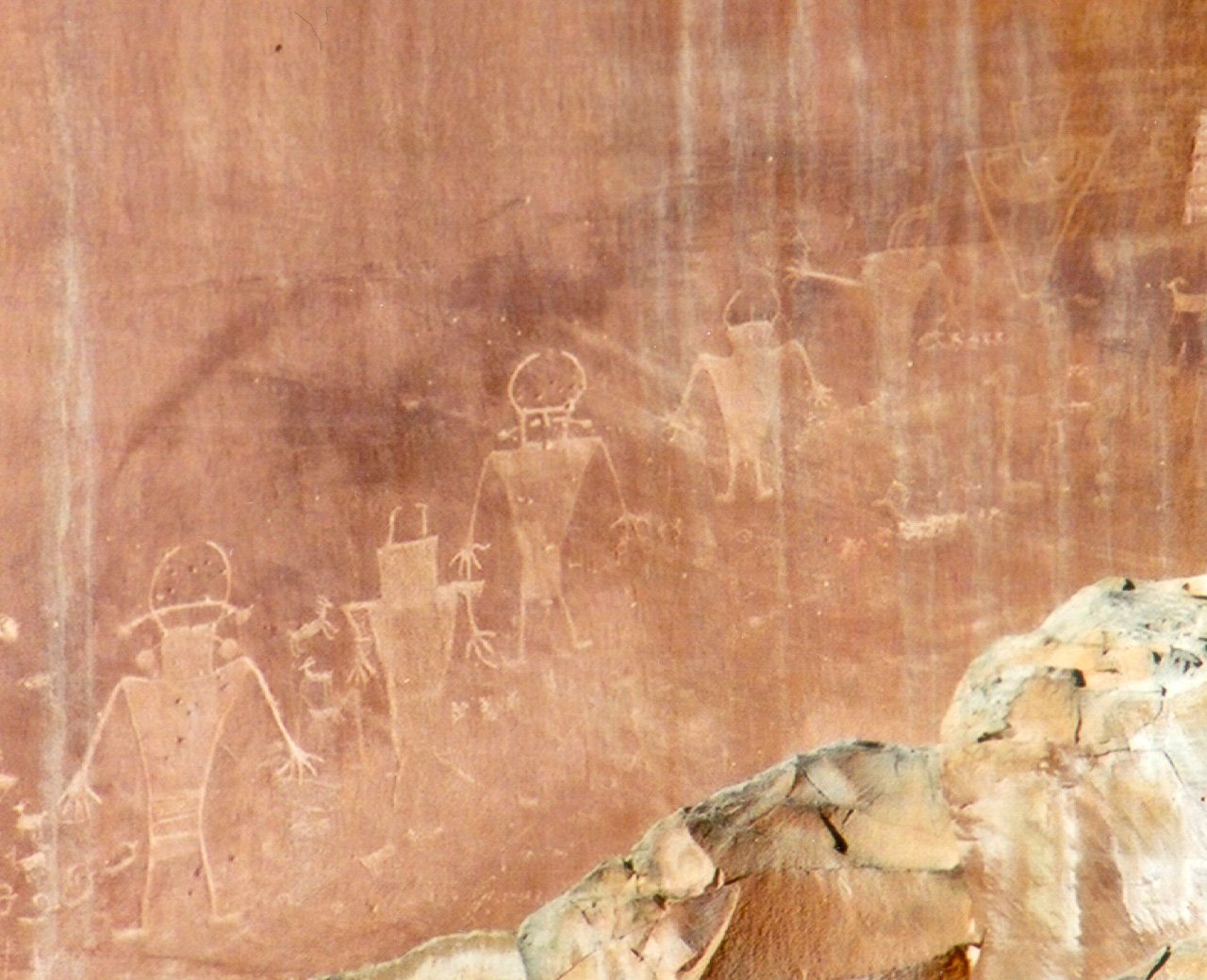
This photo captures a closeup of Fremont Indian petroglyphs near Highway 24 in Capitol Reef National Park.
Public Domain. photo by Leslie Lott of NSBO
Download Original (1152 x 864 pixels, 389.4 KB)
-
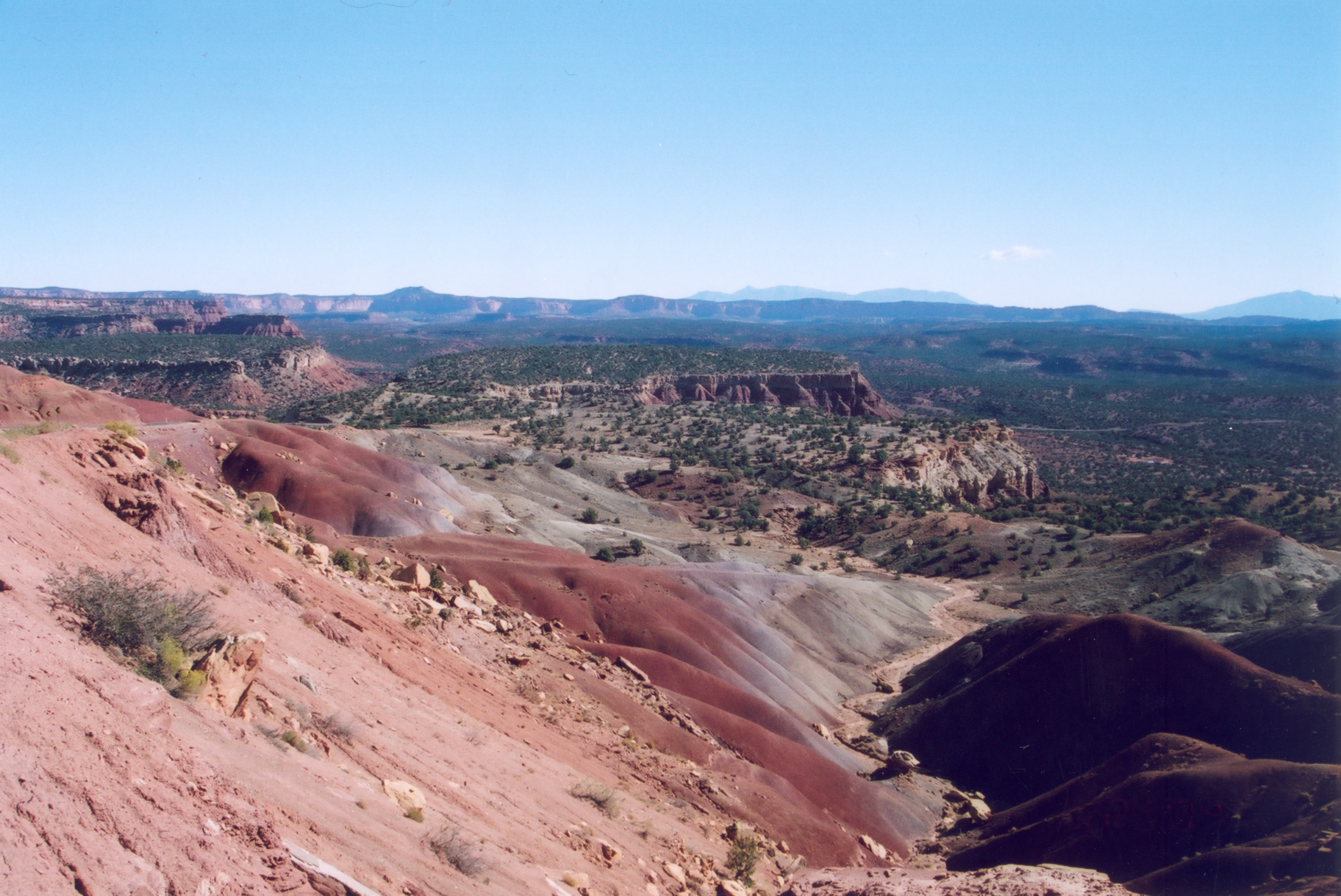
The Blues describes the entire landscape well on this bright summer day.
Public Domain.
Download Original (225 x 175 pixels, 23.6 KB)
-
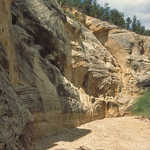
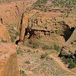
Gray and yellow bands of rock form the sides of Willis Canyon.
Public Domain. Photo by Dennis Adams of FHWA
Download Original (486 x 744 pixels, 438.2 KB)
-
The cream-colored Hickman Bridge is just a short hike from Highway 24.
Public Domain. Photo by A. E. Crane
Download Original (1169 x 1692 pixels, 537.7 KB)
-
Flash floods have created huge scooped caverns in the slot canyon walls of Willis Canyon.
Public Domain. Photo by Dennis Adams of FHWA
Download Original (485 x 749 pixels, 394.1 KB)
-
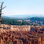
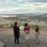
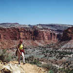
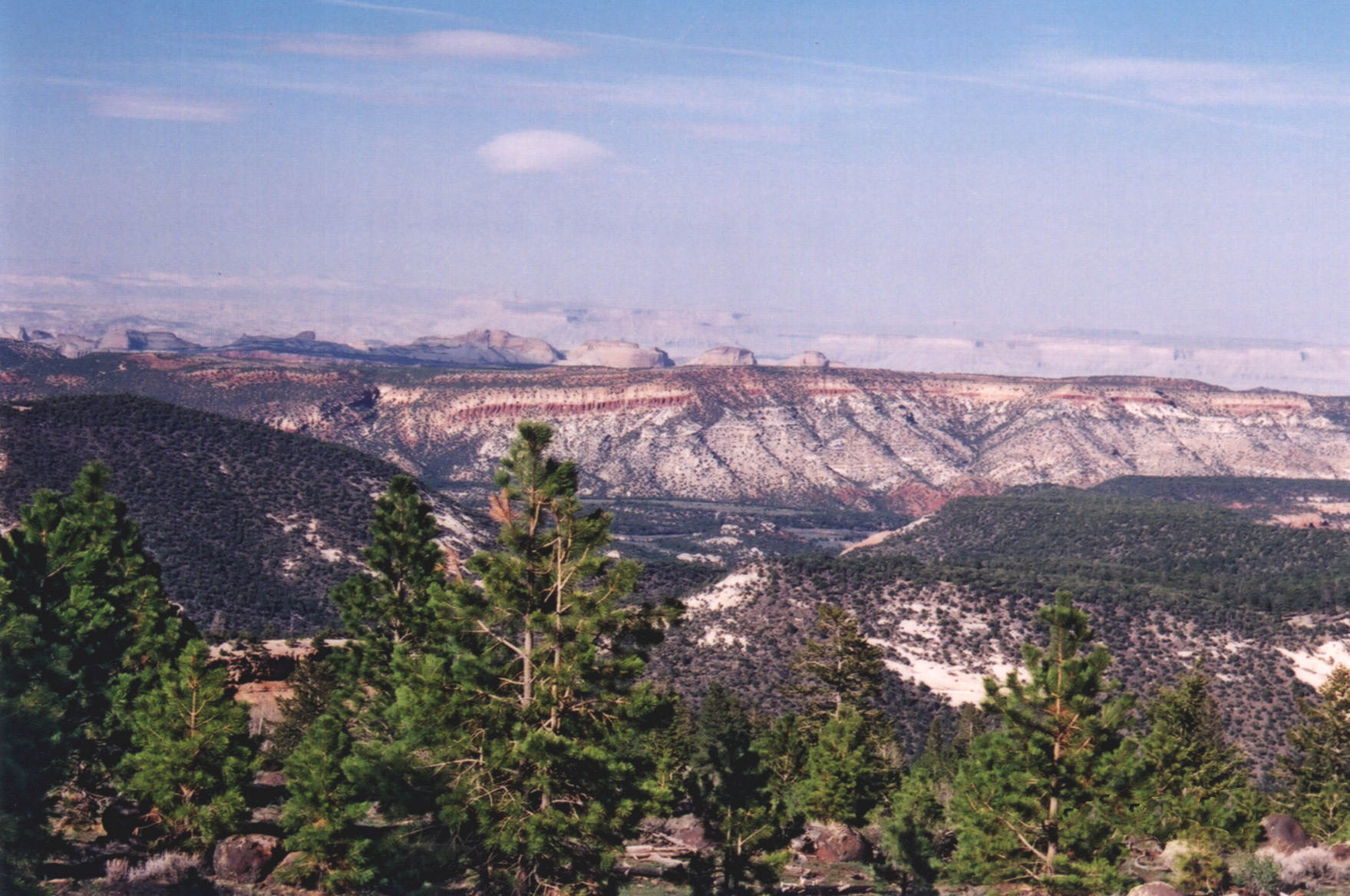
Visitors looking out from Larb Hollow Overlook on Boulder Mountain can see part of the Dixie National Forest, the Waterpocket Fold, and the Henry Mountains.
Public Domain. Photo by A. E. Crane
Download Original (1796 x 1173 pixels, 664.1 KB)
-
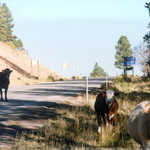
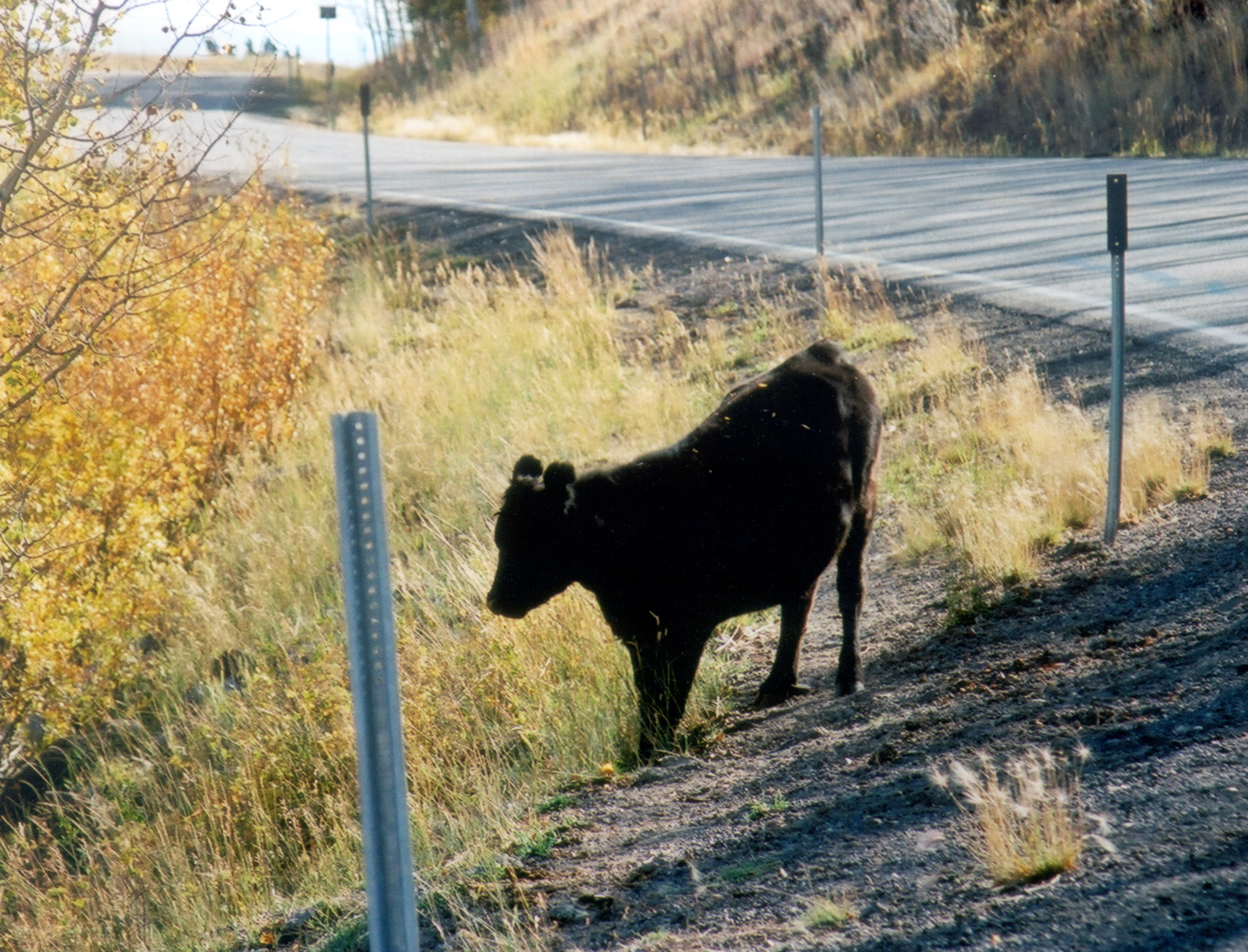
Cattle enjoy the grasses alongside Scenic Byway 12.
Public Domain. Photo by A. E. Crane
Download Original (2615 x 2015 pixels, 1445.9 MB)
-
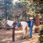
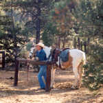
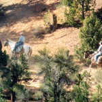
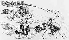
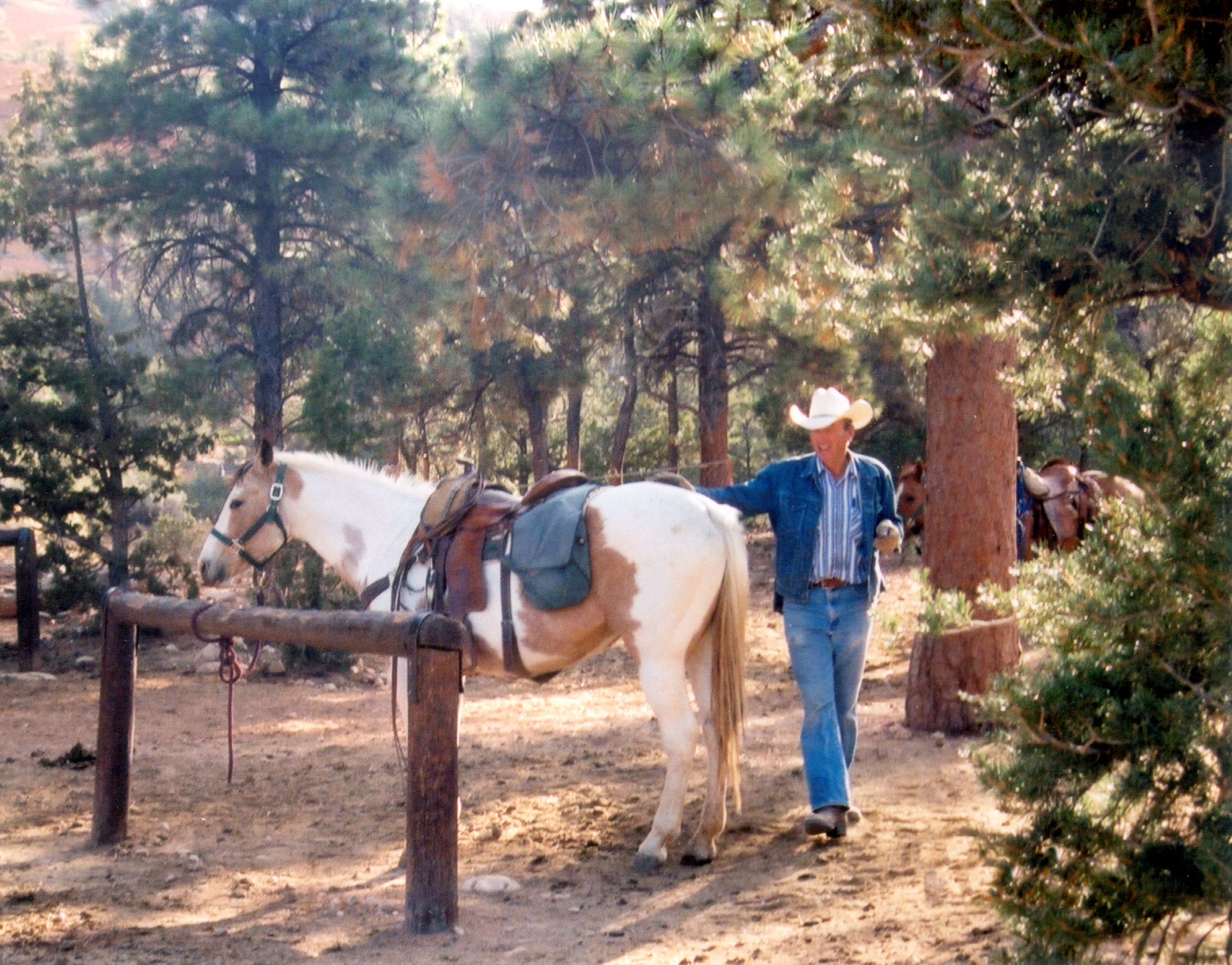
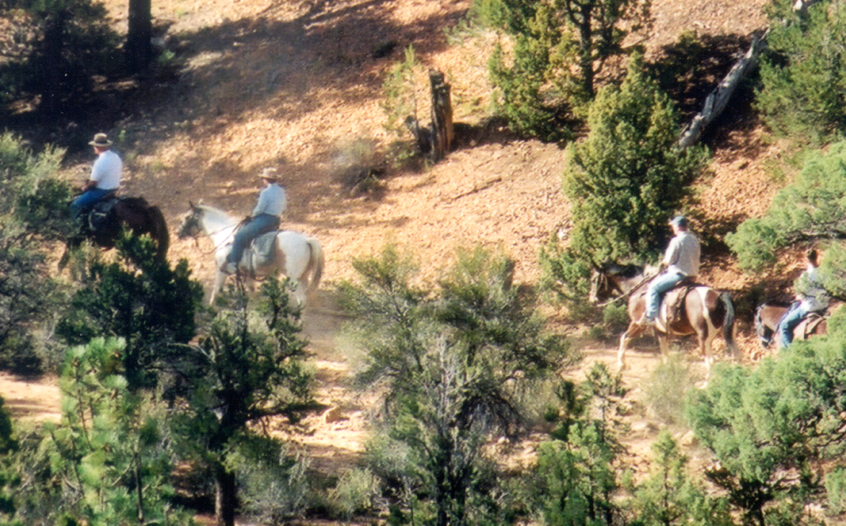
Horseback riding in the Scenic Byway 12 region has been a popular activity for decades.
Public Domain. Photo by A. E. Crane
Download Original (2272 x 1780 pixels, 1347.6 MB)
-
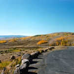
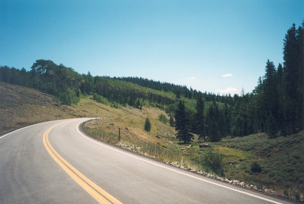
The road winds down Boulder Mountain through forests of aspens and evergreens.
Public Domain. Photo by A. E. Crane
Download Original (225 x 154 pixels, 13.8 KB)
-
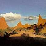
Miniscule hikers look at the sunlit hoodoos in the distance.
Public Domain. Photo by A. E. Crane
Download Original (225 x 158 pixels, 15.0 KB)
-
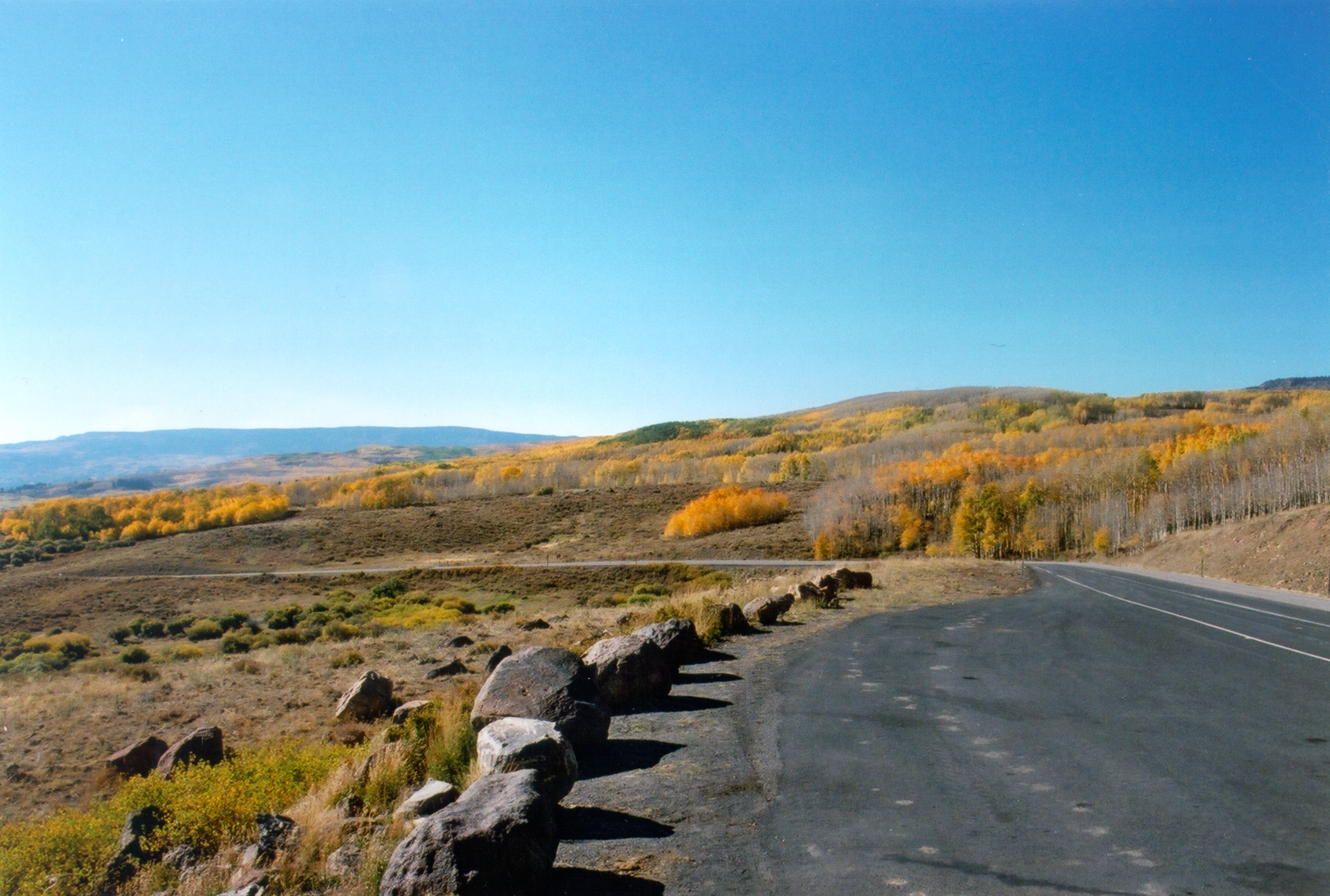
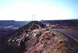
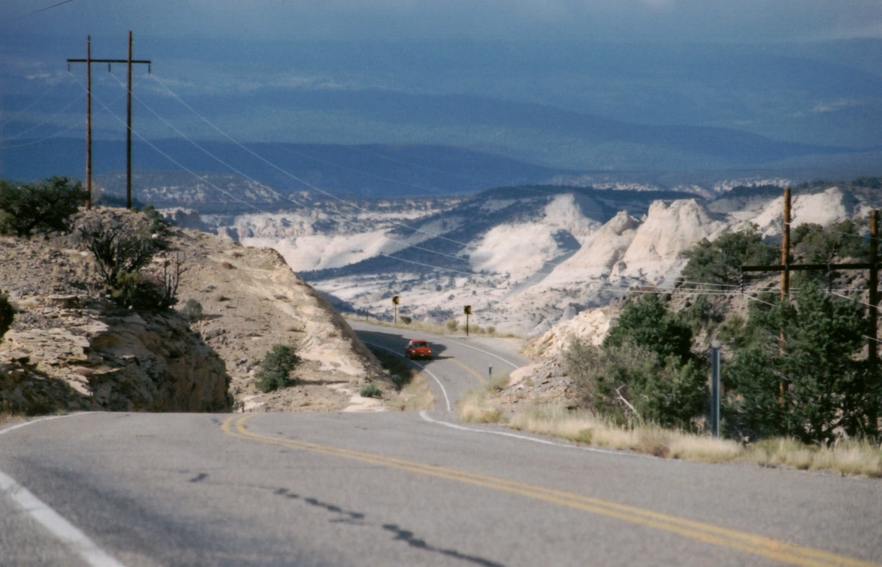
Scenic Byway 12 climbs up through the chilly-looking "Blues" at a vicious 12 percent grade.
Public Domain. Photo by A. E. Crane
Download Original (2650 x 1778 pixels, 727.9 KB)
-
Dark photo of north end of Upper Valley near Intrigue pullout.
Public Domain. Photo by A. E. Crane
Download Original (225 x 140 pixels, 10.5 KB)
-
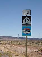
This sign is posted near the junction with Hole-In-The-Rock Scenic Backway.
Public Domain. Photo by A. E. Crane
Download Original (225 x 138 pixels, 11.6 KB)
-
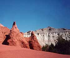
Angel's Palace Trail leads the traveler into a narrow canyon.
Public Domain. Photo by A. E. Crane
Download Original (225 x 154 pixels, 12.4 KB)
-
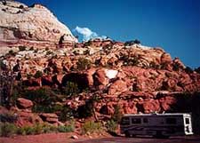
An RV waits for its owners to return at a parking area at Calf Creek, under brilliant redrock.
Public Domain. Photo by A. E. Crane
Download Original (225 x 161 pixels, 16.9 KB)
-
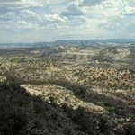
This pullout offers an extensive view of the mutli-colored mountains.
Public Domain.
Download Original (225 x 203 pixels, 26.3 KB)
-
This is the Wildcat Ranger Station area, as seen from the road in the summer.
Public Domain. Photo by A. E. Crane
Download Original (225 x 187 pixels, 20.1 KB)
-
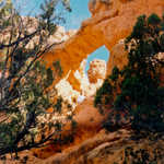
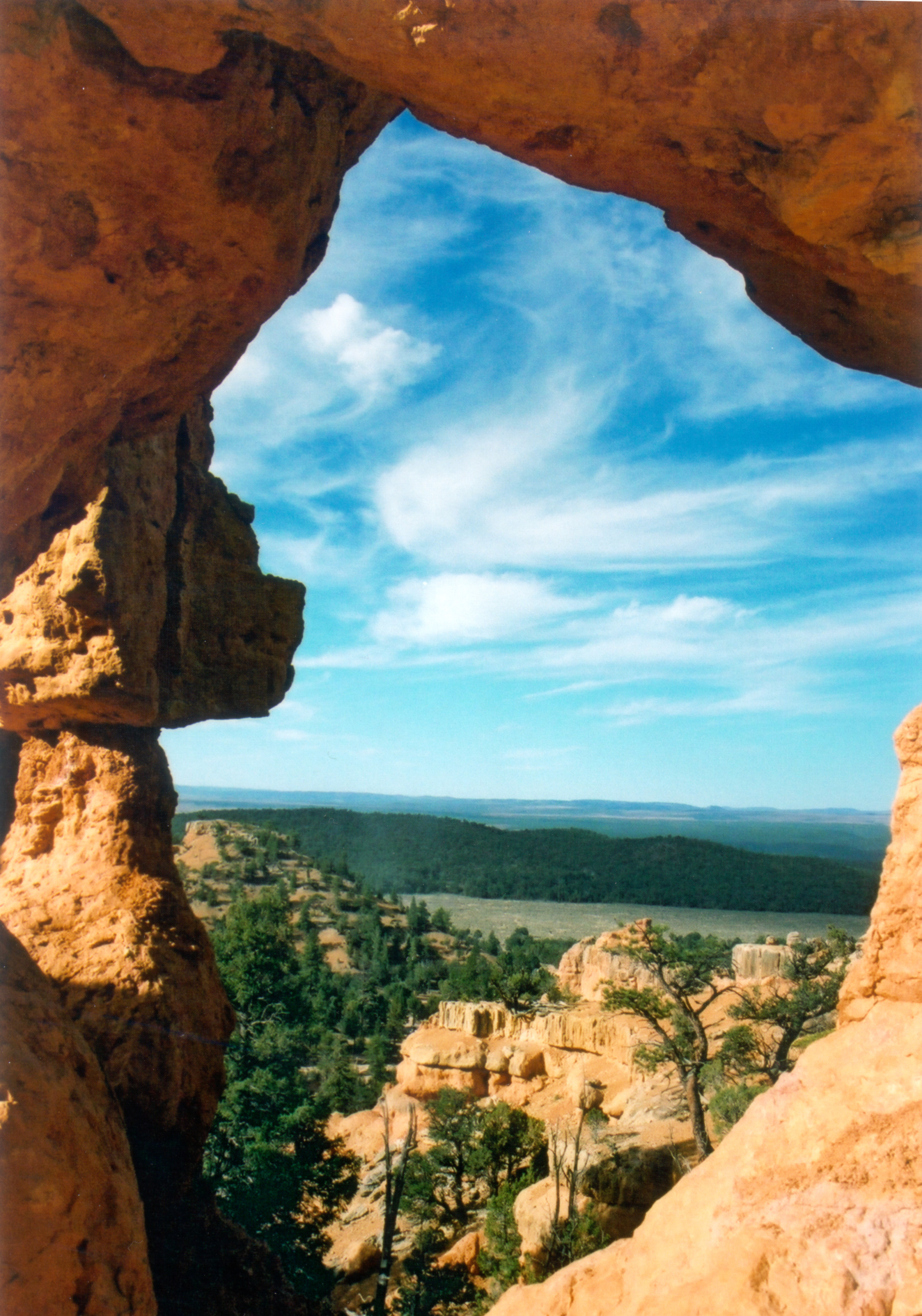
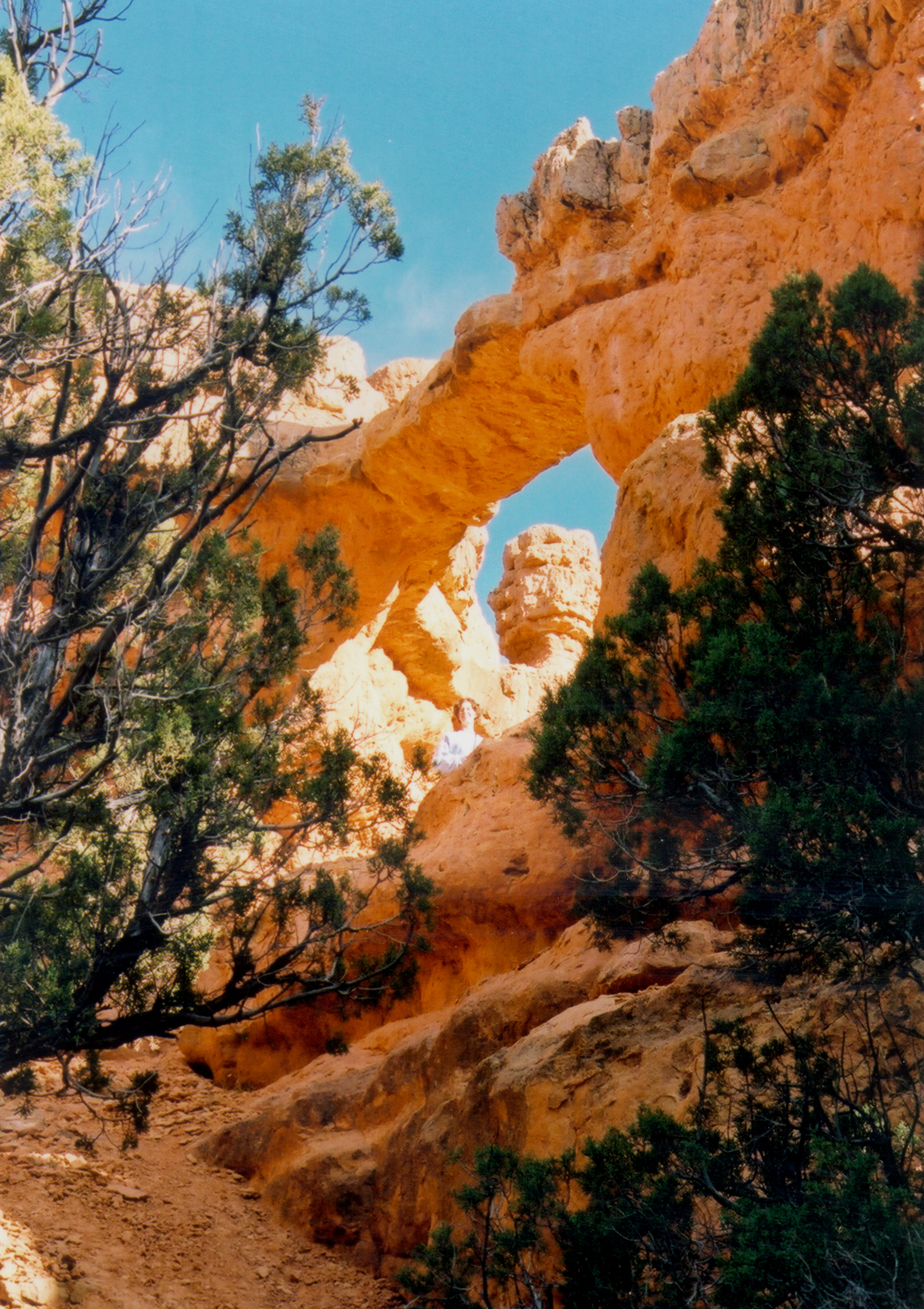
This natural arch frames layers of landscape with red stone.
Public Domain. Photo by S. Clyde
Download Original (2364 x 3372 pixels, 2111.5 MB)
-
Scenic Byway 12's Boynton Overlook commands an impressive view of the arid Escalante Canyons.
Public Domain.
Download Original (186 x 200 pixels, 19.2 KB)
-
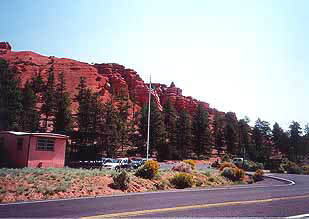
Red hills rise behind the Red Canyon Visitor Center.
Public Domain. Photo by A. E. Crane
Download Original (309 x 219 pixels, 26.3 KB)
-
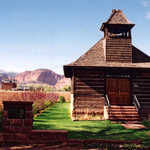
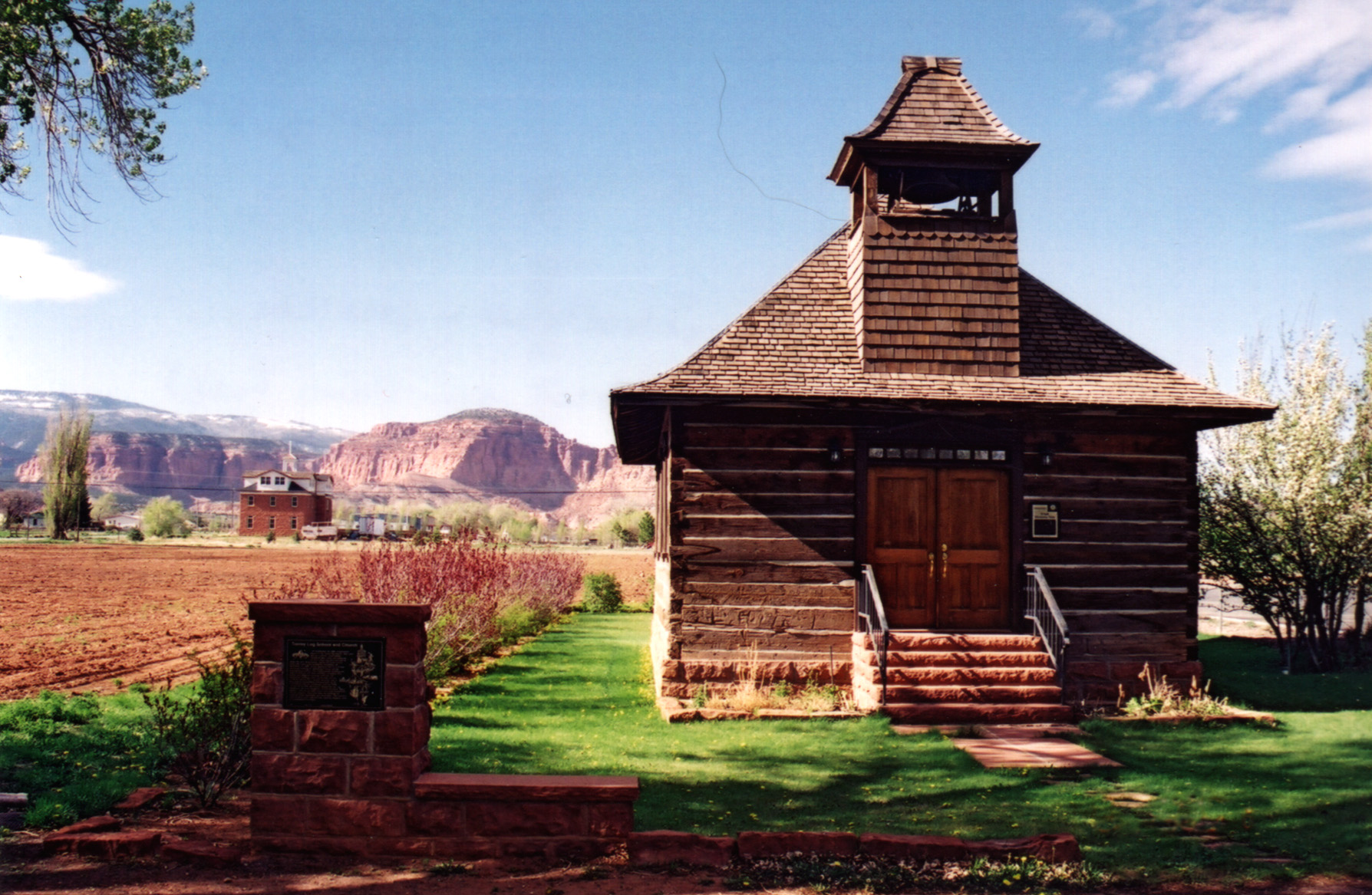
A Utah historic site, this old log schoolhouse with its bell tower and red sandstone steps is a lovely reminder of Torrey's pioneer heritage.
Public Domain. Photo by A. E. Crane
Download Original (1788 x 1167 pixels, 623.2 KB)
-
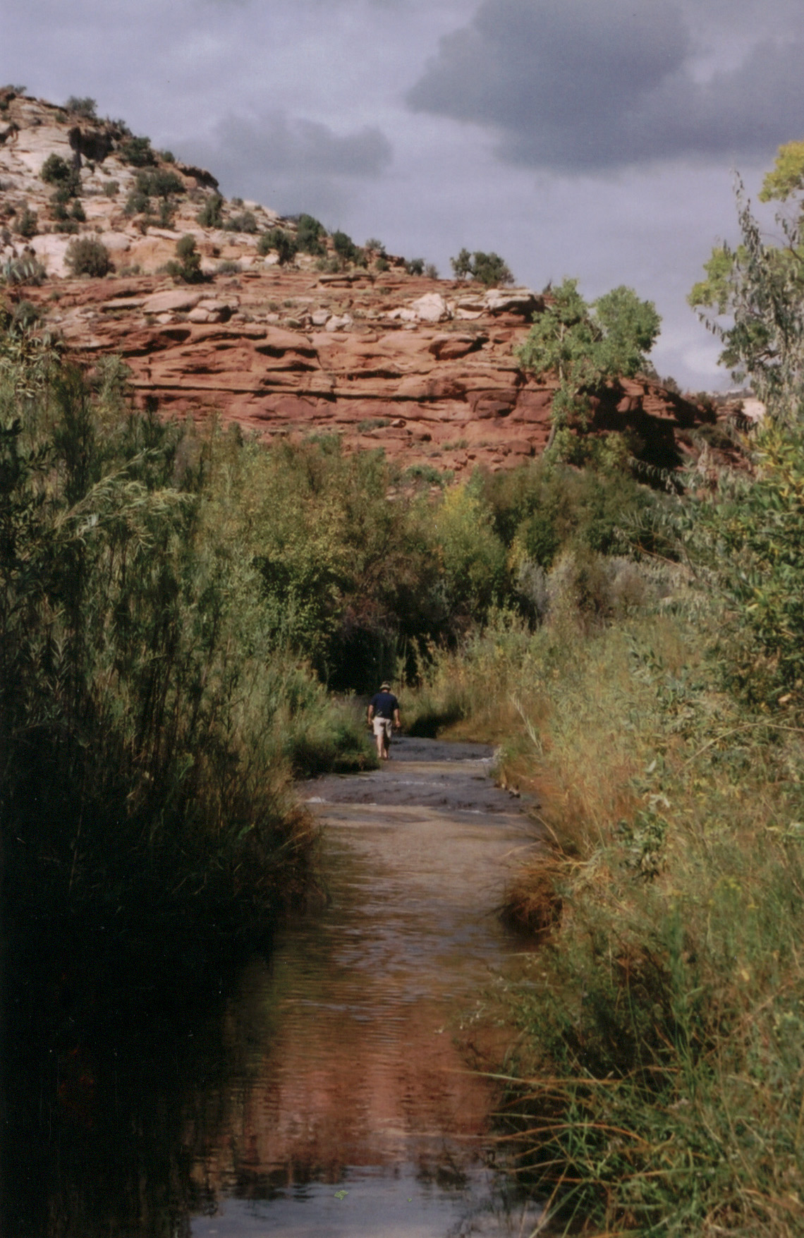
A lone hiker wades in the cool waters of Calf's Creek in Escalante Canyons, Utah.
Public Domain. Photo by A. E. Crane
Download Original (1140 x 1755 pixels, 648.3 KB)
-
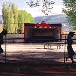
The early pioneers held evening musical entertainments and dances in the Big Apple Outdoor Dance Hall in Torrey. The hall is used for much the same purposes today.
Public Domain. Photo by A. E. Crane
Download Original (1791 x 1182 pixels, 669.3 KB)
-
The road contrasts with candy striped country near Kodachrome Basin.
Public Domain. Photo by A. E. Crane
Download Original (2524 x 1780 pixels, 1336.6 MB)
-
Linger snow clings to the shores of Posey Lake.
Public Domain.
Download Original (225 x 153 pixels, 18.3 KB)
-
Slickrock formations by Scenic Byway 12 in Utah gleam surreally in the afternoon sun.
Public Domain. Photo by A. E. Crane
Download Original (1786 x 1184 pixels, 581.5 KB)
-
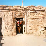
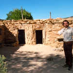
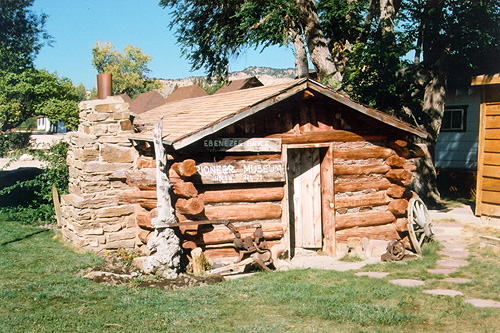
This historic cabin is part of a museum that is open to the public.
Public Domain. Photo by A. E. Crane
Download Original (500 x 333 pixels, 142.6 KB)
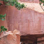
-
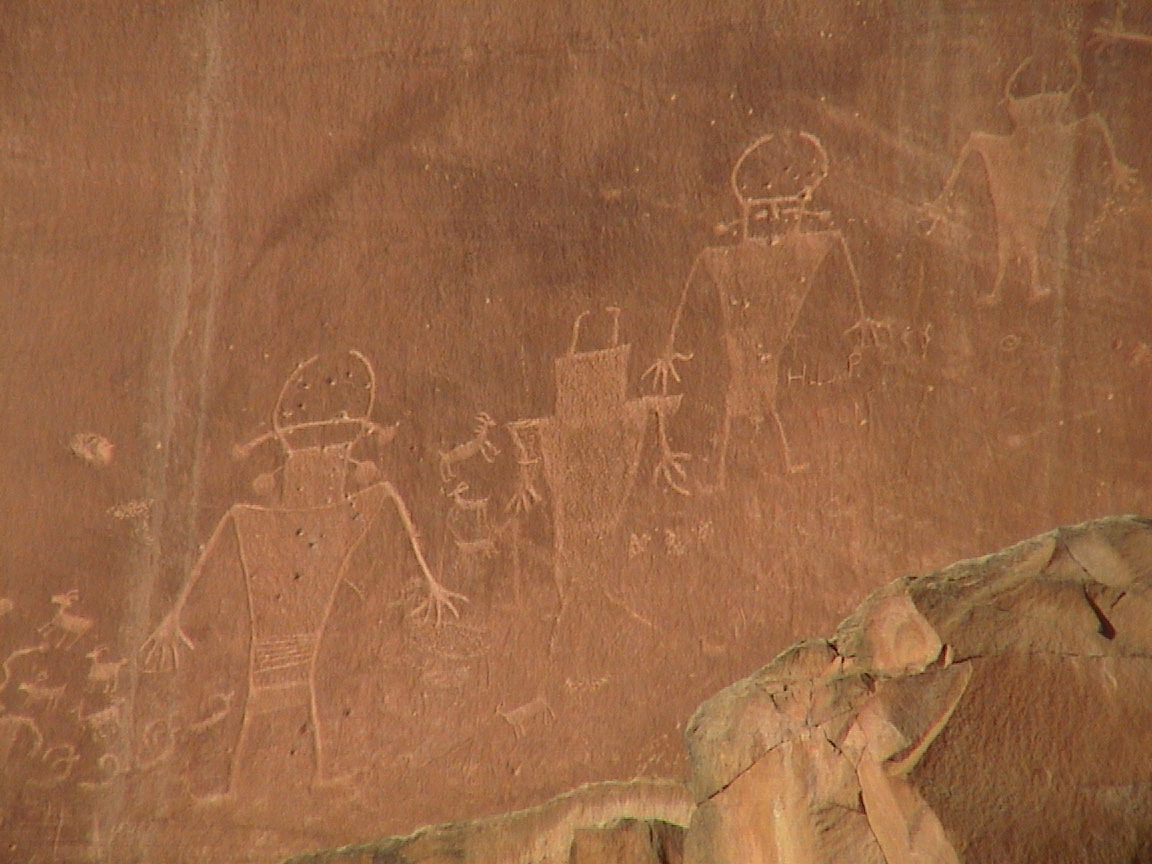
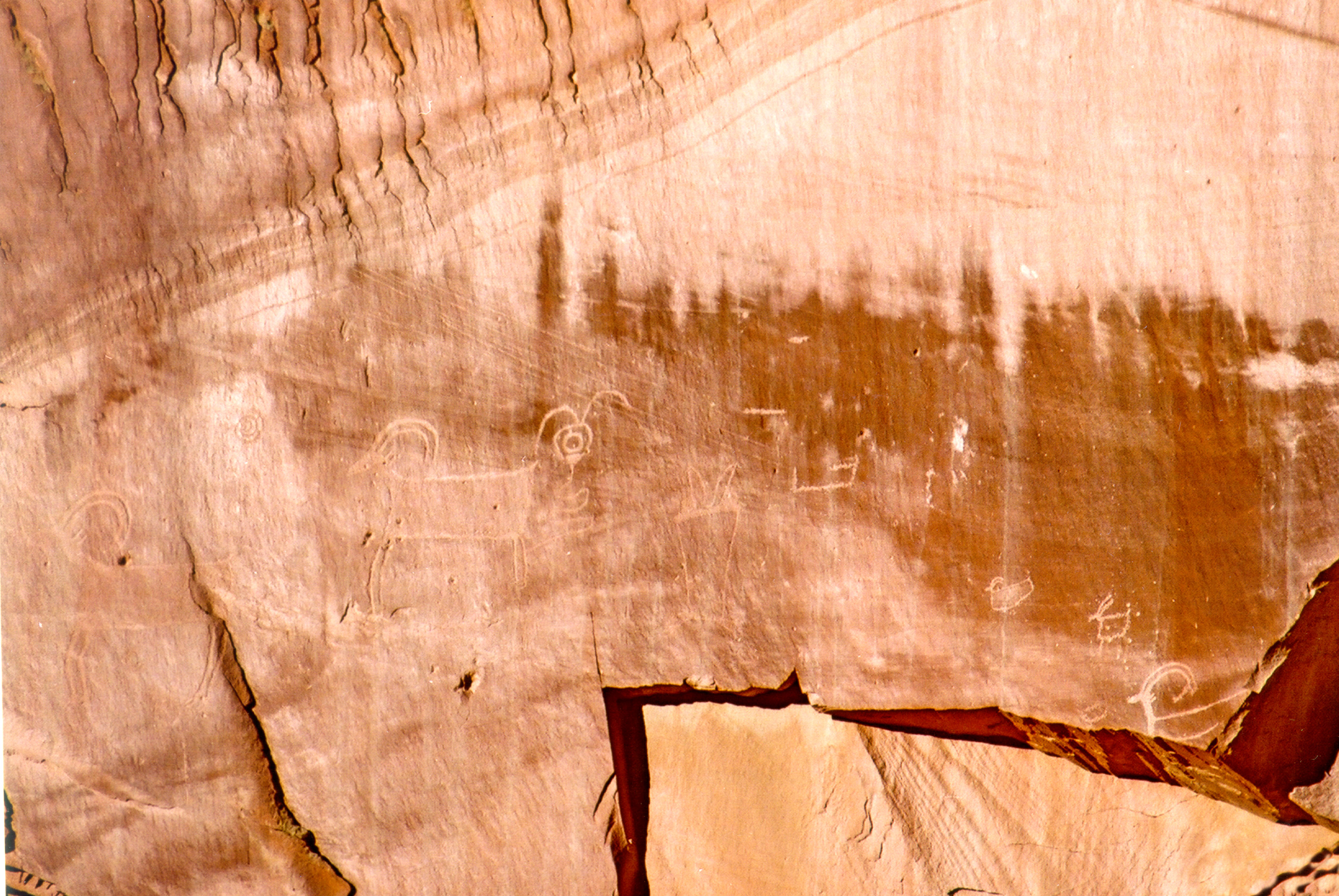
Rams, sheep, and curious figures remain etched in Fremont Indian petroglyphs next to Highway 24 in Capitol Reef National Park.
Public Domain. Photo by A. E. Crane
Download Original (2740 x 1834 pixels, 1705.5 MB)
-
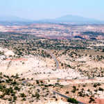
Looking northeast from Larb Hollow Overlook relatively flat candy-striped mesas sit near Dixie National Forest and east of Capitol Reef National Park.
Public Domain. Photo by A. E. Crane
Download Original (1759 x 1167 pixels, 632.4 KB)
-
Visitors peer inside Fruita's historic old log schoolhouse as they listen to the recorded voice of a former schoolteacher tell of her experiences here.
© May 2001 A. E. Crane.
-
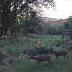
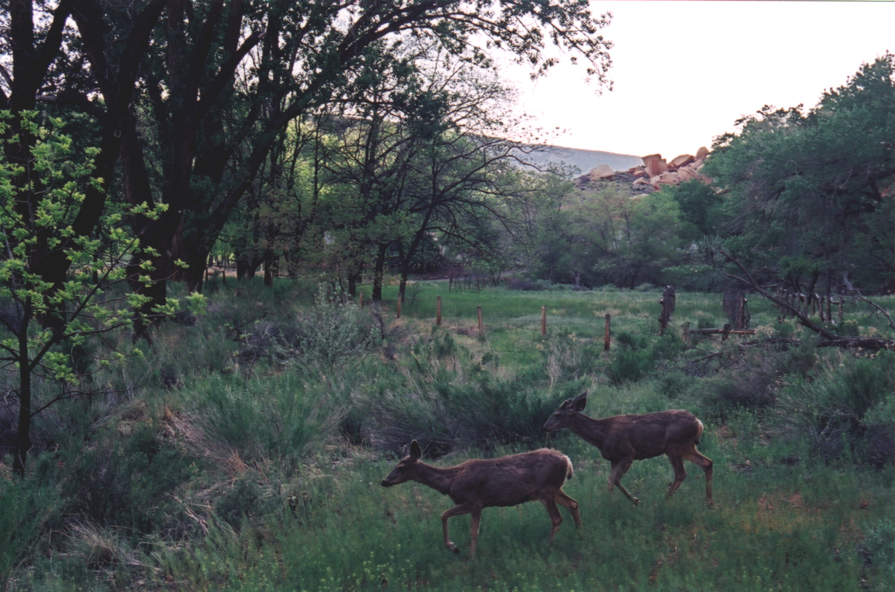
Two mule deer at dusk, startled while feeding on the spring growth near the petroglyphs by the highway in Capitol Reef National Park.
Public Domain. Photo by A. E. Crane
Download Original (1785 x 1182 pixels, 619.6 KB)
-
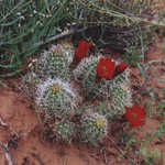
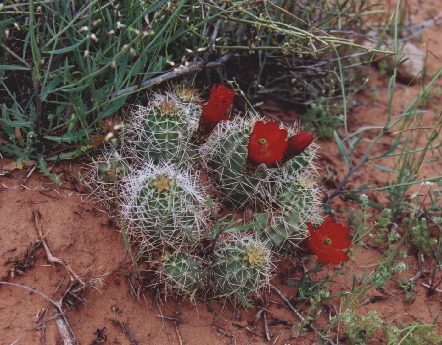
The vivid red blooms of a barrel cactus are a treasure to find on the Hickman Bridge Trail in spring.
Public Domain. Photo by A. E. Crane
Download Original (1405 x 1099 pixels, 550.8 KB)
-
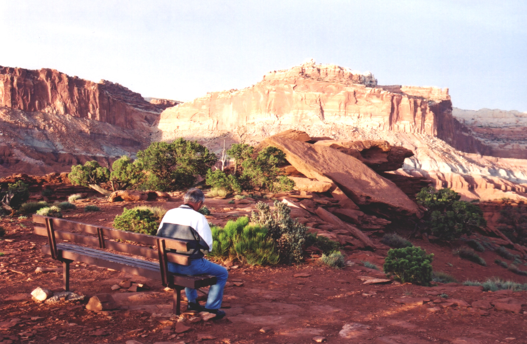
A man on a bench is catching the park at its best, with spring-bright juniper and sagebrush spotlighted against the fiery red and orange rocks of Sunset Point.
Public Domain. Photo by A. E. Crane
Download Original (1783 x 1165 pixels, 609.9 KB)
-
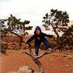
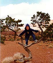
This young byway traveler has fun in a straggly juniper tree.
Public Domain. Photo by S. Clyde
Download Original (184 x 220 pixels, 22.3 KB)
-
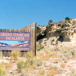
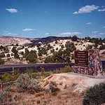
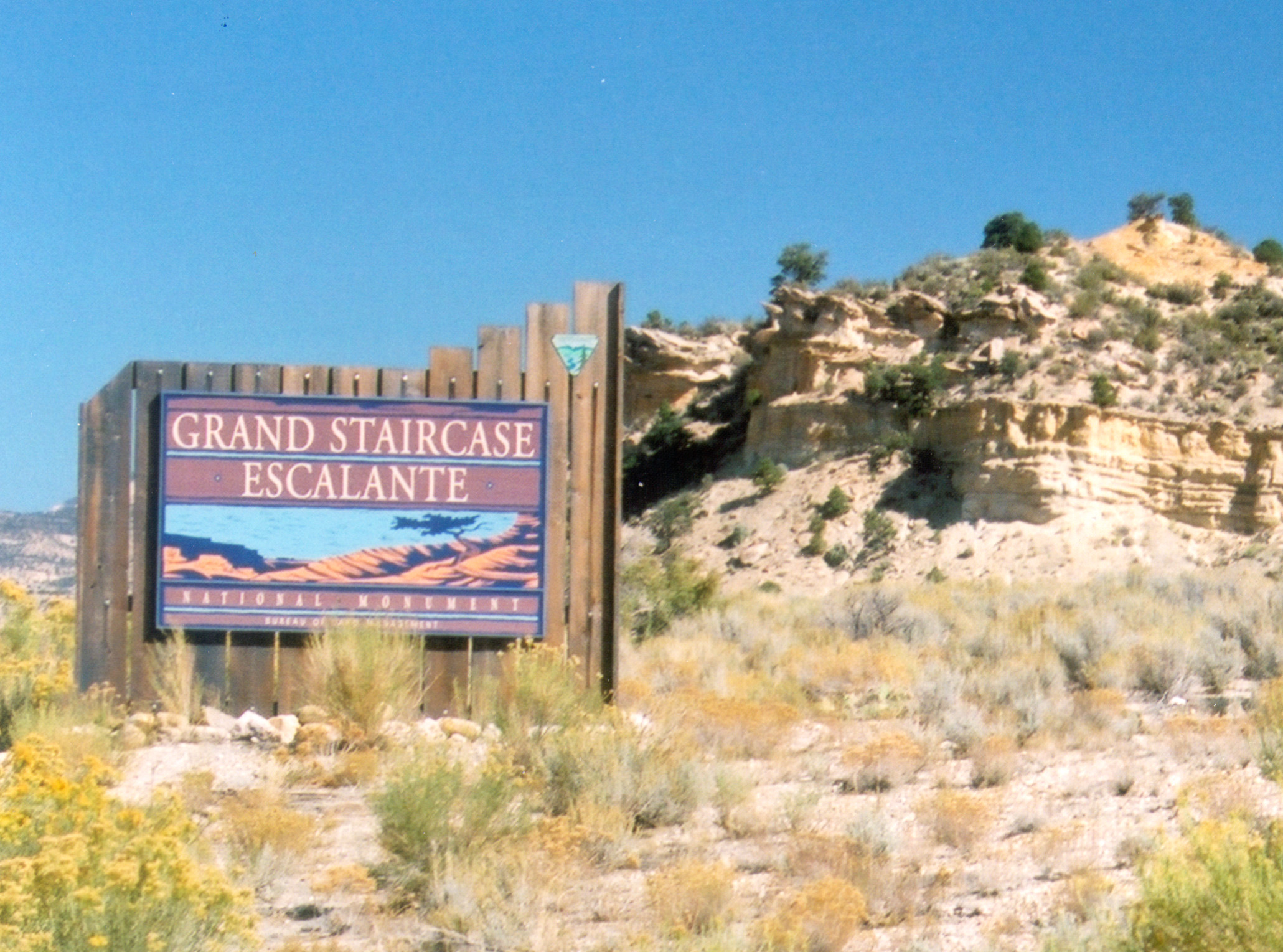
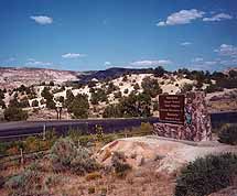
The new signs welcome visitors to the Grand Staircase-Escalante National Monument.
Public Domain. Photo by A. E. Crane
Download Original (2061 x 1529 pixels, 828.7 KB)
-

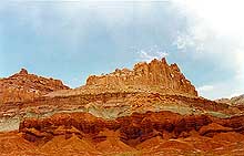
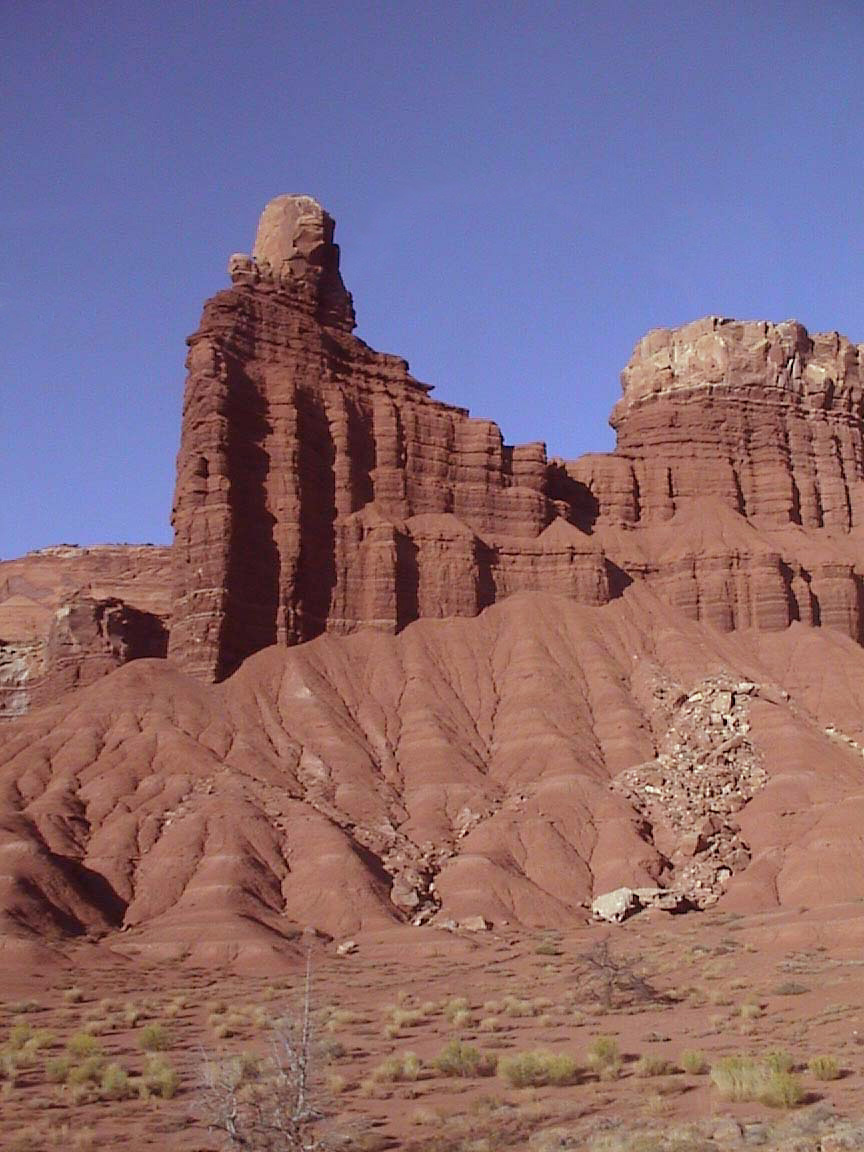
In brilliant oranges and reds, Castle Rock rises heavenward.
Public Domain. Photo by S. Clyde
Download Original (220 x 141 pixels, 12.7 KB)
-
Snow clings to the edges of the Posey Lake shore.
Public Domain.
Download Original (407 x 277 pixels, 36.6 KB)
-
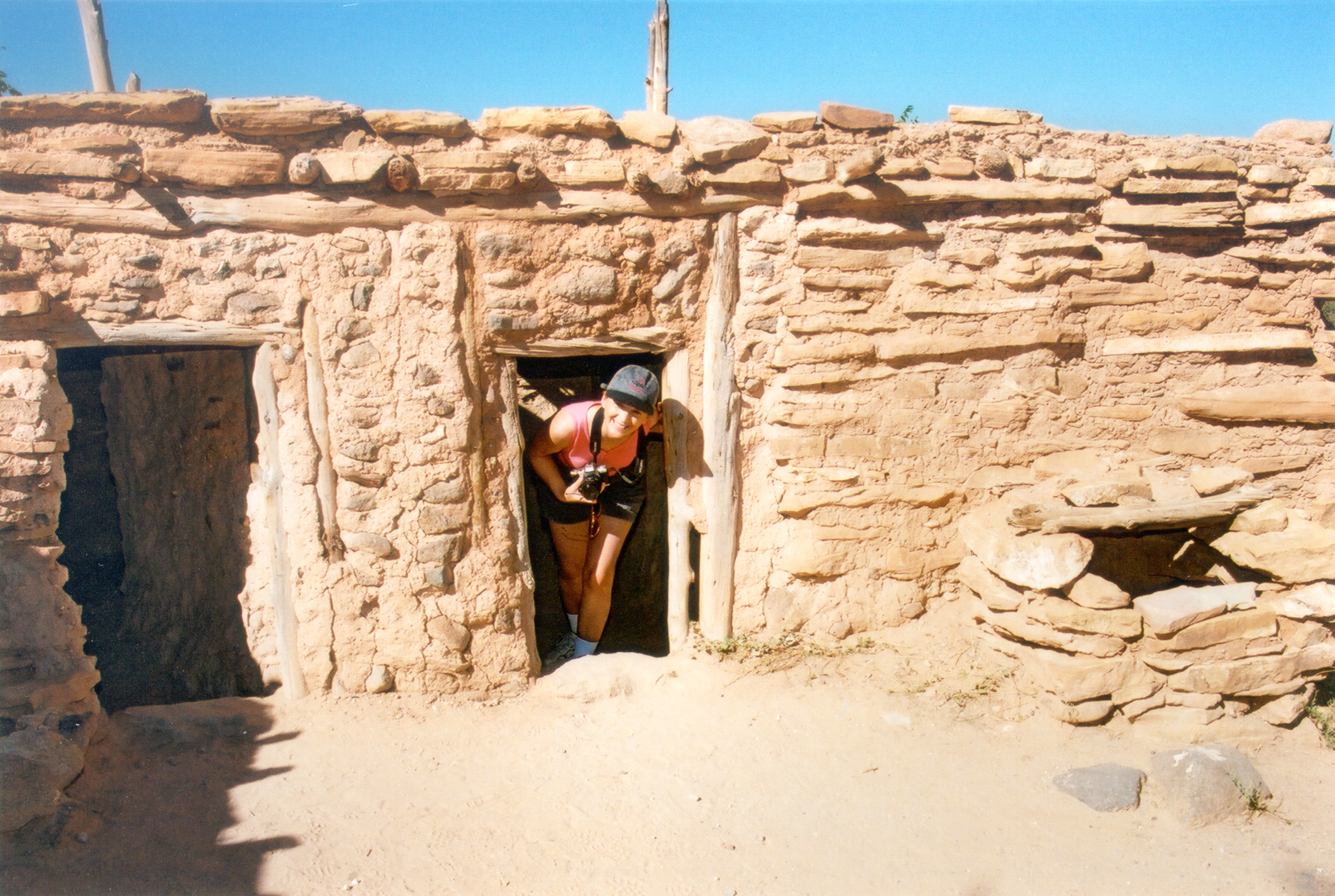
Angel explores the Anasazi buildings at Anasazi State Park.
Public Domain. Photo by S. Clyde
Download Original (3000 x 2014 pixels, 1780.4 MB)
-
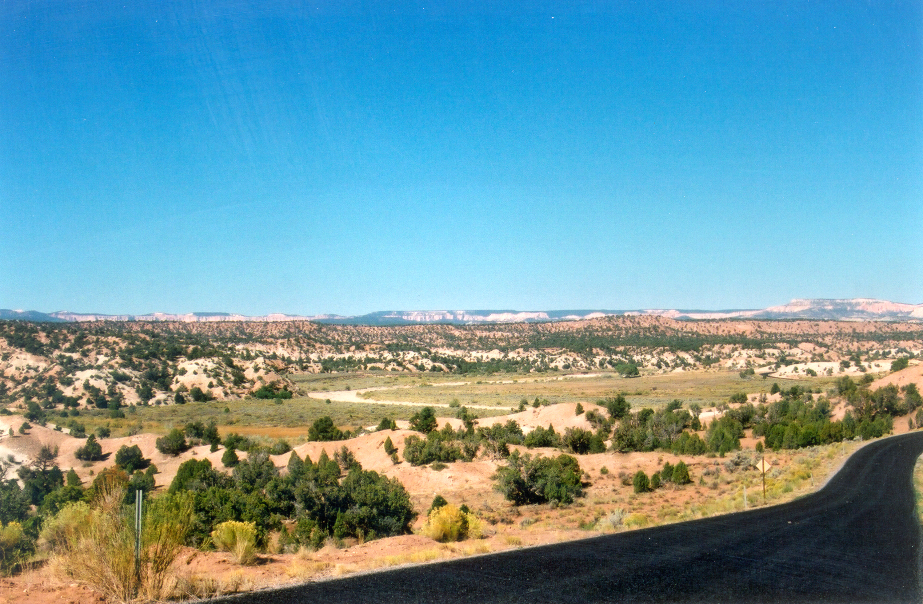
Colorful sagebrush and juniper contrast with the brightly colored mesas in the distance.
Public Domain. Photo by S. Clyde
Download Original (3000 x 1965 pixels, 1837.4 MB)
-
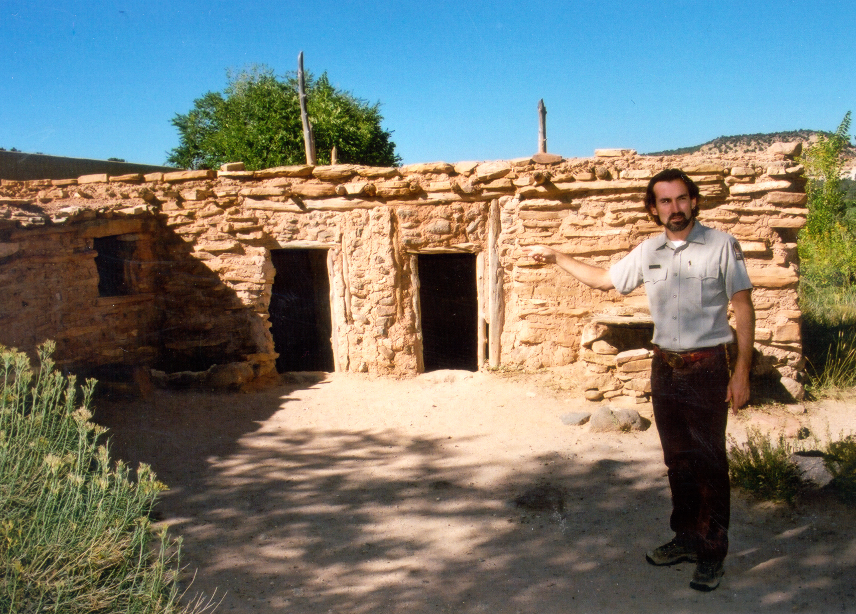
A park ranger explains the building style of the Anasazi at the Anasazi Village State Park in Boulder, Utah.
Public Domain. Photo by S. Clyde
Download Original (3000 x 2152 pixels, 2004.8 MB)
-
This view from Burr Trail shows the road when it was still unpaved (before the Escalante-Grand Staircase National Monument was designated).
Public Domain.
Download Original (225 x 208 pixels, 27.5 KB)
-
Hole-In-The-Rock Pullout and sign sit in front of a spectacular view of tall mountains.
Public Domain.
Download Original (225 x 150 pixels, 14.9 KB)
-
A single car enjoys the view near the West Entrance to Red Canyon.
Public Domain.
Download Original (225 x 200 pixels, 21.3 KB)
-
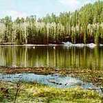
Posey Lake lies still in the summer sun.
Public Domain.
Download Original (174 x 111 pixels, 8.0 KB)
-
You'll need a pair of binoculars or a telephoto lens to get this close a look at this archaeological site.
Public Domain. Photo by A. E. Crane
Download Original (225 x 176 pixels, 37.8 KB)
-
A lone hiker heads for the shade on a trail at Posey Lake.
Public Domain.
Download Original (144 x 225 pixels, 23.5 KB)
-
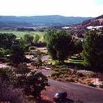
Boulder, Utah boasts several picturesque pastoral scenes framed by the mountains.
Public Domain. Photo by A. E. Crane
Download Original (2672 x 1920 pixels, 1656.0 MB)
-
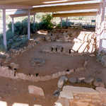
Take a walk around Anasazi Village State Park to see the ruins that have been uncovered here.
Public Domain. Photo by S. Clyde
Download Original (1836 x 2280 pixels, 1131.0 MB)
-
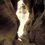
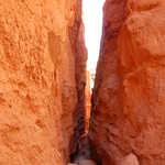
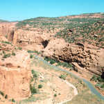
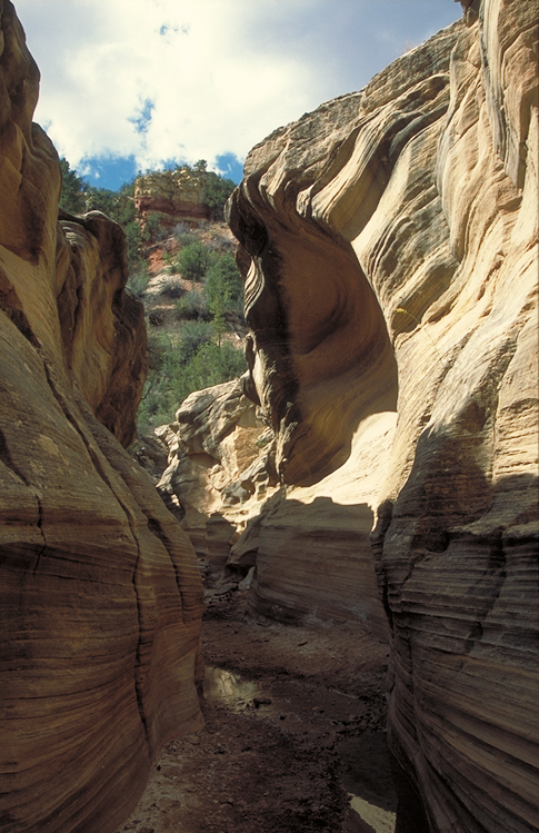
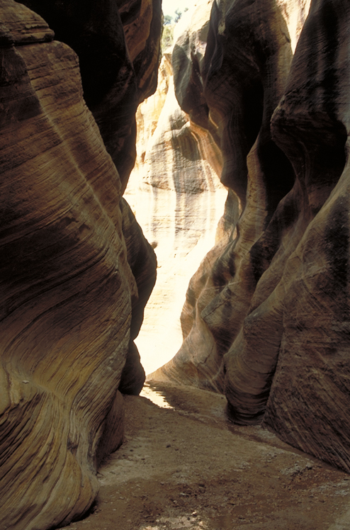
Water-etched walls line this narrow slot canyon in Escalante-Grand Staircase National Monument.
Public Domain. Photo by Dennis Adams of FHWA
Download Original (484 x 747 pixels, 354.0 KB)
-

Quaint buildings, both old and new, dot Scenic Byway 12.
Public Domain. Photo by S. Clyde
Download Original (1152 x 864 pixels, 603.0 KB)
-
-
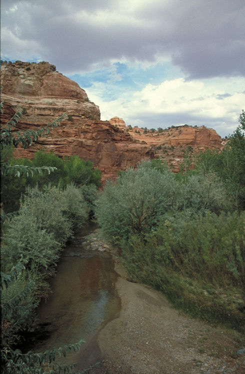
Calf Creek in the Escalante Canyons is the life blood of the area.
Public Domain.
Download Original (134 x 225 pixels, 13.3 KB)
-
The lonely Posey Lake Road junctions with Scenic Byway 12 and leads to Posey Lake.
Public Domain. Photo by A. E. Crane
Download Original (230 x 160 pixels, 11.6 KB)
-
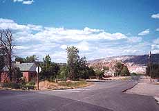
An old gas pump reveals the culture of Cannonville.
Public Domain. Photo by L. Blair
Download Original (2344 x 3456 pixels, 883.6 KB)
-
A hiker enjoys a waterfall on the Mossy Cave Trail in Bryce Canyon.
Public Domain. Photo by A. E. Crane
Download Original (2600 x 1735 pixels, 791.7 KB)
-
Brillant, orange, mossy cave fins decorate the bright blue skyline in Bryce Canyon National Park.
Public Domain. Photo by A. E. Crane
Download Original (225 x 153 pixels, 15.8 KB)
-
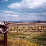
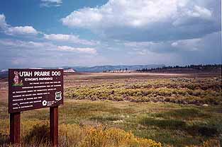
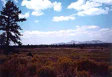
White clouds float over the expanse of the Groundhog Preservation Field.
Public Domain. Photo by A. E. Crane
Download Original (313 x 208 pixels, 13.4 KB)
-
Shadows are creeping up the rocky crags of Sunset Point.
© January 2006 Neil Li.
Download Original (1280 x 853 pixels, 398.6 KB)
-
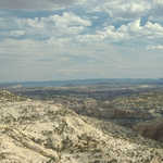
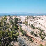
The aerial view of Escalante Petrified Forest State Park from Petrified Forest Walk lends an extensive view of the surrounding landscape.
Public Domain. Photo by A. E. Crane
Download Original (342 x 246 pixels, 20.8 KB)
-

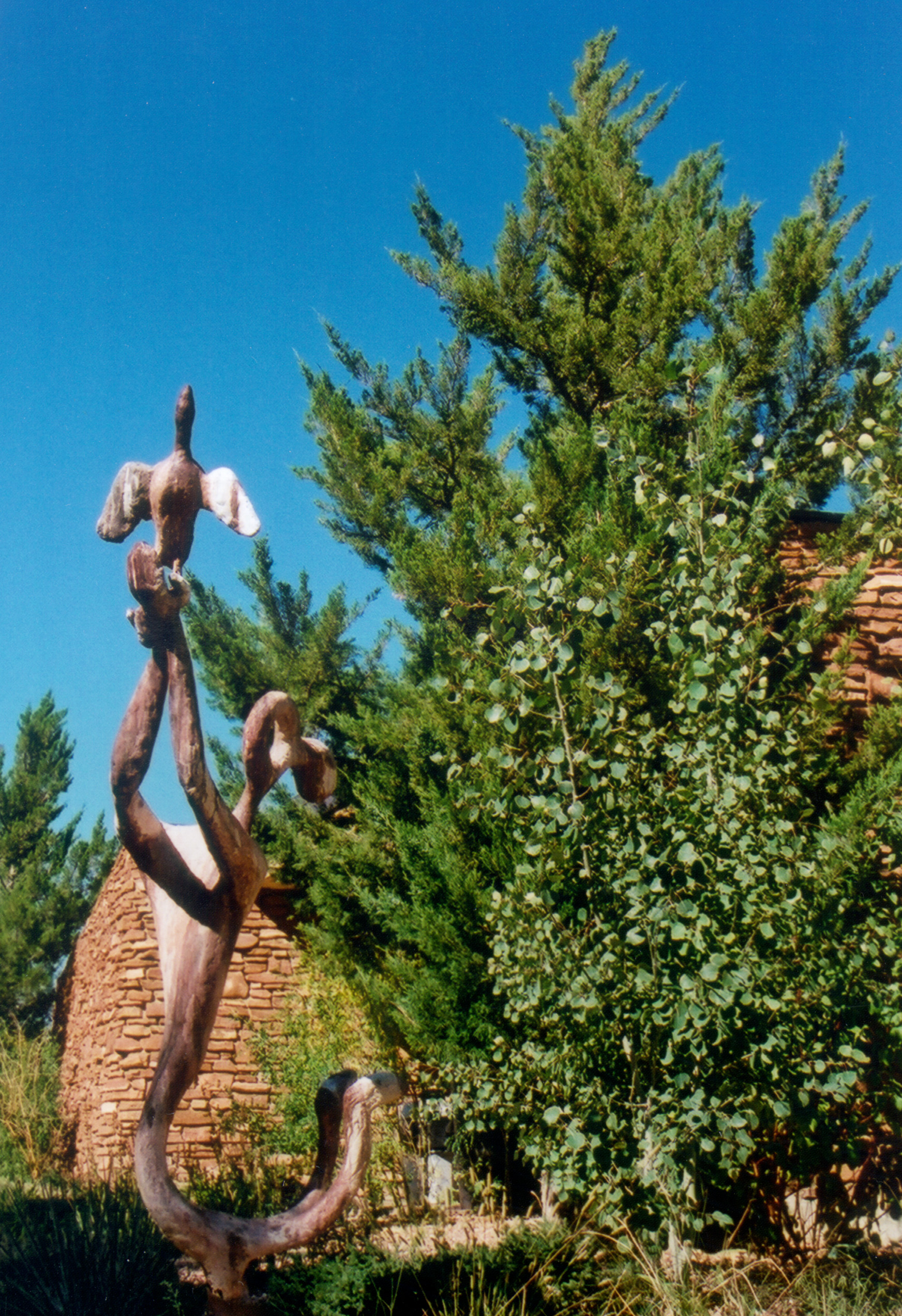
This sculpture is located at the Anasazi Village State Park in Boulder, Utah.
Public Domain. Photo by S. Clyde
Download Original (1744 x 2544 pixels, 1646.7 MB)
-
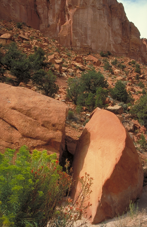
A huge orange boulder lies cracked beside the road near the Burr Trail.
Public Domain. Photo by Dennis Adams of FHWA
Download Original (487 x 750 pixels, 463.5 KB)
-
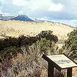
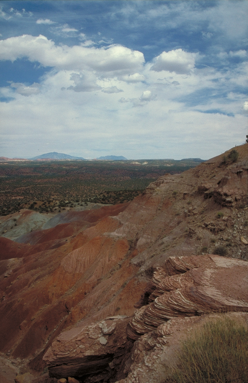
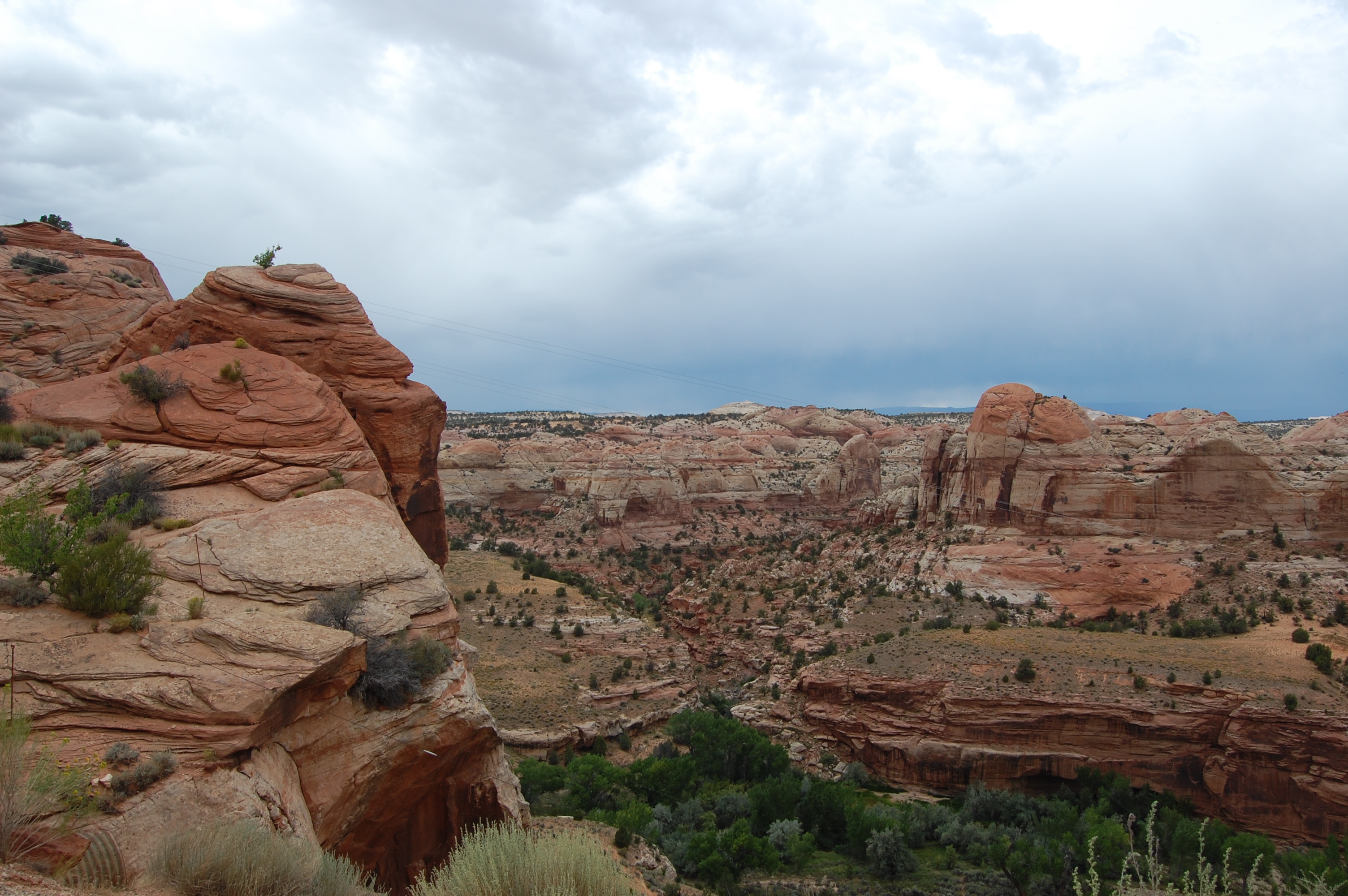
From this overlook, fascinating geology spreads out on the landscape below.
Public Domain. Photo by Dennis Adams of FHWA
Download Original (488 x 752 pixels, 332.9 KB)
-
A few cars sit in the parking lot at the Escalante Multi-Agency Office.
Public Domain. Photo by A. E. Crane
Download Original (361 x 206 pixels, 14.4 KB)
-
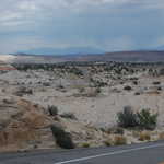
The desert landscape spreads out north before the Escalante Multi-Agency Office.
Public Domain. Photo by A. E. Crane
Download Original (215 x 178 pixels, 15.6 KB)
-
A hiker maneuvers through the twisted and bizarre slot canyons of Willis Canyon.
Public Domain. Photo by Dennis Adams of FHWA
Download Original (485 x 747 pixels, 386.3 KB)
-
The Willis Canyon hike features narrow slot canyon walls and a small stream.
Public Domain. Photo by Dennis Adams of FHWA
Download Original (488 x 746 pixels, 406.2 KB)
-
A clear sky tops the rugged terrain at an overlook on the Burr Trail.
Public Domain. Photo by A. E. Crane
Download Original (3540 x 2366 pixels, 9053.3 MB)
-
Erosion from flash floods has carved the walls of Willis Canyon.
Public Domain. Photo by Dennis Adams of FHWA
Download Original (745 x 483 pixels, 398.0 KB)
-
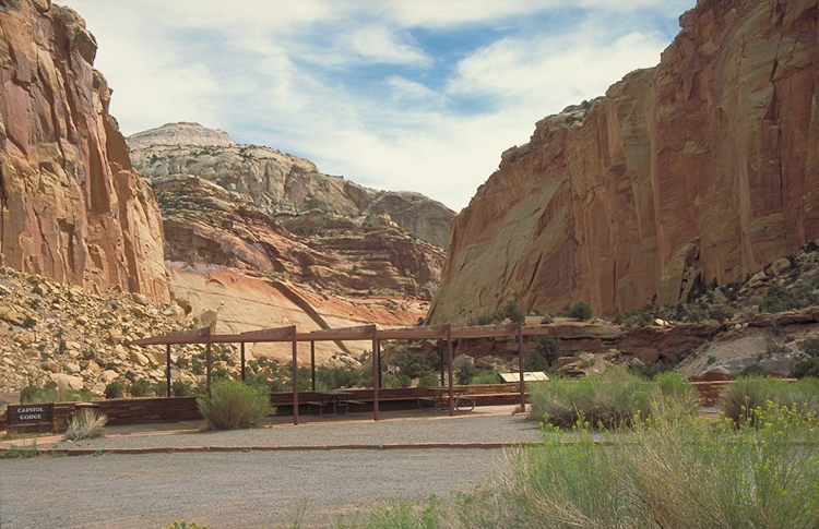
Golden cliffs tower overhead in the Capitol Gorge of Capitol Reef National Park.
Public Domain. Photo by Dennis Adams of FHWA
Download Original (487 x 755 pixels, 439.3 KB)
-
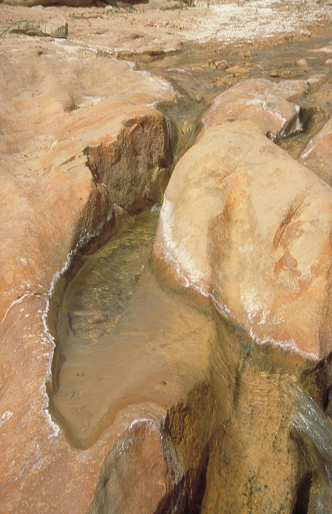
Water forms a small pool near a falls in Willis Canyon.
Public Domain. Photo by Dennis Adams of FHWA
Download Original (483 x 747 pixels, 362.1 KB)
-
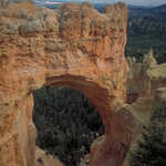
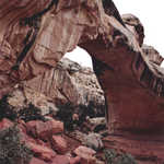
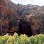
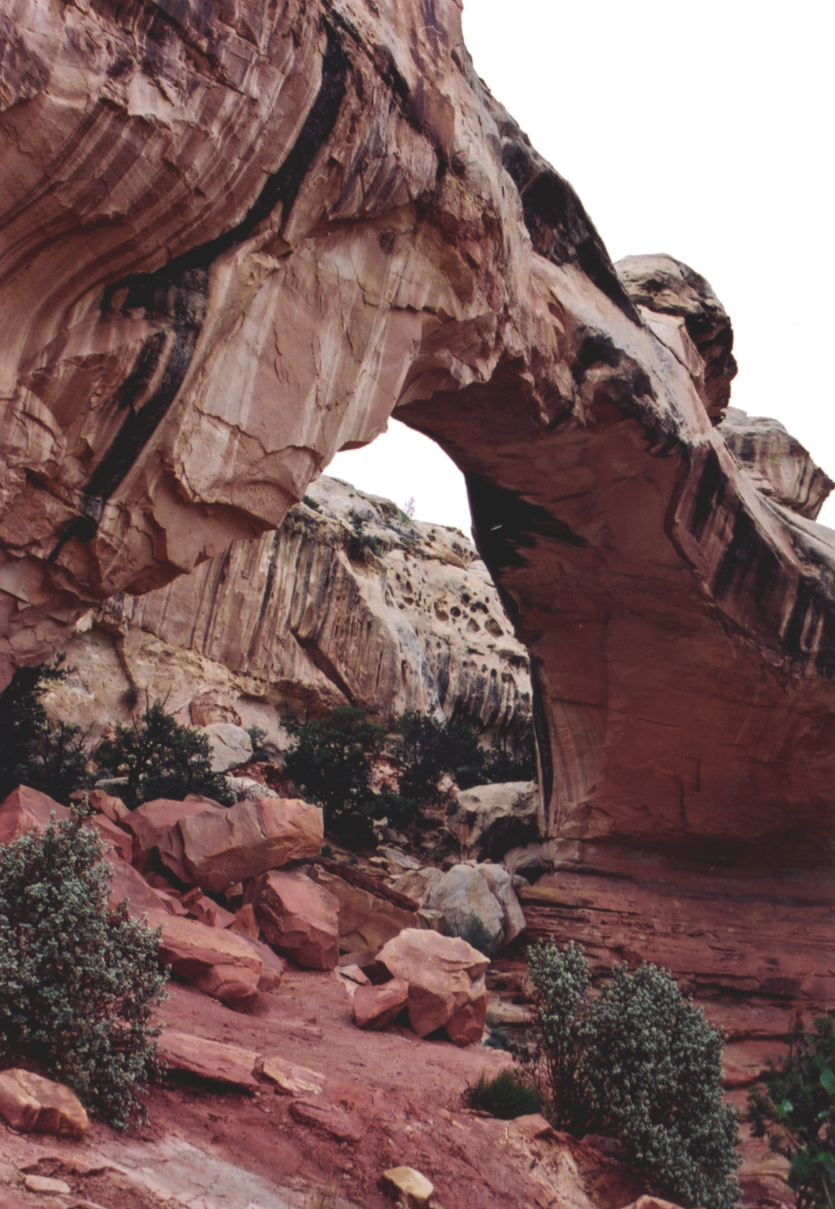
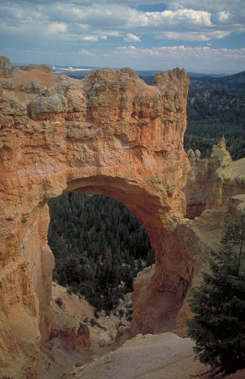
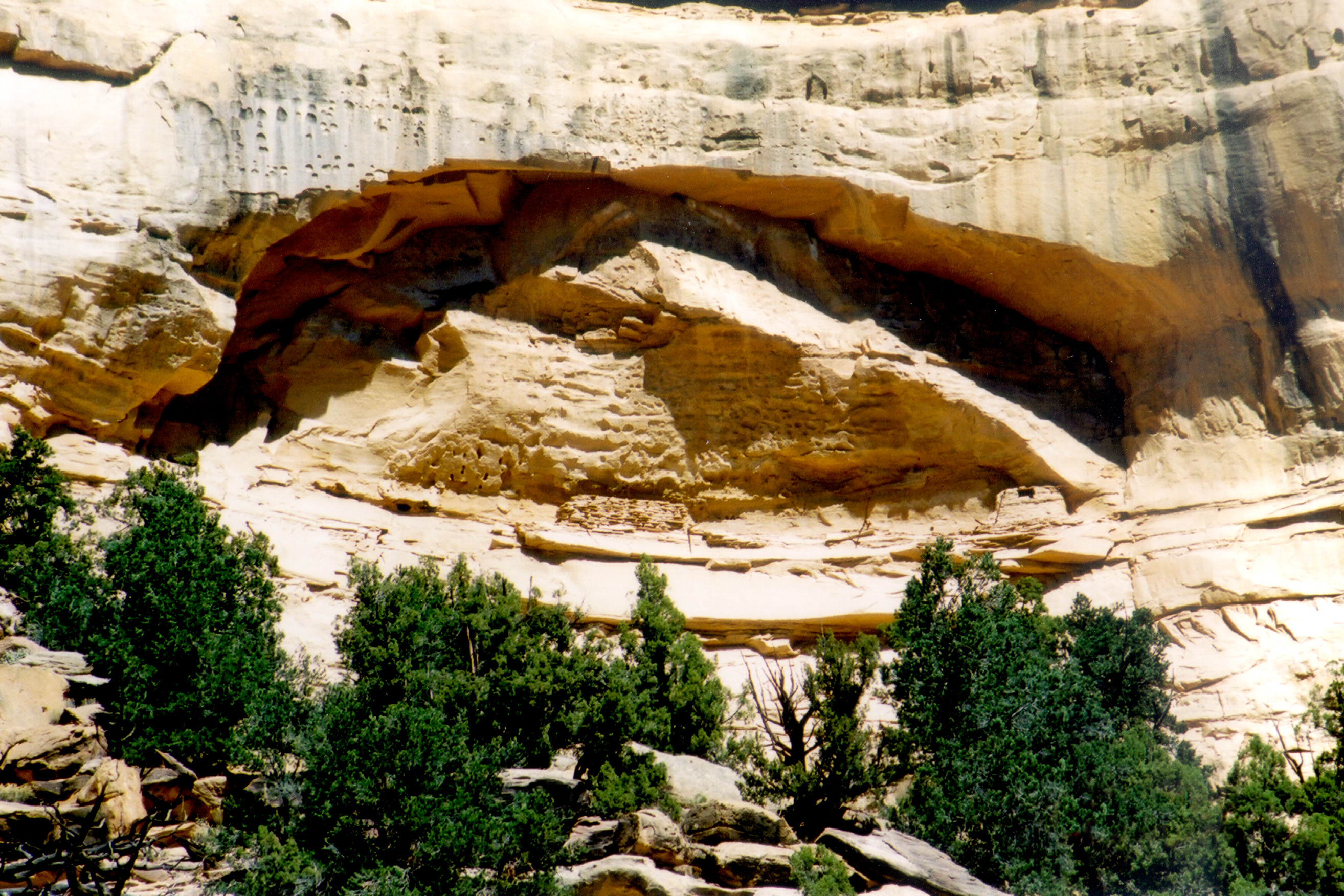
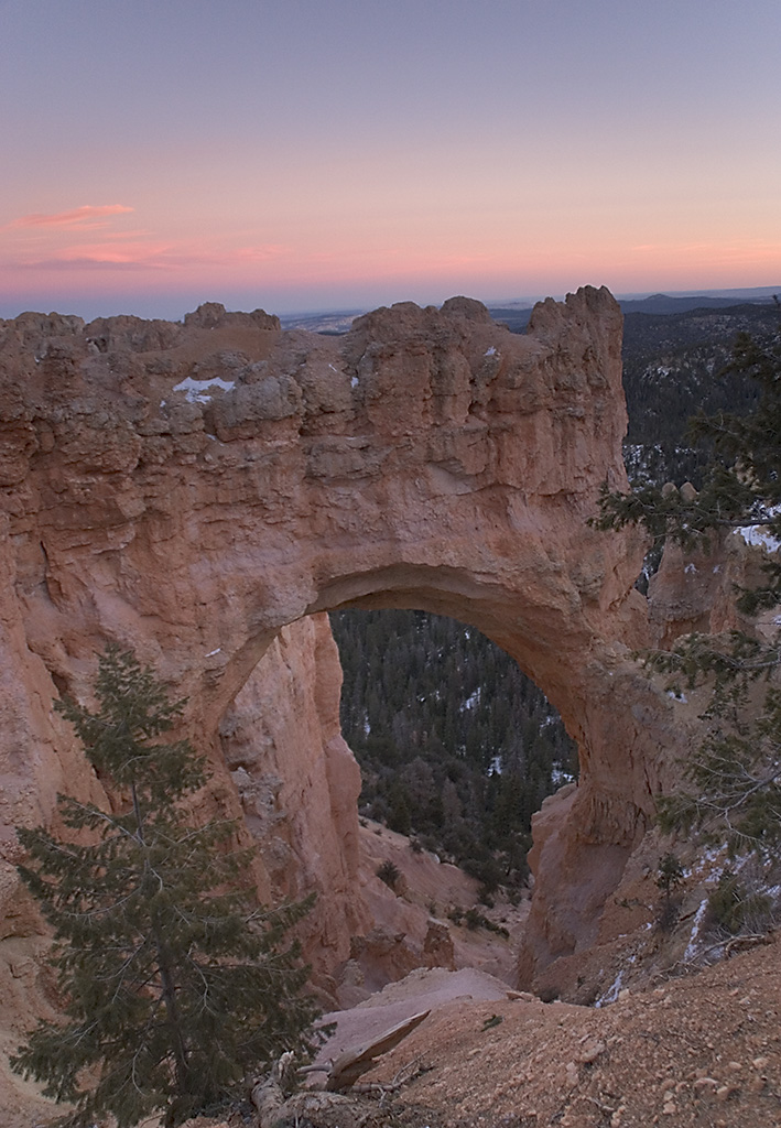
Water carved this great arch in a outcropping in Bryce Canyon.
Public Domain. Photo by Dennis Adams of FHWA
Download Original (485 x 749 pixels, 381.9 KB)
-
Long Canyon on the Burr Trail has walls of brick-red hue.
Public Domain. Photo by Dennis Adams of FHWA
Download Original (490 x 749 pixels, 420.0 KB)
-

A tiny waterfall flows beneath the glowing cliffs of Capitol Reef National Park.
Public Domain. Photo by Dennis Adams of FHWA
Download Original (488 x 747 pixels, 428.0 KB)
-
A fantastic landscape of pillars unfolds before you from a Bryce Canyon overlook.
Public Domain. Photo by Dennis Adams of FHWA
Download Original (485 x 749 pixels, 343.9 KB)
-
Willis Canyon offers hiking through shadows and sunlight as the walls converge.
Public Domain. Photo by Dennis Adams of FHWA
Download Original (494 x 748 pixels, 359.9 KB)
-
Willows and other riparian vegetation line the Escalante River and bring welcome wetness to this arid region.
Public Domain. Photo by Dennis Adams of FHWA
Download Original (490 x 748 pixels, 365.1 KB)
-
Sunlight casts warm rays on the golden cliffs of Capitol Reef National Park.
Public Domain. Photo by Dennis Adams of FHWA
Download Original (485 x 743 pixels, 408.7 KB)
-
Tall cliffs cast shadows over the trail ahead on the Capitol Gorge Trail in Capitol Reef National Park.
Public Domain. Photo by Dennis Adams of FHWA
Download Original (486 x 747 pixels, 335.5 KB)
-
The Capitol Gorge hiking path careens past high and low golden cliffs in Capitol Reef National Park.
Public Domain. Photo by Dennis Adams of FHWA
Download Original (485 x 735 pixels, 428.1 KB)
-
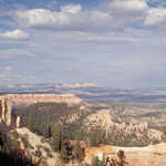
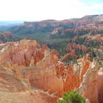
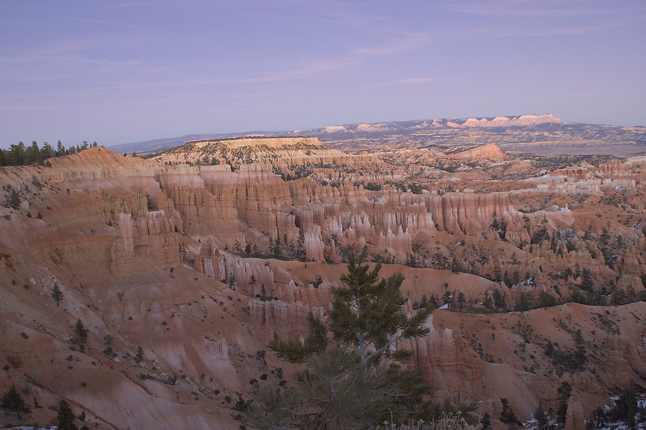
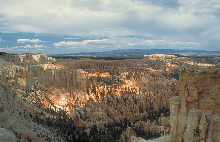
Powell Point is prominent on the horizon from Bryce Canyon on a lovely summer day.
Public Domain. Photo by Dennis Adams of FHWA
Download Original (488 x 743 pixels, 382.7 KB)
-
Bands of color line rock walls beside Capitol Gorge in Capitol Reef National Park.
Public Domain. Photo by Dennis Adams of FHWA
Download Original (487 x 748 pixels, 488.4 KB)
-
A car approaches on the Burr Trail. Golden cliffs streaked with desert varnish tower above the road in Long Canyon.
Public Domain. Photo by Dennis Adams
Download Original (749 x 486 pixels, 371.6 KB)
-
From an overlook on the Burr Trail is a bird's eye view of Long Canyon.
Public Domain. Photo by Dennis Adams
Download Original (752 x 489 pixels, 378.6 KB)
-
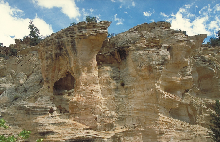
A white car parks tight against the cliffside on the Burr Trail. There is no shoulder on the cliff side, and what looks like a very long drop on the other! This may be part of the famous switchbacks descending into the Capitol Reef area.
Public Domain. Photo by Dennis Adams
Download Original (750 x 485 pixels, 352.1 KB)
-
A hiker strolls along the roadside beneath the beautiful walls of Long Canyon on Utah's Burr Trail.
Public Domain. Photo by Dennis Adams
Download Original (748 x 483 pixels, 436.1 KB)
-
The paved Burr Trail curves through a rocky desert canyon in Utah. Clouds are scattered across the blue sky, making shadows on the rocks.
Public Domain. Photo by Dennis Adams
Download Original (747 x 484 pixels, 335.6 KB)
-
The rocky desert terrain of Long Canyon looms beside the Burr Trail in Utah.
Public Domain. Photo by Dennis Adams
Download Original (746 x 493 pixels, 348.7 KB)
-
The Burr Trail winds through the desert hills of Deer Creek, Utah.
Public Domain. Photo by Dennis Adams
Download Original (747 x 485 pixels, 374.0 KB)
-
Clouds are scattered across a blue sky, making shadows in a rocky desert canyon on Utah's Burr Trail.
Public Domain. Photo by Dennis Adams
Download Original (749 x 483 pixels, 336.2 KB)
-
The red sand of the Capitol Reef area is a soft foreground to starker stone mesas and uplifts in the distance.
Public Domain. Photo by Dennis Adams
Download Original (746 x 483 pixels, 292.4 KB)
-
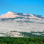
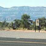
Morning sun casts an ethereal light on the white Navajo sandstone peak prominent above SR 14.
Public Domain. Photo by Dennis Adams
Download Original (748 x 481 pixels, 314.7 KB)
-
Chimney Rock and background mesas stand out against the white of a mostly cloudy sky.
Public Domain. Photo by Dennis Adams
Download Original (750 x 483 pixels, 298.1 KB)
-
Shade structure and parking area greets hikers at the entrance to Capitol Gorge in Utah's Capitol Reef National Park.
Public Domain. Photo by Dennis Adams
Download Original (750 x 485 pixels, 399.9 KB)
-
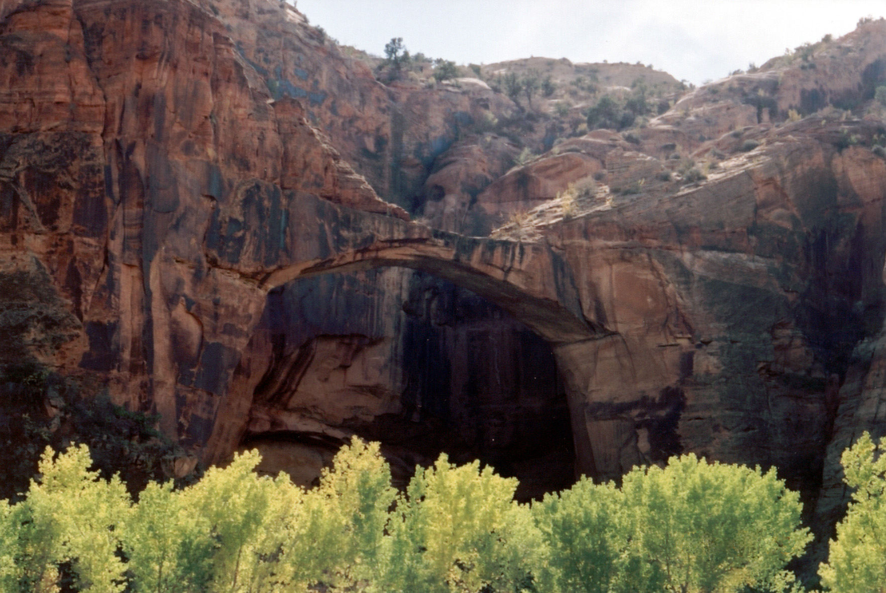
The long span of this natural bridge in the midst of the Escalante Canyons rises above the bright green band of cottonwoods lining the Escalante River, on the Escalante River Trail.
Public Domain. Photo by A. E. Crane
Download Original (1764 x 1181 pixels, 615.5 KB)
-
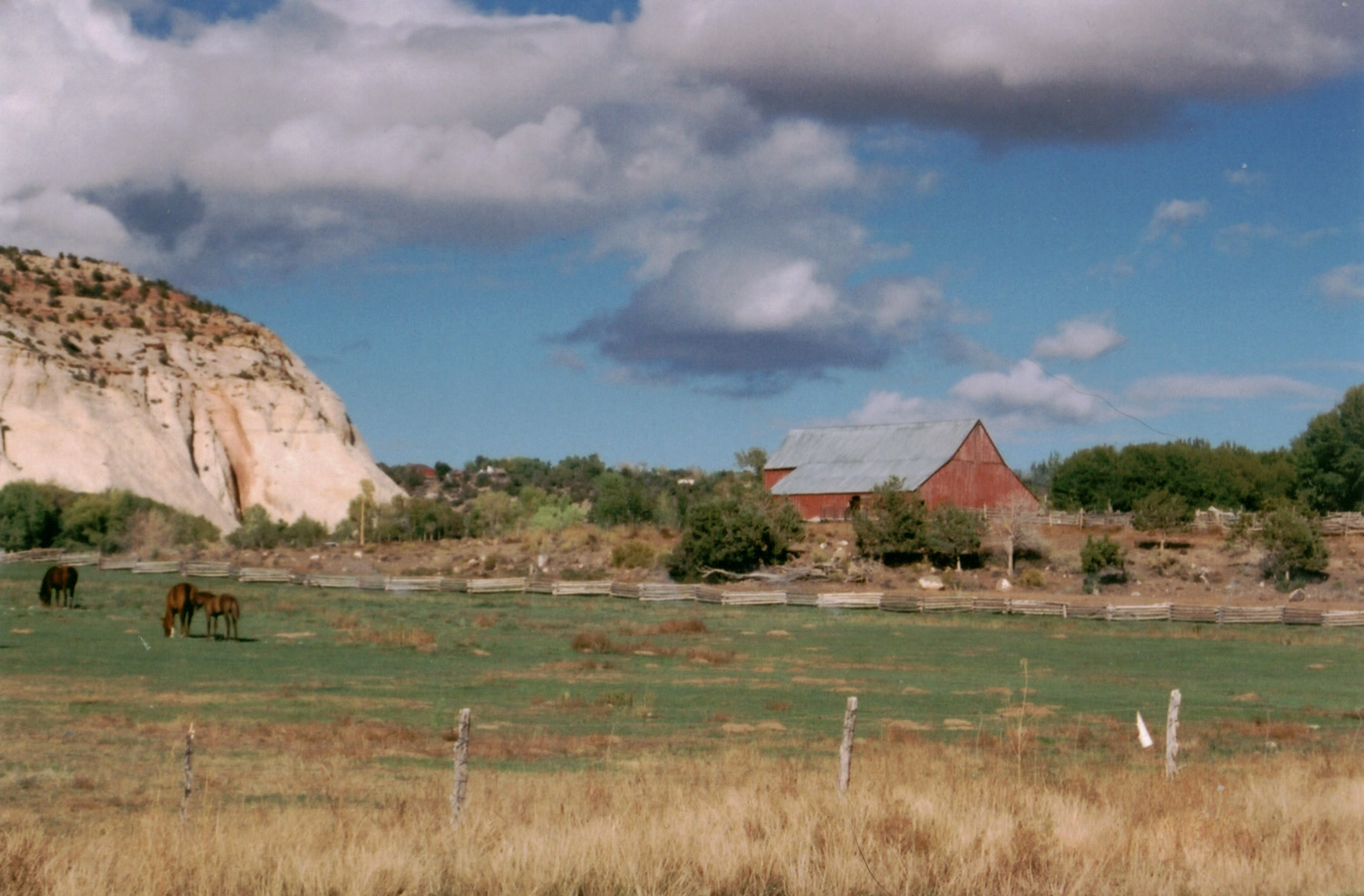
Horses graze in a pasture beside a red barn in Boulder, Utah.
Public Domain. Photo by A. E. Crane
Download Original (1773 x 1164 pixels, 433.6 KB)
-
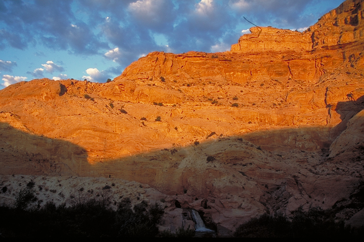
Afternoon sunlight tints the cliffs of Capitol Reef with fire.
Public Domain. Photo by Dennis Adams
Download Original (745 x 496 pixels, 413.6 KB)
-
Afternoon sunlight brings the creamy formations at Sunrise Point in of Bryce Canyon into sharp relief.
Public Domain. Photo by Dennis Adams
Download Original (752 x 485 pixels, 374.9 KB)
-
Shadows and sunlight tint the hoodoos near the Natural Bridge Overlook in Bryce Canyon.
Public Domain. Photo by Dennis Adams
Download Original (746 x 482 pixels, 326.6 KB)
-
Elegant orange and white hoodoos highlight thie view of Bryce Canyon, taken from near the end of the park road.
Public Domain. Photo by Dennis Adams
Download Original (752 x 488 pixels, 347.3 KB)
-
Pine needles frame this view of Powell Point.
Public Domain. Photo by Dennis Adams
Download Original (752 x 478 pixels, 310.6 KB)
-
A cloud-strewn sky highlights this view of a long striped ridge in Bryce Canyon.
Public Domain. Photo by Dennis Adams
Download Original (748 x 479 pixels, 330.8 KB)
-
The twisted branches and roots of a bare-twigged tree on the edge of Bryce Canyon highlight this view of red rock canyons and cloud-speckled sky.
Public Domain. Photo by Dennis Adams
Download Original (753 x 485 pixels, 401.6 KB)
-
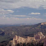
Powell Point is visible on the horizon under a sky strewn with clouds.
Public Domain. Photo by Dennis Adams
Download Original (751 x 488 pixels, 331.3 KB)
-
Sunlight brings the subtle colors of Bryce Canyon National Park to life.
Public Domain. Photo by Dennis Adams
Download Original (748 x 486 pixels, 341.4 KB)
-
Sunlight tips rock formations as far as the eye can see in Bryce Canyon.
Public Domain. Photo by Dennis Adams
Download Original (752 x 482 pixels, 328.4 KB)
-
The marvelous cream, rust and orange hoodoos of Bryce Canyon shimmer under a summer sky.
Public Domain. Photo by Dennis Adams
Download Original (744 x 482 pixels, 366.1 KB)
-
Powell Point stands out on the horizon over the cream and rust colored cliffs of this section of Bryce Canyon.
Public Domain. Photo by Dennis Adams
Download Original (746 x 486 pixels, 333.3 KB)
-
Powell Point is prominent on the horizon over the cream-colored cliffs of this section of Bryce Canyon.
Public Domain. Photo by Dennis Adams
Download Original (751 x 490 pixels, 338.9 KB)
-
A cloud-strewn sky extends over landscape of white rock dappled with rich green juniper.
Public Domain. Photo by Dennis Adams
Download Original (743 x 484 pixels, 371.0 KB)
-
A vast panorama which includes Capitol Reef National Park and the Henry Mountains can be seen from this interpretive overlook.
Public Domain. Photo by Dennis Adams
Download Original (745 x 485 pixels, 320.6 KB)
-
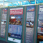
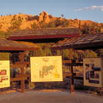
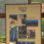
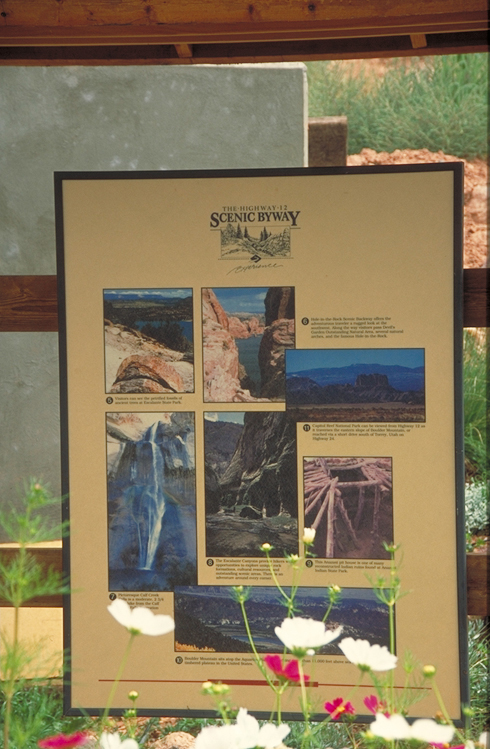
This is a close up of one of the interpretive panels at a byway roadside kiosk in Escalante.
Public Domain. Photo by Dennis Adams
Download Original (745 x 486 pixels, 332.6 KB)
-
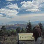
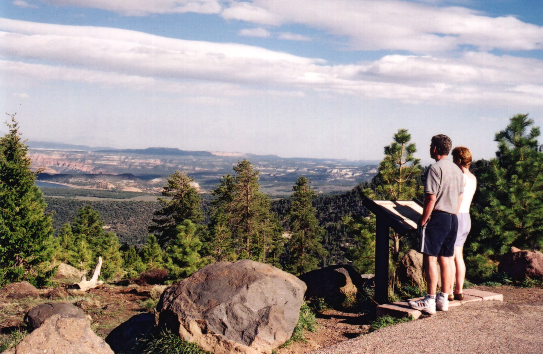
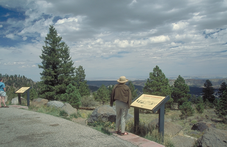
Travelers read the panels at the Larb Hollow Overlook on Boulder Mountain.
Public Domain. Photo by Dennis Adams
Download Original (746 x 485 pixels, 323.2 KB)
-
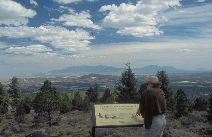
A traveler reads an panel at the Larb Hollow Overlook on Boulder Mountain.
Public Domain. Photo by Dennis Adams
Download Original (745 x 482 pixels, 312.0 KB)
-
A visitor stops for the view from an overlook on Boulder Mountain. Partly cloudy skies add texture to a spring-green forest landscape.
Public Domain. Photo by Dennis Adams
Download Original (746 x 487 pixels, 300.1 KB)
-
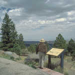
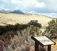
A visitor reads about the area at this overlook south of Escalante.
Public Domain. Photo by Dennis Adams
Download Original (743 x 484 pixels, 366.6 KB)
-
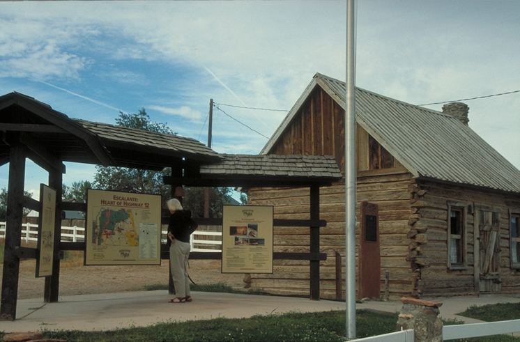
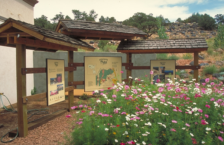
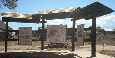
The three-paneled visitor orientation kiosk is right outside a small staffed information center in Torrey. The grounds of the center are nicely landscaped with wildflowers.
Public Domain. Photo by Dennis Adams
Download Original (746 x 484 pixels, 372.8 KB)
-
From the top of the Hogsback, this view looks over the Escalante River toward Bryce Canyon National Park. There is just a hint of the winding maze of the white section of Escalante Canyons.
Public Domain. Photo by Dennis Adams
Download Original (748 x 487 pixels, 356.1 KB)
-
From the top of the Hogsback, this view looks out over the Escalante River toward Bryce Canyon National Park. There is just a hint of the winding maze of the white section of Escalante Canyons.
Public Domain. Photo by Dennis Adams
Download Original (741 x 487 pixels, 321.6 KB)
-
Tropic Creek winds gently between trees and redrock below the Mossy Cave Trail.
Public Domain. Photo by A. E. Crane
Download Original (1196 x 1752 pixels, 884.8 KB)
-
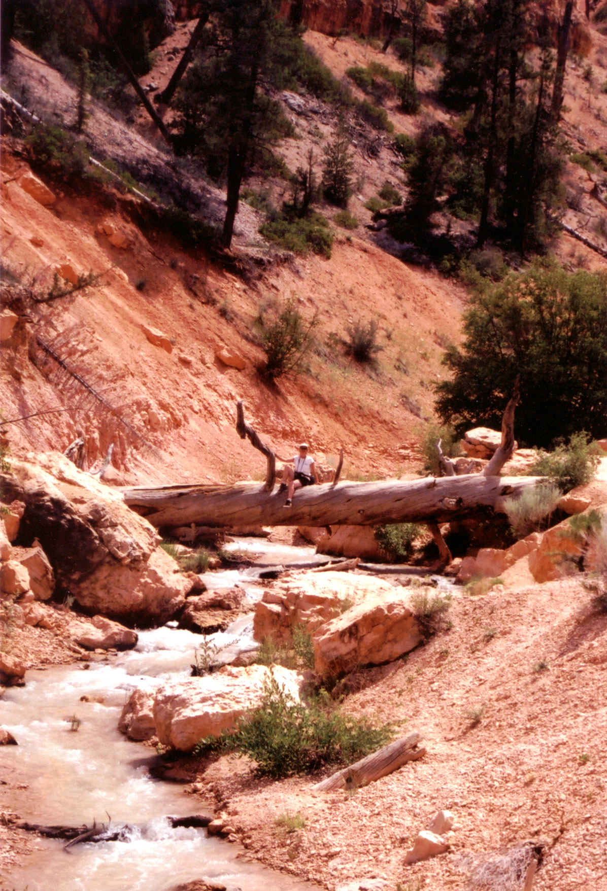
Hiker relaxes on a log bridge over one of the streams on the Mossy Cave Trail. This is on the Mossy Cave branch of the Trail.
Public Domain. Photo by A. E. Crane
Download Original (1196 x 1756 pixels, 920.2 KB)
-
Tropic Creek (actually an irrigation ditch) flows even in high summer in Bryce Canyon, on the Mossy Cave trail.
Public Domain. Photo by A. E. Crane
Download Original (1196 x 1752 pixels, 850.0 KB)
-
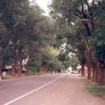
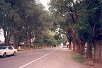
A shady, tree-lined main street is a rarity in this hot desert country.
Public Domain. Photo by A. E. Crane
Download Original (200 x 133 pixels, 24.5 KB)
-
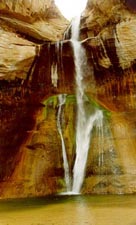
The waters of Calf Creek Falls gather gracefully in a pool below. Green foilage springs up all around.
Public Domain.
Download Original (155 x 225 pixels, 20.2 KB)
-
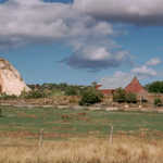
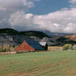
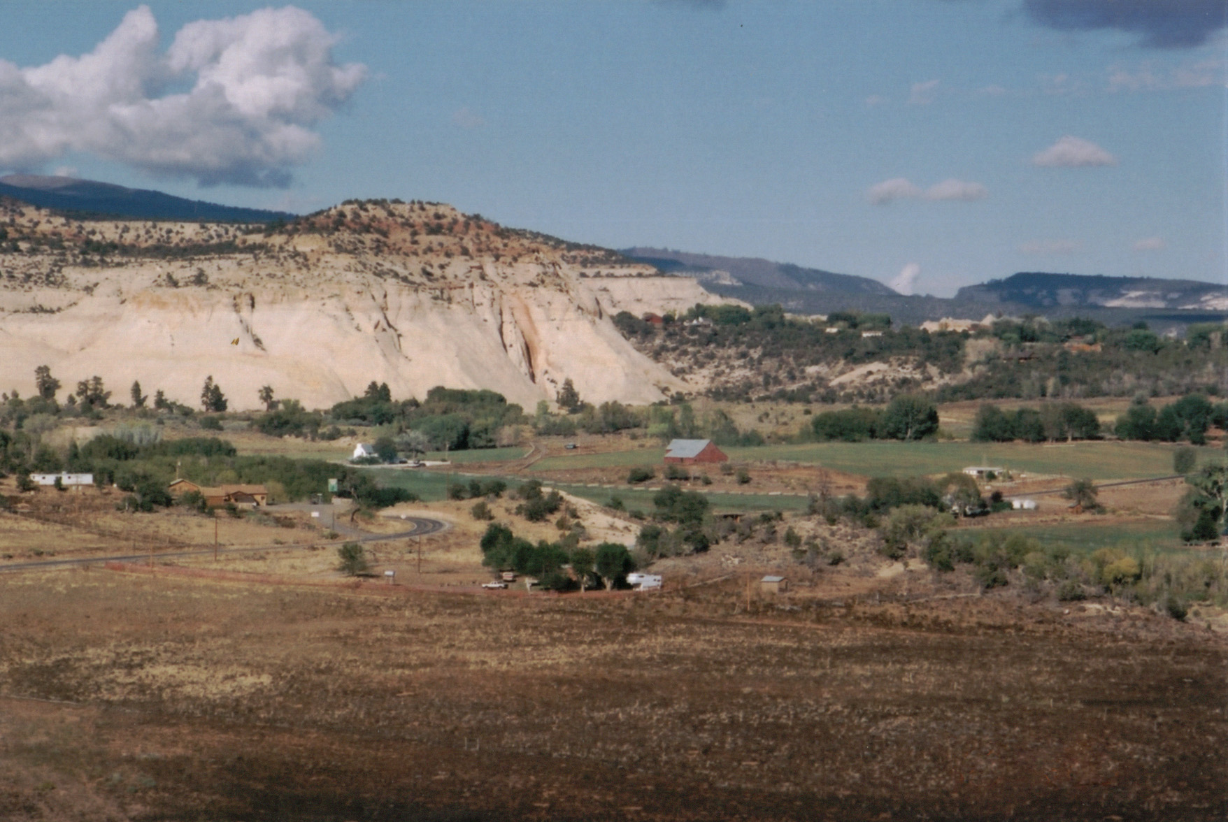
A bright red barn stands out against white cliffs and green fields on this dairy farm in Boulder, Utah.
© 1995 A. E. Crane.
-
A hiker pauses to look at the effect of flash floods in Willis Canyon.
Public Domain. Photo by Dennis Adams of FHWA
Download Original (484 x 749 pixels, 445.1 KB)
-
Scenic Byway 12 proceeds in a northeastern direction through "The Blues" from Powell Point Overlook.
Public Domain. Photo by A. E. Crane
Download Original (3000 x 2187 pixels, 1828.0 MB)
-
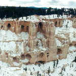
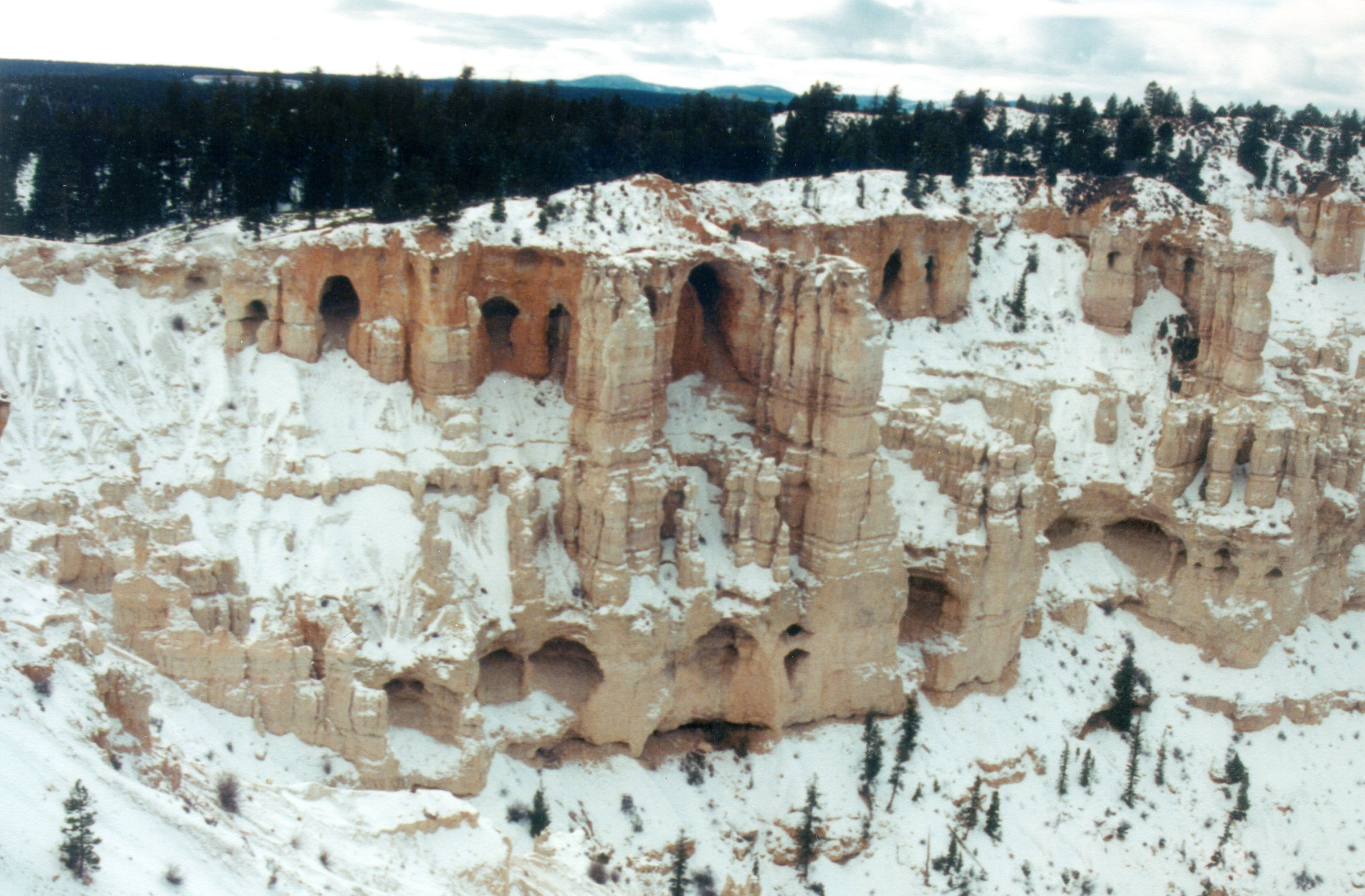
Winter is a beautiful time to visit Bryce Canyon. Winter sunlight and snow give the formations a new dimension.
© January 2002 Peter Blair.
Download Original (3300 x 2166 pixels, 875.6 KB)
-
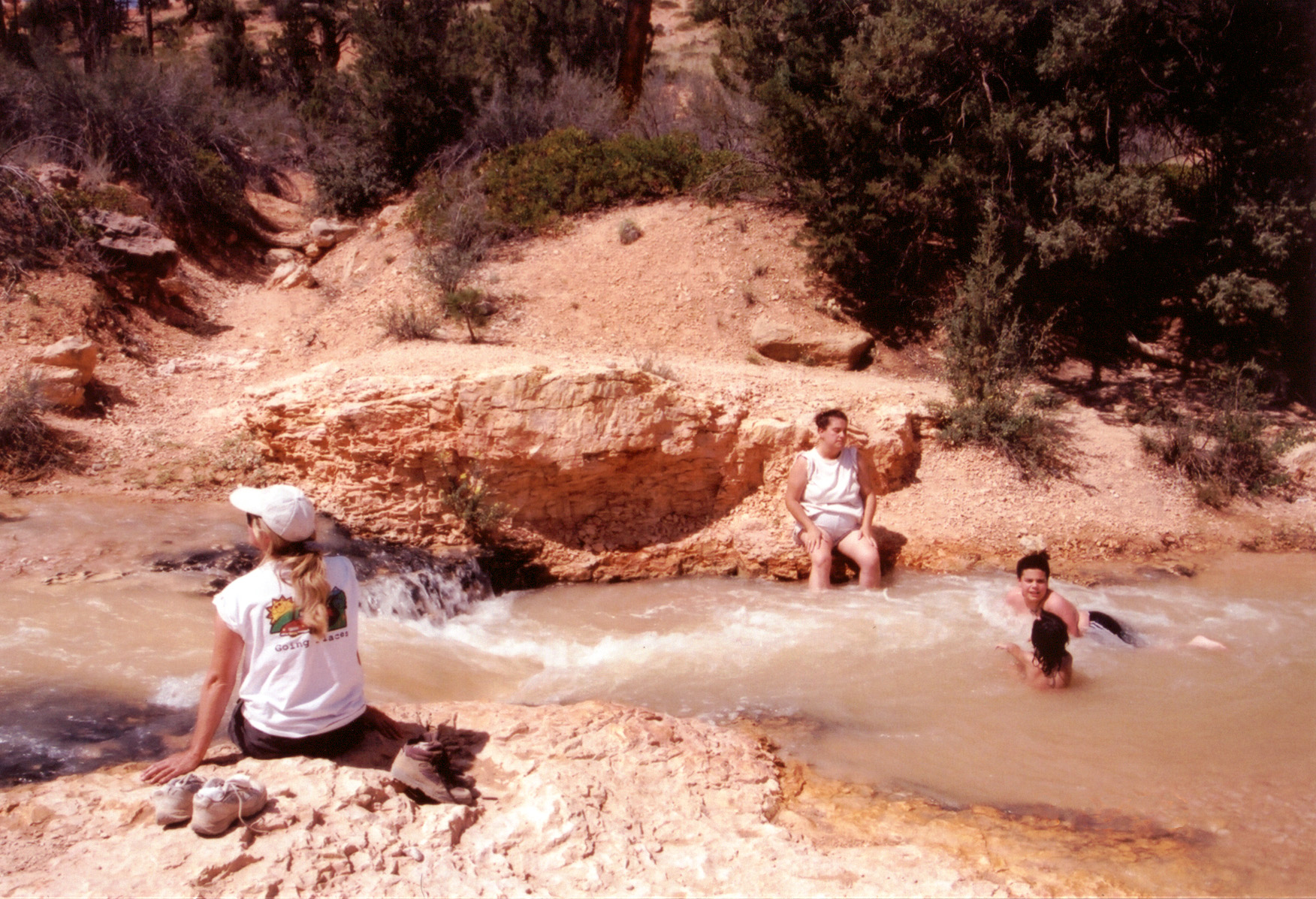
Hikers on the Mossy Cave Trail get a welcome break from the July heat with a dip in Tropic Creek in Bryce Canyon.
Public Domain. Photo by A. E. Crane
Download Original (1769 x 1186 pixels, 891.7 KB)
-
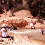
Hikers on the Mossy Cave Trail get a welcome break from the July heat with a dip in Tropic Creek in Bryce Canyon.
Public Domain. Photo by A. E. Crane
Download Original (1752 x 1197 pixels, 802.1 KB)
-
On the rim hiking trail above Bryce Canyon, a gnarled pinyon pine tree offers a shady retreat from the desert sun.
Public Domain. Photo by Jessica Dungan
Download Original (3008 x 2000 pixels, 1605.0 MB)
-
A recreational biker tries out the brand new biking trail paralleling Red Canyon on Scenic Byway 12. Cyclists find Scenic Byway 12 an increasingly popular spot to visit.
© 2001 S. W. Clyde.
-
Fremont petroglyphs can been seen on the sides of cliffs at Capitol Reef.
Public Domain. Photo by S. Clyde
Download Original (1280 x 1040 pixels, 482.2 KB)
-
You need a keen eye to see the Fremont Indian petroglyphs here in Capitol Reef National Park.
Public Domain. Photo by A. E. Crane
Download Original (1690 x 1118 pixels, 495.3 KB)
-
The rock formations really are this bright, especially in the afternoon.
© 1995 A. E. Crane.
-
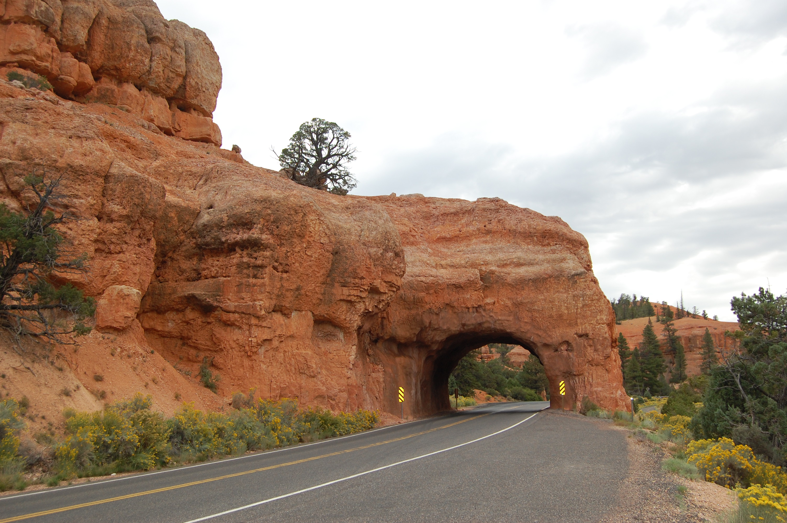
This road passes through a tunnel in Red Canyon, seen from the "Popular through the Ages" turnout.
Public Domain.
Download Original (259 x 179 pixels, 12.9 KB)
-
A lone pine looms over the flowered valley floor at the Summit Rest Area on Scenic Byway 12.
Public Domain. Photo by A. E. Crane
Download Original (225 x 154 pixels, 12.0 KB)
-
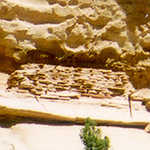
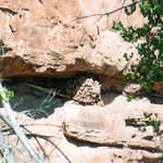
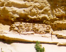
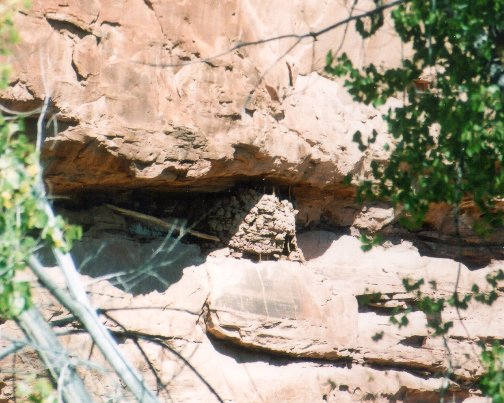
This Anasazi granary is barely visible high in a niche in the rocks above the roadside pullout.
Public Domain. Photo by A. E. Crane
Download Original (295 x 237 pixels, 26.3 KB)
-
Scenic Byway 12 takes the traveler on a magic journey through Escalante Canyons.
Public Domain. Photo by A. E. Crane
Download Original (225 x 156 pixels, 12.7 KB)
-
Power lines parallel the Cannonville junction of Scenic Byway 12 and Cottonwood Road to Kodachrome State Park.
Public Domain. Photo by A. E. Crane
Download Original (300 x 209 pixels, 11.9 KB)
-
It's worth stopping at the Boynton Overlook for this spectacular view.
Public Domain. Photo by A. E. Crane
Download Original (225 x 153 pixels, 17.1 KB)
-
This view looks back across the Hogsback on Scenic Byway 12 near Boulder.
Public Domain. Photo by A. E. Crane
Download Original (271 x 184 pixels, 14.2 KB)
-
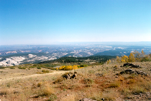
On a crystal clear day, you can see 20 miles to the Henry Mountains, Waterpocket Fold, and Dixie National Forest from the Larb Hollow Overlook on Scenic Byway 12 in Utah.
© May 2001 A. E. Crane.
-
This is the junction of Scenic Byway 12 and SR-24 near the town of Torrey.
Public Domain. Photo by A. E. Crane
Download Original (272 x 185 pixels, 10.0 KB)
-
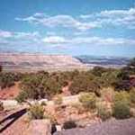
Driving along Upper Valley, golden mesas line the roadsides.
Public Domain. Photo by A. E. Crane
Download Original (225 x 157 pixels, 12.3 KB)
-
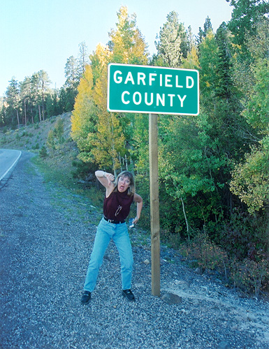
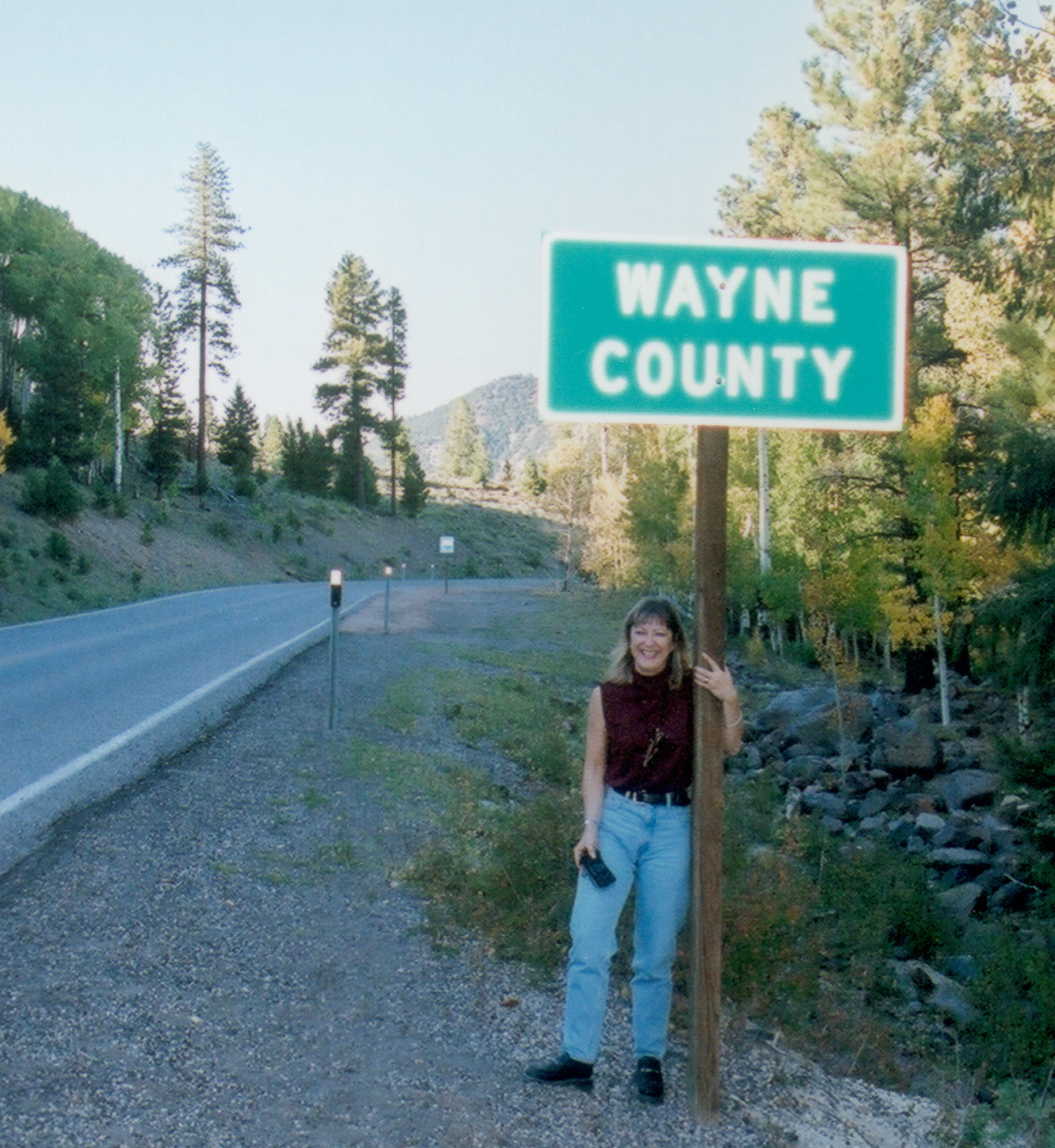
Nan, a big fan of the Wayne County part of the Byway, was ready to leave Garfield County by the time we finished driving through it.
Public Domain. Photo by S. Clyde
Download Original (385 x 500 pixels, 154.6 KB)
-
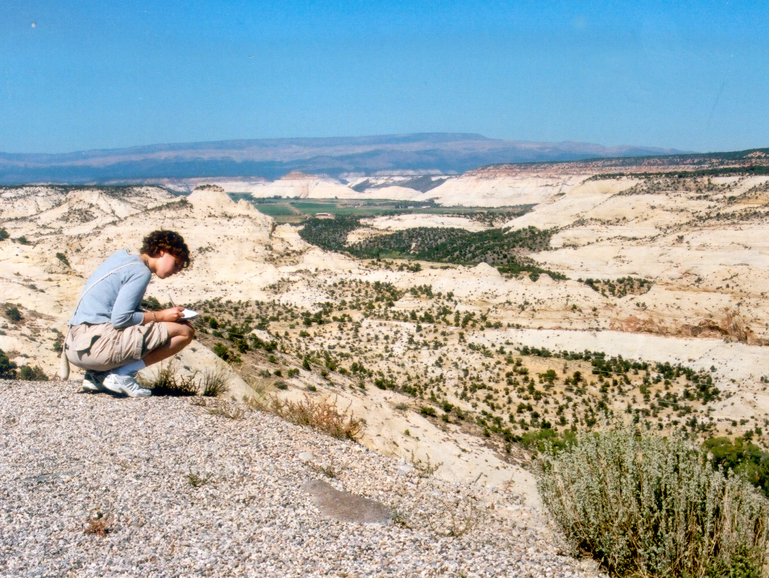
Leslie takes notes on the wonderful view on Scenic Byway 12 as it proceeds over the Hogsback.
Public Domain. Photo by S. Clyde
Download Original (2464 x 1852 pixels, 1870.4 MB)
-
A recreational cyclist utilizes the brand new biking trail that parallels Red Canyon on Scenic Byway 12.
Public Domain. Photo by S. Clyde
Download Original (3000 x 1982 pixels, 1991.8 MB)
-
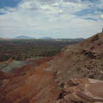
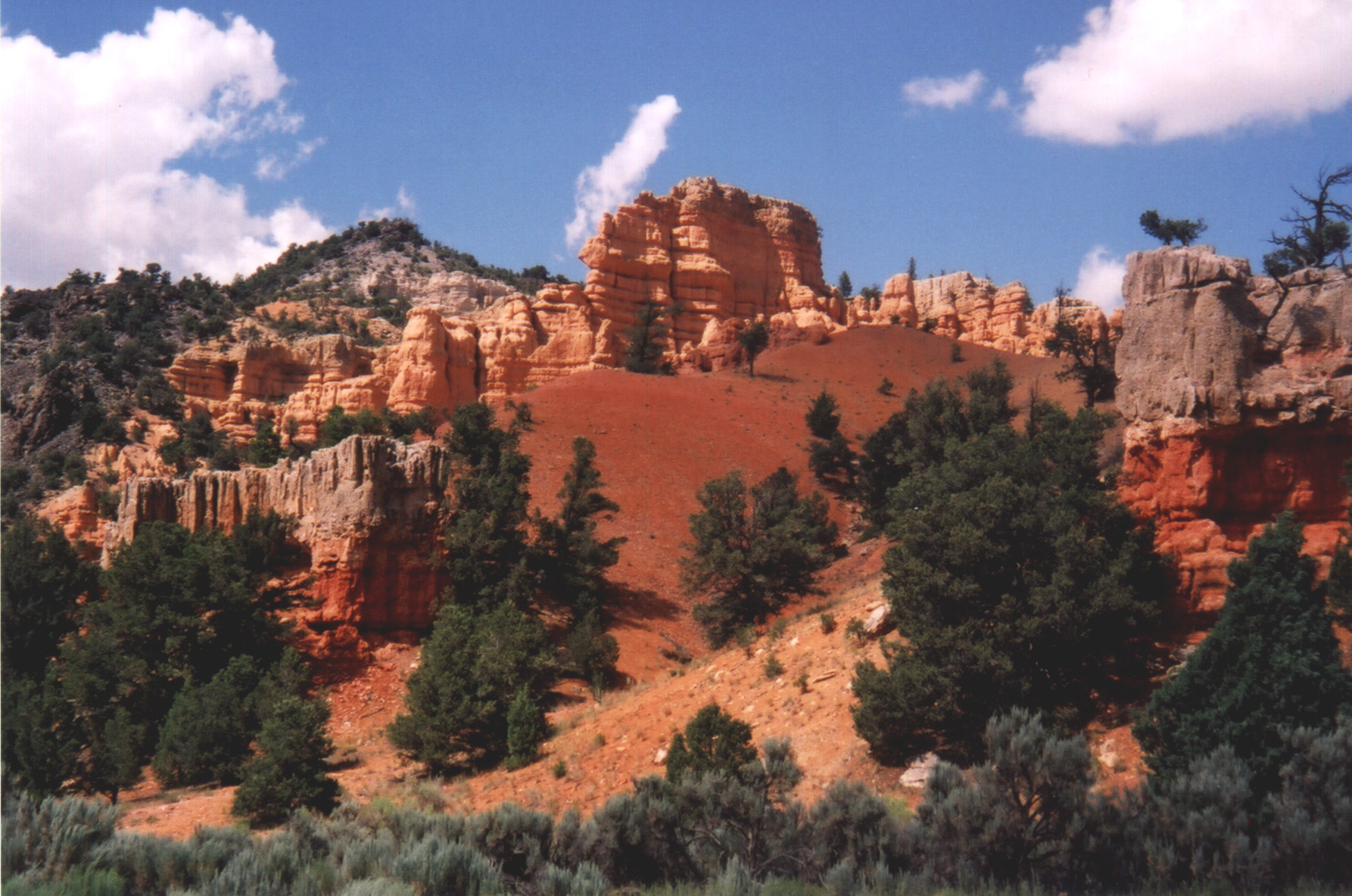
This gray landscape on Scenic Byway 12 is known as "The Blues."
Public Domain. Photo by A. E. Crane
Download Original (2712 x 1980 pixels, 1706.9 MB)
-
Farmers irrigate a field near Tropic, Utah on Scenic Byway 12.
Public Domain. Photo by S. Clyde
Download Original (1152 x 864 pixels, 482.6 KB)
-
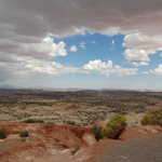
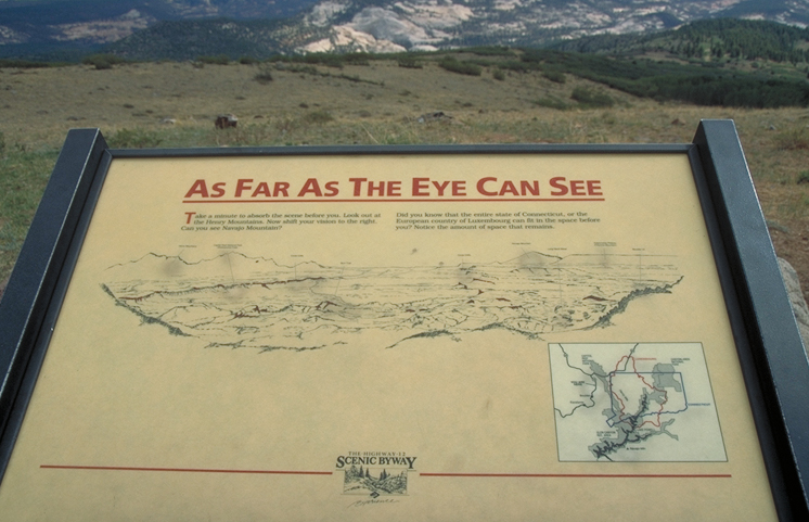
From this overlook, visitors can see enough square mileage to fill Connecticut.
Public Domain. Photo by S. Clyde
Download Original (500 x 333 pixels, 105.2 KB)
-
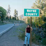
Nan Anderson finally reaches Wayne County on Scenic Byway 12.
Public Domain. Photo by S. Clyde
Download Original (1572 x 1710 pixels, 790.1 KB)
-
A visitor hikes Arches Trail on Scenic Byway 12.
Public Domain. Photo by S. Clyde
Download Original (2112 x 2184 pixels, 1419.7 MB)
-

Bruce Fullmer takes a quick nap between stops on the Scenic Byway 12 tour with NSBO.
Public Domain. Photo by S. Clyde
Download Original (2284 x 1752 pixels, 942.7 KB)
-
Look for granaries like this Anasazi Granary all along Scenic Byway 12.
Public Domain. Photo by A. E. Crane
Download Original (2628 x 1752 pixels, 1687.3 MB)
-
Hiking the Arches Trail in Losee Canyon off of Red Canyon on Scenic Byway 12, visitors can enjoy overlooks.
Public Domain. Photo by S. Clyde
Download Original (200 x 150 pixels, 61.5 KB)
-
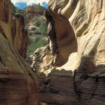
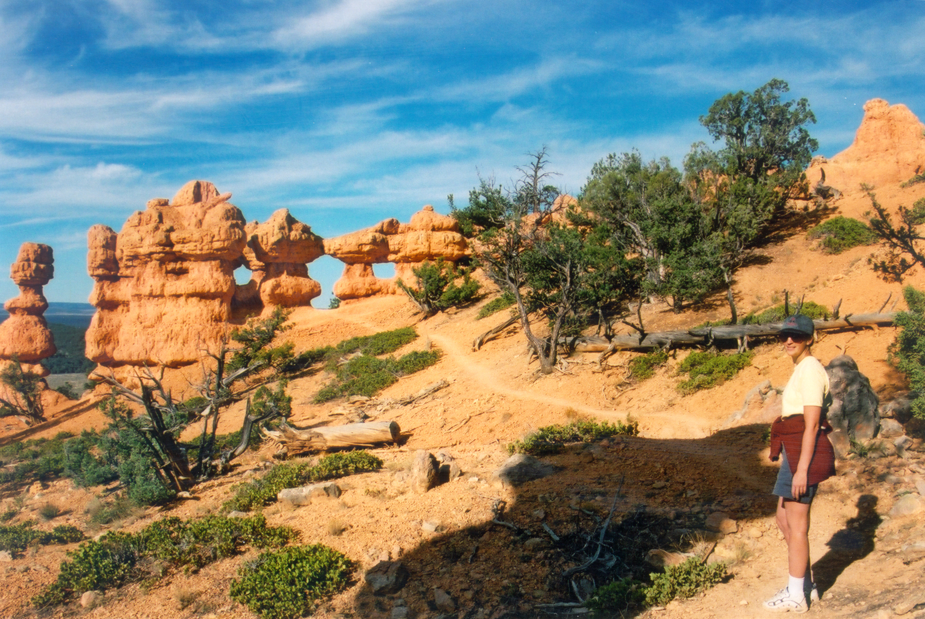
This arch is the biggest arch on the Arches Trail in Losee Canyon.
Public Domain. Photo by S. Clyde
Download Original (2118 x 3000 pixels, 1989.5 MB)
-
In the fall, on Scenic Byway 12, look for gold and orange aspen to match the gold and orange sandstone.
Public Domain. Photo by S. Clyde
Download Original (3000 x 1965 pixels, 2010.3 MB)
-
Scenic Byway 12 heads back to Escalante near Head of the Rocks overlook, passing rock outcroppings.
Public Domain. Photo by A. E. Crane
Download Original (2412 x 1904 pixels, 1133.6 MB)
-
Scenic Byway 12 travels below Boynton Overlook and crosses the Escalante River.
Public Domain. Photo by A. E. Crane
Download Original (2596 x 1843 pixels, 1509.4 MB)
-
A visitor grins as she looks out over Powell Point.
© 2001 A. E. Crane.
-
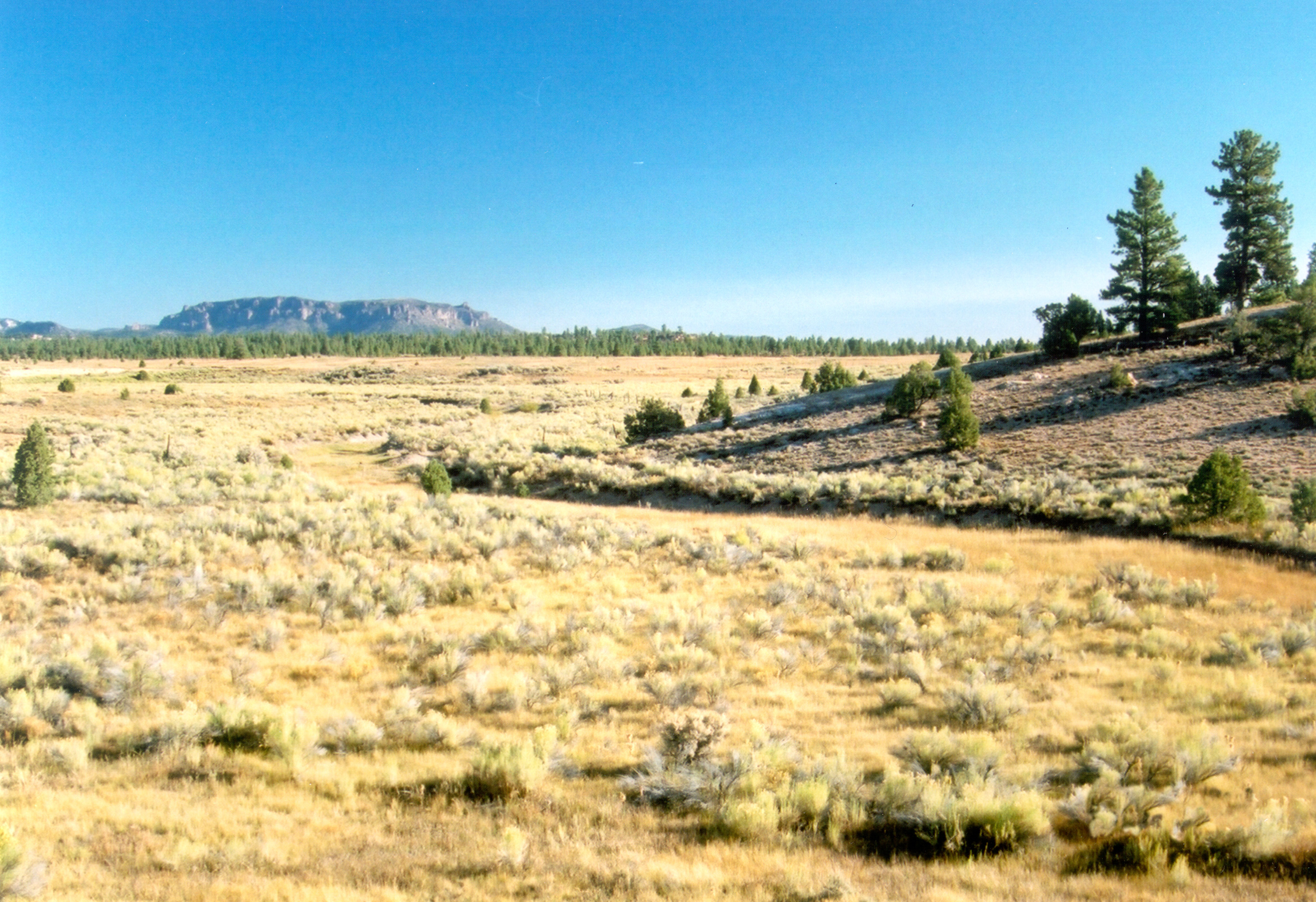
Mountains, pine trees, and sagebrush fields form a wilderness view on Scenic Byway 12.
Public Domain. Photo by A. E. Crane
Download Original (2764 x 1960 pixels, 1362.3 MB)
-
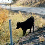
Visitors may encounter cattle along Scenic Byway 12.
Public Domain. Photo by A. E. Crane
Download Original (2208 x 1684 pixels, 1231.1 MB)
-
Scenic Byway 12 offers views in every direction when you cross the Hogsback.
Public Domain. Photo by A. E. Crane
Download Original (3000 x 2017 pixels, 1763.4 MB)
-
Scenic Byway 12 runs north along the ridge called the Hogsback.
Public Domain. Photo by A. E. Crane
Download Original (2754 x 1914 pixels, 1845.3 MB)
-

Hoodoos lie at the mouth of Casto Canyon in Red Canyon area of Scenic Byway 12.
Public Domain. Photo by A. E. Crane
Download Original (3120 x 2082 pixels, 1867.4 MB)
-
Guided trail rides are a popular activity on Scenic Byway 12.
© 2001 A. E. Crane.
-
Scenic Byway 12 winds through the Grand Staircase Escalante National Monument.
Public Domain. Photo by A. E. Crane
Download Original (3312 x 2256 pixels, 2030.3 MB)
-
The creamy white sandstone knob of Navajo Dome is prominent above Scenic Byway 12 heading west. Locals have a saltier name for this formation; you'll have to ask them for it!
Public Domain. Photo by A. E. Crane
Download Original (1785 x 1161 pixels, 605.1 KB)
-
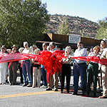
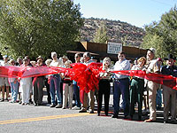
Nan Anderson, Bruce Fullmer, and many others gather in Boulder, Utah, to cut the ribbon across Scenic Byway 12, opening it for traffic as an All-American Road.
Public Domain. Photo by Dave Rogers of MDSC
Download Original (200 x 150 pixels, 30.8 KB)
-

Nan Anderson of Wayne County, Utah says a few words at the Scenic Byway 12 All-American Road celebration in Boulder, Utah.
Public Domain. Photo by Dave Rogers of MDSC
Download Original (200 x 150 pixels, 34.5 KB)
-
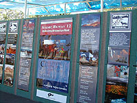
This large display at Scenic Byway 12's September designation event in Boulder, Utah is made of strip banners featuring photos, descriptions and history of the Byway.
Public Domain. Photo by Dave Rogers of MDSC
Download Original (200 x 150 pixels, 34.6 KB)
-
This is the square version of the Utah state scenic byway program roadsign, on the same signpost as a Scenic Byway 12 sign.
Public Domain. Photo by Dave Rogers of MDSC
Download Original (150 x 200 pixels, 13.5 KB)
-
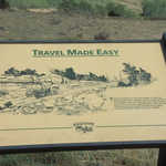
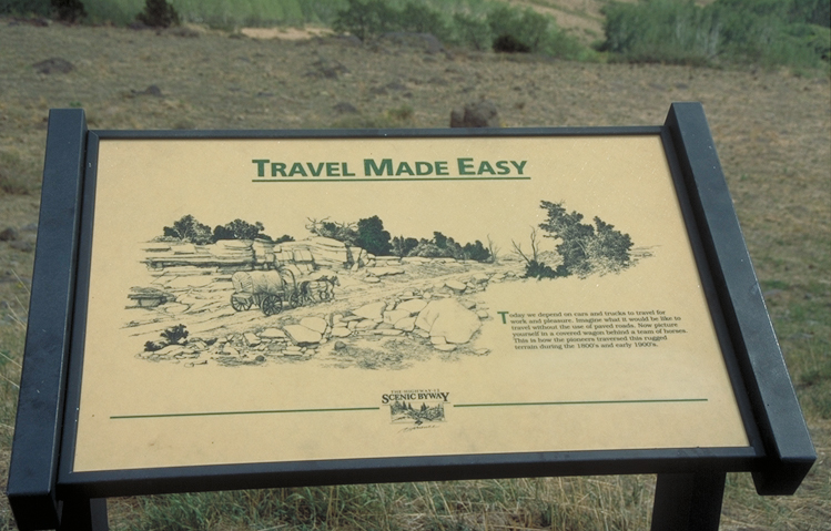
This is a closeup of the "Travel Made Easy" interpretive sign on Scenic Byway 12.
Public Domain. Photo by Dennis Adams
Download Original (749 x 479 pixels, 308.2 KB)
-
An old log cabin stands next to a three-paneled kiosk in Escalante on Scenic Byway 12.
Public Domain. Photo by Dennis Adams
Download Original (746 x 491 pixels, 332.7 KB)
-
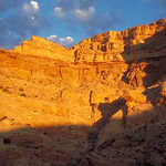
Sunset paints the red rock pinnacles and peaks of Red Canyon in fiery hues next to Scenic Byway 12.
Public Domain. Photo by Dennis Adams
Download Original (745 x 493 pixels, 398.1 KB)
-
This is a sample of an early USFS Interpretive sign on Scenic Byway 12 near Boulder, Utah.
Public Domain. Photo by Dennis Adams
Download Original (750 x 492 pixels, 372.7 KB)
-
Early morning sunlight shines on mountains near Torrey and Scenic Byway 12.
Public Domain. Photo by Dennis Adams
Download Original (749 x 483 pixels, 255.1 KB)
-
Shadows fall across both Scenic Byway 12 and a bicycle path as this car travels through Red Canyon.
Public Domain. Photo by Dennis Adams
Download Original (752 x 483 pixels, 360.0 KB)
-
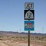
Byway and highway signage work together to indicate the route on this section of Scenic Byway 12, just south of Escalante.
Public Domain. Photo by Dennis Adams
Download Original (751 x 488 pixels, 352.7 KB)
-
This closeup of one of the three panels at Torrey's byway information kiosk shows a map of Scenic Byway 12 and its points of interest and attractions. A few cosmos flowers get in the way.
Public Domain. Photo by Dennis Adams
Download Original (752 x 485 pixels, 343.5 KB)
-
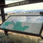
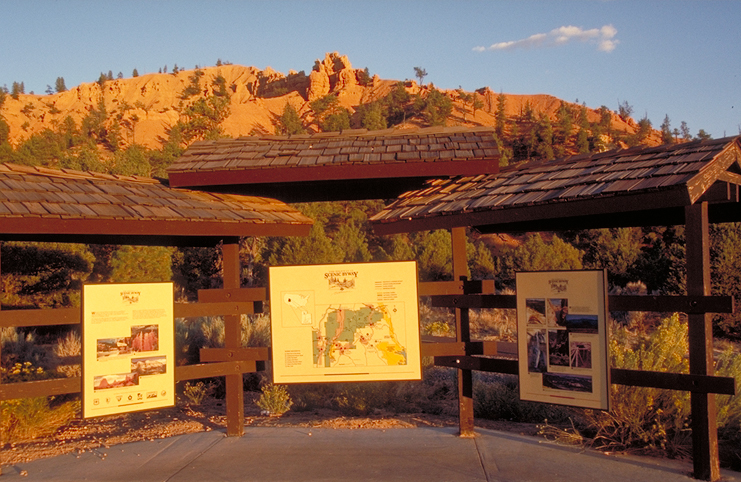
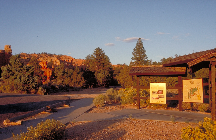
This three-paneled kiosk at the Torrey Information Center (at the entrance to Red Canyon) introduces the traveler to Scenic Byway 12 and the surrounding area.
Public Domain. Photo by Dennis Adams
Download Original (749 x 490 pixels, 419.8 KB)
-
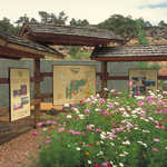
Pink and white cosmos add color to part of the Torrey Information Center where a three-paneled kiosk provides travelers with information about Scenic Byway 12.
Public Domain. Photo by Dennis Adams
Download Original (749 x 485 pixels, 449.6 KB)
-
This three-paneled kiosk at the Torrey Information Center is located at the entrance to Red Canyon. Each panel helps to introduce travelers to Scenic Byway 12 and the surrounding region.
Public Domain. Photo by Dennis Adams
Download Original (741 x 482 pixels, 438.8 KB)
-
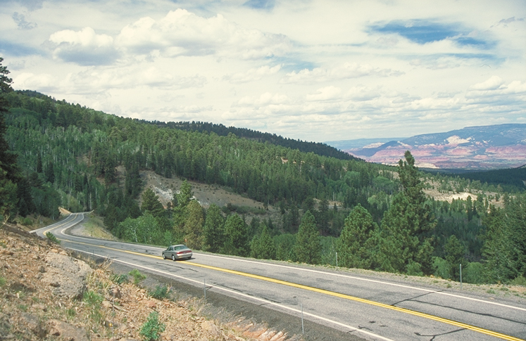
Scenic Byway 12 goes through extensive Dixie National Forest on the side of Boulder Mountain on this calm, cloudy day.
Public Domain. Photo by Dennis Adams
Download Original (747 x 485 pixels, 357.4 KB)
-
Travelers plan a trip on Scenic Byway 12, surrounded by brightly-colored wildflowers at the kiosk in Torrey.
Public Domain. Photo by Dennis Adams
Download Original (749 x 488 pixels, 455.3 KB)
-
Travelers look over the wonderful view at this interpretive stop on Scenic Byway 12.
Public Domain. Photo by Dennis Adams
Download Original (742 x 488 pixels, 336.6 KB)
-
Scenic Byway 12 descends the New Home Bench.
Public Domain. Photo by Dennis Adams
Download Original (745 x 487 pixels, 346.5 KB)
-
Scenic Byway 12 runs along the narrow ledge of the Hogsback.
Public Domain. Photo by Dennis Adams
Download Original (747 x 485 pixels, 344.5 KB)
-
Scenic Byway 12 runs close to aspens lining the Escalante River, and the road itself is edged with no shoulder right up against the towering cliffs of the Escalante Canyons.
Public Domain. Photo by Dennis Adams
Download Original (746 x 486 pixels, 373.8 KB)
-
Here, Scenic Byway 12 is benched into the redrock cliffside as it descends into the Escalante Canyons and the Escalante River.
Public Domain. Photo by Dennis Adams
Download Original (746 x 483 pixels, 362.1 KB)
-
Scenic Byway 12 descends from New Home Bench.
Public Domain. Photo by Dennis Adams
Download Original (747 x 487 pixels, 311.4 KB)
-
Scenic Byway 12 descends into the convoluted redrock canyons of the Escalante River.
Public Domain. Photo by Dennis Adams
Download Original (743 x 489 pixels, 445.6 KB)
-
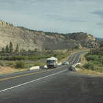
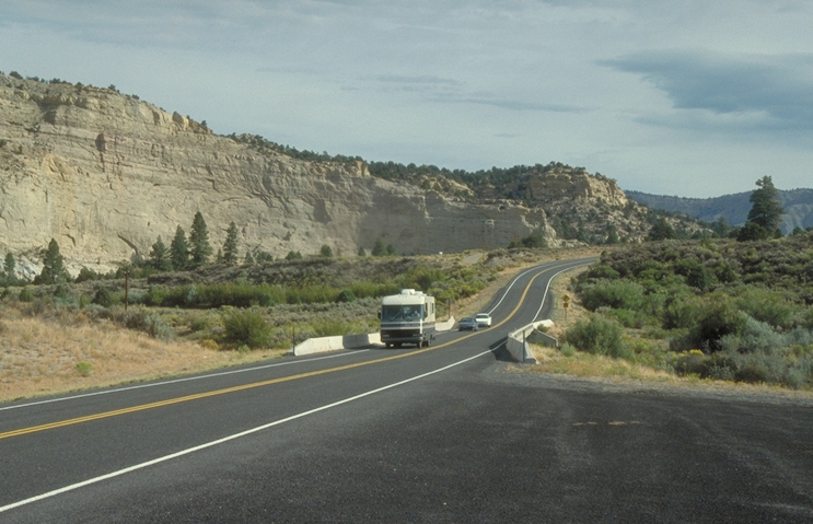
A motorhome is trailed by a few cars as it drives through a valley edged by tall white cliffs on Scenic Byway 12 in Utah.
Public Domain. Photo by Dennis Adams
Download Original (743 x 479 pixels, 315.0 KB)
-
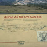
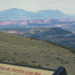
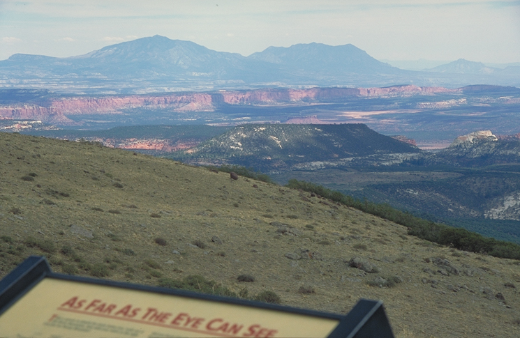
Interpretive sign for the Henry Mountains states "As Far As The Eye Can See."
Public Domain. Photo by Dennis Adams
Download Original (746 x 481 pixels, 299.5 KB)
-
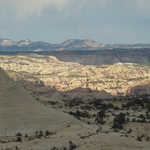
A tumbled, tortured landscape of white rock as far as the eye can see greets travelers on this overlook on Scenic Byway 12.
Public Domain. Photo by Dennis Adams
Download Original (748 x 488 pixels, 335.4 KB)
-
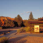
Late afternoon sunlight paints this parking area and welcome panel in rich red tones in Red Canyon on Scenic Byway 12.
Public Domain. Photo by Dennis Adams
Download Original (750 x 489 pixels, 409.0 KB)
-
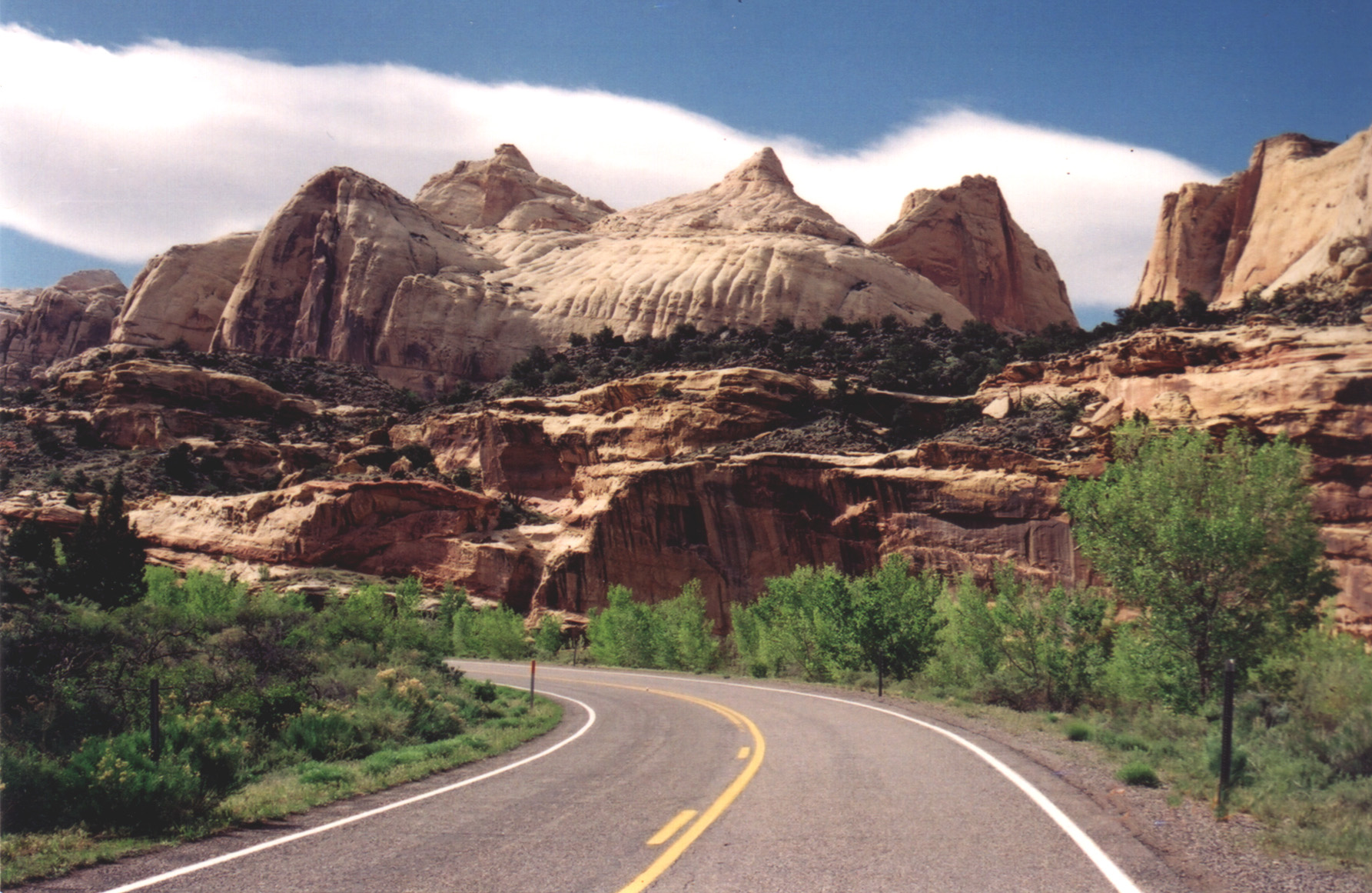
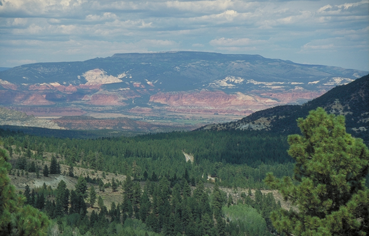
Bright green forests stretch out toward the rippling red and white ridges of Capitol Reef, which appear to lay against the deep blue and purples of the Henry Mountains. On this crystal clear day, you can see for miles.
Public Domain. Photo by Dennis Adams
Download Original (750 x 480 pixels, 349.0 KB)
-
The hogsback of Scenic Byway 12 curves atop a ridge of juniper and rock.
Public Domain. Photo by A. E. Crane
Download Original (1748 x 1124 pixels, 439.5 KB)
-
From the Hogsback of Scenic Byway 12, the ranching and farming community of Boulder nestles amidst rugged terrain.
Public Domain. Photo by A. E. Crane
Download Original (1756 x 1176 pixels, 512.5 KB)
-
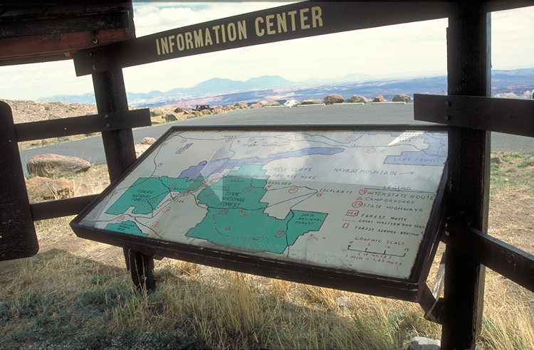
This is one of the multi-colored Scenic Byway 12 orientation signs at the Visitor Information Center in Torrey, Utah.
Public Domain. Photo by Dennis Adams of FHWA
Download Original (490 x 749 pixels, 330.5 KB)
-
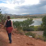
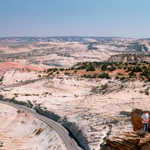
A photographer captures the perfect view of the Escalante Canyons from Boynton Overlook.
Public Domain. Photo by A. E. Crane
Download Original (1185 x 770 pixels, 296.7 KB)
-
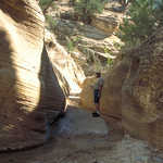
Two canyons come together in Willis Canyon.
Public Domain. Photo by Dennis Adams of FHWA
Download Original (743 x 487 pixels, 491.3 KB)
-
A well-earned view on sunlit orange hoodoos rewards hikers from a ridge in Bryce Canyon National Park.
Public Domain. Photo by Jessica Dungan
Download Original (3008 x 2000 pixels, 1556.5 MB)
-
Scenic Byway 12 tunnels through a redrock fin in Red Canyon, Utah.
Public Domain. Photo by Jessica Dungan
Download Original (3008 x 2000 pixels, 1401.3 MB)
-
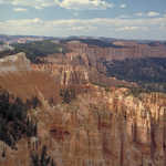
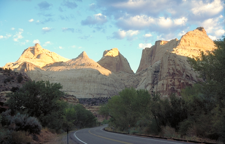
Scenic Byway 12 snakes through Bryce Canyon National Park, surrounded by hoodoos and patches of trees.
Public Domain. Photo by Janet Reffert
Download Original (3008 x 2000 pixels, 1777.9 MB)
-
On the Queen's Trail in Bryce Canyon, hikers squeeze through narrow slots in sheer sandstone walls.
Public Domain. Photo by Jessica Dungan
Download Original (2000 x 3008 pixels, 1464.9 MB)
-
A visitor approaches the "wall of arches" on Arches Trail.
Public Domain. Photo by S. Clyde
Download Original (3000 x 2008 pixels, 1986.1 MB)
-
Riders start out on horseback in Losee Canyon off of Red Canyon.
Public Domain. Photo by A. E. Crane
Download Original (1728 x 1075 pixels, 710.9 KB)
-

The darkness in the photo is an ancient pit dwelling: nice place to spend hot summer days.
Public Domain. Photo by A. E. Crane
Download Original (225 x 158 pixels, 11.8 KB)
-
Orange, peach, and cream pastels make a warm palette for rock formations at the edge of Bryce Canyon.
Public Domain. Photo by A. E. Crane
Download Original (2700 x 1792 pixels, 787.6 KB)
-
Two hikers climb along the Rim Trail at Bryce Canyon.
© 2001 A. E. Crane.
-
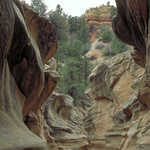
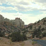
Hoodoos and arches are found throughout Losee Canyon, Casto Canyon, and Red Canyon.
Public Domain. Photo by A. E. Crane
Download Original (2788 x 2142 pixels, 1822.2 MB)
-
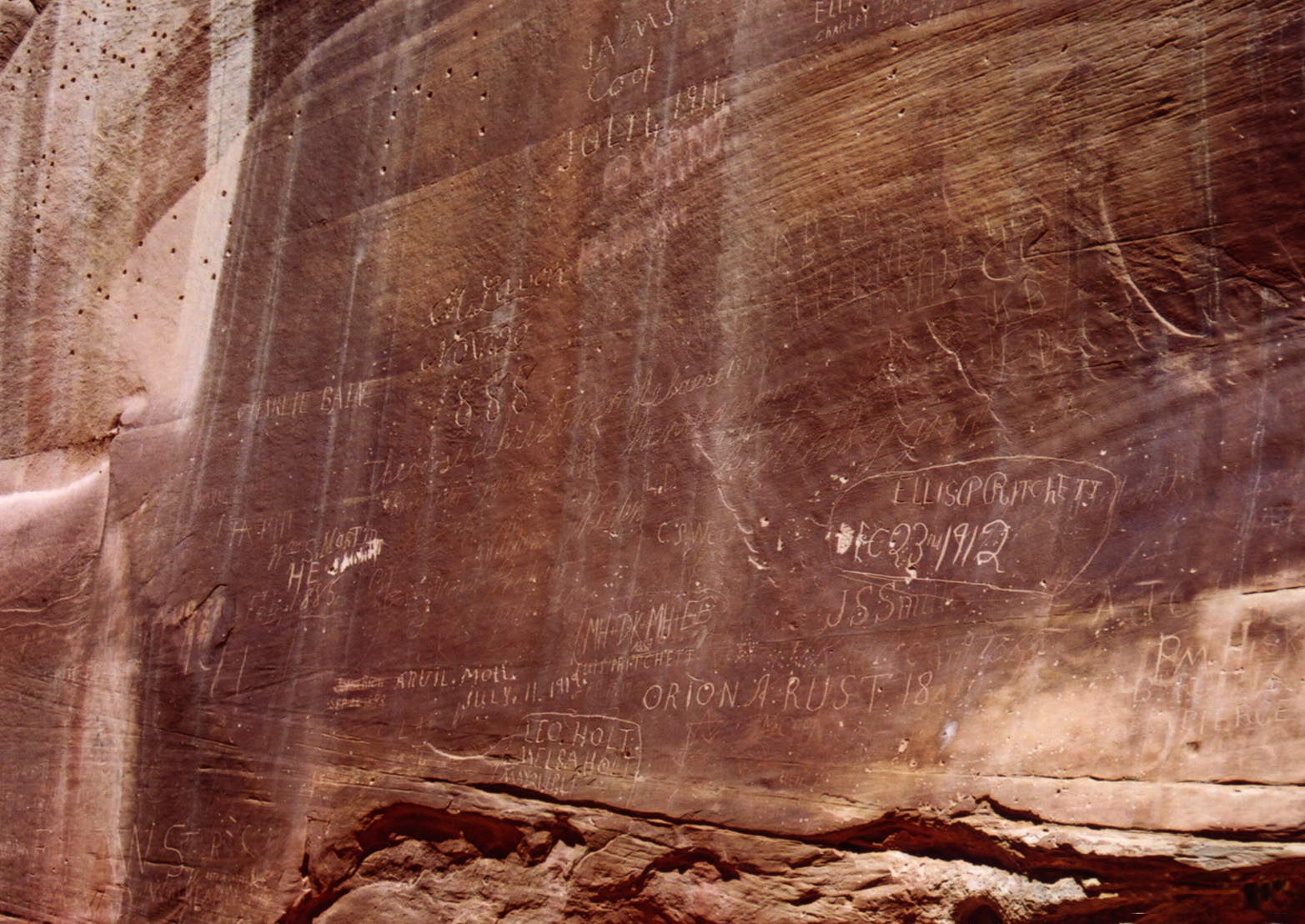
The sheer sandstone walls of this narrow wash bear these inscriptions, etched in by many pioneers who traveled on this road which was once the only way a wagon could pass through the Waterpocket Fold.
Public Domain. Photo by A. E. Crane
Download Original (1565 x 1108 pixels, 604.5 KB)
-
This old cabin sits nestled in the high meadows of late summer with a faint glimpse of Cedar Breaks in the distance.
Public Domain. Photo by A. E. Crane
Download Original (1796 x 1190 pixels, 374.5 KB)
-
The historic Fruita orchards can be seen from Capitol Reef Visitor Center.
© May 2001 A. E. Crane.
-
Visitor watches the tadpoles and other water life that survive in one of the perpetual water holes in the slickrock sandstone of Capitol Gorge.
© May 2001 A. E. Crane.
-
Three visitors pose in front of the Keyhole Arch.
Public Domain. Photo by S. Clyde
Download Original (3120 x 2231 pixels, 1983.1 MB)
-
A visitor stands beside a dead tree on Arches Trail in Losee Canyon. At least this tree is interesting!
Public Domain. Photo by S. Clyde
Download Original (2132 x 3000 pixels, 1831.5 MB)
-
A visitor stands under the biggest arch on Arches Trail in Losee Canyon.
Public Domain. Photo by A. E. Crane
Download Original (2600 x 1972 pixels, 1435.9 MB)
-
This hiker rounds a bend on the Chimney Rock Trail.
© May 2001 A. E. Crane.
-
Highway 24 runs through the rugged redrock of Capitol Reef, Utah.
Public Domain. Photo by S. Clyde
Download Original (220 x 139 pixels, 12.2 KB)
-
These three hikers take care descending the Arches Trail in Losee Canyon.
Public Domain. Photo by S. Clyde
Download Original (2496 x 1964 pixels, 1545.5 MB)
-
A hiker peers down a dry wash in Red Canyon.
Public Domain. Photo by S. Clyde
Download Original (2400 x 1629 pixels, 1947.1 MB)
-
An Anasazi granary sits in the cliffs down by the Escalante River.
Public Domain. Photo by A. E. Crane
Download Original (1652 x 1320 pixels, 615.3 KB)
-
Two visitors are awed by the scope of the wind-scoured countryside stretching out ahead.
Public Domain. Photo by A. E. Crane
Download Original (2813 x 1977 pixels, 1507.9 MB)
-
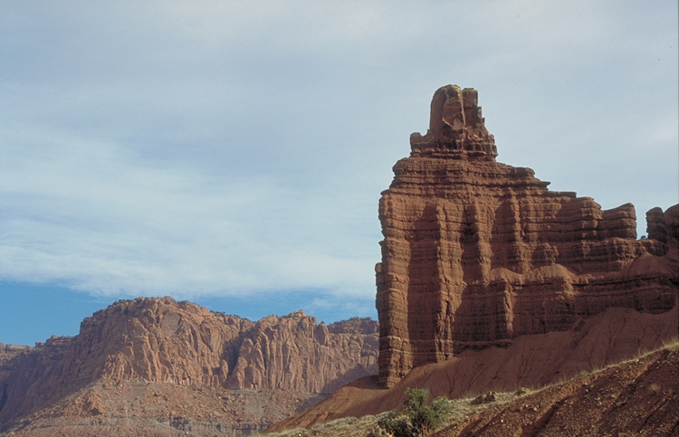
Chimney Rock stands out at Capitol Reef National Park.
© September 2001 Leslie Lott.
Download Original (864 x 1152 pixels, 273.5 KB)
-
The Fruita Orchards provide delectable fruit every year.
Public Domain. Photo by S. Clyde
Download Original (160 x 220 pixels, 16.4 KB)
-
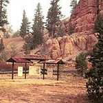
Group of hikers from Ohio gather at Red Canyon Visitor Center.
Public Domain. Photo by A. E. Crane
Download Original (2309 x 1976 pixels, 1423.4 MB)
-
As Highway 24 heads east into Capitol Reef country, the tilted strata of the Waterpocket Fold comes in to view ahead.
© May 2001 A. E. Crane.
-

Conical orange sandstone pillars contrast sharply with gray-white cliffs and deep green conifers at Kodachrome State Park in southern Utah.
Public Domain. Photo by A. E. Crane
Download Original (225 x 187 pixels, 7.4 KB)
-
Sandstone spires lit by the sun rise from the desert floor in Kodachrome Basin State Park in Utah. The park was so named because of its brilliant red sandstone spires and formations.
© August 2006 Bob Ward.
Download Original (1581 x 1061 pixels, 209.2 KB)
-
The panoramic views from Boulder Mountain are incredible.
Public Domain. Photo by S. Clyde
Download Original (3000 x 1986 pixels, 1642.5 MB)
-
A patch of blue in stormy skies over Boulder brightens this view of a red barn and fresh-sprouted fields of winter wheat.
© October 2003 A. E. Crane.
Download Original (1764 x 1176 pixels, 488.1 KB)
-
It is impossible to fit the panoramas on Boulder Mountain in a little lens.
Public Domain. Photo by S. Clyde
Download Original (500 x 333 pixels, 93.5 KB)
-
Enjoy views of the rugged country surrounding Escalane Grand Staircase National Monument.
Public Domain. Photo by S. Clyde
Download Original (2972 x 1964 pixels, 1536.8 MB)
-
This view from the edge of the Hogsback on Scenic Byway 12 looks toward Boulder.
Public Domain. Photo by A. E. Crane
Download Original (2424 x 1764 pixels, 1420.4 MB)
-
Undaunted by its surroundings, a pine tree stretches above the sandstone walls to catch a few rays of sunlight.
Public Domain. Photo by Jessica Dungan
Download Original (1985 x 2680 pixels, 2615.3 MB)
-

Ask questions and find information at the Escalante Multi-Agency Visitor Center.
Public Domain. Photo by A. E. Crane
Download Original (2524 x 1872 pixels, 933.1 KB)
-
Take a side trip on the Burr Trail Scenic Backway near Boulder.
Public Domain. Photo by A. E. Crane
Download Original (2492 x 1868 pixels, 1657.0 MB)
-
A hiker strolls past the foot of Calf Creek Falls in Escalante Canyons.
Public Domain. Photo by A. E. Crane
Download Original (1188 x 1766 pixels, 728 KB)
-

Anasazi Indian granary nestles in a niche in Escalante Canyons, Utah.
Public Domain.
Download Original (225 x 220 pixels, 30.1 KB)
-
Enjoy bursts of color on Boulder Mountain on Scenic Byway 12.
Public Domain. Photo by Leslie Lott
Download Original (200 x 150 pixels, 31.4 KB)
-
Candy-striped mesas rise up into the brilliant blue sky north of Cannonville, Utah.
Public Domain. Photo by A. E. Crane
Download Original (345 x 243 pixels, 18.8 KB)
-
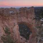
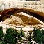
A natural bridge upholds a dappled sunset.
© January 2006 Neil Li.
Download Original (709 x 1024 pixels, 288.9 KB)
-
Water gracefully cascades down the slickened rock at Calf Creek Falls in Escalante Canyons.
Public Domain.
Download Original (136 x 225 pixels, 13.5 KB)
-
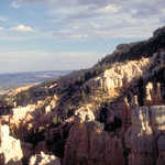
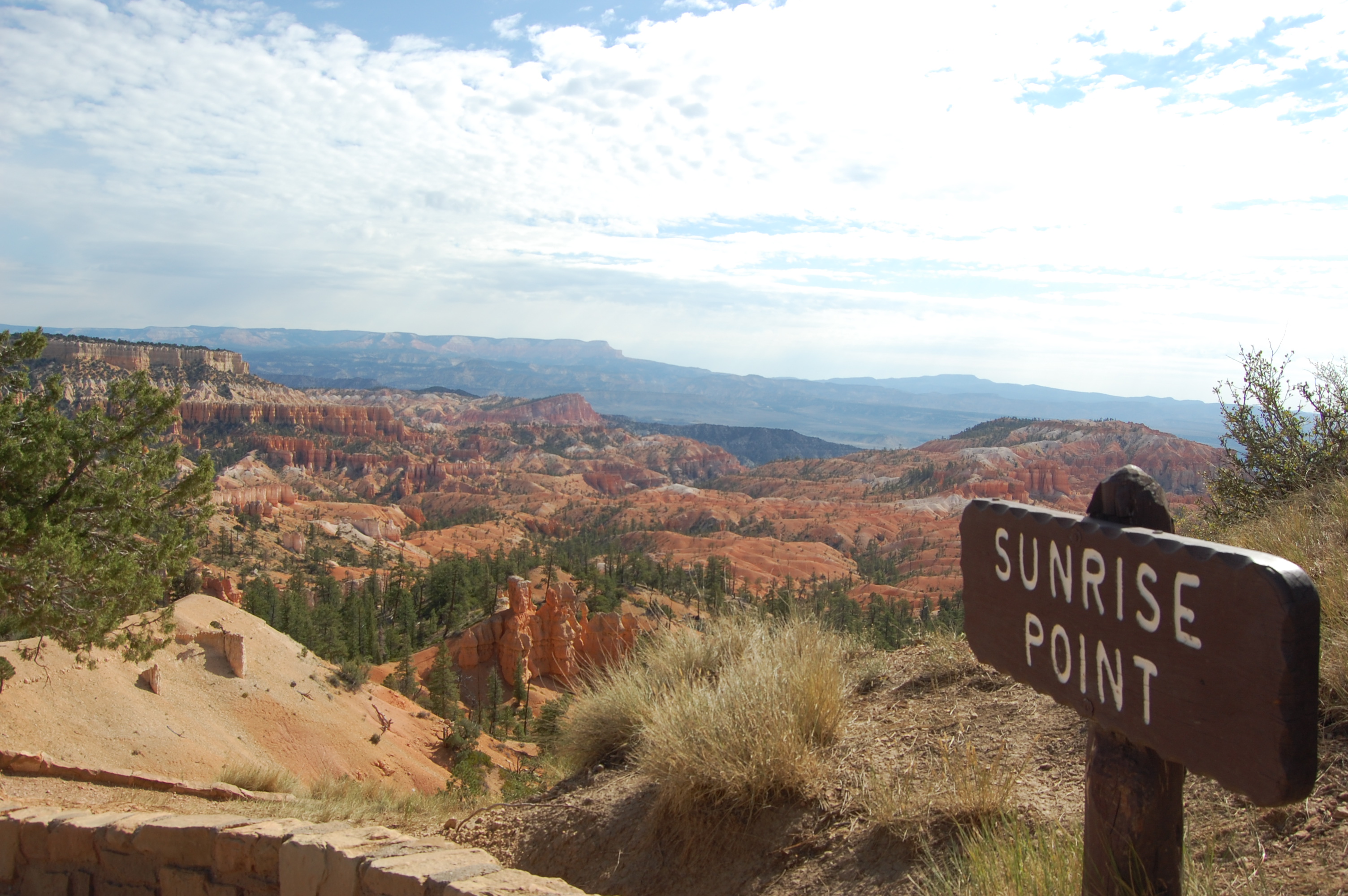
Sunlight on a beautiful morning lights up miles of the seemingly endless landscape visible from Sunrise Point in Bryce Canyon.
Public Domain. Photo by Jessica Dungan
Download Original (3008 x 2000 pixels, 1483.5 MB)
-
Scenic Byway 12 tunnels through a redrock fin in Red Canyon, Utah.
Public Domain. Photo by Jessica Dungan
Download Original (3008 x 2000 pixels, 1485.0 MB)
-
A spectacular display of redrock hoodoos and arches awaits travelers as they drive Scenic Byway 12 through Red Canyon.
Public Domain. Photo by Jessica Dungan
Download Original (3008 x 2000 pixels, 1510.6 MB)
-
Brilliant red rock formations usher sightseers into the aptly named Red Canyon west of Bryce Canyon National Park.
Public Domain. Photo by Jessica Dungan
Download Original (3008 x 2000 pixels, 1494.4 MB)
-
An overcast sky brings out the brilliant colors of sagebrush-covered cliffs and rock formations in Escalante Canyons as seen from the Boynton Overlook.
Public Domain. Photo by Jessica Dungan
Download Original (3008 x 2000 pixels, 1523.9 MB)
-
A serene landscape of sandstone stretches as far as the eye can see in the area near the Escalante River and Escalante Canyons of Utah.
Public Domain. Photo by Jessica Dungan
Download Original (3008 x 2000 pixels, 1521.7 MB)
-
Fluffy cumulus clouds sprawl out over the cream-and-orange sandstone of Escalante Canyons from the Head of the Rock Overlook on Scenic Byway 12 in Utah.
Public Domain. Photo by Jessica Dungan
Download Original (3008 x 2000 pixels, 1535.8 MB)
-
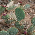
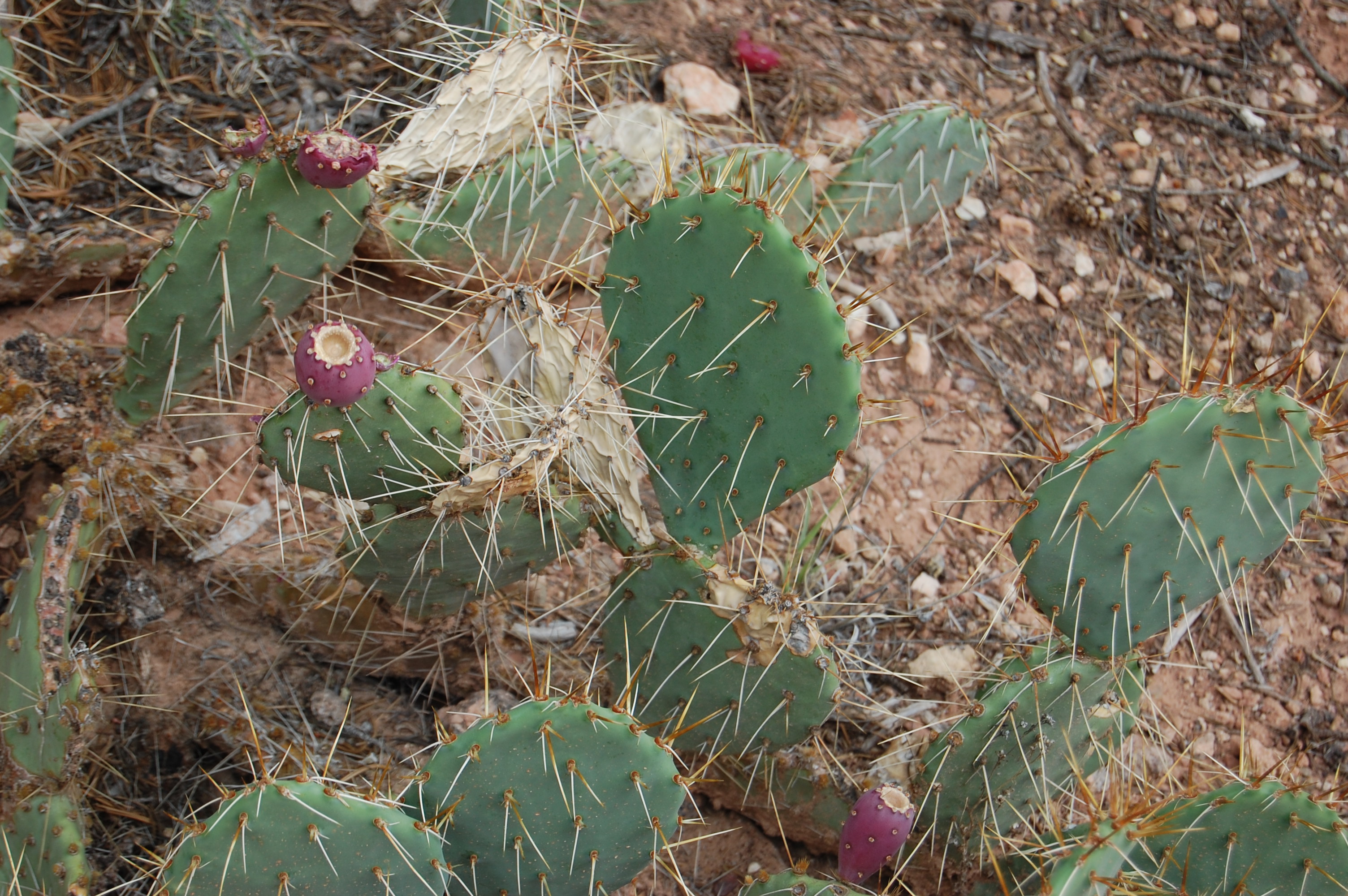
Prickly pear cactus is commonly found throughout the southwestern U.S. This one bears pinkish-purple fruit.
Public Domain. Photo by Jessica Dungan
Download Original (3008 x 2000 pixels, 1568.1 MB)
-
An Interpretive Center in Escalante informs visitors.
Public Domain.
Download Original (400 x 201 pixels, 24.3 KB)
-

Early morning view north across sagebrush meadows from the roadside near a turnoff to Bryce Canyon.
 © 2001 A. E. Crane.
Download Original (3000 x 2057 pixels, 1692.9 MB)
-
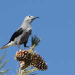
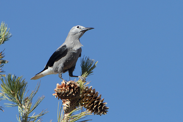
A Clark's Nutcracker perches against a striking blue sky atop a limber pine branch loaded with cones.
 © September 2010 Alan Vernon.
Download Original (640 x 427 pixels, 152.0 KB)
-

Utah's Scenic Byway 12 receives their designation plaque at the Designation 2002 event at Union Station in Washington DC.
 © June 2002 FHWA-NSB.
Download Original (1536 x 1024 pixels, 432.3 KB)