
Sheyenne River Valley Scenic Byway
All Photos (99)
-
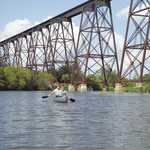
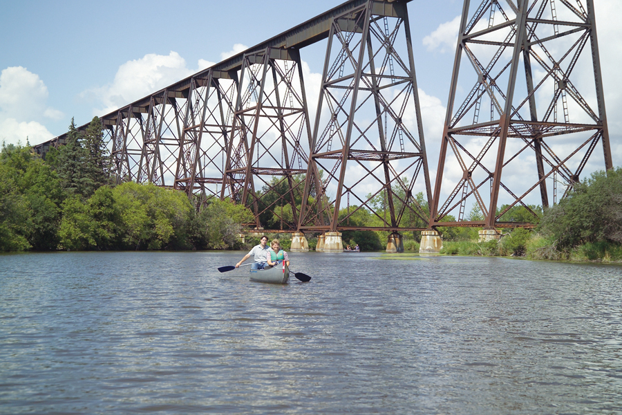
Canoers float across the peaceful waters of the Sheyenne River as they pass under the famous Highline Bridge.
Public Domain. Photo by Dutton’s Valley Gallery
Download Original (900 x 600 pixels, 647.1 KB)
-
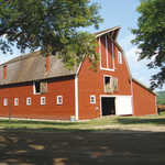
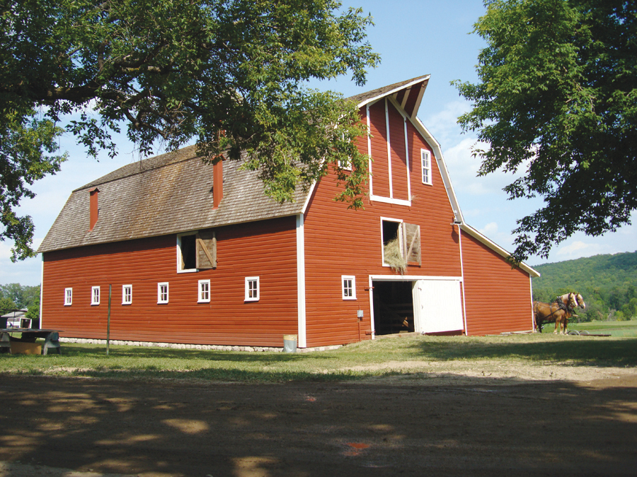
Located on Sunne Farm at Fort Ransom State Park, the red barn is a focal point for the annual Sodbuster Days celebration.
Public Domain. Photo by Sodbusters Association
Download Original (900 x 675 pixels, 810.3 KB)
-
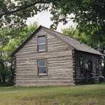
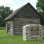
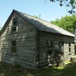
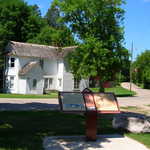
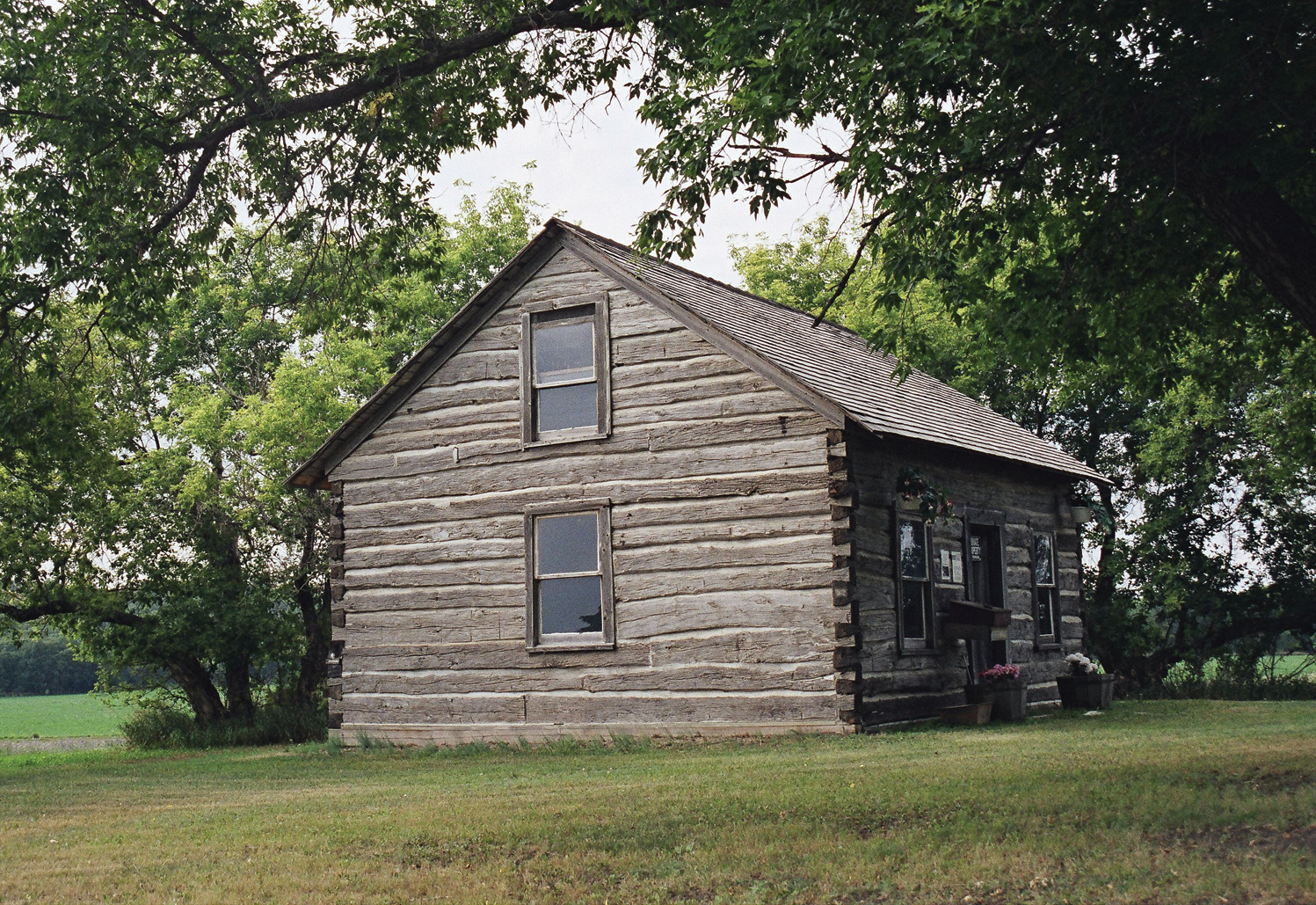
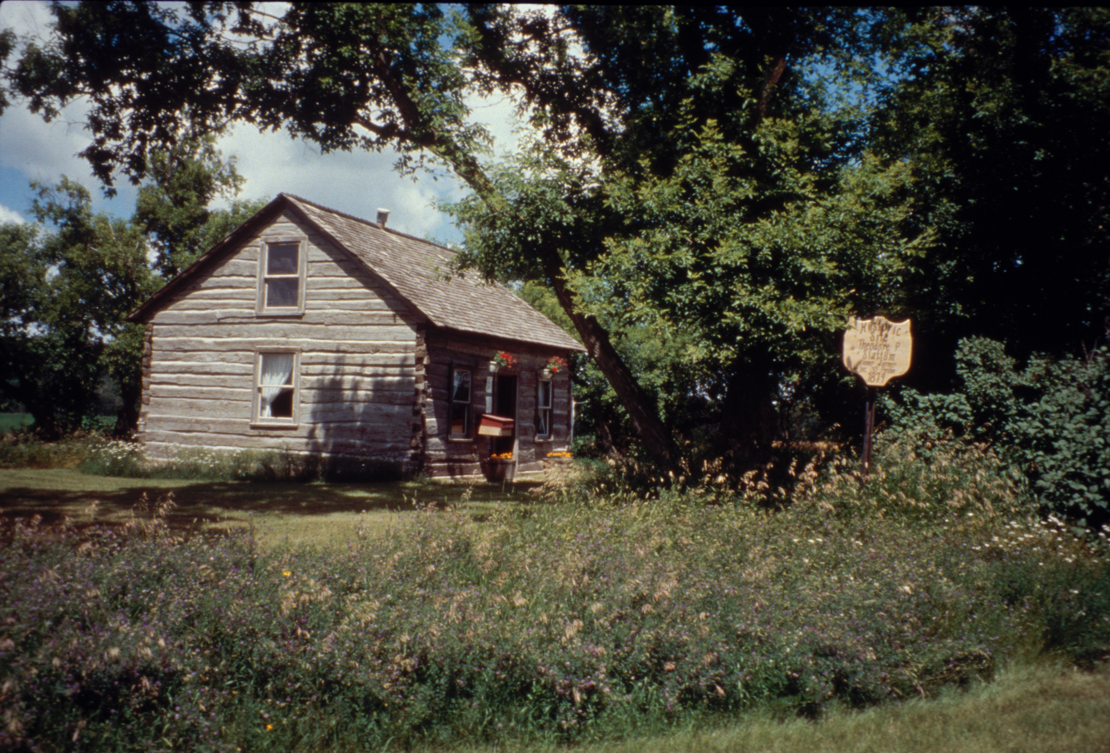
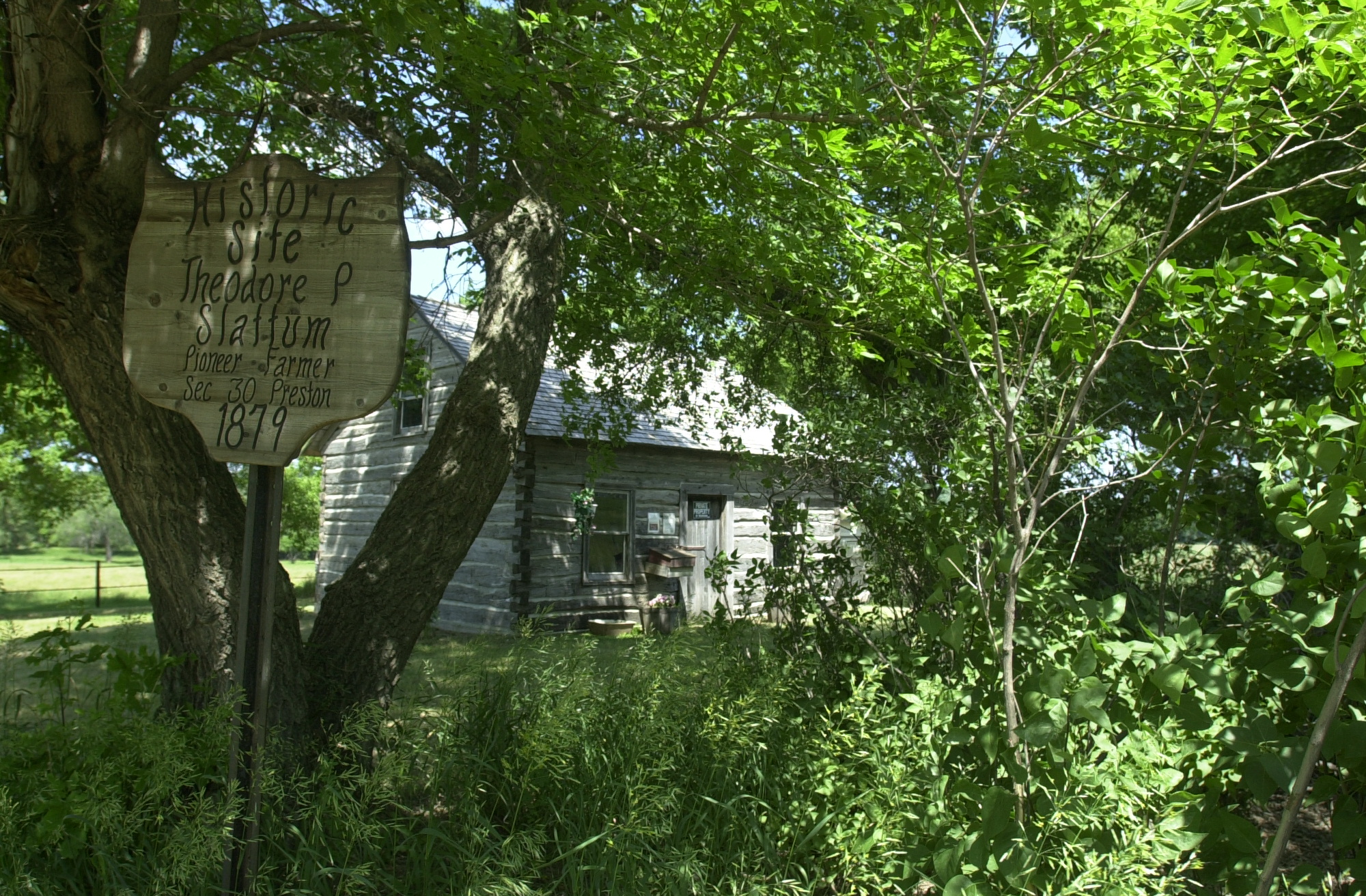
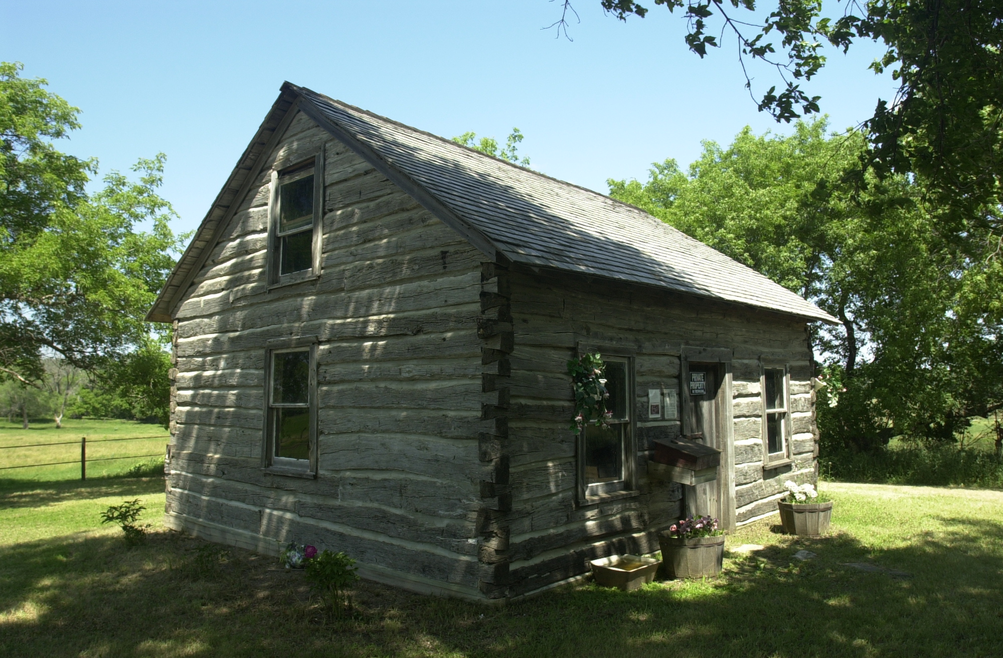
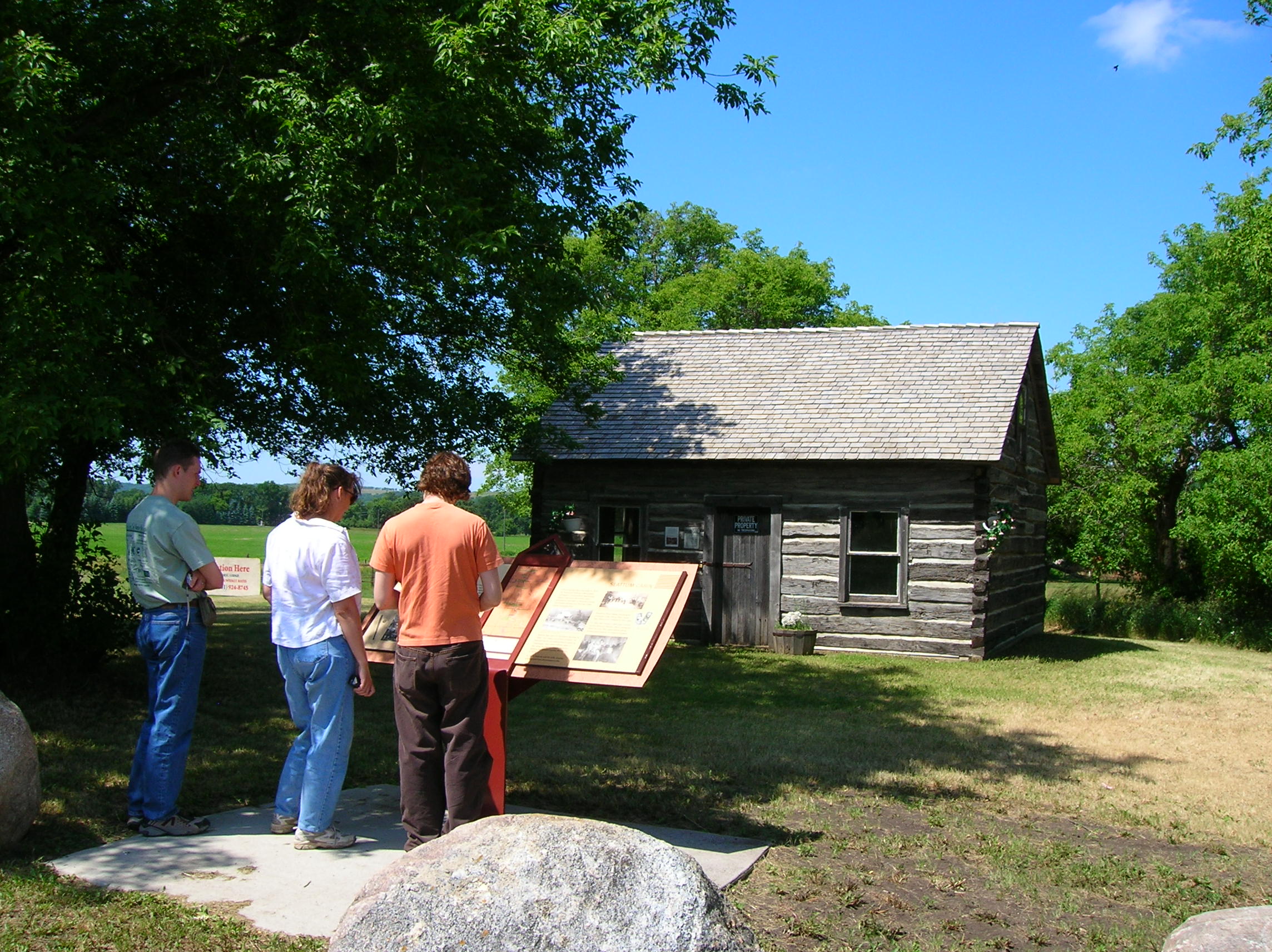
The historic Slattum Cabin stands as memorial to Theodore P. Slattum, one of the largest landowners in Ransom County, North Dakota in the 1870s.
Public Domain.
Download Original (1497 x 1029 pixels, 1748.5 MB)
-
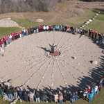
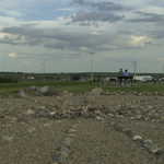
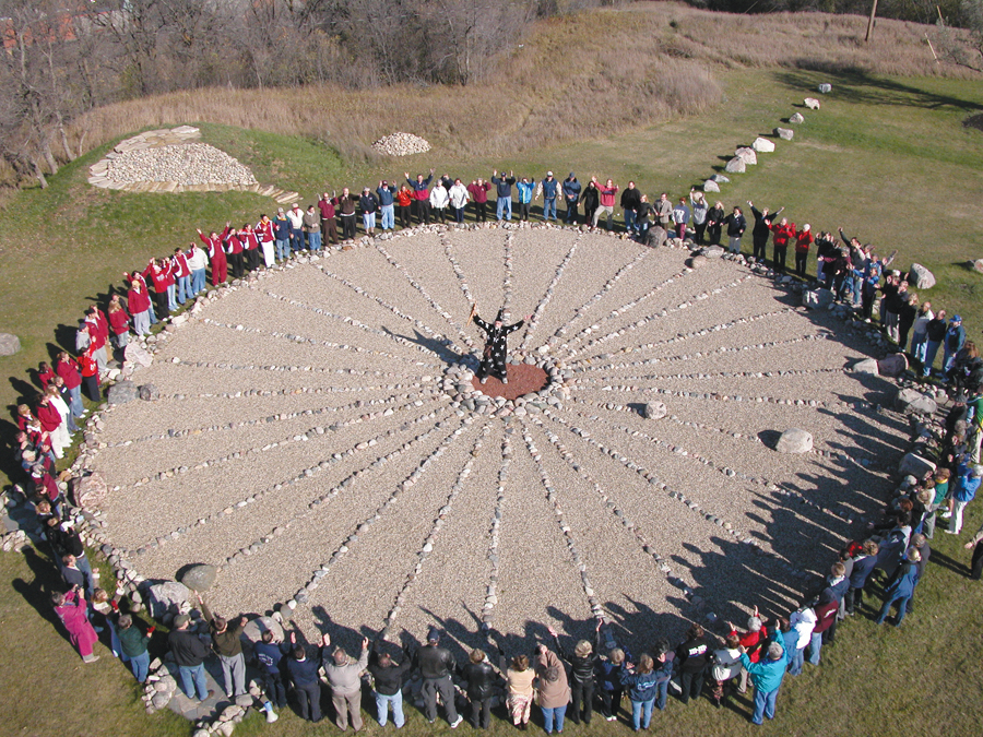
A large group of students and citizens gather around the Medicine Wheel in Valley City, North Dakota to join in a chant with "the wizard."
Public Domain. Photo by Byway Committee/VC Area Chamber
Download Original (900 x 675 pixels, 867.8 KB)
-
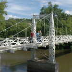
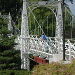
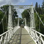
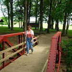
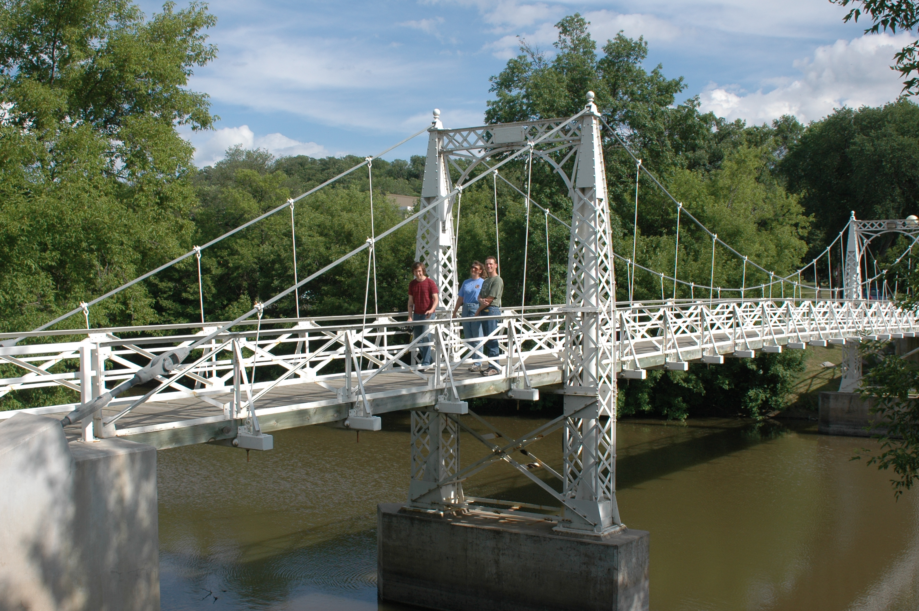
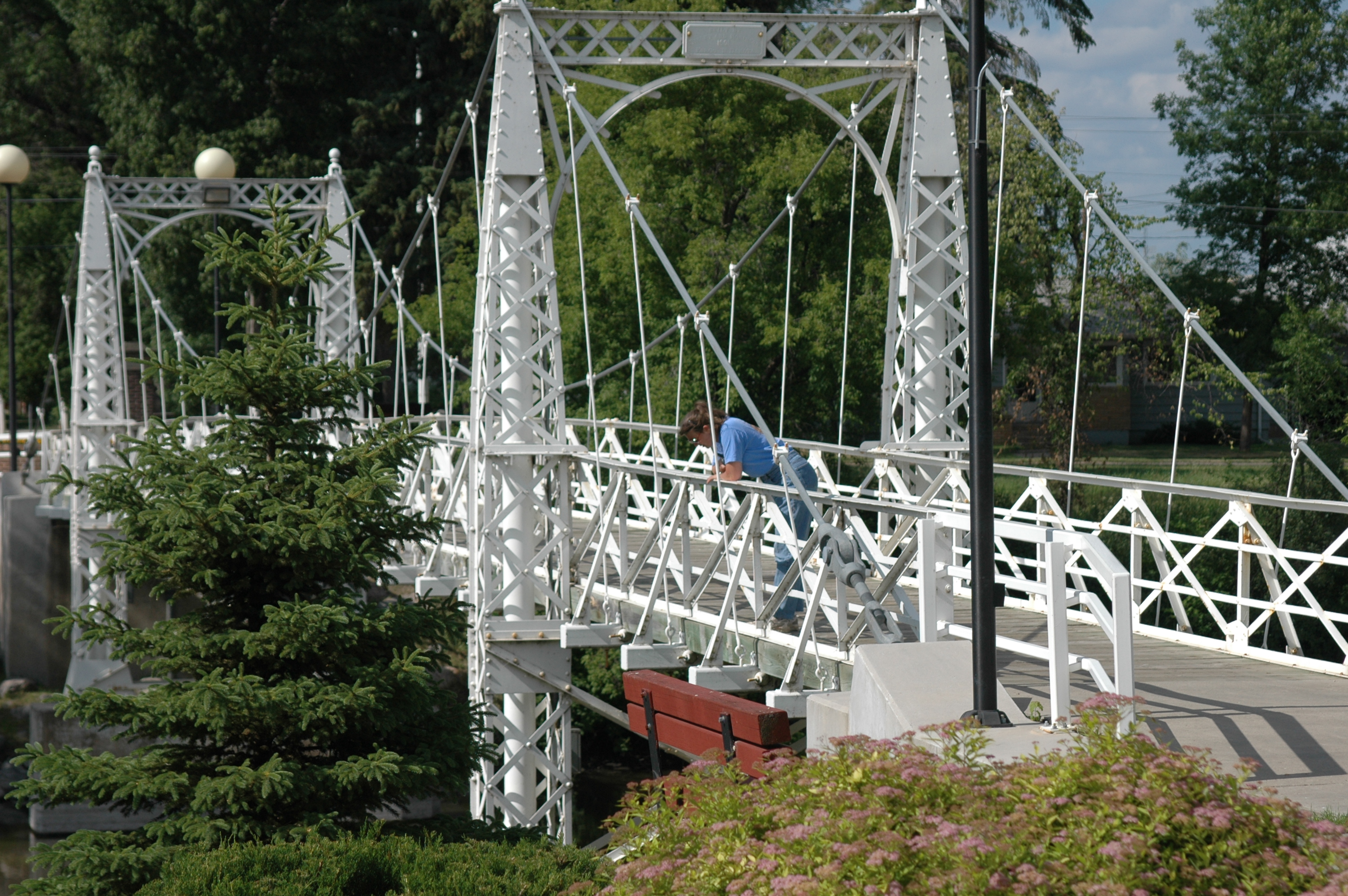
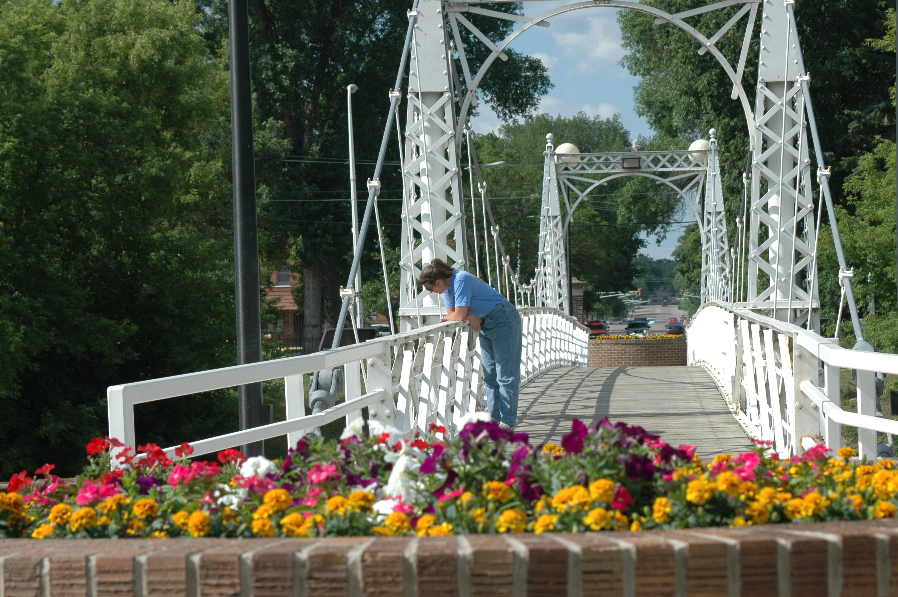
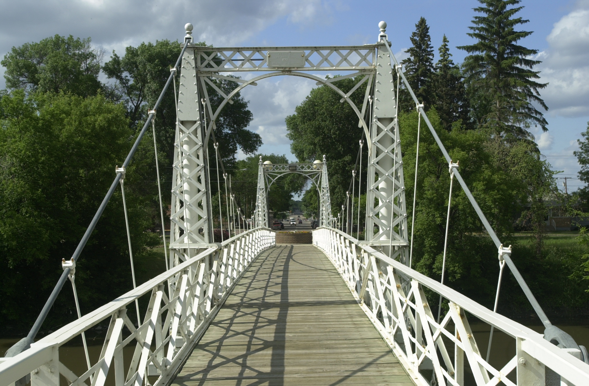
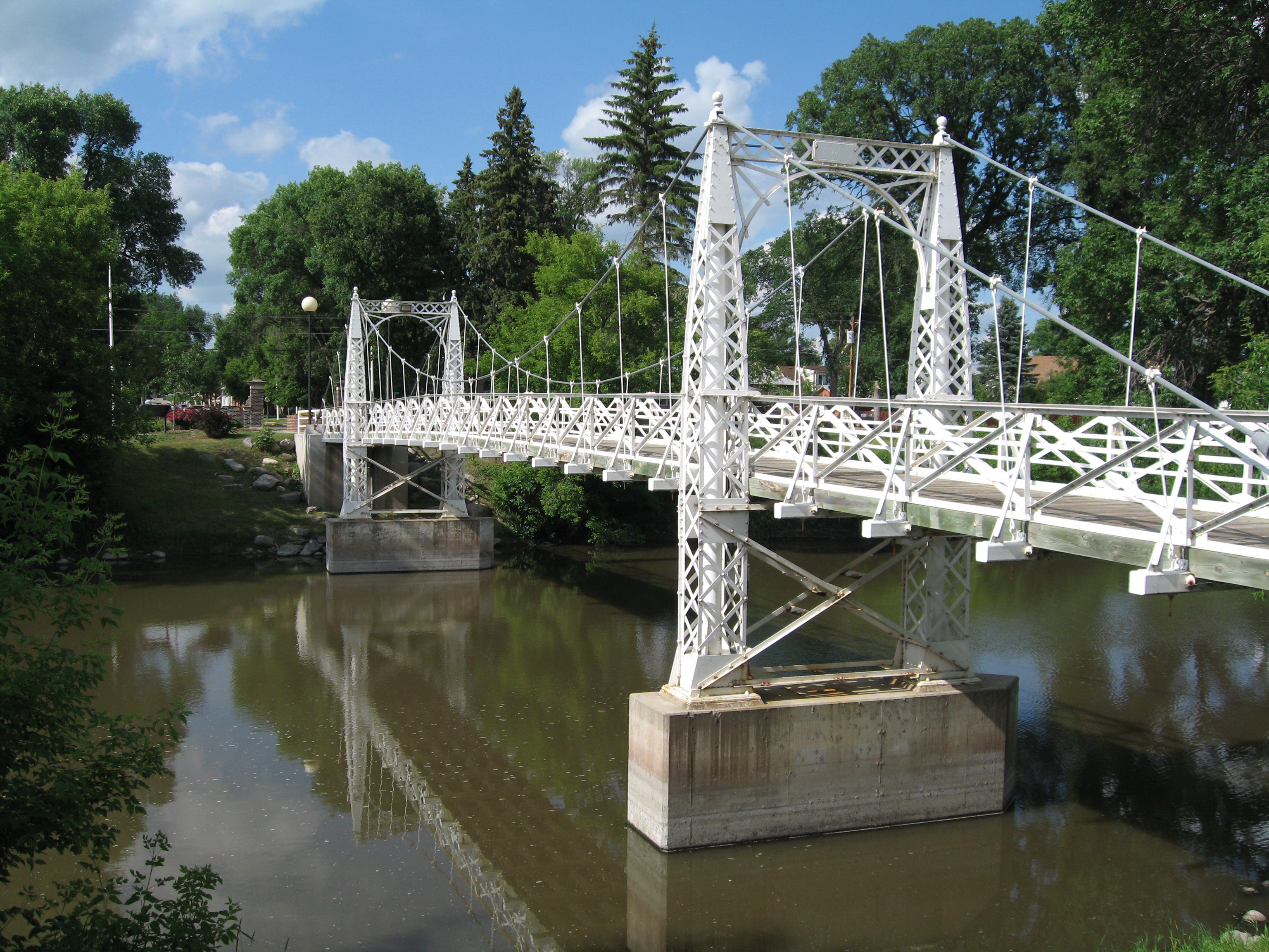
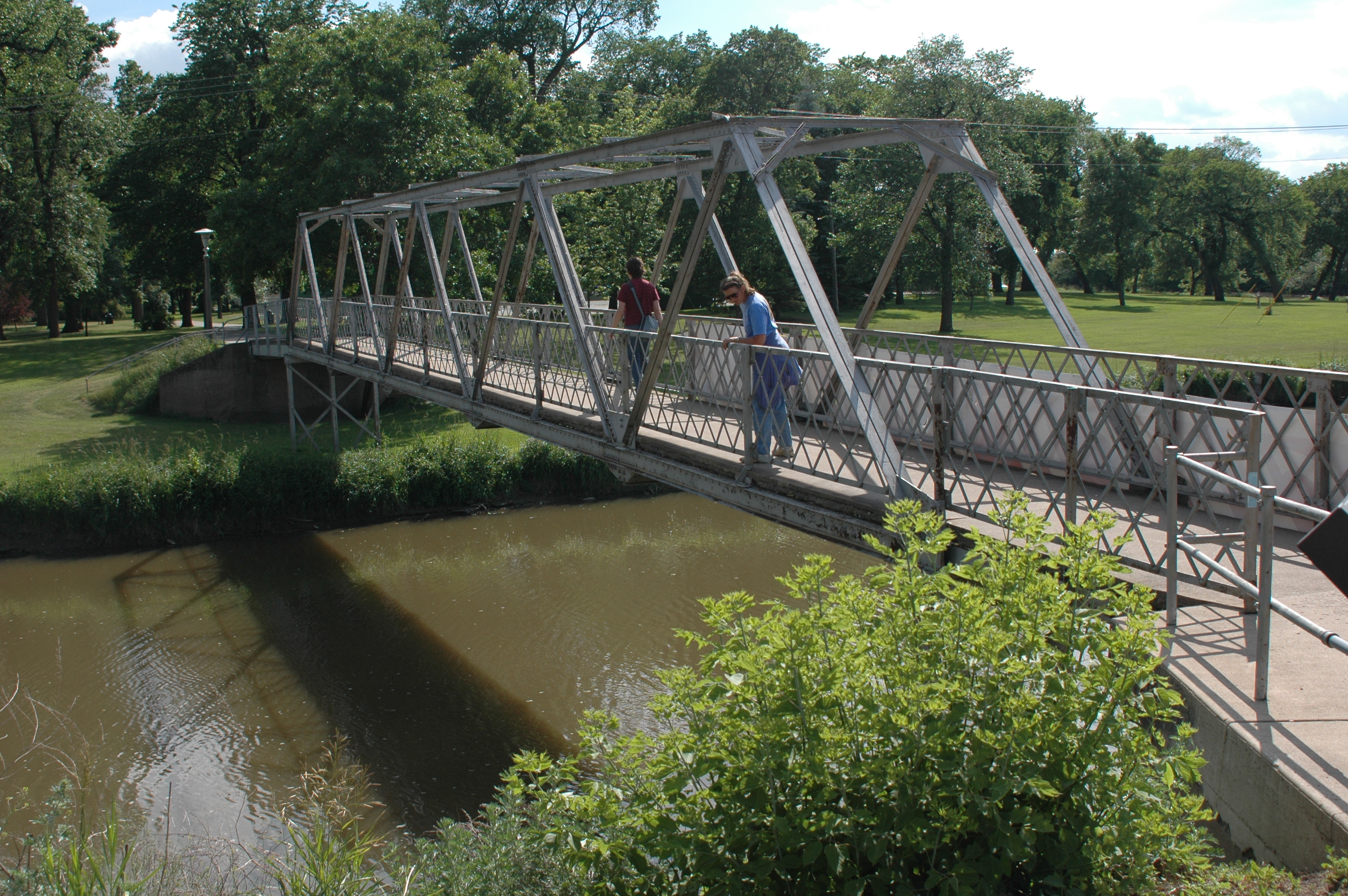
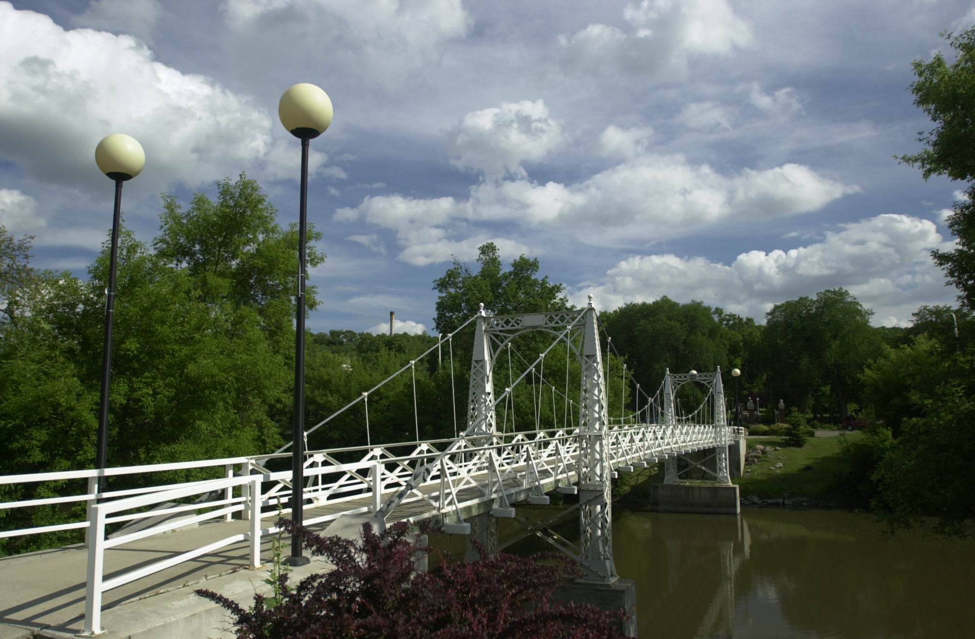
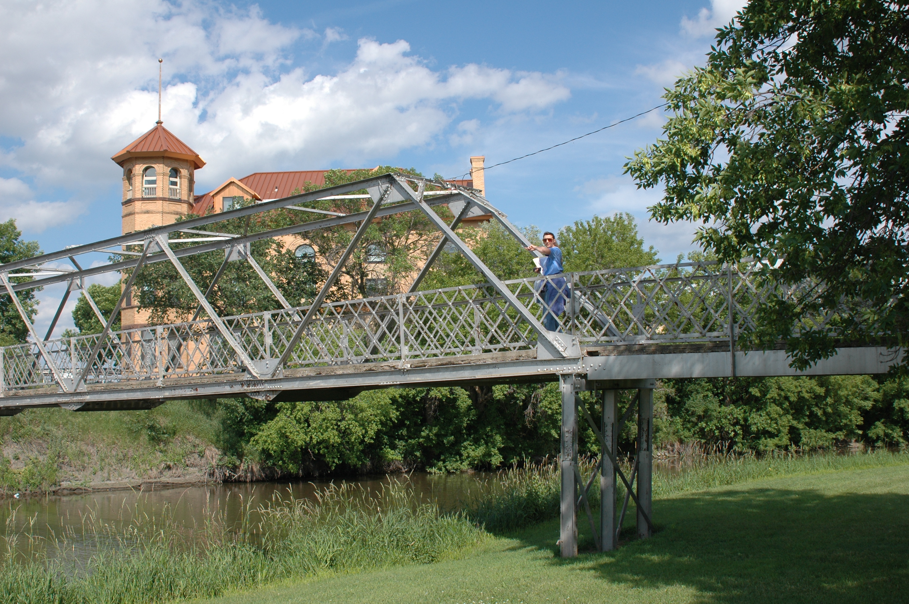
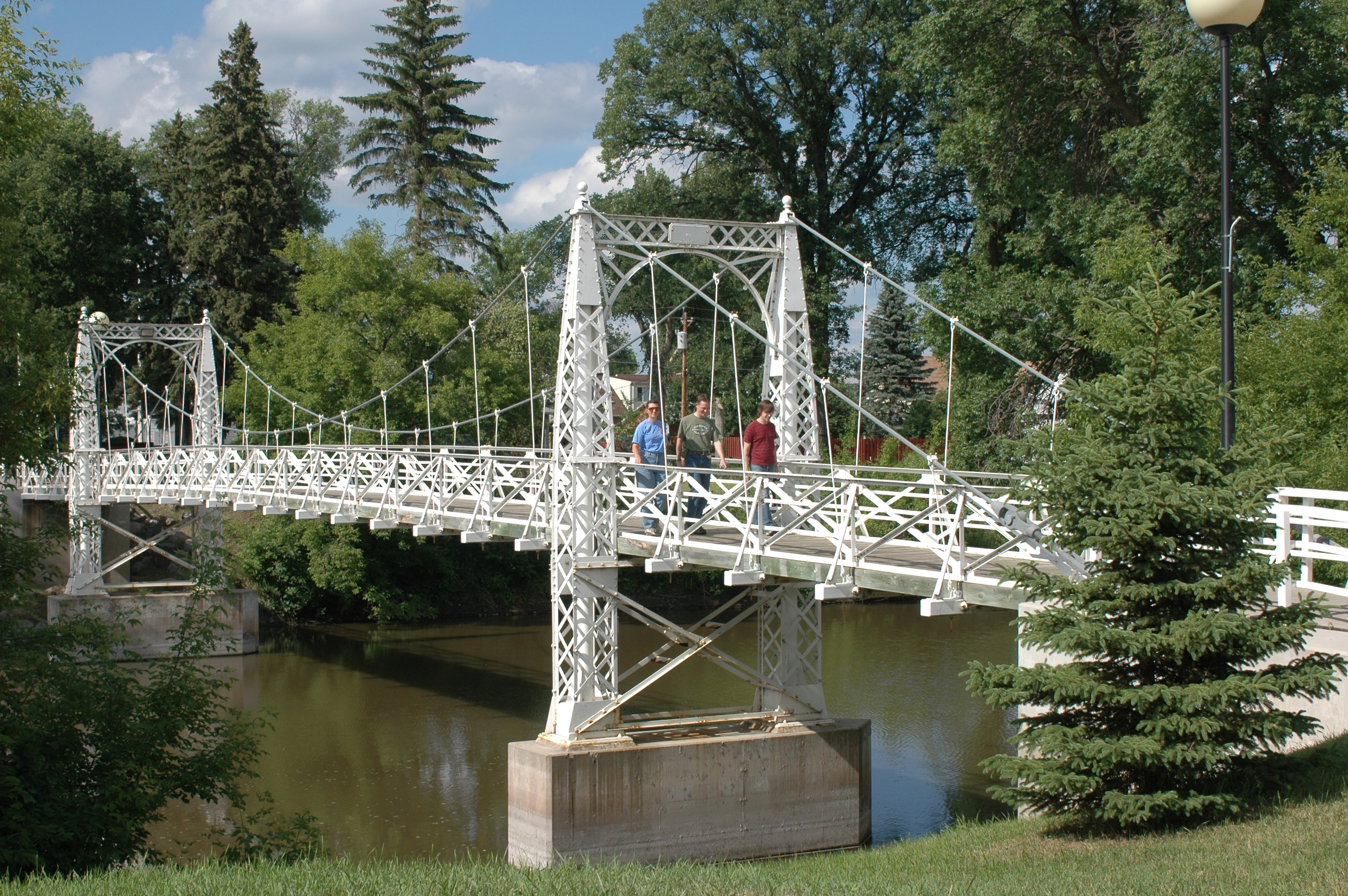
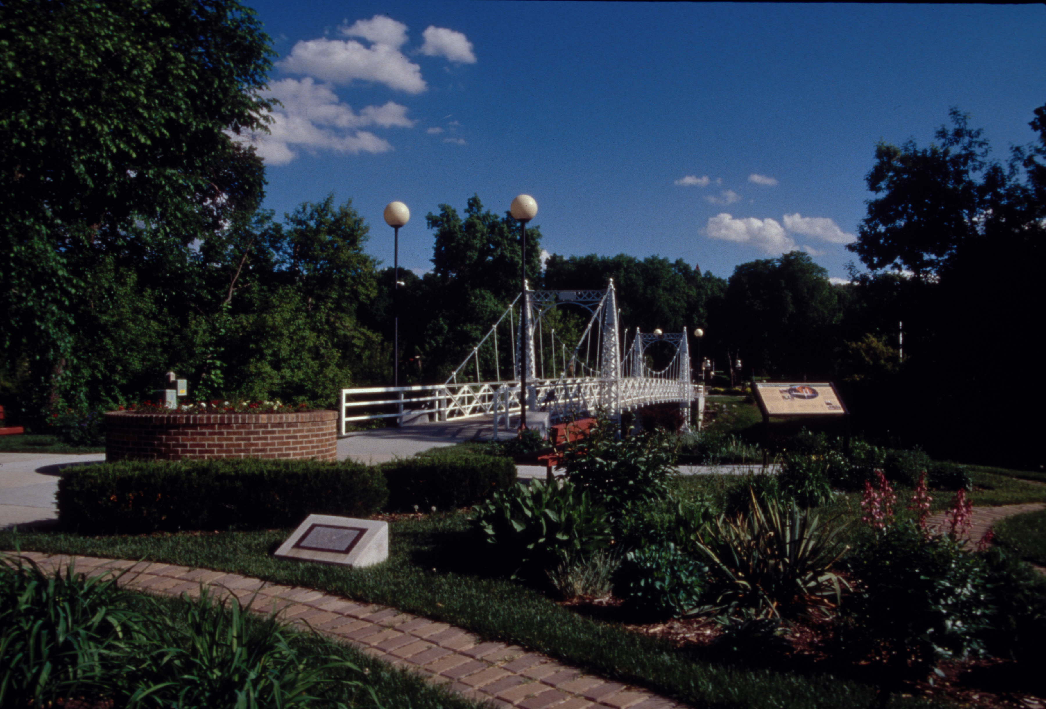
Three people cross the Valley City State University Footbridge over the Sheyenne River, leaving the University grounds for the city.
Public Domain. Photo by S. Clyde
Download Original (3008 x 2000 pixels, 3170.5 MB)
-
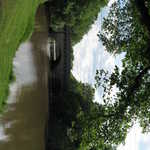
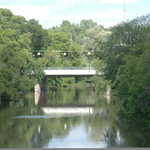
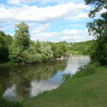
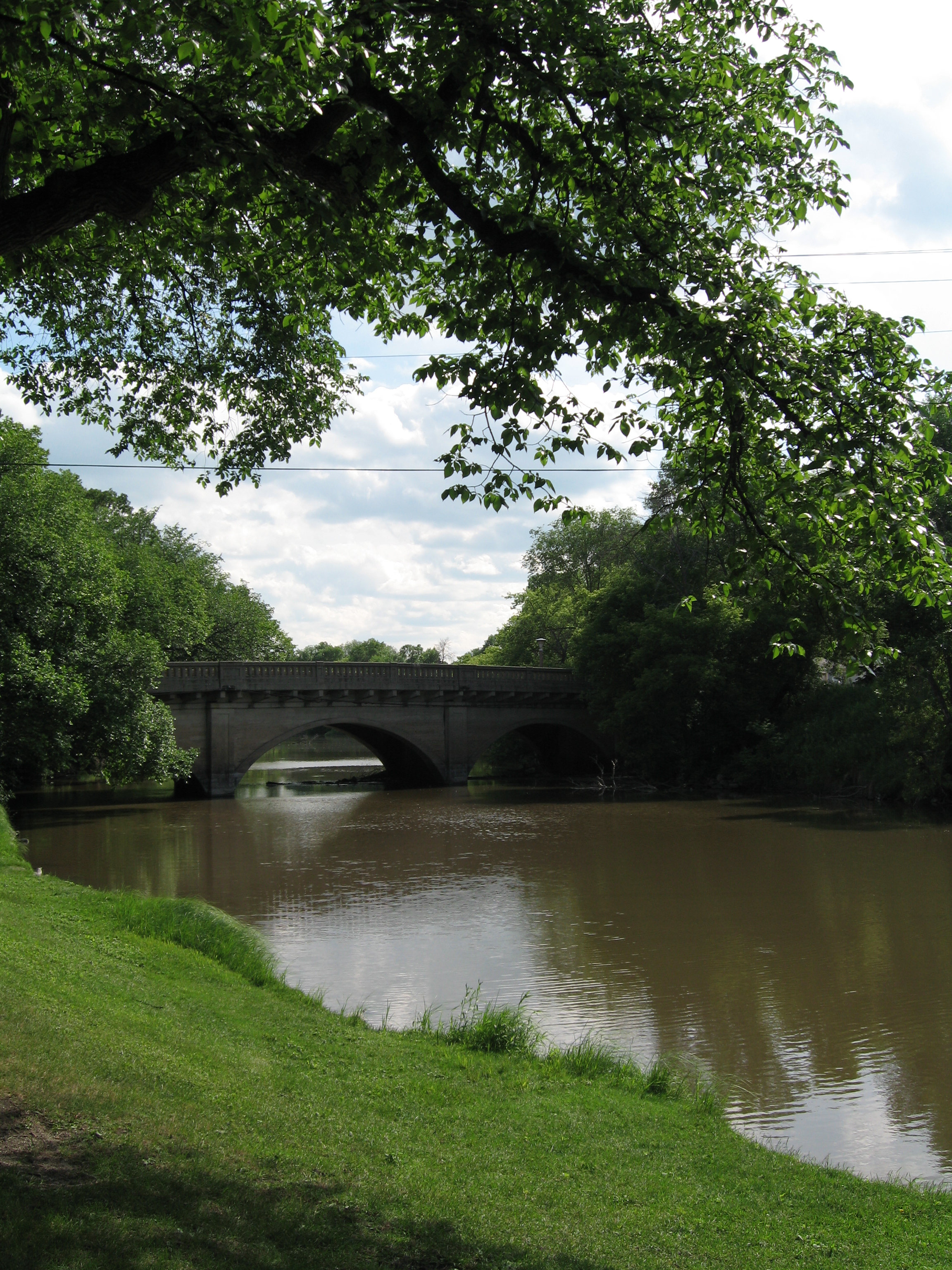
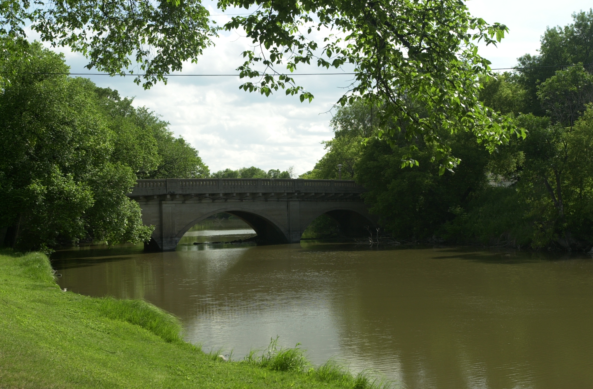
The Sheyenne River flows between green banks on its way toward th West City Park Bridge in Valley City.
Public Domain. Photo by Pete Deffendol of NSBO
Download Original (2304 x 3072 pixels, 4082.8 MB)
-
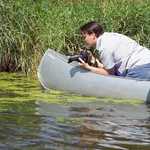
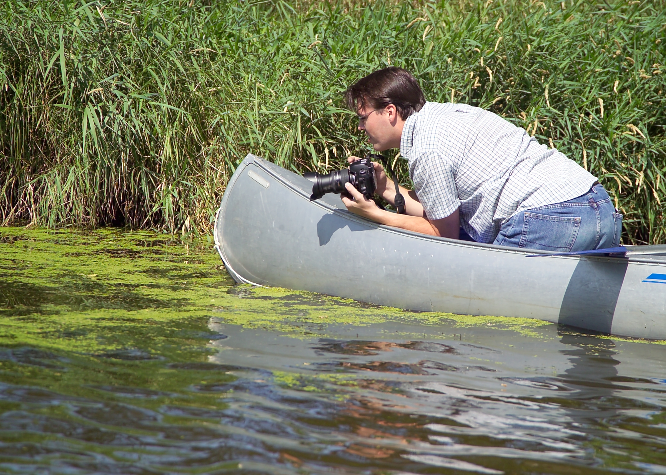
A lone canoeist prepares to take a photo of the river's edge along the Sheyenne River Valley Scenic Byway.
Public Domain. Photo taken by George Dutton
Download Original (2132 x 1520 pixels, 2645.1 MB)
-
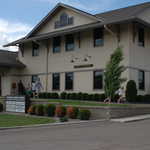
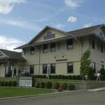
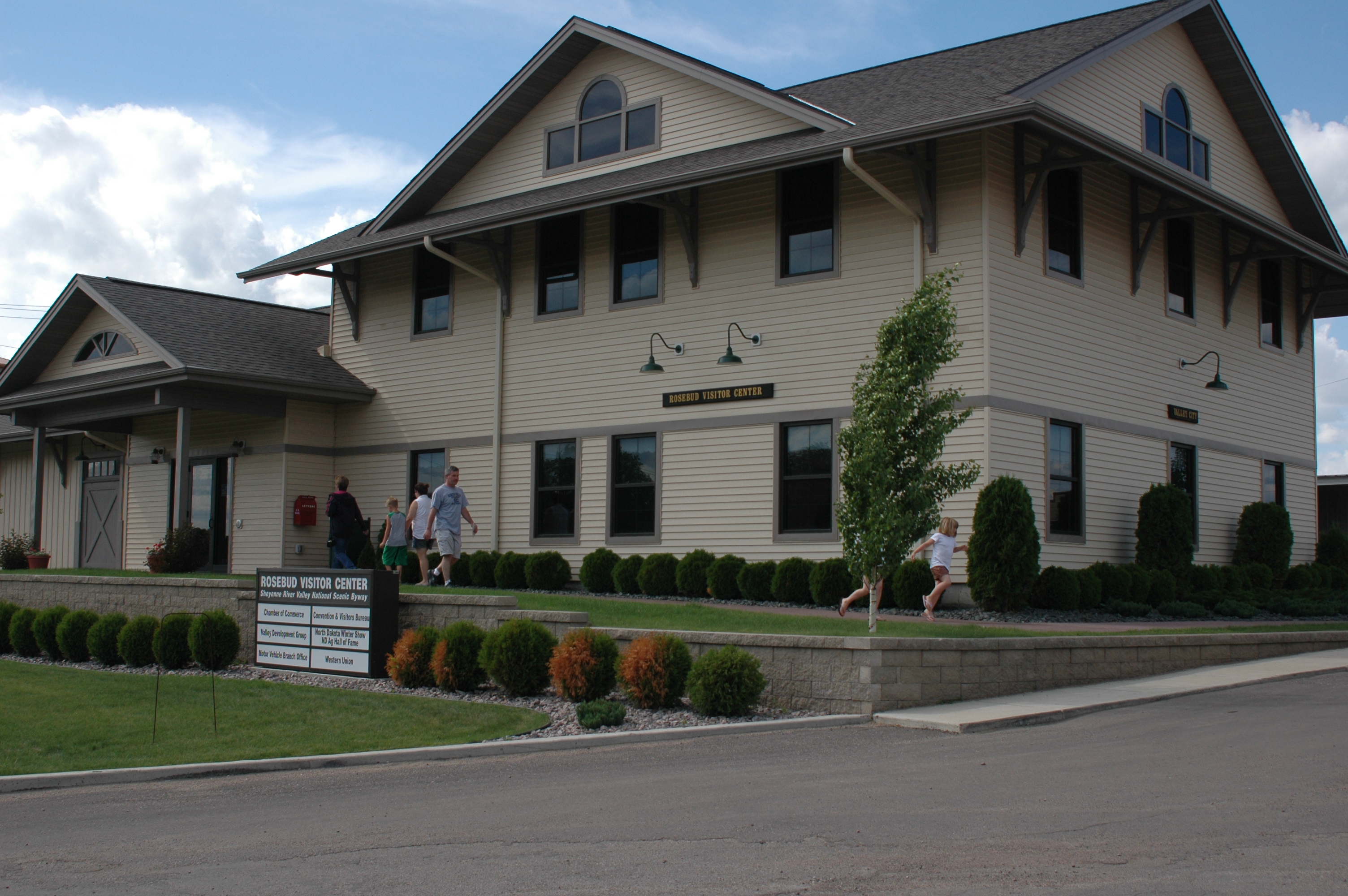
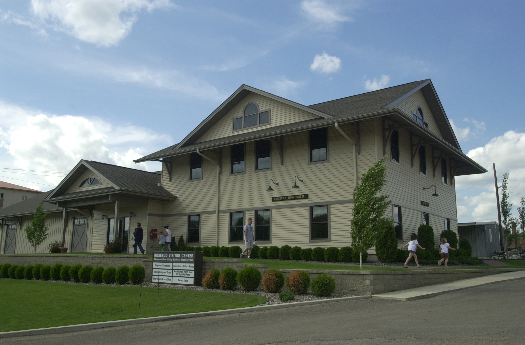
Travelers leave the Rosebud Visitor Center in Valley City.
Public Domain. Photo by S. Clyde
Download Original (3008 x 2000 pixels, 2321.5 MB)
-
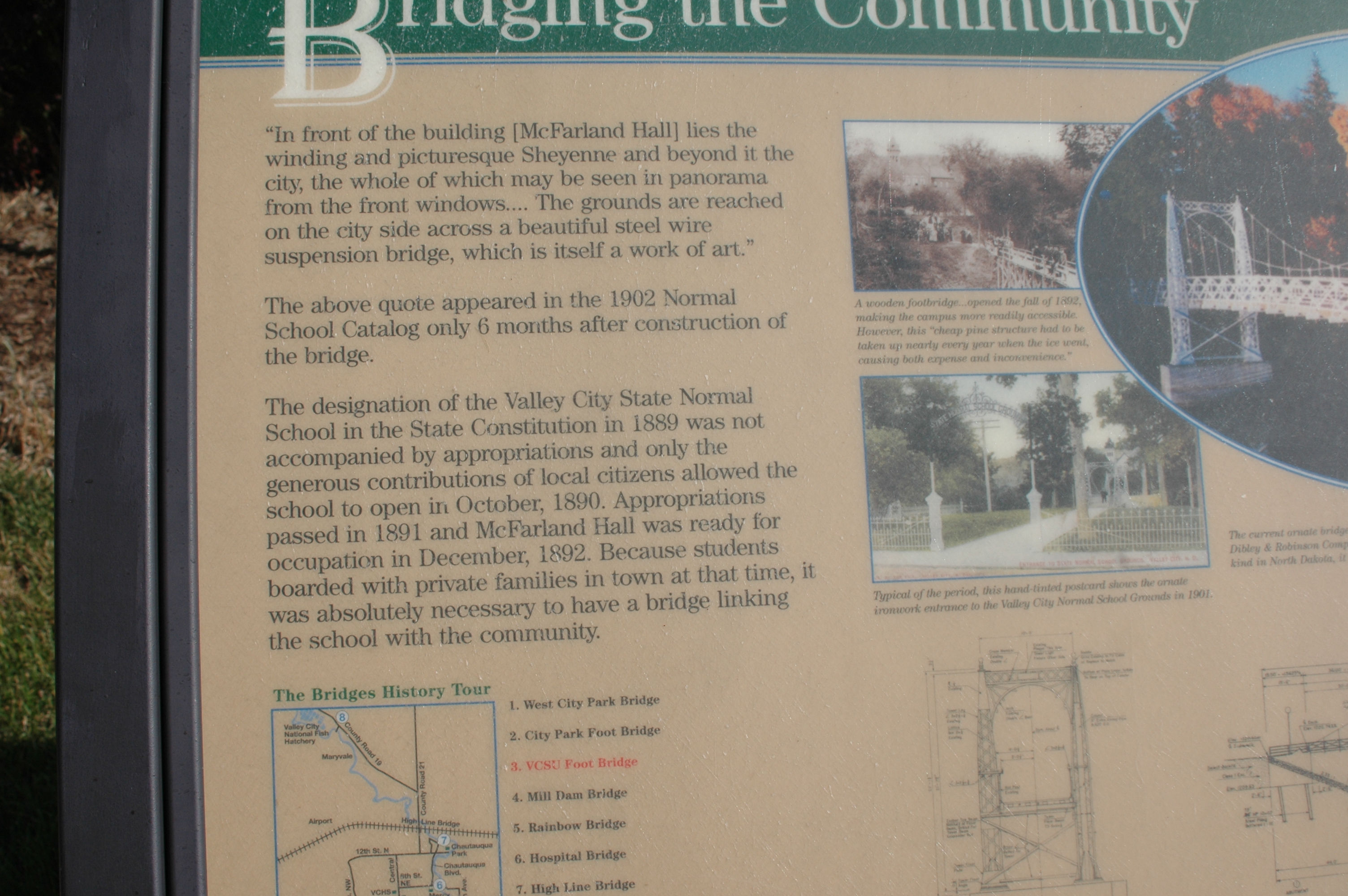
The left half of the interpretive sign at the VCSU Footbridge describes the history of the bridge and why it was needed.
Public Domain. Photo by S. Clyde
Download Original (3008 x 2000 pixels, 2778.7 MB)
-
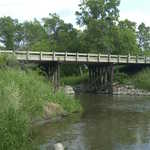
The simple span of the Mill Dam Bridge, which once ran to a millwork dam on the Sheyenne River in Valley City, can be seen to the east of the Valley City State University Footbridge.
Public Domain. Photo by S. Clyde
Download Original (3008 x 2000 pixels, 2638.1 MB)
-
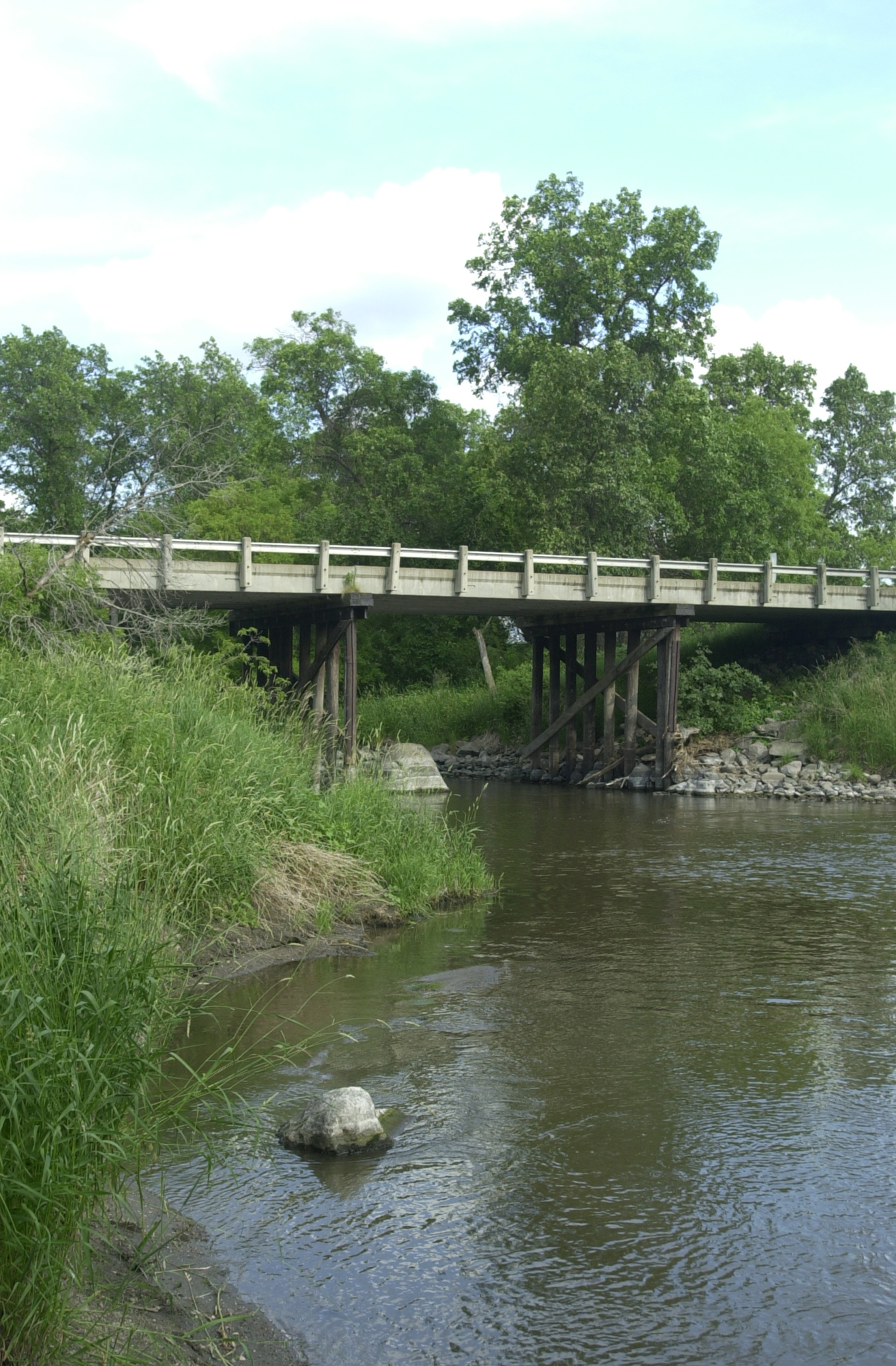
This simple bridge may not be on the Valley City Historical Bridges Tour, but it has its utility at Faust Park.
Public Domain. Photo by S. Clyde
Download Original (1312 x 2000 pixels, 1306.5 MB)
-
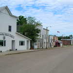
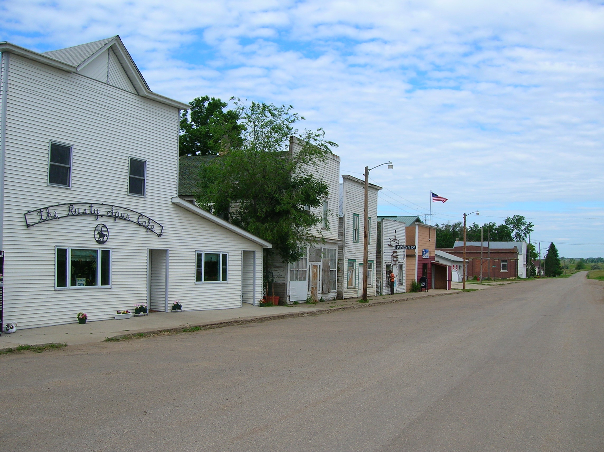
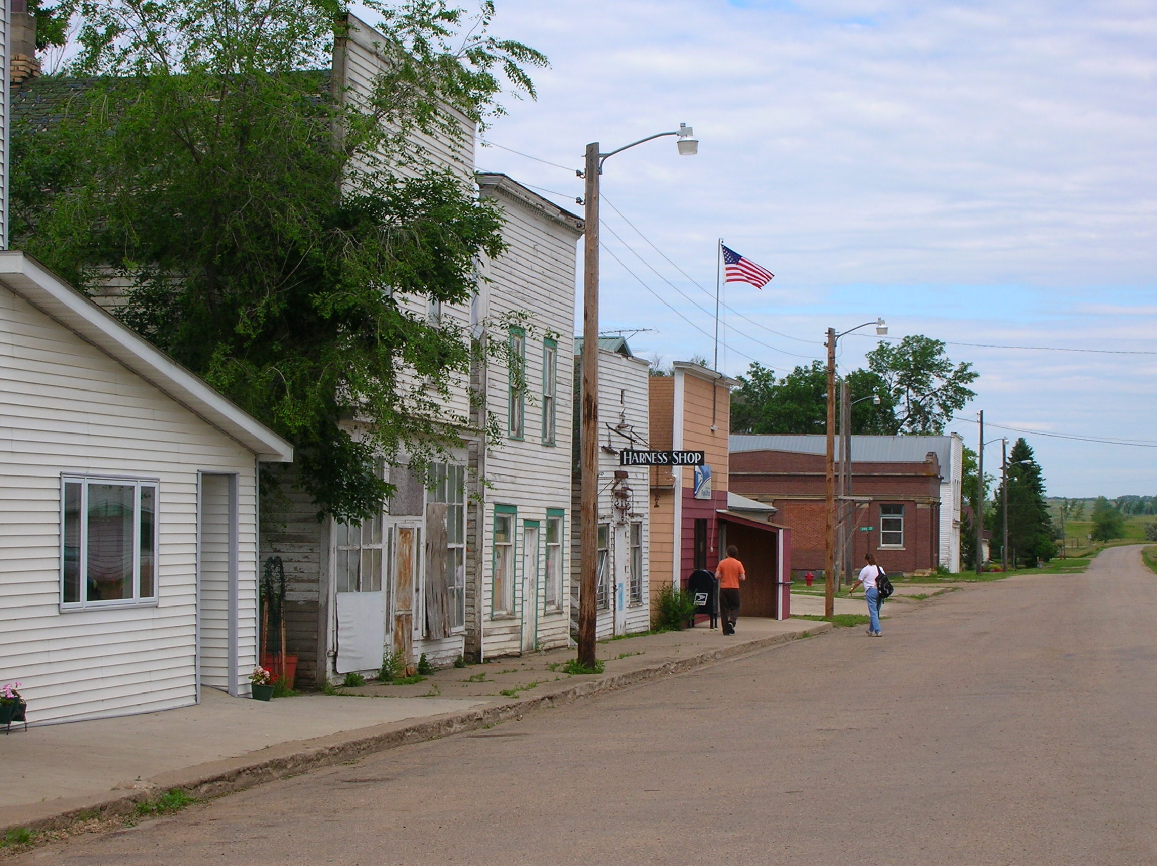
The white storefronts in Kathryn have been preserved close to their historic 1900s state.
Public Domain. Photo by S. Clyde
Download Original (2288 x 1712 pixels, 762.3 KB)
-
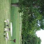
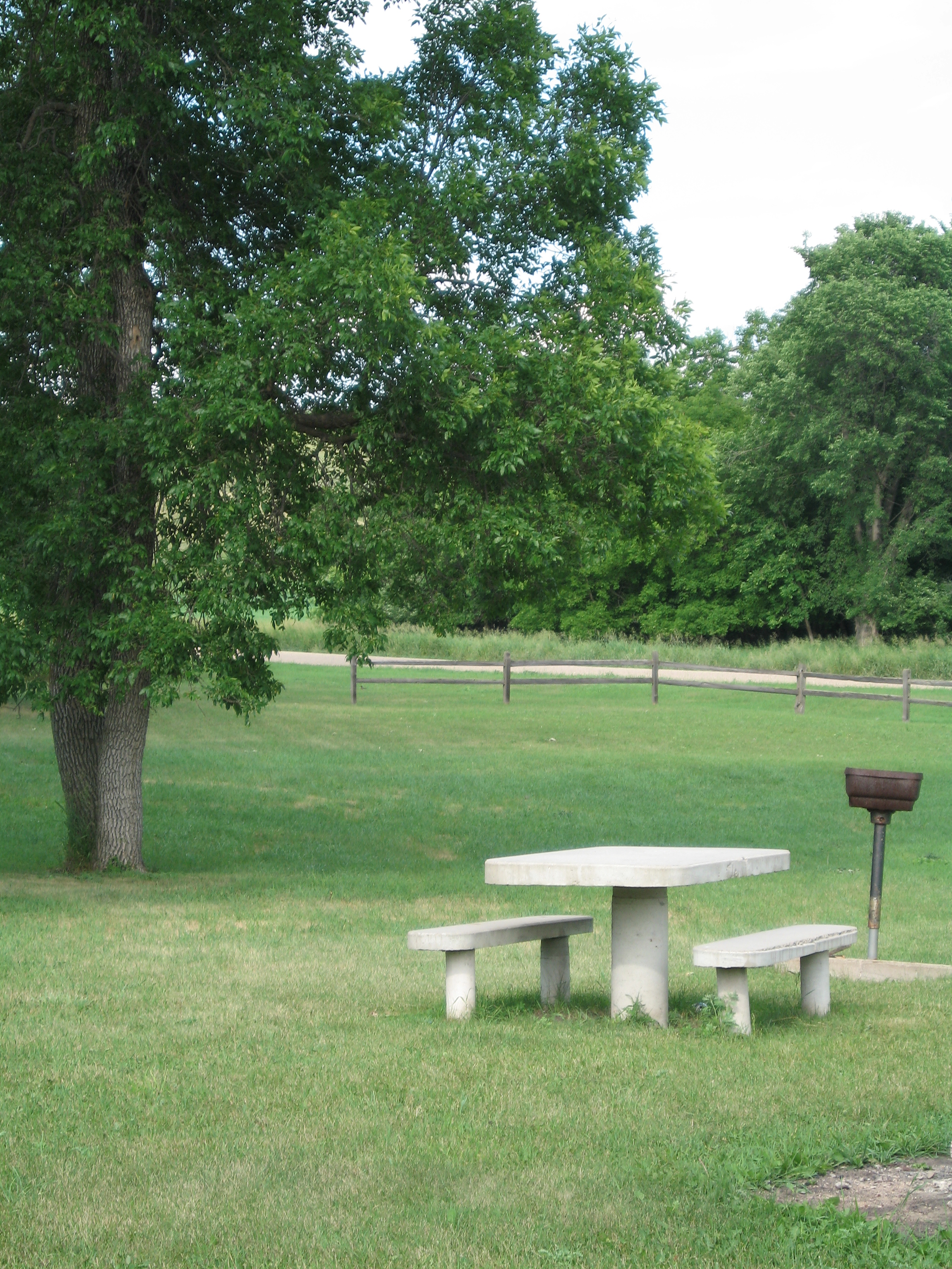
A sturdy picnic table and grill wait for picnickers at Faust Park on Route 19 north of Valley City.
Public Domain. Photo by Pete Deffendol of NSBO
Download Original (2304 x 3072 pixels, 4099.6 MB)
-
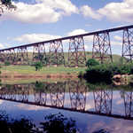
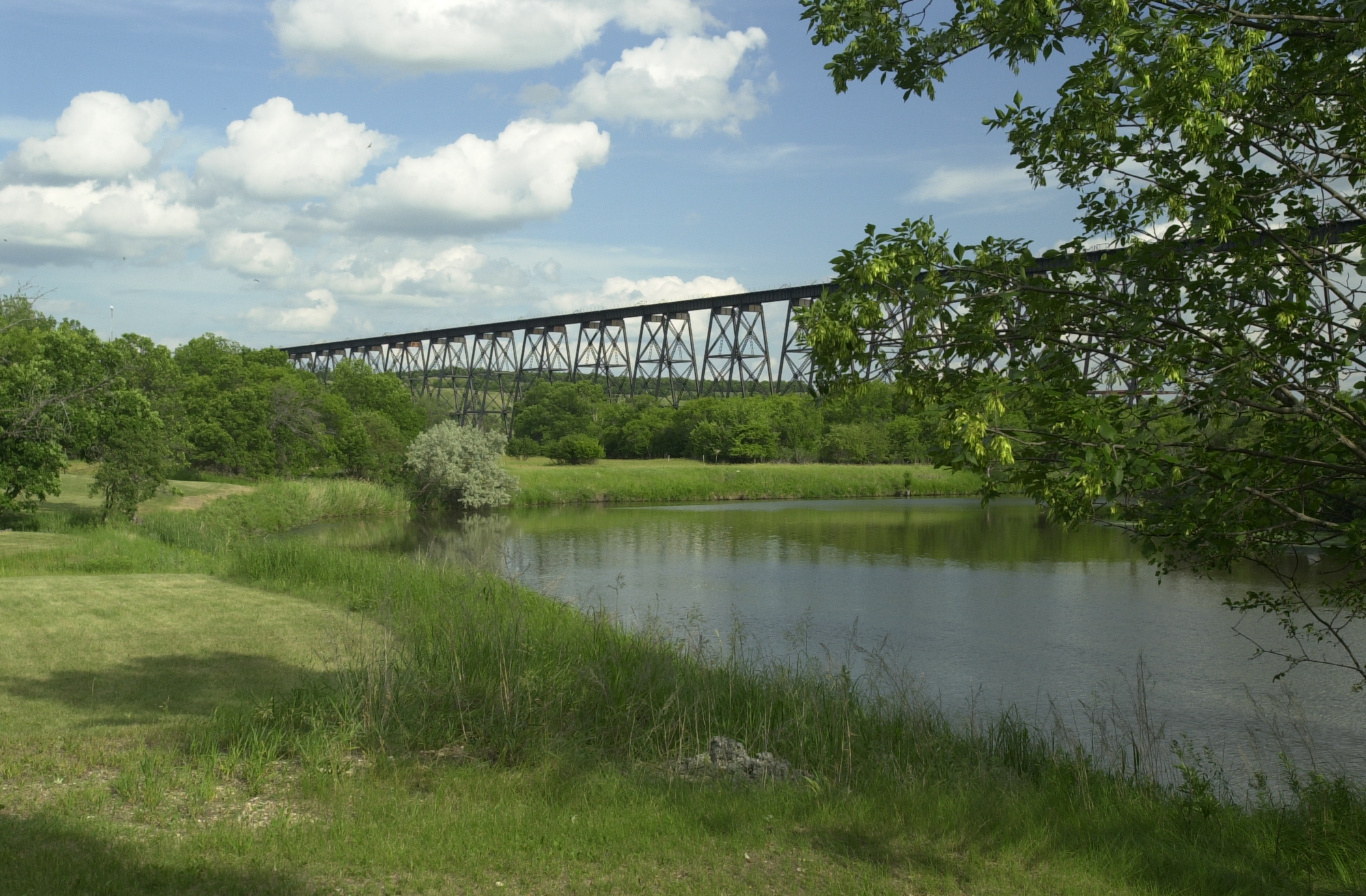
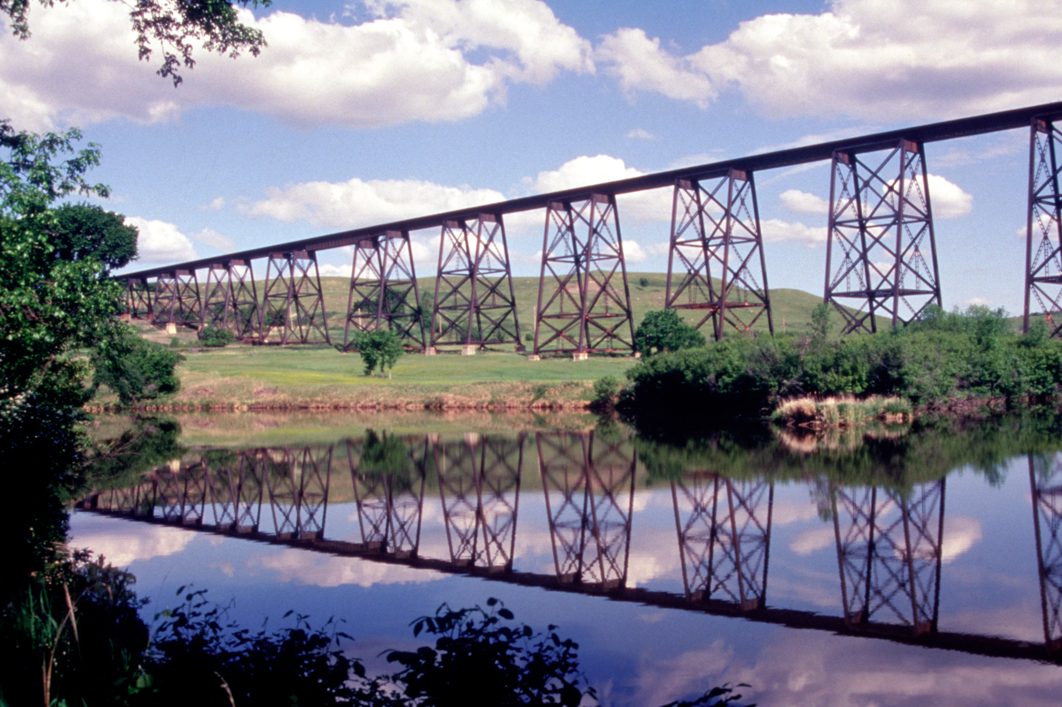
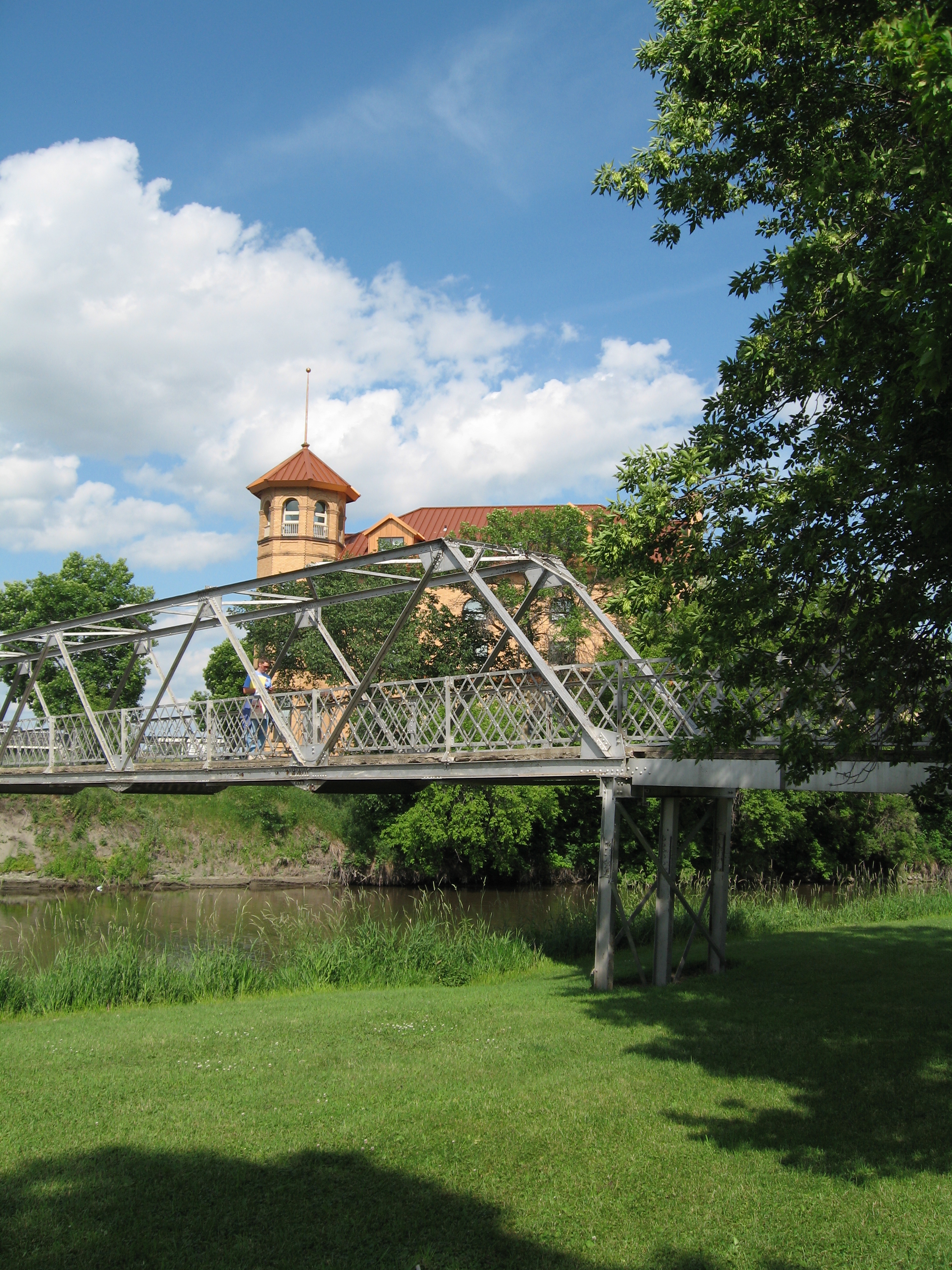
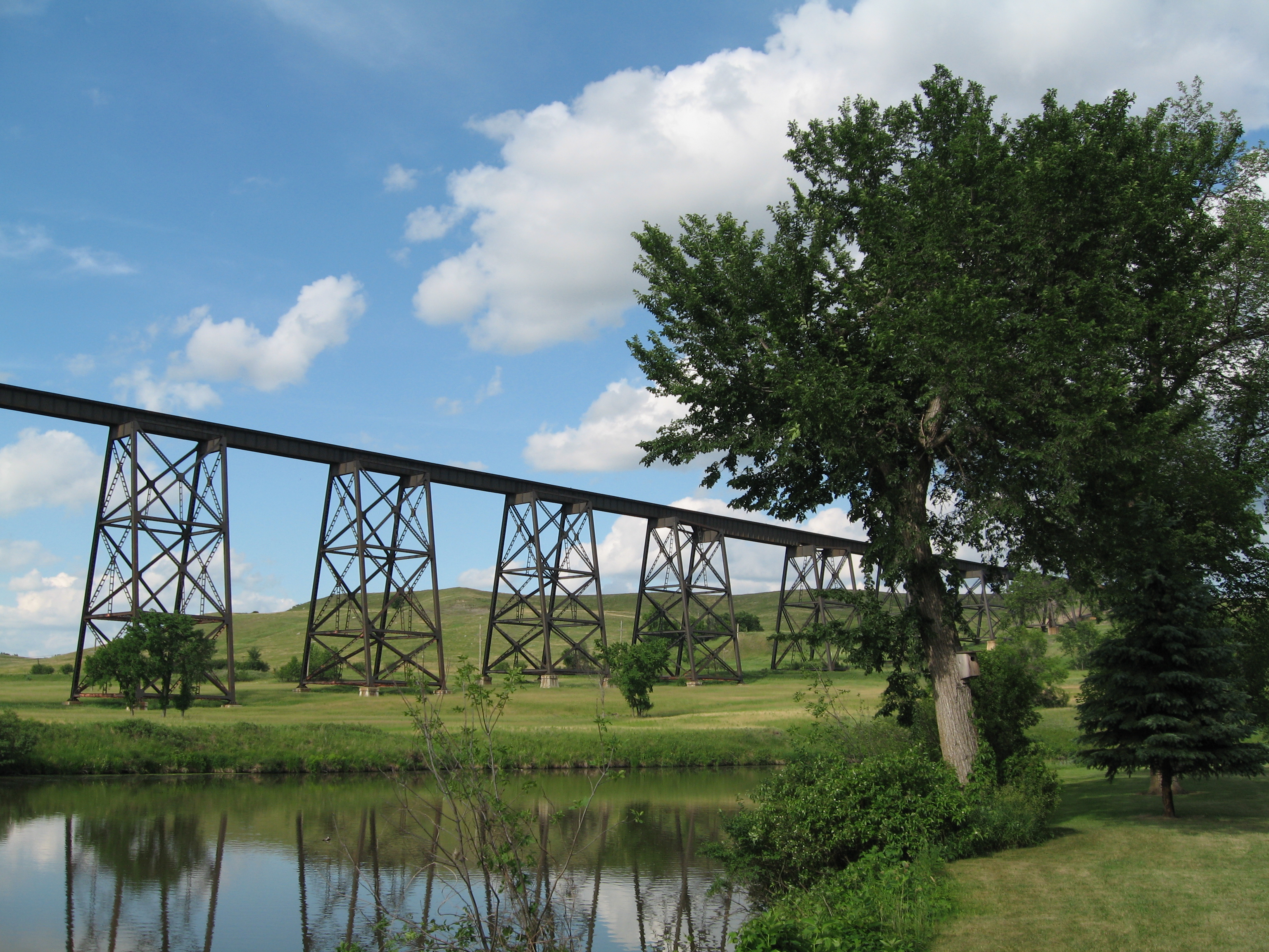
The Sheyenne River curves its way through its river valley beneath the iron towers of the Highline Bridge in Valley City.
Public Domain. Photo by Mat Leffler-Schulman of FHWA
Download Original (2000 x 1312 pixels, 1274.5 MB)
-
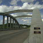
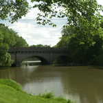
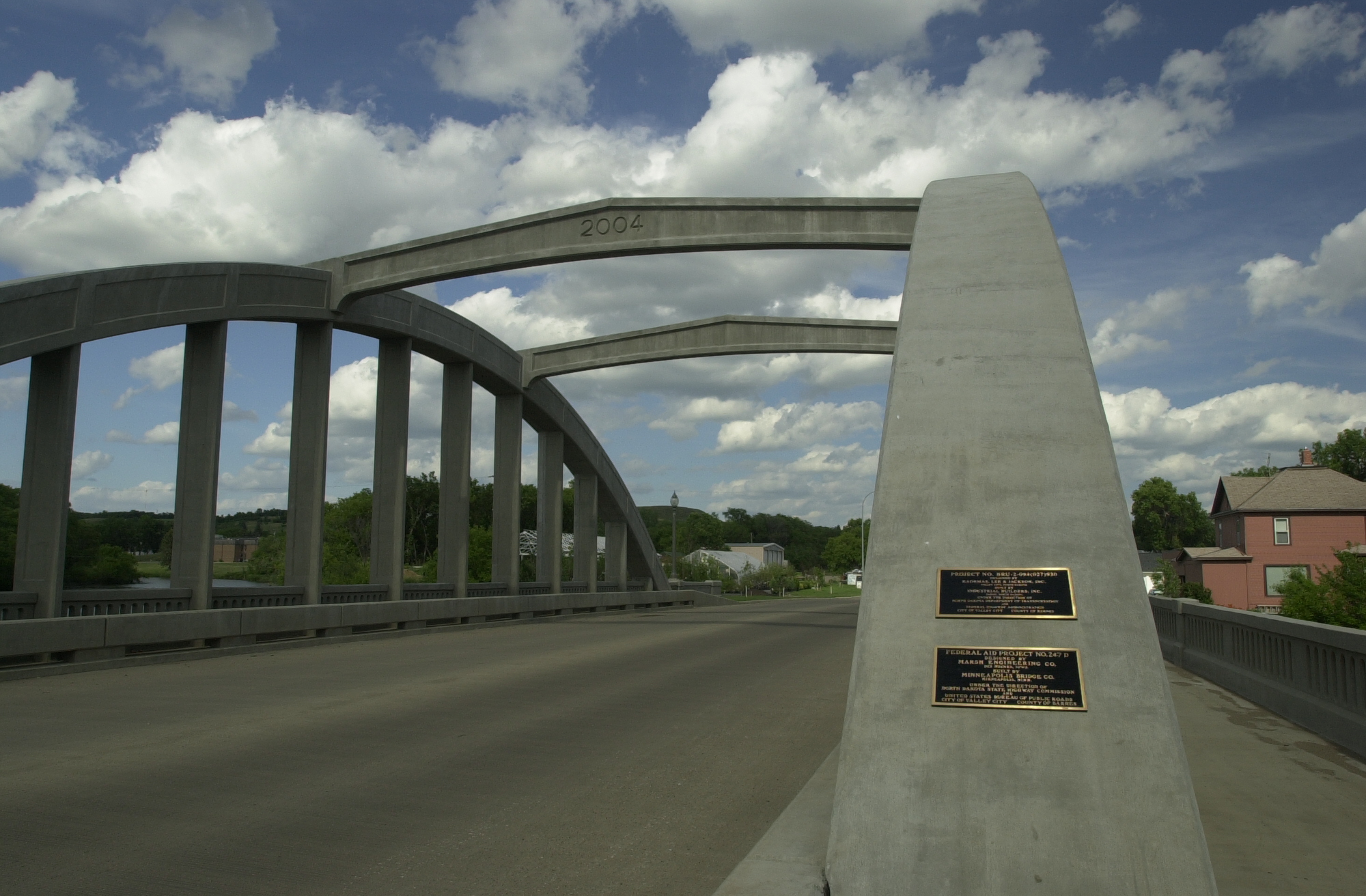
Built in 2004, this arched concrete bridge was built at the location of Valley's City's first bridge.
Public Domain. Photo by Mat Leffler-Schulman of FHWA
Download Original (2000 x 1312 pixels, 1186.5 MB)
-
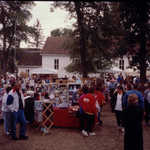
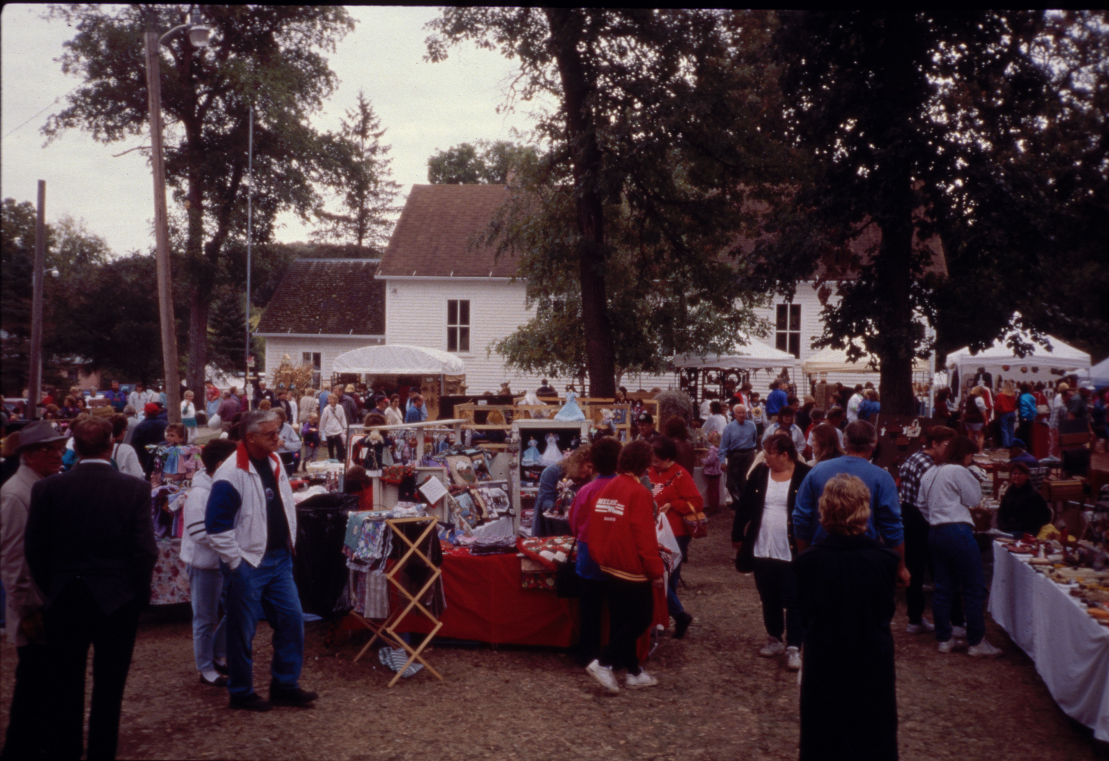
Held on the last weekend of September in Fort Ransom, during the peak of the fall color season, this two-day cultural event brings several hundred Arts and Crafts vendors and around 8,000 annual visitors.
© 2001 Janet E. Schultz.
Download Original (3592 x 2465 pixels, 5458.4 MB)
-
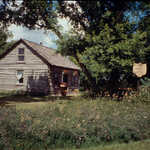
Hand-hewn 1879 pioneer log cabin. Theodore P. Slattum was one of the largest landowners in Ransom County. He immigrated to Minnesota from Norway in 1870, then moved here in 1879 and built a dugout for temporary living quarters until this cabin could be built. Seven children were raised in this cabin with two dying in early childhood.
© 1996 Janet E. Schultz.
Download Original (3600 x 2441 pixels, 6945.7 MB)
-

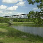
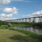
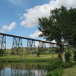
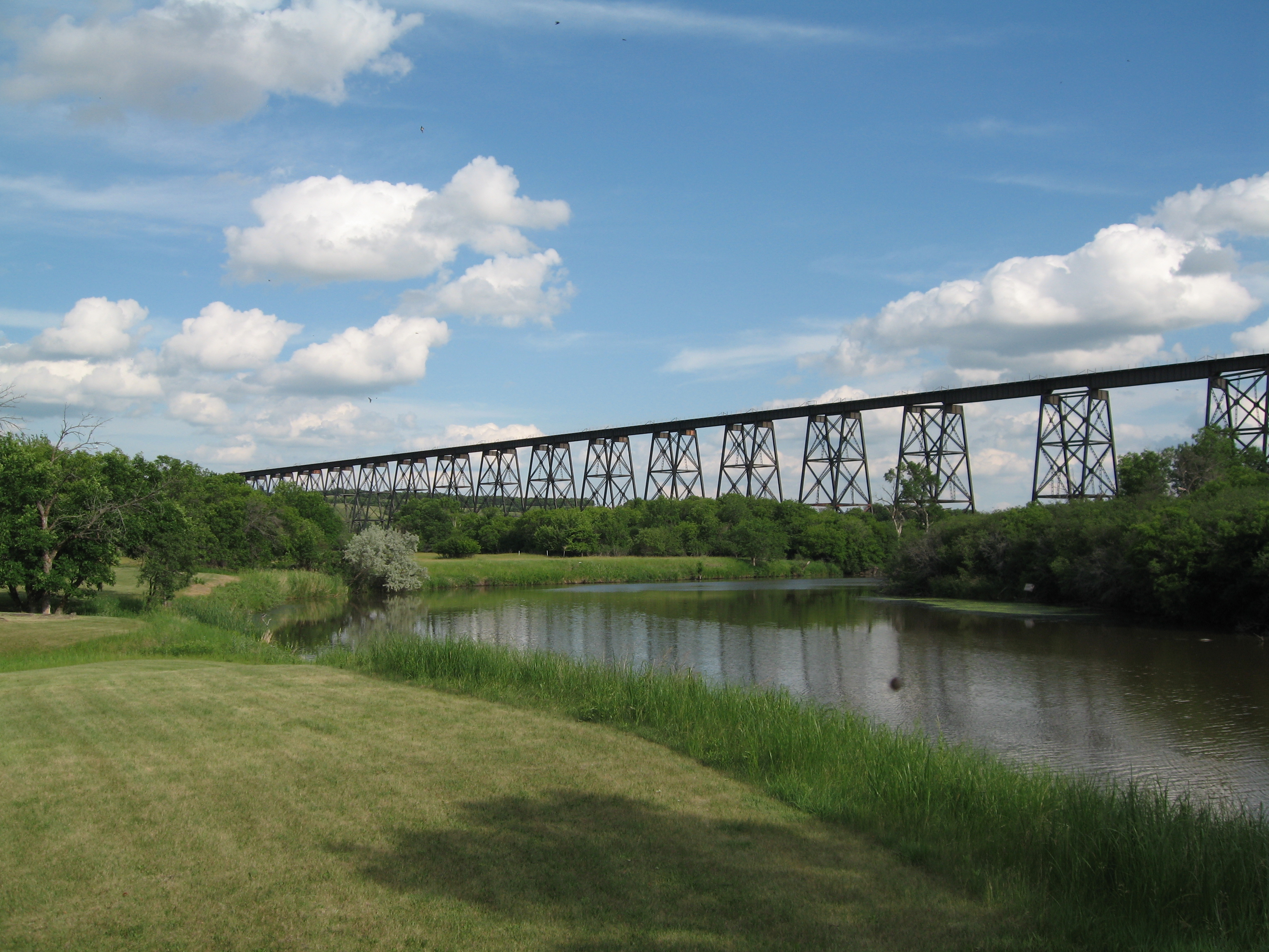
The Highline Bridge, built 1906-1908, is 3,860 feet long and 162 feet above the riverbed. It is one of the highest and longest single-track railroad bridges in the nation - not something you would expect to see on the plains of North Dakota.
© 2000 Janet E. Schultz.
Download Original (3600 x 2397 pixels, 8117.3 MB)
-
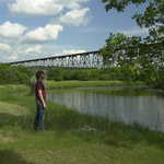
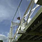
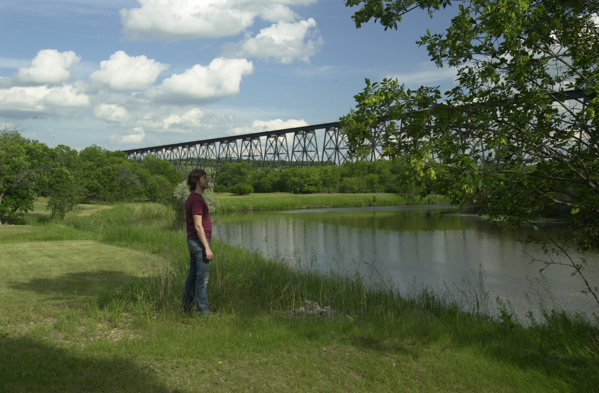
A traveler admires the Highline Bridge from the shoreline of the Sheyenne River.
Public Domain. Photo by S. Clyde
Download Original (2000 x 1312 pixels, 1407.6 MB)
-
A traveler watches the Sheyenne River flow beneath the VCSU Footbridge on a fine June afternoon.
Public Domain. Photo by S. Clyde
Download Original (3008 x 2000 pixels, 2810.0 MB)
-
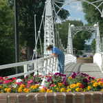
A traveler watches the Sheyenne River flow beneath the VCSU Footbridge. Pretty flowers bloom in a planter in the foreground.
Public Domain. Photo by S. Clyde
Download Original (3008 x 2000 pixels, 2645.1 MB)
-
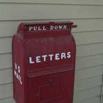
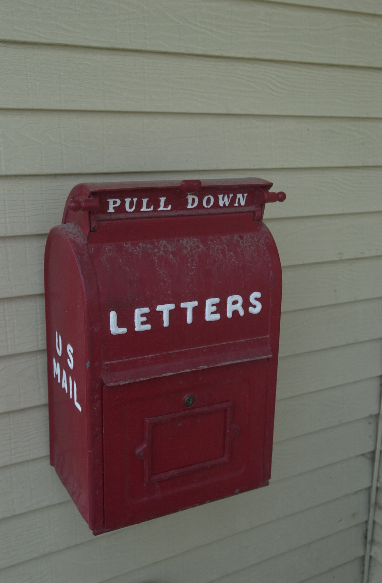
A bright red, old-fashioned mailbox is ready for your mail on the outside wall of the Rosebud Visitor Center.
Public Domain. Photo by Mat Leffler-Schulman of FHWA
Download Original (1312 x 2000 pixels, 1077.2 MB)
-
A late afternoon sun lights up the City Park Footbridge in Valley City, North Dakota.
Public Domain. Photo by Pete Deffendol of NSBO
Download Original (2304 x 3072 pixels, 3928.7 MB)
-
Just north of the bridge's crossing of Route 19 is a fine view of the Highline Bridge across the Sheyenne River.
Public Domain. Photo by S. Clyde
Download Original (3072 x 2304 pixels, 2904.4 MB)
-
The VCSU footbridge stretches due north from the Valley City State University grounds.
Public Domain. Taken by Mat Leffler-Schulman of NSBO
Download Original (2000 x 1312 pixels, 1324.9 MB)
-
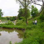
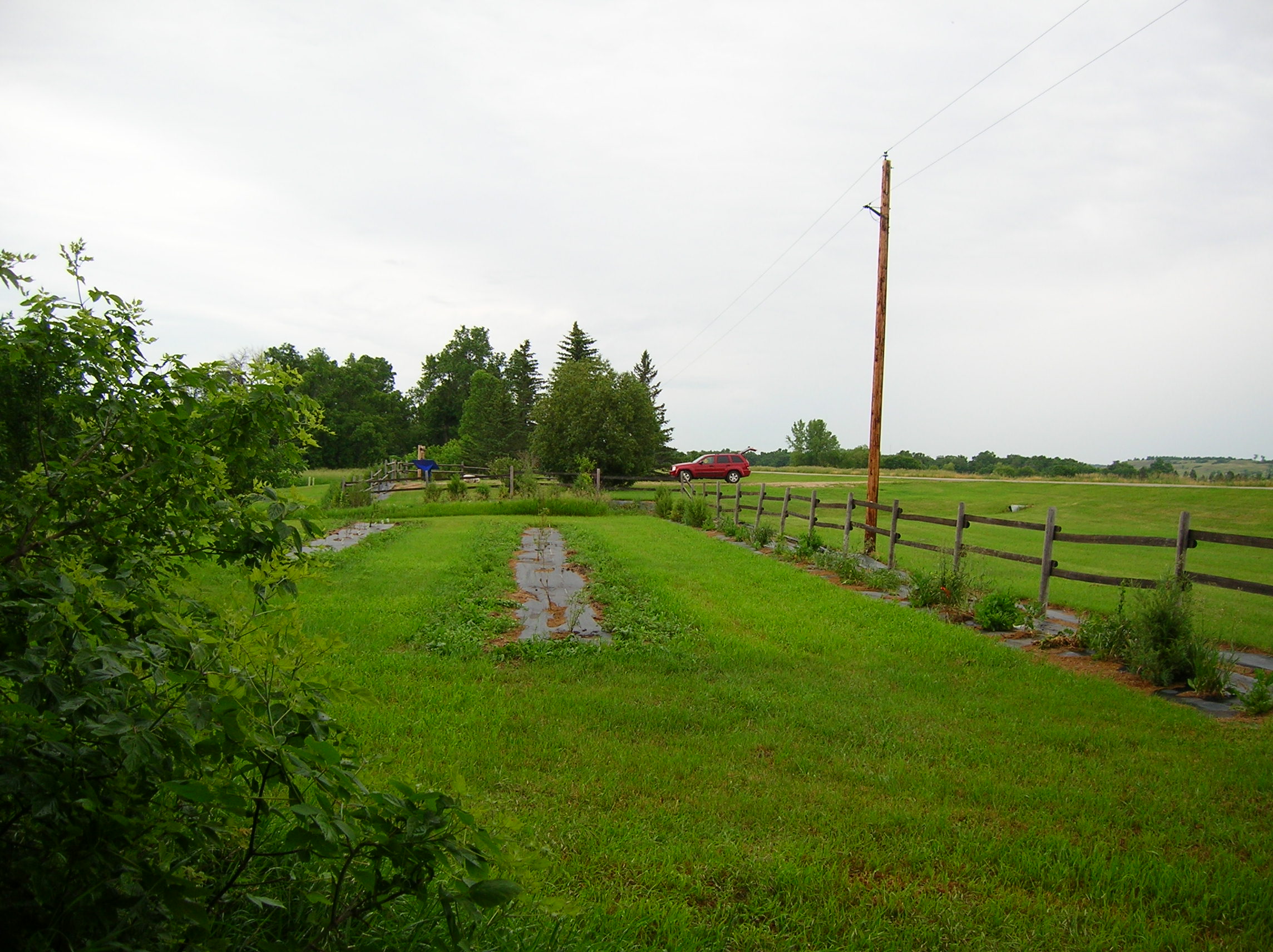
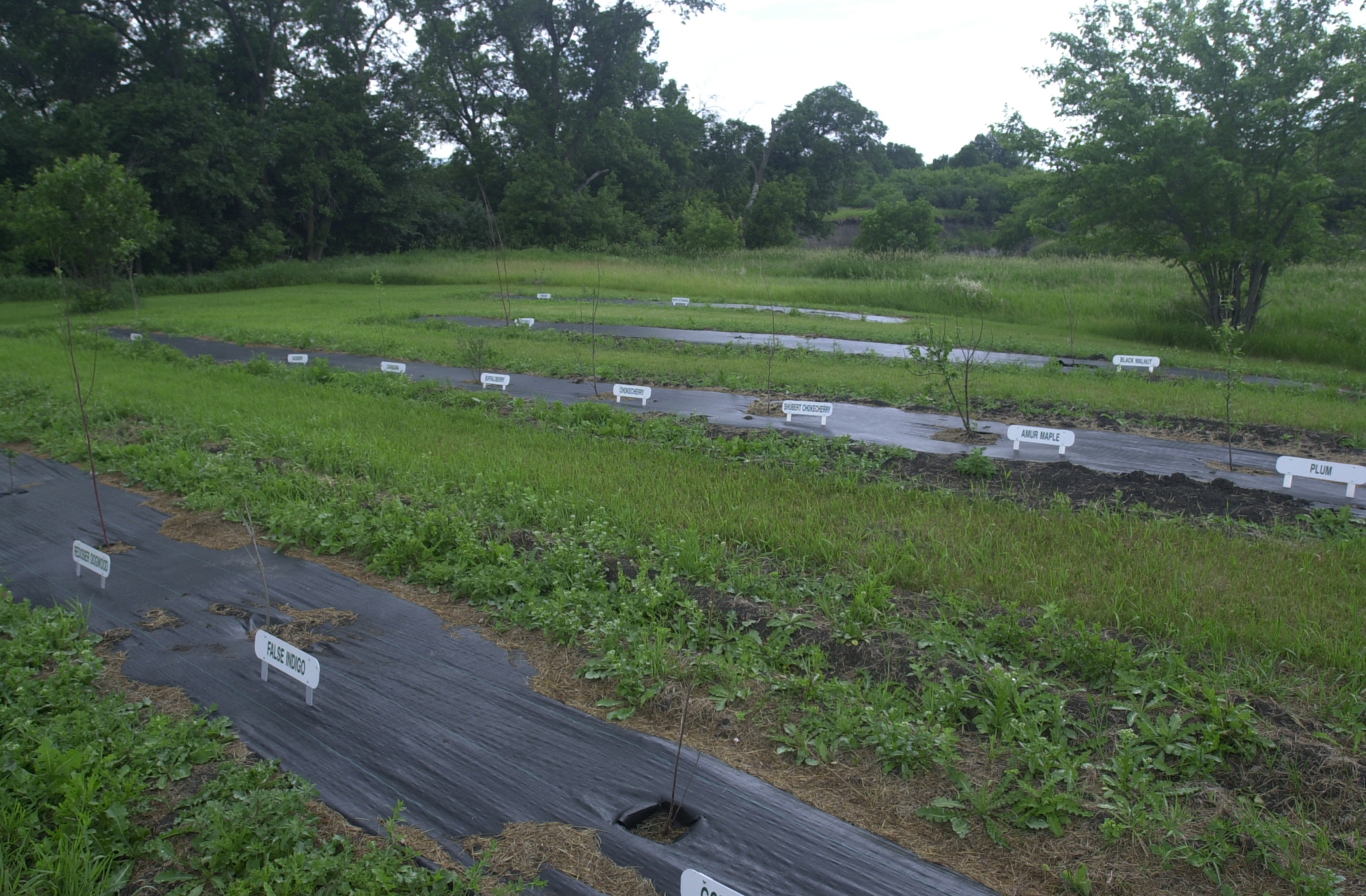
A tarp-lined plant area shows young shrubs and trees as samples of what vegetation is being tried in the restoration of the environment in this area of the Sheyenne River Valley.
Public Domain. Photo by S. Clyde
Download Original (2288 x 1712 pixels, 671.8 KB)
-
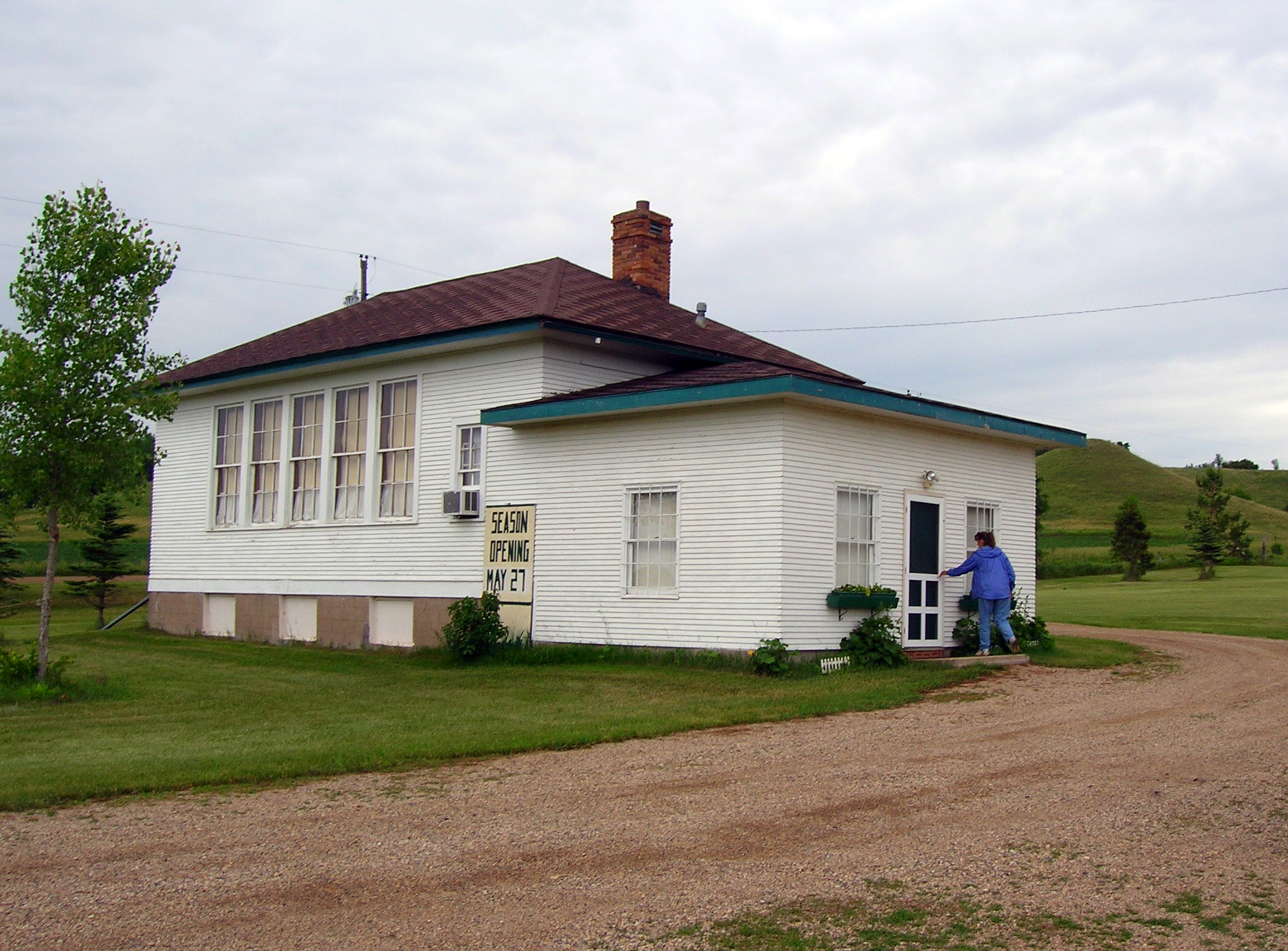
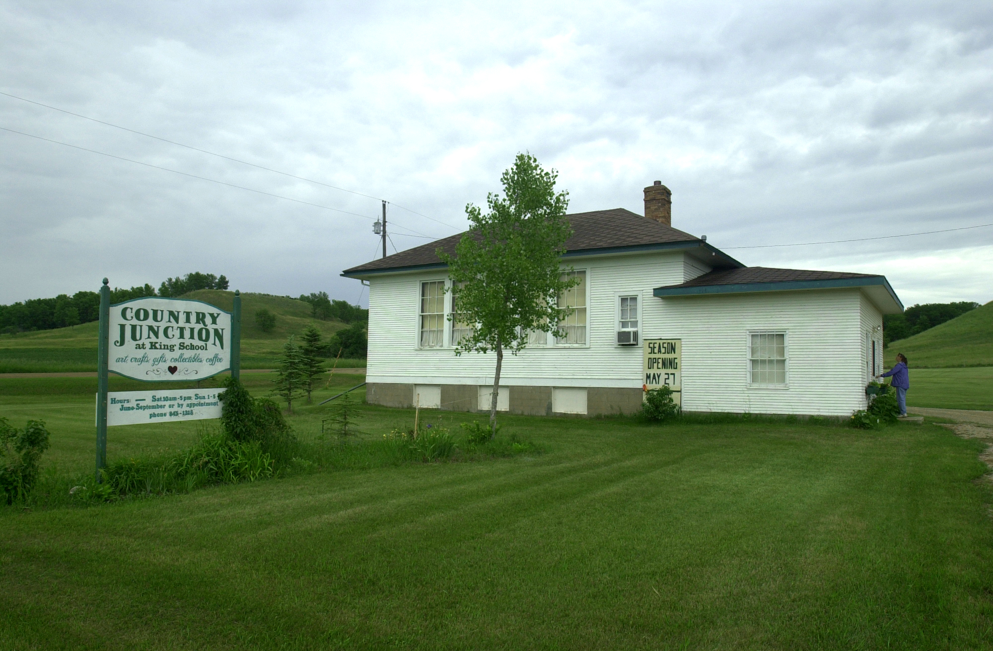
A visitor approaches King School. King School, which closed its doors to students in 1967. King School was the last operating one-room schoolhouse in Barnes County.
Public Domain. Photo by S. Clyde
Download Original (2049 x 1513 pixels, 1370.7 MB)
-
The latticework towers of the Highline Bridge span the Sheyenne River Valley in this afternoon view from Chautauqua Park.
Public Domain. Photo by Pete Deffendol of NSBO
Download Original (3072 x 2304 pixels, 3457.5 MB)
-
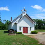
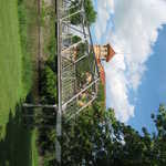
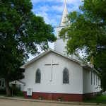
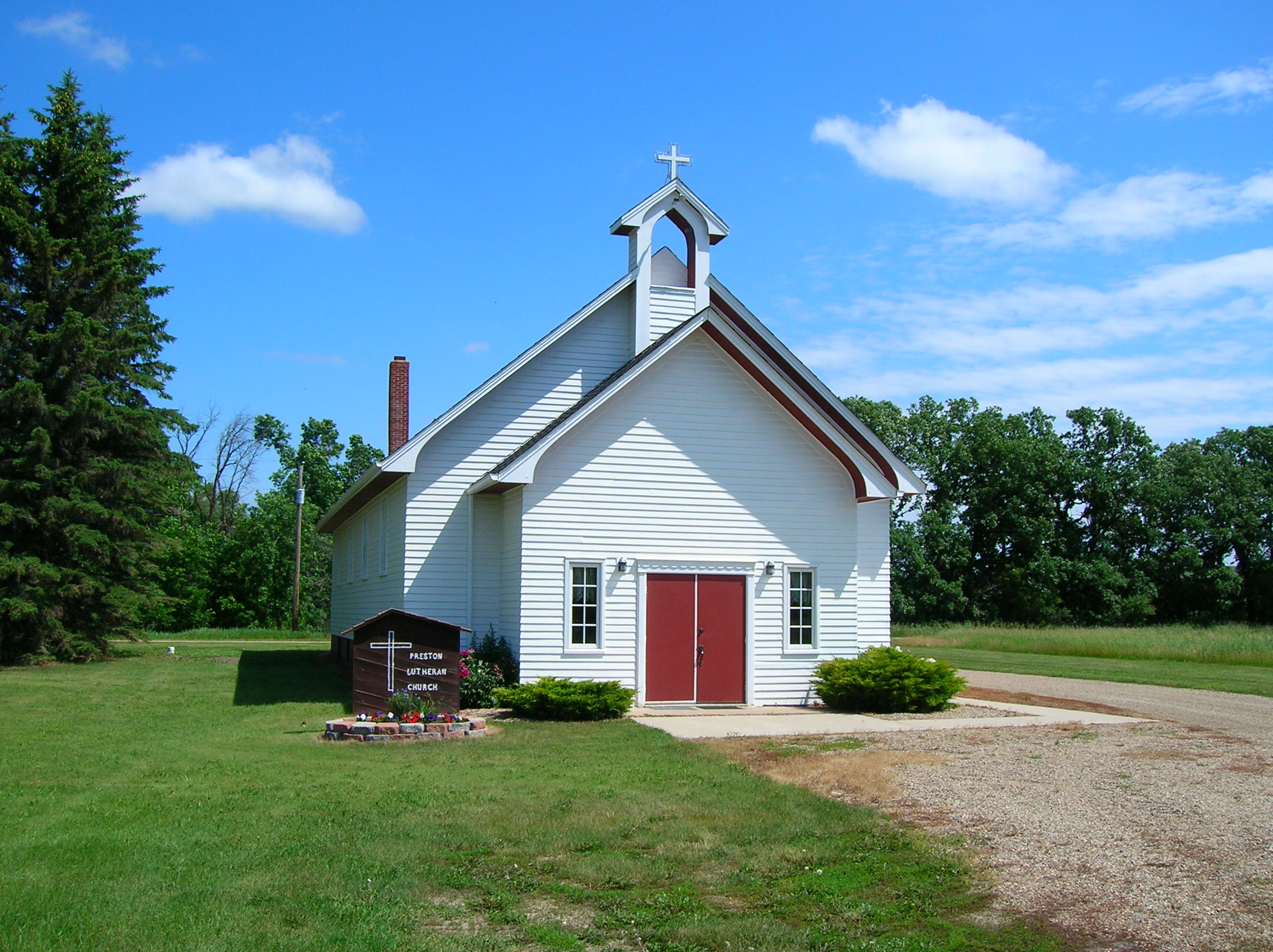
This small white frame church was built by local settlers wishing to practice their religion in their new land.
Public Domain. Photo by S. Clyde
Download Original (2288 x 1712 pixels, 735.8 KB)
-
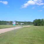
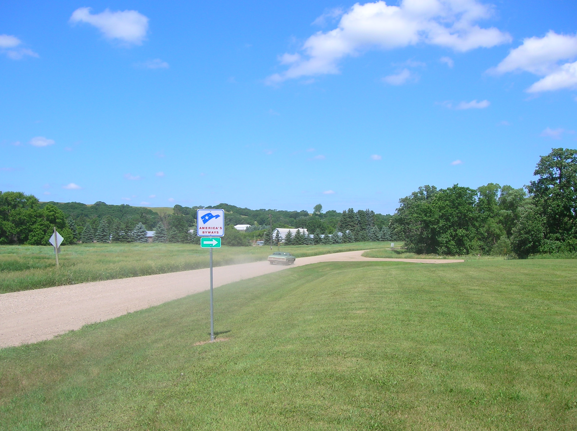
An old car drives past one of the roadsigns near Preston Church, which marks the Sheyenne River Valley Scenic Byway as one of the America's Byways.
Public Domain. Photo by S. Clyde
Download Original (2288 x 1712 pixels, 767.6 KB)
-
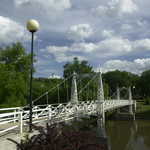
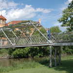
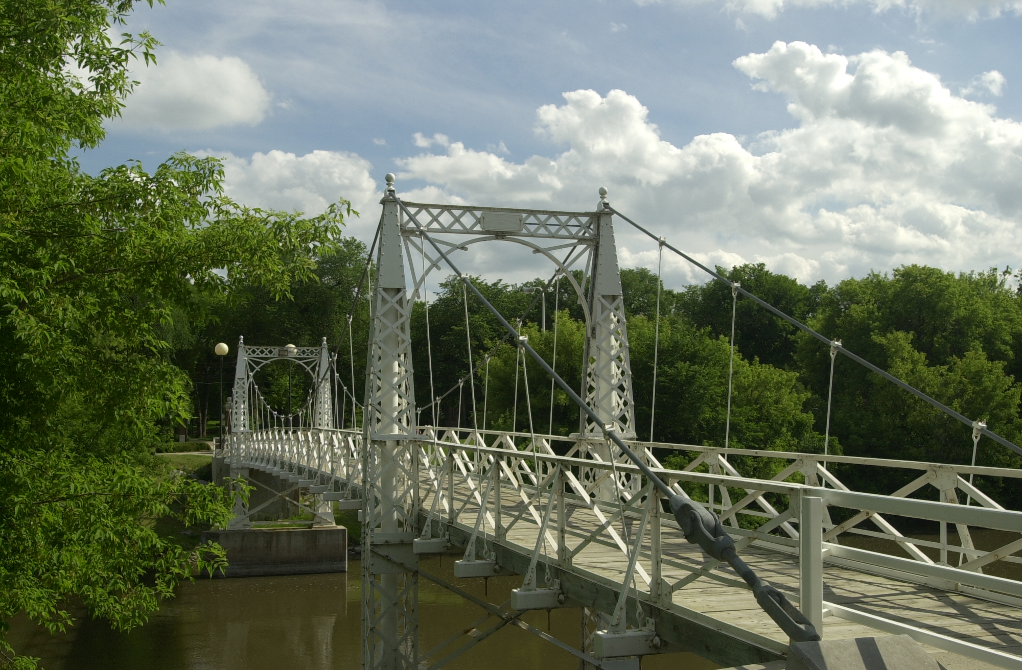
The graceful white spans of the VCSU footbridge cross the Sheyenne River to the north.
Public Domain. Taken by Pete Deffendol of NSBO
Download Original (3072 x 2304 pixels, 3668.2 MB)
-
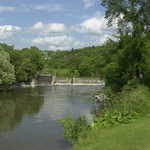
Old Mill Dam can be seen from the Mill Dam Bridge in Valley City.
Public Domain. Photo by S. Clyde
Download Original (2288 x 1712 pixels, 719.6 KB)
-
Old Mill Dam can be seen from the Mill Dam Bridge in Valley City.
Public Domain. Photo by Mat Leffler-Schulman of FHWA
Download Original (2000 x 1312 pixels, 1343.4 MB)
-
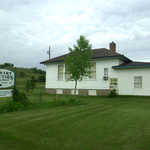
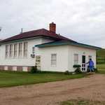
A small gift shop is now housed in the historic King School, a one-room schoolhouse on the Sheyenne River Valley Scenic Byway. King School, which closed its doors to students in 1967, was the last operating one-room schoolhouse in Barnes County.
Public Domain. Taken by Mat Leffler-Schulman of NSBO
Download Original (2000 x 1312 pixels, 1691.7 MB)
-
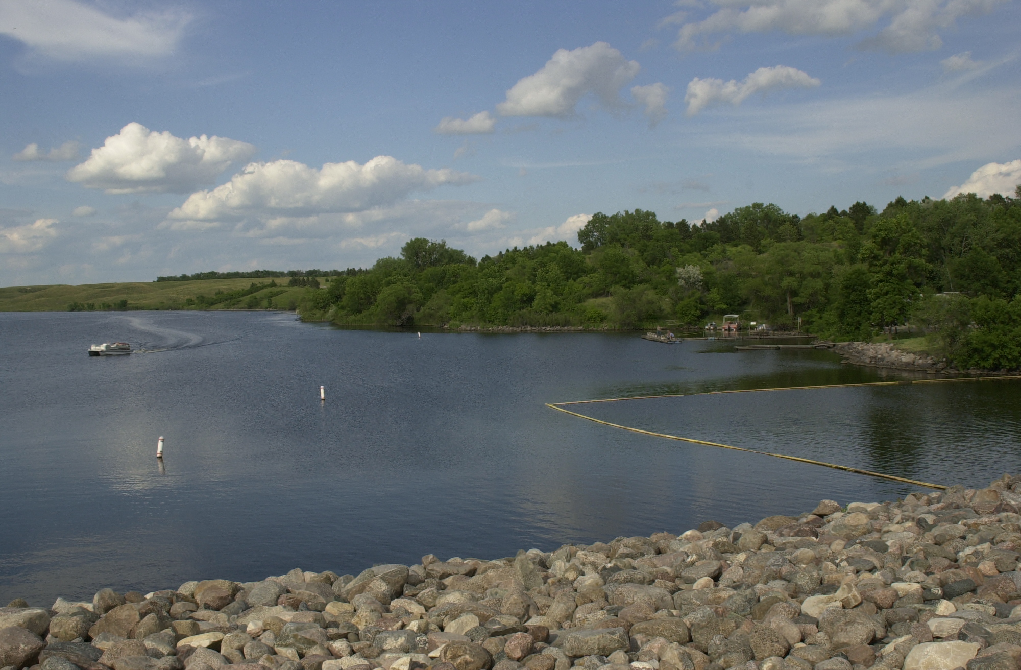
The curve of a boat's wake on Lake Ashtabula mirrors the curve of the Mel Reiman Recreational Area's swimming area east of Baldhill Dam.
Public Domain. Photo by S. Clyde
Download Original (2000 x 1312 pixels, 1124.7 MB)
-
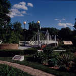
The City Park Footbridge is a steel structure spanning the Sheyenne River in City Park on Main Street across from the Rosebud Visitor Center.
Public Domain. Photo by S. Clyde
Download Original (3008 x 2000 pixels, 3362.2 MB)
-
On the VCSU Footbridge in Valley City, a traveler looks down on the Sheyenne River flowing below.
Public Domain. Taken by Mat Leffler-Schulman of NSBO
Download Original (2000 x 1312 pixels, 1216.4 MB)
-
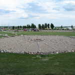
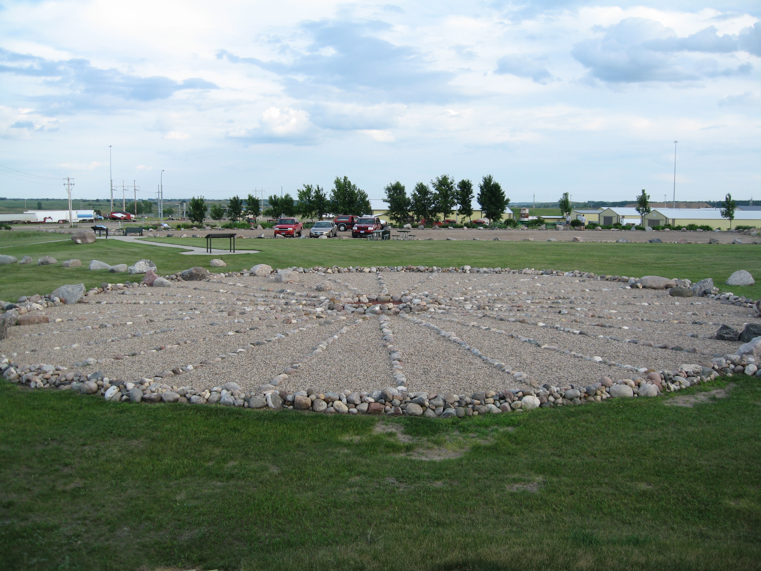
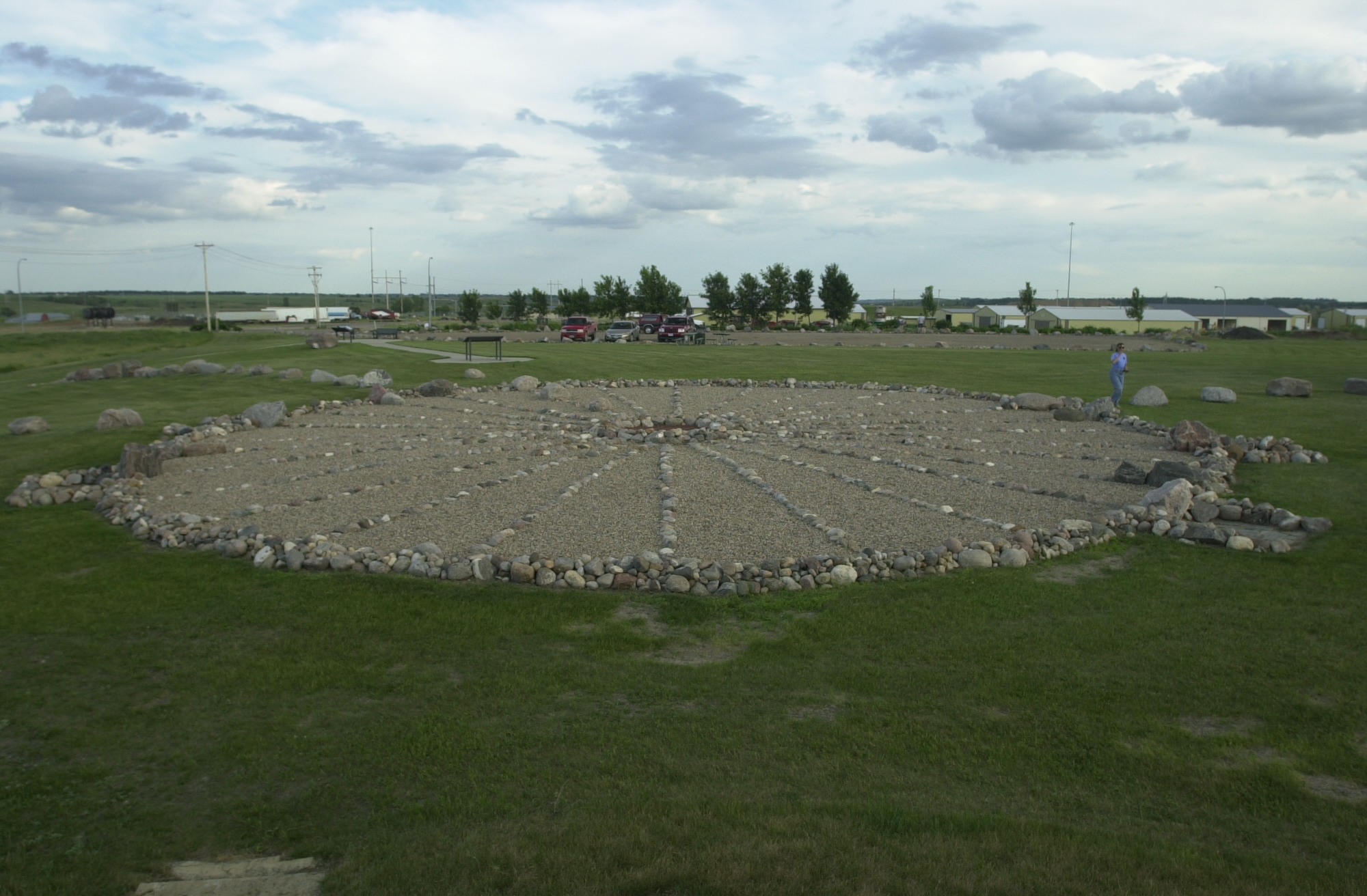
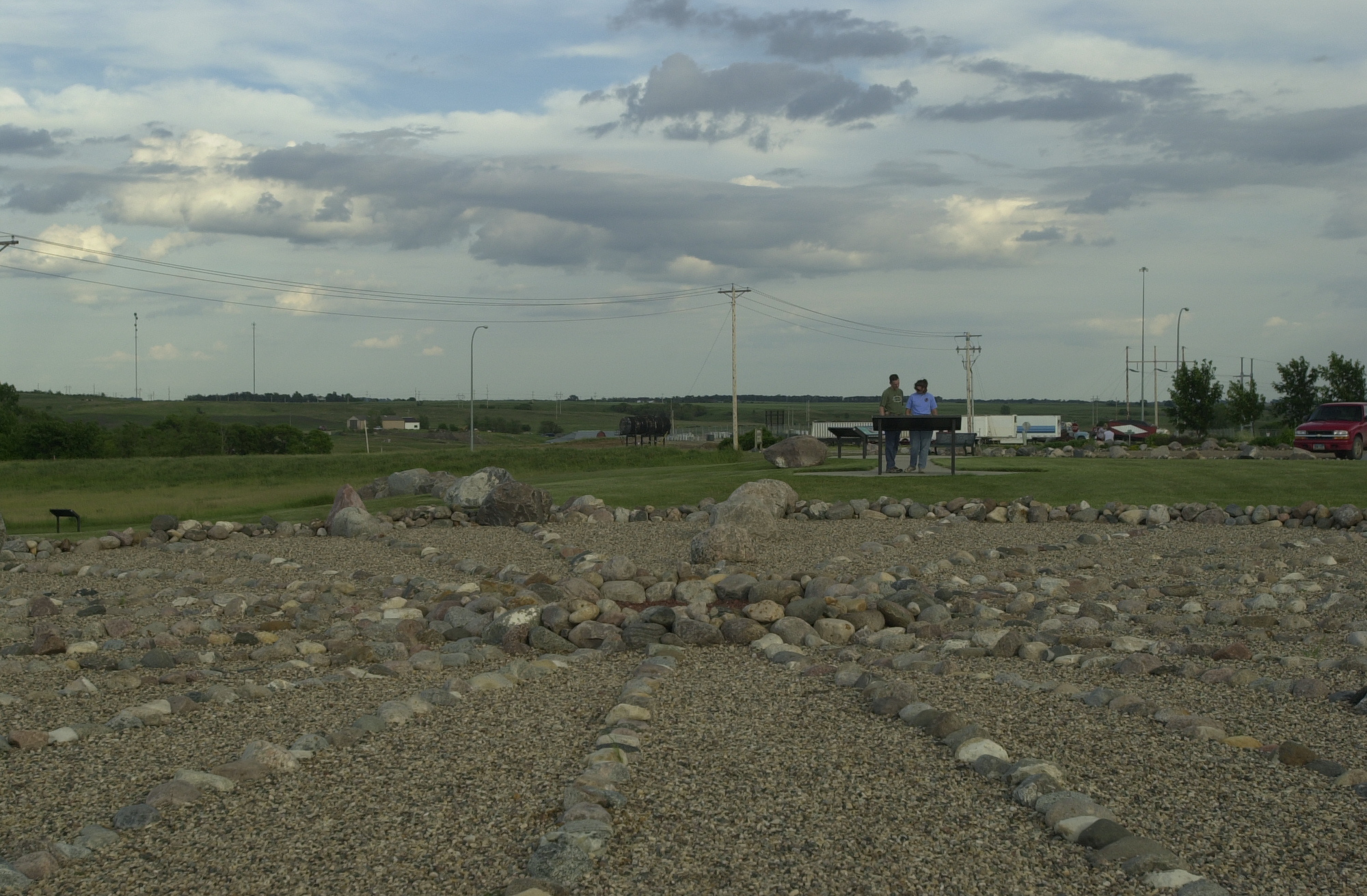
The medicine wheel at Valley City was created by staff and students at Valley City State University as part of their studies into ancient civilizations and their calendars.
Public Domain. Photo by Pete Deffendol of NSBO
Download Original (3072 x 2304 pixels, 3351.3 MB)
-
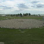
The rounded spurs on the sides of the Medicine Wheel and the line of rocks proceeding out from them align with where the sun rises and sets on the horizon at the longest and shortest days of the year.
Public Domain. Photo by Mat Leffler-Schulman of FHWA
Download Original (2000 x 1312 pixels, 1055.7 MB)
-
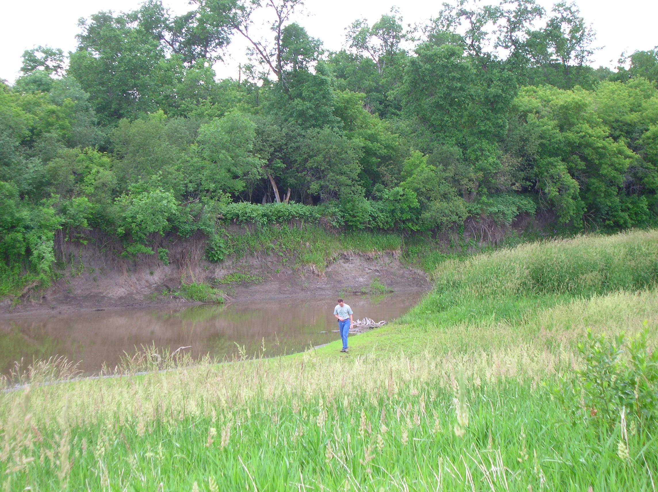
A traveler walks along the Sheyenne River's bank, and examines more closely the state of the riparian restoration project.
Public Domain. Photo by S. Clyde
Download Original (2288 x 1712 pixels, 765.6 KB)
-
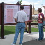
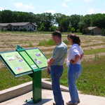
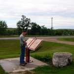
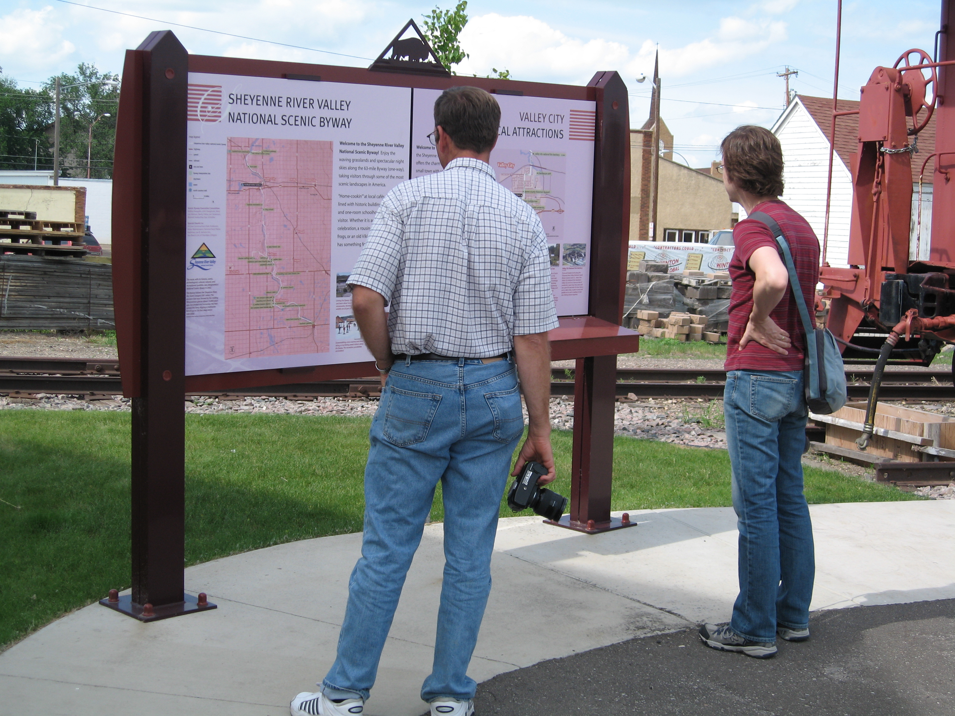
Two travelers read about the Sheyenne River Valley Scenic Byway at the Rosebud Visitor Center in Valley City.
Public Domain. Photo by Pete Deffendol of NSBO
Download Original (3072 x 2304 pixels, 3209.3 MB)
-
The graceful white spans of the VCSU footbridge cross the Sheyenne River to the south.
Public Domain. Taken by Mat Leffler-Schulman of NSBO
Download Original (2000 x 1312 pixels, 1329.0 MB)
-
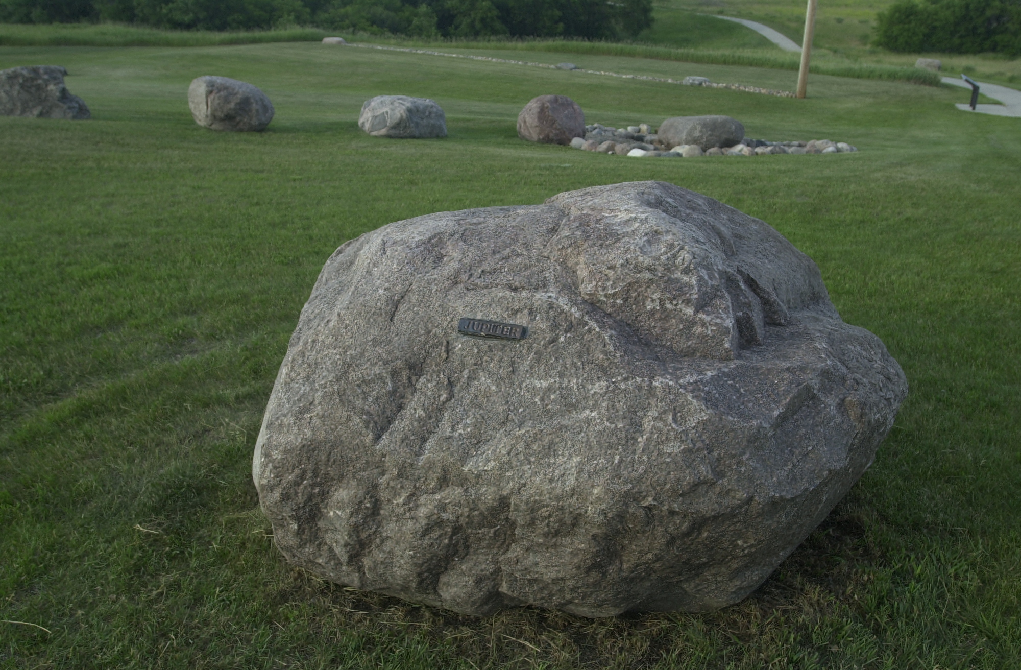
This rock, marked "Jupiter", is part of a model of the solar system at the Medicine Wheel in Valley City. Rocks for the other planets are spaced away from the red center of the Medicine Wheel (representing the Sun) in scale with their true distances in the Solar System.
Public Domain. Photo by Mat Leffler-Schulman of FHWA
Download Original (2000 x 1312 pixels, 1352.3 MB)
-
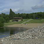
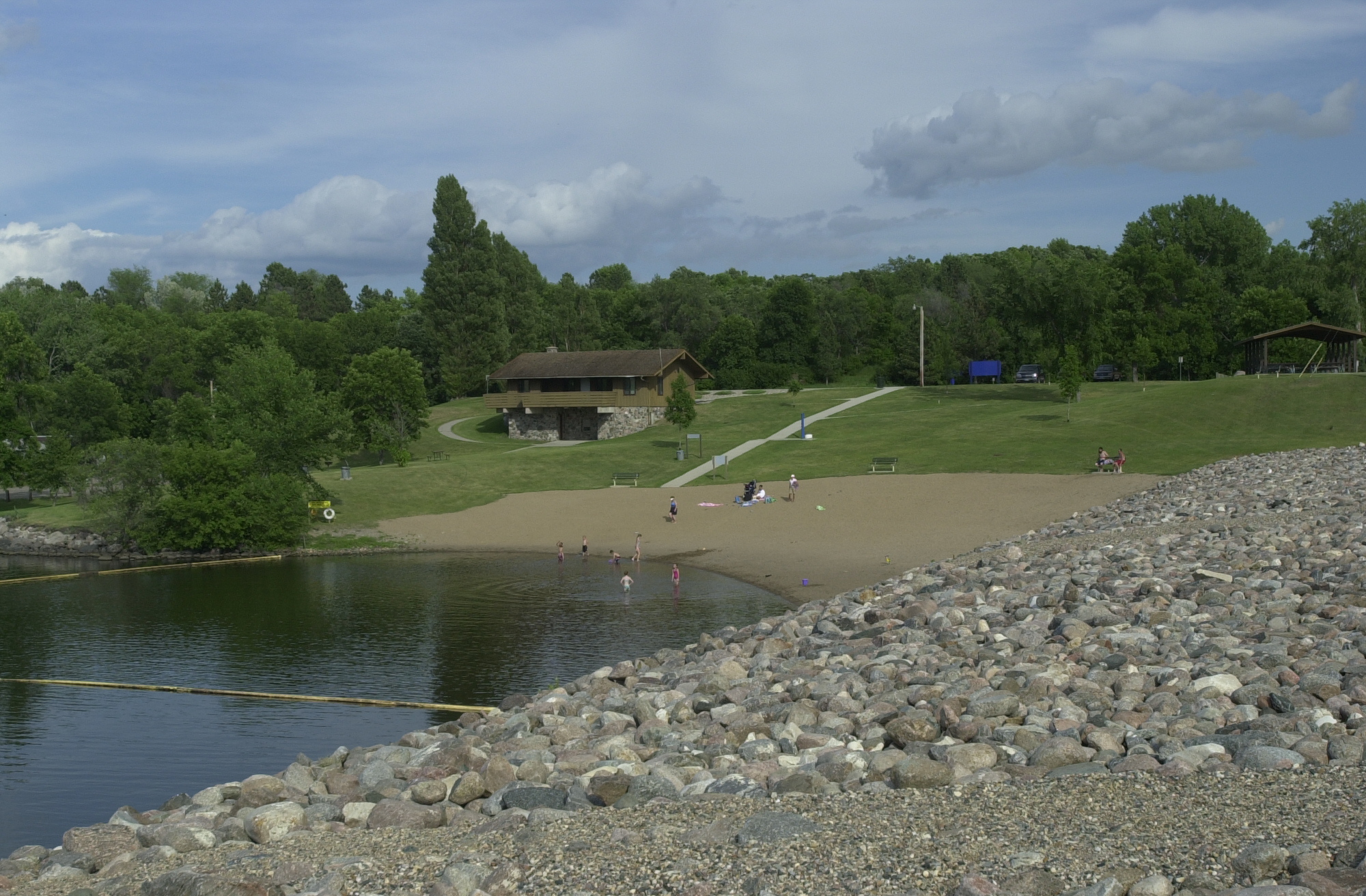
Families enjoy the Mel Rieman Recreational Area beach at the southern end of Lake Ashtabula.
Public Domain. Photo by S. Clyde
Download Original (2000 x 1312 pixels, 1302.5 MB)
-
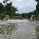
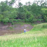
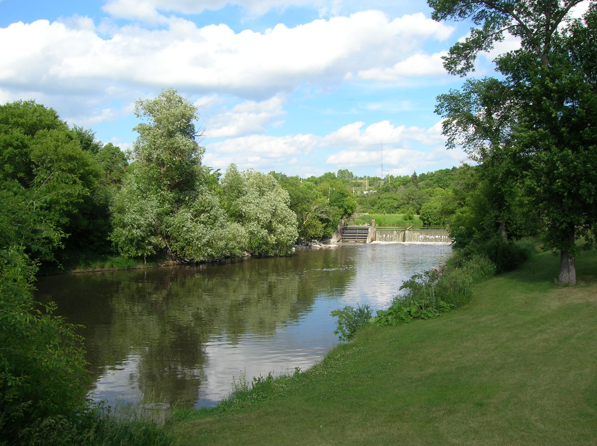
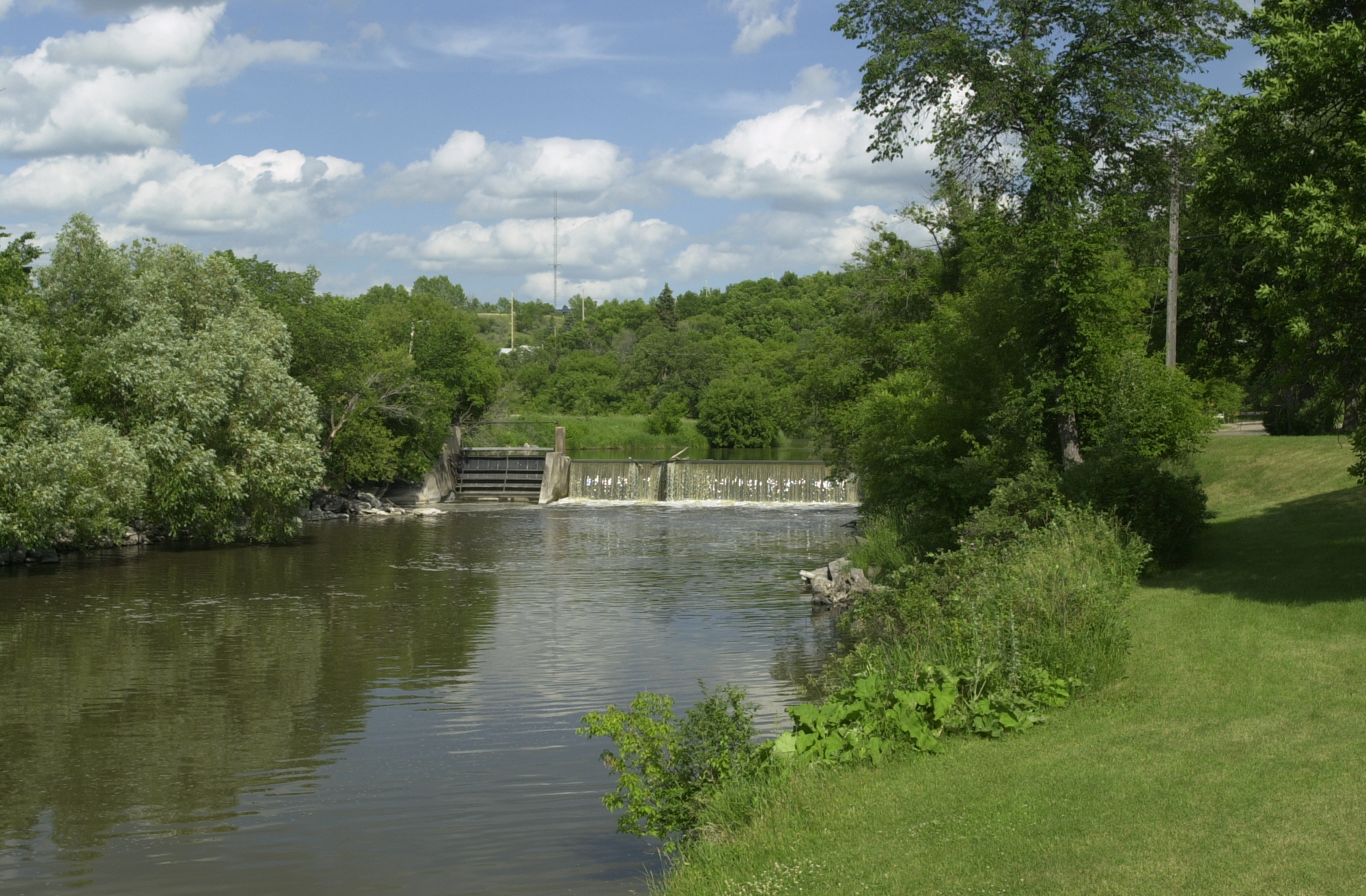
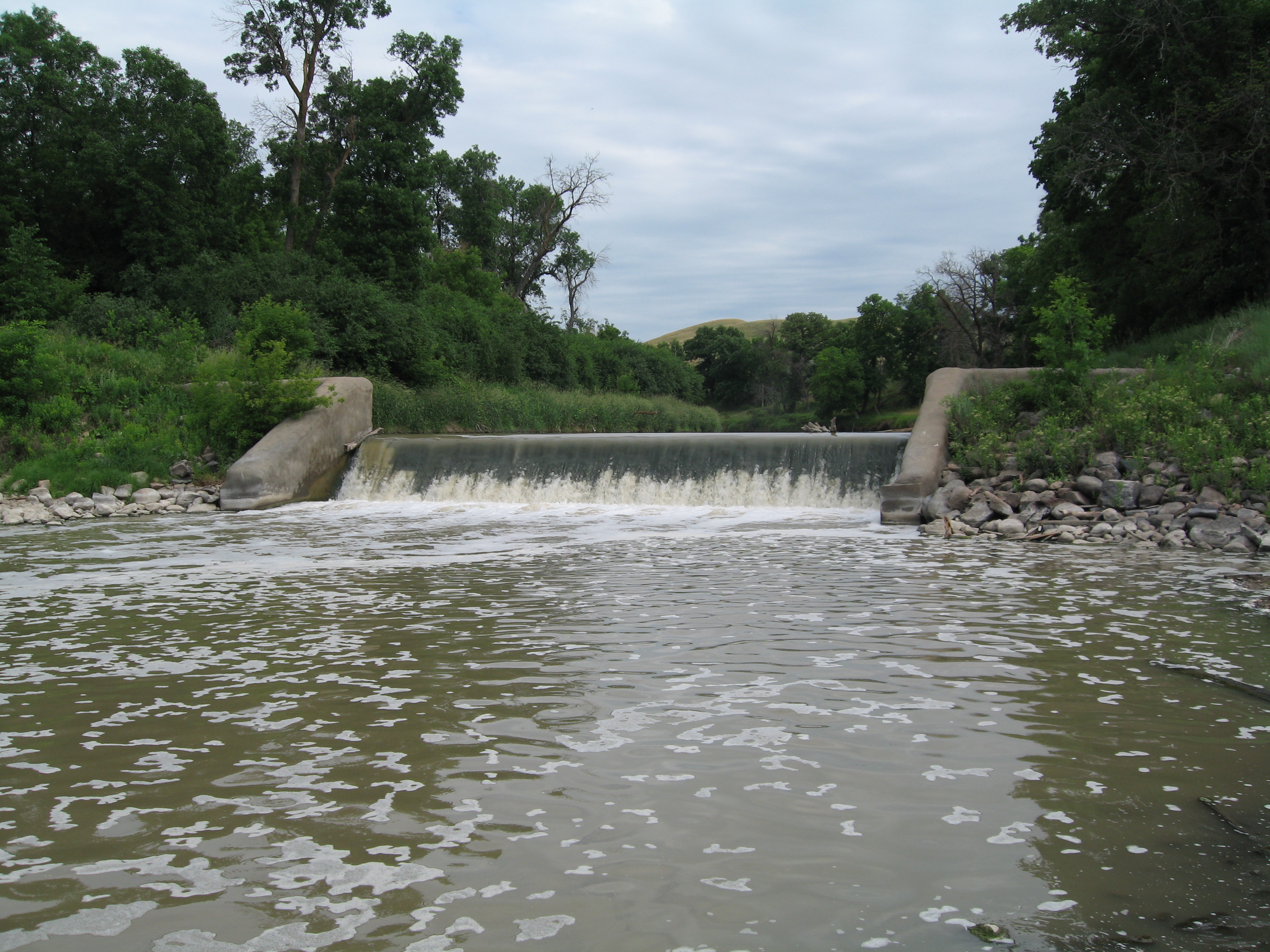
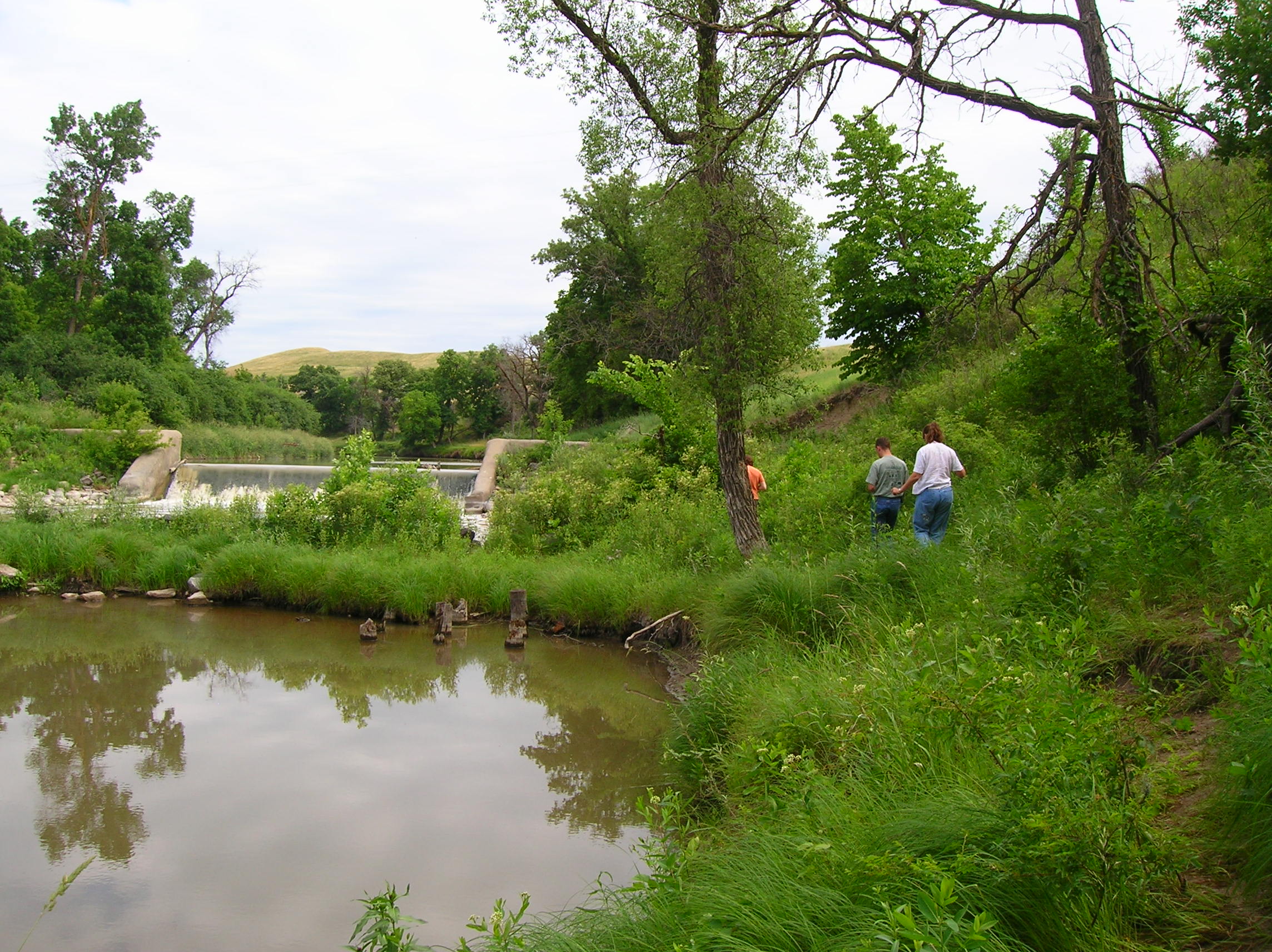
The murky brown waters of the Sheyenne River flow over the remains of Walker Dam.
Public Domain. Photo by Pete Deffendol of NSBO
Download Original (3072 x 2304 pixels, 3318.9 MB)
-
Black tarp protects small shoots of shrubs and trees laid out at the Riparian Restoration Area on the Sheyenne River Valley Scenic Byway.
Public Domain. Photo by Mat Leffler-Schulman of FHWA
Download Original (2000 x 1312 pixels, 1356.8 MB)
-
The Sheyenne River flows between green banks on its way toward th West City Park Bridge in Valley City.
Public Domain. Photo by Mat Leffler-Schulman of FHWA
Download Original (2000 x 1312 pixels, 1358.4 MB)
-
The graceful white spans of the VCSU footbridge cross the Sheyenne River to the south.
Public Domain. Taken by Mat Leffler-Schulman of NSBO
Download Original (2000 x 1312 pixels, 1168.0 MB)
-
Two visitors read about the Valley City Medicine Wheel.
Public Domain. Photo by Mat Leffler-Schulman of FHWA
Download Original (2000 x 1312 pixels, 1227.0 MB)
-
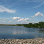
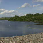
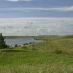
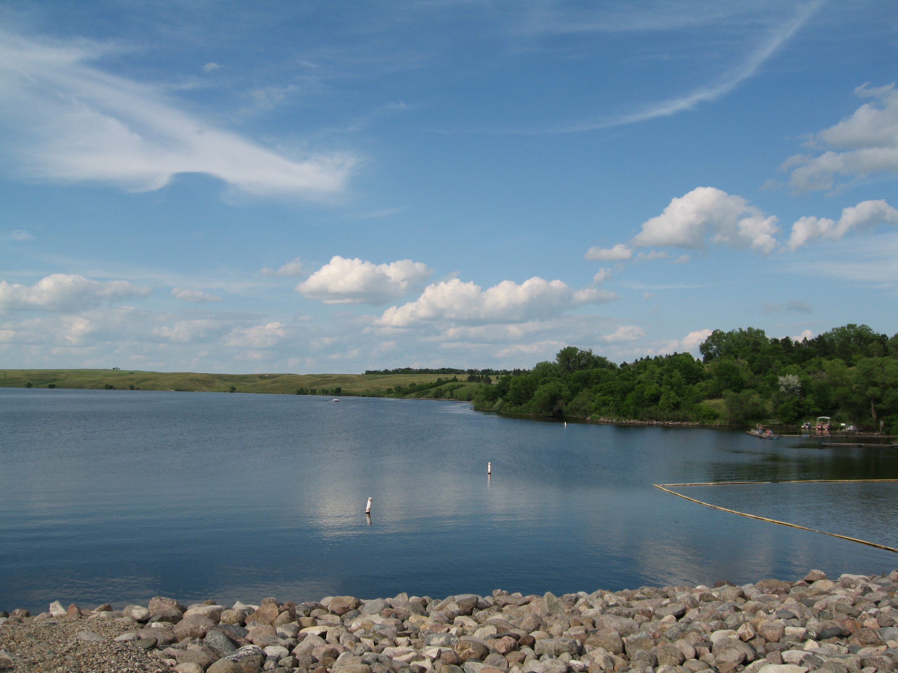
Lake Ashtabula stretches to the north from the rocky shore to the east of Baldhill Dam.
Public Domain. Photo taken by Pete Deffendol of NSBO
Download Original (3072 x 2304 pixels, 2604.4 MB)
-
Three travelers walk the short trail to get a closer look at the remains of Walker Dam.
Public Domain. Photo by S. Clyde
Download Original (2288 x 1712 pixels, 766.8 KB)
-
An interpretive sign of rounded river rocks tells a little history of this small oak log cabin.
Public Domain. Photo by Mat Leffler-Schulman of FHWA
Download Original (2000 x 1312 pixels, 1312.9 MB)
-
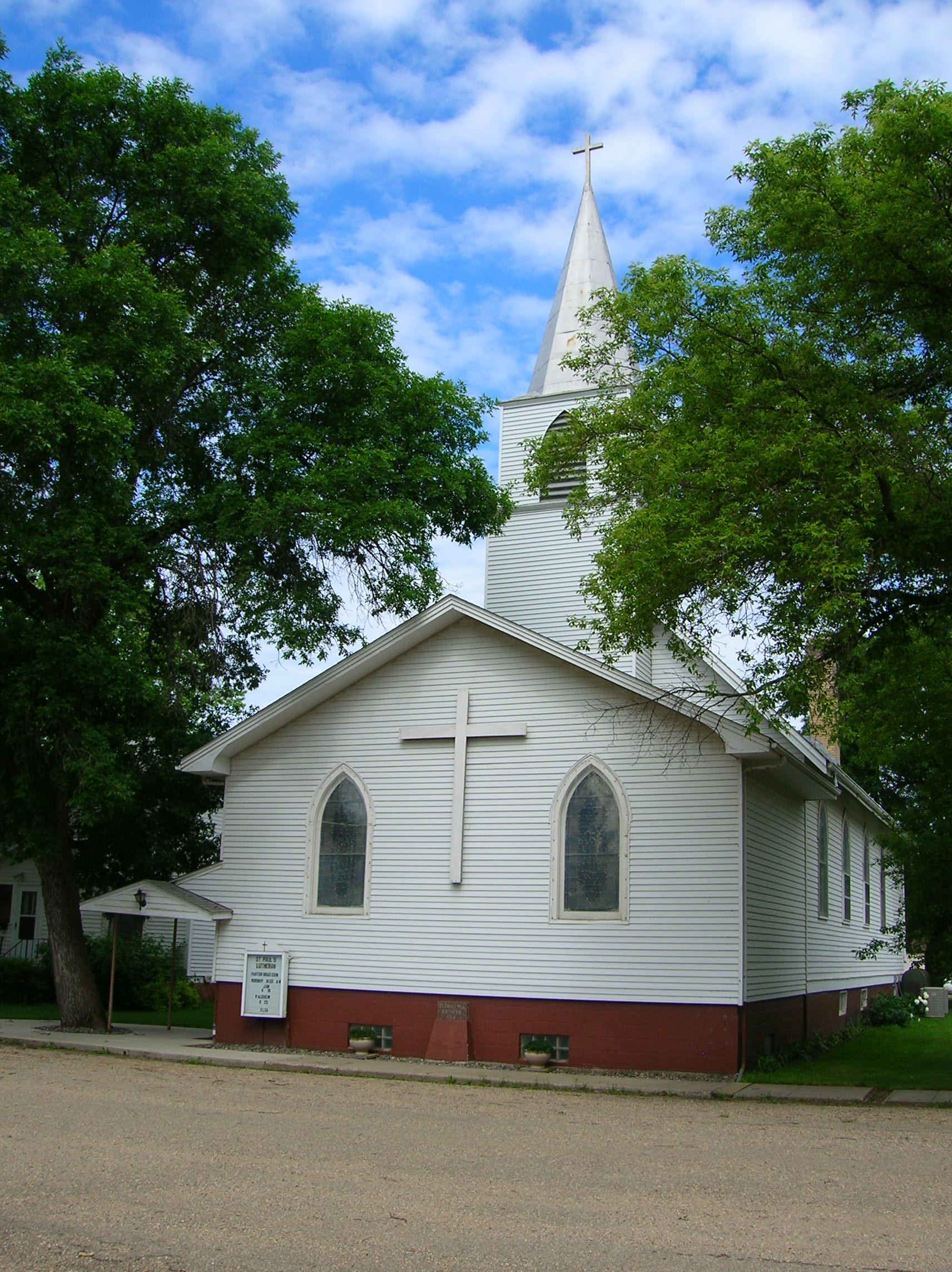
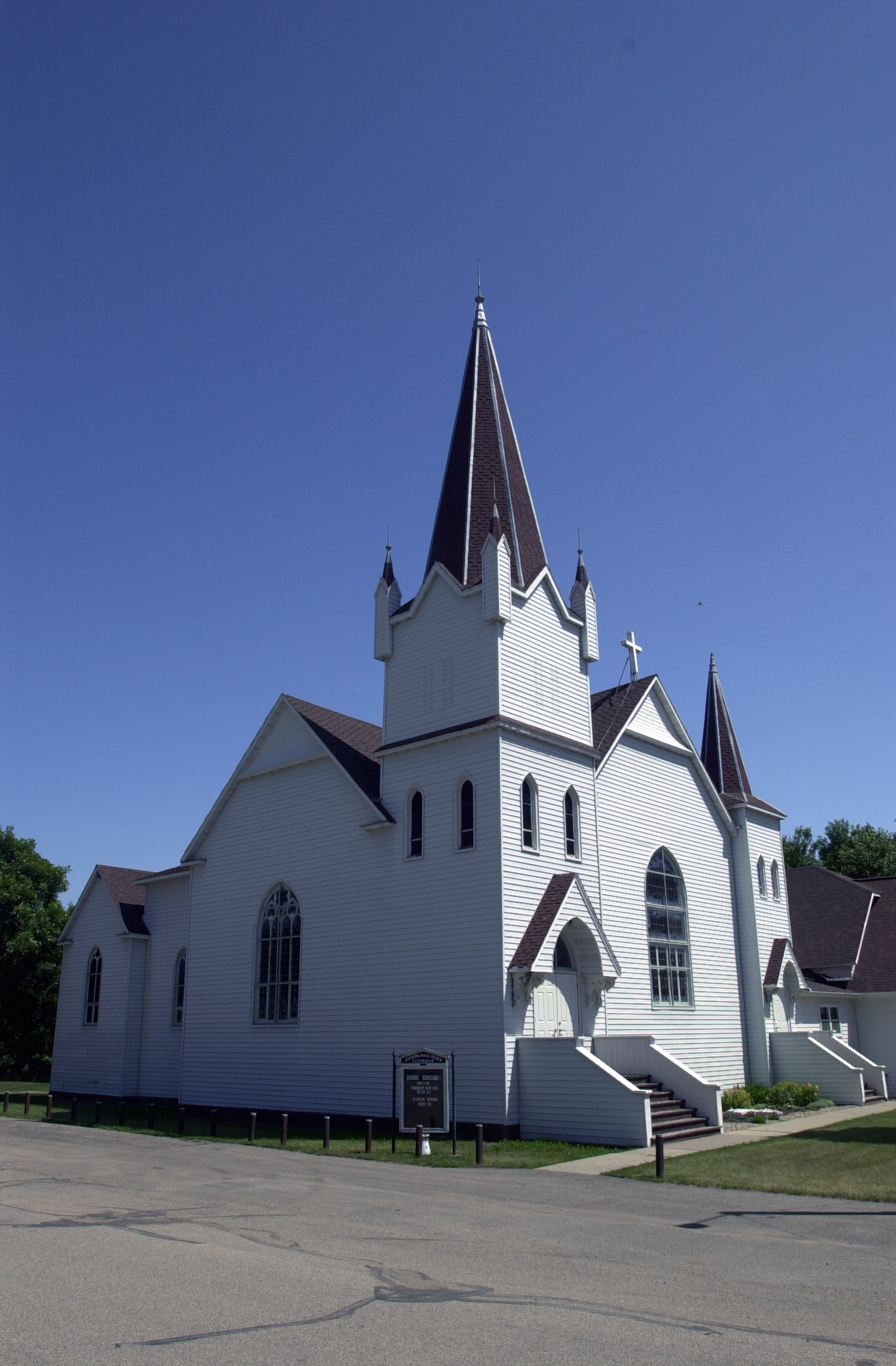
St. Paul's Lutheran Church (1914) raises a pretty white steeple to the sky in Kathryn.
Public Domain. Photo by S. Clyde
Download Original (1712 x 2288 pixels, 714.1 KB)
-
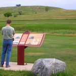
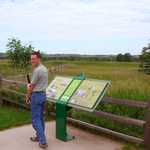
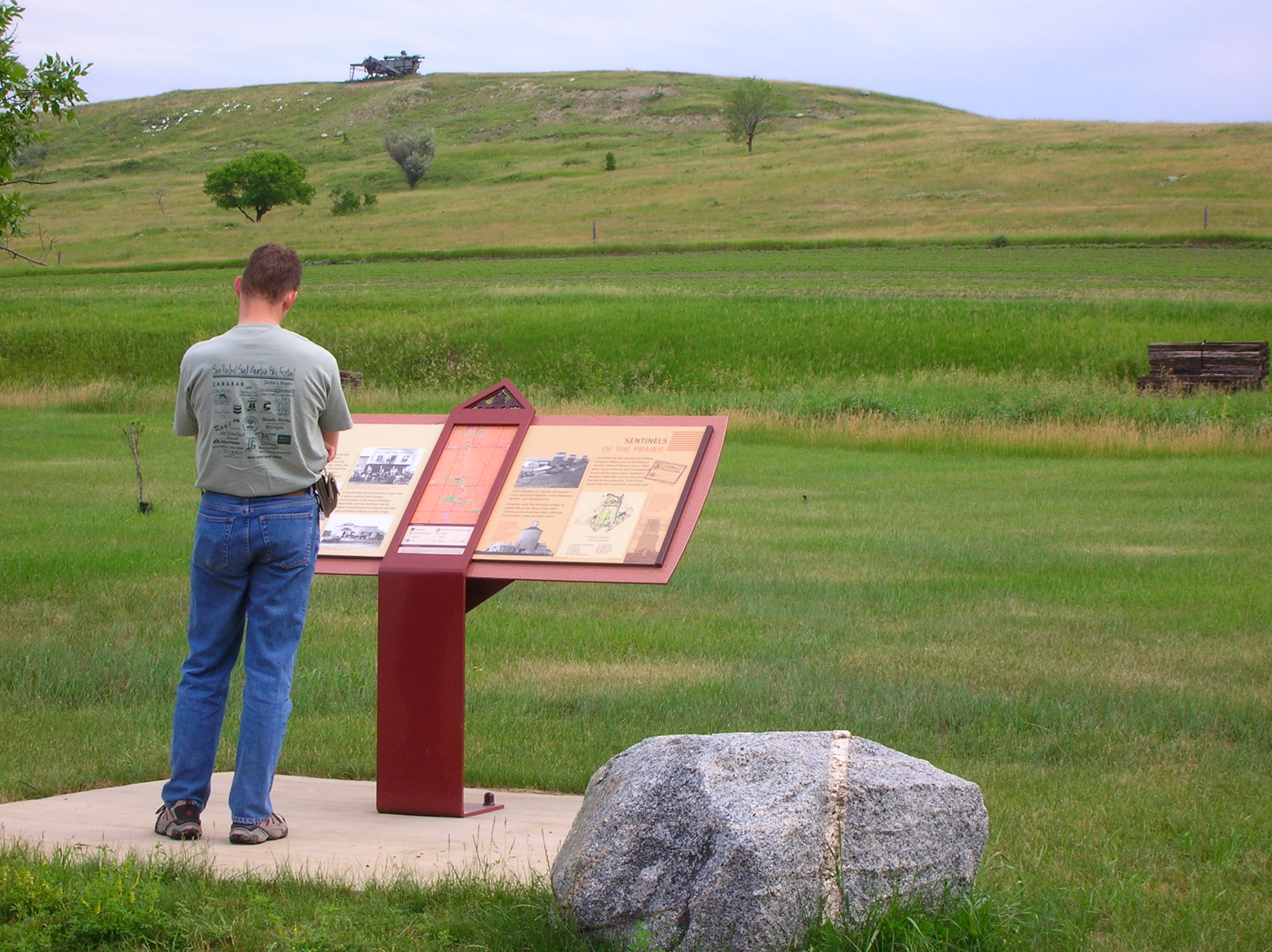
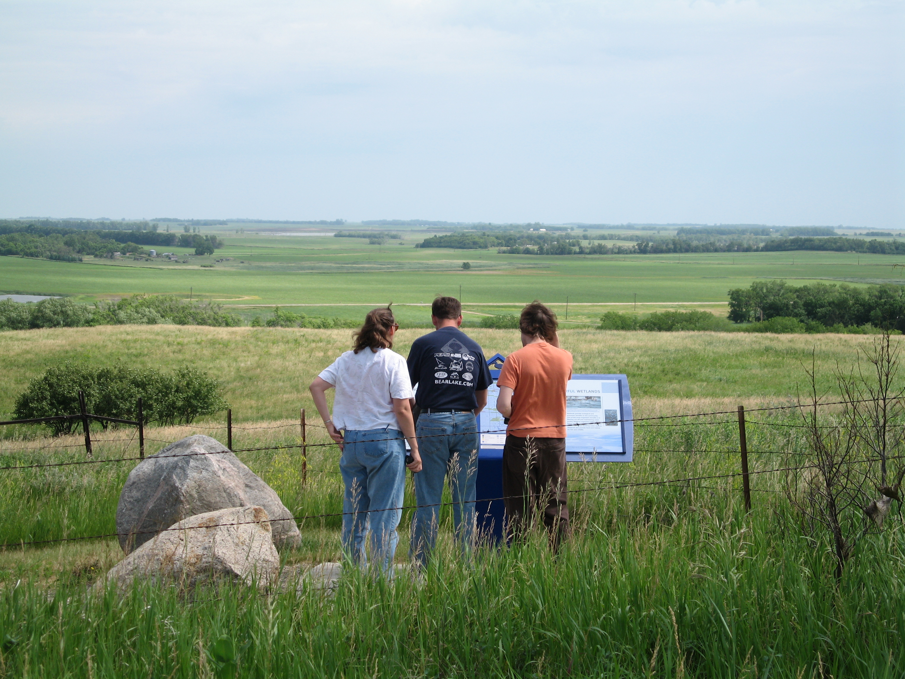
A visitor reads an interpretative sign about the "Sentinels of the Prairie" (silos, grain elevators and other farm buildings and equipment) around the Kathryn area.
Public Domain. Photo by S. Clyde
Download Original (2288 x 1712 pixels, 737.3 KB)
-
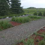
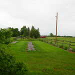
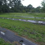
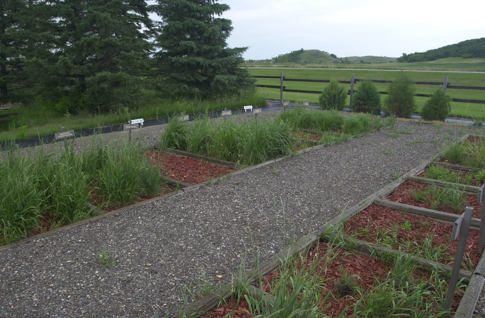
Neat plots identify and display growing examples of the plants being used to restore the environment at the Riparian Restoration Area on the Sheyenne River Valley Scenic Byway.
Public Domain. Photo by Mat Leffler-Schulman of FHWA
Download Original (2000 x 1312 pixels, 1374.5 MB)
-
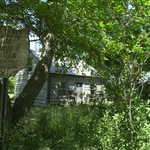
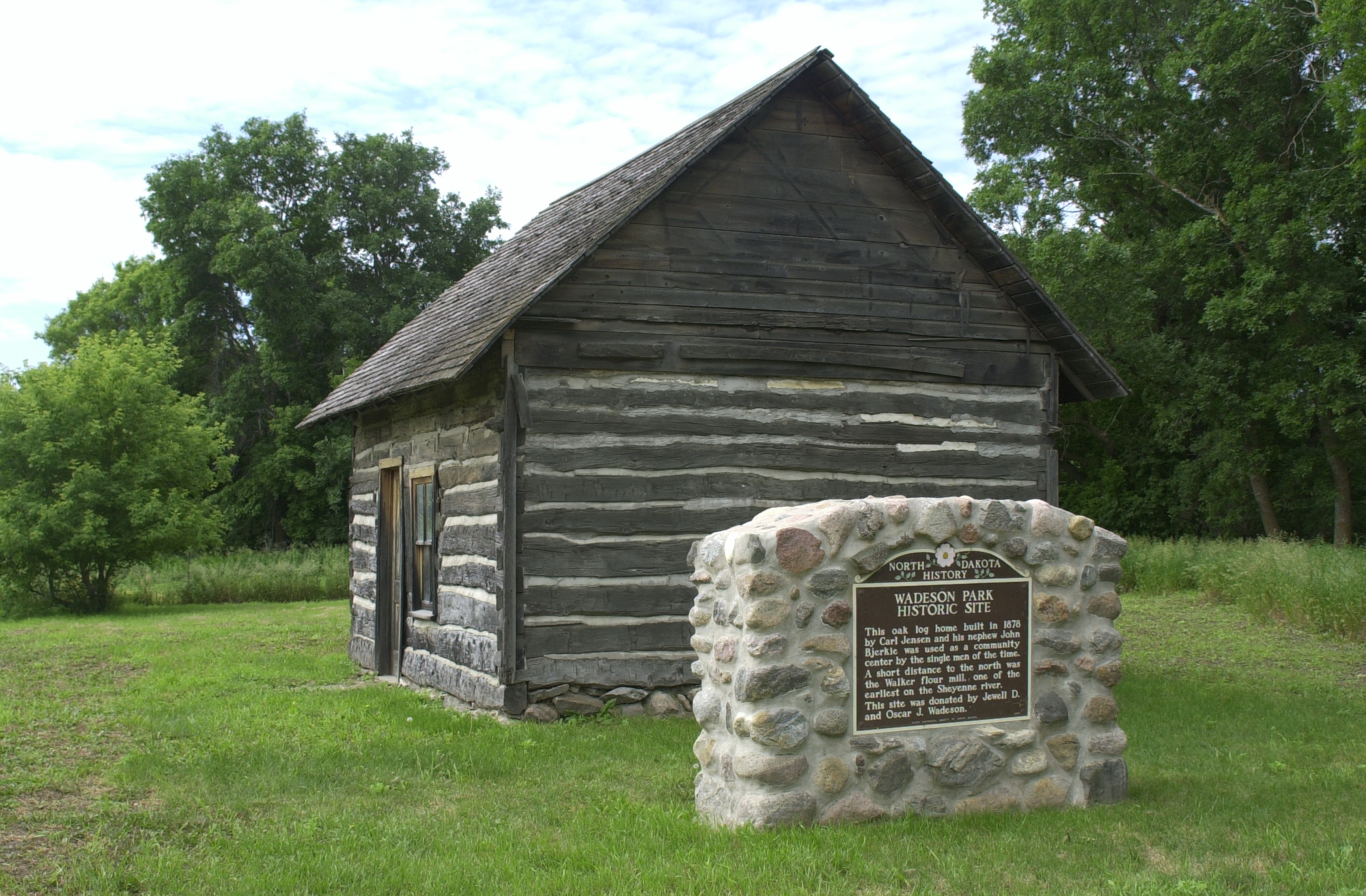
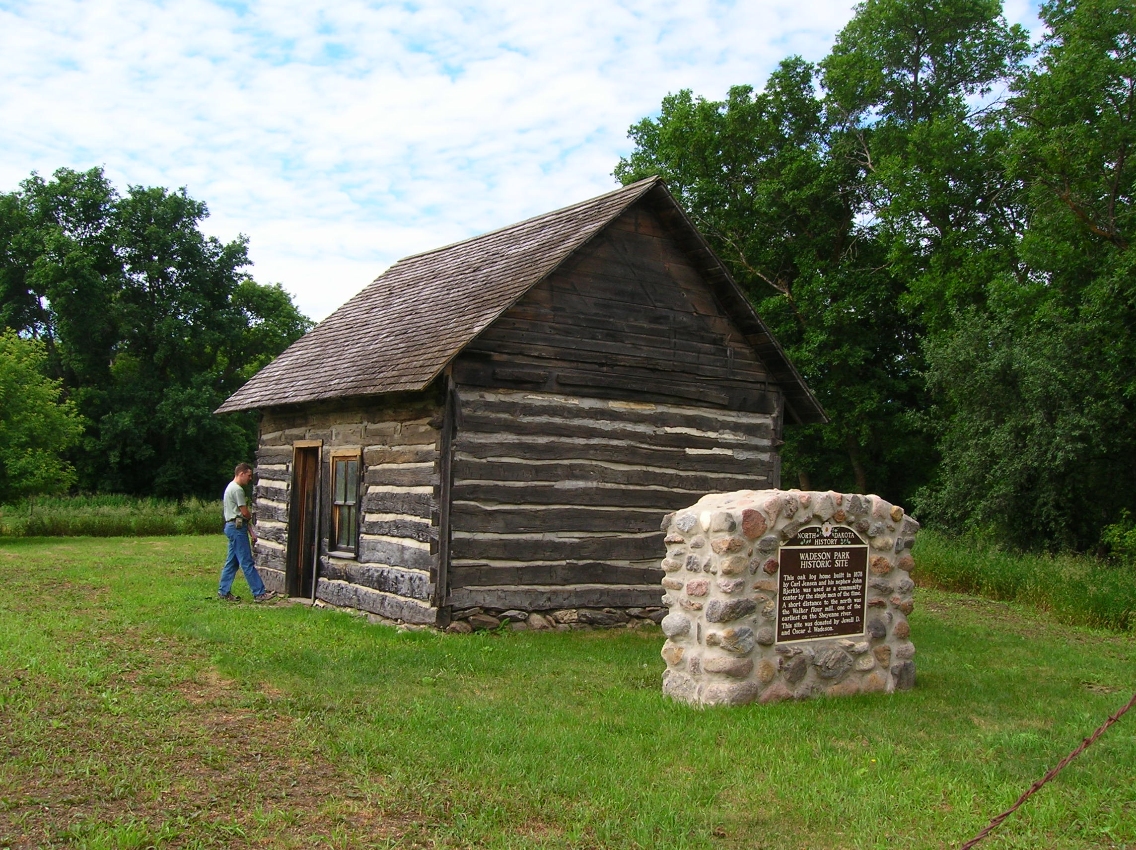
A visitor approaches the historic cabin on Wadeson Park Historic Site.
Public Domain. Photo by S. Clyde
Download Original (2288 x 1712 pixels, 774.3 KB)
-
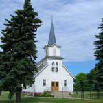
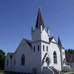
The simple lines of this Lutheran church present a pleasing example of prairie architecture.
Public Domain. Photo by Pete Deffendol of NSBO
Download Original (3072 x 2304 pixels, 2708.5 MB)
-
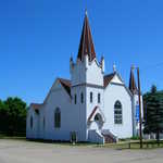
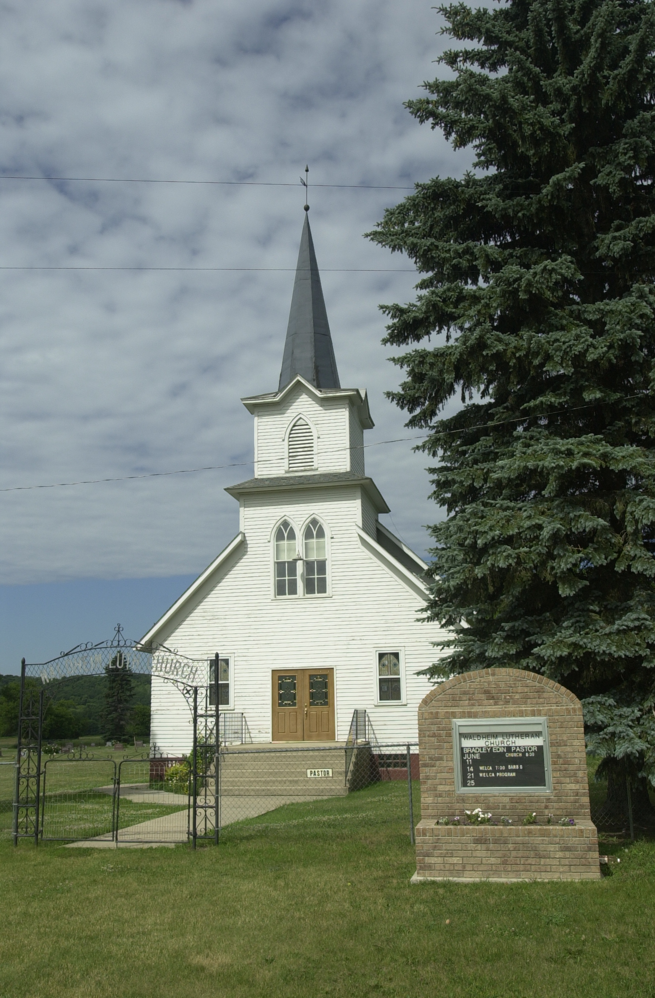
The white steeple of the Waldheim Church rises to the sky. A black iron arch above the sidewalk to the front doors says "Waldheim Luth. Church."
Public Domain. Photo by Mat Leffler-Schulman of FHWA
Download Original (1312 x 2000 pixels, 1286.1 MB)
-
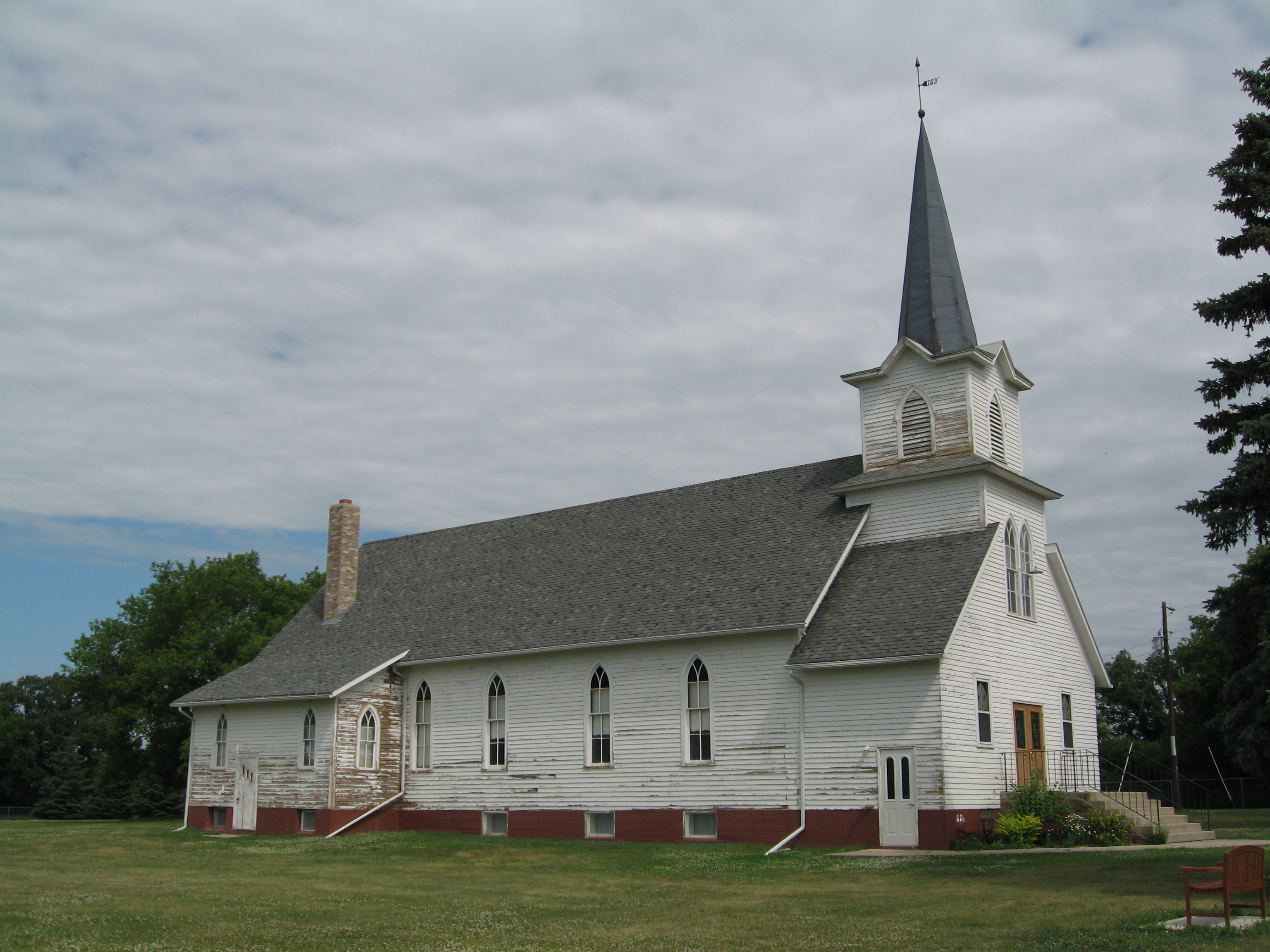
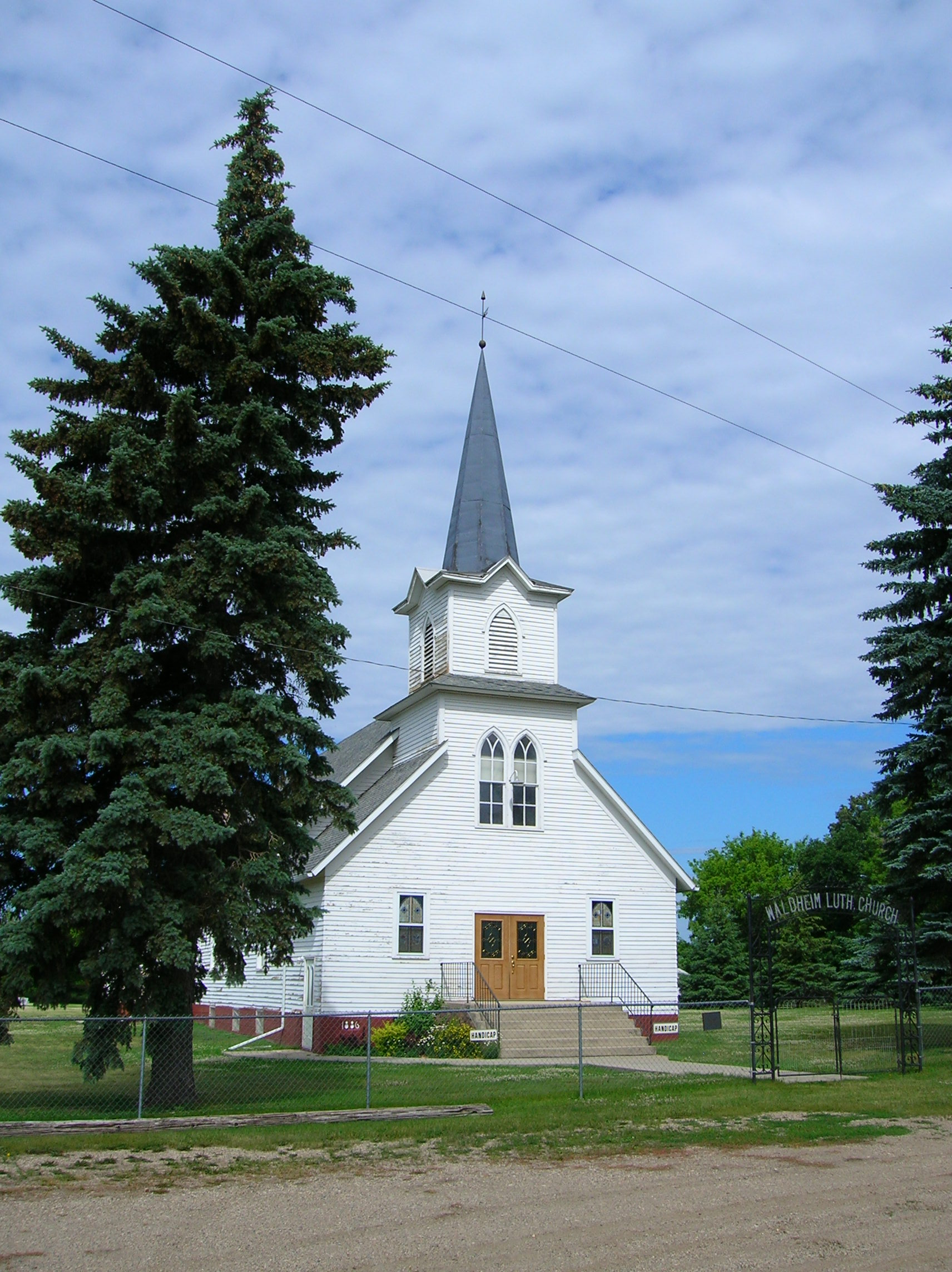
This simple white wooden structure stands out on the Sheyenne River Valley. The Waldheim Church was completed in 1900 on land donated by a local landowner.
Public Domain. Photo by S. Clyde
Download Original (1712 x 2288 pixels, 663.3 KB)
-
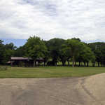
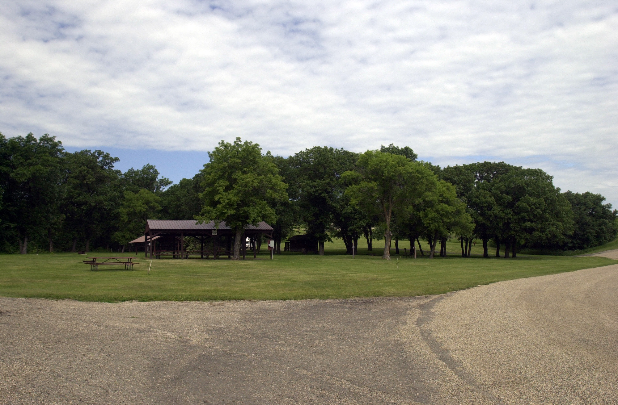
Plenty of trees provide shade and grass a pleasant picnicking surface to complement the roofed pavilions at Little Yellowstone Park.
Public Domain. Photo by Mat Leffler-Schulman of FHWA
Download Original (2000 x 1312 pixels, 890.1 KB)
-
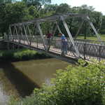
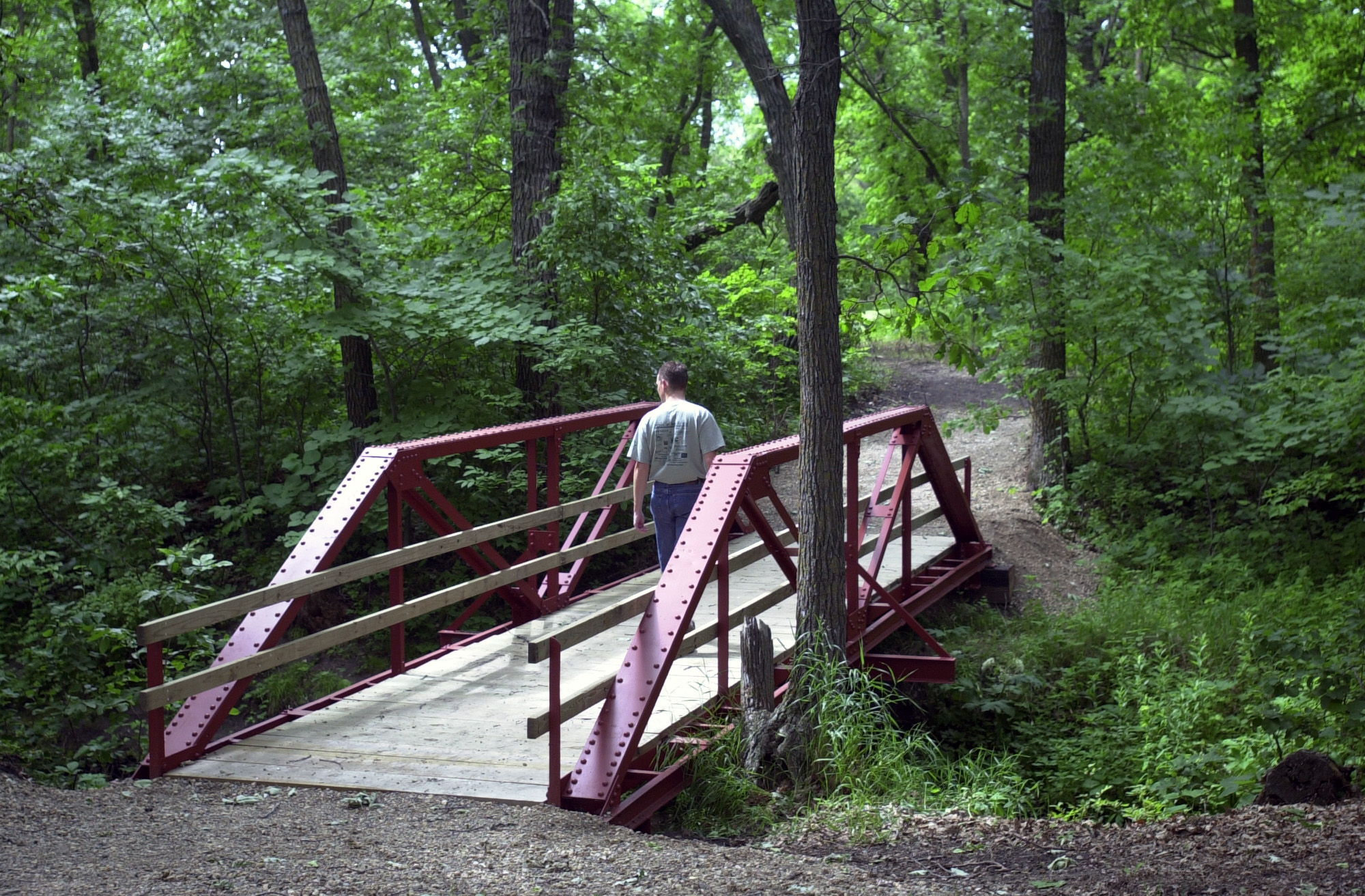
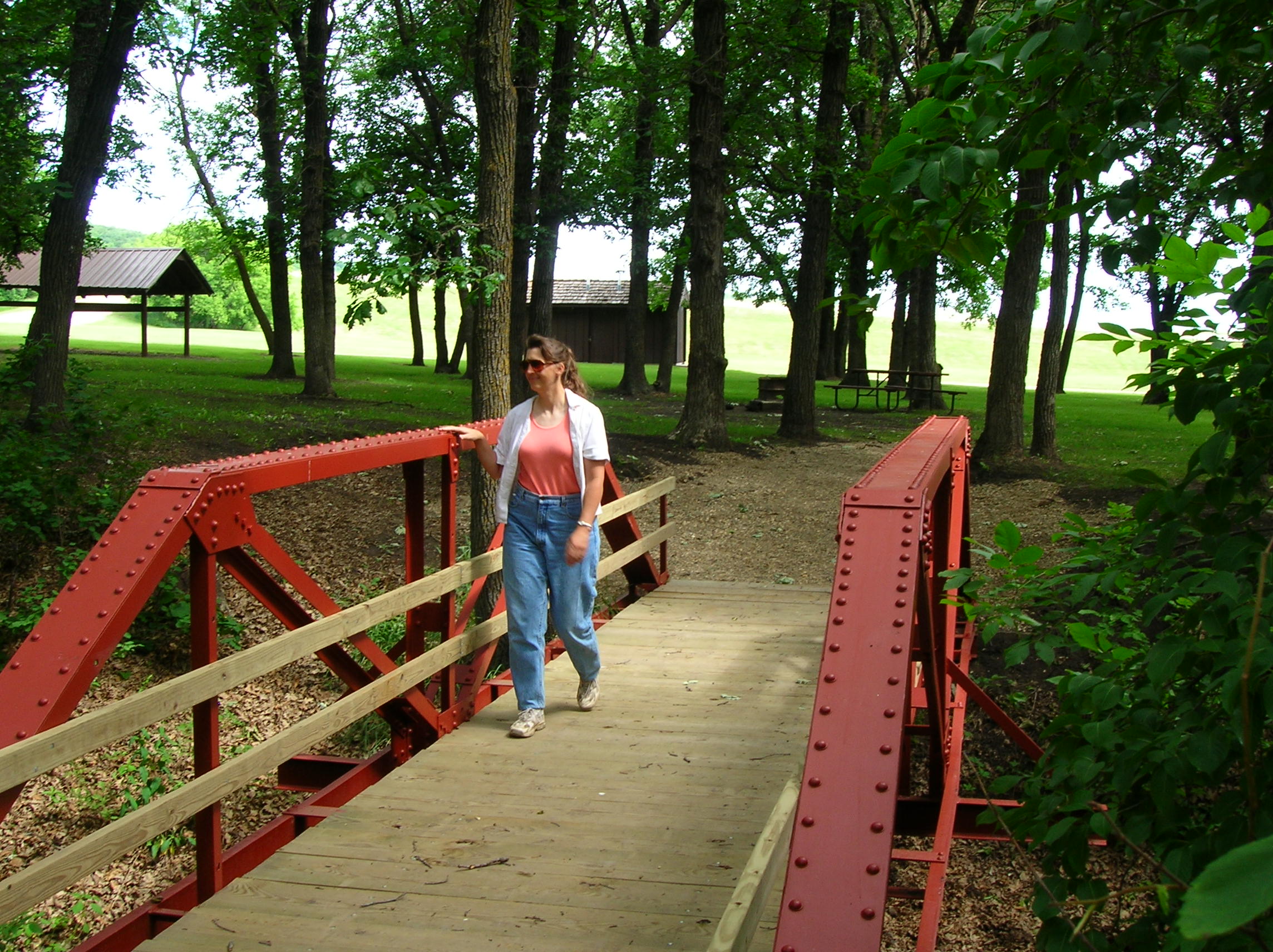
A visitor crosses a footbridge at Little Yellowstone Park.
Public Domain. Photo by Mat Leffler-Schulman of FHWA
Download Original (2000 x 1312 pixels, 1189.2 MB)
-
A visitor crosses a footbridge at Little Yellowstone Park.
Public Domain. Photo by S. Clyde
Download Original (2288 x 1712 pixels, 743.2 KB)
-
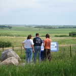
Three people read about the Standing Rock on the Sheyenne River Valley Scenic Byway
Public Domain. Photo by Pete Deffendol of NSBO
Download Original (3072 x 2304 pixels, 3338.5 MB)
-
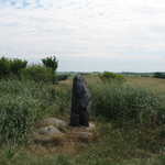
A short gray rock stands like a sentinel on the North Dakota prairie near the Sheyenne River Valley.
Public Domain. Photo by Pete Deffendol of NSBO
Download Original (3072 x 2304 pixels, 3540.2 MB)
-
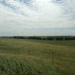
Clouds form endless patterns in the sky above the North Dakota fields near the Standing Rock of the Sheyenne River Valley.
Public Domain. Photo by Mat Leffler-Schulman of FHWA
Download Original (2000 x 1312 pixels, 707.8 KB)
-
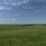
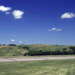
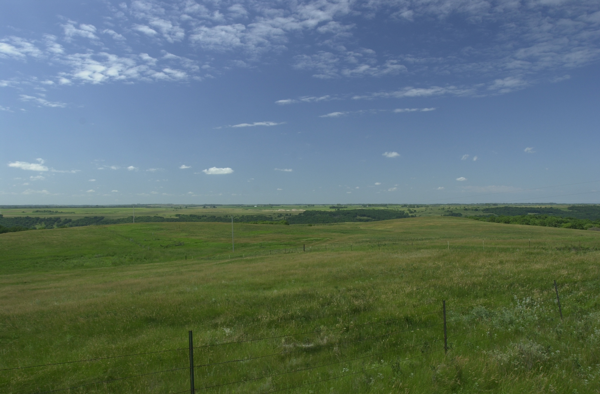
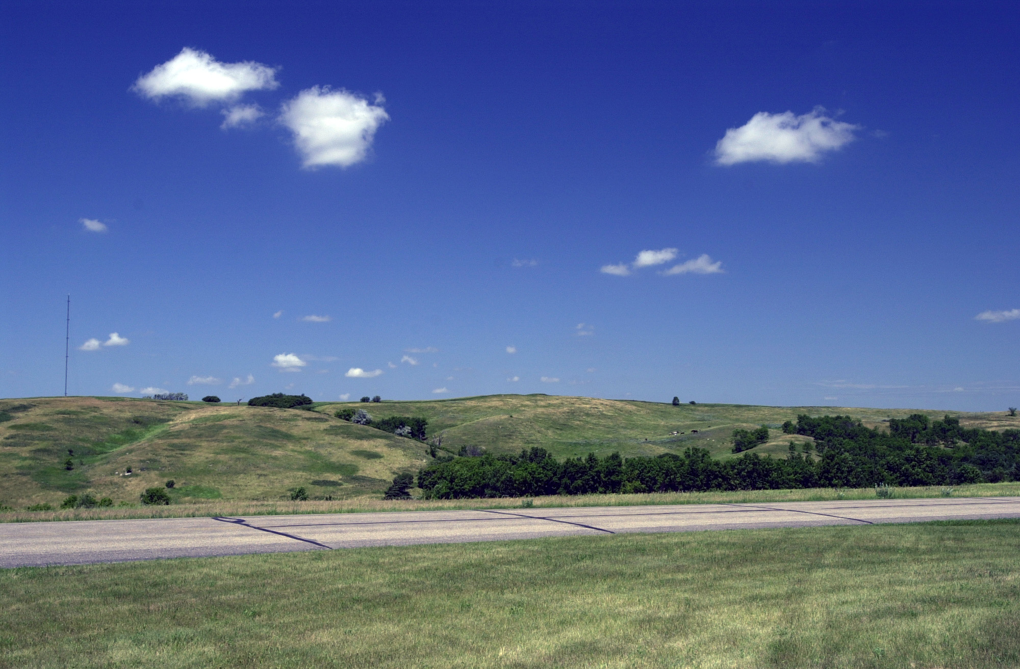
The prairie and farmland stretch to the horizon near Standing Rock by the Sheyenne River Valley.
Public Domain. Photo by Mat Leffler-Schulman of FHWA
Download Original (2000 x 1312 pixels, 1055.1 MB)
-
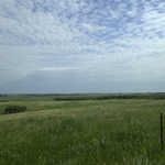
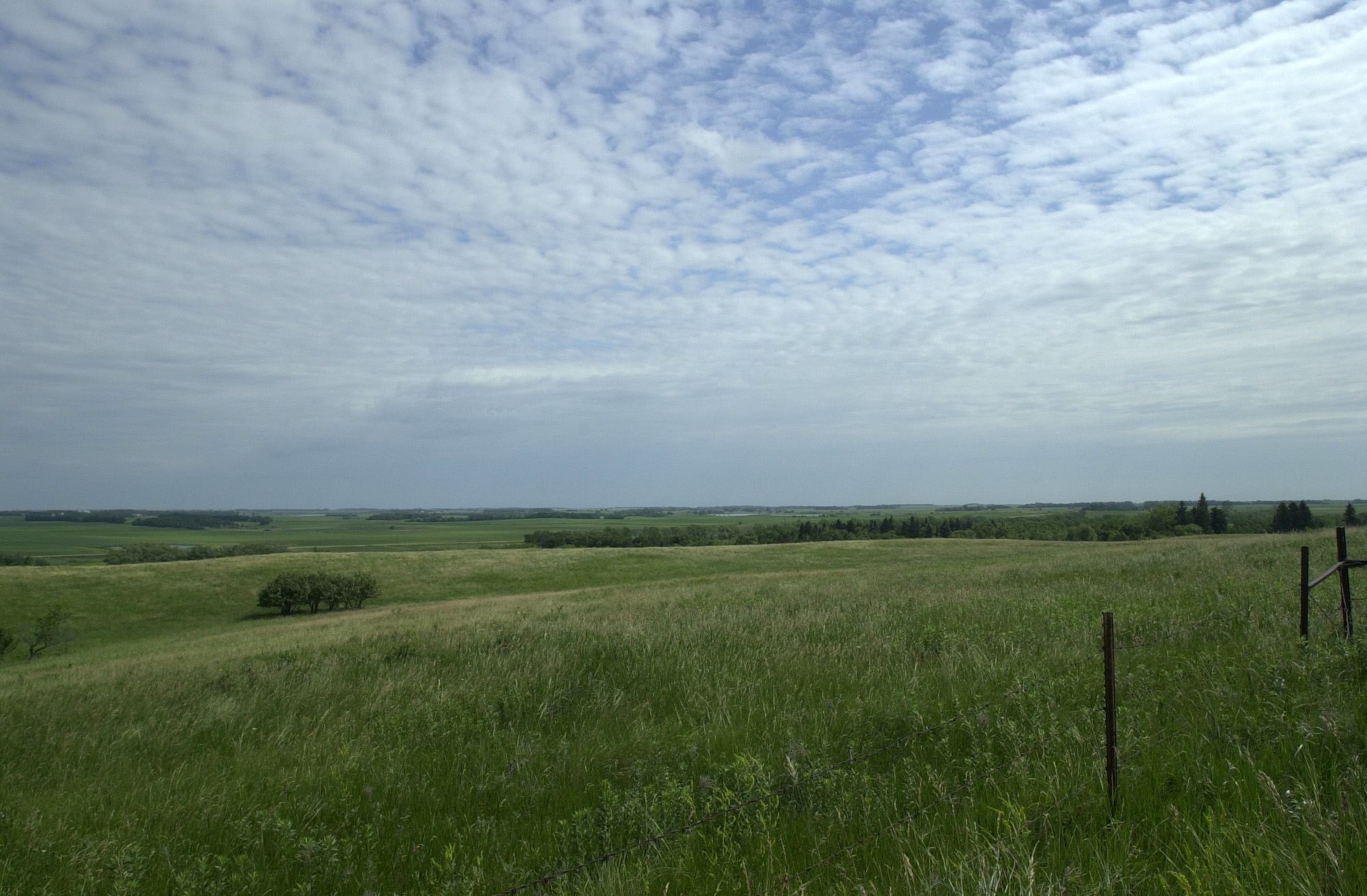
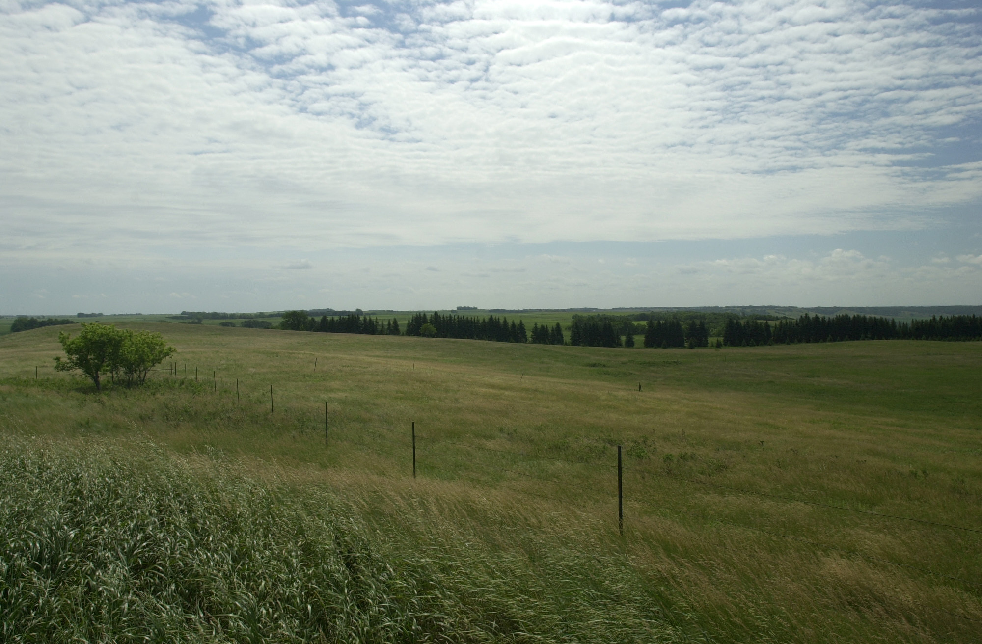
Gentle waves of grass match the gentle waves of earth in this view east from Standing Rock near the Sheyenne River Valley.
Public Domain. Photo by Mat Leffler-Schulman of FHWA
Download Original (2000 x 1312 pixels, 666.1 KB)
-
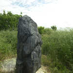
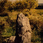
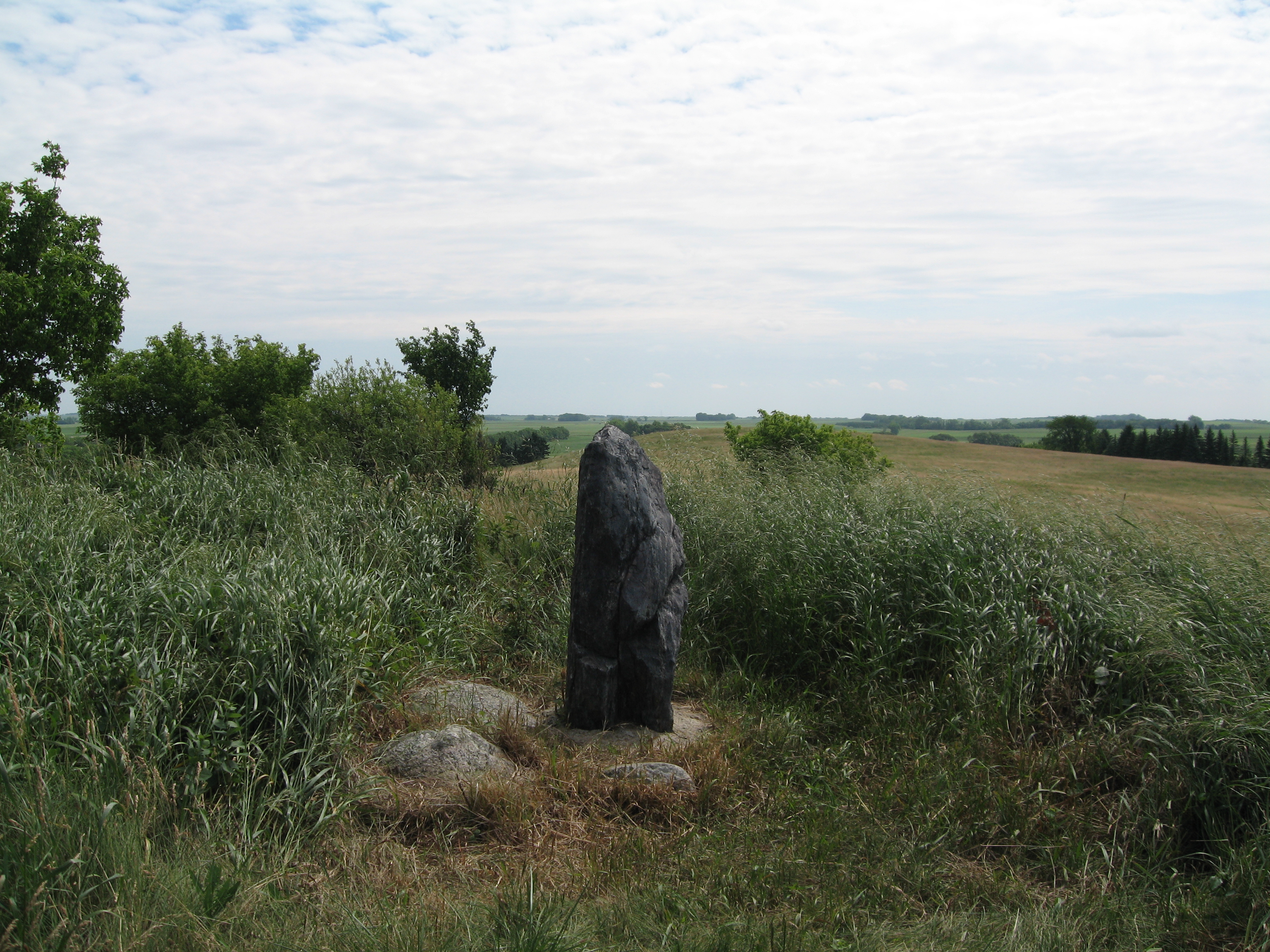
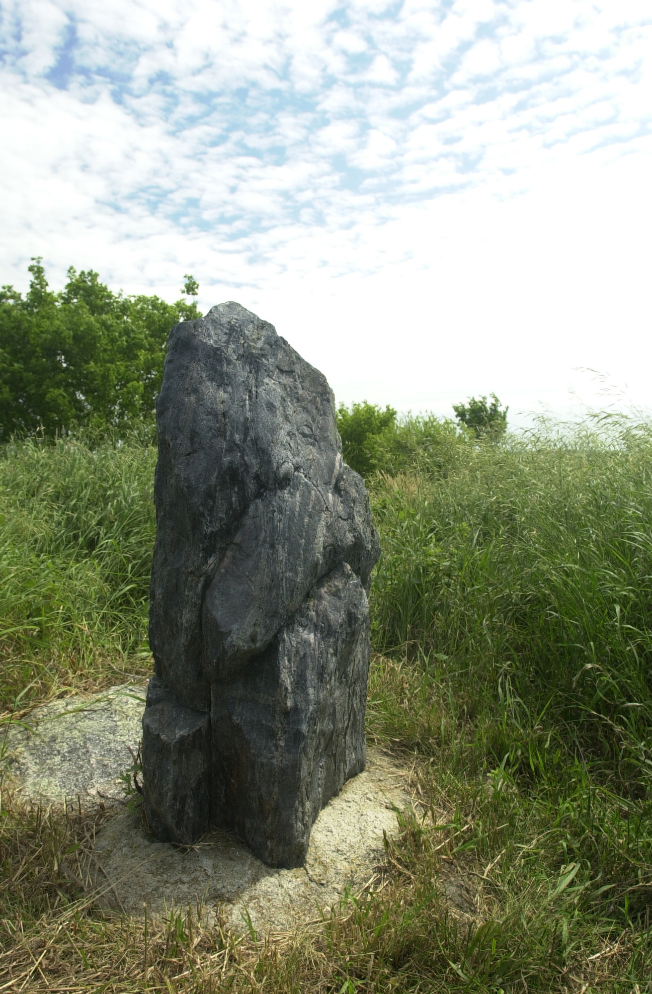
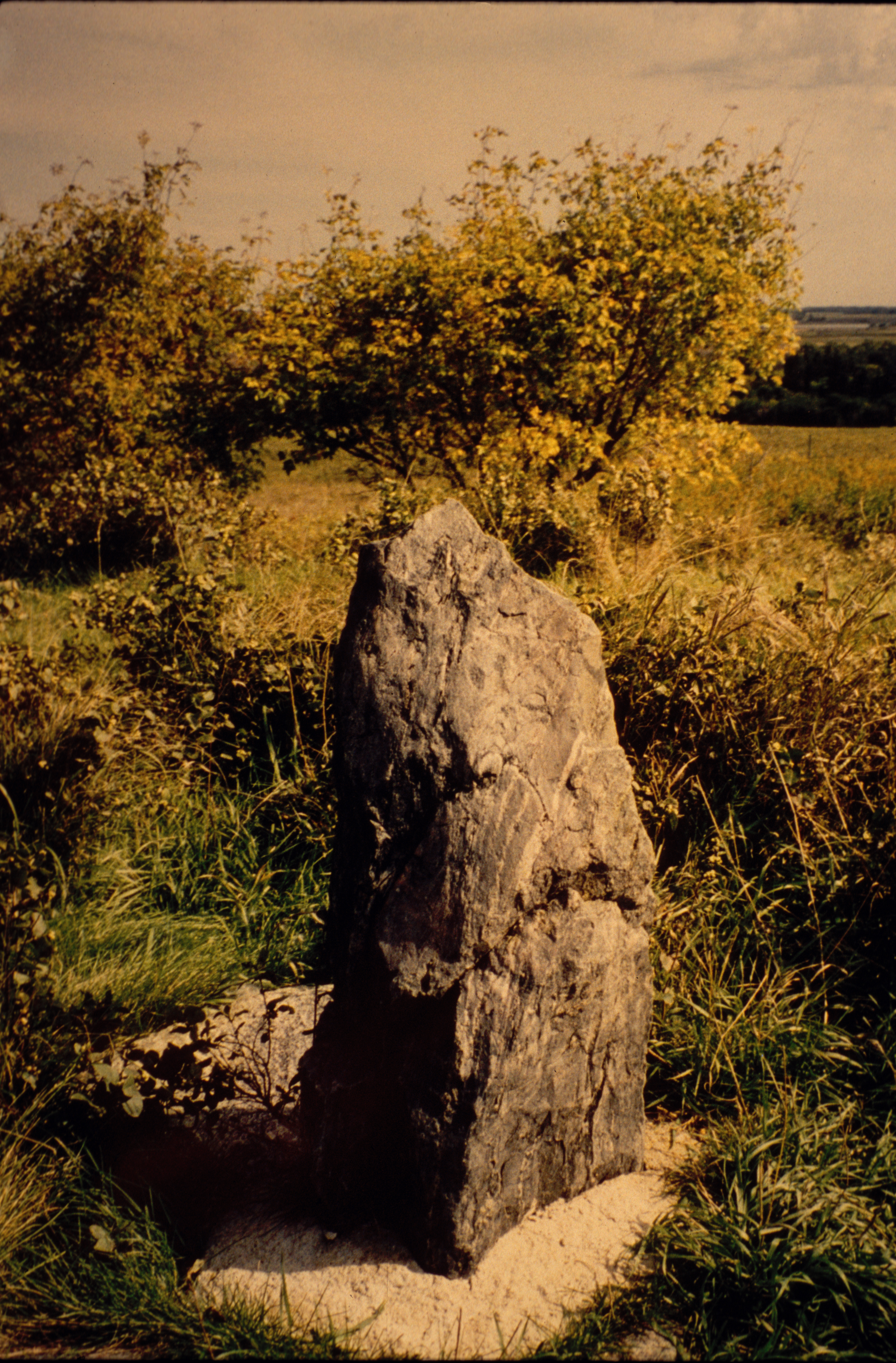
A weathered gray rock stands like a pillar, placed by an ancient civilization for purposes unknown to us today.
Public Domain. Photo by Mat Leffler-Schulman of FHWA
Download Original (1312 x 2000 pixels, 841.4 KB)
-
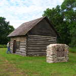
Viewed through trees, the log cabin built by Theodore Slattum in 1879 stands to show the humble beginnings of this Norwegian immigrant who eventually became one of the most prosperous farmers in Ransom County.
Public Domain. Photo by Mat Leffler-Schulman of FHWA
Download Original (2000 x 1312 pixels, 1328.4 MB)
-
Dovetail joints highlight the fine workmanship that helped this century-old cabin remain standing to the present day.
Public Domain. Photo by Mat Leffler-Schulman of FHWA
Download Original (2000 x 1312 pixels, 1327.5 MB)
-
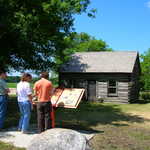
Visitors to the Slattum Cabin read about its history, and how pioneers on the prairie leavened their hard life with a little fun.
Public Domain. Photo by S. Clyde
Download Original (2288 x 1712 pixels, 758.4 KB)
-
The hills west of Fort Ransom State Historic Site are not only a fine view, but hold an ancient mystery -- a rock covered with strange petroglyphs whose purpose and meaning are lost to us today.
Public Domain. Photo by Mat Leffler-Schulman of FHWA
Download Original (2000 x 1312 pixels, 830.1 KB)
-
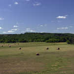
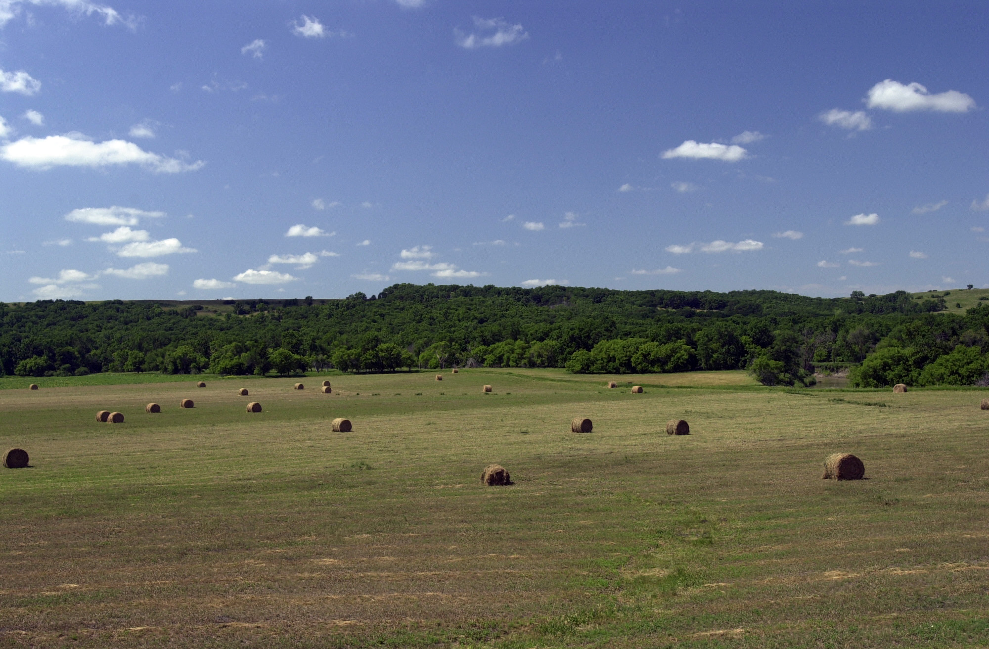
Bales of hay like giant rolls sit drying in a hayfield on the Sheyenne River Valley Scenic Byway somewhere north of the Preston Church site.
Public Domain. Photo by Mat Leffler-Schulman of FHWA
Download Original (2000 x 1312 pixels, 827.4 KB)
-
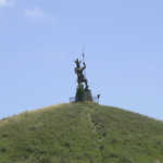
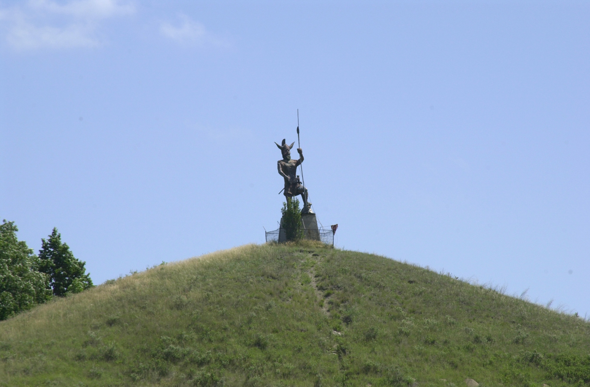
A statue of a Viking warrior stands on top of Pyramid Hill as a monument to the predominently Scandinavian ancestry of those who settled this region at the turn of the 20th Century.
Public Domain. Photo by Mat Leffler-Schulman of FHWA
Download Original (2000 x 1312 pixels, 545.2 KB)
-
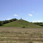
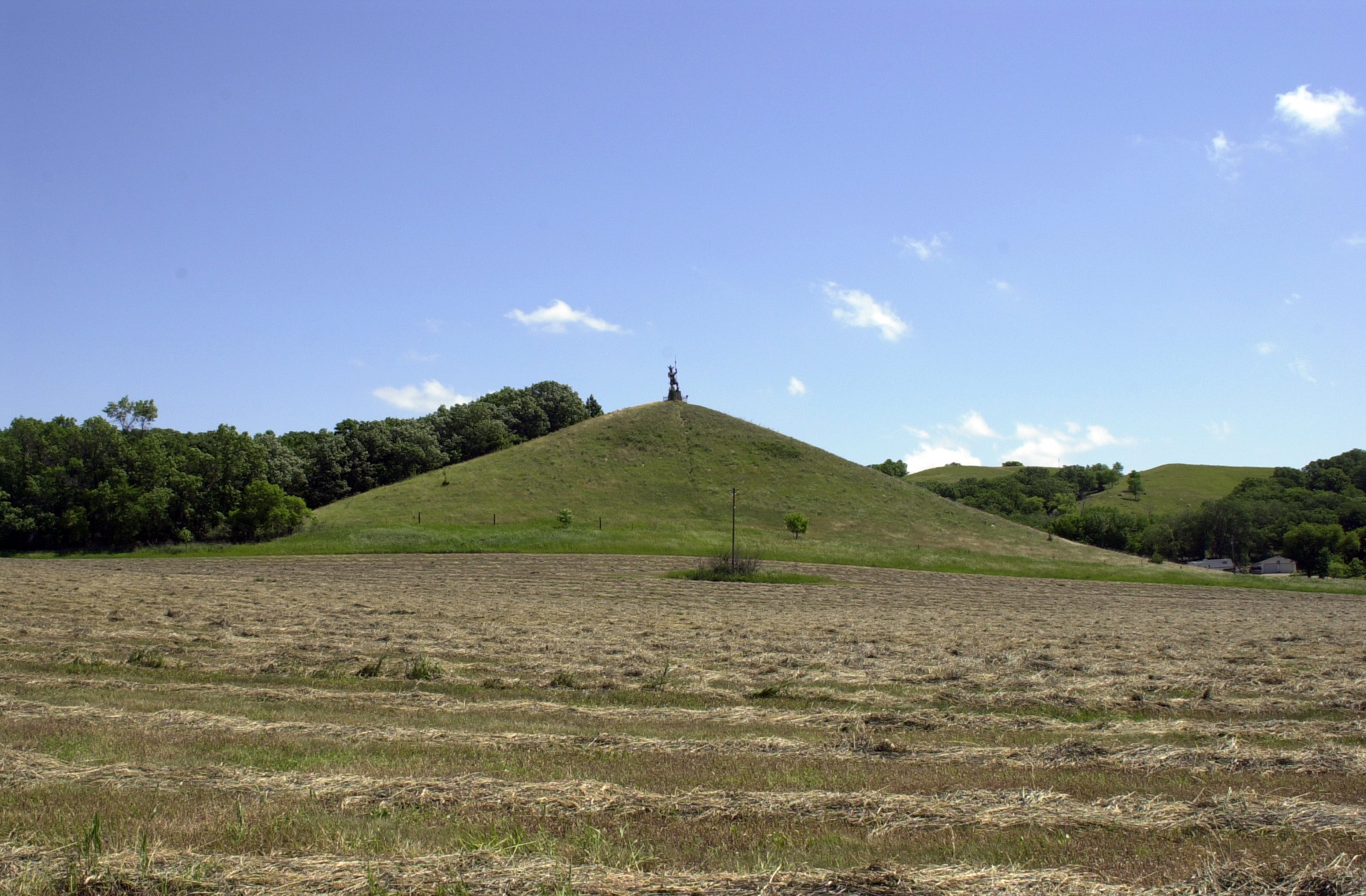
The distinctive shape of Pyramid Hill lends credence to the legends about its hiding the remains of an ancient civilization.
Public Domain. Photo by Mat Leffler-Schulman of FHWA
Download Original (2000 x 1312 pixels, 887.0 KB)
-
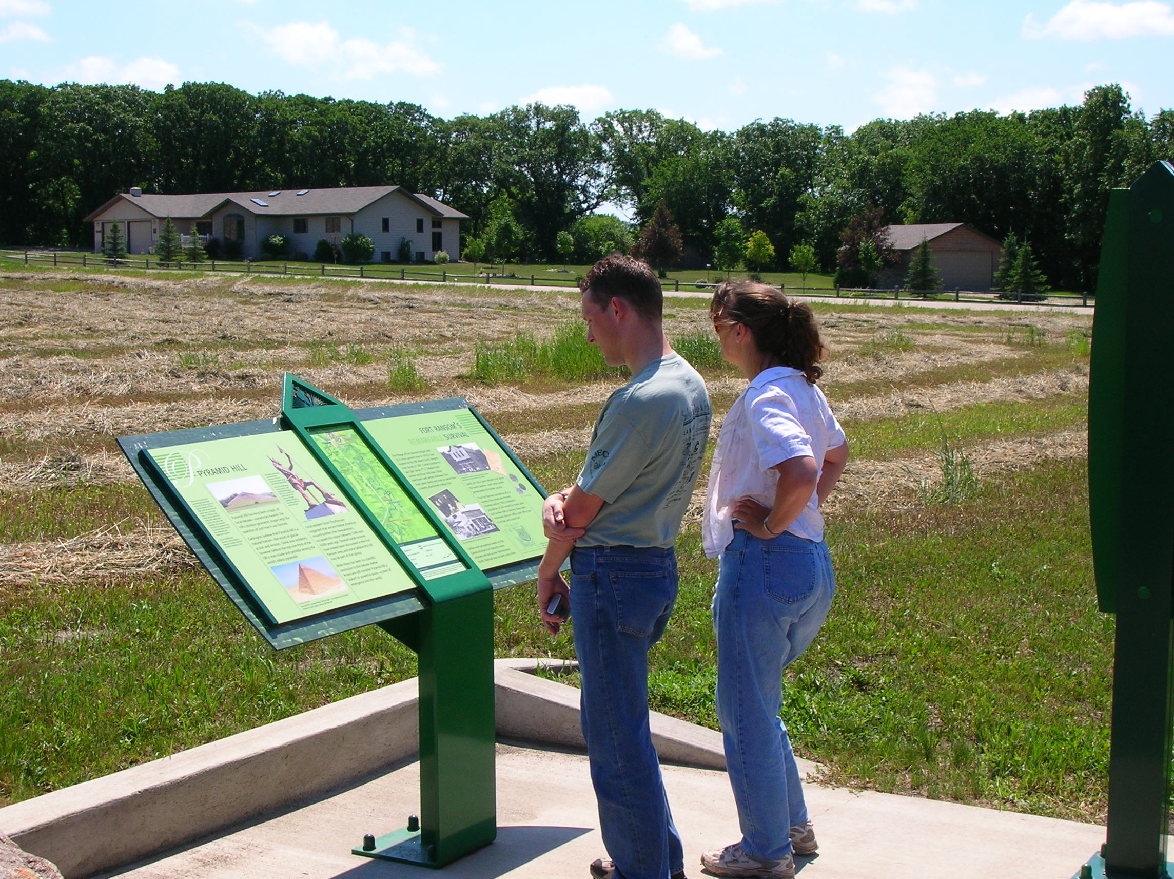
Two travelers find the legends of Pyramid Hill fascinating.
Public Domain. Photo by S. Clyde
Download Original (2288 x 1712 pixels, 748.7 KB)
-
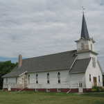
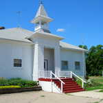
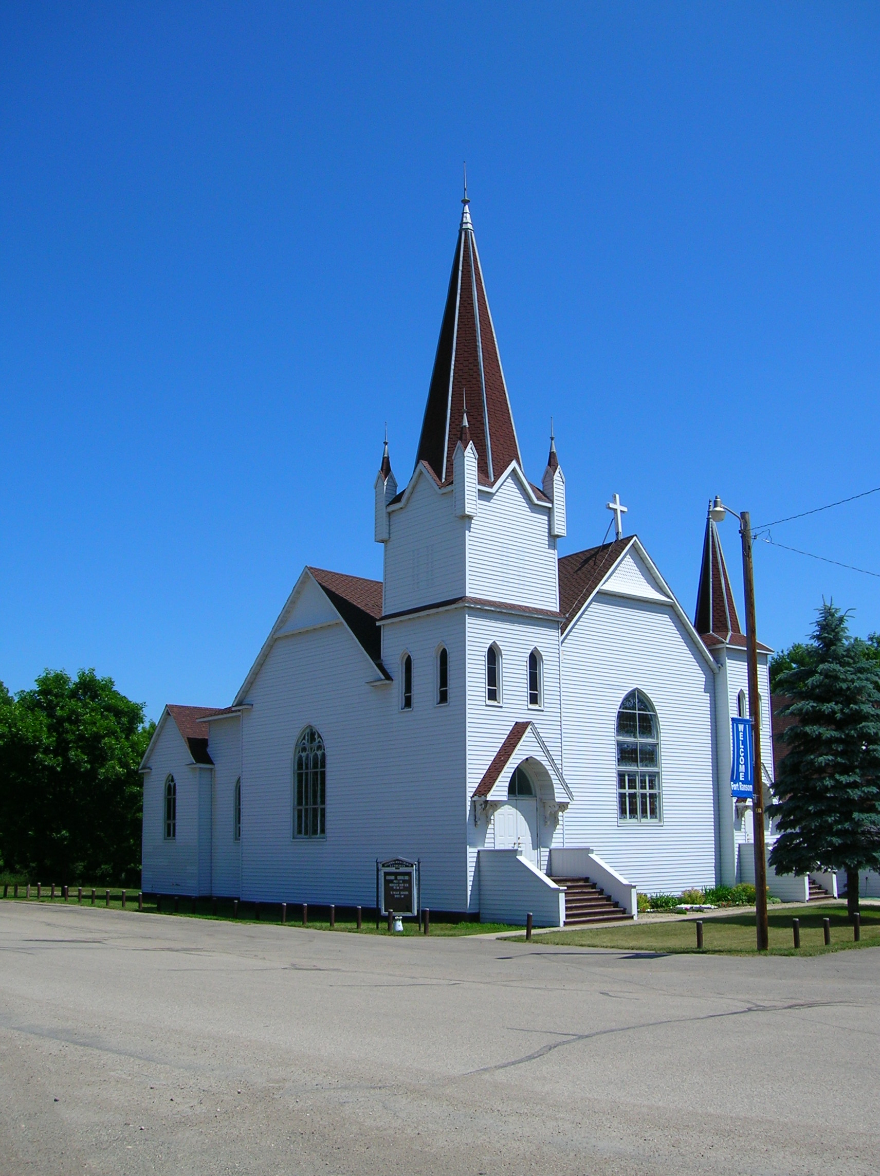
This white church with its distinctive gray steeple was built in the 1890s after the death of a local resident revealed the need for a local church and congregation to conduct funeral services. The church is one of the few in the area with an old, working pipe organ.
Public Domain. Photo by Mat Leffler-Schulman of FHWA
Download Original (1312 x 2000 pixels, 600.3 KB)
-
This white church with its distinctive gray steeple was built in the 1890s after the death of a local resident revealed the need for a local church and congregation to conduct funeral services. The church is one of the few in the area with an old, working, pipe organ.
Public Domain. Photo by S. Clyde
Download Original (1712 x 2288 pixels, 766.4 KB)
-
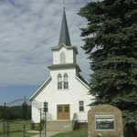
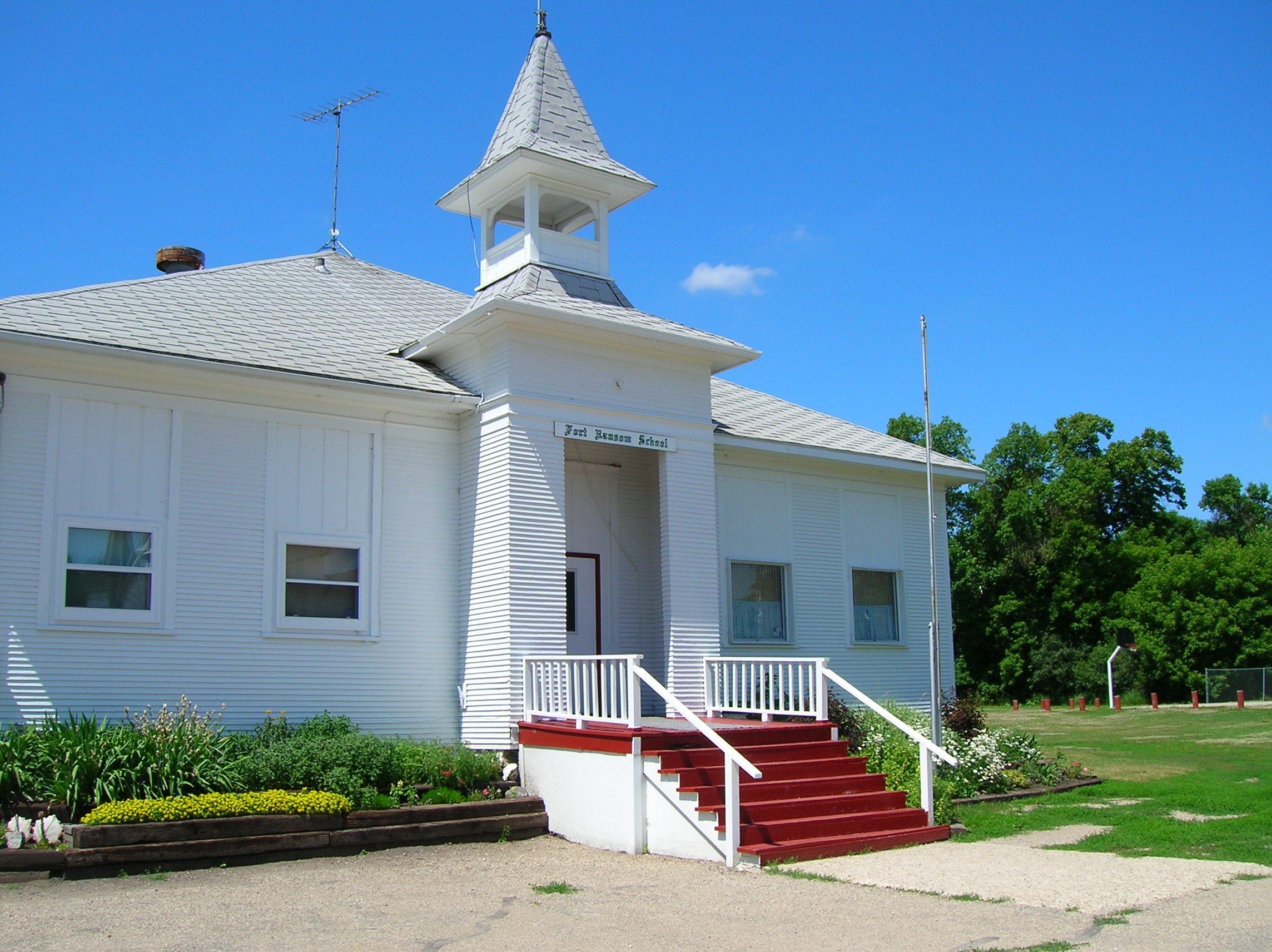
This historic schoolhouse in Fort Ransom (just north of the T.J. Walker Historic District) is just across the street from the Standing Rock Norwegian Evangelical Church.
Public Domain. Photo by S. Clyde
Download Original (2288 x 1712 pixels, 811.9 KB)
-
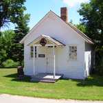
The bell hanging over the entrance to this small white one-room schoolhouse would have summoned the students to class.
Public Domain. Photo by S. Clyde
Download Original (2288 x 1712 pixels, 1177.5 MB)
-
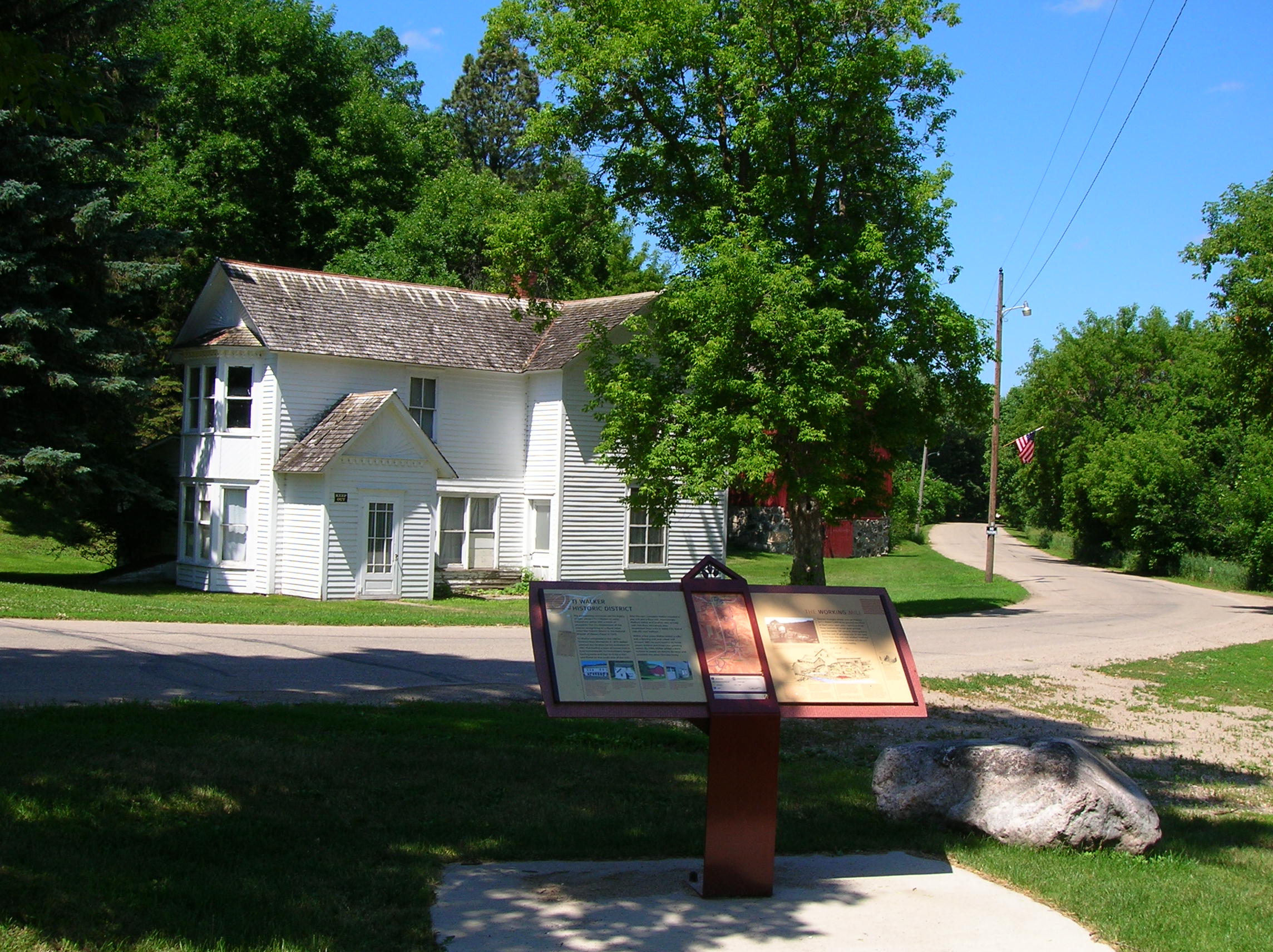
According to the sign before this home in the T.J. Walker Historic District, the Walker home "contains many decorative elements not usually seen in more common farm homes -- a sure sign of Mr. Walker's success in business."
Public Domain. Photo by S. Clyde
Download Original (2288 x 1712 pixels, 743.2 KB)
-
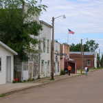
Travelers stroll down historic Main Street Kathryn, with its framework shopfronts of white siding.
Public Domain. Photo by S. Clyde
Download Original (2288 x 1712 pixels, 708.1 KB)
-
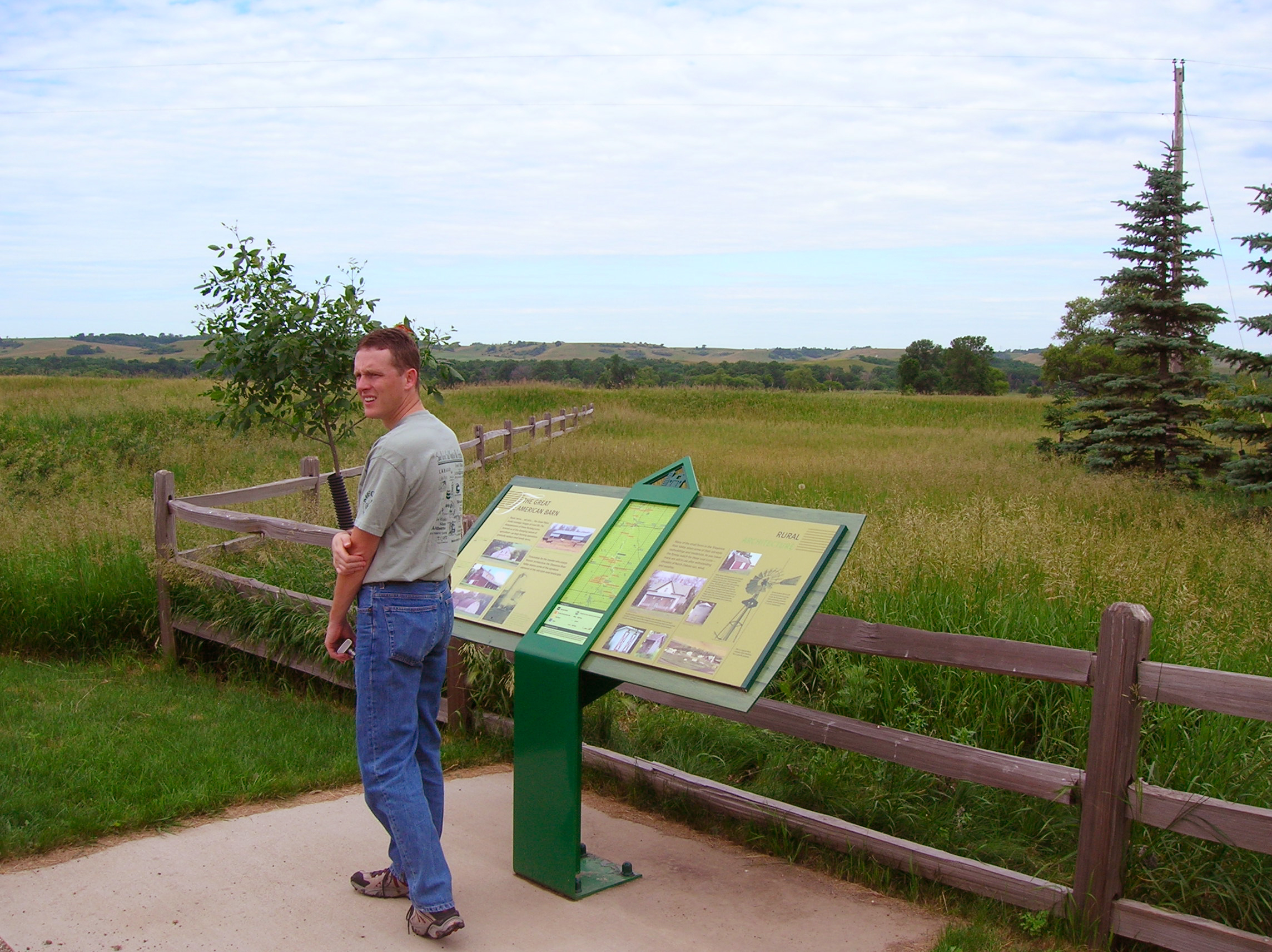
A traveler looks at one of the nearby barns after reading about rural architecture in the area.
Public Domain. Photo by S. Clyde
Download Original (2288 x 1712 pixels, 1906.8 MB)
-
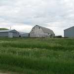
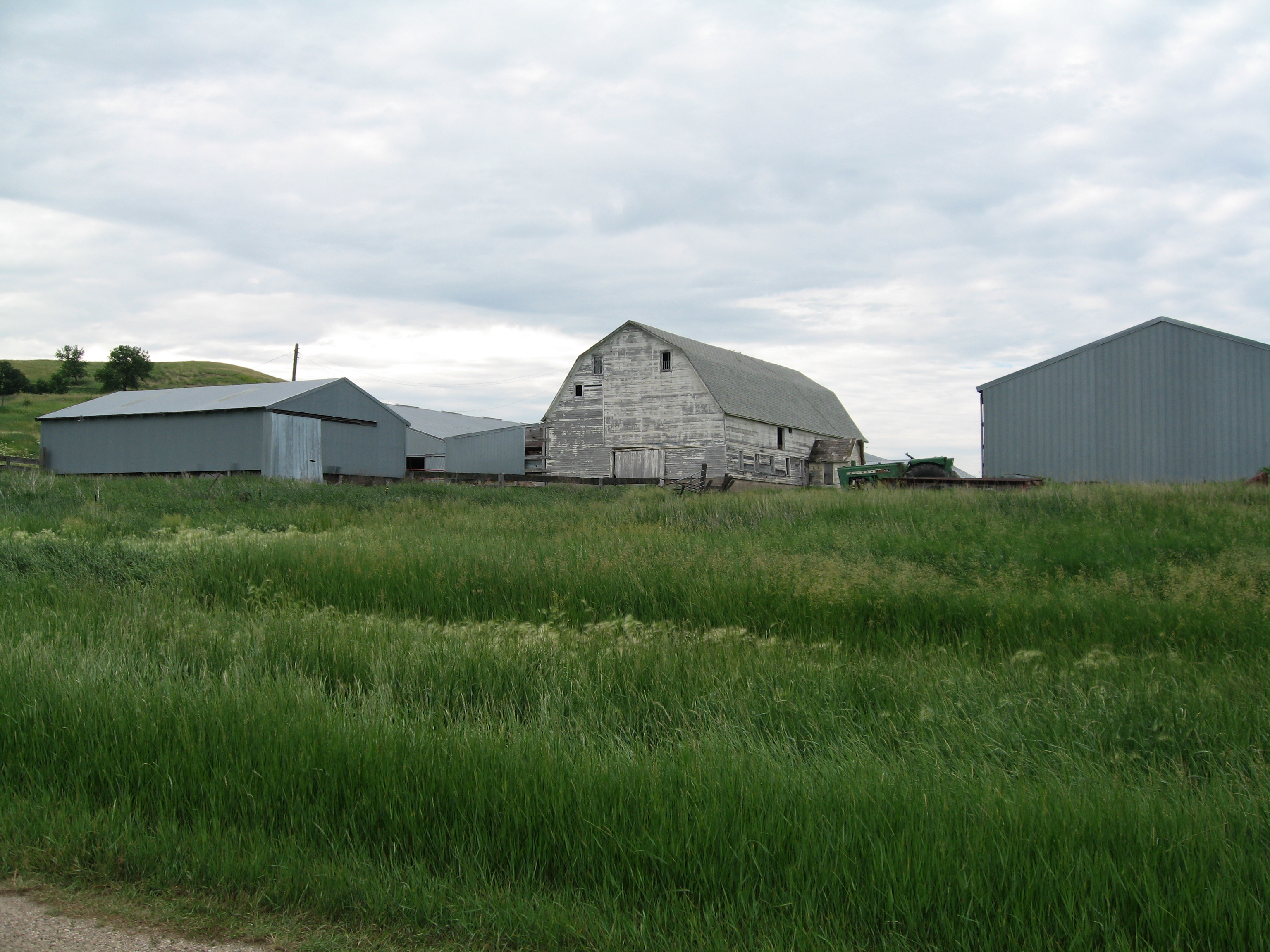
A white barn is one of many to be found in the Sheyenne River Valley. Agriculture remains one of the primary livelihoods in the area.
Public Domain. Photo by Pete Deffendol of NSBO
Download Original (3072 x 2304 pixels, 3788.6 MB)
-
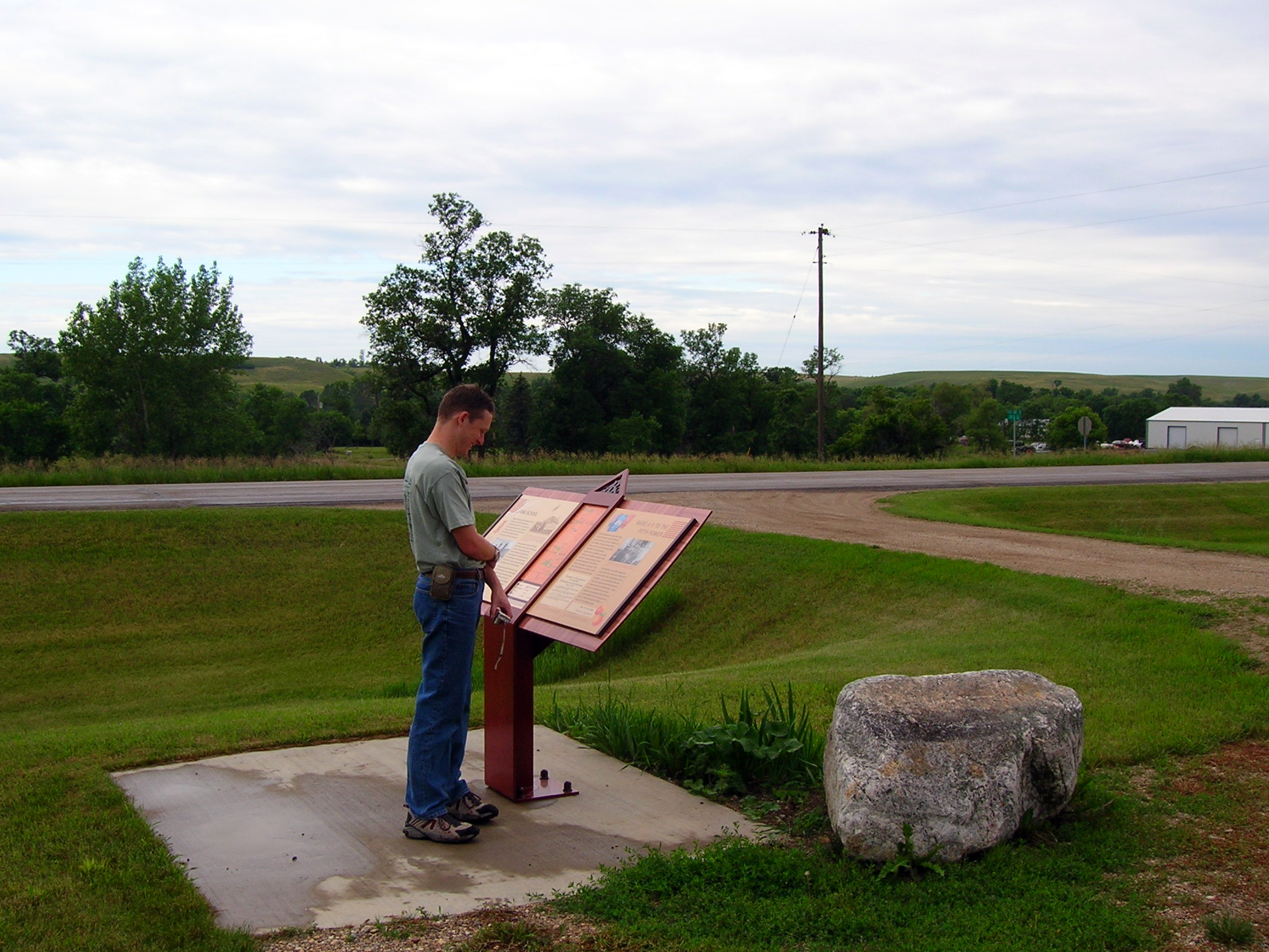
A traveler reads an interpretive sign about King School along the Sheyenne River Valley Scenic Byway.
Public Domain. Photo by S. Clyde
Download Original (2089 x 1567 pixels, 2036.8 MB)
-
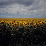
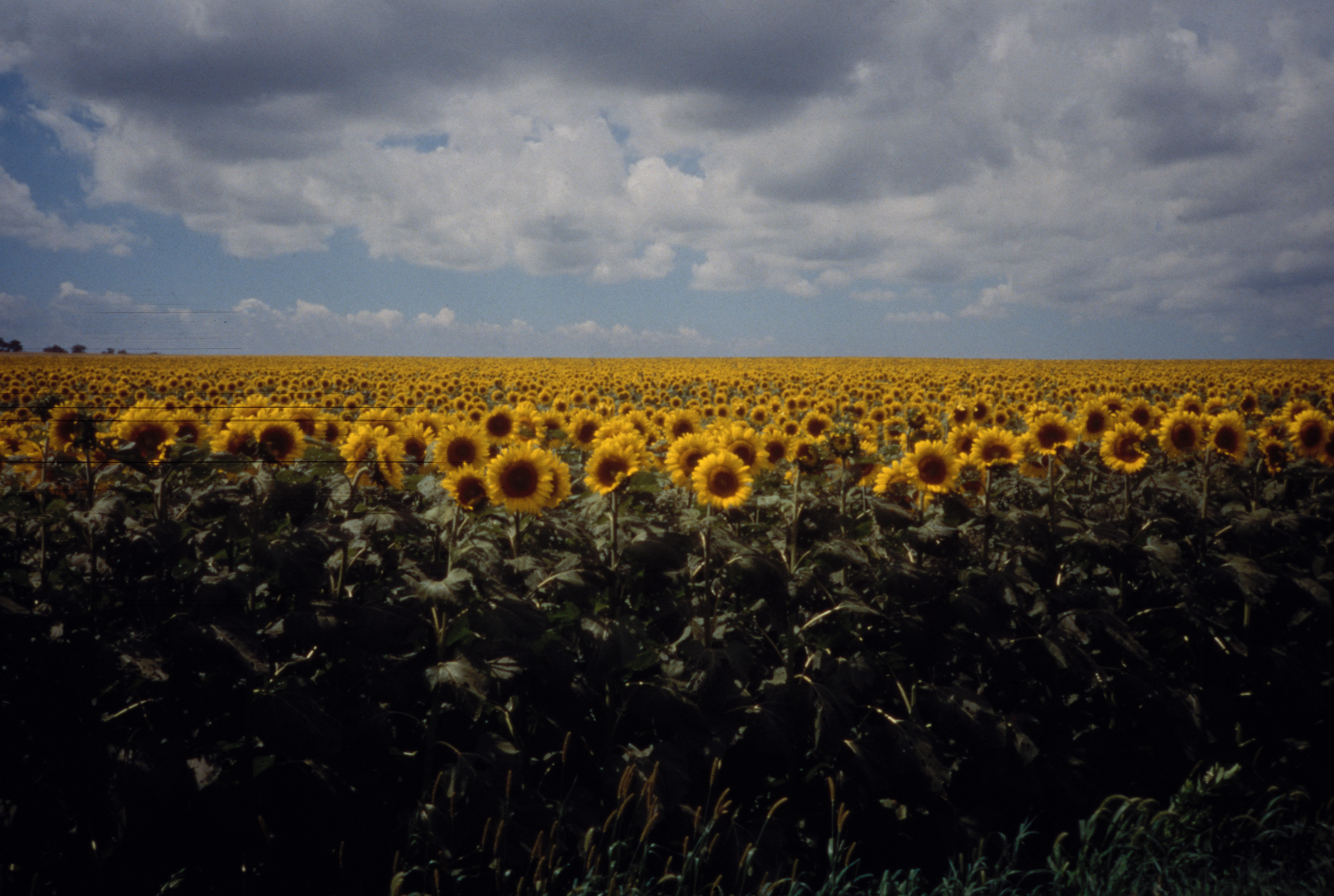
Vast fields of bright sunflowers, small grains, hay, and pastureland form intricate patterns on the land. Agriculture is the number-one form of land use along the byway.
© 2001 Janet E. Schultz.
Download Original (3587 x 2411 pixels, 6253.5 MB)
-
Glimpse Lake Ashtabula from the Sheyenne River Valley Scenic Byway.
Public Domain. Photo by S. Clyde
Download Original (2000 x 1312 pixels, 1207.2 MB)
-
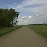
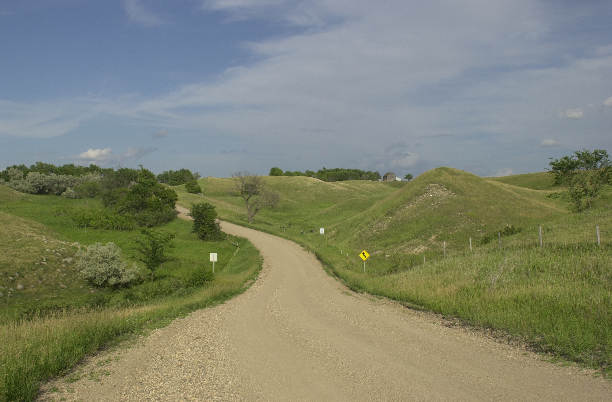
The Sheyenne River Valley Scenic Byway heads east through gentle hills and farmland near Lake Ashtabula.
Public Domain. Photo by S. Clyde
Download Original (2000 x 1312 pixels, 1167.3 MB)
-
A traveler points out some city sights from the vantage point of the City Park Footbridge in Valley City.
Public Domain. Photo by S. Clyde
Download Original (3008 x 2000 pixels, 3006.7 MB)
-
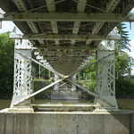
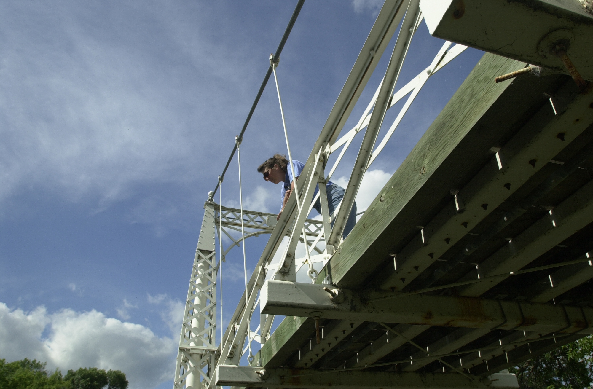
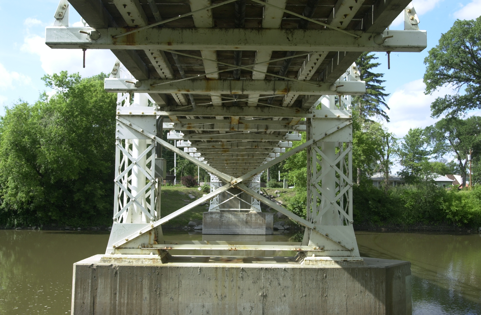
Look up from underneath the VCSU footbridge to see its construction.
Public Domain. Taken by Mat Leffler-Schulman of NSBO
Download Original (2000 x 1312 pixels, 1370.3 MB)
-
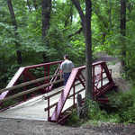
Three travelers cross beneath one of the supports of the VCSU Footbridge, a suspension bridge that links the residences of Valley City with the University, over the Sheyenne River.
Public Domain. Photo by S. Clyde
Download Original (3008 x 2000 pixels, 2989.7 MB)
-
Known as Inyun Bosndata by the Sioux Indians who consider it sacred, the four-foot tall rock is an inverted cone shape that stands on a complex of prehistoric burial mounds dating from the Woodland Period.
© 1999 Janet E. Schultz.
Download Original (2393 x 3640 pixels, 7974.3 MB)
-

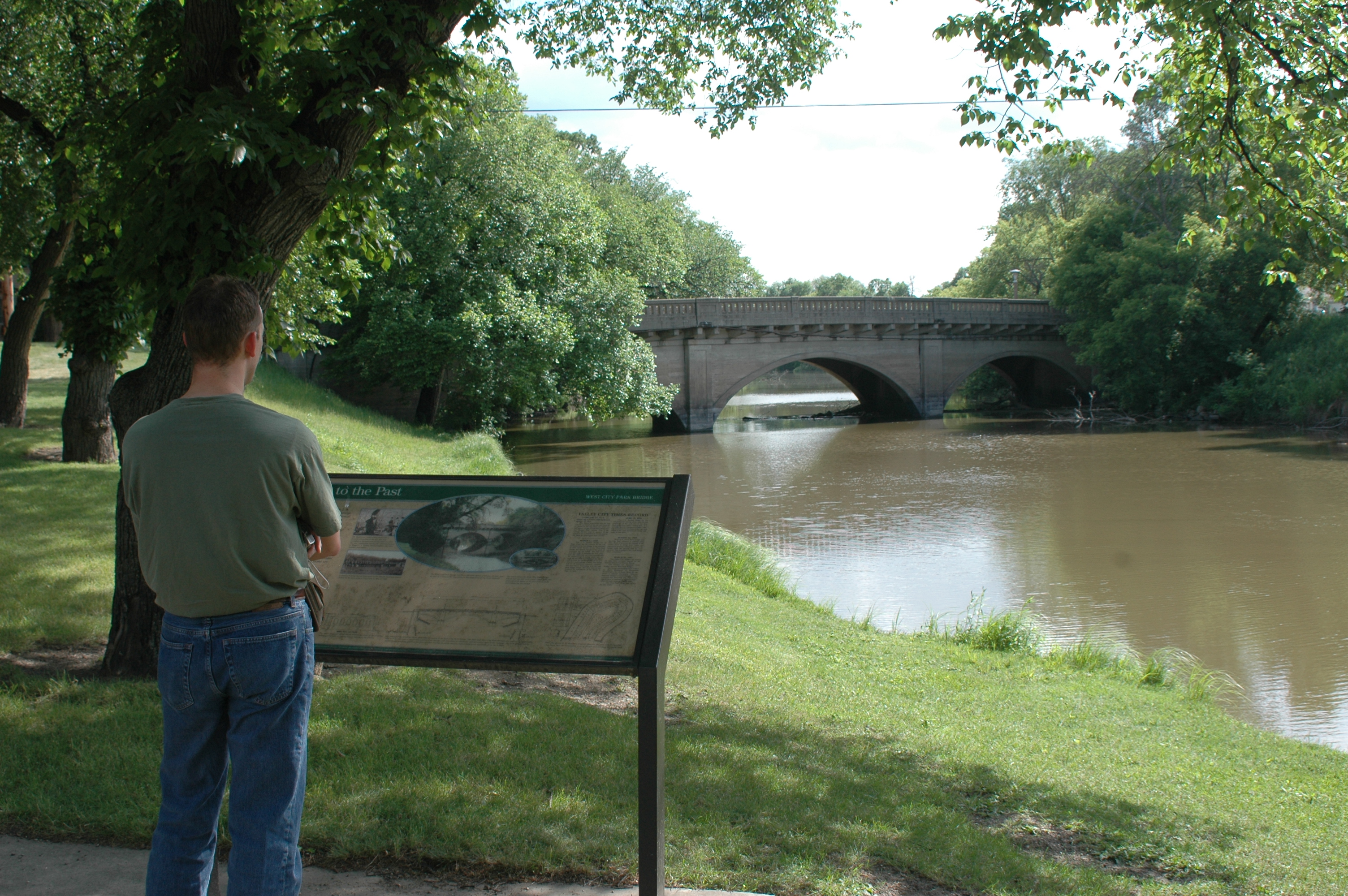
A traveler reads about the West City Park Bridge in Valley City.
Public Domain. Photo by S. Clyde
Download Original (3008 x 2000 pixels, 3084.4 MB)
-
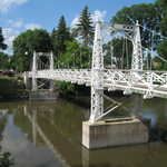
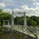
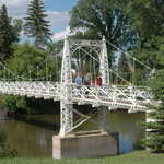
The Valley City Historic Bridges Tour also highlights some manmade developments that contribute to the quality of the corridor's visual environment. A few highlights of the tour are this beautiful white suspension bridge, one of a kind in North Dakota. Also the Highline Bridge, one of the longest and highest single-track railroad bridges in the nation, a unique quality for a plains state. These and six other bridges make up the Historic Bridges Tour.
© 2000 Janet E. Schultz.
Download Original (3600 x 2441 pixels, 5605.0 MB)
-

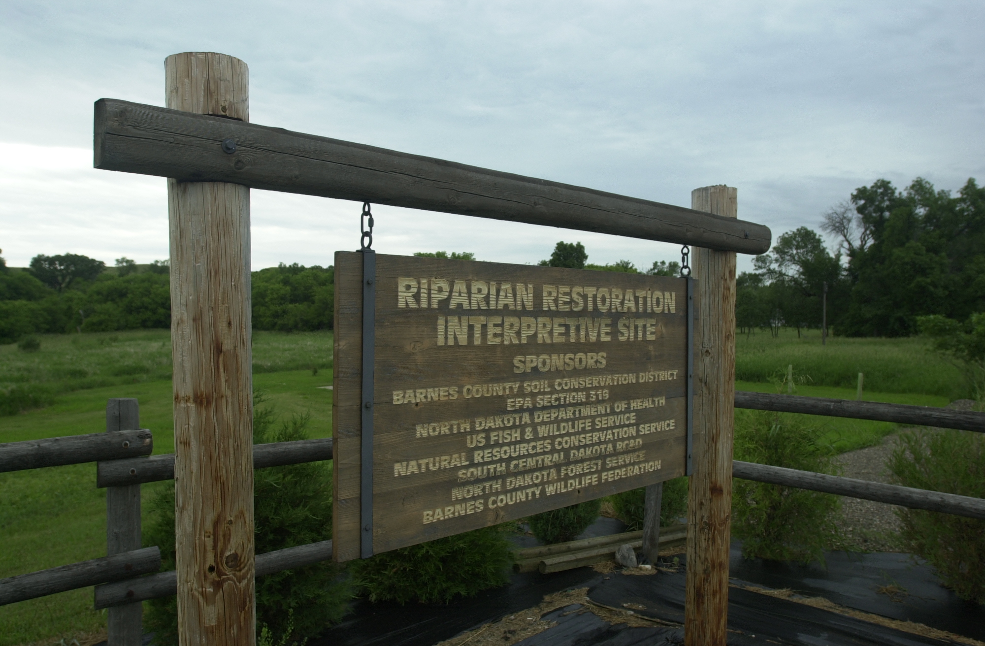
A wooden sign gives credit to the many sponsors who have made the restoration of this part of the Sheyenne River Valley possible.
Public Domain. Photo by Mat Leffler-Schulman of FHWA
Download Original (2000 x 1312 pixels, 1243.9 MB)
-
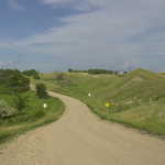
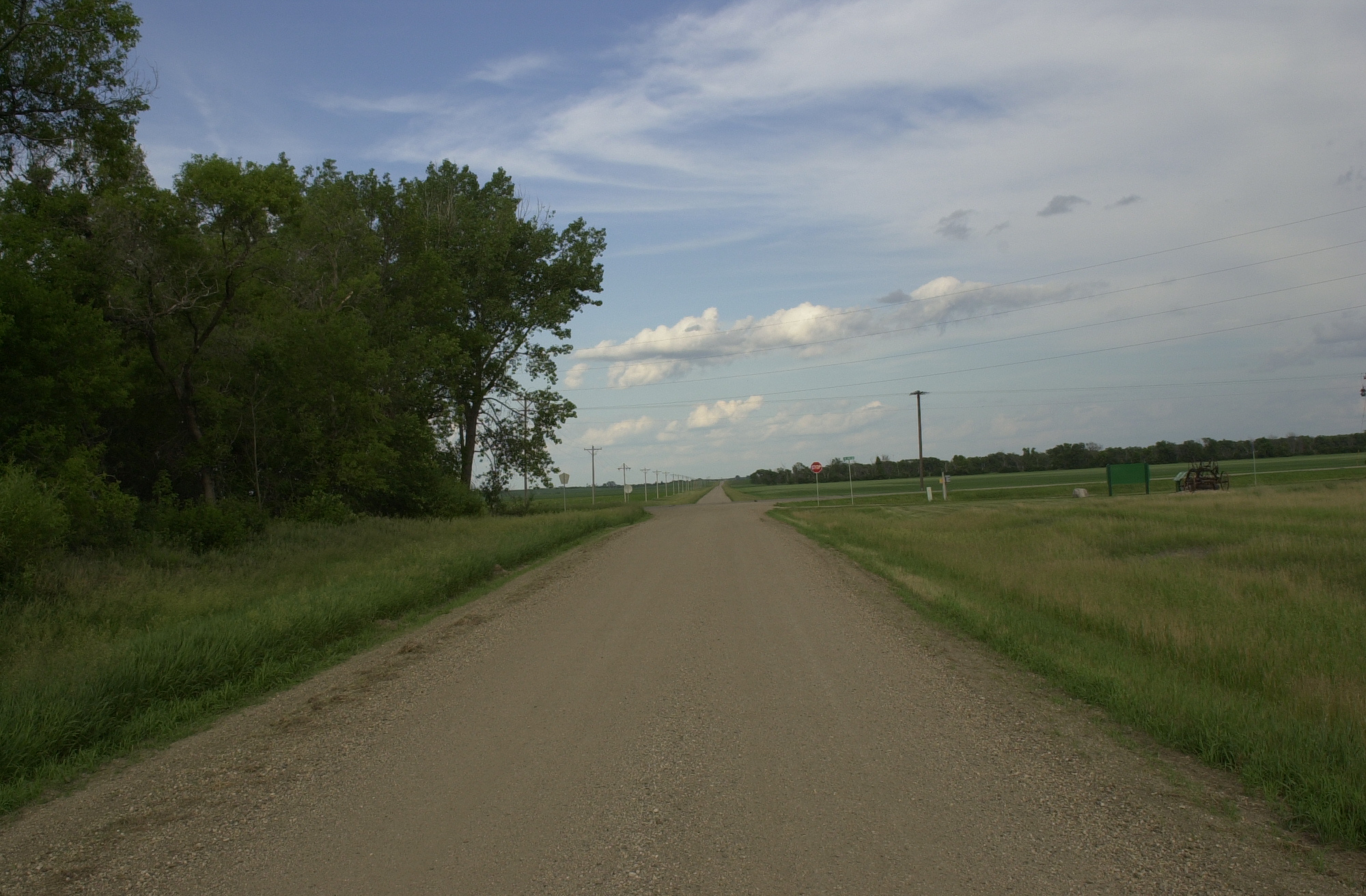
The gravel surface of State Route 17 meets State Route 21 at the end of the Sheyenne River Valley Scenic Byway.
Public Domain. Photo by S. Clyde
Download Original (2000 x 1312 pixels, 1133.8 MB)
-
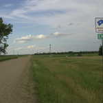
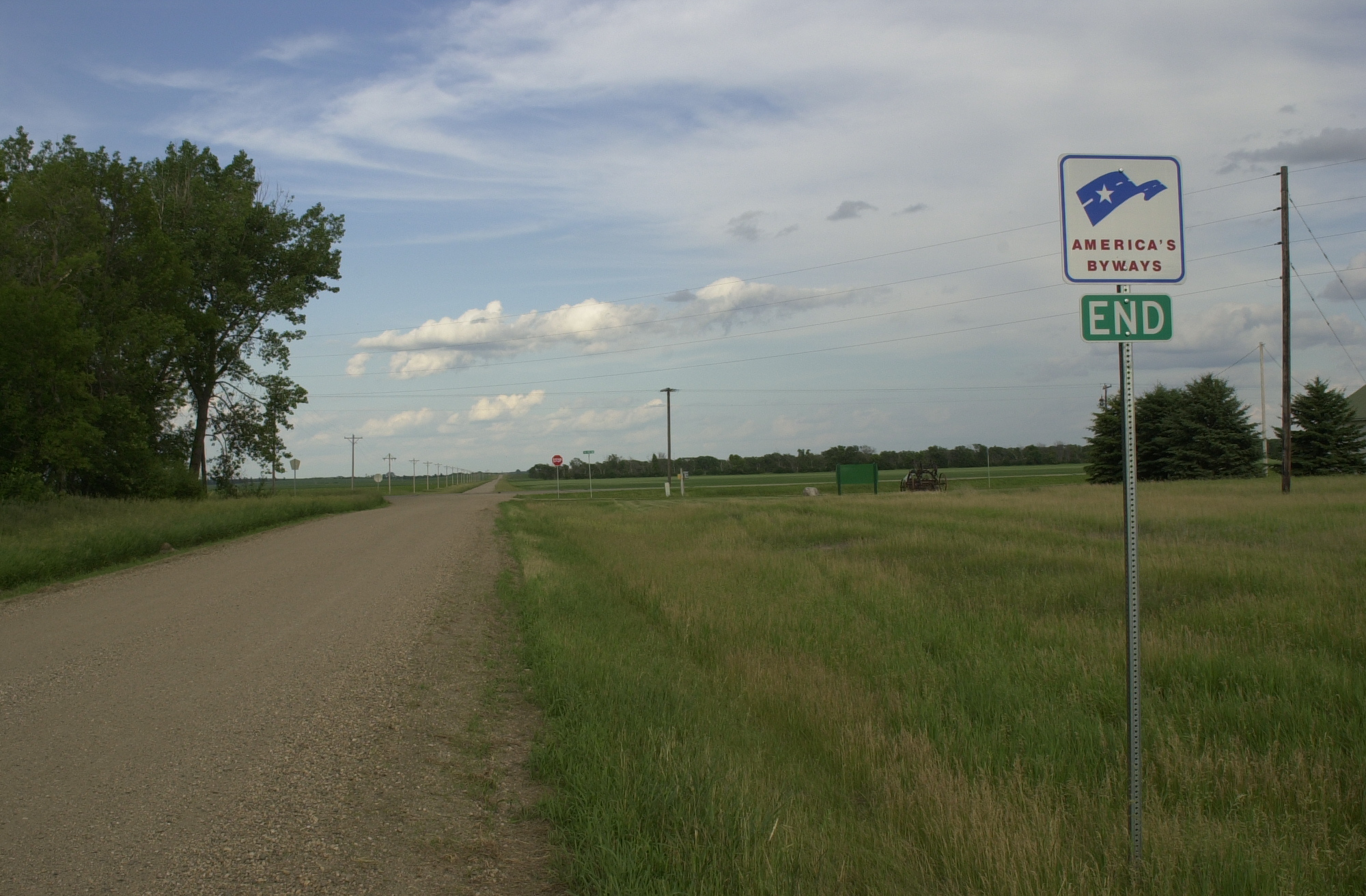
The America's Byway sign marks Northern Gateway, the end of the Sheyenne River Valley Scenic Byway, at the junction of SR 17 and SR 21.
Public Domain. Photo by S. Clyde
Download Original (2000 x 1312 pixels, 1132.7 MB)
-
A family is eager to start their journey on the Sheyenne River Valley Scenic Byway after learning all about it at the Rosebud Visitor Center in Valley City.
Public Domain. Photo by Mat Leffler-Schulman of FHWA
Download Original (2000 x 1312 pixels, 1259.4 MB)
-

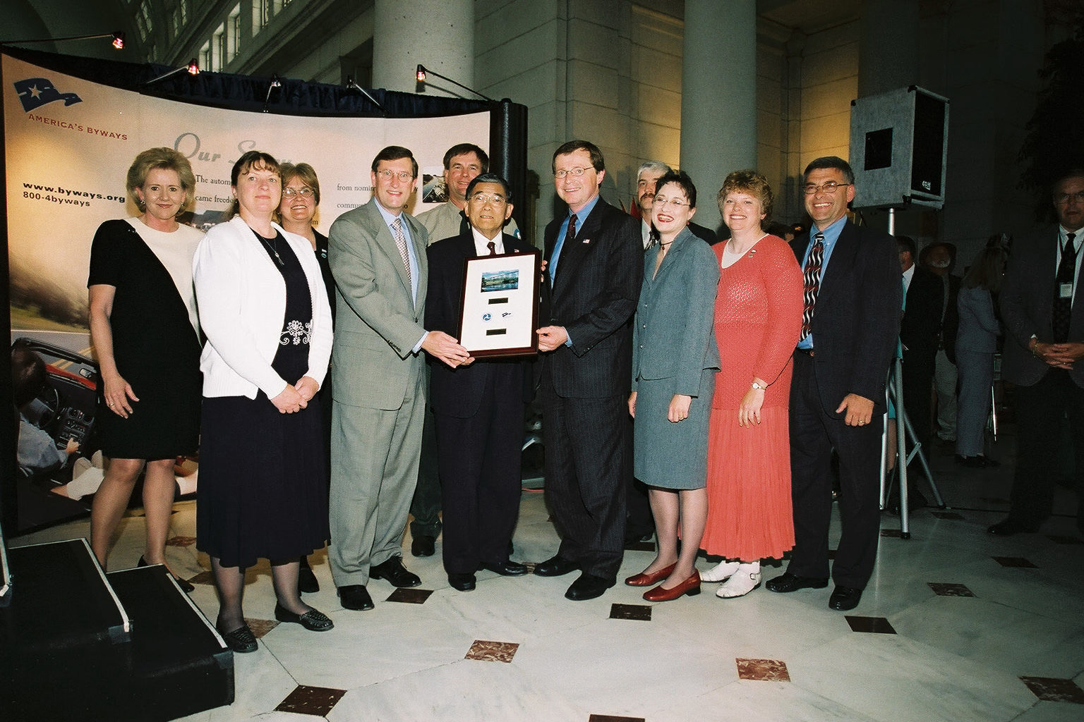
North Dakota's Sheyenne River Valley Scenic Byway receives their designation plaque at the Designation 2002 event at Union Station in Washington DC.
 © June 2002 FHWA-NSB.
Download Original (1536 x 1024 pixels, 429.3 KB)