
Outer Banks Scenic Byway
All Photos (34)
-
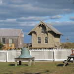
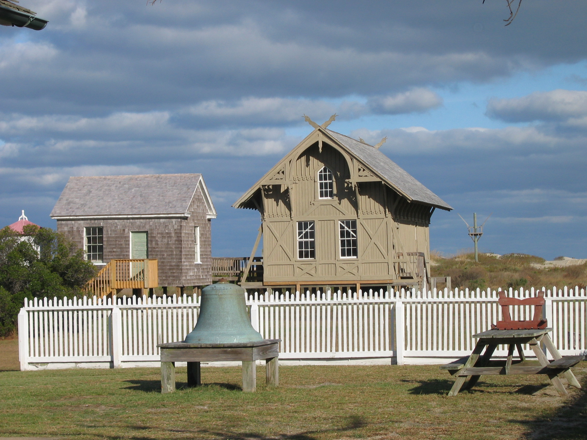
This “life-saving station,” with its decorative board-and-batten walls and elaborately styled eaves, clearly indicates European medieval inspirations for its designer, the architect Frances W. Chandler. It is the only one to survive unchanged of the first 23 built along the Atlantic coast in 1874. The boxy brown-shingled building to the left is an 1892 cookhouse.
Public Domain.
Download Original (2272 x 1704 pixels, 1041.9 MB)
-
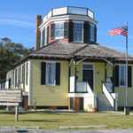
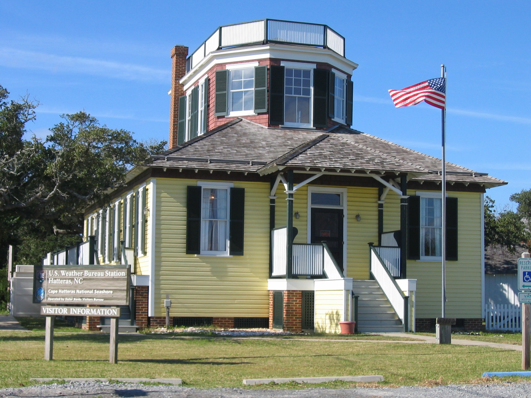
The enormous second-story railed belvedere atop the shingled hip roof of the first story of this odd-looking building along the Outer Banks Scenic Byway was the observation tower and deck for the U.S. Weather Service in 1902. Now the Hatteras Welcome Center, it has been restored to its original appearance with bright yellow clapboards on the first floor and red painted shingles visible between the dark-green shutters of the second story’s many windows.
Public Domain.
Download Original (2150 x 1613 pixels, 883.5 KB)
-
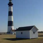
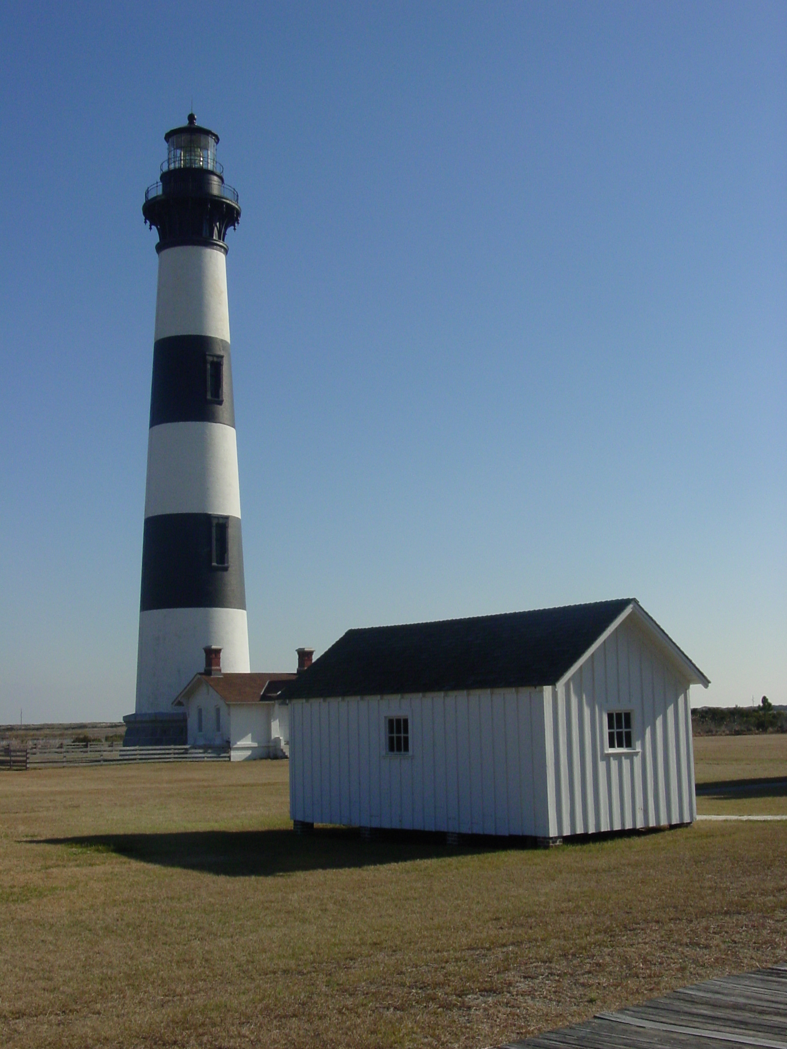
The striking black-and-white Bodie (pronounced Body) Island Lighthouse stands at the north end of Cape Hatteras National Seashore.
© 2004 Georgia Dale Griffiths.
Download Original (1536 x 2048 pixels, 1220.5 MB)
-
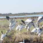
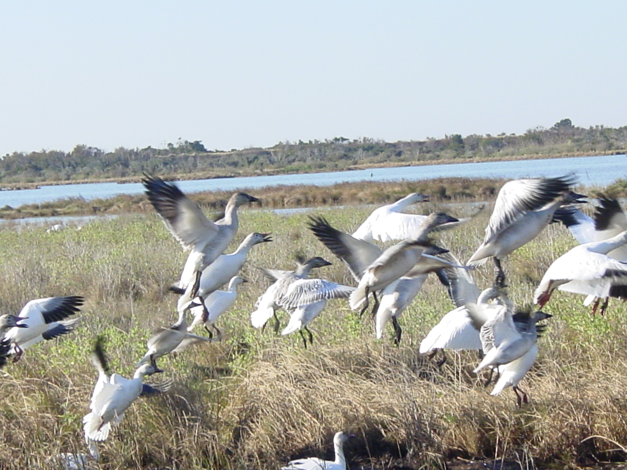
Snow Geese love to winter on the Outer Banks at the Pea Island National Wildlife Refuge.
© 2004 Georgia Dale Griffiths.
Download Original (2048 x 1536 pixels, 1244.9 MB)
-
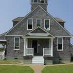
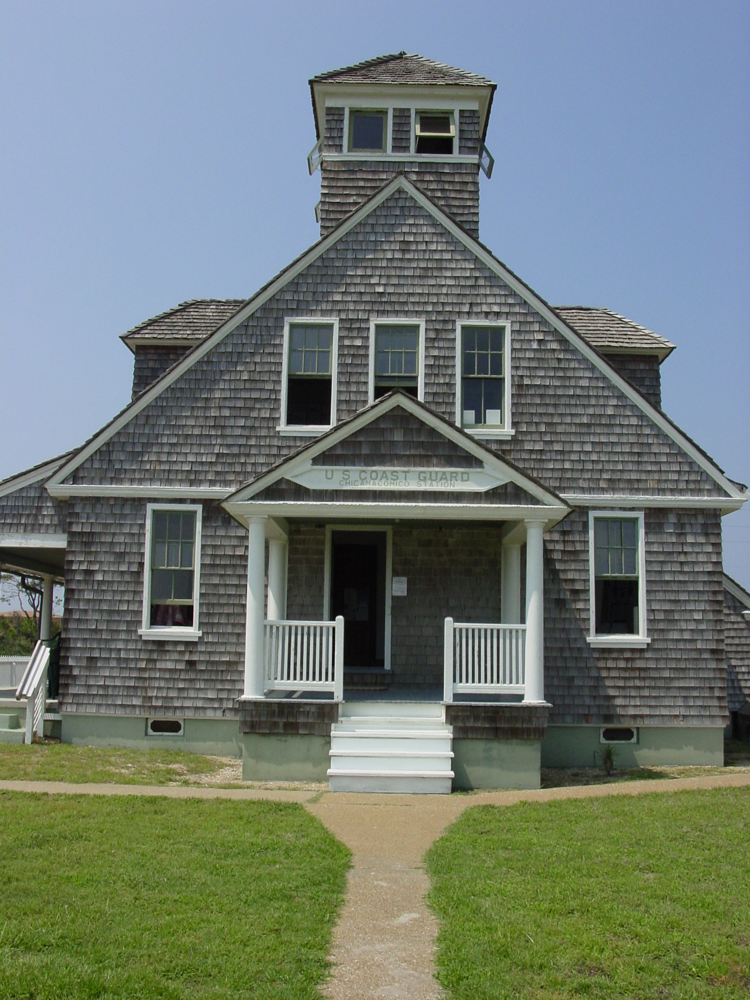
Learn about lifesaving on the Outer Banks at Chicamacomico.
© 2004 Georgia D. Griffiths.
Download Original (1536 x 2048 pixels, 1350.7 MB)
-
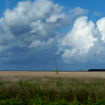
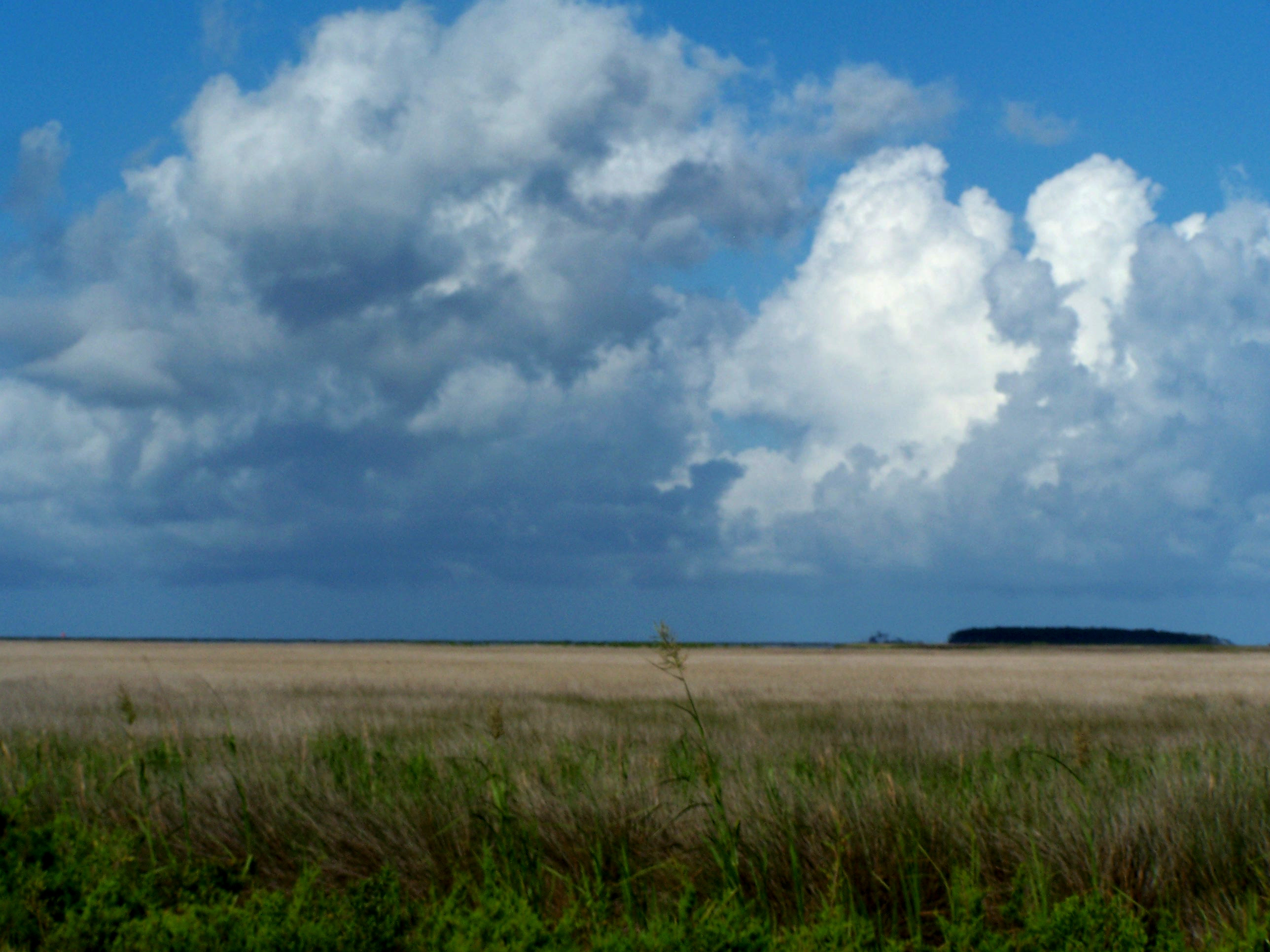
With a marsh extending nearly as far as the eye can see, the sky becomes an enormous canvas for the many moods of the weather. This photo, with its rolling blue, gray and white clouds and dead-level gold and green, captures the sense of big sky and vast lands experienced by visitors as they traverse the great marsh of Cedar Island.
Public Domain.
Download Original (2576 x 1932 pixels, 787.9 KB)
-
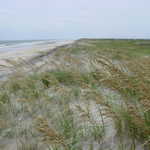
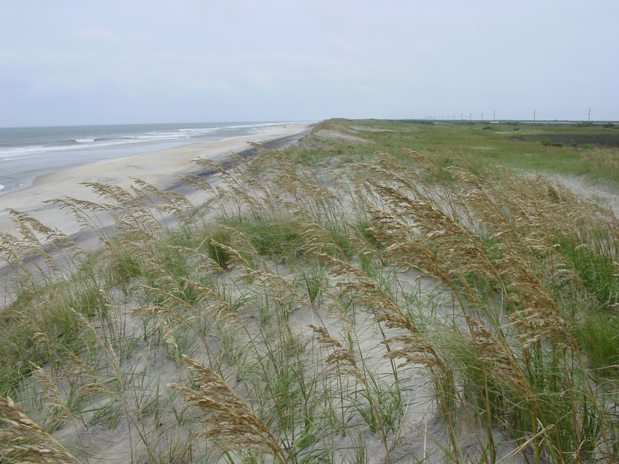
Pea Island National Wildlife Refuge has miles of deserted white sand beaches.
© 2004 Georgia Dale Griffiths.
Download Original (2048 x 1536 pixels, 1406.8 MB)
-

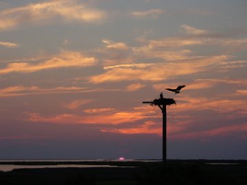
A silhouetted osprey descends to a post at sunset on Pea Island National Wildlife Refuge.
© 2004 Georgia D. Griffiths.
Download Original (360 x 270 pixels, 12.3 KB)
-

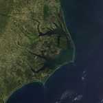
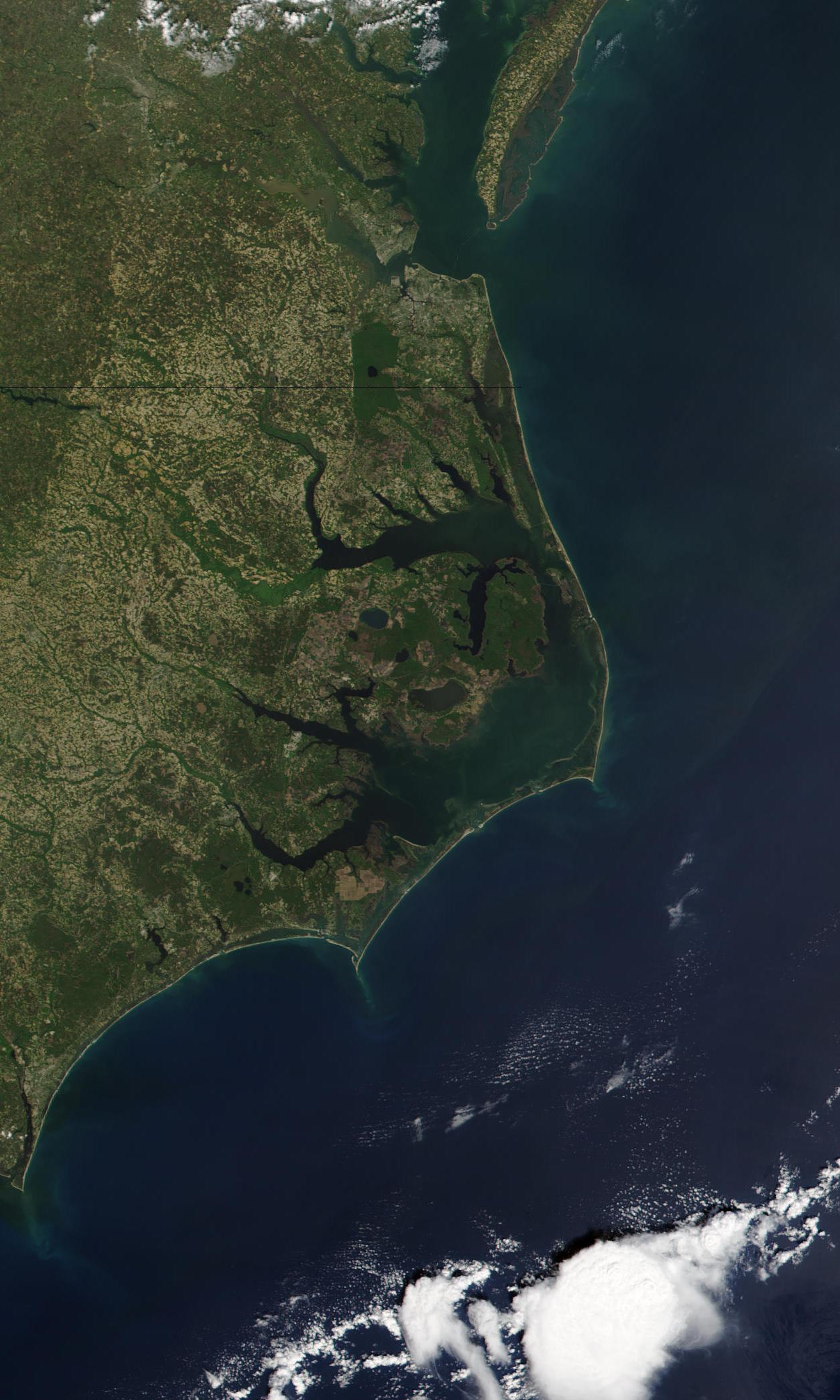
North Carolina’s Outer Banks are a prominent barrier-island landform on the United States’ east coast. A vast green watershed, varied blues of the rivers, sounds and ocean and the white strip of sand edging the islands are the natural world that shapes the unique culture celebrated along the Outer Banks Scenic Byway.
© 2009 NASA and Visible Earth .
Download Original (1260 x 2099 pixels, 289.3 KB)
-
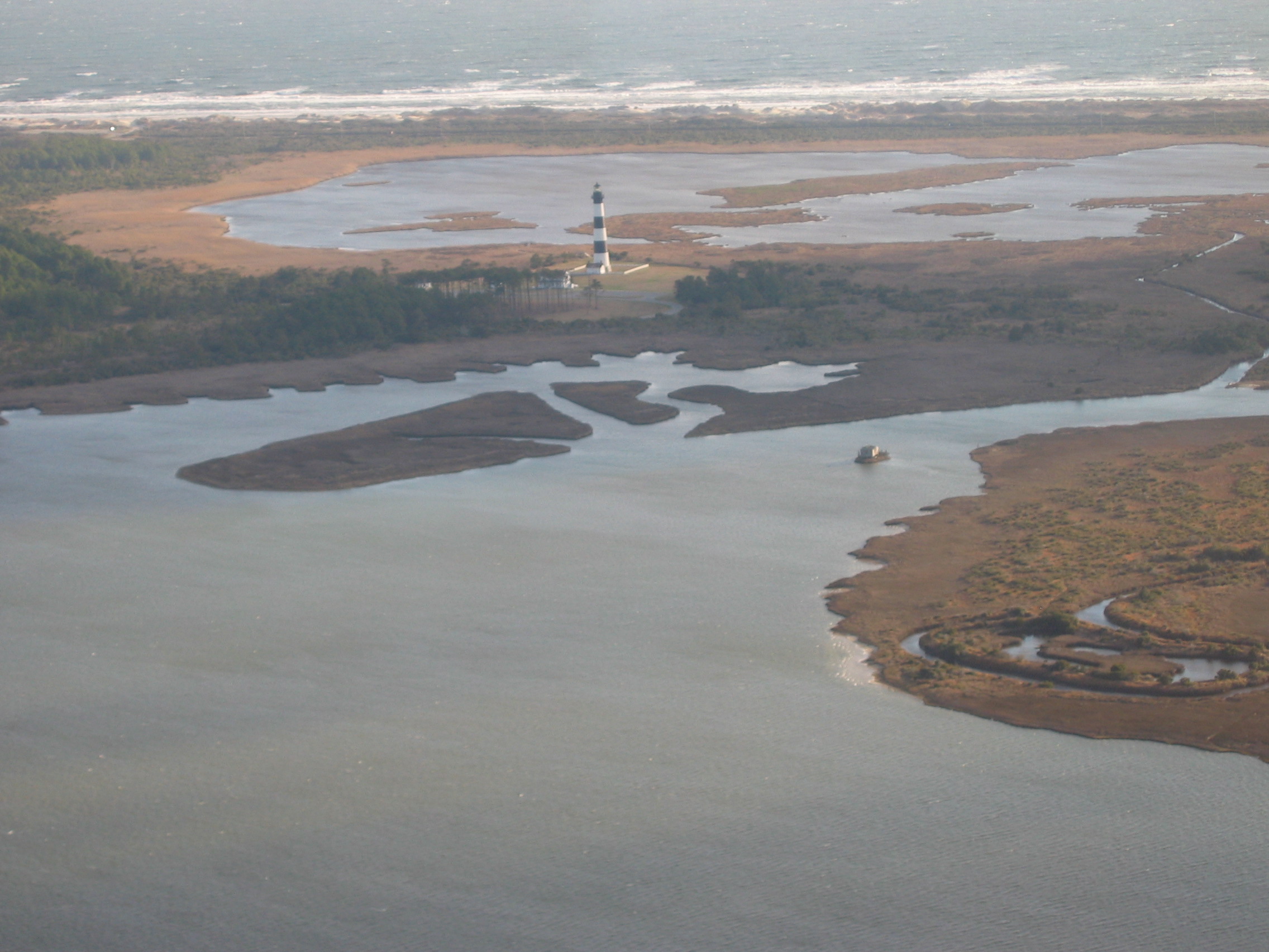
An aerial view reveals the the Outer Banks Scenic Byway’s Bodie Island Light Station from the east. The lighthouse stands stoic with its horizontal black-and-white striped “daymark,” with the white Keepers Quarters and Oil House barely visible to the left. The Atlantic Ocean’s waves create a horizontal fringe of froth in the distance.
Public Domain.
Download Original (2272 x 1704 pixels, 724.2 KB)
-
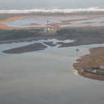
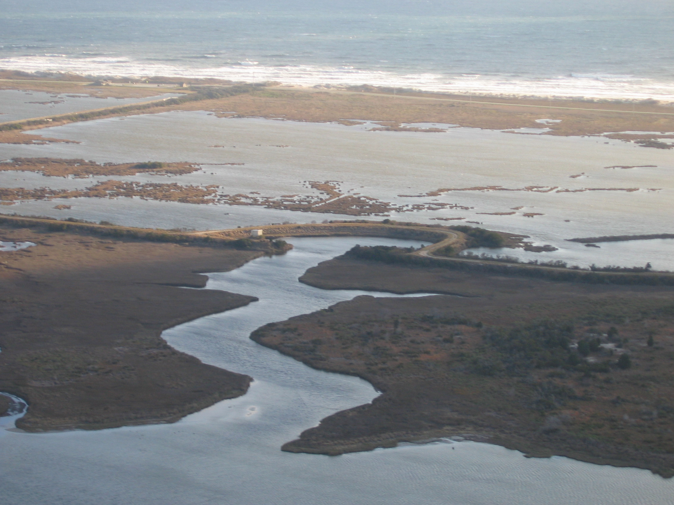
Waterfowl impoundments, constructed by the Civilian Conservation Corps in the 1930s, dominate this view of the Outer Banks Scenic Byway’s Pea Island National Wildlife Refuge. East of this narrow strip of watery land are dunes and a froth of restless white Atlantic waves.
Public Domain.
Download Original (2272 x 1704 pixels, 800.9 KB)
-
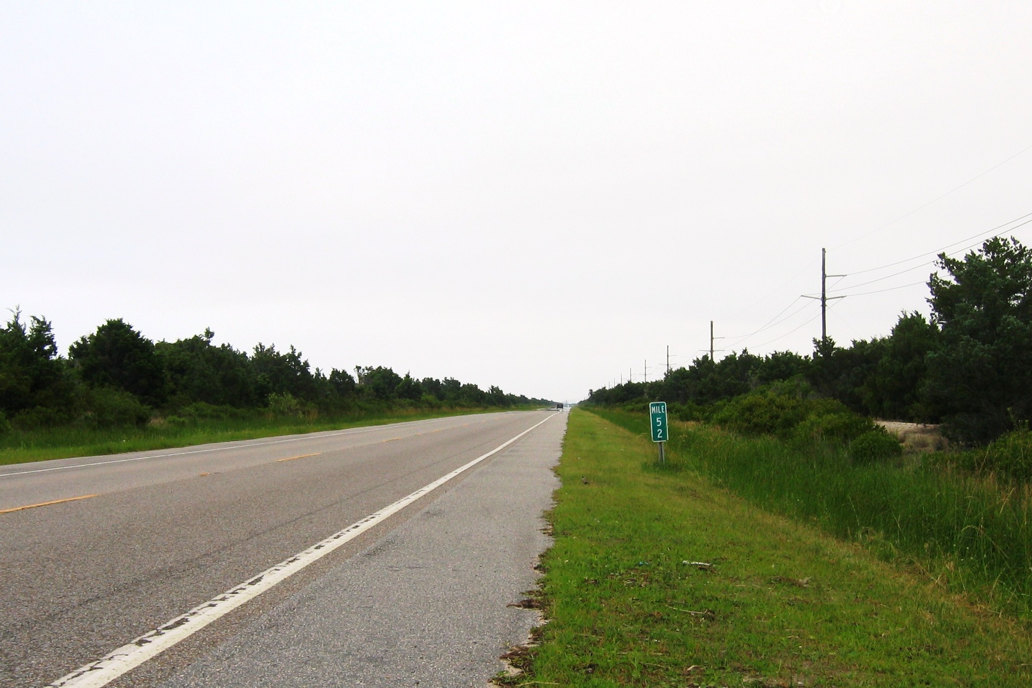
Small green numbered markers unobtrusively placed every mile on Bodie, Hatteras, and Ocracoke Islands help keep travelers oriented and aware of distances along the Outer Banks Scenic Byway.
Public Domain.
Download Original (2048 x 1366 pixels, 611.9 KB)
-
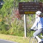
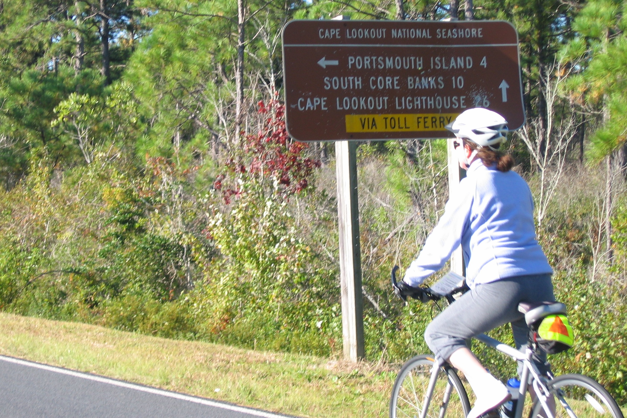
In Atlantic, a bicyclist pedals past a standard white-on-brown NPS directional sign which gives distances to three locations in the Cape Lookout National Seashore.
Public Domain.
Download Original (2184 x 1456 pixels, 1126.9 MB)
-
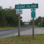
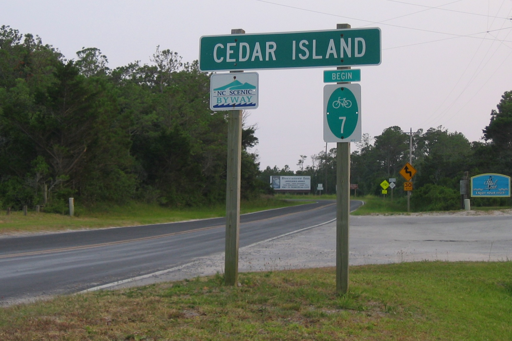
This sign signals traveler’s arrival at Cedar Island along the Outer Banks Scenic Byway. A North Carolina scenic byway marker is on its left post and a green numbered marker for NC’s bicycling system is on its right post. In the photo, a stylish ground-level sign bids visitors to “The Crystal Coast” to “enjoy your visit.”
Public Domain.
Download Original (1719 x 1146 pixels, 405.7 KB)
-
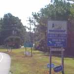
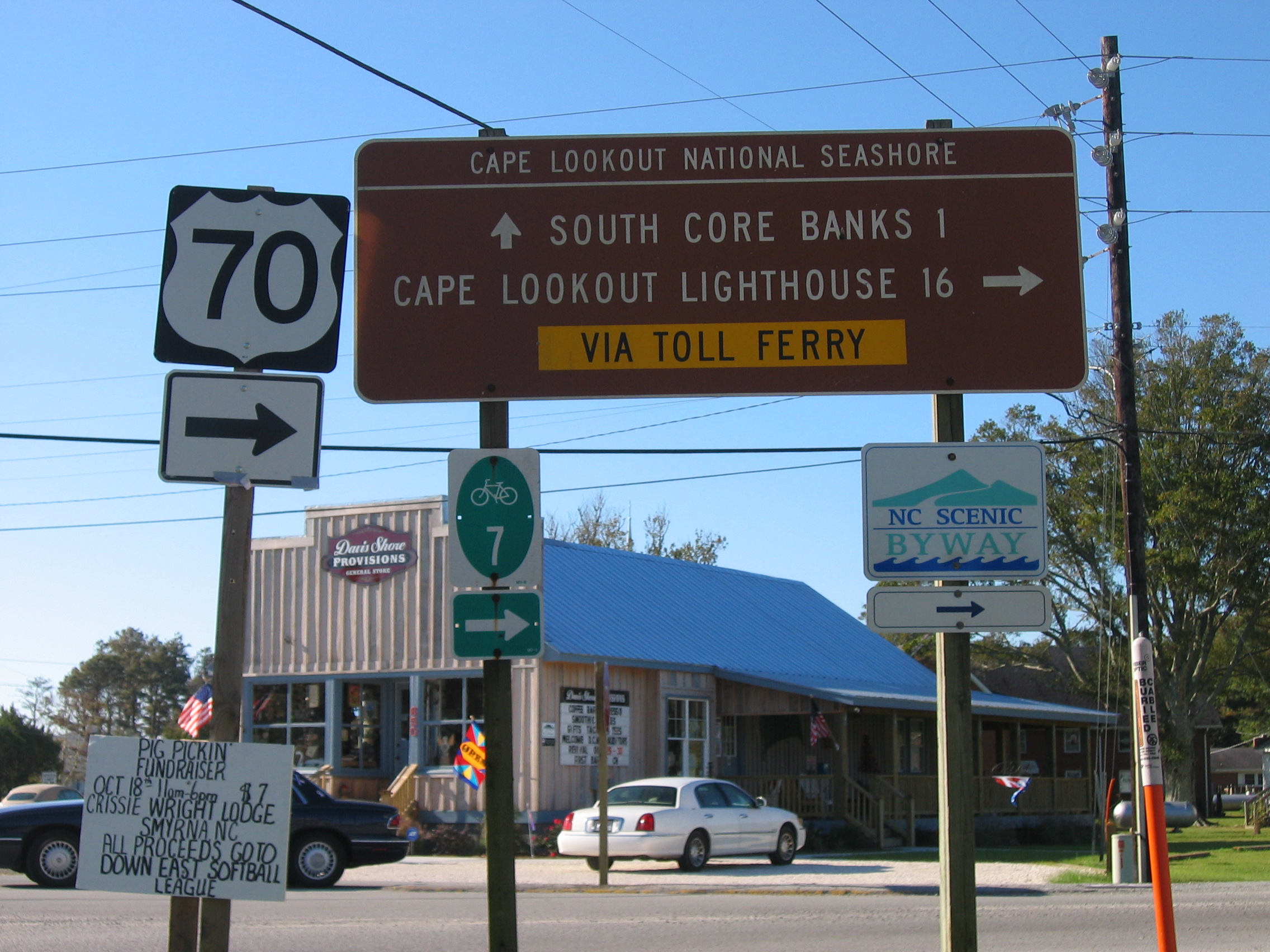
Along Outer Banks Scenic Byway, NC’s small green, blue, and white scenic byway marker is appended to the left post of a familiar brown National Park Service sign directing travelers to toll ferry locations. It is joined by the NC bicycle map marker on the right post and a separate, standard black-and-white U.S. route marker for US 70. All provide arrows guiding travelers at this key corner with its revitalized country store.
Public Domain.
Download Original (2272 x 1704 pixels, 933.5 KB)
-
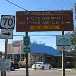
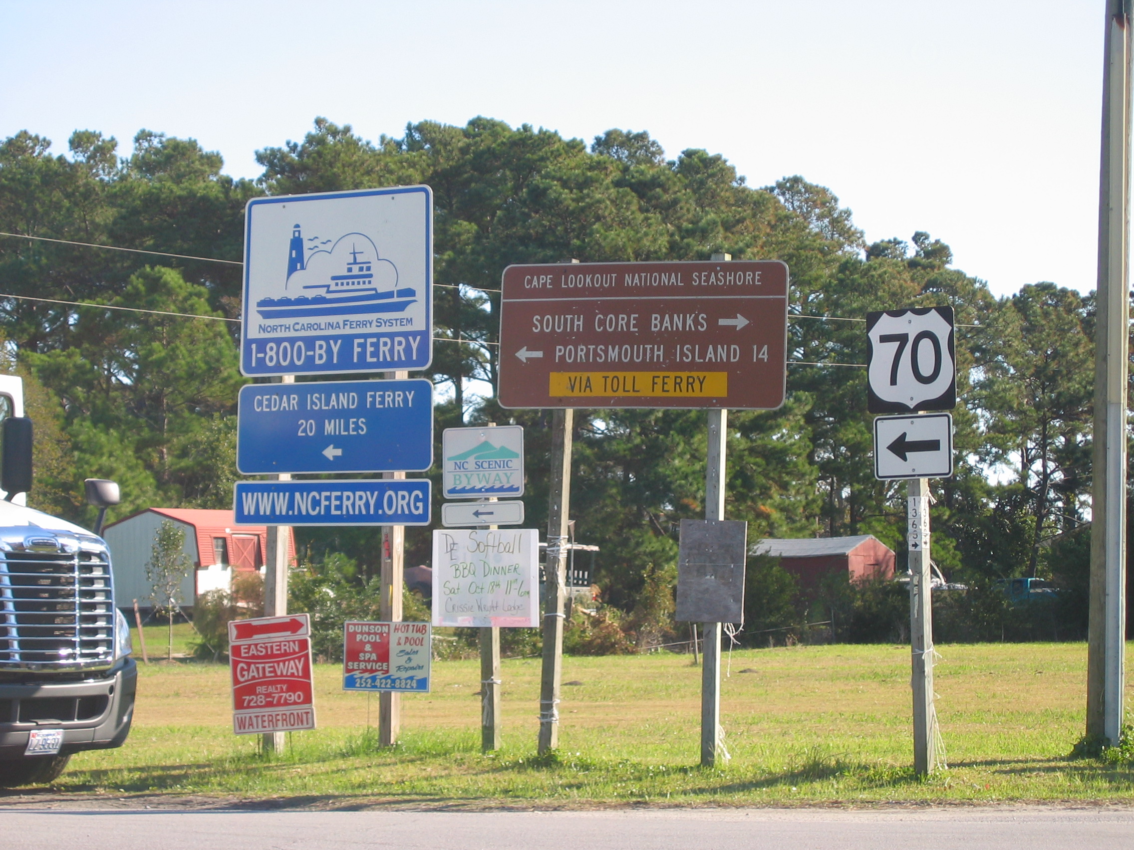
At a key turn, a thicket of wayfinding signs greets the eastbound traveler. A freestanding NC scenic byway sign, a NPS sign directing travelers to toll ferry concession locations, a separate, standard U.S. route marker for US 70 and NC’s picturesque ferry system logo direct travelers. The ferry sign provides both a toll-free number and a website address. Travelers seeking state routes “off the beaten path” in NC learn to spot the tiny four-digit numbers seen on the post below the US 70 sign.
Public Domain.
Download Original (2272 x 1704 pixels, 1108.3 MB)
-
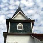
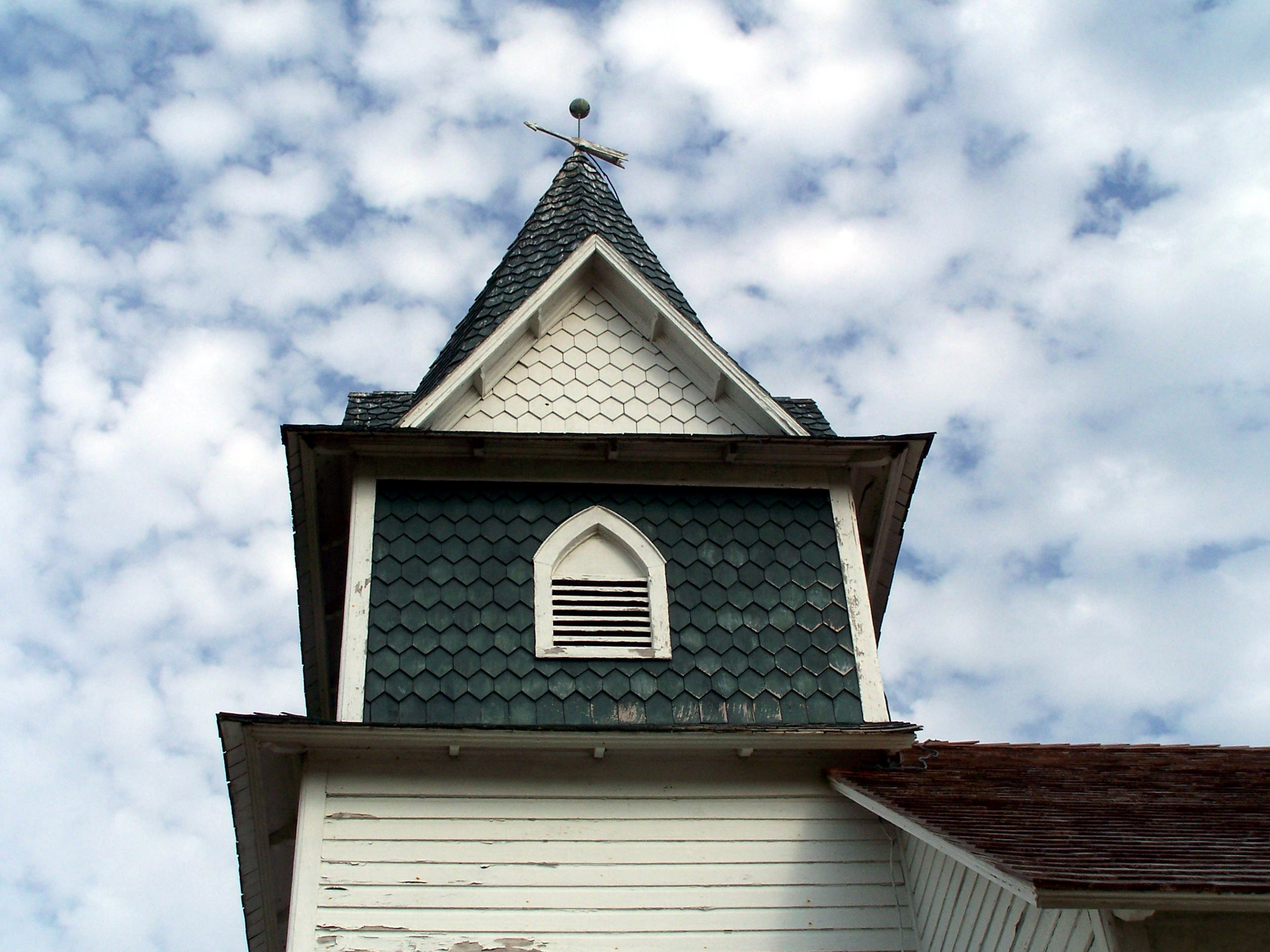
A blue sky with fluffy white clouds is pierced by the weathervane-topped, green-and-white shingle-and-clapboard steeple of Portsmouth’s 1914 Methodist Church.
Public Domain.
Download Original (2576 x 1932 pixels, 728.5 KB)
-
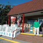
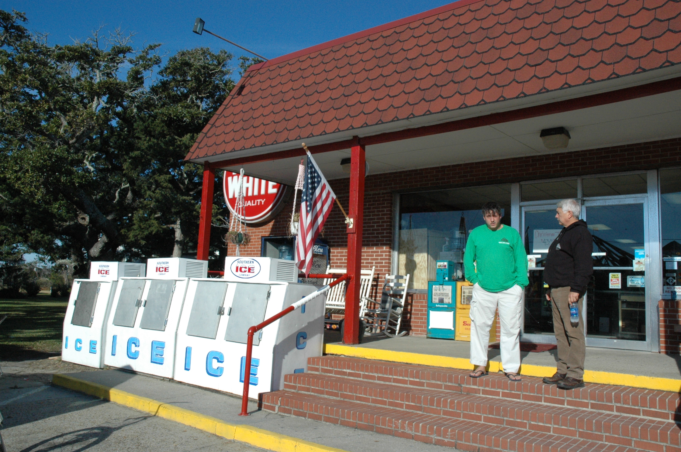
A friendly front porch with a bench and rockers welcomes customers to the Burrus Red & White, which was established in 1866. A hefty row of three ice chests speaks of hot thirsty days.
Public Domain.
Download Original (2240 x 1488 pixels, 1737.9 MB)
-

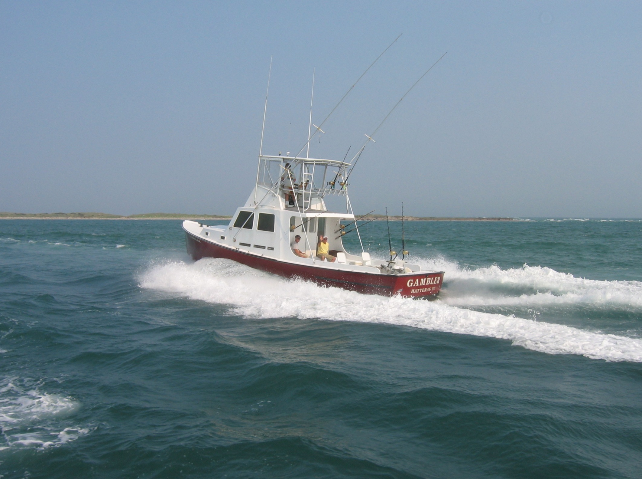
Heading homeward to Hatteras, this bright-red deep sea fishing vessel carries a friendly passenger waving to a passing ferry on the Outer Banks Scenic Byway.
Public Domain. Photo by Elizabeth Watson
Download Original (2124 x 1583 pixels, 573.7 KB)
-
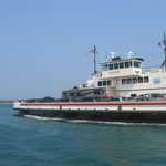
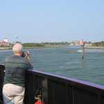
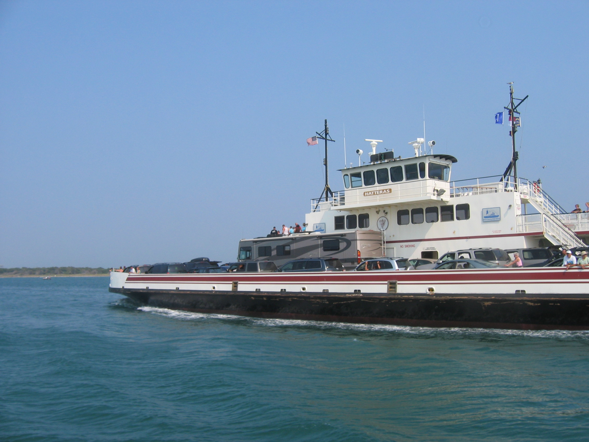
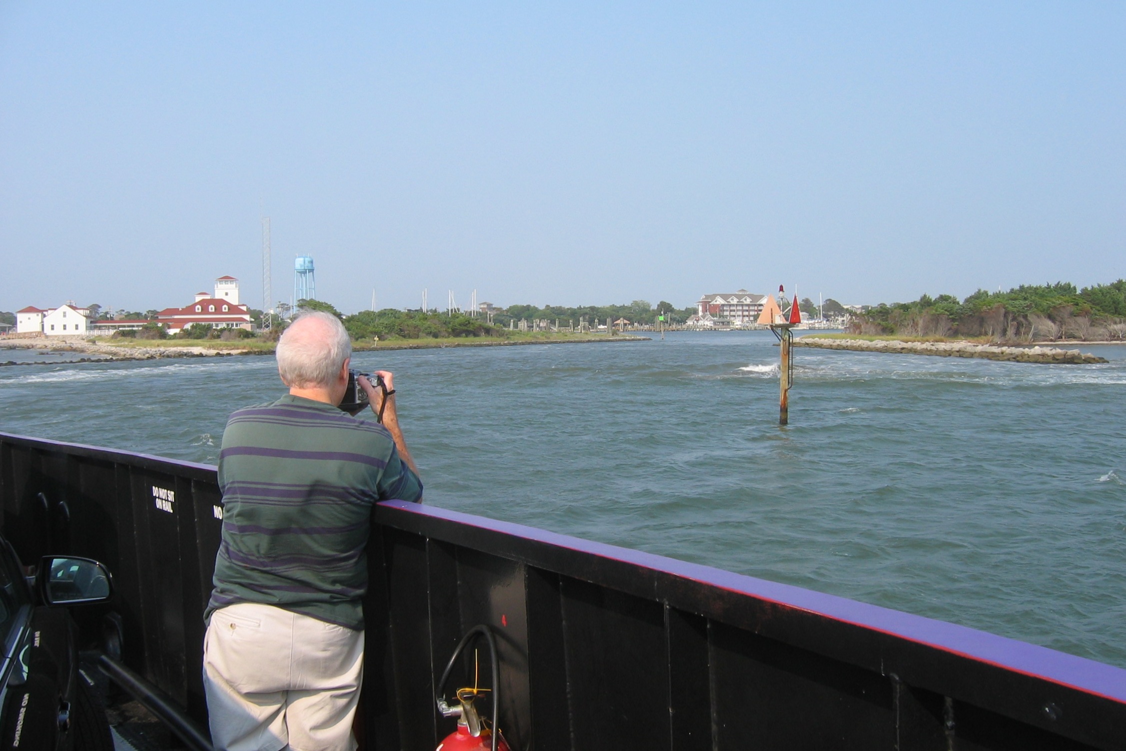
A large ferry crossing Hatteras Inlet carries a full summer load of travelers along the Outer Banks Scenic Byway. On the bow and upper deck, passengers enjoy the sunshine and the cooling breezes of Pamlico Sound.
Public Domain. Photo by Elizabeth Watson
Download Original (2272 x 1704 pixels, 753.7 KB)
-
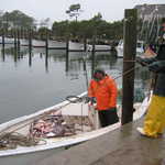
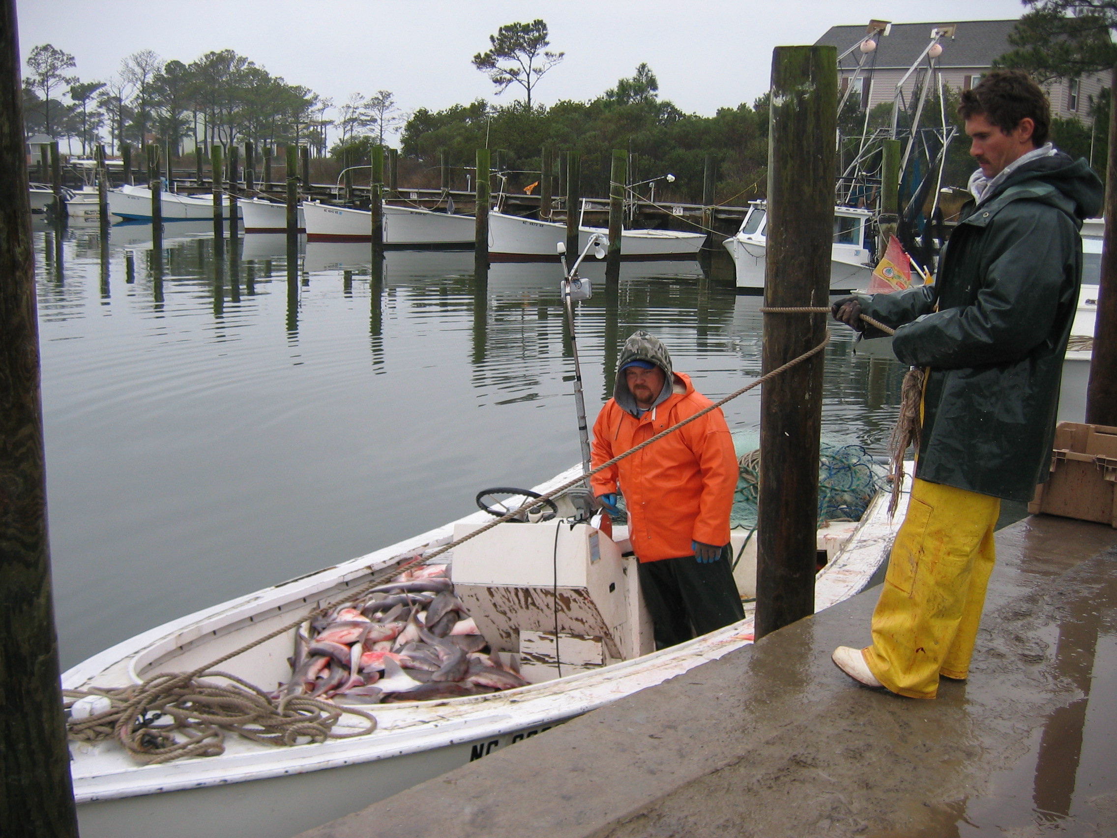
Young fishermen tie up in Harkers Island’s harbor along the Outer Banks Scenic Byway to deliver a load of fish to a waiting buyer. In the background the dark waters of the harbor reflect a line of white-painted small wooden skiffs.
Public Domain.
Download Original (2272 x 1704 pixels, 1033.0 MB)
-
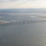
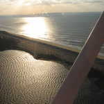
The Outer Banks Scenic Byway’s Herbert C. Bonner Bridge emphasizes the horizon as it rises gracefully above Oregon Inlet in this portrait in silver, gray, white, and sandy gold. Waves mark the turbulence as the tidal outflow from the sound joins the Atlantic Ocean.
Public Domain.
Download Original (2272 x 1704 pixels, 981.6 KB)
-
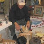
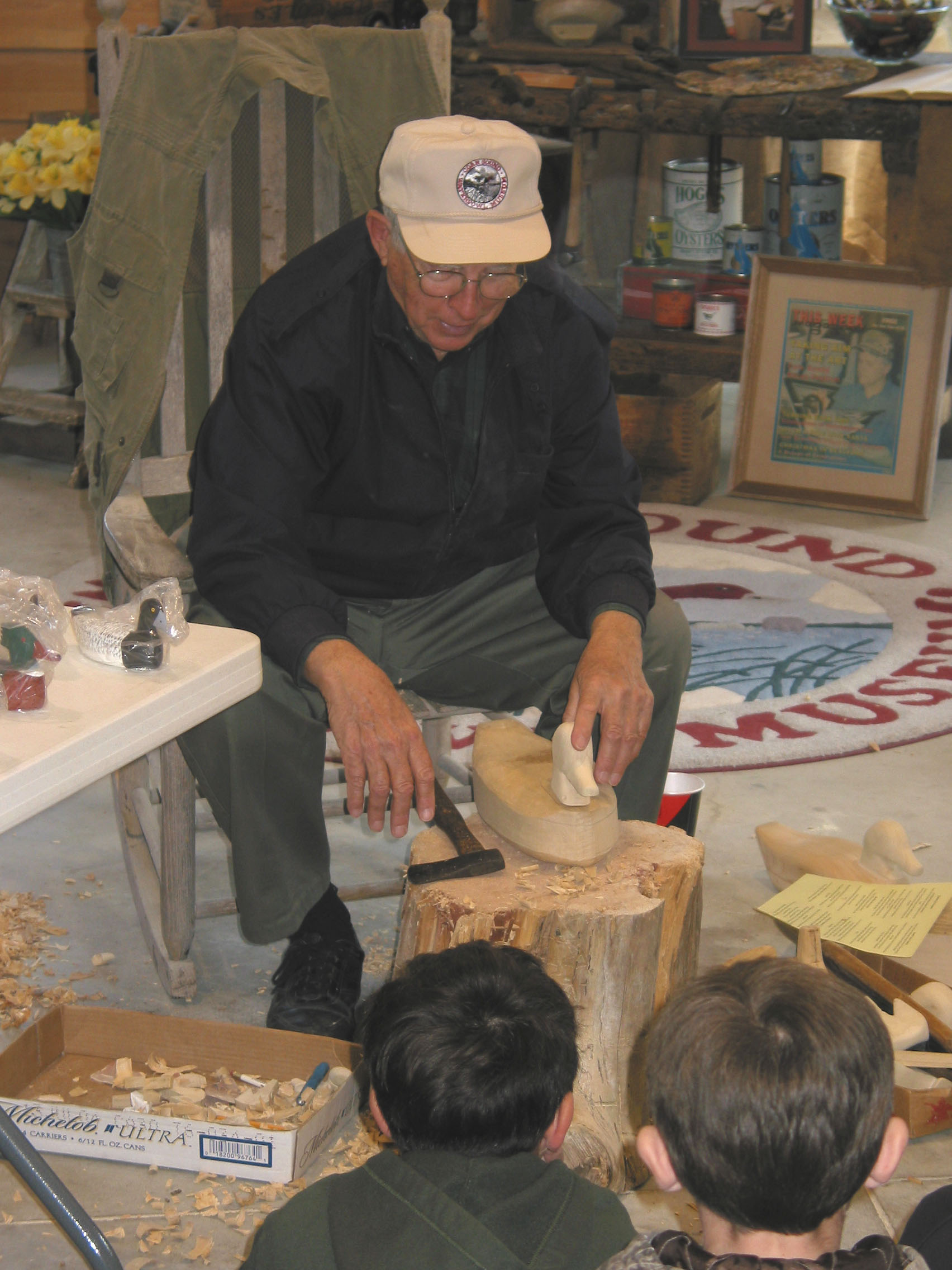
Renowned decoy carver Roy Willis demonstrates his skill for elementary school students visiting the Core Sound Waterfowl Museum and Heritage Center on Harkers Island along the Outer Banks Scenic Byway.
Public Domain.
Download Original (1704 x 2272 pixels, 414.5 KB)
-
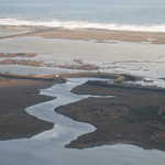
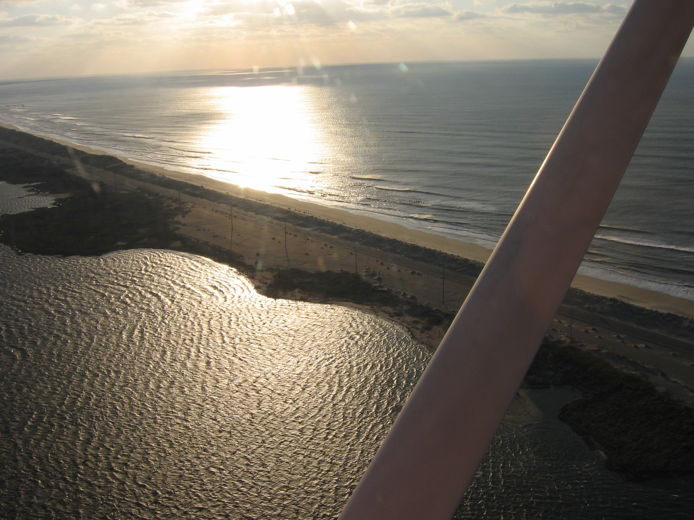
This aerial view of the Sandy Bay Soundside access and walkway gilded by morning light shows how narrow this point of Hatteras Island is.
Public Domain.
Download Original (2272 x 1704 pixels, 1111.2 MB)
-
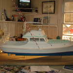
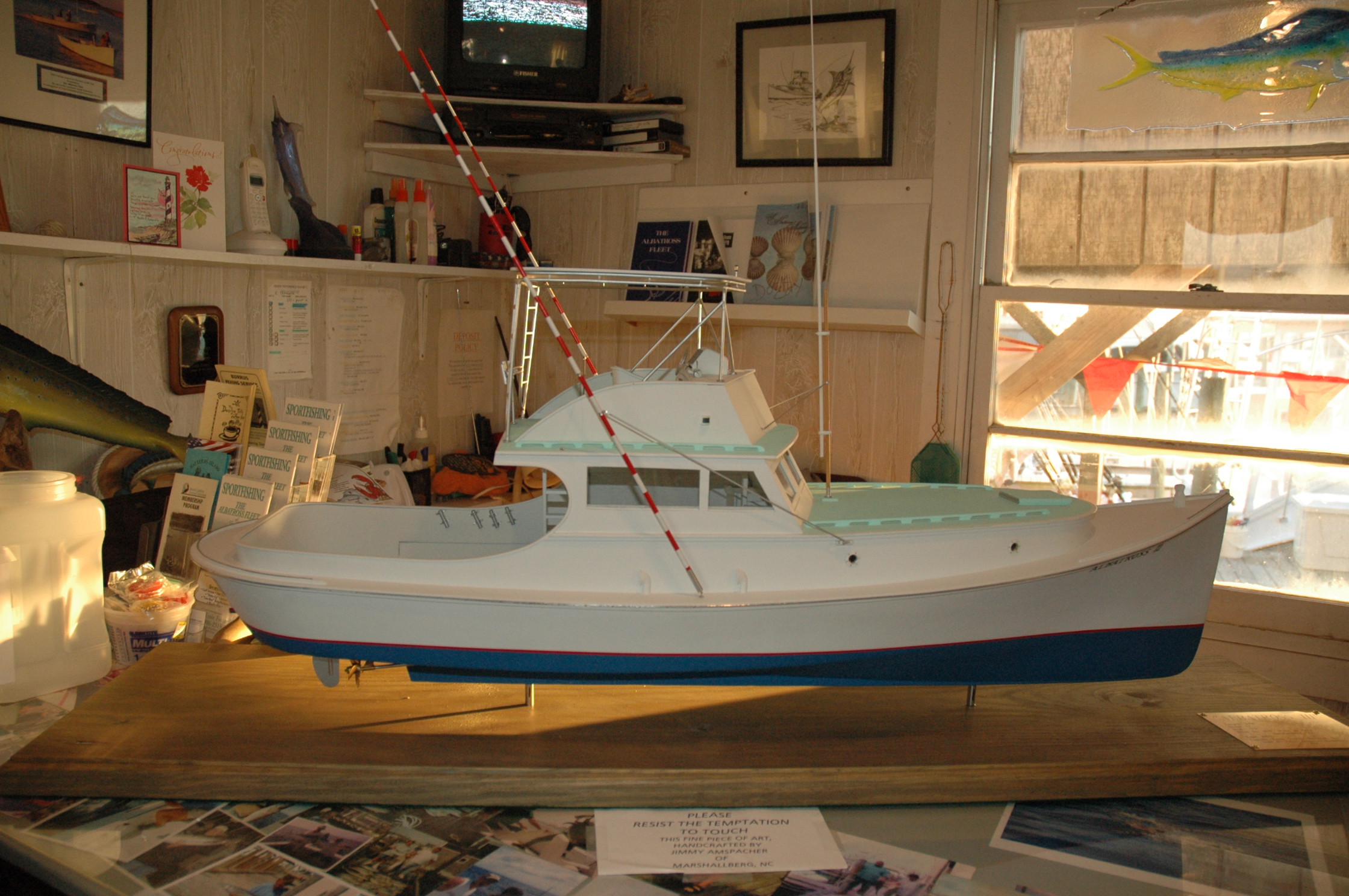
This bright white and sea green model of the Hatteras deep-sea charter fishing vessel Albatross I, by Jimmy Amspacher, shows Harkers Island heritage with a rounded stern designed to keep nets from snagging.
Public Domain.
Download Original (2240 x 1488 pixels, 711.8 KB)
-

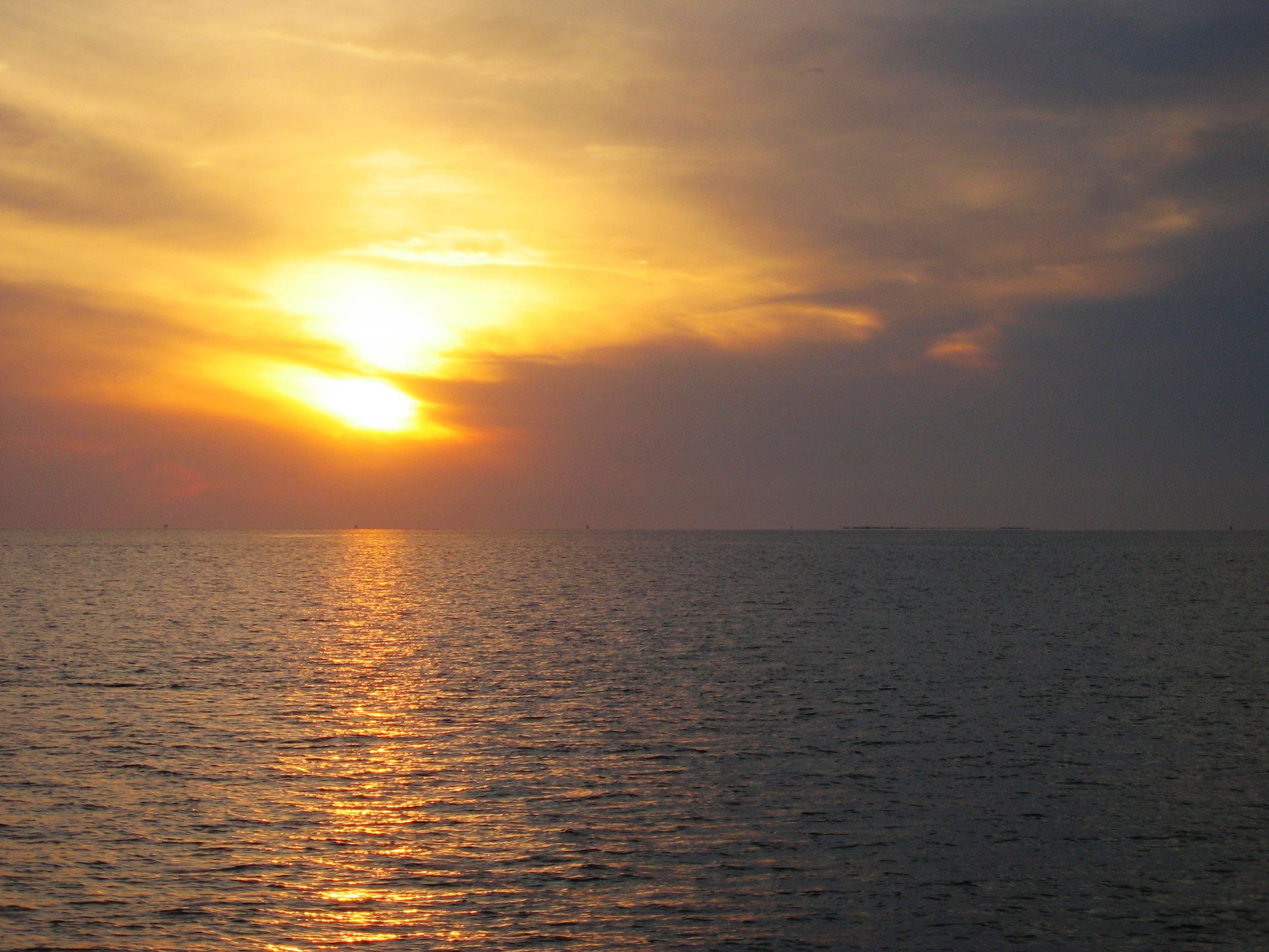
The sun sets in a splendid display of golden light and dark cloud seen to the west across the vast Pamlico Sound, one of the many visual pleasures of the Outer Banks Scenic Byway.
Public Domain.
Download Original (2272 x 1704 pixels, 825.3 KB)
-
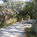
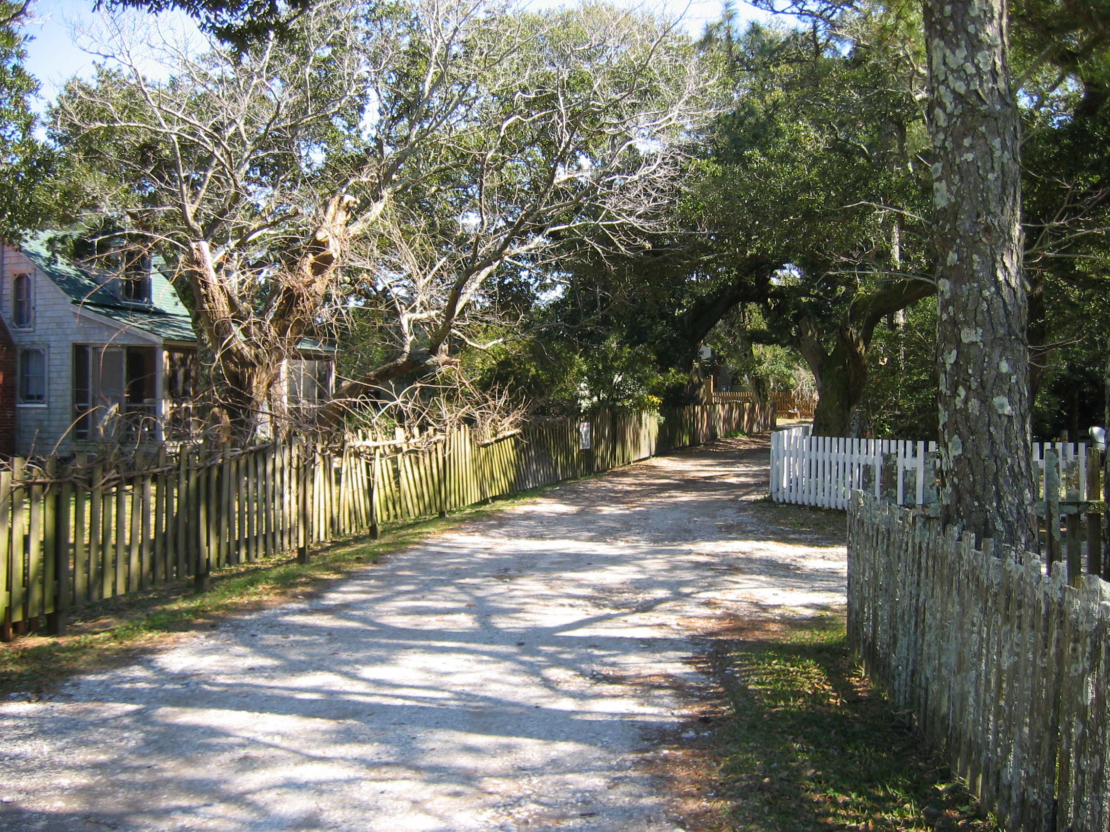
Picket fence-lined Ocracoke’s Howard Street , just off the Outer Banks Scenic Byway, is a deeply shaded narrow lane paved only with crushed oyster shells.
Public Domain.
Download Original (2272 x 1704 pixels, 1849.2 MB)
-
A summer visitor to the Outer Banks Scenic Byway engages in a favorite pastime on the ferry leaving Ocracoke’s Silver Lake, photographing the harbor and the enormous former U.S. Coast Guard Station, built in 1935.
Public Domain.
Download Original (2253 x 1502 pixels, 584.2 KB)
-
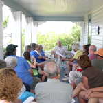
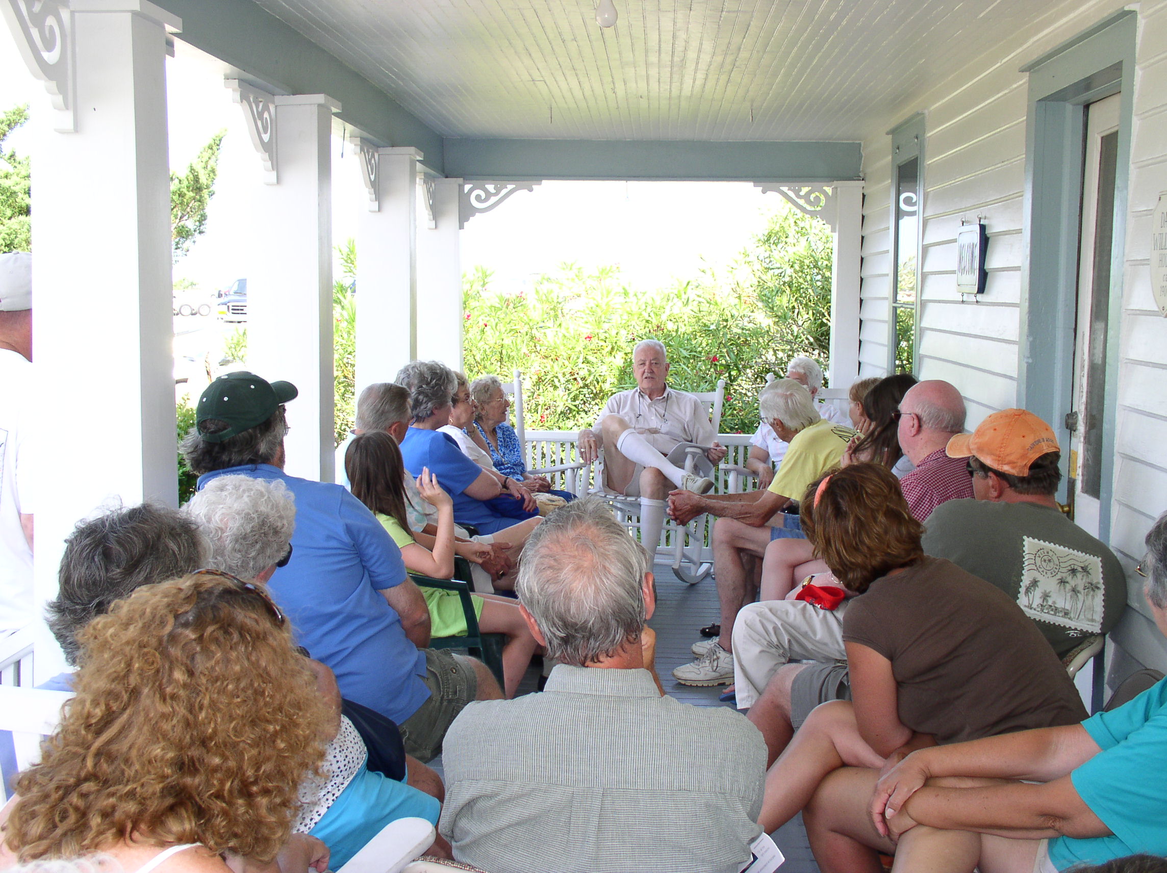
A summer crowd fills the deep front porch of the David Williams House to hear Earl O’Neal and his cousins, all three older residents of Ocracoke, tell stories of their lives on the island.
Public Domain.
Download Original (2288 x 1712 pixels, 641.6 KB)
-
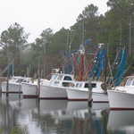
Wooden vessels in a harbor in Davis, painted in traditional white and rigged as trawlers, include the two large Harkers Island boats at right. Their low, flared hulls, designed to carve shallow waters, stand out against the straight hulls of the two larger boats at left.
Public Domain.
Download Original (2272 x 1704 pixels, 1005.4 MB)
-

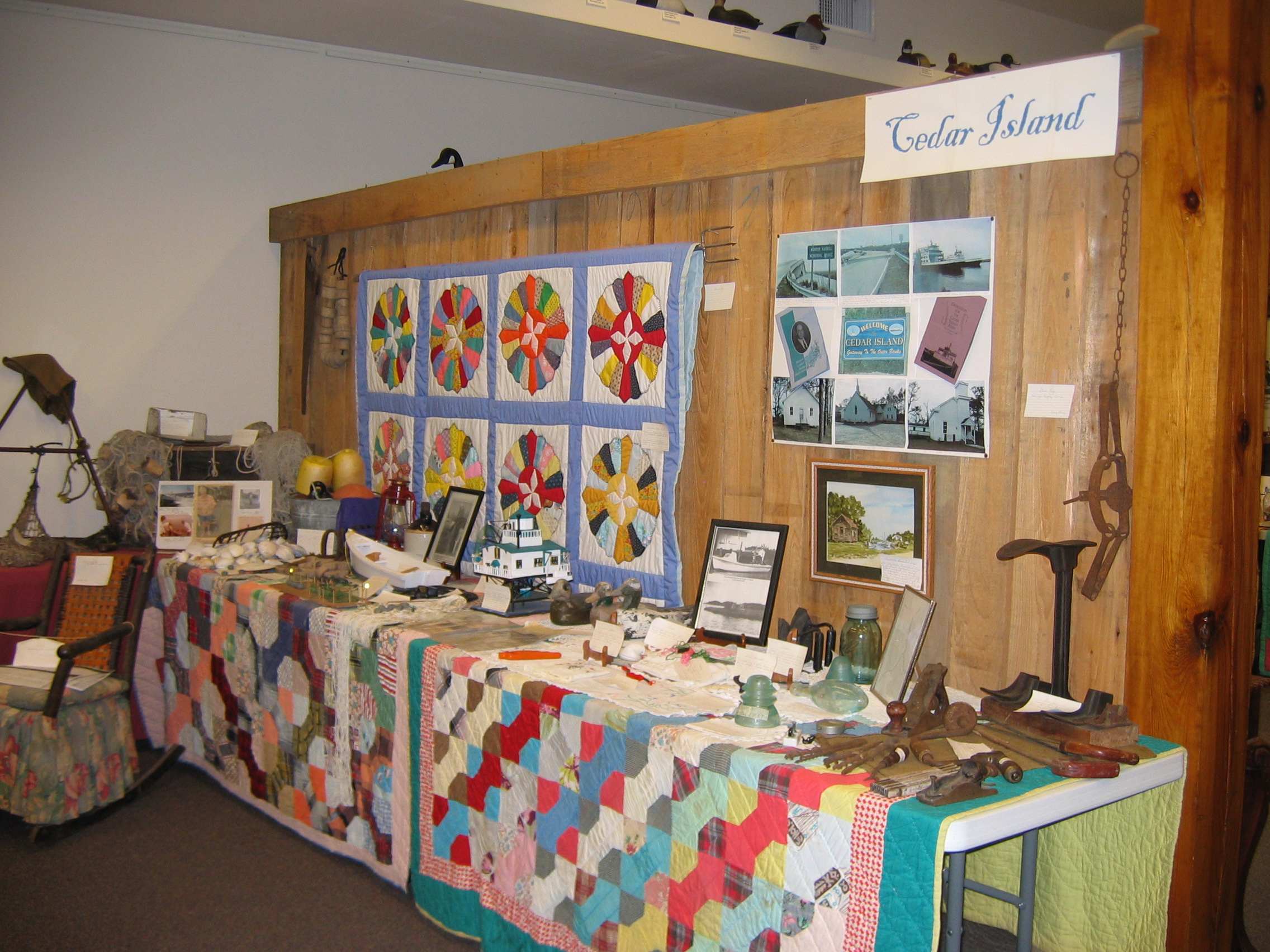
Cedar Island’s exhibit at the Core Sound Waterfowl Museum and Heritage Center includes three colorful modern versions of a long-standing Down East quilting tradition as backdrops, with one, top left, using a nautical compass as its theme.
Public Domain.
Download Original (2272 x 1704 pixels, 1114.0 MB)
-

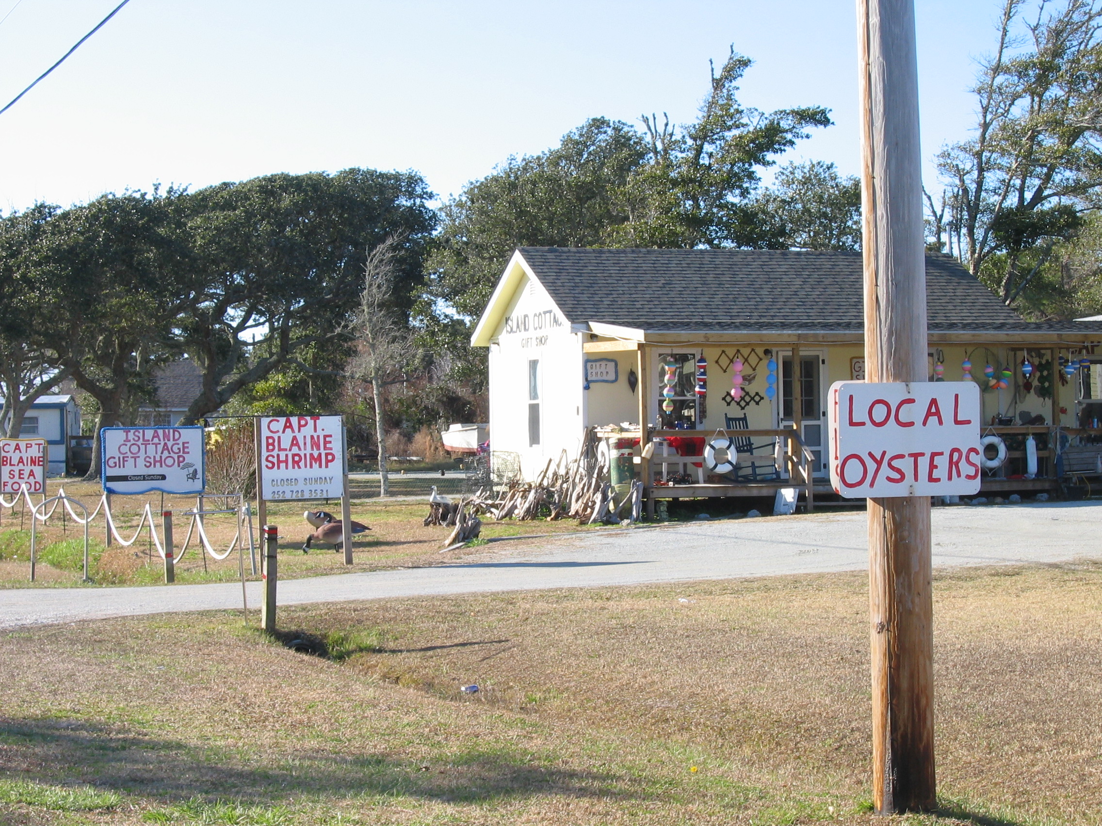
On Harkers Island along the Outer Banks Scenic Byway, hand-painted signs attract the visitor’s eye to Captain Blaine's Gift and Seafood Shop, offering fresh local seafood along with gifts, decorative buoys and driftwood.
Public Domain.
Download Original (2272 x 1704 pixels, 1543.1 MB)
-
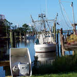
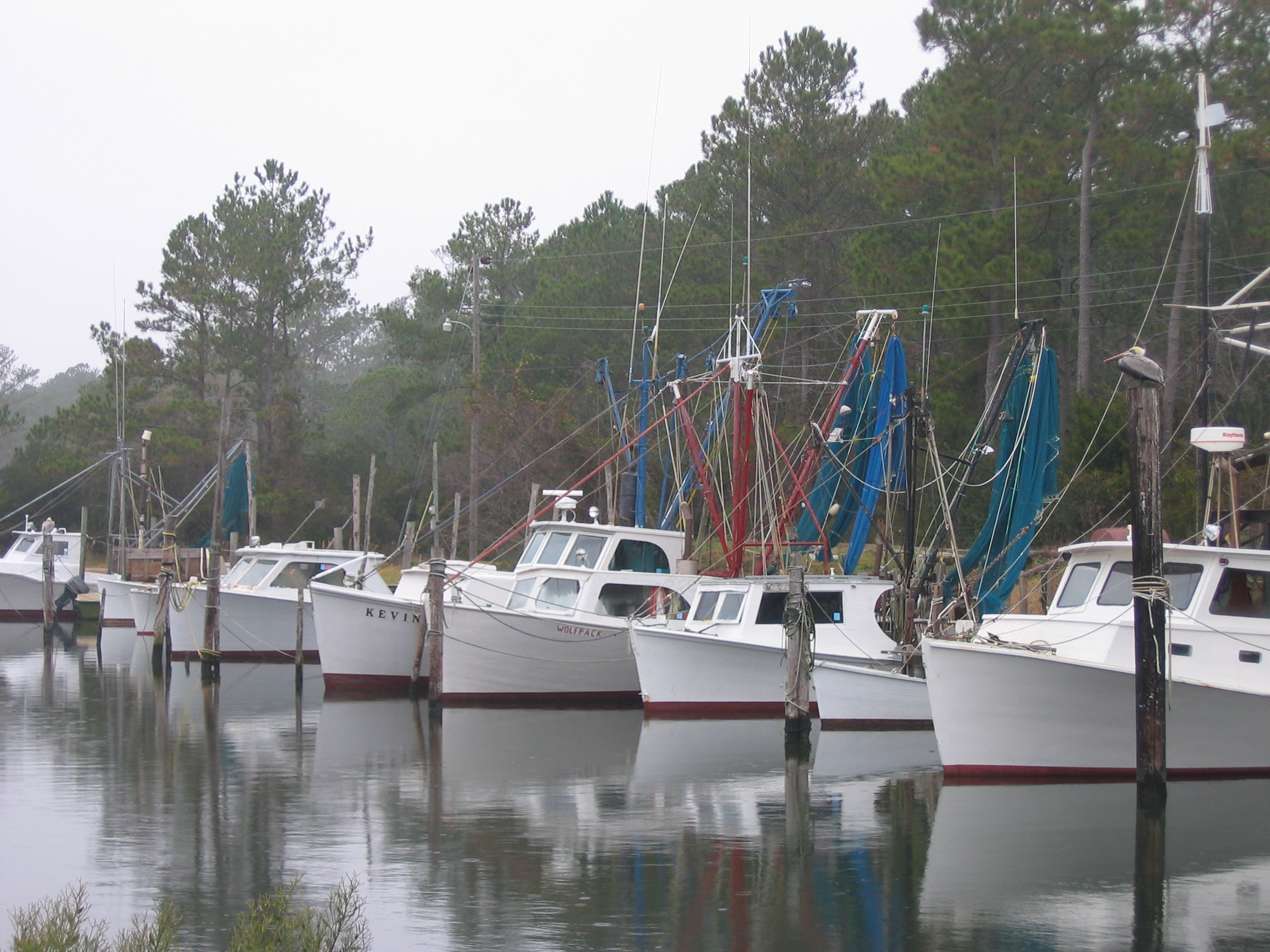
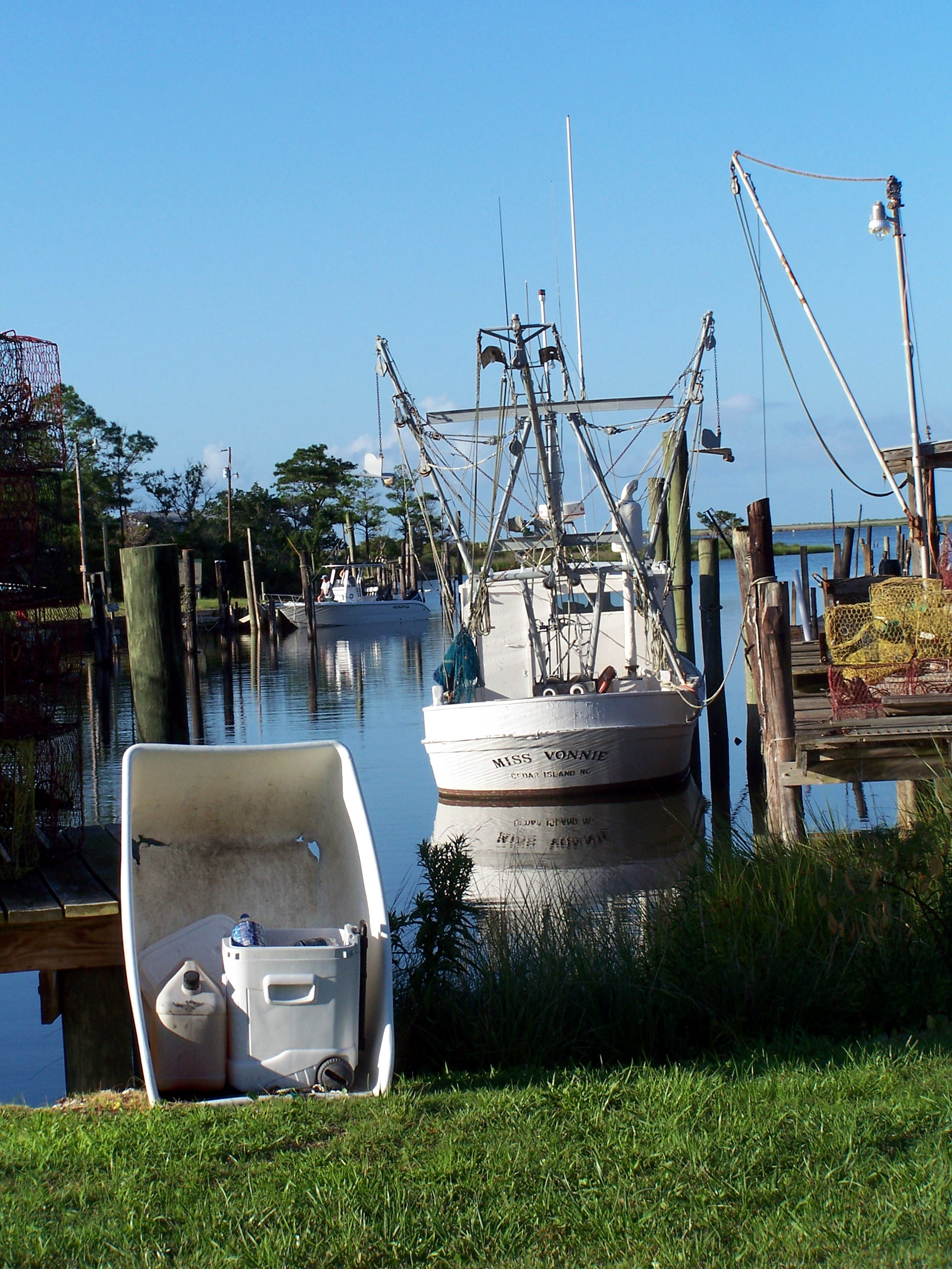
Fishing trawlers in Cedar Island’s harbor along the Outer Banks Scenic Byway include the Miss Vonnie with her rounded stern, indicating an early 20th-century style of wooden boat built along Core Sound and on Harkers Island.
Public Domain.
Download Original (1932 x 2576 pixels, 1506.4 MB)
-
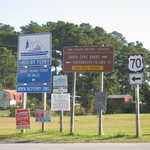
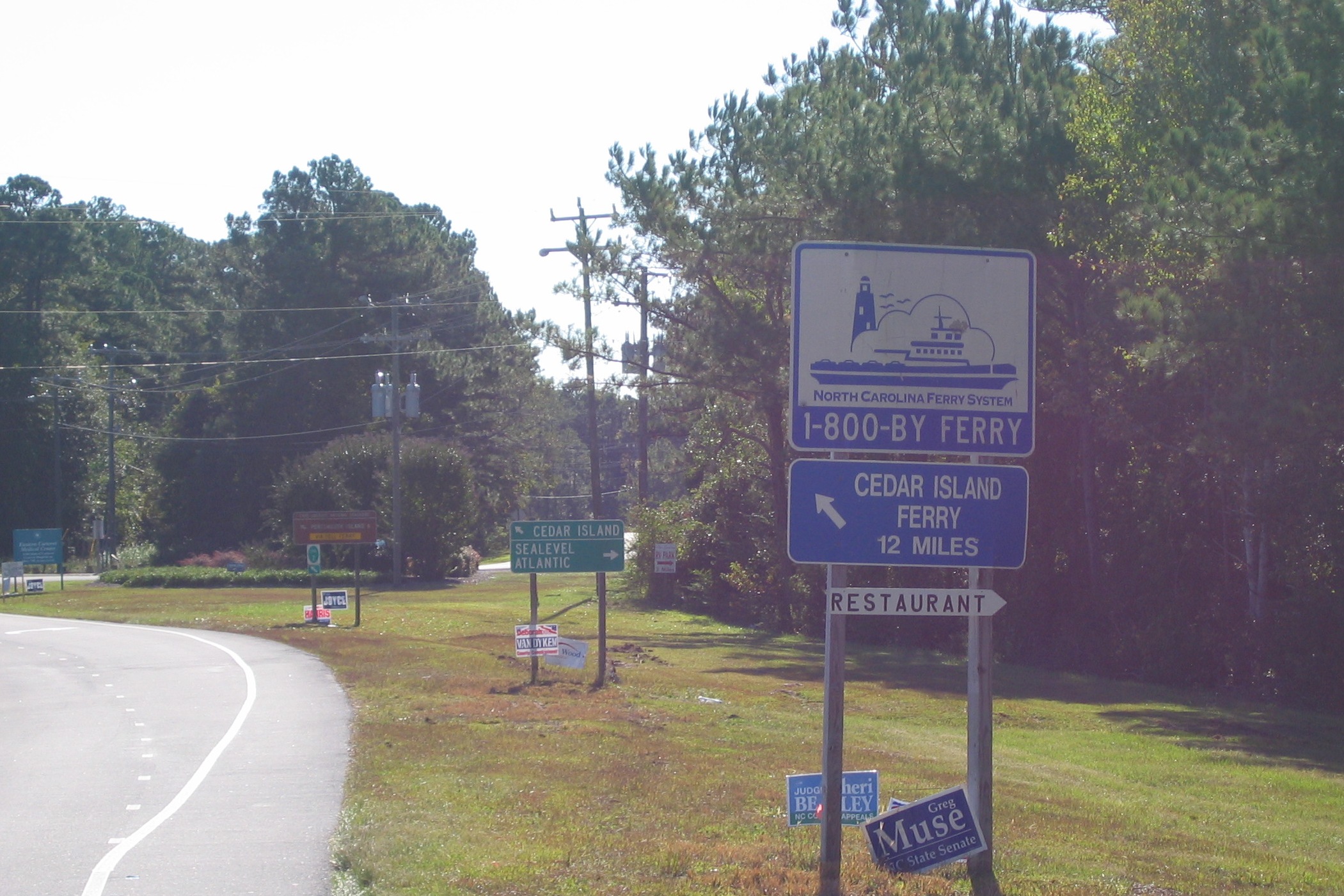
A row of directional signs greets the traveler just outside the village of Sea Level along the Outer Banks Scenic Byway. Signs on the photo include NC’s standard green directional sign, which signals the major turn just ahead, with Sea Level (the name is misspelled here as Sealevel) and Atlantic to the east, and a shortcut to Cedar Island to the left (north). The NC ferry system’s blue-and-white sign announces 12 more miles to the Cedar Island ferry. An attached handmade sign stating “restaurant,” is a hitch-hiker, designed to resemble NC’s local-level directional signs. The National Park Service’s standard sign points the way to a toll ferry ride to Portsmouth Island. NC’s green numbered marker for its bicycling system is attached.
Public Domain.
Download Original (2101 x 1401 pixels, 746.0 KB)